Climate Impacts of Agriculture Related Land Use Change in the US
|
|
|
- Kerry Copeland
- 5 years ago
- Views:
Transcription
1 Climate Impacts of Agriculture Related Land Use Change in the US Jimmy Adegoke 1, Roger Pielke Sr. 2, Andrew M. Carleton 3 1 Dept. Of Geosciences, University of Missouri-Kansas City 2 Dept. of Atmospheric Sciences, Colorado State University 3 Dept. of Geography, The Pennsylvania State University World Meteorological Organization (WMO) Committee on Agricultural Meteorology (CAgM( CAgM) ) Expert Team Meeting on the Contribution of Agriculture to the State of Climate Ottawa, Canada, September 2004
2 Presentation Outline Cropland/Forest Impacts on Convective Cloud Development in the US Midwest : Empirical studies Agriculture-related land use change impacts on seasonal climate in the Central US: Modeling studies Crop-climate modeling Issues, challenges & questions

3 Current & Potential Natural Vegetation [Copeland et al., 1996]
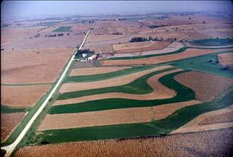
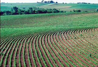
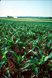
4 Agriculture - Human Imprint on the Land Surface Spring Summer

5 Land Surface-Atmosphere Interactions Schematic of the differences in surface heat energy budget and planetary boundary layer over a forest and cropland.
6 Atmosphere Temp, Water Trace Gases Pollutants Heat, Moisture Radiation Light, Temp Moisture, Wind Community Composition & Structure Landscape Modification Trace Gases & Pollutants Surface Physiology & Hydrology Water & Nutrients Agriculture Deforestation, etc. Biogeochemical & Hydrological Cycles Anthropogenic Activities Sec - Hours >1yr - 100yrs >1000yrs
7 Focus of Land Surface-Climate Work: Empirical Studies Impacts of changes in US Midwest land cover parameters (e.g. land cover, surface roughness, zones of land cover transitions) on convective cloudiness (Carleton et al., 2001 GRL Vol. 28, ) Sensitivity of the AVHRR derived Normalized Difference Vegetation Index (NDVI) and the Fractional Vegetation Cover (FVC) to growing season surface moisture conditions (Adegoke and Carleton, 2002 JHM 4, 24-41).
8 Land Use Changes in Illinois Wetland 0% Prairie 2% water 3% River 2% Jackson County Urban 3% Forest 25% Prairie 0% Wetland 2% Forest 93% Agriculture 68% Barren 1% Water 1% Wetland 5% water 5% River 0% Lake County Forest 9% Urban 34% Prairie 0% Wetland 2% Water 2% Barren 1% Prairie 29% Forest 61% Agriculture 52% [From Iverson & Risser, 1987]

9 Land Use/Land Cover Map of The Midwest Showing Sampling Locations of Convective Cloud Parameters


10 GOES INFRA RED & VISIBLE IMAGES 11 JUNE :00 UTC

11 Stratification of Case Study Days: June-Aug Strong Flow / Weak Flow : 500 mb Vector Winds
12 a) Mean BWF VIS: Crop MI Mean BWF IR TEMP: Crop MI Albedo pm 6pm 4pm 2pm 12Noon 10am 8am 6am 5pm 3pm 1pm 11am 9am 7am b) Mean BWF VIS: Boundary MI Mean BWF IR TEMP: Boundary MI Albedo pm 6pm 4pm 2pm 12Noon 10am 8am 6am 5pm 3pm 1pm 11am 9am 7am c) Mean BWF VIS: Forest MI Mean BWF IR TEMP: Forest MI Albedo pm 6pm 4pm 2pm 12Noon 10am 8am 6am 5pm 3pm 1pm 11am 9am 7am
13 a) Mean BWF VIS: Crop IN d) Mean BWF VIS: Crop MO Albedo Albedo pm 3pm 1pm 11am 9am 7am 5pm 3pm 1pm 11am 9am 7am b) Mean BWF VIS: Boundary IN e) Mean BWF VIS: Boundary MO Albedo am 9am 11am 1pm 3pm 5pm Albedo am 9am 11am 1pm 3pm 5pm c) Mean BWF VIS: Forest IN f) Mean BWF VIS: Forest MO Albedo Albedo pm 3pm 1pm 11am 9am 7am 5pm 3pm 1pm 11am 9am 7am
14 a) Mean WF VIS: Crop MI d) Data Range WF VIS: Crop MI Albedo Albedo pm 3pm 1pm 11am 9am 7am 5pm 3pm 1pm 11am 9am 7am b) Mean WF VIS: Boundary MI e) Data Range WF VIS: Boundary MI Albedo Albedo pm 3pm 1pm 11am 9am 7am 5pm 3pm 1pm 11am 9am 7am c) Mean WF VIS: Forest MI f) Data Range WF VIS: Forest MI Albedo am 9am 11am 1pm 3pm 5pm Albedo am 9am 11am 1pm 3pm 5pm
15 Mean SF VIS Brightness: Crop MI Mean BWF VIS Brightness: Crop MI pm 6pm 4pm 2pm 12Noon 10am 8am 6am Mean SF VIS Brightness: Boundary MI Mean BWF VIS Brightness: Boundary MI pm 6pm 4pm 2pm 12Noon 10am 8am 6am Mean SF VIS Brightness: Forest MI Mean BWF VIS Brightness: Forest MI am 8am 10am 12Noon 2pm 4pm 6pm 8pm
16 Average Cloud Top Brightness Temperature: MI & MO BWF Average Maximun Brightness Temp (MI) Crop Boundary Forest BWF Average Maximun Brightness Temp (MO) Crop Boundary Forest
17 Thermodynamic indices for selected weak flow days: 12Z Radiosonde Data: MI vs MO CCL (mb) CCL-EL (mb) K-Index (mb) Tc ( o C) Mean Tv ( o C) Mean T-Tv ( o C) RH o / o Water Content Michigan Missouri
18 Sensible and Latent Heating of the Atmosphere Required for Initiation of Convective Clouds vs. Bowen Ratio [Rabin et al., 1990]
19 Summary of Cloud Research Findings Analyses of Visible and IR GOES cloud data for contrasting circulation regimes indicate some cloud-land cover associations across major crop-forest boundaries. Land cover boundary zones are shown to be favored areas for enhanced cloud development under moderate mid-tropospheric (< 30 m/s) flow conditions. The boundary zones tend to behave like regions of differential vertical circulations (i.e., NCMCs)
20 Focus of Land Surface-Climate Work: Modeling Studies Improving the representation of land surface heterogeneity (land cover; soil moisture; soil type) in the Colorado State University Regional Atmospheric Modeling System (RAMS) (Adegoke et al. 2003; Strack et al. 2003; Rozoff et al., 2003) Developing protocols for a more realistic description of seasonally and interannually varying vegetation cover and growth rates in regional climate models (Adegoke et al. 2004; Eastman et al. 2001; Lixin Lu et al., 2002).
21 Lessons Learned Realistic representation of spatial heterogeneity of land surface parameters improves model simulation of regional-scale effects of agriculture-related land use changes on climate and terrestrial biophysical processes. Key Parameters: - Land Cover - Soil Moisture -LAI -Soil Type - Soil Temperature

22 Soil Moisture Impacts Over High Plains, if model soil moisture is low Forecast CAPE too low, about half the observed CAPE Forecast of instability insufficient
; Matching")

23 Soil Moisture Simulation with Different Soil (a); Matching Soil (b) (a) (b) LDAS Evaluation Team: Alan Robock et al., 2004

24 Soil Moisture LDAS Evaluation Team: Alan Robock et al., 2004
25 Recent Improvements in RAMS-LEAF2 1. Protocols for ingesting variable soil moisture 2. Incorporation of high-resolution land cover data (30 m) from the USGS NLCD database 3. Specification of variable soil type from the FAO soil type database 4. Protocols for ingesting NDVI and derivation of LAI from NDVI 5. RAMS-Century coupling for explicit modeling of the seasonal evolution of vegetation in the simulation of seasonal climate.

26 Map of U.S. High Plains Aquifer
27 Acreage of Rain fed & Irrigated Corn Farming in Nebraska ( ) Rainfed Irrigated Area (ha) Year
28 Nebraska Irrigation Modeling Project Complex changes in the lower atmosphere (PBL) radiation budget can result from large-scale land use changes of this magnitude (e.g., vapor flux CAPE) This study was designed to evaluate the changes in the summertime surface energy budget & convective rainfall parameters due to irrigation in Nebraska using RAMS.

29 RAMS Modeling Domain Coarse Grid: 40 km ; Fine Grid:10 km; Domain Height: 20km
 OGE Dry")

30 a) Kuchler Potential Vegetation b) OGE Dry Run c) OGE + Current Irrigation Control Run (a) (b) (c)
31 Summary of Model Results Significant inner domain area-averaged difference between the Control and Dry runs: - 36% increase in surface latent heat flux - 15% decrease in surface sensible heat flux - 28% increase in water vapor flux at 500m -2.6 o C elevation in dew point temperature -1.2 o C decrease in near surface temperature Greater differences observed between the Control and Natural Vegetation runs e.g., - Near ground temperature was 3.3 o C warmer & surface sensible heat 25% higher in the Natural run. [Adegoke et al., 2003 Monthly Weather Review 131(3), ]
 RAMS{temp, swin, prcp, rh, (u,v,w)} CENTURY{LAI,")
32 ClimRAMS Coupled with CENTURY (Lu et al., 2001, Journal of Climate) RAMS{temp, swin, prcp, rh, (u,v,w)} CENTURY{LAI, roots, Zo, evap, transp, vegfrac, vegalb}
33 Satellite-derived Leaf Area Index Derived from AVHRR 10- day composite NDVI NDVI LAI following Sellers et al. (1996) and Nemani et al. (1996) Lu et al., 2001 Derived LAI for Central U.S. in dry (1988), average(1989), and wet (1993) years. Average JJA NDVI for Central U.S.

34 Comparison of LAI Forcing Lu et al., 2001 STRONG DIFFERENCES Magnitude of LAI Heterogeneity of LAI SOME DIFFERENCE Seasonality of LAI Default LAI in Inner (50 km) Grid NDVI-derived LAI in Inner (50 km) Grid

35 Good Agreement between Model Predictions & Observations e.g. Domain-average maximum and minimum air temperature and precipitation for inner grid during 1989 (selected as an average year) for the run with NDVIderived LAI Lu et al., 2001


36 Runs Broadly Agree With Observations e.g. Distribution of maximum and minimum temperature and precipitation for inner grid for the run with NDVI-derived LAI January-March 1989 June-August 1989 Lu et al., 2001

37 Physical Mechanism for Precipitation Increase Lower domainaveraged LAI allows more solar radiation to reach the surface, increasing CAPE Spatial variability in LAI triggers mesoscale circulations.
38 RAMS-Century Coupling Strategy and Design Differences in spatial and temporal resolutions: RAMS: 3-D, CENTURY: 1-D time step: minute vs. day Internet Stream Socket Client/Server mechanism Both atmospheric forcings and biospheric parameters are prognostic variables Lu et al., 2001
39 Coupled Model Captures 2-way Feedbacks Default Coupled LAI response of CENTURY is different after harvest when run in coupled mode. The coupled model gives a response in modeled precipitation. Lu et al., 2001

40 Coupled Model Simulated Climate Lu et al., 2001
41 Conclusions From Lu et al Both satellite-derived and model-calculated LAI produce a significant impact on the modeled seasonal climate In both cases, the climate is cooler and produces more precipitation relative to using RAMS default LAI The effect of heterogeneity in LAI appears to be the dominant factor in producing these differences Including realistic description of heterogeneous vegetation phenology influences the prediction of seasonal climate.
42 Looking Ahead The challenge: Fully coupled crop-climate model capable of investigating the 2-way interactions of cropclimate system under a wide range of conditions. Must include feedbacks of crop growth on surface climate Will require much stronger cross-disciplinary interaction/collaboration between Agricultural and Atmospheric Sciences
43 Discussion Issues/Questions Crop models tend to operate at the field/plot spatial scale while climate models typically have horizontal resolutions of a few km to 100~200 km. Addressing this spatial scale disparity is not trivial. Are there additional local terrain and surface/vegetation characteristics that should be considered in crop-climate simulations that may not currently reflected in climate models? Crop growth parameterization issues: Century vs CERES-maize model vs General Large Area Model for annual crops (GLAM)
44
Influence of variations in low-level moisture and soil moisture on the organization of summer convective systems in the US Midwest
 Influence of variations in low-level moisture and soil moisture on the organization of summer convective systems in the US Midwest Jimmy O. Adegoke 1, Sajith Vezhapparambu 1, Christopher L. Castro 2, Roger
Diagnosing the Climatology and Interannual Variability of North American Summer Climate with the Regional Atmospheric Modeling System (RAMS)
") Diagnosing the Climatology and Interannual Variability of North American Summer Climate with the Regional Atmospheric Modeling System (RAMS) Christopher L. Castro and Roger A. Pielke, Sr. Department of
Diagnosing the Climatology and Interannual Variability of North American Summer Climate with the Regional Atmospheric Modeling System (RAMS) Christopher L. Castro and Roger A. Pielke, Sr. Department of
5. General Circulation Models
 5. General Circulation Models I. 3-D Climate Models (General Circulation Models) To include the full three-dimensional aspect of climate, including the calculation of the dynamical transports, requires
Land Surface Processes and Their Impact in Weather Forecasting
 Land Surface Processes and Their Impact in Weather Forecasting Andrea Hahmann NCAR/RAL with thanks to P. Dirmeyer (COLA) and R. Koster (NASA/GSFC) Forecasters Conference Summer 2005 Andrea Hahmann ATEC
J5.12 INFLUENCE OF VARIATIONS IN LOW-LEVEL MOISTURE AND SOIL MOISTURE ON THE ORGANIZATION OF SUMMER CONVECTIVE SYSTEMS IN THE U. S.
 J5.12 INFLUENCE OF VARIATIONS IN LOW-LEVEL MOISTURE AND SOIL MOISTURE ON THE ORGANIZATION OF SUMMER CONVECTIVE SYSTEMS IN THE U. S. MIDWEST Jimmy O. Adegoke* 1, Sajith Vezhapparambu 1, Christopher L. Castro
The Challenge of. Guy Brasseur
 The Challenge of Monitoring and Predicting Chemical Weather Guy Brasseur Introduction: What is Chemical Weather? What is Chemical Weather? Local, regional, and global distributions of important trace gases
Extreme Weather and Climate Change: the big picture Alan K. Betts Atmospheric Research Pittsford, VT NESC, Saratoga, NY
 Extreme Weather and Climate Change: the big picture Alan K. Betts Atmospheric Research Pittsford, VT http://alanbetts.com NESC, Saratoga, NY March 10, 2018 Increases in Extreme Weather Last decade: lack
Regional dry-season climate changes due to three decades of Amazonian deforestation
 In the format provided by the authors and unedited. SUPPLEMENTARY INFORMATION DOI:./NCLIMATE Regional dry-season climate changes due to three decades of Amazonian deforestation Jaya problemkhanna by using
Creating Meteorology for CMAQ
 Creating Meteorology for CMAQ Tanya L. Otte* Atmospheric Sciences Modeling Division NOAA Air Resources Laboratory Research Triangle Park, NC * On assignment to the National Exposure Research Laboratory,
Atmospheric Sciences 321. Science of Climate. Lecture 13: Surface Energy Balance Chapter 4
 Atmospheric Sciences 321 Science of Climate Lecture 13: Surface Energy Balance Chapter 4 Community Business Check the assignments HW #4 due Wednesday Quiz #2 Wednesday Mid Term is Wednesday May 6 Practice
Climate Response to Irrigation in the American West. Benjamin J. Wauer
 Climate Response to Irrigation in the American West Benjamin J. Wauer Department of Atmospheric and Oceanic Science, University of Maryland, College Park, Maryland ABSTRACT Significant changes in population
Climate Modeling Research & Applications in Wales. John Houghton. C 3 W conference, Aberystwyth
 Climate Modeling Research & Applications in Wales John Houghton C 3 W conference, Aberystwyth 26 April 2011 Computer Modeling of the Atmosphere & Climate System has revolutionized Weather Forecasting and
P1.34 MULTISEASONALVALIDATION OF GOES-BASED INSOLATION ESTIMATES. Jason A. Otkin*, Martha C. Anderson*, and John R. Mecikalski #
 P1.34 MULTISEASONALVALIDATION OF GOES-BASED INSOLATION ESTIMATES Jason A. Otkin*, Martha C. Anderson*, and John R. Mecikalski # *Cooperative Institute for Meteorological Satellite Studies, University of
East Penn School District Curriculum and Instruction
 East Penn School District Curriculum and Instruction Curriculum for: Meteorology Course(s): Meteorology Grades: 10-12 Department: Science Length of Period (average minutes): 42 Periods per cycle: 6 Length
Atmospheric Moisture, Precipitation, and Weather Systems
 Atmospheric Moisture, Precipitation, and Weather Systems 6 Chapter Overview The atmosphere is a complex system, sometimes described as chaotic in nature. In this chapter we examine one of the principal
The role of soil moisture in influencing climate and terrestrial ecosystem processes
 1of 18 The role of soil moisture in influencing climate and terrestrial ecosystem processes Vivek Arora Canadian Centre for Climate Modelling and Analysis Meteorological Service of Canada Outline 2of 18
Climate Modeling and Downscaling
 Climate Modeling and Downscaling Types of climate-change experiments: a preview 1) What-if sensitivity experiments increase the optically active gases and aerosols according to an assumed scenario, and
Land Data Assimilation at NCEP NLDAS Project Overview, ECMWF HEPEX 2004
 Dag.Lohmann@noaa.gov, Land Data Assimilation at NCEP NLDAS Project Overview, ECMWF HEPEX 2004 Land Data Assimilation at NCEP: Strategic Lessons Learned from the North American Land Data Assimilation System
Assessment of the Noah LSM with Multi-parameterization Options (Noah-MP) within WRF
 within WRF") Assessment of the Noah LSM with Multi-parameterization Options (Noah-MP) within WRF Michelle Harrold, Jamie Wolff, and Mei Xu National Center for Atmospheric Research Research Applications Laboratory and
Assessment of the Noah LSM with Multi-parameterization Options (Noah-MP) within WRF Michelle Harrold, Jamie Wolff, and Mei Xu National Center for Atmospheric Research Research Applications Laboratory and
Impact of vegetation cover estimates on regional climate forecasts
 Impact of vegetation cover estimates on regional climate forecasts Phillip Stauffer*, William Capehart*, Christopher Wright**, Geoffery Henebry** *Institute of Atmospheric Sciences, South Dakota School
MDA WEATHER SERVICES AG WEATHER OUTLOOK. Kyle Tapley-Senior Agricultural Meteorologist May 22, 2014 Chicago, IL
 MDA WEATHER SERVICES AG WEATHER OUTLOOK Kyle Tapley-Senior Agricultural Meteorologist May 22, 2014 Chicago, IL GLOBAL GRAIN NORTH AMERICA 2014 Agenda Spring Recap North America Forecast El Niño Discussion
The Influence of Historical and Projected Land Use and Land Cover Changes on Land Surface Hydrology and Regional Weather and Climate Variability
 The Influence of Historical and Projected Land Use and Land Cover Changes on Land Surface Hydrology and Regional Weather and Climate Variability Research Hypothesis: Land use and land cover changes are
Evaluation of a MODIS Triangle-based Algorithm for Improving ET Estimates in the Northern Sierra Nevada Mountain Range
 Evaluation of a MODIS Triangle-based Algorithm for Improving ET Estimates in the Northern Sierra Nevada Mountain Range Kyle R. Knipper 1, Alicia M. Kinoshita 2, and Terri S. Hogue 1 January 5 th, 2015
Introduction to Climate ~ Part I ~
 2015/11/16 TCC Seminar JMA Introduction to Climate ~ Part I ~ Shuhei MAEDA (MRI/JMA) Climate Research Department Meteorological Research Institute (MRI/JMA) 1 Outline of the lecture 1. Climate System (
Climate Modeling: From the global to the regional scale
 Climate Modeling: From the global to the regional scale Filippo Giorgi Abdus Salam ICTP, Trieste, Italy ESA summer school on Earth System Monitoring and Modeling Frascati, Italy, 31 July 11 August 2006
Introduction to climate modeling. ECOLMAS Course 1-4 April 2008
 Introduction to climate modeling ECOLMAS Course 1-4 April 2008 Course description Goal: To equipe you with a comfortable basic knowledge in the trade of climate modeling Course web site: http://www.geo.unibremen.de/~apau/ecolmas_modeling2
Effects of sub-grid variability of precipitation and canopy water storage on climate model simulations of water cycle in Europe
 Adv. Geosci., 17, 49 53, 2008 Author(s) 2008. This work is distributed under the Creative Commons Attribution 3.0 License. Advances in Geosciences Effects of sub-grid variability of precipitation and canopy
Environmental Fluid Dynamics
 Environmental Fluid Dynamics ME EN 7710 Spring 2015 Instructor: E.R. Pardyjak University of Utah Department of Mechanical Engineering Definitions Environmental Fluid Mechanics principles that govern transport,
Evaporative Fraction and Bulk Transfer Coefficients Estimate through Radiometric Surface Temperature Assimilation
 Evaporative Fraction and Bulk Transfer Coefficients Estimate through Radiometric Surface Temperature Assimilation Francesca Sini, Giorgio Boni CIMA Centro di ricerca Interuniversitario in Monitoraggio
Soil Moisture Prediction and Assimilation
 Soil Moisture Prediction and Assimilation Analysis and Prediction in Agricultural Landscapes Saskatoon, June 19-20, 2007 STEPHANE BELAIR Meteorological Research Division Prediction and Assimilation Atmospheric
WATER AND ENERGY BALANCE ESTIMATION IN PUERTO RICO USING SATELLITE REMOTE SENSING
 WATER AND ENERGY BALANCE ESTIMATION IN PUERTO RICO USING SATELLITE REMOTE SENSING Eric. W. Harmsen, Ariel Mercado Vargas, Pedro Tosado Cruz, Jonellys M Maldonado Morales and Angel O. Ortiz Lozada OCTAVA
Implementation of Modeling the Land-Surface/Atmosphere Interactions to Mesoscale Model COAMPS
 DISTRIBUTION STATEMENT A. Approved for public release; distribution is unlimited. Implementation of Modeling the Land-Surface/Atmosphere Interactions to Mesoscale Model COAMPS Dr. Bogumil Jakubiak Interdisciplinary
Variability of Reference Evapotranspiration Across Nebraska
 Know how. Know now. EC733 Variability of Reference Evapotranspiration Across Nebraska Suat Irmak, Extension Soil and Water Resources and Irrigation Specialist Kari E. Skaggs, Research Associate, Biological
Energy Systems, Structures and Processes Essential Standard: Analyze patterns of global climate change over time Learning Objective: Differentiate
 Energy Systems, Structures and Processes Essential Standard: Analyze patterns of global climate change over time Learning Objective: Differentiate between weather and climate Global Climate Focus Question
THE INFLUENCE OF HIGHLY RESOLVED SEA SURFACE TEMPERATURES ON METEOROLOGICAL SIMULATIONS OFF THE SOUTHEAST US COAST
 THE INFLUENCE OF HIGHLY RESOLVED SEA SURFACE TEMPERATURES ON METEOROLOGICAL SIMULATIONS OFF THE SOUTHEAST US COAST Peter Childs, Sethu Raman, and Ryan Boyles State Climate Office of North Carolina and
P1M.4 COUPLED ATMOSPHERE, LAND-SURFACE, HYDROLOGY, OCEAN-WAVE, AND OCEAN-CURRENT MODELS FOR MESOSCALE WATER AND ENERGY CIRCULATIONS
 P1M.4 COUPLED ATMOSPHERE, LAND-SURFACE, HYDROLOGY, OCEAN-WAVE, AND OCEAN-CURRENT MODELS FOR MESOSCALE WATER AND ENERGY CIRCULATIONS Haruyasu NAGAI *, Takuya KOBAYASHI, Katsunori TSUDUKI, and Kyeongok KIM
May 3, :41 AOGS - AS 9in x 6in b951-v16-ch13 LAND SURFACE ENERGY BUDGET OVER THE TIBETAN PLATEAU BASED ON SATELLITE REMOTE SENSING DATA
 Advances in Geosciences Vol. 16: Atmospheric Science (2008) Eds. Jai Ho Oh et al. c World Scientific Publishing Company LAND SURFACE ENERGY BUDGET OVER THE TIBETAN PLATEAU BASED ON SATELLITE REMOTE SENSING
Evaluating Parametrizations using CEOP
 Evaluating Parametrizations using CEOP Paul Earnshaw and Sean Milton Met Office, UK Crown copyright 2005 Page 1 Overview Production and use of CEOP data Results SGP Seasonal & Diurnal cycles Other extratopical
Effects of Ozone-CO 2 -Induced Vegetation Changes on Boundary-Layer Meteorology and Air Pollution
 Effects of Ozone-CO 2 -Induced Vegetation Changes on Boundary-Layer Meteorology and Air Pollution Plant-atmosphere interactions Amos P. K. Tai Assistant Professor Earth System Science Programme Faculty
Application of the Integrated Aerobiology Modeling System to Soybean Rust Forecasting in 2006
 Application of the Integrated Aerobiology Modeling System to Soybean Rust Forecasting in 2006 Scott A. Isard Penn State University & Joseph M. Russo ZedX Inc. Integrated Aerobiology Modeling System (IAMS)
Climate Change or Climate Variability?
 Climate Change or Climate Variability? Key Concepts: Greenhouse Gas Climate Climate change Climate variability Climate zones Precipitation Temperature Water cycle Weather WHAT YOU WILL LEARN 1. You will
Climate Change Impact on Air Temperature, Daily Temperature Range, Growing Degree Days, and Spring and Fall Frost Dates In Nebraska
 EXTENSION Know how. Know now. Climate Change Impact on Air Temperature, Daily Temperature Range, Growing Degree Days, and Spring and Fall Frost Dates In Nebraska EC715 Kari E. Skaggs, Research Associate
Areas of the World with high Insolation
 Areas of the World with high Insolation 22 /43 Africa Annual Average Global Horizontal Solar Radiation Map 19 Jul 2006 A map depicting model estimates of monthly average daily total radiation using inputs
VIC Hydrology Model Training Workshop Part II: Building a model
 VIC Hydrology Model Training Workshop Part II: Building a model 11-12 Oct 2011 Centro de Cambio Global Pontificia Universidad Católica de Chile Ed Maurer Civil Engineering Department Santa Clara University
GEOG415 Mid-term Exam 110 minute February 27, 2003
 GEOG415 Mid-term Exam 110 minute February 27, 2003 1 Name: ID: 1. The graph shows the relationship between air temperature and saturation vapor pressure. (a) Estimate the relative humidity of an air parcel
A SATELLITE LAND DATA ASSIMILATION SYTEM COUPLED WITH A MESOSCALE MODEL: TOWARDS IMPROVING NUMERICAL WEATHER PREDICTION
 A SATELLITE LAND DATA ASSIMILATION SYTEM COUPLED WITH A MESOSCALE MODEL: TOWARDS IMPROVING NUMERICAL WEATHER PREDICTION Mohamed Rasmy*, Toshio Koike*, Souhail Bousseta**, Xin Li*** Dept. of Civil Engineering,
Observation: predictable patterns of ecosystem distribution across Earth. Observation: predictable patterns of ecosystem distribution across Earth 1.
 Climate Chap. 2 Introduction I. Forces that drive climate and their global patterns A. Solar Input Earth s energy budget B. Seasonal cycles C. Atmospheric circulation D. Oceanic circulation E. Landform
Weather generators for studying climate change
 Weather generators for studying climate change Assessing climate impacts Generating Weather (WGEN) Conditional models for precip Douglas Nychka, Sarah Streett Geophysical Statistics Project, National Center
Christopher ISU
 Christopher Anderson @ ISU Excessive spring rain will be more frequent (except this year). Will it be more manageable? Christopher J. Anderson, PhD 89th Annual Soil Management and Land Valuation Conference
The relative impact of local connections vs distant teleconnections on a regions climate (or on hydrologic predictability) Jason Evans
 Jason Evans") The relative impact of local connections vs distant teleconnections on a regions climate (or on hydrologic predictability) Jason Evans Outline What do we need for hydrologic predictability Large scale
The relative impact of local connections vs distant teleconnections on a regions climate (or on hydrologic predictability) Jason Evans Outline What do we need for hydrologic predictability Large scale
Observational validation of an extended mosaic technique for capturing subgrid scale heterogeneity in a GCM
 Printed in Singapore. All rights reserved C 2007 The Authors Journal compilation C 2007 Blackwell Munksgaard TELLUS Observational validation of an extended mosaic technique for capturing subgrid scale
Indian National (Weather) SATellites for Agrometeorological Applications
 SATellites for Agrometeorological Applications") Indian National (Weather) SATellites for Agrometeorological Applications Bimal K. Bhattacharya Agriculture-Terrestrial Biosphere- Hydrology Group Space Applications Centre (ISRO) Ahmedabad 380015, India
Indian National (Weather) SATellites for Agrometeorological Applications Bimal K. Bhattacharya Agriculture-Terrestrial Biosphere- Hydrology Group Space Applications Centre (ISRO) Ahmedabad 380015, India
Interaction of North American Land Data Assimilation System and National Soil Moisture Network: Soil Products and Beyond
 Interaction of North American Land Data Assimilation System and National Soil Moisture Network: Soil Products and Beyond Youlong Xia 1,2, Michael B. Ek 1, Yihua Wu 1,2, Christa Peters-Lidard 3, David M.
DEVELOPMENT OF A LARGE-SCALE HYDROLOGIC PREDICTION SYSTEM
 JP3.18 DEVELOPMENT OF A LARGE-SCALE HYDROLOGIC PREDICTION SYSTEM Ji Chen and John Roads University of California, San Diego, California ABSTRACT The Scripps ECPC (Experimental Climate Prediction Center)
The Atmosphere. Importance of our. 4 Layers of the Atmosphere. Introduction to atmosphere, weather, and climate. What makes up the atmosphere?
 The Atmosphere Introduction to atmosphere, weather, and climate Where is the atmosphere? Everywhere! Completely surrounds Earth February 20, 2010 What makes up the atmosphere? Argon Inert gas 1% Variable
Remote Sensing Geographic Information Systems Global Positioning Systems
 Remote Sensing Geographic Information Systems Global Positioning Systems Assessing Seasonal Vegetation Response to Drought Lei Ji Department of Geography University of Nebraska-Lincoln AVHRR-NDVI: July
Land-cloud-climate Coupling on the Canadian Prairies
 Land-cloud-climate Coupling on the Canadian Prairies Dr. Alan K. Betts (Atmospheric Research, Pittsford, VT 05763) Ray Desjardin, D. Cerkowniak (Agriculture-Canada) and Ahmed Tawfik (NCAR) akbetts@aol.com
RAL Advances in Land Surface Modeling Part I. Andrea Hahmann
 RAL Advances in Land Surface Modeling Part I Andrea Hahmann Outline The ATEC real-time high-resolution land data assimilation (HRLDAS) system - Fei Chen, Kevin Manning, and Yubao Liu (RAL) The fine-mesh
John R. Mecikalski #1, Martha C. Anderson*, Ryan D. Torn #, John M. Norman*, George R. Diak #
 P4.22 THE ATMOSPHERE-LAND EXCHANGE INVERSE (ALEXI) MODEL: REGIONAL- SCALE FLUX VALIDATIONS, CLIMATOLOGIES AND AVAILABLE SOIL WATER DERIVED FROM REMOTE SENSING INPUTS John R. Mecikalski #1, Martha C. Anderson*,
Probabilistic Decision-Making and Weather Assessment
 5 Student Packet Probabilistic Decision-Making and Weather Assessment Use contents of this packet as you feel appropriate. You are free to copy and use any of the material in this lesson plan. Packet Contents
The Effects of Improved Land Use on the Meteorological Modeling in Klang Valley Region Malaysia
 EnvironmentAsia The international journal published by the Thai Society of Higher Education Institutes on Environment Available online at www.tshe.org/ea EnvironmentAsia 3(special issue) (2010) 117-123
Lake Tahoe Watershed Model. Lessons Learned through the Model Development Process
 Lake Tahoe Watershed Model Lessons Learned through the Model Development Process Presentation Outline Discussion of Project Objectives Model Configuration/Special Considerations Data and Research Integration
North Central U.S. Climate Summary and Outlook Webinar July 21, 2016
 North Central U.S. Climate Summary and Outlook Webinar July 21, 2016 Stuart Foster State Climatologist for Kentucky Department of Geography and Geology Western Kentucky University Stuart.foster@wku.edu
TROPICAL-EXTRATROPICAL INTERACTIONS
 Notes of the tutorial lectures for the Natural Sciences part by Alice Grimm Fourth lecture TROPICAL-EXTRATROPICAL INTERACTIONS Anomalous tropical SST Anomalous convection Anomalous latent heat source Anomalous
Weather and climate outlooks for crop estimates
 Weather and climate outlooks for crop estimates CELC meeting 2016-04-21 ARC ISCW Observed weather data Modeled weather data Short-range forecasts Seasonal forecasts Climate change scenario data Introduction
) was measured using net radiometers. Soil heat flux (Q g
 was measured using net radiometers. Soil heat flux (Q g") Paper 4 of 18 Determination of Surface Fluxes Using a Bowen Ratio System V. C. K. Kakane* and E. K. Agyei Physics Department, University of Ghana, Legon, Ghana * Corresponding author, Email: vckakane@ug.edu.gh
Paper 4 of 18 Determination of Surface Fluxes Using a Bowen Ratio System V. C. K. Kakane* and E. K. Agyei Physics Department, University of Ghana, Legon, Ghana * Corresponding author, Email: vckakane@ug.edu.gh
Thermal / Solar. When air is warmed it... Rises. Solar Energy. Evaporation. Condensation Forms Clouds
 Thermal / Solar Light from the Sun is transformed into what type of energy when it hits Earth's surface? Rises When air is warmed it... Solar Energy Water moves through the water cycle using what type
Parameterization for Atmospheric Radiation: Some New Perspectives
 Parameterization for Atmospheric Radiation: Some New Perspectives Kuo-Nan Liou Joint Institute for Regional Earth System Science and Engineering (JIFRESSE) and Atmospheric and Oceanic Sciences Department
Atmospheric Processes
 Atmospheric Processes Atmospheric prognostic variables Wind Temperature Humidity Cloud Water/Ice Atmospheric processes Mixing Radiation Condensation/ Evaporation Precipitation Surface exchanges Friction
Anticipated and Observed Trends in the Global Hydrological Cycle. Kevin E. Trenberth NCAR
 Anticipated and Observed Trends in the Global Hydrological Cycle Kevin E. Trenberth NCAR The presence of moisture affects the disposition of incoming solar radiation: Evaporation (drying) versus temperature
A R C T E X Results of the Arctic Turbulence Experiments Long-term Monitoring of Heat Fluxes at a high Arctic Permafrost Site in Svalbard
 A R C T E X Results of the Arctic Turbulence Experiments www.arctex.uni-bayreuth.de Long-term Monitoring of Heat Fluxes at a high Arctic Permafrost Site in Svalbard 1 A R C T E X Results of the Arctic
Climate changes in Finland, but how? Jouni Räisänen Department of Physics, University of Helsinki
 Climate changes in Finland, but how? Jouni Räisänen Department of Physics, University of Helsinki 19.9.2012 Outline Some basic questions and answers about climate change How are projections of climate
P2.22 DEVELOPMENT OF A NEW LAND-SURFACE MODEL FOR JMA-GSM
 P2.22 DEVELOPMENT OF A NEW LAND-SURFACE MODEL FOR JMA-GSM Masayuki Hirai * Japan Meteorological Agency, Tokyo, Japan Mitsuo Ohizumi Meteorological Research Institute, Ibaraki, Japan 1. Introduction The
Potential (Reference) and Actual Evapotranspiration Trends across U.S. High Plains in Relation to Irrigation Development and Climate Change
 and Actual Evapotranspiration Trends across U.S. High Plains in Relation to Irrigation Development and Climate Change") EXTENSION Know how. Know now. EC712 Potential (Reference) and Actual Evapotranspiration Trends across U.S. High Plains in Relation to Irrigation Development and Climate Change Suat Irmak, Extension Soil
EXTENSION Know how. Know now. EC712 Potential (Reference) and Actual Evapotranspiration Trends across U.S. High Plains in Relation to Irrigation Development and Climate Change Suat Irmak, Extension Soil
M.Sc. in Meteorology. Physical Meteorology Prof Peter Lynch. Mathematical Computation Laboratory Dept. of Maths. Physics, UCD, Belfield.
 M.Sc. in Meteorology Physical Meteorology Prof Peter Lynch Mathematical Computation Laboratory Dept. of Maths. Physics, UCD, Belfield. Climate Change???????????????? Tourists run through a swarm of pink
Sensitivity Analysis of WRF Forecasts in Arizona During the Monsoon Season Case Study: August 2, 2005 to August 3, 2005
 Sensitivity Analysis of WRF Forecasts in Arizona During the Monsoon Season Case Study: August 2, 2005 to August 3, 2005 Christopher L. Castro and Stephen Bieda III University of Arizona Susanne Grossman-Clarke
Features of Global Warming Review. GEOG/ENST 2331 Lecture 23 Ahrens: Chapter 16
 Features of Global Warming Review GEOG/ENST 2331 Lecture 23 Ahrens: Chapter 16 The Greenhouse Effect 255 K 288 K Ahrens, Fig. 2.12 What can change the global energy balance? Incoming energy Solar strength
Graduate Courses Meteorology / Atmospheric Science UNC Charlotte
 Graduate Courses Meteorology / Atmospheric Science UNC Charlotte In order to inform prospective M.S. Earth Science students as to what graduate-level courses are offered across the broad disciplines of
METRIC tm. Mapping Evapotranspiration at high Resolution with Internalized Calibration. Shifa Dinesh
 METRIC tm Mapping Evapotranspiration at high Resolution with Internalized Calibration Shifa Dinesh Outline Introduction Background of METRIC tm Surface Energy Balance Image Processing Estimation of Energy
Fluid Circulation Review. Vocabulary. - Dark colored surfaces absorb more energy.
 Fluid Circulation Review Vocabulary Absorption - taking in energy as in radiation. For example, the ground will absorb the sun s radiation faster than the ocean water. Air pressure Albedo - Dark colored
Christopher L. Castro Department of Atmospheric Sciences University of Arizona
 Spatiotemporal Variability and Covariability of Temperature, Precipitation, Soil Moisture, and Vegetation in North America for Regional Climate Model Applications Christopher L. Castro Department of Atmospheric
Inter- Annual Land Surface Variation NAGS 9329
 Annual Report on NASA Grant 1 Inter- Annual Land Surface Variation NAGS 9329 PI Stephen D. Prince Co-I Yongkang Xue April 2001 Introduction This first period of operations has concentrated on establishing
Quantifying the influence of wind advection on the urban heat island for an improvement of a climate change adaptation planning tool
 Quantifying the influence of wind advection on the urban heat island for an improvement of a climate change adaptation planning tool BEAR conference 15/12/2014 Bassett R., Cai X., Chapman L., Heaviside
The inputs and outputs of energy within the earth-atmosphere system that determines the net energy available for surface processes is the Energy
 Energy Balance The inputs and outputs of energy within the earth-atmosphere system that determines the net energy available for surface processes is the Energy Balance Electromagnetic Radiation Electromagnetic
Dust storm variability over EGYPT By Fathy M ELashmawy Egyptian Meteorological Authority
 WMO WORKSHOP ON CLIMATE MONITORING INCLUDING THE IMPLEMENTATION OF CLIMATE WATCH SYSTEMS FOR ARAB COUNTRIES IN WEST ASIA, AMMAN, JORDAN, 27-29 MAY 2013 Dust storm variability over EGYPT By Fathy M ELashmawy
Evaluation of a New Land Surface Model for JMA-GSM
 Evaluation of a New Land Surface Model for JMA-GSM using CEOP EOP-3 reference site dataset Masayuki Hirai Takuya Sakashita Takayuki Matsumura (Numerical Prediction Division, Japan Meteorological Agency)
Single-Column Modeling, General Circulation Model Parameterizations, and Atmospheric Radiation Measurement Data
 Single-Column ing, General Circulation Parameterizations, and Atmospheric Radiation Measurement Data S. F. Iacobellis, D. E. Lane and R. C. J. Somerville Scripps Institution of Oceanography University
Top Ten Overlooked Issues in Climate Change Science
 Top Ten Overlooked Issues in Climate Change Science Roger A. Pielke Sr. Colorado State University Department of Atmospheric Science Fort Collins, Colorado Policy Statement on Climate Variability and Change
Lecture Topics. 1. Vegetation Indices 2. Global NDVI data sets 3. Analysis of temporal NDVI trends
 Lecture Topics 1. Vegetation Indices 2. Global NDVI data sets 3. Analysis of temporal NDVI trends Why use NDVI? Normalize external effects of sun angle, viewing angle, and atmospheric effects Normalize
DROUGHT, HEAVY PRECIPITATION AND CLIMATE. Ronald Stewart University of Manitoba
 DROUGHT, HEAVY PRECIPITATION AND CLIMATE Ronald Stewart University of Manitoba 2000-2009 TOP WEATHER STORIES 1.Vanishing Arctic ice in 2007. 2. B.C.'s year of disastrous weather -- fires, floods and freezes
MESOSCALE MODELLING OVER AREAS CONTAINING HEAT ISLANDS. Marke Hongisto Finnish Meteorological Institute, P.O.Box 503, Helsinki
 MESOSCALE MODELLING OVER AREAS CONTAINING HEAT ISLANDS Marke Hongisto Finnish Meteorological Institute, P.O.Box 503, 00101 Helsinki INTRODUCTION Urban heat islands have been suspected as being partially
way and atmospheric models
 Scale-consistent consistent two-way way coupling of land-surface and atmospheric models COSMO-User-Seminar 9-11 March 2009 Annika Schomburg, Victor Venema, Felix Ament, Clemens Simmer TR / SFB 32 Objective
Answers to Clicker Questions
 Answers to Clicker Questions Chapter 1 What component of the atmosphere is most important to weather? A. Nitrogen B. Oxygen C. Carbon dioxide D. Ozone E. Water What location would have the lowest surface
Climate and the Atmosphere
 Climate and Biomes Climate Objectives: Understand how weather is affected by: 1. Variations in the amount of incoming solar radiation 2. The earth s annual path around the sun 3. The earth s daily rotation
Chapter 2: Physical Geography
 Chapter 2: Physical Geography Pg. 39-68 Learning Goals for Chp2: q q q q q Explain how the Earth moves in space and why seasons change. Outline the factors that influence climate and recognize different
Assimilation of satellite fapar data within the ORCHIDEE biosphere model and its impacts on land surface carbon and energy fluxes
 Laboratoire des Sciences du Climat et de l'environnement Assimilation of satellite fapar data within the ORCHIDEE biosphere model and its impacts on land surface carbon and energy fluxes CAMELIA project
ATMOSPHERIC SCIENCE-ATS (ATS)
") Atmospheric Science-ATS (ATS) 1 ATMOSPHERIC SCIENCE-ATS (ATS) Courses ATS 150 Science of Global Climate Change Credits: 3 (3-0-0) Physical basis of climate change. Energy budget of the earth, the greenhouse
Atmospheric Science-ATS (ATS) 1 ATMOSPHERIC SCIENCE-ATS (ATS) Courses ATS 150 Science of Global Climate Change Credits: 3 (3-0-0) Physical basis of climate change. Energy budget of the earth, the greenhouse
The Colorado Drought of 2002 in Perspective
 The Colorado Drought of 2002 in Perspective Colorado Climate Center Nolan Doesken and Roger Pielke, Sr. Prepared by Tara Green and Odie Bliss http://climate.atmos.colostate.edu Known Characteristics of
Eric. W. Harmsen 1, John Mecikalski 2, Pedro Tosado Cruz 1 Ariel Mercado Vargas 1
 Estimating Evapotranspiration using Satellite Remote Sensing in Puerto Rico, Haiti and the Dominican Republic Eric. W. Harmsen 1, John Mecikalski 2, Pedro Tosado Cruz 1 Ariel Mercado Vargas 1 1. University
Chapter 6: Modeling the Atmosphere-Ocean System
 Chapter 6: Modeling the Atmosphere-Ocean System -So far in this class, we ve mostly discussed conceptual models models that qualitatively describe the system example: Daisyworld examined stable and unstable