Erin Mack Ashley, PhD, LEED AP Diana Castro, PE
|
|
|
- Augusta Stevens
- 6 years ago
- Views:
Transcription


1 Impact and mitigation options for residential fires following Hurricane Sandy Erin Mack Ashley, PhD, LEED AP Diana Castro, PE June 9-14, 2013


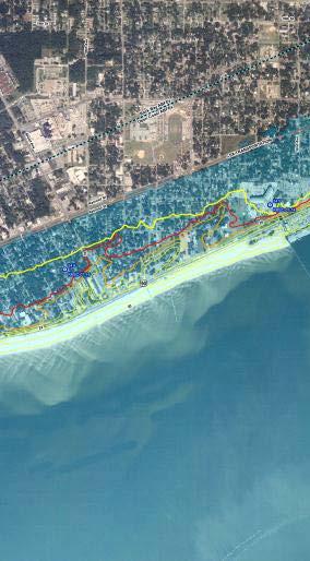
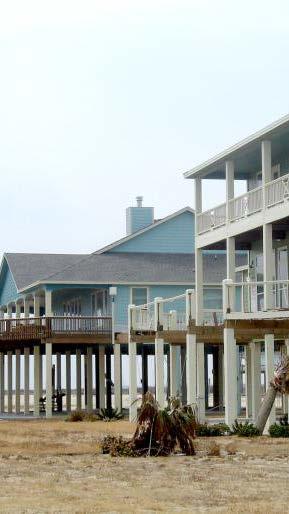
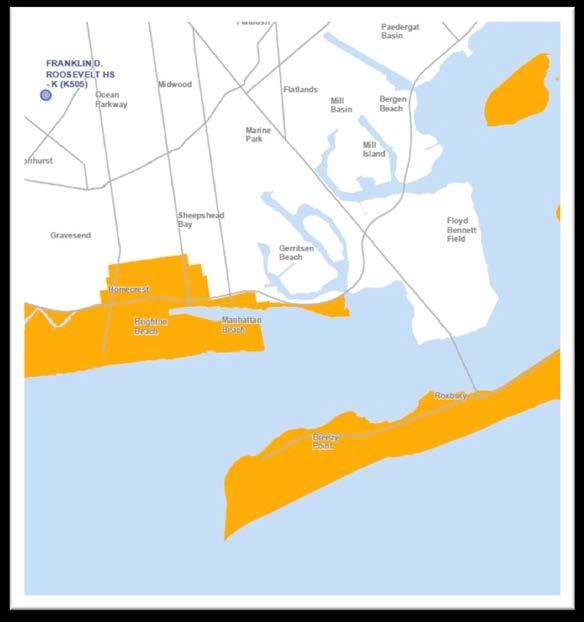
2 Hurricane Hazards Storm Surge Winds Heavy Rain Tornadoes FIRE? Tuckerton, NJ. Photo: US Coast Guard 2

3 3

4 4

5 5

6 6
7 7
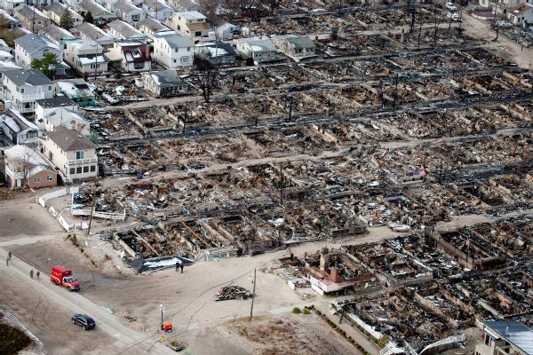
8 Breezy Point Fire October 26: As of 8:00 am, Tropical Storm Watches and Warnings issued by the NOAA National Weather Service were in effect in Florida October 28: Sandy continues moving northeast on a track that takes it parallel to the coasts of Georgia, South Carolina and North Carolina. The storm is still a Category 1 hurricane with peak winds of about 80 mph. October 29, 8:00 PM: Sandy s center comes ashore near Atlantic City, New Jersey. The storm is no longer considered a hurricane but is now classified as a post-tropical nor easter. October 30, 6:00 PM: Breezy Point sees 4-8 feet of water. October 30, 11:00 PM: Fire reported to fire department in Breezy Point. Initial reports put the number of homes affected at eight or nine, then 15 before jumping to 50. Single fire truck was able to leave flooded station. October 31, 12:00 AM: Fire efforts stalled due to high water. Fire hydrants submerged. October 31, 3:34 PM: Fire concluded. 45 hours. 8
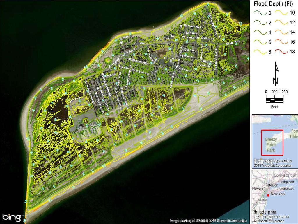
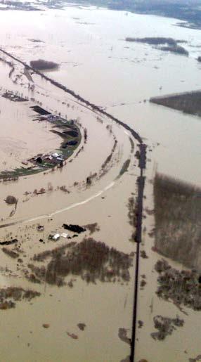
9 Flood Inundation 9


10 10
11 Fire Apparatus 11

12 12
13 13

14 Fire 14
15 Flame Dynamics 15
16 Fire Propagation in extreme weather 16
17 Fire Propagation in extreme weather 17


18 18


19 Wind Driven Fire - Interior 19

20 Heat Propagation Radiation Conduction Convection 20

21 Residential Fire Propagation 21
22 Fire Brands 22

23 Mitigation Options 23
24 Residential Fire in the Code Exterior Wall Element Min. Fire Resistant Rating Minimum Fire Separation Walls FRR 1 Hour < 5 feet Projections FRR Openings in Walls Not FRR 0 Hours 5 feet 1 Hour on the underside 2 feet to < 5 feet Not FRR 0 Hours 5 feet Not allowed 25% Max wall area N/A < 3 feet 0 hours 3 feet Unlimited 0 hours 5 feet Roof N/A Class A, B, C 3 feet from lot line 24
: the amount, type, and distribution of vegetation; the flammability of the structures (homes, businesses, outbuildings, decks, fences) in the area, and")
25 WUI WUI - Wildland Urban Interface Condition, Not Place WUI: Areas where homes are built near or among lands prone to wildland fire. Conditions include (but are not limited to): the amount, type, and distribution of vegetation; the flammability of the structures (homes, businesses, outbuildings, decks, fences) in the area, and their proximity to fire-prone vegetation and to other combustible structures; weather patterns and general climate conditions; topography; hydrology; average lot size; and road construction. 25
26 WUI vs. Fire during Hurricane WUI Fire during high wind/high water event Typical Residential Fire Vegetation Dry Wet Dry Proximity of Homes Availability of Fire Fighting Fire Positive Climate Increase in Flame Spread Ability to Evacuate Variable Variable Variable Limited Limited Available Positive Positive Not Typical Yes Yes Not Typical Limited Limited Typically Available 26

27 International WUI Code 27
28 Class 1 Ignition Resistant Construction Exterior Wall Element 2012 IRC 2012 WUIC Min. FRR Minimum Fire Separation Min. FRR Walls 0 Hours 5 feet 1 Hour FRR Projections 0 Hours 5 feet 1 Hour FRR Openings in Walls 0 hours 5 feet 20 minutes Roof Class A, B, C 3 feet from lot line Class A 28
29 Conclusions Fire Risk increased in high wind, high water events Increased by close proximity of Homes Current code, 2012 IRC, provides guidelines on fire protection Assumption is that fire fighting is available Limited defend in place WUI Code a plausible alternative in these situations Consider homes to be risk category I 29
30 Questions?

31 Additional Research IRC Flood Provisions vs. Fire Resistance 31
GC Briefing. Weather Sentinel Tropical Storm Michael. Status at 8 AM EDT (12 UTC) Today (NHC) Discussion. October 11, 2018
 Today (NHC) Discussion. October 11, 2018") GC Briefing Weather Sentinel Tropical Storm Michael October 11, 2018 After making landfall as a high-end category-4 hurricane on the Florida Panhandle, Michael weakened to tropical storm status early this
GC Briefing Weather Sentinel Tropical Storm Michael October 11, 2018 After making landfall as a high-end category-4 hurricane on the Florida Panhandle, Michael weakened to tropical storm status early this
Hurricane Season 2018
 Hurricane Season 2018 Mission Protect LIFE and Property (Save Lives and Livelihoods) NOAA/ National Weather Service We are NOT a 9-to-5 agency. We operate 24/7/365 serving communities. We are available
Tropical Update. 11 AM EDT Wednesday, October 10, 2018 Hurricane Michael, Hurricane Leslie & Tropical Storm Nadine, Caribbean Low (40%)
") Tropical Update 11 AM EDT Wednesday, October 10, 2018 Hurricane Michael, Hurricane Leslie & Tropical Storm Nadine, Caribbean Low (40%) This update is intended for government and emergency response officials,
Tropical Update 11 AM EDT Wednesday, October 10, 2018 Hurricane Michael, Hurricane Leslie & Tropical Storm Nadine, Caribbean Low (40%) This update is intended for government and emergency response officials,
Risk Assessment and Mitigation. Hurricane Checklist
 Risk Assessment and Mitigation Hurricane Checklist Hurricane Checklist Hurricanes are severe tropical storms with sustained winds of at least 74 miles per hour. Hurricane winds can reach 160 miles per
Hurricane Sandy October 28 th 31 st 2012
 Hurricane Sandy October 28 th 31 st 2012 Prepared 530 PM EDT Saturday October 27, 2012 Gary Szatkowski NOAA s NJ Forecast Office Weather.gov/phi Purpose of Briefing Briefing #7 for event Promote situational
Hurricane Matthew Threats and Impacts Briefing for Eastern NC
 Hurricane Matthew Threats and Impacts Briefing for Eastern NC October 6 th, 2016 Date/Time Created: 10/6/2016, Noon EDT National Weather Service Newport/Morehead City, NC Hurricane Matthew Key Points Changes
Hurricane Matthew. Life Threatening Flash Flooding Likely. National Weather Service Wilmington NC. Josh Weiss, Meteorologist
 Hurricane Matthew Life Threatening Flash Flooding Likely Threat Assessment for northeast South Carolina & southeast North Carolina National Weather Service Wilmington NC 630 PM EDT Friday October 7, 2016
HURRICANES. Source:
 HURRICANES Source: http://www.dc.peachnet.edu/~pgore/students/w97/matheson/hpage.htm What is a hurricane? Violent cyclonic storm that develops in the tropical region Wind speeds are > 74 mph Source: http://www.google.com/imgres?hl=en&sa=x&biw=1920&bih=955&tbm=
Very Dangerous Coastal Storm Sandy October 28 th 31 st 2012
 Very Dangerous Coastal Storm Sandy October 28 th 31 st 2012 Prepared 600 PM EDT Monday October 29, 2012 Gary Szatkowski NOAA s NJ Forecast Office Weather.gov/phi Purpose of Briefing Briefing #11 for event
GC Briefing. Weather Sentinel Hurricane Florence. Status at 5 PM EDT (21 UTC) Today (NHC) Discussion. September 13, 2018
 Today (NHC) Discussion. September 13, 2018") GC Briefing September 13, 2018 Weather Sentinel Hurricane Florence Tropical storm conditions have been reported for areas of North Carolina and will continue to spread inland to the west and south. Hurricane
GC Briefing September 13, 2018 Weather Sentinel Hurricane Florence Tropical storm conditions have been reported for areas of North Carolina and will continue to spread inland to the west and south. Hurricane
Hurricane Matthew Life Threatening Flash Flooding Likely
 Hurricane Matthew Life Threatening Flash Flooding Likely Threat Assessment for northeast South Carolina & southeast North Carolina National Weather Service Wilmington NC 12 AM EDT Saturday October 8, 2016
Monthly Long Range Weather Commentary Issued: SEPTEMBER 19, 2016 Steven A. Root, CCM, Chief Analytics Officer, Sr. VP,
 Monthly Long Range Weather Commentary Issued: SEPTEMBER 19, 2016 Steven A. Root, CCM, Chief Analytics Officer, Sr. VP, sroot@weatherbank.com SEPTEMBER 2016 Climate Highlights The Month in Review The contiguous
Hurricane Matthew. National Weather Service Wilmington NC. Steven Pfaff, WCM.
 Hurricane Matthew Threat Assessment for northeast South Carolina & southeast North Carolina National Weather Service Wilmington NC 730 AM EDT Tuesday October 4, 2016 Steven Pfaff, WCM Steven.Pfaff@noaa.gov
Are You Ready For Hurricane Season? 2018 Hurricane Talk B Y : S T O R M T E A M 8 M E T E O R O L O G I S T J U L I E P H I L L I P S
 Are You Ready For Hurricane Season? 2018 Hurricane Talk B Y : S T O R M T E A M 8 M E T E O R O L O G I S T J U L I E P H I L L I P S About Me I am Currently a Weekday Meteorologist at WFLA Channel 8.
Coastal Resiliency: Planning for Natural Variability and Recovering from Extreme Events
 Coastal Resiliency: Planning for Natural Variability and Recovering from Extreme Events Stephanie Showalter, J.D., M.S.E.L. Director, National Sea Grant Law Center University of Mississippi Coastal Hazards
Major Hurricane Matthew Briefing Situation Overview
 Major Hurricane Matthew Briefing Situation Overview THIS IS NOW A WORST CASE STORM SURGE SCENARIO Catastrophic Damage is Anticipated for Coastal Areas. Major Hurricane Matthew is still expected to move
Hurricanes and coastal storms pose a risk because powerful winds and storm surges can:
 HURRICANES A hurricane is a violent area of low pressure forming in the tropical Atlantic Ocean from June to November. August and September are peak months. (Similar Western Pacific Ocean storms are called
Major Hurricane Matthew Briefing Situation Overview
 Major Hurricane Matthew Briefing Situation Overview At 5 p.m. Tuesday, Category 4 Hurricane Matthew was about 860 miles South-Southeast of Mayport, Florida, moving north around 10 mph. Maximum sustained
NOAA s National Weather Service Philadelphia/Mt. Holly NJ
 Next Briefing Package: Friday, October 2, 2015 no later than 300 PM Hazards and Impacts: Overview: A dangerous weather pattern still threatens our region. Threats include very heavy rainfall, inland river
TROPICAL DEPRESSION HARVEY BRIEFING
 TROPICAL DEPRESSION HARVEY BRIEFING 10:15 PM CDT Wednesday, August 23, 2017 Prepared by: Lara Beal NWSCorpus www.weather.gov/corpuschristi Situation Overview No changes to Watches. Hurricane Watch remains
The Saffir-Simpson Hurricane Wind Scale
 The Saffir-Simpson Hurricane Wind Scale The Saffir-Simpson Hurricane Wind Scale is a one to five categorization based on the hurricane's intensity at the indicated time. The scale provides examples of
Natural Disasters PASSAGE 5
 PASSAGE 5 Name Directions: Read Natural Disasters. Then answer questions 1 8. Natural Disasters Our planet can be a calm place, but weather conditions often change rapidly. Gentle breezes can blow into
Where Do Hurricanes Occur?
 Where Do Hurricanes Occur? How Often Do Hurricanes Hit the U.S.? Hurricane Return Periods Hurricane return periods are the frequency at which a certain intensity of hurricane can be expected within a
5.2 IDENTIFICATION OF HAZARDS OF CONCERN
 5.2 IDENTIFICATION OF HAZARDS OF CONCERN 2015 HMP Update Changes The 2010 HMP hazard identification was presented in Section 6. For the 2015 HMP update, the hazard identification is presented in subsection
Homework Assignment IV. Weather Exercises
 Page 1 of 5 EENS 3050/6050 Tulane University Natural Disasters Prof. Stephen A. Nelson Homework Assignment IV. Weather Exercises This document last updated on 16-Nov-2016 1. Go to the following link to
Hurricanes. Hurricanes are large, tropical storm systems that form and develop over the warm waters near the equator.
 Hurricanes Hurricanes are large, tropical storm systems that form and develop over the warm waters near the equator. They are responsible for weather that can devastate entire communities: Heavy rain --
TROPICAL STORM NATE BRIEFING
 TROPICAL STORM NATE BRIEFING 5:00 AM CDT Friday, October 6, 2017 Prepared by: NWS NWSNewOrleans www.weather.gov/neworleans Situation Overview No significant changes to the track forecast this morning.
WEDNESDAY 30 TH AUGUST, :57 p.m. Tropical Storm Irma forms in the Atlantic. Don t let your guard down, always #Be Ready.
 Chapter 1 - The Set Up In the days leading up to Irma a series of composed and sobering text messages, presented in truncated form below, from Department of Disaster Management warned us of the pending
Tropical Update. 12 PM EDT Friday, October 7, 2016 Hurricane Matthew & Tropical Storm Nicole
 Tropical Update 12 PM EDT Friday, October 7, 2016 Hurricane Matthew & Tropical Storm Nicole This update is intended for government and emergency response officials, and is provided for informational and
Storms. Tropical Cyclone?
 Storms Tropical Cyclone? Tropical Cyclone: low pressure storm forming in the tropics (Start as Thunder Storms). They form around a center, producing heavy winds and rains. Storms What strengthens a Tropical
Chapter 3: Weather Fronts & Storms
 Chapter 3: Weather Fronts & Storms An AIR MASS is a large body of air that has similar characteristics (temperature, humidity) throughout. Air masses can be massively large. Air masses are classified by
NOAA s National Weather Service Philadelphia/Mt. Holly NJ
 Next Briefing Package: Thursday, October 1, 2015 no later than 300 PM Hazards and Impacts: Overview: A dangerous weather pattern is developing for our region. Threats include very heavy rainfall, inland
HURRICANES. The History, Structure, Development, and Destruction. Source:
 HURRICANES The History, Structure, Development, and Destruction Source: http://www.dc.peachnet.edu/~pgore/students/w97/matheson/hpage.htm Hurricane Sandy was the deadliest and most destructive tropical
Active Weather Threat Halloween Week Nor easter October 28 th 31 st 2012
 Active Weather Threat Halloween Week Nor easter October 28 th 31 st 2012 Prepared 1130 AM EDT Wednesday, October 24, 2012 Gary Szatkowski NOAA s NJ Forecast Office Weather.gov/phi Purpose of Briefing Briefing
Tracking Hurricane Sandy
 Name: Date: Tracking Hurricane Sandy Purpose: The purpose of this lab is to use data collected during Hurricane Sandy to track the movement of its low-pressure center. The student will also answer questions
Coastal Storm this Weekend
 Weather Briefing Prepared 9 AM EST Feb 5, 2010 Joe Miketta Warning Coordination Meteorologist NOAA s National Weather Service Philadelphia/Mt. Holly NJ Forecast Office 609-261 261-6602 6602 x223 Joseph.Miketta@noaa.gov
Hurricanes and Coastal Storms
 Hurricanes and Coastal Storms Hurricanes and Coastal Storms Display Slide Hu-0 What is the difference between a hurricane and a coastal storm? Allow the participants time to respond before displaying the
Name Earth Science Pd. Hurricanes. Directions: Read the information, view diagrams and answer the questions in the worksheet.
 Hurricanes Directions: Read the information, view diagrams and answer the questions in the worksheet. Hurricane Basics The ingredients for a hurricane include a pre-existing weather disturbance, warm tropical
Module 11: Meteorology Topic 6 Content: Severe Weather Notes
 Severe weather can pose a risk to you and your property. Meteorologists monitor extreme weather to inform the public about dangerous atmospheric conditions. Thunderstorms, hurricanes, and tornadoes are
Tropical Update. 5 PM EDT Sunday, September 10, 2017 Hurricane Irma, Hurricane Jose, Tropical Wave (60%)
") Tropical Update 5 PM EDT Sunday, September 10, 2017 Hurricane Irma, Hurricane Jose, Tropical Wave (60%) This update is intended for government and emergency response officials, and is provided for informational
Tropical Update 5 PM EDT Sunday, September 10, 2017 Hurricane Irma, Hurricane Jose, Tropical Wave (60%) This update is intended for government and emergency response officials, and is provided for informational
2017 Hurricane Season and Beyond
 2017 Hurricane Season and Beyond Ken Graham National Hurricane Center Building a Weather-Ready Nation Much of U.S. Coast Saw Tropical Wind Watches or Warnings 2017 Hurricane Season Facts and Figures 7th
Hurricanes. Cause: a low pressure storm system over warm ocean water. Effect: potential massive widespread destruction and flooding.
 Hurricanes Hurricanes Cause: a low pressure storm system over warm ocean water. Effect: potential massive widespread destruction and flooding. Hurricanes also known as: cyclone (Indian Ocean) or typhoon
LECTURE #18: Hurricane Damage, Monitoring & Case Study
 GEOL 0820 Ramsey Natural Disasters Spring, 2018 LECTURE #18: Hurricane Damage, Monitoring & Case Study Date: 27 March 2018 I. Exam II grades now posted online o high: 98, low: 46, average: 80 (~3 points
Atmospheric Moisture, Precipitation, and Weather Systems
 Atmospheric Moisture, Precipitation, and Weather Systems 6 Chapter Overview The atmosphere is a complex system, sometimes described as chaotic in nature. In this chapter we examine one of the principal
Tropical Update. 11 AM EDT Tuesday, October 9, 2018 Hurricane Michael, Tropical Storm Leslie, Tropical Storm Nadine
 Tropical Update 11 AM EDT Tuesday, October 9, 2018 Hurricane Michael, Tropical Storm Leslie, Tropical Storm Nadine This update is intended for government and emergency response officials, and is provided
Air Masses, Fronts and Weather Systems
 Air Masses, Fronts and Weather Systems Can you name the air mass? 2 1 3 4 5 6 7 8 What is a Front? Fronts are boundaries that separate air masses Where air masses meet and do not mix. Types of Fronts:
2008 Hurricane Caravan. Daniel Noah Meteorologist National Weather Service x1 May 22, 2008
 2008 Hurricane Caravan Daniel Noah Meteorologist National Weather Service daniel.noah@noaa.gov, 813-645-2323 x1 May 22, 2008 National Weather Service We never close! Open 24 hours a day 365 days per year
A HURRICANE IS COMING. Presented by Atiba Upchurch Broward Emergency Management Division
 A HURRICANE IS COMING Presented by Atiba Upchurch Broward Emergency Management Division Mission Statement To safeguard the lives and property of the people of Broward County from major hazards and emergencies
Hurricanes. Environmental Geology Mr. Paul Lowrey. Stacey Singleton, Cassandra Combs, Dwight Stephenson, Matt Smithyman
 Environmental Geology Mr. Paul Lowrey Stacey Singleton, Cassandra Combs, Dwight Stephenson, Matt Smithyman Hurricanes EMPACTS Project, Spring 2017 Northwest Arkansas Community College, Bentonville, AR
LAND USE PLANNING AND RISK: LESSONS FROM THREE AUSTRALIAN PORT CITIES
 LAND USE PLANNING AND RISK: LESSONS FROM THREE AUSTRALIAN PORT CITIES Ken Granger Disaster Risk Scientist Slide No. 1 Land use planning is the single most important mitigation measure for limiting future
Frank Revitte National Weather Service. Weather Forecast Office New Orleans/Baton Rouge
 Frank Revitte National Weather Service Weather Forecast Office New Orleans/Baton Rouge Above normal activity 17 Total Named Storms 7 Tropical Storms 4 Hurricanes 6 Major Hurricanes Not the most active,
Tropical Cyclone Hazards. Presentation
 Tropical Cyclone Hazards Presentation Kerry N Mallory AE5JY September 7, 2011 Tropical Cyclone Hazards The Four Primary Weapons of a Tropical Cyclone are: 1. Wind 2. Storm Surge 3. Rain/Freshwater Flooding
Alignments of Master of Disaster (MoD) Lessons for Grades K-2 with the Next Generation Science Standards (NGSS) X X X X X X X X X X
 Lessons for Grades K-2 with the Next Generation Science Standards (NGSS) X X X X X X X X X X") Alignments of Master of Disaster (MoD) Lessons for Grades K-2 with the Next Generation Science Standards (NGSS) Relevant Next Generation Science Standards Performance Expectations* MoD Lesson Purpose K-PS2-1
Alignments of Master of Disaster (MoD) Lessons for Grades K-2 with the Next Generation Science Standards (NGSS) Relevant Next Generation Science Standards Performance Expectations* MoD Lesson Purpose K-PS2-1
Hurricanes 1. Thunderclouds. cool, dry air falls. warm, moist air rises
 Hurricanes 1 Hurricanes are gigantic tropical storms that can be hundreds of kilometres wide. They bring along very strong winds and a lot of rainfall. They often cause flooding near the coasts and sea
TROPICAL STORM NATE BRIEFING
 TROPICAL STORM NATE BRIEFING 10:30 AM CDT Friday, October 06, 2017 Prepared by: NWS NWSNewOrleans www.weather.gov/neworleans Situation Overview Track forecast has shifted slightly eastward. Hurricane Watch
Weather briefing Strong Coastal Nor easter November 7 th -8 th, 2012
 Weather briefing Strong Coastal Nor easter November 7 th -8 th, 2012 Prepared 1245 PM EDT Tuesday November 6, 2012 Gary Szatkowski NOAA s NJ Forecast Office Weather.gov/phi Purpose of Briefing Briefing
Hurricane Matthew. National Weather Service Wilmington NC. Steven Pfaff, WCM.
 Hurricane Matthew Threat Assessment for northeast South Carolina & southeast North Carolina National Weather Service Wilmington NC 515 PM EDT Monday October 3, 2016 Steven Pfaff, WCM Steven.Pfaff@noaa.gov
HURRICANES AND TORNADOES
 HURRICANES AND TORNADOES The most severe weather systems are hurricanes and tornadoes. They occur in extremely low pressure systems, or cyclones, when the air spirals rapidly into the center of a low.
CLIMATE READY BOSTON. Climate Projections Consensus ADAPTED FROM THE BOSTON RESEARCH ADVISORY GROUP REPORT MAY 2016
 CLIMATE READY BOSTON Sasaki Steering Committee Meeting, March 28 nd, 2016 Climate Projections Consensus ADAPTED FROM THE BOSTON RESEARCH ADVISORY GROUP REPORT MAY 2016 WHAT S IN STORE FOR BOSTON S CLIMATE?
Miami-Dade County Overview
 Miami-Dade County Overview 2,000 square miles World s busiest cruise port 2.6 million residents Second busiest US airport for international travelers Gateway to the Caribbean and Latin America Natural
Hurricane Irma Page 1 HURRTRAK RM/Pro 2017 Summary Report for Tampa, FL 09/09/ EDT, Adv. # 43
 Hurricane Irma Page 1 Description of impact to Tampa, FL, Tampa, FL, is expected to receive a major impact from Hurricane Irma. The forecast maximum wind for this location has decreased since the last
HURRICANE IRENE. CONFERENCE CALL BRIEFING SLIDES Saturday August 27, :30 AM
 HURRICANE IRENE CONFERENCE CALL BRIEFING SLIDES Saturday August 27, 2011 8:30 AM NHC TRACK AND CONE HURRICANE IRENE WATCHES/WARNINGS Hurricane Warning along south coast including all of Cape Cod and Islands
Weather Permitting/Meteorology. North Carolina Science Olympiad Coaches Clinic October 6, 2018 Michelle Hafey
 Weather Permitting/Meteorology North Carolina Science Olympiad Coaches Clinic October 6, 2018 Michelle Hafey hafeym@uncw.edu Read the Rules Weather Permitting Division A Team Of Up To: 2 Bring writing
STORM HISTORY FOR COLLIER COUNTY
 STORM HISTORY FOR COLLIER COUNTY In 1960, when hurricane 'Donna' struck, there were approximately 15,500 people living full time in Collier County. Today there are more than 330,000 residents, most of
Tropical Weather Briefing
 Tropical Weather Briefing August 28, 2012 700 AM CDT National Weather Service Weather Forecast Office Slidell, LA Current Satellite Tropical Storm Isaac Watches/Warnings Tropical Storm Isaac Track Guidance
Residents Emergency Response Checklist
 COMMUNITY RESILIENCE PLAN Residents Emergency Response Checklist A helpful guide in the event of extreme weather or bushfire events. < PREVIOUS I NEXT > 02 Purchasing an existing property or building a
A Look Back at the 2012 Hurricane Season and a Look Ahead to 2013 & Beyond. Daniel Brown National Hurricane Center Miami, Florida 24 April 2013
 A Look Back at the 2012 Hurricane Season and a Look Ahead to 2013 & Beyond Daniel Brown National Hurricane Center Miami, Florida 24 April 2013 2012 Atlantic Verification Good News- Lots of Accuracy Records
Contents. Chapter 1 Introduction Chapter 2 Cyclones Chapter 3 Hurricanes Chapter 4 Tornadoes... 36
 Contents Chapter 1 Introduction.... 4 Chapter 2 Cyclones.... 14 Chapter 3 Hurricanes... 22 Chapter 4 Tornadoes.... 36 Chapter 5 The Perfect Storm... 52 Chapter 6 Hurricane Katrina... 62 Chapter 7 Joplin
Guided Notes Weather. Part 2: Meteorology Air Masses Fronts Weather Maps Storms Storm Preparation
 Guided Notes Weather Part 2: Meteorology Air Masses Fronts Weather Maps Storms Storm Preparation The map below shows North America and its surrounding bodies of water. Country borders are shown. On the
Steps to Reduce the Risk of Tornado Damage in Commercial Structures
 Hanover Risk Solutions Steps to Reduce the Risk of Tornado Damage in Commercial Structures About 1,000 tornadoes occur each year in the United States, causing an average of $1.1 billion in property damage
GCSE 4242/02 GEOGRAPHY (Specification B) FOUNDATION TIER UNIT 2 SECTION B
 FOUNDATION TIER UNIT 2 SECTION B") Surname Centre Number Candidate Number Other Names 0 GCSE 4242/02 GEOGRAPHY (Specification B) FOUNDATION TIER UNIT 2 SECTION B S15-4242-02 P.M. WEDNESDAY, 3 June 2015 1 hour 30 minutes For s use Part Maximum
Surname Centre Number Candidate Number Other Names 0 GCSE 4242/02 GEOGRAPHY (Specification B) FOUNDATION TIER UNIT 2 SECTION B S15-4242-02 P.M. WEDNESDAY, 3 June 2015 1 hour 30 minutes For s use Part Maximum
Weather Middle School Teacher Instructions and Activity
 Weather Middle School Teacher Instructions and Activity Based on the guidelines of the Saffir-Simpson Scale for hurricane severity and the Fujita Scale for tornado damage, students will write a brief synopsis
Daily Operations Briefing December 25, 2012 As of 6:30 a.m. EST
 Daily Operations Briefing December 25, 2012 As of 6:30 a.m. EST 1 Significant Activity: Dec 24-25 Significant Events: Possible Severe thunderstorms - Gulf Coast Sandy/Nor easter recovery Significant Weather:
Tropical Update 6 AM EDT Friday, October 7, 2016 Hurricane Matthew & Hurricane Nicole
 Tropical Update 6 AM EDT Friday, October 7, 2016 Hurricane Matthew & Hurricane Nicole This update is intended for government and emergency response officials, and is provided for informational and situational
Weather briefing Strong Coastal Nor easter November 7 th -8 th, 2012
 Weather briefing Strong Coastal Nor easter November 7 th -8 th, 2012 Prepared 1215 PM EDT Wednesday November 7, 2012 Gary Szatkowski NOAA s NJ Forecast Office http://www.erh.noaa.gov/phi/ Purpose of Briefing
Your Task: Read each slide then use the underlined red or underlined information to fill in your organizer.
 Severe Weather: Tornadoes and Hurricanes Thunderstorms and Lightning S6E4 d. Construct an explanation of the relationship between air pressure, weather fronts, and air masses and meteorological events
TROPICAL CYCLONE TORNADOES
 TROPICAL CYCLONE TORNADOES 2018 GOVERNOR S HURRICANE CONFERENCE TUESDAY, MAY 15, 2018 WILL ULRICH NWS FORECAST OFFICE MELBOURNE WHERE ARE THE TORNADOES? WHERE ARE THE TORNADOES? C B A WEST MELBOURNE, FL
SEVERE WEATHER 101. Flood Basics
 SEVERE WEATHER 101 Flood Basics What is flooding? Flooding is an overflowing of water onto land that is normally dry. Floods can happen during heavy rains, when ocean waves come on shore, when snow melts
Parcels & Hazard Layers in Emergency Preparedness and Response. John Siegman Brady Foust First American Spatial Solutions
 Parcels & Hazard Layers in Emergency Preparedness and Response John Siegman Brady Foust First American Spatial Solutions What is Parcel Data? Parcel boundary: the legal extents of each taxable U.S. property
Hurricane Basics and Preparedness. Jim Weyman Director, Central Pacific Hurricane Center Phone Office:
 Hurricane Basics and Preparedness Jim Weyman Director, Central Pacific Hurricane Center Phone Office: 973-5270 james.weyman@noaa.gov United States Hurricane/Typhoon Centers National Hurricane Center, Miami
From Vulnerability to Resilience And the Tools to Get There. Out of Harm s Way Partnership for the Delaware Estuary August 1, 2012
 From Vulnerability to Resilience And the Tools to Get There Out of Harm s Way Partnership for the Delaware Estuary August 1, 2012 Today s Presentation Tour of New Jersey Challenges Definitions so we re
Hurricane Preparedness and Awareness!
 Hurricane Preparedness and Awareness! Check these out Time to begin executing the evacuation plan What kind of damage are we talking about here? What Exactly Is a Hurricane? A hurricane can best be described
5.2 IDENTIFICATION OF HAZARDS OF CONCERN
 5.2 IDENTIFICATION OF HAZARDS OF CONCERN 2016 HMP Update Changes The 2011 HMP hazard identification was presented in Section 3. For the 2016 HMP update, the hazard identification is presented in subsection
Spring Water Supply and Weather Outlook How about that near Miracle March?
 Spring Water Supply and Weather Outlook How about that near Miracle March? tim.bardsley@noaa.gov NWS Reno 4.10.18 1 Out the Window March and early April have been Boom not Bust Key Points Up Front Wet
LECTURE #15: Thunderstorms & Lightning Hazards
 GEOL 0820 Ramsey Natural Disasters Spring, 2018 LECTURE #15: Thunderstorms & Lightning Hazards Date: 1 March 2018 (lecturer: Dr. Shawn Wright) I. Severe Weather Hazards focus for next few weeks o somewhat
Hurricane Florence: Rain this heavy comes along once every 1,000 years
 Hurricane Florence: Rain this heavy comes along once every 1,000 years By Associated Press, adapted by Newsela staff on 09.17.18 Word Count 786 Level 810L Image 1. This satellite image provided by the
TROPICAL STORM NATE BRIEFING
 TROPICAL STORM NATE BRIEFING 2:00 PM CDT Friday, October 06, 2017 Prepared by: NWS NWSNewOrleans www.weather.gov/neworleans Situation Overview Track forecast has not changed since the 10 am advisory. Hurricane
LECTURE #17: Severe Weather: Introduction to Hurricanes
 GEOL 0820 Ramsey Natural Disasters Spring, 2018 LECTURE #17: Severe Weather: Introduction to Hurricanes Date: 15 March 2018 I. Hurricane Overview hurricanes o what they are? o how they form? storm stages:
Comparative Analysis of Hurricane Vulnerability in New Orleans and Baton Rouge. Dr. Marc Levitan LSU Hurricane Center. April 2003
 Comparative Analysis of Hurricane Vulnerability in New Orleans and Baton Rouge Dr. Marc Levitan LSU Hurricane Center April 2003 In order to compare hurricane vulnerability of facilities located in different
Exercise Brunswick ALPHA 2018
 ALPHA Exercise Brunswick ALPHA 2018 Who we are (our structure) What we do (our forecasts) How you can access the information Tropical cyclone information (basic) Overview of the products used for Exercise
Agricultural Outlook Forum Presented: February 17, 2006 THE SCIENCE BEHIND THE ATLANTIC HURRICANES AND SEASONAL PREDICTIONS
 Agricultural Outlook Forum Presented: February 17, 2006 THE SCIENCE BEHIND THE ATLANTIC HURRICANES AND SEASONAL PREDICTIONS Gerald Bell Meteorologist, National Centers for Environmental Prediction NOAA,
Hurricane Harvey: SE Texas Impacts. 10 PM CDT UPDATE Friday, August 25, 2017 Prepared by: Lance Wood
 Hurricane Harvey: SE Texas Impacts 10 PM CDT UPDATE Friday, August 25, 2017 Prepared by: Lance Wood Latest Observations Hurricane Harvey making landfall this evening near Rockport as a category 4 hurricane.
Chapter 16, Part Hurricane Paths. 2. Hurricane Paths. Hurricane Paths and Damage
 Chapter 16, Part 2 Hurricane Paths and Damage 1. Hurricane Paths Start over tropical water except South Atlantic and eastern South Atlantic, where water is too cold. Initially steered by easterly winds
SLOSH New Orleans Basin 2012 Update
 SLOSH New Orleans Basin 2012 Update Michael Koziara Science and Operations Officer National Weather Service Slidell, LA The Basics What is storm surge? What is SLOSH? Details Assumptions Inundation = Storm
Kentucky Weather Hazards: What is Your Risk?
 Kentucky Weather Hazards: What is Your Risk? Stuart A. Foster State Climatologist for Kentucky 2010 Kentucky Weather Conference Bowling Green, Kentucky January 16, 2010 Perspectives on Kentucky s Climate
Estimating the Spatial Distribution of Power Outages during Hurricanes for Risk Management
 Estimating the Spatial Distribution of Power Outages during Hurricanes for Risk Management Marco Palmeri Independent Consultant Master s Candidate, San Francisco State University Dept. of Geography September
Canes on Canes: Keeping South Florida Prepared During the Calm Before the Storm. Matt Onderlinde and Pete Finocchio
 Canes on Canes: Keeping South Florida Prepared During the Calm Before the Storm Matt Onderlinde and Pete Finocchio Outline The Science of Hurricanes Why and When South Floridians Must Be Weather-Ready
The National Hurricane Center
 The National Hurricane Center Where we are and where we hope to go Bill Read, Director National Hurricane Center U.S. HURRICANE FORECAST SERVICE HISTORY MODERN ERA HIGHLIGHTS 1935: Began 24 hour forecast
COMMUNITY EMERGENCY RESPONSE TEAM FLOODS INTRODUCTION
 INTRODUCTION Floods are one of the most common hazards in the United States. A flood occurs any time a body of water rises to cover what is usually dry land. Flood effects can be local, impacting a neighborhood
Analysis of fatalities attributed to Hurricane Florence in the US.
 Analysis of fatalities attributed to Hurricane Florence in the US. Jonathan van Leeuwen Hurricane Florence impacted the US East Coast in September 2018 resulting in dangerous surf conditions, strong winds,