National Ocean Technology Center of China Wang Xiangnan
|
|
|
- Amelia Young
- 6 years ago
- Views:
Transcription


1 National Ocean Technology Center of China Wang Xiangnan


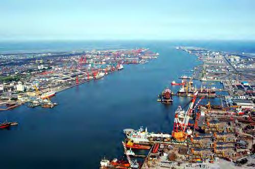
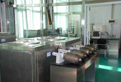
2 National Ocean Technology Center Beijing Tianjin NOTC Established in 1965 Staff of 500 Bohai Sea 2

3 3

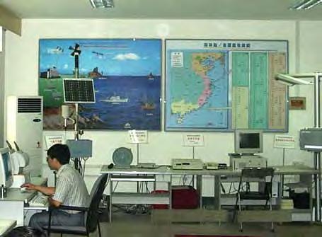
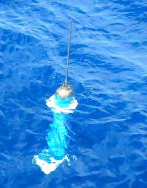
4 National Ocean Technology Center Administrated by State Oceanic Administration of China; Implement national marine technology operational management; provide technical support for national marine planning; take on marine high technology development; 4
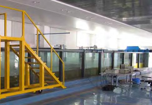
5 National Ocean Technology Center 13 research sectors, including marine environmental monitoring, marine ecological monitoring, marine remote sensing, buoy engineering, marine renewable energy utilization and so on. 5

6 6


7 7
8 Outline Introduction of Marine Ecological and Environmental Monitoring System (MEEMS) Development of MEEMS MEEMS Deployment in the Yellow Sea of China MEEMS Deployment in Polar Region Conclusion 8
9 Introduction of MEEMS Funded by Chinese High Tech Research and Development Program; ; 5 million Yuan RMB. 9
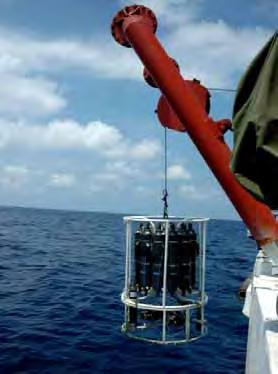
10 Introduction of MEEMS continuously measure the coastal marine ecological and environmental parameters for a long time. monitoring parameters include chlorophyll, ph, PAR, ORP, C, T, D and currents. 10

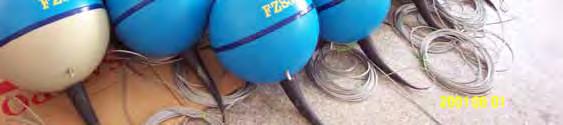
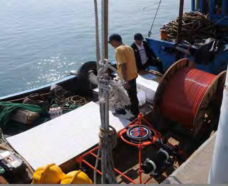
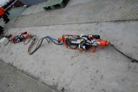
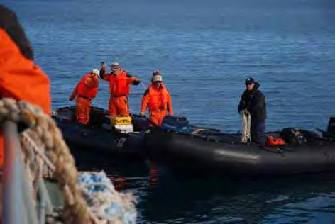
11 sketch map of MEEMS 11
12 Development of MEEMS underwater monitoring subsystem; data transmission and power subsystem; data processing subsystem. 12


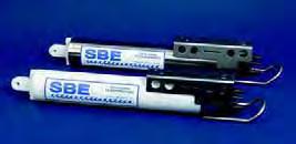
13 Underwater Monitoring Subsystem surface two sets of SBE16 Plus V2 CTD attached to the Kevlar umbilical; a set of SBE 37 SIP CTD; a set of WHM 600 ADCP mounted on the bottom framework. seawater seafloor 13
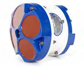
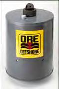
14 Instrumentation ADCP ph Sensor ORP Sensor Fluorometer CTD PAR Sensor ORE release 14
15 Data Transmission and Power Subsystem contains mainly a 1km cable, with two signal lines and two power lines; serial RS485 communication for data transmission; power supply is provided in the coastal station. 15
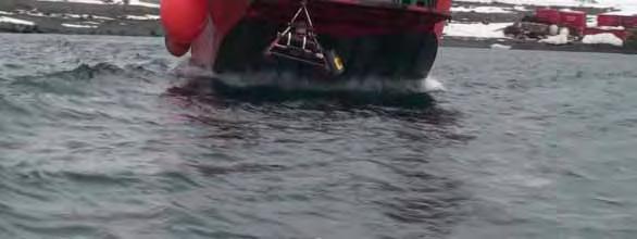
16 Data Processing Subsystem The data processing subsystem uses a designated computer located in the shore based field station to receive the data every 10 to 30 minutes (specified by user). The data is preprocessed and then be transmitted to users through s. 16
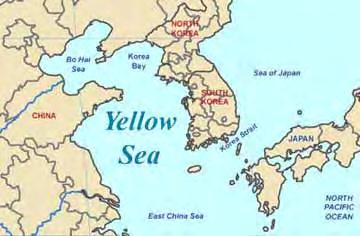
17 Deployment in the Yellow Sea MEEMS was firstly deployed in the Yellow Sea of China in September The purpose of the trial is to verify the reliability and applicability of the system. The deployment site is about 800 meters away from the coastline and the depth is about 25m. 17
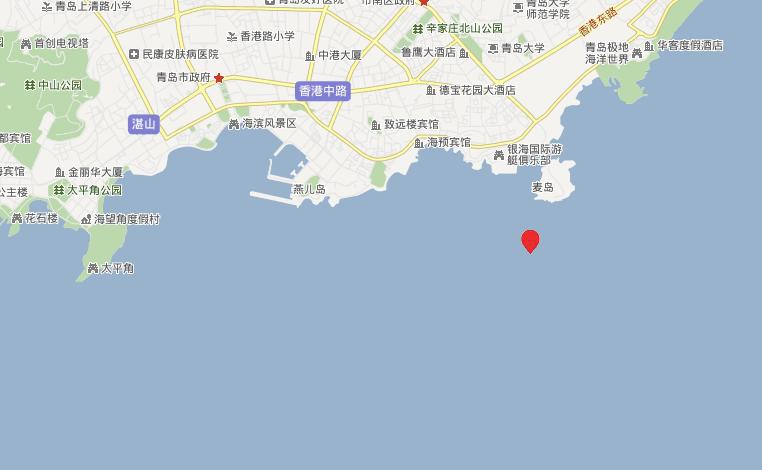
18 Deployment Site deployment preparation 18


19 Data Acquired More than 2100 groups of data were acquired during the test. ADCP U velocity ADCP V velocity 19


20 Deployment in Polar Region The deployment site is in the Great Wall Bay, west of King George Island. King George Island Great Wall Bay Antarctic 20
21 Deployment in Polar Region depth near the shoreline is about 30m; current speed is less than 3 knots; it's close to the shore based field station to lay a power cable. 21

22 Deployment 2009/2010 MEEMS was firstly deployed in December to verify the reliability of the system and its applicability in the Antarctic Ocean. 22
23 Deployment 2009/2010 Firstly, a channel was cut to lay the cable; Secondly, the cable was carried on board and spread out during the sail of the vessel; Finally, while arriving at the designated site, the underwater monitoring platform was deployed. 23
24 Deployment 2009/ months of test; more than 17 thousands groups of data. 24

25 Retrieval 25
26 Deployment 2010/2011 In December 2010, the system was deployed again. The purpose is to acquire more continuous monitoring data, accumulating experience and fundamental data for the future monitoring. 26
27 Deployment 2010/
28 Data Analysis 2010/ months of test; more than 20 thousands groups of data. 28

29 CTD Comparison between 2009/2010 and 2010/
30 Data Analysis 2010/2011 chlorophyll in the upper level (12m, as shown below) is about 2.5 times than that of the lower level (18m); 30
31 Data Analysis 2010/2011 measurement of PAR in the upper level (as shown below) is about 3 times than that of the lower level; 31
32 Data Analysis 2010/2011 The upper level ph (as shown below) is higher than the low level ph with ; 32

33 Data Analysis 2010/2011 The difference between the two levels of ORPs is not obvious (the upper level as shown below). 33
34 Conclusions MEEMS has acquired more than 40 thousands groups of data, which is typical of the status of the Great Wall Bay and could be used in marine ecological and environmental modeling of Antarctic Ocean; We plan to deploy MEEMS again in December 2011; MEEMS is an early but beneficial trial system for marine ecological and environmental monitoring in the Antarctic Ocean. MEEMS provide an effective tool for long term and continuous monitoring of marine ecology and environment. 34
Japan Agency for Marine-Earth Science and Technology (JAMSTEC), 2-15 Natsushima-cho, Yokosuka, Kanagawa, , JAPAN
, 2-15 Natsushima-cho, Yokosuka, Kanagawa, , JAPAN") LARGE EARTHQUAKE AND ASSOCIATED PHENOMENA OBSERVED WITH SEAFLOOR CABLED OBSERVATORY NEAR EPICENTER - AN IMPLICATION FOR POSSIBLE ADDITIONAL MEASUREMENT WITH TELECOMMUNICATION NETWORKS FOR IDENTIFICATION
LARGE EARTHQUAKE AND ASSOCIATED PHENOMENA OBSERVED WITH SEAFLOOR CABLED OBSERVATORY NEAR EPICENTER - AN IMPLICATION FOR POSSIBLE ADDITIONAL MEASUREMENT WITH TELECOMMUNICATION NETWORKS FOR IDENTIFICATION
Real-Time Measurement of Sea Ice Thickness, Keel Sizes and Distributions and Ice Velocities Using Upward Looking Sonar Instruments
 Real-Time Measurement of Sea Ice Thickness, Keel Sizes and Distributions and Ice Velocities Using Upward Looking Sonar Instruments David Fissel, Rene Chave and Jan Buermans ASL Environmental Sciences Inc.
Suitability of locations in the Bohai Sea, China, for the exploitation of sea ice as a freshwater resource
 Annals of Glaciology 54(62) 2013 doi:10.3189/2013aog62a304 267 Suitability of locations in the Bohai Sea, China, for the exploitation of sea ice as a freshwater resource Lantao LI, Wei GU, Chengyu LIU,
Missions from MARS: Marine Autonomous and Robotic Systems - current and future science applications
 Missions from MARS: Marine Autonomous and Robotic Systems - current and future science applications Dr Russell B Wynn (MARS Chief Scientist, Head of NOC Marine Geoscience) Marine Autonomous and Robotic
Yev Kontar. Illinois State Geological Survey, University of Illinois at Urbana-Champaign
 Addressing Caribbean Geophysical Hazards through the Continuously Operating Caribbean GPS Observational Network (COCONet) and International Ocean Drilling Program (IODP) Yev Kontar Illinois State Geological
South Bay Coastal Ocean Observing System California Clean Beaches Initiative
 South Bay Coastal Ocean Observing System California Clean Beaches Initiative Quarterly Report December 2003 to City of Imperial Beach Eric Terrill 1 1 Scripps Institution of Oceanography, University of
Hydrologic CTD Dataset Obtained through Chinese Antarctic Expeditions
 Journal of Global Change Data & Discovery. 2017, 1(2): 157-164 DOI:10.3974/geodp.2017.02.04 www.geodoi.ac.cn 2017 GCdataPR Global Change Research Data Publishing & Repository Hydrologic CTD Dataset Obtained
Long Term Autonomous Ocean Remote Sensing Utilizing the Wave Glider
 Long Term Autonomous Ocean Remote Sensing Utilizing the Wave Glider J. Griffith, K. VanderLugt, Matt Cosad Liquid Robotics 1329 Moffett Park Drive Sunnyvale, CA 94089 Abstract Rising costs of ship time
Ocean Currents Student Activity Book
 Ocean Currents Student Activity Book I. Introduction Ocean currents influence the weather in coastal areas. They also influence sailing vessels. Though they visibly affect many people's lives, they are
South Bay Coastal Ocean Observing System California Clean Beaches Initiative
 South Bay Coastal Ocean Observing System California Clean Beaches Initiative Second Quarterly Report January, 2003 to City of Imperial Beach Eric Terrill 1 1 Scripps Institution of Oceanography, University
Red Sea - Dead Sea Water Conveyance Study Program Additional Studies
 Red Sea - Dead Sea Water Conveyance Study Program Additional Studies Red Sea Study Final Report Annex 1 Field and laboratory activities carried out during the study and their results July 213 TABLE OF
Graphing Sea Ice Extent in the Arctic and Antarctic
 Graphing Sea Ice Extent in the Arctic and Antarctic 1. Large amounts of ice form in some seasons in the oceans near the North Pole and the South Pole (the Arctic Ocean and the Southern Ocean). This ice,
 Date: 25 February 2009 Application for Consent to Conduct Marine Scientific Research in Areas Under National Jurisdiction of Philippines (name of coastal state) 1. General Information 1.1 Cruise name and/or
Indian Ocean Tsunami Warning System: Example from the 12 th September 2007 Tsunami
 Indian Ocean Tsunami Warning System: Example from the 12 th September 2007 Tsunami Charitha Pattiaratchi 1 Professor of Coastal Oceanography, The University of Western Australia Email: chari.pattiaratchi@uwa.edu.au
Harmful Algal Bloom Detectives in the Gulf of Mexico Satellites, Gliders and Buoys, Oh My!
 Harmful Algal Bloom Detectives in the Gulf of Mexico Satellites, Gliders and Buoys, Oh My! By Chris Simoniello and Ruth Mullins* With information from: *The Gulf of Mexico Coastal Ocean Observing System
Byblos & the Sea - an HFF funded project Summary report: Sea Survey Mission 7 - Sept. 2016
 Byblos & the Sea - an HFF funded project Summary report: Sea Survey Mission 7 - Sept. 2016 In the framework of the research program Byblos and the Sea a marine remote sensing and sampling survey was carried
Development and deployment plan of ARGO type buoy in the Arctic Ocean
 1/16 Development and deployment plan of ARGO type buoy in the Arctic Ocean by T.Kikuchi, N.Shikama (JAMSTEC), D.Langevin, T.Monk, and O.Lebreton (MetOcean) 2/16 Ice-drifting buoy observation J-CAD ( JAMSTEC
The Physical Context for Thin Layers in the Coastal Ocean
 The Physical Context for Thin Layers in the Coastal Ocean David M. Fratantoni Physical Oceanography Department Woods Hole Oceanographic Institution Woods Hole, MA 02543 phone: (508) 289-2908 fax: (508)
Monitoring the coastal ocean: from local to regional
 Monitoring the coastal ocean: from local to regional Luísa Bastos University of Porto / CIIMAR RAIA partners Ocean monitoring To answer key societal and scientific challenges navigation safety, fisheries,
Circulation in the South China Sea in summer of 1998
 Circulation in the South China Sea in summer of 1998 LIU Yonggang, YUAN Yaochu, SU Jilan & JIANG Jingzhong Second Institute of Oceanography, State Oceanic Administration (SOA), Hangzhou 310012, China;
Appendix B. Contents. Elliston instrument deployment data report. Olympic Dam Expansion Supplementary Environmental Impact Statement 2010
 Project Alternatives Appendix B Contents B1 Elliston instrument deployment data report 1 Olympic Dam Expansion Supplementary Environmental Impact Statement 2010 Appendix B1 Elliston instrument deployment
An Integrated Network of In situ and Remote Sensors to Characterize the Somali Current
 DISTRIBUTION STATEMENT A. Approved for public release; distribution is unlimited. An Integrated Network of In situ and Remote Sensors to Characterize the Somali Current Eric J. Terrill, Ph.D. Director,
Real Time Monitoring System for Megathrust Earthquakes and Tsunamis - Cabled Network System and Buoy System in Japan -
 Real Time Monitoring System for Megathrust Earthquakes and Tsunamis - Cabled Network System and Buoy System in Japan - 1 Subduction zones around the world Haiti Italy Turkey Tohoku Sichuan Taiwan Sumatra
OSU Ocean Observing Center
 OSU Ocean Observing Center and The Ocean Observatories Initiative OSU Retirement Association March 10,19 2016 2 Early Ocean Observations OSU Retirement Association March 10,19 2016 3 No information off
Lawrence Younan Senior Applications Scientist, Turner Designs February 15, Fluorometers; Experiences with Autonomous Vehicles
 Lawrence Younan Senior Applications Scientist, Turner Designs February 15, 2017 Fluorometers; Experiences with Autonomous Vehicles Outline Fluorometers specifically designed for system-level integration
7B.4 ASSESSMENT OF THE GROSS U.S. OFFSHORE WIND ENERGY POTENTIAL
 7B.4 ASSESSMENT OF THE GROSS U.S. OFFSHORE WIND ENERGY POTENTIAL Marc Schwartz, Donna Heimiller, Steve Haymes, and Walt Musial National Renewable Energy Laboratory, Golden, Colorado 1. INTRODUCTION Offshore
Coastal Water Quality Monitoring in Cyprus using Satellite Remote Sensing
 Coastal Water Quality Monitoring in Cyprus using Satellite Remote Sensing D. G. Hadjimitsis 1*, M.G. Hadjimitsis 1, 2, A. Agapiou 1, G. Papadavid 1 and K. Themistocleous 1 1 Department of Civil Engineering
LOG_aLevel. Tsunami Warning System
 LOG_aLevel Tsunami Warning System General Acoustics e.k. Am Kiel-Kanal 1 24106 Kiel Germany Phone: +49 431 5 80 81 80 www.generalacoustics.com Info@generalacoustics.com LOG_aLevel Tsunami Warning System
HICO Calibration and Atmospheric Correction
 HICO Calibration and Atmospheric Correction Curtiss O. Davis College of Earth Ocean and Atmospheric Sciences Oregon State University, Corvallis, OR, USA 97331 cdavis@coas.oregonstate.edu Oregon State Introduction
Cruise Report. RV Oceania, AREX2011. Institute of Oceanology Polish Academy of Sciences. the Norwegian, Greenland and Barents Seas
 w Warszawy 55, 81-712 Sopot, Poland, P.O. Box 68 10 December, 2011 Cruise Report RV Oceania, AREX2011 Institution Ship Name Cruise Name Institute of Oceanology Polish Academy of Sciences RV Oceania AREX2011
Arctic. Ocean Observing Build Out Plan. alaska ocean observing system. March 1, 2013 draft. Tom Van Pelt
 Arctic Ocean Observing Build Out Plan March 1, 2013 draft Tom Van Pelt alaska ocean observing system Tom Van Pelt Why a coastal observing system in the Arctic? The Arctic is booming with increased activity
The FLIP Experiment: Testing the Relationship of Length of Upwelling Tubes to Maximize Upwelling Velocity
 The FLIP Experiment: Testing the Relationship of Length of Upwelling Tubes to Maximize Upwelling Velocity Anthony T. Jones, Ph.D. Oceanographer oceanus consulting Introduction The Hydrocratic Generator
Introduction of KOPRI
 Introduction of KOPRI Brief History of Korea Polar Research 1987. 03 Polar research lab. Established at KORDI 1988. 02 The Antarctic King Sejong station inaugurated 1989. 10 Korea joined AT as a consultative
Contribution of Norwegian partners (Aanderaa Data Instruments and NIVA) to Safeport project ( ). Final report
 to Safeport project ( ). Final report") Contribution of Norwegian partners (Aanderaa Data Instruments and NIVA) to Safeport project (2010-2012). Final report NFR-196866 Entry and Berthing Ship and Port Advising System as an Element of Port ITS.
Contribution of Norwegian partners (Aanderaa Data Instruments and NIVA) to Safeport project (2010-2012). Final report NFR-196866 Entry and Berthing Ship and Port Advising System as an Element of Port ITS.
The Lake Superior water monitoring and information system
 Michigan Technological University Digital Commons @ Michigan Tech Michigan Tech Research Institute Publications Michigan Tech Research Institute 1-28-2012 The Lake Superior water monitoring and information
NEW SEAFLOOR INSTALLATIONS REQUIRE ULTRA-HIGH RESOLUTION SURVEYS
 NEW SEAFLOOR INSTALLATIONS REQUIRE ULTRA-HIGH RESOLUTION SURVEYS Donald Hussong (Fugro Seafloor Surveys, Inc.) dhussong@fugro.com Fugro Seafloor Surveys, Inc., 1100 Dexter Avenue North (Suite 100), Seattle,
HAB Forecaster. For info on HABs in the Pacific Northwest see:
 HAB Forecaster BACKGROUND In this activity, students can take on the role as a resource manager or scientist, tasked with deciding if razor clam harvesters should go out onto the beach to harvest razor
First results from the NEMO Phase 1 experiment
 First results from the NEMO Phase 1 experiment Isabella Amore a,b for the NEMO Collaboration a Dipartimento di Fisica e Astronomia, Università di Catania, Italy b INFN Laboratori Nazionali del Sud, Catania,
Annex VI-1. Draft National Report on Ocean Remote Sensing in China. (Reviewed by the Second Meeting of NOWPAP WG4)
") UNEP/NOWPAP/CEARAC/WG4 2/9 Page1 Draft National Report on Ocean Remote Sensing in China (Reviewed by the Second Meeting of NOWPAP WG4) UNEP/NOWPAP/CEARAC/WG4 2/9 Page1 1. Status of RS utilization in marine
UNEP/NOWPAP/CEARAC/WG4 2/9 Page1 Draft National Report on Ocean Remote Sensing in China (Reviewed by the Second Meeting of NOWPAP WG4) UNEP/NOWPAP/CEARAC/WG4 2/9 Page1 1. Status of RS utilization in marine
, ; 21. , km km 2 [1 3 ] [4 ) ; 3 000, Vol. 27,No. 5 Sep.,2005 RESOURCES SCIENCE : (2005) ,2 1,2 ,,,
![, ; 21. , km km 2 [1 3 ] [4 ) ; 3 000, Vol. 27,No. 5 Sep.,2005 RESOURCES SCIENCE : (2005) ,2 1,2 ,,,](/thumbs/88/116149957.jpg ", ; 21. , km km 2 [1 3 ] [4 ) ; 3 000, Vol. 27,No. 5 Sep.,2005 RESOURCES SCIENCE : (2005) ,2 1,2 ,,,") 27 5 2005 9 RESOURCES SCIENCE Vol. 27 No. 5 Sep. 2005 :1007-7588(2005) 05-0020 - 07 1 2 1 1 2 (11 100101 ; 21 ) : GM (111) 2010 15 000 10 8 : ; ; ; 118 10 4 km 114 10 4 km 500m 2 7 000 3187 10 4 km 2 28
27 5 2005 9 RESOURCES SCIENCE Vol. 27 No. 5 Sep. 2005 :1007-7588(2005) 05-0020 - 07 1 2 1 1 2 (11 100101 ; 21 ) : GM (111) 2010 15 000 10 8 : ; ; ; 118 10 4 km 114 10 4 km 500m 2 7 000 3187 10 4 km 2 28
HY-2A Satellite User s Guide
 National Satellite Ocean Application Service 2013-5-16 Document Change Record Revision Date Changed Pages/Paragraphs Edit Description i Contents 1 Introduction to HY-2 Satellite... 1 2 HY-2 satellite data
The international project on Ocean CO 2 sequestration
 The international project on Ocean CO sequestration Measuring Ocean currents using ADCP and Acoustic Modem, Keahole Point, Hawaii, 7-31 October, Preface The report presents current measurements made near
Session 4 Presentation: Wave-Current-Surge Information System (WavCIS)
") University of New Orleans ScholarWorks@UNO Ocean Waves Workshop Ocean Waves Workshop 2011 Nov 17th, 3:15 PM - 3:40 PM Session 4 Presentation: Wave-Current-Surge Information System (WavCIS) Chunyan Li Coastal
University of New Orleans ScholarWorks@UNO Ocean Waves Workshop Ocean Waves Workshop 2011 Nov 17th, 3:15 PM - 3:40 PM Session 4 Presentation: Wave-Current-Surge Information System (WavCIS) Chunyan Li Coastal
Cruise Report YK10-06
 Cruise Report YK10-06 (R/V Yokosuka) Site Surveys for drilling projects of IODP at the Kumano-nada and the northern Izu-Bonin arc June 13 20, 2010 Center for Deep Earth Exploration (CDEX) Japan Agency
Final Report for DOEI Project: Bottom Interaction in Long Range Acoustic Propagation
 Final Report for DOEI Project: Bottom Interaction in Long Range Acoustic Propagation Ralph A. Stephen Woods Hole Oceanographic Institution 360 Woods Hole Road (MS#24) Woods Hole, MA 02543 phone: (508)
Pioneer Array. MAB continental shelf and slope. Context: Array design:
 Pioneer Array MAB continental shelf and slope Context: Fresh water to the north drives along-shelf flow Persistent front at ~150 m isobath Complex slope sea influenced by Gulf Stream eddies and meanders
Estimating vertical and horizontal resistivity of the overburden and the reservoir for the Alvheim Boa field. Folke Engelmark* and Johan Mattsson, PGS
 Estimating vertical and horizontal resistivity of the overburden and the reservoir for the Alvheim Boa field. Folke Engelmark* and Johan Mattsson, PGS Summary Towed streamer EM data was acquired in October
Ocean Observation from Haiyang Satellites:
 SPACE SCIENCE ACTIVITIES IN CHINA Ocean Observation from Haiyang Satellites: 2012 2014 AUTHORS JIANG Xingwei LIN Mingsen National Satellite Ocean Application Service, Beijing 100081 ABSTRACT During 2012
The MARS Deep-Sea Observatory in Monterey Bay
 The MARS Deep-Sea Observatory in Monterey Bay Yanwu Zhang, James Bellingham, Gene Massion, Craig Dawe, Steve Etchemendy, and Christopher Scholin Monterey Bay Aquarium Research Institute Monterey Bay Aquarium
HICO OSU Website and Data Products
 HICO OSU Website and Data Products Curtiss O. Davis College of Earth Ocean and Atmospheric Sciences Oregon State University, Corvallis, OR, USA 97331 cdavis@coas.oregonstate.edu Oregon State Introduction
MARINE WEATHER HINDCAST REPORT
 MARINE WEATHER HINDCAST REPORT PREPARED FOR US SAILING INVESTIGATIVE PANEL VESSEL : Aegean INCIDENT LOCATION : APPROX 32.45N 117.30W INCIDENT TIME : APPROX 1:30AM Apr. 28 2012 PREPARED BY SAM WILSON M.S.
Conductivity pressure correction for the 2000dbar conductivity cell
 Conductivity pressure correction for the 2000dbar conductivity cell 1 Summary In 2016 several new models of conductivity cell were released by RBR. Those new conductivity cells are called combined CT cells
High-Frequency Acoustic Propagation in Shallow, Energetic, Highly-Salt- Stratified Environments
 DISTRIBUTION STATEMENT A. Approved for public release; distribution is unlimited. High-Frequency Acoustic Propagation in Shallow, Energetic, Highly-Salt- Stratified Environments Andone C. Lavery Department
Coastal and Marine Ecological Classification Standard (CMECS)
") Coastal and Marine Ecological Classification Standard (CMECS) Mark Finkbeiner NOAA Coastal Services Center Presented at the International Workshop on Seabed Mapping Methods and Technology 18 October 2012
Coastal and Marine Ecological Classification Standard (CMECS) Mark Finkbeiner NOAA Coastal Services Center Presented at the International Workshop on Seabed Mapping Methods and Technology 18 October 2012
Last Time. GY 305: Geophysics. Seismology (Marine Surveys) Seismology. Seismology. Other Seismic Techniques UNIVERSITY OF SOUTH ALABAMA
 Seismology. Seismology. Other Seismic Techniques UNIVERSITY OF SOUTH ALABAMA") UNIVERSITY OF SOUTH ALABAMA Last Time GY 305: Geophysics Lecture 12: Introduction to (resolution versus penetration) Techniques (marine versus terrestrial) (Marine Surveys) http://www.glossary.oilfield.slb.com/displayimage.cfm?id=236
UNIVERSITY OF SOUTH ALABAMA Last Time GY 305: Geophysics Lecture 12: Introduction to (resolution versus penetration) Techniques (marine versus terrestrial) (Marine Surveys) http://www.glossary.oilfield.slb.com/displayimage.cfm?id=236
ANTARCTIC KAYAK SPONSORED BY: EXPEDITION
 ANTARCTIC KAYAK SPONSORED BY: EXPEDITION 8 FEB 2018 1000 KM 4 EXPLORER S 2 MONTHS 1 EPIC OVERVIEW A team of 4 (+2 filmmakers) will undertake a journey to navigate the Antarctic Peninsula by sea kayak for
ALASKA OCEAN OBSERVING SYSTEM 2016 ANNUAL IMPACT REPORT
 ALASKA OCEAN OBSERVING SYSTEM 2016 ANNUAL IMPACT REPORT 1 ALASKA OCEAN OBSERVING SYSTEM 2016 ANNUAL IMPACT REPORT 2 ALASKA OCEAN OBSERVING SYSTEM 2016 ANNUAL IMPACT REPORT Letter from Executive Director
Development and proof for monitoring technique of sub-seabed CCS
 Development and proof for monitoring technique of sub-seabed CCS Kimonori Shitashima IEAGHG 2 nd Combined Meeting of the Modelling and Monitoring Networks 6-8 July 2016, Edinburgh Detection/monitoring
A Comparison of Predicted Along-channel Eulerian Flows at Cross- Channel Transects from an EFDC-based Model to ADCP Data in South Puget Sound
 A Comparison of Predicted Along-channel Eulerian Flows at Cross- Channel Transects from an EFDC-based Model to ADCP Data in South Puget Sound Skip Albertson, J. A. Newton and N. Larson Washington State
C M E M S O c e a n C o l o u r S a t e l l i t e P r o d u c t s
 Implemented by C M E M S O c e a n C o l o u r S a t e l l i t e P r o d u c t s This slideshow gives an overview of the CMEMS Ocean Colour Satellite Products Marine LEVEL1 For Beginners- Slides have been
Deep Trouble! Common Problems for Ocean Observatories - Eos
 Deep Trouble! Common Problems for Ocean Observatories Ocean Observing Infrastructure and Sensing Technical Lessons Learned and Best Practices; Moss Landing, California, 23 25 September 2016 Members of
Earthquake Hazards. Tsunami
 Earthquake Hazards Tsunami Measuring Earthquakes Two measurements that describe the power or strength of an earthquake are: Intensity a measure of the degree of earthquake shaking at a given locale based
Earthquake Hazards. Tsunami
 Earthquake Hazards Tsunami Review: What is an earthquake? Earthquake is the vibration (shaking) and/or displacement of the ground produced by the sudden release of energy. The point inside the Earth where
TEACHER PAGE Trial Version
 TEACHER PAGE Trial Version * After completion of the lesson, please take a moment to fill out the feedback form on our web site (https://www.cresis.ku.edu/education/k-12/online-data-portal)* Lesson Title:
Novel Acoustic Techniques for Assessing Fish Schooling in the Context of an Operational Ocean Observatory
 Novel Acoustic Techniques for Assessing Fish Schooling in the Context of an Operational Ocean Observatory Christopher Jones Applied Physics Laboratory, University of Washington 1013 NE 40 th Street Seattle,
Korean Arctic Research 2015 update
 FARO Annual Meeting, ASSW 2016 Fairbanks, Alaska, 12 March 2016 Korean Arctic Research 2015 update International Cooperation Department Korea Polar Research Institute Outline KOPRI and Korean Arctic research;
UC Berkeley Technical Completion Reports
 UC Berkeley Technical Completion Reports Title Hydrodynamics of shallow water habitats in the Sacramento-San Joaquin Delta Permalink https://escholarship.org/uc/item/3j77h7t6 Author Stacey, Mark T Publication
DBCP 2012 SCIENTIFIC AND TECHNICAL WORKSHOP Fremantle, Australia, 2 October 2012 SALIENT FEATURES OF INDIAN DEEP SEA INSTRUMENTED BUOY NETWORK IN THE
 DBCP 2012 SCIENTIFIC AND TECHNICAL WORKSHOP Fremantle, Australia, 2 October 2012 SALIENT FEATURES OF INDIAN DEEP SEA INSTRUMENTED BUOY NETWORK IN THE BAY OF BENGAL R. Venkatesan, Arul Muthiah, Simi Mathew
Coastal seafloor observatory at Xiaoqushan in the East China Sea
 Article Oceanology September 2011 Vol.56 No.26: 2839 2845 doi: 10.1007/s11434-011-4620-y Coastal seafloor observatory at Xiaoqushan in the East China Sea XU HuiPing *, ZHANG YanWei, XU ChangWei, LI JianRu,
Marine environment monitoring : The basic requirements to support Marine Renewable Energies
 Marine environment monitoring : The basic requirements to support Marine Renewable Energies SHOM in brief SHOM is the French Government agency in charge of Hydrography and Oceanography SHOM s vocation
The ITSU System in the Pacific Region and Future Upgrades
 The ITSU System in the Pacific Region and Future Upgrades Eddie Bernard Director, Pacific Marine Environmental Laboratory (PMEL) NOAA/USA Pacific Tsunami Warning Center OPERATIONAL ACTIVITIES SEISMIC DATA
Field and Numerical Study of the Columbia River Mouth
 DISTRIBUTION STATEMENT A. Approved for public release; distribution is unlimited. Field and Numerical Study of the Columbia River Mouth Guy Gelfenbaum 400 Natural Bridges Dr. Santa Cruz, CA 95060 Phone:
Ian Turnbull, Ryan Crawford, and Erik Veitch
 Ian Turnbull, Ryan Crawford, and Erik Veitch Ian Turnbull, PhD: Ice Researcher at C-CORE and Adjunct Professor, Department of Geography, Memorial University of Newfoundland (MUN), St. John s, Newfoundland
South Bay Coastal Ocean Observing System California Clean Beaches Initiative
 South Bay Coastal Ocean Observing System California Clean Beaches Initiative Third Quarterly Report April, 2003 to City of Imperial Beach Eric Terrill 1 1 Scripps Institution of Oceanography, University
Shipboard measurements of Sea Surface Skin Temperature in the Northwest Pacific
 Shipboard measurements of Sea Surface Skin Temperature in the Northwest Pacific Lei Guan, Kailin Zhang, Minglun Yang, Liqin Qu, and Mingkun Liu Department of Marine Technology College of Information Science
Understanding oceans in change: Engineering science and technological tools for distributed real-time sensing Kristin Guldbrandsen Frøysa, CMR and
 Understanding oceans in change: Engineering science and technological tools for distributed real-time sensing Kristin Guldbrandsen Frøysa, CMR and University of Bergen Anne A Hageberg, CMR Christian Michelsen
12/11/2013& egm502 seafloor mapping
 egm502 seafloor mapping lecture 13 multi-beam echo-sounders The majority of the current charts of the ocean floors have been produced from single beam echo-sounder data. Even though these data have been
How Warm Is the Ocean?
 Currents and Sea Surface Temperature By Steven Moore, Jennifer Vuturo-Brady, and Hedley Bond Guiding Question Learning Objectives How do ocean currents impact seasonal sea surface temperatures? Students
Underway Data Management via the SAMOS Initiative
 Underway Data Management via the SAMOS Initiative Shawn R. Smith 1, Jeremy Rolph 1, Kristen Briggs 1, Mark A. Bourassa 1,2, Daniel Wolfe 3, and Chris Fairall 4 1 COAPS, Florida State University, Tallahassee,
Fine-scale Survey of Right and Humpback Whale Prey Abundance and Distribution
 DISTRIBUTION STATEMENT A: Approved for public release; distribution is unlimited. Fine-scale Survey of Right and Humpback Whale Prey Abundance and Distribution Joseph D. Warren School of Marine and Atmospheric
Real-Time Drifter and ADCP V(z) Observations of Kuroshio Intrusions on East China Sea Shelf and A New Littoral Ocean Observing System
 Observations of Kuroshio Intrusions on East China Sea Shelf and A New Littoral Ocean Observing System") Real-Time Drifter and ADCP V(z) Observations of Kuroshio Intrusions on East China Sea Shelf and A New Littoral Ocean Observing System Luca Centurioni Scripps Institution of Oceanography 9500 Gilman Drive,
Real-Time Drifter and ADCP V(z) Observations of Kuroshio Intrusions on East China Sea Shelf and A New Littoral Ocean Observing System Luca Centurioni Scripps Institution of Oceanography 9500 Gilman Drive,
Studying the Ocean Using Live Data
 Studying the Ocean Using Live Data Overview The Argo buoy project is a major oceanographic study that harnesses the power of automated unmanned buoys traveling the world s oceans (http://www.argo.ucsd.edu/).
National Marine Sanctuary Program
 National Marine Sanctuary Program NMSP/USGS Joint Seabed Mapping Initiative: September 2004 AA National Ocean Service National Marine Sanctuaries Interim Report September 2004 Background: Since 2002,
Arctic Observing Systems Challenges, New opportunities and Integration
 Arctic Observing Systems Challenges, New opportunities and Integration Japan Norway Arctic Science Week 03 June 2016 By Stein Sandven, NERSC Building an integrated Arctic Observing System Need to collect,
Australian National Report to DBCP. DBCP October, 2014 Weihai, China
 Australian National Report to DBCP DBCP-30 27-31 October, 2014 Weihai, China Outline Australian Bureau of Meteorology (ABOM) Drifting Buoys Background & Planning 2013/14 Deployments & Current Status 2014/15
Earthquake Hazards. Tsunami
 Earthquake Hazards Tsunami Review: What is an earthquake? Earthquake is the vibration (shaking) and/or displacement of the ground produced by the sudden release of energy. The point inside the Earth where
SEDIMENT AND CHLOROPHYLL CONCENTRATIONS IN MAJOR CHINESE RIVERS USING MERIS IMAGERY
 SEDIMENT AND CHLOROPHYLL CONCENTRATIONS IN MAJOR CHINESE RIVERS USING MERIS IMAGERY P.J. Mulhearn (1) and Ian S. F. Jones (2) (1) Ocean Technology Group J05, University of Sydney, NSW 2006 Australia; phil.mulhearn@otg.usyd.edu.au
8.1 SPATIAL VARIABILITY OF TIDAL CURRENTS IN PUGET SOUND, WASHINGTON. Gregory Dusek, Christina Pico, Christopher Paternostro and Paul Fanelli,
 Presented at the 96 th AMS Annual Meeting, New Orleans, LA, January 10-14, 2016 8.1 SPATIAL VARIABILITY OF TIDAL CURRENTS IN PUGET SOUND, WASHINGTON Gregory Dusek, Christina Pico, Christopher Paternostro
Ice Measurements in Cook Inlet, Alaska with an Acoustic Doppler Profiler
 Ice Measurements in Cook Inlet, Alaska with an Acoustic Doppler Profiler Alexander V. Khokhlov, Nels J. Sultan, John W. Pickering PND Engineers, Inc. Anchorage, Alaska, USA avk@pndengineers.com John Wood
Measuring the Flow Through the Kerama Gap
 DISTRIBUTION STATEMENT A. Approved for public release; distribution is unlimited. Measuring the Flow Through the Kerama Gap Mark Wimbush & Jae-Hun Park Graduate School of Oceanography University of Rhode
How typical are current conditions?
 How typical are current conditions? NANOOS provides many sources of information for those wanting to track oceanographic conditions throughout the NE Pacific Ocean to be able to understand if the current
A Numerical Simulation for Predicting Sea Waves Characteristics and Downtime for Marine and Offshore Structures Installation Operations
 K. Sadeghi, GAU J. Soc. & Appl. Sci., 3(5), 1-12, 2007 A Numerical Simulation for Predicting Sea Waves Characteristics and Downtime for Marine and Offshore Structures Installation Operations Kabir Sadeghi
Terry Hendricks CURRENT VELOCITIES REQUIRED TO MOVE SEDIMENTS
 Terry Hendricks CURRENT VELOCITIES REQUIRED TO MOVE SEDIMENTS The distribution of effluent-related sediments around an outfall, and the changes that have been observed in the properties of these sediments
First Rocketsonde Launched from an Unmanned Semi-submersible Vehicle
 ADVANCES IN ATMOSPHERIC SCIENCES, VOL. 36, APRIL 2019, 339 345 News & Views First Rocketsonde Launched from an Unmanned Semi-submersible Vehicle Hongbin CHEN 1,2,3, Jun LI 1, Yuejian XUAN 1, Xiaosong HUANG
Recalibration of temperature and conductivity sensors affixed on Argo floats
 JAMSTEC Report of Research and Development, Volume 5, March 2007, 31 39 Recalibration of temperature and conductivity sensors affixed on Argo floats Makito Yokota 1, Satoko Asai 1, Shigeki Hosoda 2, Mizue
CTD Calibration Report Leah McRaven Woods Hole Oceanographic Institution
 CTD Calibration Report Leah McRaven Woods Hole Oceanographic Institution Cruise summary Ship: USCGC Healy Project Name: DBO-NCIS Dates: 16 August 15 September, 2017 Ports: Dutch Harbor, AK Dutch Harbor,
If you have any comments or questions regarding the IMOS Bulletin please contact IMOS Communications,
 IMOS Bulletin Issue #55 June 2016 Welcome to the IMOS Bulletin. Please feel free to distribute this email bulletin to others. The Bulletin is also available for download from the website at http://imos.org.au/bulletin.html.
CRUISE SUMMARY REPORT
 CRUISE SUMMARY REPORT FOR COLLATING CENTRE USE Centre: DOD Ref. No.: Page 1 Is data exchange restricted Yes In part No SHIP enter the full name and international radio call sign of the ship from which
Applications of ice profiling sonar technology to scientific, engineering and operational issues in Polar and sub-polar waters
 Applications of ice profiling sonar technology to scientific, engineering and operational issues in Polar and sub-polar waters J.R. Marko, ASL Environmental Sciences Inc., Sidney, B.C., Canada And H. Melling,
Developed in Consultation with Florida Educators
 Developed in Consultation with Florida Educators Table of Contents Next Generation Sunshine State Standards Correlation Chart... 7 Benchmarks Chapter 1 The Practice of Science...................... 11