AFTERMATTHew, Came Irma!
|
|
|
- Oscar Hill
- 5 years ago
- Views:
Transcription


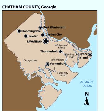
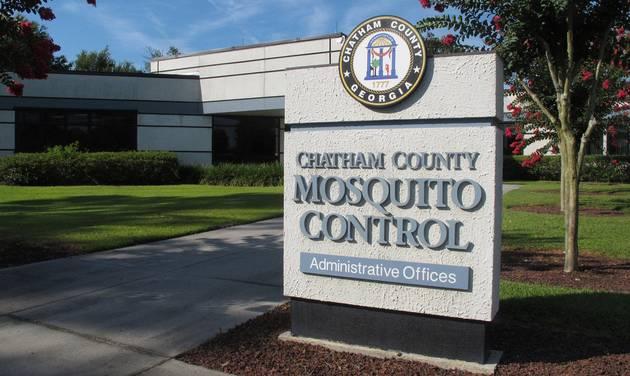
1 AFTERMATTHew, Came Irma! MOSQUITOES & STORMS LAURA PEATY CHATHAM COUNTY MOSQUITO CONTROL SAVANNAH GA
2


3 Major factors contributing to high mosquito numbers in our area include: Rain Tides Dredging operations

4 Coastal flooding can surround some of our northern islands during a particularly high spring tide

5 Seasonal flooding can be associated with the 3 major river systems and the tributaries that flow into them


6 Although it seems a direct hit from a Hurricane would be unlikely, 2016 and 2017 showed us that our area can be impacted significantly from powerful storms even hundreds of miles away


7 Our larger pieces of equipment were all fueled and secured out in the field or inside aircraft hangars ready to resume operations as soon as possible


8 Our vehicles were fueled, parked and our trailer was set up to assist with pre and post-storm tasks with many departments and other agencies

9 Evacuation zones were designed to allow plenty of time for residents to leave in phases
10 We chose not to larvicide breeding grounds after Hurricane Matthew for several reasons: 1. Larval inspections found 4 th instar and pupae 2. County-wide rain event 3. Large scale larviciding would inevitably be followed by adulticiding throughout the county 4. Nearing the end of our mosquito season; not the end of the fiscal year


11 Trap sites and equipment were inspected for damage and repairs were made allowing surveillance to continue days after the storm


12 Trails were cleared of debris to restore access for staff to breeding sites to inspect for larval populations


13 Estimating new larval breeding sites caused by the storm may prove to be difficult


14 Large debris piles were formed in several locations around the county

15 Service request calls slowly, then rapidly, increased throughout the entire county Year # of calls October October 2016 complaint calls # of service requests Hurricane Matthew calls


16 We were initially concerned with the emergence of several mosquito species of nuisance mosquitoes that would inundate the county Nuisance mosquitoes Saltmarsh species Floodwater species Aedes taeniorhynchus Container breeders Aedes sollicitans


17 We were initially concerned with the emergence of several mosquito species of nuisance mosquitoes that would inundate the county Nuisance mosquitoes Saltmarsh species Floodwater species Psorophora ferox Container breeders Aedes atlanticus

18 We were initially concerned with the emergence of several mosquito species of nuisance mosquitoes that would inundate the county Nuisance mosquitoes Saltmarsh species Floodwater species Aedes albopictus Container breeders
 were closely monitored through the quick deployment of")

19 Our primary disease vectors for eastern equine encephalitis (EEE) and West Nile virus (WNv) were closely monitored through the quick deployment of traps across the county, if conditions permitted Primary disease vectors Culiseta melanura Culiseta melanura Culex quinquefasciatus Culex quinquefasciatus
20 An increase in our saltmarsh mosquito populations was noted in our trap counts including in areas where these species were rarely found 6000 Number of saltmarsh mosquitoes collected in all traps, (Sept Dec) # of mosquitoes Sept Oct Nov Dec
21 Our Culiseta melanura collections increased slightly the following year due to a later, colder start to the year Total number of Culiseta melanura collected from chicken sentinel sites Hurricane Matthew Hurricane Irma # of mosquitoes Month
22 The flushing of our storm drain systems may have led to a reduction in Culex larvae; yet adult populations were quick to rebound Total number of Culex quinquefasciatus collected from all gravid traps, Hurricane Matthew # of mosquitoes Jan Feb March April May June July Aug Sept Oct Nov Dec MONTH

23 Our normal spray block boundaries were increased for our aerial missions allowing us to cover more acreage Total acres adulticided by aircraft in 2016 compared to a 3 year average between # of acres yr avg Jan Feb Mar April May June July Aug Sept Oct Nov Dec MONTH
24 Our ULV trucks assisted with sprays to help reduce adult mosquito numbers, but were faced with new challenges 8000 Total acres sprayed by truck, 2016 # of acres Jan Feb Mar April May June July Aug Sept Oct Nov Dec MONTH


25 Our automated notification system allowed quick, reliable messages to be sent to staff via several methods


26 Coastal flooding over high marshes left after Hurricane Irma took many days to dry down; some even introduced fish into saturated areas


27 Hurricane Irma produced significant tidal surges leading to widespread coastal flooding, however the majority of rainfall fell in the western portions of the county causing two waves of mosquito problems 7 days after Hurricane Irma 10 days later.
28 A sudden increase of calls from our residents dropped quickly once our evening aerial missions resumed 140 Number of service calls by week (July 29th - October 13th) # of service calls Hurricane Irma 20 0 July 29-Aug 4 Aug 5-11 Aug Aug Aug 26- Sep 1 Sept 2-8 Sept 9-15 Sept Sept Sept 30- Oct 6 Oct 7-13 DATE
29 1. Not all storm systems are the same Lessons learnt 2. People without power left screens and windows open = human exposure? 3. Keep essential hurricanes supplies inventoried i.e. batteries, cots, MRE s, sand for larviciding etc. 4. New mosquitoes being introduced into areas? 5. Know your role 6. Document EVERYTHING!

30 Thank you. Questions?
CITY OF FORT COLLINS AUGUST 2016 MONTHLY REPORT
 CITY OF FORT COLLINS AUGUST 2016 MONTHLY REPORT MONTHLY REPORT: SEPTEMBER 6, 2016 COLORADO MOSQUITO CONTROL West Nile Virus Risk Contact CMC: City of Fort Collins Mosquito Control Program Broox Boze, Operations
CITY OF FORT COLLINS JULY 2017 MONTHLY REPORT
 CITY OF FORT COLLINS JULY 2017 MONTHLY REPORT AUGUST 3RD, 2017 West Nile Virus Risk Contact VDCI: Northern Colorado Operations Manager Broox Boze, Ph.D. Phone (970)962-2582 Fax (970)962-2584 E-Mail: bboze@
CITY OF FORT COLLINS JULY 2018 MONTHLY REPORT
 CITY OF FORT COLLINS JULY 2018 MONTHLY REPORT AUGUST 8TH, 2018 West Nile Virus Risk Contact VDCI: Northern Colorado Operations Manager Broox Boze, Ph.D. Phone (970)962-2582 Fax (970)962-2584 As of July
Program Update. Lisle Township August 2018 Status Report SEASON PERSPECTIVE
 Lisle Township August 2018 Status Report SEASON PERSPECTIVE Introduction. Weather conditions critically affect the seasonal mosquito population. Excessive rainfall periods trigger hatches of floodwater
TOTAL RAINFALL June 1 July 24. Mundelein Lake % O Hare Cook % Midway Cook % Romeoville Will
 Village of Hainesville July 2017 - Status Report Season Perspective Weather conditions critically affect the seasonal mosquito population. Excessive rainfall periods trigger hatches of floodwater mosquitoes
Hurricane Preparation and Recovery. October 11, 2011 Jon Nance, Chief Engineer, NCDOT
 Hurricane Preparation and Recovery October 11, 2011 Jon Nance, Chief Engineer, NCDOT North Carolina & Severe Weather Our state often bears the brunt of storms, which include: Ice storms Snow storms Heavy
Objective: Demonstrate the ability to utilize the full range of ICS command, control, and coordination options to organize a disaster.
 Objective: Demonstrate the ability to utilize the full range of ICS command, control, and coordination options to organize a disaster. Instructions: 1. You will be assigned to one of the following four
North Carolina Emergency Management Agency Federal Emergency Management Agency Region IV Mosquito Abatement Fact Sheet
 North Carolina Emergency Management Agency Federal Emergency Management Agency Region IV Mosquito Abatement Fact Sheet Please review the following guidelines for reimbursement of mosquito abatement costs
THE COMING STORM. Rosmarie Kelly PhD MPH Public Health Entomologist Georgia Division of Public Health
 THE COMING STORM Rosmarie Kelly PhD MPH Public Health Entomologist Georgia Division of Public Health What is a hurricane? A hurricane is a large powerful storm with very high winds. Hurricanes originate
WHEN IS IT EVER GOING TO RAIN? Table of Average Annual Rainfall and Rainfall For Selected Arizona Cities
 WHEN IS IT EVER GOING TO RAIN? Table of Average Annual Rainfall and 2001-2002 Rainfall For Selected Arizona Cities Phoenix Tucson Flagstaff Avg. 2001-2002 Avg. 2001-2002 Avg. 2001-2002 October 0.7 0.0
Peninsular Florida p Modeled Water Table Depth Arboviral Epidemic Risk Assessment. Current Assessment: 06/08/2008 Week 23 Initial Wetting Phase
 Peninsular Florida p Modeled Water Table Depth Arboviral Epidemic Risk Assessment Current Assessment: 06/08/2008 Week 23 Initial Wetting Phase Modeled Water Table Depth: MWTD has remained low across much
Saudi Arabia. July present. Desert Locust Information Service FAO, Rome Red Sea coast outbreak
 Saudi Arabia July 2016 - present coast outbreak Desert Locust Information Service FAO, Rome www.fao.org/ag/locusts Keith Cressman (Senior Locust Forecasting Officer) updated: 24 January 2017 undetected
GIS for Integrated Pest Management. Christina Hailey. Abstract:
 GIS for Integrated Pest Management Christina Hailey Abstract: At its formation in 1965, Harris County Mosquito Control (Houston, Texas) (HCMC) was primarily involved in the prevention and control of mosquito-borne
FMEL Arboviral Epidemic Risk Assessment: Second Update for 2012 Week 23 (June 12, 2012)
") FMEL Arboviral Epidemic Risk Assessment: Second Update for 2012 Week 23 (June 12, 2012) Current Assesment of SLW\WN Epidemic Risk Figure 1. A map of peninsular Florida indicating areas currently at Medium
FMEL Arboviral Epidemic Risk Assessment: Second Update for 2012 Week 23 (June 12, 2012) Current Assesment of SLW\WN Epidemic Risk Figure 1. A map of peninsular Florida indicating areas currently at Medium
Three main areas of work:
 Task 2: Climate Information 1 Task 2: Climate Information Three main areas of work: Collect historical and projected weather and climate data Conduct storm surge and wave modeling, sea-level rise (SLR)
GAMINGRE 8/1/ of 7
 FYE 09/30/92 JULY 92 0.00 254,550.00 0.00 0 0 0 0 0 0 0 0 0 254,550.00 0.00 0.00 0.00 0.00 254,550.00 AUG 10,616,710.31 5,299.95 845,656.83 84,565.68 61,084.86 23,480.82 339,734.73 135,893.89 67,946.95
Outage Coordination and Business Practices
 Outage Coordination and Business Practices 1 2007 Objectives What drove the need for developing a planning/coordination process. Why outage planning/coordination is crucial and important. Determining what
Did Severe Rains and Flooding in May 2015 Affect Texas Poison Center Call Patterns?
 Did Severe Rains and Flooding in May 2015 Affect Texas Poison Center Call Patterns? Mathias Forrester Epidemiologist Texas Department of State Health Services (DSHS) mathias.forrester@dshs.state.tx.us
Objective: Demonstrate the ability to utilize the full range of ICS command, control, and coordination options to organize a disaster.
 Objective: Demonstrate the ability to utilize the full range of ICS command, control, and coordination options to organize a disaster. Instructions: 1. You will be assigned to one of the following four
The Colorado Drought of 2002 in Perspective
 The Colorado Drought of 2002 in Perspective Colorado Climate Center Nolan Doesken and Roger Pielke, Sr. Prepared by Tara Green and Odie Bliss http://climate.atmos.colostate.edu Known Characteristics of
Hurricane Matthew Threats and Impacts Briefing for Eastern NC
 Hurricane Matthew Threats and Impacts Briefing for Eastern NC October 6 th, 2016 Date/Time Created: 10/6/2016, Noon EDT National Weather Service Newport/Morehead City, NC Hurricane Matthew Key Points Changes
Champaign-Urbana 2001 Annual Weather Summary
 Champaign-Urbana 2001 Annual Weather Summary ILLINOIS STATE WATER SURVEY 2204 Griffith Dr. Champaign, IL 61820 wxobsrvr@sws.uiuc.edu Maria Peters, Weather Observer January: After a cold and snowy December,
Zoonotic Disease Report September 9 September 15, 2018 (Week 37)
") Zoonotic Disease Report September 9 September 15, 2018 (Week 37) Executive Summary Three additional human West Nile virus cases are reported in Boulder County. This brings the total to six to date for
Zoonotic Disease Report September 9 September 15, 2018 (Week 37) Executive Summary Three additional human West Nile virus cases are reported in Boulder County. This brings the total to six to date for
Tropical Update. 5 AM EDT Tuesday, September 12, 2017 Post-Tropical Cyclone Irma, Hurricane Jose, & Tropical Wave (10%)
") Tropical Update 5 AM EDT Tuesday, September 12, 2017 Post-Tropical Cyclone Irma, Hurricane Jose, & Tropical Wave (10%) This update is intended for government and emergency response officials, and is provided
Tropical Update 5 AM EDT Tuesday, September 12, 2017 Post-Tropical Cyclone Irma, Hurricane Jose, & Tropical Wave (10%) This update is intended for government and emergency response officials, and is provided
TROPICAL STORM HERMINE AND HURRICANE MATTHEW HI CERT RESPONSE
 AND HURRICANE MATTHEW HI CERT RESPONSE Hermine hit Hatteras Island on Labor Day 2016 High winds, very heavy rain, causing severe flooding from Avon to Hatteras village Avon had 3+ feet of water throughout
Jackson County 2013 Weather Data
 Jackson County 2013 Weather Data 61 Years of Weather Data Recorded at the UF/IFAS Marianna North Florida Research and Education Center Doug Mayo Jackson County Extension Director 1952-2008 Rainfall Data
Rainfall Observations in the Loxahatchee River Watershed
 Rainfall Observations in the Loxahatchee River Watershed Richard C. Dent Loxahatchee River District September 1997 Introduction Rain is a common occurrence in south Florida, yet its presence or absence
Champaign-Urbana 1998 Annual Weather Summary
 Champaign-Urbana 1998 Annual Weather Summary ILLINOIS STATE WATER SURVEY Audrey Bryan, Weather Observer 2204 Griffith Dr. Champaign, IL 61820 wxobsrvr@sparc.sws.uiuc.edu The development of the El Nìno
The Current SLE/WN Epidemic Assesment
 FMEL Arboviral Epidemic Risk Assessment: First Update for 2014 Week 18 (May 1, 2014) The Current SLE/WN Epidemic Assesment Funding for the Florida Medical Entomology Laboratory Epidemic Risk Model ended
SIGNIFICANT EVENTS Severe Storms November 1994 January 1996 August 1998 and May 2000 March 2002 May 2002 Champaign County
 SIGNIFICANT EVENTS Severe Storms November 1994 On Nov. 1, 1994, high winds gusted over 60 mph at times across the northwest third of Ohio. The highest measured wind gust was 63 mph at Columbus Grove (Putnam).
Monday, November 26, :30 a.m. EST
 Monday, November 26, 2018 8:30 a.m. EST Significant Activity Nov 23-26 Significant Events: CA Wildfires Tropical Activity: Atlantic No new tropical cyclones are expected during the next 5 days Eastern
WEATHER SYSTEMS IMPACTING THE CAYMAN ISLANDS Prepared by the staff of the Cayman Islands National Weather Service
 WEATHER SYSTEMS IMPACTING THE CAYMAN ISLANDS 2008 Prepared by the staff of the Cayman Islands National Weather Service TROPICAL STORM DOLLY Formed 194 miles west of Grand Cayman July 19 th. The tropical
Role of GIS in Tracking and Controlling Spread of Disease
 Role of GIS in Tracking and Controlling Spread of Disease For Dr. Baqer Al-Ramadan By Syed Imran Quadri CRP 514: Introduction to GIS Introduction Problem Statement Objectives Methodology of Study Literature
2015 Fall Conditions Report
 2015 Fall Conditions Report Prepared by: Hydrologic Forecast Centre Date: December 21 st, 2015 Table of Contents Table of Figures... ii EXECUTIVE SUMMARY... 1 BACKGROUND... 2 SUMMER AND FALL PRECIPITATION...
MISSION DEBRIEFING: Teacher Guide
 Activity 2: It s Raining Again?! Using real data from one particular location, students will interpret a graph that relates rainfall to the number of cases of malaria. Background The relationship between
Response Case Study: April 2014 Historic Flood Event. Severe Weather April 29 30, 2014
 Response Case Study: April 2014 Historic Flood Event NOAA s Regional Preparedness Training (NRPT) Natural Disaster Causing Technology Disasters in Mobile Bay Area Kimberly Albins Gulf of Mexico Regional
Major Hurricane Matthew Briefing Situation Overview
 Major Hurricane Matthew Briefing Situation Overview THIS IS NOW A WORST CASE STORM SURGE SCENARIO Catastrophic Damage is Anticipated for Coastal Areas. Major Hurricane Matthew is still expected to move
The Pennsylvania Observer
 The Pennsylvania Observer May 31, 2012 May 2012 - Pennsylvania Weather Recap By: Paul Knight The majority of the fifth month had temperatures averaging well above seasonal levels with two distinct hot
National Integrated Drought Information System. Southeast US Pilot for Apalachicola- Flint-Chattahoochee River Basin 20-March-2012
 National Integrated Drought Information System Southeast US Pilot for Apalachicola- Flint-Chattahoochee River Basin 20-March-2012 Current drought status from Drought Monitor http://www.drought.unl.edu/dm/monitor.html
2016 Meteorology Summary
 2016 Meteorology Summary New Jersey Department of Environmental Protection AIR POLLUTION AND METEOROLOGY Meteorology plays an important role in the distribution of pollution throughout the troposphere,
REDWOOD VALLEY SUBAREA
 Independent Science Review Panel Conceptual Model of Watershed Hydrology, Surface Water and Groundwater Interactions and Stream Ecology for the Russian River Watershed Appendices A-1 APPENDIX A A-2 REDWOOD
GIS to Support West Nile Virus Program
 GIS to Support West Nile Virus Program 2008 Community Excellence Awards Leadership and Innovation Regional District Regional District Okanagan Similkameen July 2008 2008 UBCM Community Excellence Awards
2013 Tide Newsletter and occasionally by much more. What's more,
 The Official Newsletter for the Nor easters Metal Detecting Club! Tide s Ed it io n HTTP://WWW.NOR EASTER S.NET Year ly Ti des for 2013 The Metal Detecting Creed By Jessie Thompson We are Metal Detectorists.
Hurricanes and Storm Surge : Before coming to lab, visit the following web site:
 Geol 108 Lab #7 Week of October 15-19, 2012 Coastal Studies Hurricanes and Storm Surge : Before coming to lab, visit the following web site: http://www.usatoday.com/graphics/weather/gra/gsurge/flash.htm
2014 Meteorology Summary
 2014 Meteorology Summary New Jersey Department of Environmental Protection AIR POLLUTION AND METEOROLOGY Meteorology plays an important role in the distribution of pollution throughout the troposphere,
Saturday, November 17, :30 a.m. EST
 Saturday, November 17, 2018 8:30 a.m. EST Significant Activity Nov 16-17 Significant Events: CA Wildfires Tropical Activity: Atlantic No new tropical cyclones are expected during the next 5 days Eastern
Integrating GIS into West Nile Virus Planning and Surveillance
 Integrating GIS into West Nile Virus Planning and Surveillance Fairfax County Health Department Adrian Joye, Environmental Health Specialist Agenda Background/Benefits Routes/Trap Locations Dead Bird Complaint
NatGasWeather.com Daily Report
 NatGasWeather.com Daily Report Issue Time: 5:15 pm EST Sunday, February 28 th, 2016 for Monday, Feb 29 th 7-Day Weather Summary (February 28 th March 5 th ): High pressure will dominate much of the US
CASE STUDY #9 - Brushy Fork Dam, Sugar Grove, West Virginia
 CASE STUDY #9 - Brushy Fork Dam, Sugar Grove, West Virginia Brushy Fork Dam is a flood control structure built by the Soil Conservation Service southeast of the city of Franklin in Pendleton County, West
Dunn County Snow Removal Policy
 Dunn County Snow Removal Policy OVERVIEW With the advent of another winter season in the northern plains comes the possibility of snow, freezing rain and slippery roadways, and area resident s concern
Extreme Weather and Climate Change: the big picture Alan K. Betts Atmospheric Research Pittsford, VT NESC, Saratoga, NY
 Extreme Weather and Climate Change: the big picture Alan K. Betts Atmospheric Research Pittsford, VT http://alanbetts.com NESC, Saratoga, NY March 10, 2018 Increases in Extreme Weather Last decade: lack
The Climate of Payne County
 The Climate of Payne County Payne County is part of the Central Great Plains in the west, encompassing some of the best agricultural land in Oklahoma. Payne County is also part of the Crosstimbers in the
AASHTO Committee on Maintenance 2018 Annual Meeting July 25, Hurricane Irma- Preparation and Response
 AASHTO Committee on Maintenance 2018 Annual Meeting July 25, 2018 Hurricane Irma- Preparation and Response Rudy Powell Director, Office of Maintenance Satellite Aerial Image (September 10, 2017) Hurricane
Champaign-Urbana 2000 Annual Weather Summary
 Champaign-Urbana 2000 Annual Weather Summary ILLINOIS STATE WATER SURVEY 2204 Griffith Dr. Champaign, IL 61820 wxobsrvr@sws.uiuc.edu Maria Peters, Weather Observer January: January started on a mild note,
Flooding Performance Indicator Summary. Performance indicator: Flooding impacts on riparian property for Lake Ontario and the Upper St.
 Flooding Performance Indicator Summary Performance indicator: Flooding impacts on riparian property for Lake Ontario and the Upper St. Lawrence River Technical Workgroup: Coastal TWG Research by: Baird
Significant Rainfall and Peak Sustained Wind Estimates For Downtown San Francisco
 Significant Rainfall and Peak Sustained Wind Estimates For Downtown San Francisco Report Prepared by John P. Monteverdi, PhD, CCM July 30, 1998 Mayacamas Weather Consultants 1. Impact of Location The location
January 25, Summary
 January 25, 2013 Summary Precipitation since the December 17, 2012, Drought Update has been slightly below average in parts of central and northern Illinois and above average in southern Illinois. Soil
The Climate of Bryan County
 The Climate of Bryan County Bryan County is part of the Crosstimbers throughout most of the county. The extreme eastern portions of Bryan County are part of the Cypress Swamp and Forest. Average annual
Advisory #35 Briefing 630 PM EDT Thursday October 06, 2016
 Advisory #35 Briefing 630 PM EDT Thursday October 06, 2016 Disclaimer: The information contained within this briefing is time-sensitive, do not use beyond 6 hours after the issuance Next Webinar Update:
Communications and Lessons Learned from
 Weather Forecast Office Charleston, SC Communications and Lessons Learned from Southeast and Caribbean and Climate Community of Practice - April, 2017 Public Information and Communications During Extremes
Comparison of Mosquito Population Between Urban Area of College Station, TX and Rural Area of Snook, TX
 Comparison of Mosquito Population Between Urban Area of College Station, TX and Rural Area of Snook, TX Garrett Jackson, Andrew Kim, Cristobal Lopez, Janelle McMahan Texas A&M University, Department of
Current Climate Trends and Implications
 Current Climate Trends and Implications Dr. Mark Seeley Professor emeritus Department of Soil, Water, and Climate University of Minnesota St Paul, MN 55108 Crop Insurance Conference September 12, 2018
over the next three weeks could lower this estimate significantly. Near perfect conditions are needed to realize this projected yield.
 Peanuts across the V-C region experienced excessive rainfall in many areas as a result of Hurricane Florence. Rainfall was particularly heavy in southeastern North Carolina and northeastern South Carolina.
Jackson County 2014 Weather Data
 Jackson County 2014 Weather Data 62 Years of Weather Data Recorded at the UF/IFAS Marianna North Florida Research and Education Center Doug Mayo Jackson County Extension Director 1952-2008 Rainfall Data
NATIONAL WEATHER SERVICE
 January 2016 February 9, 2016 This was a dry month across the HSA despite one large and several smaller snowfalls. Most locations ended up 1-2 inches below normal for the month. The driest locations at
The Climate of Pontotoc County
 The Climate of Pontotoc County Pontotoc County is part of the Crosstimbers. This region is a transition region from the Central Great Plains to the more irregular terrain of southeast Oklahoma. Average
Metro Vancouver Final Report Nuisance Mosquito Control Program 2017
 Metro Vancouver Final Report Nuisance Mosquito Control Program 2017 December 2017 www.culex.ca 1 By: Michael Jackson PhD and Kate Patterson BSc 4-4075 Kingsway Avenue Burnaby, B.C. V5H 1Y9 Phone: 604 221
GC Briefing. Weather Sentinel Hurricane Florence. Status at 5 PM EDT (21 UTC) Today (NHC) Discussion. September 13, 2018
 Today (NHC) Discussion. September 13, 2018") GC Briefing September 13, 2018 Weather Sentinel Hurricane Florence Tropical storm conditions have been reported for areas of North Carolina and will continue to spread inland to the west and south. Hurricane
GC Briefing September 13, 2018 Weather Sentinel Hurricane Florence Tropical storm conditions have been reported for areas of North Carolina and will continue to spread inland to the west and south. Hurricane
1.2 DEVELOPMENT OF THE NWS PROBABILISTIC EXTRA-TROPICAL STORM SURGE MODEL AND POST PROCESSING METHODOLOGY
 1.2 DEVELOPMENT OF THE NWS PROBABILISTIC EXTRA-TROPICAL STORM SURGE MODEL AND POST PROCESSING METHODOLOGY Huiqing Liu 1 and Arthur Taylor 2* 1. Ace Info Solutions, Reston, VA 2. NOAA / NWS / Science and
Memo. I. Executive Summary. II. ALERT Data Source. III. General System-Wide Reporting Summary. Date: January 26, 2009 To: From: Subject:
 Memo Date: January 26, 2009 To: From: Subject: Kevin Stewart Markus Ritsch 2010 Annual Legacy ALERT Data Analysis Summary Report I. Executive Summary The Urban Drainage and Flood Control District (District)
3Chapter Three: Rescue and Response
 17 16 Report Science Title and the Storms: the USGS Response to the Hurricanes of 2005 3Chapter Three: Rescue and Response This chapter documents the U.S. Geological Survey s (USGS) humanitarian rescue
Table-Top Exercise for Emergency Preparedness Evaluation: Little Anse, Isle Madame
 Table-Top Exercise for Emergency Preparedness Evaluation: Little Anse, Isle Madame Alexander Chung, M.Sc. Candidate C-Change Student Research Associate May 2013 The Community of Little Anse Coastal community
Risk Assessment and Mitigation. Hurricane Checklist
 Risk Assessment and Mitigation Hurricane Checklist Hurricane Checklist Hurricanes are severe tropical storms with sustained winds of at least 74 miles per hour. Hurricane winds can reach 160 miles per
Key Takeaways: - Rain: Coastal NC: ; isolated totals to 40 Central, Western, & Northeastern NC: 5-10 ; isolated totals to 20
 Key Takeaways: - Life-Threatening Impacts Will Extend Far From The Storm s Center: Despite the southward shift in track, widespread and extreme impacts from heavy rain, storm surge, and wind are still
Zoonotic Disease Report September 2 September 8, 2018 (Week 36)
") Zoonotic Disease Report September 2 September 8, 2018 (Week 36) Executive Summary Three human West Nile virus cases have been confirmed in Boulder County. No new cases have been identified since last week.
Zoonotic Disease Report September 2 September 8, 2018 (Week 36) Executive Summary Three human West Nile virus cases have been confirmed in Boulder County. No new cases have been identified since last week.
Stream Discharge and the Water Budget
 Regents Earth Science Unit 6: Water Cycle & Climate Name: Lab # Stream Discharge and the Water Budget Introduction: The United States Geological Survey (USGS) measures and publishes values for the daily
The Climate of Murray County
 The Climate of Murray County Murray County is part of the Crosstimbers. This region is a transition between prairies and the mountains of southeastern Oklahoma. Average annual precipitation ranges from
Sunday, June 3, :30 a.m. EDT
 Sunday, June 3, 2018 8:30 a.m. EDT Significant Activity June 2-3 Significant Events: None Tropical Activity: Atlantic No tropical cyclones expected next 48 hours Eastern Pacific Disturbance 1: HIGH (90%)
Proposal to limit Namakan Lake to 1970 Upper Rule Curve for remainder of summer
 July 7, 214 Subject: Proposal to limit Namakan Lake to 197 Upper Rule Curve for remainder of summer Background: Flooding in 214 has resulted in the highest water levels on Namakan Lake since 1968, and
DRAFT - Tsunami Response Plan Playbook Santa Cruz Harbor Maritime Community
 DRAFT - Tsunami Response Plan Playbook Santa Cruz Harbor Maritime Community Page 1 Best to display on 11X17 paper Purpose and Use of this Real-time Tsunami Response Plan Playbook PURPOSE: This product
Computing & Telecommunications Services
 Computing & Telecommunications Services Monthly Report September 214 CaTS Help Desk (937) 775-4827 1-888-775-4827 25 Library Annex helpdesk@wright.edu www.wright.edu/cats/ Table of Contents HEAT Ticket
Butte County Drought Task Force December 1, :00 AM noon 202 Mira Loma Drive, Tahoe Room Oroville, CA. Agenda
 WATER AND RESOURCE CONSERVATION 308 Nelson Avenue, Oroville, CA 95965 Telephone: (530) 538-4343 Fax: (530) 538-3807 www.buttecounty.net/waterandresource bcwater@buttecounty.net Paul Gosselin, Director
Attachment B to Technical Memorandum No.2. Operations Plan of Ross Valley Detention Basins
 Attachment B to Technical Memorandum No.2 Operations Plan of Ross Valley Detention Basins Operations Plan of Ross Valley Detention Basins Stetson Engineers Inc. January 26, 2011 1.0 Introduction Achieving
1. INTRODUCTION REGIONAL ACTIVITIES
 P 1.11 DEVELOPMENT OF CLIMATE INDICES FOR MONITORING VECTORS OF WEST NILE VIRUS Michael J. Janis Southeast Regional Climate Center, Columbia, SC Kenneth E. Kunkel Illinois State Water Survey, Champaign,
Director, Operations Services, Met-Ed
 Director, Operations Services, Met-Ed Pennsylvania House Republican Policy Committee Hearing on Storm Response Tobyhanna Township Municipal Building Pocono Pines, Pa. August 9, 2018 Planning and Forecast
Summary of the 2017 Spring Flood
 Ottawa River Regulation Planning Board Commission de planification de la régularisation de la rivière des Outaouais The main cause of the exceptional 2017 spring flooding can be described easily in just
The Climate of Texas County
 The Climate of Texas County Texas County is part of the Western High Plains in the north and west and the Southwestern Tablelands in the east. The Western High Plains are characterized by abundant cropland
The Climate of Marshall County
 The Climate of Marshall County Marshall County is part of the Crosstimbers. This region is a transition region from the Central Great Plains to the more irregular terrain of southeastern Oklahoma. Average
Water Supply Conditions and Outlook June 4, 2018
 Water Supply Conditions and Outlook June 4, 2018 Flow Forecasting & Operations Planning Water Security Agency Overview Water supply conditions across Saskatchewan are generally good with most reservoir
Business Preparedness. Hurricane Preparedness 2018 NFP InForum February 15, 2018
 Business Preparedness Hurricane Preparedness 2018 NFP InForum February 15, 2018 Agenda Past Experience Hugo Floyd Matthew Irma Hurricane Tabletop Exercise Pre-Landfall Post-Landfall (1 day and 10 days)
Are You Ready For Hurricane Season? 2018 Hurricane Talk B Y : S T O R M T E A M 8 M E T E O R O L O G I S T J U L I E P H I L L I P S
 Are You Ready For Hurricane Season? 2018 Hurricane Talk B Y : S T O R M T E A M 8 M E T E O R O L O G I S T J U L I E P H I L L I P S About Me I am Currently a Weekday Meteorologist at WFLA Channel 8.
Flooding. April 21, Notes 4/20 CONGRATULATIONS!!!!! Activity 2: AZ State Museum due TODAY. Extra Credit 2: Returned at end of class
 April 21, 2011 Flooding 1927 Mississippi Flood Notes 4/20 Activity 2: AZ State Museum due TODAY Extra Credit 2: Returned at end of class CONGRATULATIONS!!!!! Andrew Richard Undergraduate Research Grant
HURRICANES AND TORNADOES
 HURRICANES AND TORNADOES The most severe weather systems are hurricanes and tornadoes. They occur in extremely low pressure systems, or cyclones, when the air spirals rapidly into the center of a low.
Changes in Ecosystems - Natural Events
 Changes in Ecosystems - Natural Events 8A predict and describe how different types of catastrophic events impact ecosystems such as floods, hurricanes, or tornadoes Textbook pages: 396-406 How can ecosystems
Minnesota s Climatic Conditions, Outlook, and Impacts on Agriculture. Today. 1. The weather and climate of 2017 to date
 Minnesota s Climatic Conditions, Outlook, and Impacts on Agriculture Kenny Blumenfeld, State Climatology Office Crop Insurance Conference, Sep 13, 2017 Today 1. The weather and climate of 2017 to date
The Climate of Grady County
 The Climate of Grady County Grady County is part of the Central Great Plains, encompassing some of the best agricultural land in Oklahoma. Average annual precipitation ranges from about 33 inches in northern
WEDNESDAY 30 TH AUGUST, :57 p.m. Tropical Storm Irma forms in the Atlantic. Don t let your guard down, always #Be Ready.
 Chapter 1 - The Set Up In the days leading up to Irma a series of composed and sobering text messages, presented in truncated form below, from Department of Disaster Management warned us of the pending
JCOMM-CHy Coastal Inundation Forecasting Demonstration Project (CIFDP)
") WMO World Meteorological Organization Working together in weather, climate and water JCOMM-CHy Coastal Inundation Forecasting Demonstration Project (CIFDP) Coastal Flooding & Vulnerable Populations Coastal
WMO World Meteorological Organization Working together in weather, climate and water JCOMM-CHy Coastal Inundation Forecasting Demonstration Project (CIFDP) Coastal Flooding & Vulnerable Populations Coastal
El Nino 2015 in South Sudan: Impacts and Perspectives. Raul Cumba
 El Nino 2015 in South Sudan: Impacts and Perspectives Raul Cumba El Nino 2015-2016 The El Nino Event of 2015-2016 The 2015/16 El Nino Event Officially declared in March 2015 Now approaching peak intensity
JOINT BRIEFING TO THE MEMBERS. El Niño 2018/19 Likelihood and potential impact
 JOINT BRIEFING TO THE MEMBERS El Niño 2018/19 Likelihood and potential impact CURRENT EL NIÑO OUTLOOK (SEPTEMBER 2018) CPC/IRI ENSO Forecast from September. Red bars denote probability of an El Nino developing