FLIGHT FOLDER. Flight No.: B150 Date: 15 Dec 2005 Take Off 10:22:24 Landing: 15:22:45 Flight Time 5h00m21. Campaign: Operating Area: Chilbolton
|
|
|
- Barnard Morton
- 5 years ago
- Views:
Transcription

1 FLIGHT FOLDER Campaign: Cirrus Operating Area: Chilbolton Flight No.: B150 Date: 15 Dec 2005 Take Off 10:22:24 Landing: 15:22:45 Flight Time 5h00m21 POB Position Name Institute 1 Captain Alan Roberts Directflight 2 First Officer Steve Ball FAAM 3 CCM Dawn Quinn Directflight 4 Mission Scientist 1 Clare Lee Met Office 5 Flight Manger Maureen Smith FAAM 6 Cloud physics Paul James FAAM 7 Dropsondes Steve Devereau FAAM 8 ARIES / MARSS / DEIMOS Stuart Rogers Met Office 9 Mission Scientist 2 Stuart Newman Met Office 10 SWS Dave Kindred Met Office 11 CCN / CCM2 Jamie Trembath FAAM 12 CCN Training Richard Cotton Met Office 13 TAFTS Paul Green ICL 14 TAFTS Maxwell Bolton ICL 15 CPI Hazel Jones Manchester University Flight Track:
2 FLIGHT SUMMARY Flight No b150 Date: 15 Dec 2005 Project: Cirrus Location: Chilbolton Start End Time Time Event Height (s) Hdg Comments Position 0.04 kft '04.36N, 0'37.50W INU 0.04 kft 124 To Navigate T/O 1.4 kft 329 Cranfield ASPs 10.8 kft 325 Open Videos 11.0 kft 252 Start FFC & DFC Profile kft 259 Q1022 5k'to 1k' Profile kft 282 1k' to 2k' Profile kft 048 From 2k' Event 5.8 kft fpm from 5k' Profile kft Profile kft Video 24.4 kft 066 Change tapes Run kft Event 26.0 kft 066 Ovhd Chilbolton Run kft 294 Westbound Run kft Orbit kft left, start Orbit kft left, start Orbit kft left, start Run kft Event 26.0 kft 054 Ovhd Chilbolton Profile kft Profile kft Video 32.3 kft 052 St DFC Tape Run kft Event 33.0 kft 064 Contrails on RFC Event 33.1 kft 067 Ovhd Chilbolton Event 33.0 kft 291 Ovhd Chilbolton Profile kft Sonde 34.0 kft 264 Launch # Run kft Event 34.0 kft 042 Thru our contrail Profile kft Run kft Event 35.0 kft 055 Ovhd Chilbolton Event 35.1 kft 265 Ovhd Chilbolton Run kft Profile kft Event 31.2 kft 064 No contrails Profile kft Orbit kft left, start Orbit kft left, start Orbit kft left, start Profile kft fpm Profile kft fpm from FL Profile kft fpm ASPs 10.0 kft 345 Close Land 0.12 kft 212 Cranfield Position 0.10 kft '04.36N, 0'37.48W

3
4
5 CAESAR SORTIE BRIEF Cirrus in-situ measurements for radar validation B th December 2005 Aim The aim is to study the in-situ properties of cirrus over land, co-ordinated with the Chilbolton radars/lidars and coincident with an overpass of the CloudSat-Aqua train. The priority is to obtain in-situ microphysical measurements from straight and levels runs at several levels within the cloud and profiles between so that the statistical properties of the cloud are well characterized in order to validate the radar measurements. A few runs above the cloud are to be made for radiative measurements during the satellite overpass. The exact location and duration of the runs are to be determined from the cirrus location and its advection due to the wind. Weather Cirrus, ideally with clear skies below. Some cloud below is acceptable, as long as the cirrus is measurable by the radar. Operating region Runs and profiles are expected to take place along a fixed radial from the Chilbolton Meteorological Observatory ( N W) at the location of the cirrus, ideally into and with the wind direction. Note, the 35GHz radar and lidar have a fixed vertical view and hence measurements directly over the site are critical. Only the 3GHz is steerable during CAESAR 1. Clearances Clearances will be required for dropping sondes and performing a profile from minimum allowable altitude. Communications With operators at Chilbolton via SATCOM or VHF radio ( MHz, call-sign Radsearch ). wind
6 Duration Manoeuvre (min) 1 10:30 Takeoff from Cranfield and Transit at appropriate level to enter operating area at min altitude :15 Profile ascent from minimum altitude to cloud top or to max altitude at 1000ft/min :50 Perform a series of reciprocal straight and level runs at several levels within the cloud, with profile descents between each level :00 Profile ascent to max altitude :10 1 straight and level run above cloud. Drop 1 sonde :15 Satellite overpass during run. 7 13:20 Reciprocal straight and level run :30 Perform a series of reciprocal straight and level runs at several levels within the cloud, with profile descents between each level :25 Profile descent to min altitude at 1000ft/min :00 Transit to Cranfield :45 Land Cranfield Total 315 Requirements for ARIES and SWS In the cloud: ARIES: nadir with cals every 2 minutes ideally during turns SWS: series of viewing angles during every run with appropriate cals (measurements to be used to test Robin Hogan s 3D stochastic model) - see extra guidance sheet. Above cloud: 1 st run above cloud ARIES & SWS both viewing nadir. Calibrations to be coordinated such that both instruments simultaneously view the cloud for the maximum time. 2 nd run above cloud ARIES & SWS both viewing nadir then for last 2 minutes both viewing zenith.
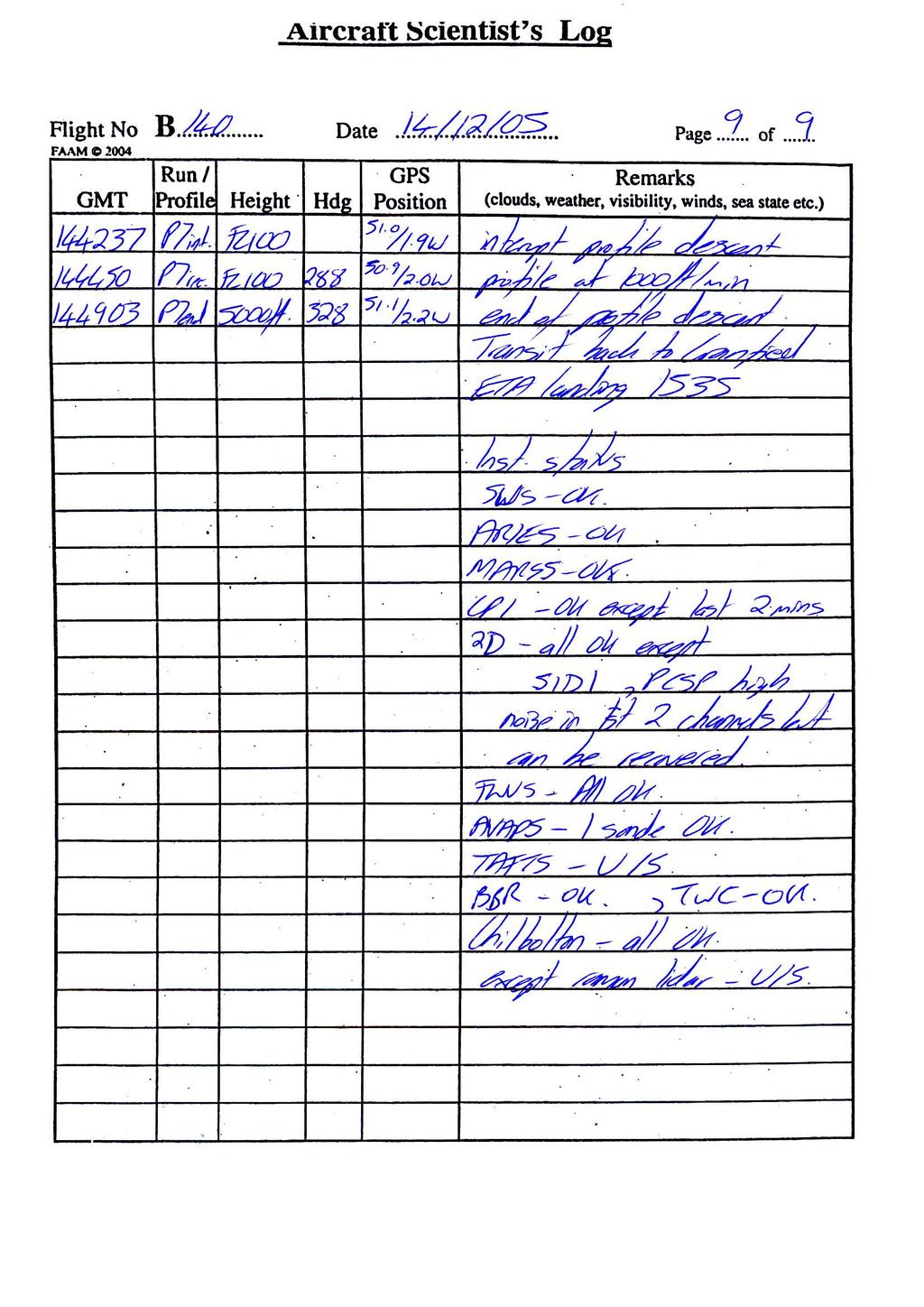
7 B th December 2005 CAESAR sortie over Chilbolton Mission scientist Clare Lee Mission Scientist Debrief The weather conditions were a thin sheet of cirrus flowing from the North, with small patches of Cu and occasionally hazy at low levels. Legs with procedural turns were made along 253 radial to and over Chilbolton, with fixed ground positions approximately cross wind. Radio contact with Chilbolton worked well. Contrails were observed above FL330 and engine settings noted. The transit from Cranfield was made at FL100 followed by a descent to 5000ft into the operating area. A profile descent (P1) was made to 1000ft (min altitude over land), followed immediately by an interrupted profile ascent to FL260. A run (R1.1) was flown towards Chilbolton below the cirrus, followed by a reciprocal run. Both runs flew directly overhead of Chilbolton. The reciprocal run (R1.3) was interrupted to perform three 50 degree banking angle left handed orbits below variable amounts of cirrus. The run (R1.3) towards Chilbolton was recommenced. The cirrus was very thin but 8/8, with variable thin Cu below. An interrupted profile climb (P3) was made to FL330. At Fl310 2D measured some ice particles. Near the end of the following run (R2.1) at FL330 CPI observed a few ice crystals. A profile to FL340 was made, followed by a run (R3.1). Some low concentrations of ice were seen periodically by 2DC. At a dropsonde was launched at a similar time to the AQUA overpass (1310). A profile ascent (P5) to FL350 was made, followed by reciprocal runs (R4) in the cirrus. Both CPI and 2DC observed ice crystals, though intermittently and in low concentrations. An interrupted profile descent (P6) to FL260 was made, during which the contrails ceased. Three left handed 50 degree banked orbits were performed at FL260, which extremely thin cirrus above. An interrupted profile descent to was made to 5000ft to characterize the atmosphere. The aircraft transited back to Cranfield. Instrument status TAFTS - U/S SWS - OK SID1 - U/S, except for short time at beginning of flight ARIES - OK, except intermittent periods of scanning slowly Chilbolton Raman lidar U/S CPI OK, except last 2 minutes 2D OK PCASP high noise in first 2 channels but can be recovered FWVS OK AVAPS 1 sone OK MARSS OK (monitored by Stuart Rogers) Deimos not operated BBR OK TWC - OK

8

9

10

11

12

13

14

15
16
17 FAAM Dropsonde Flight Log Flight No. B150 Date 51/12/2005 Page No. 1 of 1 Operator S Devereau GMT Sonde No. Event Comments e.g. launch, splashdown e.g. wind data? PTH data? Lat/Long NB strings of dropsonde data contain: time, pressure hpa, T deg C, RH %, wind direction deg, wind speed m/s, longitude, latitude, height m Launch Very good dropsonde, over land. Sonde continued to Tx from ground for some time Land

18

19

20

21

22

23

24

25

26

27
28
29 Microwave Radiometers FLIGHT LOG Operator(s) none Campaign Date 15/12/05 Flight B150 CAESAR log pages Departure Cranfield Arrival Cranfield System start MARSS Visual pod inspection Close 3 SSP circuit breakers Close all MARSS circuit breakers FERA on at time Temperature controller initial temps Ch16 C Ch C Ch18 C Temperature controller set points C 17 C -20 C MARSS CPU on at time Approx 0920 Initial target temperatures Hot Cold Target heating *** CHECK SCAN HEAD CLEAR *** Scanning on (LMD box) at time Approx 0920 Scan indication Monitor Visual Deimos Close all Deimos circuit breakers Not operated Turn on Deimos CPU *** CHECK SCAN HEAD CLEAR *** Start Deimos Software at time Initial target temperatures Hot Cold Target heating Scan indication Monitor Visual Weather Cloud Precip Surface Pressure Other System functionality check (after initial system warmup, approx 1 hour) PC to DRS Time error t PC =t DRS + 0 at time 0932 Brightness temps 'sensible' Target temps MARSS: Hot Cold Deimos: Hot Cold Channel gains 'sensible' Ch1 A ( - ) Ch3 A ( - ) Ch1 B ( - ) Ch3 B ( - ) Ch16 (40-44) Ch17 (45-49) Ch18 (40-44) Ch19 (40-44) Ch20 (44-48) Power changeover Headset on before start Listen to engine start sequence 4, 3, 2, 1. LMD off (3 switches, bottom to top) Exit Deimos Software (x) POWER CHANGEOVER LMD on (3 switches, top to bottom) then pushbutton Restart Deimos Software System running again at time
30 log page 2 of 2 Run id Alt/FL Sys Flight # B Date Operator(s) Time Remarks 0940 MARSS pc time set to DRS +/- o seconds Unable to give end of flight DRS to PC time differences, as Stuart shut down instruments after landing
31 Flight Manager s Instrument Status Log Flight No. B 150 Date: 15th December 2005 Instrument Operated Instrument Operated Navigation Cloud Physics INU Y Probes XR5M GPS Y FFSSP Y Cruciform GPS N PCASP Y Satcom C Y 2D-P Y Satcom H Y 2D-C Y Thermometers Cloudscope N De-Iced Temp Y SID 1 Y Non De-Iced Y SID 2 N Heimann Y HVPS N Hygrometers CIP25 N G. Eastern Y CIP100 Y J. Williams Y Nevzorov Y TWC Y FWVS Y Racks: Radiometers INC N Upper Clear Y CCN / CPC Y Red Y CVI N Silicon Y JN02 Y Aerosol Lower Clear Y PSAP N Red Y Nephelometer N Silicon Y Filters N JN02 Y AMS N Large Radiometers TAFTS Y MARSS Y DEIMOS Y Others: ARIES Y NIR TDLAS N SWS Y 2BT O3 N Chemistry VACC N Ozone Y PEROXIDE N SO2 Y Formaldehyde N NOX Y ADA N CO Y CPI N ORAC N NOxy N PAN N PTRMS N PERCA N Bag Sampling N WAS N Tube Sampling N
32 Faults / Incidents Log Flight No. B150 Date: 15th December 2005 Instruments 1. SID 1 lost it at 1115, keeps crashing. 2. PCASP 1 st 2 channels noisy from 11:56 3. Flight Manager s PC locked up at end of Orbit 3. Rebooted, then okay. 4. Flight Summary (and Derived Data Window) Time 2 seconds slow compared to AMTG time. The non-core instruments use AMTG as the standard time. Instrument Status TAFTS u/s ARIES running unusually slow, restart it at Improved by 1136 but still drops down to slow rate occasionally SWS, ARIES, MARSS, Sonde, FWVS okay CPI some errors at end of final profile, probably too warm, otherwise okay CCN training went okay. Very little data because of high level. Aircraft Nil Satcom H Calls Nil
33 MISSING LOG SHEETS: The following log sheets are not available for flight B150: Log Cloud Physics In Flight Cloud Physics Processing Core Chemistry CPI TAFTS CCN Reason pre flight only, unmanned operation on auto calibrate so no In Flight log Log only of interest to instrument operator so no copy left with FAAM No log is ever taken for TAFTS Very little data collected so possibly no log taken. VIDEO RECORDINGS: 4 x Forward Facing Cameras 4 x Down/Rearward Facing Cameras Digital8 video recordings from this flight reside with : Dr Jonathan P. Taylor Manager Atmospheric Radiation Research Group Met Office Cordouan 2 W079 FitzRoy Road Devon EX1 3PB UK Tel: +44 (0) Fax: +44 (0) jonathan.p.taylor@metoffice.gov.uk
FLIGHT FOLDER. Flight No.: B145 Date: 5 Dec 2005 Take Off 10:55:24 Exeter Landing: 13:55:15 Exeter Flight Time 2h59m51. Campaign:
 FLIGHT FOLDER Campaign: Test Flying Operating Area: SW approaches Flight No.: B145 Date: 5 Dec 2005 Take Off 10:55:24 Exeter Landing: 13:55:15 Exeter Flight Time 2h59m51 POB Position Name Institute 1 Captain
FLIGHT FOLDER. Flight No.: B267 Date: 07 Feb 2007 Take Off 10:34:36 Landing: 15:48:39 Flight Time 5h14m03. Campaign: Operating Area:
 FLIGHT FOLDER Campaign: VISURB Flight No.: B267 Date: 07 Feb 2007 Take Off 10:34:36 Landing: 15:48:39 Flight Time 5h14m03 Operating Area: East & South coast POB Position Name Institute 1 Captain Alan Foster
FLIGHT FOLDER. Flight No.: B239 Date: 24 th August 2006 Take Off 09:51:41 Landing: 13:53:28 Flight Time 4h01m47. Campaign: Operating Area:
 FLIGHT FOLDER Campaign: DODO Flight No.: B239 Date: 24 th August 2006 Take Off 09:51:41 Landing: 13:53:28 Flight Time 4h01m47 Operating Area: Dakar to W POB Position Name Institute 1 Captain Alan Foster
FLIGHT FOLDER. Flight No.: B040 Date: 20 Aug 2004 Take Off 13:10:02 Landing: 17:44:27 Flight Time 4h34m25
 FLIGHT FOLDER Flight No.: B040 Date: 20 Aug 2004 Take Off 13:10:02 Landing: 17:44:27 Flight Time 4h34m25 Trials Instructions: Pre-ADRIEX shakedown flight to test ADRIEX instrumentation with particular
FLIGHT FOLDER. Flight No.: B272 Date: 26 February 2007 Take Off 08:54:54 Landing: 14:23:35 Flight Time 5h28m41. Campaign: Operating Area:
 FLIGHT FOLDER Campaign: Flight No.: B272 Date: 26 February 2007 Take Off 08:54:54 Landing: 14:23:35 Flight Time 5h28m41 GFDEX Mesoscale Cyclone and Targeted observations of SAP south of Iceland (Plan 44)
FLIGHT FOLDER. Flight No. B403 Date: 22/09/08 Take Off: 07:48:00 Landing: 12:50:07 Flight Time 5h 02m 07s. Campaign: Operating Area:
 FLIGHT FOLDER Campaign: VACAR Flight No. B403 Date: 22/09/08 Take Off: 07:48:00 Landing: 12:50:07 Flight Time 5h 02m 07s Operating Area: SW Approaches POB Position Name Institute Logs y/n 1 Captain Alan
FLIGHT FOLDER. Flight No.: B174 Date: 15 Feb 2006 Take Off 09:44:00 Landing: 14:31:54 Flight Time 4h47m54s. Campaign:
 FLIGHT FOLDER Campaign: DODO Trials Instructions: Biomass / Aerosol Sampling Operating Area: North of Dakar for source, south for advection Flight No.: B174 Date: 15 Feb 2006 Take Off 09:44:00 Landing:
FLIGHT FOLDER. Flight No. B359 Date: 23 April 2008 Take Off: 08:21:41Z Landing: 10:45:52Z Flight Time 2h 24. Campaign: Operating Area:
 FLIGHT FOLDER Campaign: ACAS Flight No. B359 Date: 23 April 2008 Take Off: 08:21:41Z Landing: 10:45:52Z Flight Time 2h 24 Operating Area: Rotterdam North Sea POB Position Name Institute 1 Captain Alan
Cathryn Fox, Juliet Pickering Jon Murray, Alan Last.
 Cathryn Fox, Juliet Pickering Jon Murray, Alan Last c.fox11@imperial.ac.uk Campaign overview Cirrus Coupled Cloud-Radiation Experiment Aims: to understand the link between cirrus microphysical properties
FLIGHT FOLDER. Flight No.: B306 Date: 15 July 2007 Take Off 13:04:13 Landing: 17:01:17 Flight Time 3h57m04s. Campaign: Operating Area:
 FLIGHT FOLDER Campaign: COPS Flight No.: B306 Date: 15 July 2007 Take Off 13:04:13 Landing: 17:01:17 Flight Time 3h57m04s Operating Area: Baden-Baden, Germany POB Position Name Institute 1 Captain Alan
Aircraft and satellite hyperspectral measurements investigating the radiative impact of atmospheric water vapour
 Aircraft and satellite hyperspectral measurements investigating the radiative impact of atmospheric water vapour Stuart Newman and co-workers ITSC-17, Monterey, 14-20 April 2010 Acknowledgements Many thanks
Flight Report September 12, 2014 Summary
 Flight Report September 12, 2014 Summary 1. HALO Flight Report AC10... 2 1.1 Flight Strategy... 2 1.2 Weather Conditions Before the Flight... 2 1.3 Conditions During the Flight... 5 1. HALO Flight Report
Flight Report September 09, 2014 Summary
 Flight Report September 09, 2014 Summary 1. HALO Flight Report - AC08... 2 1.1 Flight Strategy... 2 1.2 Weather Conditions Before the Flight... 3 1.3 Conditions During the Flight... 5 1. HALO Flight Report
UK Contribution to YMC Observational Field Campaign
 UK Contribution to YMC Observational Field Campaign Land, air and sea, operational modelling YMC 3 rd Workshop, Malaysia 2017 Paul Barrett paul.barrett@metoffice.gov.uk UK Involvement in YMC HotHouse TerraMaris
MEASUREMENTS AND MODELLING OF WATER VAPOUR SPECTROSCOPY IN TROPICAL AND SUB-ARCTIC ATMOSPHERES.
 MEASUREMENTS AND MODELLING OF WATER VAPOUR SPECTROSCOPY IN TROPICAL AND SUB-ARCTIC ATMOSPHERES. J.P. Taylor, T.J. Hewison, A. McGrath and A. Vance. Airborne Remote Sensing Group, The Met Office, Y70 Building,
C-130 and instrumentation for RICO
 C-130 and instrumentation for RICO Flight schedule and staff limitations Hardpoint allocation and cabin layout Time synchronization Flight issues expectation around convection Sensor groups and expected
Aircraft and satellite hyperspectral measurements investigating the radiative impact of atmospheric water vapour
 Aircraft and satellite hyperspectral measurements investigating the radiative impact of atmospheric water vapour S. M. Newman 1, A. Larar 2, W. L. Smith 3, K. P. Shine 4, I. V. Ptashnik 4, F. I. Hilton
Joint Airborne IASI Validation Experiment (JAIVEx) - An Overview
 - An Overview") Joint Airborne IASI Validation Experiment (JAIVEx) - An Overview W. Smith 1,2, A. Larar 3, J.Taylor 4, H. Revercomb 2, S. Kireev 1, D. Zhou 3, X. Liu 3, D. Tobin 2, S. Newman 4, P. Schluessel 5, X. Calbet
Joint Airborne IASI Validation Experiment (JAIVEx) - An Overview W. Smith 1,2, A. Larar 3, J.Taylor 4, H. Revercomb 2, S. Kireev 1, D. Zhou 3, X. Liu 3, D. Tobin 2, S. Newman 4, P. Schluessel 5, X. Calbet
C-130 Flight Plan Refinement
 C-130 Flight Plan Refinement Cross-section lose MASTER? return leg at 3 km? length of outbound legs? number of levels? POC-drift/lagrangian fewer levels in stack (subcloud, cloud base, cloud top, free-troposphere)
Direct radiance validation of IASI - results from JAIVEx
 Direct radiance validation of IASI - results from JAIVEx Stuart Newman, Jonathan Taylor, Fiona Hilton, Andrew Collard, Bill Smith, Allen Larar and many others from the JAIVEx science team ITSC-XVI, Angra
Lambertian surface scattering at AMSU-B frequencies:
 Lambertian surface scattering at AMSU-B frequencies: An analysis of airborne microwave data measured over snowcovered surfaces Chawn Harlow, 2nd Workshop on Remote Sensing and Modeling of Land Surface
Flight Report September 11, 2014 Summary
 Flight Report September 11, 2014 Summary 1. HALO Flight Report AC09... 2 1.1 Flight Strategy... 2 1.2 Weather Conditions Before the Flight... 3 1.3 Conditions During the Flight... 4 1. HALO Flight Report
Fine atmospheric structure retrieved from IASI and AIRS under all weather conditions
 Fine atmospheric structure retrieved from IASI and AIRS under all weather conditions Daniel K. Zhou 1, William L. Smith 2,3, Allen M. Larar 1, Xu Liu 1, Jonathan P. Taylor 4, Peter Schlüssel 5, L. Larrabee
Remote sensing with FAAM to evaluate model performance
 Remote sensing with FAAM to evaluate model performance YOPP-UK Workshop Chawn Harlow, Exeter 10 November 2015 Contents This presentation covers the following areas Introduce myself Focus of radiation research
Meteorological Satellite Image Interpretations, Part III. Acknowledgement: Dr. S. Kidder at Colorado State Univ.
 Meteorological Satellite Image Interpretations, Part III Acknowledgement: Dr. S. Kidder at Colorado State Univ. Dates EAS417 Topics Jan 30 Introduction & Matlab tutorial Feb 1 Satellite orbits & navigation
Measurement and simulation of mid- and far-infrared spectra in the presence of cirrus
 Quarterly Journal of the Royal Meteorological Society Q. J. R. Meteorol. Soc. 136: 718 739, April 2010 Part A Measurement and simulation of mid- and far-infrared spectra in the presence of cirrus C. V.
07/16/02. Obs: Two strong cells near Miami Anvils blowing toward western ground site Will try E-W legs as far east as we can get FC:
 07/16/02 Obs: Report: Two strong cells near Miami Anvils blowing toward western ground site Will try E-W legs as far east as we can get FC: Summary: Aircraft: Convection should develop mid-afternoon along
Jorg M. Hacker Flinders University Airborne Research Australia - ARA Flinders Centre for Airborne Research - FCAR
 Airborne measurements of the atmospheric structure, evaporation and heat fluxes over the Arafura Sea and the Northern Australian savannah during the TWP-ICE field experiment Jorg M. Hacker Flinders University
Post Flight Report. Other crew: Other Details
 Post Flight Report Prepared by Guy Gratton General Details Type: Dornier 228 ARSF Purpose of Sortie: Reg: D-CALM P1: Joseph Date: 16 April 2010 P2: Davies Airfield(s): Cranfield / Cranfield Other crew:
Atmospheric Lidar The Atmospheric Lidar (ATLID) is a high-spectral resolution lidar and will be the first of its type to be flown in space.
 is a high-spectral resolution lidar and will be the first of its type to be flown in space.") www.esa.int EarthCARE mission instruments ESA s EarthCARE satellite payload comprises four instruments: the Atmospheric Lidar, the Cloud Profiling Radar, the Multi-Spectral Imager and the Broad-Band Radiometer.
www.esa.int EarthCARE mission instruments ESA s EarthCARE satellite payload comprises four instruments: the Atmospheric Lidar, the Cloud Profiling Radar, the Multi-Spectral Imager and the Broad-Band Radiometer.
The EarthCARE mission: An active view on aerosols, clouds and radiation
 The EarthCARE mission: An active view on aerosols, clouds and radiation T. Wehr, P. Ingmann, T. Fehr Heraklion, Crete, Greece 08/06/2015 EarthCARE is ESA s sixths Earth Explorer Mission and will be implemented
Flight Report September,
 Flight Report September, 06-2014 Summary 1. Strategy Flight... 2 2. Weather Conditions Before Flight... 3 3. Weather Conditions During Flight... 4 Attachment...8 1 1. Strategy flight Strategy flight for
17 August 2016: Russian Aircraft Laboratory available for Arctic Environmental Studies
 17 August 2016: Russian Aircraft Laboratory available for Arctic Environmental Studies A Russian aircraft laboratory is available for scientific use during the Year of Polar Prediction to carry out meteorological
NARVAL. North Atlantic Rainfall Validation. Christian Klepp, Stephan Bakan, Gerhard Peters, Bjorn Stevens, Lutz Hirsch, Johannes Quaas
 NARVAL North Atlantic Rainfall Validation Christian Klepp, Stephan Bakan, Gerhard Peters, Bjorn Stevens, Lutz Hirsch, Johannes Quaas Klima Campus Meteorologisches Institut, Universität Hamburg Max-Planck-Institut
Observational campaigns Informing weather and climate model development for aerosols
 Observational campaigns Informing weather and climate model development for aerosols Clouds Aerosol Radiation Interaction and Forcing Year 2017 (CLARIFY) Steven Abel, Paul Barrett, Malcolm Brooks, Hugh
Topic 5: Precipitation Formation
 Topic 5: Precipitation Formation Co leaders: Paul Field, Andy Heymsfield, Jerry Straka Contributors: Sara Pousse-Nottelmann; Alexandria Johnson; Andrea Flossmann;; Charmain Franklin; Irina Gorodetskaya;
Preliminary Observations of Cloud and Precipitation Characteristics in the Brisbane, Australia Region
 Preliminary Observations of Cloud and Precipitation Characteristics in the Brisbane, Australia Region Sarah Tessendorf April 23, 2008 R. Bruintjes,, J. Wilson, R. Roberts, E. Brandes,, P. May, J. Peter,
Duncan Axisa*, Amit Teller, Roelof Bruintjes, Dan Breed, Roelof Burger National Center for Atmospheric Research (NCAR), Boulder CO USA
, Boulder CO USA") J12.1 AEROSOL - CLOUD INTERACTIONS OVER ISTANBUL, TURKEY AND CENTRAL SAUDI ARABIA Duncan Axisa*, Amit Teller, Roelof Bruintjes, Dan Breed, Roelof Burger National Center for Atmospheric Research (NCAR),
J12.1 AEROSOL - CLOUD INTERACTIONS OVER ISTANBUL, TURKEY AND CENTRAL SAUDI ARABIA Duncan Axisa*, Amit Teller, Roelof Bruintjes, Dan Breed, Roelof Burger National Center for Atmospheric Research (NCAR),
GOSAT mission schedule
 GOSAT mission schedule 29 21 12 1 2 3 4 6 7 8 9 1 11 12 1 2 214 1 2 3 ~ Jan. 23 Launch Initial Checkout Initial function check Initial Cal. and Val. Mission life Normal observation operation Extra Operati
2.1 OBSERVATIONS AND THE PARAMETERISATION OF AIR-SEA FLUXES DURING DIAMET
 2.1 OBSERVATIONS AND THE PARAMETERISATION OF AIR-SEA FLUXES DURING DIAMET Peter A. Cook * and Ian A. Renfrew School of Environmental Sciences, University of East Anglia, Norwich, UK 1. INTRODUCTION 1.1
Ground-based Validation of spaceborne lidar measurements
 Ground-based Validation of spaceborne lidar measurements Ground-based Validation of spaceborne lidar measurements to make something officially acceptable or approved, to prove that something is correct
data Successful ozonesonde flight except overheating at lower levels. Profile looks plausible although > 40 ppb at all levels.
 ACTIVE First Campaign Log Events First Campaign 31-Oct York advance guard arr 3.00 am 01-Nov Most of ACTIVE arrived Darwin 5.30 pm 02-Nov 03-Nov Dornier arr. 2000 04-Nov Equipment arr 0830, Jorg + Dimona
Hampton University 2. University of Wisconsin-Madison 3. NASA Langley Research Center
 Ultra High Spectral Resolution Satellite Remote Sounding - Results from Aircraft and Satellite Measurements W. L. Smith Sr. 1,2, D.K. Zhou 3, A. M. Larar 3, and H. E. Revercomb 2 1 Hampton University 2
IARA - GoAmazon 2014
 IARA - GoAmazon 2014 Activities related to Aerosol, Cloud, Precipitation, and Radiation Interactions and Dynamics of Convective Cloud Systems (ACRIDICON) and CHUVA Project Luiz.Machado@cptec.inpe.br CHUVA
Methane Sensing Flight of Scanning HIS over Hutchinson, KS, 31 March 2001
 Methane Sensing Flight of Scanning HIS over Hutchinson, KS, 31 March 2001 Hank Revercomb, Chris Moeller, Bob Knuteson, Dave Tobin, Ben Howell University of Wisconsin, Space Science and Engineering Center
IASI validation studies
 IASI validation studies S. M. Newman 1, F. Hilton 1, S. Clough 1 and J. P. Taylor 1, A. D. Collard 2, W. L. Smith 3 and A. Larar 4 1 Met Office, FitzRoy Road, Exeter EX1 3PB, UK 2 European Centre for Medium-Range
McIDAS Activities Within The NASA Langley Research Center Clouds And Radiation Group
 McIDAS Activities Within The NASA Langley Research Center Clouds And Radiation Group Kristopher Bedka Science Systems and Applications Inc @ NASA LaRC In Collaboration With (in alphabetical order) J. K.
Title: The Impact of Convection on the Transport and Redistribution of Dust Aerosols
 Authors: Kathryn Sauter, Tristan L'Ecuyer Title: The Impact of Convection on the Transport and Redistribution of Dust Aerosols Type of Presentation: Oral Short Abstract: The distribution of mineral dust
Airborne and satellite observations of volcanic ash from the Eyjafjallajökull eruption
 Airborne and satellite observations of volcanic ash from the Eyjafjallajökull eruption Stuart Newman and co-authors ITSC-18, Toulouse, France, 21-27 March 2012 Photo credit: Arnar Thorisson 17.4.10 Acknowledgements
ON COMBINING AMSU AND POLAR MM5 OUTPUTS TO DETECT PRECIPITATING CLOUDS OVER ANTARCTICA
 ON COMBINING AMSU AND POLAR MM5 OUTPUTS TO DETECT PRECIPITATING CLOUDS OVER ANTARCTICA Stefano Dietrich, Francesco Di Paola, Elena Santorelli (CNR-ISAC, Roma, Italy) 2nd Antarctic Meteorological Observation,
OWLeS (Ontario Winter Lake-effect Systems)
") Request for LOAF Facility Support Wyoming King Air with Cloud Radar & Cloud Lidar Two Dual-Pol DOWs + One Rapid-scan DOW Field Catalog & Data Archive support OWLeS (Ontario Winter Lake-effect Systems)
Request for LOAF Facility Support Wyoming King Air with Cloud Radar & Cloud Lidar Two Dual-Pol DOWs + One Rapid-scan DOW Field Catalog & Data Archive support OWLeS (Ontario Winter Lake-effect Systems)
ENVISAT Data Validation with Ground-based Differential Absorption Raman Lidar (DIAL) at Toronto (73.8N, 79.5W) under A.O. ID 153
 at Toronto (73.8N, 79.5W) under A.O. ID 153") ENVISAT Data Validation with Ground-based Differential Absorption Raman Lidar (DIAL) at Toronto (73.8N, 79.5W) under A.O. ID 153 Shiv R. Pal 1, David I. Wardle 2, Hans Fast 2, Richard Berman 3, Richard
ENVISAT Data Validation with Ground-based Differential Absorption Raman Lidar (DIAL) at Toronto (73.8N, 79.5W) under A.O. ID 153 Shiv R. Pal 1, David I. Wardle 2, Hans Fast 2, Richard Berman 3, Richard
Orbit and Transmit Characteristics of the CloudSat Cloud Profiling Radar (CPR) JPL Document No. D-29695
 JPL Document No. D-29695") Orbit and Transmit Characteristics of the CloudSat Cloud Profiling Radar (CPR) JPL Document No. D-29695 Jet Propulsion Laboratory California Institute of Technology Pasadena, CA 91109 26 July 2004 Revised
Orbit and Transmit Characteristics of the CloudSat Cloud Profiling Radar (CPR) JPL Document No. D-29695 Jet Propulsion Laboratory California Institute of Technology Pasadena, CA 91109 26 July 2004 Revised
Toward assimilation of CrIS and ATMS in the NCEP Global Model
 Toward assimilation of CrIS and ATMS in the NCEP Global Model Andrew Collard 1, John Derber 2, Russ Treadon 2, Nigel Atkinson 3, Jim Jung 4 and Kevin Garrett 5 1 IMSG at NOAA/NCEP/EMC 2 NOAA/NCEP/EMC 3
How to display RGB imagery by SATAID
 How to display RGB imagery by SATAID Akihiro SHIMIZU Meteorological Satellite Center (MSC), Japan Meteorological Agency (JMA) Ver. 2015110500 RGB imagery on SATAID SATAID software has a function of overlapping
Bias correction of satellite data at the Met Office
 Bias correction of satellite data at the Met Office Nigel Atkinson, James Cameron, Brett Candy and Stephen English Met Office, Fitzroy Road, Exeter, EX1 3PB, United Kingdom 1. Introduction At the Met Office,
Observations of Integrated Water Vapor and Cloud Liquid Water at SHEBA. James Liljegren
 Observations of Integrated Water Vapor and Cloud Liquid Water at SHEBA James Liljegren Ames Laboratory Ames, IA 515.294.8428 liljegren@ameslab.gov Introduction In the Arctic water vapor and clouds influence
Innovative New Canister-type Auto Balloon Launcher aiming for Uninterrupted Observations Kensaku Shimizu, Ryota Maeda, and Norio Nagahama
 P2 (63) Innovative New Canister-type Auto Balloon Launcher aiming for Uninterrupted Observations Kensaku Shimizu, Ryota Maeda, and Norio Nagahama Meisei s new auto balloon launcher is designed to use multiple
F O U N D A T I O N A L C O U R S E
 F O U N D A T I O N A L C O U R S E December 6, 2018 Satellite Foundational Course for JPSS (SatFC-J) F O U N D A T I O N A L C O U R S E Introduction to Microwave Remote Sensing (with a focus on passive
Topics. Motivation Case study & data sources Instrument systems Validation methodology Results Summary & conclusions. LaRC. AtSC
 Validation Studies Using NAST- Interferometer Field Measurements Allen M. Larara, William L. Smitha, Daniel K. Zhoua, and Stephen Mangob anasa Langley Research Center, Hampton, VA bnpoess Integrated Program
Analysis of emissivity data from POLEX: Initial results and Development of FASTEM for Arctic Surfaces. Tim Hewison
 Analysis of emissivity data from POLEX: Initial results and Development of FASTEM for Arctic Surfaces Tim Hewison MRF Technical Note No. 35 Issue: 2 27 February 2002 (14 pages) Controlled Copy Number:
The current status of FY-3D
 The current status of FY-3D Xiang Fang National Satellite Meteorological Center, China Meteorological Administration (NSMC/CMA) OUTLINE Overview Key instruments onboard FY-3D Products and data service
Interpretation of Polar-orbiting Satellite Observations. Atmospheric Instrumentation
 Interpretation of Polar-orbiting Satellite Observations Outline Polar-Orbiting Observations: Review of Polar-Orbiting Satellite Systems Overview of Currently Active Satellites / Sensors Overview of Sensor
VAISALA RS92 RADIOSONDES OFFER A HIGH LEVEL OF GPS PERFORMANCE WITH A RELIABLE TELEMETRY LINK
 VAISALA RS92 RADIOSONDES OFFER A HIGH LEVEL OF GPS PERFORMANCE WITH A RELIABLE TELEMETRY LINK Hannu Jauhiainen, Matti Lehmuskero, Jussi Åkerberg Vaisala Oyj, P.O. Box 26 FIN-421 Helsinki Finland Tel. +358-9-89492518,
A two-season impact study of the Navy s WindSat surface wind retrievals in the NCEP global data assimilation system
 A two-season impact study of the Navy s WindSat surface wind retrievals in the NCEP global data assimilation system Li Bi James Jung John Le Marshall 16 April 2008 Outline WindSat overview and working
REVISION OF THE STATEMENT OF GUIDANCE FOR GLOBAL NUMERICAL WEATHER PREDICTION. (Submitted by Dr. J. Eyre)
") WORLD METEOROLOGICAL ORGANIZATION Distr.: RESTRICTED CBS/OPAG-IOS (ODRRGOS-5)/Doc.5, Add.5 (11.VI.2002) COMMISSION FOR BASIC SYSTEMS OPEN PROGRAMME AREA GROUP ON INTEGRATED OBSERVING SYSTEMS ITEM: 4 EXPERT
WORLD METEOROLOGICAL ORGANIZATION Distr.: RESTRICTED CBS/OPAG-IOS (ODRRGOS-5)/Doc.5, Add.5 (11.VI.2002) COMMISSION FOR BASIC SYSTEMS OPEN PROGRAMME AREA GROUP ON INTEGRATED OBSERVING SYSTEMS ITEM: 4 EXPERT
Comparison of Land Surface Infrared Spectral Emissivity Derived from MetOp IASI and Aqua AIRS
 Comparison of Land Surface Infrared Spectral Emissivity Derived from MetOp IASI and Aqua AIRS Robert Knuteson, Eva Borbas, Szu Chia Moeller, Henry Revercomb, Suzanne Seeman, and David Tobin CIMSS/SSEC,
Crown copyright Met Office
 A New Outlook on Ice Cloud through Sub-millimetre-Wave Scattering Anthony J. Baran (Met Office & University of Hertfordshire, UK), Stephan Havemann, Stuart Fox, Chawn Harlow, Jean-Claude Thelen (Met Office,
Overview of Met Office Intercomparison of Vaisala RS92 and RS41 Radiosondes
 Overview of Met Office Intercomparison of Vaisala RS92 and RS41 Radiosondes Camborne, United Kingdom, 7 th 19 th November 2013 David Edwards, Graeme Anderson, Tim Oakley, Peter Gault 12/02/14 FINAL_Overview_Branded_Vaisala_RS41_RS92_Report_12
Water Vapor Protocol. Classroom Preparation Guide. Tasks. What You Need. Getting Ready To Make Measurements
 Water Vapor Protocol Classroom Preparation Guide This section includes a detailed step-by-step discussion about how to collect water vapor data, with information about and explanations for each step. The
GCOM-W1 now on the A-Train
 GCOM-W1 now on the A-Train GCOM-W1 Global Change Observation Mission-Water Taikan Oki, K. Imaoka, and M. Kachi JAXA/EORC (& IIS/The University of Tokyo) Mini-Workshop on A-Train Science, March 8 th, 2013
AEROSOL-CLOUD INTERACTIONS AND PRECIPITATION IN A GLOBAL SCALE. SAHEL Conference April 2007 CILSS Ouagadougou, Burkina Faso
 AEROSOL-CLOUD INTERACTIONS AND PRECIPITATION IN A GLOBAL SCALE SAHEL Conference 2007 2-6 April 2007 CILSS Ouagadougou, Burkina Faso The aerosol/precipitation connection Aerosol environment has changed
The Green-OAWL (GrOAWL) Airborne Demonstrator for the ATHENA-OAWL Mission Concept: System Progress and Flight Plans
 Airborne Demonstrator for the ATHENA-OAWL Mission Concept: System Progress and Flight Plans") The Green-OAWL (GrOAWL) Airborne Demonstrator for the ATHENA-OAWL Mission Concept: System Progress and Flight Plans International Winds Working Group Workshop 27 June 1 July 2016 Monterey, CA Sara Tucker
The Green-OAWL (GrOAWL) Airborne Demonstrator for the ATHENA-OAWL Mission Concept: System Progress and Flight Plans International Winds Working Group Workshop 27 June 1 July 2016 Monterey, CA Sara Tucker
Sensitivity Study of the MODIS Cloud Top Property
 Sensitivity Study of the MODIS Cloud Top Property Algorithm to CO 2 Spectral Response Functions Hong Zhang a*, Richard Frey a and Paul Menzel b a Cooperative Institute for Meteorological Satellite Studies,
LAUNCH Concept. Lindenberg Observatory
 Concept Lindenberg Observatory LAUNCH-2005 International Lindenberg Campaign for Assessment of Humidity- and Cloud- Profiling Systems and its Impact on High-Resolution Modelling Objectives Basic Techniques
Instrumentation planned for MetOp-SG
 Instrumentation planned for MetOp-SG Bill Bell Satellite Radiance Assimilation Group Met Office Crown copyright Met Office Outline Background - the MetOp-SG programme The MetOp-SG instruments Summary Acknowledgements:
Millimetre-wave Limb Sounding
 Millimetre-wave Limb Sounding Lecture by B.Kerridge, RAL ESA Advanced AtmosphericTraining Course 15-20 th Sept 2008, Oxford Contents 1. Principles of mm-wave sounding Radiative transfer & spectroscopy
Remote Sensing I: Basics
 Remote Sensing I: Basics Kelly M. Brunt Earth System Science Interdisciplinary Center, University of Maryland Cryospheric Science Laboratory, Goddard Space Flight Center kelly.m.brunt@nasa.gov (Based on
GCOM-C/SGLI and its Lunar Calibration
 GCOM-C/SGLI and its Lunar Calibration Lunar Calibration Workshop December 1-4, 2014 JAXA/GCOM Proj. Yoshihiko Okamura (okamura.yoshihiko@jaxa.jp) 1. Overview of GCOM-C satellite and SGLI (1) Global Change
Introduction to upper air measurements with radiosondes and other in situ observing systems. John Nash, C. Gaffard,R. Smout and M.
 Introduction to upper air measurements with radiosondes and other in situ observing systems John Nash, C. Gaffard,R. Smout and M. Smees Observation Development, Met Office, Exeter Integrated Ground-based
Sentinel-3 Sea and Land Surface Temperature Radiometer (SLSTR) Mireya Etxaluze (STFC RAL Space)
 Mireya Etxaluze (STFC RAL Space)") Sentinel-3 Sea and Land Surface Temperature Radiometer (SLSTR) Mireya Etxaluze (STFC RAL Space) RAL Space Radiometry Group Dave Smith Mireya Etxaluze, Ed Polehampton, Caroline Cox, Tim Nightingale, Dan
Sentinel-3 Sea and Land Surface Temperature Radiometer (SLSTR) Mireya Etxaluze (STFC RAL Space) RAL Space Radiometry Group Dave Smith Mireya Etxaluze, Ed Polehampton, Caroline Cox, Tim Nightingale, Dan
Influence of Clouds and Aerosols on the Earth s Radiation Budget Using Clouds and the Earth s Radiant Energy System (CERES) Measurements
 Measurements") Influence of Clouds and Aerosols on the Earth s Radiation Budget Using Clouds and the Earth s Radiant Energy System (CERES) Measurements Norman G. Loeb Hampton University/NASA Langley Research Center Bruce
Influence of Clouds and Aerosols on the Earth s Radiation Budget Using Clouds and the Earth s Radiant Energy System (CERES) Measurements Norman G. Loeb Hampton University/NASA Langley Research Center Bruce
IASI Level 2 Product Processing
 IASI Level 2 Product Processing Dieter Klaes for Peter Schlüssel Arlindo Arriaga, Thomas August, Xavier Calbet, Lars Fiedler, Tim Hultberg, Xu Liu, Olusoji Oduleye Page 1 Infrared Atmospheric Sounding
Figure 1: A summary of the validation strategy for C3VP incorporating ground truth (GT) and physical validation (PV).
 and physical validation (PV).") 3.3 THE CANADIAN CLOUDSAT CALIPSO VALIDATION PROJECT:EVALUATION OF SENSITIVITY AND SUB-PIXEL VARIABILITY OF CLOUDSAT DATA PRODUCTS D. Hudak 1 *, H. Barker 1, K. Strawbridge 1, M. Wolde 2, A. Kankiewicz
3.3 THE CANADIAN CLOUDSAT CALIPSO VALIDATION PROJECT:EVALUATION OF SENSITIVITY AND SUB-PIXEL VARIABILITY OF CLOUDSAT DATA PRODUCTS D. Hudak 1 *, H. Barker 1, K. Strawbridge 1, M. Wolde 2, A. Kankiewicz
CU Airborne Multi AXis DOAS
 CU Airborne Multi AXis DOAS Detection of iodine oxide and glyoxal in the tropical free troposphere B. Dix (1), S. Baidar (1,2), J. Bresch (3), R. Volkamer (1,2) 1 Dep. of Chemistry and Biochemistry, University
On the Limitations of Satellite Passive Measurements for Climate Process Studies
 On the Limitations of Satellite Passive Measurements for Climate Process Studies Steve Cooper 1, Jay Mace 1, Tristan L Ecuyer 2, Matthew Lebsock 3 1 University of Utah, Atmospheric Sciences 2 University
P1.6 Simulation of the impact of new aircraft and satellite-based ocean surface wind measurements on H*Wind analyses
 P1.6 Simulation of the impact of new aircraft and satellite-based ocean surface wind measurements on H*Wind analyses Timothy L. Miller 1, R. Atlas 2, P. G. Black 3, J. L. Case 4, S. S. Chen 5, R. E. Hood
The CLARE 98 Campaign and Its Context
 the clare 98 campaign The CLARE 98 Campaign and Its Context J.P.V. Poiares Baptista ESA Directorate of Technical and Operational Support, ESTEC, Noordwijk, The Netherlands A.J. Illingworth Department of
P3.13 GLOBAL COMPOSITE OF VOLCANIC ASH SPLIT ` WINDOW GEOSTATIONARY SATELLITE IMAGES
 P3.13 GLOBAL COMPOSITE OF VOLCANIC ASH SPLIT ` WINDOW GEOSTATIONARY SATELLITE IMAGES Frederick R. Mosher * Embry-Riddle Aeronautical University Daytona Beach, FL 1.0 Introduction Volcanic ash is exceptionally
NIWA s Lauder Site 45.0 S, E 370m a.s.l.
 NIWA s Lauder Site 45.0 S, 169.7 E 370m a.s.l. New Zealand Lauder Site Report Third GRUAN Implementation-Coordination Meeting Queenstown New Zealand 28 February - 4 March 2011-34 -35-36 -37-38 -39-40 Auckland
On the Satellite Determination of Multilayered Multiphase Cloud Properties. Science Systems and Applications, Inc., Hampton, Virginia 2
 JP1.10 On the Satellite Determination of Multilayered Multiphase Cloud Properties Fu-Lung Chang 1 *, Patrick Minnis 2, Sunny Sun-Mack 1, Louis Nguyen 1, Yan Chen 2 1 Science Systems and Applications, Inc.,
An Evaluation of FY-3C MWHS-2 and its potential to improve forecast accuracy at ECMWF
 An Evaluation of FY-3C MWHS-2 and its potential to improve forecast accuracy at ECMWF Heather Lawrence, final-year EUMETSAT fellow, ECMWF Supervised by: Niels Bormann & Stephen English Slide 1 China s
Emissions and Impacts of supersonic BIzjets on the atmosphere (EIBIS) Rubén Rodríguez De León & David Lee Manchester Metropolitan University
 Rubén Rodríguez De León & David Lee Manchester Metropolitan University") Climate Change Emissions and Impacts of supersonic BIzjets on the atmosphere (EIBIS) Rubén Rodríguez De León & David Lee Manchester Metropolitan University Piers Forster Institute for Climate and Atmospheric
Climate Change Emissions and Impacts of supersonic BIzjets on the atmosphere (EIBIS) Rubén Rodríguez De León & David Lee Manchester Metropolitan University Piers Forster Institute for Climate and Atmospheric
Status of P3 Doppler Wind Lidar (P3DWL) data processing and archiving
 data processing and archiving") Status of P3 Doppler Wind Lidar (P3DWL) data processing and archiving Prepared by G. D. Emmitt Simpson Weather Associates 2 3 May, 2009 TPAERC/TCS08 Data Management Workshop Presented by Michael Riemer
Status of P3 Doppler Wind Lidar (P3DWL) data processing and archiving Prepared by G. D. Emmitt Simpson Weather Associates 2 3 May, 2009 TPAERC/TCS08 Data Management Workshop Presented by Michael Riemer
The Orbiting Carbon Observatory (OCO)
") GEMS 2006 Assembly The Orbiting Carbon Observatory (OCO) http://oco.jpl.nasa.gov David Crisp, OCO PI (JPL/Caltech) February 2006 1 of 13, OCO Dec 2005 Page 1 The Orbiting Carbon Observatory (OCO) OCO will
GEMS 2006 Assembly The Orbiting Carbon Observatory (OCO) http://oco.jpl.nasa.gov David Crisp, OCO PI (JPL/Caltech) February 2006 1 of 13, OCO Dec 2005 Page 1 The Orbiting Carbon Observatory (OCO) OCO will
Intensive porpoising with a research aircraft to determine atmospheric structure during the SALLJEX and NAME programs
 Intensive porpoising with a research aircraft to determine atmospheric structure during the SALLJEX and NAME programs Michael Douglas National Severe Storms Laboratory Norman, Oklahoma John Mejia CIMMS/University
EPIC2001 was conceived as an intensive process study along and near 95 o W during September and October 2001 used to make measurements of the atmosphe
 EPIC2001 was conceived as an intensive process study along and near 95 o W during September and October 2001 used to make measurements of the atmosphere and ocean in this region. Two aircraft, the National
Twin O'er Observa.ons for the MATERHORN. Dave Emmi', Simpson Weather Associates Stephan de Wekker, University of Virginia
 Twin O'er Observa.ons for the MATERHORN Dave Emmi', Simpson Weather Associates Stephan de Wekker, University of Virginia Particle probes TODWL scanner TODWL STV Surface Temperature Sensor CIRPAS Twin O'er
Ship-Based Measurements of Cloud Microphysics and PBL Properties in Precipitating Trade Cumuli During RICO
 Ship-Based Measurements of Cloud Microphysics and PBL Properties in Precipitating Trade Cumuli During RICO Institutions: University of Miami; University of Colorado; NOAA ETL Investigators: P. Kollias
APPENDIX 2 OVERVIEW OF THE GLOBAL PRECIPITATION MEASUREMENT (GPM) AND THE TROPICAL RAINFALL MEASURING MISSION (TRMM) 2-1
 AND THE TROPICAL RAINFALL MEASURING MISSION (TRMM) 2-1") APPENDIX 2 OVERVIEW OF THE GLOBAL PRECIPITATION MEASUREMENT (GPM) AND THE TROPICAL RAINFALL MEASURING MISSION (TRMM) 2-1 1. Introduction Precipitation is one of most important environmental parameters.
APPENDIX 2 OVERVIEW OF THE GLOBAL PRECIPITATION MEASUREMENT (GPM) AND THE TROPICAL RAINFALL MEASURING MISSION (TRMM) 2-1 1. Introduction Precipitation is one of most important environmental parameters.