AU-5029 GURU GHASIDAS VISHWAVIDYALAYA, BILASPUR (C.G.) INSTITUTE OF TECHNOLOGY DEPARTMENT OF CIVIL ENGINEERING B.TECH
|
|
|
- Gabriella Stanley
- 5 years ago
- Views:
Transcription
1 AU-5029 GURU GHASIDAS VISHWAVIDYALAYA, BILASPUR (C.G.) INSTITUTE OF TECHNOLOGY DEPARTMENT OF CIVIL ENGINEERING B.TECH 2 nd YEAR, III rd SEMESTER SUBJECT: SURVEYING-I COURSE CODE: 21CE02T Max Marks: 60 (i) (ii) (iii) (iv) Instruction: All Questions of Section-A are compulsory and carry 2 marks each. Attempt any two Questions from each unit of Section-B, carry 8 marks each. Draw sketches if necessary. Assume suitable data if missing and mention it clearly. SECTION-A (i) Give conventional signs for the following: a) Bench Mark b) Building c) Temple d) Stream single line (ii) Define Isogonic lines. The imaginary lines joining the places of equal declination either positive or negative, on the surface of the earth, are called Isogonic lines. (iii) Define Bench-Mark. A relatively permanent and fixed reference point of known elevation above the assumed datum, is called a Bench mark. (iv) Why the horizontal equivalent is not constant? Horizontal equivalent is the horizontal distance between any two consecutive contours. Depending on the steepness or plain nature of the ground the horizontal equivalent depends. For steeper slope the horizontal equivalent is less than a plain ground for the same difference in elevation. As the slope of the ground between two contour is not constant in all 1
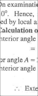
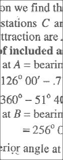
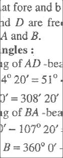
2 directions, the horizontal equivalent is not constant. (v) To the sum of the first and last ordinates, add twice the sum of the remaining odd ordinates and four times the sum of all the even ordinates. The total sum thus obtained is multiplied by one-third of the common distance between the ordinates and the result gives the required area. This rule of finding the area is called. (d) Simpson s rule (vi) The error due to is eliminated by making observations on both the faces and taking the mean value, during the angles measured by the method of repetition. (b) Imperfect adjustment of the line of collimation and the trunnion axis. (vii) Plumbing fork is used for accurate. (c) Centering. (viii) The type of surveying which requires least office work is. (c) Plane table surveying. (ix) When a chord is shorter than normal chord, it is called. (b) Sub chord. (x) A curve of varying radius curve. (d) Transition. introduced between a straight and a circular curve, is called SECTION-B UNIT-1 2. A closed compass traverse ABCD was conductedd round a lake and the following bearings were obtained. Determine which of the stations are suffering from local attraction and give the values of the corrected bearings: LINE F.B. B.B AB BC CD DA
3 3


4 3. What is ranging? Describe how you would range a survey line between two points which are not intervisible due to an intervening raised ground with the help of sketch. The process of marking a number of intermediate points on a survey line joining two stations in the field so that the length between them may be measured correctly, is called ranging. 4
5 4. The bearings of the sides of a closed transverse ABCDEA are as follows: Side F.B. B.B AB BC CD DE EA 107 o 22 o 281 o 181 o 124 o o o o 20 1 o o 45 Compute the interior angles of the traverse and exercise necessary checks. 5


6 UNIT-2 5. What do you understand by interpolation of contours? Explain their importance in location of a hill road. The process of drawing contours proportionately between the plotted ground points or in between plotted contours, is known as interpolation of contours. Interpolation of contours between points is done assuming thatt the slope of the ground between any two points is uniform. It may be done by one of the following methods: i. Estimation ii. Arithmetical calculation iii. Graphical method 6. During fly levelling, the following note is made: B.S. = 0.62, 2.05, 1.42, 2.63 and 2.42 metres F.S. = 2.44, 1.35, 0.53 and 2.41 metres The first B.S. was taken on a B.M. with R.L m. From the last B.S., it is equired to set 4 pegs each at a distance of 30 metres on a rising gradient of 1 in 200. a. Enter these notes in a form of level book. b. Calculate the R.L. of the top of each peg by Rise and Fall method. c. Also, calculate the staff readings on each peg and apply the usual checks. 6


7 7. What do you understand by indirect method of contouring? Explain each type of indirect method of contouring in brief with sketch. 7
8 8
9 UNIT-3 8. A road embankment 35m wide at formation level with side slopes 1:1 and with average height of 12 m is constructed with an average gradient 1 in 30 from contour 140 m to 580 m. The ground has an average slope of 12 to 1 in direction transverse to centre line. Calculate (i) Length of the road; (ii) Volume of the embankment. 9
10 9. What is meant by face left and face right of a theodolite? How would you change face? What instrumental errors are eliminated by face right and face left observation? Face left: When the vertical circle is on the left of the telescope at the time of observations, the observations of the angles are known as face left. Face right: When the vertical circle is on the right of the telescope at the time of observations, the observations of the angles are known as face right. Change face: It is the operation of changing the face of the telescope from left to right and vice versa. The imperfect adjustment of the line of collimation and the trunnion axis, this error is eliminated by making observations on both faces and taking mean value. 10. A railway embankment is 9 m wide at formation level, with side slope of 2 to 1. Assuming the ground to be level transversely, Calculate the volume of the embankment in cubic metres in a length of 180 m, the centre heights at 30 m intervals being 0.6, 0.8, 1.5, 1.8, 0.75, 0.3 and 0.67 m respectively. Use Trapezoidal method. 10
11 UNIT Describe with neat sketch, the method of intersection used in plane table survey. When it is used? Intersection Method:- When the location of an object is obtained on the sheet of paper by the intersection of the rays drawn after sighting at the object from two plane table stations (previously plotted), it is called intersection method. The method is suitable when the distance between the point and the instrument station is either too large or cannot be measured accurately due to some field conditions as in case of mountainous country. It is also employed for filling up details, locating distant and inaccessible object, locating the broken boundaries as in the case of rivers etc. The method can also be used for checking of plotted points. The line joining the two instrument stationss is known as the base line. No linear measurement other than the base line is made. Procedure: 1) Select two points L and M in such a way so that all the points to be plotted are visible from them. Now set the table at station, point L in such a position so that the sheet should cover all the points. Level the table and clamp it. 2) Draw the north line in the top corner of sheet by means of trough compass. 3) Now transfer the position of station point L on the sheet as l with the help of plumbing fork so that it is vertically above the instrument station. 4) With the alidade pivoted about l sight the ranging rod fixed at station point M and draw the line in the direction of M. Now measure the distance LM by means of the tape and cut off lm to some suitable scale along the ray drawn toward M; thus fixing the position of m on the sheet corresponding to station point M on the ground. The line lm is called the base line. 5) With the alidade touching the point l sight the objects in the field such as A,B,C,D,E etc. as shown in figure and draw the rays towards them. The direction of each line is marked with an arrow and a letter A, B, C, D, E etc. corresponding to above details. 6) Now shift the table to the station point M and approximately set it in the line with ML. Set it up so that the point m is vertically above the station point M and level it. 7) Orient the table roughly by compass, then finally by placing the alidade along ml and bisecting the ranging rod fixed at station point L i.e by back sighting L. Clamp the table in this position. 8) With the alidade centered at m sight the same object in the field such as A, B, C, D, E etc; and draw rays. The intersection of these rays with the respective rays from l locate the object A,B,,C,D,E etc; as a,b,c,d, e etc; on the sheet. 11
12 12. Write the statement for three point problem. What are the different methods to solve it? Explain any one method stepwise with sketch. Finding the location of the station occupied by a plane table on the sheet, by means of sighting to three well defined points whose locations have previously ben plotted on the sheet, is known as three point problem. The different methods to solve it are: a. Mechanical method or tracing paper method. b. Graphical method c. Trial and error method Mechanical method or tracing paper method: Let ABC are the three well defined points on the field. The well defined points are plotted on the drawing sheet using suitable scale. 1. Set up the plane table on the station P. Orient it roughly with the help of a magnetic compass or by eye adjustment so that ab parallel to AB. 2. Fix a tracing paper large enough to include the locations of all the four points on the sheet. 3. Mark a point p on the tracing paper to represent the instrument position P with the help of plumbing fork. 4. Pivoting the alidade about p, sight A, B, C in turn and draw rays, p a, p b and p c on the tracing paper. These lines will not pass through a, b and c as the orientation is approximate or rough. 5. Now loose the tracing paper and rotate it on the drawing paper in such a way that lines p a, p b and p c are made to pass through the plotted locations a, b and c respectively. Transfer p on to the sheet and represent it as p. Remove the tracing paper and join pa, pb and pc. 6. Keep the alidade on pa. The line of sight will not pass through A as the orientation has not yet been corrected. To correct the orientation, loose the clamp and rotate the plane table so that the line of sight passes through A. Clamp the table. The table is thus oriented. 7. To test the orientation, keep the alidade along pb. If the orientation is correct, the line of sight is pass through B. Similarly, the line of sight will pass through C when the alidade is kept on pc. 12


13 13. a. Narrate the working operations of plane tabling at each station and describe each one briefly b. Describe the method of orientation with a back ray. 13
14 14


15 UNIT Describe the methods of setting out simple circular curves by perpendicular offsets from tangents. 15
16 15. Two roads BA and CA intersect at a point A which falls in the bed of a river. These are to the connected by a simple circular curve of radius 200 m. To do this, a line MN connecting these tangents at points M and N respectively is measured to be 170 m. The angle BMN = and angle CNM = The chainage of point M is 1815 m. determine the chainage tangents joints and the length of the curve. 16


17 16. Explain the following terms with the help of neat sketch a. Point of Intersection b. Angle of deflection c. Radius of curve d. Long chord Long chord: The chord joining the point of commencement and point of tangency, is called long chord. 17
 VALLIAMMAI ENGINEERING COLLEGE Department of Civil Engineering CE6304 SURVEYING I Questions Bank UNIT-I FUNDAMENTALS AND CHAIN SURVEYING Part A 1) Define surveying. 2) What are the types of surveying?
Sub. Code:
 (ISO/IEC - 700-005 Certified) Model Answer: Summer 08 Code: 05 Important Instructions to examiners: ) The answers should be examined by key words and not as word-to-word as given in the model answer scheme.
1 Line Length I Bearing
 being 6 15'W. Calculate the true bearing of the line also error of closure and relative error of closure. 1 Line Length I Bearing AB 470m 343 52' BC 635 m 87 50' CD 430 m 172 40' DA 563 m 265 12' 9. (a)
ALPHA COLLEGE OF ENGINEERING
 ALPHA COLLEGE OF ENGINEERING DEPARTMENT OF CIVIL ENGINEERING QUESTION BANK 10CV34 SURVEYING-I UNIT -01 INTRODUCTION 1. Explain plane surveying and geodetic surveying. 2. Write a note on precision and accuracy
MAHARASHTRA STATE BOARD OF TECHNICAL EDUCATION (Autonomous) (ISO/IEC Certified)
 (ISO/IEC Certified)") SUMMER 18 EXAMINATION Subject Name: SURVEYING Model wer Subject Code: 17310 Important Instructions to examiners: 1) The answers should be examined by key words and not as word-to-word as given in the model
SUMMER 18 EXAMINATION Subject Name: SURVEYING Model wer Subject Code: 17310 Important Instructions to examiners: 1) The answers should be examined by key words and not as word-to-word as given in the model
II. COMPASS SURVEYING AND PLANE TABLE SURVEYING :
 1 II. COMPASS SURVEYING AND PLANE TABLE SURVEYING : Prismatic compass surveyor s compass bearing system of conversions Local attraction magnetic declination Dip Traversing Plotting Adjustment of errors
*1731* e) Define local attraction. State two causes of local attraction. f) State two principles of plane table survey. g) Define horizontal l
 Define local attraction. State two causes of local attraction. f) State two principles of plane table survey. g) Define horizontal l") *1731* 1731 21415 3 Hours/1 Marks S e a t o. Instructions : (1) All questions are compulsory. (2) Answer each next main question on a new page. (3) Illustrate your answers with neat sketches wherever necessary.
*1731* 1731 21415 3 Hours/1 Marks S e a t o. Instructions : (1) All questions are compulsory. (2) Answer each next main question on a new page. (3) Illustrate your answers with neat sketches wherever necessary.
SURVEY PRACTICE Vol. I
 SURVEY PRACTICE Vol. I INSTRUCTION MANUAL for III Semester B.E. Civil Engineering Compiled and Edited by V. Madhava Rao Associate Professor Roopanjali S. Assistant Professor B.S. Meghana Assistant Professor
DETERMINATION OF AREA OF POLYGON BY CHAIN AND CROSS STAFF SURVEY 1. AIM:
 Expt. No: 2 Date: DETERMINATION OF AREA OF POLYGON BY CHAIN AND CROSS STAFF SURVEY 1. AIM: To determine the area of a given field with define boundary by conducting cross staff survey. 2. INSTRUMENTS REQUIRED:
Objective questions for Practical Examination (CBCS scheme) Introduction to Surveying CE-112
 Introduction to Surveying CE-112") Objective questions for Practical Examination (CBCS scheme) Introduction to Surveying CE-112 1. The curvature of the earth s surface, is taken into account only if the extent of survey is more than i)
Objective questions for Practical Examination (CBCS scheme) Introduction to Surveying CE-112 1. The curvature of the earth s surface, is taken into account only if the extent of survey is more than i)
71- Laxmi Nagar (South), Niwaru Road, Jhotwara, Jaipur ,India. Phone: Mob. : /
, Niwaru Road, Jhotwara, Jaipur ,India. Phone: Mob. : /") www.aarekh.com 71- Laxmi Nagar (South), Niwaru Road, Jhotwara, Jaipur 302 012,India. Phone: 0141-2348647 Mob. : +91-9799435640 / 9166936207 1. An invar tape made of an alloy of: A. Copper and steel. B.
www.aarekh.com 71- Laxmi Nagar (South), Niwaru Road, Jhotwara, Jaipur 302 012,India. Phone: 0141-2348647 Mob. : +91-9799435640 / 9166936207 1. An invar tape made of an alloy of: A. Copper and steel. B.
MAHARASHTRA STATE BOARD OF TECHNICAL EDUCATION (Autonomous) (ISO/IEC Certified)
 (ISO/IEC Certified)") (ISO/IEC - 270-23 Certified) WINTER 17 EXAMINATION Subject Name: SURVEYING Model wer Subject Code: 17310 Important Instructions to examiners: 1) The answers should be examined by key words and not as word-to-word
(ISO/IEC - 270-23 Certified) WINTER 17 EXAMINATION Subject Name: SURVEYING Model wer Subject Code: 17310 Important Instructions to examiners: 1) The answers should be examined by key words and not as word-to-word
PREVIOUS YEAR SOLVED QUESTIONS SURVEYING - I. Unit - 1
 PREVIOUS YEAR SOLVED QUESTIONS SURVEYING - I Unit - 1 1. Distinguish between the following (June July 2015, June - July 2014, Dec 2013) i) Plane surveying: Curvature of earth is not taken into account.
UNIT What is basic principle on which Surveying has been classified? And explain them?
 Short Answer Type Questions: UNIT-1 1. State the Objectives of Surveying? 2. What is basic principle on which Surveying has been classified? And explain them? 3. Differentiate between Plane Surveying &
Practice Questions - Revision
 Practice Questions - Revision Question 1: (a) The data from a survey, are shown below. Use either the Rise and Fall method or the Height of Plane of Collimation (HPC) method to reduce the data. Use arithmetic
DHANALAKSHMI COLLEGE OF ENGINEERING Manimangalam, Tambaram, Chennai
 DHANALAKSHMI COLLEGE OF ENGINEERING Manimangalam, Tambaram, Chennai 601 301 DEPARTMENT OF CIVIL ENGINEERING CE6311 SURVEY PRACTICAL I III SEMESTER R 2013 LABORATORY MANUAL Name : Register No. : Class :
In such cases, direction may be used for the location of a point by any of the following methods:
 COMPASS SURVEYING Surveying is concerned with the relative location of points on, above or below the surface of the earth. It therefore becomes necessary to start from known points on a line. If the location
Only for Reference Page 1 of 11
 Only for Reference www.civilpddc2013.weebly.com Page 1 of 11 Seat No.: Enrolment No. PDDC - SEMESTER II EXAMINATION WINTER 2013 Subject Code: X20601 Date: 20-12-2013 Subject Name: Advance Surveying Time:
UNIT-2 COMPASS SYRVEYING AND PLANE TABLE SURVEYING
 UNIT-2 COMPASS SYRVEYING AND PLANE TABLE SURVEYING THE PRISMATIC COMPASS Prismatic compass is the most convenient and portable of magnetic compass which can either be used as a hand instrument or can be
CORK INSTITUTE OF TECHNOLOGY INSTITIÚID TEICNEOLAÍOCHTA CHORCAÍ. Semester 1 Examinations 2009/10
 CORK INSTITUTE OF TECHNOLOGY INSTITIÚID TEICNEOLAÍOCHTA CHORCAÍ Semester 1 Examinations 2009/10 Module Title: Traverse & Control Surveying Module Code: CIVL 6026 School: Building & Civil Engineering Programme
Serial : SK1_U+I_CE_Surveying Engineering_010918
 Serial : SK1_U+I_CE_Surveying Engineering_010918 Delhi oida Bhopal Hyderabad Jaipur Lucknow Indore Pune Bhubaneswar Kolkata Patna Web: E-mail: info@madeeasy.in Ph: 011-451461 CLASS TEST 018-19 CIVIL EGIEERIG
CE6304 SURVEYING I TWO MARKS UNIT-I FUNDAMENTALS AND CHAIN SURVEYING
 CE6304 SURVEYING I TWO MARKS UNIT-I FUNDAMENTALS AND CHAIN SURVEYING 1. Define surveying and list out its various classification. Classify surveying based on instrument used. Based on the instruments used
MAHARASHTRA STATE BOARD OF TECHNICAL EDUCATION (Autonomous) (ISO/IEC certified)
 (ISO/IEC certified)") MAHARASHTRA STATE BOARD OF TECHNICAL EDUCATION (Autonomous) (ISO/IEC -270001 2005 certified) Summer- 2017 EXAMINATION Subject code:17310 SURVEYING Model Answer Page No:01/21 Important Instructions to examiners:
MAHARASHTRA STATE BOARD OF TECHNICAL EDUCATION (Autonomous) (ISO/IEC -270001 2005 certified) Summer- 2017 EXAMINATION Subject code:17310 SURVEYING Model Answer Page No:01/21 Important Instructions to examiners:
Surveying Prof. Bharat Lohani Department of Civil Engineering Indian Institute of Technology, Kanpur. Module - 4 Lecture - 1 Compass Surveying
 Surveying Prof. Bharat Lohani Department of Civil Engineering Indian Institute of Technology, Kanpur Module - 4 Lecture - 1 Compass Surveying Welcome to this video lecture series on basic surveying and
GIET COLLEGE OF ENGINEERING DEPARTMENT OF CIVIL ENGINEERING SURVEYING LAB MANUAL FAMILARITY WITH INSTRUMENTS USED IN CHAIN SURVEYING
 GIET COLLEGE OF ENGINEERING DEPARTMENT OF CIVIL ENGINEERING SURVEYING LAB MANUAL FAMILARITY WITH INSTRUMENTS USED IN CHAIN SURVEYING OBJECTIVE: Study of various instruments used in chain surveying and
MAHATMA GANDHI MISSION S JAWAHARLAL NEHRU ENGINEERING COLLEGE, AURANGABAD. (M.S.)
") MAHATMA GANDHI MISSION S JAWAHARLAL NEHRU ENGINEERING COLLEGE, AURANGABAD. (M.S.) DEPARTMENT OF CIVIL ENGINEERING SURVEYING - II LAB MANUAL Prof.R.V.Wanjule Approved By Lab Incharge Dr. S. B. Shinde H.O.D.
MAHATMA GANDHI MISSION S JAWAHARLAL NEHRU ENGINEERING COLLEGE, AURANGABAD. (M.S.) DEPARTMENT OF CIVIL ENGINEERING SURVEYING - II LAB MANUAL Prof.R.V.Wanjule Approved By Lab Incharge Dr. S. B. Shinde H.O.D.
namibia UniVERSITY OF SCIEnCE AnD TECHnOLOGY
 namibia UniVERSITY OF SCIEnCE AnD TECHnOLOGY FACULTY OF NATURAL RESOURCES AND SPATIAL SCIENCES DEPARTMENT OF GEO-SPATIAL SCIENCES AND TECHNOLOGY QUALIFICATIONS: DIPLOMA IN GEOMATICS BACHELOR OF GEOMATICS
UNIT-4 THEODOLITE SURVEYING
 UNIT-4 THEODOLITE SURVEYING The Theodolite The measurement of horizontal and vertical angles and it is the most precise instrument designed for points on line, prolonging survey lines, establishing grades,
1. Peter cuts a square out of a rectangular piece of metal. accurately drawn. x + 2. x + 4. x + 2
 1. Peter cuts a square out of a rectangular piece of metal. 2 x + 3 Diagram NOT accurately drawn x + 2 x + 4 x + 2 The length of the rectangle is 2x + 3. The width of the rectangle is x + 4. The length
SURA's Guides for 3rd to 12th Std for all Subjects in TM & EM Available. MARCH Public Exam Question Paper with Answers MATHEMATICS
 SURA's Guides for rd to 1th Std for all Subjects in TM & EM Available 10 th STD. MARCH - 017 Public Exam Question Paper with Answers MATHEMATICS [Time Allowed : ½ Hrs.] [Maximum Marks : 100] SECTION -
AGE 303 AGRICULTURAL LAND SURVEYING INTRODUCTION Land Surveying: It has to do with the determination of relative spatial location of points on or
 AGE 303 AGRICULTURAL LAND SURVEYING INTRODUCTION Land Surveying: It has to do with the determination of relative spatial location of points on or near the surface of the earth. It is the art of measuring
Leveling. 3.1 Definitions
 Leveling 3.1 Definitions Leveling is the procedure used to determine differences in elevation between points that are remote from each other. Elevation is a vertical distance above or below a reference
MATHEMATICS ( CANDIDATES WITH PRACTICALS/INTERNAL ASSESSMENT ) ( CANDIDATES WITHOUT PRACTICALS/INTERNAL ASSESSMENT )
 ( CANDIDATES WITHOUT PRACTICALS/INTERNAL ASSESSMENT )") Total No. of Printed Pages 6 X/3/M 0 3 MATHEMATICS ( CANDIDATES WITH PRACTICALS/INTERNAL ASSESSMENT ) Full Marks : 80 Pass Marks : 4 ( CANDIDATES WITHOUT PRACTICALS/INTERNAL ASSESSMENT ) Full Marks : 00
Total No. of Printed Pages 6 X/3/M 0 3 MATHEMATICS ( CANDIDATES WITH PRACTICALS/INTERNAL ASSESSMENT ) Full Marks : 80 Pass Marks : 4 ( CANDIDATES WITHOUT PRACTICALS/INTERNAL ASSESSMENT ) Full Marks : 00
Site Surveying Procedures for Construction and the Built Environment
 Unit 27: Site Surveying Procedures for Construction and the Built Environment Unit code: R/601/1291 QCF level: 4 Credit value: 15 Aim This unit develops an understanding of the principles of site surveying
Mathematics. Single Correct Questions
 Mathematics Single Correct Questions +4 1.00 1. If and then 2. The number of solutions of, in the interval is : 3. If then equals : 4. A plane bisects the line segment joining the points and at right angles.
CBSE Board Class X Summative Assessment II Mathematics
 CBSE Board Class X Summative Assessment II Mathematics Board Question Paper 2014 Set 2 Time: 3 hrs Max. Marks: 90 Note: Please check that this question paper contains 15 printed pages. Code number given
University of Asia Pacific Department of Basic Sciences & Humanities Mid Semester Examination, Spring-2016 Program: B.Sc. Engineering (Civil)
") Department of Basic Sciences & Humanities Mid Semester Examination, Spring-2016 1st Year 12"d Semester Course Title: Mathematics II Time: 1 hr Answer any three of the followings Course Code: MTH 103 Course
Department of Basic Sciences & Humanities Mid Semester Examination, Spring-2016 1st Year 12"d Semester Course Title: Mathematics II Time: 1 hr Answer any three of the followings Course Code: MTH 103 Course
Using Map and Compass Together
 Using Map and Compass Together In situations where you foresee a potential evacuation on foot, where there are no roads, and no indication as to the direction of travel (i.e., road signs), it is recommended
1 / 24
 CBSE-XII-017 EXAMINATION CBSE-X-01 EXAMINATION MATHEMATICS Paper & Solution Time: 3 Hrs. Max. Marks: 90 General Instuctions : 1. All questions are compulsory.. The question paper consists of 34 questions
Activity Sheet 1: Constructions
 Name ctivity Sheet 1: Constructions Date 1. Constructing a line segment congruent to a given line segment: Given a line segment B, B a. Use a straightedge to draw a line, choose a point on the line, and
Department of Mathematics
 Department of Mathematics TIME: 3 Hours Setter: DS DATE: 03 August 2015 GRADE 12 PRELIM EXAMINATION MATHEMATICS: PAPER II Total marks: 150 Moderator: AM Name of student: PLEASE READ THE FOLLOWING INSTRUCTIONS
KENDRIYA VIDYALAYA SANGATHAN, HYDERABAD REGION
 KENDRIYA VIDYALAYA SANGATHAN, HYDERABAD REGION MOCK TEST PAPER 10 FOR SA II (2016-17) SUBJECT: MATHEMATICS BLUE PRINT : SA-II CLASS X Unit/Topic Algebra Quadratic Equations & Arithmetic Progression Geometry
CE 271 Spring Survey Camp
 PART IV LEVELING A. Importance of Leveling The determination of elevations with a surveying instrument, which is known as leveling, is a relatively simple but extraordinarily important process. B. Definitions
NCEES FS Practice Exam
 NCEES FS Practice Exam Terrametra Resources Lynn Patten 1. One corner of a 60-ft. 120-ft. lot, otherwise rectangular, is a curve with a radius of 20 ft. and a central angle of 90. The area (ft. 2 ) of
Surveying Prof. Bharat Lohani Department of Civil Engineering Indian Institute of Technology, Kanpur. Module - 11 Lecture No. # 01 Project surveys
 Surveying Prof. Bharat Lohani Department of Civil Engineering Indian Institute of Technology, Kanpur Module - 11 Lecture No. # 01 Project surveys (Refer Slide Time: 00:24) Welcome to this video lecture,
CBSE Board Class X Mathematics Term II Sample Paper 1 Time: 3 hrs Total Marks: 90
 CBSE Board Class X Mathematics Term II Sample Paper 1 Time: 3 hrs Total Marks: 90 General Instructions: 1. All questions are compulsory. 2. The question paper consists of 34 questions divided into four
ST MARY S DSG, KLOOF GRADE: 12 SEPTEMBER 2016 MATHEMATICS: PAPER II. 1. This question paper consists of 27 typed pages. There are also 2 blank pages.
 ST MARY S DSG, KLOOF GRADE: 12 SEPTEMBER 2016 MATHEMATICS: PAPER II Examiner: S Drew TIME: 3 HOURS Moderators: J van Rooyen J Kinsey TOTAL: 150 MARKS INSTRUCTIONS: 1. This question paper consists of 27
2001 Higher Maths Non-Calculator PAPER 1 ( Non-Calc. )
") 001 PAPER 1 ( Non-Calc. ) 1 1) Find the equation of the straight line which is parallel to the line with equation x + 3y = 5 and which passes through the point (, 1). Parallel lines have the same gradient.
001 PAPER 1 ( Non-Calc. ) 1 1) Find the equation of the straight line which is parallel to the line with equation x + 3y = 5 and which passes through the point (, 1). Parallel lines have the same gradient.
MATHEMATICS. IMPORTANT FORMULAE AND CONCEPTS for. Summative Assessment -II. Revision CLASS X Prepared by
 MATHEMATICS IMPORTANT FORMULAE AND CONCEPTS for Summative Assessment -II Revision CLASS X 06 7 Prepared by M. S. KUMARSWAMY, TGT(MATHS) M. Sc. Gold Medallist (Elect.), B. Ed. Kendriya Vidyalaya GaCHiBOWli
ST MARY S DSG, KLOOF GRADE: SEPTEMBER 2017 MATHEMATICS PAPER 2
 ST MARY S DSG, KLOOF GRADE: 12 12 SEPTEMBER 2017 MATHEMATICS PAPER 2 TIME: 3 HOURS ASSESSOR: S Drew TOTAL: 150 MARKS MODERATORS: J van Rooyen E Robertson EXAMINATION NUMBER: TEACHER: INSTRUCTIONS: 1. This
I pledge that I have neither given nor received help with this assessment.
 CORE MATHEMATICS PII Page 1 of 24 HILTON COLLEGE TRIAL EXAMINATION AUGUST 2016 Time: 3 hours CORE MATHEMATICS PAPER 2 150 marks PLEASE READ THE FOLLOWING GENERAL INSTRUCTIONS CAREFULLY. 1. This question
Complete Syllabus of Class XI & XII
 Regd. Office : Aakash Tower, 8, Pusa Road, New Delhi-0005 Ph.: 0-7656 Fa : 0-767 MM : 0 Sample Paper : Campus Recruitment Test Time : ½ Hr. Mathematics (Engineering) Complete Syllabus of Class XI & XII
BERGVLIET HIGH SCHOOL MATHEMATICS DEPARTMENT JUNE EXAMINATION GRADE 12 MATHEMATICS PAPER 2 9 JUNE 2016
 BERGVLIET HIGH SCHOOL MATHEMATICS DEPARTMENT JUNE EXAMINATION GRADE 1 MATHEMATICS PAPER 9 JUNE 016 MARKS: 150 TIME: 3 HOURS This question paper consists of 11 pages and 14 questions. INSTRUCTIONS AND INFORMATION
Core Mathematics 2 Coordinate Geometry
 Core Mathematics 2 Coordinate Geometry Edited by: K V Kumaran Email: kvkumaran@gmail.com Core Mathematics 2 Coordinate Geometry 1 Coordinate geometry in the (x, y) plane Coordinate geometry of the circle
Recognise the Equation of a Circle. Solve Problems about Circles Centred at O. Co-Ordinate Geometry of the Circle - Outcomes
 1 Co-Ordinate Geometry of the Circle - Outcomes Recognise the equation of a circle. Solve problems about circles centred at the origin. Solve problems about circles not centred at the origin. Determine
MIND ACTION SERIES. MATHEMATICS PRACTISE EXAMINATION (Original Paper set up by Mark Phillips) GRADE 12 PAPER 2 OCTOBER 2016 TIME: 3 HOURS MARKS: 150
 GRADE 12 PAPER 2 OCTOBER 2016 TIME: 3 HOURS MARKS: 150") 1 MIND ACTION SERIES MATHEMATICS PRACTISE EXAMINATION (Original Paper set up by Mark Phillips) GRADE 1 PAPER OCTOBER 016 TIME: 3 HOURS MARKS: 150 INSTRUCTIONS AND INFORMATION Read the following instructions
1 MIND ACTION SERIES MATHEMATICS PRACTISE EXAMINATION (Original Paper set up by Mark Phillips) GRADE 1 PAPER OCTOBER 016 TIME: 3 HOURS MARKS: 150 INSTRUCTIONS AND INFORMATION Read the following instructions
APPENDIX A GLOSSARY. Appendix A.1
 APPENDIX A GLOSSARY Appendix A.1 Appendix A.2 Back Bearing A back bearing is measured from the object to your position. It is the exact opposite of a direct bearing. Base Line An imaginary line on the
Mathematics CLASS : X. Time: 3hrs Max. Marks: 90. 2) If a, 2 are three consecutive terms of an A.P., then the value of a.
 If a, 2 are three consecutive terms of an A.P., then the value of a.") 1 SAMPLE PAPER 4 (SAII) MR AMIT. KV NANGALBHUR Mathematics CLASS : X Time: 3hrs Max. Marks: 90 General Instruction:- 1. All questions are Compulsory. The question paper consists of 34 questions divided
1 SAMPLE PAPER 4 (SAII) MR AMIT. KV NANGALBHUR Mathematics CLASS : X Time: 3hrs Max. Marks: 90 General Instruction:- 1. All questions are Compulsory. The question paper consists of 34 questions divided
CHENDU COLLEGE OF ENGINEERING & TECHNOLOGY DEPARTMENT OF CIVIL ENGINEERING SUB CODE & SUB NAME : CE6404 SURVEYING II
 CHENDU COLLEGE OF ENGINEERING & TECHNOLOGY DEPARTMENT OF CIVIL ENGINEERING SUB CODE & SUB NAME : CE6404 SURVEYING II UNIT I CONTROL SURVEYING PART A (2 MARKS) 1. What is the main principle involved in
Latitude and Longitude
 U n i t 3 M a p p i n g P a g e 1 Latitude and Longitude Note: These coordinates are always expressed LATITUDE/LONGITUDE!!! Coordinate System: Using and to find your position on Earth. LATITUDE LATITUDE
St. Anne s Diocesan College. Grade 12 Core Mathematics: Paper II September Time: 3 hours Marks: 150
 St. Anne s Diocesan College Grade 12 Core Mathematics: Paper II September 2018 Time: 3 hours Marks: 150 Please read the following instructions carefully: 1. This question paper consists of 21 pages and
SURVEYING II (FOR IV SEMESTER)
") SURVEYING II (FOR IV SEMESTER) UNIT I UNIT II UNIT III UNIT IV UNIT V = TACHEOMETRIC SURVEYING = CONTROL SURVEYING = SURVEY ADJUSTMENTS = ASTRONOMICAL SURVEYING = HYDROGRAPHIC AND ADVANCE SURVEYING PREPARED
SURVEYING II (FOR IV SEMESTER) UNIT I UNIT II UNIT III UNIT IV UNIT V = TACHEOMETRIC SURVEYING = CONTROL SURVEYING = SURVEY ADJUSTMENTS = ASTRONOMICAL SURVEYING = HYDROGRAPHIC AND ADVANCE SURVEYING PREPARED
Circles. Exercise 9.1
 9 uestion. Exercise 9. How many tangents can a circle have? Solution For every point of a circle, we can draw a tangent. Therefore, infinite tangents can be drawn. uestion. Fill in the blanks. (i) tangent
81-E 2. Ans. : 2. Universal set U = { 2, 3, 5, 6, 10 }, subset A = { 5, 6 }. The diagram which represents A / is. Ans. : ( SPACE FOR ROUGH WORK )
") 81-E 2 General Instructions : i) The question-cum-answer booklet contains two Parts, Part A & Part B. ii) iii) iv) Part A consists of 60 questions and Part B consists of 16 questions. Space has been provided
81-E 2 General Instructions : i) The question-cum-answer booklet contains two Parts, Part A & Part B. ii) iii) iv) Part A consists of 60 questions and Part B consists of 16 questions. Space has been provided
A-Level Notes CORE 1
 A-Level Notes CORE 1 Basic algebra Glossary Coefficient For example, in the expression x³ 3x² x + 4, the coefficient of x³ is, the coefficient of x² is 3, and the coefficient of x is 1. (The final 4 is
FIXED BEAMS CONTINUOUS BEAMS
 FIXED BEAMS CONTINUOUS BEAMS INTRODUCTION A beam carried over more than two supports is known as a continuous beam. Railway bridges are common examples of continuous beams. But the beams in railway bridges
I pledge that I have neither given nor received help with this assessment.
 CORE MATHEMATICS PII Page 1 of 4 HILTON COLLEGE TRIAL EXAMINATION AUGUST 016 Time: 3 hours CORE MATHEMATICS PAPER 150 marks PLEASE READ THE FOLLOWING GENERAL INSTRUCTIONS CAREFULLY. 1. This question paper
chapter 1 vector geometry solutions V Consider the parallelogram shown alongside. Which of the following statements are true?
 chapter vector geometry solutions V. Exercise A. For the shape shown, find a single vector which is equal to a)!!! " AB + BC AC b)! AD!!! " + DB AB c)! AC + CD AD d)! BC + CD!!! " + DA BA e) CD!!! " "
JUST IN TIME MATERIAL GRADE 11 KZN DEPARTMENT OF EDUCATION CURRICULUM GRADES DIRECTORATE TERM
 JUST IN TIME MATERIAL GRADE 11 KZN DEPARTMENT OF EDUCATION CURRICULUM GRADES 10 1 DIRECTORATE TERM 1 017 This document has been compiled by the FET Mathematics Subject Advisors together with Lead Teachers.
Downloaded from APPLICATION OF TRIGONOMETRY
 MULTIPLE CHOICE QUESTIONS APPLICATION OF TRIGONOMETRY Write the correct answer for each of the following : 1. Write the altitude of the sun is at 60 o, then the height of the vertical tower that will cost
0114ge. Geometry Regents Exam 0114
 0114ge 1 The midpoint of AB is M(4, 2). If the coordinates of A are (6, 4), what are the coordinates of B? 1) (1, 3) 2) (2, 8) 3) (5, 1) 4) (14, 0) 2 Which diagram shows the construction of a 45 angle?
R1: Sets A set is a collection of objects sets are written using set brackets each object in onset is called an element or member
 Chapter R Review of basic concepts * R1: Sets A set is a collection of objects sets are written using set brackets each object in onset is called an element or member Ex: Write the set of counting numbers
Key competencies (student abilities)
") Year 9 Mathematics Cambridge IGCSE Mathematics is accepted by universities and employers as proof of mathematical knowledge and understanding. Successful Cambridge IGCSE Mathematics candidates gain lifelong
Year 9 Mathematics Cambridge IGCSE Mathematics is accepted by universities and employers as proof of mathematical knowledge and understanding. Successful Cambridge IGCSE Mathematics candidates gain lifelong
Applied Geomorphology. Pocket Transit Survey Methods
 Applied Geomorphology Pocket Transit Survey Methods The Pocket Transit (Brunton) Used to measure compass directions Allows for magnetic declination correction Can measure vertical angles with clinometer.
1 / 22
 CBSE-XII-017 EXAMINATION MATHEMATICS Paper & Solution Time: 3 Hrs. Max. Marks: 90 General Instructions : (i) All questions are compulsory. (ii) The question paper consists of 31 questions divided into
Chapter 10. Properties of Circles
 Chapter 10 Properties of Circles 10.1 Use Properties of Tangents Objective: Use properties of a tangent to a circle. Essential Question: how can you verify that a segment is tangent to a circle? Terminology:
SURVEYING 1 CE 215 CHAPTER -3- LEVEL AND LEVELING
 Civil Engineering Department SURVEYING 1 CE 215 CHAPTER -3- LEVEL AND LEVELING 1 CHAPTER -3- LEVEL AND LEVELING 2 1 CONTENTS 1. Level instrument 2. Bubble 3. Tripod 4. Leveling staff 5. Definitions 6.
MATHEMATICS ( CANDIDATES WITH PRACTICALS/INTERNAL ASSESSMENT ) ( CANDIDATES WITHOUT PRACTICALS/INTERNAL ASSESSMENT )
 ( CANDIDATES WITHOUT PRACTICALS/INTERNAL ASSESSMENT )") Total No. of Printed Pages 6 X/5/M 0 5 MATHEMATICS ( CANDIDATES WITH PRACTICALS/INTERNAL ASSESSMENT ) Full Marks : 80 Pass Marks : 4 ( CANDIDATES WITHOUT PRACTICALS/INTERNAL ASSESSMENT ) Full Marks : 00
Total No. of Printed Pages 6 X/5/M 0 5 MATHEMATICS ( CANDIDATES WITH PRACTICALS/INTERNAL ASSESSMENT ) Full Marks : 80 Pass Marks : 4 ( CANDIDATES WITHOUT PRACTICALS/INTERNAL ASSESSMENT ) Full Marks : 00
KENDRIYA VIDYALAYA SANGATHAN, HYDERABAD REGION
 KENDRIYA VIDYALAYA SANGATHAN, HYDERABAD REGION SAMPLE PAPER 08 (2017-18) SUBJECT: MATHEMATICS(041) BLUE PRINT : CLASS X Unit Chapter VSA (1 mark) SA I (2 marks) SA II (3 marks) LA (4 marks) Total Unit
+ 2gx + 2fy + c = 0 if S
 CIRCLE DEFINITIONS A circle is the locus of a point which moves in such a way that its distance from a fixed point, called the centre, is always a constant. The distance r from the centre is called the
Straight Line. SPTA Mathematics Higher Notes
 H Straight Line SPTA Mathematics Higher Notes Gradient From National 5: Gradient is a measure of a lines slope the greater the gradient the more steep its slope and vice versa. We use the letter m to represent
Unit 3: Number, Algebra, Geometry 2
 Unit 3: Number, Algebra, Geometry 2 Number Use standard form, expressed in standard notation and on a calculator display Calculate with standard form Convert between ordinary and standard form representations
2. (i) Find the equation of the circle which passes through ( 7, 1) and has centre ( 4, 3).
 Find the equation of the circle which passes through ( 7, 1) and has centre ( 4, 3).") Circle 1. (i) Find the equation of the circle with centre ( 7, 3) and of radius 10. (ii) Find the centre of the circle 2x 2 + 2y 2 + 6x + 8y 1 = 0 (iii) What is the radius of the circle 3x 2 + 3y 2 + 5x
Circle 1. (i) Find the equation of the circle with centre ( 7, 3) and of radius 10. (ii) Find the centre of the circle 2x 2 + 2y 2 + 6x + 8y 1 = 0 (iii) What is the radius of the circle 3x 2 + 3y 2 + 5x
EROSIONAL FEATURES. reflect
 reflect Have you ever looked at the land around you and wondered what processes shaped what you see? Perhaps you see mountains, valleys, rivers, or canyons. Do you know how long these geologic features
VTU QUESTIONS AND ANSWERS. Unit 1
 VTU QUESTIONS AND ANSWERS Unit 1 1 a) Distinguish between the following: (June-July 211, Dec 211, June/July 213, Dec/Jan 213/14) i) Plane surveying: curvature of earth is not taken into account small areas.
Total No. of Questions : 58 ] [ Total No. of Printed Pages : 40. ê ÂŒÈ : πâä  FOR OFFICE USE ONLY
![Total No. of Questions : 58 ] [ Total No. of Printed Pages : 40. ê ÂŒÈ : πâä  FOR OFFICE USE ONLY](/thumbs/94/120871203.jpg "Total No. of Questions : 58 ] [ Total No. of Printed Pages : 40. ê ÂŒÈ : πâä  FOR OFFICE USE ONLY") Roll No. Serial No. of Q. C. A. B. ÈJ ÂX applerπâ   zapplew : 58 ] [ ÈJ ÆÂÈÈåX  ÂÏ πâ   zapplew : 40 Total No. of Questions : 58 ] [ Total No. of Printed Pages : 40 ê ÂŒÈ : πâä   xë   zapplew
Roll No. Serial No. of Q. C. A. B. ÈJ ÂX applerπâ   zapplew : 58 ] [ ÈJ ÆÂÈÈåX  ÂÏ πâ   zapplew : 40 Total No. of Questions : 58 ] [ Total No. of Printed Pages : 40 ê ÂŒÈ : πâä   xë   zapplew
5 Find an equation of the circle in which AB is a diameter in each case. a A (1, 2) B (3, 2) b A ( 7, 2) B (1, 8) c A (1, 1) B (4, 0)
 B (3, 2) b A ( 7, 2) B (1, 8) c A (1, 1) B (4, 0)") C2 CRDINATE GEMETRY Worksheet A 1 Write down an equation of the circle with the given centre and radius in each case. a centre (0, 0) radius 5 b centre (1, 3) radius 2 c centre (4, 6) radius 1 1 d centre
C2 CRDINATE GEMETRY Worksheet A 1 Write down an equation of the circle with the given centre and radius in each case. a centre (0, 0) radius 5 b centre (1, 3) radius 2 c centre (4, 6) radius 1 1 d centre
University of Asia Pacific Department of Civil Engineering Mid Semester Examination Fall 2016 Program: B.Sc. Engineering (Civil)
") University of Asia Pacific Department of Civil Engineering Mid Semester Examination Fall 2016 Program: B.Sc. Engineering (Civil) Course Title: Surveying Time: 1 Hour Course Code: CE 5 Full Marks: 20 1.
University of Asia Pacific Department of Civil Engineering Mid Semester Examination Fall 2016 Program: B.Sc. Engineering (Civil) Course Title: Surveying Time: 1 Hour Course Code: CE 5 Full Marks: 20 1.
CBSE Class X Mathematics Board Paper 2019 All India Set 3 Time: 3 hours Total Marks: 80
 CBSE Class X Mathematics Board Paper 2019 All India Set 3 Time: 3 hours Total Marks: 80 General Instructions: (i) All questions are compulsory. (ii) The question paper consists of 30 questions divided
Edexcel New GCE A Level Maths workbook Circle.
 Edexcel New GCE A Level Maths workbook Circle. Edited by: K V Kumaran kumarmaths.weebly.com 1 Finding the Midpoint of a Line To work out the midpoint of line we need to find the halfway point Midpoint
Map reading notes. It is a very useful kind of map that shows the topography of an area, i.e whether it is flat, undulating, rugged or mountainous
 Introduction Map reading notes In the course of 2 or 3 years course, Candidates will be exposed to topographical maps from tropical countries such as Mauritius, Tanzania, Zimbabwe and Jamaica. Many of
( Bifurcated Syllabus ) ( According to Syllabus of Class X only) PART - I
 ( According to Syllabus of Class X only) PART - I") Karunamoyee, Salt Lake, Kolkata : 70009 Mathematics (COMPULSORY) (Compulsory) Full marks : NEW 90 - For SYLLABUS Regular Candidates { Time 00 ---3 Hours - For 5 Eternal Minutes Candidates ( First 5 minutes
Karunamoyee, Salt Lake, Kolkata : 70009 Mathematics (COMPULSORY) (Compulsory) Full marks : NEW 90 - For SYLLABUS Regular Candidates { Time 00 ---3 Hours - For 5 Eternal Minutes Candidates ( First 5 minutes
B. Topographic maps are also called. contour maps
 Topographic Maps Introduction A. Topographic maps are essential tools in geologic and engineering studies because they show the configuration of Earth's surface in remarkable detail and permit one to measure
MATHEMATICS 2014 HSC Course Assessment Task 3 (Trial Examination) June 18, 2014
 June 18, 2014") MATHEMATICS 2014 HSC Course Assessment Task 3 (Trial Examination) June 18, 2014 General Instructions Working time 3 hours (plus 5 minutes reading time). Section I - 10 marks Mark your answers on the answer
MATHEMATICS 2014 HSC Course Assessment Task 3 (Trial Examination) June 18, 2014 General Instructions Working time 3 hours (plus 5 minutes reading time). Section I - 10 marks Mark your answers on the answer
TUTOR MARKED ASSIGNMENT
 Maximum Marks : 100 Weightage : 30% TUTOR MARKED ASSIGNMENT BET-017 COMPUTER BASICS DCLE(G) / DME Course Code : BET-017 Last Date of Submission : October 30, 2011 Note : All questions are compulsory and
QUEEN S COLLEGE. Yearly Examination, Mathematics Paper II. Secondary 5 Date: 23 June, Time: 8:30-9:30 Full Marks: 80
 QUEEN S COLLEGE Yearly Examination, 00-0 Mathematics Paper II Secondary 5 Date: June, 0. Time: 8:0-9:0 Full Marks: 80. Write down the information required in the spaces provided on the Answer Sheet.. When
MEI Core 1. Basic Algebra. Section 1: Basic algebraic manipulation and solving simple equations. Manipulating algebraic expressions
 MEI Core Basic Algebra Section : Basic algebraic manipulation and solving simple equations Notes and Examples These notes contain subsections on Manipulating algebraic expressions Collecting like terms
Department of Mathematics
 Department of Mathematics TIME: 3 hours Setter: CF DATE: 06 August 2018 GRADE 12 PRELIM EXAMINATION MATHEMATICS: PAPER II Total marks: 150 Moderator: DAS Name of student: PLEASE READ THE FOLLOWING INSTRUCTIONS
Surveying FE Review. Fall CIVL 4197 FE Surveying Review 1/9
 CIVL 4197 FE Surveying Review 1/9 Surveying FE Review Fall 017 Problem 18.01: Two sides of a triangular-shaped parcel are 80 ft. and 100 ft. with a 60 angle between them. The length of the third side of
The ABC's of Compass and Map STUDENT WORKBOOK
 The ABC's of Compass and Map STUDENT WORKBOOK 1 EXERCISE 1: Compass Part Identification Directions: Match the terms below with the correct parts on the compass diagram. NOTES: A. Azimuth Ring B. Compass