Time and resolution : COSMO-SkyMed VHR data in support to precision farming applications
|
|
|
- Derick Jennings
- 6 years ago
- Views:
Transcription


 COSMO-SkyMed")
1 17 th GEOCAP Conference Geomatics in Support of the CAP Tallinn, 24 November 2011 Time and resolution : COSMO-SkyMed VHR data in support to precision farming applications e-geos Headquarter Contrada Terlecchie Matera - Italy Commercial Office Via Cannizzaro Roma - Italy North Germany Pilot Project all COSMO-SkyMed images, copyright 2011 What is e-geos? EO Division (contracts, people and assets) COSMO-SkyMed (exclusive world-wide rights) Page 2 1
 Telaer JSI, Japan East-Dawn, China")

 and funded by Italian Ministry of Research (MUR) and Italian Ministry of Defence (MOD)")
2 e-geos in the world Lockheed Martin, USA GeoEye, USA GAF/Euromap, Germany Telespazio France Rartel, Romania Aurensis, Spain e-geos, Italy (Eurimage) Telaer JSI, Japan East-Dawn, China e-geos, Kenya Telespazio Brazil Telespazio Argentina Direct presence Subsidiaries Strategic partners Page 3 COSMO-SkyMed Overview COSMO-SkyMed is the largest Italian investment in Space Systems for Earth Observation, a National Program conceived by Italian Space Agency (ASI) and funded by Italian Ministry of Research (MUR) and Italian Ministry of Defence (MOD) Page 4 2


3 The COSMO constellation COSMO 1 launch June 8, :34 GMT COSMO 2 launch December 9, :31 GMT COSMO 3 launch October 25, :28 GMT COSMO 4 launch November 6, :20 GMT Page 5 Reliability & Continuity COSMO-SkyMed X-band CSK-1 launched 8 June 2007 CSK-2 launched 9 December 2007 CSK-3 launched 25 October 2008 CSK-4 launched 6 November 2010 COSMO 2 nd Generation SAOCOM L-band SAOCOM is a L-band mission co-financed by CONAE and ASI Page 6 3
: 1 left looking and 1 right looking early")
 1 left looking and 1 right looking")
 The higher the latitude, the more the")


4 Unmatched Revisit At least 4 acquisitions / day (@ equator): 1 left looking and 1 right looking early morning (ASCENDING, approx. 6 AM local time) 1 left looking and 1 right looking late afternoon (DESCENDING, approx. 6 PM local time) The higher the latitude, the more the daily passes Page 7 COSMO-SkyMed current configuration CSK CSK3 CSK4 90 CSK1 Day CSK1 CSK2 CSK3 CSK4 CSK1 In a 16-days cycle there are 4 interferometric acquisitions Same orbit direction, same look side, same incidence angle Page 8 4


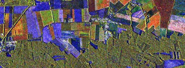
5 What is an MTC? Page 9 Multi-Temporal Coherent Colour Composite COHERENCE First SAR IMAGE Second SAR IMAGE Page 10 5
6 Analysis Page 11 Dataset SAR data: 20 COSMO-SkyMed Himage (3m of resolution) from April 30 to October 30 Optical data: 2 IRS images (23.5m of resolution) provided by GAF-AG Ancillary data provided by GAF-AG: Farmers interview about processing dates In situ photos (GPS tag) during : May-Preparation period (grubbing, plowing, sowing) July-Post-growth period (growth and harvesting) Page 12 6


7 Field Processing Monitoring Page 13 Corn Plowed: 30 Apr-3 May 05/05/ /05/2011 Page 14 7


8 Corn Sowing: 3-7 May Page 15 Corn Sowed: 7-15 May Page 16 8


9 Grown Fields Page 17 Corn Growth: 3-6 July 04/07/ /07/2011 Page 18 9


10 Corn Harvesting: Oct Page 19 Corn Harvested: Oct Page 20 10
11 Time Signature Page 21 Corn Plowed: 30 Apr-3 May 0,14 0,12 0,1 0,08 0,06 0,04 0, Page 22 11
12 Corn Sowing: 3-7 May 0,14 0,12 0,1 0,08 0,06 0,04 0, Page 23 Corn Sowed: 7-15 May 0,14 0,12 0,1 0,08 0,06 0,04 0, Page 24 12


13 27 Aug-4 Sep 0,18 0,16 0,14 0,12 0,1 0,08 0,06 0,04 0, Page Sep 0,18 0,16 0,14 0,12 0,1 0,08 0,06 0,04 0, Page 26 13


14 7-10 Oct 0,18 0,16 0,14 0,12 0,1 0,08 0,06 0,04 0, Page Oct 0,18 0,16 0,14 0,12 0,1 0,08 0,06 0,04 0, Page 28 14
15 14-22 Oct 0,18 0,16 0,14 0,12 0,1 0,08 0,06 0,04 0, Page 29 Corn Harvested: Oct 0,18 0,16 0,14 0,12 0,1 0,08 0,06 0,04 0, Page 30 15


16 Time signature: Corn vs Rye Page 31 04/07/2011 Corn vs Rye: Growth 3-6 July 04/07/2011 Page 32 16
17 Time signature: Corn 0,4 0,35 0,3 0,25 0,2 0,15 0,1 0, Page 33 Time Signature : Rye 2 1,8 1,6 1,4 1,2 1 0,8 0,6 0,4 0, Page 34 17

18 Optical-Radar Fusion Page 35 IRS Image: 23 Apr Page 36 18


19 MTC: 30 Apr-3 May Page 37 Fusion: IRS NDVI-Coherence OPtical Radar Fusion: NDVI Coherence Page 38 19


20 Optical-Radar Comparison: No Vegetattion 30 Aprl-3 May 05/05/ /04/ /05/2011 Page 39 Optical-Radar Comparison: Vegetattion 30 Aprl-3 May 05/05/ /04/ /05/2011 Page 40 20


21 Optical-Radar Comparison: Growth Vegetattion 27 Aug-4 Sept 04/07/ /08/ /07/2011 Page 41 Remarks COSMO-SkyMed VHR SAR data revealed very useful for agricultural application, thanks to : The 4 satellites constellation that allows an interferometric revisit with a frequency varying from 1 to 16 days and more,matching the wide range of needs that every agricultural activity requires Its high resolution data that allow recognition, characterization, boundary extracion and monitoring of fields The possibility to introduce Time in the anlysis allowing the characterization of the state of each field with no ambiguity and the identification of the occurred processing Page 42 21
22 Conclusions COSMO-SkyMed data allows the definition of the time signature of a field through its backscattering and time story. It is possible to define the state of a field (vegetated, not vegetated) and the type of vegetation (high plants or low plants) Optical and ground data confirmed radar results in the use of the coherence as an instrument to evaluate the state of a field COSMO-SkyMed SAR Data revealed good for a fusion with optical data, making possible to mix together time information (radar) with information about the vegetative state of plants (opticlal IR) COSMO-SkyMed data can be the best solution for agricultural monitoring and controls in international scenarios where metereological conditions make optical data no t reliable (e.g. rice monitoring in tropical areas) Page 43 Any question? lucio.cesarano@external.e-geos.it luca.pietranera@e-geos.it filippo.britti@e-geos.it vittorio.gentile@external.e-geos.it Page 44 22
GEO Joint Experiment for Crop Assessment and Monitoring (JECAM): 2014 Site Progress Report
: 2014 Site Progress Report") GEO Joint Experiment for Crop Assessment and Monitoring (JECAM): JECAM Test Site Name: China - Guangdong 2014 Site Progress Report Team Leader and Members: Prof Wu Bingfang (Leader), Jiratiwan Kruasilp,
GEO Joint Experiment for Crop Assessment and Monitoring (JECAM): JECAM Test Site Name: China - Guangdong 2014 Site Progress Report Team Leader and Members: Prof Wu Bingfang (Leader), Jiratiwan Kruasilp,
SNOW COVER MONITORING IN ALPINE REGIONS WITH COSMO-SKYMED IMAGES BY USING A MULTITEMPORAL APPROACH AND DEPOLARIZATION RATIO
 SNOW COVER MONITORING IN ALPINE REGIONS WITH COSMO-SKYMED IMAGES BY USING A MULTITEMPORAL APPROACH AND DEPOLARIZATION RATIO B. Ventura 1, T. Schellenberger 1, C. Notarnicola 1, M. Zebisch 1, T. Nagler
AUTOMATED DATA PROCESSING FOR MARITIME AND FLOODS APPLICATIONS
 YOUR HUB FOR GEOSPATIAL APPLICATIONS AUTOMATED DATA PROCESSING FOR MARITIME AND FLOODS APPLICATIONS Angelucci Maria, Daffina Filippo, Grandoni Domenico, Quattrociocchi Dino Automated Data Processing (Smart
The Polar Ice Sheets Monitoring Project A Coordinated Response from Space Agencies
 The Polar Ice Sheets Monitoring Project A Coordinated Response from Space Agencies Yves Crevier / Members of the PSTG SAR Coordination WG Canadian Space Agency CEOS SIT-28 Meeting Hampton, Virginia, USA
EXTRACTION OF FLOODED AREAS DUE THE 2015 KANTO-TOHOKU HEAVY RAINFALL IN JAPAN USING PALSAR-2 IMAGES
 EXTRACTION OF FLOODED AREAS DUE THE 2015 KANTO-TOHOKU HEAVY RAINFALL IN JAPAN USING PALSAR-2 IMAGES F. Yamazaki a, *, W. Liu a a Chiba University, Graduate School of Engineering, Chiba 263-8522, Japan
Leveraging Sentinel-1 time-series data for mapping agricultural land cover and land use in the tropics
 Leveraging Sentinel-1 time-series data for mapping agricultural land cover and land use in the tropics Caitlin Kontgis caitlin@descarteslabs.com @caitlinkontgis Descartes Labs Overview What is Descartes
Space for Smarter Government Programme
 Space for Smarter Government Programme Development of Operational National Satellite Imaging Flood Mapping Capability Project Number: 59287-454144 Web: http://www.spaceforsmartergovernment.uk/ Email: ssgp@sa.catapult.org.uk
Sentinel-1 Long Duration Mutual Interference
 MPC-S1 Sentinel-1 Long Duration Mutual Interference Reference: Nomenclature: MPC-0432 DI-MPC-ARC Issue: 1. 0 Date: 2018,Dec.04 MPC-0432 DI-MPC-ARC V1.0 2018,Dec.04 i.1 Chronology Issues: Issue: Date: Reason
C o p e r n i c u s L a n d M o n i t o r i n g S e r v i c e
 C o p e r n i c u s L a n d M o n i t o r i n g S e r v i c e Grassland Harvest Estimation (Bavaria, Germany) Copernicus EU Copernicus EU Copernicus EU www.copernicus.eu G R A S S L A N D H A R V E S T
Interannual variation of MODIS NDVI in Lake Taihu and its relation to climate in submerged macrophyte region
 Yale-NUIST Center on Atmospheric Environment Interannual variation of MODIS NDVI in Lake Taihu and its relation to climate in submerged macrophyte region ZhangZhen 2015.07.10 1 Outline Introduction Data
Application of Net Present Benefit to InSAR Monitoring. Audrey K. Moruza, Virginia Transportation Research Council (VDOT)
") Application of Net Present Benefit to InSAR Monitoring Audrey K. Moruza, Virginia Transportation Research Council (VDOT) 11/27/2017 2 11/27/2017 3 11/27/2017 4 In S A R Interferometric Synthetic Aperture
Application of Net Present Benefit to InSAR Monitoring Audrey K. Moruza, Virginia Transportation Research Council (VDOT) 11/27/2017 2 11/27/2017 3 11/27/2017 4 In S A R Interferometric Synthetic Aperture
UN COPUOS 52 nd session of the Scientific and Technical Subcommittee. COPERNICUS - an European Achievement. S. Jutz Head, ESA Copernicus Space Office
 UN COPUOS 52 nd session of the Scientific and Technical Subcommittee COPERNICUS - an European Achievement S. Jutz Head, ESA Copernicus Space Office 11 Feb 2015, Vienna 1 2 What is Copernicus? European
The DEIMOS Earth Observation System and the PanGeo Alliance. Contribution to CSCDA Data WareHouse 2. Fabrizio Pirondini CEO, Elecnor Deimos Imaging
 The DEIMOS Earth Observation System and the PanGeo Alliance Contribution to CSCDA Data WareHouse 2 Fabrizio Pirondini CEO, Elecnor Deimos Imaging Copernicus Space Component Data Access Workshop ESRIN,
Urban land and infrastructure deformation monitoring by satellite radar interferometry
 Urban land and infrastructure deformation monitoring by satellite radar interferometry Lei Zhang and Xiaoli Ding Department of Land Surveying and Geo-Informatics (LSGI) The Hong Kong Polytechnic University
DUAL-POLARIZED COSMO SKYMED SAR DATA TO OBSERVE METALLIC TARGETS AT SEA
 DUAL-POLARIZED COSMO SKYMED SAR DATA TO OBSERVE METALLIC TARGETS AT SEA F. Nunziata, M. Montuori and M. Migliaccio Università degli Studi di Napoli Parthenope Dipartimento per le Tecnologie Centro Direzionale,
COSMO-SkyMed an existing opportunity for observing the Earth
 COSMO-SkyMed an existing opportunity for observing the Earth F. Covello, F. Battazza, A. Coletta, E. Lopinto, C. Fiorentino, L. Pietranera, G. Valentini, S. Zoffoli To cite this version: F. Covello, F.
CopernicusEU. the EU's Earth Observation Programme. Sara Zennaro Atre Delegation of the European Union to Japan
 Copernicus the EU's Earth Observation Programme Sara Zennaro Atre Delegation of the European Union to Japan Status Overview, Sept 2016 & Ocean Policies Seminar 4 October 2016 ollow us on: Copernicus EU
Fulong Chen Nicola Masini, Jie Liu, Jiangbin You, Rosa Lasaponara MAEIC
 Archaeological prospection in the Western Regions of Western Han Dynasty by satellite synthetic aperture radar data, case studies of Yumen Frontier Pass and Niya ruins Fulong Chen chenfl@radi.ac.cn Nicola
Current Status of the ALOS-2 Operation and PALSAR-2 Calibration Activities
 Current Status of the ALOS-2 Operation and PALSAR-2 Calibration Activities Takeshi Motohka, Ryo Natsuaki, Yukihiro Kankaku, Shinichi Suzuki, Masanobu Shimada (JAXA) Osamu Isoguchi (RESTEC) CEOS SAR CALVAL
Synthetic Aperture Radars for Humanitarian Purposes: Products and Opportunities
 Synthetic Aperture Radars for Humanitarian Purposes: Products and Opportunities Donato Amitrano, Gerardo Di Martino, Antonio Iodice, Daniele Riccio, Giuseppe Ruello Department of Electrical and Information
NASA s Activities in Europe
 NASA s Activities in Europe Presented by Dr. Bill Barry NASA European Representative November 10, 2009 at the 2009 International Workshop on Environment and Alternative Energy 2 Current Activities The
INGV. Giuseppe Pezzo. Istituto Nazionale di Geofisica e Vulcanologia, CNT, Roma. Sessione 1.1: Terremoti e le loro faglie
 Giuseppe Pezzo Istituto Nazionale di Geofisica e Vulcanologia, CNT, Roma giuseppe.pezzo@ingv.it The study of surface deformation is one of the most important topics to improve the knowledge of the deep
Life Cycle of Convective Systems over Western Colombia
 Life Cycle of Convective Systems over Western Colombia Meiry Sakamoto Uiversidade de São Paulo, São Paulo, Brazil Colombia Life Cycle of Convective Systems over Western Colombia Convective System (CS)
Using COSMO-SkyMed images to improve river flood monitoring and forecasting.
 Using COSMO-SkyMed images to improve river flood monitoring and forecasting. D.C. Mason 1, S.L. Dance 23, J. Garcia-Pintado 24, S. Vetra-Carvalho 2, H.L. Cloke 125, P.D. Bates 6 1 Department of Geography
ALOS-2 Basic Observation Scenario (First Edition) October 10, 2014 JAXA/ALOS-2 Project
 October 10, 2014 JAXA/ALOS-2 Project") ALOS-2 Basic Observation Scenario (First Edition) October 10, 2014 JAXA/ALOS-2 Project 1 Revision details Rev. Date Page Revision details A October 10, 2014 P13,P30 P17 Updated the date of Basic Observation
ALOS-2 Basic Observation Scenario (First Edition) October 10, 2014 JAXA/ALOS-2 Project 1 Revision details Rev. Date Page Revision details A October 10, 2014 P13,P30 P17 Updated the date of Basic Observation
Earth Observation for Emergency Response and the International Charter on Space and Major Disasters.
 Earth Observation for Emergency Response and the International Charter on Space and Major Disasters. Case studies of the 2016 Alberta wildfires and 2017 Québec flooding Simon Tolszczuk-Leclerc 1, Brad
CloudSat Data Processing Center (DPC)
") CloudSat Data Processing Center (DPC) CloudSat Data Processing and R05 Processing Plan CloudSat Data Processing Center Overview 1 C l o u d S a t: Data Capture Stats The USAF has collected 99.97% of all
CloudSat Data Processing Center (DPC) CloudSat Data Processing and R05 Processing Plan CloudSat Data Processing Center Overview 1 C l o u d S a t: Data Capture Stats The USAF has collected 99.97% of all
Current and near-future SAR (and LIDAR) systems
 systems") Current and near-future SAR (and LIDAR) systems Ake Rosenqvist solo Earth Observation, Japan Mexico City, Mexico June 7-9, 2016 1 Current and near-future SARs & LIDARs ALOS-2/PALSAR-2 global mosaics SAOCOM-1A/1B
Current and near-future SAR (and LIDAR) systems Ake Rosenqvist solo Earth Observation, Japan Mexico City, Mexico June 7-9, 2016 1 Current and near-future SARs & LIDARs ALOS-2/PALSAR-2 global mosaics SAOCOM-1A/1B
Earthquake and Volcano Service
 Ref. Ares(2014)73773-15/01/2014 Earthquake and Volcano Service WP Leader: Istituto Nazionale di Geofisica e Vulcanologia (Italy) Contributors: NILU (Norway), EUCENTRE (Italy), GAMMA (Switzerland), IGAR
Photo credit: S Dumont
 Satellite Monitoring of the 2014 Dyke Intrusion and Eruption within the Bárðarbunga Volcanic System, facilitated by the CEOS Icelandic SUPERSITE M Parks, S Dumont, V Drouin, F Sigmundsson, K Spaans, A
Committee on Earth Observation Satellites. The CEOS Volcano Demonstrator Rationale and Implementation
 Committee on Earth Observation Satellites The CEOS Volcano Demonstrator Rationale and Implementation Why focus on volcanoes? Over 300,000 people have been killed by volcanoes since the 1600s Globally,
Monitoring of grass cutting with Sentinel-1 time series
 Monitoring of grass cutting with Sentinel-1 time series pilot results and vision for operational service based on big data tools and cloud computing Kaupo Voormansik 21st MARS Conference November 25, 2015
Indian National (Weather) SATellites for Agrometeorological Applications
 SATellites for Agrometeorological Applications") Indian National (Weather) SATellites for Agrometeorological Applications Bimal K. Bhattacharya Agriculture-Terrestrial Biosphere- Hydrology Group Space Applications Centre (ISRO) Ahmedabad 380015, India
Indian National (Weather) SATellites for Agrometeorological Applications Bimal K. Bhattacharya Agriculture-Terrestrial Biosphere- Hydrology Group Space Applications Centre (ISRO) Ahmedabad 380015, India
Towards eenvironment Prague, March GMES Space Component. Josef Aschbacher Head, ESA GMES Space Office
 Towards eenvironment Prague, 25-27 March 2009 GMES Space Component Josef Aschbacher Head, ESA GMES Space Office Prague from Space Segment 2 05 Nov 2003 CNES 2003 GISAT 2007 ESA GSELAND GMES is an EU led
The Potential of High Resolution Satellite Interferometry for Monitoring Enhanced Oil Recovery
 The Potential of High Resolution Satellite Interferometry for Monitoring Enhanced Oil Recovery Urs Wegmüller a Lutz Petrat b Karsten Zimmermann c Issa al Quseimi d 1 Introduction Over the last years land
NASA Jet Propulsion Laboratory Data Products
 NASA Jet Propulsion Laboratory Data Products 17 April 2014 Emergency Response Spatial Tools Technical Interchange Maggi Glasscoe Margaret.T.Glasscoe@jpl.nasa.gov Sang-Ho Yun Sang-Ho.Yun@jpl.nasa.gov www.nasa.gov
CNES actions towards risk mitigation and climate change monitoring
 United nations / Germany International Conference: International cooperation Towards Low-Emission and Resilient Societies 22-24 Nov 2017, Bonn CNES actions towards risk mitigation and climate change monitoring
ALOS-2 Basic Observation Scenario (First Edition) January 10, 2014 JAXA/ALOS-2 Project
 January 10, 2014 JAXA/ALOS-2 Project") ALOS-2 Basic Observation Scenario (First Edition) January 10, 2014 JAXA/ALOS-2 Project 1 1.First edition 2.Purpose and Background 3.Approach of the Basic Observation Scenario 4.Basic Observation
ALOS-2 Basic Observation Scenario (First Edition) January 10, 2014 JAXA/ALOS-2 Project 1 1.First edition 2.Purpose and Background 3.Approach of the Basic Observation Scenario 4.Basic Observation
Joint Polar Satellite System. 3 rd Post-EPS User Consultation Workshop Mike Haas
 3 rd Post-EPS User Consultation Workshop Mike Haas Overview Introduction - Policy Drivers - Management System Description - Space Segment - Ground Segment Partnerships Status Benefits 2 Introduction (Policy
CSK AO project workshop. AO CSK 3655 Continuous subsidence monitoring employing Cosmo-Skymed constellation.
 CSK AO project workshop AO CSK 3655 Continuous subsidence monitoring employing Cosmo-Skymed constellation. Pablo Blanco Sánchez, Roman Arbiol, Fernando Pérez pablo.blanco@icc.cat Roma 8/5/11 Outline Project
UrtheCast s High Resolution Imagery, HD Video and Synthetic Aperture Radar from Space for Smart Earth Observations Dr. Rao S.
 UrtheCast s High Resolution Imagery, HD Video and Synthetic Aperture Radar from Space for Smart Earth Observations Dr. Rao S. Ramayanam Vice President Middle East, Africa and South Asia Geo Smart Asia
Copernicus Space Component Status & Evolution
 Copernicus Space Component Status & Evolution ESCAP, Bangkok 09 October 2017 Simon Jutz Head of the ESA Copernicus Space Office Directorate of Earth Observation Programmes 28 satellites in development
Geoscience Australia Report on Cal/Val Activities
 Medhavy Thankappan Geoscience Australia Agency Report I Berlin May 6-8, 2015 Outline 1. Calibration / validation at Geoscience Australia Corner reflector infrastructure for SAR calibration (for information)
Opportunities for advanced Remote Sensing; an outsider s perspective
 Opportunities for advanced Remote Sensing; an outsider s perspective Ramon Hanssen Delft University of Technology 1 Starting questions Can we do more with the data we are already acquire? What s in stock
EO Information Services in support of Satellite Tools for Building Flood Defence Systems in Guyana
 EO Information Services in support of Satellite Tools for Building Flood Defence Systems in Guyana F. N. Koudogbo and A. Arnaud Altamira Information J. Leen, Eurosense World Bank HQ, Washington DC Date
sentinel-2 COLOUR VISION FOR COPERNICUS
 sentinel-2 COLOUR VISION FOR COPERNICUS SATELLITES TO SERVE By providing a set of key information services for a wide range of practical applications, Europe s Copernicus programme is providing a step
ERS-2 and ENVISAT orbit control Current and future strategy The impact on the interferometric baseline
 ERS-2 and ENVISAT orbit control Current and future strategy The impact on the interferometric baseline Berthyl DUESMANN (ESA) & Itziar BARAT (ESA) Contributions by Nuno Miranda, Betlem Rosich, Montse Pinol,
Current and Upcoming NASA Hurricane Measurement Missions National Hurricane Conference
 NASA Science Mission Directorate Earth Science Division Applied Sciences Program Current and Upcoming NASA Hurricane Measurement Missions National Hurricane Conference April 18, 2017 Formulation Implementation
Monitoring of Arctic Conditions from a Virtual Constellation of Synthetic Aperture Radar Satellites
 DISTRIBUTION STATEMENT A. Approved for public release; distribution is unlimited. Monitoring of Arctic Conditions from a Virtual Constellation of Synthetic Aperture Radar Satellites Hans C. Graber RSMAS
Global Flood Alert System based on satellite derived rainfall data -Targeting the era of Global Precipitation Measurement (GPM)-
-") Global Flood Alert System based on satellite derived rainfall data -Targeting the era of Global Precipitation Measurement (GPM)- Riko Oki, Misako Kachi (JAXA/EORC) Kazuhiko Fukami (PWRI) and Kazuo Umeda
Global Flood Alert System based on satellite derived rainfall data -Targeting the era of Global Precipitation Measurement (GPM)- Riko Oki, Misako Kachi (JAXA/EORC) Kazuhiko Fukami (PWRI) and Kazuo Umeda
Admin. 8/29/17. If you re at North Pole, you ll NEVER see stars that are below your horizon. Key Concepts: Lecture 4
 Admin. 8/29/17 1. Class website http://www.astro.ufl.edu/~jt/teaching/ast1002/ 2. Optional Discussion sections (start Aug. 30th) (see me at end of lecture if you can t make one of these times)! Tuesday
ASI - Italian Space Agency The Space Science Data Center is a Research Infrastructure of the Italian Space Agency
 ASI - Italian Space Agency The Space Science Data Center is a Research Infrastructure of the Italian Space Agency Geophysics, Geology, Physics of atmosphere Astronomy, Astrophysics, Solar System Exploration
Orbit Design Marcelo Suárez. 6th Science Meeting; Seattle, WA, USA July 2010
 Orbit Design Marcelo Suárez Orbit Design Requirements The following Science Requirements provided drivers for Orbit Design: Global Coverage: the entire extent (100%) of the ice-free ocean surface to at
PROGRESS IN ADDRESSING SCIENCE GOALS FOR SNOW MONITORING BY MEANS OF SAR
 Polar Space Task Group PROGRESS IN ADDRESSING SCIENCE GOALS FOR SNOW MONITORING BY MEANS OF SAR Thomas Nagler, Helmut Rott, ENVEO IT GmbH, Innsbruck, Austria SNOW: Observational Requirements and SAR Products
JRC MARS Bulletin Crop monitoring in Europe January 2019
 Online version Issued: 21 January 2019 r JRC MARS Bulletin Vol. 27 No 1 JRC MARS Bulletin Crop monitoring in Europe January 2019 Continued mild winter Improved hardening of winter cereals in central and
The International Charter Space and Major Disasters is further strengthening its contribution to disaster management worldwide.
 28 September 2012 Issue 3 The International Charter Space and Major Disasters is further strengthening its contribution to disaster management worldwide. Building on a decade of success in making satellite
Philippines NSDI Foundation Data Program. Andrew Bashfield
 Philippines NSDI Foundation Data Program Andrew Bashfield 1 Overview Part 1: Building the NSDI Framework Part 2: Collecting Foundation Datasets 2 Building the NSDI Framework Background & NDSI Overview
Remote Sensing for Sea Surface Monitoring. Cristina Bentz PETROBRAS R&D Center Environment Assessment and Monitoring
 Remote Sensing for Sea Surface Monitoring Cristina Bentz PETROBRAS R&D Center Environment Assessment and Monitoring cris@petrobras.com.br Overview Introduction Orbital sea surface monitoring: Scope and
DLR s TerraSAR-X contributes to international fleet of radar satellites to map the Arctic and Antarctica
 DLR s TerraSAR-X contributes to international fleet of radar satellites to map the Arctic and Antarctica The polar regions play an important role in the Earth system. The snow and ice covered ocean and
ACHIEVING THE ERS-2 ENVISAT INTER-SATELLITE INTERFEROMETRY TANDEM CONSTELLATION.
 ACHIEVING THE ERS-2 ENVISAT INTER-SATELLITE INTERFEROMETRY TANDEM CONSTELLATION M. A. Martín Serrano (1), M. A. García Matatoros (2), M. E. Engdahl (3) (1) VCS-SciSys at ESA/ESOC, Robert-Bosch-Strasse
Canadian Space Agency Update. STG 3 ESRIN, Frascati May 5-6, 2008 Yves Crevier
 Canadian Space Agency Update STG 3 ESRIN, Frascati May 5-6, 2008 Yves Crevier Role of CSA in IPY Ensure the use of Space Technologies in IPY Science initiatives Guarantee fluid and continued availability
Geological Mapping Using EO Data for Onshore O&G Exploration
 Geological Mapping Using EO Data for Onshore O&G Exploration Michael Hall ESA Oil and Gas Workshop, Frascati, Italy michael.hall@infoterra-global.com Why use EO data for Geological Mapping? Availability
Mapping small reservoirs in semi-arid regions using multitemporal SAR: methods and applications
 Mapping small reservoirs in semi-arid regions using multitemporal SAR: methods and applications Donato Amitrano Gerardo Di Martino Antonio Iodice Daniele Riccio Giuseppe Ruello University of Napoli, Italy
Copernicus Schaffung einer europäischen Kapazität für die operationelle Erdbeobachtung
 Copernicus Schaffung einer europäischen Kapazität für die operationelle Erdbeobachtung ESOC, Darmstadt, 23 April 2015 Simon Jutz, ESA Head, Copernicus Space Office (EOP-CO) Earth Observation Programmes
JRC MARS Bulletin Crop monitoring in Europe. December 2017 Hardening of winter cereals is delayed
 MARS Bulletin Vol. 25 No 12 18 December 2017 1 JRC MARS Bulletin Vol. 25 No 12 Period covered: 1 November-12 December Issued: 18 December 2017 JRC MARS Bulletin Crop monitoring in Europe December 2017
The use of satellite images to forecast agricultural production
 The use of satellite images to forecast agricultural production Artur Łączyński Central Statistical Office, Agriculture Department Niepodległości 208 Warsaw, Poland E-mail a.laczynski@stat.gov.pl DOI:
Project Name: Income Generation Project 4 Pouk District, Siem Reap Province Implementing Partner: Farmer Livelihood Development (FLD)
") Grant Category: Micro Finance Project Name: Income Generation Project 4 Pouk District, Siem Reap Province Implementing Partner: Farmer Livelihood Development (FLD) Status: Ongoing Start Date: 1 April 2012
Grant Category: Micro Finance Project Name: Income Generation Project 4 Pouk District, Siem Reap Province Implementing Partner: Farmer Livelihood Development (FLD) Status: Ongoing Start Date: 1 April 2012
Lunar Cycle. About This Lesson Phases of the Moon
 Lunar Cycle Misconcep on Alert: The Lunar Cycle is o en mistaken with the Luna Month. Here is the difference. The Lunar Cycle includes all 8 phases, including the New Moon phase (invisible at night because
Studies of Austfonna ice cap (Svalbard) using radar altimetry with other satellite techniques
 using radar altimetry with other satellite techniques") 15 Years of progress in Radar Altimetry Symposium Ocean surface topography science team (OSTST) International Doris Service (IDS) Workshop, Argo Workshop 13-18 March 2006, Venice, Italy Alexei V. Kouraev,
15 Years of progress in Radar Altimetry Symposium Ocean surface topography science team (OSTST) International Doris Service (IDS) Workshop, Argo Workshop 13-18 March 2006, Venice, Italy Alexei V. Kouraev,
VELOX-CI: Advanced Application of GPS for Radio Occultation and Satellite Attitude Determination
 VELOX-CI: Advanced Application of GPS for Radio Occultation and Satellite Attitude Determination Yung-Fu Tsai, Guo Xiong Lee and Kay Soon Low Satellite Research Centre (SaRC) School of Electrical and Electronic
Status of ESA EO Programmes
 Status of ESA EO Programmes 54 th ESSC Plenary Meeting 24 November 2017 Maurice Borgeaud, ESA Head of the ESA Earth Observation Science, Applications and Climate Department Issue/Revision: 0.0 Reference:
Simulated Radiances for OMI
 Simulated Radiances for OMI document: KNMI-OMI-2000-004 version: 1.0 date: 11 February 2000 author: J.P. Veefkind approved: G.H.J. van den Oord checked: J. de Haan Index 0. Abstract 1. Introduction 2.
Application of satellite InSAR data for hydrocarbon reservoir monitoring
 Application of satellite InSAR data for hydrocarbon reservoir monitoring A. Tamburini, A. Belson, A. Ferretti, F. Novali TRE Milano, Italy Copyright - Tele-Rilevamento Europa - 2004 Outline SqueeSAR TM
Volcano Monitoring on a Regional Scale:
 Volcano Monitoring on a Regional Scale: Results from the CEOS Disaster Risk Management Volcano Pilot David Arnold 1 Juliet Biggs 1 Francisco Delgado 2 Matt Pritchard 2 Susi Ebmeier 1 Mike Poland 3 Simona
K&C Phase 4 Status report. Use of short-period ALOS-2 observations for vegetation characterization and classification
 K&C Phase 4 Status report Use of short-period ALOS-2 observations for vegetation characterization and classification Paul Siqueira University of Massachusetts, Amherst Science Team meeting #22 Tokyo, Japan,
ALOS-2 Basic Observation Scenario (3rd Edition Ver. A) August 15, 2018 JAXA/ALOS-2 Project
 August 15, 2018 JAXA/ALOS-2 Project") ALOS-2 Basic Observation Scenario (3rd Edition Ver. A) August 15, 2018 JAXA/ALOS-2 Project 1 Details of revision Version Date Page Details of revision A 2018/8/15 P4, 8, 14 Changed the observation mode
ALOS-2 Basic Observation Scenario (3rd Edition Ver. A) August 15, 2018 JAXA/ALOS-2 Project 1 Details of revision Version Date Page Details of revision A 2018/8/15 P4, 8, 14 Changed the observation mode
Rice Monitoring using Simulated Compact SAR. Kun Li, Yun Shao Institute of Remote Sensing and Digital Earth
 Rice Monitoring using Simulated Compact SAR Kun Li, Yun Shao Institute of Remote Sensing and Digital Earth Outlines Introduction Test site and data Results Rice type discrimination Rice phenology retrieval
ANALYSIS OF LEAF AREA INDEX AND SOIL WATER CONTENT RETRIEVAL FROM AGRISAR DATA SETS
 ANALYSIS OF LEAF AREA INDEX AND SOIL WATER CONTENT RETRIEVAL FROM AGRISAR DATA SETS D'Urso, G. () ; Dini, L. () ; Richter, K. () ; Palladino M. () () DIIAT, Faculty of Agraria, University of Naples Federico
Remote Sensing I: Basics
 Remote Sensing I: Basics Kelly M. Brunt Earth System Science Interdisciplinary Center, University of Maryland Cryospheric Science Laboratory, Goddard Space Flight Center kelly.m.brunt@nasa.gov (Based on
Capabilities and Limitations of Land Cover and Satellite Data for Biomass Estimation in African Ecosystems Valerio Avitabile
 Capabilities and Limitations of Land Cover and Satellite Data for Biomass Estimation in African Ecosystems Valerio Avitabile Kaniyo Pabidi - Budongo Forest Reserve November 13th, 2008 Outline of the presentation
10 emergency observation requests were successfully processed during the period
 ISRO s Inputs for the Sentinel Asia DPN and JPT meeting being held during 13-16, 16, November 2012 November 2012 Sentinel Asia Activity Spectrum - A dedicated Sentinel Asia server established at NRSC,
The Inter-Agency Space Debris Coordination Committee (IADC)
") The Inter-Agency Space Debris Coordination Committee (IADC) An overview of the IADC annual activities Holger Krag, ESA IADC Chair www.iadc-online.org 54 th Session of the Scientific and Technical Subcommittee
The Inter-Agency Space Debris Coordination Committee (IADC) An overview of the IADC annual activities Holger Krag, ESA IADC Chair www.iadc-online.org 54 th Session of the Scientific and Technical Subcommittee
Teruyuki Nakajima Director, Earth Observation Research Center (EORC) Japan Aerospace Exploration Agency (JAXA)
 Japan Aerospace Exploration Agency (JAXA)") Tokyo Inter. Conference on the Forest Governance Initiative - Improving Forest Governance using Forest Early Warning Systems and Satellite Technologies - October 24-26, 2017 Teruyuki Nakajima Director,
Tokyo Inter. Conference on the Forest Governance Initiative - Improving Forest Governance using Forest Early Warning Systems and Satellite Technologies - October 24-26, 2017 Teruyuki Nakajima Director,
Applications of yield monitoring systems and agricultural statistics in agricultural (re)insurance
insurance") Image: used under license from shutterstock.com Applications of yield monitoring systems and agricultural statistics in agricultural (re)insurance 18 October 2018 Ernst Bedacht Agenda Introduction 1. Munich
Image: used under license from shutterstock.com Applications of yield monitoring systems and agricultural statistics in agricultural (re)insurance 18 October 2018 Ernst Bedacht Agenda Introduction 1. Munich
Hyperspectral at Leonardo. Ing. Alberto Sarti, CTO Electronic, Defense and Security Sector
 Hyperspectral at Leonardo Ing. Alberto Sarti, CTO Electronic, Defense and Security Sector Leonardo Hyperspectral instruments evolution AVIONIC VIRS SIM.GA 1 SIM.GA 2 SPHYDER
SMAP Data Product Overview
 http://smap.jpl.nasa.gov/ SMAP Data Product Overview ESIP Summer 2014 Copper Mountain, Colorado Barry Weiss Jet Propulsion Laboratory California Institute of Technology Pasadena, CA July 9, 2014 Copyright
A AVHRR NDVI dataset for Svalbard. Stian Solbø, Inge Lauknes, Cecilie Sneberg Grøtteland, Stine Skrunes, Hannah Vickers, Kjell Arild Høgda
 A 1986-2014 AVHRR NDVI dataset for Svalbard Stian Solbø, Inge Lauknes, Cecilie Sneberg Grøtteland, Stine Skrunes, Hannah Vickers, Kjell Arild Høgda AVHRR series of satellites/instruments Satellite name
SENTINEL 1 Mission status and contribution to PSTG
 PSTG SAR WG meeting, 12 September 2016, ESTEC SENTINEL 1 Mission status and contribution to PSTG First Sentinel1B Images 28 April 2016 Sentinel-1B Launch from Kourou, 25 April 2016 Sentinel 1 Mission Operations
GOES-R Instrument Status and Accommodations. Barbara Pfarr GOES-R Program Systems Engineering January 2010 AMS Conference
 GOES-R Instrument Status and Accommodations Barbara Pfarr GOES-R Program Systems Engineering January 2010 AMS Conference Agenda Instrument Developmental Status Significant Changes in the Last Year Introducing
Copernicus Today and Tomorrow GEO Week Group on Earth Observation Geneva, 16 January 2014 The Copernicus Space Infrastructure
 Copernicus Today and Tomorrow GEO Week Group on Earth Observation Geneva, 16 January 2014 The Copernicus Space Infrastructure Thomas Beer, Policy Coordinator, Copernicus Space Office, ESA-ESRIN, Frascati
OVERVIEW OF IMPROVED USE OF RS INDICATORS AT INAM. Domingos Mosquito Patricio
 OVERVIEW OF IMPROVED USE OF RS INDICATORS AT INAM Domingos Mosquito Patricio domingos.mosquito@gmail.com Introduction to Mozambique /INAM Introduction to AGRICAB/SPIRITS Objectives Material & Methods Results
LAND COVER CLASSIFICATION BASED ON SAR DATA IN SOUTHEAST CHINA
 LAND COVER CLASSIFICATION BASED ON SAR DATA IN SOUTHEAST CHINA Mr. Feilong Ling, Dr. Xiaoqin Wang, Mr.Xiaoming Shi Fuzhou University, Level 13, Science Building,No.53 Gongye Rd., 35, Fuzhou, China Email:
NEW CGMS BASELINE FOR THE SPACE-BASED GOS. (Submitted by the WMO Secretariat) Summary and Purpose of Document
 Summary and Purpose of Document") WORLD METEOROLOGICAL ORGANIZATION COMMISSION FOR BASIC SYSTEMS OPEN PROGRAMME AREA GROUP ON INTEGRATED OBSERVING SYSTEMS EXPERT TEAM ON SATELLITE SYSTEMS ET-SAT-7/Inf. 2 (12.III.2012) ITEM: 8.1 SEVENTH
WORLD METEOROLOGICAL ORGANIZATION COMMISSION FOR BASIC SYSTEMS OPEN PROGRAMME AREA GROUP ON INTEGRATED OBSERVING SYSTEMS EXPERT TEAM ON SATELLITE SYSTEMS ET-SAT-7/Inf. 2 (12.III.2012) ITEM: 8.1 SEVENTH
PNCD ORIZONT
 PNCD ORIZONT 2000 2000-2002 Assimilation of remotely-sensed data of high repetitivity in process models ICPA Bucharest - ICPPT Fundulea contribution to the ADAM Project (2000-2002 period) Project manager:
ERS-ENVISAT CROSS-INTERFEROMETRY SIGNATURES OVER DESERTS. Urs Wegmüller, Maurizio Santoro and Christian Mätzler
 ERS-ENVISAT CROSS-INTERFEROMETRY SIGNATURES OVER DESERTS Urs Wegmüller, Maurizio Santoro and Christian Mätzler Gamma Remote Sensing AG, Worbstrasse 225, CH-3073 Gümligen, Switzerland, http://www.gamma-rs.ch,
Implementation Status & Results Ethiopia Tana & Beles Integrated Water Resources Development (P096323)
") Public Disclosure Authorized Public Disclosure Authorized The World Bank Implementation Status & Results Ethiopia Tana & Beles Integrated Water Resources Development (P096323) Operation Name: Tana & Beles
Public Disclosure Authorized Public Disclosure Authorized The World Bank Implementation Status & Results Ethiopia Tana & Beles Integrated Water Resources Development (P096323) Operation Name: Tana & Beles
Challenges for the operational assimilation of satellite image data in agrometeorological models
 Challenges for the operational assimilation of satellite image data in agrometeorological models Mark Danson Centre for Environmental Systems Research, University of Salford, UK 0 Objectives The main objective
Progress Report Form of WCoEs 2014
 Date of Submission 25/02/2015 Progress Report Form of WCoEs 2014 3 June 2014 to 31 December 2014 1. Short Title of WCoE: Advanced Technologies for LandSlides (ATLaS) 2. Name of Institution (Name of leader
The Bishop Radish 1978 experiment
 The Bishop Radish 1978 experiment In these stressful times, it is healing for the soul to contemplate the beautiful cycles of the Moon and their relation to the zodiac. Here we look at increases in crop
Two case history of EMS data application: earthquake in central italy and flooding in Piedmont region
 Two case history of EMS data application: earthquake in central italy and flooding in Piedmont region Luca Lanteri*, Rocco Pispico*, R. Cremonini** *Arpa Piemonte, Geological and Natural Risk Dipartiment