SUPPLEMENTAL REPORT OF FAULT SURFACE RUPTURE HAZARD INVESTIGATION FOR PHASE I OF THE BEVERLY HILTON REVITALIZATION PLAN
|
|
|
- Dominick Copeland
- 5 years ago
- Views:
Transcription

1 SUPPLEMENTAL REPORT OF FAULT SURFACE RUPTURE HAZARD INVESTIGATION FOR PHASE I OF THE BEVERLY HILTON REVITALIZATION PLAN 9876 WILSHIRE BOULEVARD BEVERLY HILLS, CALIFORNIA Prepared for: OASIS WEST REALTY, LLC Beverly Hills, California October 20, 2014 Project
2
3 SUPPLEMENTAL REPORT OF FAULT SURFACE RUPTURE HAZARD INVESTIGATION FOR PHASE I OF THE BEVERLY HILTON REVITALIZATION PLAN 9876 WILSHIRE BOULEVARD BEVERLY HILLS, CALIFORNIA Prepared for: OASIS WEST REALTY, LLC Beverly Hills, California AMEC Environment & Infrastructure, Inc. Los Angeles, California October 20, 2014 Project
4 Oasis West Realty, LLC Report of Fault Surface Rupture Hazard Investigation October 20, 2014 AMEC Project TABLE OF CONTENTS EXECUTIVE SUMMARY... iii 1.0 SCOPE SITE CONDITIONS BACKGROUND SUBSURFACE INVESTIGATION GEOLOGIC MATERIALS AND GROUNDWATER DATA INTERPRETATION CONCLUSIONS RELEVANT REFERENCES FIGURES 1 SITE LOCATION MAP 2 EXPLORATION MAP 3 GEOLOGIC MAP, HOOTS AERIAL PHOTO OF SITE 5 COMPILATION OF MAPPED FAULT TRACES 6 CROSS SECTION A-A APPENDIX A: APPENDIX B: BORING LOGS AND CPT SOUNDING LOGS BETA ANALYTIC INC. REPORT OF RADIOCARBON DATING RESULTS ii
5 Oasis West Realty, LLC Report of Fault Surface Rupture Hazard Investigation October 20, 2014 AMEC Project EXECUTIVE SUMMARY This report presents our fault surface rupture hazard investigation for the first phase of the Beverly Hilton Revitalization Plan and specifically the proposed Waldorf-Astoria Luxury Hotel Tower located at 9876 Wilshire Boulevard in Beverly Hills, California. The Site is not within an existing Alquist-Priolo Earthquake Fault Zon e and no faults have been mapped to cross the Site by federal, stat e, or local g overnment agencies. Nevertheless, because previously unidentified faults have been identi fied in the broader area, the City of Beverly Hills has therefore requested additional site-specific fault investigation. We reviewed maps and reports by the California Geological Survey (CGS) and the United States Geological Survey (USGS) relative to faulting in th e area as well as published maps and consultant reports. Our subsurface investigation consisted of 5 continuous core borings and 12 cone penetration test (CPT) soundings, approximately 40 to 50 f eet apart. The cores and CPTs were aligned northeast along the sou thern portion of the Sit e adjacent to Santa Monica Boulev ard, and thus approximately perpendicular to potential north-northwest trending fault tra ces. The borings and CPTs extend to a depth of 50 feet, except due to refusal. We found t hat unfaulted stratigraphic units crossed the Site. The sediments in the lower portions of the borings are greater than 14,800 radiocarbon years old, thus predate the Pleistocene-Holocene boundary. Additionally, groundwater levels were generally continuous across the Site. We therefore conclude that active faults (Holocene), as defined by the State of California (CGS, 2007), do not impact the Site. iii
6 Oasis West Realty, LLC Report of Fault Surface Rupture Hazard Investigation October 20, 2014 AMEC Project SCOPE We have conducted a supplemental fault, su rface rupture hazard investigation for the proposed Waldorf-Astoria Luxury Hotel Tower at 9876 Wil shire Boulevard in Beverly Hills, California. The location of the Site is shown on Figure 1. Our investigation included the following: Analysis of maps and reports by the California Geological Survey (CGS), previously the California Division of Mines and Geo logy (CDMG), and the Unites States Geological Survey (USGS) relative to f aulting in the area as well as published papers and maps and reports by consultants. A Site reconnaissan ce to identify access for the pla nned continuous cores and Cone Penetrometer Test (CPT) soundings. Review of locations of the borings and soundings by Underground Service Alert and GeoVision (private utility lo cating company). Drilling, sampling, logging and backfilli ng of five continuou s core borings to depths of 50 feet below ground surface (bgs). Advancement of twelve CPT soun dings extending down to 50 feet bgs, or refusal. Preparation of this report inclu ding pertinent location and geological maps, locations of the explorations, boring an d CPT logs, cross sections, radiocarbon test date results, and te chnical conclusions. This report does not assess Site environmental con engineering design for construction purposes. ditions, nor seismic a nd related The professional opinions presented in this report have been developed using that degree of care and skill ordinarily exercised, under sim ilar circumstances, by re putable geotechnical 1
7 Oasis West Realty, LLC Report of Fault Surface Rupture Hazard Investigation October 20, 2014 AMEC Project and engineering geological consu ltants practicing in this or similar localities. No warranty, expressed or implied, is made as to the professional advice included in this report. This report has been prepared for Oasis West Realty, LLC and their consultants to be used solely in evaluating the potential for surface fault rupture hazards at the Site. The report has not been prepared for use by other pa rties, and may not cont ain sufficient information for the purposes of other parties or other uses. 2
8 Oasis West Realty, LLC Report of Fault Surface Rupture Hazard Investigation October 20, 2014 AMEC Project SITE CONDITIONS The proposed Waldorf-Astoria Hotel is to be located in the triangular shaped Site, approximately 1.4 acres in size, at the southwest intersection of Santa Monica Boulevard and Wilshire Boulevard in t he City of Beverly Hill s, California (Figure 1.) In addit ion to the Waldorf Astoria Hotel a new conference center will be constructed along Wilshire Boulevard adjacent to the existin g Beverly Hilton (replacing an e xisting building that wa s recently demolished at that locat ion). The new luxury h otel will be 12-stories in height with a pool terrace on the roof. Three levels of subterranean parking are planned below the hotel at Elevation The Site is within the weste rn Benedict Canyon W ash flood p lain, which slopes gently to the southeast. The Site slopes to the south from approximately elevation 275 to 270 feet. The Site was previously occupie d by a portion of the e xisting Beverly Hilton Hotel. The continuous cores and CPTs for this investigation w ere sited across the southeast boundary adjacent Santa Monica Boulevard. The locations are shown on Figure 2. 3
9 Oasis West Realty, LLC Report of Fault Surface Rupture Hazard Investigation October 20, 2014 AMEC Project BACKGROUND Topographically the Site is located in the western part of the southea st-sloping Benedict Canyon Wash flood plain. The historic Benedict Canyon Wash channel was about 1,100 feet west of the Site prior to enclosure in an existing buried box culvert. T he western margin o f the Benedict Canyon W ash is formed by the u plifted and dissected Cheviot Hills (San Jose De Buenos Ayres on Figure 3). Geologi cally, the proposed development resides in undifferentiated Quaternary-age alluvium as shown in the H oots 1931 map (Figure 3). The Hoots topographic base is from USGS 1923 to 1925 surveys. At that time, the onl y development in the area was Sant a Monica a nd Wilshire Boulevards and the alignment of the Pacific Electric Railroad (Figure 3.) Since that time, the area has be en heavily urbanized and the original geomorphic surfa ce is ob scured by buildings, infra structure, and parking lots/structures, (Figure 4.) The Santa Monica faul t has been previously in terpreted by numerous investigators. Hill (1979) and Wright (1991) interpreted locations (Figure 5.1) relying hea vily on oil and water well records. Dolan and Sieh (1992) delineated a northeast trending Santa Monica fault zone (Figure 5.1) based on geomorphic interpretatio ns. They a lso identified a northwe st trending Newport- Inglewood structural zone subparallel to the Inglewood fault 0.2 miles to the south. Dolan et al. (2000) later investigated the Veterans Administration property 2.6 miles t o the west, where they encountered tilted and faulted Holocene sediments. They concluded the Santa Monica fault at the Vete rans Administration site accommodates oblique, left-lateral-reverse motion, which is partitioned in the near surface into closely spaced strike-slip faults above a shallow-dipping thrust fa ult. They also delineat ed a West Beverly Hills Lineament (Figure 5.1) at the approximate location of the Newport-Inglewood structural zone of Dolan and Sieh, (1992.) In a 2005 compilation of late Quaternary faults, the Calif ornia Geological Survey (CGS), Bryant (2005), included the approximate locatio ns of the D olan et al. (2000) Santa Monica Fault Zone and West Beverly Hills Lineament as active faults (Figure 5.1.) 4
10 Oasis West Realty, LLC Report of Fault Surface Rupture Hazard Investigation October 20, 2014 AMEC Project In 2011, Parsons Brinkerhoff, in their Century City fault investigation report for the Westside subway extension, interpreted northeast-trending and northwest-trending faults as t races of the Santa Monica fault zone and West Beverly Hills Lineament/Ne wport Inglewood fault zone, respectively (Figure 5.2.). A number of the interpreted northeast-te nding and northwest-trending faults by Parsons (2011) were not found following site specific investigations. Leighton Consulting Inc. (2012) investigated th e mapped West Beverly Hills Lineament a t Beverly Hills High Sch ool by trenching, cont inuous cores and CPTs. Those investigations did not encounter Parsons (2011) northwest trending faults through Beverly Hills High School but did expose the nort heast-trending high angle fault (Figure 5.2) encountered by Parsons (2011) 0.25 miles to the west. Kenney GeoScience (2014) compiled this p rior data a s a part o f his structural and stratigraphic evaluation of the Century City-Beverly Hills area. No physical investigation was performed by Kenney in connection with this 2014 compilation. Additional fault tra ces were interpreted by Kenney; however, available d ata reviewed was considered insuf ficient to confirm the locations or determine the age of as such interpreted fault traces, if any. Further, certain fault interpretations of Kenney s were not found b y Geocon s 2014 investigation of 9900 Wilshire Boulevard. Geocon West (2014) investigated faults at 9900 Wilshire Boulevard, a bout 600 feet west of the proposed Waldorf-Astoria Site (Figure 5.2.) Northwest -trending fault traces of Parsons (2011) were not enco untered, however othe r fault traces were interpreted from their continuous core borings and CPT soundings ( Figure 5.2). Geocon (2014) concluded tha t only the northeast-trending faults int erpreted northeast of that site, (Figure 5.2,) wh ich trend away from 9876 Wilshire Boulevard and the hotel project Site, were active. There are currently no Alquist-Priolo Earthquake Fault Zones for the Santa Monica fault or the West Beverly Hills Lineament. The CGS is in the process of compiling all data for Alquist- Priolo zonation, anticipated to be published in
11 Oasis West Realty, LLC Report of Fault Surface Rupture Hazard Investigation October 20, 2014 AMEC Project None of the exposed or interpreted faults related to the Santa Monica fault or West Beverly Hills Lineament are present on, or project toward, the project Site. 6
12 Oasis West Realty, LLC Report of Fault Surface Rupture Hazard Investigation October 20, 2014 AMEC Project SUBSURFACE INVESTIGATION The presence of an ext ensive, gravel backfilled tank excavation over a large portion of th e Site and numerous underground utility lines precluded excavation of fault trenche s. The subsurface investigation consisted of continuous core borings and CPTs, generally 4 0 to 50 feet apart. The borings and CPTs extended to 50 feet depth, or refusal. The field investigation was perfo rmed on September 18 and Sep tember 22 throug h September 23, 2014, and consisted of 5 hollow stem aug er continuous core borings and 1 2 CPT soundings (Figure 2). The borings and CPTs were aligned northeast along the southern portion of the Site adjacent to Santa Monica Boulevard and specifically intended to intercept potential north-northwest trending faults. The cores were collected with a h ollow stem auger rig. A split core barrel, 2.5 inches in diameter and 5 feet in length, was advanced as the borehole was drilled. The core samples were wrapped in plastic and placed in core boxes. In general, recovery was good within finer grained sediments, however, intervals of coarse sand and gravel were lost resulting in locally poor core recovery (Ap pendix A.) Detailed logging was performed in AMEC s office by a certified engineering geologist in general accordance wit h the Unifie d Soil Classificat ion System (USCS) and re viewed by an associate certified engineering geologist. The CPT soundings were advanced by a 30-ton rig equipped with a 15 square centimeter cone, which is directly pushed vertically into the ground. T he borings and CPTs were backfilled with cement bentonite mix grout. Logs of cores and CPT soundings are presented in Appendix A. Samples of charcoal and organics were collected from the cores for radiocarbon dating. Age dating tests were performed on the four samples by Beta Analytic Inc. ( Appendix B) utilizing accelerator mass spectrometry radiocarbon dating (AMS.) Samples were collect ed from Boring B-F2 at 37.2 fee t depth, B-F4 at 43.4 an d 44 feet de pth, and B-F5 at 33 fe et depth. The locations of the samples are p lotted on Cross Section A-A (Figure 6) and no ted within the corresponding boring log (Appendix A). The test results are presented in Appendix B. 7
13 Oasis West Realty, LLC Report of Fault Surface Rupture Hazard Investigation October 20, 2014 AMEC Project GEOLOGIC MATERIALS AND GROUNDWATER Quaternary deposition in the area is pr imarily controlled by cha nnel and f lood plain deposition from the Benedict Canyon Wash. Alluvial deposits f rom the wash are predominantly comprised of sediments derived from the Santa Monica Mountains to the north. The cores recovered artificial fill (Af) placed during Site grading, and Holocene and Pleistocene alluvial de posits (Qal). Figure 6, Cross-section A-A, gra phically presents the materials encountered. Detailed descriptions of materials recovere d in the cores are presented on the logs in Appendix A. The upper 5 to 6.5 feet of soils consisted of fill materials; primarily dark to medium brown silty sand with up to 15 percent gravel. Alluvial deposits were e ncountered underlying the fill to the maximum 50-foot depth cored. Overall, the alluvial deposits coarsen with depth from clayey sediments in the upper 11 to 16 feet, becoming silty down to about 18 feet depth, and predominantly sandy below. The up per clayey sediments are silty clay with sand to sandy clay with tra ce gravel a nd local thin clay ey sand beds. The corresponding Munsell co lors observed are dark grayish brown (1 0YR 4/2) to brown (10YR 4/3) and dark yellowish brown (10YR 4/4.) When san dier, the color becomes light o live brown (2.5Y 5/3) to o live brown (2.5Y 4/4.) Some fine root hairs an d carbonate filaments are present within this layer. Over a narrow gradational zone the strata becomes silty. The silty sediments consist of sandy silt to clayey silt with sand a nd trace gravel and a few local thin silty sand beds. Fine root hairs and carbonate filaments were encountered in this layer down to about 25 feet. The corresponding Munsell colors observed are light olive brown (2.5Y 5/3-5/4) to olive brown (2.5Y 4/4). When san dier the color is yellowish brown (10YR 5/4) to brown (10YR 5/3). Below 18 feet a clay layer, about 1.5 to 2 feet thick, overlies the lower sandy sediments. The clay layer consists of sandy clay with 1 to 5 percent fine gravel. The Munsell color is oliv e brown (2.5Y 4/4) to dark yellowish brown (10YR 4/4), yellowish brown (10YR 5/6), and brown (10YR 5/3). The lowe r sandy sediments consist of silt y sand, clayey sand, and poorly graded sand with silt and/or clay. Local thin beds of clayey silt to silt are rare. Few 5 to 10 percent gravel beds grade in and out. Few cla y layers, a few inches to two feet in th ickness, occur within the dominantly sandy strata. The corresponding Munsell colors observed are brown (10YR 4/3), dark grayish brown (10YR 4/2) and (2.5Y 4/2). Wh en clayey the color is 8
14 Oasis West Realty, LLC Report of Fault Surface Rupture Hazard Investigation October 20, 2014 AMEC Project olive (5Y 4/4), and when coarser gr ained the color is yellowish brown (10yr 5/4), dark to very dark yellowish brown (10YR 4/4-3/2), and dark gray (2.5Y 4 /1). Along the west portion of the cross section, below the sandy layer are clayey s ediments consisting of silty clay with sand. The Munsell color is b rown (10YR 4/3) and dark yellowish brown (10YR 4/4). Where observed in the cores, the upper contact with clayey sediments appears to b e erosional. Manganese staining and increased oxidation were observed at about 3 0 to 40 feet depth at all boring locations. Several 10 to 40% gravel layers, less than one foot to over te n feet in thickness were encountered within the lower cl ayey and sandy stratig raphic sections at a ll boring locations. Gene rally, the gravel is subangular to angular, fine to medium in size, predominantly slate and sandstone. Fining upw ard sequences typically occur between the gravelly layers. Below the lower gravelly la yer, a clayey layer was encountered in a few of the borings and CPTs. It consists of silty clay with few thin sandy layers and trace angular to subangular gravel and strong oxidation mottling. The corresponding Munsell co lor observed is dark grayish brown (2.5Y 4/2). Contacts a re largely g radational, narrowly gradational within thin local beds. Contacts at the base of gravelly beds are generally erosional. Four dates were obtained from four organic sa mples in three of the five cores. T he dates ranged from 11,130 years bp at 33 f eet in boring B-F5, to 14,800 years bp in borin g B-F4 at 44 feet. Th e locations of the dated materials are shown on Cross Section A-A (Figure 5.) The Beta Analytic data is presented in Appendix B. The groundwater levels measured within the borings at the time of dri lling ranged between 38.7 to 41.5 feet depth, relatively level across the Site. 9
15 asis West Realty, LLC Report of Fault Surface Rupture Hazard Investigation October 20, 2014 AMEC Project DATA INTERPRETATION Along Cross Section A-A, core and CPT data indicates stratigraphic continuity. Scattered gravels observed in the cores are f requently seen in the CPT signatures in the clayey horizons. Sections of non-recovery are interpreted as coar ser grained sediments similar to the coarser grained sediments recovered either above or below. Wh ere finer grained sediments are recovered above and below no n-recovered zones contacts are estimated based on adjacent cor e and/or CPT. Due t o the alluvial depositio nal environment of sediments, a degree of lateral g radation between cores is to be anticipated and correlations were made based on stratigraphic packages. Several distinctive layers display stratigraphic continuity. A clay la yer, 1.5 to 2 feet in thickness, is continuous across B-F1 through B-F3, in B-F5 and in CPT-8 through CPT-12 at about 18 feet depth. The clay layer is likely eroded by the channel deposit encountered at 18 feet depth in B-F4. Above this clay is a silty layer and below is a silty sand to sandy silt layer in all cores except B-F5, where a channel deposit likely eroded the lower contact of the silty layer above. Two gravelly channel layers, a few feet to over ten f eet in thickness, are continuous between B-F1 through B-F5 and CPT-1 through CPT-9 at about 32 feet and 40 feet depth. CPT-10 t hrough CPT-12 signatures did not pick up the upper channel and all hit ref usal shallower than the lower channel deposit. Above th e upper channel deposit is a sandy silt and silty sand layer, below is a clay layer. Above the lower channel is a silty to clayey sand layer between B-F1 thr ough B-F3 and a clay layer between B-F4 and B-F5. There are no abrupt breaks in groundwater levels in the borings across the Site that would suggest a fault was present. The age of the sed iments below approximately 33 feet is pre-holocene. Th Holocene sediments are not faulted. erefore, In addition to our current borings and CPTs, we have included two prior borings in our interpretation which ext ended to greater depths than the current investigation. Boring T2E-B9 is a continuous core boring and Boring G-152 i s a geotechnical borin g with closely spaced (2.5 feet to 5 feet) sampling from the Pars ons (2011) investigation. The 9
16 asis West Realty, LLC Report of Fault Surface Rupture Hazard Investigation October 20, 2014 AMEC Project logs of the borings are included in Appendix A. T hese borings are plotted on the 40-scale Cross-section A-A on Figure 6. The lower oxidized cla y layer rec overed in B-F3 correlates to an oxidi zed clay layer in bori ngs T2E-B9 and G The deeper stratigraphic units, including two clay beds correlate between these two deeper borings as shown. 10
17 asis West Realty, LLC Report of Fault Surface Rupture Hazard Investigation October 20, 2014 AMEC Project CONCLUSIONS A subsurface fault rup ture hazard investigation at the 9876 Wilshire Boulevard Site consisted of 5 continuous core borings and 12 CPTs. Continuous, unfaulted stratigra phic units occur across the Site. The alluvial sediments below 33 feet a re pre-holocene in age. There were no ab rupt breaks in groundwater levels in the borings across the Site. We therefore conclude that active faults, as defined by the State of California (CGS, 2007) do not impact the Site. 11
18 asis West Realty, LLC Report of Fault Surface Rupture Hazard Investigation October 20, 2014 AMEC Project RELEVANT REFERENCES AMEC, 2014a, Report of Fault Surface Rupture Hazard Evaluation, Proposed Waldorf- Astoria Luxury Hotel and Conference Center, Revitalization of The Beverly Hilton, 9876 Wilshire Boulevard, Beverly Hills, California, report prepared for Oasis Realty, LLC, Project No , dated July 18, AMEC, 2014b, Final Report of Geotechnical Consultation, Proposed Waldorf-Astoria Luxury Hotel and Conference Center, Revitalization of The Beverly Hilton, 9876 Wilshire Boulevard, Beverly Hills, California, report prepared for Oasis Realty, LLC, Project No , dated May 9, Bryant, W. A. (compiler), 2005, Digital Database of Quaternary and Younger Faults from the Fault Activity Map of California, version 2.0: California Geological Survey Web Page, < >; (07/22/2011) California Division of Mines and Geology, 1986, State of California Special Studies Zones, Beverly Hills Quadrangle, Revised Official Map, effective Jul y 1, 1986, map scale 1:24,000. California Geological Survey, 2007, Fault-Rupture Hazard Zones in California, Alquist- Priolo Earthquake Fault Zoning Act with Index to Earthquake Fault Zones Maps, Special Publication 42, Interim Revision, 42 p. Dibblee, T.W., 1991, Geologic Map of the Beverly Hills and Van Nuys (South ½) Quadrangles, Dibblee Geological Foundation Map #DF-31, scale 1:24,000. Dolan, J. F., Sieh, K., and Rockwell, T. K., 2 000, Late Quaternary Activity and Seismic Potential of the Santa Monica Fault System, Los Angeles, California, Geological Society of America Bulletin, Vol. 12, No. 10. Dolan, J. F. and Sieh, K., 1992, Paleoseismology and Geomorphology of the Northern Los Angeles Basin: Evidence for Holocene Activity on the Santa Monica Fault a nd Identification of Ne w Strike-Slip Faults through Downtown Los An geles, EOS, Transactions of the American Geophysical Union, Vol. 73, p Feffer-Geocon, 2012, Report of Fault Rupture Hazard Investigation, Santa Monica Boulevard, Los Angeles, California, report prepared for Crescent Heights, Feffer Project No ; Geocon Project No. A , dated August, Geocon West, Inc., 2014, Phase II Site-Specific Fault Rupture Investigation, 9900 Wilshire Boulevard, Beverly Hills, California, report pre pared for All en Matkins Leck Gable Malory & Natsis, Project No. A A, dated May 6, Hill, R.L., Sprottee, E.C., Bennett, J.H., Real, C.R., and Slade, R.C., 19 79, Location and Activity of the Santa Monica Fault, Beverly Hills-Hollywood Area, California, in Earthquake Hazards Associated with Faults in the Greater Los Angeles Metropolitan Area, Los Angeles County, Including Faults in the Santa Monica-Raymond, 12
19 asis West Realty, LLC Report of Fault Surface Rupture Hazard Investigation October 20, 2014 AMEC Project Verdugo-Eagle Rock, and Benedict Canyon Fault Zones: California Geological Survey Open File Report LA, p. B1-B43. Hoots, H.W., 1931, Geologic Map of the Eastern Part of the Santa Monica Mountains and Adjacent Areas, Los Angeles Cou nty, Calif., U.S. Geologic Survey Professional Paper 165, Plate 16, map scale 1:24,000. Jennings, C.W. and Brya nt, W.A., 2010, F ault Activity Map of Cal ifornia, California Geological Survey, Geologic Data Map Series No. 6, map scale 1:750,000. Kenney GeoScience, 2014, Structural and Stratigraphic Evaluation in the Century City - Cheviot Hills Area, California, report prepared for Beverly Hills Unified School District, Project No , dated July 8, Leighton Consulting, Inc., 2012a, Fault Hazard Assessment of the West Beverly Hills Lineament, Beverly Hills High School, 241 South More no Drive, Beverly Hills, California, report prepared for Beverly Hills Unified School District, Project No , dated April 22, Leighton Consulting, Inc., 2012b, Second Response to California Geological Survey Review Comments, Fault Rupture Hazard Review, Beverly Hills Hig h School, 241 South Moreno Dri ve, Beverly Hills, California, CGS Applic ation No. 03-CGS0960, report prepared for Beverly Hills Unified School District, Project No , dated December 28, Parsons Brinkerhoff, 2011, Century City Area Fault Investigation Report, Westside Subway Extension Project, prepared for Metro, dated October 14, 2011, 32 p, 2 vol. U.S. Geological Survey, 1966, Beverly Hills 7.5-Minute Quadrangle Ma p, photorevised 1981, map scale 1:24,000. U. S. Geological Survey, 1934, Sawtelle Quadrangle, Los Angeles County, 6-Minute Series Topographic Map, map scale 1:24,000. s, Working Group on California Earthquake Probabilitie fault_db, accessed 10/16/14. Wright, T. L., 1991, Structural Geology and Tectonic Evolution of the Los Angeles Basin, California, in Biddle, K.T., ed., Active-Margin Basins: American Association of Petroleum Geologists, Memoir 52, pp Yerkes, R.F. and Ca mpbell, R.H., 2 005, Preliminary Geologic Map of the Los An geles 30 X 60 Quadrangle, Southern California, Version 1.0, United States Geological Survey Open File Report , map scale 1:100,000. Yerkes, R.F., 1997, Preliminary Geologic Map of Beverly Hills 7.5 Quadrangle, Southern California, USGS Open File Report , map scale 1:24,
20 FIGURES


21 118 26'0"W '0"W '0"W 34 4'0"N 34 4'0"N 34 5'0"N 34 5'0"N SITE G:\4953_Geotech\2012\ _Beverly Hilton\GIS\2014_Fault_Work\120141_Figure_1_Vicinity_Map.mxd 34 3'0"N Base: USGS 7.5 minute topographic maps, Beverly Hills quadrangle ,000 2,000 3,000 Feet AMEC Environment & Infrastructure, Inc Rickenbacker Road Los Angeles, California Tel: Fax: LAT: LON: SCALE: DRAWN: CHECK: DATE: :24,000 PER RM Waldorf Astoria Beverly Hills 9876 Wilshire Boulevard Beverly Hills, California SITE LOCATION MAP FIGURE: 34 3'0"N 1 PROJECT:
22 WILSHIRE BLVD A' B-F1 CPT-1 Footprint of Subterranean Level CPT-2 CPT-3 B-F2 CPT-4 CPT-5 CPT-7 B-F4 CPT-6 B-F3 SANTA MONICA BLVD (N) 0 20' 40' 80' SCALE: 1" = 40' Path: G:\4953_Geotech\2012\ Beverly Hilton Revitalization\CAD\DWG\ _Fig-2_Fault-Investigation( ).dwg [B-17x11] Date: October 20, :00pm By: vo.nguyen A CPT-12 CPT-11 CPT-9 B-F5 CPT-8 AMEC Environment & Infrastructure, Inc Rickenbacker Road, Los Angeles, CA Phone (323) Fax (323) T2E-C34 LEGEND: B-F5 CPT-12 T2E-B9 A G-152 A' CORE BORING LOCATION AND NUMBER CPT LOCATION AND NUMBER PRIOR PARSONS INVESTIGATION CPT LOCATION AND NUMBER PRIOR PARSONS INVESTIGATION CORE BORING LOCATION AND NUMBER PRIOR PARSONS INVESTIGATION CROSS SECTION LOCATION Reference: Base CAD drawing prepared by Gensler, date received September 19, 2014 ROTARY WASH BORING LOCATION AND NUMBER WALDORF ASTORIA BEVERLY HILLS 9876 Wilshire Boulevard Beverly Hills, California PREPARED BY: VMN FIGURE NO. SCALE: 1" = 40' DRAWN: PJE CHKD: MAS EXPLORATION MAP PM: PJE PROJECT NO. DATE: 10/20/

23 118 27'0"W '0"W '0"W '0"W '0"W '0"W 34 5'0"N G:\4953_Geotech\2012\ _Beverly Hilton\GIS\2014_Fault_Work\120141_Figure_3_Geology_Map.mxd 34 5'0"N 34 4'0"N Base: Hoots, H.W., 1931, Geology of the eastern part of the Santa Monica Mountains, Los Angeles County, California,USGS Professional Paper 165-C. SITE 0 1,000 2,000 4,000 6,000 Feet AMEC Environment & Infrastructure, Inc Rickenbacker Road Los Angeles, California Tel: Fax: LAT: LON: SCALE: 1 in=2,000 ft DRAWN: CHECK: DATE: PER RM Waldorf Astoria Beverly Hills 9876 Wilshire Boulevard Beverly Hills, California GEOLOGY MAP HOOTS 1931 FIGURE: 34 4'0"N 3 PROJECT:


24 118 25'0"W SITE 34 4'0"N G:\4953_Geotech\2012\ _Beverly Hilton\GIS\2014_Fault_Work\120141_Figure_4_Aerial_Map.mxd 34 4'0"N Base: Los Angeles County, Feet AMEC Environment & Infrastructure, Inc Rickenbacker Road Los Angeles, California Tel: Fax: LAT: LON: SCALE: DRAWN: CHECK: DATE: 1 in=500 ft PER RM Waldorf Astoria Beverly Hills 9876 Wilshire Boulevard Beverly Hills, California AERIAL PHOTO OF SITE LA County FIGURE: 4 PROJECT:
25 Explanation Current Borings and CPT's Project Boundary Santa Monica Fault, Community Fault Model 3.1 (USGS/CGS/Harvard; 2014) Santa Monica Fault, Community Fault Model 3.2 (USGS/CGS/Harvard; 2014) USGS/CGS Quaternary Faults (2006) Base of Santa Monica Fault Scarp (Dolan et al., 2000) West Beverly Hills Lineament (Dolan et al., 2000) Santa Monica Fault (Wright, 1991) Santa Monica Fault (Hill, 1979) G:\4953_Geotech\2012\ _Beverly Hilton\GIS\2014_Fault_Work\120141_Figure_5-1_CGS-CGM-Pubs_Faults_Map_11x17.mxd Base: Hoots, H. W., 1931, Geology of the eastern part of the Santa Monica Mountains, Los Angeles County, California, USGS Professional Paper: 165-C Feet AMEC Environment & Infrastructure, Inc Rickenbacker Road Los Angeles, California Tel: Fax: LAT: LON: SCALE: DRAWN: CHECK: DATE: 1:3,600 PER RM Waldorf Astoria Beverly Hills 9876 Wilshire Boulevard Beverly Hills, California COMPILATION OF MAPPED FAULT TRACES FIGURE: 5.1 PROJECT:
 Faults Not Active (Geocon, 2014) Active Faults (Geocon,")
 Parsons Fault Traces Not Found by Geocon (2014) Parsons (2011) 10000 Santa")


26 118 25'0"W Explanation Current Borings and CPT's Project Boundary Faults Interpreted (Parsons, 2011) Not Holocene Active Fault (Leighton, 2012) Faults Not Active (Geocon, 2014) Active Faults (Geocon, 2014) Fault (age not determined) (Geocon, 2014) 34 4'0"N 34 4'0"N 9900 Wilshire Fault Traces Not Found by Feffer-Geocon (2012) Parsons Fault Traces Not Found by Geocon (2014) Parsons (2011) Santa Monica Fault Interpreted to be Not Active by Leighton (2012) Beverly Hills High School Parsons (2011) G:\4953_Geotech\2012\ _Beverly Hilton\GIS\2014_Fault_Work\120141_Figure_5-2_Geokon_PB_Faults_Map_11x17.mxd Base: Hoots, H. W., 1931, Geology of the eastern part of the Santa Monica Mountains, Los Angeles County, California, USGS Professional Paper: 165-C Parsons (2011) Feet AMEC Environment & Infrastructure, Inc Rickenbacker Road Los Angeles, California Tel: Fax: LAT: LON: SCALE: DRAWN: CHECK: DATE: Parsons Fault Traces not Found by Leighton (2012) 1 in=300 ft PER RM Waldorf Astoria Beverly Hills 9876 Wilshire Boulevard Beverly Hills, California COMPILATION OF FAULT TRACES FROM GEOCON, LEIGHTON, AND PARSONS FIGURE: 5.2 PROJECT:
27 290 A A' 290 PROPOSED STRUCTURE FOOTPRINT 280 T2E-B9 CPT-12 CPT-11 CPT-10 CPT-9 B-F5 CPT-8 CPT-7 B-F4 CPT-6 B-F3 CPT-5 G-152 CPT-4 CPT-3 B-F2 CPT-2 CPT-1 B-F1 280 ELEVATION (FEET) Fs Qt Sleeve Stress Tip Stress COR Fs Qt Sleeve Stress Tip Stress COR Fs Qt Sleeve Stress Tip Stress COR 4 (tsf) 0 (tsf) 200 Maximum depth: 36.7 (ft) Artificial Fill (af) Clay with Silt and Sand Silt with Clay and Sand Sand with Silt and Clay Clay with Silt and Sand 4 (tsf) 0 (tsf) 200 Maximum depth: 31.7 (ft) Clay with Silt and Sand 4 (tsf) 0 (tsf) 200 Maximum depth: 42.5 (ft) Fs Sleeve Stress Qt Tip Stress COR Sandy Silt TD = 50' 38.7' 6 (tsf) 0 (tsf) Maximum depth: (ft) 300 Clay with Silt and Sand Silt with Clay and Sand Sand with Gravel Clay with Silt and Sand Sand with Silt Clay with Silt and Sand SB5-33( /- 40BP) Clay with Silt and Sand Clay with Silt and Sand Fs Sleeve Stress Qt Tip Stress COR 6 (tsf) 0 (tsf) Maximum depth: (ft) 300 Artificial Fill (af) Fs Sleeve Stress Qt Tip Stress COR TD = 50' 40' 6 (tsf) 0 (tsf) Maximum depth: 50.0 (ft) 300 Silt with Sand and Clay Clay with Silt and Sand Fs Sleeve Stress Qt Tip Stress COR SB ( /- 70BP) SB5-33( /- 50BP) Sandy Silt 5% Gravel to Silty Sand Silty Sand with Gravel 6 (tsf) 0 (tsf) Maximum depth: 50.1 (ft) 300 Clay with Silt and Sand Clay with Silt and Sand 5% Gravel Sand with Silt and Gravel Clay with Silt and Sand Sand with % Gravel Silty Sand to Sandy Silt Fs Sleeve Stress TD = 50' 40.5' Qt Tip Stress COR 6 (tsf) 0 (tsf) Maximum depth: 50.1 (ft) 300 Silty Sand Clay with Sand and Silt Silt with Sand and Clay Clayey and Silty Sand Sand and Gravel with Gravel Fs Sleeve Stress Qt Tip Stress COR 6 (tsf) 0 (tsf) Maximum depth: 50.2 (ft) 300 Artificial Fill (af) Silty Sand to Sand with Silt and Gravel Fs Qt Sleeve Stress Tip Stress COR Fs Qt Sleeve Stress Tip Stress COR TD = 50' 41.5' SB2-37.2( /- 50BP) Clay with Sand and Silt Silt with Sand and Clay Sandy Silt to Silty Sand Clayey Sand and Silty Sand Silty to Sandy Clay Clayey Sand and Silty Sand Sand with Gravel Variable Silt and Clay 6 (tsf) 0 (tsf) 300 Maximum depth: 50.0 (ft) 6 (tsf) 0 (tsf) 300 Maximum depth: 50.2 (ft) Artificial Fill (af) Clay with Silt and Sand 5 % Gravel Silty Sand with Gravel Silty Sand and Silt with Clay and Sand Fs Sleeve Stress Silty Sand Qt Tip Stress COR 6 (tsf) 0 (tsf) Maximum depth: 50.1 (ft) TD = 50' 39.5' 300 Sand with Gravel Clay with Sand ELEVATION (FEET) TD = 199' 200 N49 E 0 5' 10' 20' 200 SCALE: 1" = 10' Path: G:\4953_Geotech\2012\ Beverly Hilton Revitalization\CAD\DWG\ _Fig-6_Geologic-Sect( ).dwg [Sect_A-A'] Date: October 20, :44pm By: vo.nguyen EXPLANATION: Exploration Number Sleeve Friction (tsf) - Tip Bearing (tsf) GEOLOGY: PRIOR CONE PENETRATION TEST (CPT) PRIOR BORING FINING UPWARD SEQUENCE Exploration Number Sleeve Friction (tsf) - Tip Bearing (tsf) GROUNDWATER ENCOUNTERED DURING DRILLING APPROXIMATE GEOLOGIC CONTACT, QUERIED WHERE POORLY CONSTRAINED LOCATION OF SAMPLE COLLECTED FOR AGE DATING SHOWING DEPTH AND DATE CONE PENETRATION TEST (CPT) HOLLOW STEM AUGER CONTINUOUS SOIL CORE BORING ELEVATION (FEET) A T2E-B9 CPT-12 CPT-11 CPT-10 CPT-9 B-F5 SB5-33( /- 40BP) CPT-8 CPT-7 B-F4 Artificial Fill (af) SB ( /- 70BP) SB5-33( /- 50BP) CPT-6 PROPOSED STRUCTURE FOOTPRINT N49 E B-F3 CPT-5 G-152 CPT-4 CPT-3 B-F2 SB2-37.2( /- 50BP) CPT-2 Artificial Fill (af) CPT-1 B-F1 A' 0 20' 40' 80' SCALE: 1" = 40' ELEVATION (FEET) AMEC Environment & Infrastructure, Inc Rickenbacker Road, Los Angeles, CA Phone (323) Fax (323) PREPARED BY: SCALE: DRAWN: CHKD: PM: DATE: VMN As Noted MS RM PJE 10/20/2014 FAULT SURFACE RUPTURE HAZARD INVESTIGATION PROPOSED WALDORF- ASTORIA 9876 Wilshire Boulevard Beverly Hills, California GEOLOGIC SECTION A-A' FIGURE NO. PROJECT NO
28 APPENDIX A BORING LOGS AND CPT SOUNDINGS
29 METRO SOIL CORE MC 200 L:\70131 GEOTECH\GINTW\FAULT_INVESTIGATION_WSE_LIBRARY AMEC OCTOBER2011.GLB P:\4953 GEOTECH\2012-PROJ\ BEVERLY HILTON\3.2 ALL FIELD NOTES\GINT LOGS.GPJ 10/20/14 THIS RECORD IS AN INTERPRETATION OF SUBSURFACE CONDITIONS AT THE EXPLORATION LOCATION. LATITUDE AND LONGITUDE OF BORING LOCATION SHOWN ON LOGS ARE APPROXIMATE. SUBSURFACE CONDITIONS AT OTHER LOCATIONS AND AT OTHER TIMES MAY DIFFER. INTERFACES BETWEEN STRATA ARE APPROXIMATE. TRANSITIONS BETWEEN STRATA MAY BE GRADUAL. ELEVATION (ft) DEPTH (ft) BOX # RUN # % RECOVERY MOISTURE CONTENT (% of dry wt.) PERCENT PASSING No. 200 SIEVE SAMPLE LOC. Surface Fault Rupture Hazard Investigation 9876 Wilshire Boulevard, Beverly Hills DRILLING COMPANY/DRILLING EQUIPMENT ABC Liovin / CME 75 DRILLING METHOD Soil Core DATES DRILLED September 22, 2014 SC/CL CL- CL/ SC SC CL SC FILL SILTY SAND - light gray, dry to moist, fine sand, some medium At 1 feet: Moist At 2.5 feet: More gravel At 3.5 feet: More sand BOREHOLE LOCATION See Plan HOLE DIAMETER 8 inches QUATERNARY ALLUVIUM (Qal) SILTY SAND - grayish brown (10YR 5/2), moist, fine to medium sand, approx 10 percent fine gravel (up to 1/2 inch in size), trace rootlets CLAYEY SAND to SANDY LEAN CLAY - dark grayish brown (10YR 4/2), moist, fine to coarse sand, approx 1 percent coarse gravel, trace carbonate filaments No core recovery from 7 to 10 feet SILTY CLAY - dark grayish brown (10YR 4/2), moist, approx 15 percent fine sand At 12 feet: Approx 1 percent fine gravel (up to 3/4 inch in size) SANDY LEAN CLAY to CLAYEY SAND - light olive brown (2.5Y 5/3), slightly moist, approx 30 percent fine to medium sand, approx 30 percent silt, some carbonate veins CLAYEY SAND - light olive brown (2.5Y 5/3), slightly moist, fine sand At 14 feet: Bone fragment, 1 inch long BORING NO. B-F1 GROUND EL feet GROUND-WATER READINGS Groundwater level was measured at 37 feet below the ground surface 15 minutes after bailing of drilling mud. SILTY CLAY - light olive brown (2.5Y 5/3), slightly moist, fine sand, some root hair casts and carbonate filaments to 17.1, interbedded Clayey Sand layer, narrowly gradational contacts SANDY SILT - light olive brown (2.5Y 5/3), moist, approx 30 percent fine sand, approx 1 percent fine gravel (up to 1/4 inch in size), few siltier layers, narrowly gradational contacts CLAYEY to SILTY SAND - light olive brown (2.5Y 5/3), slightly moist, fine sand (CONTINUED ON FOLLOWING FIGURE) LOG OF BORING Project No.: Field Engineer: LH Prepared/Date: JF 9/25/2014 Checked/Date: MAS/RM 10/2/2014 Figure: A1a
30 METRO SOIL CORE MC 200 L:\70131 GEOTECH\GINTW\FAULT_INVESTIGATION_WSE_LIBRARY AMEC OCTOBER2011.GLB P:\4953 GEOTECH\2012-PROJ\ BEVERLY HILTON\3.2 ALL FIELD NOTES\GINT LOGS.GPJ 10/20/14 THIS RECORD IS AN INTERPRETATION OF SUBSURFACE CONDITIONS AT THE EXPLORATION LOCATION. LATITUDE AND LONGITUDE OF BORING LOCATION SHOWN ON LOGS ARE APPROXIMATE. SUBSURFACE CONDITIONS AT OTHER LOCATIONS AND AT OTHER TIMES MAY DIFFER. INTERFACES BETWEEN STRATA ARE APPROXIMATE. TRANSITIONS BETWEEN STRATA MAY BE GRADUAL. ELEVATION (ft) DEPTH (ft) BOX # RUN # % RECOVERY MOISTURE CONTENT (% of dry wt.) PERCENT PASSING No. 200 SIEVE SAMPLE LOC. Surface Fault Rupture Hazard Investigation 9876 Wilshire Boulevard, Beverly Hills DRILLING COMPANY/DRILLING EQUIPMENT ABC Liovin / CME 75 DRILLING METHOD Soil Core DATES DRILLED September 22, 2014 SC CL CL SC CL- SC Slightly porous, fine root hair casts At 20.3 feet: Some coarse sand and gravel SILTY SAND - light olive brown (2.5Y 5/6), moist, fine sand At 22 feet: Fine gravel SILT CLAY with SAND - olive brown (2.5Y 4/4), fine grained fine root hairs No core recovery from 22.5 to 25 feet SILTY SAND - light olive brown (2.5Y 5/4), moist, fine sand, some medium, approx 5 percent fine gravel (up to 1/2 inch in size), with clay At 26 feet: With clay BOREHOLE LOCATION See Plan HOLE DIAMETER 8 inches SANDY LEAN CLAY - olive brown (2.5Y 4/4), moist, approx 30 to 60 percent fine sand, some layers of Clayey Sand to Poorly Graded Sand with Clay No core recovery from to 30 feet CLAYEY SAND - light olive brown (2.5Y 5/3), moist, fine sand SILTY SAND with GRAVEL - light olive brown (2.5Y 5/4), moist, fine sand, fine to coarse gravel, coarse sand angular, clay clod at bottom At 31 feet: Silty, fine Sand No core recovery from 32.4 to 35 feet BORING NO. B-F1 (Continued) GROUND EL feet GROUND-WATER READINGS Groundwater level was measured at 37 feet below the ground surface 15 minutes after bailing of drilling mud. SILTY CLAY - light olive brown (2.5Y 5/4), moist, approx 20 percent fine sand, oxidation mottling At 35.5 to 35.7 feet: Slight ped development, fine pores At 35.7 feet: Some coarse sand, fine gravel CLAYEY to SILTY SAND - light olive brown (2.5Y 5/4), moist, fine sand, some coarse sand and fine gravel (up to 1/2 inch in size), some thin silt interbeds At 36.7 to 37.5 feet: Gravelly bed of Poorly Graded Sand with Gravel At 37 feet: Wet At 37.3 feet: Clayey Sand to Silty Sand, olive brown to grayish brown, moist to wet, fine sand, some medium At 38.2 feet: Approx 1 percent gravel, up to 1 inch in diameter, micaceous No core recovery from to 40 feet (CONTINUED ON FOLLOWING FIGURE) LOG OF BORING Project No.: Field Engineer: LH Prepared/Date: JF 9/25/2014 Checked/Date: MAS/RM 10/2/2014 Figure: A1b
31 METRO SOIL CORE MC 200 L:\70131 GEOTECH\GINTW\FAULT_INVESTIGATION_WSE_LIBRARY AMEC OCTOBER2011.GLB P:\4953 GEOTECH\2012-PROJ\ BEVERLY HILTON\3.2 ALL FIELD NOTES\GINT LOGS.GPJ 10/20/14 THIS RECORD IS AN INTERPRETATION OF SUBSURFACE CONDITIONS AT THE EXPLORATION LOCATION. LATITUDE AND LONGITUDE OF BORING LOCATION SHOWN ON LOGS ARE APPROXIMATE. SUBSURFACE CONDITIONS AT OTHER LOCATIONS AND AT OTHER TIMES MAY DIFFER. INTERFACES BETWEEN STRATA ARE APPROXIMATE. TRANSITIONS BETWEEN STRATA MAY BE GRADUAL. ELEVATION (ft) DEPTH (ft) BOX # 4 5 RUN # 8 9 % RECOVERY MOISTURE CONTENT (% of dry wt.) PERCENT PASSING No. 200 SIEVE SAMPLE LOC. Surface Fault Rupture Hazard Investigation 9876 Wilshire Boulevard, Beverly Hills DRILLING COMPANY/DRILLING EQUIPMENT ABC Liovin / CME 75 DRILLING METHOD Soil Core DATES DRILLED September 22, 2014 SC- CL SP- SC SILTY SAND to SANDY SILT - brown (10YR 4/3), very moist, fine sand, with clay, increased oxidation, micaceous, some fine gravel, coarse sand At 41 feet: Trace manganese staining, less clay At 42.7 feet: Few coarse sand, fine gravel SILTY, CLAYEY SAND - olive (5Y 4/4), moist, fine sand, oxidized mottling, slightly micaceous No core recovery from 43.6 to 45 feet SILTY SAND - dark grayish brown (10YR 4/2), wet, fine to medium sand, some Poorly Graded Sand with Clay layers (2 to 5 inches thick), oxidized, micaceous At 45.3 to 45.5 feet: Fine Silty Sand with few gravel SANDY LEAN CLAY - olive (5Y 4/4), wet CLAYEY SILT - gray, wet, some fine sand, few Clayey Sand layers (2 inches thick) POORLY GRADED SAND with CLAY and GRAVEL - fine to medium sand, approx 30 percent fine to medium slate gravel, angular to subangular No core recovery from 49.5 to 50 feet END OF BORING AT 50 FEET NOTES: BOREHOLE LOCATION See Plan HOLE DIAMETER 8 inches BORING NO. B-F1 (Continued) GROUND EL feet GROUND-WATER READINGS Groundwater level was measured at 37 feet below the ground surface 15 minutes after bailing of drilling mud. Hand augered upper 5 feet to avoid damage to utilities. Groundwater level was measured at 37 feet below the ground surface 15 minutes after bailing of drilling mud. Borehole backfilled with bentonite grout. LOG OF BORING Project No.: Field Engineer: LH Prepared/Date: JF 9/25/2014 Checked/Date: MAS/RM 10/2/2014 Figure: A1c
32 METRO SOIL CORE MC 200 L:\70131 GEOTECH\GINTW\FAULT_INVESTIGATION_WSE_LIBRARY AMEC OCTOBER2011.GLB P:\4953 GEOTECH\2012-PROJ\ BEVERLY HILTON\3.2 ALL FIELD NOTES\GINT LOGS.GPJ 10/20/14 THIS RECORD IS AN INTERPRETATION OF SUBSURFACE CONDITIONS AT THE EXPLORATION LOCATION. LATITUDE AND LONGITUDE OF BORING LOCATION SHOWN ON LOGS ARE APPROXIMATE. SUBSURFACE CONDITIONS AT OTHER LOCATIONS AND AT OTHER TIMES MAY DIFFER. INTERFACES BETWEEN STRATA ARE APPROXIMATE. TRANSITIONS BETWEEN STRATA MAY BE GRADUAL. ELEVATION (ft) DEPTH (ft) BOX # RUN # % RECOVERY MOISTURE CONTENT (% of dry wt.) PERCENT PASSING No. 200 SIEVE SAMPLE LOC. Surface Fault Rupture Hazard Investigation 9876 Wilshire Boulevard, Beverly Hills DRILLING COMPANY/DRILLING EQUIPMENT ABC Liovin / CME 75 DRILLING METHOD Soil Core CL- CL FILL SILTY SAND - dry to moist, fine sand, some medium to coarse At 2 feet: Moist, cobble (up to 2 inches) At 3 feet: Less gravel At 4 feet: More silt QUATERNARY ALLUVIUM (Qal) SILTY CLAY with SAND - brown (10YR 4/3), moist, fine sand, approx 1 percent fine gravel, medium plasticity, rare carbonate filaments At 6.5 feet: More clay At 8 feet: Approx 1 percent fine gravel (up to 1/4 inch in size) At 13 feet: More sand and silt BOREHOLE LOCATION See Plan BORING NO. B-F2 DATES DRILLED HOLE DIAMETER GROUND EL. September 22, 2014 to September 23, inches feet GROUND-WATER READINGS Groundwater level was measured at 41.5 feet below the ground surface on September 23, CLAYEY SILT with SAND - olive brown (2.5Y 4/4), moist, some sandier and less clayey layers, fine root hair casts and carbonate filaments At 17 to 18 feet: Sandy Silt to Silty Sand, olive brown (2.5Y 4/4), moist, fine grained LEAN CLAY with SAND - dark yellowish brown (10YR 4/4), approx 30 percent sand, approx 5 percent gravel (up to 3/4 inch in size), fine root hair casts and carbonate filaments (CONTINUED ON FOLLOWING FIGURE) LOG OF BORING Project No.: Field Engineer: LH Prepared/Date: JF 9/26/2014 Checked/Date: MAS/RM 10/2/2014 Figure: A2a
33 METRO SOIL CORE MC 200 L:\70131 GEOTECH\GINTW\FAULT_INVESTIGATION_WSE_LIBRARY AMEC OCTOBER2011.GLB P:\4953 GEOTECH\2012-PROJ\ BEVERLY HILTON\3.2 ALL FIELD NOTES\GINT LOGS.GPJ 10/20/14 THIS RECORD IS AN INTERPRETATION OF SUBSURFACE CONDITIONS AT THE EXPLORATION LOCATION. LATITUDE AND LONGITUDE OF BORING LOCATION SHOWN ON LOGS ARE APPROXIMATE. SUBSURFACE CONDITIONS AT OTHER LOCATIONS AND AT OTHER TIMES MAY DIFFER. INTERFACES BETWEEN STRATA ARE APPROXIMATE. TRANSITIONS BETWEEN STRATA MAY BE GRADUAL. ELEVATION (ft) DEPTH (ft) BOX # RUN # % RECOVERY MOISTURE CONTENT (% of dry wt.) PERCENT PASSING No. 200 SIEVE SAMPLE LOC. Surface Fault Rupture Hazard Investigation 9876 Wilshire Boulevard, Beverly Hills DRILLING COMPANY/DRILLING EQUIPMENT ABC Liovin / CME 75 DRILLING METHOD Soil Core SP- CL- / CL- BOREHOLE LOCATION See Plan CLAYEY SILT with SAND - yellowish brown (10YR 5/6) to olive brown (2.5Y 4/4), fine sand SILTY SAND - yellowish brown (10YR 5/6), moist, fine sand, some medium, approx 1 percent gravel (up to 3/4 inch in size), (slate) At 22 feet: Silty Sand to Poorly Graded Sand with Silt, light olive brown (2.5Y 5/4), moist, fine to medium sand, some coarse, approx 10 to 15 percent fine to coarse gravel (up to 1 inch in size) No core recovery from 23 to 25 feet POORLY GRADED SAND with SILT and GRAVEL - approx 20 to 30 percent fine to medium gravel, angular to subangular, oxidation coating in gravels, erosional lower contact SILTY SAND - yellowish brown (10YR 5/4), moist, fine sand, some medium grained No core recovery from 28 to 30 feet SILTY CLAY - olive brown (2.5Y 4/4), moist, some fine sand, approx 5 to 10 percent fine gravel (up to 1/2 inch in size) At 31.5 feet: Approx 15 to 20 percent gravel (up to 1½ inches in size) SILTY SAND - brown (10YR 4/3), moist, approx 15 to 25 percent gravel, erosional lower contact SANDY SILT to SILTY SAND - brown (10YR 4/3), moist, fine sand, with clay, approx 1 percent fine gravel (up to 1/4 inch in size) At 33 feet: Dark manganese staining At 34.2 feet: Clayey No core recovery from 34.5 to 35 feet SILTY CLAY - dark grayish brown (10YR 4/2), very moist, some fine sand At 37 feet: 1 inch layer of fine to medium Poorly Graded Sand with Silt At 37.2 feet: Sample collected for carbon dating At 37.5 feet: Silty, Clayey Sand At 37.8 feet: Silty Sand, approx 10 to 15 percent gravel No core recovery from 38 to 40 feet BORING NO. B-F2 (Continued) DATES DRILLED HOLE DIAMETER GROUND EL. September 22, 2014 to September 23, inches feet GROUND-WATER READINGS Groundwater level was measured at 41.5 feet below the ground surface on September 23, (CONTINUED ON FOLLOWING FIGURE) LOG OF BORING Project No.: Field Engineer: LH Prepared/Date: JF 9/26/2014 Checked/Date: MAS/RM 10/2/2014 Figure: A2b
34 METRO SOIL CORE MC 200 L:\70131 GEOTECH\GINTW\FAULT_INVESTIGATION_WSE_LIBRARY AMEC OCTOBER2011.GLB P:\4953 GEOTECH\2012-PROJ\ BEVERLY HILTON\3.2 ALL FIELD NOTES\GINT LOGS.GPJ 10/20/14 THIS RECORD IS AN INTERPRETATION OF SUBSURFACE CONDITIONS AT THE EXPLORATION LOCATION. LATITUDE AND LONGITUDE OF BORING LOCATION SHOWN ON LOGS ARE APPROXIMATE. SUBSURFACE CONDITIONS AT OTHER LOCATIONS AND AT OTHER TIMES MAY DIFFER. INTERFACES BETWEEN STRATA ARE APPROXIMATE. TRANSITIONS BETWEEN STRATA MAY BE GRADUAL. ELEVATION (ft) DEPTH (ft) BOX # 4 5 RUN # 8 9 % RECOVERY MOISTURE CONTENT (% of dry wt.) PERCENT PASSING No. 200 SIEVE SAMPLE LOC. Surface Fault Rupture Hazard Investigation 9876 Wilshire Boulevard, Beverly Hills DRILLING COMPANY/DRILLING EQUIPMENT ABC Liovin / CME 75 DRILLING METHOD Soil Core SP SW SP- SC POORLY GRADED SAND - brown (10YR 4/3), moist to wet, fine to medium sand, some coarse, some fine gravel (up to 1½ incehs in size), clods of clay, oxidized strong brown (7.5YR 5/6) WELL-GRADED SAND with GRAVEL - yellowish brown (10YR 5/4) with mottled black, white and red colors, fine to coarse sand, fine to coarse gravel (up to 1 inch in size) No core recovery from to 45 feet POORLY GRADED SAND with CLAY and GRAVEL - dark yellowish brown (10YR 4/4), wet, fine gravel, angular to subangular At 45.6 feet: Fine to coarse gravel, angular to subangular, mostly slate No core recovery from 47 to 50 feet END OF BORING AT 50 FEET NOTES: BOREHOLE LOCATION See Plan BORING NO. B-F2 (Continued) DATES DRILLED HOLE DIAMETER GROUND EL. September 22, 2014 to September 23, inches feet GROUND-WATER READINGS Groundwater level was measured at 41.5 feet below the ground surface on September 23, Hand augered upper 5 feet to avoid damage to utilities. Groundwater level was measured at 41.5 feet below the ground surface on September 23, Borehole backfilled with bentonite grout. LOG OF BORING Project No.: Field Engineer: LH Prepared/Date: JF 9/26/2014 Checked/Date: MAS/RM 10/2/2014 Figure: A2c
35 METRO SOIL CORE MC 200 L:\70131 GEOTECH\GINTW\FAULT_INVESTIGATION_WSE_LIBRARY AMEC OCTOBER2011.GLB P:\4953 GEOTECH\2012-PROJ\ BEVERLY HILTON\3.2 ALL FIELD NOTES\GINT LOGS.GPJ 10/20/14 THIS RECORD IS AN INTERPRETATION OF SUBSURFACE CONDITIONS AT THE EXPLORATION LOCATION. LATITUDE AND LONGITUDE OF BORING LOCATION SHOWN ON LOGS ARE APPROXIMATE. SUBSURFACE CONDITIONS AT OTHER LOCATIONS AND AT OTHER TIMES MAY DIFFER. INTERFACES BETWEEN STRATA ARE APPROXIMATE. TRANSITIONS BETWEEN STRATA MAY BE GRADUAL. ELEVATION (ft) DEPTH (ft) BOX # RUN # % RECOVERY MOISTURE CONTENT (% of dry wt.) PERCENT PASSING No. 200 SIEVE SAMPLE LOC. Surface Fault Rupture Hazard Investigation 9876 Wilshire Boulevard, Beverly Hills DRILLING COMPANY/DRILLING EQUIPMENT ABC Liovin / CME 75 DRILLING METHOD Soil Core DATES DRILLED September 22, 2014 CL- CL- CL SC CL HOLE DIAMETER 8 inches 6-inch thick Asphalt Concrete over 5-inch thick Base Course FILL SILTY SAND - yellowish brown to olive brown, moist, fine sand, trace fine gravel (up to 1/2 inch in size) QUATERNARY ALLUVIUM (Qal) SILTY SAND - dark olive brown (2.5Y 3/3), moist, fine to medium sand, approx 5 percent fine gravel, angular to subangular At 7 feet: Approx 5 to 10 percent fine to coarse gravel (up to 1 inch in size) SILTY CLAY - dark grayish brown (10YR 4/2), moist, approx 5 percent fine sand, carbonate filaments, plastic No core recovery from 9 to 10 feet BOREHOLE LOCATION See Plan At 12 to 14.5 feet: Increase carbonate filaments, some pores SANDY LEAN CLAY - light olive brown (2.5Y 5/3), slightly moist, fine sand, with silt CLAYEY SAND - light olive brown (2.5Y 5/3), slightly moist, fine sand No core recovery from 14.5 to 15 feet SANDY, CLAYEY SILT - light olive brown (2.5Y 5/3), slightly moist, approx 30 to 40 percent sand, fine root hair casts and carbonate filaments, narrowly gradational conacts SILT with SAND - light olive brown (2.5Y 5/3), moist, fine sand, approx 1 percent fine gravel (up to 1/2 inch in size), angular to subangular At 17 feet: Silty Sand interbed, light olive brown (2.5Y 5/4), fine sand, narrowly gradational contacts SILTY SAND - light olive brown (2.5Y 5/4), moist, fine sand, some fine gravel (up to 1/2 inch in size) SANDY LEAN CLAY - dark yellowish brown (10YR 4/4), slightly moist, approx 1 to 5 percent gravel No core recovery from 19.3 to 20 feet BORING NO. B-F3 GROUND EL feet GROUND-WATER READINGS Groundwater level was measured at 40.5 feet below the ground surface on September 22, (CONTINUED ON FOLLOWING FIGURE) LOG OF BORING Project No.: Field Engineer: LH Prepared/Date: JF 9/26/2014 Checked/Date: MAS/RM 10/2/2014 Figure: A3a
36 METRO SOIL CORE MC 200 L:\70131 GEOTECH\GINTW\FAULT_INVESTIGATION_WSE_LIBRARY AMEC OCTOBER2011.GLB P:\4953 GEOTECH\2012-PROJ\ BEVERLY HILTON\3.2 ALL FIELD NOTES\GINT LOGS.GPJ 10/20/14 THIS RECORD IS AN INTERPRETATION OF SUBSURFACE CONDITIONS AT THE EXPLORATION LOCATION. LATITUDE AND LONGITUDE OF BORING LOCATION SHOWN ON LOGS ARE APPROXIMATE. SUBSURFACE CONDITIONS AT OTHER LOCATIONS AND AT OTHER TIMES MAY DIFFER. INTERFACES BETWEEN STRATA ARE APPROXIMATE. TRANSITIONS BETWEEN STRATA MAY BE GRADUAL. ELEVATION (ft) DEPTH (ft) BOX # RUN # % RECOVERY MOISTURE CONTENT (% of dry wt.) PERCENT PASSING No. 200 SIEVE SAMPLE LOC. Surface Fault Rupture Hazard Investigation 9876 Wilshire Boulevard, Beverly Hills DRILLING COMPANY/DRILLING EQUIPMENT ABC Liovin / CME 75 DRILLING METHOD Soil Core DATES DRILLED September 22, 2014 SC- SC SP- SILTY, CLAYEY SAND - yellowish brown (10YR 5/6), slightly moist to dry, fine sand, few medium to coarse, approx 1 percent fine gravel, angular, layer of Clayey Sand (3 inches thick) No core recovery from 22.5 to 25 feet SILTY SAND - light olive brown (2.5Y 5/4), moist, fine sand, some medium, approx 1 percent fine gravel (up to 1/4 inch in size) At 26.5 feet: Some clay BOREHOLE LOCATION See Plan HOLE DIAMETER 8 inches At 27.4 feet: Poorly Graded Sand with Clay, fine sand, approx 10 to 15 percent fine to medium gravel, angular, erosional lower contact CLAYEY SAND - dark yellowish brown (10YR 4/4), moist, fine sand, approx 5 to 10 percent fine to medium gravel, angular No core recovery from 29 to 30 feet SILTY SAND - dark yellowish brown (10YR 4/6), moist, fine sand, some medium, approx 5 percent fine gravel (up to 3/4 inch in size) At 31 feet: Grades siltier, finer grained At 32.2 feet: Approx 10 to 15 percent fine to medium gravel, angular At 32.3 feet: Sandy Lean Clay, dark grayish brown (10YR 4/2), moist, approx 5 percent gravel, trace manganese staining No core recovery from 32.7 to 35 feet POORLY GRADED SAND with SILT and GRAVEL - moist, fine to medium sand, fine to coarse gravel (up to 1/2 inch in size), angular to subangular (slate) At 36.3 feet: Less gravel layering, thinly oxidized No core recovery from 37 to 40 feet BORING NO. B-F3 (Continued) GROUND EL feet GROUND-WATER READINGS Groundwater level was measured at 40.5 feet below the ground surface on September 22, (CONTINUED ON FOLLOWING FIGURE) LOG OF BORING Project No.: Field Engineer: LH Prepared/Date: JF 9/26/2014 Checked/Date: MAS/RM 10/2/2014 Figure: A3b
37 METRO SOIL CORE MC 200 L:\70131 GEOTECH\GINTW\FAULT_INVESTIGATION_WSE_LIBRARY AMEC OCTOBER2011.GLB P:\4953 GEOTECH\2012-PROJ\ BEVERLY HILTON\3.2 ALL FIELD NOTES\GINT LOGS.GPJ 10/20/14 THIS RECORD IS AN INTERPRETATION OF SUBSURFACE CONDITIONS AT THE EXPLORATION LOCATION. LATITUDE AND LONGITUDE OF BORING LOCATION SHOWN ON LOGS ARE APPROXIMATE. SUBSURFACE CONDITIONS AT OTHER LOCATIONS AND AT OTHER TIMES MAY DIFFER. INTERFACES BETWEEN STRATA ARE APPROXIMATE. TRANSITIONS BETWEEN STRATA MAY BE GRADUAL. ELEVATION (ft) DEPTH (ft) BOX # 4 5 RUN # 8 9 % RECOVERY MOISTURE CONTENT (% of dry wt.) PERCENT PASSING No. 200 SIEVE SAMPLE LOC. Surface Fault Rupture Hazard Investigation 9876 Wilshire Boulevard, Beverly Hills DRILLING COMPANY/DRILLING EQUIPMENT ABC Liovin / CME 75 DRILLING METHOD Soil Core DATES DRILLED September 22, 2014 CL- GP SP CL- SILTY CLAY - brown (10YR 4/3), wet, fine sand SILTY SAND - dark grayish brown (10YR 4/2) POORLY GRADED GRAVEL with SAND - brownish gray, wet, fine to coarse slate gravel (up to 1½ inches in size), subangular to angular, approx 30 percent fine to medium sand, some coarse No core recovery from 42.5 to 45 feet POORLY GRADED SAND with GRAVEL - very dark grayish brown (10YR 3/2), wet, fine to coarse sand, approx 10 percent fine to coarse gravel (up to 1/2 inch in size), erosional lower contact SILTY CLAY - dark grayish brown (2.5Y 4/2), wet, some few sandy layers, plastic, some fine gravel, some oxidation mottling along contact At 48 feet: Predominantly oxidized, approx 1 to 5 percent gravel, subangular to angular No core recovery from to 50 feet END OF BORING AT 50 FEET NOTES: BOREHOLE LOCATION See Plan HOLE DIAMETER 8 inches BORING NO. B-F3 (Continued) GROUND EL feet GROUND-WATER READINGS Groundwater level was measured at 40.5 feet below the ground surface on September 22, Hand augered upper 5 feet to avoid damage to utilities. Groundwater level was measured at 40.5 feet below the ground surface on September 22, Borehole backfilled with bentonite grout and patched with cold patch asphalt. LOG OF BORING Project No.: Field Engineer: LH Prepared/Date: JF 9/26/2014 Checked/Date: MAS/RM 10/2/2014 Figure: A3c
38 METRO SOIL CORE MC 200 L:\70131 GEOTECH\GINTW\FAULT_INVESTIGATION_WSE_LIBRARY AMEC OCTOBER2011.GLB P:\4953 GEOTECH\2012-PROJ\ BEVERLY HILTON\3.2 ALL FIELD NOTES\GINT LOGS.GPJ 10/20/14 THIS RECORD IS AN INTERPRETATION OF SUBSURFACE CONDITIONS AT THE EXPLORATION LOCATION. LATITUDE AND LONGITUDE OF BORING LOCATION SHOWN ON LOGS ARE APPROXIMATE. SUBSURFACE CONDITIONS AT OTHER LOCATIONS AND AT OTHER TIMES MAY DIFFER. INTERFACES BETWEEN STRATA ARE APPROXIMATE. TRANSITIONS BETWEEN STRATA MAY BE GRADUAL. ELEVATION (ft) DEPTH (ft) BOX # RUN # % RECOVERY MOISTURE CONTENT (% of dry wt.) PERCENT PASSING No. 200 SIEVE SAMPLE LOC. Surface Fault Rupture Hazard Investigation 9876 Wilshire Boulevard, Beverly Hills DRILLING COMPANY/DRILLING EQUIPMENT ABC Liovin / CME 75 DRILLING METHOD Soil Core DATES DRILLED September 23, 2014 SP- CL- CL- / / CL 5-inch thick Asphalt Concrete over 6-inch thick Base Course FILL SILTY SAND - olive yellow to yellowish brown, moist, fine to medium sand, some coarse, approx 5 percent fine to coarse gravel (up to 3/4 inch in size) At 4 feet: Olive brown, slightly more gravel At 5 feet: Sandy Silt, brownish gray POORLY GRADED SAND with SILT - light grayish brown, moist, fine to medium sand, approx 10 to 15 percent fine gravel (up to 1/2 inch in size), some coarse QUATERNARY ALLUVIUM (Qal) SILTY CLAY - brown (10YR 4/3) to yellowish brown (10YR 5/4), slightly moist, approx 15 percent fine sand, few coarse No core recovery from 9.1 to 10 feet SILTY CLAY - brown (10YR 4/3), moist, some fine sand, approx 1 percent fine gravel (up to 1/4 inch in size) CLAYEY SILT with SAND - yellowish brown (10YR 5/4), moist At 12 feet: Gravel lens SANDY SILT to SILTY SAND - yellowish brown (10YR 5/4), moist, fine sand, with clay, fine root hair casts and carbonate filaments At 13.5 feet: Grades sandier, gravel lens No core recovery from 14 to 15 feet SANDY SILT - light olive brown (2.5Y 5/3), moist, fine sand, some fine gravel (up to 1/4 inch in size), minor fine root hairs, narrowly gradational contacts At 16.5 feet: Approx 1 percent fine gravel, angular (slate) SANDY SILT with CLAY - brown (10YR 5/3), moist, approx 5 percent fine to medium gravel, angular (slate), minor root hairs SILTY SAND with GRAVEL - olive brown, moist, fine sand, some medium, approx 25 percent fine gravel (up to 1/2 inch in size) At 19 feet: Roots BOREHOLE LOCATION See Plan HOLE DIAMETER 8 inches No core recovery from 19.5 to 20 feet BORING NO. B-F4 GROUND EL feet GROUND-WATER READINGS Groundwater level was measured at 40 feet below the ground surface 10 minutes after bailing of drilling mud. (CONTINUED ON FOLLOWING FIGURE) LOG OF BORING Project No.: Field Engineer: LH Prepared/Date: JF 9/26/2014 Checked/Date: MAS/RM 10/2/2014 Figure: A4a
39 METRO SOIL CORE MC 200 L:\70131 GEOTECH\GINTW\FAULT_INVESTIGATION_WSE_LIBRARY AMEC OCTOBER2011.GLB P:\4953 GEOTECH\2012-PROJ\ BEVERLY HILTON\3.2 ALL FIELD NOTES\GINT LOGS.GPJ 10/20/14 THIS RECORD IS AN INTERPRETATION OF SUBSURFACE CONDITIONS AT THE EXPLORATION LOCATION. LATITUDE AND LONGITUDE OF BORING LOCATION SHOWN ON LOGS ARE APPROXIMATE. SUBSURFACE CONDITIONS AT OTHER LOCATIONS AND AT OTHER TIMES MAY DIFFER. INTERFACES BETWEEN STRATA ARE APPROXIMATE. TRANSITIONS BETWEEN STRATA MAY BE GRADUAL. ELEVATION (ft) DEPTH (ft) BOX # RUN # % RECOVERY MOISTURE CONTENT (% of dry wt.) PERCENT PASSING No. 200 SIEVE SAMPLE LOC. Surface Fault Rupture Hazard Investigation 9876 Wilshire Boulevard, Beverly Hills DRILLING COMPANY/DRILLING EQUIPMENT ABC Liovin / CME 75 DRILLING METHOD Soil Core DATES DRILLED September 23, 2014 CL- CL- CL- At 20 feet: Slightly more silt HOLE DIAMETER 8 inches At 20.5 feet: Fine root hairs SANDY SILT - light olive brown (2.5Y 5/6), moist, fine sand At 21.5 feet: Thin fine gravel lens BOREHOLE LOCATION See Plan No core recovery from to 25 feet At 25 feet: Approx 1 to 5 percent fine to coarse gravel (up to 3/4 inch in size) At 26 feet: Approx 10 percent gravel SANDY SILTY CLAY - olive brown (2.5Y 4/3), moist, fine sand, few manganese stain splotches, erosional upper contact No core recovery from to 30 feet SANDY SILT - olive brown (2.5Y 4/3), moist, fine sand, some medium, some fine gravel (up to 1/4 inch in size), with clay At feet: Thin fine sand lens SILTY CLAY - olive brown (2.5Y 4/3), moist, some fine sand BORING NO. B-F4 (Continued) GROUND EL feet GROUND-WATER READINGS Groundwater level was measured at 40 feet below the ground surface 10 minutes after bailing of drilling mud. SILTY SAND - olive, moist, fine sand, some medium, approx 5 to 10 percent fine to coarse gravel (up to 3/4 inch in size), with clay At 33.3 feet: Approx 30 to 40 percent fine to medium gravel, angular to subangular No core recovery from 33.3 to 35 feet SILTY CLAY with SAND - dark yellowish brown (10YR 4/4), moist to wet, fine sand, slightly mottled (CONTINUED ON FOLLOWING FIGURE) LOG OF BORING Project No.: Field Engineer: LH Prepared/Date: JF 9/26/2014 Checked/Date: MAS/RM 10/2/2014 Figure: A4b
40 METRO SOIL CORE MC 200 L:\70131 GEOTECH\GINTW\FAULT_INVESTIGATION_WSE_LIBRARY AMEC OCTOBER2011.GLB P:\4953 GEOTECH\2012-PROJ\ BEVERLY HILTON\3.2 ALL FIELD NOTES\GINT LOGS.GPJ 10/20/14 THIS RECORD IS AN INTERPRETATION OF SUBSURFACE CONDITIONS AT THE EXPLORATION LOCATION. LATITUDE AND LONGITUDE OF BORING LOCATION SHOWN ON LOGS ARE APPROXIMATE. SUBSURFACE CONDITIONS AT OTHER LOCATIONS AND AT OTHER TIMES MAY DIFFER. INTERFACES BETWEEN STRATA ARE APPROXIMATE. TRANSITIONS BETWEEN STRATA MAY BE GRADUAL. ELEVATION (ft) DEPTH (ft) BOX # 4 5 RUN # 8 9 % RECOVERY MOISTURE CONTENT (% of dry wt.) PERCENT PASSING No. 200 SIEVE SAMPLE LOC. Surface Fault Rupture Hazard Investigation 9876 Wilshire Boulevard, Beverly Hills DRILLING COMPANY/DRILLING EQUIPMENT ABC Liovin / CME 75 DRILLING METHOD Soil Core DATES DRILLED September 23, 2014 SP At 40 feet: Wet, some fine sand At 43 feet: Manganese staining At 43.1 feet: Oxidized horizon (1/2 inch thick), flat laying At 43.4 feet: Sample collected for carbon dating At 44 feet: Sample collected for carbon dating At feet: Grades sandier No core recovery from to 45 feet POORLY GRADED SAND with GRAVEL - dark grayish brown (2.5Y 4/2), wet, fine to coarse sand, fine to coarse gravel (up to 3/4 inch in size), some clay At 46 feet: More gravel At 47 feet: Olive brown (2.5Y 4/4), moist No core recovery from to 50 feet END OF BORING AT 50 FEET NOTES: BOREHOLE LOCATION See Plan HOLE DIAMETER 8 inches BORING NO. B-F4 (Continued) GROUND EL feet GROUND-WATER READINGS Groundwater level was measured at 40 feet below the ground surface 10 minutes after bailing of drilling mud. Hand augered upper 5 feet to avoid damage to utilities. Groundwater level was measured at 40 feet below the ground surface 10 minutes after bailing of drilling mud. Borehole backfilled with bentonite grout and patched with cold patch asphalt. LOG OF BORING Project No.: Field Engineer: LH Prepared/Date: JF 9/26/2014 Checked/Date: MAS/RM 10/2/2014 Figure: A4c
41 METRO SOIL CORE MC 200 L:\70131 GEOTECH\GINTW\FAULT_INVESTIGATION_WSE_LIBRARY AMEC OCTOBER2011.GLB P:\4953 GEOTECH\2012-PROJ\ BEVERLY HILTON\3.2 ALL FIELD NOTES\GINT LOGS.GPJ 10/20/14 THIS RECORD IS AN INTERPRETATION OF SUBSURFACE CONDITIONS AT THE EXPLORATION LOCATION. LATITUDE AND LONGITUDE OF BORING LOCATION SHOWN ON LOGS ARE APPROXIMATE. SUBSURFACE CONDITIONS AT OTHER LOCATIONS AND AT OTHER TIMES MAY DIFFER. INTERFACES BETWEEN STRATA ARE APPROXIMATE. TRANSITIONS BETWEEN STRATA MAY BE GRADUAL. ELEVATION (ft) DEPTH (ft) BOX # RUN # % RECOVERY MOISTURE CONTENT (% of dry wt.) PERCENT PASSING No. 200 SIEVE SAMPLE LOC. Surface Fault Rupture Hazard Investigation 9876 Wilshire Boulevard, Beverly Hills DRILLING COMPANY/DRILLING EQUIPMENT ABC Liovin / CME 75 DRILLING METHOD Soil Core DATES DRILLED September 23, 2014 CL- SP- CL 5-inch thick Asphalt Concrete over 6-inch thick Base Course FILL SILTY SAND - olive yellow to olive brown, moist, fine sand, some medium, some fine to coarse gravel (up to 1 inch in size) At 3 feet: More silt At 5 feet: Gravel BOREHOLE LOCATION See Plan HOLE DIAMETER 8 inches QUATERNARY ALLUVIUM (Qal) SANDY SILT - light olive brown (2.5Y 5/4), dry to moist, fine sand No core recovery from 6.25 to 10 feet SILTY CLAY - brown (10YR 4/3), moist, fine sand, few carbonate filaments, fine root hair casts, slightly porous SANDY SILT with CLAY - yellowish brown (10YR 5/4), moist, fine sand, with clay, carbonate filaments, root hair casts, slightly porous No core recovery from 14.5 to 15 feet POORLY GRADED SAND with SILT - light olive brown (2.5Y 5/6), slightly moist, fine sand At 15.4 feet: Poorly Graded Sand with Silt and Gravel, olive brown (2.5Y 4/3), some medium to coarse sand, erosional lower contact SANDY LEAN CLAY - yellowish brown (10YR 5/6), slightly moist At 17 feet: Approx 5 percent gravel No core recovery from 17.5 to 20 feet BORING NO. B-F5 GROUND EL feet GROUND-WATER READINGS Groundwater level was measured at feet below the ground surface 10 minutes after bailing of drilling mud. (CONTINUED ON FOLLOWING FIGURE) LOG OF BORING Project No.: Field Engineer: LH Prepared/Date: JF 9/26/2014 Checked/Date: MAS/RM 10/2/2014 Figure: A5a
42 METRO SOIL CORE MC 200 L:\70131 GEOTECH\GINTW\FAULT_INVESTIGATION_WSE_LIBRARY AMEC OCTOBER2011.GLB P:\4953 GEOTECH\2012-PROJ\ BEVERLY HILTON\3.2 ALL FIELD NOTES\GINT LOGS.GPJ 10/20/14 THIS RECORD IS AN INTERPRETATION OF SUBSURFACE CONDITIONS AT THE EXPLORATION LOCATION. LATITUDE AND LONGITUDE OF BORING LOCATION SHOWN ON LOGS ARE APPROXIMATE. SUBSURFACE CONDITIONS AT OTHER LOCATIONS AND AT OTHER TIMES MAY DIFFER. INTERFACES BETWEEN STRATA ARE APPROXIMATE. TRANSITIONS BETWEEN STRATA MAY BE GRADUAL. ELEVATION (ft) DEPTH (ft) BOX # RUN # % RECOVERY MOISTURE CONTENT (% of dry wt.) PERCENT PASSING No. 200 SIEVE SAMPLE LOC. Surface Fault Rupture Hazard Investigation 9876 Wilshire Boulevard, Beverly Hills DRILLING COMPANY/DRILLING EQUIPMENT ABC Liovin / CME 75 DRILLING METHOD Soil Core DATES DRILLED September 23, 2014 SP- SP- CL- CL- POORLY GRADED SAND with SILT - moist, trace fine gravel (up to 1/4 inch in size), some silt and clay, roots and root hairs No core recovery from to 25 feet At to 26 feet: More clay SILTY SAND - light olive brown (2.5Y 5/4), moist, fine sand, grades to clay at feet SILTY CLAY with SAND - olive brown (2.5Y 4/3), moist, fine sand. manganese staining At 29.5 feet: Olive brown (2.5Y 4/4), more clay At 30 feet: Grades sandier At 31.5 feet: Thin layer of Silty Sand, olive brown, moist, fine sand At feet: Roots At 33 feet: Sample collected for organic dating SILTY SAND with GRAVEL - yellowish brown, moist, fine to coarse sand, fine to coarse gravel (up to 1¾ inches in size) No core recovery from 34 to 35 feet At feet: Less gravel HOLE DIAMETER 8 inches SILTY CLAY to CLAYEY SILT with SAND - dark yellowish brown (10YR 4/4), mottled, moist to wet, fine sand, trace fine gravel (up to 1/2 inch in size), erosional upper contact At feet: More clay At 38 feet: Increase in moisture BOREHOLE LOCATION See Plan No core recovery from to 40 feet BORING NO. B-F5 (Continued) GROUND EL feet GROUND-WATER READINGS Groundwater level was measured at feet below the ground surface 10 minutes after bailing of drilling mud. (CONTINUED ON FOLLOWING FIGURE) LOG OF BORING Project No.: Field Engineer: LH Prepared/Date: JF 9/26/2014 Checked/Date: MAS/RM 10/2/2014 Figure: A5b
43 METRO SOIL CORE MC 200 L:\70131 GEOTECH\GINTW\FAULT_INVESTIGATION_WSE_LIBRARY AMEC OCTOBER2011.GLB P:\4953 GEOTECH\2012-PROJ\ BEVERLY HILTON\3.2 ALL FIELD NOTES\GINT LOGS.GPJ 10/20/14 THIS RECORD IS AN INTERPRETATION OF SUBSURFACE CONDITIONS AT THE EXPLORATION LOCATION. LATITUDE AND LONGITUDE OF BORING LOCATION SHOWN ON LOGS ARE APPROXIMATE. SUBSURFACE CONDITIONS AT OTHER LOCATIONS AND AT OTHER TIMES MAY DIFFER. INTERFACES BETWEEN STRATA ARE APPROXIMATE. TRANSITIONS BETWEEN STRATA MAY BE GRADUAL. ELEVATION (ft) DEPTH (ft) BOX # 4 5 RUN # 8 9 % RECOVERY MOISTURE CONTENT (% of dry wt.) PERCENT PASSING No. 200 SIEVE SAMPLE LOC. Surface Fault Rupture Hazard Investigation 9876 Wilshire Boulevard, Beverly Hills DRILLING COMPANY/DRILLING EQUIPMENT ABC Liovin / CME 75 DRILLING METHOD Soil Core DATES DRILLED September 23, 2014 CL SP- GP GP GP/ SP SANDY LEAN CLAY - wet, gravel at top of sample SILTY SAND to POORLY GRADED SAND with SILT - olive brown, wet, fine to medium sand, gradational contacts At 42 feet: Grades to more gravelly POORLY GRADED GRAVEL - very dark grayish brown (2.5Y 3/2), wet, fine to medium gravel, some coarse, subangular to angular, some clay No core recovery from 43.5 to 45 feet At 45 feet: Dark gray (2.5Y 4/1), wet POORLY GRADED GRAVEL to POORLY GRADED SAND - fine to medium slate gravel, angular, few granitics No core recovery from 48 to 50 feet END OF BORING AT 50 FEET NOTES: BOREHOLE LOCATION See Plan HOLE DIAMETER 8 inches BORING NO. B-F5 (Continued) GROUND EL feet GROUND-WATER READINGS Groundwater level was measured at feet below the ground surface 10 minutes after bailing of drilling mud. Hand augered upper 5 feet to avoid damage to utilities. Groundwater level was measured at feet below the ground surface 10 minutes after bailing of drilling mud. Borehole backfilled with bentonite grout and patched with cold patch asphalt. LOG OF BORING Project No.: Field Engineer: LH Prepared/Date: JF 9/26/2014 Checked/Date: MAS/RM 10/2/2014 Figure: A5c
44 METRO SOIL CORE S:\70131 GEOTECH\GINTW\FAULT_INVESTIGATION_WSE_LIBRARY AMEC OCTOBER2011 (2).GLB G:\PROJECT_DIRECTORIES\4953\2010\101561_METRO_WESTSIDE_EXTENSION\ FAULT HAZARD INVESTIGATION\3.2 ALL FIELD NOTES\GINT LOGS\ TRANSECT 2E.GPJ 10/14/11 THIS RECORD IS AN INTERPRETATION OF SUBSURFACE CONDITIONS AT THE EXPLORATION LOCATION. LATITUDE AND LONGITUDE OF BORING LOCATION SHOWN ON LOGS ARE APPROXIMATE. SUBSURFACE CONDITIONS AT OTHER LOCATIONS AND AT OTHER TIMES MAY DIFFER. INTERFACES BETWEEN STRATA ARE APPROXIMATE. TRANSITIONS BETWEEN STRATA MAY BE GRADUAL. ELEVATION (ft) DEPTH (ft) BOX # RUN # % RECOVERY SAMPLE LOC. MTA Westside Subway Extension Los Angeles, California DRILLING COMPANY/DRILLING EQUIPMENT Jet Drilling / CME 75 DRILLING METHOD BOREHOLE LOCATION Hollow-Stem Auger See Plate 3 DATES DRILLED 6/4/2011-6/30/2011 GROUNDWATER READINGS Encountered at 38 feet. / CL 11 inches of asphaltic concrete over 3 inches of base FILL [Af] Silty Sand and Sandy Silt, very fine grained, trace coarse sand and fine gravel (Jsm and Tm) NOTE: Jsm = Santa Monica Slate Tm = Modelo formation See end of log for more detailed descriptions of clasts YOUNGER / OLDER ALLUVIAL FAN DEPOSITS [Qf/Qfo] Clayey Silt, variable fine sand, trace coarse sand and fine gravel (Jsm and Tm); very dark grayish brown (10YR 3/2); appears moist At 6.1 to 9.0': No recovery Clay and Silty Clay, trace coarse sand (Jsm and Tm); very dark grayish brown (10YR 3/2); appears moist and very stiff to hard; lower contact is gradational At 11.7 to 12.6': Trace calcium carbonate filaments and uncemented nodules up to 1/8 inch ESTUARINE DEPOSITS [Qe] Clayey to Sandy Silt; dark yellowish brown (10YR 4/6); appears damp to moist and very stiff to hard; faint brown (10YR 4/3) laminations, rare (<1%) coarse sand and fine gravel (Jsm and Tm); well sorted; lower contact is gradational At 15.5 to 19.0': No recovery HOLE DIAMETER 8 inches At 19.0 to 20.0': Silty Sand with Gravel, fine to coarse grained, clasts 20 to 30% up to 1 inch, mainly subangular to subrounded slate (Jsm), shale (Tm) and sandstone (Tm); dark yellowish brown (10YR 4/4); appears moist and dense Geologist: LH/MF Prepared/Date: WL/PK 10/14/2011 (CONTINUED ON FOLLOWING FIGURE) Checked/Date: MW/MF 10/14/2011 LOG OF BORING Project No.: BORING NO. T2E-B9 GROUND EL. 270 feet Figure: T2E-B9a
45 METRO SOIL CORE S:\70131 GEOTECH\GINTW\FAULT_INVESTIGATION_WSE_LIBRARY AMEC OCTOBER2011 (2).GLB G:\PROJECT_DIRECTORIES\4953\2010\101561_METRO_WESTSIDE_EXTENSION\ FAULT HAZARD INVESTIGATION\3.2 ALL FIELD NOTES\GINT LOGS\ TRANSECT 2E.GPJ 10/14/11 THIS RECORD IS AN INTERPRETATION OF SUBSURFACE CONDITIONS AT THE EXPLORATION LOCATION. LATITUDE AND LONGITUDE OF BORING LOCATION SHOWN ON LOGS ARE APPROXIMATE. SUBSURFACE CONDITIONS AT OTHER LOCATIONS AND AT OTHER TIMES MAY DIFFER. INTERFACES BETWEEN STRATA ARE APPROXIMATE. TRANSITIONS BETWEEN STRATA MAY BE GRADUAL. ELEVATION (ft) DEPTH (ft) BOX # RUN # % RECOVERY SAMPLE LOC. MTA Westside Subway Extension Los Angeles, California DRILLING COMPANY/DRILLING EQUIPMENT Jet Drilling / CME 75 DRILLING METHOD BOREHOLE LOCATION Hollow-Stem Auger See Plate 3 DATES DRILLED 6/4/2011-6/30/2011 GROUNDWATER READINGS Encountered at 38 feet. CL - SC CL Qe Continued At 20.0 to 21.5': No recovery Clayey to Sandy Silt as above At 22.3 to 24.0': No recovery At 24.5' to 27.7': Predominantly Sandy Silt, trace to some clay At 26.5 to 31.5': Becomes very moist and medium stiff At 29.5 to 31.5': Color becomes dark brown (10YR 3/3) Silty Clay, rare (<1%) coarse sand and fine gravel (Jsm and Tm); dark grayish brown (10YR 4/2); appears very moist to wet and soft; variable manganese oxide staining; lower contact occurs between runs At 32.7 to 34.0': No Recovery HOLE DIAMETER 8 inches At 35.2 to 35.8': Color becomes dark gray (2.5Y 4/1), slightly micaceous OLDER ALLUVIAL FAN DEPOSITS [Qfo] Clayey, Silty Sand, fine grained; dark grayish brown (10YR 4/2); appears wet and medium dense At 36.9 to 37.4': Silty Clay with Sand, sand decreases with depth; dark grayish brown (10YR 4/2); appears wet and soft At 37.4 to 39.0': No recovery SP Poorly Graded Sand, fine to medium grained; color variable, generally very dark grayish brown (2.5Y 3/2); appears wet and dense; coarse sand content increasing with depth; lower contact is gradational Geologist: LH/MF Prepared/Date: WL/PK 10/14/2011 (CONTINUED ON FOLLOWING FIGURE) Checked/Date: MW/MF 10/14/2011 LOG OF BORING Project No.: BORING NO. T2E-B9 (Continued) GROUND EL. 270 feet Figure: T2E-B9b
46 METRO SOIL CORE S:\70131 GEOTECH\GINTW\FAULT_INVESTIGATION_WSE_LIBRARY AMEC OCTOBER2011 (2).GLB G:\PROJECT_DIRECTORIES\4953\2010\101561_METRO_WESTSIDE_EXTENSION\ FAULT HAZARD INVESTIGATION\3.2 ALL FIELD NOTES\GINT LOGS\ TRANSECT 2E.GPJ 10/14/11 THIS RECORD IS AN INTERPRETATION OF SUBSURFACE CONDITIONS AT THE EXPLORATION LOCATION. LATITUDE AND LONGITUDE OF BORING LOCATION SHOWN ON LOGS ARE APPROXIMATE. SUBSURFACE CONDITIONS AT OTHER LOCATIONS AND AT OTHER TIMES MAY DIFFER. INTERFACES BETWEEN STRATA ARE APPROXIMATE. TRANSITIONS BETWEEN STRATA MAY BE GRADUAL. ELEVATION (ft) DEPTH (ft) BOX # RUN # % RECOVERY SAMPLE LOC. MTA Westside Subway Extension Los Angeles, California DRILLING COMPANY/DRILLING EQUIPMENT Jet Drilling / CME 75 DRILLING METHOD BOREHOLE LOCATION Hollow-Stem Auger See Plate 3 DATES DRILLED 6/4/2011-6/30/2011 GROUNDWATER READINGS Encountered at 38 feet. SP CL/ GM CL/ CL/ CH Qfo Continued Silty Clay, variable fine sand, trace coarse sand (Jsm and Tm), dark gray (10YR 4/1), appears wet and soft; poorly sorted At 42.7 to 42.9': Becomes gravelly, clasts 30 to 40%, up to 1½ inches, mainly subangular slate (Jsm) At 42.9 to 44.0': No recovery Silty Gravel, clast 60 to 70%, up to 1 inch, mainly slate (Jsm), matrix is fine silty sand, very dark grayish brown (10YR 3/2), appears wet and dense, lower contact is sharp, erosional ESTUARINE DEPOSITS - FINE GRAINED [Qef] Clay to Silty Clay, variable fine sand, trace coarse sand and fine gravel (Jsm and Tm); strongly mottled, grayish brown (10YR 5/2) to strong brown (7.5YR 5/6), appears very moist and stiff; occasional sandy silt pockets; lower contact is narrowly gradational At 46.0 to 49.0': No recovery At 49.0 to 52.0': Becomes mottled, grayish brown (10YR 5/2) to reddish brown (5YR 4/4); occasional manganese oxide flecks and staining Clay, mottled, brown (7.5YR 4/4) to dark grayish brown (10YR 4/2); appears moist and very stiff to hard; variable (2 to 15%) manganese oxide flecks and staining At 54.5 to 55.5': Occasional reddish brown (5YR 4/4), mottling At 59.0 to 61.9': Appears very moist to wet and soft to medium stiff; variable fine to coarse sand (CONTINUED ON FOLLOWING FIGURE) HOLE DIAMETER 8 inches LOG OF BORING Project No.: BORING NO. T2E-B9 (Continued) GROUND EL. 270 feet Geologist: LH/MF Prepared/Date: WL/PK 10/14/2011 Checked/Date: MW/MF 10/14/2011 Figure: T2E-B9c
47 METRO SOIL CORE S:\70131 GEOTECH\GINTW\FAULT_INVESTIGATION_WSE_LIBRARY AMEC OCTOBER2011 (2).GLB G:\PROJECT_DIRECTORIES\4953\2010\101561_METRO_WESTSIDE_EXTENSION\ FAULT HAZARD INVESTIGATION\3.2 ALL FIELD NOTES\GINT LOGS\ TRANSECT 2E.GPJ 10/14/11 THIS RECORD IS AN INTERPRETATION OF SUBSURFACE CONDITIONS AT THE EXPLORATION LOCATION. LATITUDE AND LONGITUDE OF BORING LOCATION SHOWN ON LOGS ARE APPROXIMATE. SUBSURFACE CONDITIONS AT OTHER LOCATIONS AND AT OTHER TIMES MAY DIFFER. INTERFACES BETWEEN STRATA ARE APPROXIMATE. TRANSITIONS BETWEEN STRATA MAY BE GRADUAL. ELEVATION (ft) DEPTH (ft) BOX # RUN # % RECOVERY SAMPLE LOC. MTA Westside Subway Extension Los Angeles, California DRILLING COMPANY/DRILLING EQUIPMENT Jet Drilling / CME 75 DRILLING METHOD BOREHOLE LOCATION Hollow-Stem Auger See Plate 3 DATES DRILLED 6/4/2011-6/30/2011 GROUNDWATER READINGS Encountered at 38 feet. CL/ CH CL SC CL/ Qef Continued ESTUARINE DEPOSITS [Qe] Clay; mottled, brown (7.5YR 4/4) to dark grayish brown (10YR 4/2); appears moist and very stiff to hard; occasional gravelly or sandy beds as noted above; lower contact is gradational At 61.1 to 61.9': Becomes gravelly, clasts 25 to 35%, up to 1-inch, mainly subrounded slate (Jsm), shale (Tm) and sandstone (Tm) At 61.9 to 62.3': Some oxidized, strong brown (7.5YR 4/6) silt laminations At 62.0 to 64.0': No recovery At 64.0 to 64.8': Appears wet and medium stiff At 64.8 to 65.3': Grades to Sandy Clay Silty Clay and Sandy Clay, variable fine to coarse sand, trace fine gravel (Jsm and Tm); color variable; very dark grayish brown (10YR 3/2); occasional dark reddish brown (5YR 3/4) mottling; appears wet and soft to medium stiff, lower contact occurs between runs At 67.9 to 68.1': Becomes very moist and very stiff At 68.0 to 69.0': No recovery OLDER ALLUVIAL FAN DEPOSITS [Qfo] Clayey Sand with gravel, fine to coarse grained, clasts 15 to 20%, up to ¾ inch; mainly subangular to subrounded slate (Jsm), shale (Tm) and sandstone (Tm); color variable; appears wet and dense At 69.9 to 70.3': Silty Clay, dark reddish brown (5YR 3/3); appears wet and soft Clayey Silt and Silty Clay, variable fine to coarse sand and gravel, clasts 5 to 20%, up to ¾ inch, mainly subangular to subrounded slate (Jsm), shale (Tm) and sandstone (Tm); brown (7.5YR 4/4); appears very moist and very stiff; poorly sorted; occasional less gravelly (2-5%) beds; occasional dark reddish brown (5YR 3/4) mottling, lower contact is narrowly gradational At 71.5 to 73.0': Appears wet and soft to medium stiff At 74.0 to 77.7': Becomes brown (7.5YR 4/4); appears very moist to wet and medium stiff At 77.7 to 80.2': Becomes reddish brown (5YR 4/4); appears very moist to wet and stiff (CONTINUED ON FOLLOWING FIGURE) HOLE DIAMETER 8 inches LOG OF BORING Project No.: BORING NO. T2E-B9 (Continued) GROUND EL. 270 feet Geologist: LH/MF Prepared/Date: WL/PK 10/14/2011 Checked/Date: MW/MF 10/14/2011 Figure: T2E-B9d
48 METRO SOIL CORE S:\70131 GEOTECH\GINTW\FAULT_INVESTIGATION_WSE_LIBRARY AMEC OCTOBER2011 (2).GLB G:\PROJECT_DIRECTORIES\4953\2010\101561_METRO_WESTSIDE_EXTENSION\ FAULT HAZARD INVESTIGATION\3.2 ALL FIELD NOTES\GINT LOGS\ TRANSECT 2E.GPJ 10/14/11 THIS RECORD IS AN INTERPRETATION OF SUBSURFACE CONDITIONS AT THE EXPLORATION LOCATION. LATITUDE AND LONGITUDE OF BORING LOCATION SHOWN ON LOGS ARE APPROXIMATE. SUBSURFACE CONDITIONS AT OTHER LOCATIONS AND AT OTHER TIMES MAY DIFFER. INTERFACES BETWEEN STRATA ARE APPROXIMATE. TRANSITIONS BETWEEN STRATA MAY BE GRADUAL. ELEVATION (ft) DEPTH (ft) BOX # RUN # % RECOVERY SAMPLE LOC. MTA Westside Subway Extension Los Angeles, California DRILLING COMPANY/DRILLING EQUIPMENT Jet Drilling / CME 75 DRILLING METHOD BOREHOLE LOCATION Hollow-Stem Auger See Plate 3 DATES DRILLED 6/4/2011-6/30/2011 GROUNDWATER READINGS Encountered at 38 feet. CL/ CL/ CL/ CH CL/ CH Qfo Continued At 80.2 to 83.0': Becomes reddish brown (5YR 4/4) to dark grayish brown (10YR 4/2) mottles; appears very moist to wet and medium stiff to stiff At 83.0 to 83.8': Gravel increases to 25 to 30% ESTUARINE DEPOSITS [Qe] Silty Clay and Clayey Silt, variable fine sand, trace coarse sand and fine gravel (Jsm and Tm); brown (7.5YR 4/4) with occasional grayish brown (2.5Y 5/2) mottling; appears very moist and very stiff; lower contact is narrowly gradational At 85.4 to 85.0': Gravel increases to 5 to 10% At 86.3 to 89.0':Trace manganese oxide flecks At 86.5 to 86.3': Some grayish brown laminations Clay, rare (<1%) coarse sand (Jsm and Tm); brown (7.5YR 4/4); appears moist and very stiff to hard; variable varve-like bedding; lower contact occurs between runs At 91.8 to 92.2': Grades to Clayey to Sandy Silt, trace coarse sand and fine gravel (Jsm and Tm) At 92.2 to 94.0': No recovery At 94.0 to 95.1': Sandy Silt, variable clay, trace coarse sand and fine gravel (Jsm and Tm); brown (7.5YR 4/4); appears very moist and stiff; micaceous At 95.9 to 99.0': No recovery HOLE DIAMETER 8 inches CL OLDER ALLUVIAL FAN DEPOSITS [Qfo] Clay and Silty Clay, variable fine to coarse sand; brown (7.5YR 5/4); appears very moist to wet and medium stiff; poorly sorted; occasional clayey silt and sandy silt Geologist: LH/MF Prepared/Date: WL/PK 10/14/2011 (CONTINUED ON FOLLOWING FIGURE) Checked/Date: MW/MF 10/14/2011 LOG OF BORING Project No.: BORING NO. T2E-B9 (Continued) GROUND EL. 270 feet Figure: T2E-B9e
49 METRO SOIL CORE S:\70131 GEOTECH\GINTW\FAULT_INVESTIGATION_WSE_LIBRARY AMEC OCTOBER2011 (2).GLB G:\PROJECT_DIRECTORIES\4953\2010\101561_METRO_WESTSIDE_EXTENSION\ FAULT HAZARD INVESTIGATION\3.2 ALL FIELD NOTES\GINT LOGS\ TRANSECT 2E.GPJ 10/14/11 THIS RECORD IS AN INTERPRETATION OF SUBSURFACE CONDITIONS AT THE EXPLORATION LOCATION. LATITUDE AND LONGITUDE OF BORING LOCATION SHOWN ON LOGS ARE APPROXIMATE. SUBSURFACE CONDITIONS AT OTHER LOCATIONS AND AT OTHER TIMES MAY DIFFER. INTERFACES BETWEEN STRATA ARE APPROXIMATE. TRANSITIONS BETWEEN STRATA MAY BE GRADUAL. ELEVATION (ft) DEPTH (ft) BOX # RUN # % RECOVERY SAMPLE LOC. MTA Westside Subway Extension Los Angeles, California DRILLING COMPANY/DRILLING EQUIPMENT Jet Drilling / CME 75 DRILLING METHOD BOREHOLE LOCATION Hollow-Stem Auger See Plate 3 DATES DRILLED 6/4/2011-6/30/2011 GROUNDWATER READINGS Encountered at 38 feet. CL CL CL/ CH CL CL/ CH beds; Qfo Continued occasional strong brown (7.5YR 4/6) or grayish brown (10YR 5/2) mottling At to 102.2': Trace manganese oxide flecks Sandy Clay with Gravel, clasts, 20 to 30%, up to 2 inches, mainly subangular to subrounded slate (Jsm), shale (Tm) and sandstone (Tm); mottled, color variable; appears wet and medium stiff; lower contact is aharp At to 104.0': No recovery At to 105.2': Clay; mottled, light brownish gray (10YR 6/2); appears very moist and stiff; trace manganese oxide flecks At to 109': No recovery ESTUARINE DEPOSITS - FINE GRAINED [Qef] Clay, strongly mottled, grayish brown (2.5Y 5/2) to strong brown (7.5YR 4/6), occasional reddish brown (5YR 4/4) mottles; appears moist and stiff to very stiff; lower contact is gradational At to 111.2': Prominant varve-like bedding At to 112.2': Clay described above alternates with Sandy Silt beds; slightly micaceous; appears very moist and medium stiff to stiff At to 114.0': No recovery At to 115.8': Distinct laminations defined by color At to 115.9': Clayey Sand bed, fine to coarse grained At to 119.0': No recovery At to 119.5': Sandy Silt to Clayey Silt interbeds At to 120.2': Distinct laminations defined by color (CONTINUED ON FOLLOWING FIGURE) HOLE DIAMETER 8 inches LOG OF BORING Project No.: BORING NO. T2E-B9 (Continued) GROUND EL. 270 feet Geologist: LH/MF Prepared/Date: WL/PK 10/14/2011 Checked/Date: MW/MF 10/14/2011 Figure: T2E-B9f
50 METRO SOIL CORE S:\70131 GEOTECH\GINTW\FAULT_INVESTIGATION_WSE_LIBRARY AMEC OCTOBER2011 (2).GLB G:\PROJECT_DIRECTORIES\4953\2010\101561_METRO_WESTSIDE_EXTENSION\ FAULT HAZARD INVESTIGATION\3.2 ALL FIELD NOTES\GINT LOGS\ TRANSECT 2E.GPJ 10/14/11 THIS RECORD IS AN INTERPRETATION OF SUBSURFACE CONDITIONS AT THE EXPLORATION LOCATION. LATITUDE AND LONGITUDE OF BORING LOCATION SHOWN ON LOGS ARE APPROXIMATE. SUBSURFACE CONDITIONS AT OTHER LOCATIONS AND AT OTHER TIMES MAY DIFFER. INTERFACES BETWEEN STRATA ARE APPROXIMATE. TRANSITIONS BETWEEN STRATA MAY BE GRADUAL. ELEVATION (ft) DEPTH (ft) BOX # RUN # % RECOVERY SAMPLE LOC. MTA Westside Subway Extension Los Angeles, California DRILLING COMPANY/DRILLING EQUIPMENT Jet Drilling / CME 75 DRILLING METHOD BOREHOLE LOCATION Hollow-Stem Auger See Plate 3 DATES DRILLED 6/4/2011-6/30/2011 GROUNDWATER READINGS Encountered at 38 feet. SW - SC CL/ CH CL/ CH CL OLDER ALLUVIAL FAN DEPOSITS [Qfo] Clayey Silt with sand and gravel increasing with depth; mottled, grayish brown (2.5Y 5/2) to strong brown (7.5YR 4/6); appears moist and stiff At to 124.0': No recovery Well Graded Sand, fine to coarse grained, trace fine gravel (Jsm and Tm); light brownish gray (2.5Y 6/2); appears wet and dense At to 129.0': No recovery At to 134.0': Recovered only slough At 134 to 134.3': Clayey Silty Sand with Gravel, fine to coarse grained; clasts 20 to 30%, up to ½ inch, mainly subangular to subrounded slate (Jsm); brown (7.5YR 4/4); appears wet and dense; lower contact is sharp ESTUARINE DEPOSITS -FINE GRAINED [Qe/Qef] Clay, very dark grayish brown (10YR 3/2); appears very moist and very stiff; variable (5 to 20%) manganese oxide flecks; lower contact is narrowly gradational Clay, rare (<1%) coarse sand (Jsm and Tm); strongly mottled, very dark gray (10YR 3/1) to strong brown (7.5YR 4/6); appears moist and very stiff to hard; variable varve-like bedding; strong brown mottling occurs as coarse, irregular pockets and diffuse zones; trace manganese oxide flecks; lower contact is gradational At to 139': No recovery At 139 to 141.5': Color becomes dark gray (10YR 4/1) with strong brown (7.5YR 5/6) mottling; trace coarse sand and fine gravel (Jsm and Tm) (CONTINUED ON FOLLOWING FIGURE) HOLE DIAMETER 8 inches LOG OF BORING Project No.: BORING NO. T2E-B9 (Continued) GROUND EL. 270 feet Geologist: LH/MF Prepared/Date: WL/PK 10/14/2011 Checked/Date: MW/MF 10/14/2011 Figure: T2E-B9g
51 METRO SOIL CORE S:\70131 GEOTECH\GINTW\FAULT_INVESTIGATION_WSE_LIBRARY AMEC OCTOBER2011 (2).GLB G:\PROJECT_DIRECTORIES\4953\2010\101561_METRO_WESTSIDE_EXTENSION\ FAULT HAZARD INVESTIGATION\3.2 ALL FIELD NOTES\GINT LOGS\ TRANSECT 2E.GPJ 10/14/11 THIS RECORD IS AN INTERPRETATION OF SUBSURFACE CONDITIONS AT THE EXPLORATION LOCATION. LATITUDE AND LONGITUDE OF BORING LOCATION SHOWN ON LOGS ARE APPROXIMATE. SUBSURFACE CONDITIONS AT OTHER LOCATIONS AND AT OTHER TIMES MAY DIFFER. INTERFACES BETWEEN STRATA ARE APPROXIMATE. TRANSITIONS BETWEEN STRATA MAY BE GRADUAL. ELEVATION (ft) DEPTH (ft) BOX # RUN # % RECOVERY SAMPLE LOC. MTA Westside Subway Extension Los Angeles, California DRILLING COMPANY/DRILLING EQUIPMENT Jet Drilling / CME 75 DRILLING METHOD BOREHOLE LOCATION Hollow-Stem Auger See Plate 3 DATES DRILLED 6/4/2011-6/30/2011 GROUNDWATER READINGS Encountered at 38 feet. CL CL/ CH CL/ CH CL/ CH Qef Continued At to 142.1': Increasing fine to coarse sand and fine gravel, clasts 5 to 10%, up to ½ inch (Jsm and Tm) At to 142.7' and ': Color becomes dark brown (7.5YR 3/2) with dark gray (10YR 4/1) mottling At to 144.0': No recovery Clay, very dark gray (10YR 3/1); appears very moist and very stiff; calcium carbonate occurs as irregular, steeply dipping stringers and pockets, total calcium carbonate about 10%; lower contact is gradational Clay and Silty Clay, rare (<1%) coarse sand (Jsm and Tm); dark brown (7.5YR 3/3); appears very moist and stiff to very stiff; trace calcium carbonate filaments and stringers Top 12 inches of sample disturbed Clay, dark brown (7.5YR 3/2), appears wet and soft, lower contact is narrowly gradational OLDER ALLUVIAL FAN DEPOSITS [Qfo] Silty Sand with Gravel, trace to some clay, clasts 15 to 20%%, up to 1 inch, mainly sandstone and shale (Tm) and slate (Jsm), subangular; dark yellowish brown (10YR 3/6) to (10YR 4/4); appears moist and dense; poorly sorted; lower contact occurs between runs At to 154.0': No recovery Clayey Silt, variable fine to medium sand, trace gravel, occasional more gravelly beds; dark yellowish brown (10YR 4/4); appears very moist to wet and firm At to 156.2': Silty Sand, trace gravel At 157.3': Trace calcium carbonate At to 159.0': No recovery (CONTINUED ON FOLLOWING FIGURE) HOLE DIAMETER 8 inches LOG OF BORING Project No.: BORING NO. T2E-B9 (Continued) GROUND EL. 270 feet Geologist: LH/MF Prepared/Date: WL/PK 10/14/2011 Checked/Date: MW/MF 10/14/2011 Figure: T2E-B9h
52 METRO SOIL CORE S:\70131 GEOTECH\GINTW\FAULT_INVESTIGATION_WSE_LIBRARY AMEC OCTOBER2011 (2).GLB G:\PROJECT_DIRECTORIES\4953\2010\101561_METRO_WESTSIDE_EXTENSION\ FAULT HAZARD INVESTIGATION\3.2 ALL FIELD NOTES\GINT LOGS\ TRANSECT 2E.GPJ 10/14/11 THIS RECORD IS AN INTERPRETATION OF SUBSURFACE CONDITIONS AT THE EXPLORATION LOCATION. LATITUDE AND LONGITUDE OF BORING LOCATION SHOWN ON LOGS ARE APPROXIMATE. SUBSURFACE CONDITIONS AT OTHER LOCATIONS AND AT OTHER TIMES MAY DIFFER. INTERFACES BETWEEN STRATA ARE APPROXIMATE. TRANSITIONS BETWEEN STRATA MAY BE GRADUAL. ELEVATION (ft) DEPTH (ft) BOX # RUN # % RECOVERY SAMPLE LOC. MTA Westside Subway Extension Los Angeles, California DRILLING COMPANY/DRILLING EQUIPMENT Jet Drilling / CME 75 DRILLING METHOD BOREHOLE LOCATION Hollow-Stem Auger See Plate 3 DATES DRILLED 6/4/2011-6/30/2011 GROUNDWATER READINGS Encountered at 38 feet. - CL Qe Continued At 160.8': Sand layer (1½ inch thick) At to 164.0': Gravel decreases, deposits generally finer At 162.4': Color change to dark brown (10YR 1/2); silt becomes sandy, very fine sand, trace clay; lower contact occurs between runs At 163.0': Trace calcium carbonate At to 165.0': Clayey Silt; olive gray (5Y 4/2); appears moist and stiff, trace to some fine gravel, granitic rock, shale (Tm), sandstone (Tm), and slate (Jsm); poorly sorted ESTUARINE DEPOSITS [Qe] Sandy Silt, trace clay; dark grayish brown (2.5Y 4/2); well sorted Clayey Silt; olive brown (2.5Y 4/3); indistinct laminations of oxidized siltier beds At to 169.0': No recovery At to 171.7': Distinct wavy laminations and thin beds of oxidized, fine Silty Sand At 170.3': Decomposing wood fragment At to 172.8': Silty Clay bed, olive brown (2.5Y 4/3) At to 175.0': Becomes Sandy Silt with some Clay and trace fine gravel, lower contact occurs between runs to 179.0': No recovery HOLE DIAMETER 8 inches OLDER ALLUVIAL FAN / ESTUARINE DEPOSITS [Qfo/Qe] Clayey Silt with Gravel, clasts 30 to 40%, up to 2 inches, mainly subangular slate (Jsm) and shale (Tm); lower contact is sharp Geologist: LH/MF Prepared/Date: WL/PK 10/14/2011 (CONTINUED ON FOLLOWING FIGURE) Checked/Date: MW/MF 10/14/2011 LOG OF BORING Project No.: BORING NO. T2E-B9 (Continued) GROUND EL. 270 feet Figure: T2E-B9i
53 METRO SOIL CORE S:\70131 GEOTECH\GINTW\FAULT_INVESTIGATION_WSE_LIBRARY AMEC OCTOBER2011 (2).GLB G:\PROJECT_DIRECTORIES\4953\2010\101561_METRO_WESTSIDE_EXTENSION\ FAULT HAZARD INVESTIGATION\3.2 ALL FIELD NOTES\GINT LOGS\ TRANSECT 2E.GPJ 10/14/11 THIS RECORD IS AN INTERPRETATION OF SUBSURFACE CONDITIONS AT THE EXPLORATION LOCATION. LATITUDE AND LONGITUDE OF BORING LOCATION SHOWN ON LOGS ARE APPROXIMATE. SUBSURFACE CONDITIONS AT OTHER LOCATIONS AND AT OTHER TIMES MAY DIFFER. INTERFACES BETWEEN STRATA ARE APPROXIMATE. TRANSITIONS BETWEEN STRATA MAY BE GRADUAL. ELEVATION (ft) DEPTH (ft) BOX # RUN # % RECOVERY SAMPLE LOC. MTA Westside Subway Extension Los Angeles, California DRILLING COMPANY/DRILLING EQUIPMENT Jet Drilling / CME 75 DRILLING METHOD BOREHOLE LOCATION Hollow-Stem Auger See Plate 3 DATES DRILLED 6/4/2011-6/30/2011 GROUNDWATER READINGS Encountered at 38 feet. SP CL SP SP Qfo/Qe Continued At 180.7': Silt bed (1/3 inch thick); dark reddish brown (5YR 2.5/2) Clayey to Sandy Silt; olive brown (2.5Y 4/4); appears wet and firm to stiff, thin sand and clay interbeds; sandier beds are dark reddish brown (5YR 4/3); occasional beds with trace fine gravel At to 184.0': No recovery At 186.4': Coarse gravelly layer, mainly slate (Jsm) and shale (Tm) At to 187.5': Grades to fine Sand At 187.4': Sand becomes fine to coarse grained, lower contact occurs between runs At to 189.0': No recovery Clayey to Sandy Silt, coarsering downward to sand At to 189.9': Appears very moist to wet and stiff to dense, lower contact is sharp, subhorizontal At to 191.2': Clay; olive brown (2.5Y 4/3); appears very moist and stiff Clayey Silt, olive brown (2.5Y 4/3), appears very moist and stiff; trace gravel (2%), mainly shale (Tm), sandstone (Tm), and slate (Jsm) At to 191.7': Fracture infilled with calcium carbonate At to 195.8': Poorly Graded Sand, some Clay and Silt, fine to medium grained, some coarse, trace gravels, fine shale (Tm), sandstone (Tm) and slate (Jsm) At to 196.1': Silty Sand, very fine grained; olive brown (2.5Y 4/4); appears very moist and dense At to No recovery END OF BORING AT 199 FEET NOTES: (CONTINUED ON FOLLOWING FIGURE) HOLE DIAMETER 8 inches LOG OF BORING Project No.: BORING NO. T2E-B9 (Continued) GROUND EL. 270 feet Geologist: LH/MF Prepared/Date: WL/PK 10/14/2011 Checked/Date: MW/MF 10/14/2011 Figure: T2E-B9j
54 METRO SOIL CORE S:\70131 GEOTECH\GINTW\FAULT_INVESTIGATION_WSE_LIBRARY AMEC OCTOBER2011 (2).GLB G:\PROJECT_DIRECTORIES\4953\2010\101561_METRO_WESTSIDE_EXTENSION\ FAULT HAZARD INVESTIGATION\3.2 ALL FIELD NOTES\GINT LOGS\ TRANSECT 2E.GPJ 10/14/11 THIS RECORD IS AN INTERPRETATION OF SUBSURFACE CONDITIONS AT THE EXPLORATION LOCATION. LATITUDE AND LONGITUDE OF BORING LOCATION SHOWN ON LOGS ARE APPROXIMATE. SUBSURFACE CONDITIONS AT OTHER LOCATIONS AND AT OTHER TIMES MAY DIFFER. INTERFACES BETWEEN STRATA ARE APPROXIMATE. TRANSITIONS BETWEEN STRATA MAY BE GRADUAL. ELEVATION (ft) DEPTH (ft) BOX # RUN # % RECOVERY SAMPLE LOC. MTA Westside Subway Extension Los Angeles, California DRILLING COMPANY/DRILLING EQUIPMENT Jet Drilling / CME 75 DRILLING METHOD BOREHOLE LOCATION Hollow-Stem Auger See Plate 3 DATES DRILLED 6/4/2011-6/30/2011 GROUNDWATER READINGS Encountered at 38 feet. HOLE DIAMETER 8 inches Boring backfilled with cement/bentonite grout from bottom up and patched. -Munsell colors listed in order of predominance (most predominant color first). -Where observed, contacts and bedding appear subhorizontal unless otherwise noted. -Non-recovery intervals are assumed to occur at the bottom of run unless otherwise noted. -Santa Monica Slate (Jsm) clasts are generally very dark gray, subangular to subrounded slate unless otherwise noted. Modelo Formation (Tm) clasts are generally white to pale yellow to tan, subangular to subrounded shale and sandstone unless otherwise noted. -The term "clasts" herein describes gravel-size rock fragments (larger than ¼ inch). -Beds are generally massive unless otherwise noted. Boring deepended from 149 to 199 on 6/28 to 6/30/11. Locationof deepened boring offset south-east approximately 1 foot from original boring location LOG OF BORING Project No.: BORING NO. T2E-B9 (Continued) GROUND EL. 270 feet Geologist: LH/MF Prepared/Date: WL/PK 10/14/2011 Checked/Date: MW/MF 10/14/2011 Figure: T2E-B9k
55 LA METRO PB-TUNNEL ZONE S:\70131 GEOTECH\GINTW\LIBRARY MACTEC JUNE2011.GLB G:\PROJECT_DIRECTORIES\4953\2010\101561_METRO_WESTSIDE_EXTENSION\ GEOTECHNICAL DESIGN\3.2 ALL FIELD NOTES\GINT LOG\NEW TEMPLATE - MARCH 14, 2011\ _( ).GPJ 10/18/11 THIS RECORD IS AN INTERPRETATION OF SUBSURFACE CONDITIONS AT THE EXPLORATION LOCATION. LATITUDE AND LONGITUDE OF BORING LOCATION SHOWN ON LOGS ARE APPROXIMATE. SUBSURFACE CONDITIONS AT OTHER LOCATIONS AND AT OTHER TIMES MAY DIFFER. INTERFACES BETWEEN STRATA ARE APPROXIMATE. TRANSITIONS BETWEEN STRATA MAY BE GRADUAL. ELEVATION (ft) DEPTH (ft) "N" VALUE STD.PEN.TEST OVA (ppm)** MOISTURE CONTENT (% of dry wt.) DRY DENSITY (pcf) MTA Westside Subway Extension Los Angeles, California - BLOW COUNT* (blows/ft) PERCENT PASSING No. 200 SIEVE 12 SAMPLE LOC. DOWNHOLE TESTS DRILLING COMPANY/DRILLING EQUIPMENT C & L Drilling / Mayhew 1000 DRILLING METHOD Rotary Wash DATES DRILLED 1/31/2011-2/1/2011 CL CL SW- BOREHOLE LOCATION Sta , Lt 40 feet HOLE DIAMETER 4-7/8 inches 5-inch thick Asphalt Concrete over 6-inch thick Portland Cement Concrete and 4-inch thick Base Course FILL [Af] SILTY SAND - moist, light brown to brown, fine to medium-grained, some coarse, trace slate gravel QUATERNARY YOUNGER ALLUVIUM [Qal] SILTY SAND - moist, brown, fine to medium-grained LEAN CLAY - stiff, moist, dark olive brown, trace slate gravel (up to 1/4 inch in size) QUATERNARY OLDER ALLUVIUM [Qalo] LEAN CLAY - medium stiff, olive brown SILTY SAND - loose, moist, olive brown, fine to medium-grained, some coarse, some gravel SILT - moist, olive brown, some clay BORING NO. G-152 GROUND EL. 271 feet GROUND-WATER READINGS Drilling mud bailed on 2/1/2011. Ground-water level measured at 37 feet below the ground surface 20 minutes after bailing of drilling mud. (CONTINUED ON FOLLOWING FIGURE) WELL GRADED SAND with SILT - medium dense, moist, gray, fine to coarse-grained, some gravel (up to 1/2 inch in size) SILTY SAND - medium dense, moist, olive brown, fine to medium-grained, some coarse SANDY SILT - medium stiff, moist, gray, with sand lenses SILTY SAND - loose, moist, gray, fine to medium-grained, trace gravel Field Tech: AR Prepared/Date: JF 3/31/2011 Checked/Date: LT/PE 9/19/2011 LOG OF BORING Project No.: Figure: A-2.47a
56 LA METRO PB-TUNNEL ZONE S:\70131 GEOTECH\GINTW\LIBRARY MACTEC JUNE2011.GLB G:\PROJECT_DIRECTORIES\4953\2010\101561_METRO_WESTSIDE_EXTENSION\ GEOTECHNICAL DESIGN\3.2 ALL FIELD NOTES\GINT LOG\NEW TEMPLATE - MARCH 14, 2011\ _( ).GPJ 10/18/11 THIS RECORD IS AN INTERPRETATION OF SUBSURFACE CONDITIONS AT THE EXPLORATION LOCATION. LATITUDE AND LONGITUDE OF BORING LOCATION SHOWN ON LOGS ARE APPROXIMATE. SUBSURFACE CONDITIONS AT OTHER LOCATIONS AND AT OTHER TIMES MAY DIFFER. INTERFACES BETWEEN STRATA ARE APPROXIMATE. TRANSITIONS BETWEEN STRATA MAY BE GRADUAL. ELEVATION (ft) Tunnel DEPTH (ft) "N" VALUE STD.PEN.TEST 44 50/6" OVA (ppm)** MOISTURE CONTENT (% of dry wt.) DRY DENSITY (pcf) MTA Westside Subway Extension Los Angeles, California BLOW COUNT* (blows/ft) PERCENT PASSING No. 200 SIEVE SAMPLE LOC. DOWNHOLE TESTS NV NV NV DRILLING COMPANY/DRILLING EQUIPMENT C & L Drilling / Mayhew 1000 DRILLING METHOD Rotary Wash DATES DRILLED 1/31/2011-2/1/2011 SW CL CH CL Becomes wet, brownish gray, some coarse sand WELL GRADED SAND with GRAVEL - dense, wet, brown, fine to coarse-grained (Sample not recovered) Becomes gray, gravel (up to 1 inch in size) SILTY SAND with GRAVEL - very dense, very moist, brown, fine to coarse-grained, gravel (up to 3/4 inch in size) SILT - hard, moist, reddish brown SILTY SAND - loose, wet, light to dark brown, fine to medium-grained, some coarse, trace gravel (up to 1/2 inch in size), with thin layers of Clayey Silt Slate gravel (up to 1 inch in size) Becomes medium dense, thin layer of Well Graded Sand with gravel (up to 1 inch in size) SANDY LEAN CLAY - very stiff, moist, olive brown, trace gravel (up to 1/2 inch in size), with thin layers of Silty Sand Becomes hard FAT CLAY - very stiff, moist, dark and reddish brown, trace sand, trace gravel Becomes hard BOREHOLE LOCATION Sta , Lt 40 feet HOLE DIAMETER 4-7/8 inches BORING NO. G-152 (Continued) GROUND EL. 271 feet GROUND-WATER READINGS Drilling mud bailed on 2/1/2011. Ground-water level measured at 37 feet below the ground surface 20 minutes after bailing of drilling mud. (CONTINUED ON FOLLOWING FIGURE) SANDY LEAN CLAY - hard, moist, brown, trace gravel (up to 3/8 inch in size) Field Tech: AR Prepared/Date: JF 3/31/2011 Checked/Date: LT/PE 9/19/2011 LOG OF BORING Project No.: Figure: A-2.47b
57 LA METRO PB-TUNNEL ZONE S:\70131 GEOTECH\GINTW\LIBRARY MACTEC JUNE2011.GLB G:\PROJECT_DIRECTORIES\4953\2010\101561_METRO_WESTSIDE_EXTENSION\ GEOTECHNICAL DESIGN\3.2 ALL FIELD NOTES\GINT LOG\NEW TEMPLATE - MARCH 14, 2011\ _( ).GPJ 10/18/11 THIS RECORD IS AN INTERPRETATION OF SUBSURFACE CONDITIONS AT THE EXPLORATION LOCATION. LATITUDE AND LONGITUDE OF BORING LOCATION SHOWN ON LOGS ARE APPROXIMATE. SUBSURFACE CONDITIONS AT OTHER LOCATIONS AND AT OTHER TIMES MAY DIFFER. INTERFACES BETWEEN STRATA ARE APPROXIMATE. TRANSITIONS BETWEEN STRATA MAY BE GRADUAL. ELEVATION (ft) DEPTH (ft) "N" VALUE STD.PEN.TEST 55 50/5" OVA (ppm)** MOISTURE CONTENT (% of dry wt.) DRY DENSITY (pcf) MTA Westside Subway Extension Los Angeles, California BLOW COUNT* (blows/ft) PERCENT PASSING No. 200 SIEVE 26 SAMPLE LOC. DOWNHOLE TESTS DRILLING COMPANY/DRILLING EQUIPMENT C & L Drilling / Mayhew 1000 DRILLING METHOD Rotary Wash DATES DRILLED 1/31/2011-2/1/2011 SC SW MH CL SW SP CLAYEY SAND with GRAVEL - very dense, wet, brown, fine to medium-grained, some coarse, gravel (up to 1 inch in size) Increase in gravel content BOREHOLE LOCATION Sta , Lt 40 feet HOLE DIAMETER 4-7/8 inches SILTY SAND - very dense, very moist, brown, fine to coarse-grained, gravel (up to 1/4 inch in size) WELL GRADED SAND - very dense, wet, gray, fine to coarse-grained, with gravel (up to 3/4 inch in size) ELASTIC SILT - hard, moist, olive gray to gray, trace sand, calcium carbonate nodules Trace gravel (up to 1/4 inch in size) SANDY LEAN CLAY - hard, moist, brown, with gravel (up to 1/4 inch in size) SANDY SILT - hard, moist, brown, some clay WELL GRADED SAND - wet, brown, fine to coarse-grained, with gravel (up to 1/4 inch in size) POORLY GRADED SAND - very dense, moist, fine to coarse-grained, trace gravel (up to 1/4 inch in size) SILTY SAND - dense, moist, reddish brown, fine to coarse-grained, trace gravel END OF BORING AT 111 FEET NOTES: Hand augered upper 9 feet to avoid damage to utilities. Borehole grouted with cement-bentonite slurry and patched with asphalt concrete. "N" Value Standard Penetration Test: Number of blows required to drive the SPT sampler 18 inches using a 140 pound automatic hammer falling 30 inches *Number of blows required to drive the Crandall Sampler 12 inches using a 300 pound hammer falling 18 inches **Photo Ionization Detector used for OVA readings Downhole Test: NV = Noise/Vibration BORING NO. G-152 (Continued) GROUND EL. 271 feet GROUND-WATER READINGS Drilling mud bailed on 2/1/2011. Ground-water level measured at 37 feet below the ground surface 20 minutes after bailing of drilling mud. Field Tech: AR Prepared/Date: JF 3/31/2011 Checked/Date: LT/PE 9/19/2011 LOG OF BORING Project No.: Figure: A-2.47c

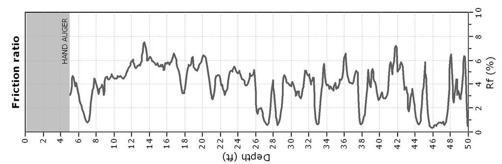
58

59

60
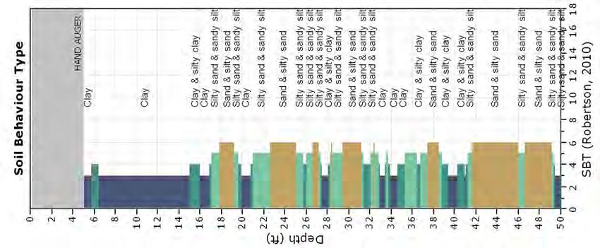
61

62

63

64
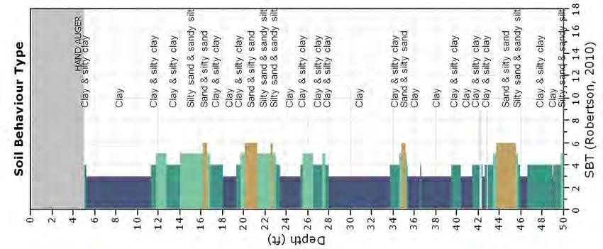
65


66

67

68

69
70 APPENDIX B BETA ANALYTIC INC. REPORT OF RADIOCARBON DATING RESULTS

71 October 6, 2014 Ms. Rosalind Munro AMEC 6001 Rickenbacker Road Los Angeles, CA United States RE: Radiocarbon Dating Results For Samples SB2-37.2, SB4-43.4, SB4-44, SB5-33 Dear Ms. Munro: Enclosed are the radiocarbon dating results for four samples recently sent to us. As usual, the method of analysis is listed on the report with the results and calibration data is provided where applicable. The Conventional Radiocarbon Ages have all been corrected for total fractionation effects and where applicable, calibration was performed using 2013 calibration databases (cited on the graph pages). The web directory containing the table of results and PDF download also contains pictures, a cvs spreadsheet download option and a quality assurance report containing expected vs. measured values for 3-5 working standards analyzed simultaneously with your samples. Reported results are accredited to ISO standards and all chemistry was performed here in our laboratories and counted in our own accelerators here in Miami. Since Beta is not a teaching laboratory, only graduates trained to strict protocols of the ISO program participated in the analyses. As always Conventional Radiocarbon Ages and sigmas are rounded to the nearest 10 years per the conventions of the 1977 International Radiocarbon Conference. When counting statistics produce sigmas lower than +/- 30 years, a conservative +/- 30 BP is cited for the result. When interpreting the results, please consider any communications you may have had with us regarding the samples. As always, your inquiries are most welcome. If you have any questions or would like further details of the analyses, please do not hesitate to contact us. The cost of the analysis was charged to the VISA card provided. Thank you. As always, if you have any questions or would like to discuss the results, don t hesitate to contact me. Sincerely, Digital signature on file Page 1 of 6


72 Ms. Rosalind Munro Report Date: 10/6/2014 AMEC Material Received: 10/1/2014 Sample Data Measured 13C/12C Conventional Radiocarbon Age Ratio Radiocarbon Age(*) Beta /- 50 BP o/oo /- 50 BP SAMPLE : SB ANALYSIS : AMS-TIMEGUIDE delivery MATERIAL/PRETREATMENT : (organic sediment): acid washes 2 SIGMA CALIBRATION : Cal BC to (Cal BP to 15840) Beta /- 70 BP o/oo /- 70 BP SAMPLE : SB ANALYSIS : AMS-TIMEGUIDE delivery MATERIAL/PRETREATMENT : (organic sediment): acid washes 2 SIGMA CALIBRATION : Cal BC to (Cal BP to 16265) Beta /- 50 BP o/oo /- 50 BP SAMPLE : SB4-44 ANALYSIS : AMS-TIMEGUIDE delivery MATERIAL/PRETREATMENT : (organic sediment): acid washes 2 SIGMA CALIBRATION : Cal BC to (Cal BP to 17905) Beta /- 40 BP o/oo /- 40 BP SAMPLE : SB5-33 ANALYSIS : AMS-TIMEGUIDE delivery MATERIAL/PRETREATMENT : (charred material): acid/alkali/acid 2 SIGMA CALIBRATION : Cal BC to (Cal BP to 12925) Page 2 of 6
REPORT OF FAULT SURFACE RUPTURE HAZARD EVALUATION PROPOSED WALDORF-ASTORIA LUXURY HOTEL AND CONFERENCE CENTER
 REPORT OF FAULT SURFACE RUPTURE HAZARD EVALUATION PROPOSED WALDORF-ASTORIA LUXURY HOTEL AND CONFERENCE CENTER 9876 WILSHIRE BOULEVARD BEVERLY HILLS, CALIFORNIA Prepared for: OASIS WEST REALTY, LLC Beverly
APPENDIX C HYDROGEOLOGIC INVESTIGATION
 Figure B-5.7 Figure B-5.8 Preliminary Geotechnical and Environmental Report Appendix C Hydrogeologic Investigation APPENDIX C HYDROGEOLOGIC INVESTIGATION December 21, 2011 WESTSIDE SUBWAY EXTENSION PROJECT
 UNIT DESCRIPTIONS: Artificial Fill, Undocumented (Afu): Locally derived sandy silt and silty sand, locally with clay and varying amounts of gravel and man-made debris. Abundant concrete rubble, in places
Response to Leighton Consulting Report
 ` Contract No. PS-4350-2000 Response to Leighton Consulting Report Prepared for: Prepared by: 777 South Figueroa Street Suite 1100 Los Angeles, California 90017 May 14, 2012 1.0 Introduction 1.0 INTRODUCTION
IV. ENVIRONMENTAL IMPACT ANALYSIS G. GEOLOGY AND SOILS
 IV. ENVIRONMENTAL IMPACT ANALYSIS G. GEOLOGY AND SOILS The following section is a summary of the geotechnical report conducted for the proposed project. The Report of Geotechnical Investigation Proposed
 Photo 1 - Southerly view across 2700 parking lot toward existing building. Multi-residential building borders western side of property in upper right of view. Photo 2 - Southerly view across 2750 parking
 Project: ITHACA-TOMPKINS REGIONAL AIRPORT EXPANSION Project Location: ITHACA, NY Project Number: 218-34 Key to Soil Symbols and Terms TERMS DESCRIBING CONSISTENCY OR CONDITION COARSE-GRAINED SOILS (major
IV. ENVIRONMENTAL IMPACT ANALYSIS E. GEOLOGY AND SOILS
 IV. ENVIRONMENTAL IMPACT ANALYSIS E. GEOLOGY AND SOILS The following section is a summary of the geotechnical report conducted for the Proposed Project. The Geotechnical Engineering Investigation (the
Section 2 Geotechnical Fault Investigations Summary Memorandum Revision 1
 LOS ANGELES COUNTY METROPOLITAN TRANSPORTATION AUTHORITY, SECTION 2 ADVANCED PRELIMINARY ENGINEERING Contract No. PS-4350-2000 Section 2 Geotechnical Fault Investigations Summary Memorandum Revision 1
Date: April 2, 2014 Project No.: Prepared For: Mr. Adam Kates CLASSIC COMMUNITIES 1068 E. Meadow Circle Palo Alto, California 94303
 City of Newark - 36120 Ruschin Drive Project Draft Initial Study/Mitigated Negative Declaration Appendix C: Geologic Information FirstCarbon Solutions H:\Client (PN-JN)\4554\45540001\ISMND\45540001 36120
SUPPLEMENTARY INVESTIGATION AND LABORATORY TESTING Aggregate Resource Evaluation Proposed Bernand Quarry San Diego County, California
 October 3, 2 Mr. Mark San Agustin Project No. 28-- Home Land Investments Document No. -92 2239 Curlew Street San Diego, CA 92 SUBJECT: SUPPLEMENTARY INVESTIGATION AND LABORATORY TESTING Aggregate Resource
IV. ENVIRONMENTAL IMPACT ANALYSIS E. GEOLOGY/SOILS
 IV. ENVIRONMENTAL IMPACT ANALYSIS E. GEOLOGY/SOILS Except where otherwise noted, the following Section is based on the Preliminary Geotechnical Investigation, Proposed Medical Office Buildings and Mixed-Use
Appendix G GEOLOGICAL INVESTIGATION
 Appendix G GEOLOGICAL INVESTIGATION JOB NUMBER: 3268.001 DATE: 10-14-13 BY: CC SITE 0 2000 1"=2000' VICINITY MAP CARGILL PARCEL HICKORY STREET AND ENTERPRISE DRIVE NEWARK, CALIFORNIA FOR
IV. ENVIRONMENTAL IMPACT ANALYSIS E. GEOLOGY AND SOILS
 IV. ENVIRONMENTAL IMPACT ANALYSIS E. GEOLOGY AND SOILS INTRODUCTION This section evaluates potential impacts related to geology, including seismicity, and soils associated with development of the proposed
CALIFORNIA GEOLOGICAL SURVEY
 STATE OF CALIFORNIA, NATURAL RESOURCES AGENCY DEPARTMENT OF CONSERVATION EDMUND G. BROWN, JR., GOVERNOR CALIFORNIA GEOLOGICAL SURVEY SCHOOL REVIEW UNIT 801 K STREET, MS 12-32 SACRAMENTO, CALIFORNIA 95814
Converse Consultants Geotechnical Engineering, Environmental & Groundwater Science, Inspection & Testing Services
 Converse Consultants Geotechnical Engineering, Environmental & Groundwater Science, Inspection & Testing Services Ms. Rebecca Mitchell Mt. San Antonio College Facilities Planning & Management 1100 North
Parsons APPENDIX A BORING LOGS AND DEVELOPMENT LOG
 Parsons APPENDIX A BORING LOGS AND DEVELOPMENT LOG GEOLOGIC LOG DATE STARTED: DATE COMPLETED: 08-Sep-09 08-Sep-09 LOGGER: Quin Kinnebrew WEATHER: Clear & Warm PAGE 1 OF 2 WELL NO. GMW-66 COMPANY NAME:
APPENDIX IV.A Geotechnical Study
 City of Los Angeles February 2014 APPENDIX IV.A Geotechnical Study Technical Appendices Museum Square Office Building Draft Environmental Impact Report February 8, 2013 File No. 20477 5757 Wilshire, LLC
IV. ENVIRONMENTAL IMPACT ANALYSIS E. GEOLOGY AND SOILS
 IV. ENVIRONMENTAL IMPACT ANALYSIS E. GEOLOGY AND SOILS The following analysis is based on the Geotechnical Investigation Report, Proposed Mid-Rise Multi- Family Residential Development Project Wetherly
GEOTECHNICAL REPORT. Matanuska-Susitna Borough. Parks Highway Connections Museum Drive. Matanuska-Susitna Borough, Alaska.
 Matanuska-Susitna Borough GEOTECHNICAL REPORT Parks Highway Connections Museum Drive Matanuska-Susitna Borough, Alaska March 2, 20 Prepared By: John Thornley, PE Geotechnical Engineer 333 Arctic Blvd.,
December 5, Junction Gateway, LLC 7551 W. Sunset Boulevard #203 Los Angeles, CA Mr. James Frost P: Dear Mr.
 December 5, 2014 Junction Gateway, LLC 7551 W. Sunset Boulevard #203 90046 Attn: Re: Mr. James Frost P: 323.883.1800 Geotechnical Update Letter Sunset & Effie Mixed Use Development 4301 to 4311 Sunset
Executive Summaries for the Century City Area Tunneling Safety Report and Fault Investigation Report
 ` Executive Summaries for the Century City Area Tunneling Safety Report and Fault Investigation Report Prepared for: Prepared by: October 19, 2011 Executive Summaries for the Century City Area Tunneling
INQUA Focus Group on Paleoseismology and Active Tectonics
 The West Beverly Hills Lineament and Beverly Hills High School: An Unexpected Journey Gath, Eldon (1), Tania Gonzalez (1), Joe Roe (2), Philip Buchiarelli (2), Miles Kenney (3) (1) Earth Consultants International,
CALIFORNIA GEOLOGICAL SURVEY
 STATE OF CALIFORNIA, NATURAL RESOURCES AGENCY DEPARTMENT OF CONSERVATION EDMUND G. BROWN, JR., GOVERNOR CALIFORNIA GEOLOGICAL SURVEY SCHOOL REVIEW UNIT 801 K STREET, MS 12-32 SACRAMENTO, CALIFORNIA 95814
Pierce County Department of Planning and Land Services Development Engineering Section
 Page 1 of 7 Pierce County Department of Planning and Land Services Development Engineering Section PROJECT NAME: DATE: APPLICATION NO.: PCDE NO.: LANDSLIDE HAZARD AREA (LHA) GEOLOGICAL ASSESSMENT REPORT
Depth (ft) USCS Soil Description TOPSOIL & FOREST DUFF
 USCS Soil Description TOPSOIL & FOREST DUFF") Test Pit No. TP-6 Location: Latitude 47.543003, Longitude -121.980441 Approximate Ground Surface Elevation: 1,132 feet Depth (ft) USCS Soil Description 0 1.5 1.5 5.0 SM 5.0 8.0 SM Loose to medium dense,
Test Pit No. TP-6 Location: Latitude 47.543003, Longitude -121.980441 Approximate Ground Surface Elevation: 1,132 feet Depth (ft) USCS Soil Description 0 1.5 1.5 5.0 SM 5.0 8.0 SM Loose to medium dense,
2.0 DATA COLLECTION AND LITERATURE REVIEW
 2.0 DATA COLLECTION AND LITERATURE REVIEW In order to perform the geotechnical evaluation, a comprehensive compilation and review of available publications, reports, and data was performed for all areas
3.0 SUMMARY OF FINDINGS
 AECOM 500 W Jefferson St. Suite 1600 Louisville, KY 40202 www.aecom.com 502-569-2301 tel 502-569-2304 fax October 17, 2018 Big Rivers Electric Corporation Sebree Generating Station 9000 Highway 2096 Robards,
Field Exploration. March 31, J-U-B ENGINEERS, Inc. 115 Northstar Avenue Twin Falls, Idaho Attn: Mr. Tracy Ahrens, P. E. E:
 March 31, 201 11 Northstar Avenue 83301 Attn: Mr. Tracy Ahrens, P. E. E: taa@jub.com Re: Geotechnical Data Report Preliminary Phase 1 Field Exploration Revision No. 1 Proposed Rapid Infiltration Basin
NAPLES MUNICIPAL AIRPORT
 NAPLES MUNICIPAL AIRPORT NAPLES MUNICIPAL AIRPORT (APF) TAXIWAY D REALIGNMENT AND DRAINAGE IMPROVEMENTS NORTH QUADRANT ADDENDUM NUMBER TWO March, The following Addendum is hereby made a part of the Plans
ENVIRONMENTAL IMPACT ANALYSIS C. GEOLOGY
 IV. ENVIRONMENTAL IMPACT ANALYSIS C. GEOLOGY This section summarizes the results of a geotechnical evaluation conducted for the proposed project by Jerry Kovacs and Associates, Inc. in August 1996. The
B-1 BORE LOCATION PLAN. EXHIBIT Drawn By: 115G BROOKS VETERINARY CLINIC CITY BASE LANDING AND GOLIAD ROAD SAN ANTONIO, TEXAS.
 N B-1 SYMBOLS: Exploratory Boring Location Project Mngr: BORE LOCATION PLAN Project No. GK EXHIBIT Drawn By: 115G1063.02 GK Scale: Checked By: 1045 Central Parkway North, Suite 103 San Antonio, Texas 78232
Ardaman & Associates, Inc. Geotechnical, Environmental and Materials Consultants
 SUBSURFACE SOIL EXPLORATION 42-INCH FORCE MAIN REPLACEMENT CHIQUITA BOULEVARD S AND SW 34 TH STREET CAPE CORAL, LEE COUNTY, FLORIDA Ardaman & Associates, Inc. Geotechnical, Environmental and Materials
16 January 2018 Job Number: RICHARD NEWMAN C\- CLARK FORTUNE MCDONALD AND ASSOCIATES PO BOX 553 QUEENSTOWN
 16 January 2018 Job Number: 50595 RICHARD NEWMAN C\- CLARK FORTUNE MCDONALD AND ASSOCIATES PO BOX 553 QUEENSTOWN CHANSEN@CFMA.CO.NZ STORMWATER DISPOSAL ASSESSMENT Dear Richard, RDAgritech were requested
GEOLOGY, SOILS, AND SEISMICITY
 4.9 GEOLOGY, SOILS, AND SEISMICITY 4.9.1 Introduction Information about the geological conditions and seismic hazards in the study area was summarized in the FEIR, and was based on the Geotechnical Exploration
Impact : Changes to Existing Topography (Less than Significant)
") 4.2 Land Resources 4.2.1 Alternative A Proposed Action Impact 4.2.1-1: Changes to Existing Topography (Less than Significant) Development of the project site would involve grading and other earthwork as
4.2 Land Resources 4.2.1 Alternative A Proposed Action Impact 4.2.1-1: Changes to Existing Topography (Less than Significant) Development of the project site would involve grading and other earthwork as
Ardaman & Associates, Inc. Geotechnical, Environmental and Materials Consultants
 SUBSURFACE SOIL EXPLORATION DRAINAGE IMPROVEMENTS TO THE HENDRY COUNTY, FLORIDA Ardaman & Associates, Inc. Geotechnical, Environmental and Materials Consultants OFFICES Orlando, 88 S. Orange Avenue, Orlando,
COMMUNITY DEVELOPMENT DEPARTMENT POLICY & PROCEDURE
 COMMUNITY DEVELOPMENT DEPARTMENT POLICY & PROCEDURE Policy No: DSP-OO3 Release Date: January 1, 2014 Effective Date: January 1, 2014 Revision Date: March 1, 2018 TITLE: The City Policy for Site Specific
COMMENT CARD RESPONSES (SEISMIC)
") COMMENT CARD 1 1. Please explain once and for all why the original route isn t an option while it s safer and cheaper, instead of going under the high school? Response: Please refer to the November Community
COMMENT CARD 1 1. Please explain once and for all why the original route isn t an option while it s safer and cheaper, instead of going under the high school? Response: Please refer to the November Community
DATA REPORT GEOTECHNICAL INVESTIGATION GALVESTON CRUISE TERMINAL 2 GALVESTON, TEXAS
 DATA REPORT GEOTECHNICAL INVESTIGATION GALVESTON CRUISE TERMINAL 2 GALVESTON, TEXAS SUBMITTED TO PORT OF GALVESTON 123 ROSENBERG AVENUE, 8TH FLOOR GALVESTON, TEXAS 77553 BY HVJ ASSOCIATES, INC. HOUSTON,
APPENDIX C. Borehole Data
 APPENDIX C Borehole Data MAJOR DIVISIONS SOIL CLASSIFICATION CHART SYMBOLS GRAPH LETTER TYPICAL DESCRIPTIONS ADDITIONAL MATERIAL
Sacramento Modesto Roseville Pleasanton September 19, 2013 Marcia Medina GHD Inc. 417 Montgomery Street, Suite 700 San Francisco, CA Subject: GE
 Sacramento Modesto Roseville Pleasanton September 19, 2013 Marcia Medina GHD Inc. 417 Montgomery Street, Suite 700 San Francisco, CA 94104 Subject: GEOTECHNICAL REPORT AMENDMENT Stonybrook Creek Crossings
SURFACE GEOLOGY AND LIQUEFACTION SUSCEPTIBILITY IN THE INNER RIO GRANDE VALLEY NEAR ALBUQUERQUE, NEW MEXICO
 SURFACE GEOLOGY AND LIQUEFACTION SUSCEPTIBILITY IN THE INNER RIO GRANDE VALLEY NEAR ALBUQUERQUE, NEW MEXICO Keith I. Kelson, Christopher S. Hitchcock, and Carolyn E. Randolph William Lettis & Associates,
IV. ENVIRONMENTAL IMPACT ANALYSIS E. GEOLOGY/SOILS
 IV. ENVIRONMENTAL IMPACT ANALYSIS E. GEOLOGY/SOILS The following discussion is based upon information contained in the Hollywood Redevelopment Plan Amendment EIR and a letter prepared by Geotechnologies,
APPENDIX E SOILS TEST REPORTS
 Otsego County, NY Site Work Specifications APPENDIX E SOILS TEST REPORTS Blue Wing Services, Inc. July 1, 2010 Blue Wing Services May 20, 2010 Page 2 the site, was not made available to Empire at this
John Baldwin and Brian Gray Lettis Consultants International, Inc. Alexis Lavine AMEC Josh Goodman and Janet Sowers Fugro Consultants, Inc.
 John Baldwin and Brian Gray Lettis Consultants International, Inc. Alexis Lavine AMEC Josh Goodman and Janet Sowers Fugro Consultants, Inc. December 1, 2011 Pacific Gas & Electric SSHAC Workshop 1 San
November 16, 2016 Revised August 15, 2017 File No Trammell Crow Company 2221 Rosecrans Avenue, Suite 200 El Segundo, California 90245
 November 16, 2016 Revised August 15, 2017 File No. 21338-01 Trammell Crow Company 2221 Rosecrans Avenue, Suite 200 El Segundo, California 90245 Attention: Karen Shorr Subject: Geotechnical Assessment Site
Fifield Companies. EIR Technical Transmittal January 6, 2005 MACTEC PROJECT
 Fifield Companies. EIR Technical Transmittal January 6, 2005 MACTEC PROJECT 4951-04-1071 September 20, 2004 Fifield Realty Corp. 2010 Main Street, Suite 610 Irvine, CA 96214 Attention: Mr. David K. Robbins,
KANSAS GEOLOGICAL SURVEY Open File Report LAND SUBSIDENCE KIOWA COUNTY, KANSAS. May 2, 2007
 KANSAS GEOLOGICAL SURVEY Open File Report 2007-22 LAND SUBSIDENCE KIOWA COUNTY, KANSAS Prepared by Michael T. Dealy L.G., Manager, Wichita Operations SITE LOCATION The site was approximately four miles
J.H. Campbell Generating Facility Pond A - Location Restriction Certification Report
 J.H. Campbell Generating Facility Pond A - Location Restriction Certification Report Pursuant to: 40 CFR 257.60 40 CFR 257.61 40 CFR 257.62 40 CFR 257.63 40 CFR 257.64 Submitted to: Consumers Energy Company
B-1 SURFACE ELEVATION
 5A 5B LOGGED BY El. S. Bhangoo DRILLING CONTRACTOR Pitcher Drilling DRILLING METHOD Rotary Wash BEGIN DATE 12-14-12 SAMPLER TYPE(S) AND SIZE(S) (ID) SPT, MC BOREHOLE BACKFILL AND COMPLETION COMPLETION
GEOLOGY AND SOILS. This chapter summarizes geologic and geotechnical aspects of the site as they relate to the Project.
 9 GEOLOGY AND SOILS INTRODUCTION This chapter summarizes geologic and geotechnical aspects of the site as they relate to the Project. This chapter utilizes information from the following reports prepared
Log of Monitoring Well D58B
 Project: Motiva - Monitoring Well and Soil Boring Data Project Location: Delaware City Refinery Project Number: 20240412.W1000 Log of Monitoring Well D58B Sheet 1 of 7 Date(s) Drilled Drilling Method Drill
Redwood City Harbor, California, Navigation Improvement Feasibility Study. Appendix D. Geotechnical Engineering. DRAFT April 2015
 1 Redwood City Harbor, California, Navigation Improvement Feasibility Study Appendix D Geotechnical Engineering DRAFT April 2015 2 Contents 1 Purposes of Report... 3 2 Background... 3 3 References and
Geotechnical Data Report
 Geotechnical Data Report Downtown Greenville Future Conveyance Study December 1, 2015 Terracon Project No. 86155032 Prepared for: Prepared by: Terracon Consultants, Inc. December 1, 2015 561 Mauldin Road
GEOTECHNICAL EXPLORATION REPORT ROPOSED COMMERCIAL/RETAIL DEVELOPMENT 7967, & 8015 BEVERLY BOULEVARD
 ADDENDUM TO GEOTECHNICAL EXPLORATION REPORT PROPOSED COMMERCIAL/RETAIL DEVELOPMENT 7967, 8001-8011 & 8015 BEVERLY BOULEVARD CITY OF LOS ANGELES, CALIFORNIA Prepared for: OPT Beverly, LLC 6400 South Fiddlers
 SOIL CLASSIFICATION CHART COARSE-GRAINED SOILS MORE THAN 50% RETAINED ON NO.200 SIEVE FINE-GRAINED SOILS 50% OR MORE PASSES THE NO.200 SIEVE PRIMARY DIVISIONS GRAVELS MORE THAN 50% OF COARSE FRACTION RETAINED
Civil Engineering, Surveying and Environmental Consulting WASP0059.ltr.JLS.Mich Ave Bridge Geotech.docx
 2365 Haggerty Road South * Canton, Michigan 48188 P: 734-397-3100 * F: 734-397-3131 * www.manniksmithgroup.com August 29, 2012 Mr. Richard Kent Washtenaw County Parks and Recreation Commission 2330 Platt
Guidelines for Site-Specific Seismic Hazard Reports for Essential and Hazardous Facilities and Major and Special-Occupancy Structures in Oregon
 Guidelines for Site-Specific Seismic Hazard Reports for Essential and Hazardous Facilities and Major and Special-Occupancy Structures in Oregon By the Oregon Board of Geologist Examiners and the Oregon
Geotechnical Engineering Report
 Geotechnical Engineering Report Turner Turnpike Widening Bridge B Bridge Crossing: South 257 th West Avenue Creek County, Oklahoma June 1, 2016 Terracon Project No. 04155197 Prepared for: Garver, LLC Tulsa,
ENGINEER S CERTIFICATION OF FAULT AREA DEMONSTRATION (40 CFR )
") PLATTE RIVER POWER AUTHORITY RAWHIDE ENERGY STATION BOTTOM ASH TRANSFER (BAT) IMPOUNDMENTS LARIMER COUNTY, CO ENGINEER S CERTIFICATION OF FAULT AREA DEMONSTRATION (40 CFR 257.62) FOR COAL COMBUSTION RESIDUALS
PLATTE RIVER POWER AUTHORITY RAWHIDE ENERGY STATION BOTTOM ASH TRANSFER (BAT) IMPOUNDMENTS LARIMER COUNTY, CO ENGINEER S CERTIFICATION OF FAULT AREA DEMONSTRATION (40 CFR 257.62) FOR COAL COMBUSTION RESIDUALS
APPENDIX A. Borehole Logs Explanation of Terms and Symbols
 APPENDIX A Borehole Logs Explanation of Terms and Symbols Page 153 of 168 EXPLANATION OF TERMS AND SYMBOLS The terms and symbols used on the borehole logs to summarize the results of field investigation
Report of Preliminary Geotechnical Exploration. CSO-012 Sewer Separation Cincinnati, Hamilton County, Ohio. February, 2011
 11242843_GeoTech_Preliminary - Feburary 2011_1/40 Report of Preliminary Geotechnical Exploration CSO-012 Sewer Separation Cincinnati, Hamilton County, Ohio February, 2011 11242843_GeoTech_Preliminary -
Correlation of gravel deposits from trenching project on Alder Creek fluvial terrace near Point Arena, California
 Correlation of gravel deposits from trenching project on Alder Creek fluvial terrace near Point Arena, California Aletha Lee Department of Geology and Geography, West Virginia University, White Hall, Morgantown,
PARQUE COLON AGUADILLA (LAND PROPERTY OF MUNICIPIO AGUADA) LOT PROPERTY OF SUNC. ESTEVEZ BW-1 BW-5 BW-2 DB1 BW-3 DB2 BW-4 DB3 GWS-1
 LOT PROPERTY OF SUNC. ESTEVEZ BW-1 BW-5 BW-2 DB1 BW-3 DB2 BW-4 DB3 GWS-1") N 64650 N 64600 N 64550 N 64500 N 64450 N 64400 N 64350 N 64300 N 64250 N 64200 N 64150 N 64100 N 64050 N 64000 N 63950 N 63900 N 63850 N 63800 N 63750 N 63700 N 63650 N 63600 N 63550 N 63500 N 63450 N
N 64650 N 64600 N 64550 N 64500 N 64450 N 64400 N 64350 N 64300 N 64250 N 64200 N 64150 N 64100 N 64050 N 64000 N 63950 N 63900 N 63850 N 63800 N 63750 N 63700 N 63650 N 63600 N 63550 N 63500 N 63450 N
ATTACHMENT A PRELIMINARY GEOTECHNICAL SUMMARY
 ATTACHMENT A PRELIMINARY GEOTECHNICAL SUMMARY Kevin M. Martin, P.E. KMM Geotechnical Consultants, LLC 7 Marshall Road Hampstead, NH 0384 603-489-6 (p)/ 603-489-8 (f)/78-78-4084(m) kevinmartinpe@aol.com
Data Report for White Point Landslide Boring B-12 W.O. E Task Order Solicitation San Pedro District Los Angeles, California
 Data Report for White Point Landslide Boring B-12 W.O. E1907483 Task Order Solicitation 11-087 San Pedro District Los Angeles, California Submitted To: Mr. Christopher F. Johnson, P.E., G.E. City of Los
Geotechnical Engineering Report
 Geotechnical Engineering Report Turner Turnpike Widening Polecat Creek Bridge (Bridge A) June 1, 2016 Terracon Project No. 04155197 Prepared for: Garver, LLC Prepared by: Terracon Consultants, Inc. TABLE
Geotechnical Data Report
 Geotechnical Data Report Emergency Bridge Package 6 Richland County, South Carolina May 12, 2016 SCDOT Project ID.: P029942, P029943, P029944 Terracon Project No. 73100L (Rev. 1) Prepared for: South Carolina
Geotechnical Engineering Report
 Geotechnical Engineering Report Turner Turnpike Widening Bridge D Bridge Crossing: South 209 th West Avenue Creek County, Oklahoma June 1, 2016 Terracon Project No. 04155197 Prepared for: Garver, LLC Tulsa,
 TP-1 N61E 0 DARK BROWN SANDY SILT (ML) stiff, wet with roots (Disturbed Surficial Soil) DEPTH (FEET) 5 REDDISH BROWN SANDSTONE intensely fractured, weak to friable, deeply weathered, tight (Franciscan
ENGINEERING ASSOCIATES
 July 16, 211 Vista Design, Inc. 11634 Worcester Highway Showell, Maryland 21862 Attention: Reference: Dear Mr. Polk: Mr. Richard F. Polk, P.E. Geotechnical Engineering Report Charles County RFP No. 11-9
Seismic Reflection Imaging across the Johnson Ranch, Valley County, Idaho
 Seismic Reflection Imaging across the Johnson Ranch, Valley County, Idaho Report Prepared for the Skyline Corporation Lee M. Liberty Center for Geophysical Investigation of the Shallow Subsurface (CGISS)
BR-01 PAINT BRIDGE NO. 55 C GENERAL PLAN 720'-0" VC 605'-0" VC 1. FOR INDEX TO PLANS, QUANTITIES, AND GENERAL NOTES, SEE "INDEX TO PLANS" SHEET.
 2'-" VC 6'-" VC BB EB 1 1 1 1 1 TV - " TV CONDUITS (COX E 8 - " ELECTRIC CONDUITS (SDG & E T - " TELEPHONE CONDUITS 1. FOR INDEX TO PLANS, QUANTITIES, AND GENERAL NOTES, SEE "INDEX TO PLANS" SHEET. 2.
Northern Colorado Geotech
 PRELIMINARY GEOTECHNICAL ENGINEERING REPORT PROPOSED CECIL FARMS DEVELOPMENT WELD COUNTY ROAD 7, BETWEEN ROADS 7 AND 7 SEVERANCE, COLORADO NORTHERN COLORADO GEOTECH PROJECT NO. 0-6 APRIL 0, 06 Prepared
2. Initial Summary of Preliminary Expert Opinion of Converse and Psomas Reports
 UNITED WALNUT TAXPAYERS PRELIMINARY REVIEW OF NEGATIVE GEOTECHNICAL AND GEOLOGICAL ASPECTS OF CONSTRUCTING EARTHFILL PAD FOR A SOLAR FARM ON THE WEST PARCEL - DRAFT 1. Introduction A licensed Engineering
Project No: 68R3056 Client: City of Frederick Project: RFQ 14-H Future North Side Water Tank City/State: 7516 Hayward Road, Frederick, MD
 Boring: SB-1 (1 of 1) Moist, brown to orange brown CLAY and SILT, trace sand with fine weathered rock fragments. POSSIBLE FILL. Dry, orange brown sandy SILT trace clay (SM-ML). RESIDUAL SOIL : Not Surveyed
Sacred Lands File & Native American Contacts List Request
 Sacred Lands File & Native American Contacts List Request NATIVE AMERICAN HERITAGE COMMISSION 915 Capitol Mall, RM 364 Sacramento, CA 95814 (916) 653-4082 (916) 657-5390 Fax nahc@pacbell.net Information
Geotechnical Investigation Juneau Seawalk - Taku Fisheries to Miner s Wharf Juneau, Alaska DM&A Job No
 Duane Miller & Associates 5821 Arctic Boulevard, Suite A Anchorage, AK 99518-1654 (907) 644-3200 Fax 644-0507 Arctic & Geotechnical Engineering May 4, 2006 Tetra Tech/KCM, Inc. 1971 First Avenue Seattle,
CEMEX Eliot Quarry. Lake A Evaluation Report. Alameda County, California
 May 7, 2015 May 7, 2015 Project No. GT13-16 Prepared for: CEMEX 5180 Golden Foothills, Parkway El Dorado Hills, California 95762 7400 Shoreline Drive, Ste. 6 Stockton, California 95219 Tel: 209-472-1822
Limited Geotechnical Engineering Evaluation Classroom Additions Albany County Campus Laramie, Wyoming
 Limited Geotechnical Engineering Evaluation Classroom Additions Albany County Campus 2300 Missile Drive, Cheyenne, Wyoming 82001 Phone 307-635-0222 www.stratageotech.com Limited Geotechnical Engineering
Hydro One (Sept 2014) Hydro One (Sept 2014) Hydro One (Sept 2014)
 Hydro One (Sept 2014) Hydro One (Sept 2014)") TABLE 1 WELL CONSTRUCTION DETAILS MOE WWR No Well ID Location Installation Date Status Easting Coordinates Northing Source Elevation Screened Interval Screened Material Borehole Well Stick-up Ground Top
TABLE 1 WELL CONSTRUCTION DETAILS MOE WWR No Well ID Location Installation Date Status Easting Coordinates Northing Source Elevation Screened Interval Screened Material Borehole Well Stick-up Ground Top
C.Y. Geotech, Inc. Soil Engineering Investigation Victory Boulevard, Van Nuys, California. August 31, Ibid.
 E. SOILS AND GEOLOGY The purpose of this section is to assess impacts related to geologic resources resulting from construction and development of the proposed project and adjacent Add Area, such as seismically
M E M O R A N D U M. Mr. Jonathan K. Thrasher, P.E., Mr. Ian Kinnear, P.E. (FL) PSI
 PSI") M E M O R A N D U M TO: FROM: Mr. Mark Schilling Gulf Interstate Engineering Mr. Jonathan K. Thrasher, P.E., Mr. Ian Kinnear, P.E. (FL) PSI DATE: November 11, 2014 RE: Summary of Findings Geotechnical
M E M O R A N D U M TO: FROM: Mr. Mark Schilling Gulf Interstate Engineering Mr. Jonathan K. Thrasher, P.E., Mr. Ian Kinnear, P.E. (FL) PSI DATE: November 11, 2014 RE: Summary of Findings Geotechnical
NOA ASSESSMENT HARRIS QUARRY MENDOCINO COUNTY, CALIFORNIA TABLE OF CONTENTS
 NOA ASSESSMENT HARRIS QUARRY MENDOCINO COUNTY, CALIFORNIA TABLE OF CONTENTS Introduction... 1 Scope of Services... 1 Project Location and Description... 1 Geologic Setting... 1 Regional Geology... 1 Site
IV. ENVIRONMENTAL IMPACT ANALYSIS C. GEOLOGY/SOILS
 IV. ENVIRONMENTAL IMPACT ANALYSIS C. GEOLOGY/SOILS The following section is a summary of the preliminary geotechnical consultation conducted for the Proposed Project. The Report of Geotechnical Engineering
Feet. SAND; clayey, fine grained; shells are common; rounded quartz grains. SHELLS; muddy; almost no sand, shells and fragments common
 SAND; clayey, fine grained; shells are common; rounded quartz grains SHELLS; muddy; almost no sand, shells and fragments common SAND; back to medium to fine; has a mottled appearance and looks burrowed;
New WW Hastings Hospital Geotechnical Investigation RFP Addendum #1
 88 E. Marshall Street, Suite 0 Tulsa, OK 76 98 8 9 Phone 98 8 798 FAX DATE: April 9, 0 ADDENDUM NO.: PROJECT: New WW Hastings Hospital BID PACKAGE NO: Geotechnical Investigation RFP SUBMITTED BY: CNCR
AN ARCHAEOLOGICAL SURVEY FOR THE EASTHAM STATE PRISON FARM UNIT PROJECT IN HOUSTON COUNTY TEXAS
 AN ARCHAEOLOGICAL SURVEY FOR THE EASTHAM STATE PRISON FARM UNIT PROJECT IN HOUSTON COUNTY TEXAS Antiquities Permit 5693 By William E. Moore and Edward P. Baxter Brazos Valley Research Associates Contract
Mitigation of Liquefaction Potential Using Rammed Aggregate Piers
 ASCE 2011 557 Mitigation of Liquefaction Potential Using Rammed Aggregate Piers R.W. Rudolph, M. ASCE, G.E. 1, B. Serna, M. ASCE, P.E. 2, and T. Farrell, M. ASCE, G.E. 3 1 Principal Consultant, ENGEO,
Appendix 6A Geologic Information about the Project Area prepared by Ninyo & Moore October 2008
 Appendix 6A Geologic Information about the Project Area prepared by Ninyo & Moore October 2008 Appendix 6A: Geologic Information about the Project Area 6A-1Existing Geologic and Subsurface Conditions
DRILL HOLE # BH-BGC13-FN-01
 DILL HOLE # BH-BGC3-FN-0 Drill Method: Mud otary/coring Depth To ock (m): N/A Page of 7 eviewed by: AJB 0 GAVEL (GW) Fine to coarse, sandy, well graded, dense, max particle size = 30 mm, angular to subrounded,
3.8 Geology/Soils. Environmental Setting. Topography. Geology and Soils
 3.8 Geology/Soils This section examines whether implementation of the 2004 Land Use Mobility Elements, Zoning Code Revisions, and Central District Specific Plan the will expose people or structures to
Preliminary Geotechnical Investigation Cadiz / Trigg County I-24 Business Park. Cadiz, Kentucky
 Environmental & Geoscience, LLC 834 Madisonville Road Hopkinsville, KY 440 70.44.000 FAX 70.44.8300 www.wedrill.com A member of Trinity Energy & Infrastructure Group, LLC Preliminary Geotechnical Investigation
ADDENDUM 1 FISHER SLOUGH RESTORATION PROJECT SKAGIT COUNTY, WASHINGTON
 F I N A L A D D E N D U M 1 R E P O R T ADDENDUM 1 FISHER SLOUGH RESTORATION PROJECT SKAGIT COUNTY, WASHINGTON REPORT OF GEOTECHNICAL INVESTIGATION URS JOB NO. 3376186 Prepared for Tetra Tech Inc. 142
patersongroup Mineral Aggregate Assessment 3119 Carp Road Ottawa, Ontario Prepared For Mr. Greg LeBlanc March 7, 2014 Report: PH2223-REP.
 Geotechnical Engineering Environmental Engineering group Hydrogeology Geological Engineering Archaeological Studies Materials Testing 3119 Carp Road Prepared For Mr. Greg LeBlanc March 7, 2014 Paterson
SUMMARY OF SOIL CONDITIONS CITYWIDE SIDEWALK IMPROVEMENT PROJECT JIMMY DURANTE BOULEVARD, VIA DE LA VALLE, AND CAMINO DEL MAR DEL MAR, CALIFORNIA
 SUMMARY OF SOIL CONDITIONS CITYWIDE SIDEWALK IMPROVEMENT PROJECT JIMMY DURANTE BOULEVARD, VIA DE LA VALLE, AND CAMINO DEL MAR DEL MAR, CALIFORNIA PREPARED FOR NASLAND ENGINEERING SAN DIEGO, CALIFORNIA
June 9, R. D. Cook, P.Eng. Soils Engineer Special Services Western Region PUBLIC WORKS CANADA WESTERN REGION REPORT ON
 PUBLIC WORKS CANADA WESTERN REGION REPORT ON GEOTECHNICAL INVESTIGATION PROPOSED MARTIN RIVER BRIDGE MILE 306.7 MACKENZIE HIGHWAY Submitted by : R. D. Cook, P.Eng. Soils Engineer Special Services Western
Feet. Cape May Core #51 Start depth: 240 ft Stop depth: 245 ft Recovery (ft): 5.1 ft Date: 3/21/94 Described by: JVB, KGM, CL. 5.
: 5.1 ft Date: 3/21/94 Described by: JVB, KGM, CL. 5.") SAND; medium to fine sand with abundant silt, homogenous slightly mottled appearance; mica on outside, mostly quartz; few darks; peat layer.9 - ft; cnv - same as above; the last few cores are all the same;
SAND; medium to fine sand with abundant silt, homogenous slightly mottled appearance; mica on outside, mostly quartz; few darks; peat layer.9 - ft; cnv - same as above; the last few cores are all the same;
Geology, Soils, and Seismicity
 Section 3.8 Geology, Soils, and Seismicity Introduction This section generally evaluates the effects of the alternatives analyzed in this Supplemental DEIS with regard to geology, soils and seismicity.