Monitoring of geothermal reservoirs by hybrid gravimetry
|
|
|
- Pierce Bradley
- 5 years ago
- Views:
Transcription
1 Monitoring of geothermal reservoirs by hybrid gravimetry Jacques Hinderer 1, Marta Calvo 1, 3, Basile Hector 1, Umberto Riccardi 2, Gilbert Ferhat 1, Yassine Abdelfettah 1,4 & Jean Daniel Bernard 1 1 Institut de Physique du Globe de Strasbourg UMR 7516 CNRS/Université de Strasbourg, 5 rue Descartes Strasbourg, France 2 Dipartimento di Scienze della Terra, dell'ambiente e delle Risorse (DiSTAR) Universita "Federico II" di Napoli, Italy 3 IGN Madrid, Spain 4 Institut für Nukleare Entsorgung INE, Karlsruher Institut für Technologie (KIT), Germany
 newtonian attraction effects geothermal signal")
2 Gravity signal due to geothermal reservoir Vadose zone Density changes are due to: Pore space opening/closing in hydrofracturing or hydroshearing Fluid infiltration Heating/cooling mineralization Contributions to surface gravity changes: After corrections for: solid and ocean tides air pressure effect hydrogravimetry (vadose zone + aquifers) newtonian attraction effects geothermal signal deformation effects (poro elasticity?) strong link to geodesy (cgps + leveling)
")
3 Observational strategy Networks with RG Scintrex CG5 RG Advantage spatial coverage control on RG drift by loop repetition Disadvantage need for a reference point expensive in manpower and time (measurements + processing) 3
4 Data collection: Gravity measurements with a relative spring gravimeter (Scintrex CG 5) weekly repetition of micro gravity survey with imbricated loops around a reference point (GPK1) Time interval: 2 months in 2013 and 2 months in 2014 Number of stations: 11 stations (Soultz) and 2 stations (Rittershoffen) Link at beginning and end of each survey with Strasbourg gravimetric Observatory where continuous gravity observations with a superconducting gravimeter are available One or two measurements of absolute gravity with FG5 at GPK1

5 Location of the gravity stations Soultz Network of 11 stations Strasbourg gravimetric Observatory Rittershoffen 2 stations


6 Micro gravimetric repetition network at Soultz sous Forêts PYR2 Spatial distribution of stations KUTZENHAUSEN GPK1 PYR1 GPK2 SOULTZ 5 loops 11 stations Loop 1 GPK1 Pyr1 Pyr2 Kutzenhausen church GPK1 PYR3 FARM HOHWILLER Loop 2 GPK1 Kutzenhausen church Pyr3 Soultz church GPK1 PYR4 Loop 3 GPK1 Soultz church Pyr4 farm GPK1 CHAPEL Time period: Once per week in July August 2013 and July August 2014 Loop 4 GPK1 chapel farm GPK2 GPK1 Loop 5 GPK1 Soultz church Hohwiller church GPK1

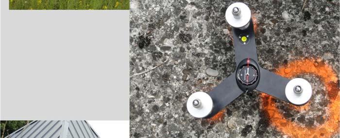

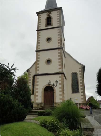
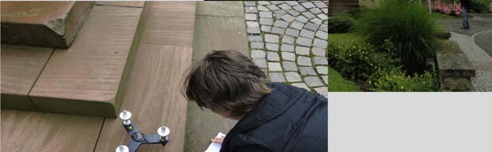
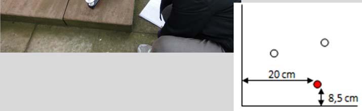
7 PYR 3 station Kutzenhausen church
8 Gravity simple and double differences After tide and drift corrections: Sahel Time t, station x x 0 Information on topography/density Time t 0, station x x 0 Information on topography/density Gravity double difference: Spa al: sta on x station x 0 (reference) Temporal: me t time t 0 Information on underground water storage 8
9 An example of the screen of the micro gravity processing code Pygrav New code written by B. Hector (IPGS/EOST) in Python
10 Simple differences: mainly topography and density structure (milligal range)
11
12 Double differences: sensitive to water distribution and deformation (µgal range)
13
14 Uncertainty in the double difference gravity observations in our network 2013 Station Survey 1 (2/7/2013) Survey 2 (8/7/2013) Survey 3 (16/7/2013) Survey 4 (23/7/2013) Average SD Station Survey 1 (1/7/2014) Survey 2 (15/7/2014) Survey 3 (23/7/2014) Survey 4 (5/8/2014) Survey 5 (11/8/2014) Survey 6 (18/8/2014) Average SD Strong improvement in 2014 versus 2013 due to instrument change Small uncertainties in the 2014 surveys ranging from 2.6 to 6.6 µgal
15 To be compared to very high micro gravimetric work done on a water catchment in West Africa and walking distance Hector et al. 2014

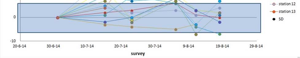
16 Results for Rittershoffen (ECOGI) Gravity decrease due to production test experiment?

17 Strong impact of calibration factor of the gravimeter If there is a change α of 10 4 in the scale factor between two surveys, the simple difference change between 2stations is α. g m : Max in our network at Soultz = 17 milligal x 10 4 = 1.7 µgal still small effect An example of scale factor changes of a Scintrex CG3 used in the Bouillante (Guadeloupe) gravity survey Stability increases with time Debeglia & Dupont 2007 Our Scintrex CG5 used in 2013 was calibrated on a 323 milligal calibration line between sea and mountain (1740 m) in Greece with AG FG5 Δg(CG5)/ Δg(FG5) = / = 1 + ε with ε =
18 Impact of ground vertical deformation Gravity changes with height: Free air gradient = 0.31 µgal/mm Bouguer gradient (takes into account the gravity effect of a crustal layer of density 2.6) = 0.20 µgal/mm Ex: 1 cm elevation change leads to 2 µgal gravity decrease (without any direct mass transfer contribution) Precise control of elevation of the points of the micro gravimetric network required
19 How to link surface gravity changes to geothermal activity? 0. Idealised case : Point source approach g G M/d 2 1 µgal change due to a mass of 150 kg at 1 m distance or 0.15 MT at 1 km depth 1. Bouguer slab approach Relation between mass loss and gravity change (Allis 2001): g (µgal) 42 M / A where M(in T) is the mass change occurring over an average area A (in m 2 ) 2. Realistic 3D computation with prismatic bodies Takes into account geological model and any reservoir shape Needs an estimate of the density changes within the reservoir


20 A case study: water injection at 2000 m depth Modeled surface gravity 20 l/sec during 100 days in a reservoir 1 km x 1 km x 50 m less than 1 µgal Geological model frombaillieux2012 derived from seismic and borehole data 6 layers 30 x 20 x 5 km 3 Bouguer slab: 7.1 µgal Point source: 0.3 µgal Y. Abdelfettah 2014
21 Summary Set up of a micro gravity network (11 stations in 5 loops at Soultz and 2 stations at Rittershoffen) Efficient processing of all the gravity data using Pygrav code in Python (local development) Strong improvement in the quality of the results in 2014 wrt 2013 with uncertainties in the gravity double differences of less than 5 µgal Relative stability of the Soultz network and possible (small) signal at ECOGI stations in august 2014 Importance of the calibration stability of the gravimeter Importance of the vertical control of the gravity stations First results of realistic modeling suggest weak gravity signals at the surface
22 Thank you for your attention!
Università degli Studi di Napoli Federico II, Dipartimento di Scienze della Terra Napoli, Italy
 Three years of monitoring using leveling and hybrid gravimetry applied to geothermal sites of Soultz-sous-Forêts and Rittershoffen, Rhine Graben, France Gilbert FERHAT 1, Nolwenn PORTIER 1, Jacques HINDERER
Induced seismicity in Enhanced Geothermal Systems (EGS) in Alsace, France. Jean Schmittbuhl 1
 in Alsace, France. Jean Schmittbuhl 1") Induced seismicity in Enhanced Geothermal Systems (EGS) in Alsace, France Jean Schmittbuhl 1 Olivier Lengliné 1, Mohamed Boubacard 1, Lucie Lamourette 1, Lilas Vivin 1, Nicolas Cuenot 2 1 EOST-IPGS, Université
Induced seismicity in Enhanced Geothermal Systems (EGS) in Alsace, France Jean Schmittbuhl 1 Olivier Lengliné 1, Mohamed Boubacard 1, Lucie Lamourette 1, Lilas Vivin 1, Nicolas Cuenot 2 1 EOST-IPGS, Université
Advances in Ground-based Gravity for Hydrologic Studies
 Advances in Ground-based Gravity for Hydrologic Studies L. Longuevergne (1,2), C.R. Wilson 1, B.R. Scanlon 2 1 Department of Geological Sciences, UT Austin 2 Bureau of Economic Geology, UT Austin What
Reservoir Monitoring Using Hybrid Micro-Gravity Measurements in the Takigami Geothermal Field, Central Kyushu, Japan
 Proceedings World Geothermal Congress 2010 Bali, Indonesia, 25-29 April 2010 Reservoir Monitoring Using Hybrid Micro-Gravity Measurements in the Takigami Geothermal Field, Central Kyushu, Japan Jun Nishijima,
Gravity data reduction
 Gravity data reduction REDUCTION: raw data à gravity anomaly data Temporal corrections tides and instrument drift Spatial corrections latitude and elevation GRS67 = gravity variation with latitude at sea
GRAVITY EXPLORATION (Gph 301) Chokri Jallouli 2014/2015
 Chokri Jallouli 2014/2015") KING SAUD UNIVERSITY FACULTY OF SCIENCES Department of Geology and Geophysics GRAVITY EXPLORATION (Gph 301) Chokri Jallouli 2014/2015 INTRODUCTION Definition Gravity method consists of measuring, studying
KING SAUD UNIVERSITY FACULTY OF SCIENCES Department of Geology and Geophysics GRAVITY EXPLORATION (Gph 301) Chokri Jallouli 2014/2015 INTRODUCTION Definition Gravity method consists of measuring, studying
Free Core Nutation parameters from hydrostatic long-base tiltmeter records collected at Sainte-Croix aux Mines (Alsace-Eastern France)
") Free Core Nutation parameters from hydrostatic long-base tiltmeter records collected at Sainte-Croix aux Mines (Alsace-Eastern France) Riccardi U. 1, Boy J.P. 2, Hinderer J. 2, Rosat S. 2, Boudin F. 3
Free Core Nutation parameters from hydrostatic long-base tiltmeter records collected at Sainte-Croix aux Mines (Alsace-Eastern France) Riccardi U. 1, Boy J.P. 2, Hinderer J. 2, Rosat S. 2, Boudin F. 3
Permeability in deep-seated granitic rocks: lessons learnt from deep geothermal boreholes in the Upper Rhine Graben (URG)
") Permeability in deep-seated granitic rocks: lessons learnt from deep geothermal boreholes in the Upper Rhine Graben (URG) Albert GENTER (1), Jeanne VIDAL (2), Clément BAUJARD (1), Eléonore DALMAIS (1),
Permeability in deep-seated granitic rocks: lessons learnt from deep geothermal boreholes in the Upper Rhine Graben (URG) Albert GENTER (1), Jeanne VIDAL (2), Clément BAUJARD (1), Eléonore DALMAIS (1),
GRAVITY AND MAGNETIC METHODS
 Presented at Short Course IX on Exploration for Geothermal Resources, organized by UNU-GTP, GDC and KenGen, at Lake Bogoria and Lake Naivasha, Kenya, Nov. 2-24, 2014. Kenya Electricity Generating Co.,
Gravimetry as a tool for hydrologic research at the Sutherland Observatory
 Gravimetry as a tool for hydrologic research at the Sutherland Observatory Andreas Güntner, Christoph Förste, Theresa Blume GFZ German Research Centre for Geosciences Gaathier Mahed, Maarten De Wit, Moctour
Magnetic and Gravity Methods for Geothermal Exploration
 Magnetic and Gravity Methods for Geothermal Exploration Dr. Hendra Grandis Geophysics - ITB method and survey procedure Aero- or ground magnetic (covers a large area) Schlumberger resistivity mapping and
ABSOLUTE AND RELATIVE GRAVITY MEASUREMENTS AT ETNA VOLCANO (ITALY)
") ABSOLUTE AND RELATIVE GRAVITY MEASUREMENTS AT ETNA VOLCANO (ITALY) F. Greco 1, G. Currenti 1, G. D Agostino 2, C. Del Negro 1, A. Di Stefano 1, A. Germak 2, R. Napoli 1, C. Origlia 2, A. Pistorio 1, 3,
ABSOLUTE AND RELATIVE GRAVITY MEASUREMENTS AT ETNA VOLCANO (ITALY) F. Greco 1, G. Currenti 1, G. D Agostino 2, C. Del Negro 1, A. Di Stefano 1, A. Germak 2, R. Napoli 1, C. Origlia 2, A. Pistorio 1, 3,
GM 1.4. SEG/Houston 2005 Annual Meeting 639
 storage recovery project in Leyden, Colorado Kristofer Davis *, Yaoguo Li, Michael Batzle, and Bob Raynolds** Center for Gravity, Electrical, and Magnetic Studies, Department of Geophysics, Colorado School
Total gravitational field is sum of contributions from all masses.
 Gravity force (acceleration) vs potential (energy) acceleration (g) => GM/r 2 Potential => - GM/r G is Newton s gravitational constant 6.67x10⁻¹¹ (S.I. units) you should determine what the S.I. units are
Intercomparison of Relative and Absolute Gravimeters. Olivier FRANCIS
 Intercomparison of Relative and Absolute Gravimeters Olivier FRANCIS The right gravimeter for the right job (signal to be detected) Absolute/relative Stability (accuracy)/precision (repetability) Spatial
To the best of our knowledge, the FG5 gravimeter represents the current state-of-the-art in the measurement of absolute gravity.
 FG5 gravity meter To the best of our knowledge, the FG5 gravimeter represents the current state-of-the-art in the measurement of absolute gravity. American Geophysical Union, EOS Journal Since its introduction
ABSOLUTE GRAVITY MEASUREMENTS
 ABSOLUTE GRAVITY MEASUREMENTS AT THE CONRAD OBSERVATORIUM IN AUSTRIA IN JUNE 2012 Final Report August 2012 Prof. Dr. Olivier Francis University of Luxembourg Faculty of Sciences, Technology and Communication
Introduction to the use of gravity measurements in Ge111A
 Introduction to the use of gravity measurements in Ge111A Background & basic intuition Data reduction Use of the instrument See Reynolds for detailed quantitative discussion What and Why Gravity measures
Intermediary Report - August Prof. Dr. Olivier Francis and Prof. Dr. Tonie Van Dam
 ABSOLUTE GRAVITY MEASUREMENTS IN YELLOWSTONE IN SEPTEMBER 2009 Intermediary Report - August 2010 Prof. Dr. Olivier Francis and Prof. Dr. Tonie Van Dam University of Luxembourg Faculty of Sciences, Technology
Geothermal Energy Resources Exploration using Gravity and magnetics. By Mariita, N.O. KenGen
 Geothermal Energy Resources Exploration using Gravity and magnetics By Mariita, N.O. KenGen What is Geothermal Energy? Geothermal Energy = heat from the Earth Transmitted by fluids via fractures and pores
Department of Geophysics Faculty of Earth Sciences King Abdulaziz University
 Department of Geophysics Faculty of Earth Sciences King Abdulaziz University Dr. Mansour A. Al-Garni Office: room 233/Buld. 27 OR Dept. chair office/buld. 55 Introduction to Geophysics EGP 211 Time: 10-10:55
How to validate satellite-derived gravity observations with gravimeters at the ground? Jacques Hinderer, Caroline de Linage & Jean-Paul Boy
 How to validate satellite-derived gravity observations with gravimeters at the ground? Jacques Hinderer, Caroline de Linage & Jean-Paul Boy EOST/IPG Strasbourg (UMR CNRS/ULP 7516) 5 rue Descartes 67084
KMS Technologies KJT Enterprises Inc. Presentation
 KMS Technologies KJT Enterprises Inc. Presentation Thomsen, L., Strack, K. M., Brady, J., Biegert, E. 2003 A Novel Approach to 4D: Full Field Density Monitoring Society of Exploration Geophysicists, Annual
On Integrated Geodetic Monitoring for Sinkhole-Induced Surface Deformation and Mass Dislocation
 On Integrated Geodetic Monitoring for Sinkhole-Induced Surface Deformation and Mass Dislocation - JISDM2016 - Joint International Symposium on Deformation Monitoring - Session - Multi-Sensor-Systems for
Absolute gravity monitoring in the Taiwan Orogen
 Absolute gravity monitoring in the Taiwan Orogen 1 M. Mouyen 1, F. Masson 1, C. Hwang 2, C.C. Cheng 2, N. Le Moigne 3, C.W. Lee 4, R. Kao 2,4, W.C. Hsieh 2,4 1 : Institut de Physique du Globe de Strasbourg,
Methodological and experimental approaches to evaluate the volcanic activity by high precision microgravity measurements
 Methodological and experimental approaches to evaluate the volcanic activity by high precision microgravity measurements International Doctoral Research Course for Ingegneria Elettronica, Automatica e
Time-lapse surface to depth gravity measurements on a karst system reveal the dominant role of the epikarst as a water storage entity
 Geophys. J. Int. (29) 177, 347 36 doi: 1.1111/j.1365-246X.29.4118.x Time-lapse surface to depth gravity measurements on a karst system reveal the dominant role of the epikarst as a water storage entity
Hybrid Gravimetry for Optimization Time Lapse Monitoring Data: A case study in Kamojang Geothermal Field
 Proceedings World Geothermal Congress 2015 Melbourne, Australia, 19-25 April 2015 Hybrid Gravimetry for Optimization Time Lapse Monitoring Data: A case study in Kamojang Geothermal Field Yayan Sofyan 1,4,
 http://foundation.aapg.org/students/undergraduate/weeks.cfm Tim Carr - West Virginia University 3 Potential Fields Indirect Visualization Density and Magnetization Gravity and Magnetic Exploration Locate
ECGN - Development of the European Combined Geodetic Network in Austria
 ECGN - Development of the European Combined Geodetic Network in Austria Diethard Ruess 1, Gelöscht: BEV Dept. Control Survey Abstract Austria takes part in the European Combined Geodetic Network - Project
Introduction to the use of gravity measurements
 Introduction to the use of gravity measurements Background & basic intuition Data reduction Use of the instrument See Reynolds, Chpt 2, for detailed quantitative discussion What and Why Gravity measures
Development of a Borehole Gravity Meter for Mining Applications
 Ground and Borehole Geophysical Methods Paper 111 Development of a Borehole Gravity Meter for Mining Applications Seigel, H. O. [1], Nind, C. [1], Lachapelle, R. [1], Chouteau, M. [2], Giroux, B. [2] 1.
MEASUREMENT OF SURFACE DEFORMATION ASSOCIATED WITH HYDROFRACTURE
 Proceedings, 11 th FIG Symposium on Deformation Measurements, Santorini, Greece, 2003. MEASUREMENT OF SURFACE DEFORMATION ASSOCIATED WITH HYDROFRACTURE Bassam Saleh 1, Balqies Sadoun 1 and Pierre Antoine
Last Time. Today s s Agenda. Geophysics. Geophysics. Geophysics. MAS 603: Geological Oceanography. Lecture 21: Geophysics 1: Gravity
 UNIVERSITY OF SOUTH ALABAMA Last Time MAS 603: Geological Oceanography Extinctions Lecture 21: 1: http://www.cartoonstock.com/newscartoons/cartoonists/for/lowres/forn441l.jpg Today s s Agenda Introduction
Chapter 6. Conclusions. 6.1 Conclusions and perspectives
 Chapter 6 Conclusions 6.1 Conclusions and perspectives In this thesis an approach is presented for the in-situ characterization of rocks in terms of the distribution of hydraulic parameters (called SBRC
Integration of space and terrestrial techniques to study crustal deformation. Examples in northeastern Italy
 Integration of space and terrestrial techniques to study crustal deformation. Examples in northeastern Italy Susanna Zerbini Dipartimento di Fisica, University of Bologna, Italy IAG-IASPEI Joint Capacity
ONE YEAR WITH OUR ABSOLUTE GRAVIMETER
 ONE YEAR WITH OUR ABSOLUTE GRAVIMETER Mikael Lilje, Jonas Ågren, Andreas Engfeldt, Per-Anders Olsson Lantmäteriet, Sweden Introduction In Sweden, a new generation of reference systems has been introduced.
Absolute and Relative Gravity Measurements at the Istituto Nazionale di Ricerca Metrologica (INRIM) of Turin (Italy) in June 2006
 of Turin (Italy) in June 2006") Absolute and Relative Gravity Measurements at the Istituto Nazionale di Ricerca Metrologica (INRIM) of Turin (Italy) in June 2006 Final Report September 2006 Prof. Dr. Olivier Francis University of Luxembourg
Absolute and Relative Gravity Measurements at the Istituto Nazionale di Ricerca Metrologica (INRIM) of Turin (Italy) in June 2006 Final Report September 2006 Prof. Dr. Olivier Francis University of Luxembourg
Precision Gravimetry in the New Zugspitze Gravity Meter Calibration System
 Precision Gravimetry in the New Zugspitze Gravity Meter Calibration System J. Flury, T. Peters, M. Schmeer Institute for Astronomical and Physical Geodesy (IAPG), Technische Universität München, 80290
Geophysical Monitoring Researches for CO 2 Geological Storage. Shinsuke NAKAO Geological Survey of Japan, AIST
 Geophysical Monitoring Researches for CO 2 Geological Storage Shinsuke NAKAO Geological Survey of Japan, AIST 1 2 OUTLINE Introduction Multi-lateral Background, Objectives Geophysical Monitoring Researches
Three-dimensional geophysical modelling of the Alalobeda geothermal field
 Three-dimensional geophysical modelling of the Alalobeda geothermal field Daniele Rizzello 1, Egidio Armadillo 2, Claudio Pasqua 2,3, Massimo Verdoya 2, Solomon Kebede 4, Andarge Mengiste 4, Getenesh H/Giorgis
r 1 r 2 r 3 Dr is what matters!
 Today s Agenda Gravity - Background & basic intuition - Data reduction - Use of the instrument - See textbook for detailed quantitative discussion - Measure height of Millikan or S. Mudd What and Why Gravity
GRAVIMETRIC MAP OF CHILE. Services Mining and Engineering Geophysics Instituto Geográfico Militar
 GRAVIMETRIC MAP OF CHILE Araneda M., Rivas L., Avendaño M, Sottolichio G., Rubio W. Services Mining and Engineering Geophysics segmi@netexpress.cl) Instituto Geográfico Militar (lrivas@igm.cl) Abstract
Mount Stromlo Gravity Station Gravimetry at the ANU
 ANU COLLEGE OF SCIENCE RESEARCH SCHOOL OF EARTH SCIENCES Canberra ACT 0200 Australia Mount Stromlo Gravity Station Gravimetry at the ANU Background Terrestrial observing has been conducted at Mount Stromlo
MEASUREMENT OF HYDRAULICALLY ACTIVATED SUBSURFACE FRACTURE SYSTEM IN GEOTHERMAL RESERVOIR BY USING ACOUSTIC EMISSION MULTIPLET-CLUSTERING ANALYSIS
 MEASUREMENT OF HYDRAULICALLY ACTIVATED SUBSURFACE FRACTURE SYSTEM IN GEOTHERMAL RESERVOIR BY USING ACOUSTIC EMISSION MULTIPLET-CLUSTERING ANALYSIS HIROKAZU MORIYA 1, HIROAKI NIITSUMA 1 and ROY BARIA 2
Geophysical Journal International
 Geophysical Journal International Geophys. J. Int. (6), 89 96 GJI Gravity, geodesy and tides doi:.93/gji/ggv93 Accounting for time- and space-varying changes in the gravity field to improve the network
2.2 Gravity surveys. Gravity survey
 2.2 Gravity surveys Gravity survey The effect of latitude The effect of elevation The Bouguer effect Topographic effect The effect of tides Summary of corrections Gravity in boreholes Gravity survey In
Seismological monitoring of the GRT1 hydraulic stimulation (Rittershoffen, Alsace, France)
") Seismological monitoring of the GRT1 hydraulic stimulation (Rittershoffen, Alsace, France) Mohamed Boubacar 1, Olivier Lengliné 2 1. University of Quebec, INRS 2. University of Strasbourg, EOST Summary
Seismological monitoring of the GRT1 hydraulic stimulation (Rittershoffen, Alsace, France) Mohamed Boubacar 1, Olivier Lengliné 2 1. University of Quebec, INRS 2. University of Strasbourg, EOST Summary
LOCATING AND CHARACTERIZING ABANDONED MINES USING MICROGRAVITY by Richard C. Benson 1, Ronald D. Kaufmann 1, Lynn Yuhr 1, Richard Hopkins 2 ABSTRACT
 LOCATING AND CHARACTERIZING ABANDONED MINES USING MICROGRAVITY by Richard C. Benson 1, Ronald D. Kaufmann 1, Lynn Yuhr 1, Richard Hopkins 2 ABSTRACT Surface geophysical methods can be an important part
Borowa Gora (BG) IGETS Station Report
 IGETS Station Report") Borowa Gora (BG) IGETS Station Report Przemyslaw Dykowski, Marcin Sekowski, Jan Krynski Institute of Geodesy and Cartography, Warsaw, Poland przemyslaw.dykowski@igik.edu.pl IGETS Business meeting 2017.07.03,
Borowa Gora (BG) IGETS Station Report Przemyslaw Dykowski, Marcin Sekowski, Jan Krynski Institute of Geodesy and Cartography, Warsaw, Poland przemyslaw.dykowski@igik.edu.pl IGETS Business meeting 2017.07.03,
Keywords: Gravimetry; Spring gravimeter; Superconducting gravimeter
 Analysis of co-located measurements made with a LaCoste&Romberg Graviton-EG gravimeter and two superconducting gravimeters at Strasbourg (France) and Yebes (Spain) J. Arnoso 1), U. Riccardi 2), J. Hinderer
a z41. COMMONWEALTH OF AUSTRALIA DEPARTMENT OF NATIONAL DEVELOPMENT BUREAU OF MINERAL RESOURCES, GEOLOGY AND GEOPHYSICS RECORD 1961 No.
 a z41. COMMONWEALTH OF AUSTRALIA ff..4 *.re /Veis DEPARTMENT OF NATIONAL DEVELOPMENT BUREAU OF MINERAL RESOURCES, GEOLOGY AND GEOPHYSICS RECORD 1961 No. 66 RED TANK BORE GRAVITY SURVEY, PLENTY RIVER, N.T.
Constraining the density of CO 2 within the Utsira formation using time-lapse gravity measurements
 Constraining the density of CO 2 within the Utsira formation using time-lapse gravity measurements Scott Nooner *1, Mark Zumberge 1, Ola Eiken 2, Torkjell Stenvold 3, Sylvain Thibeau 4 1 Scripps Institution
Cavity Investigation by Surface Wave Tomography and Microgravity
 Cavity Investigation by Surface Wave Tomography and Microgravity Adnand Bitri, Kévin Samyn, Thomas Jacob To cite this version: Adnand Bitri, Kévin Samyn, Thomas Jacob. Cavity Investigation by Surface Wave
Monitoring techniques developed at CO2 natural laboratories to improve risks assessment and safety strategy
 Monitoring techniques developed at CO2 natural laboratories to improve risks assessment and safety strategy Sabina Bigi Dipartimento di Scienze della Terra Sapienza Università di Roma 3 rd International
Migration-based Detection and Location of the Seismicity Induced at Rittershoffen Geothermal Field (Alsace, France)
") Migration-based Detection and Location of the Seismicity Induced at Rittershoffen Geothermal Field (Alsace, France) INSTITUTE OF APPLIED GEOSCIENCES DIVISION OF GEOTHERMAL RESEARCH Emmanuel GAUCHER (KIT)
Migration-based Detection and Location of the Seismicity Induced at Rittershoffen Geothermal Field (Alsace, France) INSTITUTE OF APPLIED GEOSCIENCES DIVISION OF GEOTHERMAL RESEARCH Emmanuel GAUCHER (KIT)
HDR PROJECT SOULTZ: HYDRAULIC AND SEISMIC OBSERVATIONS DURING STIMULATION OF THE 3 DEEP WELLS BY MASSIVE WATER INJECTIONS
 PROCEEDINGS, Thirty-Second Workshop on Geothermal Reservoir Engineering Stanford University, Stanford, California, January 22-24, 27 SGP-TR-183 HDR PROJECT SOULTZ: HYDRAULIC AND SEISMIC OBSERVATIONS DURING
ENVI.2030L - Plate Tectonics - Geomagnetism, Earthquakes, and Gravity
 I. Geomagnetism Name ENVI.2030L - Plate Tectonics - Geomagnetism, Earthquakes, and Gravity The earth's magnetic field can be viewed as a simple bar magnet located near the center of the earth and inclined
Lab 8: Gravity and Isostasy (35 points)
") it's not the most important thing in your life right now. But what is important is gravity. Arnold Schwarzenegger as Colonel John Matrix, Commando (Check out this classic of American cinema!) Lab 8: Gravity
it's not the most important thing in your life right now. But what is important is gravity. Arnold Schwarzenegger as Colonel John Matrix, Commando (Check out this classic of American cinema!) Lab 8: Gravity
Comparison between measurements with the superconducting gravimeter T020 and the absolute gravimeter FG5-221 at Metsähovi, Finland in
 Comparison between measurements with the superconducting gravimeter T020 and the absolute gravimeter FG5-221 at Metsähovi, Finland in 2003-2012 H. Virtanen,, M. Bilker-Koivula, J. Mäkinen J. Näränen, A.
Reservoir Monitoring in the Okuaizu Geothermal Field Using Multi-Geophysical Survey Techniques
 Proceedings World Geothermal Congress 2005 Antalya, Turkey, 24-29 April 2005 Reservoir Monitoring in the Okuaizu Geothermal Field Using Multi-Geophysical Survey Techniques 1 Yuji Nishi, Tuneo Ishido, Mituhiko
or
 PROCEEDINGS, Thirty-Seventh Workshop on Geothermal Reservoir Engineering Stanford University, Stanford, California, January 30 - February 1, 2012 SGP-TR-194 DECLINED MASS TRENDS OF UNBALANCED PRODUCTION
Hijiori HDR Reservoir Evaluation by Micro-Earthquake Observation
 GRC Transactions, Vol. 38, 2014 Hijiori HDR Reservoir Evaluation by Micro-Earthquake Observation Hideshi Kaieda Central Research Institute of Electric Power Industry, Abiko, Chiba, Japan Keywords HDR,
Final Report. January Prof. Dr. Olivier Francis
 ABSOLUTE AND RELATIVE GRAVITY MEASUREMENTS IN NUUK (GREENLAND) IN JULY 2005 Final Report January 2006 Prof. Dr. Olivier Francis University of Luxembourg Faculty of Sciences, Technology and Communication
Comparison of variations in air mass attraction derived from radiosonde data and a meteorological weather model
 Comparison of variations in air mass attraction derived from radiosonde data and a meteorological weather model D. Simon 1, Th. Klügel 2, and C. Kroner 3 1 Frankensteinstr.4, D-36469 Tiefenort, Germany,
FAULTING MECHANISMS AND STRESS TENSOR AT THE EUROPEAN HDR SITE OF SOULTZ-SOUS-FORÊTS
 PROCEEDINGS, Thirtieth Workshop on Geothermal Reservoir Engineering Stanford University, Stanford, California, January 31-February 2, 2005 SGP-TR-176 FAULTING MECHANISMS AND STRESS TENSOR AT THE EUROPEAN
Establishment of a Global Absolute Gravity Network
 Establishment of a Global Absolute Gravity Network H. Wilmes 1), H. Wziontek 1), R. Falk 1), J. Ihde 1), S. Bonvalot 2), R. Forsberg 3), S. Kenyon 4), L. Vitushkin 5) 1) Federal Agency for Cartography
Estimating epikarst water storage by time-lapse surface-to-depth gravity measurements
 https://doi.org/10.5194/hess-22-3825-2018 Author(s) 2018. This work is distributed under the Creative Commons Attribution 3.0 License. Estimating epikarst water storage by time-lapse surface-to-depth gravity
Gravimètre Quantique Absolu : une utilisation opérationnelle des atomes froids pour la mesure de gravité. Dr. Jean Lautier-Gaud Journée CNFGG
 Gravimètre Quantique Absolu : une utilisation opérationnelle des atomes froids pour la mesure de gravité Dr. Jean Lautier-Gaud Journée CNFGG Outline Brief overview of Muquans Absolute gravimetry with cold
TIME-DEPENDENT SEISMIC TOMOGRAPHY OF GEOTHERMAL SYSTEMS
 PROCEEDINGS, Thirty-Fourth Workshop on Geothermal Reservoir Engineering Stanford University, Stanford, California, February 9-11, 2009 SGP-TR-187 TIME-DEPENDENT SEISMIC TOMOGRAPHY OF GEOTHERMAL SYSTEMS
THERMAL THERMAL AND AND RHEOLOGIC SIGNATURES OF
 THERMAL THERMAL AND AND RHEOLOGIC SIGNATURES OF OF HIGH HIGH ENTHALPY ENTHALPY RESOURCES ENGINE ENGINE Workshop Workshop Exploring Exploring high high temperature temperature reservoirs: reservoirs: new
YOKOYAMA (1977) have recently reported the oceanic effects in the coastal
 have recently reported the oceanic effects in the coastal") J. Phys. Earth, 27, 481-496, 1979 TIDAL CORRECTIONS FOR PRECISE GRAVITY MEASUREMENTS IN IZU PENINSULA Hideo HANADA* Earthquake Research Institute, University of Tokyo, Tokyo, Japan (Received June 18, 1979)
J. Phys. Earth, 27, 481-496, 1979 TIDAL CORRECTIONS FOR PRECISE GRAVITY MEASUREMENTS IN IZU PENINSULA Hideo HANADA* Earthquake Research Institute, University of Tokyo, Tokyo, Japan (Received June 18, 1979)
The geomechanical significance of clay in geothermal reservoirs
 The geomechanical significance of clay in geothermal reservoirs Carola Meller, Emmanuel Gaucher, Thomas Kohl KIT Institute of Applied Geosciences, Div. Geothermal Research, Adenauerring 20b, 76131 Karlsruhe,
CO 2 and heat fluxes in the Apennines, Italy
 CO 2 and heat fluxes in the Apennines, Italy Giovanni Chiodini (INGV, sezione di Bologna, Italy) CO 2 Earth degassing and climate changes CO 2 Earth degassing and tectonics CO 2 flux Mt yr 1 Fossil fuels
RELATIVE GRAVITY MEASUREMENTS
 RELATIVE GRAVITY MEASUREMENTS IN ILULISSAT IN JULY 2013 Final Report June 2015 Prof. Dr. Olivier Francis University of Luxembourg Faculty of Sciences, Technology and Communication Campus Kirchberg 6, rue
Last week we obtained a general solution: 1 cos αdv
 GRAVITY II Surface Gravity Anomalies Due to Buried Bodies Simple analytical solution may be derived for bodies with uniform density contrast simple shape, such as: Sphere Horizontal/vertical cylinders
Microseismic Activity Induced During Recent Circulation Tests at the Soultz-sous-Forêts EGS Power Plant
 Proceedings World Geothermal Congress 2015 Melbourne, Australia, 19-25 April 2015 Microseismic Activity Induced During Recent Circulation Tests at the Soultz-sous-Forêts EGS Power Plant Nicolas Cuenot
CONTINUOUS GRAVITY MEASUREMENTS FOR RESERVOIR MONITORING. M. Sugihara
 PROCEEDINGS, Twenty-Fourth Workshop on Geothermal Reservoir Engineering Stanford University, Stanford, California, January 25-27, 1999 SGP-TR-162 CONTINUOUS GRAVITY MEASUREMENTS FOR RESERVOIR MONITORING
Search for the Gravitational Absorption Effect Using Spring and Super-conducting Gravimeters during the Total Solar Eclipse of August 11, 1999
 Bulletin d Information de Marees Terrestres (BIM) 138 (2003) 10967 http://www.astro.oma.be/icet/bim/bim138/vanruymbeke2.htm Search for the Gravitational Absorption Effect Using Spring and Super-conducting
LAND SUBSIDENCE USING ABSOLUTE AND RELATIVE GRAVIMETRY: A CASE STUDY IN CENTRAL TAIWAN
 Survey Review, 42, 315 pp. 27-39 (January 2010) LAND SUBSIDENCE USING ABSOLUTE AND RELATIVE GRAVIMETRY: A CASE STUDY IN CENTRAL TAIWAN Cheinway Hwang 1, Tze-Chiang Cheng 1, C.C. Cheng 1, and W.C. Hung
GEOPHYSICS AND GEOCHEMISTRY Vol.III - Gravimetric Measurement Techniques - V. A. Childers GRAVIMETRIC MEASUREMENT TECHNIQUES
 GRAVIMETRIC MEASUREMENT TECHNIQUES V. A. Childers Marine Physics Branch, Naval Research Laboratory, USA Keywords:gravity measurement, gravity meter, absolute gravity, relative gravity, microgravity, gravity
Note that gravity exploration is different to seismic exploration in the following way:
 224B3 Other factors that cause changes in g and need to be corrected Note that gravity exploration is different to seismic exploration in the following way: In a seismic survey, the travel time depends
RELATIONSHIP BETWEEN GEOTHERMAL ACTIVITY AND GRAVITY ANOMALIES ON VULCANO ISLAND, ITALY
 Proceedings NZ Geothermal Workshop 2002 RLATIONSHIP BTWN GOTHRMAL ACTIVITY AND GRAVITY ANOMALIS ON VULCANO ISLAND, ITALY M. S.OKUMA', S.NAKANO', R. FURUKAWA', M. KOMAZAWA' & R. SUPPR 2 'Geological Survey
One Year with Our Absolute Gravimeter
 Mikael LILJE, Jonas ÅGREN, Andreas ENGFELDT and Per-Anders OLSSON, Sweden ABSTRACT In 2006 Lantmäteriet (the National Land Survey of Sweden) bought an absolute gravimeter (Micro-g Lacoste FG5) together
Integration of a strapdown gravimeter system in an Autonomous Underwater Vehicle
 Integration of a strapdown gravimeter system in an Autonomous Underwater Vehicle Clément ROUSSEL PhD - Student (L2G - Le Mans - FRANCE) April 17, 2015 Clément ROUSSEL ISPRS / CIPA Workshop April 17, 2015
Faulting mechanisms and stress regime at the European HDR site of Soultz-sous-Forêts, France
 Geothermics 35 (2006) 561 575 Faulting mechanisms and stress regime at the European HDR site of Soultz-sous-Forêts, France Nicolas Cuenot a,1, Jean Charléty a,, Louis Dorbath a,b, Henri Haessler a a Institut
RELATIVE GRAVITY MEASUREMENTS
 RELATIVE GRAVITY MEASUREMENTS IN KELLYVILLE AND KANGERLUSSUAQ IN JULY 2013 Final Report June 2015 Prof. Dr. Olivier Francis University of Luxembourg Faculty of Sciences, Technology and Communication Campus
Rigorous Combination of Superconducting and Absolute Gravity Measurements with Respect to Instrumental Properties
 Rigorous Combination of Superconducting and Absolute Gravity Measurements with Respect to Instrumental Properties H. Wziontek, R. Falk, H. Wilmes, P. Wolf Bundesamt für Kartographie und Geodäsie (BKG),
A LabVIEW environment to compensate temperature-driven fluctuations in the signal. from continuously running spring gravimeters
 A LabVIEW environment to compensate temperature-driven fluctuations in the signal from continuously running spring gravimeters + Bruno Andò and ++ Daniele Carbone + Dipartimento di Ingegneria Elettrica
Long-term crustal deformation monitored by gravity and space techniques at Medicina, Italy and Wettzell, Germany
 Journal of Geodynamics 38 (2004) 281 292 Long-term crustal deformation monitored by gravity and space techniques at Medicina, Italy and Wettzell, Germany B. Richter a,, S. Zerbini b, F. Matonti b, D. Simon
John E. Gale 1 and Eunjeong Seok 2
 Field and Laboratory Coupled Fracture Deformation-Pore Pressure-Permeability Experiments That Provide Insight for Depressurization of Fractured Rock Slopes John E. Gale 1 and Eunjeong Seok 2 1 Fracflow
Monitoring and Verification of CO 2 Storage in Geological Formations Sally M. Benson Lawrence Berkeley National Laboratory Berkeley, CA 94720
 Monitoring and Verification of CO 2 Storage in Geological Formations Sally M. Benson Lawrence Berkeley National Laboratory Berkeley, CA 94720 Global Climate & Energy Project (GCEP) International Workshop
WP 4.1. Site selection criteria and ranking methodology. Karen Kirk
 WP 4.1 Site selection criteria and ranking methodology Karen Kirk 1 Basic site selection criteria Sufficient depth and storage capacity supercritical CO 2 below 700-800 m (rule of thumb) 2 Variation of
Results of the Seventh International Comparison of Absolute Gravimeters ICAG-2005 at the Bureau International des Poids et Mesures, Sèvres
 Chapter 7 the Seventh International Comparison of Absolute Gravimeters ICAG-2005 at the Bureau International des Poids et Mesures, Sèvres L. Vitushkin, Z. Jiang, L. Robertsson, M. Becker, O. Francis, A.
GInGER (GravImetry for Geothermal ExploRation): A New Tool for Geothermal Exploration Using Gravity and 3D Modelling Software
: A New Tool for Geothermal Exploration Using Gravity and 3D Modelling Software") Proceedings World Geothermal Congress 2015 Melbourne, Australia, 19-25 April 2015 GInGER (GravImetry for Geothermal ExploRation): A New Tool for Geothermal Exploration Using Gravity and 3D Modelling Software
Proceedings World Geothermal Congress 2015 Melbourne, Australia, 19-25 April 2015 GInGER (GravImetry for Geothermal ExploRation): A New Tool for Geothermal Exploration Using Gravity and 3D Modelling Software
GRAVITY AND ISOSTASY
 GRAVITY AND ISOSTASY Gravity The Geoid is the oblate spheroid -- the sea level surface over the entire Earth's surface Physically, the Geoid is an equipotential surface for gravity (i.e. the surface for
GRAVIMETRIC TIDES GOUGENHEIM
 GRAVIMETRIC TIDES (Lecture delivered by Ingénieur hydrographe en Chef André GOUGENHEIM at Sixth International Hydrographie Conference, Monaco, April-May 1952). 1. Definition. A gravimetric tide is the
Measuring integral soil moisture variations using a geoelectrical resistivity meter
 Measuring integral soil moisture variations using a geoelectrical resistivity meter Thomas Klügel 1, Günter Harnisch 2 & Martina Harnisch 2 1 Bundesamt für Kartographie und Geodäsie, Fundamentalstation
Warkworth geodetic station as a potential GGOS core site in New Zealand
 "Launching the Next-Generation IVS Network Session 2: Correlators, Stations and Operations Centers. 7th IVS General Meeting March 5, 2012 Madrid, Spain Warkworth geodetic station as a potential GGOS core
ESTABLISHMENT OF A GRAVIMETRIC POLYGON OF CALIBRATION IN SINAIA, PRAHOVA COUNTY
 R.D.N. Crișan, C. Erhan, N. Avramiuc, M. Flueraș, C.M. Burada, D.C. Andrei Establishment of a Gravimetric Polygon of Calibration in Sinaia, Prahova County ESTABLISHMENT OF A GRAVIMETRIC POLYGON OF CALIBRATION