Autopsy of a Small UST site in Bedrock: Case Study, Devens, MA
|
|
|
- Karen Stewart
- 5 years ago
- Views:
Transcription
1 Autopsy of a Small UST site in Bedrock: Implications for ISCO Effectiveness Case Study, Devens, MA William C. Brandon, Hydrogeologist, US EPA Region 1 NEWMOA ISCO WORKSHOP Westford Regency Westford, MA March 15, 2011 Quinnebaug Valley Community College Daneilson, CT March 16, 2011
2 Acknowledgements Gannet Fleming Inc. Army BRAC Office HGL Inc. EPA Region 1 Federal Facilities EPA Region 1 OEME Mass Development
3 KEY THEMES Robust Geologic-Fracture Model (GFM) Essential DATA = Bedrock and Fracture Measurements and Observations Outcrops not exposed at many sites Need to consider if available If you don t understand this, hire a qualified geologist (or focus on overburden sites) Remedial Efforts which do not adequately assess and account for bedrock are doomed to Failure
4 KEY THEMES (Continued) Numerical Modeling? Save your $...Until you understand Fracture System (GFM) CSM requires robust GFM Nuisance Site : Mindset Drives unsuccessful approaches Just because you want it to just go away doesn t mean it will be simple
5 CSM Considerations Competing CSMs Residual NAPL distribution Pancake Model Vertical Equilibrium Model Fracture System Simple GFM Sub-horizontal Sheeting Fractures West-Dipping Foliation Parallel Fractures GFM implications to CSM and ISCO effectiveness CSM considers GFM CSM does not consider GFM
6 Site Location SITE
7 SITE Geologic Setting
8 Major Structural Elements and Rock Fabric SHL SITE UST-13 Site
9 Site Geology SITE Silurian metasediments Intrusion of Ayer Granodiorite (Devonian) Intrusion of Chelmsford Granite (later Devonian) Deformation, faulting, metamorphism Quaternary glaciation and deglaciation Unloading, development of sheeting fractures Deposition of sand, gravel Modified from Kopera, 2008
10 DRMO Site History Defense Reutilization and Marketing Office (DRMO) Equipment Recycling ~ gal Waste Oil UST UST removed 1992 Limited soil removal Tank grave partially in BR COCs: TCE, DCB, VPH, As, Mn ; 1999; LTMP (V_1.0) Initiated
11 DRMO LTM Network Pre-2000 One Bedrock MW 32M-92-06X
12 COC Trends (Pre-2000) 32M-92-06X Remove UST Complete RI/FS No Data 1,2-DCB 1,4-DCB 1,3-DCB TCE Feb-93 May-93 Aug-93 Nov-93 Feb-94 May-94 Aug-94 Nov-94 Feb-95 May-95 Aug-95 Nov-95 Feb-96 May-96 Aug-96 Nov-96 Feb-97 May-97 Aug-97 Nov-97 Feb-98 May-98 Aug-98 Nov-98 32M-92-06X Date Nov No Data WL May-93 Aug-93 Nov-93 Feb-94 May-94 Aug-94 Nov-94 Feb-95 May-95 Aug-95 Nov-95 Feb-96 May-96 Aug-96 Nov-96 Feb-97 May-97 Aug-97 Nov-97 Feb-98 May-98 Aug-98 Nov-98 Nov-92 Feb-93 GW WElevaton(famsl) Conce entration (ug/l)
13 Site History (Part II) : Warehouse Construction/Large-scale site alterations Bedrock Blasting/Cut-and-fill Engineered Drainage (Storm sewers, Detention Basin) Extensive area of impervious surface (Building, Parking lots) Site Hydrology Profoundly Altered SYSTEMATIC WATER LEVEL RISE BEGINS ; LTMP Revised (v.2), Numerous new monitoring wells installed. New baseline Ongoing LTM and data evaluation ( )
14 Site: Pre-construction (March 2000)
15 Fill Emplacement SW of Building Footprint
16 Storm Drain Installation
17 LTM/CSM Issues ( ) 2006) Moving Target - Site Hydrology Slowly Evolving Post- Construction ti Down-gradient directions uncertain Persistent Contamination in UST-13 Area Bedrock Affected, but Fracture Network not evaluated Adequacy of LTM network called into question
18 Near-Term Objectives UPDATE CSM IN CONSIDERATION OF BEDROCK DATA (GFM) and HYDRAULIC DATA Bedrock Surface Map Bedrock Fracture Data Ground Water Flow Gradients Lateral/vertical Source Areas/Downgradient of Source Areas Long-term water level trends Configuration of Subsurface Hydrostratigraphic Units (2D/3D) Detailed cross sections through each source area normal and parallel to hydraulic gradient Identify Data Gaps Recommend Adjustments to GW Monitoring Network
19 Longer-term Objectives Install New Monitoring Wells Decommission Unnecessary Wells New Baseline; Re-initiate iti t Long-term Monitoring Evaluate time-series contaminant trends Determine whether additional remedial measures are needed Site Closeout


20 Site Plan with Existing Monitoring Well Locations Source: MACTEC, 2006


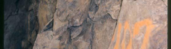


21 Blasting Presents Fresh Exposures
22 Bedrock Elevation (Pre-Blast)


23 Elevation of Bedrock Surface (Post-Blast) Source: MACTEC, 2006


24 Elements of Bedrock Evaluation Configuration of top-of-bedrock of surface Geologic Mapping Rock Type Identification Foliation orientation Data Joint Orientation Data Structural Analysis Stereo-net analysis Joint/Fracture Mapping
25 Overview of Locations Where Structural Data Was Collected
26 Foliation Primary layering in metamorphic rocks Generally follows compositional layering Consistent orientation at site-scale Strikes N-S Dips 50 0 West Local evidence of minor folding
27 Plan View of Foliation Data NE Corner of Building
28 Plan View of Foliation Data SE Corner of Building
29 Stereoplot of Foliation indicating Fold Axis A i th N21E Azimuth ~ N21E Plunge ~ 40
30 Joints Generic Term for Planar discontinuity in Rock Mass (e.g., crack) Open joints may transmit water (oxidation) Greater Variability than Foliation


31 Intersecting Joint Sets Oxidized Fracture Plane
32 Stereo-plot of Joint Orientations N= stations
33 Major and Minor Joint Sets N3E +/-, W (parallel to foliation) N45E +/-, SE Near-surface sheeting joints at various orientations, Sub-parallel to former topography p ~ N70W, Subvertical (weak) ~ N30W, > SE or SW Dips (weak)


34 Interpretive Overburden Groundwater Surface Map, October 7, 2004 Overburden Absent: GW Divide Source: MACTEC, 2006


35 Interpretive Bedrock Groundwater Surface Map, October 7, 2004 Down-Dip Smear Zone? BR GW Divide Source: MACTEC, 2006
36 N-S Hydrogeologic Cross Section UST 13
37 W-E Hydrogeologic Cross-Section UST 13 Area

38 W-E Hydrogeologic Cross-Section UST 13 Area Pancake Model
39
40 True-Scale Cross Section of UST- 13 Area Normal to Foliation, Illustrating Monitoring Gap
41 GFM: Conceptual Fracture Network Proposed Source Area Well Proposed DG Water Table Well
42 Plan View of Site 32-43A Indicating Proposed Locations for New Monitoring Wells
43 Summary and Conclusions CSM Considerations (sans GFM) Systematic water table rise in the POL area Drowned Smear Zone Many existing MWs no longer screened optimally for water table monitoring; UST-13 Area Requires several new MWs Source area True down-gradient directions Water-table (BR/OB)
44 Summary and Conclusions CSM Considerations (with GFM) Basic Geologic Analysis + Simple GFM: points to numerous opportunities for LTM Improvement Joints parallel to foliation may play a significant role in contaminant migration Down-dip migration of NAPL in source zone(w/sw) Dissolved COC migration along strike (S) Several MWs needed to South and SW of source area along ao primary flow pathways ays (SOB/DOB/BR) O / Target SW-striking Bedrock Structure
45 Recommendations and Outstanding Issues Install New Monitoring Wells Decommission Unnecessary Wells New Baseline Re-initiate Long-term Monitoring Evaluate time-series contaminant trends
46 NEXT STEPS Consensus on Competing CSMs CSM 1 (Simplistic): Residual NAPL: Pancake Model Bedrock as Equivalent Porous Medium (EPM) CSM2 (More Complex) Residual NAPL: Vertical Equilibrium Model (VEM) Bedrock: CSM considers Bedrock Complexity (GFM) Determine whether additional remedial measures are needed..
Case Study: University of Connecticut (UConn) Landfill
 Landfill") Case Study: University of Connecticut (UConn) Landfill Problem Statement:» Locate disposal trenches» Identify geologic features and distinguish them from leachate and locate preferential pathways in fractured
Case Study: University of Connecticut (UConn) Landfill Problem Statement:» Locate disposal trenches» Identify geologic features and distinguish them from leachate and locate preferential pathways in fractured
2 Geology. 2.1 Elements of Terrane Analysis. Terrane or Terrain? Potential receptors
 2 Geology Knowledge of fractured rock geology, or terrane, provides important context for investigating contaminated sites. Tectonic forces impart characteristic structures on rock formations that influence
February 22, 2011 Picatinny Team Meeting Edison, New Jersey
 February 22, 2011 Picatinny Team Meeting Edison, New Jersey Updated Groundwater Model and Remedies Mid-Valley Groundwater (PICA 204) February 22, 2011 Imagine the result Review of 2009 2010 Field Program
Geologic Considerations of Shallow SAGD Caprock; Seal Capacity, Seal Geometry and Seal Integrity, Athabasca Oilsands, Alberta Canada
 Geologic Considerations of Shallow SAGD Caprock; Seal Capacity, Seal Geometry and Seal Integrity, Athabasca Oilsands, Alberta Canada Gordon T. Stabb, Michael Webb Durando Resources Corp, Suncor Energy
Chapter 15 Structures
 Chapter 15 Structures Plummer/McGeary/Carlson (c) The McGraw-Hill Companies, Inc. TECTONIC FORCES AT WORK Stress & Strain Stress Strain Compressive stress Shortening strain Tensional stress stretching
Stress and Strain. Stress is a force per unit area. Strain is a change in size or shape in response to stress
 Geologic Structures Geologic structures are dynamically-produced patterns or arrangements of rock or sediment that result from, and give information about, forces within the Earth Produced as rocks change
Back-to-Basics Part 1: Developing the CSM & Site Characterization
 Back-to-Basics Part 1: Developing the CSM & Site Characterization Agenda What is a CSM and how do you use it Physical Components (Geology, Hydrogeology, and Chemistry) Site Use History Likely Fate and
Use of Tracer Dyes to Understand Fractured Bedrock Flow during a Pumping Test
 Use of Tracer Dyes to Understand Fractured Bedrock Flow during a Pumping Test 2015 NGWA Conference on Groundwater in Fractured Rock Presenter: Bette Nowack, PE, Stone Environmental Co-Authors: Andrew Fuller,
TO: Joe Marchesani, SRP Ground Water Pollution Abatement
 1 DEPARTMENT OF ENVIRONMENTAL PROTECTION CHRIS CHRISTIE Water Resource Management BOB MARTIN Governor New Jersey Geological Survey Commissioner Mail Code: 29-01 29 Arctic Pkwy KIM GUADAGNO PO Box 420 Lt.
WaterTech 2017 April 4, 2017
 Haskayne Master Drainage Plan: Hydraulic Relationships Between Groundwater Flow Systems and the Bearspaw Reservoir and Potential for Stormwater Disposal, City of Calgary WaterTech 2017 April 4, 2017 Project
Hydrogeology of Karst NE Wisconsin. Dr. Maureen A. Muldoon UW-Oshkosh Geology Department
 Hydrogeology of Karst NE Wisconsin Dr. Maureen A. Muldoon UW-Oshkosh Geology Department WI Bedrock Outline Karst Landscapes Existing WQ Data Flow in Karst Aquifers Overview of Silurian Aquifer Water Level
BOS 100 Overburden and Bedrock Groundwater Remediation Former Dry Cleaning Facility
 BOS 100 Overburden and Bedrock Groundwater Remediation Former Dry Cleaning Facility Site Description Location Central Kentucky Site Use Retail Shopping Center Geologic Setting Inner Bluegrass Bedrock Ordovician
Groundwater Sequence Stratigraphy:
 Groundwater Sequence Stratigraphy: A Geology-based Approach for Developing Accurate and Representative Hydrogeologic Conceptual Models for Successful Groundwater Sustainability Plans Rick Cramer, Burns
IN SITU CHEMICAL OXIDATION SHORT COURSE DESCRIPTION, OUTLINE, AND BIOS Presented by Will Caldicott of In Situ Oxidative Technologies, Inc.
 IN SITU CHEMICAL OXIDATION SHORT COURSE DESCRIPTION, OUTLINE, AND BIOS Presented by Will Caldicott of In Situ Oxidative Technologies, Inc. In-situ oxidation techniques have been utilized by the North American
Springshed Springshed Management Training Curriculum
 Springshed Springshed Management Training Curriculum Management Training Curriculum Draft Version 2 January 2016 The Springs Initiative 2016 The Springs Initiative SESSION TITLE: Mapping Springs in Crystalline
LAB 1: ORIENTATION OF LINES AND PLANES
 LAB 1: ORIENTATION OF LINES AND PLANES Read the introductory section, chapter 1, pages 1-3, of the manual by Rowland et al (2007) and make sure you understand the concepts of bearing, strike, dip, trend,
Differentiation of chloride source using stable chlorine isotopes
 Differentiation of chloride source using stable chlorine isotopes RemTech 2009 Banff, Alberta October 14-16 2009 Dr. Alec Blyth and Tom Anthony 1 1 currently City of Calgary Background: DOW Chemical Canada
Detailed CVOC Source Area Investigation In The Context Of A Fractured Bedrock Conceptual Site Model
 Proceedings of the Annual International Conference on Soils, Sediments, Water and Energy Volume 12 Article 36 January 2010 Detailed CVOC Source Area Investigation In The Context Of A Fractured Bedrock
ENGINEER S CERTIFICATION OF FAULT AREA DEMONSTRATION (40 CFR )
") PLATTE RIVER POWER AUTHORITY RAWHIDE ENERGY STATION BOTTOM ASH TRANSFER (BAT) IMPOUNDMENTS LARIMER COUNTY, CO ENGINEER S CERTIFICATION OF FAULT AREA DEMONSTRATION (40 CFR 257.62) FOR COAL COMBUSTION RESIDUALS
PLATTE RIVER POWER AUTHORITY RAWHIDE ENERGY STATION BOTTOM ASH TRANSFER (BAT) IMPOUNDMENTS LARIMER COUNTY, CO ENGINEER S CERTIFICATION OF FAULT AREA DEMONSTRATION (40 CFR 257.62) FOR COAL COMBUSTION RESIDUALS
FORENSIC GEOLOGY A CIVIL ACTION
 NAME 89.215 - FORENSIC GEOLOGY A CIVIL ACTION I. Introduction In 1982 a lawsuit was filed on behalf of eight Woburn families by Jan Schlictmann. The suit alleged that serious health effects (childhood
Soils, Hydrogeology, and Aquifer Properties. Philip B. Bedient 2006 Rice University
 Soils, Hydrogeology, and Aquifer Properties Philip B. Bedient 2006 Rice University Charbeneau, 2000. Basin Hydrologic Cycle Global Water Supply Distribution 3% of earth s water is fresh - 97% oceans 1%
Appendix D Fractured Rock Appendix
 Appendix D Fractured Rock Appendix 1.0 Introduction The behavior of LNAPL in fractured bedrock is not necessarily intuitive and is not as easily described using the principles and techniques adopted for
Key factors for a successful ISCO application with Permanganate
 Key factors for a successful ISCO application with Permanganate Prepared by: Richard W Lewis CPG Program Manager ERM 1, 11/22/2002 1 1 ISCO Treatment Two key issues Does the reaction take place? Competing
FRACTURED ROCK Characterization and Remediation. Allan Horneman September 30, 2016
 FRACTURED ROCK Characterization and Remediation Allan Horneman September 30, 2016 Disclaimers and Notices The materials herein are intended to furnish viewers with a summary and overview of general information
Reservoir Geomechanics and Faults
 Reservoir Geomechanics and Faults Dr David McNamara National University of Ireland, Galway david.d.mcnamara@nuigalway.ie @mcnamadd What is a Geological Structure? Geological structures include fractures
RITS Fall 2009 Getting the Most Out of Your Conceptual Site Model 1
 of Your Conceptual Site Model 1 of Your Conceptual Site Model 2 of Your Conceptual Site Model 3 of Your Conceptual Site Model 4 of Your Conceptual Site Model 5 The CSM is a comprehensive representation
Structural Geology Lab. The Objectives are to gain experience
 Geology 2 Structural Geology Lab The Objectives are to gain experience 1. Drawing cross sections from information given on geologic maps. 2. Recognizing folds and naming their parts on stereoscopic air
Name. GEOL.5220 Structural Geology Faults, Folds, Outcrop Patterns and Geologic Maps. I. Properties of Earth Materials
 I. Properties of Earth Materials GEOL.5220 Structural Geology Faults, Folds, Outcrop Patterns and Geologic Maps Name When rocks are subjected to differential stress the resulting build-up in strain can
Michigan s Geology and Groundwater
 Michigan s Geology and Groundwater Ralph J. Haefner Deputy Director U.S. Geological Survey Michigan-Ohio Water Science Center Lansing, Michigan Outline About the USGS Geology 101 Michigan s geology Bedrock
A. Baiocchi 1, W. Dragoni 2, F. Lotti 1, S.M. Piacentini 2, V. Piscopo 1
 A. Baiocchi 1, W. Dragoni 2, F. Lotti 1, S.M. Piacentini 2, V. Piscopo 1 (1) Department of Ecological and Biological Sciences, University of Tuscia, Viterbo, Italy (2) Department of Physics and Geology,
GEOL.3250 Geology for Engineers Glacial Geology
 GEOL.3250 Geology for Engineers Glacial Geology NAME Part I: Continental Glaciation Continental glaciers are large ice sheets that cover substantial portions of the land area. In the region of accumulation
Regional groundwater mapping and model
 Regional groundwater mapping and model Boyd, Dwight 1, Steve Holysh 2, and Jeff Pitcher 1 1 Grand River Conservation Authority, Canada; 2 Regional Municipality of Halton, Canada The Grand River forms one
AWRA PMAS Engineers Club of Philadelphia. A Geologic Perspective on Stormwater
 AWRA PMAS Engineers Club of Philadelphia A Geologic Perspective on Stormwater Toby J. Kessler, P.G. Hydrogeologist Trevor G. Woodward, P.G. Engineering Geologist September 10, 2014 Gilmore & Associates,
Finding Large Capacity Groundwater Supplies for Irrigation
 Finding Large Capacity Groundwater Supplies for Irrigation December 14, 2012 Presented by: Michael L. Chapman, Jr., PG Irrigation Well Site Evaluation Background Investigation Identify Hydrogeologic Conditions
3.0 GEOLOGY AND HYDROGEOLOGY
 3.0 GEOLOGY AND HYDROGEOLOGY 3.1 Methodology The Geological Survey of Ireland (GSI) publication Geology of South Cork was consulted to establish the nature of the bedrock lithology and Quaternary sediments.
Groundwater Hydrology
 EXERCISE 12 Groundwater Hydrology INTRODUCTION Groundwater is an important component of the hydrologic cycle. It feeds lakes, rivers, wetlands, and reservoirs; it supplies water for domestic, municipal,
Investigating Background Groundwater Quality at Contaminated Sites A Hydrogeochemical Approach
 Investigating Background Groundwater Quality at Contaminated Sites A Hydrogeochemical Approach Remediation Technologies Symposium 2011, Banff, Alberta (October 2011) Presented by: Stephen Munzar 1 Presentation
Springshed Springshed Management Training Curriculum
 Springshed Springshed Management Training Curriculum Management Training Curriculum Draft Version 2 January 2016 The Springs Initiative 2016 The Springs Initiative SESSION TITLE: Section Mapping SECTION:
Pressure Grouting of Fractured Bedrock to Control Acid Mine Drainage
 WATER RESOURCES AT RISK May 14-18, 1995 Denver American Institute of Hydrology Pressure Grouting of Fractured Bedrock to Control Acid Mine Drainage S. A. Effner, G. D. Vandersluis, and V. Straskraba Hydro-Geo
Table 5-1 Sampling Program Summary for Milltown Ford Avenue Redevelopment Area, NJ.
 Table 5- Sampling Program Summary for Milltown Ford Avenue Redevelopment Area, NJ. Transformer Pads (9 pads: PAD 9) Evaluate if PCBs presently exist in soils adjacent to, and/or beneath the transformer
Wisconsin s Hydrogeology: an overview
 2012 Soil and Water Conservation Society Conference Stevens Point, WI Feb 9, 2012 Wisconsin s Hydrogeology: an overview Ken Bradbury Wisconsin Geological and Natural History Survey University of Wisconsin-Extension
Soil Sampling Results Former Truck Maintenance Garage
 Soil Sampling Results Former Truck Maintenance Garage Maine Yankee Decommissioning Project Corrective Measures Study May 2004 Prepared for: Maine Yankee 321 Old Ferry Road, Bailey Point Wiscasset, ME 04578
Control of Fractured Bedrock Structure on the Movement of Chlorinated Volatile Organics in Bedrock and Overburden Aquifers, Newark Basin of New Jersey
 Control of Fractured Bedrock Structure on the Movement of Chlorinated Volatile Organics in Bedrock and Overburden Aquifers, Newark Basin of New Jersey Robert M. Bond, PG and Katherine E. Linnell, PG, Langan
Remedial Program. GE Hudson Falls Plant Site. GE Hudson Falls Plant Site. TDCS Status
 Updates on Remedial Programs at the GE Hudson Falls Plant Site and GE Fort Edward Plant Site GE Hudson Falls USEPA Community Advisory Group Meeting September 11, 2008 GE Fort Edward Division of Environmental
WHITE POINT LANDSLIDE GEOTECHNICAL INVESTIGATION November 29, 2012 Status Report
 Gary Lee Moore, P.E., City Engineer Vince Jones, P.E., Deputy City Engineer WHITE POINT LANDSLIDE GEOTECHNICAL INVESTIGATION November 29, 2012 Status Report White Point Landslide Geotechnical Investigation
Crustal Deformation Earth - Chapter Pearson Education, Inc.
 Crustal Deformation Earth - Chapter 10 Structural Geology Structural geologists study the architecture and processes responsible for deformation of Earth s crust. A working knowledge of rock structures
Geology and Soil Mechanics /1A ( ) Mark the best answer on the multiple choice answer sheet.
 Mark the best answer on the multiple choice answer sheet.") Geology and Soil Mechanics 55401 /1A (2003-2004) Mark the best answer on the multiple choice answer sheet. 1. Soil mechanics is the application of hydraulics, geology and mechanics to problems relating
Geology and Soil Mechanics 55401 /1A (2003-2004) Mark the best answer on the multiple choice answer sheet. 1. Soil mechanics is the application of hydraulics, geology and mechanics to problems relating
SLOPE STABILITY EVALUATION AND ACCEPTANCE STANDARDS
 INFORMATION BULLETIN / PUBLIC - BUILDING CODE REFERENCE NO.: LAMC 98.0508 Effective: 1-26-84 DOCUMENT NO. P/BC 2002-049 Revised: 11-1-02 Previously Issued As: RGA #1-84 SLOPE STABILITY EVALUATION AND ACCEPTANCE
HYDROGEOLOGICAL PROPERTIES OF THE UG2 PYROXENITE AQUIFERS OF THE BUSHVELD COMPLEX
 R. Gebrekristos, P.Cheshire HYDROGEOLOGICAL PROPERTIES OF THE UG2 PYROXENITE AQUIFERS OF THE BUSHVELD COMPLEX R. Gebrekristos Digby Wells Environmental P. Cheshire Groundwater Monitoring Services Abstract
Gotechnical Investigations and Sampling
 Gotechnical Investigations and Sampling Amit Prashant Indian Institute of Technology Gandhinagar Short Course on Geotechnical Investigations for Structural Engineering 12 14 October, 2017 1 Purpose of
Crustal Deformation. (Building Earth s Surface, Part 1) Science 330 Summer Mapping geologic structures
 Science 330 Summer Mapping geologic structures") Crustal Deformation (Building Earth s Surface, Part 1) Science 330 Summer 2005 Mapping geologic structures When conducting a study of a region, a geologist identifies and describes the dominant rock structures
Crustal Deformation (Building Earth s Surface, Part 1) Science 330 Summer 2005 Mapping geologic structures When conducting a study of a region, a geologist identifies and describes the dominant rock structures
Structural Geology Lab. The Objectives are to gain experience
 Geology 2 Structural Geology Lab The Objectives are to gain experience 1. Drawing cross sections from information given on geologic maps. 2. Recognizing folds and naming their parts on stereoscopic air
GUIDELINES FOR OPEN PIT SLOPE DESIGN EDITORS: JOHN READ, PETER STACEY # & CSIRO. J x PUBLISHING
 GUIDELINES FOR OPEN PIT SLOPE DESIGN EDITORS: JOHN READ, PETER STACEY # & CSIRO J x PUBLISHING S Contents Preface and acknowledgments xiii 1 Fundamentals of slope design 1 Peter Stacey 1.1 Introduction
Rock Mechanics for Tunneling
 Rock Mechanics for Tunneling Discrete Fracture Approach Dr. William Dershowitz Dept of Civil Engineering University of Washington FracMan Technology Group Golder Associates Inc Rock Quality -RQD Rock Quality
SLOPE STABILITY EVALUATION AND ACCEPTANCE STANDARDS
 INFORMATION BULLETIN / PUBLIC - BUILDING CODE REFERENCE NO.: LABC 7006.3, 7014.1 Effective: 01-01-2017 DOCUMENT NO.: P/BC 2017-049 Revised: 12-21-2016 Previously Issued As: P/BC 2014-049 SLOPE STABILITY
A. Refer to Appendix F in back of lab manual for list of commonly used geologic map symbols
 Structural Geology Lab 2: Outcrop Patterns and Structure Contours I. Geologic Map Symbols A. Refer to Appendix F in back of lab manual for list of commonly used geologic map symbols 1. Emphasis: a. strike
GROUNDWATER MONITORING DATA 2016 SAMPLING EVENT HARSHAW CHEMICAL COMPANY FUSRAP SITE
 GROUNDWATER MONITORING DATA 2016 SAMPLING EVENT HARSHAW CHEMICAL COMPANY FUSRAP SITE U.S. Army Corps of Engineers Buffalo District Building Strong April 2017 ly Utilized Sites Remedial Action Program The
TAKING THE MYSTERY OUT OF USACE S ER DRILLING IN EARTH EMBANKMENT DAMS AND LEVEES
 TAKING THE MYSTERY OUT OF USACE S ER 1110-1-1807 DRILLING IN EARTH EMBANKMENT DAMS AND LEVEES 237 237 237 217 217 217 200 200 200 80 119 27 252 174.59 1 255 255 255 0 0 0 163 163 163 131 132 122 239 65
CONTROLLING FACTORS BASIC ISSUES SAFETY IN OPENCAST MINING WITH SPECIAL REFERENCE TO SLOPE STABILITY
 SAFETY IN OPENCAST MINING WITH SPECIAL REFERENCE TO SLOPE STABILITY CONTROLLING FACTORS Dr. J C. JHANWAR Sr. Principal Scientist CSIR-Central Institute of Mining & Fuel Research Regional Centre, Nagpur
UTILITY REPORT FOR THORNTON SELF STORAGE THORNTON, COLORADO
 UTILITY REPORT FOR THORNTON SELF STORAGE THORNTON, COLORADO Prepared by: Bowman Consulting 63 Park Point Dr. Suite 1 Golden, CO 841 (33)-81-29 June 29, 215 Revised August 14, 215 Revised September 3, 215
DATA ACQUISITION METHODS FOR GROUNDWATER INVESTIGATION AND THE SITING OF WATER SUPPLY WELLS
 DATA ACQUISITION METHODS FOR GROUNDWATER INVESTIGATION AND THE SITING OF WATER SUPPLY WELLS M.B.J. Foster Tetra Tech EM Inc., San Francisco, CA, USA Keywords: Groundwater, water wells, drilled wells, geophysical
GPR AS A COST EFFECTIVE BEDROCK MAPPING TOOL FOR LARGE AREAS. Abstract
 GPR AS A COST EFFECTIVE BEDROCK MAPPING TOOL FOR LARGE AREAS Dr. Jutta L. Hager, Hager GeoScience, Inc., Waltham, MA Mario Carnevale, Hager GeoScience, Inc., Waltham, MA Abstract Hager GeoScience, Inc.
A Short Course in Contaminated Fractured Rock Hydrogeology and Geophysics
 A Short Course in Contaminated Fractured Rock Hydrogeology and Geophysics An Eight Hour Geophysics Course Offered Through the Environmental Professionals' Organization of Connecticut Date: Nov 19, Nov
Azimuthal Resistivity to Characterize Fractures in a Glacial Till. Mark Boris, University of Saskatchewan Jim Merriam, University of Saskatchewan
 Azimuthal Resistivity to Characterize Fractures in a Glacial Till Mark Boris, University of Saskatchewan Jim Merriam, University of Saskatchewan Abstract Azimuthal resistivity was used to characterize
Slope Stability Evaluation Ground Anchor Construction Area White Point Landslide San Pedro District Los Angeles, California.
 Slope Stability Evaluation Ground Anchor Construction Area White Point Landslide San Pedro District Los Angeles, California Submitted To: Mr. Gene Edwards City of Los Angeles Department of Public Works
Essentials of Geology, 11e
 Essentials of Geology, 11e Groundwater Chapter 10 Instructor Jennifer Barson Spokane Falls Community College Geology 101 Stanley Hatfield Southwestern Illinois Co Jennifer Cole Northeastern University
INNOVATIVE TECHNIQUES TO INVESTIGATE CONTAMINATION IN FRACTURED BEDROCK
 INNOVATIVE TECHNIQUES TO INVESTIGATE CONTAMINATION IN FRACTURED BEDROCK Abstract Christopher Gaule 1, Kenneth Goldstein 2, Grant Anderson 3 Watervliet Arsenal, located in Watervliet, New York, is the oldest
GROUND WATER EXPLORATION AND DEVELOPMENT IN IGNEOUS AND METAMORPHIC ROCKS OF THE SOUTHERN PIEDMONT/BLUE RIDGE
 GROUND WATER EXPLORATION AND DEVELOPMENT IN IGNEOUS AND METAMORPHIC ROCKS OF THE SOUTHERN PIEDMONT/BLUE RIDGE Thomas J. Crawford¹ and Randy L. Kath² AUTHORS: ¹Professor of Geology, Emeritus, ²Professor
Part I. PRELAB SECTION To be completed before labs starts:
 Student Name: Physical Geology 101 Laboratory #13 Structural Geology II Drawing and Analyzing Folds and Faults Grade: Introduction & Purpose: Structural geology is the study of how geologic rock units
Rotating Dual Axis Blending Technology at MGP Sites
 Applicability of ISCO Using Rotating Dual Axis Blending Technology at MGP Sites MGP 2012 March 28 30, 2012 Scott Tarmann AECOM ISCO at MGP Sites In-situ chemical oxidation (ISCO) has been used with varied
Crags, Cracks, and Crumples: Crustal Deformation and Mountain Building
 Crags, Cracks, and Crumples: Crustal Deformation and Mountain Building Updated by: Rick Oches, Professor of Geology & Environmental Sciences Bentley University Waltham, Massachusetts Based on slides prepared
Information Request 12
 Information Request 12 Information Request 12 12-1 Responses to Information Request 12 Response to Information Request 12a Response to Information Request 12b Response to Information Request 12c 12-3 12-7
Evaluation of Structural Geology of Jabal Omar
 International Journal of Engineering Research and Development e-issn: 2278-067X, p-issn: 2278-800X, www.ijerd.com Volume 11, Issue 01 (January 2015), PP.67-72 Dafalla Siddig Dafalla * and Ibrahim Abdel
In this lab, we will study and analyze geologic maps from a few regions, including the Grand Canyon, western Wyoming, and coastal California.
 Name: Lab Section: work in groups, but each person turns in his/her own GEOSCIENCE 001 LAB UNDERSTANDING GEOLOGIC MAPS Geologic maps are colorful and even beautiful, but they also contain an amazing amount
Structural Geology and Geology Maps Lab
 Structural Geology and Geology Maps Lab Mesa College Geology 101 Lab Ray Rector: Instructor Structural Geology Lab Pre-Lab Resources Pre-Lab Internet Links 1) Fundamentals of Structural Geology 2) Visualizing
Basin Analysis Applied to Modelling Buried Valleys in the Great Lakes Basin
 EARTH SCIENCES SECTOR GENERAL INFORMATION PRODUCT 35 Basin Analysis Applied to Modelling Buried Valleys in the Great Lakes Basin Sharpe, D R; Russell, H A J 2004 Originally released as: Basin Analysis
Florida s Karst Geology
 Florida s Karst Geology Orange Creek Basin Interagency Working Group Public Workshop, November 5 th, 2015 Harley Means, P.G. Assistant State Geologist Florida Geological Survey Karst Karst a type of topography
The Geology and Hydrogeology of the Spyhill Area
 The Geology and Hydrogeology of the Spyhill Area Clare North (WorleyParsons Komex) and Martin Ortiz (The City of Calgary) 2-Jul-08 Outline Background Site Location Existing Information New Work Geology
A. V T = 1 B. Ms = 1 C. Vs = 1 D. Vv = 1
 Geology and Soil Mechanics 55401 /1A (2002-2003) Mark the best answer on the multiple choice answer sheet. 1. Soil mechanics is the application of hydraulics, geology and mechanics to problems relating
Answers: Internal Processes and Structures (Isostasy)
") Answers: Internal Processes and Structures (Isostasy) 1. Analyse the adjustment of the crust to changes in loads associated with volcanism, mountain building, erosion, and glaciation by using the concept
Answers: Internal Processes and Structures (Isostasy) 1. Analyse the adjustment of the crust to changes in loads associated with volcanism, mountain building, erosion, and glaciation by using the concept
Controls on the Distribution of Drift Filled Hollows in London
 Controls on the Distribution of Drift Filled Hollows in London Stephanie Bricker, Vanessa Banks and Kate Royse Engineering Geology of Scour Features Geol Soc. London, 22 January 2013 Outline 1. Why study
Chapter 14. Groundwater
 Chapter 14 Groundwater Importance of groundwater! Groundwater is water found in the pores of soil and sediment, plus narrow fractures in bedrock! Groundwater is the largest reservoir of fresh water that
GLY 155 Introduction to Physical Geology, W. Altermann. Press & Siever, compressive forces. Compressive forces cause folding and faulting.
 Press & Siever, 1995 compressive forces Compressive forces cause folding and faulting. faults 1 Uplift is followed by erosion, which creates new horizontal surface. lava flows Volcanic eruptions cover
Borehole Problems. Horizontal Level Ground. Boreholes Sunk on Horizontal Ground. Depth Diagram (Not to Scale)
") Borehole roblems 43 4 Borehole roblems Horizontal Level Ground In order to determine the subsurface geology of an area, boreholes are sunk at convenient places in areas such as cultivated lands, forests
Borehole roblems 43 4 Borehole roblems Horizontal Level Ground In order to determine the subsurface geology of an area, boreholes are sunk at convenient places in areas such as cultivated lands, forests
Groundwater. (x 1000 km 3 /y) Oceans Cover >70% of Surface. Groundwater and the. Hydrologic Cycle
 Oceans Cover >70% of Surface. Groundwater and the. Hydrologic Cycle") Chapter 17 Oceans Cover >70% of Surface Groundwater and the Hydrologic Cycle Vasey s Paradise, GCNP Oceans are only 0.025% of Mass Groundwater Groundwater is liquid water that lies in the subsurface in
Chapter 17 Oceans Cover >70% of Surface Groundwater and the Hydrologic Cycle Vasey s Paradise, GCNP Oceans are only 0.025% of Mass Groundwater Groundwater is liquid water that lies in the subsurface in
Mapping Magnetic Lineaments in the Foothills of Northeastern British Columbia using 2-D Wavelet Transform
 Mapping Magnetic Lineaments in the Foothills of Northeastern British Columbia using 2-D Wavelet Transform Hassan Hassan* GEDCO, Calgary, Alberta, Canada hassan@gedco.com Abstract Summary This work describes
Aquitard Characterization The Legend of Indiana s Magic Clay Layer. Juliet Port, LPG #2214 July 2014
 Aquitard Characterization The Legend of Indiana s Magic Clay Layer Juliet Port, LPG #2214 July 2014 Topics What is an Aquitard? Why do we care? Review of Indiana glacial geology Conceptual Framework Investigation
A.M. TUESDAY, 12 May hours
 Candidate Name Centre Number 2 Candidate Number GCE AS/A level 1212/01 New AS GEOLOGY - GL2a Investigative Geology A.M. TUESDAY, 12 May 2009 1 1 2 hours For Examiner s Use Only ADDITIONAL MATERIALS In
The Geology of Two Lights State Park. Cape Elizabeth, Maine
 Maine Geologic Facts and Localities June, 2002 Cape Elizabeth, Maine 43 33 33.48 N, 70 12 13.32 W Text by Henry N. Berry IV and Robert G. Marvinney, Department of Agriculture, Conservation & Forestry 1
Staple this part to part one of lab 6 and turn in. Lab 6, part two: Structural geology (analysis)
") Geology 101 Staple this part to part one of lab 6 and turn in Lab 6, part two: Structural geology (analysis) Recall that the objective of this lab is to describe the geologic structures of Cougar Mountain
Geology 101 Staple this part to part one of lab 6 and turn in Lab 6, part two: Structural geology (analysis) Recall that the objective of this lab is to describe the geologic structures of Cougar Mountain
What We Know (and don t know)
") What We Know (and don t know) about the M5.1 La Habra Earthquake Dr. Robert Graves U.S. Geological Survey In collaboration with: Dr. Egill Hauksson and Dr. Thomas Göbel Caltech Dr. Elizabeth Cochran U.S.
What We Know (and don t know) about the M5.1 La Habra Earthquake Dr. Robert Graves U.S. Geological Survey In collaboration with: Dr. Egill Hauksson and Dr. Thomas Göbel Caltech Dr. Elizabeth Cochran U.S.
What Causes Rock to Deform?
 Crustal Deformation Earth, Chapter 10 Chapter 10 Crustal Deformation What Causes Rock to Deform? Deformation is a general term that refers to all changes in the shape or position of a rock body in response
1. classic definition = study of deformed rocks in the upper crust
 Structural Geology I. Introduction 1. classic definition = study of deformed rocks in the upper crust deformed includes translation, rotation, and strain (change of shape) All rocks are deformed in some
Geophysical Methods for Screening and Investigating Utility Waste Landfill Sites in Karst Terrain
 Geophysical Methods for Screening and Investigating Utility Waste Landfill Sites in Karst Terrain Gary Pendergrass, PE, RG, F.NSPE Principal Geological Engineer Kansas City Geotechnical Conference 2017
Indicators, Tracers, and Surrogates of Chlorinated Vapor Intrusion Pressure and Wind as Indicators
 Innovation that provides sustainable solutions to complex challenges worldwide Indicators, Tracers, and Surrogates of Chlorinated Vapor Intrusion Pressure and Wind as Indicators State-of-the-Science for
The McPhillamys Gold Deposit, Discovery History & Geology. Presenter: Tara French
 The McPhillamys Gold Deposit, Discovery History & Geology. Presenter: Tara French Forward-Looking Statements This presentation contains forward-looking statements. without limitation: Estimates of future
Structural Geology Laboratory.
 Structural Geology Wikipedia-Structural geology is the study of the threedimensional distribution of rock units with respect to their deformational histories. The primary goal of structural geology is
FUNDAMENTALS OF ENGINEERING GEOLOGY
 FUNDAMENTALS OF ENGINEERING GEOLOGY Prof. Dr. HUSSEIN HAMEED KARIM Building and Construction Engineering Department 2012 Preface The impulse to write this book stemmed from a course of geology given by
UNDERSTANDING GEOLOGIC M APS
 Name: Lab Section: work in groups, but each person turns in his/her own GEOSCIENCE 001 L AB UNDERSTANDING GEOLOGIC M APS Geologic maps are colorful and even beautiful, but they also contain an amazing
Chapter 8 Fetter, Applied Hydrology 4 th Edition, Geology of Groundwater Occurrence
 Chapter 8 Fetter, Applied Hydrology 4 th Edition, 2001 Geology of Groundwater Occurrence Figure 8.42. Alluvial Valleys ground-water region. Fetter, Applied Hydrology 4 th Edition, 2001 Fetter, Applied