BOREHOLE GEOPHYSICAL LOGGING IN UNCONSOLIDATED SEDIMENTS -AN AID TO 3-D 3 D MAPPING. J.A. Hunter Geological Survey of Canada
|
|
|
- Kenneth Anderson
- 5 years ago
- Views:
Transcription


1 BOREHOLE GEOPHYSICAL LOGGING IN UNCONSOLIDATED SEDIMENTS -AN AID TO 3-D 3 D MAPPING J.A. Hunter Geological Survey of Canada
2 QUALITATIVE PARAMETERS - grain size - sediment type - porosity - density - pore-water salinity - elastic moduli - heavy mineral content
3 BOREHOLE : OGS3-1 Natural Gamma (cps) Inductive Conductivity (ms/m) 3 4 Magnetic Susceptibility (ppt SI) Neutron Gamma-gamma Spectral (cps) (cps) Density Temperature <---porosity density increasing Ratio (deg. C) P-Wave Velocity (m/sec) increasing > T1a Driller's Log Till-sandy,silt T1b T1c T1 water level in casing CLAY Depth (m) 3 T2a T2b T3 P S Till-sandy,silt T2 Till-sandy,clayey T3 GRAVEL -pebble -cobble 3 T G Till,silty sandy 4 T4 SILT T4 4 Till,silty,sandy DOLOSTONE 5 Near Far 5 % SMOOTHING Grad.(C deg./km) S-Wave Velocity (m/s) DOLOSTONE 5


4 Groundwater Investigations Fredericton, New Brunswick An aid to understanding the detailed stratigraphy of the confined aquifer system
5 CONDUCTIVITY (ms/m) base of coarsegrained interbeds DEPTH (m) 3 MS Cond MS Cond 3 MS Cond MS Cond? MAGNETIC SUSCEPTIBILITY (X -3 SI) BH: A BH: B BH: C BH: D <<-- ~4 km --> <-- ~5km --> <-- ~15km --> Correlation of geophysical marker horizons in Leda Clay, Eastern Ontario / Western Quebec
6 Presence of Newmarket Till in N-S N S borehole transect across ORM (as indicated by high P-wave P velocities) South Velocity (km/s) Top of Newmarket Till Oak Ridges Moraine North Elevation (masl) 3 25 Bottom of Newmarket Till Velocities between 25 and 35 m/s 15 P1-BH27 OGS OGS OGS GSC-94-MC1 OGS-93-14
7 1.9 POROSITY vs Vs POROSITY = *ln(Vs) # of Observations: 1148 R-coefficient:.82 2 sigma = +/ FRACTIONAL POROSITY Holocene Pleistocene SHEAR WAVE VELOCITY (m/s) -note separation of data based on geological age
8 SHEAR WAVE VELOCITY V S (m/s) 5 15 SHEAR WAVE VELOCITY (m/s) 5 15 SHEAR WAVE VELOCITY (m/s) 5 15 V S Ø V S Ø V S Ø 3 DEPTH (m) 4 5 DEPTH (m) 3 DEPTH (m) OGS FRACTIONAL "TOTAL" POROSITY Ø OGS FRACTIONAL "TOTAL" POROSITY 6 OGS FRACTIONAL "TOTAL" POROSITY DOWNHOLE SHEAR WAVE VELOCITY and TOTAL POROSITY WATERLOO MORAINE
9 Neutron (cps) Neutron (cps) 4 3 DEPTH (m) 3 DEPTH (m) OGS FRACTIONAL "TOTAL" POROSITY 5 OGS FRACTIONAL "TOTAL" POROSITY OGS BHs,, Waterloo Moraine
10 GAMMA-GAMMA (cps) 4 3 OGS - 1 OGS - 2 OGS - 3 OGS - 4 OGS - 5 OGS - 6 OGS - 7 OGS - 8 OGS NEUTRON (cps) Waterloo Moraine BH s 1 to 9
11 NEW SONDES (what s coming down the pipe at the GSC?) The Borehole Logging Methods Group under the leadership of Jonathan Mwenifumbo are researching the following: -spectral gamma signatures of unconsolidated overburden from passive monitoring of radio-isotopes isotopes of U, Th,, and K -capacitive-coupled coupled resistivity equipment and techniques
12 Spectral Gamma Signatures (high sensitivity 512 channel B.H. spectrometer) Gamma (cps) Count rate (cps) A Spectrum OGS-3-1 (-14m) K window U window Th window Depth (m) 3 A B Count rate (cps) B Spectrum OGS-3-1 (26-29m) C Count rate (cps) C Spectrum OGS-3-1 (34-41m) Energy (kev) 3

13 Differing U/Th ratios between Zones A and B suggest possible differing provenances
 55 mm 14 mm Capacitive Resistivity Probe Receiver Transmitter l MN = 4 mm l AB = 263 mm Spacer 175 mm 33 mm 55 mm switch battery 28 mm mm 1 mm 74 mm 8 mm 1 mm mm 123 mm T-R Spacing 414")
14 Capacitive-coupled coupled Resistivity Sonde designed by V. M. Timofeev,, U.S.S.R. (Canadianized by Q. Bristow, GSC) 55 mm 14 mm Capacitive Resistivity Probe Receiver Transmitter l MN = 4 mm l AB = 263 mm Spacer 175 mm 33 mm 55 mm switch battery 28 mm mm 1 mm 74 mm 8 mm 1 mm mm 123 mm T-R Spacing 414 mm 599 mm 744 mm 919 mm 4 mm 2 mm T-R Spacing 414 mm + Spacer Electrodes N, M, B, A are thin-walled hollow cylinders ~ 4 mm in dia.
15 Why capacitive-coupled? coupled? -operates in plastic casing no fluid contact needed - enhanced vertical resolution at higher resistivities Gamma (cps) Resistivity ( Ω-m) Depth (m) 3
16 ANCHORING THE 3-D 3 D FRAMEWORK WITH GOLDEN SPIKES Strategically placed, well documented boreholes in unconsolidated sediments which have been: - continuously cored and have detailed geological descriptions - cased with plastic casing and grouted c/w vandal-proof surface completions - geophysically logged with most standard slim-hole tools - sampled for geological, geotechnical and geophysical properties THESE BECOME INVESTMENTS IN THE FUTURE NATIONAL TREASURES
17
18

19

20
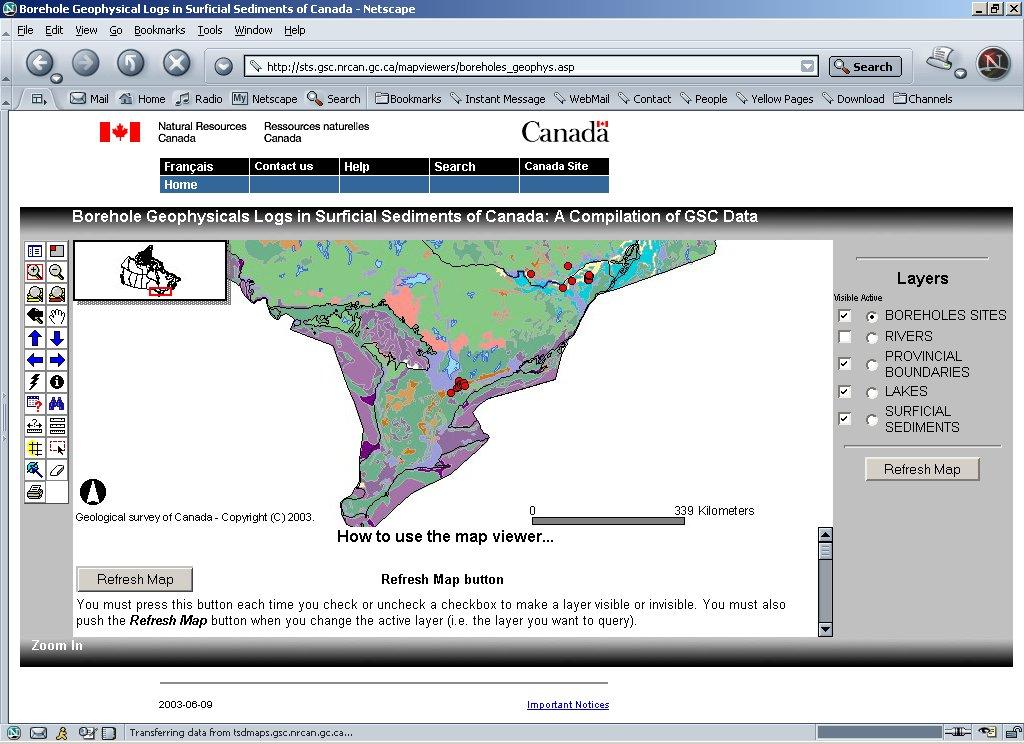
21 Borehole Geophysical Logs in Surficial Sediments of Canada -a a (downloadable) PDF format collection of geophysical log suites with geological descriptions, from boreholes across Canada drilled and a cased in (mainly) Holocene and Pleistocene strata. Digital data available from: jhunter@nrcan.gc.ca
HOW. HOW vehicle mounted units portable units also available. HOW, WHEN & WHY to Geophysically Log in S.I.?
 HOW, WHEN & WHY to Geophysically Log in S.I.? by Kim Beesley HOW HOW vehicle mounted units portable units also available Access to borehole Depth of borehole sump / rat -hole? 1 HOW? - subject to borehole
Buried-valley Aquifers: Delineation and Characterization from Reflection Seismic and Core Data at Caledon East, Ontario
 Buried-valley Aquifers: Delineation and Characterization from Reflection Seismic and Core Data at Caledon East, Ontario Russell, H.A.J. 1, S.E. Pullan 1, J.A. Hunter 1, D.R. Sharpe 1, and S. Holysh 2 1
Geological Mapping using Geophysics
 Geological Mapping using Geophysics Pugin, A.J.M. and T.H. Larson Illinois State Geological Survey, 615 E Peabody Dr., Champaign, IL 61820; E-mail: A.J.M. Pugin at pugin@isgs.uiuc.edu Mapping Techniques.
Canadian Journal of Earth Sciences. Borehole geophysical log signatures and stratigraphic assessment in a glacial basin, southern Ontario
 Borehole geophysical log signatures and stratigraphic assessment in a glacial basin, southern Ontario Journal: Canadian Journal of Earth Sciences Manuscript ID cjes-2017-0016.r1 Manuscript Type: Article
SASKATCHEWAN STRATIGRAPHY GLACIAL EXAMPLE BOULDERS IN GLACIAL DEPOSITS
 SASKATCHEWAN STRATIGRAPHY GLACIAL EXAMPLE BOULDERS IN GLACIAL DEPOSITS 51 SASKATCHEWAN STRATIGRAPHY GLACIAL SURFICIAL STRATIFIED DEPOSITS 52 SASKATCHEWAN STRATIGRAPHY GLACIAL EXAMPLE OF SEDIMENT DEPOSITION
Finding Large Capacity Groundwater Supplies for Irrigation
 Finding Large Capacity Groundwater Supplies for Irrigation December 14, 2012 Presented by: Michael L. Chapman, Jr., PG Irrigation Well Site Evaluation Background Investigation Identify Hydrogeologic Conditions
Monitoring of In-Situ Chemical Oxidation (ISCO) with Time Series Geophysical Surveys
 with Time Series Geophysical Surveys") Monitoring of In-Situ Chemical Oxidation (ISCO) with Time Series Geophysical Surveys Philip T. Harte, P.G. U.S. Geological Survey ptharte@usgs.gov 603-226-7813 U.S. Department of the Interior U.S. Geological
Monitoring of In-Situ Chemical Oxidation (ISCO) with Time Series Geophysical Surveys Philip T. Harte, P.G. U.S. Geological Survey ptharte@usgs.gov 603-226-7813 U.S. Department of the Interior U.S. Geological
Geological control in 3D stratigraphic modeling, Oak Ridges Moraine, southern Ontario. Logan, C., Russell, H. A. J., and Sharpe, D. R.
 Geological control in 3D stratigraphic modeling, Oak Ridges Moraine, southern Ontario Logan, C., Russell, H. A. J., and Sharpe, D. R. Rationale Increasing urbanization in the Greater Toronto Area is creating
Site Characterization & Hydrogeophysics
 Site Characterization & Hydrogeophysics (Source: Matthew Becker, California State University) Site Characterization Definition: quantitative description of the hydraulic, geologic, and chemical properties
NEW PRODUCTS AND ADVANCEMENTS IN 3-D MODELLING PROTOCOLS BASED ON STUDIES IN THICK DRIFT AREAS IN ONTARIO, CANADA
 NEW PRODUCTS AND ADVANCEMENTS IN 3-D MODELLING PROTOCOLS BASED ON STUDIES IN THICK DRIFT AREAS IN ONTARIO, CANADA Abigail K. Burt and Andrew F. Bajc Ontario Geological Survey, 933 Ramsey Lake Road, Sudbury,
RESISTIVITY IMAGING AND BOREHOLE INVESTIGATION OF THE BANTING AREA AQUIFER, SELANGOR, MALAYSIA. A.N. Ibrahim Z.Z.T. Harith M.N.M.
 JOURNAL OF ENVIRONMENTAL HYDROLOGY The Electronic Journal of the International Association for Environmental Hydrology On the World Wide Web at http://www.hydroweb.com VOLUME 11 2003 RESISTIVITY IMAGING
Aquifer Mapping and Characterization in southern Ontario:
 OGS-GSC Open House, Guelph March10 th, 2016 Aquifer Mapping and Characterization in southern Ontario: A Collaborative OGS GSC project 2014-2019 Hazen A.J. Russell & Andy F. Bajc Where to Find us! Workshop
6.1.6 Sampling, Measurement and Testing. 1) Sampling
 Sampling") 6.1.6 Sampling, Measurement and Testing 1) Sampling In the course of drilling at each borehole, the data of all formations encountered was logged while drilling and a record was made of all variations
6.1.6 Sampling, Measurement and Testing 1) Sampling In the course of drilling at each borehole, the data of all formations encountered was logged while drilling and a record was made of all variations
Oak Ridges Moraine Aquifer Vulnerability Mapping
 Accompanying Document to the Reference Map for Ontario Regulation 140/02 (Oak Ridges Moraine Conservation Plan) March 2004 2 1. Purpose of Report Accompanying Document to the Reference Map for Ontario
APPENDIX C Frontier Geoscience Geophysical Survey Report
 Aquifer Mapping Study WL09-1578 Town of Gibsons, British Columbia 13 May 2013 Submitted To The Town of Gibsons APPENDIX C Frontier Geoscience Geophysical Survey Report WATERLINE RESOURCES INC. REPORT ON
How to Identify and Properly Classify Drill Cuttings
 How to Identify and Properly Classify Drill Cuttings (Creating Useful Borehole Logs) Dave Larson Hydrogeology and Geophysics Section Accurate information about the borehole location and a careful description
Rouge River Watershed. Chapter 2.0 Setting and Issues
 Rouge River Watershed Scenario Modelling ling and Analysis Report Chapter 2.0 Setting and Issues TABLE OF CONTENTS 2.0 SETTING AND KEY ISSUES... 2-1 2.1 Climate... 2-1 2.2 Physiography, Topography, and
Geophysics for Environmental and Geotechnical Applications
 Geophysics for Environmental and Geotechnical Applications Dr. Katherine Grote University of Wisconsin Eau Claire Why Use Geophysics? Improve the quality of site characterization (higher resolution and
Vertical electrical sounding (VES) for subsurface geophysical investigation in Kanigiri area, Prakasam district, Andhra Pradesh, India
 for subsurface geophysical investigation in Kanigiri area, Prakasam district, Andhra Pradesh, India") Available online at www.pelagiaresearchlibrary.com Advances in Applied Science Research, 2014, 5(5):82-86 ISSN: 0976-8610 CODEN (USA): AASRFC Vertical electrical sounding (VES) for subsurface geophysical
Available online at www.pelagiaresearchlibrary.com Advances in Applied Science Research, 2014, 5(5):82-86 ISSN: 0976-8610 CODEN (USA): AASRFC Vertical electrical sounding (VES) for subsurface geophysical
Boreholes. Implementation. Boring. Boreholes may be excavated by one of these methods: 1. Auger Boring 2. Wash Boring 3.
 Implementation Boreholes 1. Auger Boring 2. Wash Boring 3. Rotary Drilling Boring Boreholes may be excavated by one of these methods: 4. Percussion Drilling The right choice of method depends on: Ground
Fundamentals Of Petroleum Engineering FORMATION EVALUATION
 Fundamentals Of Petroleum Engineering FORMATION EVALUATION Mohd Fauzi Hamid Wan Rosli Wan Sulaiman Department of Petroleum Engineering Faculty of Petroleum & Renewable Engineering Universiti Technologi
GY 402: Sedimentary Petrology
 UNIVERSITY OF SOUTH ALABAMA GY 402: Sedimentary Petrology Lecture 27: Introduction to Wireline Log Interpretations Instructor: Dr. Douglas W. Haywick Last Time Carbonate Diagenesis Diagenesis 0.5 mm PPL
POTASH DRAGON CHILE GEOPHYSICAL SURVEY TRANSIENT ELECTROMAGNETIC (TEM) METHOD. LLAMARA and SOLIDA PROJECTS SALAR DE LLAMARA, IQUIQUE, REGION I, CHILE
 METHOD. LLAMARA and SOLIDA PROJECTS SALAR DE LLAMARA, IQUIQUE, REGION I, CHILE") POTASH DRAGON CHILE GEOPHYSICAL SURVEY TRANSIENT ELECTROMAGNETIC (TEM) METHOD LLAMARA and SOLIDA PROJECTS SALAR DE LLAMARA, IQUIQUE, REGION I, CHILE OCTOBER 2012 CONTENT Page I INTRODUCTION 1 II FIELD
POTASH DRAGON CHILE GEOPHYSICAL SURVEY TRANSIENT ELECTROMAGNETIC (TEM) METHOD LLAMARA and SOLIDA PROJECTS SALAR DE LLAMARA, IQUIQUE, REGION I, CHILE OCTOBER 2012 CONTENT Page I INTRODUCTION 1 II FIELD
MOUNT POLLEY MINING CORPORATION TECHNICAL REPORT ON MULTI-ELECTRODE RESISTIVITY AND SEISMIC REFRACTION SURVEYS MOUNT POLLEY TAILINGS DAM PROJECT
 MOUNT PLEY MINING CORPORATION TECHNICAL REPORT ON MULTI-ELECTRODE RESISTIVITY AND SEISMIC REFRACTION SURVEYS MOUNT PLEY TAILINGS DAM PROJECT LIKELY, B.C. by Claudia Krumbiegel, M.Sc. Cliff Candy, P.Geo.
LECTURE 10. Module 3 : Field Tests in Rock 3.6 GEOPHYSICAL INVESTIGATION
 LECTURE 10 3.6 GEOPHYSICAL INVESTIGATION In geophysical methods of site investigation, the application of the principles of physics are used to the study of the ground. The soil/rock have different characteristics
Downloaded 08/23/13 to Redistribution subject to SEG license or copyright; see Terms of Use at
 Analysis of seismic data and correlation with downhole geophysical measurements in the assessment of a Swedish area prone to quick clay landslides Silvia Salas Romero*, Alireza Malehmir, Ian Snowball,
Sand & Gravel Case Study
 Sand & Gravel Case Study Table of Contents Jim Reed RockWare Incorporated 1/12/06 Table of Contents...1 Table of Figures...1 Creating a Borehole Database...2 Displaying the Boreholes...2 Generating the
Groundwater Hydrology
 EXERCISE 12 Groundwater Hydrology INTRODUCTION Groundwater is an important component of the hydrologic cycle. It feeds lakes, rivers, wetlands, and reservoirs; it supplies water for domestic, municipal,
Dept. of Earth and Environmental Sciences, University of Waterloo, 200 University Ave W, Waterloo, Ontario, Canada, N2L 3G1 2
 A modelling strategy to develop a regional Quaternary geological model across rural and urban areas and administrative borders using existing geological information M. Ross 1, M. Parent 2, A. Taylor 1
INTRODUCTION TO LOGGING TOOLS
 BY: MUHAMMAD ZAHID INTRODUCTION TO LOGGING TOOLS 1- SPONTANEOUS POTENTIAL (SP) The Spontaneous potential survey, (sp) was one of the first measurements, which was carried out, in a well bore. The SP log
The Impact of Forestry on Coastal Geomorphology at Newborough Warren/ Ynys Llanddwyn NNR, SSSI, psac. Boreholes. Volume 4
 The Impact of Forestry on Coastal Geomorphology at Newborough Warren/ Ynys Llanddwyn NNR, SSSI, psac Boreholes Volume 4 Contract number: FC 73-05-18 Dr Charlie Bristow School of Earth Sciences, Birkbeck
June 9, R. D. Cook, P.Eng. Soils Engineer Special Services Western Region PUBLIC WORKS CANADA WESTERN REGION REPORT ON
 PUBLIC WORKS CANADA WESTERN REGION REPORT ON GEOTECHNICAL INVESTIGATION PROPOSED MARTIN RIVER BRIDGE MILE 306.7 MACKENZIE HIGHWAY Submitted by : R. D. Cook, P.Eng. Soils Engineer Special Services Western
Station Description Sheet GRA
 Station Description Sheet GRA 1. General Information 2. Geographical Information / Geomorphology 3. Geological Information 4. Geotechnical Site Characterization 5. Geophysical Site Characterization 6.
Station Description Sheet W03
 Station Description Sheet W3 1. General Information 2. Geographical Information / Geomorphology 3. Geological Information 4. Geotechnical Site Characterization 5. Geophysical Site Characterization 6. Site
Site Investigation and Landfill Construction I
 Site Investigation and Landfill Construction I Gernot Döberl Vienna University of Technology Institute for Water Quality, Resources and Waste Management Contents Site Investigation Base Liners Base Drainage
GEOPHYSICAL IMAGING TO ENHANCE ANALYSIS, DESIGN AND DRILLING OF LARGE-SCALE GEOTHERMAL SYSTEMS. Abstract
 GEOPHYSICAL IMAGING TO ENHANCE ANALYSIS, DESIGN AND DRILLING OF LARGE-SCALE GEOTHERMAL SYSTEMS John A. Mundell, Mundell & Associates, Inc., Indianapolis, Indiana Gabriel Hebert, Mundell & Associates, Inc.,
Geophysics Course Introduction to DC Resistivity
 NORAD supported project in MRRD covering Capacity Building and Institutional Cooperation in the field of Hydrogeology for Faryab Province Afghanistan Geophysics Course Introduction to DC Resistivity By
Quick Clay: (Leda Clay gone bad!) Origin, Mineralogy, Chemistry and Landslides
 Origin, Mineralogy, Chemistry and Landslides") Quick Clay: (Leda Clay gone bad!) Origin, Mineralogy, Chemistry and Landslides What is Leda Clay? The fine-grained (silty clay and clayey silt) sediments that accumulated in the St. Lawrence drainage basin,
Quick Clay: (Leda Clay gone bad!) Origin, Mineralogy, Chemistry and Landslides What is Leda Clay? The fine-grained (silty clay and clayey silt) sediments that accumulated in the St. Lawrence drainage basin,
Connecticut's Aquifers
 Page 1 of 5 DEP Search: Connecticut's Aquifers The technical definition of the word "aquifer" is: any geologic formation capable of yielding significant quantities of water to wells. By that definition,
Detailed Low-Induction-Number EM Sounding to 9-m Depth
 Detailed Low-Induction-Number EM Sounding to 9-m Depth Richard S. Taylor, Dualem Inc. J. Scott Holladay, Geosensors Inc. David Lalonde, Geosensors Inc. SAGEEP, Charleston SC, April 11 Copyright 11, Dualem
GROUND RESPONSE ANALYSIS FOR SEISMIC DESIGN IN FRASER RIVER DELTA, BRITISH COLUMBIA
 13 th World Conference on Earthquake Engineering Vancouver, B.C., Canada August 1-6, 2004 Paper No. 2104 GROUND RESPONSE ANALYSIS FOR SEISMIC DESIGN IN FRASER RIVER DELTA, BRITISH COLUMBIA Uthaya M. UTHAYAKUMAR
3. Magnetic Methods / 62
 Contents Preface to the Second Edition / xv Excerpts from Preface to the FirstEdition / xvii Mathematical Conventions / xix 1. Introduction / 1 Reference / 5 2. Gravity Methods / 6 2. I. Introduction /
PREDICTING FLOW PROPERTIES USING GEOPHYSICAL DATA: IMPROVING AQUIFER CHARACTERIZATION A DISSERTATION SUBMITTED TO THE DEPARTMENT OF GEOPHYSICS
 PREDICTING FLOW PROPERTIES USING GEOPHYSICAL DATA: IMPROVING AQUIFER CHARACTERIZATION A DISSERTATION SUBMITTED TO THE DEPARTMENT OF GEOPHYSICS AND THE COMMITTEE ON GRADUATE STUDIES OF STANFORD UNIVERSITY
Aquitard Characterization The Legend of Indiana s Magic Clay Layer. Juliet Port, LPG #2214 July 2014
 Aquitard Characterization The Legend of Indiana s Magic Clay Layer Juliet Port, LPG #2214 July 2014 Topics What is an Aquitard? Why do we care? Review of Indiana glacial geology Conceptual Framework Investigation
Hydrogeophysics - Seismics
 Hydrogeophysics - Seismics Matthias Zillmer EOST-ULP p. 1 Table of contents SH polarized shear waves: Seismic source Case study: porosity of an aquifer Seismic velocities for porous media: The Frenkel-Biot-Gassmann
Opal Formation at Lightning Ridge
 Opal Formation at Lightning Ridge JJ Watkins NSW Geological Survey Dept of Primary Industries Opal Formation at Lightning Ridge 1. Structures - faults/lineaments 2. Cretaceous palaeochannels 3. Microbes
patersongroup Design for Earthquakes Consulting Engineers May 19, 2016 File: PG3733-LET.01
 patersongroup May 19, 2016 File: PG3733-LET.01 Hydro Ottawa Limited c/o Cresa Toronto 170 University Avenue, Suite 1 Toronto, Ontario M5H 3B3 Attention: Ms. Barbara Wright Consulting Engineers 154 Colonnade
10. GEOTECHNICAL EXPLORATION PROGRAM
 Geotechnical site investigations should be conducted in multiple phases to obtain data for use during the planning and design of the tunnel system. Geotechnical investigations typically are performed in
Geologging Imagery, Applications and Geological Interpretation. Shea Altadonna 1, Jim Fulton 2, E.I.T.
 Geologging Imagery, Applications and Geological Interpretation Shea Altadonna 1, Jim Fulton 2, E.I.T. 1 Geologist, Advanced Construction Techniques Inc. 1000 N. West St. Ste 1200, Wilmington, DE 19801;
Gotechnical Investigations and Sampling
 Gotechnical Investigations and Sampling Amit Prashant Indian Institute of Technology Gandhinagar Short Course on Geotechnical Investigations for Structural Engineering 12 14 October, 2017 1 Purpose of
QUANTITATIVE ASSESSMENT OF GAS HYDRATES IN THE MALLIK L-38 WELL, MACKENZIE DELTA, N.W.T., CANADA
 QUANTITATIVE ASSESSMENT OF GAS HYDRATES IN THE MALLIK L-38 WELL, MACKENZIE DELTA, N.W.T., CANADA Timothy S. Collett 1, Scott R. Dallimore 2 1. U.S. Geological Survey, Denver Federal Center Box 25046, MS-939
APPENDIX H SOIL SURVEY
 Environmental Impact Statement Beryl Solar Farm APPENDIX H SOIL SURVEY Beryl Solar Farm 16 347 Final V1 H i Geotechnical Engineers & Engineering Geologists NATA Accredited Laboratories for Asphalt, Aggregate,
Resistivity & IP methods
 International PhD Course in HYDROGEOPHYSICS Resistivity & IP methods Andrew Binley Lancaster University Overview We have demonstrated links between hydrological and geophysical properties and show the
VOLUME III GEOLOGY, HYDROGEOLOGY & GEOTECHNICAL REPORT CAPITAL REGION RESOURCE RECOVERY CENTRE
 3.0 GEOLOGICAL SETTING The geology of the CRRRC Site has been assessed based on a regional, local and Site scale as discussed in the following sections, placing it within the overall context of the Ottawa
Land subsidence due to groundwater withdrawal in Hanoi, Vietnam
 Land Subsidence (Proceedings of the Fifth International Symposium on Land Subsidence, The Hague, October 1995). 1AHS Publ. no. 234, 1995. 55 Land subsidence due to groundwater withdrawal in Hanoi, Vietnam
Module 1 : Site Exploration and Geotechnical Investigation
 Objectives In this section you will learn the following Displacement borings Wash boring Auger boring Rotary drilling Percussion drilling Continuous sampling Boring methods of exploration The boring methods
CE 240 Soil Mechanics & Foundations Lecture 5.2. Permeability III (Das, Ch. 6) Summary Soil Index Properties (Das, Ch. 2-6)
 Summary Soil Index Properties (Das, Ch. 2-6)") CE 40 Soil Mechanics & Foundations Lecture 5. Permeability III (Das, Ch. 6) Summary Soil Index Properties (Das, Ch. -6) Outline of this Lecture 1. Getting the in situ hydraulic conductivity 1.1 pumping
CE 40 Soil Mechanics & Foundations Lecture 5. Permeability III (Das, Ch. 6) Summary Soil Index Properties (Das, Ch. -6) Outline of this Lecture 1. Getting the in situ hydraulic conductivity 1.1 pumping
Basin Analysis Applied to Modelling Buried Valleys in the Great Lakes Basin
 EARTH SCIENCES SECTOR GENERAL INFORMATION PRODUCT 35 Basin Analysis Applied to Modelling Buried Valleys in the Great Lakes Basin Sharpe, D R; Russell, H A J 2004 Originally released as: Basin Analysis
SITE CHARACTERIZATION
 SITE CHARACTERIZATION Part 2. Intrusive Investigation Technologies Tyler E. Gass, CPG Tetra Tech, Inc. Louisville, CO SITE CHARACTERIZATION INTRUSIVE TECHNOLOGIES Defining the Objectives of the Investigation
Geoelectrical and IP Imaging Used for Pre-investigation at a Tunnel Project. Danielsen, Berit Ensted; Arver, Henrik; Karlsson, T; Dahlin, Torleif
 Geoelectrical and IP Imaging Used for Pre-investigation at a Tunnel Project Danielsen, Berit Ensted; Arver, Henrik; Karlsson, T; Dahlin, Torleif 2008 Link to publication Citation for published version
Borehole Geophysics: Exploring the Third Dimension
 Keynote Session Paper 4 Explor97 Master Page Explor97 Contents Previous Paper G O T O Author Index Section Contents Next Paper Borehole Geophysics: Exploring the Third Dimension Killeen, P.G. [1] 1. Mineral
Rock Physics Interpretation of microstructure Chapter Jingqiu Huang M.S. Candidate University of Houston
 Rock Physics Interpretation of microstructure Chapter2.1 2.2 2.3 Jingqiu Huang M.S. Candidate University of Houston Introduction Theory and models Example in North Sea Introduction Theoretical models Inclusion
1. Resistivity of rocks
 RESISTIVITY 1) Resistivity of rocks 2) General principles of resistivity surveying 3) Field procedures, interpretation and examples 4) Summary and conclusions INDUCED POLARIZATION 1) General principles
Application of Weights of Evidence Method for Assessment of Flowing Wells in the Greater Toronto Area, Canada
 Natural Resources Research, Vol. 13, No. 2, June 2004 ( C 2004) Application of Weights of Evidence Method for Assessment of Flowing Wells in the Greater Toronto Area, Canada Qiuming Cheng 1,2 Received
GEOTECHNICAL SITE CHARACTERIZATION
 GEOTECHNICAL SITE CHARACTERIZATION Neil Anderson, Ph.D. Professor of Geology and Geophysics Richard W. Stephenson, P.E., Ph.D. Professor of Civil, Architectural and Environmental Engineering University
The Value of Geophysical Data to the Refinement of a Groundwater-flow Model Les Voigt Fish Hatchery, Bayfield, WI
 The Value of Geophysical Data to the Refinement of a Groundwater-flow Model Les Voigt Fish Hatchery, Bayfield, WI Leah Kammel 1 Peter Chase 2, Carolyn Streiff 2, Michael Baierlipp 3, William Kean 3 1 USGS
EFFECTIVENESS OF HYDROFRACTURE PREDICTION FOR HDD DESIGN
 North American Society for Trenchless Technology (NASTT) No-Dig Show 2010 Chicago, Illinois May 2-7, 2010 Paper F-1-01 EFFECTIVENESS OF HYDROFRACTURE PREDICTION FOR HDD DESIGN Kimberlie Staheli, Ph.D.,
MSCL-S: MULTI-SENSOR CORE LOGGER NON-DESTRUCTIVE CONTINUOUS CORE SCANNING FOR INDUSTRY & RESEARCH
 MSCL-S: MULTI-SENSOR CORE LOGGER NON-DESTRUCTIVE CONTINUOUS CORE SCANNING FOR INDUSTRY & RESEARCH IF CORE S WORTH TAKING, IT S WORTH LOGGING AUTOMATED & FLEXIBLE CORE LOGGING & SCANNING The Geotek Standard
SURFACE GEOLOGY AND LIQUEFACTION SUSCEPTIBILITY IN THE INNER RIO GRANDE VALLEY NEAR ALBUQUERQUE, NEW MEXICO
 SURFACE GEOLOGY AND LIQUEFACTION SUSCEPTIBILITY IN THE INNER RIO GRANDE VALLEY NEAR ALBUQUERQUE, NEW MEXICO Keith I. Kelson, Christopher S. Hitchcock, and Carolyn E. Randolph William Lettis & Associates,
Indicator Mineral Methods in Mineral Exploration. Harvey Thorleifson Minnesota Geological Survey
 Indicator Mineral Methods in Mineral Exploration Harvey Thorleifson Minnesota Geological Survey Mineral exploration Direct inspection Remote detection Remote detection Exploration geophysics Exploration
Geology 228/378 Applied & Environmental Geophysics Lecture 8. Induced Polarization (IP) and Nuclear Magnetic Resonance (NMR)
 and Nuclear Magnetic Resonance (NMR)") Geology 228/378 Applied & Environmental Geophysics Lecture 8 Induced Polarization (IP) and Nuclear Magnetic Resonance (NMR) Induced Polarization (IP) and Nuclear Magnetic Resonance (NMR) 1. Time domain
Geology 228/378 Applied & Environmental Geophysics Lecture 8 Induced Polarization (IP) and Nuclear Magnetic Resonance (NMR) Induced Polarization (IP) and Nuclear Magnetic Resonance (NMR) 1. Time domain
Sand Control Rock Failure
 Sand Control Rock Failure Why? A bit of Mechanics on rock failure How? Some choices that depend on the rock What is moving? Sand grains? Fines? 3/14/2009 1 Young s Modulus, E Young s Modulus is a material
Formation Evaluation: Logs and cores
 These powerpoint files were produced for the Earth History class at the Free University Berlin, Department of Geological Sciences The copyright for texts, graphical elements, and images lies with C. Heubeck,
Variation of Moisture Content as a Parameter of Study by Induced Polarization Technique in Soil Sample of Coastal Andhra Pradesh
 Cloud Publications International Journal of Advanced Civil Engineering and Architecture Research 2012, Volume 1, Issue 1, pp. 1-5, Article ID Tech-27 Research Article Open Access Variation of Moisture
Manual on Subsurface Investigations National Highway Institute Publication No. FHWA NHI Federal Highway Administration Washington, DC
 Manual on Subsurface Investigations National Highway Institute Publication No. FHWA NHI-01-031 Federal Highway Administration Washington, DC Geotechnical Site Characterization July 2001 by Paul W. Mayne,
Tu 23P1 06 Mapping Possible Flowpaths of Contaminants through Surface and Cross-borehole Spectral Timedomain Induced Polarization
 Tu 23P1 06 Mapping Possible Flowpaths of Contaminants through Surface and Cross-borehole Spectral Timedomain Induced Polarization T. Bording* (Aarhus University), G. Fiandaca (Aarhus University), P.K.
Geophysical Surveys for Groundwater Modelling of Coastal Golf Courses
 1 Geophysical Surveys for Groundwater Modelling of Coastal Golf Courses C. RICHARD BATES and RUTH ROBINSON Sedimentary Systems Research Group, University of St. Andrews, St. Andrews, Scotland Abstract
Principles of Applied Geophysics
 Principles of Applied Geophysics Fifth edition D.S. Parasnis Professor emeritus of Applied Geophysics Department of Applied Geophysics, University ofluled, Lulea, Sweden Fellow of the Royal Swedish Academy
DOWN-HOLE SEISMIC SURVEY AND VERTICAL ELECTRIC SOUNDINGS RABASKA PROJECT, LÉVIS, QUÉBEC. Presented to :
 DOWN-HOLE SEISMIC SURVEY AND VERTICAL ELECTRIC SOUNDINGS RABASKA PROJECT, LÉVIS, QUÉBEC Presented to : TERRATECH 455, René-Lévesque Blvd. West Montreal, Québec HZ 1Z3 Presented by : GEOPHYSICS GPR INTERNATIONAL
Subsurface Geology of the Kennebec River
 Maine Geologic Facts and Localities July, 1998 Subsurface Geology of the Kennebec River 43 54 40.75 N, 69 48 29.01 W Text by Daniel B. Locke, Department of Agriculture, Conservation & Forestry 1 Map by
Don Elsenheimer, Ph.D Glenn Melchert Minnesota Dept. Natural Resources
 Regional Survey of Gold in Till, Bigfork Greenstone Belt, St. Louis & Itasca Counties, Minnesota: Follow-up Trenching in Areas with Anomalously High Gold Grain Counts Don Elsenheimer, Ph.D Glenn Melchert
Geotechnical modelling based on geophysical logging data
 University of Wollongong Research Online Coal Operators' Conference Faculty of Engineering and Information Sciences 2013 Geotechnical modelling based on geophysical logging data Peter Hatherly Coalbed
An Introduction to Geophysical Exploration
 An Introduction to Geophysical Exploration Philip Kearey Department of Earth Sciences University of Bristol Michael Brooks Ty Newydd, City Near Cowbridge Vale of Glamorgan Ian Hill Department of Geology
ISC 5 SELF-BORING PRESSUREMETER TESTS AT THE NATIONAL FIELD TESTING FACILITY, BALLINA 5 9 SEPT 2016
 ISC 5 5 9 SEPT 2016 SELF-BORING PRESSUREMETER TESTS AT THE NATIONAL FIELD TESTING FACILITY, BALLINA Fillippo Gaone James Doherty Susan Gourvenec Centre for Offshore Foundation Systems, UWA School of Civil,
D/V Chikyu Standard Measurements Policy
 D/V Chikyu Standard Measurements Policy (Ver. 6; July 2015) A. Standard Measurements Chikyu standard measurements are those that are collected on all Chikyu IODP riser and riserless expeditions if practical
2. REGIS II: PARAMETERIZATION OF A LAYER-BASED HYDROGEOLOGICAL MODEL
 HYDRAULIC PARAMETERIZATION OF 3D SUBSURFACE MODELS: FROM MEASUREMENT-SCALE TO MODEL-SCALE Jan L. Gunnink, Jan Stafleu, Denise Maljers and Jan Hummelman TNO Geological Survey of the Netherlands, P.O. Box
Hydro One (Sept 2014) Hydro One (Sept 2014) Hydro One (Sept 2014)
 Hydro One (Sept 2014) Hydro One (Sept 2014)") TABLE 1 WELL CONSTRUCTION DETAILS MOE WWR No Well ID Location Installation Date Status Easting Coordinates Northing Source Elevation Screened Interval Screened Material Borehole Well Stick-up Ground Top
TABLE 1 WELL CONSTRUCTION DETAILS MOE WWR No Well ID Location Installation Date Status Easting Coordinates Northing Source Elevation Screened Interval Screened Material Borehole Well Stick-up Ground Top
RADIONUCLIDE DIFFUSION IN GEOLOGICAL MEDIA
 GEOPHYSICS RADIONUCLIDE DIFFUSION IN GEOLOGICAL MEDIA C. BUCUR 1, M. OLTEANU 1, M. PAVELESCU 2 1 Institute for Nuclear Research, Pitesti, Romania, crina.bucur@scn.ro 2 Academy of Scientists Bucharest,
Our File: 92 F/1, 92 F/8. Numerous licenced springs occur north of the B.C. Hydro right-of-way on. Water Management Branch
 J.C. Foweraker, Head Groundwater Section Water Management Branch Date: May 23, 1986 Our File: 92 F/1, 92 F/8 Re: Groundwater - D.L. 117. Nanoose District As requested by Mr. B. Hollingshead, Regional Water
Enhanced Characterization of the Mississippi River Valley Alluvial Aquifer Using Surface Geophysical Methods
 Photo by Shane Stocks, U.S. Geological Survey Enhanced Characterization of the Mississippi River Valley Alluvial Aquifer Using Surface Geophysical Methods Presented by Ryan F. Adams US Geological Survey
CHAPTER 5 GEOPHYSICAL SURVEY. 5.1 Purpose of Survey
 CHAPTE 5 GEOPHYSICAL SUVEY 5.1 Purpose of Survey The objective of the Time Domain Electro- Magnetic (TDEM) survey was to define the electrical structure of the Stampriet Artesian Basin and relate this
DRILL HOLE # BH-BGC13-FN-01
 DILL HOLE # BH-BGC3-FN-0 Drill Method: Mud otary/coring Depth To ock (m): N/A Page of 7 eviewed by: AJB 0 GAVEL (GW) Fine to coarse, sandy, well graded, dense, max particle size = 30 mm, angular to subrounded,
Early Exploration Plan Activity Information
 Early Exploration Plan Activity Information Activities That Require an Early Exploration Plan: Line cutting that is a width of 1.5 metres or less; Geophysical surveys on the ground requiring the use of
HYDROGEOLOGICAL PROPERTIES OF THE UG2 PYROXENITE AQUIFERS OF THE BUSHVELD COMPLEX
 R. Gebrekristos, P.Cheshire HYDROGEOLOGICAL PROPERTIES OF THE UG2 PYROXENITE AQUIFERS OF THE BUSHVELD COMPLEX R. Gebrekristos Digby Wells Environmental P. Cheshire Groundwater Monitoring Services Abstract
Mechanical Properties Log Processing and Calibration. R.D. Barree
 Mechanical Properties Log Processing and Calibration R.D. Barree Logging for Mechanical Properties Acoustic logs Measure compressional and shear velocity or slowness (1/v) Can be affected by fractures,
11/22/2010. Groundwater in Unconsolidated Deposits. Alluvial (fluvial) deposits. - consist of gravel, sand, silt and clay
 deposits. - consist of gravel, sand, silt and clay") Groundwater in Unconsolidated Deposits Alluvial (fluvial) deposits - consist of gravel, sand, silt and clay - laid down by physical processes in rivers and flood plains - major sources for water supplies
Groundwater in Unconsolidated Deposits Alluvial (fluvial) deposits - consist of gravel, sand, silt and clay - laid down by physical processes in rivers and flood plains - major sources for water supplies
Introducing the Stratagem EH4. Electrical Conductivity Imaging System Hybrid-Source Magnetotellurics
 Introducing the Stratagem EH4 Electrical Conductivity Imaging System Hybrid-Source Magnetotellurics Stratagem EH4 Hybrid-Source Magnetotellurics Frequency range of 10 Hz to 90k Hz Approx. depth of investigation
ERDC/GSL TN-14-1 August 2014 Electromagnetic Induction Survey of the Mississippi River in Cleveland, Mississippi
 Electromagnetic Induction Survey of the Mississippi River in Cleveland, Mississippi By Joseph B. Dunbar and Maureen K. Corcoran PURPOSE: This study was conducted in support of Mississippi State University
Ground-Water Exploration in the Worthington Area of Nobles County: Summary of Seismic Data and Recent Test Drilling Results
 Ground-Water Exploration in the Worthington Area of Nobles County: Summary of Seismic Data and Recent Test Drilling Results Jim Berg and Todd Petersen Geophysicists, DNR Waters January 2000 Table of Contents
Appendix J. Geological Investigation
 Appendix J Geological Investigation Appendix J Geological Environment Table of Contents Page 1 INTRODUCTION...J-1 1.1 Purpose of the Investigation...J-1 1.2 Scope of the Investigation...J-1 2 METHODO OF