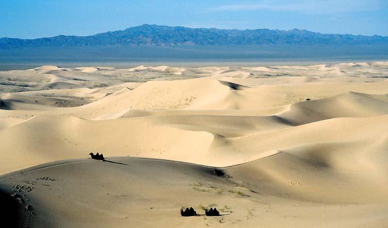
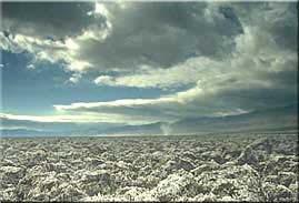
every continent has an extensive dry region! " deserts are as much as 1/3 of Earth s surface!
|
|
|
- Lewis Gardner
- 6 years ago
- Views:
Transcription
1 deserts!
2

3 deserts! every continent has an extensive dry region! " deserts are as much as 1/3 of Earth s surface! Hollywood portrayal of vast stretches of sand dune! " Sahara has only 10% covered by sand! " Arabian (sandiest) has only 30% covered by sand!

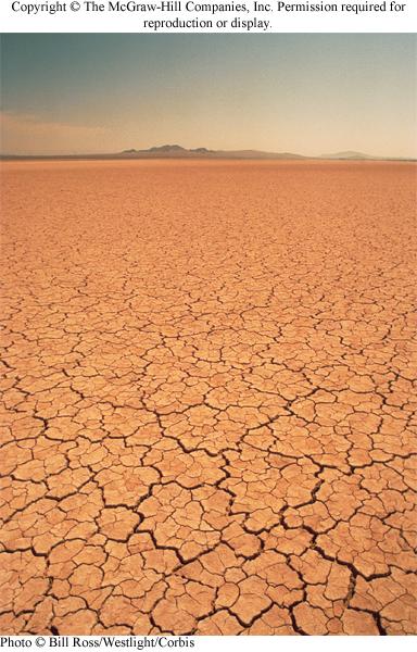
4 deserts! any region that receives < 25 cm (~10 inches) rain per year! despite this, running water is predominant force in landscape! flash floods produce most desert erosion!

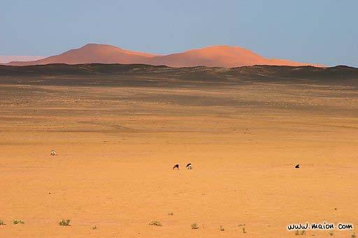
5 deserts are not deserted! vegetation that grows where rain < 25 cm per year!

6 deserts! aridity index! potential annual evaporation! recorded average annual precipitation! if index is > 4.0, evaporation is 4 times > precipitation! "--area is a desert! if index is 1.0, precipitation = potential for evaporation! "--area is humid! Atacama desert! 2 driest spots on planet:! Atacama Desert, Peru! and eastern Sahara! aridity index! ~200 (hyperarid)!
7
8
9


10 distribution of deserts! deserts can be found anywhere air is dry! global wind patterns! deserts associated! with descending air! at ~30 N or S latitude! (Hadley Cell)! hot, moist air rises in tropics! --loses moistures in atmosphere! --descends as dry air at 30!

!")
11 global wind zones! controls are:! solar heating,! atmospheric circulation,! Coriolis effect (rotation)! image source:

12 global distribution of rainfall (deserts)!

13 deserts: rain shadows! deserts also form downwind of where moist air rises! "over mountains!

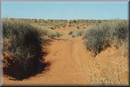
14 characteristics of deserts! streams flow intermittently! desert streambeds are dry most of the time! most deserts lack through-flowing streams! desert regions tend to have internal drainage, such that! "streams drain into land-locked basins! rain comes from occasional, often violent, thunderstorms! "producing flash flooding!
!")

15 characteristics of deserts! desert washes (arroyos)! are steep-sided! have flat sandy floors! result from rare, but highly erosive flash flooding events!

16 desert landforms of SW United States! 2 distinct landscapes! Colorado Plateau! Basin and Range!

17 Colorado plateau! flat-lying sediments that are heavily eroded! erosion produces characteristic landforms! plateaus! broad, flat-topped areas bounded by cliffs! mesas! flat-topped hills bounded by cliffs, capped by resistant rock! buttes! small, flat-topped hills, capped by resistant rock!
18 Monument Valley, UT (Colorado plateau)!

19 Book Cliffs, CO and UT (Colorado plateau)!

20 Basin and Range! linear mountains separated by flat-floored valleys! mountains are bounded by faults! narrow canyons carry sediment to valley floor during rains!

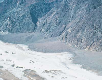
21 Basin and Range! landforms in the Basin and Range! plateaus! broad, flat-topped areas bounded by cliffs! alluvial fans! cone shaped sites of sediment accumulation at mouth of canyon! bajadas! overlapping and coalescing alluvial fans! playas! ephemeral, saline lakes that evaporate and leave minerals!

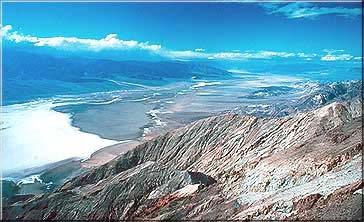
22 Death Valley (Basin and Range)! bajada! 3 km of relief! playa!

23 alluvial fans!
!")
24 bajada (coalesced alluvial fans)! satellite image!

25 downstream view to alluvial fan and playa!
26 playas!

27 Racetrack Playa, Death Valley! how did the rocks get here?!


28 Devil s Golf Course! Death Valley!

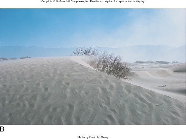
29 deserts: wind action! important agent for transportation and erosion! caused by large daily temperature and pressure changes! dust storms! occur if fine grained sediments are available!

30 dust storm!

! ventifacts!")
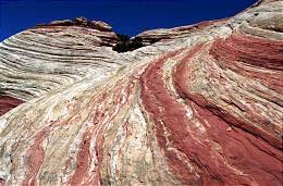
31 deserts: wind action! dust suspended by wind! larger sand grains move by saltation (bouncing)! ventifacts! formed by sand grains moving in high speed winds! sand blasting!


32 ventifacts! wind blowing in one direction abrades up wind rock faces! wind!

33 deserts: wind action! blowout and pillar formation! wind picks! up dry fine! sediment! and creates! blowout! vegetation holds! sediment! in place! and forms! pillar!
34 blowout! from:

35 sand pillar!


36 deserts: wind action! deflation: loss of fine grained material by wind transport! " and concentraton of coarse-grained particles! desert pavement! closely packed stones! left behind by! deflation!


37 deserts: wind action! loess: wind deposited clay and silt sized particles! " sources are glacial outwash and playas! forms fertile soils that erode easily! Iowa! Dust Bowl of 1930 s produced by! erosion of loess during drought!

38 global distribution of loess deposits!
!")
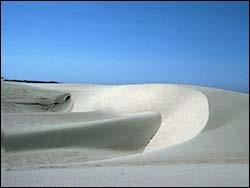
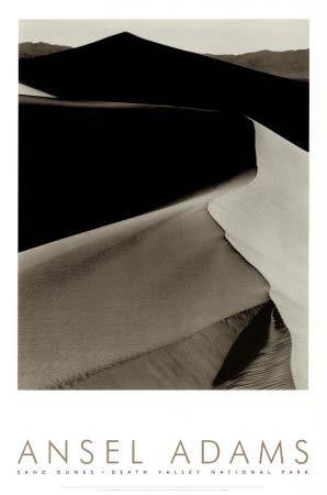
39 deserts: wind action! sand dunes: mounds of loose sand piled up by wind! large sand supply! winds that blow in same direction! dune migrates through time! sand erodes from and! blows up the! slope facing the wind! sand falls down the! down wind slope! (slipface)! and deposits! (calm air)!
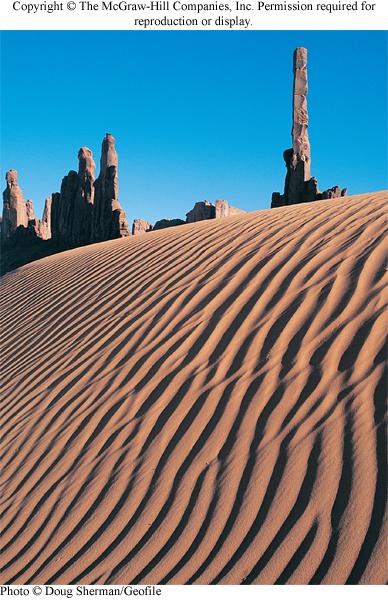
40 dunes!
 and amount of sand!")
41 types of sand dunes! controlled by dominant wind direction(s) and amount of sand! barchan! parabolic! transverse! longitudinal!


42 types of sand dunes! barchan! crescent shaped! horns point down wind! steep slip face on concave side! one direction of wind and limited sand supply!


43 types of sand dunes! transverse! straight! elongate! steep slip face! one direction of wind and large sand supply!

!")
44 types of sand dunes! parabolic! deeply curved! horns anchored by vegetation! convex in down wind direction (opposite to barchans)! one direction of wind and large sand supply!
, and straight!")

45 types of sand dunes! longitudinal! extremely long, high (100 s of meters), and straight! long axis parallel to prevailing wind direction! regularly spaced! area between dunes is swept clean of sand! cross winds may be important! large sand supply -- mechanism not fully understood!
46

47 sand dunes in the rock record! dunes migrate in wind direction, pile up, and lithify! each white line corresponds to dune surface at some point!

48 ancient sand dunes!

49 ancient sand dunes!

50 sand dunes on Mars (barchans)!
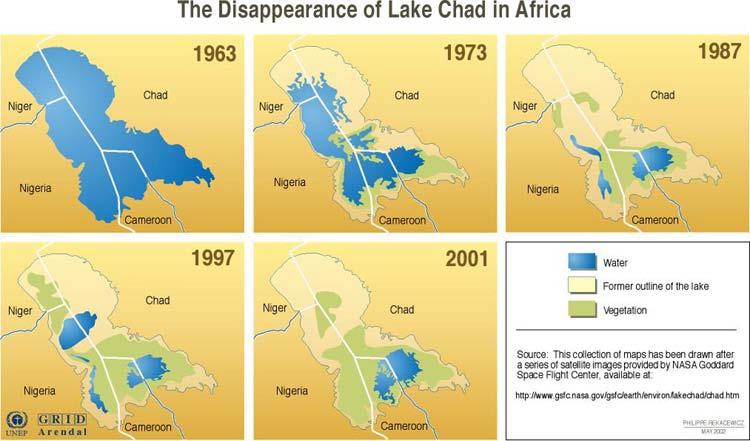
51 desertification! invasion of desert conditions into non-desert! significant lowering of water table! reduction in surface-water supply! increased salinity in waters and soils! destruction of native vegetation! accelerated rate of erosion! rapid in northern and western Africa for last 2000 years! 8000 to 2000 years ago, Namid Desert was fertile grassland! "that supported advanced Stone Age societies! 2 causes:! "1) natural: drought! "2) human-induced: overpopulation and mismanagement! Sahel--region south of Sahara--is hardest hit!
52

!")
53 Dust Bowl of 1930 s! drought and removal of prairie grass for agriculture! decrease in rainfall to < 20 inches per year! high winds swept away topsoil (no roots to hold it)! ended as rainfall increased and farm practices improved!
Physical Geology, 15/e
 Lecture Outlines Physical Geology, 15/e Plummer, Carlson & Hammersley Deserts & Wind Action Physical Geology 15/e, Chapter 13 Deserts Desert any arid region that receives less than 25 cm of precipitation
7/4/2018. Deserts and Winds
 1 2 3 4 5 6 7 8 9 10 11 12 13 14 15 16 17 18 Deserts and Winds Earth Chapter 19 Chapter 19 Deserts & Winds What Is Meant by Dry? A dry climate is one where yearly precipitation is not as great as the potential
Chapter 5: Glaciers and Deserts
 I. Glaciers and Glaciation Chapter 5: Glaciers and Deserts A. A thick mass of ice that forms over land from the compaction and recrystallization of snow and shows evidence of past or present flow B. Types
2/23/2009. Visualizing Earth Science. Chapter Overview. Deserts and Drylands. Glaciers and Ice Sheets
 Visualizing Earth Science By Z. Merali and B. F. Skinner Chapter 6 Deserts, Glaciers and Ice Sheets Chapter Overview Deserts and Drylands Glaciers and Ice Sheets Deserts Geography Categorization of deserts
Prentice Hall EARTH SCIENCE
 Prentice Hall EARTH SCIENCE Tarbuck Lutgens Chapter 7 Glaciers, Desert, and Wind 7.1 Glaciers Types of Glaciers A glacier is a thick ice mass that forms above the snowline over hundreds or thousands of
EOLIAN PROCESSES & LANDFORMS
 EOLIAN PROCESSES & LANDFORMS Wind can be an effective geomorphic agent under conditions of sparse vegetation & abundant unconsolidated sediment egs. hot & cold deserts, beaches & coastal regions, glacial
Name: Class: Date: Multiple Choice Identify the letter of the choice that best completes the statement or answers the question.
 Name: Class: Date: geology ch 7 test 2008 Multiple Choice Identify the letter of the choice that best completes the statement or answers the question. 1. Which of the following is true about ice sheets?
Lecture Outlines PowerPoint. Chapter 6 Earth Science 11e Tarbuck/Lutgens
 Lecture Outlines PowerPoint Chapter 6 Earth Science 11e Tarbuck/Lutgens 2006 Pearson Prentice Hall This work is protected by United States copyright laws and is provided solely for the use of instructors
Foundations of Earth Science, 6e Lutgens, Tarbuck, & Tasa
 Foundations of Earth Science, 6e Lutgens, Tarbuck, & Tasa Glacial and Arid Landscapes Foundations, 6e - Chapter 4 Stan Hatfield Southwestern Illinois College Glaciers Glaciers are parts of two basic cycles
Laboratory Exercise #4 Geologic Surface Processes in Dry Lands
 Page - 1 Laboratory Exercise #4 Geologic Surface Processes in Dry Lands Section A Overview of Lands with Dry Climates The definition of a dry climate is tied to an understanding of the hydrologic cycle
A ventifact. is a crescent-shaped sand dune lying at right angles to the prevailing wind.
 1. Match the definition to the process or landform. Hot environments processes and landforms is where unconsolidated, fine-grained particles are bounced along the ground by the wind. A ventifact is a form
Chapter 9 Notes: Ice and Glaciers, Wind and Deserts
 Chapter 9 Notes: Ice and Glaciers, Wind and Deserts *Glaciers and Glacial Features glacier is a mass of ice that moves over land under its own weight through the action of gravity Glacier Formation must
Erosion and Deposition
 Erosion and Deposition Erosion Sediment natural forces move rock/soil from one place to another. gravity, water, wind, glaciers, waves are causes material moved by erosion Deposition when erosion lays
Bell Ringer. Are soil and dirt the same material? In your explanation be sure to talk about plants.
 Bell Ringer Are soil and dirt the same material? In your explanation be sure to talk about plants. 5.3 Mass Movements Triggers of Mass Movements The transfer of rock and soil downslope due to gravity is
Anticipation guide # 3
 Wind Anticipation guide # 3 Creep is a type of mass movement that happens slowly over many years Oxidation is a type of physical weathering A delta is a depositional feature that occurs with glaciers The
MASS MOVEMENTS, WIND, AND GLACIERS
 Date Period Name MASS MOVEMENTS, WIND, AND GLACIERS SECTION.1 Mass Movements In your textbook, read about mass movements. Use each of the terms below just once to complete the passage. avalanche creep
Mass Movements, Wind, and Glaciers
 Mass Movements,, and Glaciers SECTION 8.1 Mass Movement at Earth s Surface In your textbook, read about mass movement. Use each of the terms below just once to complete the passage. avalanche creep landslide
Science EOG Review: Landforms
 Mathematician Science EOG Review: Landforms Vocabulary Definition Term canyon deep, large, V- shaped valley formed by a river over millions of years of erosion; sometimes called gorges (example: Linville
Weathering & Erosion
 Weathering & Erosion Weathering and Erosion Weathering - processes at or near Earth s surface that cause rocks and minerals to break down Erosion - process of removing Earth materials from their original
Erosion and Deposition
 CHAPTER 3 LESSON 2 Erosion and Deposition Landforms Shaped by Water and Wind Key Concepts What are the stages of stream development? How do water erosion and deposition change Earth s surface? How do wind
1/6/ th Grade Earth s Surface. Chapter 3: Erosion and Deposition. Lesson 1 (Mass Movement)
") Lesson 1 (Mass Movement) 7 th Grade Earth s Surface Chapter 3: Erosion and Deposition Weathering the chemical and physical processes that break down rock at Earth s surface Mechanical weathering when rock
Lesson 1 (Mass Movement) 7 th Grade Earth s Surface Chapter 3: Erosion and Deposition Weathering the chemical and physical processes that break down rock at Earth s surface Mechanical weathering when rock
EROSION AND DEPOSITION
 CHAPTER 8 EROSION AND DEPOSITION SECTION 8 1 Changing Earth s Surface (pages 252-255) This section explains how sediment is carried away and deposited elsewhere to wear down and build up Earth s surface.
The Effect of Weather, Erosion, and Deposition in Texas Ecoregions
 The Effect of Weather, Erosion, and Deposition in Texas Ecoregions 7.8B: I can analyze the effects of weathering, erosion, and deposition on the environment in ecoregions of Texas Weathering The breakdown
Essential Questions. What is erosion? What is mass wasting?
 Erosion Essential Questions What is erosion? What is mass wasting? What is Erosion? Erosion The transportation of sediment from one area to another Caused mainly by running water but also caused by glaciers,
The Agents of Erosion
 The Agents of Erosion 1. Erosion & Deposition 2. Water 3. Wind 4. Ice California Science Project 1 1. Erosion and Deposition Erosion is the physical removal and transport of material by mobile agents such
Changing Earth s Surface
 Name Date Class Changing Earth s Surface What processes wear down and build up Earth s surface? What causes the different types of mass movement? Erosion is the process by which natural forces move weathered
Chapter 3 Erosion and Deposition. The Big Question:
 Chapter 3 Erosion and Deposition The Big Question: 1 Design a way to represent and describe the 4 types of mass movement. You may use pictures, diagrams, list, web, chart, etc 2 Chapter 3: Erosion and
1 Shoreline Erosion and Deposition
 CHAPTER 12 1 Shoreline Erosion and Deposition SECTION Agents of Erosion and Deposition BEFORE YOU READ After you read this section, you should be able to answer these questions: What is a shoreline? How
Erosion Surface Water. moving, transporting, and depositing sediment.
 + Erosion Surface Water moving, transporting, and depositing sediment. + Surface Water 2 Water from rainfall can hit Earth s surface and do a number of things: Slowly soak into the ground: Infiltration
ES 105 Surface Processes I. Hydrologic cycle A. Distribution % in oceans 2. >3% surface water a. +99% surface water in glaciers b.
 ES 105 Surface Processes I. Hydrologic cycle A. Distribution 1. +97% in oceans 2. >3% surface water a. +99% surface water in glaciers b. >1/3% liquid, fresh water in streams and lakes~1/10,000 of water
Streams. Water. Hydrologic Cycle. Geol 104: Streams
 Streams Why study streams? Running water is the most important geologic agent in erosion, transportation and deposition of sediments. Water The unique physical and chemical properties of water make it
27. Running Water I (p ; )
") 27. Running Water I (p. 424-436; 440-444) Hydrosphere How much of the Earth s surface is covered by water? Earth's water is collectively called the and is stored in a number of so-called as follows: 1.
27. Running Water I (p. 424-436; 440-444) Hydrosphere How much of the Earth s surface is covered by water? Earth's water is collectively called the and is stored in a number of so-called as follows: 1.
3. The map below shows an eastern portion of North America. Points A and B represent locations on the eastern shoreline.
 1. Most tornadoes in the Northern Hemisphere are best described as violently rotating columns of air surrounded by A) clockwise surface winds moving toward the columns B) clockwise surface winds moving
Lab 9: Eolian and Arid Region Landforms
 Name: Lab 9: Eolian and Arid Region Landforms The objective of this lab is to familiarize yourself with a few basic desert and eolian landforms. Answer the following problems completely. You may need to
Chapter 10. Running Water aka Rivers. BFRB Pages
 Chapter 10 Running Water aka Rivers BFRB Pages 101-116 Stream Erosion and Transportation Running water is all precipitation (rain, snow, etc) that falls on Earth and is pulled downhill by gravity. Running
GEOL 1121 Earth Processes and Environments
 GEOL 1121 Earth Processes and Environments Wondwosen Seyoum Department of Geology University of Georgia e-mail: seyoum@uga.edu G/G Bldg., Rm. No. 122 Seyoum, 2015 Chapter 6 Streams and Flooding Seyoum,
Winds and Deserts CHAPTER 19. Chapter Summary
 CHAPTER 19 Winds and Deserts Chapter Summary Deserts are regions where evaporation exceeds precipitation. Desert regions on Earth are the result of: global air circulation patterns which generate a relatively
Dust Storm, Tunisia, (D. Heron Photo)
") Dust Storm, Tunisia, (D. Heron Photo) Many of The Images Used in This Presentation Were Obtained From a Web Site Constructed by Duncan Heron, Duke University Http://www.Geo.Duke.Edu/geo41/win.Htm Aeolian
Dust Storm, Tunisia, (D. Heron Photo) Many of The Images Used in This Presentation Were Obtained From a Web Site Constructed by Duncan Heron, Duke University Http://www.Geo.Duke.Edu/geo41/win.Htm Aeolian
Erosion and Deposition
 Erosion and Deposition The Erosion-Deposition Process What do you think? Read the two statements below and decide whether you agree or disagree with them. Place an A in the Before column if you agree with
Google Mars: Wind Processes
 Google Mars: Wind Processes This assignment will require the use of the latest version of Google Earth (version 5.0 or later), which you can download for free from http://earth.google.com. You must have
LECTURE #14: Extreme Heat & Desertification
 GEOL 0820 Ramsey Natural Disasters Spring, 2018 LECTURE #14: Extreme Heat & Desertification Date: 27 February 2018 (lecturer: Dr. Shawn Wright) I. Start of Part 2 of the Course weather-related disasters
Surface Water and Stream Development
 Surface Water and Stream Development Surface Water The moment a raindrop falls to earth it begins its return to the sea. Once water reaches Earth s surface it may evaporate back into the atmosphere, soak
4. The map below shows a meandering stream. Points A, B, C, and D represent locations along the stream bottom.
 1. Sediment is deposited as a river enters a lake because the A) velocity of the river decreases B) force of gravity decreases C) volume of water increases D) slope of the river increases 2. Which diagram
Fukien Secondary School Monthly Vocabulary/Expression List for EMI Subjects Secondary Two. Subject: Geography
 Focus: General Specific : Section Two : Unit One 1 Landslide 2 Downslope movement 3 Rock 4 Soil 5 Gravity 6 Natural hazard 7 Rainwater 8 Friction 9 Hilly relief 10 Unstable 11 Season 12 Saturated 13 Construction
EARTH S CHANGING SURFACE
 EARTH S CHANGING SURFACE Weathering Together, weathering and erosion work continuously to wear down the material on Earth s surface. weathering process that breaks down rock and other substances of Earth
8UNIT. External dynamics of the Earth. What do you remember? Key language. Content objectives
 8UNIT External dynamics of the Earth What do you remember? Can you name the solids in the photograph? nd the liquid? Is the liquid moving? How does it move? What is the name of this formation of water?
GEOL 440 Sedimentology and stratigraphy: processes, environments and deposits. Lectures 17 & 18: Aeolian Facies
 GEOL 440 Sedimentology and stratigraphy: processes, environments and deposits Lectures 17 & 18: Aeolian Facies Today: Processes air/water differences Deposits bedforms Facies a little on models and controls
Author: Joanna Bullard, Professor of Physical Geography, Department of Geography, Loughborough University
 Dryland Landscapes New A Level Subject Content Overview Author: Joanna Bullard, Professor of Physical Geography, Department of Geography, Loughborough University Introduction Drylands cover 40-50% of Earth
Ch. 8: Mass Movements, Wind and Glaciers
 Ch. 8: Mass Movements, Wind and Glaciers Every day the landscape around us undergoes changes. Changes that are powered by gravity alone are called mass movement or mass wasting. Mass movement includes
What is weathering and how does it change Earth s surface? Answer the question using
 7 th Grade Lesson What is weathering and how does it change Earth s surface? Answer the question using the sentence frame. You have 4 minutes. Weathering is. This changes the Earth s surface because. 1
Unit 4: Landscapes Practice Problems
 Name: Date: 1. Soil with the greatest porosity has particles that are A. poorly sorted and densely packed B. poorly sorted and loosely packed C. well sorted and densely packed D. well sorted and loosely
Read Across America. Listen as I read for facts about Volcanoes. In the Shadow of the Volcano
 Read Across America Listen as I read for facts about Volcanoes. In the Shadow of the Volcano Constructive & Destructive Processes Earth s surface is always changing. Blowing wind and flowing water causes
Physical Geography A Living Planet
 Physical Geography A Living Planet The geography and structure of the earth are continually being changed by internal forces, like plate tectonics, and external forces, like the weather. Iguaçu Falls at
Aeolian Environments. And Controls on Sedimentation. John Luchok, Kyle Balling, Cristopher Alvarez
 Aeolian Environments And Controls on Sedimentation John Luchok, Kyle Balling, Cristopher Alvarez The Aeolian Environment Aeolian Processes - geologic activity with regards to wind Desert Environments (Hyper-Arid,
Finding Mars on Earth Student Worksheet
 Finding Mars on Earth Student Worksheet by David V. Black Student Names: Date: Period: Instructions: Your job is to compare and contrast landforms on Earth with those on Mars to see if similar processes
Continental Landscapes
 Continental Landscapes Landscape influenced by tectonics, climate & differential weathering Most landforms developed within the last 2 million years System moves toward an equilibrium Continental Landscapes
core mantle crust the center of the Earth the middle layer of the Earth made up of molten (melted) rock
 rock") core the center of the Earth mantle the middle layer of the Earth made up of molten (melted) rock crust the surface layer of the Earth that includes the continents and oceans 1 continental drift the theory
core the center of the Earth mantle the middle layer of the Earth made up of molten (melted) rock crust the surface layer of the Earth that includes the continents and oceans 1 continental drift the theory
WHAT CAN MAPS TELL US ABOUT THE GEOGRAPHY OF ANCIENT GREECE? MAP TYPE 1: CLIMATE MAPS
 WHAT CAN MAPS TELL US ABOUT THE GEOGRAPHY OF ANCIENT GREECE? MAP TYPE 1: CLIMATE MAPS MAP TYPE 2: PHYSICAL AND/OR TOPOGRAPHICAL MAPS MAP TYPE 3: POLITICAL MAPS TYPE 4: RESOURCE & TRADE MAPS Descriptions
Namib Desert, Namibia DESERTS
 Namib Desert, Namibia DESERTS ORIGIN OF DESERTS - Hadley cells Rising air Figure 15.1 Distribution of deserts on Earth Figure 15.15 Deserts in time: Modern aeolian regions Glacial-maximum (18ka) aeolian
STUDY GUIDE FOR CONTENT MASTERY. Surface Water Movement
 Surface Water SECTION 9.1 Surface Water Movement In your textbook, read about surface water and the way in which it moves sediment. Complete each statement. 1. An excessive amount of water flowing downslope
Which map shows the stream drainage pattern that most likely formed on the surface of this volcano? A) B)
 B)") 1. When snow cover on the land melts, the water will most likely become surface runoff if the land surface is A) frozen B) porous C) grass covered D) unconsolidated gravel Base your answers to questions
1. When snow cover on the land melts, the water will most likely become surface runoff if the land surface is A) frozen B) porous C) grass covered D) unconsolidated gravel Base your answers to questions
Erosion and Deposition
 Erosion and Deposition Chapter Test A Multiple Choice Write the letter of the correct answer on the line at the left. 1. Water erosion begins when runoff from rainfall flows in a thin layer over the land
Weathering, Erosion and Deposition
 Weathering, Erosion and Deposition Shaping the Earth s Surface Weathering the process of breaking down rocks into smaller fragments Erosion the transport of rock fragments from one location to another
Weathering and Soil Formation. Chapter 10
 Weathering and Soil Formation Chapter 10 Old and New Mountains The Appalachian Mountains appear very different from the Sierra Mountains. The Appalachians are smaller, rounded, gently sloping, and covered
Chapter 2 Planet Earth
 Chapter 2 Planet Earth Section Notes Earth and the Sun s Energy Water on Earth The Land Close-up The Water Cycle World Almanac Major Eruptions in the Ring of Fire Quick Facts Chapter 2 Visual Summary Video
Name: Which rock layers appear to be most resistant to weathering? A) A, C, and E B) B and D
 A, C, and E B) B and D") Name: 1) The formation of soil is primarily the result of A) stream deposition and runoff B) precipitation and wind erosion C) stream erosion and mass movement D) weathering and biological activity 2)
Name: 1) The formation of soil is primarily the result of A) stream deposition and runoff B) precipitation and wind erosion C) stream erosion and mass movement D) weathering and biological activity 2)
Surface Events & Landforms. Mrs. Green
 Surface Events & Landforms Mrs. Green Bell Work 1) Which event MOST likely causes the slowest change to the surface of Earth? a) Earthquake b) Landslide c) Volcano d) Wind 2) When cold weather freezes
CHAPTER 4 NOTES -WEATHERING AND EROSION- LESSON 4.1: TYPES OF WEATHERING
 CHAPTER 4 NOTES -WEATHERING AND EROSION- LESSON 4.1: TYPES OF WEATHERING WEATHERING Weathering- the process by which rocks are broken down by the forces of nature. - the breakdown of large rocks into fragments
 12 10 8 6 4 2 0 40-50 50-60 60-70 70-80 80-90 90-100 Fresh Water What we will cover The Hydrologic Cycle River systems Floods Groundwater Caves and Karst Topography Hot springs Distribution of water in
1. Any process that causes rock to crack or break into pieces is called physical weathering. Initial product = final product
 Weathering 1. Any process that causes rock to crack or break into pieces is called physical weathering. Initial product = final product End Result of physical weathering is increased surface area. 2. Physical
How does erosion happen?
 How does erosion happen? By National Geographic, adapted by Newsela staff on 10.03.17 Word Count 682 Level 830L These rock formations, in Bryce Canyon National Park, Utah, are called hoodoos. Although
Unit 3 Review - Surface Processes
 Unit 3 Review - Surface Processes 1. Why is the surface of Mercury covered with meteor impact craters, while Earth s surface has relatively few craters? A) Mercury is larger than Earth, so it gets hit
Ecoregions Glossary. 7.8B: Changes To Texas Land Earth and Space
 Ecoregions Glossary Ecoregions The term ecoregions was developed by combining the terms ecology and region. Ecology is the study of the interrelationship of organisms and their environments. The term,
Our Environment Class 7 Questions on Give Reasons for quick revision for Competitive Exams
 Questions on Give reasons at the end of each Chapter Chapter 1 1. Man modifies his environment Man has tried to make life more comfortable for his own species on a continuous basis. For this he has learnt
Spring break reading. Glacial formation. Surface processes: Glaciers and deserts. The Control of Nature
 suggested Spring break reading The Control of Nature by John McPhee Surface processes: Glaciers and deserts describes our efforts to control three natural hazards: 1. The Mississippi Floods 2. The Heimaey
Geology 0800 Review for Third Exam, Fall 2014 Please read all the questions very carefully.
 Geology 0800 Name Review for Third Exam, Fall 2014 Please read all the questions very carefully. 1. The slope of a stream bed measured at some point along its course is the. a. base level b. floodplain
Biosphere. All living things, plants, animals, (even you!) are part of the zone of the earth called the biosphere.
 are part of the zone of the earth called the biosphere.") Unit 1 Study Guide Earth s Spheres Biosphere All living things, plants, animals, (even you!) are part of the zone of the earth called the biosphere. Hydrosphere Water covers ¾ of the earth, made up mostly
Unit 1 Study Guide Earth s Spheres Biosphere All living things, plants, animals, (even you!) are part of the zone of the earth called the biosphere. Hydrosphere Water covers ¾ of the earth, made up mostly
PHYSICAL GEOGRAPHY. By Brett Lucas
 PHYSICAL GEOGRAPHY By Brett Lucas FLUVIAL PROCESSES Fluvial Processes The Impact of Fluvial Processes on the Landscape Streams and Stream Systems Stream Channels Structural Relationships The Shaping and
What do you need for a Marathon?
 What do you need for a Marathon? Water and a snack? What about just a normal day? 1 flush = 3.5 gallons 1 flush = 3.5 gallons 10 minute shower = 20 gal 1 flush = 3.5 gallons 10 minute shower = 20 gal Jeans
FLUVIAL LANDFORMS. Floodplains
 FLUVIAL LANDFORMS Floodplains fairly flat & continuous surface occupying much of a valley bottom normally underlain by unconsolidated sediments subject to periodic flooding (usually once every year or
Landscape evolution. An Anthropic landscape is the landscape modified by humans for their activities and life
 Landforms Landscape evolution A Natural landscape is the original landscape that exists before it is acted upon by human culture. An Anthropic landscape is the landscape modified by humans for their activities
a) Piedmont: e) Monument: f) Plateau: g) Mesa: h) Butte: i) Playa: j) Perennial Stream:
 Piedmont: e) Monument: f) Plateau: g) Mesa: h) Butte: i) Playa: j) Perennial Stream:") Name: Lab day: Tuesday Wednesday CEEES/SC 10110L-20110L Planet Earth Laboratory Laboratory #11: Arid Environments & Landforms Readings: See handout at http://www.nd.edu/~cneal/physicalgeo/lab-deserts/index.html.
Name: Lab day: Tuesday Wednesday CEEES/SC 10110L-20110L Planet Earth Laboratory Laboratory #11: Arid Environments & Landforms Readings: See handout at http://www.nd.edu/~cneal/physicalgeo/lab-deserts/index.html.
Earth s Dynamic Surface
 Earth s Dynamic Surface Key Concepts What is the difference between physical and chemical weathering? How do water, ice, and wind change Earth s surface? Changing Earth s Surface What do you think? Read
11/12/2014. Running Water. Introduction. Water on Earth. The Hydrologic Cycle. Fluid Flow
 Introduction Mercury, Venus, Earth and Mars share a similar history, but Earth is the only terrestrial planet with abundant water! Mercury is too small and hot Venus has a runaway green house effect so
Your web browser (Safari 7) is out of date. For more security, comfort and the best experience on this site: Update your browser Ignore
 is out of date. For more security, comfort and the best experience on this site: Update your browser Ignore") Your web browser (Safari 7) is out of date. For more security, comfort and the best experience on this site: Update your browser Ignore ALLU VIAL FAN colluvial fan, debris cone For the complete encyclopedic
Your web browser (Safari 7) is out of date. For more security, comfort and the best experience on this site: Update your browser Ignore ALLU VIAL FAN colluvial fan, debris cone For the complete encyclopedic
Field Trips. Cacapon Mountain - Saturday
 Field Trips BRING LUNCH & drink, Bathrooms few & far between. In lieu of lab on 2 April Pick which trip If you can't make either one, see Kite http://www.weather.com/weather/weekend/uswv0507?from=search
Earth Science S5E1b (EarthScienceS5E1b)
") Name: Date: 1. The flattest part of the ocean floor is the A. trench. B. abyssal plain. C. continental shelf. D. mid-ocean rift valley. 2. Which causes some parts of the ocean to be saltier than other
Name: Date: 1. The flattest part of the ocean floor is the A. trench. B. abyssal plain. C. continental shelf. D. mid-ocean rift valley. 2. Which causes some parts of the ocean to be saltier than other
Unit 7.2 W.E.D. & Topography Test
 Name: Score: Unit 7.2 W.E.D. & Topography Test 1. 2. 3. 4. 5. 6. 7. 8. 9. 10. 11. 12. 13. 14. 15. 16. 17. 18. 19. 20. 21. 22. 23. 24. 25. 1. The formation of mountains is due mainly to while the destruction
Soil Formation. Lesson Plan: NRES B2-4
 Soil Formation Lesson Plan: NRES B2-4 1 Anticipated Problems 1. What are five different factors that affect soil formation? 2. What are some different types of parent material that affect soils? 3. What
6.E E Rock Cycle/Weathering/Soil
 Name: Date: 1. A lake is surrounded by hills covered with trees and shrubs. Which statement correctly describes how a change to the plants in this area will affect this environment? A. Adding plants to
Day 3 Weathering and Erosion.notebook. October 02, Section 7.2. Erosion and Deposition. Objectives
 Objectives Describe the relationship of gravity to all agents of erosion. Contrast the features left from different types of erosion. Analyze the impact of living and nonliving things on the processes
STAAR Science Tutorial 40 TEK 8.9C: Topographic Maps & Erosional Landforms
 Name: Teacher: Pd. Date: STAAR Science Tutorial 40 TEK 8.9C: Topographic Maps & Erosional Landforms TEK 8.9C: Interpret topographic maps and satellite views to identify land and erosional features and
GEL 109 Midterm W01, Page points total (1 point per minute is a good pace, but it is good to have time to recheck your answers!
 GEL 109 Midterm W01, Page 1 50 points total (1 point per minute is a good pace, but it is good to have time to recheck your answers!) 1. Where in a water flow is there usually a zone of laminar flow even
Lab 7: Sedimentary Structures
 Name: Lab 7: Sedimentary Structures Sedimentary rocks account for a negligibly small fraction of Earth s mass, yet they are commonly encountered because the processes that form them are ubiquitous in the
1. The diagram below shows the stump of a tree whose root grew into a small crack in bedrock and split the rock apart.
 1. The diagram below shows the stump of a tree whose root grew into a small crack in bedrock and split the rock apart. 4. Which process involves either a physical or chemical breakdown of earth materials?
STREAM SYSTEMS and FLOODS
 STREAM SYSTEMS and FLOODS The Hydrologic Cycle Precipitation Evaporation Infiltration Runoff Transpiration Earth s Water and the Hydrologic Cycle The Hydrologic Cycle The Hydrologic Cycle Oceans not filling
Precipitation Evaporation Infiltration Earth s Water and the Hydrologic Cycle. Runoff Transpiration
 STREAM SYSTEMS and FLOODS The Hydrologic Cycle Precipitation Evaporation Infiltration Earth s Water and the Hydrologic Cycle Runoff Transpiration The Hydrologic Cycle The Hydrologic Cycle Oceans not filling
Summary. Streams and Drainage Systems
 Streams and Drainage Systems Summary Streams are part of the hydrologic cycle and the chief means by which water returns from the land to the sea. They help shape the Earth s surface and transport sediment
1. Erosion by Running Water Most powerful cause of erosion
 I. Destructive Forces Notes: Destructive force: a process in which land is destroyed or changed such as weathering and erosion. All landforms are a result of a combination of constructive and destructive
SCIENCE TEST1 (VWILLIAMSSCIENCETEST1)
") Name: Date: 1. In which of the following areas would soil erosion MOST LIKELY occur if they received the same amount of rainfall? A. a forest B. flat agricultural lands C. agricultural lands on steep slopes
Name: Date: 1. In which of the following areas would soil erosion MOST LIKELY occur if they received the same amount of rainfall? A. a forest B. flat agricultural lands C. agricultural lands on steep slopes