IIHR - Hydroscience & Engineering The University of Iowa Iowa City, Iowa
|
|
|
- Stanley Richard
- 5 years ago
- Views:
Transcription
1 The Effects of Agriculture Management Practices on Hydrologic Forcing at the Watershed Scale Under Various Hydrologic Conditions by Thanos Papanicolaou IIHR - Hydroscience & Engineering The University of Iowa Iowa City, Iowa


2 Processes of upland erosion and sediment conveyance Watershed erosion processes starts with the interrill erosion where soil particle detaches by rain drop impact and gets delivered into the rills by sheet flow.
3 Hypothesis Although precipitation is the driving mechanism of water erosion, land use and associated management practices may be the major control of long-term erosion in small agricultural watersheds such as the headwaters of Clear Creek, IA (South Amana)

4 Study Site
5 Clear Creek is an ideal place to test our hypothesis ~90% of the land use within the SASW is as follows: FTC-NTB (31.1%) NTB-STC (25.1%) NTC-FTB (22.8%) CRP, hay and pasture (7.9%)
6 Study Rational The few existing watershed scale studies do not provide a systematic representation of the heterogeneity of different physical and biogeochemical constituents in a watershed. We argue that continuous simulations via distributed, physically based NPS modeling complemented with long-term observations (e.g., weather, land management practices) can provide an improved and scientifically based understanding of the role that land use and associated management practices play on long-term net erosion at significant scales. A hindrance to performing continuous distributed simulations is the lack of long-term available data, especially at large scales. As a result, very few models are calibrated and verified (e.g. Yu et al., 2000). Also, there is a misconception in some of the literature that physically based models do not require calibration as it is pointed in the ingenious work by Vieux (2004).
7 Objective The overarching objective of this research is to provide an improved understanding of the longterm role of land use and associated management practices on net erosion in intense agricultural watersheds under different hydrologic conditions by utilizing an established, physically based, distributed parameter model.
8 NPS model selection criteria Water Erosion Prediction Project (WEPP version ) was employed to simulate runoff and erosion processes in the study site.this is the latest version of WEPP and has extensive improvements to the winter hydrology and frost/thaw calculations; The hydrology extension of ESRI s ArcGIS version 9.2 is used to map the drainage network structure component for flow and sediment routing (Wu et al., 2002; Dun et al., 2006; Dun et al., 2007). The Windows interface slope editor of the latest WEPP model version ( ) supports up to 50 segments per hillslope, thus allowing a more accurate representation of the landscape geometry in terms of hillslope gradient and curvature.
.")
9 Water Erosion Prediction Project model structure Weather The effective hydraulic conductivity is a key hydraulic soil parameter that determines the amount of estimated runoff (Nearing et al., 1990; Schoeneberger and Wysocki, 2005). Key soil parameters affecting the rate of net erosion during an event are the critical erosional strength and rill/interrill erodibilities (Tiscareno-Lopez et al., 1993; Pieri et al., 2007). Pedotransfer functions (PTFs) have been developed, and built in WEPP for these key soil parameters.
10 Water Erosion Prediction Project model structure Detachment, transport and deposition of sediment in rills are calculated by employing a steady state solution to the 1-D sediment continuity equation (Foster et al., 1995): where G is sediment load (kg.s 1.m 1 ), x represents distance downslope (m), D f is rill erosion rate (kg.s 1.m 2 ), and D i is interrill sediment delivery to the rill (kg.s 1.m 2 ). Similarly, sediment conveyance within channels are also calculated by a steady-state solution to the 1-D sediment continuity equation (Ascough et al., 1995).
11 Water Erosion Prediction Project model structure Baseline hydraulic conductivity, K b (mm/hr) Baseline interrill erodibility, K ib (kg.s.m -4 ) Baseline rill erodibility, K rb (s.m -1 ) and the baseline critical erosional strength, τ cb (Pa)
12 Weather WEPP inputs
13 Water Erosion Prediction Project model structure Effective hydraulic conductivity, K e (mm/hr) Adjusted interrill erodibility, K iadj, (kg.s.m -4 ) Adjusted rill erodibility, K radj (s.m -1 ) Adjusted critical erosional strength, τ cadj (Pa)
14 Weather WEPP inputs
15 Weather For the continuous WEPP simulations two sources of precipitation (P) data were employed: 1) CLIGEN; 2) NCEP Stage IV data through IOWA Mesonet. Daily Monthly Yearly Mesonet CLIGEN Mesonet CLIGEN Mesonet CLIGEN Mean amount of (P) (mm) Standard deviation of (P) (mm) Maximum amount (mm) Mean # of raindays/year NA NA NA NA CLIGEN overpredicted daily amounts but underpredicted the average number of raindays per year. Similar to Zhang and Garbrecht (2003), these two balanced each other in the long-term and resulted in accurate annual precipitation estimates for continuous WEPP simulations.


16 Topography and drainage network structure 30 m resolution USGS National Elevation Dataset was employed. The hydrology extension of ESRI s ArcGIS version 9.2 was utilized to map the flow directions. The drainage network structure of the WEPP model was developed for the SASW which comprises of 135 hillslopes and 87 channels.
; and Colo (formed from alluvium) soil types comprised approximately 80% of the total acreage.")
17 Soils ISPAID and SSURGO Databases were utilized. Tama, Downs (formed from Peorian loess); and Colo (formed from alluvium) soil types comprised approximately 80% of the total acreage. ~225 topsoil surface samples were analyzed for important soil biogeochemical properties. Soil cores were collected for soil profile characterization.


18 Soils c b d a


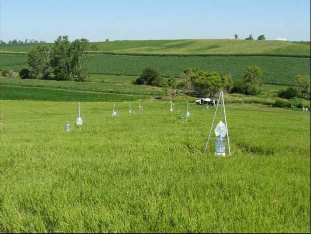

19 Keff measurements
20 The automated Amoozemeter & DRI measurements


21 The automated Amoozemeter & DRI measurements


22 Rill, interrill erodibility & τ c measurements


23 Rill, interrill erodibility & τ c measurements

 NTC-FTB (22.")
24 Land use and management practices ~90% of the land use within the SASW is as follows: FTC-NTB (31.1%) NTB-STC (25.1%) NTC-FTB (22.8%) CRP, hay and pasture (7.9%)


25 Outlet Measurements
26 WEPP calibration Calibration of WEPP was performed by adjusting the key parameters within physical ranges
27 WEPP model calibration A 100 years CLIGEN generated weather data was employed for the calibration simulation to: 1) account for average weather conditions; 2) reach steady conditions with the WEPP model results. First, the hydrologic component was calibrated through the K b Next, the upland erosion component was calibrated via τ c, K i and K r Finally, the sediment component was calibrated by adjusting Manning s n and channel erodibility.
28 Physical ranges for the key parameters Parameter Range Reference Colo, Tama and Downs soil types Interrill erodibility 1E5-1E7 kg.s.m -4 Elliot et al. 1989, Papanicolaou et al Rill erodibility s/m Elliot et al. 1989, Gilley et al Critical erosional strength Pa Elliot et al. 1989, Gilley et al. 1993, Julian &Torres 2006 Effective hydraulic conductivity mm/hr Bouwer 1969, Chow et al. 1988, Risse et al., 1995 Tillage - Ripple coulters PRB on rill/interrill areas for non-fragile crops % Al-Kaisi and Hanna 2002 PRB on rill/interrill areas for fragile crops % Al-Kaisi and Hanna 2002 Random roughness value after tillage cm Alberts et al. 1995, Gilley and Finkner 1991 Surface area disturbed % USDA-NRCS-Williamsburg Office (Personal contact) Clear Creek Manning's n for bare soil in channel Phillips and Tadayon 2006 Total Manning's n allowing for vegetation Phillips and Tadayon 2006 Channel erodibility factor s/m Elliot et al PRB for percent residue buried


29 WEPP model calibration In order to smoothen out the short-term fluctuations and highlight the long-term trends, a 5 year moving-average was applied to both water discharge and sediment flux time series.
30 WEPP model calibration As the final step for calibration assessment, a relationship of sediment delivery ratio to the drainage area was developed by delineating all the nested subcatchments within SASW to the smallest scale possible (i.e., hillslope scale).
31 WEPP model calibration
32 WEPP validation
33 WEPP model validation Validation on a daily basis is not common due to immense data requirement. Additionally, time shifts in the precipitation and flow data can make the task even more difficult to accurately accomplish (Benaman et al., 2005). Validation of the WEPP model was performed based on monthly and yearly time series for the period without making any further adjustments to the governing parameters. The NCEP Stage IV data was used for the WEPP model weather data input.
34 WEPP model validation Monthly predicted loads agreed well with the measured quantities. However, the WEPP model had a tendency to underpredict large monthly loads.
35 WEPP model validation Goodness of fit statistics Monthly Yearly Water Dis. Sed. Dis. Water Dis. Sed. Dis. R Mean [P/O] E f Yearly predictions were slightly better as expected.
36 WEPP model predictions


37 WEPP model predictions
38 Conclusions 1) Results of this study showed that for all crop rotations, a strong correspondence existed between net erosion fluxes and high magnitude precipitation events during the period of mid-april and late July, as expected. The magnitude of this correspondence, however, was strongly affected by the crop rotation characteristics, such as canopy/residue cover provided by the crop, and the type and associated timing of tillage.
39 Conclusions 2) Tillage type (i.e., primary and secondary tillages) affected the roughness of the soil surface and resulted in increases of the rill/interrill erodibilities up to 35% and 300%, respectively. Particularly, the NTC-FTB crop rotation, being the most intense land use in terms of tillage operations, caused the highest average annual erosion rate within the SASW yielding quadrupled erosion rates comparatively to NTB-STC.
40 Conclusions 3) Timing of operations affected the life-time of residue cover and as a result the degree of protection that residue cover offers against the water action on soil surface. In the case of NTC-FTB crop rotation, dense corn residue stayed on the ground for only 40 days, whereas for the other two rotations corn residue provided a protective layer for nearly 7 months, lessening thus the degree of net erosion. The cumulative effects of tillage type and timing in conjunction to canopy/residue cover led to the overall conclusion that land management practices can significantly amplify or deamplify the impact of precipitation on long-term net erosion in small agricultural watersheds.


41 WEPP model predictions Heterogeneous Model Homogeneous Model Sediment Yield = 5004 tons/yr Sediment Yield = 5794 tons/yr
42 Future directions 1) Better estimation of Random Roughness variability Random roughness decay with time after tillage is predicted from a modified relationship of Potter (1990): where RR t is the random roughness at time t (m), C br is the adjustment factor for buried residue, R c is the cumulative rainfall since tillage (m), and b is a coefficient.
43 2) The transectionally averaged sheetflow sediment concentration where,, are respectively, the averaged sheetflow depth, sediment concentration, and raindrop erosion rate at the scale of a hillslope transect; is transect-scale mean parameter vector for interrill areas ( ) ( ) ( ) = S i j r r j i x j i x S c h r r r K r r r K x t c h 2 3/ 0 2 0, cov ( ) ( ) ( ) S i j r r j i y j i y ir rd S c h r r r K r r r K D 2 3/ 0 2, cov = = ρ ρ c s 0 h s c rd D r Future directions
44 Future directions K = C S + x y z z K = C S + 2 [ 1 ( S S ) ] 1/ 4 1/ 2 0 x / 0 y / 0x 2 [ 1 ( S S ) ] 1/ 4 1/ 2 0 y / 0x / 0 y where C z is Chezy s roughness coefficient; S ox and S oy respectively are the bed slopes in x and y directions ρ ( λ ) ir = Nro / 1 ra λua where N ro is rill occurrence density; λ ra is rill surface proportion and λ ua is unsaturated surface proportion of a hillslope transect length.
45 Future directions 3) Linking WEPP with daily CENTURY for SOM Soil temperature plant production Plant carbon Deposition and fixation Plant nutrients Soil moisture TEMPERATUR E PRECIPITATIO N Decomposition rate SOIL TEXTURE Lignin content Soil carbo n Litterfall/ death Soil nutrients available (mineralize d) nutrients Hydrological model Microbial respiration Leaching removal MANAGEMENT (burning, grazing, harvesting, tillage)
46 Future directions WEPP erosion inputs to CENTURY Period 1: Initialization Prairie 81 year Simulation Val ue Units Average Annual Precipitation inches Average Annual Runoff 4.02 inches Average Annual Soil Loss ton/a Average Annual Sediment Yield ton/a Period 2: Corn, Corn, Oats-Meadow (3 yr. crop rotation) 45 year Simulation Val ue Units Average Annual Precipitation inches Average Annual Runoff 6.08 inches Average Annual Soil Loss ton/a Average Annual Sediment Yield ton/a Period 3: Corn, Corn and Soybean (3 yr. crop rotation) 15 year Simulation Val ue Units Average Annual Precipitation inches Average Annual Runoff 5.72 inches Average Annual Soil Loss ton/a Average Annual Sediment Yield ton/a Period 4and 5a: Corn-Soybean (2 yr. crop rotation) 110 year Simulation Val ue Units Average Annual Precipitation inches Average Annual Runoff 5.48 inches Average Annual Soil Loss ton/a Average Annual Sediment Yield ton/a Period 5b: Continuous Corn Period 93 year Simulation Val ue Units Average Annual Precipitation inches Average Annual Runoff 4.76 inches Average Annual Soil Loss ton/a Average Annual Sediment Yield ton/a
47 End of presentation!!!
Conservation Planning evaluate land management alternatives to reduce soil erosion to acceptable levels. Resource Inventories estimate current and
 Conservation Planning evaluate land management alternatives to reduce soil erosion to acceptable levels. Resource Inventories estimate current and projected erosion levels and their impact on natural resource
WEPP: MODEL USE, CALIBRATION,
 WEPP: MODEL USE, CALIBRATION, AND VALIDATION D. C. Flanagan, J. R. Frankenberger, J. C. Ascough II ABSTRACT. The Water Erosion Prediction Project (WEPP) model is a process-based, continuous simulation,
KINEROS2/AGWA. Fig. 1. Schematic view (Woolhiser et al., 1990).
.") KINEROS2/AGWA Introduction Kineros2 (KINematic runoff and EROSion) (K2) model was originated at the USDA-ARS in late 1960s and released until 1990 (Smith et al., 1995; Woolhiser et al., 1990). The spatial
KINEROS2/AGWA Introduction Kineros2 (KINematic runoff and EROSion) (K2) model was originated at the USDA-ARS in late 1960s and released until 1990 (Smith et al., 1995; Woolhiser et al., 1990). The spatial
Modeling soil erosion by water on agricultural land in Cenei, Timiş County, Romania
 Modeling soil erosion by water on agricultural land in Cenei, Timiş County, Romania GEORGE NARCIS PELEA, IOANA ALINA COSTESCU, ERIKA BEILICCI, TEODOR EUGEN MAN, ROBERT BEILICCI Faculty of Civil Engineering,
Watershed Conservation Management Planning Using the Integrated Field & Channel Technology of AnnAGNPS & CONCEPTS
 Watershed Conservation Management Planning Using the Integrated Field & Channel Technology of AnnAGNPS & CONCEPTS Eddy Langendoen Ron Bingner USDA-ARS National Sedimentation Laboratory, Oxford, Mississippi
Chapter 1. OVERVIEW OF THE WEPP EROSION PREDICTION MODEL
 1.1 Chapter 1. OVERVIEW OF THE WEPP EROSION PREDICTION MODEL D.C. Flanagan, J.C. Ascough II, A.D. Nicks, M.A. Nearing and J.M. Laflen 1.1 Introduction The USDA - Water Erosion Prediction Project (WEPP)
Regionalization Methods for Watershed Management - Hydrology and Soil Erosion from Point to Regional Scales
 This paper was peer-reviewed for scientific content. Pages 1062-1067. In: D.E. Stott, R.H. Mohtar and G.C. Steinhardt (eds). 2001. Sustaining the Global Farm. Selected papers from the 10th International
Development of a GIS Interface for WEPP Model Application to Great Lakes Forested Watersheds
 Development of a GIS Interface for WEPP Model Application to Great Lakes Forested Watersheds J.R. Frankenberger 1, S. Dun 2, D.C. Flanagan 1, J.Q. Wu 2, W.J. Elliot 3 1 USDA-ARS, West Lafayette, IN 2 Washington
Watershed Application of WEPP and Geospatial Interfaces. Dennis C. Flanagan
 Watershed Application of WEPP and Geospatial Interfaces Dennis C. Flanagan Research Agricultural Engineer USDA-Agricultural Research Service Adjunct Professor Purdue Univ., Dept. of Agric. & Biol. Eng.
CHAPTER 2 LITERATURE REVIEW
 7 CHAPTER 2 LITERATURE REVIEW A broad understanding of various topics in environmental science and modeling technology was required to complete the studies presented in this thesis, and it is important
Great Lakes Online Watershed Interface W. Elliot, Research Engineer USDA Forest Service Rocky Mountain Research Station, Moscow, ID March, 2016
 Great Lakes Online Watershed Interface W. Elliot, Research Engineer USDA Forest Service Rocky Mountain Research Station, Moscow, ID March, 2016 Guidelines for using the Web WEPP Watershed Tool to Support
A probabilistic approach to modeling postfire erosion after the 2009 Australian bushfires
 18 th World IMACS / MODSIM Congress, Cairns, Australia 13-17 July 2009 http://mssanz.org.au/modsim09 A probabilistic approach to modeling postfire erosion after the 2009 Australian bushfires P.R. Robichaud
Chapter 10. HYDRAULICS OF OVERLAND FLOW
 10.1 Chapter 10. HYDRAULICS OF OVERLAND FLOW J.E. Gilley and M.A. Weltz 10.1 Introduction Proper identification of hydraulic parameters is essential for the operation of other WEPP model components. Routing
PREDICTING BACKGROUND AND RISK-BASED SEDIMENTATION FOR FOREST WATERSHED TMDLS
 This is not a peer-reviewed article. Watershed Management to Meet Water Quality Standards and TMDLS (Total Maximum Daily Load) Proceedings of the Fourth Conference 10-14 March 2007 (San Antonio, Texas
REPRESENTATIVE HILLSLOPE METHODS FOR APPLYING
 REPRESENTATIVE HILLSLOPE METHODS FOR APPLYING THE WEPP MODEL WITH DEMS AND GIS T. A. Cochrane, D. C. Flanagan ABSTRACT. In watershed modeling with WEPP, the process of manually identifying hillslopes and
2 Development of a Physically Based Hydrologic Model of the Upper Cosumnes Basin
 2 Development of a Physically Based Hydrologic Model of the Upper Cosumnes Basin 2.1 Introduction The physically based watershed hydrologic model, WEHY (watershed environmental hydrology) model (Kavvas
ADAPTING WEPP (WATER EROSION PREDICTION PROJECT) FOR FOREST WATERSHED EROSION MODELING SHUHUI DUN
 FOR FOREST WATERSHED EROSION MODELING SHUHUI DUN") ADAPTING WEPP (WATER EROSION PREDICTION PROJECT) FOR FOREST WATERSHED EROSION MODELING By SHUHUI DUN A thesis submitted in partial fulfillment of the requirements for the degree of MASTER OF SCIENCE IN
ADAPTING WEPP (WATER EROSION PREDICTION PROJECT) FOR FOREST WATERSHED EROSION MODELING By SHUHUI DUN A thesis submitted in partial fulfillment of the requirements for the degree of MASTER OF SCIENCE IN
Each basin is surrounded & defined by a drainage divide (high point from which water flows away) Channel initiation
 Channel initiation") DRAINAGE BASINS A drainage basin or watershed is defined from a downstream point, working upstream, to include all of the hillslope & channel areas which drain to that point Each basin is surrounded &
DRAINAGE BASINS A drainage basin or watershed is defined from a downstream point, working upstream, to include all of the hillslope & channel areas which drain to that point Each basin is surrounded &
Model Integration - How WEPP inputs are calculated from GIS data. ( ArcGIS,TOPAZ, Topwepp)
") Model Integration - How WEPP inputs are calculated from GIS data. ( ArcGIS,TOPAZ, Topwepp) ArcGIS 9.1-9.3 Allows user to locate area of interest, assemble grids, visualize outputs. TOPAZ Performs DEM
Model Integration - How WEPP inputs are calculated from GIS data. ( ArcGIS,TOPAZ, Topwepp) ArcGIS 9.1-9.3 Allows user to locate area of interest, assemble grids, visualize outputs. TOPAZ Performs DEM
 W. Elliot, PE, PhD USDA Forest Service, Rocky Mountain Research Station Moscow, Idaho Version: April, 2017 WEPP PEP The Water Erosion Prediction Project (WEPP) Post Fire Erosion Predictor (PEP) is an online
Technical Memorandum No
 Pajaro River Watershed Study in association with Technical Memorandum No. 1.2.10 Task: Evaluation of Four Watershed Conditions - Sediment To: PRWFPA Staff Working Group Prepared by: Gregory Morris and
EXECUTIVE SUMMARY MANAGEMENT OF NONPOINT SOURCE POLLUTION AN INTEGRATIVE GIS-ANNAGNPS MODEL SEPTEMBER 2003
 EXECUTIVE SUMMARY MANAGEMENT OF NONPOINT SOURCE POLLUTION AN INTEGRATIVE GIS-ANNAGNPS MODEL SEPTEMBER 2003 CENTRAL PLAINS CENTER FOR BIOASSESSMENT KANSAS BIOLOGICAL SURVEY AND KANSAS GEOLOGICAL SURVEY
Adapting WEPP (Water Erosion Prediction Project) for Forest Watershed Erosion Modeling
 for Forest Watershed Erosion Modeling") Adapting WEPP (Water Erosion Prediction Project) for Forest Watershed Erosion Modeling Joan Q. Wu Arthur C. Xu William J. Elliot Department of Biological Systems Engineering Rocky Mountain Research Station
Adapting WEPP (Water Erosion Prediction Project) for Forest Watershed Erosion Modeling Joan Q. Wu Arthur C. Xu William J. Elliot Department of Biological Systems Engineering Rocky Mountain Research Station
Roger Andy Gaines, Research Civil Engineer, PhD, P.E.
 Roger Andy Gaines, Research Civil Engineer, PhD, P.E. Research Civil Engineer/Regional Technical Specialist Memphis District August 24, 2010 Objectives Where we have been (recap of situation and what s
Application of an Enhanced, Fine-Scale SWAT Model to Target Land Management Practices for Maximizing Pollutant Reduction and Conservation Benefits
 Application of an Enhanced, Fine-Scale SWAT Model to Target Land Management Practices for Maximizing Pollutant Reduction and Conservation Benefits Amanda Flynn, Todd Redder, Joe DePinto, Derek Schlea Brian
Application of the WEPP model with digital geographic information GIS/EM4 No. 149
 4th International Conference on Integrating GIS and Environmental Modeling (GIS/EM4): Problems, Prospects and Research Needs. Banff, Alberta, Canada, September 2-8, 2000. Application of the WEPP model
Updating Slope Topography During Erosion Simulations with the Water Erosion Prediction Project
 This paper was peer-reviewed for scientific content. Pages 882-887. In: D.E. Stott, R.H. Mohtar and G.C. Steinhardt (eds). 2001. Sustaining the Global Farm. Selected papers from the 10th International
USDA-Agricultural Research Service (ARS)
") THE WEPP WATERSHED MODEL: I. HYDROLOGY AND EROSION J. C. Ascough II, C. Baffaut, M. A. Nearing, B. Y. Liu ABSTRACT. The Water Erosion Prediction Project (WEPP) watershed scale model is a continuous simulation
THE WEPP WATERSHED MODEL: I. HYDROLOGY AND EROSION J. C. Ascough II, C. Baffaut, M. A. Nearing, B. Y. Liu ABSTRACT. The Water Erosion Prediction Project (WEPP) watershed scale model is a continuous simulation
Overview of fluvial and geotechnical processes for TMDL assessment
 Overview of fluvial and geotechnical processes for TMDL assessment Christian F Lenhart, Assistant Prof, MSU Research Assoc., U of M Biosystems Engineering Fluvial processes in a glaciated landscape Martin
A SEDIMENT COMPOSITE FINGERPRINTING TOOL: A FIELD- BASED QUANTIFICATION METHOD OF THE SEDIMENT ORIGIN WITHIN A WATER ENVIRONMENT- A PILOT STUDY
 A SEDIMENT COMPOSITE FINGERPRINTING TOOL: A FIELD- BASED QUANTIFICATION METHOD OF THE SEDIMENT ORIGIN WITHIN A WATER ENVIRONMENT- A PILOT STUDY by Thanos Papanicolaou, Ozan Abaci, and Ranjani Theregowda
HYDRAULIC MODELING OF SOIL ERORION
 18-21 August 28, Daejeon, Korea HYDRAULIC MODELING OF SOIL ERORION Liu Qing-quan Institute of Mechanics, Chinese Academy of Sciences, Beijing 18, China. Email: qqliu@imech.ac.cn ABSTRACT: The prediction
SMALL WATERSHED MODELING WITH WEPP USING GRID-BASED DEMS AND GIS
 Paper No. 993089 An ASAE Meeting Presentation SMALL WATERSHED MODELING WITH WEPP USING GRID-BASED DEMS AND GIS by T. A. Cochrane and D.C. Flanagan Agricultural and Biological Engineering Department and
VARIABLE SOURCE AREA HYDROLOGY MODELING WITH THE WATER EROSION PREDICTION PROJECT MODEL 1
 Vol. 51, No. 2 AMERICAN WATER RESOURCES ASSOCIATION April 2015 VARIABLE SOURCE AREA HYDROLOGY MODELING WITH THE WATER EROSION PREDICTION PROJECT MODEL 1 Jan Boll, Erin S. Brooks, Brian Crabtree, Shuhui
LI Yong (1,2), FRIELINGHAUS Monika (1), BORK Hans-Rudolf (1), WU Shuxia (2), ZHU Yongyi (2)
, FRIELINGHAUS Monika (1), BORK Hans-Rudolf (1), WU Shuxia (2), ZHU Yongyi (2)") Scientific registration n : Symposium n : 31 Presentation : poster Spatial patterns of soil redistribution and sediment delivery in hilly landscapes of the Loess Plateau Motifs spaciaux de zones d'érosion
Scientific registration n : Symposium n : 31 Presentation : poster Spatial patterns of soil redistribution and sediment delivery in hilly landscapes of the Loess Plateau Motifs spaciaux de zones d'érosion
Drainage Basin Geomorphology. Nick Odoni s Slope Profile Model
 Drainage Basin Geomorphology Nick Odoni s Slope Profile Model Odoni s Slope Profile Model This model is based on solving the mass balance (sediment budget) equation for a hillslope profile This is achieved
The Iowa Watershed Approach
 A vision for a more resilient Iowa Larry Weber Director, IIHR Hydroscience & Engineering Larry-weber@uiowa.edu 1 Kickoff Iowa Grant meeting Award: follow-up $96,887,177 2 How can we stay informed about
Modeling Upland and Channel Sources of Sediment in the Le Sueur River Watershed, Minnesota
 Modeling Upland and Channel Sources of Sediment in the Le Sueur River Watershed, Minnesota Solomon Folle and David Mulla Department of Soil, Water and Climate University of Minnesota August 6, 2009 5 th
A rational method for estimating erodibility and critical shear stress of an eroding rill
 Available online at www.sciencedirect.com Geoderma 144 (2008) 628 633 www.elsevier.com/locate/geoderma A rational method for estimating erodibility and critical shear stress of an eroding rill T.W. Lei
Water Quality and Water Quantity: Two sides of the Same Coin. Chris Jones
 Water Quality and Water Quantity: Two sides of the Same Coin Chris Jones Unit of the College of Engineering Director: Larry Weber 90 Graduate Students from 16 countries 61 Research Engineers and Scientists
Darcy-Weisbach Roughness Coefficients for Gravel and Cobble Surfaces
 University of Nebraska - Lincoln DigitalCommons@University of Nebraska - Lincoln Biological Systems Engineering: Papers and Publications Biological Systems Engineering 2-1992 Darcy-Weisbach Roughness Coefficients
Appendix D. Model Setup, Calibration, and Validation
 . Model Setup, Calibration, and Validation Lower Grand River Watershed TMDL January 1 1. Model Selection and Setup The Loading Simulation Program in C++ (LSPC) was selected to address the modeling needs
The WEPP online GIS interface uses the OpenLayers (http://openlayers.org/) software to assist in setting
 software to assist in setting") WEPP Online GIS OpenLayers/Google Maps Interface February 15,2011 Website: http://milford.nserl.purdue.edu/ol/wepp/ The WEPP online GIS interface uses the OpenLayers (http://openlayers.org/) software to
WEPP Online GIS OpenLayers/Google Maps Interface February 15,2011 Website: http://milford.nserl.purdue.edu/ol/wepp/ The WEPP online GIS interface uses the OpenLayers (http://openlayers.org/) software to
Nutrient and Sediment Cycling and Retention in Urban Floodplain Wetlands
 Nutrient and Sediment Cycling and Retention in Urban Floodplain Wetlands Greg Noe, Cliff Hupp, Nancy Rybicki, Ed Schenk, and Jackie Batson National Research Program, Reston VA U.S. Department of the Interior
Sediment exports from French rivers. Magalie Delmas, Olivier Cerdan, Jean-Marie Mouchel*, Frédérique Eyrolles, Bruno Cheviron
 Sediment exports from French rivers Magalie Delmas, Olivier Cerdan, Jean-Marie Mouchel*, Frédérique Eyrolles, Bruno Cheviron Université Pierre et Marie Curie, Paris BRGM, Orléans ISRN, Cadarache Study
Nitrogen and phosphorus dynamics in restored riverine floodplains in intensively managed watersheds
 Nitrogen and phosphorus dynamics in restored riverine floodplains in intensively managed watersheds Sara McMillan 1, Alex Johnson 1, Celena Alford 1, Greg Noe 2, Venkatesh Merwade 1, Sayan Dey, 1 Siddharth
Notes: Space for as many as two segments per flow type can be used for each worksheet. Include a map, schematic, or description of flow segments.
 Worksheet 3: Time of Concentration (Tc) or travel time (Tt) Project By Date Location Checked Date Check one: Present Developed Check one: Tc Tt through subarea Notes: Space for as many as two segments
Validation of the Weather Generator CLIGEN with Precipitation Data from Uganda. W. J. Elliot C. D. Arnold 1
 Validation of the Weather Generator CLIGEN with Precipitation Data from Uganda W. J. Elliot C. D. Arnold 1 9/19/00 ABSTRACT. Precipitation records from highland and central plains sites in Uganda were
THE CASPAR CREEK EXPERIMENTAL WATERSHED. Thomas Lisle, Hydrologist Pacific Southwest Forest and Range Experiment Station Arcata, Califorina
 THE CASPAR CREEK EXPERIMENTAL WATERSHED Thomas Lisle, Hydrologist Pacific Southwest Forest and Range Experiment Station Arcata, Califorina The Caspar Creek Experimental Watershed was set up as a traditional
Sediment yield estimation from a hydrographic survey: A case study for the Kremasta reservoir, Western Greece
 Sediment yield estimation from a hydrographic survey: A case study for the Kremasta reservoir, Western Greece 5 th International Conference Water Resources Management in the Era of Transition,, Athens,
Chapter 13. WATERSHED MODEL CHANNEL HYDROLOGY AND EROSION PROCESSES
 13.1 Chapter 13. WATERSHED MODEL CHANNEL HYDROLOGY AND EROSION PROCESSES J.C. Ascough II, C. Baffaut, M.A. Nearing and D.C. Flanagan 13.1 Watershed Model Overview The Water Erosion Prediction Project (WEPP)
CHAPTER VII FULLY DISTRIBUTED RAINFALL-RUNOFF MODEL USING GIS
 80 CHAPTER VII FULLY DISTRIBUTED RAINFALL-RUNOFF MODEL USING GIS 7.1GENERAL This chapter is discussed in six parts. Introduction to Runoff estimation using fully Distributed model is discussed in first
Flood Forecasting Tools for Ungauged Streams in Alberta: Status and Lessons from the Flood of 2013
 Flood Forecasting Tools for Ungauged Streams in Alberta: Status and Lessons from the Flood of 2013 John Pomeroy, Xing Fang, Kevin Shook, Tom Brown Centre for Hydrology, University of Saskatchewan, Saskatoon
Effect of Runoff and Sediment from Hillslope on Gully Slope In the Hilly Loess Region, North China**
 This paper was peer-reviewed for scientific content. Pages 732-736. In: D.E. Stott, R.H. Mohtar and G.C. Steinhardt (eds). 2001. Sustaining the Global Farm. Selected papers from the 10th International
NREM 407/507 - March 26. International Rivers Project. 1. Yellow River Presentation today Nile River next Tuesday
 NREM 407/507 - March 26 1. Yellow River Presentation today Nile River next Tuesday 2. Calculate stream bank erosion, gully erosion and sheet and rill erosion for the Swenson Farm that we visited on Tuesday
F or most landowners, production incentives and the economics of soil loss require
 RANGELAND MONITORING SERIES Publication 8014 Sediment Delivery Inventory and Monitoring A Method for Water Quality Management in Rangeland Watersheds UNIVERSITY OF CALIFORNIA Division of Agriculture and
Surface Processes Focus on Mass Wasting (Chapter 10)
") Surface Processes Focus on Mass Wasting (Chapter 10) 1. What is the distinction between weathering, mass wasting, and erosion? 2. What is the controlling force in mass wasting? What force provides resistance?
Surface Processes Focus on Mass Wasting (Chapter 10) 1. What is the distinction between weathering, mass wasting, and erosion? 2. What is the controlling force in mass wasting? What force provides resistance?
Erosion Surface Water. moving, transporting, and depositing sediment.
 + Erosion Surface Water moving, transporting, and depositing sediment. + Surface Water 2 Water from rainfall can hit Earth s surface and do a number of things: Slowly soak into the ground: Infiltration
Modeling of a River Basin Using SWAT Model and SUFI-2
 Modeling of a River Basin Using SWAT Model and SUFI-2 NINA OMANI MASOUD TAJRISHY AHMAD ABRISHAMCHI Sharif University of Technology, Tehran, Iran Karkheh Dam, Iran 1 Area of Gharasu Sub-basin : 5793 km2
SPECIFIC DEGRADATION AND RESERVOIR SEDIMENTATION. By Renee Vandermause & Chun-Yao Yang
 SPECIFIC DEGRADATION AND RESERVOIR SEDIMENTATION By Renee Vandermause & Chun-Yao Yang Outline Sediment Degradation - Erosion vs Sediment Yield - Sediment Yield - Methods for estimation - Defining Sediment
Erosion Risk Management Tool (ERMiT) User Manual
 User Manual") United States Department of Agriculture Forest Service Rocky Mountain Research Station General Technical Report RMRS-GTR-188 April 2007 Erosion Risk Management Tool (ERMiT) User Manual (version 2006.01.18)
United States Department of Agriculture Forest Service Rocky Mountain Research Station General Technical Report RMRS-GTR-188 April 2007 Erosion Risk Management Tool (ERMiT) User Manual (version 2006.01.18)
Objectives: After completing this assignment, you should be able to:
 Data Analysis Assignment #1 Evaluating the effects of watershed land use on storm runoff Assignment due: 21 February 2013, 5 pm Objectives: After completing this assignment, you should be able to: 1) Calculate
Randy B. Foltz and William J. Elliot 1
 Measuring and Modeling Impacts of Tire Pressure on Road Erosion Randy B. Foltz and William J. Elliot 1 Abstract The sediment production from highway tire pressures, constant reduced tire pressures, and
Improved S oil E rosion and S ediment Transport in GS S HA
 Improved S oil E rosion and S ediment Transport in GS S HA by Charles W. Downer, Fred L. Ogden, Nawa Pradhan, Siqing Liu, and Aaron R. Byrd PURPOSE: To describe the new sediment transport formulation in
Assessment of solid load and siltation potential of dams reservoirs in the High Atlas of Marrakech (Moorcco) using SWAT Model
 using SWAT Model") Assessment of solid load and siltation potential of dams reservoirs in the High Atlas of Marrakech (Moorcco) using SWAT Model Amal Markhi: Phd Student Supervisor: Pr :N.Laftrouhi Contextualization Facing
Assessment of solid load and siltation potential of dams reservoirs in the High Atlas of Marrakech (Moorcco) using SWAT Model Amal Markhi: Phd Student Supervisor: Pr :N.Laftrouhi Contextualization Facing
STREUVER FIDELCO CAPPELLI, LLC YONKERS DOWNTOWN DEVELOPMENT PHASE 1. DRAFT ENVIRONMENTAL IMPACT STATEMENT For: PALISADES POINT
 STREUVER FIDELCO CAPPELLI, LLC YONKERS DOWNTOWN DEVELOPMENT PHASE 1 DRAFT ENVIRONMENTAL IMPACT STATEMENT For: PALISADES POINT Prepared by: PAULUS, SOKOLOWSKI & SARTOR STORMWATER MANAGEMENT 1. Methodology
Linking the WEPP Model to Stability Models
 Paper No. 002150. An ASAE Meeting Presentation Linking the WEPP Model to Stability Models by W. J. Elliot S. A. Lewis Project Leader Civil Engineer Soil and Water Engineering, Rocky Mountain Research Station
Soil Formation. Lesson Plan: NRES B2-4
 Soil Formation Lesson Plan: NRES B2-4 1 Anticipated Problems 1. What are five different factors that affect soil formation? 2. What are some different types of parent material that affect soils? 3. What
the path to studying tile drainage
 Fingerprinting Sources of Suspended Sediments Mean 210 Pb Flux (pci/cm 2 /yr) 2.5 2 1.5 1 0.5 Sagatagan Kreighle Henderson George Long Diamond Duck Stahl Reference Lakes y = 0.65 + 4.8x R 2 = 0.58 Hook
Web (Java, ArcGIS Server [WebADF, flex, silverlight]) Mobile (ArcGIS Mobile, ArcPad, Windows Mobile) Deskt
![Web (Java, ArcGIS Server [WebADF, flex, silverlight]) Mobile (ArcGIS Mobile, ArcPad, Windows Mobile) Deskt](/thumbs/96/129284052.jpg "Web (Java, ArcGIS Server [WebADF, flex, silverlight]) Mobile (ArcGIS Mobile, ArcPad, Windows Mobile) Deskt") GIS Services company in Lincoln, NE Custom GIS database design and build (for local, county, state and private corporations) Custom (ESRI and non-esri) application design and build in Java, C++, C#,.Net
GIS Services company in Lincoln, NE Custom GIS database design and build (for local, county, state and private corporations) Custom (ESRI and non-esri) application design and build in Java, C++, C#,.Net
Measuring Streambank Erosion Bank Profiles to more Robustly Estimate Recession Rates and Calibration of the AnnAGNPS-CEAP Model
 Measuring Streambank Erosion Bank Profiles to more Robustly Estimate Recession Rates and Calibration of the AnnAGNPS-CEAP Model Clare Prestwich, P.E. 1 & W. Barry Southerland, Ph.D. 2 Water Quality and
Use of SWAT to Scale Sediment Delivery from Field to Watershed in an Agricultural Landscape with Depressions
 Use of SWAT to Scale Sediment Delivery from Field to Watershed in an Agricultural Landscape with Depressions James E. Almendinger St. Croix Watershed Research Station, Science Museum of Minnesota Marylee
Distinct landscape features with important biologic, hydrologic, geomorphic, and biogeochemical functions.
 1 Distinct landscape features with important biologic, hydrologic, geomorphic, and biogeochemical functions. Have distinguishing characteristics that include low slopes, well drained soils, intermittent
A GIS-based Approach to Watershed Analysis in Texas Author: Allison Guettner
 Texas A&M University Zachry Department of Civil Engineering CVEN 658 Civil Engineering Applications of GIS Instructor: Dr. Francisco Olivera A GIS-based Approach to Watershed Analysis in Texas Author:
STREAM SYSTEMS and FLOODS
 STREAM SYSTEMS and FLOODS The Hydrologic Cycle Precipitation Evaporation Infiltration Runoff Transpiration Earth s Water and the Hydrologic Cycle The Hydrologic Cycle The Hydrologic Cycle Oceans not filling
Precipitation Evaporation Infiltration Earth s Water and the Hydrologic Cycle. Runoff Transpiration
 STREAM SYSTEMS and FLOODS The Hydrologic Cycle Precipitation Evaporation Infiltration Earth s Water and the Hydrologic Cycle Runoff Transpiration The Hydrologic Cycle The Hydrologic Cycle Oceans not filling
Running Water Earth - Chapter 16 Stan Hatfield Southwestern Illinois College
 Running Water Earth - Chapter 16 Stan Hatfield Southwestern Illinois College Hydrologic Cycle The hydrologic cycle is a summary of the circulation of Earth s water supply. Processes involved in the hydrologic
Eagle Creek Post Fire Erosion Hazard Analysis Using the WEPP Model. John Rogers & Lauren McKinney
 Eagle Creek Post Fire Erosion Hazard Analysis Using the WEPP Model John Rogers & Lauren McKinney Columbia River Gorge at Risk: Using LiDAR and GIS-based predictive modeling for regional-scale erosion susceptibility
Introduction Fluvial Processes in Small Southeastern Watersheds
 Introduction Fluvial Processes in Small Southeastern Watersheds L. Allan James Scott A. Lecce Lisa Davis Southeastern Geographer, Volume 50, Number 4, Winter 2010, pp. 393-396 (Article) Published by The
STUDY GUIDE FOR CONTENT MASTERY. Surface Water Movement
 Surface Water SECTION 9.1 Surface Water Movement In your textbook, read about surface water and the way in which it moves sediment. Complete each statement. 1. An excessive amount of water flowing downslope
City of Thornton Attn: Tim Semones Development Engineeering 9500 Civic Center Dr. Thornton, CO 80229
 Development Engineering Land Surveying Construction Administration District Services October 20, 2017 City of Thornton Attn: Tim Semones Development Engineeering 9500 Civic Center Dr. Thornton, CO 80229
WHEN CAN YOU SEED FALLOW GROUND IN THE FALL? AN HISTORICAL PERSPECTIVE ON FALL RAIN
 WHEN CAN YOU SEED FALLOW GROUND IN THE FALL? AN HISTORICAL PERSPECTIVE ON FALL RAIN Steve Petrie and Karl Rhinhart Abstract Seeding at the optimum time is one key to producing the greatest yield of any
Monitoring Headwater Streams for Landscape Response to
 Monitoring Headwater Streams for Landscape Response to Climate Change Matthew Connor, PhD Connor nvironmental, nc. www.oe-i.com icom Healdsburg, California verview Headwater stream geomorphology Response
Dan Miller + Kelly Burnett, Kelly Christiansen, Sharon Clarke, Lee Benda. GOAL Predict Channel Characteristics in Space and Time
 Broad-Scale Models Dan Miller + Kelly Burnett, Kelly Christiansen, Sharon Clarke, Lee Benda GOAL Predict Channel Characteristics in Space and Time Assess Potential for Fish Use and Productivity Assess
Using WEPP Technology to Predict Erosion and Runoff Following Wildfire
 An ASABE Meeting Presentation Paper Number: 068011 Using WEPP Technology to Predict Erosion and Runoff Following Wildfire William J. Elliot, PE, PhD, Project Leader (welliot@fs.fed.us) Ina Sue Miller,
Soil Erosion and Sedimentation
 Soil Erosion and Sedimentation Geologic and accelerated erosion -- Erosion is a natural process : stream development, landscape lowering -- Geologic erosion rates vary with climate, but usually low (
Kaskaskia Morphology Study Headwaters to Lake Shelbyville
 Kaskaskia Morphology Study Headwaters to Lake Shelbyville KWA Mini Summit 5 March 2012 1 Kaskaskia Morphology Study Headwaters to Lake Shelbyville Conducted by U.S. Army Corps of Engineers, St. Louis District
Recent findings related to measuring and modeling forest road erosion
 18 th World IMACS / MODSIM Congress, Cairns, Australia 13-17 July 2009 http://mssanz.org.au/modsim09 Recent findings related to measuring and modeling forest road erosion W. J. Elliot 1, R. B. Foltz 1
Hydrologic and Water Quality Modeling for the Missouri River Basin (MORB)
") 2016 International SWAT Conference in Beijing, China Hydrologic and Water Quality Modeling for the Missouri River Basin (MORB) Zhonglong Zhang, PhD, PE, May Wu, PhD Courtesy of USACE Outline Missouri River
2016 International SWAT Conference in Beijing, China Hydrologic and Water Quality Modeling for the Missouri River Basin (MORB) Zhonglong Zhang, PhD, PE, May Wu, PhD Courtesy of USACE Outline Missouri River
Near Real-Time Runoff Estimation Using Spatially Distributed Radar Rainfall Data. Jennifer Hadley 22 April 2003
 Near Real-Time Runoff Estimation Using Spatially Distributed Radar Rainfall Data Jennifer Hadley 22 April 2003 Introduction Water availability has become a major issue in Texas in the last several years,
AREAL MODELING OF EROSION FOR ENVIRONMENTAL NONPOINT APPLICATIONS (AMEENA)
") AREAL MODELING OF EROSION FOR ENVIRONMENTAL NONPOINT APPLICATIONS (AMEENA) Mohammad Ahmed Al-Smadi Dissertation submitted to the Faculty of Virginia Polytechnic Institute and State University in partial
AREAL MODELING OF EROSION FOR ENVIRONMENTAL NONPOINT APPLICATIONS (AMEENA) Mohammad Ahmed Al-Smadi Dissertation submitted to the Faculty of Virginia Polytechnic Institute and State University in partial
Module 5: Channel and Slope Protection Example Assignments
 Module 5: Channel and Slope Protection Example Assignments A) Example Project Assignment on Slope and Swale Design North America Green Software Example (Erosion Control Materials Design Software) The following
Hydrology and Hydraulics Design Report. Background Summary
 To: National Park Services Montezuma Castle National Monument Richard Goepfrich, Facility Manager From: Multicultural Technical Engineers Date: Tuesday - February 13, 2018 Subject: 30% Hydrology and Hydraulics
River Response. Sediment Water Wood. Confinement. Bank material. Channel morphology. Valley slope. Riparian vegetation.
 River Response River Response Sediment Water Wood Confinement Valley slope Channel morphology Bank material Flow obstructions Riparian vegetation climate catchment vegetation hydrological regime channel
Section 4: Model Development and Application
 Section 4: Model Development and Application The hydrologic model for the Wissahickon Act 167 study was built using GIS layers of land use, hydrologic soil groups, terrain and orthophotography. Within
Chapter 2. Commonalities in WEPP and WEPS and Efforts Towards a Single Erosion Process Model
 Chapter 2 Commonalities in WEPP and WEPS and Efforts Towards a Single Erosion Process Model D.C. Flanagan 1 & S.M. Visser 2 1 Agricultural Engineer & WEPP Leader USDA - Agricultural Research Service &
Using 7Be to Trace Temporal Variation of Interrill and Rill Erosion on Slopes
 Available online at www.sciencedirect.com Procedia Environmental Sciences 11 (2011) 1220 1226 Using 7Be to Trace Temporal Variation of Interrill and Rill Erosion on Slopes Gang Liu 1, Qiong Zhang 3, Mingyi
ONE ROCK DAM ORD. capture more sediment. The original ORD becomes the splash apron for the new layer. STEP 4: When ORD fills in, add a new layer
 ONE ROCK DAM ORD A low grade control structure built with a single layer of rock on the bed of the channel. ORDs stabilize the bed of the channel by slowing the flow of water, increasing roughness, recruiting
Lake Tahoe Watershed Model. Lessons Learned through the Model Development Process
 Lake Tahoe Watershed Model Lessons Learned through the Model Development Process Presentation Outline Discussion of Project Objectives Model Configuration/Special Considerations Data and Research Integration
Upper Truckee River Restoration Lake Tahoe, California Presented by Brendan Belby Sacramento, California
 Upper Truckee River Restoration Lake Tahoe, California Presented by Brendan Belby Sacramento, California Mike Rudd (Project Manager), Charley Miller & Chad Krofta Declines in Tahoe s Water Clarity The
Wetland & Floodplain Functional Assessments and Mapping To Protect and Restore Riverine Systems in Vermont. Mike Kline and Laura Lapierre Vermont DEC
 Wetland & Floodplain Functional Assessments and Mapping To Protect and Restore Riverine Systems in Vermont Mike Kline and Laura Lapierre Vermont DEC NWI+ Hydro-Geomorphic Characterization of Wetlands and