SURVEI GRAVITI (Gravity Surveying)
|
|
|
- Stephany McCoy
- 5 years ago
- Views:
Transcription
1 Introduction SURVEI GRAVITI (Gravity Surveying) Gravity surveys measure the acceleration due to gravity, g. Average value of g at Earth s surface is 9.80 ms -2. Gravitational attraction depends on density of underlying rocks, so value of g varies across surface of Earth. Density, ρ, is physical parameter to which gravity surveys are sensitive. Examples Micro-gravity: location of subsurface cavities, location of tombs (low density of air relative to soil/rock) Small scale: mapping bedrock topography (high density bedrock relative to soil), mineral exploration (high density massive ore body relative to host rock) Medium scale: location of salt domes in oil exploration (low density salt relative to sediments) Large scale: estimation of crustal thickness (low density crust over higher density mantle) Newton s Law of Gravitation Gravity surveying is based on Isaac Newton s Universal Law of Gravitation, described in Principia Mathematica in Newton s Universal Law of Gravitation The force of attraction between two bodies of known mass is directly proportional to the product of the two masses and inversely proportional to the square of the distance between them. where M and m are the masses of the two bodies, r the distance separating them, and G=6.67 x Nm 2 kg -2 is the gravitational constant. 1/36
2 On the Earth: For a mass on the surface of a uniform spherical Earth of mass M and radius R, the gravitational attraction on a small mass m is given by: g m is the weight of the mass, and g is the acceleration due to gravity, or just gravity. g = 9.80 ms -2 on average. Units of Gravity Galileo made the first measurement of the acceleration due to gravity by dropping objects from the leaning tower of Pisa. In honour of Galileo, the c.g.s. unit of gravity is called the Gal. 1 Gal = 1 cm s -2 Modern gravity meters are extremely sensitive and can measure g to within 1 part in (Equivalent to measuring the distance from the Earth to the Moon to within 1 metre). So the c.g.s unit commonly used in gravity measurement is the milligal: 1 mgal = 10-3 Gal = 10-3 cm s -2 In m.k.s. SI units, gravity is commonly measured in µm s -2 or g.u. (gravity unit). 10 g.u. = 1 mgal 2/36
3 Both mgal and g.u. are commonly utilised in gravity surveying. Example What is the value of g in mgal? g = 9.80 ms -2 = 9.8 x 10 6 µm s -2 = 9,800,000 g.u. = 980,000 mgal Accuracy of Gravity Measurement On land: ± 0.1 g.u. At sea: ± 10 g.u. (due to motion of ship) Shape of the Earth If the Earth were a uniform sphere g would be constant. However, gravity varies because the density varies within the Earth and the Earth is not a perfect sphere. The Earth has the shape of a flattened sphere because of its rotation. The radius is greater at the equator because the greater centrifugal force tends to pull material outward. R Equator = R Pole + 21 km = 6378 km The Earth s shape is described mathematically as an ellipse of rotation, or an oblate spheroid. The topography of the Earth s surface is also an important effect on the measured gravity. 3/36
4 The Geoid The sea-level surface, if unaffected by tides or winds, is called the geoid. On land, the geoid is the surface that would correspond to the water level in imaginary canals cut through the continents. The geoid represents a surface on which the gravitational field has the same value, and so is called an equipotential surface. [If the gravity value varied, there would be a gravitational force that would force water to flow from one place to another.] The force of gravitational attraction is a vector, and is everywhere perpendicular to the geoid. The direction of gravity deviates from the vertical due to long wavelength features such as the continents and to short wavelength features such as a sulphide ore body. Thus the geoid deviates from the ellipse of rotation. Geoid vs. Ellipse of Rotation The difference between the average geoid at a latitude around the earth shows the effect of the long wavelength variations. 4/36
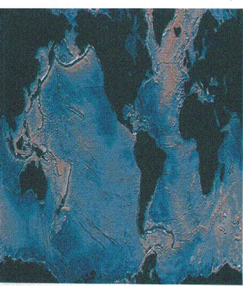
5 5/36

6 There are also extremes in the geoid over India, -80 m, and the western Pacific, +60 m, relative to ellipse of rotation. Variation of Gravity with Latitude Gravity is g.u. greater at the poles than at the equator. The acceleration due to gravity varies with latitude due to two effects: 1. Earth s shape: radius is 21 km greater at equator so g is less 2. Earth s rotation: Centrifugal acceleration reduces g. Effect is largest at equator where rotational velocity is greatest, 1674 km/h. Zero effect at poles. 6/36
7 For a uniform ellipse of rotation, the measured gravity is the resultant of the gravitational attraction vector and the centrifugal acceleration vector. International Gravity Formula The angle φ defines the geographic latitude. In 1743, Clairaut deduced a formula that expressed the variation of gravity with latitude. This has been incorporated into the International Gravity Formula: where g 0 is the gravity at sea level at the equator and φ the latitude. The most recent standard derived from the IGF is the 1967 Geodetic Reference System (GRS67), given by: where g 0 = m s -2 a = b = Note that there is an older 1930 standard, and surveys that use this will exhibit differences from the 1967 standard unless corrected (see Reynolds Box 2.4). 7/36
8 Densities of Geological Materials We must know the density of typical subsurface rocks accurately to interpret gravity data. The table below gives common ranges and avergae values for density in Mg m -3. Densities of Sedimentary Rocks Sedimentary rocks exhibit the greatest range of density variation due to factors such as: Mineral composition Cementation Porosity Pore fluid type Typically the contrast between adjacent sedimentary layers is less than 0.25 Mg m - 3. Density is increased by depth of burial: Sandstones and Limestones: density is increased by infilling of the pore space, not by volume change. Shales: density increased by compaction, and ultimately recrystallisation into minerals with higher densities. Densities of Igneous Rocks Igneous rocks tend to be denser than sedimentary rocks, with the density controlled primarily by silica content: Mafic rocks are thus more dense than felsic. Ultramafic rocks are most dense The range of density variation tends to be less than in sediments as porosities are typically lower. Measurement of Gravity There are basically two type of gravity measurement: Absolute Gravity Measured under laboratory conditions using careful experiments employing two possible methods: Falling body Swinging Pendulum 8/36
9 9/36
10 Used to provide absolute values of g at network of worldwide sites such as National Physical Laboratory in UK or National Bureau of Standards in USA. (International Gravity Standardisation Net 1971, IGSN 71). Relative Gravity In most applications, only the variation of gravity relative to a base station (which can often be related to IGSN 71) is necessary. Gravity readings are recorded at secondary stations such that the difference relative to the base station is well known. The spacing of gravity stations varies: 2-3 per km 2 for regional surveys 8-10 per km 2 for hydrocarbon exploration 5-50 m grid for high resolution work, e.g. archeology 0.5 m for microgravity work Accuracy On land, achieving an accuracy of ±0.1 mgal (or 1g.u.) requires that: latitudinal position be known to ±10 m elevation above mean sea level, i.e. geoid, be known to ±1 cm Many different instruments for measuring relative gravity Pendulum-Based Gravity Meters Gravity first measured using a pendulum by Pierre Bouguer in Method commonly used up to 1930s in hydrocarbon exploration. Period of a Pendulum Gravity is inversely proportional to the square of the period of oscilation, T, of a swinging pendulum: where L is length of pendulum. If pendulum swung under identical conditions at two locations, relative change in g can be found: 10/36
11 Spring-Based Gravimeters Gravimeters, essentially a mass suspended from a sophisicated spring balance, have been used to measure relative gravity since 1930s. As weight of mass (mass x gravity) increases, the spring is stretched. Hooke s Law Amount of extension of spring, δl, is proportional to extending force. In gravimetry, extending force is change in gravity, δg, and spring constant, κ, is known: Variations in g are small, so need to measure very small values of extension. For 30 cm long spring, change in length is ~3x10⁻⁸ m (30 nm, which is less than wavelength of light at ~500 nm). Mechanism for amplifying spring extension required so it can be measured. Stable Gravimeters Stable gravimeters consist of a mass at end of a beam, which pivots on a fulcrum, and is balanced by a tensioned spring. 11/36

12 Changes in gravity affect weight of mass, which is balanced by restoring force of spring. Askania Gravimeter Beam is pivoted on main spring. A beam of light is reflected from the mass to a photoelectric cell. Deflection of mass, displaces light beam and changes voltage in circuit. Retensioning auxiliary spring restores beam to null position, i.e. same position at which all measurements made. Stable Gravimeters Using Electrical Amplification Some gravimeters, including the common Scintrex CG-3, use the small extension of the mass to change the capcitance in an electric circuit. Boliden Gravimeter Mass is in form of a bobbin with two metal plates suspended between two other metal plates. Change in gravity causes mass to move and changes capacitance between top plates -- detected by tuned circuit. Mass returned to null position by adjusting DC current connected two lower plates mass supported by electrostatic repulsion. 12/36
13 Scinntrex CG-3 Gravimeter CG-3 operates on same principle, but uses feedback circuit to control current to plates that restores mass to null position. Unstable (Astatic) Gravimeters In a stable system, mass will return to equilibrium position after small disturbance. In unstable system, mass continues to move. Example Stable: pencil lying flat on table. Lift up one end; it falls back flat Unstable: Pencil standing on end. Push it; it falls over. Unstable gravimeters use mechanical instability to exaggerate small movement due to change in gravity. Horizontal hinged beam supports mass at end. Turning moment due to mass is mglcosθ. Beam supported by spring connected above hinge. Turning moment due to spring proportional to perpendicular distance d. 13/36
14 Increase in gravity extends spring, but shortens d reducing increase in restoring force and allowing greater movement (need to adjust geometry precisely). LaCoste-Romberg Unstable Gravimeter Spring is metal with high thermal conductivity to minimise effects of thermal expansion/contraction. Thermally insulated. Spring is zero-length, i.e. pretensioned during manufacture so behaves as if it would contract to zero length if tension lost. Zero length spring is weak, and maximises extension. Mass is large. Reading made by viewing light reflected from beam in eyepiece. Null position recovered by adjusting micrometer screw. Long length of screw means meter can read over range of 50,000 g.u.; used for worldwide surveys. Accurate to 0.03 g.u. 14/36


15 Worden Unstable Gravimeter For thermal problem, made of quartz glass springs, rods, and fibres. (Quartz less sensitive to heat than metal). Assembly housed inside vacuum flask with electrical thermostat. Range of instrument is 20,000 g.u. with accuracy up to 0.1 g.u., but 1 g.u. more usual. Lower range means it is more commonly used for local surveys, over which g changes less. Shipborne Gravimeters Static Measurement Use remote-controlled land instrument in waterproof housing, which is lowered to seafloor. Accuracy almost as good as land, but often impractical. Continuous Measurement Gravimeter mounted on gyro-stabilised horizontal platform, so meter responds to vertical motions only. Horizontal motion due to yawing of ship eliminated. 15/36

16 External accelerations due to waves attenuated by heavy damping of suspension, and averaging reading over longer period than wave motion (>8 s). External motions can cause variations in measured gravity up to 10 6 g.u.. With use of platform and corrections, accuracy is ±10 g.u.. Variation of LaCoste-Romberg often used. Corrections to Gravity Observations Instrument Calibration Factor Reading on gravimeter must usually be multiplied by calibration factor to get value of observed gravity, g obs. Reduction to Geoid Before interpretation, raw gravity data must be corrected to common measurement datum such as mean sea level (geoid). Gravity Anomaly Difference between the observed anomaly and the value of the International Gravity Formula, e.g. GRS67, at the same location is the Gravity Anomaly with which we work. Summary of Gravity Data Corrections Several corrections must be applied to observed gravity to obtain sea level reference and anomaly: Instrumental Drift Drift Gravimeters are very sensitive instruments. Temperature changes and elastic creep in springs cause reading to change gradually with time. 16/36
17 Drift is monitored by repeating reading at same station at different times of day, perhaps every 1-2 hours, to produce a drift curve. Instrument drift correction for each station can be estimated from drift curve. Example Drift curve for survey shown above. For reading taken at 12:30 hrs, observed gravity reading should be reduced by d. Drift values are typically < 10 gu per hour. Larger values indicate an instrument problem. Earth Tides Solid Earth responds to pull of Sun and Moon just like oceans, but movement is much less. Pull of Sun and Moon large enough to affect gravity reading. Changes g obs with period of 12 hours or so. 17/36
18 Earth tide corrections can be corrected by repeated readings at same station in same way as instrument drift. Correction can also be made using published tables, e.g. Tidal Gravity Corerctions for Latitude Correction Gravity anomaly values obtained by subtracting theoretical value of gravity defined by International Gravity Formula, g φ Local Latitude Correction Approximate correction can be applied to small-scale surveys (<100 km), not tied in to absolute gravity network through base station readings. Horizontal gravity gradient determined at local base station from latitude: gu per km Gravity increases towards poles, so latitude correction is more negative towards poles (as subtracted), i.e. with northward distance in northern hemisphere or southward distance in the southern hemisphere. At 51 o N, local latitude correction is around 8 gu/km. Latitude must be known ±10 m for surveys with accuracy of ±0.1gu. 18/36
19 Free-air Correction Corrects for reduction in gravity with height above geoid, irrespective of nature of rock below. Free-air correction is difference between gravity measured at sea level and at an elevation, h, with no rock in between. Free-air Correction = g.u./m = h g.u. Correction is positive above sea level (i.e. added), negative below. Varies slightly with latitude from g.u./m at equator to g.u./m at poles. With usual gravimeter measurement accuracy of 0.1 g.u., elevation must be known to within 5 cm!!! Free Air Anomaly Free-air Anomaly is obtained after application of latitude and free-air corrections. FA anomaly maps commonly used for ocean areas. Bouguer Correction Free-air correction takes no account of rock mass between measurement station and sea level. Bouguer correction, δg B, accounts for effect of rock mass by calculating extra gravitational pull exerted by rock slab of thickness h and mean density ρ. Assumes flat topography. In rough areas terrain corrections required. 19/36

20 On land: g.u. where ρ is in Mg m -3 and h is in metres. At sea: where h is the water depth. Bouguer Anomaly BA is Free-air Anomaly after subtraction of Bouguer correction. Nettleton s method Bouguer correction quite sensitive to value of density used. Example With 250 m elevation, an 0.1 Mg m -3 error in density will produce an error of 10gu. The Bouguer Anomaly should show no correlation with topography, but an incorrect choice of density will reflect the topography. Nettleton developed method of calculating BA using various trial density values. Correct density corresponds to BA correction that shows no correlation with topography. 20/36
21 Elevation is 76 m (250 ft). Correct density is 2.3 Mg m -3 Terrain Corrections Bouguer correction assumes subdued topography. Additional terrain corrections must be applied where measurements near to mountains or valleys. If station next to mountain, there is an upward force on gravimeter from mountain that reduces reading. 21/36
22 If station is next to valley, there is an absence of the downward force on gravimeter assumed in Bouguer correction, which reduces free-air anomaly too much. In both cases, terrain correction is added to Bouguer Anomaly. Example of terrain correction a. Gravity station at elevation h above geoid b. Infinite rock mass assumed for Bouguer correction c. Terrain correction compensates for error A in BC and also B Hammer Charts Terrain corrections can be computed using transparent template, called a Hammer Chart, which is placed over a topgraphic map. 22/36
23 Chart is centred on gravity station and topography read off at centre of each segment. Contribution to terrain correction is obtained from tabulated values for each segement and then summed to obtain total correction. (See Table 2.8 in Reynolds). Based on formula for gravitational attraction of cylindrical segment. Considered an additional part of Bouguer correction, i.e. results in Bouguer Anomaly. Eötvös Correction If gravimeter is in moving vehicle such as ship or plane, it is affected by vertical component of Coriolis acceleration, which depends on speed and travel direction of vehicle. where φ is geographic latitude and V is vehicle speed in knots. Two components: Outward acting centrifugal acceleration due to movement of vehicle over curved surface of Earth. gu Change in centrifugal acceleration due to movement relative to Earth s rotational axis. If vehicle moves east, it s rotational speed is increased; if west, its speed is reduced. 23/36

24 Isostatic Correction If no lateral density variations in Earth s crust, Bouguer Anomaly would be the same, i.e. Earth s gravity at the equator at geoid. Bouguer anomaly positive over oceans, negative over mountains. If crust is floating on mantle like an iceberg in ocean, total mass summed over any vertical column is the same. (Isostasy) Airy Isostasy Airy proposed that crust is thicker beneath mountains and thinner beneath the oceans. Excess mass under the oceans from a shallower, high density mantle. Mass deficiency beneath mountains due to crustal root. Pratt Isostasy Pratt proposed that observation could be explained by lateral changes in density within a uniform thickness crust. 24/36


25 Airy Isostatic corrections can be applied to remove these long wavelength variations, isolating upper crustal anomalies. Regional and Residual Anomalies Bouguer Anomaly maps contain: Regional anomaly: long wavelength features due to deep crustal features Residual anomaly: short wavelength anomalies due to shallow structures Residual must be separated for interpretation. Smoothed trend is fitted to BA graphically or by computer. 25/36
26 Example of Bouguer Anomaly and regional field: Interpretation of Gravity Anomalies is Non-Unique As with interpretation of many geophysical data, interpretation of gravity is ambiguous. Example Residual anomaly from a 600m radius sphere of 1.0 Mg m -3 at 3 km depth also be produced by each of the bodies shown. 26/36
27 Interpretation can proceed by forward modelling or inversion methods. Calculating Gravity Anomalies of Simple Bodies Gravity anomaly of a body can be calculated by summing contribution of its component elements using computer. For simple bodies, anomaly can be calculated simply: Sphere or Point Mass For point mass at distance r, gravitational attraction given by: 27/36
28 Gravimeter only measures vertical component, so anomaly is projection onto vertical: Since attraction due to sphere is same as that of same mass at centre, this is formula for anomaly of buried sphere. (3-D case) Horizontal Cylinder Can integrate above formula to get result for horizontal cylinder(2-d case): where m is mass per unit length. Gravity Anomalies of Spheres and Cylinders Anomaly shape can be plotted using formula. Anomaly from sphere decays more quickly than that of horizontal cylinder. Vertical cylinder has different shape with steeper flanks: 28/36
29 Depth Estimation by Half-Width Method Using the formulae for the anomalies due to various bodies, it is posible to estimate the limiting depth of a body. Limiting depth is maximum depth at which top of body could occur to produce anomaly. (Body could be shallower). Half-Width Method Half-width, X 1/2, is the distance from the centre of an anomaly at which amplitude has decreased to half its peak value. If anomaly is spherical: 29/36
30 If anomaly is horizontal cylinder: If anomaly is vertical cylinder: If anomaly is thin steeply dipping sheet: Depths are overestimates as based on centre of mass of body. Depth Estimation by Gradient-Amplitude Method Can obtain estimates of limiting depth from maximum slope also. If value of maximum slope, g max, estimated: For 3-D body: For 2-D body: 30/36
31 Mass Estimation Anomalous Mass is difference between mass of anomalous body and mass of body replaced with host rock. Anomalous mass can be uniquely determined from gravity anomaly, but important that regional be correctly removed. Anomaly divided into series of rings, each of which is divided into further segments, δa i. If g i is value of residual anomaly in segment, Total Anomalous Mass given by: Actual mass can be determined simply from anomalous mass if densities of anomaly and host rock are known: where ρ 1 is density of body, and ρ 0 density of host rock. If body less dense than surrounding rock, anomalous mass will be negative, mass deficiency. Important method for estimating ore reserves. Application to Salt Domes Average density of salt, 2.2 Mg m -3, is less than most sediments in a basin, so salt often rises in diapir due to its bouyancy. Makes good target for gravity surveys, and will show up as a bullseye anomaly. Example: Mors salt dome, Denmark Studied for radioactive waste disposal. Dots are gravity stations. 31/36

32 From profile across anomaly: Maximum amplitude of residual anomaly = 16 mgal Anomaly half-width= 3.7 km Assuming salt dome represented by sphere, limiting depth, i.e. depth to centre of mass = 4.8 km Assuming density contrast of 0.25 Mg m -3, radius of sphere estimated at 3.8 km. So top of salt at 1 km depth. 32/36
33 Best model obtained by forward modelling of gravity data: Compare inferences from gravity with best model derived from all methods, including seismic reflection and drilling. 33/36
34 Application to Massive Sulphide Exploration Massive sulphide ore bodies have high densities due to minerals present. Can show as gravity high in residual anomaly. Example: Faro Pb-Zn deposit, Yukon Gravity proved to be best geophysical technique to delimit deposit Tonnage of 44.7 million estimated from gravity, which compares with drilling estimate of 46.7 million. 34/36

35 Application to Detection of Underground Cavities Buried cavities due to old mine workings can be a significant hazard! Result of catastrophic failure of roof of ancient flint mine in chalk. Cavities can be good target for micro-gravity due to high density contrast between a void, or rubble-filled void, and host rock. In practice, many anomalies are greater than predicted by theory. Example: Inowroclaw, Poland Karst caverns in subsurface composed of gypsum, anhydrite, dolomite, and limestone. Develop towards surface and destroy buldings. Density contrasts are around -1.8 Mg m -3 and -1.0 Mg m -3 for void and rubble-filled void. 35/36
36 Rubble-filled void should not have been detectable from calculated anomaly. 36/36
Section 2: Gravity Surveying
 Introduction Section 2: Gravity Surveying Gravity surveys measure the acceleration due to gravity, g. Average value of g at Earth s surface is 9.80 ms -2. Gravitational attraction depends on density of
Total gravitational field is sum of contributions from all masses.
 Gravity force (acceleration) vs potential (energy) acceleration (g) => GM/r 2 Potential => - GM/r G is Newton s gravitational constant 6.67x10⁻¹¹ (S.I. units) you should determine what the S.I. units are
GRAVITY EXPLORATION (Gph 301) Chokri Jallouli 2014/2015
 Chokri Jallouli 2014/2015") KING SAUD UNIVERSITY FACULTY OF SCIENCES Department of Geology and Geophysics GRAVITY EXPLORATION (Gph 301) Chokri Jallouli 2014/2015 INTRODUCTION Definition Gravity method consists of measuring, studying
KING SAUD UNIVERSITY FACULTY OF SCIENCES Department of Geology and Geophysics GRAVITY EXPLORATION (Gph 301) Chokri Jallouli 2014/2015 INTRODUCTION Definition Gravity method consists of measuring, studying
Introduction to the use of gravity measurements in Ge111A
 Introduction to the use of gravity measurements in Ge111A Background & basic intuition Data reduction Use of the instrument See Reynolds for detailed quantitative discussion What and Why Gravity measures
GRAVITY AND GRAVITY ANOMALIES Newtonian Gravitation
 Gravity Exploration GRAVITY AND GRAVITY ANOMALIES Newtonian Gravitation Gravity: force of attraction between objects with mass Consider two objects with mass m 1 and m 2 : m 1 m 2 F g F g distance (r)
mdu G = Fdr = mgdr Dr. Clint Conrad POST 804 Gravity, the Geoid, and Mantle Dynamics Lecture: Gravity and the Geoid U G = G M r
 GG 611 Big Gulp Fall 2014 Gravity, the Geoid, and Mantle Dynamics Lecture: Gravity and the Geoid Dr. Clint Conrad POST 804 clintc@hawaii.edu Gravitational Potential For a point mass: Newton s law of gravitation:
Last week we obtained a general solution: 1 cos αdv
 GRAVITY II Surface Gravity Anomalies Due to Buried Bodies Simple analytical solution may be derived for bodies with uniform density contrast simple shape, such as: Sphere Horizontal/vertical cylinders
Gravity data reduction
 Gravity data reduction REDUCTION: raw data à gravity anomaly data Temporal corrections tides and instrument drift Spatial corrections latitude and elevation GRS67 = gravity variation with latitude at sea
Note that gravity exploration is different to seismic exploration in the following way:
 224B3 Other factors that cause changes in g and need to be corrected Note that gravity exploration is different to seismic exploration in the following way: In a seismic survey, the travel time depends
Last Time. Today s s Agenda. Geophysics. Geophysics. Geophysics. MAS 603: Geological Oceanography. Lecture 21: Geophysics 1: Gravity
 UNIVERSITY OF SOUTH ALABAMA Last Time MAS 603: Geological Oceanography Extinctions Lecture 21: 1: http://www.cartoonstock.com/newscartoons/cartoonists/for/lowres/forn441l.jpg Today s s Agenda Introduction
Lab 8: Gravity and Isostasy (35 points)
") it's not the most important thing in your life right now. But what is important is gravity. Arnold Schwarzenegger as Colonel John Matrix, Commando (Check out this classic of American cinema!) Lab 8: Gravity
it's not the most important thing in your life right now. But what is important is gravity. Arnold Schwarzenegger as Colonel John Matrix, Commando (Check out this classic of American cinema!) Lab 8: Gravity
Gravitational constraints
 Gravitational constraints Reading: Fowler p172 187 Gravity anomalies Free-air anomaly: g F = g g( λ ) + δg obs F Corrected for expected variations due to the spheroid elevation above the spheroid Bouguer
GRAVITY AND ISOSTASY
 GRAVITY AND ISOSTASY Gravity The Geoid is the oblate spheroid -- the sea level surface over the entire Earth's surface Physically, the Geoid is an equipotential surface for gravity (i.e. the surface for
Isostacy: Compensation of Topography and Isostatic Geoid Anomalies
 Isostacy: Compensation of Topography and Isostatic Geoid Anomalies November 3, 2016 1 Isostacy One of the major goals of interpreting planetary gravity fields is to understand how topography positive (
Introduction to the use of gravity measurements
 Introduction to the use of gravity measurements Background & basic intuition Data reduction Use of the instrument See Reynolds, Chpt 2, for detailed quantitative discussion What and Why Gravity measures
r 1 r 2 r 3 Dr is what matters!
 Today s Agenda Gravity - Background & basic intuition - Data reduction - Use of the instrument - See textbook for detailed quantitative discussion - Measure height of Millikan or S. Mudd What and Why Gravity
5. Gravity. 5.1 Geoid Variations. The Australian Continent: A Geophysical Synthesis Gravity
 34 The Australian Continent: A Geophysical Synthesis Gravity 5. Gravity Gravity data map subtle changes in the Earth s gravitational field caused by variations in the density of the underlying materials.
 http://foundation.aapg.org/students/undergraduate/weeks.cfm Tim Carr - West Virginia University 3 Potential Fields Indirect Visualization Density and Magnetization Gravity and Magnetic Exploration Locate
2.2 Gravity surveys. Gravity survey
 2.2 Gravity surveys Gravity survey The effect of latitude The effect of elevation The Bouguer effect Topographic effect The effect of tides Summary of corrections Gravity in boreholes Gravity survey In
Magnetic and Gravity Methods for Geothermal Exploration
 Magnetic and Gravity Methods for Geothermal Exploration Dr. Hendra Grandis Geophysics - ITB method and survey procedure Aero- or ground magnetic (covers a large area) Schlumberger resistivity mapping and
Answers: Internal Processes and Structures (Isostasy)
") Answers: Internal Processes and Structures (Isostasy) 1. Analyse the adjustment of the crust to changes in loads associated with volcanism, mountain building, erosion, and glaciation by using the concept
Answers: Internal Processes and Structures (Isostasy) 1. Analyse the adjustment of the crust to changes in loads associated with volcanism, mountain building, erosion, and glaciation by using the concept
AP Physics C Mechanics Objectives
 AP Physics C Mechanics Objectives I. KINEMATICS A. Motion in One Dimension 1. The relationships among position, velocity and acceleration a. Given a graph of position vs. time, identify or sketch a graph
L.O: THE CRUST USE REFERENCE TABLE PAGE 10
 USE REFERENCE TABLE PAGE 10 1. The oceanic crust is thought to be composed mainly of A) granite B) sandstone C) basalt D) rhyolite 2. To get sample material from the mantle, drilling will be done through
Determination of Subsurface Bulk Density Distribution for Geotechnical Investigation using Gravity Technique
 Journal of Earth Sciences and Geotechnical Engineering, vol. 7, no.2, 2017, 63-69 ISSN: 1792-9040 (print), 1792-9660 (online) Scienpress Ltd, 2017 Determination of Subsurface Bulk Density Distribution
Late 20 th Century Tests of the Continental Drift Hypothesis
 Late 20 th Century Tests of the Continental Drift Hypothesis 5 Characteristics of the Ocean Trenches Unless otherwise noted the artwork and photographs in this slide show are original and by Burt Carter.
GRAVITY AND MAGNETIC METHODS
 Presented at Short Course IX on Exploration for Geothermal Resources, organized by UNU-GTP, GDC and KenGen, at Lake Bogoria and Lake Naivasha, Kenya, Nov. 2-24, 2014. Kenya Electricity Generating Co.,
Lecture 2: Gravity, Isostasy and Flexure
 Lecture 2: Gravity, Isostasy and Flexure Read pages 42-51 in KK&V You can access all of KK&V through ereserves (password: yf160) Homework 1 is due next Thursday Gravity: theory and measurements Newton:
The atmosphere in motion: forces and wind. AT350 Ahrens Chapter 9
 The atmosphere in motion: forces and wind AT350 Ahrens Chapter 9 Recall that Pressure is force per unit area Air pressure is determined by the weight of air above A change in pressure over some distance
LOCATING AND CHARACTERIZING ABANDONED MINES USING MICROGRAVITY by Richard C. Benson 1, Ronald D. Kaufmann 1, Lynn Yuhr 1, Richard Hopkins 2 ABSTRACT
 LOCATING AND CHARACTERIZING ABANDONED MINES USING MICROGRAVITY by Richard C. Benson 1, Ronald D. Kaufmann 1, Lynn Yuhr 1, Richard Hopkins 2 ABSTRACT Surface geophysical methods can be an important part
INTRODUCTION TO APPLIED GEOPHYSICS
 INTRODUCTION TO APPLIED GEOPHYSICS EXPLORING THE SHALL0W SUBSURFACE H. Robert Burger Anne F. Sheehan Craig H.Jones VERSITY OF COLORADO VERSITY OF COLORADO W. W. NORTON & COMPANY NEW YORK LONDON Contents
9. Density Structure. The Australian Continent: A Geophysical Synthesis Density Structure
 84 The Australian Continent: A Geophysical Synthesis Density Structure 9. Density Structure Although the primary focus for the development of the AuSREM model was the creation of 3-D seismic wavespeed
Forces That Shape Earth. How do continents move? What forces can change rocks? How does plate motion affect the rock cycle?
 Forces That Shape Earth How do continents move? What forces can change rocks? How does plate motion affect the rock cycle? Plate Motion Mountain ranges are produced by plate tectonics. The theory of plate
Topic 12: Dynamic Earth Pracatice
 Name: Topic 12: Dynamic Earth Pracatice 1. Earth s outer core is best inferred to be A) liquid, with an average density of approximately 4 g/cm 3 B) liquid, with an average density of approximately 11
STUDY GUIDE FOR MID-TERM EXAM KEY. Color, luster, cleavage, fracture, hardness, taste, smell, fluorescence, radioactivity, magnetism
 STUDY GUIDE FOR MID-TERM EXAM KEY 1. In which type of rock are fossils most likely to be found? Sedimentary Rocks 2. Which mineral is easily identified by smell? Sulfur 3. Which natural resource makes
Plate Tectonics. entirely rock both and rock
 Plate Tectonics I. Tectonics A. Tectonic Forces are forces generated from within Earth causing rock to become. B. 1. The study of the origin and arrangement of Earth surface including mountain belts, continents,
Shape Earth. Plate Boundaries. Building. Building
 Chapter Introduction Lesson 1 Lesson 2 Lesson 3 Lesson 4 Chapter Wrap-Up Forces That Shape Earth Landforms at Plate Boundaries Mountain Building Continent Building How is Earth s surface shaped by plate
CHAPTER X. Second Half Review 2017
 CHAPTER X Second Half Review 217 Here is a quick overview of what we covered in the second half of the class. Remember that the final covers the whole course but there will naturally be a bias towards
D) outer core B) 1300 C A) rigid mantle A) 2000 C B) density, temperature, and pressure increase D) stiffer mantle C) outer core
 outer core B) 1300 C A) rigid mantle A) 2000 C B) density, temperature, and pressure increase D) stiffer mantle C) outer core") 1. In which area of Earth's interior is the pressure most likely to be 2.5 million atmospheres? A) asthenosphere B) stiffer mantle C) inner core D) outer core Base your answers to questions 2 and 3 on
1. In which area of Earth's interior is the pressure most likely to be 2.5 million atmospheres? A) asthenosphere B) stiffer mantle C) inner core D) outer core Base your answers to questions 2 and 3 on
Environmental and Exploration Geophysics I Gravity I tom.h.wilson
 Environmental and Exploration Geophysics I Gravity I tom.h.wilson tom.wilson@mail.wvu.edu Department of Geology and Geography West Virginia University Morgantown, WV Discuss mid term exam Objectives for
g E. An object whose weight on 6 Earth is 5.0 N is dropped from rest above the Moon s surface. What is its momentum after falling for 3.0s?
 PhysicsndMathsTutor.com 1 1. Take the acceleration due to gravity, g E, as 10 m s on the surface of the Earth. The acceleration due to gravity on the surface of the Moon is g E. n object whose weight on
A) B) C) D) 4. Which diagram below best represents the pattern of magnetic orientation in the seafloor on the west (left) side of the ocean ridge?
 B) C) D) 4. Which diagram below best represents the pattern of magnetic orientation in the seafloor on the west (left) side of the ocean ridge?") 1. Crustal formation, which may cause the widening of an ocean, is most likely occurring at the boundary between the A) African Plate and the Eurasian Plate B) Pacific Plate and the Philippine Plate C)
1. Crustal formation, which may cause the widening of an ocean, is most likely occurring at the boundary between the A) African Plate and the Eurasian Plate B) Pacific Plate and the Philippine Plate C)
GRAVIMETRIC MAP OF CHILE. Services Mining and Engineering Geophysics Instituto Geográfico Militar
 GRAVIMETRIC MAP OF CHILE Araneda M., Rivas L., Avendaño M, Sottolichio G., Rubio W. Services Mining and Engineering Geophysics segmi@netexpress.cl) Instituto Geográfico Militar (lrivas@igm.cl) Abstract
TAKE HOME EXAM 8R - Geology
 Name Period Date TAKE HOME EXAM 8R - Geology PART 1 - Multiple Choice 1. A volcanic cone made up of alternating layers of lava and rock particles is a cone. a. cinder b. lava c. shield d. composite 2.
Theory of Plate Tectonics
 Plate Tectonics Theory of Plate Tectonics Lithosphere is made of sections called plates that move around called continental drift Plates move because they float on the asthenosphere Most plates consist
Gravity Tectonics Volcanism Atmosphere Water Winds Chemistry. Planetary Surfaces
 Gravity Tectonics Volcanism Atmosphere Water Winds Chemistry Planetary Surfaces Gravity & Rotation Polar flattening caused by rotation is the largest deviation from a sphere for a planet sized object (as
CIE Physics IGCSE. Topic 1: General Physics
 CIE Physics IGCSE Topic 1: General Physics Summary Notes Length and time A ruler (rule) is used to measure the length of an object between 1mm and 1m. The volume of an object of irregular shape can be
Gravity Methods (IV)
") Environmental and Exploration Geophysics II Gravity Methods (IV) tom.h.wilson tom.wilson@mail.wvu.edu Department of Geology and Geography West Virginia University Morgantown, WV Possible employment opportunities
Environmental and Exploration Geophysics II Gravity Methods (IV) tom.h.wilson tom.wilson@mail.wvu.edu Department of Geology and Geography West Virginia University Morgantown, WV Possible employment opportunities
10. Paleomagnetism and Polar Wandering Curves.
 Map of ocean floor Evidence in Support of the Theory of Plate Tectonics 10. Paleomagnetism and Polar Wandering Curves. The Earth's magnetic field behaves as if there were a bar magnet in the center of
UNIT 6 PLATE TECTONICS
 UNIT 6 PLATE TECTONICS CONTINENTAL DRIFT Alfred Wegner proposed the theory that the crustal plates are moving over the mantle. He argued that today s continents once formed a single landmass, called Pangaea
GRAVITY AND MAGNETIC SURVEY NECHAKO BASIN STUDY ACQUISITION AND PROCESSING PHASE
 GRAVITY AND MAGNETIC SURVEY NECHAKO BASIN STUDY ACQUISITION AND PROCESSING PHASE Report prepared for the B.C. Ministry of Energy and Mines Resource Development Division New Ventures Branch by Bemex Consulting
GRAVITY EXPLORATION. subsurface density. (material property) Gravity anomalies of some simple shapes
 Gravity anomalies of some simple shapes") GRAVITY EXPLORATION g at surface (observation) subsurface density (material property) subsurface geology Gravity anomalies of some simple shapes Reminder: we are working with values about... 0.01-0.001
GRAVITY EXPLORATION g at surface (observation) subsurface density (material property) subsurface geology Gravity anomalies of some simple shapes Reminder: we are working with values about... 0.01-0.001
Chapter 7 Plate Tectonics
 Chapter 7 Plate Tectonics Earthquakes Earthquake = vibration of the Earth produced by the rapid release of energy. Seismic Waves Focus = the place within the Earth where the rock breaks, producing an earthquake.
a reference frame that accelerates in a straight line a reference frame that moves along a circular path Straight Line Accelerated Motion
 1.12.1 Introduction Go back to lesson 9 and provide bullet #3 In today s lesson we will consider two examples of non-inertial reference frames: a reference frame that accelerates in a straight line a reference
Geophysics for Environmental and Geotechnical Applications
 Geophysics for Environmental and Geotechnical Applications Dr. Katherine Grote University of Wisconsin Eau Claire Why Use Geophysics? Improve the quality of site characterization (higher resolution and
topography half is commonly represented in maps, and how it interacts with
 Topography T. Perron 12.001 We ll spend a large fraction of the second half of the course discussing Earth s surface. Today we ll do two things: First, we ll discuss the ways topography is commonly represented
/////// ///////////// Module ONE /////////////// ///////// Space
 // // / / / / //// / ////// / /// / / // ///// ////// ////// Module ONE Space 1 Gravity Knowledge and understanding When you have finished this chapter, you should be able to: define weight as the force
Gravity surveys. Introduction. Gravity surveys. Historical perspective
 Gravity surveys Introduction These pages introduce the fundamentals and practicalities of gravity surveying. They are not exhaustive, and are meant only to serve as an introduction. Note that the examples
Plate Tectonics. Why Continents and Ocean Basins Exist
 Plate Tectonics Plate Tectonics Why Continents and Ocean Basins Exist Topics Density Structure of Earth Isostasy Sea-Floor Spreading Mechanical Structure of Earth Driving Mechanism of Plate Tectonics Lithospheric
FORWARD MODELING OF THE GEOID ANOMALY USING SPHERICAL HARMONICS: APPLICATIONS IN THE SIERRA NEVADA. Alissa C Scire
 FORWARD MODELING OF THE GEOID ANOMALY USING SPHERICAL HARMONICS: APPLICATIONS IN THE SIERRA NEVADA by Alissa C Scire A Prepublication Manuscript Submitted to the Faculty of the DEPARTMENT OF GEOSCIENCES
Plate Tectonics Practice Test
 Plate Tectonics Practice Test 1. What is the main idea Alfred Wegner proposed in the Theory of Continental Drift that he published in 1915? a. The continents float on a liquid layer that allows them to
Global geophysics and wave propagation
 Global geophysics and wave propagation Reading: Fowler p76 83 Remote sensing Geophysical methods Seismology Gravity and bathymetry Magnetics Heat flow Seismology: Directly samples the physical properties
Upthrust and Archimedes Principle
 1 Upthrust and Archimedes Principle Objects immersed in fluids, experience a force which tends to push them towards the surface of the liquid. This force is called upthrust and it depends on the density
Dynamic Crust Practice
 1. Base your answer to the following question on the cross section below and on your knowledge of Earth science. The cross section represents the distance and age of ocean-floor bedrock found on both sides
The Gulf of Mexico - From Various Vantage Points John E. Bain, Kenton J. Hamilton
 The Gulf of Mexico - From Various Vantage Points John E. Bain, Kenton J. Hamilton Oftentimes in exploration geophysics we tend to focus on specific near-term exploration prospects, as dictated by the current
Lecture 2. Lecture 1. Forces on a rotating planet. We will describe the atmosphere and ocean in terms of their:
 Lecture 2 Lecture 1 Forces on a rotating planet We will describe the atmosphere and ocean in terms of their: velocity u = (u,v,w) pressure P density ρ temperature T salinity S up For convenience, we will
The net force on a moving object is suddenly reduced to zero. As a consequence, the object
 The net force on a moving object is suddenly reduced to zero. As a consequence, the object (A) stops abruptly (B) stops during a short time interval (C) changes direction (D) continues at a constant velocity
Pre-AP Physics Review Problems
 Pre-AP Physics Review Problems SECTION ONE: MULTIPLE-CHOICE QUESTIONS (50x2=100 points) 1. The graph above shows the velocity versus time for an object moving in a straight line. At what time after t =
Continental Drift and Plate Tectonics
 Continental Drift and Plate Tectonics Continental Drift Wegener s continental drift hypothesis stated that the continents had once been joined to form a single supercontinent. Wegener proposed that the
The Dynamic Crust 2) 4) Which diagram represents the most probable result of these forces? 1)
 4) Which diagram represents the most probable result of these forces? 1)") 1. The diagrams below show cross sections of exposed bedrock. Which cross section shows the least evidence of crustal movement? 1) 3) 4. The diagram below represents a section of the Earth's bedrock. The
1. The diagrams below show cross sections of exposed bedrock. Which cross section shows the least evidence of crustal movement? 1) 3) 4. The diagram below represents a section of the Earth's bedrock. The
Plate Tectonics Tutoiral. Questions. Teacher: Mrs. Zimmerman. Plate Tectonics and Mountains Practice Test
 Teacher: Mrs. Zimmerman Print Close Plate Tectonics and Mountains Practice Test Plate Tectonics Tutoiral URL: http://www.hartrao.ac.za/geodesy/tectonics.html Questions 1. Fossils of organisms that lived
Development of geophysical investigation for verifying treatment efficiency of underground cavities
 Development of geophysical investigation for verifying treatment efficiency of underground cavities Hasan A. Kamal* Kuwait Institute for Scientific Research, Infrastructure Risk and Reliability Program,
ENVI.2030L - Plate Tectonics - Geomagnetism, Earthquakes, and Gravity
 I. Geomagnetism Name ENVI.2030L - Plate Tectonics - Geomagnetism, Earthquakes, and Gravity The earth's magnetic field can be viewed as a simple bar magnet located near the center of the earth and inclined
B6 Isostacy. B6.1 Airy and Pratt hypotheses. Geophysics 210 September 2008
 B6 Isostacy B6.1 Airy and Pratt hypotheses Himalayan peaks on the Tibet-Bhutan border In the 19 th century surveyors used plumblines and theodolites to map India. A plumb line was used when measuring the
Name Date Class. Directions: Use the diagram below to answer question Florida Progress Monitoring and Benchmark Assessments
 b e n c h m a r k t e s t : e a r t h a n d s p a c e s c i e n c e Multiple Choice 1. Geologists obtain indirect evidence about Earth s interior by A measuring pressure differences at Earth s surface.
C5 Magnetic exploration methods data analysis techniques
 C5 Magnetic exploration methods data analysis techniques C5.1 Data processing and corrections After magnetic field data have been collected a number of corrections are applied to simplify the interpretation.
UNIVERSITY OF MANITOBA. All questions are of equal value. No marks are subtracted for wrong answers.
 (1:30 pm 4:30 pm) PAGE NO.: 1 of 7 All questions are of equal value. No marks are subtracted for wrong answers. Record all answers on the computer score sheet provided. USE PENCIL ONLY! Black pen will
Getting Started: Using and Understanding Gravity Data
 The University of Texas at El Paso Pan-American Center for Earth and Environmental Studies Thu 13-Sep-2007 ABOUT PACES Mission Newsletter Sponsors RESEARCH Geoinformatics Remote Sensing Geoscience GIS
9 MECHANICAL PROPERTIES OF SOLIDS
 9 MECHANICAL PROPERTIES OF SOLIDS Deforming force Deforming force is the force which changes the shape or size of a body. Restoring force Restoring force is the internal force developed inside the body
1. In the diagram below, letters A and B represent locations near the edge of a continent.
 1. In the diagram below, letters A and B represent locations near the edge of a continent. A geologist who compares nonsedimentary rock samples from locations A and B would probably find that the samples
Defining the former elevation and shape of the lithosphere, in particular the elevation of the Earth s surface,
 Isostasy in Move Defining the former elevation and shape of the lithosphere, in particular the elevation of the Earth s surface, is important in the restoration of a model as it aids in reducing uncertainty
Name: Date: MIDTERM 1. Physics 2306 Fall 2012 BEFORE YOU BEGIN:
 Name: Date: MIDTERM 1 Physics 2306 Fall 2012 FORM A BEFORE YOU BEGIN: 1. Fill in CORRECTLY your ID number in the Scantron, as well as which FORM of the test you have. 2. Write the course number (2306)
What Forces Drive Plate Tectonics?
 What Forces Drive Plate Tectonics? The tectonic plates are moving, but with varying rates and directions. What hypotheses have been proposed to explain the plate motion? Convection Cells in the Mantle
Geothermal Energy Resources Exploration using Gravity and magnetics. By Mariita, N.O. KenGen
 Geothermal Energy Resources Exploration using Gravity and magnetics By Mariita, N.O. KenGen What is Geothermal Energy? Geothermal Energy = heat from the Earth Transmitted by fluids via fractures and pores
PRELIMINARY EXAMINATION 2018 H2 PHYSICS 9749/01. Paper 1 SEP 2018
 PRELIMINARY EXAMINATION 2018 H2 PHYSICS 9749/01 Paper 1 SEP 2018 Additional Materials: Multiple Choice Answer Sheet Duration: 1 hour DO NOT OPEN THIS BOOKLET UNTIL YOU ARE TOLD TO DO SO READ THESE INSTRUCTIONS
Marine Science and Oceanography
 Marine Science and Oceanography Marine geology- study of the ocean floor Physical oceanography- study of waves, currents, and tides Marine biology study of nature and distribution of marine organisms Chemical
Ch 6 Using Newton s Laws. Applications to mass, weight, friction, air resistance, and periodic motion
 Ch 6 Using Newton s Laws Applications to mass, weight, friction, air resistance, and periodic motion Newton s 2 nd Law Applied Galileo hypothesized that all objects gain speed at the same rate (have the
HIMALAYAN AIRBORNE GRAVITY AND GEOID OF NEPAL
 Mt. Everest HIMALAYAN AIRBORNE GRAVITY AND GEOID OF NEPAL -Niraj Manandhar Head, Geodetic Survey Branch Survey Department, Geodetic Survey Branch Project Background Air Borne Gravity Survey Project was
EARTH SCIENCE KEY UNIT 2-H
 EARTH SCIENCE KEY UNIT 2-H UNIT 2 MODELS & DIMENSIONS OF EARTH I. Model = ANYTHING THAT REPRESENTS THE PROPERTIES OF AN OBJECT OR SYSTEM A. Types and examples of models: 1. PHYSICAL Provides us with information
Which lettered location has the highest elevation? A) A B) B C) C D) D
 A B) B C) C D) D") 1. New York State's highest peak, Mt. Marcy, is located at approximately A) 44 10' N 74 05' W B) 44 05' N 73 55' W C) 73 55' N 44 10' W D) 74 05' N 44 05' W 2. Four locations, A, B, C, and D, are represented
1. New York State's highest peak, Mt. Marcy, is located at approximately A) 44 10' N 74 05' W B) 44 05' N 73 55' W C) 73 55' N 44 10' W D) 74 05' N 44 05' W 2. Four locations, A, B, C, and D, are represented
Geologic Structures. Changes in the shape and/or orientation of rocks in response to applied stress
 Geologic Structures Changes in the shape and/or orientation of rocks in response to applied stress Figure 15.19 Can be as big as a breadbox Or much bigger than a breadbox Three basic types Fractures >>>
Earth. Temp. increases with depth, the thermal gradient is 25 o C/km. Pressure and density also increase with depth.
 Plate Tectonics Earth Earth overall average density = 5.5 g/cm 3. Temp. increases with depth, the thermal gradient is 25 o C/km. Pressure and density also increase with depth. Spheroid: with a longer major
Oceanic crust forms at ocean ridges and becomes part of the seafloor. Review Vocabulary. basalt: a dark-gray to black fine-grained igneous rock
 Sea-Floor Spreading Oceanic crust forms at ocean ridges and becomes part of the seafloor. Review Vocabulary basalt: a dark-gray to black fine-grained igneous rock I. Mapping the Ocean Floor Until the mid-1900
I. Earth s Layers a. Crust: Earth s outside layer. Made of mostly rock. i. Continental: er; made of mostly granite, forms the continents and shallow
 I. Earth s Layers a. Crust: Earth s outside layer. Made of mostly rock. i. Continental: er; made of mostly granite, forms the continents and shallow sea beds, floats! ii. Oceanic: er; dense rock such as
6. In the diagram below, letters A and B represent locations near the edge of a continent.
 1. Base your answer to the following question on the cross section below and on your knowledge of Earth science. The cross section represents the distance and age of ocean-floor bedrock found on both sides
Theme 2 - PHYSICS UNIT 2 Forces and Moments. A force is a push or a pull. This means that whenever we push or pull something, we are doing a force.
 Forces A force is a push or a pull. This means that whenever we push or pull something, we are doing a force. Forces are measured in Newtons (N) after the great physicist Sir Isaac Newton. The instrument
Novel Application in Determining Oil Shale Porosity Using a Borehole Gravimeter
 Novel Application in Determining Oil Shale Porosity Using a Borehole Gravimeter Shell Exploration & Production Katia Pronina Robert Pimentel Matt Holman (presenter) 3/17/2010 File Title Copyright: SIPC
Force mediated by a field - long range: action at a distance: The attractive or repulsion between two stationary charged objects.
 VISUAL PHYSICS ONLINE DYNAMICS TYPES O ORCES 1 Electrostatic force orce mediated by a field - long range: action at a distance: The attractive or repulsion between two stationary charged objects. AB A
Chapter 2 Plate Tectonics and the Ocean Floor
 Chapter 2 Plate Tectonics and the Ocean Floor Chapter Overview Much evidence supports plate tectonics theory. The plate tectonics model describes features and processes on Earth. Plate tectonic science
The surface of the ocean floor is as varied as the land. The five major oceans, from largest to smallest, are
 11.1 Ocean Basins The surface of the ocean floor is as varied as the land. The five major oceans, from largest to smallest, are w the Pacific w the Atlantic w the Indian w the Southern w the Arctic The
Chapter 8 Rotational Motion
 Chapter 8 Rotational Motion Chapter 8 Rotational Motion In this chapter you will: Learn how to describe and measure rotational motion. Learn how torque changes rotational velocity. Explore factors that