NASA Earth Science Data Systems Program. Martha Maiden Program Executive, Earth Science Data Systems Earth Science Subcommittee November 28, 2012
|
|
|
- Dominick Young
- 5 years ago
- Views:
Transcription


1 NASA Earth Science Data Systems Program Martha Maiden Program Executive, Earth Science Data Systems Earth Science Subcommittee November 28, 2012
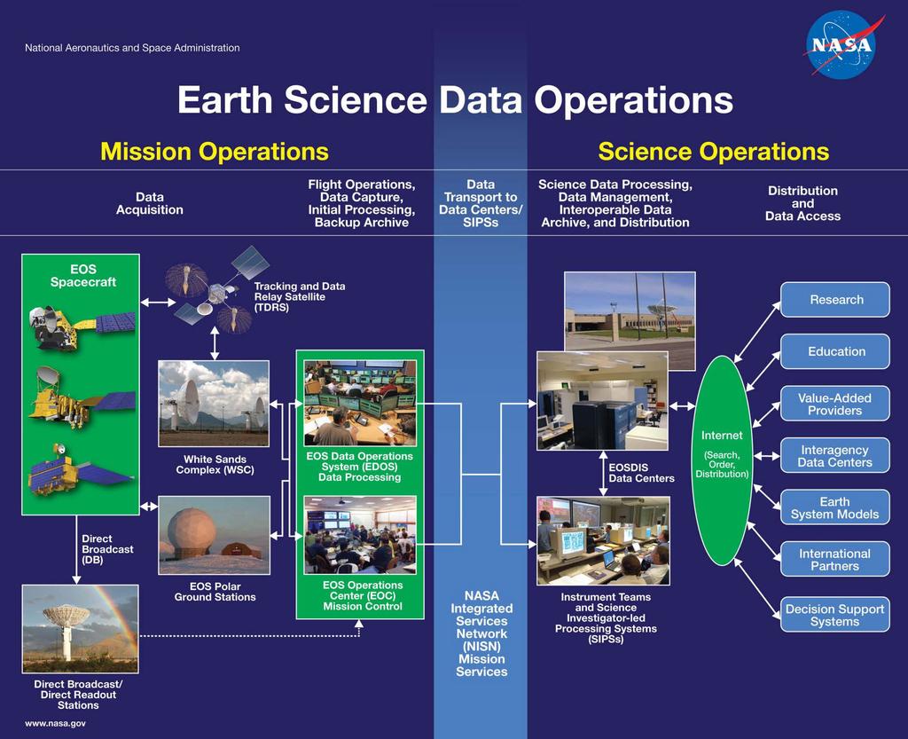
2 NASA s Earth Observing System Data and Information System Manages data from several types of sources satellite missions, aircraft investigations, PI-led dataset generation efforts Initiated in 1990 In operation since 1994 with mature metadata for heritage datasets In operation since 1997 supporting EOS instrument datasets starting with the Tropical Rainfall Measuring Mission A petabyte-scale archive of environmental data that supports global climate change research Designed to receive, process, distribute and archive several terabytes of science data per day Provides a distributed information framework supporting a broad user community Open Data Policy Data are openly available to all and free of charge except where governed by international agreements Consistent with Circular A-130 By having open application layers to the EOSDIS framework, we allow many other value-added services to access NASA s vast Earth Science Collection Interoperates with data archives of other agencies and countries 2


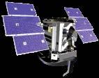


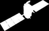
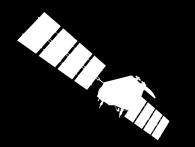


3 National Aeronautics and Space Administration Earth Science Measurements Acrimsat 12/99 Solar Output ACRIM Energy Budget CERES Albedo, Aerosols, Vegetation MISR Terra 12/99 Lower Atmospheric Chemistry MOPITT Surface Imaging MODIS, ASTER Aqua 5/02 Energy Atmospheric Surface Budget Sounders Imaging CERES AMSR-E MODIS AIRS/AMSU/ HSB SORCE 1/03 Solar Irradiance TIM, SIM, XPS Solstice Aura 7/04 Trace\ Atmospheric Gases Composition TES HIRDLS, MLS, OMI MESOSPHERE TRMM 11/97 Rainfall CERES, TMI VIRS, PR, LIS Rain Jason 12/01 Ocean Altimetry Poseidon 2/ JMR/DORIS GRACE 3/02 Gravity Field GPS, KBR CloudSat 4/06 Cloud Properties CPR CALIPSO 4/06 Cloud, Aerosol Properties CALIOP Rain OSTM 6/08 Ocean Altimetry Poseidon 3/ AMR/DORIS STRATOSPHERE O 3, CIO, BrO, OH, Trace Gases, Aerosols Ice Bridge 10/09 Ice Topography and Altimetry ATM Temperature Moisture Sea Surface Winds Ecosystem Dynamics TROPOSPHERE O 3, Precursor Gases, Aerosols Volcanology Ocean Biology Sea Ice Land Biology Fire Occurrence Ocean Surface Topography Evaporation H 2 O Ocean Circulation Land Ice and Snow Cover

4 Earth Science Measurements Applied


5 Discipline-oriented Data Centers ASF SDC SAR Products, Sea Ice, Polar Processes, Geophysics PO.DAAC Gravity, Sea Surface Temperature, Ocean Winds, Topography, Circulation & Currents NSIDC DAAC Snow and Ice, Cryosphere, Climate Interactions, Sea Ice LP DAAC Surface Reflectance, Land Cover, Vegetation Indices SEDAC Human Interactions, Land Use, Environmental Sustainability, Geospatial Data GES DISC Global Precipitation, Solar Irradiance, Atmospheric Composition and Dynamics, Global Modeling CDDIS Space Geodesy, Solid Earth OBPG Ocean Biology, Sea Surface Temperature GHRC DAAC Hydrologic Cycle, Severe Weather Interactions, Lightning, Atmospheric Convection LaRC ASDC Radiation Budget, Clouds, Aerosols, Tropospheric Chemistry ORNL DAAC Biogeochemical Dynamics, Ecological Data, Environmental Processes MODAPS/ LAADS MODIS Level-1 and Atmosphere Data Products

6 6 ECHO Architecture ECHO is NASA s middleware layer between Earth science data and users via a service-oriented architecture. Designed to improve the discovery and access of NASA data. Developed as a part of NASA s core data systems but fully adaptable to the needs/requirem ents of science communities. Acts as an order broker between end users and EOSDIS Data Centers who provide metadata for their data holdings and other Earth science-related data holdings. User-defined specialized clients can be easily developed to give science data users of their community access to data and services using ECHO s open APIs.
 ~635,000,000 products in 2012 >120X increase")
7 EOSDIS Key Metrics Millions Preliminary EOSDIS FY2012 Metrics Unique Data Products 6,986 Distinct Users of EOSDIS Data and Services Web Site Visits of 1 Minute or more Average Daily Archive Growth Total Archive Volume End User Distribution Products End User Average Daily Distribution Volume EOSDIS Products Delivered (Millions) ~635,000,000 products in 2012 >120X increase over M 1.97 M 5.3 TB/day 6.4 PB 635 M 14.8 TB/day ESDIS Project Supports Science System Elements Interfaces Partnerships Missions Data Centers 12 SIPS 14 Interface Control Documents 22 US 10 International 6 Science Data Processing 10 Archiving and Distribution 37 Instruments Supported More information: EOSDIS: FY00 FY01 FY02 FY03 FY04 FY05 FY06 FY07 FY08 FY09 FY10 FY11 FY12 to date Sep 7
8 Evolution of EOSDIS Elements and Continuous Evolution EOSDIS underwent a concerted process for Evolution in the timeframe. Led by EOSDIS Project Manager Esfandiari, OES Program Executive Martha Maiden Recommendations by External Advisory Panel, led by Moshe Pniel Effort under Terms of Reference signed by Ghassem Asrar, with Implementation Plan concurred by Mary Cleave Resultant system reduced costs 30%, Information Technology currency, closer to science needs, with capability to continuously evolve. Continuous evolution investments about 10% of Multi-Mission Ops budget, and include system and data product/quality investments. ESS reviewed the EOSDIS System at their January 2008 meeting, reserving one hour on the agenda. ESS letter February 6, 2008 was complimentary (from NASA website). We were impressed by the success and clear sense of direction of that program. We are a long way from the EOSDIS problems of less than a decade ago! 8
9 2015 Vision Goals Addressed Vision Tenet Archive Management EOS Data Interoperability Future Data Access and Processing Data Pedigree Cost Control User Community Support IT Currency Vision 2015 Goals NASA will ensure safe stewardship of the data through its lifetime. The EOS archive holdings are regularly peer reviewed for scientific merit. Multiple data and metadata streams can be seamlessly combined. Research and value added communities use EOS data interoperably with other relevant data and systems. Processing and data are mobile. Data access latency is no longer an impediment. Physical location of data storage is transparent. Finding data is based on common search engines. Services invoked by machine-machine interfaces. Custom processing provides only the data needed, the way needed. Open interfaces and best practice standard protocols universally employed. Mechanisms to collect and preserve the pedigree of derived data products are readily available. Data systems evolve into components that allow a fine-grained control over cost drivers. Expert knowledge is readily accessible to enable researchers to understand and use the data. Community feedback directly to those responsible for a given system element. Access to all EOS data through services at least as rich as any contemporary science information system. EEE Feb 3, 2005
10 2015 Vision Goals Addressed Vision Tenet Archive Management EOS Data Interoperability Future Data Access and Processing Data Pedigree Cost Control User Community Support IT Currency Vision 2015 Goals NASA will ensure safe stewardship of the data through its lifetime. The EOS archive holdings are regularly peer reviewed for scientific merit. + Multiple data and metadata streams can be seamlessly combined. Research and value added communities use EOS data interoperably with other relevant data and systems. Processing and data are mobile. + + Data access latency is no longer an impediment. Physical location of data storage is transparent. Finding data is based on common search engines. Services invoked by machine-machine interfaces. Custom processing provides only the data needed, the way needed. Open interfaces and best practice standard protocols universally employed. Mechanisms to collect and preserve the pedigree of derived data products are readily available. Data systems evolve into components that allow a fine-grained control over cost drivers. Expert knowledge is readily accessible to enable researchers to understand and use the data. Community feedback directly to those responsible for a given system element. Access to all EOS data through services at least as rich as any contemporary science information system. EEE As of In Progress
ESIP Summer 2012 Meeting Innovation Applied through Geospatial Application
 ESIP Summer 2012 Meeting Innovation Applied through Geospatial Application Ryan Boller, George Chang Kevin Murphy, Charles Thompson, Lucian Plesea, Jeff Schmaltz, Tilak Joshi, Shriram Ilavajhala, Diane
National Aeronautics and Space Administration. Earth Day is everyday at NASA. activity booklet
 National Aeronautics and Space Administration Earth Day is everyday at NASA activity booklet Earth Day is everyday at NASA NASA s Fleet of Earth Observing Satellites ACRIMSAT Landsat 7 Aqua SORCE Terra
Impact of NASA EOS data on the scientific literature: 16 years of published research results from Terra, Aqua, Aura, and Aquarius
 Impact of NASA EOS data on the scientific literature: 16 years of published research results from Terra, Aqua, Aura, and Aquarius Gene R. Major NASA Goddard Library Nebulous Connections April 4, 2017 RESACs/RA
NES: Weather and Climate: Satellite Meteorology
 LIVE INTERACTIVE LEARNING @ YOUR DESKTOP NES: Weather and Climate: Satellite Meteorology Presented by: Rudo Kashiri January 23, 2012 Weather and Climate: Satellite Meteorology Presented by Rudo Kashiri
History of Aerosol Remote Sensing. Mark Smithgall Maria Zatko 597K Spring 2009
 History of Aerosol Remote Sensing Mark Smithgall Maria Zatko 597K Spring 2009 Aerosol Sources Anthropogenic Biological decomposition from fertilizer and sewage treatment (ex. ammonium) Combustion of fossil
GRACE Cloudsat CALIPSO Aqua. Metop TRMM TOPEX. Meteor/ SAGE GIFTS NOAA/ POES. Landsat GOES MTSAT. SeaWiFS. Aura. Terra MSG. Jason ICESat SORCE
 TRMM Metop GRACE Cloudsat CALIPSO Aqua TOPEX Meteor/ SAGE GIFTS NOAA/ POES Landsat GOES SeaWiFS MTSAT Terra Aura Jason ICESat SORCE MSG THE EARTH SYSTEM SCIENCE It is the science that studies the whole
Radio Frequency Earth Science
 Radio Frequency Earth Science Overview for Committee On Radio Frequency (CORF) National Academy of Science National Research Council April 27, 2005 Bill.Watson@NASA.Gov Program Executive for Ground Networks
3D data in climatology
 GIS Laboratory, Institute of Geography and Spatial Management, Jagiellonian University 1 3D applications There are at least three distinct fields of Earth sciences, were 3D data play an important (or fundamental)
NASA REPORT ON THE STATUS OF CURRENT AND FUTURE SATELLITE SYSTEMS. Brian D. Killough NASA Langley Research Center, Hampton, Virginia
 12 June 2013 Prepared by Agenda Item: D.2.5 Discussed in Plenary REPORT ON THE STATUS OF CURRENT AND FUTURE SATELLITE SYSTEMS Brian D. Killough Langley Research Center, Hampton, Virginia Executive summary
NASA WGCV37 Update. K. Thome Based on charts from M. Freilich and H. Maring Earth Science Division, Science Mission Directorate February 2014
 NASA WGCV37 Update K. Thome Based on charts from M. Freilich and H. Maring Earth Science Division, Science Mission Directorate February 2014 NASA On-Orbit Operating Flight Missions Missions Partnerships
Joint Polar Satellite System. 3 rd Post-EPS User Consultation Workshop Mike Haas
 3 rd Post-EPS User Consultation Workshop Mike Haas Overview Introduction - Policy Drivers - Management System Description - Space Segment - Ground Segment Partnerships Status Benefits 2 Introduction (Policy
APPENDIX 2 OVERVIEW OF THE GLOBAL PRECIPITATION MEASUREMENT (GPM) AND THE TROPICAL RAINFALL MEASURING MISSION (TRMM) 2-1
 AND THE TROPICAL RAINFALL MEASURING MISSION (TRMM) 2-1") APPENDIX 2 OVERVIEW OF THE GLOBAL PRECIPITATION MEASUREMENT (GPM) AND THE TROPICAL RAINFALL MEASURING MISSION (TRMM) 2-1 1. Introduction Precipitation is one of most important environmental parameters.
APPENDIX 2 OVERVIEW OF THE GLOBAL PRECIPITATION MEASUREMENT (GPM) AND THE TROPICAL RAINFALL MEASURING MISSION (TRMM) 2-1 1. Introduction Precipitation is one of most important environmental parameters.
Monitoring Air Pollution from Space
 Monitoring Air Pollution from Space Media Regional Training Workshop 16 th Nov 20 th Nov 2015 Shreta Ghimire International Centre for Integrated Mountain Development Kathmandu, Nepal Why do we study air
REVISION OF THE STATEMENT OF GUIDANCE FOR GLOBAL NUMERICAL WEATHER PREDICTION. (Submitted by Dr. J. Eyre)
") WORLD METEOROLOGICAL ORGANIZATION Distr.: RESTRICTED CBS/OPAG-IOS (ODRRGOS-5)/Doc.5, Add.5 (11.VI.2002) COMMISSION FOR BASIC SYSTEMS OPEN PROGRAMME AREA GROUP ON INTEGRATED OBSERVING SYSTEMS ITEM: 4 EXPERT
WORLD METEOROLOGICAL ORGANIZATION Distr.: RESTRICTED CBS/OPAG-IOS (ODRRGOS-5)/Doc.5, Add.5 (11.VI.2002) COMMISSION FOR BASIC SYSTEMS OPEN PROGRAMME AREA GROUP ON INTEGRATED OBSERVING SYSTEMS ITEM: 4 EXPERT
Analyzing and Visualizing Precipitation and Soil Moisture in ArcGIS
 Analyzing and Visualizing Precipitation and Soil Moisture in ArcGIS Wenli Yang, Pham Long, Peisheng Zhao, Steve Kempler, and Jennifer Wei * NASA Goddard Earth Science Data and Information Services Center
The Probabilistic Risk Assessment of the CloudSat Profiling Radar
 The Probabilistic Risk Assessment of the CloudSat Profiling Radar Todd Paulos, Alejo Engineering, Simi Valley, CA John Klohoker,,, Pasadena, CA May 2008 What is CloudSat? Launched on April 28, 2006 with
An Overview of NOAA s Satellite, Data, and Information Stewardship Program
 An Overview of NOAA s Satellite, Data, and Information Stewardship Program John J. Bates and Mitch Goldberg National Oceanic and Atmospheric Administration National Environmental Satellite Data and Information
Launched on May 4, K. Hokusai
 CITES-2009 CITES-2009 CONFERENCE CONFERENCE KRASNOYARSK, KRASNOYARSK, Russia Russia OBSERVING THE EARTH FROM SPACE AS AN INTEGRATED SYSTEM: THE USA/F* A-TRAIN CONCEPT G. BEGNI, D. RENAUT (CNES CNES), D.
National Climatic Data Center Data Management Issues Tom Karl Director, NOAA s National Climatic Data Center
 National Climatic Data Center Data Management Issues Tom Karl Director, NOAA s National Climatic Data Center Opening Meeting NOAA Science Advisory Board s Data Archiving and Access Requirements Working
Amita Mehta and Ana Prados
 Building Capacity in Utilizing NASA Remote Sensing Observations in SWAT for Water Resources and Agricultural Management Applications Amita Mehta and Ana Prados NASA - University of Maryland Baltimore County
Influence of Clouds and Aerosols on the Earth s Radiation Budget Using Clouds and the Earth s Radiant Energy System (CERES) Measurements
 Measurements") Influence of Clouds and Aerosols on the Earth s Radiation Budget Using Clouds and the Earth s Radiant Energy System (CERES) Measurements Norman G. Loeb Hampton University/NASA Langley Research Center Bruce
Influence of Clouds and Aerosols on the Earth s Radiation Budget Using Clouds and the Earth s Radiant Energy System (CERES) Measurements Norman G. Loeb Hampton University/NASA Langley Research Center Bruce
Interpretation of Polar-orbiting Satellite Observations. Atmospheric Instrumentation
 Interpretation of Polar-orbiting Satellite Observations Outline Polar-Orbiting Observations: Review of Polar-Orbiting Satellite Systems Overview of Currently Active Satellites / Sensors Overview of Sensor
Earth Science Flight Mission Overview
 Earth Science Flight Mission Overview Nand Topiwala Science Mission Directorate NASA Headquarters April 25, 2007 Earth Science Missions Afternoon Constellation, or A-Train, Multi-Satellite Observatory
Monitoring Climate Change from Space
 Monitoring Climate Change from Space Richard Allan (email: r.p.allan@reading.ac.uk twitter: @rpallanuk) Department of Meteorology, University of Reading Why Monitor Earth s Climate from Space? Global Spectrum
Climate Modeling Research & Applications in Wales. John Houghton. C 3 W conference, Aberystwyth
 Climate Modeling Research & Applications in Wales John Houghton C 3 W conference, Aberystwyth 26 April 2011 Computer Modeling of the Atmosphere & Climate System has revolutionized Weather Forecasting and
Once a specific data set is selected, NEO will list related data sets in the panel titled Matching Datasets, which is to the right of the image.
 NASA Earth Observations (NEO): A Brief Introduction NEO is a data visualization tool that allows users to explore a wealth of environmental data collected by NASA satellites. The satellites use an array
ERA5 and the use of ERA data
 ERA5 and the use of ERA data Hans Hersbach, and many colleagues European Centre for Medium-Range Weather Forecasts Overview Overview of Reanalysis products at ECMWF ERA5, the follow up of ERA-Interim,
Lecture 4b: Meteorological Satellites and Instruments. Acknowledgement: Dr. S. Kidder at Colorado State Univ.
 Lecture 4b: Meteorological Satellites and Instruments Acknowledgement: Dr. S. Kidder at Colorado State Univ. US Geostationary satellites - GOES (Geostationary Operational Environmental Satellites) US
NASA Flood Monitoring and Mapping Tools
 National Aeronautics and Space Administration ARSET Applied Remote Sensing Training http://arset.gsfc.nasa.gov @NASAARSET NASA Flood Monitoring and Mapping Tools www.nasa.gov Outline Overview of Flood
CEOS Overview and JAXA Plans for Water Cycle Observation
 CEOS Overview and JAXA Plans for Water Cycle Observation Asian Water Cycle Symposium November 2-4, 2005 Tokyo, Japan Chu Ishida Japan Aerospace Exploration Agency (JAXA) Contents 1. CEOS overview 2. CEOS
Remote Sensing I: Basics
 Remote Sensing I: Basics Kelly M. Brunt Earth System Science Interdisciplinary Center, University of Maryland Cryospheric Science Laboratory, Goddard Space Flight Center kelly.m.brunt@nasa.gov (Based on
NOAA s Strategy for Monitoring Earth s Climate System. John J Bates NOAA s National Climatic Data Center
 NOAA s Strategy for Monitoring Earth s Climate System John J Bates NOAA s National Climatic Data Center May 21, 2010 Understanding the various complex processes that make up Earth s system is a major scientific
Climate Change Service
 Service Metadata for the Data Store Dick Dee, ECMWF C3S: data + expertise + operational Open and free access to climate data (observations, reanalyses, model predictions) Tools and best scientific practices
Research applications with Click to edit Master title style NOAA s Climate Data Record Program
 Research applications with Click to edit Master title style NOAA s Climate Data Record Program Click to edit Master subtitle style Jessica Matthews November 29, 2016 1 NOAA s CDR Program Mission: To develop
NEW CGMS BASELINE FOR THE SPACE-BASED GOS. (Submitted by the WMO Secretariat) Summary and Purpose of Document
 Summary and Purpose of Document") WORLD METEOROLOGICAL ORGANIZATION COMMISSION FOR BASIC SYSTEMS OPEN PROGRAMME AREA GROUP ON INTEGRATED OBSERVING SYSTEMS EXPERT TEAM ON SATELLITE SYSTEMS ET-SAT-7/Inf. 2 (12.III.2012) ITEM: 8.1 SEVENTH
WORLD METEOROLOGICAL ORGANIZATION COMMISSION FOR BASIC SYSTEMS OPEN PROGRAMME AREA GROUP ON INTEGRATED OBSERVING SYSTEMS EXPERT TEAM ON SATELLITE SYSTEMS ET-SAT-7/Inf. 2 (12.III.2012) ITEM: 8.1 SEVENTH
GGOS. Global Geodetic Observing System. Carey Noll NASA GSFC (on behalf of GGOS) WDS Forum September 11, 2016
 WDS Forum September 11, 2016") https://ntrs.nasa.gov/search.jsp?r=20160011397 2018-12-07T18:04:29+00:00Z GGOS Global Geodetic Observing System Carey Noll NASA GSFC (on behalf of GGOS) WDS Forum September 11, 2016 Global Geodetic Observing
https://ntrs.nasa.gov/search.jsp?r=20160011397 2018-12-07T18:04:29+00:00Z GGOS Global Geodetic Observing System Carey Noll NASA GSFC (on behalf of GGOS) WDS Forum September 11, 2016 Global Geodetic Observing
Interferometric Synthetic Aperture Radar (InSAR) and GGOS. Andrea Donnellan NASA/JPL February 21, 2007
 and GGOS. Andrea Donnellan NASA/JPL February 21, 2007") Interferometric Synthetic Aperture Radar (InSAR) and GGOS Andrea Donnellan NASA/JPL February 21, 2007 Sources for Science Objectives Fourth component of EarthScope Involvement: NSF, NASA, USGS, Universities
Interferometric Synthetic Aperture Radar (InSAR) and GGOS Andrea Donnellan NASA/JPL February 21, 2007 Sources for Science Objectives Fourth component of EarthScope Involvement: NSF, NASA, USGS, Universities
Weather and Climate: Satellite Meteorology
 LIVE INTERACTIVE LEARNING @ YOUR DESKTOP Weather and Climate: Satellite Meteorology Presented by: Rudo Kashiri April 4, 2013 6:30 p.m. 8:00 p.m. Eastern time 1 2 http://learningcenter.nsta.org NSTA Learning
REMOTE SENSING KEY!!
 REMOTE SENSING KEY!! This is a really ugly cover page I m sorry. Name Key. Score / 100 Directions: You have 50 minutes to take this test. You may use a cheatsheet (2 pages), a non-graphing calculator,
- satellite orbits. Further Reading: Chapter 04 of the text book. Outline. - satellite sensor measurements
 (1 of 12) Further Reading: Chapter 04 of the text book Outline - satellite orbits - satellite sensor measurements - remote sensing of land, atmosphere and oceans (2 of 12) Introduction Remote Sensing:
Space Atmospheric Gases. the two most common gases; found throughout all the layers a form of oxygen found in the stratosphere
 Earth s atmospheric layers Earth s atmosphere is the layer of gases that surrounds the planet and makes conditions on Earth suitable for living things. Layers Earth s atmosphere is divided into several
Variability in Global Top-of-Atmosphere Shortwave Radiation Between 2000 And 2005
 Variability in Global Top-of-Atmosphere Shortwave Radiation Between 2000 And 2005 Norman G. Loeb NASA Langley Research Center Hampton, VA Collaborators: B.A. Wielicki, F.G. Rose, D.R. Doelling February
Current and Upcoming NASA Hurricane Measurement Missions National Hurricane Conference
 NASA Science Mission Directorate Earth Science Division Applied Sciences Program Current and Upcoming NASA Hurricane Measurement Missions National Hurricane Conference April 18, 2017 Formulation Implementation
Atmospheric Basics AOSC 200 Tim Canty
 Atmospheric Basics AOSC 200 Tim Canty Class Web Site: http://www.atmos.umd.edu/~tcanty/aosc200 Topics for today: Structure of the Atmosphere Temperature vs height Atmospheric pressure Atmospheric composition
Copernicus Today and Tomorrow GEO Week Group on Earth Observation Geneva, 16 January 2014 The Copernicus Space Infrastructure
 Copernicus Today and Tomorrow GEO Week Group on Earth Observation Geneva, 16 January 2014 The Copernicus Space Infrastructure Thomas Beer, Policy Coordinator, Copernicus Space Office, ESA-ESRIN, Frascati
Japanese Programs on Space and Water Applications
 Japanese Programs on Space and Water Applications Tamotsu IGARASHI Remote Sensing Technology Center of Japan June 2006 COPUOS 2006 Vienna International Centre Water-related hazards/disasters may occur
Today s Lecture: Land, biosphere, cryosphere (All that stuff we don t have equations for... )
") Today s Lecture: Land, biosphere, cryosphere (All that stuff we don t have equations for... ) 4 Land, biosphere, cryosphere 1. Introduction 2. Atmosphere 3. Ocean 4. Land, biosphere, cryosphere 4.1 Land
Today s Lecture: Land, biosphere, cryosphere (All that stuff we don t have equations for... ) 4 Land, biosphere, cryosphere 1. Introduction 2. Atmosphere 3. Ocean 4. Land, biosphere, cryosphere 4.1 Land
OSE/OSSEs at NOAA. Eric Bayler NOAA/NESDIS/STAR
 OSE/OSSEs at NOAA Eric Bayler NOAA/NESDIS/STAR OSE/OSSEs at NOAA NOAA Leadership view: Relatively inexpensive way to: Assess the impact of potential new observations Refine and redirect current observing
Progress on GCOS-China CMA IOS Development Plan ( ) PEI, Chong Department of Integrated Observation of CMA 09/25/2017 Hangzhou, China
 PEI, Chong Department of Integrated Observation of CMA 09/25/2017 Hangzhou, China") Progress on GCOS-China CMA IOS Development Plan (2016-2020) PEI, Chong Department of Integrated Observation of CMA 09/25/2017 Hangzhou, China 1. Progress on GCOS-China 1 Organized GCOS-China GCOS-China
Progress on GCOS-China CMA IOS Development Plan (2016-2020) PEI, Chong Department of Integrated Observation of CMA 09/25/2017 Hangzhou, China 1. Progress on GCOS-China 1 Organized GCOS-China GCOS-China
Observed State of the Global Climate
 WMO Observed State of the Global Climate Jerry Lengoasa WMO June 2013 WMO Observations of Changes of the physical state of the climate ESSENTIAL CLIMATE VARIABLES OCEANIC ATMOSPHERIC TERRESTRIAL Surface
The Earth Explorer Missions - Current Status
 EOQ N 66 July 2000 meteorology earthnet remote sensing solid earth future programmes Earth Observation Quarterly The Earth Explorer Missions - Current Status G. Mégie (1) and C.J. Readings (2) (1) Institut
GCOM-W1 now on the A-Train
 GCOM-W1 now on the A-Train GCOM-W1 Global Change Observation Mission-Water Taikan Oki, K. Imaoka, and M. Kachi JAXA/EORC (& IIS/The University of Tokyo) Mini-Workshop on A-Train Science, March 8 th, 2013
VISION FOR THE GOS IN 2025 ( Approved by CBS-XIV and Adopted by EC LXI in June 2009)
") WORLD METEOROLOGICAL ORGANIZATION Weather Climate Water VISION FOR THE GOS IN 2025 ( Approved by CBS-XIV and Adopted by EC LXI in June 2009) PREAMBLE This Vision provides high-level goals to guide the
WORLD METEOROLOGICAL ORGANIZATION Weather Climate Water VISION FOR THE GOS IN 2025 ( Approved by CBS-XIV and Adopted by EC LXI in June 2009) PREAMBLE This Vision provides high-level goals to guide the
Inventory & Evaluation of Space-based Instruments: Using OSCAR for space weather
 WMO OMM World Meteorological Organization Working together in weather, climate and water Inventory & Evaluation of Space-based Instruments: Using OSCAR for space weather Jérôme Lafeuille (WMO) Alain Hilgers
NASA EARTH SCIENCE SENIOR REVIEW 2009
 NASA EARTH SCIENCE SENIOR REVIEW 2009 Submitted to: Dr. Michael Freilich, Director Earth Science Division Science Mission Directorate Submitted by: Steven A. Ackerman (chair), Richard Bevilacqua, Bill
Earth s Climate: the role of satellites for monitor, understand and forecast
 We need to now go beyond understanding natural systems alone into understanding how natural systems connect with human systems, Dr. Tom Karl, director of NOAA s National Climatic Data Center. Earth s Climate:
Weather and climate outlooks for crop estimates
 Weather and climate outlooks for crop estimates CELC meeting 2016-04-21 ARC ISCW Observed weather data Modeled weather data Short-range forecasts Seasonal forecasts Climate change scenario data Introduction
Remote Sensing in Meteorology: Satellites and Radar. AT 351 Lab 10 April 2, Remote Sensing
 Remote Sensing in Meteorology: Satellites and Radar AT 351 Lab 10 April 2, 2008 Remote Sensing Remote sensing is gathering information about something without being in physical contact with it typically
Spatial Data Availability Energizes Florida s Citizens
 NASCIO 2016 Recognition Awards Nomination Spatial Data Availability Energizes Florida s Citizens State of Florida Agency for State Technology & Department of Environmental Protection Category: ICT Innovations
Interannual variability of top-ofatmosphere. CERES instruments
 Interannual variability of top-ofatmosphere albedo observed by CERES instruments Seiji Kato NASA Langley Research Center Hampton, VA SORCE Science team meeting, Sedona, Arizona, Sep. 13-16, 2011 TOA irradiance
NOAA Climate Data Record (CDR) Program and Products: Briefing to the NOAA Climate Reanalysis Task Force (seeking opportunity and collaboration)
 Program and Products: Briefing to the NOAA Climate Reanalysis Task Force (seeking opportunity and collaboration)") NOAA Climate Data Record (CDR) Program and Products: Briefing to the NOAA Climate Reanalysis Task Force (seeking opportunity and collaboration) E. J. Kearns, W. J. Glance, and X. (Tom) Zhao 28 January
NOAA Climate Data Record (CDR) Program and Products: Briefing to the NOAA Climate Reanalysis Task Force (seeking opportunity and collaboration) E. J. Kearns, W. J. Glance, and X. (Tom) Zhao 28 January
2 nd Cryonet-Asia Worskshop Salekhard, Russian Federation (2-5 February 2016)
") WMO 2 nd Cryonet-Asia Worskshop Salekhard, Russian Federation (2-5 February 2016) WMO Rolling Review of Requirements (RRR) Etienne Charpentier Chief, WMO Observing Systems Division WMO; Name of Department
WMO 2 nd Cryonet-Asia Worskshop Salekhard, Russian Federation (2-5 February 2016) WMO Rolling Review of Requirements (RRR) Etienne Charpentier Chief, WMO Observing Systems Division WMO; Name of Department
TIROS-1. 1) National Aeronautics and Space Administration 2) National Oceanic and Atmospheric Administration
 National Aeronautics and Space Administration 2) National Oceanic and Atmospheric Administration") NOAA TIROS-1 NASA 1) National Aeronautics and Space Administration 2) National Oceanic and Atmospheric Administration Sputnik Sputlink Aerobee Aerobee TIROS-1 TIROS-1 1) Spiral swirl SeaWIFS Orb View2
NOAA TIROS-1 NASA 1) National Aeronautics and Space Administration 2) National Oceanic and Atmospheric Administration Sputnik Sputlink Aerobee Aerobee TIROS-1 TIROS-1 1) Spiral swirl SeaWIFS Orb View2
JAXA Remote Sensing Satellite Missions Utilization for Earth and Environment Observation
 JAXA Remote Sensing Satellite Missions Utilization for Earth and Environment Observation 27 th June 2013 Toshiyoshi Kimura EORC/JAXA Inventory, Modeling and Climate Impacts of Greenhouse Gas emissions
5. General Circulation Models
 5. General Circulation Models I. 3-D Climate Models (General Circulation Models) To include the full three-dimensional aspect of climate, including the calculation of the dynamical transports, requires
ATMOSPHERIC SCIENCE-ATS (ATS)
") Atmospheric Science-ATS (ATS) 1 ATMOSPHERIC SCIENCE-ATS (ATS) Courses ATS 150 Science of Global Climate Change Credits: 3 (3-0-0) Physical basis of climate change. Energy budget of the earth, the greenhouse
Atmospheric Science-ATS (ATS) 1 ATMOSPHERIC SCIENCE-ATS (ATS) Courses ATS 150 Science of Global Climate Change Credits: 3 (3-0-0) Physical basis of climate change. Energy budget of the earth, the greenhouse
CGMS Baseline. Sustained contributions to the Global Observing System. Endorsed by CGMS-46 in Bengaluru, June 2018
 CGMS Baseline Sustained contributions to the Global Observing System Best Practices for Achieving User Readiness for New Meteorological Satellites Endorsed by CGMS-46 in Bengaluru, June 2018 CGMS/DOC/18/1028862,
EPS-SG Candidate Observation Missions
 EPS-SG Candidate Observation Missions 3 rd Post-EPS User Consultation Workshop Peter Schlüssel Slide: 1 EPS-SG benefits to activities of NMSs Main Payload High-Resolution Infrared Sounding Microwave Sounding
Global warming and Extremes of Weather. Prof. Richard Allan, Department of Meteorology University of Reading
 Global warming and Extremes of Weather Prof. Richard Allan, Department of Meteorology University of Reading Extreme weather climate change Recent extreme weather focusses debate on climate change Can we
Changes in Earth s Albedo Measured by satellite
 Changes in Earth s Albedo Measured by satellite Bruce A. Wielicki, Takmeng Wong, Norman Loeb, Patrick Minnis, Kory Priestley, Robert Kandel Presented by Yunsoo Choi Earth s albedo Earth s albedo The climate
Science of Global Warming and Climate Change
 Science of Global Warming and Climate Change Part 1 Science Dr. David H. Manz, P. Eng. University of Calgary May 2015 Weather vs. Climate Weather happens day to day (moment to moment) best forecast is
NCAR Unified Community Atmosphere Modeling Roadmap
 (Project) NCAR Unified Community Atmosphere Modeling Roadmap Andrew Gettelman, Bill Skamarock, Mary Barth, Jean-François Lamarque On behalf of the Singletrack Steering Group (Also a mountain biking Magazine:
Weather Forecasts and Climate AOSC 200 Tim Canty. Class Web Site: Lecture 27 Dec
 Weather Forecasts and Climate AOSC 200 Tim Canty Class Web Site: http://www.atmos.umd.edu/~tcanty/aosc200 Topics for today: Climate Natural Variations Feedback Mechanisms Lecture 27 Dec 4 2018 1 Climate
On the Satellite Determination of Multilayered Multiphase Cloud Properties. Science Systems and Applications, Inc., Hampton, Virginia 2
 JP1.10 On the Satellite Determination of Multilayered Multiphase Cloud Properties Fu-Lung Chang 1 *, Patrick Minnis 2, Sunny Sun-Mack 1, Louis Nguyen 1, Yan Chen 2 1 Science Systems and Applications, Inc.,
Spatial Variability of Aerosol - Cloud Interactions over Indo - Gangetic Basin (IGB)
") Spatial Variability of Aerosol - Cloud Interactions over Indo - Gangetic Basin (IGB) Shani Tiwari Graduate School of Environmental Studies Nagoya University, Nagoya, Japan Email: pshanitiwari@gmail.com
Spatial Variability of Aerosol - Cloud Interactions over Indo - Gangetic Basin (IGB) Shani Tiwari Graduate School of Environmental Studies Nagoya University, Nagoya, Japan Email: pshanitiwari@gmail.com
The known requirements for Arctic climate services
 The known requirements for Arctic climate services based on findings described in STT White paper 8/2015 Johanna Ekman / EC PHORS STT Regional drivers The Arctic region is home to almost four million people
Building a 4-D Weather Data Cube for the NextGen Initial Operating Capability (IOC)
") Building a 4-D Weather Data Cube for the NextGen Initial Operating Capability (IOC) Friends/Partners in Aviation Weather Vision Forum July 15, 2008 Bruce Lambert - DoD Tom Ryan FAA Jason Tuell NWS 1 Overview
Building a 4-D Weather Data Cube for the NextGen Initial Operating Capability (IOC) Friends/Partners in Aviation Weather Vision Forum July 15, 2008 Bruce Lambert - DoD Tom Ryan FAA Jason Tuell NWS 1 Overview
JAXA Earth Observation Satellites and the Validation
 JAXA Earth Observation Satellites and the Validation Keiji Imaoka + many colleagues Earth Observation Research Center (EORC) Japan Aerospace Exploration Agency (JAXA) March 9, 2012 4 th GRUAN ICM Meeting
Experiences of using ECV datasets in ECMWF reanalyses including CCI applications. David Tan and colleagues ECMWF, Reading, UK
 Experiences of using ECV datasets in ECMWF reanalyses including CCI applications David Tan and colleagues ECMWF, Reading, UK Slide 1 Main points Experience shows benefit of integrated & iterative approach
I T A T I O N H B I T B T V A O C J K M R S A T M O S P H E R E
 Word Search Directions: Below are definitions of vocabulary terms. Figure out each term and then find and circle it in the puzzle. Words may appear horizontally, vertically, or diagonally. K E M I S S
EUMETSAT Data and Services for Climate Services and Research. Jörg Schulz
 EUMETSAT Data and Services for Climate Services and Research Jörg Schulz 1 WMO Workshop on Operational Space-based Weather and Climate Extremes Monitoring, WMO HQ, Geneva, Switzerland, 15-17 February 2017
New NASA Ocean Observations and Coastal Applications
 New NASA Ocean Observations and Coastal Applications Duane Armstrong Chief, Applied Science & Technology Project Office August 20, 2014 1 Outline NASA s new Earth Science Ocean Science Missions for 2014
The Copernicus Climate Change (C3) service: State of play
 service: State of play") Enterprise and Industry The Copernicus Climate Change (C3) service: State of play B. Pinty (a) & J-N. Thépaut (b) (a) Copernicus G.2 unit (b) ECMWF CCI October2014 Legal frame & MS consultations Publica6on
Enterprise and Industry The Copernicus Climate Change (C3) service: State of play B. Pinty (a) & J-N. Thépaut (b) (a) Copernicus G.2 unit (b) ECMWF CCI October2014 Legal frame & MS consultations Publica6on
EUMETSAT SAF NETWORK. Lothar Schüller, EUMETSAT SAF Network Manager
 1 EUMETSAT SAF NETWORK Lothar Schüller, EUMETSAT SAF Network Manager EUMETSAT ground segment overview METEOSAT JASON-2 INITIAL JOINT POLAR SYSTEM METOP NOAA SATELLITES CONTROL AND DATA ACQUISITION FLIGHT
Example Biases and Development Needs for CESM
 Example Biases and Development Needs for CESM Marika Holland NCAR (On behalf of the CESM Project)!"#$%"&'())"*+& 1 CESM Status! CESM2 currently being assembled! CAM5.5, POP2+, CLM5, CICE5! CESM has benefitted
Original (2010) Revised (2018)
 Revised (2018)") Section 1: Why does Climate Matter? Section 1: Why does Climate Matter? y Global Warming: A Hot Topic y Data from diverse biological systems demonstrate the importance of temperature on performance across
Section 1: Why does Climate Matter? Section 1: Why does Climate Matter? y Global Warming: A Hot Topic y Data from diverse biological systems demonstrate the importance of temperature on performance across
Observation (EO) & Geomatics in Canada
 & Geomatics in Canada") Innovating to Increase the Impact of Earth Observation (EO) & Geomatics in Canada Natural Resources Canada February 25, 2014 Prashant Shukle, Director General Canada Centre for Mapping and Earth Observation
Innovating to Increase the Impact of Earth Observation (EO) & Geomatics in Canada Natural Resources Canada February 25, 2014 Prashant Shukle, Director General Canada Centre for Mapping and Earth Observation
ESA Climate Change Initiative (CCI)
") ESA Climate Change Initiative (CCI) New ESA Programme with the aim to contribute to worldwide efforts to generate Essential Climate Variables (ECVs) C. Zehner Barcelona, 07/09/2009 Two climate action paths
ESA Climate Change Initiative (CCI) New ESA Programme with the aim to contribute to worldwide efforts to generate Essential Climate Variables (ECVs) C. Zehner Barcelona, 07/09/2009 Two climate action paths
A perturbed physics ensemble climate modeling. requirements of energy and water cycle. Yong Hu and Bruce Wielicki
 A perturbed physics ensemble climate modeling study for defining satellite measurement requirements of energy and water cycle Yong Hu and Bruce Wielicki Motivation 1. Uncertainty of climate sensitivity
Country Report - Singapore
 Country Report - Singapore The 5th Meeting of the Coordinating Group Vladivostok city, Russky Island, Russia Far Eastern Federal University of the RA II WIGOS Satellite Project 21 October 2017 Outline
Usage of McIDAS V with GOES R AWG products
 McIDAS User Group Meeting, October 25-27, 2010, Madison, WI Usage of McIDAS V with GOES R AWG products William Straka III UW/CIMSS Madison, Wisconsin, USA With help from Tom Rink (CIMSS/), Tom Achtor (CIMSS/),
student pretest Stewardship Project middle school (Grades 7-8)
") student pretest Stewardship Project middle school (Grades 7-8) 1. True or False. Solar energy is radiant energy carried through the sun s heat and light. 2. Yes or No. Does solar energy dissipate as it
student pretest Stewardship Project middle school (Grades 7-8) 1. True or False. Solar energy is radiant energy carried through the sun s heat and light. 2. Yes or No. Does solar energy dissipate as it
CLIMATE AND CLIMATE CHANGE MIDTERM EXAM ATM S 211 FEB 9TH 2012 V1
 CLIMATE AND CLIMATE CHANGE MIDTERM EXAM ATM S 211 FEB 9TH 2012 V1 Name: Student ID: Please answer the following questions on your Scantron Multiple Choice [1 point each] (1) The gases that contribute to
Climate Program Office Research Transition Activities
 Climate Program Office Research Transition Activities Dan Barrie, Annarita Mariotti, Jin Huang, Monika Kopacz, Sandy Lucas, Ken Mooney Building a Weather-Ready Nation by Transitioning Academic Research
Solar Insolation and Earth Radiation Budget Measurements
 Week 13: November 19-23 Solar Insolation and Earth Radiation Budget Measurements Topics: 1. Daily solar insolation calculations 2. Orbital variations effect on insolation 3. Total solar irradiance measurements
Instrumentation planned for MetOp-SG
 Instrumentation planned for MetOp-SG Bill Bell Satellite Radiance Assimilation Group Met Office Crown copyright Met Office Outline Background - the MetOp-SG programme The MetOp-SG instruments Summary Acknowledgements:
CGMS Baseline In response to CGMS action/recommendation A45.01 HLPP reference: 1.1.8
 Prepared by WGIII Agenda Item: 7.1 Discussed in WGIII CGMS Baseline In response to CGMS action/recommendation A45.01 HLPP reference: 1.1.8 In CGMS-45, Working Group III agreed to hold a review of the CGMS
On Surface fluxes and Clouds/Precipitation in the Tropical Eastern Atlantic
 On Surface fluxes and Clouds/Precipitation in the Tropical Eastern Atlantic Chris Fairall, NOAA/ESRL Paquita Zuidema, RSMAS/U Miami with contributions from Peter Minnett & Erica Key AMMA Team Meeting Leeds,
Website Lecture 3 The Physical Environment Part 1
 Website http://websites.rcc.edu/halama Lecture 3 The Physical Environment Part 1 1 Lectures 3 & 4 1. Biogeochemical Cycling 2. Solar Radiation 3. The Atmosphere 4. The Global Ocean 5. Weather and Climate
NASA Research Strategy for Earth System Science: Climate Component
 NASA Research Strategy for Earth System Science: Climate Component Ghassem Asrar,* Jack A. Kaye,* and Pierre Morel + ABSTRACT This paper describes the principles adopted by the NASA Earth Science Enterprise