Rose, F. (1989) Grasses, sedges, rushes and ferns of the British Isles and north-western Europe. Viking
|
|
|
- Jewel Russell
- 5 years ago
- Views:
Transcription
1
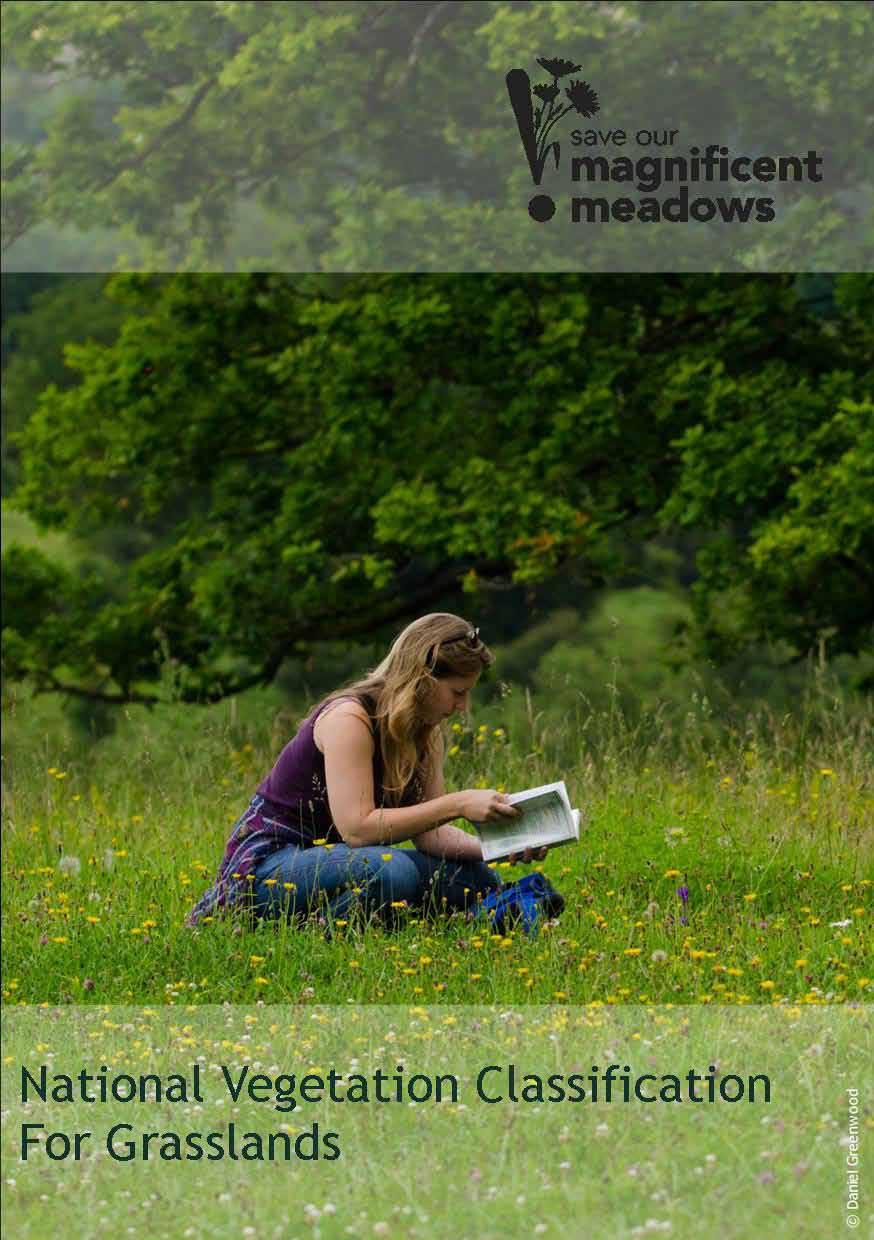
 is a survey method that helps to identify the community of plants in a habitat and likely associations. This leaflet explains the method.")
2 The diversity of grasslands is often based on the presence of flowering plants and grasses. National Vegetation Classification (NVC) is a survey method that helps to identify the community of plants in a habitat and likely associations. This leaflet explains the method. There are three steps in the process: Preparation for the survey (this may already have been done for you) Undertaking the vegetation survey Data analysis to identify the community of plants (and subcommunity if applicable) (this may be done by someone else). NVC is usually undertaken at the beginning of a monitoring period to identify a baseline of plants. It may also be undertaken at intervals of 5-10 years or even longer to assess if there are any large-scale changes in vegetation. An NVC survey includes the monitoring of all plants present in similar (homogeneous) stands of plant composition and structure. In grassland, the majority of these plants are flowering plants, grasses, rushes and sedges, but some identification of mosses may be required for particular communities of plants. The method does not categorise the transition between vegetation types particularly well, and it is advised not to be used in these situations. NVC can be completed by an individual or as part of a small group ideally with a maximum of 5-6 people. If there are more people, perhaps split into several groups to complete the survey faster.
3 Survey Methodology Equipment Map of the site showing the area to be monitored NVC record form suitable for the site Clipboard Pencil / pen ID books and hand lens GPS (see details for some suitable mobile apps) To help with identification of plants please bring a couple of plant ID books. Some ID books are listed below, but bring your favourite books that cover flowering plants, grasses, rushes and sedges. Rose, F. (2006) The Wild Flower Key. Penguin Group Rose, F. (1989) Grasses, sedges, rushes and ferns of the British Isles and north-western Europe. Viking Poland, J. And Clement, E. (2009) The vegetative key to the British flora. BSBI. Hubbard, C.E. (1984) Grasses. Penguin Books. Risk Assessment Please read the risk assessment prior to the survey. Bring a copy if you feel that it may be useful. If doing the survey alone, make sure that you have set up a buddy system someone that knows where you are and what time you are expected home. Survey period and timing For inexperienced botanists, NVC is best undertaken when the wildflowers and grasses are in bloom to ease identification. This is usually between May and August with the optimum time June and July before grasslands are cut or grazed by livestock.
4 Preparation for the survey This may have already been done for you, but here are some things that should be done before heading out to complete the vegetation survey. 1. The survey is based around surveying similar stands of vegetation in both species composition and structure. Identification of the areas that look similar can be done beforehand using aerial photographs and drawing outlines on a map indicating the similar areas of vegetation. Two good websites that display OS maps and aerial photographs sideby-side are 1 : Grab a Grid Reference Duo Where s the Path 3 Identify areas of the site look similar, for example they may have the same structure, often shown by the colour and patchiness of the map. One of the best ways of seeing vegetation change is to let your eyes become slightly unfocused blurring the colours of the aerial photo. This helps pick out any textural differences in the photo without being too detailed. Topography can also help to identify different plant communities, especially slopes which may not have been agriculturally improved. You may also want to identify different areas of grassland using different pen colours. The purpose of doing this preliminary mapping is to make it easier to get to the right areas of the site that you wish to survey. You may not be able to find any difference in the appearance of the grasslands, but don t worry as you can do a walk-over of the grassland to identify similar vegetation stands at the beginning of the survey. Of course, there may not be any major changes in vegetation structure or composition across the site and it may all be similar. You may find that there is little difference in the grassland habitats once you get to the site to do the survey, but this may help identify the places where you could sample and speed-up the location of representative areas for placement of the quadrats. 1 Websites sourced in March Other websites may have superseded these and provide good alternatives.
5 Undertaking the survey 1. On entering the site, go to the area that has been identified for survey using the prepared map. If you find that there are other areas of the site that are similar in structure and overall species composition (they look the same) then you may want to add in these vegetation stands. A quick walk-over of the part of the site you want to survey for NVC would suffice so that you can find your bearings and locate representative samples of vegetation. 2. The choice of where to place each 2x2m quadrat is subjective. It should be placed in what you consider to be a uniform stand of vegetation that is an area that is representative of the overall site. If the site is a mosaic of grassland you may also want to capture this in the NVC. The selection of location for the quadrat should not be swayed by trying to get a particularly rich composition of species or particular structure, such as concentrating in areas with a finer sward compared to those with a coarser sward. This would alter the results. There will always be some variation in sward across a site, and obvious boundaries between different types of grassland should be avoided. However, boundaries between grassland are usually more gradual, and can be hard to avoid. Figure 1 shows the placement of quadrats in relation to boundaries in plant composition and structure. It might be easier to identify the areas that are clearly different black and white first and then identify the less different swards making up the greys in-between. 3. After identifying the similar areas of vegetation composition and structure at the site, you will need to undertake 3-5 quadrats within each similar stand of vegetation. At the top of the record sheet enter an 8-figure or 10-figure grid reference of the quadrat (see description about how to take a grid reference). All plants should be recorded from each quadrat and a coverage scale estimating the percentage coverage of a species. This is needed to analyse the data using the NVC tables. Coverage scales include the DOMIN scale and Braun- Blanquet scale.

6 Location of quadrats either side of an obvious boundary. Each type of grassland would be surveyed as separate samples. Location of quadrats across a gradual boundary. This may be difficult to determine where one community with similar floristic composition ends and another begins. Location of quadrats to avoid a complex boundary. Each type of grassland would be surveyed as separate samples. Location of quadrats to sample a mosaic. Figure 1: Examples of quadrat placement in different sites to survey uniform stands or similar areas of mosaics. DOMIN Scale Braun-Blanquet Scale Cover Domin Cover Scale % % % % % % % % % 6 1 5% % 5 <1% % 4 <4% (many individuals) 3 <4% (several individuals) 2 <4% (few individuals) 1
7 Avoid using the DAFOR (Dominant, Abundant, Frequent, Occasional and Rare) scale as there is no quantitative meaning to these frequencies. The DOMIN scale can be related to the simpler Braun- Blanquet scale but not vice versa. The total percentage cover can be above 100% as plants often lay on top of one another (see the description about how to assess percentage cover of a plant). 4. Other useful information to record include: Altitude Slope Aspect Geology Soil type Bare rock, bare soil and vegetation litter recorded as a percentage Describing the terrain (i.e. an annotated sketch) Information about site management, such as animals grazing, burning etc. Data analysis This may be done by someone else following your survey. Data tables can be constructed by hand and compared with the NVC tables. The NVC tables are based on two parameters for each species that you have found in the quadrat, frequency and coverage: Frequency this is the number of times the plant is found in the quadrats. 3 quadrats are the minimum number of samples that can be entered, but it is better to assess vegetation over 5 quadrats. The NVC tables (see the NVC books in the references), frequency is referred to using roman numerals: Frequency class Percentage of quadrats Descriptive measure I 1-20% (1 quadrat out of 3 or 5) Scarce II 21-40% Occasional III 41-60% Frequent IV 61-80% Constant V % Constant
8 For example, if Betony was found in three out of the five quadrats it would have a frequency of III. If cock s-foot was found in five out of five quadrats it would have a frequency of V. Coverage this is usually in the form of absolute coverage, the DOMIN scale or Blaun-Blanquet scale. The NVC tables use the DOMIN scale. The species should be ordered from the greatest coverage and most frequent to the least coverage and frequent. The constant species are those that tend to define the NVC community and you will need to compare these species to the tables in the NVC handbooks. There are also two freely available software programmes that can analyse the data for you; TABLEFIT (from the Centre of Ecology and Hydrology at 2 ) MAVIS (from the Centre of Ecology and Hydrology at 2 ) The data should be entered into the computer programme see the manuals for guidance on how to do this. It might be useful to run the analysis twice. Once with all the species, and the second time stripping out all of the weeds (and ruderal plants), and any shrub and tree seedlings. The reason for doing this is based on the final part of the NVC classification which was for the open vegetation communities (termed OV). The presence of these plants can sometimes override the other vegetation giving a false output for the community. Once the data has been entered and analysis completed, the resulting NVC matches should be assessed using the NVC hand books to determine whether the outputs are a good match for the species. Remember that the software uses the numbers but there are other factors that may come into play regarding the final assessment of a site, so don t necessarily take the top answer as the final match! 2 Websites last accessed in March 2015.
9 How to assess a percentage cover The easiest way to decide whether this is the case is to imagine the plant is grouped into a corner or line against one edge of the quadrat. The coverage can then be estimated depending on the number of squares filled by the plant on an imaginary 5 x 5 grid of the quadrat. Each square represents 4%. This is 4% of a quadrat, and is a 4 on the DOMIN scale and a 1 on the Braun-Blanquet scale. Anything lower than this is marked as 1-3 on the DOMIN scale or 1 on the Braun-Blanquet scale. This is 48% of a quadrat, and is a 7 on the DOMIN scale and a 3 on the Braun-Blanquet scale. This is 76% of a quadrat, and 9 on the DOMIN scale and 5 on the Braun-Blanquet scale.
10 Grid Reference There are several ways of taking a grid reference. A 10-figure grid reference is needed for the most detailed fix on the location. However, you can note down a 6 figure grid reference using a close-up map of the site. To do this you need to identify the horizontal lines called northings and vertical lines called eastings. These are located at every 1km interval on a map creating a series of squares covering the UK and each 1x1km square is called a monad. Grid references are easy if you can remember that you always have to go along the corridor before you go up the stairs. To find the number of a monad, first use the eastings to go along the corridor until you come to the bottom left-hand corner of the monad you want. Write this two-figure number down. Now imagine this monad is divided up into 100 tiny squares with 10 squares along each side. Still remembering to go along the corridor mark down the number of small squares where your point falls. This creates the first three digits of a grid reference. To create the next three digits repeat this process using the northings to go up the stairs until you find the same corner of the monad. Mark down these two numbers and then imagine the monad is spilt into 100 tiny squares with 10 squares along each side. Still remembering to go up the stairs mark down the number of small squares where your point falls. To get the two letter code for the front of the grid reference look at the corner of the map. The UK is split into 100x100km squares and each of these huge squares is given a code so that it can be located across the country. Altogether this creates the grid reference i.e. Stonehenge is at SU An alternative way to get a more detailed grid is to use a handheld GPS unit. These can give up to 10 figure grid references with varying degrees of accuracy depending on the satellites available. Each GPS unit is different, and you may need to read the instructions to find out how to use it. There are good mobile apps that can provide a 6, 8 or 10 figure grid reference 3. 3 Apps sourced on 1 st February Newer or alternative apps may be available.
11 For Windows Phones (and tablets); GPS to Grid Ref (green icon with OS on it). It currently costs 0.79 but will convert long & lat from the phone's internal navigation into a 10 figure OS grid reference. Grid Ref UK and Ireland (UK map icon) which will give you a 6 figure OS grid reference and is free (but not as good as an 8 or 10 figure grid ref). For Android and iphones (and tablets); OS Mapfinder (map with the OS logo on top) will project your location onto an OS map at a large scale (more detailed maps can be downloaded for a fee). By pressing on the icon hovering on your position you can get a 10 figure grid reference. This app is free (you won t need the more detailed maps for NVC). All of the apps should be downloaded prior to the survey as some also require base maps to be downloaded to work (such as OS Mapfinder which needs to download the large-scale maps) and require internet access to do this. They may not be usable without downloading this background information. All of these apps use satellite technology so you do not need to be in mobile reception to get a grid reference, but where satellite access is restricted, such as under a tree canopy in a woodland, in gorges and tunnels etc., they may not be able to connect to a satellite to provide a grid reference, or the grid reference may be inaccurate. If you cannot do any of these do not worry. Although this is really useful information, it is not absolutely essential. Doing a survey without taking grid references is much better than surveys not being completed at all.
12 References Rodwell, J.s. (1991) British Plant Communities Volume 2: Mires and heaths. Cambridge University Press. Rodwell, J.s. (1992) British Plant Communities Volume 3: Grasslands and montane communities. Cambridge University Press. Rodwell, J.s. (2000) British Plant Communities Volume 5: Maritime communities and open habitats. Cambridge University Press. Rodwell, J.S. (2006) NVC User s Guide. JNCC. Last accessed 27/03/2015.
13
The Wild Flower Key: A Guide To Plant Identification In The Field, With And Without Flowers By Francis Rose READ ONLINE
 The Wild Flower Key: A Guide To Plant Identification In The Field, With And Without Flowers By Francis Rose READ ONLINE Southeastern Flora is an online and herbaceous plants without knowing how to read
Using OS Resources - A fieldwork activity for Key Stage 2
 Using OS Resources - A fieldwork activity for Key Stage 2 Liz Spincer, Saltford CE Primary School Outline of the fieldwork project: This series of activities was designed to illustrate how Primary School
Marsh Club-moss Lycopodiella inundatum at Stedham and Iping Commons Graeme Lyons January 2013
 Marsh Club-moss Lycopodiella inundatum at Stedham and Iping Commons Graeme Lyons January 2013 0 - Summary Two specimens of Marsh Club-moss were recorded at Stedham Common on the 30 th May 2012, the first
What is a map? Understanding your map needs
 What is a map? A map is simply a drawing or picture of a landscape or location. Maps usually show the landscape as it would be seen from above, looking directly down. As well as showing the landscape of
Core practical 15: Investigate the effect of different sampling methods on estimates of the size of a population
 Core practical 15 Teacher sheet Core practical 15: Investigate the effect of different sampling methods on Objectives To investigate the effect of using different quadrat types on To understand how to
GPS Measurement Protocol
 GPS Measurement Protocol Purpose To determine the latitude, longitude, and elevation of your school and of all your GLOBE sites Overview The GPS receiver will be used to determine the latitude, longitude
The Wild Flower Key: A Guide To Plant Identification In The Field, With And Without Flowers By Francis Rose
 The Wild Flower Key: A Guide To Plant Identification In The Field, With And Without Flowers By Francis Rose If you are looking for the ebook The Wild Flower Key: A Guide to Plant Identification in the
Map reading made easy
 Map reading made easy 1. What is a map? A map is simply a drawing or picture (in 2-D) of a landscape or area of a country (in 3-D). It could be anything from a sketch map for a visitor to find your school
Chapter 6. Field Trip to Sandia Mountains.
 University of New Mexico Biology 310L Principles of Ecology Lab Manual Page -40 Chapter 6. Field Trip to Sandia Mountains. Outline of activities: 1. Travel to Sandia Mountains 2. Collect forest community
Map reading made easy
 Map reading made easy Maps can be great fun and they can lead you to all sorts of discoveries. They can help you get to know an area really well, because they pinpoint interesting places that are often
How to Perform a Site Based Plant Search
 PlantSelector Help Use PlantSelector to get detailed information and photos of plants by: Searching for plants that will grow well at your planting site. How do I do this? OR Searching for plants with
Give 4 advantages of using ICT in the collection of data. Give. Give 4 disadvantages in the use of ICT in the collection of data
 Give 4 advantages of using ICT in the collection of data can use a handheld GPS to get accurate location information which can be used to show data linked to specific locations within a GIS can collect
FIELDWORK FOR ATLAS 2020 A BEGINNERS GUIDE TO RECORDING
 FIELDWORK FOR ATLAS 2020 A BEGINNERS GUIDE TO RECORDING The first edition of this guide was produced in 1996 for the Atlas 2000 project. Technology has moved on a bit since then and some plant names have
Carbon Cycle Sample Site Set- up - Student Field Guide. Sample Site Corner Team
 1) Start at the center of the sample site. Sample Site Corner Team 2) Select one person to stand at center with the compass. Turn the housing to an azimuth of one of the sample site corners (e.g. 315).
Nested Frequency Plot Sample Design and Field Methods for Vegetation Monitoring
 1 Nested Frequency Plot Sample Design and Field Methods for Vegetation Monitoring Materials Plot frame Map of site showing boundaries and sampling point locations Compass GPS pre-loaded with sample points
Map reading made easy
 Map reading made easy 1 1. What is a map? A map is simply a drawing or picture (in 2-D) of a landscape or area of a country (in 3-D). It could be anything from a sketch map for a visitor to find your school
Teacher s Guide. Trees, Weeds and Vegetables So Many Kinds of Plants!
 Teacher s Guide Trees, Weeds and Vegetables So Many Kinds of Plants! Introduction This teacher s guide helps you teach young children about different kinds of plants. With over 350,000 varieties of plants
RHOSYDD LLANPUMSAINT SITE OF SPECIAL SCIENTIFIC INTEREST
 RHOSYDD LLANPUMSAINT SITE OF SPECIAL SCIENTIFIC INTEREST Sam Bosanquet 2008 YOUR SPECIAL SITE AND ITS FUTURE Your Special Site and its Future is part of our commitment to improve the way we work with Site
LAB 2 - ONE DIMENSIONAL MOTION
 Name Date Partners L02-1 LAB 2 - ONE DIMENSIONAL MOTION OBJECTIVES Slow and steady wins the race. Aesop s fable: The Hare and the Tortoise To learn how to use a motion detector and gain more familiarity
So you want to know your plants...
 So you want to know your plants... A guide for future field botanists on... what to do where to go who to ask resources to use BOTANICAL FIELD SKILLS PYRAMID 7 6 5 4 3 2 1 0 Outstanding: a national expert
Wednesday 21 May 2014 Afternoon
 Wednesday 21 May 2014 Afternoon AS GCE SCIENCE G641/01 Remote Sensing and the Natural Environment *1319354529* Candidates answer on the Question Paper. OCR supplied materials: None Other materials required:
Study of Scrubland Ecosystem
 Study of Scrubland Ecosystem INTRODUCTION In Hong Kong, scrubland is defined as land with fairly continuous cover of shrubs and bushes of 0.3 m to 2.9 m in height. Scrubland is a transitional stage between
Dune habitat conservation status assessment review
 Annotated document key - Item Summary Emphasis Dune habitat conservation status assessment review CCW carried out an assessment of the condition of the dune habitats of the SAC in the summer of 2005 and
GEOGRAPHY. ATAR course examination, Question/Answer booklet. Time allowed for this paper Reading time before commencing work:
 ATAR course examination, 2017 Question/Answer booklet GEOGRAPHY Please place your student identification label in this box Student number: In figures In words Time allowed for this paper Reading time before
Lab Slide Rules and Log Scales
 Name: Lab Slide Rules and Log Scales [EER Note: This is a much-shortened version of my lab on this topic. You won t finish, but try to do one of each type of calculation if you can. I m available to help.]
Fishery Bay, D.Shefi 12 Feb. 2006
 Fishery Bay, D.Shefi 12 Feb. 2006 Flinders University Maritime Archaeology Field School Arch 8103 Mount Dutton Bay, Eyre Peninsula, South Australia 1-15 February 2006 Dianna Zwart 2037383 Table of contents
Map reading made easy
 Map reading made easy 1. What is a map? A map is simply a drawing or picture (in 2-D) of a landscape or area of a country (in 3-D). It could be anything from a sketch map for a visitor to find your school
Lesson Plan 2 - Middle and High School Land Use and Land Cover Introduction. Understanding Land Use and Land Cover using Google Earth
 Understanding Land Use and Land Cover using Google Earth Image an image is a representation of reality. It can be a sketch, a painting, a photograph, or some other graphic representation such as satellite
GIS Workshop Data Collection Techniques
 GIS Workshop Data Collection Techniques NOFNEC Conference 2016 Presented by: Matawa First Nations Management Jennifer Duncan and Charlene Wagenaar, Geomatics Technicians, Four Rivers Department QA #: FRG
Estimation of a Plant Density Exercise 4
 Estimation of a Plant Density Exercise 4 2011-2014 Johnson, Larson, Louhaichi, & Woerz Density from Quadrats or Plots When monitoring for ecosystem change, especially for change in rare or endangered plant
Approach to Field Research Data Generation and Field Logistics Part 1. Road Map 8/26/2016
 Approach to Field Research Data Generation and Field Logistics Part 1 Lecture 3 AEC 460 Road Map How we do ecology Part 1 Recap Types of data Sampling abundance and density methods Part 2 Sampling design
Assignment #0 Using Stellarium
 Name: Class: Date: Assignment #0 Using Stellarium The purpose of this exercise is to familiarize yourself with the Stellarium program and its many capabilities and features. Stellarium is a visually beautiful
RESTORING ACTIVE BLANKET BOG IN IRELAND Project reference: LIFE02NAT/IRL/8490
 Page 1 of 34 RESTORING ACTIVE BLANKET BOG IN IRELAND Project reference: LIFE02NAT/IRL/8490 A REPORT ON THE RESTORATION OF PROJECT SITE No. 13. CROAGHONAGH, CO. DONEGAL. Compiled by: John Conaghan 11 Dun
YEAR 7 REVISION BOOKLET
 YEAR 7 REVISION BOOKLET Assessment checklist 1. To be able to define Geography. 2. Give examples of what we study in geography 3. Group what we study into the three major areas of geography 4. To be able
Measurement: Length, Area and Volume Part I
 IDS 101 Name Measurement: Length, Area and Volume Part I If we ask someone the size of a common object, such as a dime or penny, most people come pretty close to the actual size. However, objects that
Line Point Intercept Transect for Foliar Cover Composition
 Chapter 9 Line Point Intercept Transect for Foliar Cover Composition 9.1 Overview This chapter covers data elements relating to: foliar canopy and basal cover 9.2 What s New The following changes were
NAME: DATE: Leaving Certificate GEOGRAPHY: Maps and aerial photographs. Maps and Aerial Photographs
 NAME: DATE: Leaving Certificate Geography Maps and Aerial Photographs Please see Teachers Notes for explanations, additional activities, and tips and suggestions. Learning Support Vocabulary, key terms
Appendix 5: Purple Loosestrife Biocontrol Monitoring Protocol from Cornell University
 Appendix 5: Purple Loosestrife Biocontrol Monitoring Protocol from Cornell University Contents: Introduction Site Selection and Quadrat Setup Data Collection Form 1 (site location information) Form 2 (spring
Name Block Date. The Quadrat Study: An Introduction
 Name Block Date The Quadrat Study: An Introduction A quadrat study can almost be thought of as a snapshot of the ecosystem during a particular year and at a particular time of that year. The plant and
Scout Skills Mapping QUALITY TRAINING FOR QUALITY SCOUTING INFORMATION SHEET
 Scout Skills Mapping INFORMATION SHEET A map is a picture of a given area of what the ground looks like from directly above. When undertaking a journey, we need to be able to find our way around competently,
Curriculum Links AS and A level Field Studies
 Equipment Includes Human Geography Coastal Management Students examine the conflicts that arise from coastal erosion and the options for coastal management. They investigate different types of coastal
Favourable Condition of Blanket Bog on Peak District SSSIs. Richard Pollitt Lead Adviser, Conservation & Land Management, Dark and South West Peak
 Favourable Condition of Blanket Bog on Peak District SSSIs Richard Pollitt Lead Adviser, Conservation & Land Management, Dark and South West Peak Definitions SSSI Site of Special Scientific Interest statutory
Rebecca Nayler Medium term planning. Curriculum area GEOGRAPHY - AUTUMN 2016
 Medium term planning Curriculum area GEOGRAPHY - AUTUMN 2016 As geographers we are getting better at: LO s EYFS Early Learning Goal Children know about similarities and differences in relation to places,
Geographic Information Systems. Introduction to Data and Data Sources
 Geographic Information Systems Introduction to Data and Data Sources Presented by John Showler, NJDA-SSCC NJ SCD GIS Training Session December 10, 209 The Objectives of this session are 3-fold: 1. Introduce
ACCESS TO SCIENCE, ENGINEERING AND AGRICULTURE: MATHEMATICS 1 MATH00030 SEMESTER / Lines and Their Equations
 ACCESS TO SCIENCE, ENGINEERING AND AGRICULTURE: MATHEMATICS 1 MATH00030 SEMESTER 1 017/018 DR. ANTHONY BROWN. Lines and Their Equations.1. Slope of a Line and its y-intercept. In Euclidean geometry (where
ESRM 304. Environmental and Resource Assessment. Final Exam Hints & Helps
 ESRM 304 Environmental and Resource Assessment Final Exam Hints & Helps ESRM 304 Final Exam Hints! The exam will contain up to 9 sections of : Short Answers, Calculations, Definitions, Multiple Choice,
CO6: Introduction to Computational Neuroscience
 CO6: Introduction to Computational Neuroscience Lecturer: J Lussange Ecole Normale Supérieure 29 rue d Ulm e-mail: johann.lussange@ens.fr Solutions to the 2nd exercise sheet If you have any questions regarding
Progression of skills in Geography
 New Curriculum Holy Trinity CE Primary Academy 2013-14 Subject: Geography Skills: Progression of skills in Geography Geographical enquiry Teacher led enquiries, to ask and respond to simple closed questions.
A303 Stonehenge Amesbury to Berwick Down Archaeological Geophysical Survey Design Brief
 A303 Stonehenge Amesbury to Berwick Down Archaeological Geophysical Survey Design Brief March 2016 Table of contents Chapter Pages 1 Summary 1 2 Background 1 2.1 Purpose 1 2.2 Location 2 2.3 Archaeological
LAB 2: INTRODUCTION TO MOTION
 Lab 2 - Introduction to Motion 3 Name Date Partners LAB 2: INTRODUCTION TO MOTION Slow and steady wins the race. Aesop s fable: The Hare and the Tortoise Objectives To explore how various motions are represented
Chapter 3 Populations and interactions
 Chapter 3 Populations and interactions Worksheet 1: Definitions Worksheet 2: Succession *Practical 1: Investigating the distribution of plants using random sampling *Practical 2: Investigating the distribution
Directions: Using the Succession Power Point, answer the following questions. 1. What did these events do to the earth? 2. How did the events do this?
 Name Period Date Assigned Date Due Date Returned Directions: Using the Succession Power Point, answer the following questions. 1. What did these events do to the earth? 2. How did the events do this? 3.
Deforestation. Can you name any countries rainforests can be found in?
 The test will be on everything you have studied this year. Use this resource as a guide to help you revise. It should support your other revision activities, such as making mindmaps or flashcards. You
Map My Property User Guide
 Map My Property User Guide Map My Property Table of Contents About Map My Property... 2 Accessing Map My Property... 2 Links... 3 Navigating the Map... 3 Navigating to a Specific Location... 3 Zooming
Scout Skills Mapping INFORMATION SHEET. Town Maps
 Scout Skills Mapping 0845 300 1818 INFORMATION SHEET A map is a picture of a given area of what the ground looks like from directly above. When undertaking a journey, we need to be able to find our way
Quality and Coverage of Data Sources
 Quality and Coverage of Data Sources Objectives Selecting an appropriate source for each item of information to be stored in the GIS database is very important for GIS Data Capture. Selection of quality
Factors That Shape Places Sackville North
 Factors That Shape Places Sackville North As urban Sydney sprawls in all directions, the North West is changing dramatically. This Geographical Inquiry will focus on the connections between people and
VCS MODULE VMD0018 METHODS TO DETERMINE STRATIFICATION
 VMD0018: Version 1.0 VCS MODULE VMD0018 METHODS TO DETERMINE STRATIFICATION Version 1.0 16 November 2012 Document Prepared by: The Earth Partners LLC. Table of Contents 1 SOURCES... 2 2 SUMMARY DESCRIPTION
Graphic Attachment 2 Photo-simulations PROPOSED DAIRY PLANT EXPANSION - STUDHOLME
 Graphic Attachment 2 Photo-simulations PROPOSED DAIRY PLANT EXPANSION - STUDHOLME 1 Methodology for Preparation of Photo Simulations 1 The main objective of a photo simulation is to provide an image that,
Unit 8D Ecological relationships. About the unit. Expectations. Science Year 8. Where the unit fits in
 Science Year 8 Unit 8D Ecological relationships About the unit In this unit pupils: study a habitat in detail and learn how: organisms can be identified and sizes of populations compared feeding relationships
Watershed Modeling Orange County Hydrology Using GIS Data
 v. 10.0 WMS 10.0 Tutorial Watershed Modeling Orange County Hydrology Using GIS Data Learn how to delineate sub-basins and compute soil losses for Orange County (California) hydrologic modeling Objectives
1.1 What is Site Fingerprinting?
 Site Fingerprinting Utilizing GIS/GPS Technology 1.1 What is Site Fingerprinting? Site fingerprinting is a planning tool used to design communities where protection of natural resources is the primary
Lesson Plan for Santa Rita Experimental Range Vegetation Monitoring Martha Gebhardt, Outreach Coordinator
 Lesson Plan for Santa Rita Experimental Range Vegetation Monitoring Martha Gebhardt, Outreach Coordinator Objectives: Part 1: Students will learn about common plant species on SRER through vegetation monitoring
Topic Section Marks INSTRUCTION TO CANDIDATES:
 Topic Section Marks Earth Science Multiple choice /10 Short answer /20 Investigating /15 Extended /answer /15 Genetics and Evolution Multiple choice /10 Short answer /20 Investigating /15 Extended Answer
CHAPTER 7 PRODUCT USE AND AVAILABILITY
 CHAPTER 7 PRODUCT USE AND AVAILABILITY Julie Prior-Magee Photo from SWReGAP Training Site Image Library Recommended Citation Prior-Magee, J.S. 2007. Product use and availability. Chapter 7 in J.S. Prior-Magee,
Looking Ahead to Chapter 10
 Looking Ahead to Chapter Focus In Chapter, you will learn about polynomials, including how to add, subtract, multiply, and divide polynomials. You will also learn about polynomial and rational functions.
BUSH NAV BUSH NAV DAY Navigation for Bush Navigation Day. November. WhitehorseD AY. Section 1 Registration, Maps & Checkpoints
 BUSH DAY Navigation for Bush Navigation Day Robert Kirwan, Nunawading SES W NW N NE E If you have little or no bush navigation experience then you will have been teamed up with members that have that experience
Cambridge International Examinations Cambridge International General Certificate of Secondary Education
 Cambridge International Examinations Cambridge International General Certificate of Secondary Education *4087030179* GEOGRAPHY 0460/41 Paper 4 Alternative to Coursework May/June 2017 Candidates answer
Fieldwork at Buffalo Creek Reserve and Sugarloaf Point. A Local Ecosystem NORTH RYDE EAST RYDE. P Mangrove
 A Local Ecosystem Fieldwork at Buffalo Creek Reserve and Sugarloaf Point Map of Buffalo Creek Reserve and Sugarloaf Point NORTH RYDE EAST RYDE C T P Map: Walking Tracks of the Lane Cove Valley, STEP Inc
Parish Boundaries Project. East Midlands NOTES ON THE PARISH BOUNDARIES PROJECT
 Parish Boundaries Project East Midlands NOTES ON THE PARISH BOUNDARIES PROJECT GENERAL COMMENTS 1. Parishes first came into existence during Anglo-Saxon times and were variable in area depending on changes
Map showing location of tropical rainforests
 Information sheet one: where are the rainforests located? Map showing location of tropical rainforests On your sheet describe the geographical location of the tropical rainforests. Top tip: Use an atlas
Chapter 1 Review of Equations and Inequalities
 Chapter 1 Review of Equations and Inequalities Part I Review of Basic Equations Recall that an equation is an expression with an equal sign in the middle. Also recall that, if a question asks you to solve
Field Trip to Tempe Butte
 Synopsis Field Trip to Tempe Butte So far you have been identifying rocks and mapping their locations without actually going there. Now it is your chance to put it all together and see real rocks out in
Biomes Section 1. Chapter 6: Biomes Section 1: What is a Biome? DAY ONE
 Chapter 6: Biomes Section 1: What is a Biome? DAY ONE What is a Biome? Biomes are large regions characterized by a specific type of climate and certain types of plant and animal communities. The climate
ECOLOGY MODULE FIELDWORK REPORT FOR LEAVING CERTIFICATE STUDENTS ECOSYSTEM HABITAT. Name. School. Date
 ECOLOGY MODULE FIELDWORK REPORT FOR LEAVING CERTIFICATE STUDENTS ECOSYSTEM HABITAT Name School Date Experiments covered 1) To carry out quantitative and qualitative surveys of the habitat 2) To use simple
Image Interpretation and Landscape Analysis: The Verka River Valley
 Image Interpretation and Landscape Analysis: The Verka River Valley Terms of reference Background The local government for the region of Scania has a need for improving the knowledge about current vegetation
Tiree s great yellow bumblebee project
 Tiree s great yellow bumblebee project * * * * * Facts about the great yellow bumblebee LATIN NAME Bombus distinguendus GAELIC NAME Seillean mòr buidhe HOW RARE ARE THEY? It s one of the UK s rarest bumblebees
Stat 20 Midterm 1 Review
 Stat 20 Midterm Review February 7, 2007 This handout is intended to be a comprehensive study guide for the first Stat 20 midterm exam. I have tried to cover all the course material in a way that targets
Listening. The Air. Did you know? Did you know?
 Listening 1. Find a place to sit. 2. Close your eyes and listen carefully to all the sounds you can hear. Cup your hands around your ears and turn your head to help you listen in particular directions.
Brief for Habitat and Boundary survey and action plans
 Brief for Habitat and Boundary survey and action plans Introduction The Forest of Bowland Area of Outstanding Natural Beauty (AONB) is the lead partner of the proposed Pendle Hill Landscape Partnership
STAGE 2 GEOGRAPHY: Natural environments
 STAGE 2 GEOGRAPHY: Natural environments Focus area: The Earth s environment Different environments Significance of environments Key inquiry questions How does the environment support the lives of people
Effect of competition on the distribution of Marram Grass within a sand dune system Introduction
 » sjhoward.co.uk Effect of competition on the distribution of Marram Grass within a sand dune system Introduction Sand dunes provide a classic example of the progression of ecological succession, with
FIELD SPECTROMETER QUICK-START GUIDE FOR FIELD DATA COLLECTION (LAST UPDATED 23MAR2011)
") FIELD SPECTROMETER QUICK-START GUIDE FOR FIELD DATA COLLECTION (LAST UPDATED 23MAR2011) The ASD Inc FieldSpec Max spectrometer is a precision instrument designed for obtaining high spectral resolution
FIELD SPECTROMETER QUICK-START GUIDE FOR FIELD DATA COLLECTION (LAST UPDATED 23MAR2011) The ASD Inc FieldSpec Max spectrometer is a precision instrument designed for obtaining high spectral resolution
2010/11 Scouts Environment Program Ra bbitsca n Field Guide
 2010/11 Scouts Environment Program Ra bbitsca n Field Guide Scouts invitation to be involved in citizen science RabbitScan provides Scouts Australia with an excellent opportunity to be involved in an important
Physics E-1ax, Fall 2014 Experiment 3. Experiment 3: Force. 2. Find your center of mass by balancing yourself on two force plates.
 Learning Goals Experiment 3: Force After you finish this lab, you will be able to: 1. Use Logger Pro to analyze video and calculate position, velocity, and acceleration. 2. Find your center of mass by
Physics 20 Lesson 6 Graphical Analysis Activities
 Physics 2 Lesson 6 Graphical Analysis Activities I. Motion Up and Down an Incline Objective: To analyse the motion of an object that moves up and then down an inclined plane (an air table). Materials:
Map Makers 2nd Grade
 Map Makers 2nd Grade Students use mapmaking to develop science and social studies concepts and practice map skills while developing a sense of place and a connection to the property. Concepts of landforms,
The Shrinking Aral Sea
 The Shrinking Aral Sea Practical equipment: A4 Printed copies of satellite images of Aral Sea (15 images total) A4 transparency printed with 5mm grid squares (15 copies) Equipment for producing a graph
Matrix ranking: a means to discussion
 Matrix ranking: a means to discussion Stephany Kersten Introduction Matrix ranking was discussed by Simon Maxwell and Claude Bart in PLA Notes 22 (199) in terms of its numerical outcomes. However, they
Standards Alignment... 5 Safe Science... 9 Scienti c Inquiry...11 Assembling Rubber Band Books... 15
 Standards Alignment... 5 Safe Science... 9 Scienti c Inquiry...11 Assembling Rubber Band Books... 15 Organization and Development of Living Organisms Enviroscape... 17 Plant Parts...23 Getting to the Root
Designing a Quilt with GIMP 2011
 Planning your quilt and want to see what it will look like in the fabric you just got from your LQS? You don t need to purchase a super expensive program. Try this and the best part it s FREE!!! *** Please
Evaluating Wildlife Habitats
 Lesson C5 4 Evaluating Wildlife Habitats Unit C. Animal Wildlife Management Problem Area 5. Game Animals Management Lesson 4. Evaluating Wildlife Habitats New Mexico Content Standard: Pathway Strand: Natural
Preparing Landslide Inventory Maps using Virtual Globes
 Introduction: A landslide is the movement of a mass of rock, debris, or earth down a slope, under the influence of gravity. Landslides can be caused by different phenomena, including intense or prolonged
GEOGRAPHY. Western Australian Certificate of Education Examination, Question/Answer Booklet. Stage 3
 Western Australian Certificate of Education Examination, 2015 Question/Answer Booklet GEOGRAPHY Stage 3 Please place your student identification label in this box Student Number: In figures In words Time
CITY OF LONDON CEMETERY TEACHERS GUIDE TO ROCK TYPE EXERCISES: LOCATION ONE
 CITY OF LONDON CEMETERY TEACHERS GUIDE TO ROCK TYPE EXERCISES: LOCATION ONE The City of London Cemetery is a haven for the geologist, with representatives from the sedimentary, igneous and metamorphic
Mathematics Enhancement Programme
 UNIT 9 Lesson Plan 1 Perimeters Perimeters 1 1A 1B Units of length T: We're going to measure the lengths of the sides of some shapes. Firstly we need to decide what units to use - what length-units do
Ground-truthing protocol. Landscape Mosaics CIFOR-ICRAF Biodiversity Platform
 Ground-truthing protocol Landscape Mosaics CIFOR-ICRAF Biodiversity Platform Prepared by Spatial Analysis team Contact persons: Sonya Dewi (sdewi@cgiar.org) Andree Ekadinata (aekadinata@cgiar.org) Introduction
Page 1 of 5. New: evidence, measure, nutrients, light, soil, transport, volume, water, warmth, insect, pollen, pollinate, nectar.
 National Curriculum Objectives: (Statutory requirements) a) Identify and describe the functions of different parts of flowering : roots, stem/trunk, leaves and flowers b) Explore the requirements of for
Quite often plants are seen as the background against which the more interesting (animal) wildlife occurs. After all, often, when we use the word
 wildlife occurs. After all, often, when we use the word") 1 Quite often plants are seen as the background against which the more interesting (animal) wildlife occurs. After all, often, when we use the word 'habitat', we are actually using it as shorthand for
1 Quite often plants are seen as the background against which the more interesting (animal) wildlife occurs. After all, often, when we use the word 'habitat', we are actually using it as shorthand for
Mapping Earth. How are Earth s surface features measured and modeled?
 Name Mapping Earth How are Earth s surface features measured and modeled? Before You Read Before you read the chapter, think about what you know about maps Record your thoughts in the first column Pair