MSAG Synchronization. Patrick McKinney, Cumberland County
|
|
|
- Alexandra Page
- 5 years ago
- Views:
Transcription
1 MSAG Synchronization Patrick McKinney, Cumberland County
2 NENA Sync GIS Databases with MSAG & ALI On-going process of syncing MSAG & GIS datasets Recommended minimum match rate of 98% (p. 8) Differences between MSAG & Road Centerlines includes (p. 8): o Missing roads o Naming conventions of roads o Inaccurate address ranges o Incorrect MSAG Community designation Official title: NENA Information Document for Synchronizing Geographic Information System Databases with MSAG & ALI

3 MSAG & GIS Update procedures Developing standard update procedures for MSAG & CAD datasets can help reduce errors Consider using tools like Esri Attribute Assistant in workflows Possibility of managing NENA & CAD required fields simultaneously


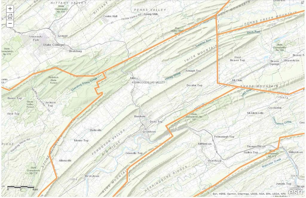
4 Cumberland County Process 1. Export table of all possible MSAG addresses. Icons provided by flaticon.com 2. Geocode MSAG addresses; spatially join CAD municipal boundaries to mapped addresses 3. Resolve unmapped addresses; resolve mapped addresses in wrong municipality

5 MSAG Database Coordinate addressing with 33 municipalities & 2 military institutions MS SQL Server back-end with MS Access frontend for edits
6 MSAG all addresses script
7 Geocode Process 3 Locators: Road Centerlines, Address Points, and Composite Perform geocode on composite and road centerlines Address locators need to be created with the municipality as your zone/place instead of postal community zip code

8 Geocode results - Address Points - Road Centerlines
9 Unmapped MSAG Addresses Export records to table and review Update ranges in road centerlines Create address point (or commonplace) Check with municipality about existence and/or necessity of address ranges and update MSAG

10 Inconsistent Address Ranges - Address Points - Commplaces
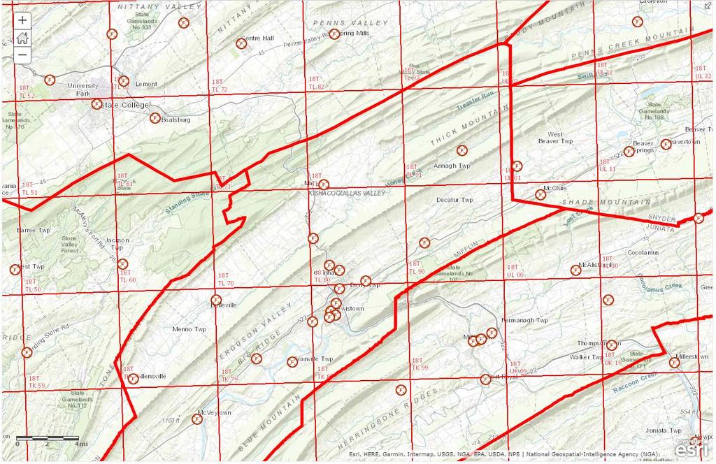
11 Mapped MSAG addresses Goal is for addresses to geocode in assigned municipality Administration of municipal boundaries is not purvey of Counties (but we still have to deal with it for CAD) Identify which MSAG records (table) do not geocode in assigned municipality (polygon) o Spatially join CAD municipality layer to mapped addresses o Perform attribute query to find mismatched records

12 Municipal Boundary quirks - Road Centerline Geocoded Addresses - CAD Municipal Boundary - PennDOT Municipal Boundary
13 Cumberland County Process 1. Export table of all possible MSAG addresses. Icons provided by flaticon.com 2. Geocode MSAG addresses; spatially join CAD municipal boundaries to mapped addresses 3. Resolve unmapped addresses; resolve mapped addresses in wrong municipality
14 Remember the reason! crucial to providing telecommunicators the information they need to correctly verify the location of a caller and provide proper emergency response." P. 8, NENA Information Document for Synchronizing Geographic Information System Databases with MSAG & ALI
15 Questions?
16 Break
17 Pennsylvania GIS NG911 Best Practices PEMA GIS Workgroup Next Steps and What to Expect for Pennsylvania NG911 GIS Standards Justin Smith, Cumberland County

18
19 Gap Analysis Compare datasets used in CAD GIS Validation with needs of NG911 Geospatial Call Routing Detailed layer analysis QA/QC o Attribute format o Missing data o Topology rules o Address inconsistencies
20 Gap Analysis Remediation needs report o Counties with incomplete data o Edge matching Transform submitted data into statewide layers o NENA GIS Data Model o Beta version for testing Next Gen Core Services
21 We will do this once. How do we do it a thousand times? Outreach and commitment of data stewards Fund increased expectations of county GIS Provide editing and ETL tools to data stewards Prioritize automation Maximize update frequency Collaborate with Geoboard
22 PA NG911 GIS Standards Local data field map into NG911 data schema Consistent standards for attributes and geometry Documenting maintenance procedures for GIS Data Stewards Local workflows for error resolution Reporting hierarchies


23 Kansas NG911 GIS Standards Road Class domain oprimary, SECONDARY, LOCAL, RAMP, SERVICE, VEHICULAR TRAIL, WALKWAY, ALLEY, PRIVATE, PARKING LOT, TRAIL All road centerline segments shall be broken at intersections, even overpasses. Elevation attributes [ELEV_F] & [ELEV_T] will represent roads passing over other roads.
24 Arizona NG911 GIS Standards GIS datasets and ALI require a 98% match o Funding may be withheld if match rate not met PSAP must identify GIS Administrator responsible for tasks related to GIS and 911 PSAP shall develop procedures to ensure integrity of GIS in the delivery of NG911 services o Procedures used to update new GIS information o Procedures used to correct GIS
25 PA NG911 GIS Standards 1. PEMA GIS Workgroup will draft PA NG911 GIS Standards and Best Practices 2. County review and comment 3. Submit to 911 Advisory Board for adoption Identify data remediation and workflow changes needed to meet new standards
26 The Need for Boundary Delineation Procedures Steve Kocsis, GISP, Cambria County
27 Boundaries Context: Boundaries used in GIS come from somewhere o Census o USGS o PennDOT o Local No designated official GIS source to use, display, update

28

29
30
31 Boundaries Often started from a source but used for other purposes o Voting o Population o Funding Allocation o Service Areas o Analysis

32
33 Boundaries Change over time Change between different sources Impact interpreted use and analysis Can fall into 2 categories o Authoritative o Functional/Administrative
34 Boundaries Authoritative (aka. Official) o Official rules and laws for the creation or change of boundaries PA Municipal Code PA Title 53 (Assessments) PA Boroughs Townships and County Code PA Boundary Change Procedures (DCED 2014) o Laws and procedures cover legal description and paper; this does not percolate into an official GIS Source

35
36 Boundaries Functional/Administrative o Created at some point in time from some source probably not updated since o Created for a specific purpose o Reused or adjusted for multiple purposes Regulation (law enforcement, zoning, land use, etc.) Voting Population (Census) Funding Allocation (taxes and grants) Service Areas (emergency or other) Tied to analysis
37
38 Boundaries NG911 Functional/Administrative o PSAP (Public Safety Answering Point) Generally considered a county boundary but can include MOU/Service agreements or extended coverage areas o ESZs (Emergency Service Zones) Police, Fire, EMS Can be municipality, parts of municipalities, specific response area, groups of tax parcels, bounded by roads or geographic features, grids, etc.
39 Boundaries Problem: no delineation procedures or standardized training for GIS maintenance o PSAP Created at some point in time from some source probably not updated since Impact: call shipping, GIS feature matching, background (basemap) alignment Solution: PennDOT County boundaries as a starting point for current year o Recognize PennDOT GIS boundary steward (already doing it) Common Geometry o Census Boundary Annexation Survey (BAS) annual update from PennDOT DCED as state official certifying source o 67 counties start with their PSAP and align coincident boundaries with PennDOT County and Municipal boundaries and adjust with other service area boundaries to create consistent PSAP o Fix road centerline info to break at coincident boundaries o Update annually for consistency with BAS and PennDOT boundaries
40
41 Boundaries Problem: no delineation procedures or standardized training for GIS maintenance o ESZs Created at some point in time from some source. Probably not coincident with neighbors boundaries, definitely not standardized in the method Impact: call shipping and dispatching, GIS feature matching, background (basemap) alignment, timely and appropriate response Solution: define the method in which ESZ boundaries are created, adjusted, maintained and do not waiver from standards o Road intersection to intersection o Tax parcels o Municipal boundaries o Defined grids (such as US National Grid) o Closest capable response not turf war or political but life saving!

42

43

44

45
46 Boundaries NG911 Functional/Administrative Boundaries Delineation Solution o Consistent standards and procedures for delineation and maintenance o Common Geometries o Training for GIS Managers and analyst o 67 county interoperability o Callers expectations: I need help NOW! Closest available and capable response

47
48

49
50 Boundary Issues Panel Nick Barger, Centre County Scott Zubek, GISP, Tioga County Stephen Kocsis, GISP, Cambria County Barry Hutchins, Lycoming County
51 Nick Barger GIS Director, Centre County

52 How important are boundaries? Boundaries will make or break NG911 o Used to route calls to the correct PSAP o Used to define the appropriate responding agency and apparatus to an incident. o Used in reporting PA has 67 Counties and approximately 2,700 Township / Borough / City boundaries. All of these entities must have coincident boundaries. Any gap or overlap in these boundaries could cause a problem with NG911.

53 Process for Correcting boundaries At this point we are still determining the best practices and procedures for correcting boundary lines. However, there are some givens We know that we need to start with Municipal Boundaries. Many other datasets will be based off these initial datasets. o Streets are split by municipal boundaries. o Often times response boxes follow municipal boundaries. We know that we will need a single authoritative source to use as the NG911 State, and County Boundaries. o This could be the PennDOT s municipal boundaries. o This could also be a mixture of PennDOT and County boundaries. o Regardless, they must be synonymous.

54 Process for Correcting boundaries An option on the table would be to use PennDOT State and County boundaries while maintaining the Municipal boundaries from the County records. *** Note PennDOT has a process for updating their information as long as you have the proper documentation. Ultimately we are in this together. This communication is vital to a successful project.

55 The Next Steps Once all your Municipal Boundary issues are resolved we can move into the correction of other Boundary layers like PSAP, Fire, Police, EMS, etc. o This will take communication, cooperation and some compromising. o Review your emergency service boundaries internally and make sure they are the most effective responses possible. o Talk to your neighboring Counties and make sure your boundaries are coincident. ***Remember any gaps or overlaps will cause problems with NG911.
56 What are Gaps and Overlaps? There s been a lot of emphasis about gaps and overlaps but what does this mean in terms of the data and how does this cause problems with NG911? A gap is an area of missing data Notice the white space in the image to the right. This is a gap or an area of no data. o This could be a problem if a callers information falls within the area of the gap. So, if the X/Y coordinates of the caller, or the given address falls within this area NG911 will not know where to send the call (Municipal line gap), or not know what apparatus, (fire police, EMS gap), to send to the incident.

57 What are Gaps and Overlaps? An overlap is an area where 2 polygon zones occupy the same area. Notice the purple colored area in the image to the right. o This is equally as problematic. In this instance, NG911 still will not know which PSAP to choose, potentially sending it to the incorrect PSAP causing and causing a delay in response time. o Similarly, if this is a response zone, NG911 may select the incorrect zone sending the wrong apparatus to an incident. ***Note: These gaps and overlaps are not limited to just inter-county boundaries. Any gap or overlap, whether within your own county or between counties is an issue!
58 Scott Zubek GIS Director, Tioga County
59 GIS Pros Boundary committee Convened in the summer/fall of 2016 o Reviewed many of the nuances of the boundary issues in Pennsylvania. NENA Conference in the fall of 2016 o Presentation of subcommittee findings during a scheduled session. o Information presented from a variety of sources. o Reviewed issues from background of survey delineation in PA to current issues. Boundary issues in the commonwealth are quite complex and interlocking. o Geography o Sources o Legality o Accuracy o Disputes o Conflict Resolution o Need for a Base-map o Indemnification


60 Geography Pennsylvania not part of the Public Land Survey System o USGS Info for PLSS

61 Boundary related issues Varied Sources can create conflicts o USGS o US Census Bureau o Pennsylvania DOT o Internal Research o Hybrids Legality o DCED manual Boundary Change Procedures o Section No. 2 Legal Setting State has authority o Local aggregation of information and data
62 Boundary related issues Accuracy o Detailed information in some instances o Very lacking in others o Leads to disputes o Who has the most resources & verifiable information? Disputes o Confusion results from the above factors. o Disagreements arise as to where boundary lines should fall. o Impact on jurisdictional authority & allocation of resources. Indemnification o Liability is high, agencies will not agree to indemnification, but state has the final say on boundary location? o Changes may have drastic impact. E.g. PennDOT liquid fuels calculation Even small changes may shift tens of thousands of dollars between jurisdictions over time.
63 Conflict resolution Who has the resources for the most research? o Research Utilize GIS to quickly identify conflicts. Analyze how boundary source versions differ. Identify major/minor discrepancies. Identify structures in conflict areas. Where do conflicts actually occur? Head-off problems o Goes to the courts o Mutual agreements o Costly process, no matter how one looks at it
64 Boundary solutions Need for a Base-map o Ideal solution is an agreed upon base-map o Sanctioned by the state. o All conflicts worked out in advance to head off more costly disagreements and legal problems. o NextGen 911 map a good start for a base-map. o Could it possibly evolve into something reliable and legally binding for statewide matters as to jurisdiction?
65 Tioga County boundary research project circa Detailed project, RETTEW o Identified 621 monuments related to boundaries o Extensive volume of written material o Images o Vector data deliverable Additional field resources o Monument recovery layer 68 points used for aerial photo geodetics as well. o County surveyor of record, control points from extensive library of digital survey copies. o Parcel fabric editing geodetic control & entry by way of COGO.

66 Tioga County 66
67 Wrap Up
68 Thank you for your time today! Today s slides will be sent out to attendees some time this week. What other NG911/GIS related content do you want to see covered in a similar format? How did we do? Please fill out the evaluation form. Thank you to CCAP and PEMA for their support of this event!
The Road to Improving your GIS Data. An ebook by Geo-Comm, Inc.
 The Road to Improving your GIS Data An ebook by Geo-Comm, Inc. An individual observes another person that appears to be in need of emergency assistance and makes the decision to place a call to 9-1-1.
Key Steps for Assessing Mission Critical Data for An ebook by Geo-Comm, Inc.
 Key Steps for Assessing Mission Critical Data for 9-1-1 An ebook by Geo-Comm, Inc. If you re reading this, you probably understand transitioning to Next Generation 9-1-1 (NG9-1-1) means your Geographic
NG911 GIS Information Session
 NG911 GIS Information Session January 29, 2018 Presented by: County GIS Professionals Association of Pennsylvania Pennsylvania Emergency Management Agency Welcome! Agenda Our Goals for the Day County Pros
UTILIZING GIS IN NEXT GENERATION Tennessee Information for Public Safety. Presented by State of TN, OIR-GIS Services
 UTILIZING GIS IN NEXT GENERATION 9-1-1 Tennessee Information for Public Safety Presented by State of TN, OIR-GIS Services Next Generation 9-1-1 WHAT IT IS AND HOW IT WORKS Next Generation 9-1-1 IP (Internet
Preparing GIS Data for NG9-1-1 in the Commonwealth of Virginia
 Preparing GIS Data for NG9-1-1 in the Commonwealth of Virginia Brian Crumpler Regional Coordinator Virginia Information Technologies Agency (VITA) February 28, 2017 1 1 Overview: Sharing ways Virginia
Kansas Next Generation 911
 Kansas Next Generation 911 Kansas Next Generation 911 the largest IT project in state history* the largest GIS project in state history* * could be...has not been fact checked Project overview Primary
Utilizing GIS Technology for Rockland County. Rockland County Planning Department Douglas Schuetz & Scott Lounsbury
 Utilizing GIS Technology for Rockland County Rockland County Planning Department Douglas Schuetz & Scott Lounsbury Presentation Agenda Introduction What is GIS What can GIS do GIS Efforts for BOE Resources
Merging and DOT Data
 Merging 9-1-1 and DOT Data Presented By: Ken Nelson - GIO - State of Kansas Patrick Melancon - Product Manager - GeoComm Date: Wednesday 9/27/2017 @10:30am Primary NG911 project goals Deploy an IP-based
GIS at the Regional District
 GIS at the Regional District Amanda Spendiff Outline Introduction What is a Regional District? Our GIS department What does the GIS department do? Data management & mapping 9-1-1 fire/dispatch support
The 2020 Census Geographic Partnership Opportunities
 The 2020 Census Geographic Partnership Opportunities Web Adams Geographer, U.S. Census Bureau New York Regional Office 1 Geographic Partnership Opportunities The 2020 Census Local Update of Census Addresses
Why You Should Invest in an Address Point Layer
 A GeoComm White Paper June 6, 2012 601 West Saint Germain St. St. Cloud, MN 56301 1.866.GEO.COMM Identifying 9-1-1 Caller Location By John Brosowsky, GeoComm Product Development Director Nathan Ekdahl,
Managing Parcels in ArcGIS 10
 Managing Parcels in ArcGIS 10 ArcGIS Geodatabase Editing Workflows Editing Maps Tim Hensley Esri Solution Engineer Karen Lowrey Esri Geospatial Analyst Basemaps Public Access Value Analysis ArcGIS 10 Parcel
Everything NENA: GIS Data Standards, the NEAD, and the NG9-1-1 Act of 2017
 Everything NENA: GIS Data Standards, the NEAD, and the NG9-1-1 Act of 2017 Cheryl Benjamin Richard Kelly NYS ITS GIS Program Office 911 Datamaster NSGIC liaison to NENA NENA liaison to NSGIC NENA Standard
GIS Monroe Geographic Information System March 14, 2018
 GIS Monroe Geographic Information System March 14, 2018 Goals Maintain Enterprise/County-wide geo-database Increase spatial accuracy of data Build and acquire more data layers Increase use of GIS; as another
Enhancing Parcel Data In Colleton County. February 10, 2009
 Enhancing Parcel Data In Colleton County GIS & CAMA Conference February 10, 2009 Introductions Bruce T. Harper Technology Director Colleton County, SC Bill Wetzel National GIS Account Manager The Sidwell
GIS Updates for Next Generation in Washington State
 GIS Updates for Next Generation 9-1-1 in Washington State Dan Miller E911 GIS Manager Washington State 9-1-1 Program Office Agenda Background on the State of Washington Assessing the Status: The State
GIS ADMINISTRATOR / WEB DEVELOPER EVANSVILLE-VANDERBURGH COUNTY AREA PLAN COMMISSION
 GIS ADMINISTRATOR / WEB DEVELOPER EVANSVILLE-VANDERBURGH COUNTY AREA PLAN COMMISSION SALARY RANGE INITIATION $43,277 SIX MONTHS $45,367 POSITION GRADE PAT VI The Evansville-Vanderburgh County Area Plan
Kansas Next Generation 911 Data Remediation Program. Esri Imagery Forum June 26, 2016
 Kansas Next Generation 911 Data Remediation Program Esri Imagery Forum June 26, 2016 Kansas NextGen 911 Project Overview Development of statewide Emergency Services IP Network (ESINet) GIS database development,
Ohio s Linear Based Referencing System (a.k.a. Location Based Response System LBRS), a True State and Local Government Partnership
, a True State and Local Government Partnership") Ohio s Linear Based Referencing System (a.k.a. Location Based Response System LBRS), a True State and Local Government Partnership Ron Cramer Digital Data Technologies, Inc. Joseph Hausman The Ohio Department
Ohio s Linear Based Referencing System (a.k.a. Location Based Response System LBRS), a True State and Local Government Partnership Ron Cramer Digital Data Technologies, Inc. Joseph Hausman The Ohio Department
WELCOME & INTRODUCTIONS
 GIS Monroe Geographic Information System January 31, 2018 WELCOME & INTRODUCTIONS Chip Thomas, Ritter GIS Sarah Schrader, Acct. Mgr., ESRI Chris Beyett, Solutions Engineer, ESRI Colleen Hinzmann, IT Director,
GEOGRAPHIC INFORMATION SYSTEMS Session 8
 GEOGRAPHIC INFORMATION SYSTEMS Session 8 Introduction Geography underpins all activities associated with a census Census geography is essential to plan and manage fieldwork as well as to report results
Chapter 6. Fundamentals of GIS-Based Data Analysis for Decision Support. Table 6.1. Spatial Data Transformations by Geospatial Data Types
 Chapter 6 Fundamentals of GIS-Based Data Analysis for Decision Support FROM: Points Lines Polygons Fields Table 6.1. Spatial Data Transformations by Geospatial Data Types TO: Points Lines Polygons Fields
2013 NASCIO Award Submission Category: Cross-Boundary Collaboration and Partnerships. Project Title: Public Safety and Enterprise GIS in Tennessee
 2013 NASCIO Award Submission Category: Cross-Boundary Collaboration and Partnerships Project Title: Public Safety and Enterprise GIS in Tennessee State of Tennessee, Board of Parole State of Tennessee,
The Dance Hall Goes in What School District?
 The Dance Hall Goes in What School District? Vern C. Svatos Jarrod S. Doucette Abstract This paper presents the results of a GIS mapping effort created for the Delaware State Department of Education using
KING GEORGE COUNTY DEPARTMENT OF COMMUNITY DEVELOPMENT
 GIS REPORT 2017 KING GEORGE COUNTY DEPARTMENT OF COMMUNITY DEVELOPMENT Background The GIS (Geographic Information System) manager was hired in 2001 to develop a GIS for King George County. Prior to 2001,
Getting Started with Community Maps
 Esri International User Conference San Diego, California Technical Workshops July 24, 2012 Getting Started with Community Maps Shane Matthews and Tamara Yoder Topics for this Session ArcGIS is a complete
BOWIE SENIORS COMPUTER CLUB
 BOWIE SENIORS COMPUTER CLUB Meeting Minutes for May 5, 2016 Through the efforts of Program Chairman Dan Lee, we had Patrick T. Callahan, GIS Manager of the Prince George's County Office of Information
The Use of Geographic Information Systems (GIS) by Local Governments. Giving municipal decision-makers the power to make better decisions
 by Local Governments. Giving municipal decision-makers the power to make better decisions") The Use of Geographic Information Systems (GIS) by Local Governments Giving municipal decision-makers the power to make better decisions Case Study: Examples of GIS Usage by Local Governments in North
The Use of Geographic Information Systems (GIS) by Local Governments Giving municipal decision-makers the power to make better decisions Case Study: Examples of GIS Usage by Local Governments in North
Landmark LRM. MM and RefPts can be same or different
 1 2 This project began in the fall of 2005. At the time CDOT had three different business units maintaining different LRS s. That is, the beginning and ending reference points and the measured length of
GIS-T 2010 Building a Successful Geospatial Data Sharing Framework: A Ohio DOT Success Story
 GIS-T 2010 Building a Successful Geospatial Data Sharing Framework: A Ohio DOT Success Story ODOT District 2 GIS John Puente District 1 GIS Coordinator\ Planning Administrator 2 Interoperability 3 District
John Laznik 273 Delaplane Ave Newark, DE (302)
") Office Address: John Laznik 273 Delaplane Ave Newark, DE 19711 (302) 831-0479 Center for Applied Demography and Survey Research College of Human Services, Education and Public Policy University of Delaware
Office Address: John Laznik 273 Delaplane Ave Newark, DE 19711 (302) 831-0479 Center for Applied Demography and Survey Research College of Human Services, Education and Public Policy University of Delaware
GIS ANALYSIS METHODOLOGY
 GIS ANALYSIS METHODOLOGY No longer the exclusive domain of cartographers, computer-assisted drawing technicians, mainframes, and workstations, geographic information system (GIS) mapping has migrated to
NC Streambed Mapping Project Issue Paper
 ISSUE 1: The Western North Carolina Drainage Area Requirement Issue Several inquiries and discussions in regard to the determination of the 6-acre drainage area requirement as the upstream limit have been
Regional GIS Initiatives Geospatial Technology Center
 Regional GIS Initiatives Geospatial Technology Center Mr. Bobby Lear GIS Coordinator St. James Parish & Dr. Balaji Ramachandran Contractors Educational Trust Fund Endowed Professor Geomatics Program, Department
Houston Plat Tracker puts the GIS in Land Development
 Houston Plat Tracker puts the GIS in Land Development Abstract: The Plat Tracker supports Houston's land development approval process. This home grown web-based system includes GIS research tools and a
LBRS Ohio s Location-Based Response System
 LBRS Ohio s Location-Based Response System Comprised of state-level statewide datasets for Ohio, including road centerlines with point-based address locations, parcels, and orthophotography Spatially accurate
1. Which agency in your state is PRIMARILY responsible for archiving geospatial data and managing archived geo records? (choose one) nmlkj.
 nmlkj.") Survey Intro Kentucky, North Carolina, and Utah are partnering with the Library of Congress as part of the National Digital Information Infrastructure and Preservation Program (NDIIPP) to examine the current
Survey Intro Kentucky, North Carolina, and Utah are partnering with the Library of Congress as part of the National Digital Information Infrastructure and Preservation Program (NDIIPP) to examine the current
Digitization in a Census
 Topics Connectivity of Geographic Data Sketch Maps Data Organization and Geodatabases Managing a Digitization Project Quality and Control Topology Metadata 1 Topics (continued) Interactive Selection Snapping
Preventing Misuse of GIS Data and Products. Preventing Misuse of GIS Data and Products
 Preventing Misuse of GIS Data and Products Goals & Objectives Review and discuss the following History behind this effort Minimum metadata standards Standard disclaimers for data and products Guidelines
Oklahoma GIS for GeoCIP
 GeoCIP Program Partners Oklahoma GIS for GeoCIP A Center for Spatial Analysis Report to Oklahoma GI Council 6 November 2009 The CSA team Kathy Hines Tran Trung Semiha Caliskan Peter Camili Scott March
ArcGIS for Desktop. ArcGIS for Desktop is the primary authoring tool for the ArcGIS platform.
 ArcGIS for Desktop ArcGIS for Desktop ArcGIS for Desktop is the primary authoring tool for the ArcGIS platform. Beyond showing your data as points on a map, ArcGIS for Desktop gives you the power to manage
Introduction-Overview. Why use a GIS? What can a GIS do? Spatial (coordinate) data model Relational (tabular) data model
 data model Relational (tabular) data model") Introduction-Overview Why use a GIS? What can a GIS do? How does a GIS work? GIS definitions Spatial (coordinate) data model Relational (tabular) data model intro_gis.ppt 1 Why use a GIS? An extension
Introduction-Overview Why use a GIS? What can a GIS do? How does a GIS work? GIS definitions Spatial (coordinate) data model Relational (tabular) data model intro_gis.ppt 1 Why use a GIS? An extension
It Starts at Home: Why local GIS, mapping and data are the building blocks for location success! RICHARD KELLY 911 DATAMASTER
 It Starts at Home: Why local GIS, mapping and data are the building blocks for location success! RICHARD KELLY 911 DATAMASTER NG9-1-1 Concepts to Keep in PIDF-LO (Presence Information Data Format-Location
Office of Technology Partnerships GIS Collaboration
 Office of Technology Partnerships GIS Collaboration State GIS Update April 21, 2017 Mark Holmes, GISP Outline MGF Upgrade Project Census Programs Imagery Update LiDAR Update Open Discussion 2 MGF Background
GIS. in the City of Lewiston Maine
 GIS in the City of Lewiston Maine The purpose of this slideshow is to provide an overview of the city GIS and how it is used, maintained and accessed in-house as well as by the public. Please simply hit
Applications of Map Book Software for Local Government Agencies. Melisa Bowman Lincoln Parish GIS
 Applications of Map Book Software for Local Government Agencies Melisa Bowman Lincoln Parish GIS North Central Louisiana Parish 472 Square Miles Population: 42,000 Ruston: Largest Municipality Home to
Iowa Department of Transportation Office of Transportation Data GIS / CAD Integration
 Iowa Department of Transportation Office of Transportation Data GIS / CAD Integration From GIS data to CAD graphics - Iowa DOT's workflow utilizing GeoMedia and MicroStation to develop map products. Mark
2018 NASCIO Award Submission Category: Cross-Boundary Collaboration and Partnerships. Project Title: Tennessee Wildfires: A Coordinated GIS Response
 2018 NASCIO Award Submission Category: Cross-Boundary Collaboration and Partnerships Project Title: Tennessee Wildfires: A Coordinated GIS Response Sevier County, Tennessee State of Tennessee, Emergency
E Geographic Information System. Created By: Freda Rocker Pearl River County Mapping
 E-9-1-1 Geographic Information System Created By: Freda Rocker Pearl River County Mapping frocker@pearlrivercounty.net Overview of Pearl River County E-9-1-1 Communications District GIS In 1998 the Pearl
GIS Data the Way: Understanding NENA s NG9-1-1 GIS Data Model Standard
 GIS Data the 9-1-1 Way: Understanding NENA s NG9-1-1 GIS Data Model Standard Cheryl Benjamin NYS ITS GIS Program Office NSGIC liaison to NENA Richard Kelly 911 Datamaster NENA liaison to NSGIC What is
Geographic Information System Services. Strategic Plan FY
 Geographic Information System Services Strategic Plan FY 2011 2012 Drafted by: Gary Palmer, Assistant Town Manager Major Sections: History Mission, Vision, Values Strategic Issues Performance Measurement
NC Geospatial Data Archiving Project
 NC Geospatial Data Archiving Project 1. Frequency of Capture of Geospatial Data We seek your advice and experience in creating geospatial data snapshots for your archives -- versions of vector data and
Principle 3: Common geographies for dissemination of statistics Poland & Canada. Janusz Dygaszewicz Statistics Poland
 Principle 3: Common geographies for dissemination of statistics Poland & Canada Janusz Dygaszewicz Statistics Poland Reference materials Primary: Ortophotomap, Cadastral Data, Administrative division borders,
GIS for Crime Analysis. Building Better Analysis Capabilities with the ArcGIS Platform
 GIS for Crime Analysis Building Better Analysis Capabilities with the ArcGIS Platform Crime Analysis The Current State One of the foundations of criminological theory is that three things are needed for
ESRI Survey Summit August Clint Brown Director of ESRI Software Products
 ESRI Survey Summit August 2006 Clint Brown Director of ESRI Software Products Cadastral Fabric How does Cadastral fit with Survey? Surveyors process raw field observations Survey measurements define high-order
Office of Geographic Information Systems
 Office of Geographic Information Systems Print this Page Spring 2009 - Desktop GIS: Dakota County GIS Extensions in ArcMap By Dan Castaneda In the past, the Office of GIS has created desktop extensions
The Indiana Data Sharing Initiative and the IndianaMap. Cross-Boundary Collaboration and Partnerships. State of Indiana
 The Indiana Data Sharing Initiative and the IndianaMap Cross-Boundary Collaboration and Partnerships State of Indiana Brian Arrowood, CIO James Sparks, GIO EXECUTIVE SUMMARY Under the collaboration oriented
GIS and Governing Anchorage. GIS Critical for Efficient, Transparent Government How is GIS Program Doing Where can GIS Program Take us
 GIS and Governing Anchorage GIS Critical for Efficient, Transparent Government How is GIS Program Doing Where can GIS Program Take us Municipality of Anchorage Office of Economic And Community Development
Steve Pietersen Office Telephone No
 Steve Pietersen Steve.Pieterson@durban.gov.za Office Telephone No. 031 311 8655 Overview Why geography matters The power of GIS EWS GIS water stats EWS GIS sanitation stats How to build a GIS system EWS
Quality and Coverage of Data Sources
 Quality and Coverage of Data Sources Objectives Selecting an appropriate source for each item of information to be stored in the GIS database is very important for GIS Data Capture. Selection of quality
GIS Needs Assessment. for. The City of East Lansing
 GIS Needs Assessment for The City of East Lansing Prepared by: Jessica Moy and Richard Groop Center for Remote Sensing and GIS, Michigan State University February 24, 2000 Executive Summary At the request
GEOCODING SELF-REPORTED ADDRESSES: LESSONS LEARNED. Karyn Backus CT Department of Public Health
 GEOCODING SELF-REPORTED ADDRESSES: LESSONS LEARNED Karyn Backus CT Department of Public Health GEOCODING ADDRESSES The process of assigning a location to an address Collect the address information Use
Creating Basemaps to Manage Buildings and Facilities
 Esri International User Conference San Diego, California Technical Workshops July 26, 2012 Creating Basemaps to Manage Buildings and Facilities Mark Stewart and Tamara Yoder Topics for this Session Overview
IMPERIAL COUNTY PLANNING AND DEVELOPMENT
 IMPERIAL COUNTY PLANNING AND DEVELOPMENT GEODATABASE USER MANUAL FOR COUNTY BUSINESS DEVELOPMENT GIS June 2010 Prepared for: Prepared by: County of Imperial Planning and Development 801 Main Street El
Swedish examples on , and
 Swedish examples on 11.2.1, 11.3.1 and 11.7.1 Marie Haldorson, Director Seminar in Nairobi 7 Dec 2018 SDG Indicator Tests by Countries in Europe GEOSTAT 3: ESS Project with a purpose to guide countries
DATA SOURCES AND INPUT IN GIS. By Prof. A. Balasubramanian Centre for Advanced Studies in Earth Science, University of Mysore, Mysore
 DATA SOURCES AND INPUT IN GIS By Prof. A. Balasubramanian Centre for Advanced Studies in Earth Science, University of Mysore, Mysore 1 1. GIS stands for 'Geographic Information System'. It is a computer-based
To: Ross Martin, Lisa Stapleton From: Brad Lind Subject: Joint Funding Agreement with USGS for 2012 Imagery Date: March 14, 2012.
 To: Ross Martin, Lisa Stapleton From: Brad Lind Subject: Joint Funding Agreement with USGS for 2012 Imagery Date: March 14, 2012 Attached are two copies of the Joint Funding Agreement (JFA) between SanGIS
KING GEORGE COUNTY DEPARTMENT OF COMMUNITY DEVELOPMENT
 GIS REPORT 2016 KING GEORGE COUNTY DEPARTMENT OF COMMUNITY DEVELOPMENT Background The GIS (Geographic Information System) coordinator was hired in 2001 to develop a GIS for King George County. Prior to
Designing GIS Databases to Support Mapping and Map Production Charlie Frye, ESRI Redlands Aileen Buckley, ESRI Redlands
 Designing GIS Databases to Support Mapping and Map Production Charlie Frye, ESRI Redlands Aileen Buckley, ESRI Redlands 1 Designing GIS Databases to Support Mapping and Map Production Charlie Frye, ESRI
Reference: 4880(DOP.ADA)1136 Subject: Survey on the integration of geographic information systems into postal address development
1136 Subject: Survey on the integration of geographic information systems into postal address development") International Bureau Weltpoststrasse 4 P.O. Box 312 3000 BERNE 15 SWITZERLAND To: Union member countries Regulators Designated operators T +41 31 350 31 11 F +41 31 350 31 10 www.upu.int For information
International Bureau Weltpoststrasse 4 P.O. Box 312 3000 BERNE 15 SWITZERLAND To: Union member countries Regulators Designated operators T +41 31 350 31 11 F +41 31 350 31 10 www.upu.int For information
2011 Land Use/Land Cover Delineation. Meghan Jenkins, GIS Analyst, GISP Jennifer Kinzer, GIS Coordinator, GISP
 2011 Land Use/Land Cover Delineation Meghan Jenkins, GIS Analyst, GISP Jennifer Kinzer, GIS Coordinator, GISP History O Key Points O Based on Anderson s Land Use and Land Cover Classification System O
GIS = Geographic Information Systems;
 What is GIS GIS = Geographic Information Systems; What Information are we talking about? Information about anything that has a place (e.g. locations of features, address of people) on Earth s surface,
INDOT Office of Traffic Safety
 Intro to GIS Spatial Analysis INDOT Office of Traffic Safety Intro to GIS Spatial Analysis INDOT Office of Traffic Safety Kevin Knoke Section 130 Program Manager Highway Engineer II Registered Professional
Boundary and Annexation Survey (BAS)
") Boundary and Annexation Survey (BAS) New Mexico SDC Meeting Chris Wingate Geography Division U.S. Census Bureau 1 Agenda Boundary and Annexation Survey (BAS) BAS Overview American Community Survey (ACS)
Boundary and Annexation Survey (BAS) New Mexico SDC Meeting Chris Wingate Geography Division U.S. Census Bureau 1 Agenda Boundary and Annexation Survey (BAS) BAS Overview American Community Survey (ACS)
FIRE DEPARMENT SANTA CLARA COUNTY
 DEFINITION FIRE DEPARMENT SANTA CLARA COUNTY GEOGRAPHIC INFORMATION SYSTEM (GIS) ANALYST Under the direction of the Information Technology Officer, the GIS Analyst provides geo-spatial strategic planning,
Who has the data? Results of Maryland s 3-Week Statewide GIS Inventory Challenge. This is your state. This is your inventory.
 Who has the data? Results of Maryland s 3-Week Statewide GIS Inventory Challenge This is your state. This is your inventory. Maryland s Need for GIS Inventory Maryland had no central repository for its
STATE GEOGRAPHIC INFORMATION DATABASE
 STATE GEOGRAPHIC INFORMATION DATABASE Data Information and Knowledge Management STATE GEOGRAPHIC INFORMATION DATABASE EXECUTIVE SUMMARY Utah has developed one of the most comprehensive statewide GIS resources
GIS Geographical Information Systems. GIS Management
 GIS Geographical Information Systems GIS Management Difficulties on establishing a GIS Funding GIS Determining Project Standards Data Gathering Map Development Recruiting GIS Professionals Educating Staff
Linear Referencing in Boulder County, CO. Getting Started
 Linear Referencing in Boulder County, CO Getting Started 1 Authors Janie Pierre GIS Technician, Boulder County Road centerline and storm sewer geodatabases & maps John Mosher GIS Specialist, Boulder County
Common geographies for dissemination of SDG Indicators
 5 th High Level Forum on United Nations GGIM, Mexico 2017 Common geographies for dissemination of SDG Indicators Understanding statistical and geodetic division of territory Janusz Dygaszewicz Central
Esri UC2013. Technical Workshop.
 Esri International User Conference San Diego, California Technical Workshops July 9, 2013 CAD: Introduction to using CAD Data in ArcGIS Jeff Reinhart & Phil Sanchez Agenda Overview of ArcGIS CAD Support
State GIS Officer/GIS Data
 State GIS Officer/GIS Data This Act creates the position of state Geographic Information Systems (GIS) officer. The Act: requires the state GIS officer to adopt or veto the GIS data standards and a statewide
State GIS Update. Master Address Repository (MAR) IMAGIN 2016 Everett Root May 16, 2016
 IMAGIN 2016 Everett Root May 16, 2016") State GIS Update Master Address Repository (MAR) IMAGIN 2016 Everett Root roote@michigan.gov May 16, 2016 Master Address Repository Mark Holmes GeoSpatial Services Manager (MAR) Josh Ross Framework Manager
State GIS Update Master Address Repository (MAR) IMAGIN 2016 Everett Root roote@michigan.gov May 16, 2016 Master Address Repository Mark Holmes GeoSpatial Services Manager (MAR) Josh Ross Framework Manager
Geographic Information System Visualization and Analysis for Assessment in Wisconsin
 WAAO Quarterly Meeting June 23, 2017 Adam Dorn City of Oshkosh IT Division Geographic Information System Visualization and Analysis for Assessment in Wisconsin Outline Introduction Data Maintenance Who
Information. Information Technology. Geographic. Services (GIS) 119 W Indiana Ave Deland, FL 32720
 119 W Indiana Ave Deland, FL 32720") Information Technology Geographic Information Services (GIS) 119 W Indiana Ave Deland, FL 32720 A GIS consists of 5 primary components: Hardware Software People Data Methods or Business Processes --- Hardware
Information Technology Geographic Information Services (GIS) 119 W Indiana Ave Deland, FL 32720 A GIS consists of 5 primary components: Hardware Software People Data Methods or Business Processes --- Hardware
GIS APPLICATIONS IN SOIL SURVEY UPDATES
 GIS APPLICATIONS IN SOIL SURVEY UPDATES ABSTRACT Recent computer hardware and GIS software developments provide new methods that can be used to update existing digital soil surveys. Multi-perspective visualization
Greg Collier, Battalion Chief Larry Fox, Captain Mount Laurel Fire Department
 Greg Collier, Battalion Chief Larry Fox, Captain Mount Laurel Fire Department Hurdles (NAVTEQ data Laurel Green example) Current software use map books field data (COP, OEM, disasters, critical infrastructure,
If you aren t familiar with Geographical Information Systems (GIS), you. GIS, when combined with a database that stores response information,
, you. GIS, when combined with a database that stores response information,") Geographical Information Systems in EMS By William E. Ott If you aren t familiar with Geographical Information Systems (GIS), you should take a look at what GIS can offer you as an EMS manager. GIS, when
Geographical Information Systems in EMS By William E. Ott If you aren t familiar with Geographical Information Systems (GIS), you should take a look at what GIS can offer you as an EMS manager. GIS, when
Strategic Plan
 2013-2015 Strategic Plan April 23, 2014 Introduction The Indiana Geographic Information Council's (IGIC) 2013-2015 Strategic Plan establishes a path of action to meet opportunities and challenges of applying
Data Aggregation with InfraWorks and ArcGIS for Visualization, Analysis, and Planning
 Data Aggregation with InfraWorks and ArcGIS for Visualization, Analysis, and Planning Stephen Brockwell President, Brockwell IT Consulting, Inc. Join the conversation #AU2017 KEYWORD Class Summary Silos
Vector Analysis: Farm Land Suitability Analysis in Groton, MA
 Vector Analysis: Farm Land Suitability Analysis in Groton, MA Written by Adrienne Goldsberry, revised by Carolyn Talmadge 10/9/2018 Introduction In this assignment, you will help to identify potentially
Down East RPO. Strategic Prioritization Office of Transportation Local Input Point Assignment Methodology. Introduction
 Down East RPO Introduction Strategic Prioritization Office of Transportation Local Input Point Assignment Methodology The Down East Rural Planning Organization (DERPO) is required by state law to develop
UTAH S STATEWIDE GEOGRAPHIC INFORMATION DATABASE
 UTAH S STATEWIDE GEOGRAPHIC INFORMATION DATABASE Data Information and Knowledge Management NASCIO Awards 2009 STATE GEOGRAPHIC INFORMATION DATABASE B. EXECUTIVE SUMMARY Utah has developed one of the most
Summary Description Municipality of Anchorage. Anchorage Coastal Resource Atlas Project
 Summary Description Municipality of Anchorage Anchorage Coastal Resource Atlas Project By: Thede Tobish, MOA Planner; and Charlie Barnwell, MOA GIS Manager Introduction Local governments often struggle
GEOVEKST A Norwegian Program for Cost Sharing in Production, Updating and Administration of Geographic Data
 GEOVEKST A Norwegian Program for Cost Sharing in Production, Updating and Administration of Dr. Anne Kirsten S. HØSTMARK, Norway Key words: Mapping in large scale, formal co-operation, cost sharing, standarised
Exercise 2: Working with Vector Data in ArcGIS 9.3
 Exercise 2: Working with Vector Data in ArcGIS 9.3 There are several tools in ArcGIS 9.3 used for GIS operations on vector data. In this exercise we will use: Analysis Tools in ArcToolbox Overlay Analysis
Base Maps: Creating, Using & Participating
 Base Maps: Creating, Using & Participating Michael Fashoway & Erin Geraghty Montana Base Map Service Center 2010 MAGIP Technical Session October 28, 2010 What is a Base Map? Using a Base Map Creating a
Economic and Social Council
 United Nations Economic and Social Council Distr.: General 18 July 2016 Original: English Committee of Experts on Global Geospatial Information Management Sixth session New York, 3-5 August 2016 Item 2
2006 GIS-T T Symposium Columbus Ohio
 2006 GIS-T T Symposium Columbus Ohio Creating a Location Based Response System Using ESRI Technology Brian Stevens, CP Woolpert, Inc. Agenda Introduction What is LBRS? History Specifications Proposed Method
Targeted LiDAR use in Support of In-Office Address Canvassing (IOAC) March 13, 2017 MAPPS, Silver Spring MD
 March 13, 2017 MAPPS, Silver Spring MD") Targeted LiDAR use in Support of In-Office Address Canvassing (IOAC) March 13, 2017 MAPPS, Silver Spring MD Imagery, LiDAR, and Blocks In 2011, the GEO commissioned independent subject matter experts (Jensen,
Targeted LiDAR use in Support of In-Office Address Canvassing (IOAC) March 13, 2017 MAPPS, Silver Spring MD Imagery, LiDAR, and Blocks In 2011, the GEO commissioned independent subject matter experts (Jensen,