It Starts at Home: Why local GIS, mapping and data are the building blocks for location success! RICHARD KELLY 911 DATAMASTER
|
|
|
- Hector Barker
- 6 years ago
- Views:
Transcription

1 It Starts at Home: Why local GIS, mapping and data are the building blocks for location success! RICHARD KELLY 911 DATAMASTER
2 NG9-1-1 Concepts to Keep in PIDF-LO (Presence Information Data Format-Location Object) - Replaces ALI with more location information that needs to match GIS: Civic Address has more detailed location elements than ALI Geodetic Location refers to coordinates for latitude and longitude (X / Y) LVF validates all civic locations in data prior to inclusion in a LIS, ALI or LDB. ECRF provides real time routing instructions for all call types: When presented with a valid location, will deliver the next hop in call delivery Requires data which facilitates that next hop, such as a URI The same data should be used for both LVF and ECRF Mind for Today
3 GIS Data Needs for NG9-1-1
 i3 Architecture STA-010 (previously NENA 08-003) PC Review Development")
 Released Last Week!")

4 NENA GIS Data Related CLDXF Civic Local Data Exchange Format (NENA-STA ) i3 Architecture STA-010 (previously NENA ) PC Review Development of Site Structure Address Point GIS Data for (NENA-INF ) Released Last Week! Provisioning and Maintenance of GIS data to ECRF / LVF Workgroup (STA) Completed w Adoption Next NG9-1-1 Data Management (NENA-REQ ) ) Completed w Adoption Next NG9-1-1 GIS Data Model (STA) Public Review Soon Documents
5 STA-010 (formerly ) NENA Detailed Functional and Interface Standards for the NENA i3 Solution A selection of GIS related points of interest: Appendix B schema vs. NG9-1-1 GIS Data Model schema Near real time rather than Real time requirements Replication distribution authorization: SI or ECRF control? Map Database Service Polygon gap determination thresholds Data beyond jurisdiction marked with Informative attribute for ECRF/LVF to ignore? ECRF\LVF ignore value for data


6 NG9-1-1 Call Routing Location & Service Location & PSAP PIDF-LO + Service URN: urn:service:sos Service URN (Uniform Resource Name) Is the IP reference to the type of service. Location + Service URN LVF / ECRF ESINet Location + PSAP URI PIDF-LO + PSAP URI: sos@psap.austin.tx.us PSAP URI (Uniform Resource Identifier) Is the identifier of the PSAP to connect the call to. ESRP PRF Location Validation Query PIDF_LO Caller Dials LIS PSAP
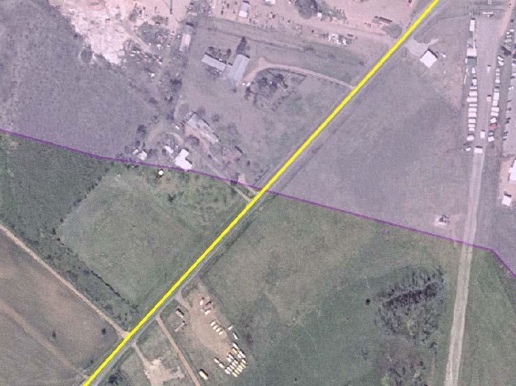
7 Example 1: Geodetic location (X, Y coordinates) is compared to the Polygon layer representing PSAPs to route to. (X,Y) (Civic) Example 2: Civic location is geocoded to RCL layer then compared to the Polygon layer representing PSAPs to route to. PSAP A PSAP B
8 NG9-1-1 GIS Data Model Provides GIS database structure for NG9-1-1 NG9-1-1 GIS Data Model database schemas for: o o o o o o o Road Centerlines (required) Emergency Service Boundaries such as PSAP and Responder (required) Street Name Alias Table State, County, Municipal Division Boundaries Site / Structure Address Points Cell Sites and Sectors Others Authoritative designation (boundary vs attribute) Effective and Expiration dates Landmarks included
9 Tabular Data and the ECRF It doesn t have to all be only GIS data all the time (Data it Data is Data). Tabular searching = Faster searching. Top issues we see in traditional databases (MSAG): o o o o o o Concatenated address elements in street name field MSAG communities that only make sense to the LEC Buffered ranges Non-standard (or inconsistent) taxonomy (i.e. sometimes it is US 71, then US-71, then Hwy- 71, etc.) Implied data. Example, in some telco MSAG s the street type ST it is omitted Non-standard abbreviations (BV instead of BLVD)
10 The Spatial Interface SI Spatial Interface (SI) - Provides for layer replication between an authoritative copy of GIS data and functional elements (ex. LVF / ECRF). ATOM protocol replication feed identified within OGC r2 uses WFS for Insert, Update and Delete actions. WGS84 Transformation Some design considerations: o What serves as the centralized data repository for multiple entities? o Where is the best location to perform edge matching between jurisdictions? o How to support different local government access needs and data formats?

11 NG9-1-1 SI Example LVF / ECRF Forest Guide The Goal: Get Spatial Data to where it needs to go, in the correct format in needs to be in!
12 GIS Data Quality Concerns
13 Where to Start Condition of many GIS data sources today GIS data does not meet the quality and content standards outlined by NENA. In some cases data is degrading (with and without sites knowing it). Many sites don t know what problems their data has because it s only been used for one purpose. Opinions on GIS data status Our data is good because so-and-so created it. Objective assessment over subjective is a must! No substitute for comprehensive analysis. GIS staffing & training limitations Little to no time to review and update while still performing regular duties. Needed expertise is dropping with turnover. Too little or too much complexity in both procedures and software.
14 Priority Checks for Routability QC data both internally and externally. Fix the issues below first before comparing to ALI / MSAG. GIS data matching ALI/MSAG does not ensure routability! Polygons (Initial Effort) 1. Empty (Null) Geometry 2. Geometry Overlaps PSAP Responders 3. Geometry Gaps PSAP Responders 4. Missing Required Field Values* Road Centerlines (Secondary Effort) 5. Empty (Null) Geometry 6. Address Range Overlaps 7. Address Ranges Zero* 8. Not in a Polygon PSAP Responders 9. RCL to Polygon Attribute Mismatch* 10. No USPS Standard Match
15 Polygons

16 Polygon Alignment with Other Jurisdictions Inaccurate boundary lines may cause routing issues. Polygon boundaries should be a #1 priority for review / updating.

17 Polygons with Simplified or Changing Boundaries

18 Valid or Unnecessary? Zero gaps/overlaps on this one. 2.5 miles away from main polygon. Valid! Site has phone service through a different phone company necessitating it its own ESN.


19 Should RCLs Split This Polygon?
20 Road Centerlines (RCLs)


21 Road Centerline Splitting Affects Attributes PSAP Boundaries PSAP A X PSAP B X Road Intersections County Lines X City Limits X

22 Valid or Unnecessary? Zero gaps or overlaps were detected for this one. Potential problems can t always be found by software!
23 RCL Address Ranges and NG9-1-1 Where should 1103 geocode? Longhorn Rd ESN 333 ESN Buffered Addressing (continuous, exhaustive, hypothetical, padded, or theoretical) vs. Actual Addressing Longhorn Rd ESN 333 ESN

24 RCL Gaps Over time, RCLs may experience drop out (loss or corruption) for a variety of reasons. Nothing can substitute for the occasional visual QC.
25 Even if You Can t See it You Still Need to Fix It! Overlapping feature geometry is often invisible. And this happens with polygons as well!

26 Where should geometry be adjusted and/or attribution? How Far is Too Far?


27 Automated GIS Cleanup Induced Geometry Issues Some automated cleanup tools can cause more problems than they solve. For example, when using tools such as Esri s Snap Geoprocessing to automate editing, users must keep in mind what is set for the distance tolerance. Example T intersection
28 Common GIS Attribution Issues How are empty attributes represented? Looks good, right? PreDirectional Street Name Street Suffix Walnut Blvd Walnut Blvd Walnut Blvd Walnut Blvd Upon closer inspection, not so good! PreDirectional Street Name Street Suffix <NULL> Walnut Blvd Walnut Blvd Walnut Blvd Walnut Blvd


29 Street Names vs. Aliases Unique street names in the Alias field while Name field entries are not unique. The result is duplicate overlapping RCL segment address ranges.

30 Automated GIS Cleanup Induced Attribution Issues Common attribution mistakes with automated attribute processing: Automated cleanup of attribute data can lead to problems if not closely monitored and verified. Software settings can not replace local knowledge and decision making.
31 Synchronizing GIS with ALI/MSAG NENA Information Document for Synchronizing Geographic Information System databases with MSAG & ALI (pg.8 NENA ): the synchronization process will never yield a 100 percent match rate. It is recommended that a minimum match rate of 98% be set prior to using the GIS data should be part of an ongoing and continuous process to ensure that the databases remain current and synchronized. For GIS RCLs in this process, Actual address ranges should be used. Standardization and quality control processing must take place on the GIS street centerline data and the MSAG data prior to comparing the two data sets GIS RCLs should contain all valid addressing information present in the MSAG. Attribute fields should be fully parsed out per the NG9-1-1 GIS Data Model.
32 Synchronizing GIS with ALI/MSAG Standardization of the GIS road centerline data and the MSAG data should incorporate the following (pg.9 of NENA ): - N, S, E, W, NE, NW, SE, or SW as the only directionals used. - Directionals abbreviated when not part of the actual street name. - Punctuation should be avoided and special characters removed (ex. dashes). - Use only whole numbers in the house number fields. - Use complete spelling of the legal street name as assigned. - Spell out the complete MSAG and Postal Community name. - Standardize street name components according USPS Publication No. 28. Attribute fields should be fully parsed out per the NG9-1-1 GIS Data Model.
33 GIS Standardization Example Required step in following NENA Information Document for Synchronizing Geographic Information System databases with MSAG & ALI (NENA ). Before After Prefix Street Post Prefix Street Post Street Name Street Name Directional Suffix Directional Directional Suffix Directional North Elm St N Elm St N Grand W Parkway N Grand West Pkwy Barton Trail Barton Trl Cana Road Cana Rd Stockyard's PKY Stockyards Pkwy Mary's Place S S Marys Pl S Market Plaza Market Plz M.L.K. BV M L K Blvd W 9 W 9th Av J Avenue JJ St Albans Ln Saint Albans Ln M. D. Anderson Blvd M D Anderson Blvd E R. Jones Road E R Jones Rd

34 Legacy Addressing How do you deal with inconsistent AP to RCL addressing? In this case a small segment with a completely different address range to facilitate an out of sync addressing assignment. 1947
.")
35 ESNs Used During Transition Are Still Part of the Equation ESN Boundaries shown in white for: Now look at the RCL ESN attributes noted on each RCL label (760 for all three). 760


36 To Driveway or Not Used if addressed structure is not visible or is more than 500 feet from road. Many unnamed roads/driveways require extensive line work. 3 or more addressed structures, should be considered for naming.


37 Annexations Change Boundaries Frequently
38 Site Structure Address Points (APs)
 Site / Structure Address Point usage in public safety applications NG9-1-1 Validation NG9-1-1 Call Routing 9-1-1 Map Display Computer Aided Dispatch (CAD) Vehicle Routing Emergency")
39 NENA Information Document for Development of Site/Structure Address Point GIS Data for Guide for placement of address points in GIS. (NENA-INF ) Site / Structure Address Point usage in public safety applications NG9-1-1 Validation NG9-1-1 Call Routing Map Display Computer Aided Dispatch (CAD) Vehicle Routing Emergency Notification Sections include: Address Points vs. Access Points Placement methodologies based on: Parcels, Property Access, Structures, Sites, Geocoding Address Point Placement for Subaddresses Best Practices Data Quality Considerations Metadata References


40 105 PSAP A PSAP B
41 NG9-1-1 Data Model Example Site / Structure Address Point (partial list) Site/Structure Address Field M/C/O Data Example Source of Data M Hulk County Date Updated M 12/01/2012 Effective Date O 01/01/2013 Expiration Date O 12/31/2015 Site Unique ID M 05673@hulk911.tx.us Country M US State M Texas County M Hulk Additional Code C Additional Data URI C Incorporated Municipality M West Lake Hollow Unincorporated Community O Neighborhood Community O Address Number Prefix C Address Number C 105 Address Number Suffix C S Street Name Pre Modifier C Old Street Name Pre Directional C N Street Name Pre Type C Street Name Pre Type Separator C Street Name C Franklin Street Name Post Type C St Street Name Post Directional C S Street Name Post Modifier O Bypass
42 NG9-1-1 Data Model Example Site / Structure Address Point (partial list) Site/Structure Address Field M/C/O Data Example ESN C 105 MSAG Community C Hulk Postal Community Name C West Lake Hollow Postal Code C ZIP Plus 4 O Building O A Floor O 2 Unit O 7 Room O 701 Seat O 2 Additional Location Information O On drive off main road Landmark Name Part O Complete Landmark Name O Milepost C Place Type O Business Placement Method O Entrance Longitude O Latitude O Elevation O
43 The Need for Unique IDs A globally unique ID for all GIS features is required in the NENA NG9-1-1 GIS Data Model (proposed name of NUGID - NENA Universally Global ID) to facilitate but not be limited to: o Importation in to a centralized database o Data exchange o Feature identification A globally unique ID can be generated by taking local Unique ID numbers and concatenating them with the providers domain. o Example: = @MYCOUNTY.TX.US Who should be logging/tracking domains? Esri Object IDs or Feature IDs may only be unique to a single table whereas globally unique IDs for NG must be unique across ALL data, from everywhere. Problems occur today in live systems, when IDs are not universally unique (even multiple GUIDs).
44 What s Next?
 Phase II location accuracy: Network solution = Handset solution = 67% within 150 meters 90% within 300 meters 67% within 50 meters 90% within 150 meters Latitude & Longitude estimate")
45 Wireless Location Now NENA E9-1-1 Wireless Maintenance Call Routing & Testing Validation Standard (NENA ) Phase I location accuracy: Local jurisdictions and carriers working together on routing (tower/sector) Phase II location accuracy: Network solution = Handset solution = 67% within 150 meters 90% within 300 meters 67% within 50 meters 90% within 150 meters Latitude & Longitude estimate provided along with confidence and uncertainty, with data accuracy left to service providers (proprietary). Calls can arrive without Phase II and with less accuracy than in earlier years (more wireless indoors?).
46 New Location Accuracy Requirements Coming February 23rd, 2015 FCC released FCC15-9 detailing new wireless and E911 location accuracy requirements (applicable to PSAPs) covering: o o o o o o Outdoor location accuracy Indoor location accuracy Vertical accuracy Defines Dispatchable Location Timeline for implementation National Emergency Address Database (NEAD) PSAPs have to be ready to accept the data and CPE must be capable of supporting new data fields.
47 Defined in FCC15-9 (pg16 of 116) as: What is a Dispatchable Location? the civic address of the calling party plus additional information such as floor, suite, apartment or similar information that may be needed to adequately identify the location of the calling party. FCC15-9 notes that while all dispatchable addresses are necessarily civic addresses, not all civic addresses are dispatchable, e.g., P.O. Boxes, diplomatic or armed forces pouch addresses, etc. Wireless GIS layers will be needed for and will likely require assignment, by the MSAG/GIS Coordinator, of a dispatchable location for every cell tower and sector, as received from a wireless service provider in a call routing spreadsheet. GIS will need the granularity needed to support this (i.e. subaddressing)
48 Timeline of Requirements Year 2, 40% of wireless calls must be accurate to within 50 meters for both outdoor and indoor wireless call locations. Year 3, this requirement goes up to 50% and adds uncompensated barometric pressure determination of elevation. Year 5, this requirement goes up to 70% of wireless calls. Year 6, this requirement goes up to 80% of wireless calls, with movement in to 25% of calls having Dispatchable Locations (top 25 areas) and/or Z value. Year 8, 80% of wireless calls must have an associated dispatchable location (top 50 areas) and/or Z value.
49 Vertical or Z Values in NG9-1-1 Representing elevation / height Already included in both the NG9-1-1 GIS Data Model and the Provisioning and Maintenance of GIS data to ECRF / LVF standards Measuring elevation in feet / meters, above ground / sea level, floors, or barometric pressure How can Z value be used most effectively to convey location to users in a display? Developing / Maintaining data representing elevation Some organizations already taking steps to develop data with base values
50 NENA NG9-1-1 Data Management Requirements Standards to Requirements document with 17 discrepancy and 7 performance reports. Several relate directly to GIS data: o o o o o o SI Operator to the Authority on provisioning GIS data ECRF / LVF Operator to SI Operator on GIS data provisioning ECRF / LVF Operator to DR Subscribers on GIS gaps and overlaps PSAP / Entity to Authority on misroute to their PSAP/Entity [where GIS related] PSAP to the GIS Provider when issues found in map display Forest Guide Operator to Contributing ECRF Node Operator on provisioning coverage data Discrepancy reporting requirements are integrated in to STA-010. A new Data Operations Management standard may be created to cover how discrepancies should be processed / worked

51 Final Thoughts Standardizing your GIS data and resolving geometry & attribution issues now, will mitigate problems in the future and improve its use in systems today. This is an unattended system utilizing the best available data for automated decision making. Elevation and improved accuracy of location information will impact GIS needs later. Plan for rapid turn around of GIS data corrections and updating. Watch for NENA document public review times. New NENA workgroup NENA Next Generation GIS Data Compilation and Stewardship You are responsible for NG9-1-1 Data Preparation and Integrity!
52 Thank You R I C H A R D K E L LY V P E N T E R P R I S E G E O S PAT I A L S O L U T I O N S D ATA M A S T E R R I C H A R D D ATA M A S T E R. C O M
GIS Data the Way: Understanding NENA s NG9-1-1 GIS Data Model Standard
 GIS Data the 9-1-1 Way: Understanding NENA s NG9-1-1 GIS Data Model Standard Cheryl Benjamin NYS ITS GIS Program Office NSGIC liaison to NENA Richard Kelly 911 Datamaster NENA liaison to NSGIC What is
Everything NENA: GIS Data Standards, the NEAD, and the NG9-1-1 Act of 2017
 Everything NENA: GIS Data Standards, the NEAD, and the NG9-1-1 Act of 2017 Cheryl Benjamin Richard Kelly NYS ITS GIS Program Office 911 Datamaster NSGIC liaison to NENA NENA liaison to NSGIC NENA Standard
The Road to Improving your GIS Data. An ebook by Geo-Comm, Inc.
 The Road to Improving your GIS Data An ebook by Geo-Comm, Inc. An individual observes another person that appears to be in need of emergency assistance and makes the decision to place a call to 9-1-1.
Key Steps for Assessing Mission Critical Data for An ebook by Geo-Comm, Inc.
 Key Steps for Assessing Mission Critical Data for 9-1-1 An ebook by Geo-Comm, Inc. If you re reading this, you probably understand transitioning to Next Generation 9-1-1 (NG9-1-1) means your Geographic
Why You Should Invest in an Address Point Layer
 A GeoComm White Paper June 6, 2012 601 West Saint Germain St. St. Cloud, MN 56301 1.866.GEO.COMM Identifying 9-1-1 Caller Location By John Brosowsky, GeoComm Product Development Director Nathan Ekdahl,
Preparing GIS Data for NG9-1-1 in the Commonwealth of Virginia
 Preparing GIS Data for NG9-1-1 in the Commonwealth of Virginia Brian Crumpler Regional Coordinator Virginia Information Technologies Agency (VITA) February 28, 2017 1 1 Overview: Sharing ways Virginia
UTILIZING GIS IN NEXT GENERATION Tennessee Information for Public Safety. Presented by State of TN, OIR-GIS Services
 UTILIZING GIS IN NEXT GENERATION 9-1-1 Tennessee Information for Public Safety Presented by State of TN, OIR-GIS Services Next Generation 9-1-1 WHAT IT IS AND HOW IT WORKS Next Generation 9-1-1 IP (Internet
GIS Updates for Next Generation in Washington State
 GIS Updates for Next Generation 9-1-1 in Washington State Dan Miller E911 GIS Manager Washington State 9-1-1 Program Office Agenda Background on the State of Washington Assessing the Status: The State
GIS at the Regional District
 GIS at the Regional District Amanda Spendiff Outline Introduction What is a Regional District? Our GIS department What does the GIS department do? Data management & mapping 9-1-1 fire/dispatch support
NG911 GIS Information Session
 NG911 GIS Information Session January 29, 2018 Presented by: County GIS Professionals Association of Pennsylvania Pennsylvania Emergency Management Agency Welcome! Agenda Our Goals for the Day County Pros
Kansas Next Generation 911
 Kansas Next Generation 911 Kansas Next Generation 911 the largest IT project in state history* the largest GIS project in state history* * could be...has not been fact checked Project overview Primary
MSAG Synchronization. Patrick McKinney, Cumberland County
 MSAG Synchronization Patrick McKinney, Cumberland County NENA Sync GIS Databases with MSAG & ALI On-going process of syncing MSAG & GIS datasets Recommended minimum match rate of 98% (p. 8) Differences
Kansas Next Generation 911 Data Remediation Program. Esri Imagery Forum June 26, 2016
 Kansas Next Generation 911 Data Remediation Program Esri Imagery Forum June 26, 2016 Kansas NextGen 911 Project Overview Development of statewide Emergency Services IP Network (ESINet) GIS database development,
Merging and DOT Data
 Merging 9-1-1 and DOT Data Presented By: Ken Nelson - GIO - State of Kansas Patrick Melancon - Product Manager - GeoComm Date: Wednesday 9/27/2017 @10:30am Primary NG911 project goals Deploy an IP-based
GEOCODING SELF-REPORTED ADDRESSES: LESSONS LEARNED. Karyn Backus CT Department of Public Health
 GEOCODING SELF-REPORTED ADDRESSES: LESSONS LEARNED Karyn Backus CT Department of Public Health GEOCODING ADDRESSES The process of assigning a location to an address Collect the address information Use
Landmark LRM. MM and RefPts can be same or different
 1 2 This project began in the fall of 2005. At the time CDOT had three different business units maintaining different LRS s. That is, the beginning and ending reference points and the measured length of
Enhancing Parcel Data In Colleton County. February 10, 2009
 Enhancing Parcel Data In Colleton County GIS & CAMA Conference February 10, 2009 Introductions Bruce T. Harper Technology Director Colleton County, SC Bill Wetzel National GIS Account Manager The Sidwell
Canadian Board of Examiners for Professional Surveyors Core Syllabus Item C 5: GEOSPATIAL INFORMATION SYSTEMS
 Study Guide: Canadian Board of Examiners for Professional Surveyors Core Syllabus Item C 5: GEOSPATIAL INFORMATION SYSTEMS This guide presents some study questions with specific referral to the essential
What is 511? Need for 511 Services. Development & Deployment of Regional Road and Weather Information Supporting 511 Traveler Services
 Development & Deployment of Regional Road and Weather Information Supporting 511 Traveler Services Leon F. Osborne University of North Dakota Regional Weather Information Center Grand Forks, ND David L.
Road Ahead: Linear Referencing and UPDM
 Road Ahead: Linear Referencing and UPDM Esri European Petroleum GIS Conference November 7, 2014 Congress Centre, London Your Work Making a Difference ArcGIS Is Evolving Your GIS Is Becoming Part of an
Subwatersheds File Geodatabase Feature Class
 Subwatersheds File Geodatabase Feature Class Tags subwatersheds, watersheds Summary shows the subwatersheds of the 9 watersheds in TRCA's jurisdiction Description sub watershed boundaries in TRCA jurisdiction.
Selection of the Most Suitable Locations for Telecommunication Services in Khartoum
 City and Regional Planning Term Project Final Report Selection of the Most Suitable Locations for Telecommunication Services in Khartoum By Amir Abdelrazig Merghani (ID:g201004180) and Faisal Mukhtar (ID:
Statewide State Roads Layer Michigan Geographic Framework Field Definitions
 Statewide State Roads Layer Michigan Geographic Framework Field Definitions (Shapefile Attribute Table) (June 1, 2012 Version 12b) The following field definitions make up the shapefile attribute table
LRS Task Force June 13, REVISION HISTORY
 North Carolina Department of Transportation Geographic Information Systems (GIS) Unit LINEAR REFERENCING SYSTEM (LRS) PROJECT DEFINITION Version 1.0 REVISION HISTORY Date Document Manager Revision Purpose
ArcGIS for Desktop. ArcGIS for Desktop is the primary authoring tool for the ArcGIS platform.
 ArcGIS for Desktop ArcGIS for Desktop ArcGIS for Desktop is the primary authoring tool for the ArcGIS platform. Beyond showing your data as points on a map, ArcGIS for Desktop gives you the power to manage
GIS Needs Assessment. for. The City of East Lansing
 GIS Needs Assessment for The City of East Lansing Prepared by: Jessica Moy and Richard Groop Center for Remote Sensing and GIS, Michigan State University February 24, 2000 Executive Summary At the request
NR402 GIS Applications in Natural Resources
 NR402 GIS Applications in Natural Resources Lesson 1 Introduction to GIS Eva Strand, University of Idaho Map of the Pacific Northwest from http://www.or.blm.gov/gis/ Welcome to NR402 GIS Applications in
Flood Hazard Zone Modeling for Regulation Development
 Flood Hazard Zone Modeling for Regulation Development By Greg Lang and Jared Erickson Pierce County GIS June 2003 Abstract The desire to blend current digital information with government permitting procedures,
GIS ANALYSIS METHODOLOGY
 GIS ANALYSIS METHODOLOGY No longer the exclusive domain of cartographers, computer-assisted drawing technicians, mainframes, and workstations, geographic information system (GIS) mapping has migrated to
GEOGRAPHIC INFORMATION SYSTEMS Session 8
 GEOGRAPHIC INFORMATION SYSTEMS Session 8 Introduction Geography underpins all activities associated with a census Census geography is essential to plan and manage fieldwork as well as to report results
Linear Referencing in Boulder County, CO. Getting Started
 Linear Referencing in Boulder County, CO Getting Started 1 Authors Janie Pierre GIS Technician, Boulder County Road centerline and storm sewer geodatabases & maps John Mosher GIS Specialist, Boulder County
GeoPostcodes. Denmark
 Denmark Denmark About.com Launched in 2007, website offers comprehensive and reliable databases of localities, streets, administrative regions, ZIP/postal codes and lots of other information for all countries.
LBRS Ohio s Location-Based Response System
 LBRS Ohio s Location-Based Response System Comprised of state-level statewide datasets for Ohio, including road centerlines with point-based address locations, parcels, and orthophotography Spatially accurate
IDENTIFYING THE TYPE OF COORDINATE SYSTEM FOR DATA USING ARCMAP
 CHAPTER 1 IDENTIFYING THE TYPE OF COORDINATE SYSTEM FOR DATA USING ARCMAP I got a parcel shapefile from the county, but it doesn t line up with my other data in ArcMap. My boss told me to make a map using
GeoPostcodes. Trinidad & Tobago
 Trinidad & Tobago Trinidad & Tobago About.com Launched in 2007, website offers comprehensive and reliable databases of localities, streets, administrative regions, ZIP/postal codes and lots of other information
GIS ADMINISTRATOR / WEB DEVELOPER EVANSVILLE-VANDERBURGH COUNTY AREA PLAN COMMISSION
 GIS ADMINISTRATOR / WEB DEVELOPER EVANSVILLE-VANDERBURGH COUNTY AREA PLAN COMMISSION SALARY RANGE INITIATION $43,277 SIX MONTHS $45,367 POSITION GRADE PAT VI The Evansville-Vanderburgh County Area Plan
Developing a Subdivision Build- Out Study and Site Suitability Tool; Enabling Access Through a Web GIS Application
 Developing a Subdivision Build- Out Study and Site Suitability Tool; Enabling Access Through a Web GIS Application DOUG SEXTON GEOG 596A SUMMER 2017 ADVISOR: DR. JAMES O BRIEN Project Outline Introduction
GeoPostcodes. Luxembourg
 Luembourg Luembourg About.com Launched in 2007, website offers comprehensive and reliable databases of localities, streets, administrative regions, ZIP/postal codes and lots of other information for all
AACOG Program Overview
 9-1-1 Area Judges Meeting AACOG 9-1-1 Program Overview [September 28, 2016] Public Safety Director Marcela Medina Item I: Dispatcher Training On August 23, 2016, we hosted a PSAP Supervisor meeting to
GeoPostcodes. Litauen
 Litauen - Litauen About.com Launched in 2007, website offers comprehensive and reliable databases of localities, streets, administrative regions, ZIP/postal codes and lots of other information for all
GeoPostcodes. Grecia
 Grecia - Grecia About.com Launched in 2007, website offers comprehensive and reliable databases of localities, streets, administrative regions, ZIP/postal codes and lots of other information for all countries.
DATA SOURCES AND INPUT IN GIS. By Prof. A. Balasubramanian Centre for Advanced Studies in Earth Science, University of Mysore, Mysore
 DATA SOURCES AND INPUT IN GIS By Prof. A. Balasubramanian Centre for Advanced Studies in Earth Science, University of Mysore, Mysore 1 1. GIS stands for 'Geographic Information System'. It is a computer-based
PAD-US (CBI Edition) Version 2: Standards and Procedures
 Version 2: Standards and Procedures") PAD-US (CBI Edition) Version 2: Standards and Procedures October 31, 2012 Prepared by: The Conservation Biology Institute Kai Henifin 1 Table of Contents INTRODUCTION TO PAD-US (CBI EDITION) VERSION 2...3
PAD-US (CBI Edition) Version 2: Standards and Procedures October 31, 2012 Prepared by: The Conservation Biology Institute Kai Henifin 1 Table of Contents INTRODUCTION TO PAD-US (CBI EDITION) VERSION 2...3
FIRE DEPARMENT SANTA CLARA COUNTY
 DEFINITION FIRE DEPARMENT SANTA CLARA COUNTY GEOGRAPHIC INFORMATION SYSTEM (GIS) ANALYST Under the direction of the Information Technology Officer, the GIS Analyst provides geo-spatial strategic planning,
Application of GIS in Public Transportation Case-study: Almada, Portugal
 Case-study: Almada, Portugal Doutor Jorge Ferreira 1 FSCH/UNL Av Berna 26 C 1069-061 Lisboa, Portugal +351 21 7908300 jr.ferreira@fcsh.unl.pt 2 FSCH/UNL Dra. FCSH/UNL +351 914693843, leite.ines@gmail.com
GIS TECHNICIAN I GIS TECHNICIAN II
 GIS TECHNICIAN I GIS TECHNICIAN II CITY OF ROSEVILLE DEFINITION To perform a variety of technical office and field work duties related to the creation and maintenance of maps, tables, graphs and other
Dan Goldberg GIS Research Laboratory Department of Computer Science University of Southern California https://webgis.usc.edu
 Presented to: CSCI 548 Information Integration on the Web 04-20-2009 Dan Goldberg GIS Research Laboratory Department of Computer Science University of Southern California https://webgis.usc.edu 1 (Very)
Introduction-Overview. Why use a GIS? What can a GIS do? Spatial (coordinate) data model Relational (tabular) data model
 data model Relational (tabular) data model") Introduction-Overview Why use a GIS? What can a GIS do? How does a GIS work? GIS definitions Spatial (coordinate) data model Relational (tabular) data model intro_gis.ppt 1 Why use a GIS? An extension
Introduction-Overview Why use a GIS? What can a GIS do? How does a GIS work? GIS definitions Spatial (coordinate) data model Relational (tabular) data model intro_gis.ppt 1 Why use a GIS? An extension
Proposal to Include a Grid Referencing System in S-100
 1 st IHO-HSSC Meeting The Regent Hotel, Singapore, 22-24 October 2009 Paper for consideration by HSSC Proposal to Include a Grid Referencing System in S-100 Submitted by: Executive Summary: Related Documents:
RESOLUTION NO
 RESOLUTION NO. 09-2017 Adopting Job Descriptions for Engineering and GIS Manager and GIS Analyst and Amending the Pay Resolution to Accommodate Said Positions and Amending the Staffing Chart to Accommodate
Appendixx C Travel Demand Model Development and Forecasting Lubbock Outer Route Study June 2014
 Appendix C Travel Demand Model Development and Forecasting Lubbock Outer Route Study June 2014 CONTENTS List of Figures-... 3 List of Tables... 4 Introduction... 1 Application of the Lubbock Travel Demand
Your web browser (Safari 7) is out of date. For more security, comfort and. the best experience on this site: Update your browser Ignore
 is out of date. For more security, comfort and. the best experience on this site: Update your browser Ignore") Your web browser (Safari 7) is out of date. For more security, comfort and Activityengage the best experience on this site: Update your browser Ignore Introduction to GIS What is a geographic information
Your web browser (Safari 7) is out of date. For more security, comfort and Activityengage the best experience on this site: Update your browser Ignore Introduction to GIS What is a geographic information
ASSESSMENT. Industry Solutions Harness the Power of GIS for Property Assessment
 ASSESSMENT Industry Solutions Harness the Power of GIS for Property Assessment Esri Canada has thousands of customers worldwide who are using the transforming power of GIS technology to collect, maintain,
ADDRESS_APN. Tags Addresses, Parcel Address, SITUS Address, Assessor Parcel Number (APN), San Diego County
, San Diego County") Page 1 of 7 ADDRESS_APN Tags Addresses, Parcel Address, SITUS Address, Assessor Parcel Number (APN), San Diego County Summary: This dataset comprises SITUS address points (as opposed to owner or mailing
Page 1 of 7 ADDRESS_APN Tags Addresses, Parcel Address, SITUS Address, Assessor Parcel Number (APN), San Diego County Summary: This dataset comprises SITUS address points (as opposed to owner or mailing
Utilizing GIS Technology for Rockland County. Rockland County Planning Department Douglas Schuetz & Scott Lounsbury
 Utilizing GIS Technology for Rockland County Rockland County Planning Department Douglas Schuetz & Scott Lounsbury Presentation Agenda Introduction What is GIS What can GIS do GIS Efforts for BOE Resources
Outline. Chapter 1. A history of products. What is ArcGIS? What is GIS? Some GIS applications Introducing the ArcGIS products How does GIS work?
 Outline Chapter 1 Introducing ArcGIS What is GIS? Some GIS applications Introducing the ArcGIS products How does GIS work? Basic data formats The ArcCatalog interface 1-1 1-2 A history of products Arc/Info
Ohio s Linear Based Referencing System (a.k.a. Location Based Response System LBRS), a True State and Local Government Partnership
, a True State and Local Government Partnership") Ohio s Linear Based Referencing System (a.k.a. Location Based Response System LBRS), a True State and Local Government Partnership Ron Cramer Digital Data Technologies, Inc. Joseph Hausman The Ohio Department
Ohio s Linear Based Referencing System (a.k.a. Location Based Response System LBRS), a True State and Local Government Partnership Ron Cramer Digital Data Technologies, Inc. Joseph Hausman The Ohio Department
Bentley Map Advancing GIS for the World s Infrastructure
 Bentley Map Advancing GIS for the World s Infrastructure Presentation Overview Why would you need Bentley Map? What is Bentley Map? Where is Bentley Map Used? Why would you need Bentley Map? Because your
Creating a Pavement Management System Using GIS
 Christopher Castruita PPD 631 Prof. Barry Waite & Prof. Bonnie Shrewsbury Creating a Pavement Management System Using GIS Problem Definition As is the case with many cities, the city of La Cañada Flintridge
The 2020 Census Geographic Partnership Opportunities
 The 2020 Census Geographic Partnership Opportunities Web Adams Geographer, U.S. Census Bureau New York Regional Office 1 Geographic Partnership Opportunities The 2020 Census Local Update of Census Addresses
CUNY Tax Lots, New York NY, Sept 2016
 Page 1 of 6 Metadata format: ISO 19139 CUNY Tax Lots, New York NY, Sept 2016 ISO 19139 metadata content Resource Identification Information Spatial Representation Information Reference System Information
software, just as word processors or databases are. GIS was originally developed and cartographic capabilities have been augmented by analysis tools.
 1. INTRODUCTION 1.1Background A GIS is a Geographic Information System, a software package for creating, viewing, and analyzing geographic information or spatial data. GIS is a class of software, just
Providing Public Access to King County GIS Data. Presented by: Michael Jenkins King County GIS Center Seattle, WA
 Providing Public Access to King County GIS Data Presented by: Michael Jenkins King County GIS Center Seattle, WA King County, Washington Microsoft Boeing Amazon.Com Starbucks Port of Seattle Weyerhauser
HIGH RESOLUTION BASE MAP: A CASE STUDY OF JNTUH-HYDERABAD CAMPUS
 HIGH RESOLUTION BASE MAP: A CASE STUDY OF JNTUH-HYDERABAD CAMPUS K.Manjula Vani, Abhinay Reddy, J. Venkatesh, Ballu Harish and R.S. Dwivedi ABSTRACT The proposed work High Resolution Base map: A Case study
Tax Jurisdiction Sourcing Data Bases
 Tax Jurisdiction Sourcing Data Bases Reducing Cost and Improving Tax Determination via quality data base information Bob Meador Director, GeoTAX Product Management Group 1 Software Agenda Tax issues Tax
Technical Specifications. Form of the standard
 Used by popular acceptance Voluntary Implementation Mandatory Legally enforced Technical Specifications Conventions Guidelines Form of the standard Restrictive Information System Structures Contents Values
I Background. Under the Cotton Tree: Situs Addressing System in Africa. Table of contents
 Cairo, April 2005 Under the Cotton Tree: Situs Addressing System in Africa Table of contents 1. Background 2. Current situation of addressing system in Africa 3. Benefits of a functional addressing system
GIS Level 2. MIT GIS Services
 GIS Level 2 MIT GIS Services http://libraries.mit.edu/gis Email: gishelp@mit.edu TOOLS IN THIS WORKSHOP - Definition Queries - Create a new field in the attribute table - Field Calculator - Add XY Data
If you aren t familiar with Geographical Information Systems (GIS), you. GIS, when combined with a database that stores response information,
, you. GIS, when combined with a database that stores response information,") Geographical Information Systems in EMS By William E. Ott If you aren t familiar with Geographical Information Systems (GIS), you should take a look at what GIS can offer you as an EMS manager. GIS, when
Geographical Information Systems in EMS By William E. Ott If you aren t familiar with Geographical Information Systems (GIS), you should take a look at what GIS can offer you as an EMS manager. GIS, when
MODERNIZATION OF THE MUNICIPAL MAPPING USING HIGH END GNSS SYSTEM AND GIS SOFTWARE
 MODERNIZATION OF THE MUNICIPAL MAPPING USING HIGH END GNSS SYSTEM AND GIS SOFTWARE Mr. R. A. R. Khan Assistant Engineer, Sewerage Utility Management Centre (SUMC) Municipal Corporation Of Greater Mumbai
BEFORE THE BOARD OF COUNTY COMMISSIONERS OF LANE COUNTY, OREGON
 BEFORE THE BOARD OF COUNTY COMMISSIONERS OF LANE COUNTY, OREGON ORDER NO. 18-05-22-06 IN THE MATTER OF SURRENDER OF A PORTION OF COAST GUARD STATION ROAD (COUNTY ROAD NUMBER 65) AND A PORTION OF S. HARBOR
Reference: 4880(DOP.ADA)1136 Subject: Survey on the integration of geographic information systems into postal address development
1136 Subject: Survey on the integration of geographic information systems into postal address development") International Bureau Weltpoststrasse 4 P.O. Box 312 3000 BERNE 15 SWITZERLAND To: Union member countries Regulators Designated operators T +41 31 350 31 11 F +41 31 350 31 10 www.upu.int For information
International Bureau Weltpoststrasse 4 P.O. Box 312 3000 BERNE 15 SWITZERLAND To: Union member countries Regulators Designated operators T +41 31 350 31 11 F +41 31 350 31 10 www.upu.int For information
LEADS. The Essential Elements of a 3-D Geographic Coordinate
 The Essential Elements of a 3-D Geographic Coordinate John W. Dix 13 September 2005 ESRI Homeland Security GIS Summit - Denver, CO John.W.Dix@nga.mil NATIONAL GEOSPATIAL-INTELLIGENCE AGENCY Overview is
Geographic Products and Data. Improvements in Spatial Accuracy and Accessing Data
 Geographic Products and Data Improvements in Spatial Accuracy and Accessing Data How it Began TIGER was internally developed to support the 1990 Decennial Census operations Used data sources such as USGS
Data Aggregation with InfraWorks and ArcGIS for Visualization, Analysis, and Planning
 Data Aggregation with InfraWorks and ArcGIS for Visualization, Analysis, and Planning Stephen Brockwell President, Brockwell IT Consulting, Inc. Join the conversation #AU2017 KEYWORD Class Summary Silos
Introduction to GIS. Dr. M.S. Ganesh Prasad
 Introduction to GIS Dr. M.S. Ganesh Prasad Department of Civil Engineering The National Institute of Engineering, MYSORE ganeshprasad.nie@gmail.com 9449153758 Geographic Information System (GIS) Information
Enterprise Linear Referencing at the NYS Department of Transportation
 Enterprise Linear Referencing at the NYS Department of Transportation One Highway Network to Support Many Business Processes May 9, 2018 May 9, 2018 2 Agenda An overview of Linear Referencing How NYSDOT
Linear Referencing Systems (LRS) Support for Municipal Asset Management Systems
 Support for Municipal Asset Management Systems") Linear Referencing Systems (LRS) Support for Municipal Asset Management Systems Esri Canada Infrastructure Asset Management Leadership Forum November 1, 2017 Toronto, ON David Loukes, P. Eng., FEC Andy
Linear Referencing Systems (LRS) Support for Municipal Asset Management Systems Esri Canada Infrastructure Asset Management Leadership Forum November 1, 2017 Toronto, ON David Loukes, P. Eng., FEC Andy
CyberGIS: What Still Needs to Be Done? Michael F. Goodchild University of California Santa Barbara
 CyberGIS: What Still Needs to Be Done? Michael F. Goodchild University of California Santa Barbara Progress to date Interoperable location referencing coordinate transformations geocoding addresses point-of-interest
Census Geography, Geographic Standards, and Geographic Information
 Census Geography, Geographic Standards, and Geographic Information Michael Ratcliffe Geography Division US Census Bureau New Mexico State Data Center Data Users Conference November 19, 2015 Today s Presentation
Creation of an Internet Based Indiana Water Quality Atlas (IWQA)
") Department of Environmental Management Creation of an Internet Based Water Quality Atlas (IWQA) May 4, 2005 IUPUI 1200 Waterway Blvd., Suite 100 polis, 46202-5140 Water Quality Atlas John Buechler, Neil
Department of Environmental Management Creation of an Internet Based Water Quality Atlas (IWQA) May 4, 2005 IUPUI 1200 Waterway Blvd., Suite 100 polis, 46202-5140 Water Quality Atlas John Buechler, Neil
Targeted LiDAR use in Support of In-Office Address Canvassing (IOAC) March 13, 2017 MAPPS, Silver Spring MD
 March 13, 2017 MAPPS, Silver Spring MD") Targeted LiDAR use in Support of In-Office Address Canvassing (IOAC) March 13, 2017 MAPPS, Silver Spring MD Imagery, LiDAR, and Blocks In 2011, the GEO commissioned independent subject matter experts (Jensen,
Targeted LiDAR use in Support of In-Office Address Canvassing (IOAC) March 13, 2017 MAPPS, Silver Spring MD Imagery, LiDAR, and Blocks In 2011, the GEO commissioned independent subject matter experts (Jensen,
ArcGIS Pro: Essential Workflows STUDENT EDITION
 ArcGIS Pro: Essential Workflows STUDENT EDITION Copyright 2018 Esri All rights reserved. Course version 6.0. Version release date August 2018. Printed in the United States of America. The information contained
GIS (GEOGRAPHIC INFORMATION SYSTEMS)
") GIS (GEOGRAPHIC INFORMATION SYSTEMS) 1 1. DEFINITION SYSTEM Any organised assembly of resources and procedures united and regulated by interaction or interdependence to complete a set of specific functions.
GIS (GEOGRAPHIC INFORMATION SYSTEMS) 1 1. DEFINITION SYSTEM Any organised assembly of resources and procedures united and regulated by interaction or interdependence to complete a set of specific functions.
Summary Description Municipality of Anchorage. Anchorage Coastal Resource Atlas Project
 Summary Description Municipality of Anchorage Anchorage Coastal Resource Atlas Project By: Thede Tobish, MOA Planner; and Charlie Barnwell, MOA GIS Manager Introduction Local governments often struggle
An online data and consulting resource of THE UNIVERSITY OF TOLEDO THE JACK FORD URBAN AFFAIRS CENTER
 An online data and consulting resource of THE JACK FORD URBAN AFFAIRS CENTER THE CENTER FOR GEOGRAPHIC INFORMATION SCIENCE AND APPLIED GEOGRAPHICS DEPARTMENT OF GEOGRAPHY AND PLANNING THE UNIVERSITY OF