FDES: Chapter 1. Overview of Environment Statistics Characteristics and Challenges. FDES: Framework for the Development of Environment Statistics
|
|
|
- Oswin Nichols
- 5 years ago
- Views:
Transcription
1 FDES: Chapter 1 Overview of Environment Statistics Characteristics and Challenges FDES: Framework for the Development of Environment Statistics Environment Environmental Protection, Resources and Management and their Use Engagement 1. Environmental Conditions and Human Habitat Emissions, Quality and Residuals and Environmental Waste Health 4. Disasters and Extreme Events
2 Overall programme FDES Chapters (90min each) Module Title 1 Chapter 1: Overview of Environment Statistics Characteristics and Challenges 2 Chapter 2: Conceptual Foundation and Structure Chapter 5: Applications of the FDES to Cross-cutting Environmental Issues Chapter 3: Components of the FDES and the Basic Set of Environment Statistics Environmental Conditions and Quality Environmental Resources and their Use Residuals Extreme Events and Disasters Human Settlements and Environmental Health Environmental Protection, Management and Engagement 9 Chapter 4: From the Basic Set to the Core Set of Environment Statistics 2
3 Outline Level 1 (20 min) 1. Objective, Scope, Users 2. Information, data, statistics and indicators 3. Data sources Group exercise (30 min) Level 2 (30 min) 4. Classifications 5. Time, Space 6. Institutional dimension Group discussion (10 min) Environment Environmental Protection, Resources and Management and their Use Engagement 1. Environmental Conditions and Human Habitat Emissions, Quality and Residuals and Environmental Waste Health 4. Disasters and Extreme Events 3
4 Learning objectives Level 1 Be able to use the FDES manual Be familiar with the characteristics and challenges in environment statistics Learn to describe your data Level 2 Understand data sources, main classifications, spatial and temporal dimensions Learn about institutional challenges (and what to do about it) 4


5 Why environment statistics? Improve knowledge Support evidence-based policy Provide information to the general public, media and user groups 5
6 Environment statistics are interdisciplinary and inter-institutional Environment statistics are about: 1. the state of the environment, 2. our dependence on it, 3. our impact on it, 4, 5. it s impact on us (even negative ones), and 6. how we protect and manage it. This information comes from many institutions using different methods, concepts and classifications. FDES: Framework for the Development of Environment Statistics 6. Environment Protection, Management and Engagement 5. Human Habitat and Environmental Health 1. Environmental Conditions and Quality 4. Disasters and Extreme Events 2. Environmental Resources and their Use 3. Emissions, Residuals and Waste 6 ESCAP - Environment Statistics Overview


7 Information, data, statistics, accounts and indicators Information The world Metadata Data: Qualitative Quantitative Rules: Structure, Aggregate Statistics Select Themes: Stock/flow Accounts Indicators Combine Indices 7 ESCAP - Environment Statistics Overview
8 A note on frameworks Quantity Price FDES: Framework for the Development of Environment Statistics Integrate statistics SEEA: System of Environmental- Economic Accounting SNA: System of National Accounts Value of nature 8
 - Links to SNA by using same classifications and methods - Good for compiling integrated indicators (e.")

9 A note on frameworks FDES is an organizing framework - Based on Pressure-State-Response - Good for compiling basic statistics and reporting - Covers most issues of concern BUT: May risk viewing all human activities as pressures SEEA is an accounting framework - Integrates related statistics into accounts (e.g., water, energy, land, ecosystems) - Links to SNA by using same classifications and methods - Good for compiling integrated indicators (e.g., water intensity of economy) to assess trade-offs - BUT: Covers limited set of issues & less experience Note: The two can be used together. Can start with FDES to compile basic statistics. Can start with SEEA to identify accounts of interest. 9
10 Main users & uses Users Policy and decision makers General public (media, education, civil society) Analysts, researchers, academia Metadata Types of information Detailed data Accounts National statistical offices Indicators National agencies International agencies 10
11 The statistics supply chain Statisticians assess user needs, design & build collection systems, collect & compile, validate, describe and structure data to produce statistics series, accounts and indicators. This applies to all government departments, not only NSOs. Statistical activity 1 (Primary) Needs Design Build Collect Validate Process Analyse Output Evaluate Statistical activity 2 (Primary) Needs Design Build Collect Validate Process Analyse Output Evaluate Statistical activity 3 (Secondary) Needs Design Build Collect Validate Process Analyse Output Evaluate Publications, databases Statistics Accounts Indicators 11

12 FDES Structure 6. Environment Protection, Management and Engagement 2. Environmental Resources and their Use 5. Human Habitat and Environmental Health 1. Environmental Conditions and Quality 4. Disasters and Extreme Events 3. Emissions, Residuals and Waste FDES describes the scope and components of environment statistics; harmonizes data with common standards. To compile these, you need to exploit many different kinds of data Environment Environmental Protection, Resources and Management and their Use Engagement 1. Environmental Conditions and Human Habitat Emissions, Quality and Residuals and Environmental Waste Health 4. Disasters and Extreme Events 12
13 Types of data sources Statistical surveys Administrative records Remote sensing and mapping Environmental monitoring Scientific research and special projects Global & international sources 13
14 Statistical surveys Census: Collects data for the entire population of interest (all people, all businesses, all ecosystems) Sample survey: Collects data for a representative portion of the population (e.g., one in 5,000 people) Results are weighted to represent the population Environment surveys can be specialized (e.g., Households and the Environment, Environmental Protection Expenditures ) Environment data can be obtained from other surveys by adding questions (e.g., source of water on Census) 14
15 Administrative records Data needed for administration Less expensive, less response burden, coverage known Examples: Utility records water & sewer, electricity & gas bills Tax returns environmental taxes and subsidies Government expenditures environmental protection Limitations: Different concepts, definitions and classifications Restricted access Poor data quality if not validated (e.g., business names) 15
16 Remote sensing and mapping Satellite images, aerial photos, land survey Satellite images land cover, habitat types Aerial photos = more detailed crop type, animals Land survey topographic (elevation), hydrological (rivers, streams, wetlands), soil condition Thematic mapping = classified and validated forest, shrubland Combined in Geographic Information System (GIS) Validate, integrate (make coherent) OneMap 16
17 Environmental monitoring Observations from field monitoring (air, water, soil, weather, animals) Advantages: Documented methods, validated, time series, models improve data quality Limitations: Storm chasing = not random sample Similar data from different jurisdictions/studies difficult to integrate 17
18 Scientific research & special projects Examples: UK National Ecosystem Assessment, ecosystem services valuation studies, effects of X on Y, case studies, ) Advantages: In public domain (research papers, databases) Don t need to do it over again (e.g., no response burden) Can fill data gaps (e.g., benefits transfer, function transfer, other estimates) Limitations: Different concepts, methods and classifications No access to raw data, no metadata One-time or one location case study 18
19 Global sources Most data in international databases are derived from national statistics But Global remote sensing and spatial estimates Good starting point, but may not agree with national data Some international organizations model national data Check your data in international databases! 19

20 Metadata - two sides of the coin Priority setting, institutional setting, work planning Inventory of environment statistics Recommended use FDES ESSAT (Environment Statistics Self- Assessment Tool) ESSAT Part I Statistics Institutional mandates ESSAT Part II Statistics Documentation of national system for environment statistics Long-term planning SEEA Diagnostic Tool Accounts Data sources & users ESCAP Inventory Template Statistical processes (inputs, outputs) Workshop setting Coordination of working group to develop specific pilot accounts 20
21 Group exercise Groups of minutes to prepare Statistical activity 1 (Primary) Needs Design Build Collect Select ONE dataset or statistical activity that you use or produce [See Inventory Template] What is it s name? [1.1] Who produces it? [1.2] What type is it? (survey, administrative, monitoring ) [2.2.2] How do you ensure its quality? [3.1] What is the output (indicators, database, publication)? [5.10] How is it used to make policy/decisions? [1.6] Report: 2 minutes! Warning! We ll document this dataset further. Validate Process Analyse Output Evaluate Statistical activity 2 (Primary) Needs Design Build Collect Validate Process Analyse Output Evaluate Statistical activity 3 (Secondary) Needs Design Build Collect Validate Process Analyse Output Evaluate 21
22 Welcome to Level 2! A few more concepts Classifications Time and space Geospatial information Institutional dimensions Discussion of priorities 22
23 Classifications A classification is a way of grouping data: Age (young = 0-15, working age = 16-65, retirement = 66+) Industry: primary, manufacturing, service Land cover: forest, inland water, shrubland, grassland, wetland, coastal Best if Mutually exclusive: One unit can be classified in only one category Exhaustive: Covers all possibilities (e.g., all species) Hierarchical: Detailed levels (e.g., dense coniferous forest) add to higher levels (e.g., all forest) Include definitions of what to measure (and how) 23
24 Classifications Why classify? Aggregate (simplify) complex data by common properties Rules and definitions make sure everybody classifies the same way Integrate environment data (e.g., pollution generation of industry) with economic data (e.g., value added of industry) A common language Standard classifications are the norm Variants can be explained relative to the standard Coherence problems if everybody uses different classifications 24
25 Classifications No universal environmental classifications Would be useful to get everybody to read from the same page Emerging and sectoral classifications LCCS: FAO Land Cover Classification System UNFC: UN Framework Classification for Fossil Energy and Mineral Reserves and Resources ILO: Employment in Environmental Activities SEEA: Land Cover, Land Use, Natural Inputs, Emissions, Effluents, Solid Wastes CEA: Classification of Environmental Activities (expenditures) CEPA: Classification of Environmental Protection Activities Groupings not developed for statistical purposes CRED-EMDAT: Natural and technological disasters Protected areas (UNEP-WCMC, IUCN) Threatened species (UNEP-WCMC, IUCN) Source categories for GHGs (IPCC) CICES: Common International Classification of Ecosystem Services OECD PRTR (Pollutant Release and Transfer Registry) 25
26 Classifications Environment statistics use existing social and economic statistical classifications ISIC: International Standard Industrial Classification of All Economic Activities CPC: Central Product Classification ICD: International Classification of Diseases COFOG: Classification of Functions of Government (OECD) COFOG 05 based on CEPA See UNSD: What is an international classification? See Hancock (2013) PDF 26
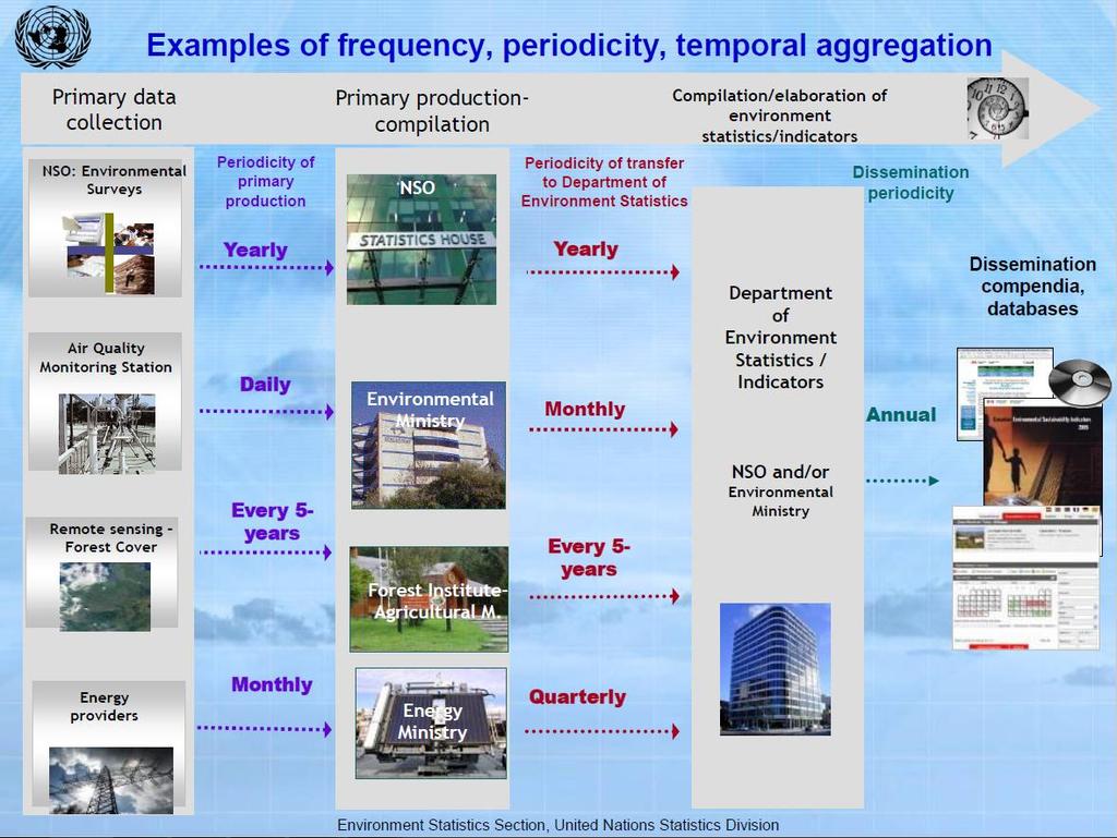
27 Time Time concepts Periodicity (frequency): How often collected? Period of record: When series started & ended? Reference/Accounting period: Measures represent what duration? Time of recording: When was the event recorded? Aggregate annually to align with economic and social data Need rules (depends on what is measured) Hourly daily monthly annual decade eon Sum, max, min, range, average, median, interquartile range 27
28 28
29 and time again How often to measure? Depends on dynamics of phenomena (minute, hourly, seasonal flood cycles, slow ecological processes) Seasonal: Temperature, fish stocks, ice cap, fires Annual averages obscure variation! Hourly: Smog, PM 10 concentrations, temperature, rain Daily averages wash out hourly min/max (Bordt & Rastan, 2015) Daily: max/min temperature, hours of sunshine Quarterly: GDP, GHGs (estimated from leading trends) 29
30 Space the final frontier Like Time, Space is important Depends on what is being measured Environment not evenly distributed (= heterogeneous) Temperature, rainfall, humidity Land cover, habitats, species (some move around!) Pollution, people, roads Natural resources, disaster events Need meaningful spatial units and georeferenced data! Drainage area (for water-related) Ecozone (for ecological), land cover units Sometimes need to slice and dice to administrative areas (See Bordt, 2015) 30
31 Space Geospatial information Location & characteristics of atmosphere, surface & sub-surface Visual display & analysis of data (hot spots, regional differences) Maps are easy to use and to understand GIS can overlay multiple datasets for deeper analysis, modelling, filling gaps Much easier if National Spatial Data Infrastructure (NSDI) exists: agreed boundaries, standards, sources 31


32 Space Integration in GIS Source: GAO (2004) 32
33 Space Frequent and detailed satellite data available Need specialized skills & equipment (share!) Cartography: producing meaningful maps Analytical: Detail OK if validating quality, comparing with other maps Better to focus on a message than displaying data Less detail, easier to interpret & compare over time 33
34 Institutional dimensions Legal framework: NSOs have mandate to produce official statistics Remember Fundamental Principles Policy departments mandates to promote sectoral policies Environment statistics mostly collected by policy departments (environment, natural resources, agriculture, fisheries, forestry, health ) Requires coordination and collaboration Common objectives impartial evidence better decisions 34
35 Institutional dimensions Constraints to cooperation NSO may have little influence over National Statistical System (NSS) Overlapping, competing mandates No data sharing (protected by law!) Diverse technical capacity, methods, classifications Possible solutions Clarify role of NSO for quality, coordination of NSS Agree on common standards for environment statistics Share data for statistical purposes Work together (working groups, joint projects, training!) Engage the NSO when you re designing the project! 35
36 Discussion What kinds of priority data sources in your country: Are missing? Need work (e.g., help from statisticians, experts)? What kinds of work (quality, estimation, integration, aggregation, presentation)? What are some of the constraints to doing this? (data, technical capacity, institutions) Volunteers? 36
37 Take home points Good statistics are cheaper than bad decisions. Environment statistics are interdisciplinary and interinstitutional Therefore needs a conceptual and organizing framework FDES is a useful organizing framework SEEA can integrate most FDES statistics into accounts Most environment statistics are collected by policy departments (not NSOs) Agreeing on a framework will support collaboration, integration and maximize use of data 37
38 References Bordt, M. & Rastan S The Role of National Agencies as Honest Brokers Between Science and Policy: Case Studies on Environmental Sustainability Indicators. Handbook of Clean Energy Systems. Wiley. Bordt, M Spatial units, scaling and aggregation. UNSD (PDF) FAO LCCS Land Cover Classification System FDES: Government Accountability Office Geospatial Information: Better Coordination Needed to Identify and Reduce Duplicative Investments. Hancock, A. (2013). Best Practice Guidelines for Developing International Statistical Classifications (PDF) (No. ESA/STAT/AC.267/5). New York, NY: United Nations Statistics Division. OECD PRTR (Pollutant release and transfer registry) SEEA-CF: Statistics Canada Human activity and the environment 2013: Measuring ecosystem goods and services. Ottawa, Canada. 38
39 Acknowledgements Materials prepared by: Michael Bordt Regional Adviser on Environment Statistics ESCAP Statistics Division Materials adapted from: UNSD (Environment Statistics) FDES presentations: Tanzania: Togo: ml (aussi en Français) 39
Fundamentals of Environment Statistics
 6. Environment Protection, Management and Engagement 5. Human Settlements and Environmental Health 1. Environmental Conditions and Quality 4. Extreme Events and Disasters 2. Environmental Resources and
Chapter 1: Overview of Environment Statistics Characteristics and Challenges
 Chapter 1: Overview of Environment Statistics Characteristics and Challenges Workshop on Environment Statistics in support of the implementation of the Framework for the Development of Environment Statistics
KENYA NATIONAL BUREAU OF STATISTICS Workshop on
 KENYA NATIONAL BUREAU OF STATISTICS Workshop on Capacity Building in Environment Statistics: the Framework for the Development of Environment Statistics (FDES 2013) Coordination with Sector Ministries
Spatial Units (Level 1)
") Spatial Units (Level 1) Project: Advancing the SEEA Experimental Ecosystem Accounting Overview: Spatial Units 1. Learning objectives 2. Review of Level 0 (5m) 3. Level 1 (Compilers): Presentation & group
Spatial Units (Level 1) Project: Advancing the SEEA Experimental Ecosystem Accounting Overview: Spatial Units 1. Learning objectives 2. Review of Level 0 (5m) 3. Level 1 (Compilers): Presentation & group
06/04/2015. Overview: Spatial units. Advancing the SEEA Experimental Ecosystem Accounting Spatial units (Level 1)
") Advancing the SEEA Experimental Ecosystem Accounting Spatial units (Level 1) Advancing the SEEA-EEA Project Overview: Spatial units 1. Learning objectives 2. Level 1: Presentation & group exercise Spatial
Advancing the SEEA Experimental Ecosystem Accounting Spatial units (Level 1) Advancing the SEEA-EEA Project Overview: Spatial units 1. Learning objectives 2. Level 1: Presentation & group exercise Spatial
Spatial units (Levels 0 and 1)
") Spatial units (Levels 0 and 1) Project: Advancing the SEEA Experimental Ecosystem Accounting Overview: Spatial units 1. Learning objectives 2. Level 1: Presentation & group exercise Spatial units (10m
Spatial units (Levels 0 and 1) Project: Advancing the SEEA Experimental Ecosystem Accounting Overview: Spatial units 1. Learning objectives 2. Level 1: Presentation & group exercise Spatial units (10m
COMPILATION OF ENVIRONMENTALLY-RELATED QUESTIONS IN CENSUSES AND SURVEY, AND SPECIALIZED ENVIRONMENTAL SURVEYS
 COMPILATION OF ENVIRONMENTALLY-RELATED QUESTIONS IN CENSUSES AND SURVEY, AND SPECIALIZED ENVIRONMENTAL SURVEYS 6. 2. Environment Environmental Protection, Resources and Management and their Use Engagement
Land Accounting. Sub-regional Workshop on Environment Statistics for South and South-West Asian Countries. Michael Bordt ESCAP
 Land Accounting Michael Bordt ESCAP bordt@un.org Sub-regional Workshop on Environment Statistics for South and South-West Asian Countries Feb. 6-8, 2017 Bangkok, Thailand Overview: Land Accounting Learning
Land Accounts - The Canadian Experience
 Land Accounts - The Canadian Experience Development of a Geospatial database to measure the effect of human activity on the environment Who is doing Land Accounts Statistics Canada (national) Component
SEEA Experimental Ecosystem Accounting
 SEEA Experimental Ecosystem Accounting Sokol Vako United Nations Statistics Division Training for the worldwide implementation of the System of Environmental Economic Accounting 2012 - Central Framework
Spatial Units, Scaling and Aggregation (Level 1) October 2017
 October 2017") Spatial Units, Scaling and Aggregation (Level 1) October 2017 Overview: Spatial Units 1. Learning objectives 2. Review of Level 0 (5m) 3. Level 1 (Compilers): Presentation & group exercise Spatial units
Spatial Units, Scaling and Aggregation (Level 1) October 2017 Overview: Spatial Units 1. Learning objectives 2. Review of Level 0 (5m) 3. Level 1 (Compilers): Presentation & group exercise Spatial units
Data sources and classification for ecosystem accounting g
 Data sources and classification for ecosystem accounting Ken Bagstad 23 February 2015 Wealth Accounting and the Valuation of Ecosystem Services www.wavespartnership.org Data sources and classification
THE ROLE OF GEOSPATIAL AT THE WORLD BANK
 THE ROLE OF GEOSPATIAL AT THE WORLD BANK INSPIRE Conference Barcelona, Spain September 26, 2016 Kathrine Kelm Senior Land Administration Specialist Global Land and Geospatial Unit The World Bank Group
MANUAL ON THE BSES: LAND USE/LAND COVER
 6. Environment Protection, Management and Engagement 2. Environmental Resources and their Use 5. Human Habitat and Environmental Health 1. Environmental Conditions and Quality 4. Disasters and Extreme
Discussion paper on spatial units
 Discussion paper on spatial units for the Forum of Experts in SEEA Experimental Ecosystem Accounting 2018 Version: 8 June 2018 Prepared by: SEEA EEA Revision Working Group 1 on spatial units (led by Sjoerd
Measuring ecosystems and biodiversity and related goods and services
 Measuring ecosystems and biodiversity and related goods and services World Bank, WAVES Partnership Meeting Michael Bordt, EASD Statistics Canada March 30, 2011 Outline What exists already in Canada and
Compact guides GISCO. Geographic information system of the Commission
 Compact guides GISCO Geographic information system of the Commission What is GISCO? GISCO, the Geographic Information System of the COmmission, is a permanent service of Eurostat that fulfils the requirements
Extent. Level 1 and 2. October 2017
 Extent Level 1 and 2 October 2017 Overview: Extent account 1. Learning objectives 2. Review of Level 0 (5m) 3. Level 1 (Compilers): Concepts (15m) Group exercise and discussion (15m) 4. Level 2 (Data Providers)
System of Environmental-Economic Accounting. Advancing the SEEA Experimental Ecosystem Accounting. Extent Account (Levels 1 and 2)
") Advancing the SEEA Experimental Ecosystem Accounting Extent Account (Levels 1 and 2) Overview: The Extent Account 1. Learning objectives 2. Review of Level 0 (5m) What is it? Why do we need it? What does
Advancing the SEEA Experimental Ecosystem Accounting Extent Account (Levels 1 and 2) Overview: The Extent Account 1. Learning objectives 2. Review of Level 0 (5m) What is it? Why do we need it? What does
Spanish national plan for land observation: new collaborative production system in Europe
 ADVANCE UNEDITED VERSION UNITED NATIONS E/CONF.103/5/Add.1 Economic and Social Affairs 9 July 2013 Tenth United Nations Regional Cartographic Conference for the Americas New York, 19-23, August 2013 Item
Measuring Sustainable Tourism (MST)
") Towards a statistical framework for sustainable Meeting of the Working Group of Experts on Measuring Sustainable Tourism 20-21 October 2016, UNWTO HQ UNWTO Statistics and TSA Programme Measuring Sustainable
Towards a statistical framework for sustainable Meeting of the Working Group of Experts on Measuring Sustainable Tourism 20-21 October 2016, UNWTO HQ UNWTO Statistics and TSA Programme Measuring Sustainable
CountrySTAT REGIONAL BASIC ADMINISTRATOR TRAINING for GCC MEMBER STATES. CountrySTAT STATISTICS COMPONENT
 CountrySTAT REGIONAL BASIC ADMINISTRATOR TRAINING for GCC MEMBER STATES Abu Dhabi, United Arab Emirates (UAE), 26 30 January 2014 CountrySTAT STATISTICS COMPONENT (Concepts, Definitions, Classification,
By Lillian Ntshwarisang Department of Meteorological Services Phone:
 By Lillian Ntshwarisang Department of Meteorological Services Phone: +267 3612200 Email: lntshwarisang@gov.bw/ lntshwarisang@gmail.com Introduction Mandate of DMS Function of the Department Services to
Use of Geospatial data for disaster managements
 Use of Geospatial data for disaster managements Source: http://alertsystemsgroup.com Instructor : Professor Dr. Yuji Murayama Teaching Assistant : Manjula Ranagalage What is GIS? A powerful set of tools
Indicator: Proportion of the rural population who live within 2 km of an all-season road
 Goal: 9 Build resilient infrastructure, promote inclusive and sustainable industrialization and foster innovation Target: 9.1 Develop quality, reliable, sustainable and resilient infrastructure, including
MALDIVES. Regional Expert Workshop On Land Accounting For SDG Monitoring & Reporting (25-27 th Sept 2017) - Fathimath Shanna, Aishath Aniya -
 - Fathimath Shanna, Aishath Aniya -") MALDIVES Regional Expert Workshop On Land Accounting For SDG Monitoring & Reporting (25-27 th Sept 2017) - Fathimath Shanna, Aishath Aniya - ABOUT MALDIVES Approximately 860 km long and 120 km wide Consists
MALDIVES Regional Expert Workshop On Land Accounting For SDG Monitoring & Reporting (25-27 th Sept 2017) - Fathimath Shanna, Aishath Aniya - ABOUT MALDIVES Approximately 860 km long and 120 km wide Consists
Brazil Paper for the. Second Preparatory Meeting of the Proposed United Nations Committee of Experts on Global Geographic Information Management
 Brazil Paper for the Second Preparatory Meeting of the Proposed United Nations Committee of Experts on Global Geographic Information Management on Data Integration Introduction The quick development of
The Global Fundamental Geospatial Data Themes Journey. April Clare Hadley WG Chair
 The Global Fundamental Geospatial Data Themes Journey April 2018 Clare Hadley WG Chair The Road to here Why Global? Why Geospatial? Why Fundamental? Why Themes? The route we took Where does the road go
The Global Statistical Geospatial Framework and the Global Fundamental Geospatial Themes
 The Global Statistical Geospatial Framework and the Global Fundamental Geospatial Themes Sub-regional workshop on integration of administrative data, big data and geospatial information for the compilation
GEOGRAPHIC INFORMATION SYSTEMS Session 8
 GEOGRAPHIC INFORMATION SYSTEMS Session 8 Introduction Geography underpins all activities associated with a census Census geography is essential to plan and manage fieldwork as well as to report results
UNSD SEEA-EEA revision 2020
 UNSD SEEA-EEA revision 2020 Area 1: Spatial units; introduction Sjoerd Schenau, Patrick Bogaart, Edwin Horlings London group meeting, October 2018 Overview Spatial units in SEEA EEA Main revision issues
Role of GIS and Remote Sensing to Environment Statistics
 United Nations Economic Commission for Africa Role of GIS and Remote Sensing to Environment Dozie Ezigbalike Data Management Coordinator A Definition Environment statistics are statistics that describe
PROPOSED MST RESEARCH PROGRAM
 UNWTO Statistics and Tourism Satellite Account Programme COMMITTEE ON STATISTICS AND THE TOURISM SATELLITE ACCOUNT Seventeenth meeting UNWTO Headquarters, Madrid, Spain 24-25 January 2017 PROPOSED MST
EuroGEOSS Protected Areas Pilot
 EuroGEOSS Protected Areas Pilot Max Craglia European Commission Joint Research Centre Part 1: the present MyNatura2000 Mobile app. Awareness raising & volunteered data collection. Natura2000 covers 18%
Foundation Geospatial Information to serve National and Global Priorities
 Foundation Geospatial Information to serve National and Global Priorities Greg Scott Inter-Regional Advisor Global Geospatial Information Management United Nations Statistics Division UN-GGIM: A global
Land Administration and Cadastre
 Geomatics play a major role in hydropower, land and water resources and other infrastructure projects. Lahmeyer International s (LI) worldwide projects require a wide range of approaches to the integration
Land Use in the context of sustainable, smart and inclusive growth
 Land Use in the context of sustainable, smart and inclusive growth François Salgé Ministry of sustainable development France facilitator EUROGI vice president AFIGéO board member 1 Introduction e-content+
Physical Geography: Patterns, Processes, and Interactions, Grade 11, University/College Expectations
 Geographic Foundations: Space and Systems SSV.01 explain major theories of the origin and internal structure of the earth; Page 1 SSV.02 demonstrate an understanding of the principal features of the earth
Key Concepts. (Level 0) October 2017
 October 2017") Key Concepts (Level 0) October 2017 Overview SEEA-EEA Training (Level 0) > Overview of training modules > Basic concepts: Ecosystems as Assets Ecosystem Services Cascade Accounting Principles Ecosystem
Key Concepts (Level 0) October 2017 Overview SEEA-EEA Training (Level 0) > Overview of training modules > Basic concepts: Ecosystems as Assets Ecosystem Services Cascade Accounting Principles Ecosystem
Disaster Management in Mongolia
 The Third UN-GGIM-AP Plenary Meeting Disaster Management in Mongolia ~Coordination among NGIA & Other Related Organizations and Recommendations~ Bali Indonesia 10 November 2014 Khurelshagai Ayurzana, Director
Accounting Units for Ecosystem Accounts Paper prepared by Alessandra Alfieri, Daniel Clarke, and Ivo Havinga United Nations Statistics Division
 DEPARTMENT OF ECONOMIC AND SOCIAL AFFAIRS STATISTICS DIVISION UNITED NATIONS Expert Meeting on Ecosystem Accounts London, UK 5-7 December 2011 Accounting Units for Ecosystem Accounts Paper prepared by
Roles of NGII in successful disaster management
 The Second UN-GGIM-AP Plenary Meeting Roles of NGII in successful disaster management Republic of Korea Teheran Iran 28 October 2013 Sanghoon Lee, Ph.D. NGII Outline Type of Disasters Occur in Korea Practical
MANAGEMENT OF SPATIAL DATA IN MULTIDISCIPLINARY PROJECTS
 MANAGEMENT OF SPATIAL DATA IN MULTIDISCIPLINARY PROJECTS Ir. B.P.J. van den Bergh Resource Analysis Dr. Ir. A. de Vries IWACO BV Working Group IC-19, TC IV-3, WG IV/6 KEY WORDS: Spatial Data Management,
The Integrated Ge spatial Information Framework to the strengthening of NSDI, Mongolia
 Young Geospatial Professionals Summit 21 NOV 2018 The Integrated Ge spatial Information Framework to the strengthening of NSDI, Mongolia BAYARMAA ENKHTUR Geospatial information and technology department
Economic Benefit Study on Value of Spatial Information Australian Experience
 Economic Benefit Study on Value of Spatial Information Australian Experience Dr Zaffar Sadiq Mohamed-Ghouse Director, International Relations Cooperative Research Centre for Spatial Information zsadiq@crcsi.com.au
Disaster Management & Recovery Framework: The Surveyors Response
 Disaster Management & Recovery Framework: The Surveyors Response Greg Scott Inter-Regional Advisor Global Geospatial Information Management United Nations Statistics Division Department of Economic and
GIS Building Communities beyond National Borders (Building Successful Spatial Data Infrastructures) Nick Land, ESRI Europe
 Nick Land, ESRI Europe") GIS Building Communities beyond National Borders (Building Successful Spatial Data Infrastructures) Nick Land, ESRI Europe UK worst flooding in the last 60 years 350,000 households without drinking water
GIS Building Communities beyond National Borders (Building Successful Spatial Data Infrastructures) Nick Land, ESRI Europe UK worst flooding in the last 60 years 350,000 households without drinking water
SDI Development in Georgia. Mari Khardziani Head of International Relations Unit National Agency of Public Registry
 SDI Development in Georgia Mari Khardziani Head of International Relations Unit National Agency of Public Registry Kehl, Germany September 5, 2017 2 National Agency of Public Registry Legal Entity of Public
UN-GGIM: Strengthening Geospatial Capability
 Fifth Plenary Meeting of UN-GGIM: Europe Brussels, 6-7 June 2018 UN-GGIM: Strengthening Geospatial Capability Walking the talk to leave no one behind Greg Scott, UN-GGIM Secretariat Environmental Statistics
Georeferencing and Satellite Image Support: Lessons learned, Challenges and Opportunities
 Georeferencing and Satellite Image Support: Lessons learned, Challenges and Opportunities Shirish Ravan shirish.ravan@unoosa.org UN-SPIDER United Nations Office for Outer Space Affairs (UNOOSA) UN-SPIDER
TOWARDS CLIMATE-RESILIENT COASTAL MANAGEMENT: OPPORTUNITIES FOR IMPROVED ICZM IN BELIZE
 TOWARDS CLIMATE-RESILIENT COASTAL MANAGEMENT: OPPORTUNITIES FOR IMPROVED ICZM IN BELIZE CHANTALLE SAMUELS Coastal Zone Management Authority and Institute The Caribbean Community Climate Change Centre VULNERABILITY
GIS FOR MAZOWSZE REGION - GENERAL OUTLINE
 GIS FOR MAZOWSZE REGION - GENERAL OUTLINE S. Bialousz 1), K Mączewski 2), E. Janczar 2), K. Osinska-Skotak 1) 1) Warsaw University of Technology, Warsaw, Poland 2) Office of the Surveyor of the Mazowieckie
Declaration Population and culture
 Declaration Population and culture The ministers of the parties to the Alpine Convention regard the socio-economic and socio-cultural aspects mentioned in Article 2, Paragraph 2, Item a., as being central
NCAVES - Global initiative and national pilots
 NCAVES - Global initiative and national pilots Kavita Sharma UN Environment Pretoria, March 2018 Outline 1. Global initiative > Introduction > Objectives and deliverables >Activities in 2017 and 2018 2.
Development of Global Map for GEOSS SBAs US-09-03a
 Development of Global Map for GEOSS SBAs US-09-03a UIC User Engagement Session 2 November, 2010 Yoshikazu FUKUSHIMA Secretariat General of International Steering Committee for Global Mapping Geospatial
Capabilities and Limitations of Land Cover and Satellite Data for Biomass Estimation in African Ecosystems Valerio Avitabile
 Capabilities and Limitations of Land Cover and Satellite Data for Biomass Estimation in African Ecosystems Valerio Avitabile Kaniyo Pabidi - Budongo Forest Reserve November 13th, 2008 Outline of the presentation
Geography General Course Year 12. Selected Unit 3 syllabus content for the. Externally set task 2019
 Geography General Course Year 12 Selected Unit 3 syllabus content for the Externally set task 2019 This document is an extract from the Geography General Course Year 12 syllabus, featuring all of the content
Topic 4: Changing cities
 Topic 4: Changing cities Overview of urban patterns and processes 4.1 Urbanisation is a global process a. Contrasting trends in urbanisation over the last 50 years in different parts of the world (developed,
The UN-GGIM: Europe core data initiative to encourage Geographic information supporting Sustainable Development Goals Dominique Laurent, France
 INSPIRE conference Strasbourg 6 September 2017 The UN-GGIM: Europe core data initiative to encourage Geographic information supporting Sustainable Development Goals Dominique Laurent, France Introduction
KUNMING FORUM ON UNITED NATIONS GLOBAL GEOSPATIAL INFORMATION MANAGEMENT CITIES OF THE FUTURE: SMART, RESILIENT
 KUNMING FORUM ON UNITED NATIONS GLOBAL GEOSPATIAL INFORMATION MANAGEMENT CITIES OF THE FUTURE: SMART, RESILIENT and SUSTAINABLE Yunnan Zhenzhuang Guest House, Kunming, China 10 12 May 2017 BACKGROUND CONCEPT
WMO Priorities and Perspectives on IPWG
 WMO Priorities and Perspectives on IPWG Stephan Bojinski WMO Space Programme IPWG-6, São José dos Campos, Brazil, 15-19 October 2012 1. Introduction to WMO Extended Abstract The World Meteorological Organization
GIS = Geographic Information Systems;
 What is GIS GIS = Geographic Information Systems; What Information are we talking about? Information about anything that has a place (e.g. locations of features, address of people) on Earth s surface,
Statistical-geospatial integration - The example of Sweden. Marie Haldorson Director, Statistics Sweden
 Statistical-geospatial integration - The example of Sweden Marie Haldorson Director, Statistics Sweden Spatial data and geospatial applications at Statistics Sweden Long tradition GI integrated in production
Building Institutional Capacity for Multi-Hazard Early Warning in Asia and the Pacific Subtitle
 Building Institutional Capacity for Multi-Hazard Early Warning in Asia and the Pacific Subtitle Title Keran Wang Chief, Space Applications Section ICT and Disaster Risk Reduction Division 22 May 2018 Pillar
GEOMATICS. Shaping our world. A company of
 GEOMATICS Shaping our world A company of OUR EXPERTISE Geomatics Geomatics plays a mayor role in hydropower, land and water resources, urban development, transport & mobility, renewable energy, and infrastructure
Land accounting in Québec: Pilot project for a sub-provincial area
 Land accounting in Québec: Pilot project for a sub-provincial area Stéphanie Uhde 8th meeting of the London Group on Environmental Accounting Ottawa, 2 October, 2012 Province of Québec Area: 1 667 441
Plenary Session 2, part 2 A European shared information system
 3 rd GMES Forum 5 6 June 2003 Athens Plenary Session 2, part 2 A European shared information system Gordon McInnes Deputy Director European Environment Agency 1 I keep six honest serving men. They taught
WELCOME & INTRODUCTION
 MPA Management Capacity Building Training Module 1: WELCOME & INTRODUCTION Participants Distinguished Guests Welcome Site Overviews of MPAs represented Overview of Training Program What are Today s Objectives?
Outline National legislative & policy context Regional history with ESSIM ESSIM Evaluation Phase Government Integration via RCCOM Regional ICOM Framew
 What MSP Implementation could change in the Maritimes Region Tim Hall, Regional Manager Oceans and Coastal Management Division Ecosystem Management Branch Fisheries and Oceans Canada Maritimes Region BIO
Training on national land cover classification systems. Toward the integration of forest and other land use mapping activities.
 Training on national land cover classification systems Toward the integration of forest and other land use mapping activities. Guiana Shield 9 to 13 March 2015, Paramaribo, Suriname Background Sustainable
Reducing Vulnerability to Extreme Heat: Science-Policy Interface
 Reducing Vulnerability to Extreme Heat: Science-Policy Interface Olga Wilhelmi, Mary Hayden, Jennifer Boehnert, Ursula Lauper and SIMMER research team October 23, 2013 Toronto SIMMER workshop Science-Policy
Next steps: what national and international statistical offices can do to improve our measures
 Next steps: what national and international statistical offices can do to improve our measures Walter Radermacher President of the Federal Statistical Office, Germany Conference Beyond GDP 19-20 November
Methodological issues in the development of accessibility measures to services: challenges and possible solutions in the Canadian context
 Methodological issues in the development of accessibility measures to services: challenges and possible solutions in the Canadian context Alessandro Alasia 1, Frédéric Bédard 2, and Julie Bélanger 1 (1)
GIS as a tool in flood management
 GIS for the United Nations and the International Community Conference Panel: GIS and Capacity - How Territorial Planning Benefits from Geospatial Information 3-5 April 2012 Geneva, Switzerland GIS as a
Egypt Public DSS. the right of access to information. Mohamed Ramadan, Ph.D. [R&D Advisor to the president of CAPMAS]
![Egypt Public DSS. the right of access to information. Mohamed Ramadan, Ph.D. [R&D Advisor to the president of CAPMAS]](/thumbs/89/98483713.jpg "Egypt Public DSS. the right of access to information. Mohamed Ramadan, Ph.D. [R&D Advisor to the president of CAPMAS]") Egypt Public DSS ì the right of access to information Central Agency for Public Mobilization and Statistics Arab Republic of Egypt Mohamed Ramadan, Ph.D. [R&D Advisor to the president of CAPMAS] Egypt
Egypt Public DSS ì the right of access to information Central Agency for Public Mobilization and Statistics Arab Republic of Egypt Mohamed Ramadan, Ph.D. [R&D Advisor to the president of CAPMAS] Egypt
Land Cover and Land use in Environment Statistics
 UNITED NATIONS STATISTICS DIVISION (UNSD) Workshop on Environment Statistics in support of the implementation of the Framework for the Development of Environment Statistics (FDES 2013) Balaclava, Mauritius
Global Geospatial Information Management Country Report Finland. Submitted by Director General Jarmo Ratia, National Land Survey
 Global Geospatial Information Management Country Report Finland Submitted by Director General Jarmo Ratia, National Land Survey Global Geospatial Information Management Country Report Finland Background
Challenges and Potentials of Place Based Information Management in Nepal"
 Nineteenth United Nations Regional Cartographic Conference for Asia and the Pacific, Bangkok, Thailand, 29 October 1 November 2012 Challenges and Potentials of Place Based Information Management in Nepal"
Accounting for Ecosystem and Biodiversity Related Themes in Uganda
 Introduction Accounting for Ecosystem and Biodiversity Related Themes in Uganda Calls for more evidence-based approaches to policy have increased the need for integrated environmental-economic information
INSPIREd solutions for Air Quality problems Alexander Kotsev
 INSPIREd solutions for Air Quality problems Alexander Kotsev www.jrc.ec.europa.eu Serving society Stimulating innovation Supporting legislation The European data puzzle The European data puzzle 24 official
DEPARTMENT OF GEOGRAPHY B.A. PROGRAMME COURSE DESCRIPTION
 DEPARTMENT OF GEOGRAPHY B.A. PROGRAMME COURSE DESCRIPTION (3 Cr. Hrs) (2340100) Geography of Jordan (University Requirement) This Course pursues the following objectives: - The study the physical geographical
Towards a Statistical Framework for Measuring Sustainable Tourism (MST)
") Towards a Statistical Framework for Measuring Sustainable Tourism (MST) 11th UNWTO/PATA Forum Guilin, China Clara van der Pol, UNWTO How do we work? the process of UN official statistics Engage, Research
Towards a Statistical Framework for Measuring Sustainable Tourism (MST) 11th UNWTO/PATA Forum Guilin, China Clara van der Pol, UNWTO How do we work? the process of UN official statistics Engage, Research
Towards an International Data Set for MST
 Towards an International Data Set for MST Carl Obst, UNWTO Consultant 15 October, 2018 Background and context The key role of the Measuring the Sustainability of Tourism (MST) project is to support more
Geospatial workflows and potential applications to the Sustainable Development Goals of countries in West Asia
 Geospatial workflows and potential applications to the Sustainable Development Goals of countries in West Asia Ameer Abdulla, PhD Senior Advisor, European Topic Center for Spatial Analysis, Spain Associate
Realizing benefits of Spatial Data Infrastructure A user s perspective from Environment Agency - Abu Dhabi
 Realizing benefits of Spatial Data Infrastructure A user s perspective from Environment Agency - Abu Dhabi Anil Kumar Director, Environment Information Management 26 April 2012 Geospatial World Forum,
Turkey s National SDI Implementation
 Onur PAŞAOĞULLARI Head of Department Turkey s National SDI Implementation Presentation Plan NSDI Background General Directorate of Geographic Information Systems NSDI Project INSPIRE Directive Urban Information
INSPIRATION results and benefits for the Agency for Real Estate Cadastre
 JOINT RESEARCH CENTER - E&I WORKSHOP INSPIRATION results and benefits for the Agency for Real Estate Cadastre Sonja Dimova, state advisor AGENCY FOR REAL ESTATE CADASTRE REPUBLIC OF MACEDONIA Wednesday,
Barnabas Chipindu, Department of Physics, University of Zimbabwe
 DEFICIENCIES IN THE OPERATIONAL APPLICATIONS OF LONG - RANGE WEATHER PREDICTIONS FOR AGRICULTURE - RECOMMENDATIONS FOR IMPROVING THE TECHNOLOGY FOR THE BENEFIT OF AGRICULTURE AT THE NATIONAL AND REGIONAL
Local EPM Implementation Process in 5 stages
 Local PM Implementation Process in 5 stages 3. Working groups 1. City nvironmental Profile/ Outlook 5. Consolidation & Institutionalisation 4. Strategy & Action plans 2. City Consultation Urban nvironmental
System of Environmental-Economic Accounting Key Concepts = Level 0
 Key Concepts = Level 0 Project: Advancing the SEEA Experimental Ecosystem Accounting Overview 1. SEEA-EEA Training (Level 0) Overview of training modules Basic concepts: Ecosystems as Assets Ecosystem
Challenges and Successes in Sharing Geospatial Data in Africa
 Challenges and Successes in Sharing Geospatial Data in Africa 2018 GeoNode Summit Torino, Italy March 26-28, 2018 Bernard Justus Muhwezi Manager, Geo-Information Services Uganda Bureau of Statistics, Kampala,
Urban Integrated Services and Multi-Hazard Early Warning Systems
 WMO for UN New Urban Agenda Urban Integrated Services and Multi-Hazard Early Warning Systems Gregory R. Carmichael WMO WMO Priority: Urbanization - Research and services for megacities and large urban
Land Use / Land Cover Mapping in
 Land Use / Land Cover Mapping in Eastern and Southern African Regions RCMRD Experience by 6/24/2013, Nairobi Kenya Dr. Tesfaye Korme Director of RS, GIS and Mapping, RCMRD I. About RCMRD, Its Vision and
The Use of Geographic Information Systems (GIS) by Local Governments. Giving municipal decision-makers the power to make better decisions
 by Local Governments. Giving municipal decision-makers the power to make better decisions") The Use of Geographic Information Systems (GIS) by Local Governments Giving municipal decision-makers the power to make better decisions Case Study: Examples of GIS Usage by Local Governments in North
The Use of Geographic Information Systems (GIS) by Local Governments Giving municipal decision-makers the power to make better decisions Case Study: Examples of GIS Usage by Local Governments in North
Arctic Spatial Data Infrastructure Enabling Access to Arctic Location-Based Information
 Arctic Spatial Data Infrastructure Enabling Access to Arctic Location-Based Information Arctic SDI Side Event Co-Chairs: Arvo Kokkonen Arctic SDI Board Chair & Director General, National Land Survey of
Understanding Weather and Climate Risk. Matthew Perry Sharing an Uncertain World Conference The Geological Society, 13 July 2017
 Understanding Weather and Climate Risk Matthew Perry Sharing an Uncertain World Conference The Geological Society, 13 July 2017 What is risk in a weather and climate context? Hazard: something with the
Work Group A «Core Data» Report and Update François Chirié, Dominique Laurent, France
 JOINT UN-GGIM: EUROPE ESS MEETING ON THE INTEGRATION OF STATISTICAL AND GEOSPATIAL INFORMATION LUXEMBOURG 11 MARCH 2016 Work Group A «Core Data» Report and Update François Chirié, Dominique Laurent, France
Improving rural statistics. Defining rural territories and key indicators of rural development
 Improving rural statistics Defining rural territories and key indicators of rural development Improving rural statistics Improving Rural Statistics In 2016, the Global Strategy to improve Agricultural
Development of Geospatial Information in Indonesia: Progress & Challenge
 Development of Geospatial Information in Indonesia: Progress & Challenge Dr. Nurwadjedi Sarbini Deputy of Thematic Geospatial Information Geospatial Information Agency (BIG) Geosmart Asia, September 29
GENERAL RECOMMENDATIONS. Session 7. Breakout discussion. discuss on regional and interregional. proposals 1. COLLABORATION BETWEEN PROGRAMMES
 Session 7 24 July 2016, 9.00-11.00 Breakout discussion on regional and interregional joint project proposals Mr Shahbaz Khan summarized the two days of presentations and exchanges and requested the participants