, We carried out this study in several stages by using GIs and remote. : Topographic maps for 1990 (scale 1:25,000), used for geometric
|
|
|
- Lee King
- 5 years ago
- Views:
Transcription
1

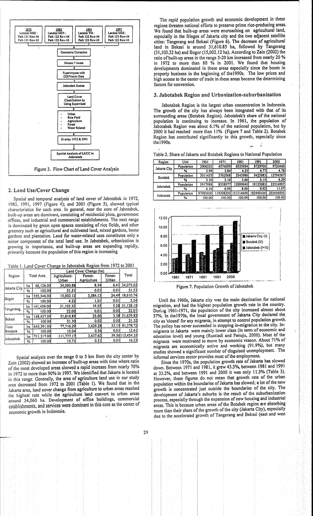
2 111. Land Cover Change in Jabotabek Region Ernan RUSTIADI, Alinda M. ZAIN, Bambang H. TRISASONGKO Faculty of Agriculture, Bogor Agricultural University, JI. Meranti, Dannaga Campus, IPB. Bogor, Indonesia Ita CAROLITA Center of Remote Sensing Application, LAPAN, J1. LAPAN 70, Pekayon, Jakarta Timur Indonesia 1. Introduction General land use and cover change in Indonesia has been predominated by two trends, namely deforestation and urbanizationsuburbanization Indonesia has more than 120 million ha of tropical fbrest, the second largest area after Brazil. Deforestation significantly causes loss of species diversity and ultimately leads to species extinction, and to disruption of the hydrological cycle. It also contributes significantly to global warming and greenhouse effect. In contrast to urbanization in the West, urbanization of metropolitan regions in Southeast Asian counbmies is often characterizcd by t~ncontrolled urban expansion and chaotic land use (Yokohari el al., 2000). Agglomeration and growth of population in the center of the region often lead to expansion of urbanized areas beyond rural areas, wliich are dominated by agricultural activity. This expansion has resulted in land use conversion from agriculture to urban uses and the cmcrgence of a new landscape in Asia characterized by a niix of agricultural and non-agricultural land uses (McGee, 1991; Sui and Zeng, 2001). During the last 25 years, remotely sensed data have been used extensively to monitor environmental change, to map land cover, and to monitor urban expansion (Kawamura et al., 1998; Jim, 2000). This study presents the results of research project on LUCC in the capital city of Indonesia, carried out at the Faculty of Agriculture, Bogor Agriculture University (IPB). The research is devoted to the mapping of land uselland cover of Jakarta Metropolitan Region (also known as Jabotabek) by using combination of remote sensing and in-field data of different spatial and temporal resolution. Our main objective was to study temporal change a"d spatial distribution of land cover change within Jabotabek. We carried out the study in three stages by using GIs and remote sensing softwbre packages. First, to analyze land cover change from remote sensing data. Second, to conduct spatial and temporal analysis of land cover changc in thc study area. Third, to discuss the driving forces of land cover changc in the region. Jabotabek is located in the northern part of Java island and comprises 7 administrative areas within 3 provinces (Figure I and 2). 'Thc first province is Jakarta (Daerah Khusus Ibukota). The second is Wcst Java Province, consisting of the municipalities of Bogor and Bekasi, and the districts of Bogor and Bekasi. The third is Banten I'rovince, which before 2001 used to be a region of West Java Province, and comprises the municipality of ~an~erang and district of Tangerang. This nletropolitan region, covering an area of about 6,752 krn2, is the largest urban agglomeration in Indonesia. The study area is situated along the northern coast and mountainous westenl part of Java. The altitude varies from 0 to 3,000 m. Three types of landform exist: the northcrn lowlands of the coastal plain along Jakarta Bay, the ccntral plateau, and the southern uplands and mountainous areas. We studied temporal change in land use withinajabotabek by using I Landsat MSS and TM data. Sdveral studies have shown the utility of I such data in land use surveys (Baban & Yusof, 2001; JI, 2001). Landsat MSS image dga hr 1972 and 1983 and Landsat TM data for 1991 were sourced from the Tropical Rain Forest Information Center (Michigan, USA), a NASA's Federation of Earth Scicnce Information Partners (funded by Lab. of Landscape Ecology & Planning, The University of Tokyo). Landsat TM 2001 was sourced, froni Indonesian National Institute of Aeronautics and Space (LAPAN). : Topographic maps for 1990 (scale 1:25,000), used for geometric 1 correction of the images, and ae-ial photographs for 1993 (1:50,000) i wcre obtained from the National Coordination Agency for Surveys and 1 Mapping (Bakosurtanal), Jdkarta, Indonesia. GIs data set was sourced I froni National Land Bureau (BPN), Jakarta, Indonesia., We carried out this study in several stages by using GIs and remote scnsing software packages (Arc-Info 7 and ERDAS 8.3).First, wc geometrically corrected the images of 1972, 1983, 1991 and by using the Bakosurtanal topographical map and a GIs vector data set from National Land Bureau (BPN), Jakarta, Indonesia. The data were transformed to the Universal Mercator (UTM) coordinate system using the Clarke 1880 spheroid in conformity with the topographic map. The root-mean-square error tolerance was set at a maximum of 1. Second, we joined two overlapping Landsat scenes for each year of Jabotabek area to create a single image for each date by mosaic the individual images. For the Jabotabek region, GIs vector data was superimposed on Landsat raster data within the modeler process in ERDAS, The accuracy of geometric information in vector data and raster data of Landsat images is necessary for the successful superimposition of mosaic images of Jabotabek. Third, we prepared maps on land cover through supervised classification of the images. Then, we make spatial distribution of land cover change since 1972 to C '

3
4
5

6
7
Trends in urbanization and patterns of land use in the Asian mega cities Jakarta, Bangkok, and Metro Manila
 Trends in urbanization and patterns of land use in the Asian mega cities Jakarta, Bangkok, and Metro Manila Akinobu Murakami a, Alinda Medrial Zain b, Kazuhiko Takeuchi c, Atsushi Tsunekawa c and Shigehiro
Urban monitoring using former Japanese Army maps and remote sensing - The 100 years of urban change of Jakarta city -
 Urban monitoring using former Japanese Army maps and remote sensing - The 100 years of urban change of city - J. Tetuko S. S. 1, I. Indreswari S. 2, and R. Tateishi 1 1 Center for Environmental Remote
RESEARCH METHODOLOGY
 III. RESEARCH METHODOLOGY 3.1. Time and Research Area The field work was taken place in primary forest around Toro village in Lore Lindu National Park, Indonesia. The study area located in 120 o 2 53 120
Integration Activities in Indonesia: The Integration of Land and Marine Spatial Data Sets as Part of Indonesian SDI Development
 Integration Activities in Indonesia: The Integration of Land and Marine Spatial Data Sets as Part of Indonesian SDI Development M. Arief Syafi i National Coordination Agency for Surveys and Mapping (B
Investigation of the Effect of Transportation Network on Urban Growth by Using Satellite Images and Geographic Information Systems
 Presented at the FIG Congress 2018, May 6-11, 2018 in Istanbul, Turkey Investigation of the Effect of Transportation Network on Urban Growth by Using Satellite Images and Geographic Information Systems
Coastal Landuse Change Detection Using Remote Sensing Technique: Case Study in Banten Bay, West Java Island, Indonesia
 Kasetsart J. (Nat. Sci.) 39 : 159-164 (2005) Coastal Landuse Change Detection Using Remote Sensing Technique: Case Study in Banten Bay, West Java Island, Indonesia Puvadol Doydee ABSTRACT Various forms
Droughts are normal recurring climatic phenomena that vary in space, time, and intensity. They may affect people and agriculture at local scales for
 I. INTRODUCTION 1.1. Background Droughts are normal recurring climatic phenomena that vary in space, time, and intensity. They may affect people and agriculture at local scales for short periods or cover
ESTIMATION OF LANDFORM CLASSIFICATION BASED ON LAND USE AND ITS CHANGE - Use of Object-based Classification and Altitude Data -
 ESTIMATION OF LANDFORM CLASSIFICATION BASED ON LAND USE AND ITS CHANGE - Use of Object-based Classification and Altitude Data - Shoichi NAKAI 1 and Jaegyu BAE 2 1 Professor, Chiba University, Chiba, Japan.
MAPPING LAND USE/ LAND COVER OF WEST GODAVARI DISTRICT USING NDVI TECHNIQUES AND GIS Anusha. B 1, Sridhar. P 2
 MAPPING LAND USE/ LAND COVER OF WEST GODAVARI DISTRICT USING NDVI TECHNIQUES AND GIS Anusha. B 1, Sridhar. P 2 1 M. Tech. Student, Department of Geoinformatics, SVECW, Bhimavaram, A.P, India 2 Assistant
Dynamic urban modelling: Cellular automata (CA) and Agent-based modelling (ABM) approach
 and Agent-based modelling (ABM) approach") Dynamic urban modelling: Cellular automata (CA) and Agent-based modelling (ABM) approach Agung Wahyudi Spatio-Temporal Analytics Research Laboratory (STAR-Lab) Understanding JMA s urban spatial pattern
Dynamic urban modelling: Cellular automata (CA) and Agent-based modelling (ABM) approach Agung Wahyudi Spatio-Temporal Analytics Research Laboratory (STAR-Lab) Understanding JMA s urban spatial pattern
ASSESSING THEMATIC MAP USING SAMPLING TECHNIQUE
 1 ASSESSING THEMATIC MAP USING SAMPLING TECHNIQUE University of Tehran, Faculty of Natural Resources, Karaj-IRAN E-Mail: adarvish@chamran.ut.ac.ir, Fax: +98 21 8007988 ABSTRACT The estimation of accuracy
IMPACT OF URBAN EVOLUTION ON LAND-USE CHANGE OF SARGODHA CITY, PAKISTAN
 Impact of Urban Evolution on Land-Use Change of Sargodha City in Pakistan J. Sc. & Tech. Univ. Peshawar, 2015, 39 (2), 29-36. IMPACT OF URBAN EVOLUTION ON LAND-USE CHANGE OF SARGODHA CITY, PAKISTAN SAJJAD
LEMBAGA PENERBANGAN DAN ANTARIKSA NASIONAL INDONESIAN NATIONAL INSTITUTE OF AERONAUTICS AND SPACE (LAPAN)
") LEMBAGA PENERBANGAN DAN ANTARIKSA NASIONAL INDONESIAN NATIONAL INSTITUTE OF AERONAUTICS AND SPACE (LAPAN) The Utilization of Remotely Sensed Data to Analyze The Estimated Volume of Pyroclastic Deposits
LEMBAGA PENERBANGAN DAN ANTARIKSA NASIONAL INDONESIAN NATIONAL INSTITUTE OF AERONAUTICS AND SPACE (LAPAN) The Utilization of Remotely Sensed Data to Analyze The Estimated Volume of Pyroclastic Deposits
PROGRESS IN GEOGRAPHY
 28 1 2009 01 PROGRESS IN GEOGRAPHY Vol.28, No.1 Jan., 2009 (1., 550001; 2., 400047; 3., 550025) : 1976 MSS,1986 1996 TM,2006 CBERS 1 5 DEM,, 30m ;, ;,,, 5~15km, : ; ; 1,,, [16],,, R.Welch 30 TM, GIS, [1],,,
Food Security Monitoring Bulletin. INDONESIA Special Focus: Estimating Impact of Disasters on Market Access
 Food Security Monitoring Bulletin INDONESIA Special Focus: Estimating Impact of Disasters on Market Access Volume 10, May 2018 CLIMATE AND FOOD SECURITY January - April 2018 More floods and landslides
Urban Sprawl and Land Use Characteristics in the Urban Fringe of Metro Manila, Philippines
 Urban Sprawl and Land Use Characteristics in the Urban Fringe of Metro Manila, Philippines Akinobu Murakami* 1 and Armando M. Palijon 2 1 Associate Professor, Interdisciplinary Graduate School of Science
Hydrology and Floodplain Analysis, Chapter 10
 Hydrology and Floodplain Analysis, Chapter 10 Hydrology and Floodplain Analysis, Chapter 10.1 Introduction to GIS GIS Geographical Information System Spatial Data Data linked with geographical location
7.1 INTRODUCTION 7.2 OBJECTIVE
 7 LAND USE AND LAND COVER 7.1 INTRODUCTION The knowledge of land use and land cover is important for many planning and management activities as it is considered as an essential element for modeling and
Available online at ScienceDirect. Procedia Environmental Sciences 33 (2016 )
") Available online at www.sciencedirect.com ScienceDirect Procedia Environmental Sciences 33 (2016 ) 365 375 The 2 nd International Symposium on LAPAN-IPB Satellite for Food Security and Environmental Monitoring
Available online at www.sciencedirect.com ScienceDirect Procedia Environmental Sciences 33 (2016 ) 365 375 The 2 nd International Symposium on LAPAN-IPB Satellite for Food Security and Environmental Monitoring
The Integration of Land and Marine Spatial Data Set As Part of Indonesian Spatial Data Infrastructure Development
 UNITED NATIONS E/CONF.97/6/IP. 46 ECONOMIC AND SOCIAL COUNCIL Seventeenth United Nations Regional Cartographic Conference for Asia and the Pacific Bangkok, 18-22 September 2006 Item 7 of the provisional
URBAN CHANGE DETECTION OF LAHORE (PAKISTAN) USING A TIME SERIES OF SATELLITE IMAGES SINCE 1972
 USING A TIME SERIES OF SATELLITE IMAGES SINCE 1972") URBAN CHANGE DETECTION OF LAHORE (PAKISTAN) USING A TIME SERIES OF SATELLITE IMAGES SINCE 1972 Omar Riaz Department of Earth Sciences, University of Sargodha, Sargodha, PAKISTAN. omarriazpk@gmail.com ABSTRACT
URBAN CHANGE DETECTION OF LAHORE (PAKISTAN) USING A TIME SERIES OF SATELLITE IMAGES SINCE 1972 Omar Riaz Department of Earth Sciences, University of Sargodha, Sargodha, PAKISTAN. omarriazpk@gmail.com ABSTRACT
9/19/2018. Dr. Hoch. RGPL 103 Global Cities: Planning and Development.
 Dr. Hoch RGPL 103 Global Cities: Planning and Development Dr. Hoch Email: rhoch@iup.edu 1 2 Earth s Orbit Around Sun Aphelion July 6 (12:00) Perihelion Jan 3 (00:00) EARTH 152.5 Million Km 147.5 Mil. Km
CHANGES IN VIJAYAWADA CITY BY REMOTE SENSING AND GIS
 International Journal of Civil Engineering and Technology (IJCIET) Volume 8, Issue 5, May 2017, pp.217 223, Article ID: IJCIET_08_05_025 Available online at http://www.ia aeme.com/ijciet/issues.asp?jtype=ijciet&vtyp
Progress and Land-Use Characteristics of Urban Sprawl in Busan Metropolitan City using Remote sensing and GIS
 Progress and Land-Use Characteristics of Urban Sprawl in Busan Metropolitan City using Remote sensing and GIS Homyung Park, Taekyung Baek, Yongeun Shin, Hungkwan Kim ABSTRACT Satellite image is very usefully
PREDICTION OF FUTURE LAND USE LAND COVER CHANGES OF VIJAYAWADA CITY USING REMOTE SENSING AND GIS
 PREDICTION OF FUTURE LAND USE LAND COVER CHANGES OF VIJAYAWADA CITY USING REMOTE SENSING AND GIS K. Sundara Kumar 1 *, N V A Sai Sankar Valasala 2, J V Subrahmanyam V 3, Mounika Mallampati 4 Kowsharajaha
Report. Developing a course component on disaster management
 Report Developing a course component on disaster management By Chira Prangkio Tawee Chaipimonplin Department of Geography, Faculty of Social Sciences, Chiang Mai University Thailand Presented at Indian
THE USE OF GOOGLE MAPS AND UNIVERSAL TRANSVERSE MERCATOR (UTM) COORDINATE IN LAND MEASUREMENT OF REGION IN DIFFERENT ZONE
 COORDINATE IN LAND MEASUREMENT OF REGION IN DIFFERENT ZONE") 5 th December 8. Vol.9. No 5 ongoing JATIT & LLS ISSN: 99-85 www.jatit.org E-ISSN: 87-95 THE USE OF GOOGLE MAPS AND UNIVERSAL TRANSVERSE MERCATOR (UTM) COORDINATE IN LAND MEASUREMENT OF REGION IN DIFFERENT
5 th December 8. Vol.9. No 5 ongoing JATIT & LLS ISSN: 99-85 www.jatit.org E-ISSN: 87-95 THE USE OF GOOGLE MAPS AND UNIVERSAL TRANSVERSE MERCATOR (UTM) COORDINATE IN LAND MEASUREMENT OF REGION IN DIFFERENT
Long-lead prediction of the 2015 fire and haze episode in Indonesia
 Long-lead prediction of the 2015 fire and haze episode in Indonesia Robert Field 1,2 Dilshad Shawki 3, Michael Tippett 2, Bambang Hero Saharjo 4, Israr Albar 5, Dwi Atmoko 6, Apostolos Voulgarakis 1 1.
A SPATIAL ANALYSIS OF AEGEAN SEA USING REMOTELY SENSED IMAGERY AND GIS TECHNOLOGY
 A SPATIAL ANALYSIS OF AEGEAN SEA USING REMOTELY SENSED IMAGERY AND GIS TECHNOLOGY Cigdem GOKSEL 1,I.OztugBILDIRICI 2, Cengizhan IPBUKER 1, and Necla ULUGTEKIN 1 1 ITU Faculty of Civil Engineering, Dept.
Post Independence Trends of Urbanization and Role of Small and Medium Towns in Maharashtra- A Geographical Analysis
 Post Independence Trends of Urbanization and Role of Small and Medium Towns in Maharashtra- A Geographical Analysis A careful and systematic study of the process of urbanization and related factors is
Remote Sensing and GIS Application in Change Detection Study Using Multi Temporal Satellite
 Cloud Publications International Journal of Advanced Remote Sensing and GIS 2013, Volume 2, Issue 1, pp. 374-378, Article ID Tech-181 ISSN 2320-0243 Case Study Open Access Remote Sensing and GIS Application
Name Date Class. a. High elevation and high relief b. High elevation and level surface c. Flat land and low relief
 Exploring Earth s Surface (pp. 21 27) This section describes factors that determine the shape of Earth s land surface. The section also describes how scientists divide Earth into four spheres. Use Target
Lanzhou Urban Growth Prediction Based on Cellular Automata 1
 Lanzhou Urban Growth Prediction Based on Cellular Automata 1 Yaowen Xie*, Aigong Ma, Haoyu Wang Key Laboratory of West China's Environmental System (Ministry of Education), Lanzhou University, Lanzhou,
Development of Geospatial Information in Indonesia: Progress & Challenge
 Development of Geospatial Information in Indonesia: Progress & Challenge Dr. Nurwadjedi Sarbini Deputy of Thematic Geospatial Information Geospatial Information Agency (BIG) Geosmart Asia, September 29
Simulation of Wetlands Evolution Based on Markov-CA Model
 Simulation of Wetlands Evolution Based on Markov-CA Model ZHANG RONGQUN 1 ZHAI HUIQING 1 TANG CHENGJIE 2 MA SUHUA 2 1 Department of Geography informantion science, College of information and Electrical
LAND USE CHANGE WITHIN THE BASIC DESIGN IN NORTH OF BAGHDAD
 LAND USE CHANGE WITHIN THE BASIC DESIGN IN NORTH OF BAGHDAD Ruba Yousif Hussain Highway and Transportation Engineering Department, College of Engineering, Mustansiriyah University, Baghdad, Iraq E-Mail:
Land Use Changing Scenario at Kerniganj Thana of Dhaka District Using Remote Sensing and GIS
 Research Paper Land Use Changing Scenario at Kerniganj Thana of Dhaka District Using Remote Sensing and GIS Farzana Raihan 1 * and Nowrine Kaiser 1 1 Assistant Professor, Department of Forestry and Environment
OBJECT-BASED CLASSIFICATION USING HIGH RESOLUTION SATELLITE DATA AS A TOOL FOR MANAGING TRADITIONAL JAPANESE RURAL LANDSCAPES
 OBJECT-BASED CLASSIFICATION USING HIGH RESOLUTION SATELLITE DATA AS A TOOL FOR MANAGING TRADITIONAL JAPANESE RURAL LANDSCAPES K. Takahashi a, *, N. Kamagata a, K. Hara b a Graduate School of Informatics,
USE OF SATELLITE IMAGES FOR AGRICULTURAL STATISTICS
 USE OF SATELLITE IMAGES FOR AGRICULTURAL STATISTICS National Administrative Department of Statistics DANE Colombia Geostatistical Department September 2014 Colombian land and maritime borders COLOMBIAN
Environmental Change Analysis in Nias Island Using Remote Sensing Technique
 IJCST Vo l. 8, Is s u e 2, Ap r i l - Ju n e 2017 ISSN : 0976-8491 (Online) ISSN : 2229-4333 (Print) Environmental Change Analysis in Nias Island Using Remote Sensing Technique 1 Togi Tampubolon, 2 Rita
APPLICATION OF LAND CHANGE MODELER FOR PREDICTION OF FUTURE LAND USE LAND COVER A CASE STUDY OF VIJAYAWADA CITY
 APPLICATION OF LAND CHANGE MODELER FOR PREDICTION OF FUTURE LAND USE LAND COVER A CASE STUDY OF VIJAYAWADA CITY K. Sundara Kumar 1, Dr. P. Udaya Bhaskar 2, Dr. K. Padmakumari 3 1 Research Scholar, 2,3
Object-Oriented Oriented Method to Classify the Land Use and Land Cover in San Antonio using ecognition Object-Oriented Oriented Image Analysis
 Object-Oriented Oriented Method to Classify the Land Use and Land Cover in San Antonio using ecognition Object-Oriented Oriented Image Analysis Jayar S. Griffith ES6973 Remote Sensing Image Processing
The Efforts of Building GIS Infrastructure in a Newly Independent State: The case of Timor Leste *
 UNITED NATIONS E/CONF.100/IP.12 ECONOMIC AND SOCIAL COUNCIL Eighteenth United Nations Regional Cartographic Conference for Asia and the Pacific Bangkok, 26-29 October 2009 Item 7(b) of the provisional
Using Geographic Information Systems and Remote Sensing Technology to Analyze Land Use Change in Harbin, China from 2005 to 2015
 Using Geographic Information Systems and Remote Sensing Technology to Analyze Land Use Change in Harbin, China from 2005 to 2015 Yi Zhu Department of Resource Analysis, Saint Mary s University of Minnesota,
What is Climate? Understanding and predicting climatic changes are the basic goals of climatology.
 What is Climate? Understanding and predicting climatic changes are the basic goals of climatology. Climatology is the study of Earth s climate and the factors that affect past, present, and future climatic
Characteristic of rainfall in the flood period in DKI Jakarta in 1996, 2002, and 2007
 MATEC Web of Conferences 9, 00 (08) ICDM 08 https://doi.org/.5/matecconf/08900 Characteristic of rainfall in the flood period in DKI Jakarta in 996, 00, and 007 Mangapul Parlindungan Tambunan,* Department
Applications of GIS and Remote Sensing for Analysis of Urban Heat Island
 Chuanxin Zhu Professor Peter V. August Professor Yeqiao Wang NRS 509 December 15, 2016 Applications of GIS and Remote Sensing for Analysis of Urban Heat Island Since the last century, the global mean surface
URBAN LAND PLANNING AND CHANGE DETECTION USING SATELLITE IMAGES (CASE STUDY: ANZALI WETLAND WATERSHED)
") URBAN LAND PLANNING AND CHANGE DETECTION USING SATELLITE IMAGES (CASE STUDY: ANZALI WETLAND WATERSHED) Borhan Riazi, Seyed Masoud Monavari, * Ali Bali, Nematollah Khorasani and Mir Masoud Kheirkhah Zarkesh
URBAN LAND PLANNING AND CHANGE DETECTION USING SATELLITE IMAGES (CASE STUDY: ANZALI WETLAND WATERSHED) Borhan Riazi, Seyed Masoud Monavari, * Ali Bali, Nematollah Khorasani and Mir Masoud Kheirkhah Zarkesh
Using Cellular Automaton to Simulate Urban Expansion in Changchun, China
 Sensors & Transducers 2014 by IFSA Publishing, S. L. http://www.sensorsportal.com Using Cellular Automaton to Simulate Urban Expansion in Changchun, China 1, 2 Jing MA, 3 Qiang BI, 4 Jingxia ZHANG, 1 Hongmei
Predicting Tsunami Inundated Area and Evacuation Road Based On Local Condition Using GIS
 IOSR Journal of Environmental Science, Toxicology and Food Technology (IOSR-JESTFT) ISSN: 2319-2402, ISBN: 2319-2399. Volume 1, Issue 4 (Sep-Oct. 2012), PP 05-11 Predicting Tsunami Inundated Area and Evacuation
Land Use/Cover Changes & Modeling Urban Expansion of Nairobi City
 Land Use/Cover Changes & Modeling Urban Expansion of Nairobi City Overview Introduction Objectives Land use/cover changes Modeling with Cellular Automata Conclusions Introduction Urban land use/cover types
What do we think of our cities?
 What do we think of our cities? Do we think of cities as beautiful places? Are cities healthy places to live? Do most of the world s people live in cities? Do cities function like other natural systems,
Operational Definitions of Urban, Rural and Urban Agglomeration for Monitoring Human Settlements
 Operational Definitions of Urban, Rural and Urban Agglomeration for Monitoring Human Settlements By Markandey Rai United Nations Human Settlements Programme PO Box-30030 Nairobi, Kenya Abstract The United
Monitoring Urban Space Expansion Using Remote Sensing Data in Ha Long City, Quang Ninh Province in Vietnam
 Monitoring Urban Space Expansion Using Remote Sensing Data in Ha Long City, Quang Ninh Province in Vietnam MY Vo Chi, LAN Pham Thi, SON Tong Si, Viet Key words: VSW index, urban expansion, supervised classification.
This table connects the content provided by Education Perfect to the NSW Syllabus.
 Education Perfect Geography provides teachers with a wide range of quality, engaging and innovative content to drive positive student learning outcomes. Designed by teachers and written by our in-house
INTERNATIONAL JOURNAL OF GEOMATICS AND GEOSCIENCES Volume 2, No 1, 2011
 INTERNATIONAL JOURNAL OF GEOMATICS AND GEOSCIENCES Volume 2, No 1, 2011 Copyright 2010 All rights reserved Integrated Publishing services Research article ISSN 0976 4380 Spatio-Temporal changes of Land
Wetland Mapping. Wetland Mapping in the United States. State Wetland Losses 53% in Lower US. Matthew J. Gray University of Tennessee
 Wetland Mapping Caribbean Matthew J. Gray University of Tennessee Wetland Mapping in the United States Shaw and Fredine (1956) National Wetlands Inventory U.S. Fish and Wildlife Service is the principle
John A. Ritter, Ph.D. Oregon Institute of Technology
 Oregon Institute of Technology Department t of Geomatics A GIS Degree That Merges GIS with Surveying Presented By Presented By John A. Ritter, Ph.D. Oregon Institute of Technology Presentation Objectives
An analysis on the relationship between land subsidence and floods at the Kujukuri Plain in Chiba Prefecture, Japan
 doi:10.5194/piahs-372-163-2015 Author(s) 2015. CC Attribution 3.0 License. An analysis on the relationship between land subsidence and floods at the Kujukuri Plain in Chiba Prefecture, Japan Y. Ito 1,
Use of Corona, Landsat TM, Spot 5 images to assess 40 years of land use/cover changes in Cavusbasi
 New Strategies for European Remote Sensing, Olui (ed.) 2005 Millpress, Rotterdam, ISBN 90 5966 003 X Use of Corona, Landsat TM, Spot 5 images to assess 40 years of land use/cover changes in Cavusbasi N.
DEVELOPMENT OF LAND SUITABILITY EVALUATION SYSTEM FOR COASTAL AQUACULTURE USING ARTIFICIAL NEURAL NETWORK AND GEOGRAPHICAL INFORMATION SYSTEMS
 DEVELOPMENT OF LAND SUITABILITY EVALUATION SYSTEM FOR COASTAL AQUACULTURE USING ARTIFICIAL NEURAL NETWORK AND GEOGRAPHICAL INFORMATION SYSTEMS Case Study: Mahakam Delta, East Kalimantan I KETUT SUTARGA
1. Introduction. Chaithanya, V.V. 1, Binoy, B.V. 2, Vinod, T.R. 2. Publication Date: 8 April DOI: https://doi.org/ /cloud.ijarsg.
 Cloud Publications International Journal of Advanced Remote Sensing and GIS 2017, Volume 6, Issue 1, pp. 2088-2096 ISSN 2320 0243, Crossref: 10.23953/cloud.ijarsg.112 Research Article Open Access Estimation
The Road to Data in Baltimore
 Creating a parcel level database from high resolution imagery By Austin Troy and Weiqi Zhou University of Vermont, Rubenstein School of Natural Resources State and local planning agencies are increasingly
STUDY ON RELATION BETWEEN URBAN STRUCTURE AND LAND VALUE FACTORS IN THE TOKYO METROPOLIS USING GEOGRAPHIC INFORMATION SYSTEM (GIS)
") STUDY ON RELATION BETWEEN URBAN STRUCTURE AND LAND VALUE FACTORS IN THE TOKYO METROPOLIS USING GEOGRAPHIC INFORMATION SYSTEM (GIS) Ippei Harada 1, Akihiko Kondoh 2 1 Center for Environmental Remote Sensing,
STUDY ON RELATION BETWEEN URBAN STRUCTURE AND LAND VALUE FACTORS IN THE TOKYO METROPOLIS USING GEOGRAPHIC INFORMATION SYSTEM (GIS) Ippei Harada 1, Akihiko Kondoh 2 1 Center for Environmental Remote Sensing,
Policies and practices of remote sensing implementation in Indonesia
 Policies and practices of remote sensing implementation in Indonesia AGF 2014 Jakarta, 26 Nov 2014 Orbita Roswintiarti Deputy Chairman for Remote Sensing Affairs Outline Background Role of LAPAN in remote
Overview of Remote Sensing in Natural Resources Mapping
 Overview of Remote Sensing in Natural Resources Mapping What is remote sensing? Why remote sensing? Examples of remote sensing in natural resources mapping Class goals What is Remote Sensing A remote sensing
The efforts building GIS infrastructure in a newly independent state The case of Timor Leste
 The efforts building GIS infrastructure in a newly independent state The case of Timor Leste Paulino da Cruz Ministry of Justice National Directorate of Land and Property and Cadastral Services (DNTPSC)
The Positional and Thematic Accuracy for Analysis of Multi-Temporal Satellite Images on Mangrove Areas
 The Positional and Thematic Accuracy for Analysis of Multi-Temporal Satellite Images on Mangrove Areas Paulo Rodrigo Zanin¹, Carlos Antonio O. Vieira² ¹Universidade Federal de Santa Catarina, Campus Universitário
Developing National Geospatial Thematic Information on Land Cover/Land Use: An Implementation of One Map Policy
 Developing National Geospatial Thematic Information on Land Cover/Land Use: An Implementation of One Map Policy Nurwadjedi, Suprajaka, Dheny Trie Wahyu Sampurno, Indonesia Keywords: Thematic Land Cover/Land
Physical Geography: Patterns, Processes, and Interactions, Grade 11, University/College Expectations
 Geographic Foundations: Space and Systems SSV.01 explain major theories of the origin and internal structure of the earth; Page 1 SSV.02 demonstrate an understanding of the principal features of the earth
Analysis of urban sprawl phenomenon
 Analysis of urban sprawl phenomenon Detection of city growth based on spatiotemporal analysis and landscape metrics. Leopold Leśko University for Sustainable Development Eberswalde, 2013 Presentanion Outline
VEGETATION ANALYSIS AND LAND USE LAND COVER CLASSIFICATION OF FOREST IN UTTARA KANNADA DISTRICT INDIA USING REMOTE SENSIGN AND GIS TECHNIQUES
 VEGETATION ANALYSIS AND LAND USE LAND COVER CLASSIFICATION OF FOREST IN UTTARA KANNADA DISTRICT INDIA USING REMOTE SENSIGN AND GIS TECHNIQUES A.G. Koppad a, B S Janagoudar b a Professor and Head (NRM),
Modeling the Rural Urban Interface in the South Carolina Piedmont: T. Stephen Eddins Lawrence Gering Jeff Hazelton Molly Espey
 Modeling the Rural Urban Interface in the South Carolina Piedmont: T. Stephen Eddins (teddins@clemson.edu) Lawrence Gering Jeff Hazelton Molly Espey ABSTRACT Continuing growth of America s cities has created
Shalaby, A. & Gad, A.
 Urban Sprawl Impact Assessment on the Fertile Agricultural Land of Egypt Using Remote Sensing and Digital Soil Database, Case study: Qalubiya Governorate Shalaby, A. & Gad, A. National Authority for Remote
Monitoring and Change Detection along the Eastern Side of Qena Bend, Nile Valley, Egypt Using GIS and Remote Sensing
 Advances in Remote Sensing, 2013, 2, 276-281 http://dx.doi.org/10.4236/ars.2013.23030 Published Online September 2013 (http://www.scirp.org/journal/ars) Monitoring and Change Detection along the Eastern
VISUALIZATION URBAN SPATIAL GROWTH OF DESERT CITIES FROM SATELLITE IMAGERY: A PRELIMINARY STUDY
 CO-439 VISUALIZATION URBAN SPATIAL GROWTH OF DESERT CITIES FROM SATELLITE IMAGERY: A PRELIMINARY STUDY YANG X. Florida State University, TALLAHASSEE, FLORIDA, UNITED STATES ABSTRACT Desert cities, particularly
Land use and land cover change detection at Mirzapur Union of Gazipur District of Bangladesh using remote sensing and GIS technology
 IOP Conference Series: Earth and Environmental Science OPEN ACCESS Land use and land cover change detection at Mirzapur Union of Gazipur District of Bangladesh using remote sensing and GIS technology To
This paper presented in MAPASIA 2010 in July, Kuala Lumpur- Malaysia. Theme: Connecting Government & Citizen Through Ubiquitous GIS
 This paper presented in MAPASIA 2010 in 26-28 July, Kuala Lumpur- Malaysia Theme: Connecting Government & Citizen Through Ubiquitous GIS 1 Paper Reference Number: 6 Name: ADIPANDANG YUDONO Author (s) Affiliation:Department
Urban remote sensing: from local to global and back
 Urban remote sensing: from local to global and back Paolo Gamba University of Pavia, Italy A few words about Pavia Historical University (1361) in a nice town slide 3 Geoscience and Remote Sensing Society
LAND COVER IN LEIHITU PENINSULA AMBON DISTRICT BASED ON IMAGE SPECTRAL TRANSFORMATION
 International Journal of Health Medicine and Current Research Vol. 2, Issue 04, pp.620-626, December, 2017 DOI: 10.22301/IJHMCR.2528-3189.620 Article can be accessed online on: http://www.ijhmcr.com ORIGINAL
Derin Orhon:
 The Use of Remote Sensing and GIS Technologies for Comprehensive Wastewater Management Necla Ulugtekin*, Filiz Bektas**, Ahmet Ozgur Dogru*, Cigdem Goksel**, Idil Aslan Alaton***, Derin Orhon*** * Istanbul
Land Use/Land Cover Mapping in and around South Chennai Using Remote Sensing and GIS Techniques ABSTRACT
 Land Use/Land Cover Mapping in and around South Chennai Using Remote Sensing and GIS Techniques *K. Ilayaraja, Abhishek Singh, Dhiraj Jha, Kriezo Kiso, Amson Bharath institute of Science and Technology
Modelling of the Interaction Between Urban Sprawl and Agricultural Landscape Around Denizli City, Turkey
 Modelling of the Interaction Between Urban Sprawl and Agricultural Landscape Around Denizli City, Turkey Serhat Cengiz, Sevgi Gormus, Şermin Tagil srhtcengiz@gmail.com sevgigormus@gmail.com stagil@balikesir.edu.tr
The Study of Multi-temporal Analysis of Urban Development and Environmental Changes of the City of Abu Dhabi
 The Study of Multi-temporal Analysis of Urban Development and Environmental Changes of the City of Abu Dhabi H. Hussein and M. Hussein Abstract The city of Abu Dhabi is the capital of the United Arab Emirates.
Spatial modelling of land use/cover change (LUCC) in South Tangerang City, Banten
 in South Tangerang City, Banten") IOP Conference Series: Earth and Environmental Science PAPER OPEN ACCESS Spatial modelling of land use/cover change (LUCC) in South Tangerang City, Banten To cite this article: K Saifullah et al 2017 IOP
IOP Conference Series: Earth and Environmental Science PAPER OPEN ACCESS Spatial modelling of land use/cover change (LUCC) in South Tangerang City, Banten To cite this article: K Saifullah et al 2017 IOP
Case Study: Ecological Integrity of Grasslands in the Apache Highlands Ecoregion
 Standard 9: Screen all target/biodiversity element occurrences for viability or ecological integrity. Case Study: Ecological Integrity of Grasslands in the Apache Highlands Ecoregion Summarized from: Marshall,
Analyzing Suitability of Land for Affordable Housing
 Analyzing Suitability of Land for Affordable Housing Vern C. Svatos Jarrod S. Doucette Abstract: This paper explains the use of a geographic information system (GIS) to distinguish areas that might have
Plant Distribution in a Sonoran Desert City CAP LTER Data Explorations
 in a Sonoran Desert City CAP LTER Data Explorations Author: Ecology Explorers Team, adapted from data analysis by J. Walker and the CAP LTER 200 point survey Time: 15-30 minutes Grade Level: 9-12 Background:
Environmental Impact Assessment Land Use and Land Cover CISMHE 7.1 INTRODUCTION
 7 LAND USE AND LAND COVER 7.1 INTRODUCTION The knowledge of land use and land cover is important for many planning and management activities as it is considered an essential element for modeling and understanding
IOP Conference Series: Earth and Environmental Science. Related content OPEN ACCESS
 IOP Conference Series: Earth and Environmental Science OPEN ACCESS Using GIS to integrate the analysis of land-use, transportation, and the environment for managing urban growth based on transit oriented
Spatial and Temporal Pattern of Flood Area in Cisadane Watershed, Banten Province
 1st International Conference on Geography and Education (ICGE 2016) Spatial and Temporal Pattern of Flood Area in Cisadane Watershed, Banten Province Mangapul P.Tambunan Lecturer in the Department of Geography
Queries of Agricultural Areas Falling into Cadastral Parcels and Organizing and Analyzing Them with Python Programming Language
 Queries of Agricultural Areas Falling into Cadastral Parcels and Organizing and Analyzing Them with Python Programming Language Ekrem SARALIOGLU, Deniz YILDIRIM and Oguz GUNGOR Keywords: Geographic Information
SDI DEVELOPMENT UPDATES OF INDONESIA
 SDI DEVELOPMENT UPDATES OF INDONESIA DR. ANTONIUS B. WIJANARTO Center For Management And Dissemination Of Geospatial Information GEOSPATIAL INFORMATION AUTHORITY GOVERNMENT OF THE REPUBLIC OF INDONESIA
Modeling Urban Land Cover Growth Dynamics Based on Land Change Modeler (LCM) Using Remote Sensing: A Case Study of Gurgaon, India
 Using Remote Sensing: A Case Study of Gurgaon, India") Advances in Computational Sciences and Technology ISSN 0973-6107 Volume 10, Number 10 (2017) pp. 2947-2961 Research India Publications http://www.ripublication.com Modeling Urban Land Cover Growth Dynamics
Advances in Computational Sciences and Technology ISSN 0973-6107 Volume 10, Number 10 (2017) pp. 2947-2961 Research India Publications http://www.ripublication.com Modeling Urban Land Cover Growth Dynamics
NCAVES - Global initiative and national pilots
 NCAVES - Global initiative and national pilots Kavita Sharma UN Environment Pretoria, March 2018 Outline 1. Global initiative > Introduction > Objectives and deliverables >Activities in 2017 and 2018 2.
Criteria for delineating a new boundary for the Fisher Bay Park Reserve, Manitoba
 1 Criteria for delineating a new boundary for the Fisher Bay Park Reserve, Manitoba R. A. Lastra Department of Botany, University of Manitoba, Winnipeg, MB, Canada, R3T 2N2 1. INTRODUCTION Historic park
 Title Generation of DEM for Urban Vietnam Transfo Author(s) Yonezawa, Go Citation Kyoto Working Papers on Area Studie 60: 1-10 Issue Date 2009-03 URL http://hdl.handle.net/2433/155764 Right 2009 Center
Coastal Abrasion and Accretion Studies of West Sumatera Province in Period
 Journal of Environmental Science and Engineering A 7 (2018) 22-29 doi:10.17265/2162-5298/2018.01.003 D DAVID PUBLISHING Coastal Abrasion and Accretion Studies of West Sumatera Province in Period 2003-2016
GEOGRAPHY (GEOGRPHY) Geography (GEOGRPHY) 1
 Geography (GEOGRPHY) 1") Geography (GEOGRPHY) 1 GEOGRAPHY (GEOGRPHY) GEOGRPHY 1040 Planet Earth 4 Credits The features of the natural environment (lithosphere, atmosphere and hydrosphere); their character, distribution, origin
Geography (GEOGRPHY) 1 GEOGRAPHY (GEOGRPHY) GEOGRPHY 1040 Planet Earth 4 Credits The features of the natural environment (lithosphere, atmosphere and hydrosphere); their character, distribution, origin
Percentage of Vegetation Cover Change Monitoring in Wuhan Region Based on Remote Sensing
 Available online at www.sciencedirect.com Procedia Environmental Sciences 10 (2011 ) 1466 1472 2011 3rd International Conference on Environmental Science and Information Conference Application Title Technology