Shalaby, A. & Gad, A.
|
|
|
- Cecilia Payne
- 5 years ago
- Views:
Transcription

1 Urban Sprawl Impact Assessment on the Fertile Agricultural Land of Egypt Using Remote Sensing and Digital Soil Database, Case study: Qalubiya Governorate Shalaby, A. & Gad, A. National Authority for Remote Sensing and Space Sciences, Egypt 1
2 Motivations The ever increasing population and urban sprawl in addition to land degradation causes a huge pressure on the limited agricultural land and decrease in area per capita. The amount, the rate and the intensity of urban sprawl and lose of agricultural land need to be analyzed. 2
3 Introduction Urban sprawl is one of the main problems that threaten the limited highly fertile land in the Nile Delta of Egypt. Urbanization is an inevitable process due to progress and development however the encroachments of urban settlements on expense of agricultural lands may pose dire consequences. Therefore, changes of the land covers and the environmental impact of these changes should be carefully considered. For this purpose 3
4 Objectives To study the urban sprawl using multi-temporal satellite data Integrating remote sensing and GIS in studying the spatial distribution of urban sprawl and its impact on agricultural land. 4


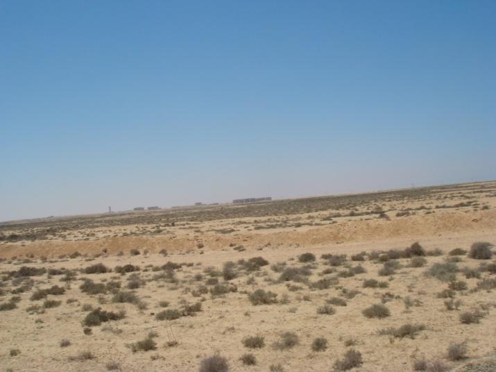
5 Study area of Al-Qalubiya Governorate The Qalubiya Governorate is located on the eastern side of the River Nile, near the Delta head. It is bounded from the south by both Cairo and Giza Governorates, from the north by Dakahlia and Gharbia Governorates, from the east by El-Sharkia Governorate and from the west by El-Monofia Governorate.
6 Climate of the study Area * The climatic data of Qalubiya Governorate indicate that the total rainfalls does not exceed 7.2 mm/year. The mean minimum and maximum annual temperatures are 16.5 and 31.0 C, respectively. * The evaporation rates are coinciding with temperatures, where the lowest evaporation rate (1.9 mm/day) was recorded in January, while the highest value (7.6 mm/day) was recorded in June. * Qalubiya Governorate is located under arid climatic conditions. 6
7 Materials Satellite data (TM, ETM+, and Egypt Sat-1 Topographic maps (Scale 1-50,000) Field data Digital soil database 7
8 Methodology flowchart Landsat TM 1993 Landsat ETM Egypt Sat-1, 2009 Geo-referencing & rectification Geo-referencing & rectification Geo-referencing & rectification Supervised classification Visual interpretation Supervised classification Visual interpretation Supervised classification Visual interpretation Land cover Map 1987 Integration using GIS Interprete d map Land cover Map 2001 Integration using GIS Interpreted map Land cover Map 2001 Integration using GIS Interprete d map Higher accuracy map 1993 Higher accuracy map 2001 Higher accuracy map 2001 Post-classification change detection Change detection map tabular data 8


9 Field work Field work has been carried out to collect ground truth for image classification and soil samples for soil mapping Vertic Torrifluvents soil sub-great group 9
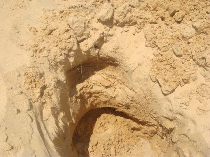
10 Typic Torriorthents soil sub-great group 10
11 Image enhancement and visual interpretation The goal of image enhancement is to improve the visual interpretability of an image The purpose is to optimize the complementary abilities of the human mind and the computer. Because the mind is excellent at interpreting spatial attributes and identifying obscure features (Lillesand and Kiefer, 1994). 11

12 FCC, 4,3,2, of TM

13 FCC, 4,3,2, of ETM
14 FCC, 3,2,1, of Egypt Sat-1,
15
16
17


18 Area (km2) Area (km2) 0 year Area (km2) Urban sprawl from
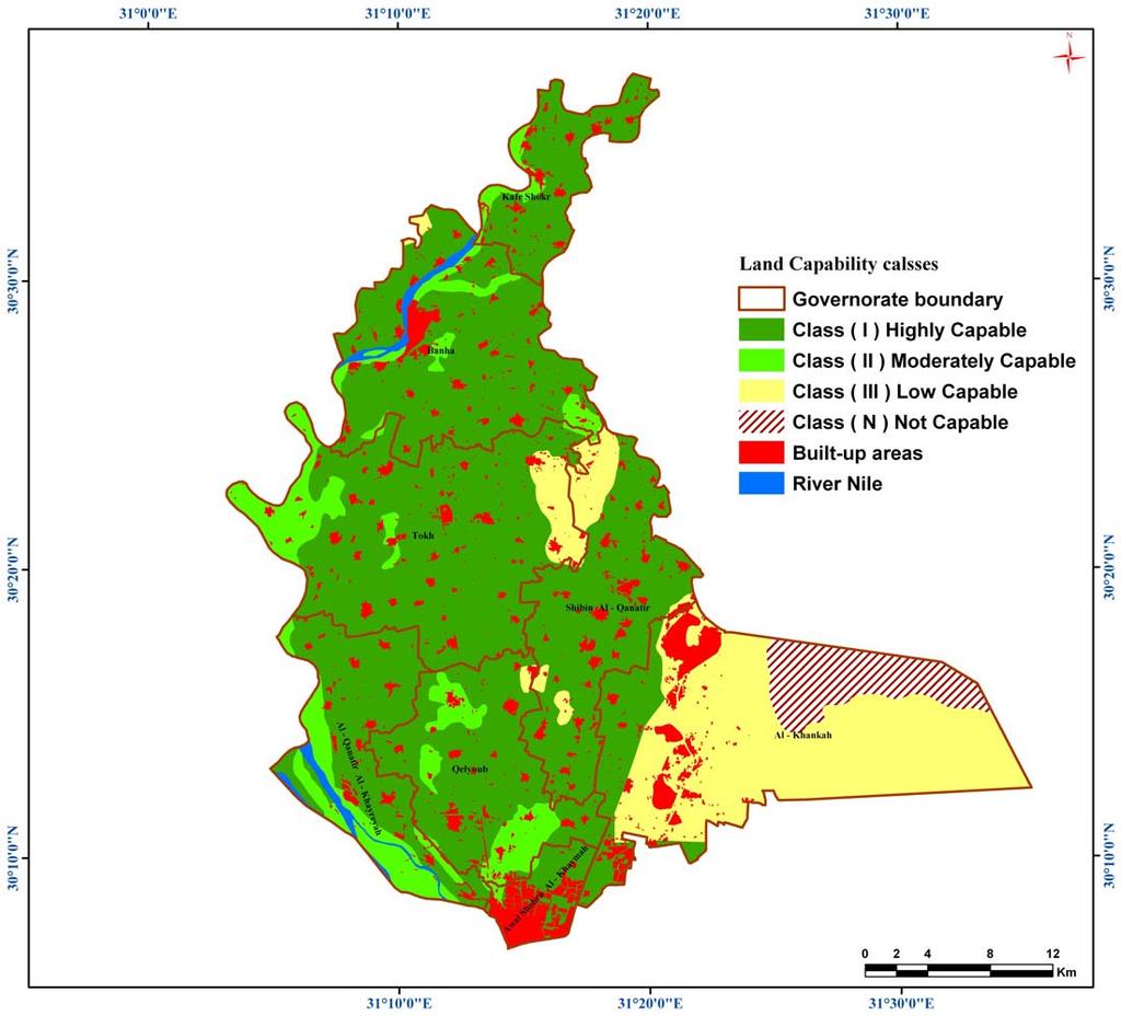
19 Urban areas of 1992 overlaid on Capability map, Awal Shobra district 19

20 Urban areas of 2001 overlaid on Capability map, Awal Shobra district 20
21 Urban areas of 2009 overlaid on Capability map, Awal Shobra district 21


22 Area (km2) Area (km2) year Area (km2) Urban sprawl from
23 Conclusion Integrating visual interpretation with supervised classification led to increase in the overall accuracy. The study area has undergone a very severe land cover changes; increase in urban settlements and decrease in agricultural land, Integrating GIS and remote sensing provided valuable information e.g.. Area and spatial distribution urban expansion. The closer the district to Cairo the faster the urban sprawl 23
Monitoring and Change Detection along the Eastern Side of Qena Bend, Nile Valley, Egypt Using GIS and Remote Sensing
 Advances in Remote Sensing, 2013, 2, 276-281 http://dx.doi.org/10.4236/ars.2013.23030 Published Online September 2013 (http://www.scirp.org/journal/ars) Monitoring and Change Detection along the Eastern
Use of Corona, Landsat TM, Spot 5 images to assess 40 years of land use/cover changes in Cavusbasi
 New Strategies for European Remote Sensing, Olui (ed.) 2005 Millpress, Rotterdam, ISBN 90 5966 003 X Use of Corona, Landsat TM, Spot 5 images to assess 40 years of land use/cover changes in Cavusbasi N.
Investigation of the Effect of Transportation Network on Urban Growth by Using Satellite Images and Geographic Information Systems
 Presented at the FIG Congress 2018, May 6-11, 2018 in Istanbul, Turkey Investigation of the Effect of Transportation Network on Urban Growth by Using Satellite Images and Geographic Information Systems
Landuse/Landcover Change Detection in Umshing- Mawkynroh of East Khasi Hills District, Meghalaya Using Spatial Information Technology
 International Journal of Scientific and Research Publications, Volume 6, Issue 1, January 2016 197 Landuse/Landcover Change Detection in Umshing- Mawkynroh of East Khasi Hills District, Meghalaya Using
The Relationship between Groundwater, Landuse, and Demography in Dakhla Oasis, Egypt
 The Relationship between Groundwater, Landuse, and Demography in Dakhla Oasis, Egypt Hiroshi KATO 1, Salwa ELBEIH 2, Erina IWASAKI 3, Ahmed SEFELNASR 4, Adel SHALABY 2, and Elsayed ZAGHLOUL 2 Abstract:
Land Use Mapping For Path Selection of Strategic Road Using EgyptSat-1 Imagery
 Land Use Mapping For Path Selection of Strategic Road Using EgyptSat-1 Imagery ABSTRACT ElSayed Hermas * and Islam Abou El-Magd The National Authority for Remote Sensing and Space Sciences The Egyptian
Assessment of Urban Geomorphological Hazard in the North-East of Cairo City, Using Remote Sensing and GIS Techniques. G. Albayomi
 Assessment of Urban Geomorphological Hazard in the North-East of Cairo City, Using Remote Sensing and GIS Techniques G. Albayomi Geography Department, Faculty of Arts, Helwan University, Cairo, Egypt Gehan_albayomi@arts.helwan.edu.eg
Annotated Bibliography. GIS/RS Assessment of Desertification
 David Hussong NRS 509 12/14/2017 Annotated Bibliography GIS/RS Assessment of Desertification Desertification is one of the greatest environmental challenges of the modern era. The United Nations Conference
Accuracy Assessment of Land Use & Land Cover Classification (LU/LC) Case study of Shomadi area- Renk County-Upper Nile State, South Sudan
 Case study of Shomadi area- Renk County-Upper Nile State, South Sudan") International Journal of Scientific and Research Publications, Volume 3, Issue 5, May 2013 1 Accuracy Assessment of Land Use & Land Cover Classification (LU/LC) Case study of Shomadi area- Renk County-Upper
International Journal of Scientific and Research Publications, Volume 3, Issue 5, May 2013 1 Accuracy Assessment of Land Use & Land Cover Classification (LU/LC) Case study of Shomadi area- Renk County-Upper
Environmental Impact Assessment Land Use and Land Cover CISMHE 7.1 INTRODUCTION
 7 LAND USE AND LAND COVER 7.1 INTRODUCTION The knowledge of land use and land cover is important for many planning and management activities as it is considered an essential element for modeling and understanding
Soils and Water use Dept., National Research Center, Dokki, Cairo, Egypt.
 Scientific registration n : 2459 Symposium n :36 Presentation : poster Problem of urban encroachment in some areas of great Cairo (Egypt) Problème de l expansion urbaine dans quelques zones autour de l
International Journal of Scientific & Engineering Research, Volume 6, Issue 7, July ISSN
 International Journal of Scientific & Engineering Research, Volume 6, Issue 7, July-2015 1428 Accuracy Assessment of Land Cover /Land Use Mapping Using Medium Resolution Satellite Imagery Paliwal M.C &.
GEO GRAPHICAL RESEARCH
 23 5 2004 3 GEO GRAPHICAL RESEARCH Vol123, No13 May, 2004,, (, 100101) :,, 1976 20,,,, GIS,,,, : ; ; ; : P737112 + 1 ; P33215 : 100020585 (2004) 0320339208 1 1855,,, 10, 7 [1 ] 1976 5,,,,,,,, [2 ],, [3
This is trial version
 Journal of Rangeland Science, 2012, Vol. 2, No. 2 J. Barkhordari and T. Vardanian/ 459 Contents available at ISC and SID Journal homepage: www.rangeland.ir Full Paper Article: Using Post-Classification
Monitoring of Forest Cover Change in Sundarban mangrove forest using Remote sensing and GIS
 Monitoring of Forest Cover Change in Sundarban mangrove forest using Remote sensing and GIS By Mohammed Monirul Alam April 2008 Content 1: INTRODUCTION 2: OBJECTIVES 3: METHODOLOGY 4: RESULTS & DISCUSSION
7.1 INTRODUCTION 7.2 OBJECTIVE
 7 LAND USE AND LAND COVER 7.1 INTRODUCTION The knowledge of land use and land cover is important for many planning and management activities as it is considered as an essential element for modeling and
CHANGES IN VIJAYAWADA CITY BY REMOTE SENSING AND GIS
 International Journal of Civil Engineering and Technology (IJCIET) Volume 8, Issue 5, May 2017, pp.217 223, Article ID: IJCIET_08_05_025 Available online at http://www.ia aeme.com/ijciet/issues.asp?jtype=ijciet&vtyp
Monitoring Coastline Change Using Remote Sensing and GIS Technologies
 2012 International Conference on Earth Science and Remote Sensing Lecture Notes in Information Technology, Vol.30 Monitoring Coastline Change Using Remote Sensing and GIS Technologies Arzu Erener 1,a,*,
Landuse Landcover Changes in Delta Province of Egypt:
 Master Thesis submitted within the UNIGIS MSc. programme at the Department of Geoinformatics - Z_GIS University of Salzburg, Austria under the provisions of UNIGIS India framework Landuse Landcover Changes
.C.V. Dr. Rafat Ramadan
 .C.V. Dr. Rafat Ramadan Surname Other names Title Gender Address Ali Rafat Ramadan Dr Male Soils and water use Dept. National Research Centre, El Behoth, st. Dokki, Giza Post Code 11787 Telephone Numbers
Remote Sensing and GIS Application in Change Detection Study Using Multi Temporal Satellite
 Cloud Publications International Journal of Advanced Remote Sensing and GIS 2013, Volume 2, Issue 1, pp. 374-378, Article ID Tech-181 ISSN 2320-0243 Case Study Open Access Remote Sensing and GIS Application
INVESTIGATION LAND USE CHANGES IN MEGACITY ISTANBUL BETWEEN THE YEARS BY USING DIFFERENT TYPES OF SPATIAL DATA
 INVESTIGATION LAND USE CHANGES IN MEGACITY ISTANBUL BETWEEN THE YEARS 1903-2010 BY USING DIFFERENT TYPES OF SPATIAL DATA T. Murat Celikoyan, Elif Sertel, Dursun Zafer Seker, Sinasi Kaya, Uğur Alganci ITU,
Abstract: About the Author:
 REMOTE SENSING AND GIS IN LAND USE PLANNING Sathees kumar P 1, Nisha Radhakrishnan 2 1 1 Ph.D Research Scholar, Department of Civil Engineering, National Institute of Technology, Tiruchirappalli- 620015,
Droughts are normal recurring climatic phenomena that vary in space, time, and intensity. They may affect people and agriculture at local scales for
 I. INTRODUCTION 1.1. Background Droughts are normal recurring climatic phenomena that vary in space, time, and intensity. They may affect people and agriculture at local scales for short periods or cover
Analysis of Landuse, Landcover Change and Urban Expansion in Akure, Nigeria (pp )
") Journal of Innovative Research in Engineering and Sciences 2(4), June, 2011. ISSN : 2141-8225. http://www.grpjournal.org. Printed in Nigeria. All rights researved. Global Research Publishing, 2011. Analysis
Journal of Innovative Research in Engineering and Sciences 2(4), June, 2011. ISSN : 2141-8225. http://www.grpjournal.org. Printed in Nigeria. All rights researved. Global Research Publishing, 2011. Analysis
Monitoring of Settlement Development Methodological Problems and Solutions in Germany
 Monitoring of Settlement Development Methodological Problems and Solutions in Germany Gotthard Meinel Leibniz Institute for Ecological Urban and Regional Development (IOER), Germany/Dresden Overview LU-Problem
URBAN CHANGE DETECTION OF LAHORE (PAKISTAN) USING A TIME SERIES OF SATELLITE IMAGES SINCE 1972
 USING A TIME SERIES OF SATELLITE IMAGES SINCE 1972") URBAN CHANGE DETECTION OF LAHORE (PAKISTAN) USING A TIME SERIES OF SATELLITE IMAGES SINCE 1972 Omar Riaz Department of Earth Sciences, University of Sargodha, Sargodha, PAKISTAN. omarriazpk@gmail.com ABSTRACT
URBAN CHANGE DETECTION OF LAHORE (PAKISTAN) USING A TIME SERIES OF SATELLITE IMAGES SINCE 1972 Omar Riaz Department of Earth Sciences, University of Sargodha, Sargodha, PAKISTAN. omarriazpk@gmail.com ABSTRACT
CHANGE DETECTION USING REMOTE SENSING- LAND COVER CHANGE ANALYSIS OF THE TEBA CATCHMENT IN SPAIN (A CASE STUDY)
") CHANGE DETECTION USING REMOTE SENSING- LAND COVER CHANGE ANALYSIS OF THE TEBA CATCHMENT IN SPAIN (A CASE STUDY) Sharda Singh, Professor & Programme Director CENTRE FOR GEO-INFORMATICS RESEARCH AND TRAINING
CHANGE DETECTION USING REMOTE SENSING- LAND COVER CHANGE ANALYSIS OF THE TEBA CATCHMENT IN SPAIN (A CASE STUDY) Sharda Singh, Professor & Programme Director CENTRE FOR GEO-INFORMATICS RESEARCH AND TRAINING
MAPPING LAND USE/ LAND COVER OF WEST GODAVARI DISTRICT USING NDVI TECHNIQUES AND GIS Anusha. B 1, Sridhar. P 2
 MAPPING LAND USE/ LAND COVER OF WEST GODAVARI DISTRICT USING NDVI TECHNIQUES AND GIS Anusha. B 1, Sridhar. P 2 1 M. Tech. Student, Department of Geoinformatics, SVECW, Bhimavaram, A.P, India 2 Assistant
VISUALIZATION URBAN SPATIAL GROWTH OF DESERT CITIES FROM SATELLITE IMAGERY: A PRELIMINARY STUDY
 CO-439 VISUALIZATION URBAN SPATIAL GROWTH OF DESERT CITIES FROM SATELLITE IMAGERY: A PRELIMINARY STUDY YANG X. Florida State University, TALLAHASSEE, FLORIDA, UNITED STATES ABSTRACT Desert cities, particularly
Quantifying Land Use/Cover Dynamics of Nainital Town (India) Using Remote Sensing and GIS Techniques
 Using Remote Sensing and GIS Techniques") Quantifying Land Use/Cover Dynamics of Nainital Town (India) Using Remote Sensing and GIS Techniques Jiwan Rawat 1*, Vivekananda Biswas 1 and Manish Kumar 1 1 Centre of Excellence for NRDMS in Uttarakhand,
Quantifying Land Use/Cover Dynamics of Nainital Town (India) Using Remote Sensing and GIS Techniques Jiwan Rawat 1*, Vivekananda Biswas 1 and Manish Kumar 1 1 Centre of Excellence for NRDMS in Uttarakhand,
Landuse and Landcover change analysis in Selaiyur village, Tambaram taluk, Chennai
 Landuse and Landcover change analysis in Selaiyur village, Tambaram taluk, Chennai K. Ilayaraja Department of Civil Engineering BIST, Bharath University Selaiyur, Chennai 73 ABSTRACT The synoptic picture
A. Gad. National Authority for Remote Sensing and Space Sciences (NARSS) Abstract
 Abstract") Integration of satellite data and GIS Spatial analyses for assessing sustainable development of desert depressions, case studies of Al Fayoum and Wadi El Natrun, Egypt A. Gad National Authority for Remote
Integration of satellite data and GIS Spatial analyses for assessing sustainable development of desert depressions, case studies of Al Fayoum and Wadi El Natrun, Egypt A. Gad National Authority for Remote
Urban Expansion of the City Kolkata since last 25 years using Remote Sensing
 [ VOLUME 5 I ISSUE 2 I APRIL JUNE 2018] E ISSN 2348 1269, PRINT ISSN 2349-5138 Urban Expansion of the City Kolkata since last 25 years using Remote Sensing Soumita Banerjee Researcher, Faculty Council
1. Introduction. Chaithanya, V.V. 1, Binoy, B.V. 2, Vinod, T.R. 2. Publication Date: 8 April DOI: https://doi.org/ /cloud.ijarsg.
 Cloud Publications International Journal of Advanced Remote Sensing and GIS 2017, Volume 6, Issue 1, pp. 2088-2096 ISSN 2320 0243, Crossref: 10.23953/cloud.ijarsg.112 Research Article Open Access Estimation
Abstract. TECHNOFAME- A Journal of Multidisciplinary Advance Research. Vol.2 No. 2, (2013) Received: Feb.2013; Accepted Oct.
 Received: Feb.2013; Accepted Oct.") Vol.2 No. 2, 83-87 (2013) Received: Feb.2013; Accepted Oct. 2013 Landuse Pattern Analysis Using Remote Sensing: A Case Study of Morar Block, of Gwalior District, M.P. Subhash Thakur 1 Akhilesh Singh 2
Vol.2 No. 2, 83-87 (2013) Received: Feb.2013; Accepted Oct. 2013 Landuse Pattern Analysis Using Remote Sensing: A Case Study of Morar Block, of Gwalior District, M.P. Subhash Thakur 1 Akhilesh Singh 2
MORPHOLOGICAL VARIATION OF THE NILE RIVER FOURTH REACH
 MORPHOLOGICAL VARIATION OF THE NILE RIVER FOURTH REACH R. M. El-SAYED 1, ABDELAZIM M. NEGM 2, S. GHALY 3, AND K. A. ALI 4 1 Civil Engineering Department, Faculty of Engineering, Aswan University, Aswan,
Monitoring Land-Cover in the New Reclaimed Area: A Case Study in EL-Nubaria, Egypt
 Monitoring Land-Cover in the New Reclaimed Area: A Case Study in EL-Nubaria, Egypt * Abou-Hadid A. F., M.A. A. Abdrabbo, A.A. Khalil and M. K. Hassanein The Central laboratory for Agricultural Climate,
International Journal of Intellectual Advancements and Research in Engineering Computations
 ISSN:2348-2079 Volume-5 Issue-2 International Journal of Intellectual Advancements and Research in Engineering Computations Agricultural land investigation and change detection in Coimbatore district by
Digital Change Detection Using Remotely Sensed Data for Monitoring Green Space Destruction in Tabriz
 Int. J. Environ. Res. 1 (1): 35-41, Winter 2007 ISSN:1735-6865 Graduate Faculty of Environment University of Tehran Digital Change Detection Using Remotely Sensed Data for Monitoring Green Space Destruction
Human Activities and Environmental Risks Natural Hazards and Urban Development Issues Vallée de la Bruche, Alsace
 STER 98 Remote Sensing Project Tutorials 1 Human Activities and Environmental Risks Natural Hazards and Urban Development Issues Vallée de la Bruche, Alsace Stephen Clandillon, SERTIT, Parc d'innovation,
Accuracy Assessment of Land Cover Classification in Jodhpur City Using Remote Sensing and GIS
 Accuracy Assessment of Land Cover Classification in Jodhpur City Using Remote Sensing and GIS S.L. Borana 1, S.K.Yadav 1 Scientist, RSG, DL, Jodhpur, Rajasthan, India 1 Abstract: A This study examines
Comparison of MLC and FCM Techniques with Satellite Imagery in A Part of Narmada River Basin of Madhya Pradesh, India
 Cloud Publications International Journal of Advanced Remote Sensing and GIS 013, Volume, Issue 1, pp. 130-137, Article ID Tech-96 ISS 30-043 Research Article Open Access Comparison of MLC and FCM Techniques
Available online at ScienceDirect. Procedia Engineering 154 (2016 )
") Available online at www.sciencedirect.com ScienceDirect Procedia Engineering 154 (2016 ) 936 942 12th International Conference on Hydroinformatics, HIC 2016 Monitoring Land Use/Land Cover Changes Around
Available online at www.sciencedirect.com ScienceDirect Procedia Engineering 154 (2016 ) 936 942 12th International Conference on Hydroinformatics, HIC 2016 Monitoring Land Use/Land Cover Changes Around
CLICK HERE TO KNOW MORE
 CLICK HERE TO KNOW MORE Geoinformatics Applications in Land Resources Management G.P. Obi Reddy National Bureau of Soil Survey & Land Use Planning Indian Council of Agricultural Research Amravati Road,
About the Author: Abstract:
 Temporal Analysis of Land use Pattern Changes of Noida, NCR Using Geospatial Tools Noyingbeni Kikon & Prafull Singh Amity Institute of Geo-informatics and Remote Sensing Amity University, Sector-125, Noida,
LAND USE LAND COVER, CHANGE DETECTION OF FOREST IN KARWAR TALUK USING GEO-SPATIAL TECHNIQUES
 LAND USE LAND COVER, CHANGE DETECTION OF FOREST IN KARWAR TALUK USING GEO-SPATIAL TECHNIQUES Dr. A.G Koppad 1, Malini P.J 2 Professor and University Head (NRM) COF SIRSI, UAS DHARWAD Research Associate,
Monitoring and Assessment of Urban Sprawl Expansion on Fertile Land of Nile Delta Using Multisensor Data
 Monitoring and Assessment of Urban Sprawl Expansion on Fertile Land of Nile Delta Using Multisensor Data Sayed M. Arafat 1, Nagwan M. Afify 1, Abdel Aziz S. Sheta 2, Mohammed S. Abd-Elwahed 2 1-Agricultural
Land Use/Land Cover Mapping in and around South Chennai Using Remote Sensing and GIS Techniques ABSTRACT
 Land Use/Land Cover Mapping in and around South Chennai Using Remote Sensing and GIS Techniques *K. Ilayaraja, Abhishek Singh, Dhiraj Jha, Kriezo Kiso, Amson Bharath institute of Science and Technology
An Internet-based Agricultural Land Use Trends Visualization System (AgLuT)
") An Internet-based Agricultural Land Use Trends Visualization System (AgLuT) Prepared for Missouri Department of Natural Resources Missouri Department of Conservation 07-01-2000-12-31-2001 Submitted by
An Internet-based Agricultural Land Use Trends Visualization System (AgLuT) Prepared for Missouri Department of Natural Resources Missouri Department of Conservation 07-01-2000-12-31-2001 Submitted by
DATA INTEGRATION FOR PAN EUROPEAN LAND COVER MONITORING. Victor van KATWIJK Geodan IT
 DATA INTEGRATION FOR PAN EUROPEAN LAND COVER MONITORING Victor van KATWIJK Geodan IT victor@geodan.nl Wideke BOERSMA CSO, The Netherlands w.boersma@bunnik.cso.nl Sander MÜCHER Alterra, the Netherlands
Journal of Asian Scientific Research STUDYING OF THE ENVIRONMENTAL CHANGES IN MARSH AREA USING LANDSAT SATELLITE IMAGES
 Journal of Asian Scientific Research journal homepage: http://aessweb.com/journal-detail.php?id=5003 STUDYING OF THE ENVIRONMENTAL CHANGES IN MARSH AREA USING LANDSAT SATELLITE IMAGES Salah A. H. Saleh
Hydrologic Modelling of the Upper Malaprabha Catchment using ArcView SWAT
 Hydrologic Modelling of the Upper Malaprabha Catchment using ArcView SWAT Technical briefs are short summaries of the models used in the project aimed at nontechnical readers. The aim of the PES India
Overview of Remote Sensing in Natural Resources Mapping
 Overview of Remote Sensing in Natural Resources Mapping What is remote sensing? Why remote sensing? Examples of remote sensing in natural resources mapping Class goals What is Remote Sensing A remote sensing
Land Use and Land Cover Mapping and Change Detection in Jind District of Haryana Using Multi-Temporal Satellite Data
 Land Use and Land Cover Mapping and Change Detection in Jind District of Haryana Using Multi-Temporal Satellite Data Ravindra Prawasi, M.P. Sharma, T. P. Babu, Om Pal, Saroj, Kirti Yadav, R.S.Hooda Abstract
Urban Sprawl Mapping and Landuse Change Detection in and around Udupi Town: A Remote Sensing based Approach
 Urban Sprawl Mapping and Landuse Change Detection in and around Udupi Town: A Remote Sensing based Approach 1 K. Silambarasan, 2 M. S. Vinaya, 3 S. Suresh Babu 1,2,3 Department of Civil Engineering, 1,2,3
A GIS approach to generation of thematic maps to monitor tea plantations: A case study
 Two and a Bud 59(2):41-45, 2012 RESEARCH PAPER. A GIS approach to generation of thematic maps to monitor tea plantations: A case study Minerva Saiki a I and R.M. Bhagat Department of Soils, Tocklai Experimental
Land Use and Land Cover Changes of West Tahta Region, Sohag Governorate, Upper Egypt
 Journal of Geographic Information System, 2012, 4, 483-493 http://dx.doi.org/10.4236/jgis.2012.46053 Published Online December 2012 (http://www.scirp.org/journal/jgis) Land Use and Land Cover Changes of
Monitoring and Temporal Study of Mining Area of Jodhpur City Using Remote Sensing and GIS
 Monitoring and Temporal Study of Mining Area of Jodhpur City Using Remote Sensing and GIS S. K Yadav 1, S. L Borana 2 1,2 Scientist, Remote Sensing Group, DL, Jodhpur-342011, Rajasthan, India ---------------------------------------------------------------------***---------------------------------------------------------------------
Satellite remote sensing and GIS used to quantify water input for rice cultivation (Rhône delta, France)
") 446 Remote Sensing and Hydrology 2000 (Proceedings of a symposium held at Sanla Fe, New Mexico, USA, April 2000). IAHS Publ. no. 267, 2001. Satellite remote sensing and GIS used to quantify water input
446 Remote Sensing and Hydrology 2000 (Proceedings of a symposium held at Sanla Fe, New Mexico, USA, April 2000). IAHS Publ. no. 267, 2001. Satellite remote sensing and GIS used to quantify water input
Monitoring Vegetation Growth of Spectrally Landsat Satellite Imagery ETM+ 7 & TM 5 for Western Region of Iraq by Using Remote Sensing Techniques.
 Monitoring Vegetation Growth of Spectrally Landsat Satellite Imagery ETM+ 7 & TM 5 for Western Region of Iraq by Using Remote Sensing Techniques. Fouad K. Mashee, Ahmed A. Zaeen & Gheidaa S. Hadi Remote
International Journal of Scientific Research and Reviews
 Case Study Available online www.ijsrr.org ISSN: 2279 0543 International Journal of Scientific Research and Reviews Study on the Pattern of Land Use /Land Cover Change in Sonipat District of NCR, A Block
International Journal of Research in Advent Technology, Vol.2, No.10, October 2014 E-ISSN:
 Monitoring of Land Use Land Cover Change over the Years Due to River Course Shifting: A Case Study on Ganga River Basin near Malda District, West Bengal Using Geo-informatices Techniques Somnath maiti
Progress and Land-Use Characteristics of Urban Sprawl in Busan Metropolitan City using Remote sensing and GIS
 Progress and Land-Use Characteristics of Urban Sprawl in Busan Metropolitan City using Remote sensing and GIS Homyung Park, Taekyung Baek, Yongeun Shin, Hungkwan Kim ABSTRACT Satellite image is very usefully
IMPACT OF URBAN EVOLUTION ON LAND-USE CHANGE OF SARGODHA CITY, PAKISTAN
 Impact of Urban Evolution on Land-Use Change of Sargodha City in Pakistan J. Sc. & Tech. Univ. Peshawar, 2015, 39 (2), 29-36. IMPACT OF URBAN EVOLUTION ON LAND-USE CHANGE OF SARGODHA CITY, PAKISTAN SAJJAD
APPLICATION OF REMOTE SENSING IN LAND USE CHANGE PATTERN IN DA NANG CITY, VIETNAM
 APPLICATION OF REMOTE SENSING IN LAND USE CHANGE PATTERN IN DA NANG CITY, VIETNAM Tran Thi An 1 and Vu Anh Tuan 2 1 Department of Geography - Danang University of Education 41 Le Duan, Danang, Vietnam
Remote sensing Based Assessment of Urban Heat Island Phenomenon in Nagpur Metropolitan Area
 International Journal of Information & Computation Technology. ISSN 0974-2239 Volume 4, Number 11 (2014), pp. 1069-1074 International Research Publications House http://www. irphouse.com Remote sensing
Application of Remote Sensing Techniques for Change Detection in Land Use/ Land Cover of Ratnagiri District, Maharashtra
 IOSR Journal of Applied Geology and Geophysics (IOSR-JAGG) e-issn: 2321 0990, p-issn: 2321 0982.Volume 3, Issue 6 Ver. II (Nov. - Dec. 2015), PP 55-60 www.iosrjournals.org Application of Remote Sensing
Coastal Landuse Change Detection Using Remote Sensing Technique: Case Study in Banten Bay, West Java Island, Indonesia
 Kasetsart J. (Nat. Sci.) 39 : 159-164 (2005) Coastal Landuse Change Detection Using Remote Sensing Technique: Case Study in Banten Bay, West Java Island, Indonesia Puvadol Doydee ABSTRACT Various forms
Yanbo Huang and Guy Fipps, P.E. 2. August 25, 2006
 Landsat Satellite Multi-Spectral Image Classification of Land Cover Change for GIS-Based Urbanization Analysis in Irrigation Districts: Evaluation in Low Rio Grande Valley 1 by Yanbo Huang and Guy Fipps,
THE REVISION OF 1:50000 TOPOGRAPHIC MAP OF ONITSHA METROPOLIS, ANAMBRA STATE, NIGERIA USING NIGERIASAT-1 IMAGERY
 I.J.E.M.S., VOL.5 (4) 2014: 235-240 ISSN 2229-600X THE REVISION OF 1:50000 TOPOGRAPHIC MAP OF ONITSHA METROPOLIS, ANAMBRA STATE, NIGERIA USING NIGERIASAT-1 IMAGERY 1* Ejikeme, J.O. 1 Igbokwe, J.I. 1 Igbokwe,
VILLAGE INFORMATION SYSTEM (V.I.S) FOR WATERSHED MANAGEMENT IN THE NORTH AHMADNAGAR DISTRICT, MAHARASHTRA
 FOR WATERSHED MANAGEMENT IN THE NORTH AHMADNAGAR DISTRICT, MAHARASHTRA") VILLAGE INFORMATION SYSTEM (V.I.S) FOR WATERSHED MANAGEMENT IN THE NORTH AHMADNAGAR DISTRICT, MAHARASHTRA Abstract: The drought prone zone in the Western Maharashtra is not in position to achieve the agricultural
VILLAGE INFORMATION SYSTEM (V.I.S) FOR WATERSHED MANAGEMENT IN THE NORTH AHMADNAGAR DISTRICT, MAHARASHTRA Abstract: The drought prone zone in the Western Maharashtra is not in position to achieve the agricultural
Preparation of LULC map from GE images for GIS based Urban Hydrological Modeling
 International Conference on Modeling Tools for Sustainable Water Resources Management Department of Civil Engineering, Indian Institute of Technology Hyderabad: 28-29 December 2014 Abstract Preparation
Land cover/land use mapping and cha Mongolian plateau using remote sens. Title. Author(s) Bagan, Hasi; Yamagata, Yoshiki. Citation Japan.
 Bagan, Hasi; Yamagata, Yoshiki. Citation Japan.") Title Land cover/land use mapping and cha Mongolian plateau using remote sens Author(s) Bagan, Hasi; Yamagata, Yoshiki International Symposium on "The Imp Citation Region Specific Systems". 6 Nove Japan.
Title Land cover/land use mapping and cha Mongolian plateau using remote sens Author(s) Bagan, Hasi; Yamagata, Yoshiki International Symposium on "The Imp Citation Region Specific Systems". 6 Nove Japan.
Effect of land use/land cover changes on runoff in a river basin: a case study
 Water Resources Management VI 139 Effect of land use/land cover changes on runoff in a river basin: a case study J. Letha, B. Thulasidharan Nair & B. Amruth Chand College of Engineering, Trivandrum, Kerala,
Land Use/Cover Changes & Modeling Urban Expansion of Nairobi City
 Land Use/Cover Changes & Modeling Urban Expansion of Nairobi City Overview Introduction Objectives Land use/cover changes Modeling with Cellular Automata Conclusions Introduction Urban land use/cover types
Geospatial Information for Urban Sprawl Planning and Policies Implementation in Developing Country s NCR Region: A Study of NOIDA City, India
 Geospatial Information for Urban Sprawl Planning and Policies Implementation in Developing Country s NCR Region: A Study of NOIDA City, India Dr. Madan Mohan Assistant Professor & Principal Investigator,
Copyright is owned by the Author of the thesis. Permission is given for a copy to be downloaded by an individual for the purpose of research and
 Copyright is owned by the Author of the thesis. Permission is given for a copy to be downloaded by an individual for the purpose of research and private study only. The thesis may not be reproduced elsewhere
Spatio-temporal dynamics of Raichur City
 LA KE 2012 LAKE 2012: National Conference on Conservation and Management of Wetland Ecosystems Energy and Wetlands Research Group, Centre for Ecological Sciences, Indian Institute of Science, Bangalore
Review Using the Geographical Information System and Remote Sensing Techniques for Soil Erosion Assessment
 Polish J. of Environ. Stud. Vol. 19, No. 5 (2010), 881-886 Review Using the Geographical Information System and Remote Sensing Techniques for Soil Erosion Assessment Nuket Benzer* Landscape Architecture
URBAN SPRAWL, PATTERN AND MEASUREMENT IN LOKOJA, NIGERIA
 URBAN SPRAWL, PATTERN AND MEASUREMENT IN LOKOJA, NIGERIA Michael Oloyede ALABI Department of Geography and Planning, Kogi State University P.M. B. 1008, Anyigba, Nigeria alabimo06@yahoo.com Abstract Lokoja
Dynamic Expansion and Urbanization of Greater Cairo Metropolis, Egypt Ahmed Abdelhalim M. Hassan
 Ahmed Abdelhalim M. Hassan (MSc Ahmed Abdelhalim M. Hassan, Institue of Landscape Ecology, Muenster University, Robert-Koch Straße 28, D-48149 Münster, Germany, ahmedahalim@uni-muenster.de) 1 ABSTRACT
LAND USE MAPPING AND MONITORING IN THE NETHERLANDS (LGN5)
") LAND USE MAPPING AND MONITORING IN THE NETHERLANDS (LGN5) Hazeu, Gerard W. Wageningen University and Research Centre - Alterra, Centre for Geo-Information, The Netherlands; gerard.hazeu@wur.nl ABSTRACT
LAND USE MAPPING AND MONITORING IN THE NETHERLANDS (LGN5) Hazeu, Gerard W. Wageningen University and Research Centre - Alterra, Centre for Geo-Information, The Netherlands; gerard.hazeu@wur.nl ABSTRACT
Civil Engineering Journal
 Available online at www.civilejournal.org Civil Engineering Journal Vol. 1, No. 2, December, 2015 Comparative Study of Landsat and Aster Data by Morphometric Analysis Sujit Kumar a*, Tapasi Bhandary b
M.C.PALIWAL. Department of Civil Engineering NATIONAL INSTITUTE OF TECHNICAL TEACHERS TRAINING & RESEARCH, BHOPAL (M.P.), INDIA
, INDIA") INVESTIGATIONS ON THE ACCURACY ASPECTS IN THE LAND USE/LAND COVER MAPPING USING REMOTE SENSING SATELLITE IMAGERY By M.C.PALIWAL Department of Civil Engineering NATIONAL INSTITUTE OF TECHNICAL TEACHERS
INVESTIGATIONS ON THE ACCURACY ASPECTS IN THE LAND USE/LAND COVER MAPPING USING REMOTE SENSING SATELLITE IMAGERY By M.C.PALIWAL Department of Civil Engineering NATIONAL INSTITUTE OF TECHNICAL TEACHERS
INTERNATIONAL JOURNAL OF GEOMATICS AND GEOSCIENCES Volume 2, No 1, 2011
 INTERNATIONAL JOURNAL OF GEOMATICS AND GEOSCIENCES Volume 2, No 1, 2011 Copyright 2010 All rights reserved Integrated Publishing services Research article ISSN 0976 4380 Spatio-Temporal changes of Land
DEVELOPING FLOOD RISK MAP FOR GAMA. Cephas Kagblor
 DEVELOPING FLOOD RISK MAP FOR GAMA Cephas Kagblor Introduction Flooding- A major environmental problem in GAMA Annual event since 1995 Devastating effects on both life and property. Floods in June-August
Geospatial Analysis of Landuse and Landcover Dynamics In Ado-Ekiti, Nigeria
 International Journal of Scientific Research in Computer Science, Engineering and Information Technology 2016 IJSRCSEIT Volume 1 Issue 2 ISSN : 2456-3307 Geospatial Analysis of Landuse and Landcover Dynamics
Applications of GIS and Remote Sensing for Analysis of Urban Heat Island
 Chuanxin Zhu Professor Peter V. August Professor Yeqiao Wang NRS 509 December 15, 2016 Applications of GIS and Remote Sensing for Analysis of Urban Heat Island Since the last century, the global mean surface
APPLICATION OF LAND CHANGE MODELER FOR PREDICTION OF FUTURE LAND USE LAND COVER A CASE STUDY OF VIJAYAWADA CITY
 APPLICATION OF LAND CHANGE MODELER FOR PREDICTION OF FUTURE LAND USE LAND COVER A CASE STUDY OF VIJAYAWADA CITY K. Sundara Kumar 1, Dr. P. Udaya Bhaskar 2, Dr. K. Padmakumari 3 1 Research Scholar, 2,3
Remote sensing approach to identify salt-affected soils in Hambantota District
 PROCEEDINGS OF THE SECOND ACADEMIC SESSIONS - 2004 Remote sensing approach to identify salt-affected soils in Hambantota District PG Chandana', K.D.N. Weerasinghe', S. Subasinghe' and S. Pathirana" 'Department
URBAN WATERSHED RUNOFF MODELING USING GEOSPATIAL TECHNIQUES
 URBAN WATERSHED RUNOFF MODELING USING GEOSPATIAL TECHNIQUES DST Sponsored Research Project (NRDMS Division) By Prof. M. GOPAL NAIK Professor & Chairman, Board of Studies Email: mgnaikc@gmail.com Department
Modeling Urban Land Cover Growth Dynamics Based on Land Change Modeler (LCM) Using Remote Sensing: A Case Study of Gurgaon, India
 Using Remote Sensing: A Case Study of Gurgaon, India") Advances in Computational Sciences and Technology ISSN 0973-6107 Volume 10, Number 10 (2017) pp. 2947-2961 Research India Publications http://www.ripublication.com Modeling Urban Land Cover Growth Dynamics
Advances in Computational Sciences and Technology ISSN 0973-6107 Volume 10, Number 10 (2017) pp. 2947-2961 Research India Publications http://www.ripublication.com Modeling Urban Land Cover Growth Dynamics
PREDICTION OF FUTURE LAND USE LAND COVER CHANGES OF VIJAYAWADA CITY USING REMOTE SENSING AND GIS
 PREDICTION OF FUTURE LAND USE LAND COVER CHANGES OF VIJAYAWADA CITY USING REMOTE SENSING AND GIS K. Sundara Kumar 1 *, N V A Sai Sankar Valasala 2, J V Subrahmanyam V 3, Mounika Mallampati 4 Kowsharajaha
Urban Expansion. Urban Expansion: a global phenomenon with local causes? Stephen Sheppard Williams College
 Urban Expansion: a global phenomenon with local causes? Stephen Sheppard Williams College Presentation for World Bank, April 30, 2007 Presentations and papers available at http://www.williams.edu/economics/urbangrowth/homepage.htm
INTERNATIONAL JOURNAL OF GEOMATICS AND GEOSCIENCES Volume 4, No 4, 2014
 INTERNATIONAL JOURNAL OF GEOMATICS AND GEOSCIENCES Volume 4, No 4, 2014 Copyright 2010 All rights reserved Integrated Publishing services Research article ISSN 0976 4380 Land use/land cover change detection:
Contents. Introduction Study area Data and Methodology Results Conclusions
 Modelling Spatial Changes in Suburban Areas of Istanbul Using Landsat 5 TM Data Şinasi Kaya(Assoc. Prof. Dr. ITU) Elif Sertel(Assoc. Prof. Dr. ITU) Dursun Z. Şeker(Prof. Dr. ITU) 1 Contents Introduction
CJES Caspian Journal of Environmental Sciences
 Caspian J. Env. Sci. 2010, Vol. 8 No.1 pp. 35~41 Copyright by The University of Guilan, Printed in I.R. Iran [Research] CJES Caspian Journal of Environmental Sciences IRS-1C image data applications for
Digital Modeling of Land Use Changes in Some Parts of Eastern Nigeria
 American Journal of Remote Sensing 2015; 3(3): 37-42 Published online June 13, 2015 (http://www.sciencepublishinggroup.com/j/ajrs) doi: 10.11648/j.ajrs.20150303.11 ISSN: 2328-5788 (Print); ISSN: 2328-580X
Spatiotemporal Analysis of Noida, Greater Noida and Surrounding Areas (India) Using Remote Sensing and GIS Approaches
 Using Remote Sensing and GIS Approaches") Spatiotemporal Analysis of Noida, Greater Noida and Surrounding Areas (India) Using Remote Sensing and GIS Approaches Gopal Krishna* Indian Agricultural Research Institute, New Delhi, India ABSTRACT Spatiotemporal
Spatiotemporal Analysis of Noida, Greater Noida and Surrounding Areas (India) Using Remote Sensing and GIS Approaches Gopal Krishna* Indian Agricultural Research Institute, New Delhi, India ABSTRACT Spatiotemporal