Geographic and cartosemiotic books of Hansgeorg Schlichtmann
|
|
|
- Ursula Carpenter
- 5 years ago
- Views:
Transcription

1 Bibliographic Photoatlas Schlichtmann H., Wolodtschenko A. Geographic and cartosemiotic books of Hansgeorg Schlichtmann Dresden Regina 2016
2 2 Table of contents 1. Biographical note 2. Books (authored, co-authored, edited, co-edited) 3. About the bibliographic photoatlas 4. Book-shelf 5. List of publications 6. Impressum

3 1. Biographical note Hansgeorg Schlichtmann trained as a geographer. In 1967 he received his degree of Dr. phil. from Eberhard-Karls-Universität in Tübingen. He first worked as a research officer in the Federal Research Institution for Geography and Planning in Bonn, where his duties included the compilation and editing of thematic maps. In 1970 he joined the Department of Geography at the University of Regina in Regina, where he taught as a professor until his retirement in In 1977 he was a visiting scholar at the University of Adelaide. In geography, Professor Schlichtmann s areas of professional interest are cultural geography, historical geography, geography of settlements, and cartography. He was co-editor of several books, contributing chapters to all of them. Dr. Hansgeorg Schlichtmann, Professor Emeritus schlichh@uregina.ca Website: 3
4 4 1. Biographical note Through his work in cartography, H. Schlichtmann developed an interest in cartosemiotics, i.e., the semiotics of maps and other cartographic representations also called cartographic models. This subject area finally became his main field of study. His research stands in the semiotic tradition of continental Europe. Results have, in the first place, been disseminated through articles in journals and collections; many of them are available online. A representative publication is Cartosemiotics (2008) at In the International Cartographic Association he was chairman of the Working Group on Map Semiotics ( ) and vice-chairman of the Commission on Theoretical Cartography ( ). He co-edited the former discussion-paper series Kartosemiotik/Картосемиотика ( ) and is currently co-editor of the successor series Diskussionsbeiträge zur Kartosemiotik und zur Theorie der Kartographie. Further, he serves on the editorial board of the journal meta-carto-semiotics Journal for Theoretical Cartography.
5 5 1. Biographical note The subject matter of cartosemiotics encompasses (1) signs and systems of signs employed in cartographic models, (2) processes of creating and using such sign systems (sign processes), (3) contexts in which signs originate and function (functional contexts), and, finally, (4) some peripheral phenomena (like map legends). Among the cartographic models, it is mostly maps in the traditional sense which have been studied, since they are the most versatile and most widely used kind. The sign systems constitute the core area of cartosemiotics and are its raison d'être. H. Schlichtmann sees his chief task in studying the said systems with a view to imposing a consistent and reasonably complete theoretical order on diverse observations, just as linguists do for natural and artificial languages.
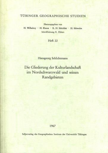
6 Die Gliederung der Kulturlandschaft im Nordschwarzwald und seinen Randgebieten. [The regional structure of the cultural landscape in the northern Black Forest and adjacent areas] (1967) This book elucidates delimitation and properties of spatial units in the cultural landscape, each unit being characterized by a mosaic of elementary parts. Although the theoretical background of the study has changed in the meantime, the research method is still applicable.
7 Southern Prairies field excursion: Tour Guide (Co-editor with with E.H. Dale and A.H. Paul, 1972) In the context of the 22nd International Geographical Congress, held in Canada in 1972, four geography departments jointly conducted a field excursion through the southern part of the Prairie Provinces. On this occasion two books were produced. The Tour Guide, being the first, is a collection of detailed route descriptions which in part contain original research.

8 Southern Prairies field excursion: Background Papers (Co-editor with with A.H. Paul and E.H. Dale, 1972) The Background Papers are a companion volume of the Tour guide mentioned earlier. The book covers a number of topics concerning the three Prairie Provinces. This volume met a keenly felt need, since in 1972 little relevant research about the region was available in print. The Background Papers are still in use.
 This volume, produced for the 17th International Cartographic Conference in Barcelona, brings together three studies on general issues of cartosemiotics as a component of")
9 Cartographic thinking and map semiotics (Co-author with J. Pravda and A. Wolodtschenko, 1994) This volume, produced for the 17th International Cartographic Conference in Barcelona, brings together three studies on general issues of cartosemiotics as a component of theoretical cartography. J. Pravda addresses the development of theoretical cartography. H. Schlichtmann presents his concept of map symbolism also called map language as it had developed by the mid-1990s. A. Wolodtschenko, finally, informs about components of map language and approaches according to which it has been studied.
10 Map semiotics around the world (Editor, 1999) Major works in cartosemiotics started to appear in the 1960s. By the 1990s, the field had developed so far that the need for taking stock arose. Responding to this need, a Working Group of the International Cartographic Association produced this book. It is an inventory and review of existing research achievements in cartosemiotics (at that time the narrower term map semiotics was used). The collection contains detailed literature reports for those language areas in which most of the relevant work had been done, together with an introductory discussion by its editor. Almost all of the studies reported upon had appeared in cartographic (rather than semiotic) publications.
11 Saskatchewan: Geographic perspectives (Co-editor with B.D. Thraves, M.L. Lewry, and J.E. Dale, 2007) This is the first university-level synthesis covering the geography of Saskatchewan, one of the three Prairie Provinces of Canada. Two general sections an introduction and a retrospect-and-outlook discussion and 18 major thematic chapters are complemented by 29 short focus studies which provide details on specific topics. Authors and editors have taken care to give adequate weight to both northern and southern regions the prairies (grassland) in the south and the forested part in the north, to both rural and urban environments, and to the aboriginal component of the population.
12 Cartosemiotics. A short dictionary (2011) As H. Schlichtmann had, by and by, developed his ideas of cartosemiotics, it became necessary to summarize the relevant concepts and terms in a dictionary (2011). This publication is the first cartosemiotic dictionary in English (there are lexicographic works in other languages, based on other approaches). The book is an encyclopedic dictionary or dictionnaire raisonné, that is, it combines definitions of terms with comments on the matters being discussed. The author hopes that it can later be expanded by including other approaches to cartosemiotics.
13 13 3. About the bibliographic photoatlas The bibliographic photoatlas or Bildatlas Geographic and semiotic books of Hansgeorg Schlichtmann presents books of Dr. Hansgeorg Schlichtmann, Professor Emeritus at the University of Regina. The photoatlas is part of the project Iconic Atlassing, which develops the semiotic information technology and complements traditional textual references (for example, bibliographies). The bibliographic photoatlas is compact (up to slides), ubiquitous (usable anytime and anywhere), and presents advanced information products. The initiator of the photoatlas is A. Wolodtschenko, co-editor of the journal <meta-carto-semiotics>.


14 14 4. Book-shelf Geographic books Cartosemiotic books
15 15 5. List of publications Die Gliederung der Kulturlandschaft im Nordschwarzwald und seinen Randgebieten [The regional structure of the cultural landscape in the northern Black Forest and adjacent areas] (Tübinger Geographische Studien, 22). Tübingen: Geographisches Institut der Universität Tübingen Southern Prairies field excursion: Tour guide. 22nd International Geographical Congress,Canada, August, Regina: Department of Geography, University of Saskatchewan Regina Campus [now University of Regina]. (Co-editor with Dale, E.H. and Paul, A.H.) Southern Prairies field excursion: Background papers. 22nd International Geographical Congress, Canada, August, Regina: Department of Geography, University of Saskatchewan Regina Campus [now University of Regina]. (Co-editor with Paul, A.H. and Dale, E.H.) Cartographic thinking and map semiotics (Geographia Slovaca, 5). Bratislava: Slovenská akadémia vied, Geografický ústav. (Co-author with Pravda, J. and Wolodtschenko, A.) Map semiotics around the world. International Cartographic Association. Printed in Canada, University of Regina, Regina. (Editor/Author). [Available from the author.]
16 16 5. List of publications Saskatchewan: geographic perspectives (Canadian Plains studies, 52). Regina: Canadian Plains Research Center, University of Regina. (Co-editor with Thraves, B.D., Lewry, M.L., and Dale, J.E.) Cartosemiotics: A short dictionary. International Cartographic Association. Printed in Canada, University of Regina, Regina. [Available from the author.]
17 17 6. Impressum Schlichtmann, H., Wolodtschenko, A. Geographic and cartosemiotic books of Hansgeorg Schlichtmann Bibliographic Photoatlas. Dresden Regina 2016, 17 S. This photoatlas presents books of Hansgeorg Schlichtmann, Professor Emeritus at the University of Regina, Canada. It is aimed at geographers, cartographers, and semioticians, in particular those who are interested in maps and other cartographic models. Dresden Regina 2016
The Region in Canadian Geography
 The Region in Canadian Geography Reading Course website (www.yorku.ca/anderson) Lists today s reading Laliberté et al (2015) Teaching the geographies of Canada: Reflections on pedagogy, curriculum, and
Handbook of vegetation science
 Vegetation mapping Handbook of vegetation science FOUNDED BY R. TUXEN H. LIETH, EDITOR IN CHIEF Volume 10 Vegetation mapping Edited by A. w. KOCHLER and I. S. ZONNEVELD Kluwer Academic Publishers Dordrecht
CARTOSEMIOTIC ANALYSIS OF ECOLOGICAL ATLASES
 CARTOSEMIOTIC ANALYSIS OF ECOLOGICAL ATLASES Alexander Wolodtschenko Institute for Cartography, Dresden University of Technology e-mail: alexander.wolodtschenko@mailbox.tu-dresden.de Irina Rotanova Institute
A Current International Bibliography of the Literature of the History of Cartography on the WWW: of Whom, by Whom, and for Whom?
 LIBER QUARTERLY, ISSN 1435-5205 LIBER 2000. All rights reserved K.G. Saur, Munich. Printed in Germany A Current International Bibliography of the Literature of the History of Cartography on the WWW: of
ADVANCES OF INTERDISCIPLINARY CARTOGRAPHY IN THE HIMALAYAN MOUNTAINS
 Geographia Technica, Special Issue, 2010, pp. 120 to 125 ADVANCES OF INTERDISCIPLINARY CARTOGRAPHY IN THE HIMALAYAN MOUNTAINS David SCHOBESBERGER 1, Karel KRIZ 1 ABSTRACT: This paper follows up on the
Socials Studies. Chapter 3 Canada s People 3.0-Human Geography
 Socials Studies Chapter 3 Canada s People 3.0-Human Geography Physical Geography Study of the natural features of the Earth s surface including landforms, climate, ocean currents and flora and fauna Human
CARTOGRAPHIC SOCIETY OF THE SLOVAK REPUBLIC ACTIVITIES National Report for the 14 th General Assembly of the ICA
 CARTOGRAPHIC SOCIETY OF THE SLOVAK REPUBLIC ACTIVITIES 2003-2006 National Report for the 14 th General Assembly of the ICA Bratislava 2007 CARTOGRAPHIC SOCIETY OF THE SLOVAK REPUBLIC CARTOGRAPHIC SOCIETY
Characteristic features of toponym objects and their dynamics
 23 May 2002 English only Eighth United Nations Conference on the Standardization of Geographical Names Berlin, 27 August-5 September 2002 Item 12 (c) of the provisional agenda* Toponymic data files: toponymic
Observe Reflect Question What type of document is this?
 Appendix 2 An Empty Primary Source Analysis Tool and a Full Primary Source Analysis Tool with Guiding Questions Observe Reflect Question What type of document is this? What is the purpose of this document?
Unit 1: Introduction: Thinking Geographically, Basic Concepts
 Unit 1: Introduction: Thinking Geographically, Basic Concepts 38:180 Human Geography What does it mean to think like a geographer? Memorizing places? Countries, capital cities, rivers, etc School Geography
Canadian Historical GIS Partnership Development: Taking Steps for Historical Mapping in Canada
 Canadian Historical GIS Partnership Development: Taking Steps for Historical Mapping in Canada Byron Moldofsky Manager, GIS and Cartography Office Department of Geography and Planning University of Toronto
HOSTING AN INTERNATIONAL CONFERENCE ON THE HISTORY OF CARTOGRAPHY: GUIDELINES,
 HOSTING AN INTERNATIONAL CONFERENCE ON THE HISTORY OF CARTOGRAPHY: GUIDELINES, WITH SOME REQUIREMENTS 15 March 2016 About this Document This document provides the information needed by those who wish to
CARTOGRAPHIC DESIGN PRINCIPLES FOR 3D MAPS A CONTRIBUTION TO CARTOGRAPHIC THEORY
 CARTOGRAPHIC DESIGN PRINCIPLES FOR 3D MAPS A CONTRIBUTION TO CARTOGRAPHIC THEORY Christian Haeberling Institute of Cartography Swiss Federal Institute of Technology (ETH Zurich) ETH Hoenggerberg CH-8093
Michael James Hermann University of Maine Canadian-American Center 154 College Avenue, Orono, ME
 Michael James Hermann University of Maine Canadian-American Center 154 College Avenue, Orono, ME 04473 mike.hermann@umit.maine.edu Purple Lizard Publishing PO Box 769, State College, PA 16804 mike@purplelizard.com
An Information Model for Maps: Towards Cartographic Production from GIS Databases
 An Information Model for s: Towards Cartographic Production from GIS Databases Aileen Buckley, Ph.D. and Charlie Frye Senior Cartographic Researchers, ESRI Barbara Buttenfield, Ph.D. Professor, University
DEPARTMENT OF GEOGRAPHY B.A. PROGRAMME COURSE DESCRIPTION
 DEPARTMENT OF GEOGRAPHY B.A. PROGRAMME COURSE DESCRIPTION (3 Cr. Hrs) (2340100) Geography of Jordan (University Requirement) This Course pursues the following objectives: - The study the physical geographical
MEADOWS PRIMARY SCHOOL and NURSERY GEOGRAPHY POLICY
 MEADOWS PRIMARY SCHOOL and NURSERY GEOGRAPHY POLICY Purpose of study The teaching of Geography at Meadows is done by following the 2014 National Curriculum. The planning and teaching of the subject aims
Economic and Social Council
 United Nations Economic and Social Council Distr.: General 23 May 2012 Original: English E/CONF.101/100 Tenth United Nations Conference on the Standardization of Geographical Names New York, 31 July 9
Taking GIS Retrospective to the Federal Level: Seminar Introduction
 FedGIS Conference February 24 25, 2016 Washington, DC Taking GIS Retrospective to the Federal Level: Seminar Introduction Dr. Seminar Organizer and Chair Principal, Wellar Consulting Inc. Professor Emeritus,
1. Origins of Geography
 II. ORIGINS AND BRANCHES OF GEOGRAPHY My Notes A. Origins of Geography Unit One 6 Before carefully examining the tools of the geographer, it would be useful to examine the origins and roots of this ancient
Land Accounts in Canada
 Land Accounts in Canada 22 nd meeting of the London Group September 29 th, 2016 Statistics Norway, Oslo Gabriel Gagnon Statistics Canada Land accounts in Canada OVERVIEW Context Strategic direction Latest
Curriculum Catalog
 2017-2018 Curriculum Catalog - for use with AP courses 2017 Glynlyon, Inc. - for use with AP courses Table of Contents HUMAN GEOGRAPHY COURSE OVERVIEW... 1 UNIT 1: GEOGRAPHY NATIVE AND PERSPECTIVE... 1
GOVERNMENT GIS BUILDING BASED ON THE THEORY OF INFORMATION ARCHITECTURE
 GOVERNMENT GIS BUILDING BASED ON THE THEORY OF INFORMATION ARCHITECTURE Abstract SHI Lihong 1 LI Haiyong 1,2 LIU Jiping 1 LI Bin 1 1 Chinese Academy Surveying and Mapping, Beijing, China, 100039 2 Liaoning
Markville. CGC 1DL/PL Geography. Geography of Canada. Natural Environment Unit Test
 Markville CGC 1DL/PL Geography Geography of Canada Natural Environment Unit Test Name: Thinking /10 Knowledge /10 Application /10 Communication /10 Part A: Blanks (1 mark each) Thinking Choose the correct
Complementary Studies Elective Courses
 Complementary Studies Elective Courses Effective July 1, 2016 The Complementary Studies component of the Bachelor of Engineering Degree programs at Lakehead University consists of three parts. Students
Geography Policy 2014
 Geography Policy 2014 DEFINITION Geography education should inspire in pupils a curiosity and fascination about the world and its people that will remain with them for the rest of their lives. Teaching
GEOGRAPHY (GE) Courses of Instruction
 Courses of Instruction") GEOGRAPHY (GE) GE 102. (3) World Regional Geography. The geographic method of inquiry is used to examine, describe, explain, and analyze the human and physical environments of the major regions of the
GEOGRAPHY (GE) GE 102. (3) World Regional Geography. The geographic method of inquiry is used to examine, describe, explain, and analyze the human and physical environments of the major regions of the
cooperating sites as the three initial units of a new Southern Appalachian Biosphere Reserve, approved by UNESCO in 1988.
 -» TOWARD A U.S. MODALITY OF BIOSPHERE RESERVES: THE SOUTHERN APPALACHIAN BIOSPHERE RESERVE William s_ P. Gregg, Chief, International Affairs Office, National Biological Service, Washington, D.C. Hubert
Mapping Project. Name: Theme:
 Mapping Project Name: Theme: Your Task: You will use the information from several thematic maps to create a map of your own using Google Maps. Your map will have a clear theme, and will attempt to answer
State and National Standard Correlations NGS, NCGIA, ESRI, MCHE
 GEOGRAPHIC INFORMATION SYSTEMS (GIS) COURSE DESCRIPTION SS000044 (1 st or 2 nd Sem.) GEOGRAPHIC INFORMATION SYSTEMS (11, 12) ½ Unit Prerequisite: None This course is an introduction to Geographic Information
AAG CENTER FOR GLOBAL GEOGRAPHY EDUCATION Internationalizing the Teaching and Learning of Geography
 Using the CGGE Materials in Advanced Placement Human Geography Classes About the CGGE: The AAG Center for Global Geography Education (CGGE) is a collection of online modules for undergraduate courses in
European Migration to Tilting, Newfoundland
 European Migration to Tilting, Newfoundland Lesson Overview In this lesson, students will learn about historical connections between Tilting, Newfoundland and Labrador, and Ireland. Using the Canadian
ECONOMIC AND SOCIAL COUNCIL 13 July 2007
 UNITED NATIONS E/CONF.98/CRP.34 ECONOMIC AND SOCIAL COUNCIL 13 July 2007 Ninth United Nations Conference on the Standardization of Geographical Names New York, 21-30 August 2007 Item 17(b) of the provisional
A.P. Human Geography
 A.P. Human Geography 2012-2013 Instructor: Chris Vitt Brief Description of Course AP Human Geography is designed to provide students with a learning experience equivalent to that obtained in most college
Republic of Korea in Czech atlases and geography textbooks. Jan Ptacek, Kartografie Praha
 Republic of Korea in Czech atlases and geography textbooks Jan Ptacek, Kartografie Praha Schools in the Czech republic Primary schools 9 years (age 6 15) Geography from the age of 11, only one year of
Sample file. Copyright 2002, 2003, 2005, 2006, 2009 Cindy Wiggers Revised 2006 Published by Geography Matters, Inc
 Copyright 2002, 2003, 2005, 2006, 2009 Cindy Wiggers Revised 2006 Published by Geography Matters, Inc Cover design by Alex Wiggers Photography by Kim Whitmore-Weber All rights reserved. No part of this
Seymour Centre 2017 Education Program 2071 CURRICULUM LINKS
 Suitable for: Stage 5 Stage 6 HSC Subject Links: Seymour Centre 2017 Education Program 2071 CURRICULUM LINKS Science Stage Content Objective Outcomes Stage 5 Earth and Space ES3: People use scientific
Geography. Programmes of study for Key Stages 1-3
 Geography Programmes of study for Key Stages 1-3 February 2013 Contents Purpose of study 3 Aims 3 Attainment targets 3 Subject content 4 Key Stage 1 4 Key Stage 2 5 Key Stage 3 6 2 Purpose of study A high-quality
Analysis of European Topographic Maps for Monitoring Settlement Development
 Analysis of European Topographic Maps for Monitoring Settlement Development Ulrike Schinke*, Hendrik Herold*, Gotthard Meinel*, Nikolas Prechtel** * Leibniz Institute of Ecological Urban and Regional Development,
GEOGRAPHY POLICY STATEMENT. The study of geography helps our pupils to make sense of the world around them.
 GEOGRAPHY POLICY STATEMENT We believe that the study of geography is concerned with people, place, space and the environment and explores the relationships between the earth and its peoples. The study
DRAFT CONCEPT NOTE. WDR 2008: Agriculture for Development WDR 2007: Development and the Next Generation WDR 2006: Equity and Development
 WORLD DEVELOPMENT REPORT, WDR 2009 RESHAPING ECONOMIC GEOGRAPHY CONSULTATION - MENA REGION MAY 5-6, 2008 DRAFT CONCEPT NOTE The World Bank publishes each year a World Development Report (WDR) focusing
Climate Change: How it impacts Canadians and what we can do to slow it down.
 Climate Change: How it impacts Canadians and what we can do to slow it down. Lesson Overview This lesson takes stock of how climate change has already affected Canadians in geographic, economic, and cultural
Land accounting in Québec: Pilot project for a sub-provincial area
 Land accounting in Québec: Pilot project for a sub-provincial area Stéphanie Uhde 8th meeting of the London Group on Environmental Accounting Ottawa, 2 October, 2012 Province of Québec Area: 1 667 441
POPULATION ATLAS OF SLOVAKIA
 POPULATION ATLAS OF SLOVAKIA Jozef Mládek Department of Human Geography and Demogeography Faculty of Nature Sciences Comenius University Bratislava mladek@fns.uniba.sk Jana Marenčáková University of Central
The study of Geography and the use of geographic tools help us view the world in new ways.
 S How does Geography help us understand our world? What factors shape the Earth s different environments? 7.1.9 7.2.9 BIG IDEAS COMPETENCIES Text pages or The study of Geography and the use of geographic
Curriculum Vitae. Dr. Danqing (Dana) Xiao. Ph.D. in Department of Geography, University of California Santa Barbara.
 Xiao. Ph.D. in Department of Geography, University of California Santa Barbara.") Curriculum Vitae Dr. Danqing (Dana) Xiao Personal Information Assistant Professor Department of Environmental, Geographical, and Geological Sciences (EGGS), Bloomsburg University of Pennsylvania Research
Curriculum Vitae Dr. Danqing (Dana) Xiao Personal Information Assistant Professor Department of Environmental, Geographical, and Geological Sciences (EGGS), Bloomsburg University of Pennsylvania Research
Canadian Explorers. Learning object La Vérendyre map
 Canadian Explorers Learning object La Vérendyre map Lesson overview Students will be inspired by La Vérendyre to become explorers themselves. Students will embark on a research expedition to discover the
St. James C of E Primary School
 St. James C of E Primary School Geography Policy St. James C of E Primary School Geography Policy Written by: Lisa Harford Written: April 2016 Reviewed: April 2018 1. Introduction Geography is concerned
The Present and Prospective Status of Geographical Name Research
 UNITED NATIONS WORKING PAPER GROUP OF EXPERTS NO. 43/18 ON GEOGRAPHICAL NAMES Twenty-eight session 28 April 2 May 2014 Item 18 of the Provisional Agenda Other Toponymic issues The Present and Prospective
MIDDLE TENNESSEE STATE UNIVERSITY Global Studies / Cultural Geography Major Matrix Page 1 of 7
 Page 1 of 7 I. Social Studies Core GS 4990 (3) Senior Seminar in Global Studies SSC 1. Demonstrate critical thinking in the social sciences by GEOG 2000 (1/3) Introduction to Regional Geography posing
Teaching Geography Author Phil GERSMEHL
 Teaching Geography Author Phil GERSMEHL University of Minnesota, USA 332 Review of International Geographical Education Online RIGEO, 2015, 5(3), 332-336 Publisher: The Guilford Press Publication Year:
ST AMBROSE CATHOLIC PRIMARY SCHOOL Geography Policy
 ST AMBROSE CATHOLIC PRIMARY SCHOOL Geography Policy 2017-2018 Our school policy is developed in accordance with the National Curriculum for Geography and Foundation Stage Curriculum for Understanding of
ASSESSING THEMATIC MAP USING SAMPLING TECHNIQUE
 1 ASSESSING THEMATIC MAP USING SAMPLING TECHNIQUE University of Tehran, Faculty of Natural Resources, Karaj-IRAN E-Mail: adarvish@chamran.ut.ac.ir, Fax: +98 21 8007988 ABSTRACT The estimation of accuracy
Nevada Academic Content Standards Science Grade: 6 - Adopted: 2014
 Main Criteria: Nevada Academic Content Standards Secondary Criteria: Subjects: Science, Social Studies Grade: 6 Correlation Options: Show Correlated Nevada Academic Content Standards Science Grade: 6 -
Chapter 3. Canada s People. Please note, page # s may be wrong. I m using the older edition text for my notes
 Chapter 3 Canada s People Please note, page # s may be wrong. I m using the older edition text for my notes Introduction You need to remember all the physical features we studied in the last chapter. This
GACE Middle Grades Social Science Assessment Test at a Glance
 GACE Middle Grades Social Science Assessment Test at a Glance Updated June 2017 See the GACE Middle Grades Social Science Assessment Study Companion for practice questions and preparation resources. Assessment
Expanding Canada s Rail Network to Meet the Challenges of the Future
 Expanding Canada s Rail Network to Meet the Challenges of the Future Lesson Overview Rail may become a more popular mode of transportation in the future due to increased population, higher energy costs,
Revive, Contemplate, and Integrate Lesson Plan. Your Name: Amanda Pellerin, Amanda Kodeck, and Pat Cruz Grade: 7
 Revive, Contemplate, and Integrate Lesson Plan Your Name: Amanda Pellerin, Amanda Kodeck, and Pat Cruz Grade: 7 Unit of Study: Social Studies/ Visual Arts Lesson Title: Modern Day Maps Goal/Purpose: Students
Stillwater Area Schools Curriculum Guide for Elementary Social Studies
 Stillwater Area Schools Curriculum Guide for Elementary Social Studies Grade Four Draft March 21, 2006 Minnesota and the St. Croix Valley I. Historical Skills A. The student will acquire skills of chronological
Display/Resources ideas:
 Year 3/4 Key Skills to be covered, taken from National Curriculum pitching at the correct year group and differentiation within plan for different groups Be specific in the key skills, and make them more
Why Do We Live Here? : A Historical Geographical Study of La Tabatiere, Quebec North Shore
 Why Do We Live Here? : A Historical Geographical Study of La Tabatiere, Quebec North Shore Lesson Overview Many communities and their occupants have historical connections to exploration routes and traditional
Regional Geography C. LANGDON WHITE. Professor Emeritus Stanford University EDWIN J. FOSCUE TOM L. MCKNIGHT
 Regional Geography of Anglo-America Sixth Edition C. LANGDON WHITE Professor Emeritus Stanford University EDWIN J. FOSCUE Late of Southern Methodist University TOM L. MCKNIGHT Professor of Geography University
Historical Fisheries off the Grand Banks (Wet and Dry Fisheries)
") Lesson Overview Historical Fisheries off the Grand Banks (Wet and Dry Fisheries) The French conducted the earliest trans-atlantic fishery with the Portuguese fishermen, soon joined by Basques, who took
Lesson Overview Historical Fisheries off the Grand Banks (Wet and Dry Fisheries) The French conducted the earliest trans-atlantic fishery with the Portuguese fishermen, soon joined by Basques, who took
Touring Around the Islands of Atlantic Canada
 Lesson Overview Touring Around the Islands of Atlantic Canada In this lesson, students will examine the history and heritage of the islands of Atlantic Canada and examine their similarities and differences.
Study Visit University of Applied Sciences Utrecht Netherlands
 Study Visit University of Applied Sciences Utrecht Netherlands Directorate-General for Territorial Development Lisbon 1 April 2014 1 Agenda Presentation Cadastre Department Surveying / Geodesy Department
This Week s Topics. GIS and Forest Engineering Applications. FE 257. GIS and Forest Engineering Applications. Instructor Information.
 FE 257. GIS and Forest Engineering Applications Introduction Instructor Information Associate Professor in FERM Department Instructor for FE 257, FE 480, FE 432/532 PhD from Forest Resources with minor
1. Pass GE1101E Geographical Journeys: Exploring World Environments. This will be counted towards the Faculty Core or UE requirements.
 H Geography At the Department of Geography, students are encouraged to develop a deeper and more critical understanding of both physical and human environments. Students will acquire knowledge, skills
Looking at Communities: Comparing Urban and Rural Neighborhoods
 Looking at Communities: Comparing Urban and Rural Neighborhoods OVERVIEW & OBJECTIVES Our urban areas have become so dominant that frequently the children we teach have no connection with and very few
FUTURE COURSES AND CAREERS
 FUTURE COURSES AND CAREERS IN GEOGRAPHY CGC1D Ms. Hyndman PHYSICAL GEOGRAPHY: PATTERNS, PROCESSES AND INTERACTIONS CGF3M Grade 11 course This course examines the major patterns of physical geography and
Deutsche Gesellschaft für Kartographie e.v.
 Deutsche Gesellschaft für Kartographie e.v. Der Vizepräsident Prof. Dr. Manfred Buchroithner, TU Dresden, 01062 Dresden International Cartographic Association Executive Committee Prof. Dr. Manfred Buchroithner
Conceptual Aspects of 3D Map Integration in Interactive School Atlases
 Conceptual Aspects of 3D Map Integration in Interactive School Atlases Christian Haeberling Hans Rudolf Baer Institute of Cartography ETH Zurich 8093 Zurich, Switzerland E-Mail: haeberling@karto.baug.ethz.ch
E/CONF.105/75/CRP.75. Report of the Republic of Belarus
 E/CONF.105/75/CRP.75 23 June 2017 Original: Russian 11 th United Nations Conference on the Standardization of Geographical Names New York, 8-17 August 2017 Item 5 of the provisional agenda* Reports by
St Joseph s R.C. Primary School. Policy for Geography
 St Joseph s R.C. Primary School Policy for Geography 2016-2017 This policy is written with consideration to our school commitment to the Rights of the Child and our achievement of becoming a Rights Respecting
Social Studies. Unit Topic: Confederation Grade 10
 Social Studies Unit Topic: Confederation Grade 10 Rationale: Students will understand the various aspects of Confederation through a geographical lens. Students will evaluate each of British colonies and
Range of Opportunities
 Geograhy Curriculum Cropwell Bishop Primary School Range of Opportunities Year 1 Year 2 Year 3 Year 4 Year 5 Year 6 All Key Stage 1 Key Stage 2 Investigate the countries and capitals of the United Kingdom.
EVALUATION AND APPROVAL OF ATLASES
 EVALUATION AND APPROVAL OF ATLASES Elementary and Secondary Education Frame of Reference Ministère de l Éducation, du Loisir et du Sport Direction des ressources didactiques Bureau d approbation du matériel
Underground Railroad Grades 6-8. Time Frame: 1-3 class periods, depending on the extent of outside research
 Underground Railroad Grades 6-8 Introduction This activity is intended for students who have already learned about slavery and are currently studying the Underground Railroad. They ll compare a map of
Pool Canvas. Add. Creation Settings. Chapter 1--Objectives and Tools of World Regional Geography. Description Instructions.
 1 of 6 TEST BANK > CONTROL PANEL > POOL MANAGER > POOL CANVAS Pool Canvas Add, modify, and remove questions. Select a question type from the Add Question drop-down list and click Go to add questions. Use
Generic Success Criteria
 Generic Success Criteria Significance I can identify a short term and long term impact that a development/event/issue has/had locally/globally. I can discuss (verbally, graphically, etc.) how a development/event/issue
November 23, 2017 D-2
 We ve been busy! 2017 has been another key year for building the TRUGG program and awareness: Destination BC Journeys project, bringing our trails to life worldwide Northern BC Destination Development
St John s Catholic Primary School. Geography Policy. Mission Statement
 St John s Catholic Primary School Geography Policy Mission Statement We at St John s strive for excellence in education by providing a safe, secure and caring family environment where individuals are valued
COURSES OUTSIDE THE JOURNALISM SCHOOL
 COURSES OUTSIDE THE JOURNALISM SCHOOL Students are not limited to the science courses on this list and may select classes from additional specialties. In accordance with University policy, 400-level courses
Information Needs & Information Seeking in Internet Era: A Case Study of Geographers in Maharashtra
 International Journal of Research in Library Science ISSN: 2455-104X Indexed in: IIJIF, ijindex, SJIF,ISI Volume 2,Issue 1 (January-June) 2016,99-108 Received: 7 May 2016 ; Accepted: 12 May 2016 ; Published:
Geospatial Analysis in Cultural Anthropology
 Eduardo Brondizio (ebrondiz@ufl.edu) Tracy Van Holt (tvanholt@ufl.edu) Geospatial Analysis in Cultural Anthropology Description and Objectives: This intensive course introduces different components of
Alleghany County Schools Curriculum Guide GRADE/COURSE: World Geography
 GRADE/COURSE: World 2013-14 GRADING PERIOD: 1 st Six Weeks Time Frame Unit/SOLs SOL # Strand Resource Assessment 8 days* The student will use maps, globes, satellite images, photographs, or diagrams to
Eastern Illinois University Revised Course Proposal GEG 1100G, Cultural Geography
 Eastern Illinois University Revised Course Proposal GEG 1100G, Cultural Geography 1. Catalog Description GEG 1100G. Cultural Geography. (3-0-3) F,S, Su. Cultural Geog. A geographic survey of population,
2018/1 The integration of statistical and geospatial information. The Regional Committee of UN-GGIM: Americas:
 The following are the conclusions and recommendations of the Regional Committee of the United Nations on Global Geospatial Information Management for the Americas, during its Fifth Session, Thursday 8
Gathering Data on Your Collection: Sample Page. Curriculum relevance (how relevant are the existing titles to the new curriculum) Good Fair Poor
 Good Fair Poor") Gathering Data on Your Collection: Sample Page Part of the collection development process involves the critical examination of your existing collection to identify needs. Realistically, you should target
Gathering Data on Your Collection: Sample Page Part of the collection development process involves the critical examination of your existing collection to identify needs. Realistically, you should target
Map Collections and the Internet: Some Ideas about Various Online Map Services, Based on the ETH Map Collection in Zürich
 LIBER QUARTERLY, ISSN 1435-5205 LIBER 2000. All rights reserved K.G. Saur, Munich. Printed in Germany Map Collections and the Internet: Some Ideas about Various Online Map Services, Based on the ETH Map
Leo Bagrow and St. Petersburg ( )
") Alexander Wolodtschenko Leo Bagrow and St. Petersburg (1898-1918) BILDATLAS Dresden 2015 2 Table of contents Title Table of contents Preface The teachers of Leo Bagrow Ya. Gurevich private gymnasium Classmates
Alexander Wolodtschenko Leo Bagrow and St. Petersburg (1898-1918) BILDATLAS Dresden 2015 2 Table of contents Title Table of contents Preface The teachers of Leo Bagrow Ya. Gurevich private gymnasium Classmates
Table of Contents. Introduction...3 How to Use This Book...4 Standards Information...6 The World in Spatial Terms
 Table of Contents Introduction...................................................................3 How to Use This Book..........................................................4 Standards Information...........................................................6
Canadian Geo Course Introduction
 Canadian Geo 1202 Course Introduction Course Overview Unit 1 Natural and Human Systems (SCO 1.0 and SCO 2.0) - What happens when systems interact? In this unit students are challenged to reflect on the
AP Human Geography Syllabus
 AP Human Geography Syllabus Textbook The Cultural Landscape: An Introduction to Human Geography. Rubenstein, James M. 10 th Edition. Upper Saddle River, N.J.: Prentice Hall 2010 Course Objectives This
Learning Target : Describe the purposes and uses of different types of maps.
 Learning Target : Describe the purposes and uses of different types of maps. Directions: 1. Below, place a where you think you are located. 2. In which continent are you located? 3. In which country are
August 19 students first day of class (M1-M17) Place. Movement. Human- Environment Interaction. Cartography. Elevation
 Place. Movement. Human- Environment Interaction. Cartography. Elevation") Month August 2010 6 th Grade Western Hemisphere 2010-2011 Curriculum Map Pacing Vocabulary Assessment Resources Content Skills Mapmaster 7. Location August 19 Skills students first Handbook 7.6.1 Region
Month August 2010 6 th Grade Western Hemisphere 2010-2011 Curriculum Map Pacing Vocabulary Assessment Resources Content Skills Mapmaster 7. Location August 19 Skills students first Handbook 7.6.1 Region
Canadian Geography Final Exam Review (September to Mid-term Exam)
") Canadian Geography 1202 - Final Exam Review (September to Mid-term Exam) Glossary Terms: Some of the following terms may be covered in the questions that follow. System Natural System Ecosystem Human System
Canadian Geography 1202 - Final Exam Review (September to Mid-term Exam) Glossary Terms: Some of the following terms may be covered in the questions that follow. System Natural System Ecosystem Human System
Diplomarbeit. zur Erlangung des akademischen Grades Diplomingenieur für Kartographie
 Falkultät Forst-, Geo- und Hydrowissenschaften, Institut für Kartographie Diplomarbeit zur Erlangung des akademischen Grades Diplomingenieur für Kartographie Combination of Remote Sensing and Socio-Economic
David Lee Baylis, Ph.D.
 1 David Lee Baylis, Ph.D. 1003 W. Sunflower Rd DSU Box 2284, Cleveland MS, 38733 Delta State University - Division of Social Sciences and History - 210 Kethley Hall SUMMARY (615) 925-9950 - dbaylis@deltastate.edu
OKANAGAN COLLEGE WINTER 2018 ARTS COURSE OFFERINGS
 ANTH 103 Introduction to Archaeology ANTH 111 Introduction to Biological Anthropology ANTH 121 Introduction to Cultural Anthropology ANTH 260 Ethbotany: Plants & Peoples ANTH 270 Phonology ANTH 295 Globalization,