Web-based benthic databases: availability for science and quality issues. Sabine Cochrane (& friends) Akvaplan-niva Framsenteret, Tromsø
|
|
|
- Homer Walton
- 5 years ago
- Views:
Transcription
 Akvaplan-niva Framsenteret,")
1 Web-based benthic databases: availability for science and quality issues Sabine Cochrane (& friends) Akvaplan-niva Framsenteret, Tromsø

2 Outline Background What are benthic data? From paper to hard-disk to web From reality to ideals and back again Quality issues Names and authorities Limitations Availability Open access or restricted information Publicising resources Conclusions Optimal compromise Relevance for MAREANO for discussion!
3


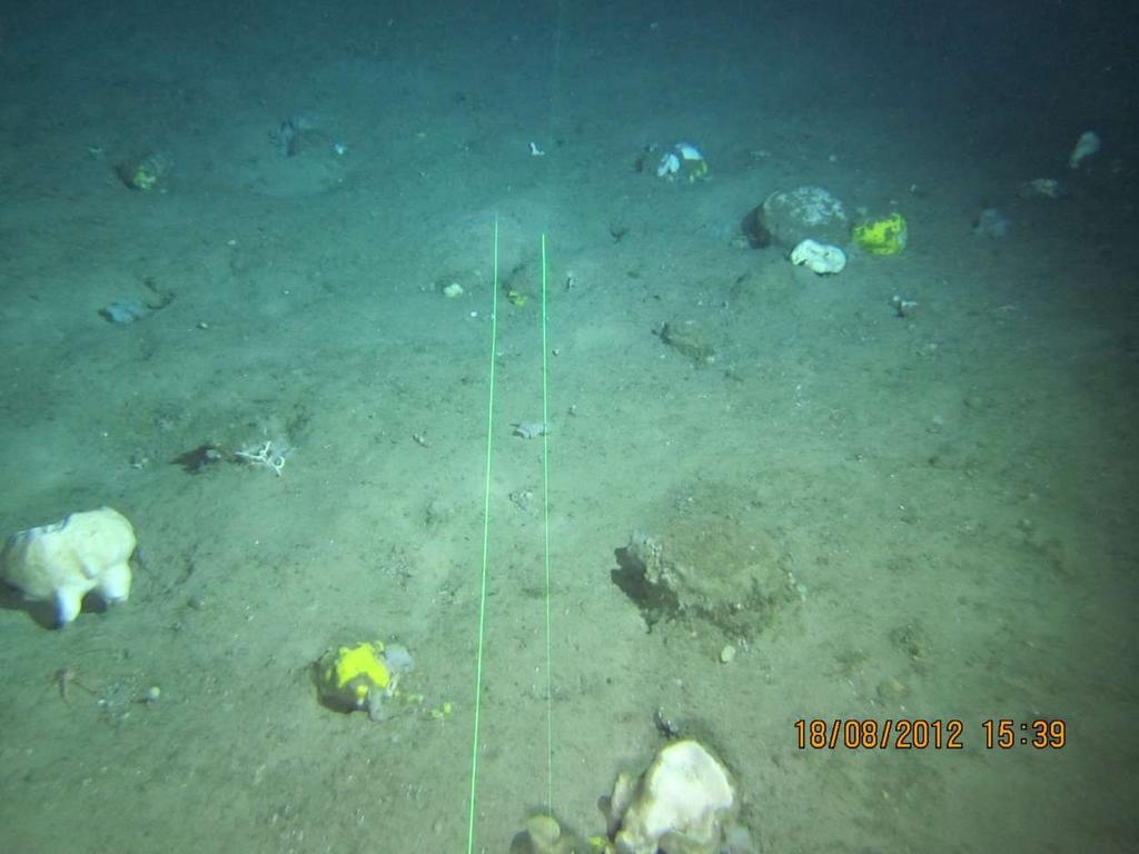
4 Example: Benthic infauna Good indicators of sea floor conditions Quantitative sampling Sieve out fauna Identify and count Database and analysis Number taxa, individuals, diversity, similarity
5 Taxon lists the building blocks

6 Back to the background Paper archives Increased focus re time series Digitalising old species lists Hard disks and servers From individuals to company servers Property discussions. Inter-company cooperation National and international access Example MOD database Web based National Usually themed Wider focus Larger scope bigger undertaking

7 The process Data agreement Authorship issues Everyone provides data Needs standardising Either work to get all to fill in schemes Or leader does it for everyone Once the names and positions are in Positions need checking Names need checking Taxonomic levels need harmonising Several databases exist Harmonising and standardising variable stuff Challenges for user Do all users know what they get??

8 FP7 NoE: Marine Biodiversity and Ecosystem Function

9 The MarBEF vision and lasting legacy (?)

10 From reality to ideals

11 And back to reality


12 Comparison of biodiversity from o N. Renaud et al (2009)
13

14

15 Global Biodiversity Information System (GBIF)

16 Finding datasets

17 Selecting data

18 Ocean Biogeographic Information System

19 «seek and thee shall find»

20 From paper pile to electronic pile Many parallel databases Some are linked, others not Quality disclaimers Which to choose? Are they compatible??

21 Why might data be incompatible? Discovery of taxa new to science Early descriptions very general Previous single species can be split into several Reassigned to other genera Different identifier practices Expertise Literature Time pressure Sampling bias Between institutes between gears sample size

22 Good girls don t

23 Back to the building blocks

24 The problem List A Aricidea hartmanni Aricidea quadrilobata Aricidea nolani Aricidea sp. = 4 taxa i.e. 4 statistical units Maldane sarsi List B Aricidea sp. = 1 taxon i.e. single statistical unit Maldane arctica Could be same taxon, could be differences in identifier competence or literature

25 European Register of Marine Species

26 Name check function

27

28 World Register of Marine Species

29 Problems solved and problems remaining Solved Taxonomic synonyms Spelling mistakes (Pectinaridae / Pectinariidae etc) Remaining «wriggles» Identifier differences several «correct» species Different levels the sp. ghost Historical data Name changes without ability to trace which now is valid

30 Possible approaches Surrogacy Selected taxa Ratios between taxa Lumping to higher taxon Genus? Family? Beware!! Consider information content Information value? Ecological function Names used as shorthand for function info anyway! Functional diversity has value in ecological studies Assess long term change in terms of ecosystem function


31 Function what do benthic fauna do?

32 List of functional groups See also work by Pearson, Jumars, Dawe, Lopez, Rosenberg, Bremer.
33 Spatial patterns: names F-1998 GA-2008 AL-2008 F-2000 F-2008 SA-2008 H-2003 LS-2008 SV-2008 N-2007 SF-2007 SN-2007 F-2003 SD-2007 A A N SE-2007 GT-2008 R9-01_08 GD-2008 G TO-2008 Grf-A_08 GB-2008 I-2008 GC-2008 GE-2008 CA-2008 GG Dots represent 8-50 stations Huge data resource Institute bias?? How to extract ecological info from this?


34 Spatial patterns: functional groups Institute bias removed (different name = same function) Spread of stations Sediment composition Function of depth


35 A question of scale Choose your data set to answer your questions Treat your data according to the questions Local scale vs large-scale, long-term etc Ecosystem function vs community composition Shifts in species distribution Know what s in your dataset Do with it what it can address Do not do things with it which it can t
 North Sea Atlantic Pan-European Who")
36 Conclusions implications for MAREANO Decide what is wanted Max profiling of datasets Control of publications? Altruistic use of datasets? Decide on level of availability Presence/absence or full data Station/species maps, linked Compare with other datasets Norway (MOD) North Sea Atlantic Pan-European Who is going to do the harmonising?

37 Thank you!
Antarctic Marine Biodiversity Data Now Online
 Contact: Bruno Danis +32(2)6274139 bruno.danis@scarmarbin.be EMBARGOED UNTIL 9 a.m ECT, March 31 2009 Antarctic Marine Biodiversity Data Now Online An efficient network of specialists, data and tools to
Management Planning & Implementation of Communication Measures for Terrestrial Natura 2000 Sites in the Maltese Islands Epsilon-Adi Consortium
 Management Planning & Implementation of Communication Measures for Terrestrial Natura 2000 Sites in the Maltese Islands Epsilon-Adi Consortium Briefing Meetings, February 2013 CT3101/2011, MEPA, Malta
Resolution XIII.23. Wetlands in the Arctic and sub-arctic
 13th Meeting of the Conference of the Contracting Parties to the Ramsar Convention on Wetlands Wetlands for a Sustainable Urban Future Dubai, United Arab Emirates, 21-29 October 2018 Resolution XIII.23
The study of insect species diversity and modern approaches
 The study of insect species diversity and modern approaches Humala A.E. Forest Research Institute Karelian Research Centre RAS Petrozavodsk, RUSSIA The main idea and aim of any research TO FILL THE GAPS
Metadata Catalogue of Diatom Names
 Metadata Catalogue of Diatom Names Exported from the Freshwater Biodiversity Data Portal, http://data.freshwaterbiodiversity.eu Visit the Freshwater Metadatabase, http://data.freshwaterbiodiversity.eu/metadb/about_metadata
ADDENDUM 2 SUBSETS IN THE UGENT DATABASE & SAMPLING TECHNIQUES OF THE MANUELA AND UGENT DATA
 ADDENDUM 2 SUBSETS IN THE UGENT DATABASE & SAMPLING TECHNIQUES OF THE MANUELA AND UGENT DATA ADDENDUM 2 SUBSETS IN THE UGENT DATABASE & SAMPLING TECHNIQUES OF THE MANUELA AND UGENT DATA The UGent database
Programme. International workshop on seabed mapping methods and technology, Trondheim 17 th -18 th October 2012
 Programme International workshop on seabed mapping methods and technology, Trondheim 17 th -18 th October 2012 WEDNESDAY 17 TH OCTOBER Introductory talks seabed mapping for ocean management international
Offshore Video Survey and Oceanographic Analysis: Georges Bank to the Chesapeake project
 Non-Technical Synopsis of the Offshore Video Survey and Oceanographic Analysis: Georges Bank to the Chesapeake project Executive Summary Dave Bethoney Kristin Kleisner Mark Anderson Changsheng Chen Bradley
The Catalogue of Life: towards an integrative taxonomic backbone for biodiversity. Frank A. Bisby, Yuri R. Roskov
 Nimis P. L., Vignes Lebbe R. (eds.) ù Biodiversity: Progress and Problems pp. 37-42. ISBN 978-88-8303-295-0. EUT, 2010. The Catalogue of Life: towards an integrative taxonomic backbone for biodiversity
Project 1.3.1: Improved knowledge of biota, habitats and risks. Project Leader: Dr Mick Haywood, CSIRO Division of Marine and Atmospheric Research
 Marine and Tropical Sciences Research Facility (MTSRF) June 2007 Milestone Report Project 1.3.1: Improved knowledge of biota, habitats and risks Project Leader: Dr Mick Haywood, CSIRO Division of Marine
Research Programme Polar, Marine and Coastal Systems. Current and future Arctic research priorities of Germany Nicole Biebow, AWI
 Research Programme Polar, Marine and Coastal Systems Current and future Arctic research priorities of Germany Nicole Biebow, AWI Arctic Science and Technology (S&T) Collaboration and Engagement Workshop,
Creating an e-flora for South Africa
 SANBI POLICY DOCUMENT DIVISION: Biosystematics Research and Biodiversity Collections EFFECTIVE DATE: 1 April 2014 Compiler: Marianne le Roux & Janine Victor POLICY NUMBER: LAST AMENDED: Creating an e-flora
Identifying and characterizing biodiversity hotspots in the BCLME: its relevance in the light of climate change
 Identifying and characterizing biodiversity hotspots in the BCLME: its relevance in the light of climate change Kirkman SP 1, Yemane D 2, Kathena J 3, Mafwila S 4, Nsiangango S 5, Samaai T 1, Singh L 2
Using seascapes to help predict Australia s benthic marine habitat diversity in the development of a national system of marine protected areas
 Using seascapes to help predict Australia s benthic marine habitat diversity in the development of a national system of marine protected areas A.D. Heap 1, T. Whiteway 1, V. Lucieer 2, S. Nichol 1 1. Geoscience
Priorities for the development of a European taxonomic information system
 Beispielbild Priorities for the development of a European taxonomic information system Cornelia Löhne & Walter Berendsohn Botanischer Garten und Botanisches Museum Berlin-Dahlem Freie Universität Berlin
What does EUREF considers as a realisation of EVRS?
 1 (1) DRAFT PM 2010-05-24 previous versions: 2010-03-08 2010-02-15 What does EUREF considers as a realisation of EVRS? Contents Contents...1 Purpose of document...1 Short review on activities towards a
SITMUN: Cooperating to Build Local SDIs in the Barcelona Region
 SITMUN: Cooperating to Build Local SDIs in the Barcelona Region Diputació de Barcelona Territory and Sustainability Area Territorial Information Systems Department INSPIRE CONFERENCE Barcelona, September
Motivations, principles and development of a pan-european approach to describe MPA network coherence in Europe s seas
 Motivations, principles and development of a pan-european approach to describe MPA network coherence in Europe s seas G. Mo 1, S. Agnesi 1, J. Reker 2 1 ISPRA (Rome, Italy) & European Topic Center on Inland
Ecologically or Biologically Significant Areas (EBSAs) in the Convention on Biological Diversity Arctic EBSA workshop as an example
 in the Convention on Biological Diversity Arctic EBSA workshop as an example") Ecologically or Biologically Significant Areas (EBSAs) in the Convention on Biological Diversity Arctic EBSA workshop as an example Ville Karvinen / SYKE HELCOM STATE & CONSERVATION 3-2015 12.11.2015 CBD
Ecologically or Biologically Significant Areas (EBSAs) in the Convention on Biological Diversity Arctic EBSA workshop as an example Ville Karvinen / SYKE HELCOM STATE & CONSERVATION 3-2015 12.11.2015 CBD
Introduction: The Gulf of Mexico Alliance. The Gulf GAME project MERMAid and PHINS Results & Conclusions What s next? Examples
 AAG Las Vegas March 25, 2009 Introduction: Ocean governance and Ecosystem-Based Management The Gulf of Mexico Alliance Habitat Identification and Characterization The Gulf GAME project MERMAid and PHINS
Enabling Access to Arctic Location Based Information
 Enabling Access to Arctic Location Based Information Kevin Gallagher Arctic SDI Board Chair, United States Geological Survey Alaska Surveying and Mapping Conference, GeoJam 15 February 2017 What is Arctic
HAMILTON DECLARATION ON COLLABORATION FOR THE CONSERVATION OF THE SARGASSO SEA
 HAMILTON DECLARATION ON COLLABORATION FOR THE CONSERVATION OF THE SARGASSO SEA Hamilton, Bermuda 11 March, 2014 WE, THE SIGNATORIES LISTED BELOW: Recognising that the islands of Bermuda are the only land
NOAA s Big Data Project: Vision and Approach
 NOAA s Big Data Project: Vision and Approach Andy Bailey, BDP Technical Lead NOAA Office of the Chief Information Officer What is NOAA? United States Government Agency NOAA ~ National Oceanic and Atmospheric
Phylogenetic diversity and conservation
 Phylogenetic diversity and conservation Dan Faith The Australian Museum Applied ecology and human dimensions in biological conservation Biota Program/ FAPESP Nov. 9-10, 2009 BioGENESIS Providing an evolutionary
Lesson 3 Classification of Insects
 Lesson 3 Classification of Insects Timeframe 1 Fifty minute class period Target Audience Middle School (6-8) Life Science but easily adapted to Grades 4-12 Materials - Petri Dishes - Magnifying Lenses
Restoration efforts required for achieving the objectives of the Birds and Habitats Directives
 In association with Restoration efforts required for achieving the objectives of the Birds and Habitats Directives Database notes and guidelines Prepared for the European Commission DG ENV Contents 1.
Akvaplan-niva rapport
 Grunnlagsundersøkelse på Snøhvit og Område C i Barentshavet, 2003 Akvaplan-niva rapport APN-411.2785-1 Introduction Statoil and Norsk Hydro commissioned Akvaplan-niva AS to perform baseline surveys at
Marine Spatial Planning Leslie-Ann McGee Battelle Memorial Institute
 Marine Spatial Planning Leslie-Ann McGee Battelle Memorial Institute Rev061708 1 Marine Spatial Planning What is it? Why is it different? Where is it currently being employed? What is happening in the
Land Board, NW Services and SDI Tambet Tiits, FRICS
 Land Board, NW Services and SDI Tambet Tiits, FRICS 07.09.2016 200th anniversary of the Struve Geodetic Arc Friedrich Georg Wilhelm Struve and Carl Friedrich Tenner Struve Geodetic Arc The Struve Geodetic
INSPIRE Monitoring and Reporting Implementing Rule Draft v2.1
 INSPIRE Infrastructure for Spatial Information in Europe INSPIRE Monitoring and Reporting Implementing Rule Draft v2.1 Title INSPIRE Monitoring and Reporting Implementing Rule v2.1 Creator DT Monitoring
National Survey on the Natural Environment of Japan. Hajime Hirosawa Biodiversity Center of Japan Ministry of the Environment (MOE)
") National Survey on the Natural Environment of Japan Hajime Hirosawa Biodiversity Center of Japan Ministry of the Environment (MOE) Biodiversity Center of Japan, MOE Establishment: 1998 Purpose: to encourage
National Survey on the Natural Environment of Japan Hajime Hirosawa Biodiversity Center of Japan Ministry of the Environment (MOE) Biodiversity Center of Japan, MOE Establishment: 1998 Purpose: to encourage
Taxonomy and Systematics: a broader classification system that also shows evolutionary relationships
 Taxonomy: a system for naming living creatures Carrolus Linnaeus (1707-1778) The binomial system: Genus and species e.g., Macrocystis pyrifera (Giant kelp); Medialuna californiensis (halfmoon) Taxonomy
climate famous data sharing toolbox in
 This is the story of what was done, and some lessons learnt as we bumped along on a very rough road. In the process of our work in mapping vegetation, modelling to investigate the possible impacts of climate
Citizen Science and Arctic Observing: Using the Internet and Simple Technologies to Improve Understanding of Arctic Ecosystem Change
 Citizen Science and Arctic Observing: Using the Internet and Simple Technologies to Improve Understanding of Arctic Ecosystem Change Maribeth S. Murray 1, Phillip A. Loring 2, Howard Ferren 3 and Rebekka
Vision: The National Oceanography Centre will, by 2015, be recognised as the world-leading Centre for integrated ocean sciences and technology".
 National Oceanography Centre from coast to deep ocean Waterfront Campus, Southampton Vision: Joseph Proudman Building, Liverpool The National Oceanography Centre will, by 2015, be recognised as the world-leading
A big data approach to macrofaunal baseline assessment, monitoring and sustainable exploitation of the seabed
 Oil & Gas UK Environmental Seminar Aberdeen, 12 Dec 2017 A big data approach to macrofaunal baseline assessment, monitoring and sustainable exploitation of the seabed Keith Cooper & Jon Barry Centre for
Bathymetry. EMODnet Stakeholder Conference & Sea-basin Workshops February Bathymetry
 EMODnet Stakeholder Conference & Sea-basin Workshops 14-15 February 2017 Arctic checkpoint Belinda Kater On behalf of all Checkpoints http://www.emodnet.eu 1 ? is the study of the "beds" or "floors" of
EUREF2009 SYMPOSIUM. J. Torres, V. Bitenc, A. Caporali, P. Cruddace, L. Engberg, B. Garayt and H. Habrich
 EUREF2009 SYMPOSIUM The European Reference Systems in Inspire J. Torres, V. Bitenc, A. Caporali, P. Cruddace, L. Engberg, B. Garayt and H. Habrich (members of TWG-RS) May 27-29, 2009 Florence 1 SUMMARY
Biogeographic Approach to Coastal Assessments & Spatial Planning
 NOAA s Biogeographic Approach to Coastal Assessments & Spatial Planning Mark E. Monaco Mark.Monaco@noaa.gov Center for Coastal Monitoring and Assessment http://ccma.nos.noaa.gov/about/biogeography Biogeography
A Joint European GIS Under Construction: The 1:5 Million International Geological Map of Europe and Adjacent Areas (IGME 5000)
") Abstract 2001 Annual Conference of the International Association for Mathematical Geology Technical Program - Session I (Poster) Building National and Regional Geologic Map Databases A Joint European GIS
Abstract 2001 Annual Conference of the International Association for Mathematical Geology Technical Program - Session I (Poster) Building National and Regional Geologic Map Databases A Joint European GIS
Roadmap to interoperability of geoinformation
 Roadmap to interoperability of geoinformation and services in Europe Paul Smits, Alessandro Annoni European Commission Joint Research Centre Institute for Environment and Sustainability paul.smits@jrc.it
Outline National legislative & policy context Regional history with ESSIM ESSIM Evaluation Phase Government Integration via RCCOM Regional ICOM Framew
 What MSP Implementation could change in the Maritimes Region Tim Hall, Regional Manager Oceans and Coastal Management Division Ecosystem Management Branch Fisheries and Oceans Canada Maritimes Region BIO
the map Redrawing Donald Hobern takes a look at the challenges of managing biodiversity data [ Feature ]
![the map Redrawing Donald Hobern takes a look at the challenges of managing biodiversity data [ Feature ]](/thumbs/82/86628837.jpg "the map Redrawing Donald Hobern takes a look at the challenges of managing biodiversity data [ Feature ]") Redrawing the map Donald Hobern takes a look at the challenges of managing biodiversity data 46 Volume 12 > Number 9 > 2008 www.asiabiotech.com Cicadetta sp., Canberra, Australia, December 2007 Photograph
Redrawing the map Donald Hobern takes a look at the challenges of managing biodiversity data 46 Volume 12 > Number 9 > 2008 www.asiabiotech.com Cicadetta sp., Canberra, Australia, December 2007 Photograph
Emerging tensions between blue growth and good environmental status
 Emerging tensions between blue growth and good environmental status Dr Peter Jones, Reader in Environmental Governance, Dept of Geography, University College London www.bnycharters.com Slides @PJSJones
The Baltic Sea Region Maritime Spatial Planning Data Expert Sub-group. First Report 2015/2016/
 The Baltic Sea Region Maritime Spatial Planning Data Expert Sub-group First Report 2015/2016/2017 21.04.2017. Contents 1. Glossary 2 2. Introduction. 3 3. MSP Data. 5 3.1. Input Data. 5 3.2 Output Data.
Global Geospatial Information Management Country Report Finland. Submitted by Director General Jarmo Ratia, National Land Survey
 Global Geospatial Information Management Country Report Finland Submitted by Director General Jarmo Ratia, National Land Survey Global Geospatial Information Management Country Report Finland Background
Northwestern Hawaiian Islands Coral Reef Research Partnership: Ocean Mapping, Ecosystem Threats, and Information Management
 Northwestern Hawaiian Islands Coral Reef Research Partnership: Ocean Mapping, Ecosystem Threats, and Information Management Malia Chow Papahanaumokuakea Marine National Monument National Oceanic and Atmospheric
Evolution and Life in the Ocean
 Characteristics of All Living Things Contain matter in a highly organized state Capture, store and transmit energy; all organisms require energy Capable of reproduction Change through time and adapt to
econtentplus GS Soil
 econtentplus GS Soil General aims Assessment and strategic development of INSPIRE compliant Geodata-Services for European Soil Data BPN on basis of the EU 2007/2/EC (INSPIRE) Directive for Annex III theme
Impacts of Deep Sea Mining. Phil Weaver Seascape Consultants Romsey, UK
 Impacts of Deep Sea Mining Phil Weaver Seascape Consultants Romsey, UK phil.weaver@seascapeconsultants.co.uk MIN_GUIDE annual mee?ng, Brussels, 13-14 December, 2017 Three types of Deep Sea Mineral Mn-Nodules
Linking Tourism & Conservation
 Linking Tourism & Conservation Pasvik, October 14, 2014 Peter Prokosch 1 The Green Belt is an Important Part of the Global Protected Area Network 2 The CBD Aichi 2020 target 11 By 2020, at least 17 per
BIODIVERSITY: STRUCTURE AND FUNCTION Vol. I - Data and Information Management and Communication - Walter G. Berendsohn
 DATA AND INFORMATION MANAGEMENT AND COMMUNICATION Walter G. Freie Universität Berlin, Botanic Garden and Botanical Museum Berlin-Dahlem, Germany Keywords: Biodiversity informatics, biological informatics,
Historical Biogeography. Historical Biogeography. Systematics
 Historical Biogeography I. Definitions II. Fossils: problems with fossil record why fossils are important III. Phylogeny IV. Phenetics VI. Phylogenetic Classification Disjunctions debunked: Examples VII.
an accessible interface to marine environmental data Russell Moffitt
 an accessible interface to marine environmental data Russell Moffitt The Atlas Project GOAL: To provide a single point of access to oceanographic and environmental data for use by marine resource researchers,
Use of the ISO Quality standards at the NMCAs Results from questionnaires taken in 2004 and 2011
 Use of the ISO 19100 Quality standards at the NMCAs Results from questionnaires taken in 2004 and 2011 Eurogeographics Quality Knowledge Exchange Network Reference: History Version Author Date Comments
Experiences of using ECV datasets in ECMWF reanalyses including CCI applications. David Tan and colleagues ECMWF, Reading, UK
 Experiences of using ECV datasets in ECMWF reanalyses including CCI applications David Tan and colleagues ECMWF, Reading, UK Slide 1 Main points Experience shows benefit of integrated & iterative approach
SUSTAINABLE OCEANS GOVERNANCE:: NEW APPROACHES. Oceans Governance: Shaping our Future Workshop USP, 1-2 December 2016
 SUSTAINABLE OCEANS GOVERNANCE:: NEW APPROACHES Oceans Governance: Shaping our Future Workshop USP, 1-2 December 2016 WHAT IS SUSTAINABLE OCEAN GOVERNANCE? O C E A N G O V E R N A N C E I S T H E C O N
Oceanology International, London, March 2012 Ocean Observation & Forecasting programme. An African Network of Offshore Real-Time Metocean Stations
 Oceanology International, London, March 2012 Ocean Observation & Forecasting programme An African Network of Offshore Real-Time Metocean Stations Valérie QUINIOU-RAMUS, Rémi ESTIVAL (TOTAL S.A., EP/DEV/TEC/GEO)
GIS From Storing to Sharing. Esben Munk Sørensen
 GIS From Storing to Sharing Esben Munk Sørensen ems@land.aau.dk Aalborg University Department of Planning (www.plan.aau.dk) Innovative Fishery Management plus Geoinformation and Land Management = Blue
Marine Spatial Planning, a Norwegian user case NSHC33
 Marine Spatial Planning, a Norwegian user case NSHC33 Marine Spatial Management Tool Support the marine spatial planning process with updated and reliable geospatial information Marine management is important
THE SEVILLE STRATEGY ON BIOSPHERE RESERVES
 THE SEVILLE STRATEGY ON BIOSPHERE RESERVES 1 VISION FOR BIOSPHERE RESERVES IN THE 21 ST CENTURY The international Seville Conference on Biosphere Reserves, organised by UNESCO, adopted a two-pronged approach,
SDI-Challenges European perspective
 THE HIGH LEVEL FORUM ON GLOBAL GEOSPATIAL INFORMATION MANAGEMENT Seoul, Republic of Korea, 24-26 October 2011 Session 1: Challenges in geospatial policy formation and institutional arrangements SDI-Challenges
8 th Arctic Regional Hydrographic Commission Meeting September 2018, Longyearbyen, Svalbard Norway
 8 th Arctic Regional Hydrographic Commission Meeting 11-13 September 2018, Longyearbyen, Svalbard Norway Status Report of the Arctic Regional Marine Spatial Data Infrastructures Working Group (ARMSDIWG)
Developing a network of tourism operations involved in conservation monitoring and wildlife research
 Developing a network of tourism operations involved in conservation monitoring and wildlife research Ronda Green and Peter Wood Wildlife Tourism Australia Workshop 2013 There is a vision of a network of
World Oceans Day 2010 Our oceans: opportunities and challenges
 World Oceans Day 2010 Our oceans: opportunities and challenges Roundtable discussion on the United Nations Convention on the Law of the Sea fifteen years after its entry into force HOW EFFECTIVELY IS UNCLOS
Functional Diversity. By Morgan Davies and Emily Smith
 Functional Diversity By Morgan Davies and Emily Smith Outline Introduction to biodiversity and functional diversity How do we measure functional diversity Why do we care about functional diversity Applications
African Coastal Atlas developments. 10 July 2008 EEA Copenhagen, Denmark
 African Coastal Atlas developments 10 July 2008 EEA Copenhagen, Denmark Africa Overview Africa has approximately 40 000 km of coast across 32 mainland countries and four island states. Africa's coastal
COR Safety Management Data system
 CER Position Paper Brussels, 21 December 2016 COR Safety Management Data system 1 CER aisbl - COMMUNITY OF EUROPEAN RAILWAY AND INFRASTRUCTURE COMPANIES Avenue des Arts, 53-1000 Bruxelles T: +32 (0)2 213
Role of macrofauna and the impacts of natural and anthropogenic disturbance on sediment biogeochemical processes (Module 3)
") Biogeochemistry, macronutrient and carbon cycling in the benthic layer (BMCC) WP2 Role of macrofauna and the impacts of natural and anthropogenic disturbance on sediment biogeochemical processes (Module
Biogeochemistry, macronutrient and carbon cycling in the benthic layer (BMCC) WP2 Role of macrofauna and the impacts of natural and anthropogenic disturbance on sediment biogeochemical processes (Module
MiningImpact. Ecological Aspects of Deep-Sea Mining. Life time 1 January December 2017 Budget ~9.5 Mio (funding: ~6.
 MiningImpact Ecological Aspects of Deep-Sea Mining Partners 25 institutes from 11 European countries Coordinator: Matthias Haeckel, GEOMAR Life time 1 January 2015 31 December 2017 Budget ~9.5 Mio (funding:
GEOGRAPHIC INFORMATION SYSTEMS (GIS) AT GERS LAB
 AT GERS LAB") GEOGRAPHIC INFORMATION SYSTEMS (GIS) AT GERS LAB Fernando Gilbes Santaella GERS Lab-Department of Geology University of Puerto Rico at Mayaguez fernando.gilbes@upr.edu Geological and Environmental Remote
GEOGRAPHIC INFORMATION SYSTEMS (GIS) AT GERS LAB Fernando Gilbes Santaella GERS Lab-Department of Geology University of Puerto Rico at Mayaguez fernando.gilbes@upr.edu Geological and Environmental Remote
Marine Base Maps in Coastal Norway: A Case for Developing Sustainable Blue Growth in Coastal Communities
 Marine Base Maps in Coastal Norway: A Case for Developing Sustainable Blue Growth in Coastal Communities Minika Ekanem Project Manager IMDIS 2018 The Norwegian Coastal Areas 422 municipalities in Norway
a national geological survey perspective François ROBIDA BRGM (French Geological Survey)
") a national geological survey perspective François ROBIDA BRGM (French Geological Survey) Pre-Conference Seminar on Socio-Economic Value of Geospatial for National and Regional Development 21 August 2017,
a national geological survey perspective François ROBIDA BRGM (French Geological Survey) Pre-Conference Seminar on Socio-Economic Value of Geospatial for National and Regional Development 21 August 2017,
Phanerozoic Diversity and Mass Extinctions
 Phanerozoic Diversity and Mass Extinctions Measuring Diversity John Phillips produced the first estimates of Phanerozoic diversity in 1860, based on the British fossil record Intuitively it seems simple
Introduction to future synergy options
 Deep Ocean Cabled Observatories Amsterdam, 24-25 May 2012 Introduction to future synergy options Uli Katz ECAP, Univ. Erlangen 25.05.2012 The next 20 minutes Synergy opportunities Mediterranean nodes in
Deep-ocean observatories, biogeochemical & biophysical time-series data: NZ-Australia & international linkages
 Deep-ocean observatories, biogeochemical & biophysical time-series data: NZ-Australia & international linkages Scott Nodder (NIWA), Tom Trull (ACE-CRC, UTas, CSIRO) & Eric Schulz (BoM) IMOS NZ-Australia
Measuring ecosystems and biodiversity and related goods and services
 Measuring ecosystems and biodiversity and related goods and services World Bank, WAVES Partnership Meeting Michael Bordt, EASD Statistics Canada March 30, 2011 Outline What exists already in Canada and
SPLAN-Natura Towards an integrated spatial planning approach for Natura th January, 2017 Brussels. Commissioned by DG Environment
 SPLAN-Natura 2000 Towards an integrated spatial planning approach for Natura 2000 Commissioned by DG Environment 17 th January, 2017 Brussels V. Simeonova (Ph.D.) Drivers towards integrating Biodiversity
Marine Spatial Planning: A Tool for Implementing Ecosystem-Based Management
 Marine Spatial Planning: A Tool for Implementing Ecosystem-Based Management Steven Murawski, Ph.D., Ecosystem Goal Team Lead National Oceanic and Atmospheric Administration NOAA November 16, 2009 1 To
Building a National Data Repository
 Building a National Data Repository Mladen Stojic, Vice President - Geospatial 1/30/2013 2012 Intergraph Corporation 1 Information has meaning and gives power only when shared and distributed. Information,
Geog 469 GIS Workshop. Managing Enterprise GIS Geodatabases
 Geog 469 GIS Workshop Managing Enterprise GIS Geodatabases Outline 1. Why is a geodatabase important for GIS? 2. What is the architecture of a geodatabase? 3. How can we compare and contrast three types
Geological information for Europe : Towards a pan-european Geological Data Infrastructure
 Geological information for Europe : Towards a pan-european Geological Data Infrastructure Integrating geoscientific information for EU competitiveness Co-funded by the European Union European societal
Technologies for sea bottom inhabitants' monitoring and Integral Costal Zones Management. Example of the Kandalaksha Bay, White Sea
 Technologies for sea bottom inhabitants' monitoring and Integral Costal Zones Management. Example of the Kandalaksha Bay, White Sea Mikhail Tokarev, Roman Pevzner Transfer Technology Office of Lomonosov
Identifying Sensitive Marine Areas: A tour of the legal and scientific criteria
 Identifying Sensitive Marine Areas: A tour of the legal and scientific criteria CIL High Seas Governance: Gaps and Challenges Panel 1 on Sensitive Marine Areas 24-25 April 2017, Singapore Youna Lyons,
Picture: Nigel Keeley. SustainAqua. Sustainable aquaculture in the North identifying thresholds, indicators and tools for future growth
 Picture: Nigel Keeley SustainAqua Sustainable aquaculture in the North identifying thresholds, indicators and tools for future growth 4 årigt forskningsråds prosjekt Norway International Raymond Bannister
ESPON 2020 Cooperation Programme. Anneloes van Noordt MC-member Belgium
 ESPON 2020 Cooperation Programme Anneloes van Noordt MC-member Belgium Anneloes.vannoordt@vlaanderen.be Outline ESPON 2020 Cooperation Programme Applied Research Targeted Analysis Database & Tools Outreach
Data Management for Algal Monitoring in the Gulf of Mexico
 Data Management for Algal Monitoring in the Gulf of Mexico Scott Cross NOAA National Oceanographic Data Center/ Coastal Data Development Center (NCDDC) Outline History Current & Future Directions Needs
Contribution of Norwegian partners (Aanderaa Data Instruments and NIVA) to Safeport project ( ). Final report
 to Safeport project ( ). Final report") Contribution of Norwegian partners (Aanderaa Data Instruments and NIVA) to Safeport project (2010-2012). Final report NFR-196866 Entry and Berthing Ship and Port Advising System as an Element of Port ITS.
Contribution of Norwegian partners (Aanderaa Data Instruments and NIVA) to Safeport project (2010-2012). Final report NFR-196866 Entry and Berthing Ship and Port Advising System as an Element of Port ITS.
EXTINCTION CALCULATING RATES OF ORIGINATION AND EXTINCTION. α = origination rate Ω = extinction rate
 EXTINCTION CALCULATING RATES OF ORIGINATION AND EXTINCTION α = origination rate Ω = extinction rate 1 SPECIES AND GENERA EXTINCTION CURVES INDICATE THAT MOST SPECIES ONLY PERSIST FOR A FEW MILLION YEARS.
Data Procurement for Enabling Scientific Workflows: On Exploring Inter-Ant Parasitism
 Data Procurement for Enabling Scientific Workflows: On Exploring Inter-Ant Parasitism Shawn Bowers 1, David Thau 2, Rich Williams 3, and Bertram Ludäscher 1 1 San Diego Supercomputer Center, UCSD, La Jolla,
CLIMAR-III Third JCOMM Workshop on Advances in Marine Climatology 6-9 May Gdynia, Poland
 CLIMAR-III Third JCOMM Workshop on Advances in Marine Climatology 6-9 May 2008. Gdynia, Poland Catherine Marzin Historical Ecology Program Manager National Marine Sanctuary Program Stefan Claesson Research
WIGOS, the RRR, and the Vision for WIGOS in 2040
 WIGOS, the RRR, and the Vision for WIGOS in 2040 Lars Peter Riishojgaard WIGOS Project Office, WMO Secretariat WMO; Observing and Information Systems Department) Overview 1. Brief introduction to WIGOS
Introduction to Biosystematics. Course Website: Lecture 1: Introduction to Biological Systematics Outline: The role and value of Systematics
 Introduction to Biosystematics Course Website: http://homepages.ucalgary.ca/~dsikes/courses.htm Check weekly for lecture updates, readings, etc. D. S. Sikes University of Calgary There have been many authorities
Conceptually, we define species as evolutionary units :
 Bio 1M: Speciation 1 How are species defined? S24.1 (2ndEd S26.1) Conceptually, we define species as evolutionary units : Individuals within a species are evolving together Individuals of different species
The IHPT Marine Spatial Data infrastructure and its contribution to the INSPIRE Directive
 The IHPT Marine Spatial Data infrastructure and its contribution to the INSPIRE Directive INSPIRE - GWF 2015 - Coastal & Marine session Lisbon Congress Center, Portugal - Thursday, 28 May 2015 Summary
Implementation of the Political Declaration on energy cooperation between the North Seas Countries. Support Group 1 on Maritime Spatial Planning
 Implementation of the Political Declaration on energy cooperation between the North Seas Countries Support Group 1 on Maritime Spatial Planning Work Programme 1. Work area as outlined in Annex I to the
SPANISH GOOD (AND NO SO GOOD) PRACTICES IMPLEMENTING INSPIRE
 PRACTICES IMPLEMENTING INSPIRE") SPANISH GOOD (AND NO SO GOOD) PRACTICES IMPLEMENTING INSPIRE HELLO! I am Emilio López I am here because I am the Director of the National Centre for Geographic Information You can find me at elromero@fomento.es
SPANISH GOOD (AND NO SO GOOD) PRACTICES IMPLEMENTING INSPIRE HELLO! I am Emilio López I am here because I am the Director of the National Centre for Geographic Information You can find me at elromero@fomento.es
世界在线植物志 (World Flora Online) 项目介绍
 项目介绍") Global Strategy for Plant Conservation 世界在线植物志 (World Flora Online) 项目介绍 覃海宁 中国科学院植物研究所 Email: hainingqin@ibcas.ac.cn Website: www.cvh.org.cn #gppc Global Strategy for Plant Conservation A programme of
Global Strategy for Plant Conservation 世界在线植物志 (World Flora Online) 项目介绍 覃海宁 中国科学院植物研究所 Email: hainingqin@ibcas.ac.cn Website: www.cvh.org.cn #gppc Global Strategy for Plant Conservation A programme of
An overview of the use of acoustic data for geology and habitat mapping in MAREANO
 An overview of the use of acoustic data for geology and habitat mapping in MAREANO Margaret Dolan, Valerie Bellec, Sigrid Elvenes, Reidulv Bøe, Terje Thorsnes, Shyam Chand, Leif Rise, Monica Winsborrow
The HELCOM Baltic Sea Action Plan and Marine Spatial Planning
 The HELCOM Baltic Sea Action Plan and Marine Spatial Planning Anne Christine Brusendorff Executive Secretary HELCOM The Baltic Sea Our common responsibility. Workshop on Integrated Sea Use management Stockholm