Study-IQ education, All rights reserved
|
|
|
- Godfrey Boyd
- 5 years ago
- Views:
Transcription

1
2
3 Study-IQ education, All rights reserved


4 TIRELESSSOUL
5 GauravGarg888
6
 Palk Strait 2) Andaman Sea & South")
 Gulf of Mannar & Bay of Bengal E) Gibraltar Strait 5)")
 A-5; C-1; B-3; D - 2 E-4 4) A-3; C-2; B-5; D")
7 Q1) Match the following; Straits Joins Options: A) Malacca Strait 1) Gulf of Persia & Gulf of Oman B) Palk Strait 2) Andaman Sea & South China Sea C) Strait of Hormuz 3) Java Sea & Indian Ocean D) Sunda Strait 4) Gulf of Mannar & Bay of Bengal E) Gibraltar Strait 5) Mediterranean Sea & Atlantic Ocean 1) A 2; B 4: C-1; D-3 E-5 2) C-1; A-5; B - 4; D-2 E-3 3) A-5; C-1; B-3; D - 2 E-4 4) A-3; C-2; B-5; D - 1 E-4
8
 India Myanmar Thailand Trilateral Highway is a highway under construction that will connect Moreh, India with Mae Sot, Thailand via Myanmar.")
9 Q2) which of the following is true A) Kaladan Multi-Modal Transit Transport Project is a project that will connect the eastern Indian seaport of Haldia with Sittwe seaport in Rakhine State, Myanmar by sea. B) India Myanmar Thailand Trilateral Highway is a highway under construction that will connect Moreh, India with Mae Sot, Thailand via Myanmar. C) Asia already accounts for almost half of the world s population, half of the world s container traffic, one-third of its bulk cargo and 40% of the world s off-shore oil reserves D) China has a dispute with Japan and Taiwan in the South China Sea Options: 1) All are correct 2) B & C 3) B & D 4) A, C & D
10 Q3) Which of the following is true A) A traditional Indian Bihu dance was staged at National Palace Museum in Taipei City as part of efforts to strengthen cultural exchanges between Taiwan and the South Asian nation. B) The Chhau dance was added to UNESCO s Representative List of the Intangible Cultural Heritage of Humanity in 2010 C) Jointly organized by NPM and Ministry of Culture D) India and the Singapore Navy conducted SIMBEX-17, a week-long bilateral military exercise in the Indian Ocean in E) Chhau features dancers in colorful masks and costumes performing movements inspired by animals, birds, martial arts and tribal and folk customs. Options: 1) B, C & D are false; A & E are true 2) A, B & D are false; C & E are true 3) A, C & D are false; B & E are true 4) A, B & C are false; D & E are true

11 Chhau dance, also spelled as Chau or Chhau, is a semi classical Indian dance with martial, tribal and folk origins. origins in the eastern Indian states of Odisha, Jharkhand and West Bengal. It is found in three styles named after the location where they are performed, ie. the Purulia Chau of Bengal, the Seraikella Chau of Jharkhand, and the Mayurbhanj Chau of Odisha. Established in 1965, NPM is the world s largest treasure house of Chinese imperial art, boasting 650,000 antiquities covering 7,000 years from the prehistoric Neolithic period to the end of the Qing dynasty ( ).
12 Q4) Which of the following is Correct : A) The Maitreyi Yatra is an exchange programme for schoolchildren as part of a Memorandum of Understanding (MoU) between the J&K government and the Ministry of Home Affairs. B) Under the Maitreyi Yatra programme, nearly 500 Class 9-12 students from J&K came to Delhi for a 10-day stay. C) the objective of Maitreyi Yatra was to integrate the youth of Jammu and Kashmir to the rest of the country and to promote brotherhood and harmony. Options: 1) A & C 2) B & C 3) All are correct 4) A & B
13
14 Q5) Which of the following statement is Incorrect A. Apple rootstocks have been divided into three groups: standard, semi-dwarf, and dwarf. B. M-9, a variety of Dwarf apple rootstocks were imported from Europe by the Jammu and Kashmir. C. Khiram-Sirhama was declared the Valley s first Apple Model Village D. Dwarf trees are the result of grafting merging two (or more) trees to create a living, fruit-bearing combination. E. J&K is the largest apple-producing State in India, accounting for 71% of the national production Options: 1) A, B & C 2) A, C & D 3) None 4) B, C & D

15 Q6) Which of the following statement is True A. The Holocaust is also referred to as the Shoah. B. International Holocaust Remembrance Day is observed every year on 27 th January C. The 2018 commemorative theme Holocaust Remembrance: Educating for a Better Future Options: 1) A & B 2) All are correct 3) B & C 4) A & B
16 Theme : Holocaust Remembrance and Education: Our Shared Responsibility
 China plans to build a Polar Silk Road by developing the Arctic shipping routes C) There are 8 Arctic nations including Canada, Denmark, Finland, Iceland, Norway, Russia, Sweden and the US D)")
17 Q7) Which of the following statements is / are true A) China is a Near-Arctic State, one of the continental States that are closest to the Arctic Circle. B) China plans to build a Polar Silk Road by developing the Arctic shipping routes C) There are 8 Arctic nations including Canada, Denmark, Finland, Iceland, Norway, Russia, Sweden and the US D) China will participate in the development of Arctic shipping routes which are composed of the Northeast Passage, Northwest Passage, and the Central Passage. Options: 1) All are correct 2) B, C & D 3) A, C & D 4) A & C

18 Q8 ) Which of the following statement is / are true: A. The US scientists have cloned two Identical monkeys B. The two identical long-tailed macaques are the first primates to be cloned from nonembryonic cells. C. Somatic cell nuclear transfer, or SCNT was used to create Dolly the sheep in 1996 D. (SCNT), which involves transferring the nucleus of a cell, which includes its DNA, into an egg which has had its nucleus removed. Options 1) A & B 2) All are true 3) A, B & D 4) B, C & D
19 Study-IQ education, All rights reserved
Real GDP Growth to Clock 6.75 Percent this Fiscal. Economic Survey Predicts Percent Growth in
 ETEN Enlightens-Daily current capsules (Prelims Prominence) 30 th Jan 2018 Economic Survey 2017-18 Real GDP Growth to Clock 6.75 Percent this Fiscal Economic Survey Predicts 7-7.5 Percent Growth in 2018-19
09 November 2017 (Week ) NEW BRITISH ADMIRALTY PUBLICATIONS AVAILABLE NOW
 NEW BRITISH ADMIRALTY PUBLICATIONS AVAILABLE NOW") 09 November 2017 (Week 45 2017) NEW BRITISH ADMIRALTY PUBLICATIONS AVAILABLE NOW CODE TITLE AVAILABLE PRICE GBP NP057B Norway Pilot Volume 2B, 10th Edition, 2017 WK 45/17 60.60 NP207-18 ADMIRALTY Tide
09 November 2017 (Week 45 2017) NEW BRITISH ADMIRALTY PUBLICATIONS AVAILABLE NOW CODE TITLE AVAILABLE PRICE GBP NP057B Norway Pilot Volume 2B, 10th Edition, 2017 WK 45/17 60.60 NP207-18 ADMIRALTY Tide
CENTRAL ASIAN REPUBLICS AND THEIR NEW TRANSPORT DEMANDS
 2. CENTRAL ASIAN REPUBLICS AND THEIR NEW TRANSPORT DEMANDS The Central Asia subregion, which comprises all CAR: Kazakhstan, Kyrgyzstan, Tajikistan, Turkmenistan and Uzbekistan is flanked by the Russian
The Indian Ocean. Copyright 2010 LessonSnips
 The Indian Ocean One of the five major geographic divisions of the world s ocean, the Indian Ocean is located in the Eastern Hemisphere. The Indian Ocean is bounded by three continents: Africa to the west,
... Asia. Based on Bloom s Taxonomy. Human & Movement. Location Place. Regions. Environment. Interactions
 ... Asia Location Place Human & Environment Interactions Movement Regions LEVEL 1 Knowledge Match Show or Label List Information Recall Details (5Ws + H) Find Information LEVEL 2 Comprehension LEVEL 3
Dr. Steven Lamy Sophie Cottle
 Dr. Steven Lamy Sophie Cottle The Circumpolar North has begun to acquire an identity of its own in the minds of policymakers and scholars alike. Yet this region cannot be understood properly as a cockpit
Unit 1 Test - Version A
 Unit 1 Test - Version A 1. Approximately, how many degrees of longitude equal one time zone change? a. 5 b. 10 c. 15 d. 20 e. 25 2. The city of Lewisville has a population of 1,000 people living in 100
United States of America Geography
 United States of America Geography Part I by Sonja E. Schild LearnSmart Publishing Co. Vancouver, BC, Canada Phone: (604) 433-1347 ISBN 0-9694445-3-9 Notice! All rights reserved. Permission to reproduce
READY TO SCRAP: HOW MANY VESSELS AT DEMOLITION VALUE?
 READY TO SCRAP: HOW MANY VESSELS AT DEMOLITION VALUE? August 206 VesselsValue Global number of vessels at demolition value At scrap value 7,27 6 Above scrap value,8 84 Number of vessels at demolition value
Simple Solutions Social Studies Level 2. Level 2. Social Studies. Help Pages
 Level 2 Social Studies 147 148 adobe houses with bricks made of clay and straw ancestor a family member who lived before us appoint choose; leaders can appoint others barter trading one thing for another
Understanding Projections
 GEOGRAPHY SKILLS 1 Understanding Projections The earth is a sphere and is best shown as a globe. For books and posters, though, the earth has to be represented as a flat object. To do this, mapmakers create
4th Grade US Regional Geography First Nine Weeks
 4th Grade US Regional Geography First Nine Weeks 2014-2015 Identify the choice that best completes the statement or answers the question. 1 The line identified as 0 runs west and east on the globe and
Indian Council of World Affairs Sapru House, Barakhambha Road New Delhi. Policy Brief. The Arctic Council: Is There a Case for India
 Indian Council of World Affairs Sapru House, Barakhambha Road New Delhi Policy Brief The Arctic Council: Is There a Case for India Dr Vijay Sakhuja* It is an acknowledged fact that the melting of the Arctic
Third Annual Climate Science and Policy Conference, UC Santa Cruz: Earth s Climate Future: Unchartered Territory
 Third Annual Climate Science and Policy Conference, UC Santa Cruz: Earth s Climate Future: Unchartered Territory Geopolitics of Climate Change: The Arctic Case Steven L. Lamy, PhD Vice Dean for Academic
Continents. and. Oceans
 Continents and Oceans Continents and Oceans Africa Africa Antarctica Antarctica Asia Asia Australia Australia Europe Europe North America North America South America South America World Map World Map Continents
Climate Outlook for March August 2018
 The APEC CLIMATE CENTER Climate Outlook for March August 2018 BUSAN, 26 February 2018 The synthesis of the latest model forecasts for March to August 2018 (MAMJJA) from the APEC Climate Center (APCC),
The World of Geography Pre-Test/Study Guide Chapter 1 Test
 Read each statement or question. On the lines below write the letter of the best answer. 1. Geographers look at the Earth 5. What are the two specific A. by studying cities first. measurements of Earth
23TGEO 220 COURSE OUTLINE. Prerequisites: None. Course Description:
 Lecture 23TGEO 220 23TWorld Regional Geography Revised: Fall 2015 COURSE OUTLINE Prerequisites: None Course Description: Studies physical and cultural characteristics of selected geographical regions of
Downloaded from
 I II III IV V VI Define the following terms:- a) Orbitb) Meteoroids c) Celestial bodies GEOGRAPHY ASSIGNMENTS The Earth In The Solar System d) Satellite e) Comets Give one word answers:- a) Blue planet
Map Skills Test. 1. What do we call a person who makes maps? a. mapographer b. cartographer c. geologist d. archaeologist
 Map Skills Test 1. What do we call a person who makes maps? a. mapographer b. cartographer c. geologist d. archaeologist 2. What is the name of the 0 latitude line? a. Equator b. Arctic Circle c. First
September 14, 2013 Objective: How does geography impact history? What important features exist that have shaped societies?
 Lowenhaupt 1 September 14, 2013 Objective: How does geography impact history? What important features exist that have shaped societies? Warm-Up: In your binder, answer the following question: Imagine you
HOTEL BUSINESS AND TOURISM INSTITUTE RUSSIAN SEGMENT OF THE SILK ROAD
 HOTEL BUSINESS AND TOURISM INSTITUTE RUSSIAN SEGMENT OF THE SILK ROAD RUDN university HOTEL BUSINESS AND TOURISM INSTITUTE (HBTI) RUDN (1960) HBTI (1997) 150 countries, 28000 students, 7100 international
Mr. Chairman, Hon ble Ministers, Excellencies, Distinguished participants, Ladies and Gentlemen.
 Ministerial Level Exchange of Views on National Experiences on improving transport connectivity and trade facilitation for the achievement of the SDGs: BHUTAN Mr. Chairman, Hon ble Ministers, Excellencies,
The Place of Joint Development in the Sustainable Arctic Governance
 The Place of Joint Development in the Sustainable Arctic Governance ShipArc2015: Joint WMU - IMO - Arctic Council International Conference on Safe and Sustainable Shipping in a Changing Arctic Environment
Static GK. World Geography. innovation. Assignment 01
 Static GK World Geography innovation Assignment 01 World Geography Practice Assignment 01 Direction for question 1-35: Mark the best option. 1. Which strait separates Europe from Africa? A) Mallaica B)
LET S GO ON A ROAD TRIP
 Partner School News June 2016 In this issue: Education Children Around the World www.opportunityeducation.org Road Trip Start Writing Right Now Teaching Tip of the Month Focus on Schools LET S GO ON A
South, Southeast, and East Asia. Physical Geography
 South, Southeast, and East Asia Physical Geography Mountains v Mountains are important in Asia because they influence: A. Population patterns B. Movement of people and goods C. Climate Mountains v The
OCEANOGRAPHY MEASURING THE DEPTHS OF THE OCEANS
 Water 2 page 1 OCEANOGRAPHY Name If all the water was drained from the ocean basins, what kind of surface would be revealed? It would not be the quiet, subdued topography as was once thought, but a surface
ANNOUNCEMENT WMO/ESCAP PANEL ON TROPICAL CYCLONES THIRTY-EIGHTH SESSION NEW DELHI, INDIA
 WMO IMD ESCAP ANNOUNCEMENT THIRTY-EIGHTH SESSION NEW DELHI, INDIA (21-25 February 2011) HISTORICAL BACKGROUND The tropical cyclones are particularly severe in the north Indian Ocean region. The northern
Wednesday, November 15, 2017
 Wednesday, November 15, 2017 Northern Europe: Physical Geography Objective: Locate and describe the various traditional regions of Western Europe. Outline how the physical geography varies from region
2008 SIVECO Romania. All Rights Reserved. Geography. AeL econtent Catalogue
 2008 SIVECO Romania. All Rights Reserved. Geography AeL econtent Catalogue The Earth's Movements Recommended for two hours of teaching. AeL Code: 352. 2. The Earth Rotation Movement in 24 hours 3. The
SAMPLE QUESTION PAPER SET-II CLASS XII SUBJECT- GEOGRAPHY (029)
") SAMPLE QUESTION PAPER SET-II CLASS XII SUBJECT- GEOGRAPHY (029) 2015-2016 TIME ALLOWED- 3 HRS. MAXIMUM MARKS-70 General Instructions: I. There are 22 questions in all. II. III. IV. All questions are compulsory.
SAMPLE QUESTION PAPER SET-II CLASS XII SUBJECT- GEOGRAPHY (029) 2015-2016 TIME ALLOWED- 3 HRS. MAXIMUM MARKS-70 General Instructions: I. There are 22 questions in all. II. III. IV. All questions are compulsory.
By Geri Flanary To accompany AP Human Geography: A Study Guide 3 rd edition By Ethel Wood
 Session 1 By Geri Flanary To accompany AP Human Geography: A Study Guide 3 rd edition By Ethel Wood WHAT IS DEMOGRAPHY? It is the scientific or statistical study of population. It comes from the Greek
Chapter 6 Test Northern Europe 1
 Name Score Chapter 6 Test Northern Europe Part 1 Labeling A. (5 pts.) Locate the countries in the word box below on the map of Northern Europe on the next page. Write the name of the country in the correct
CLASS XII GEOGRAPHY (029) SAMPLE QUESTION PAPER ( ) Time allowed - 3 Hrs. Max. Marks 70
 SAMPLE QUESTION PAPER ( ) Time allowed - 3 Hrs. Max. Marks 70") CLASS XII GEOGRAPHY (029) SAMPLE QUESTION PAPER (208-9) Time allowed - 3 Hrs. Max. Marks 70 General Instructions: There are 22 general questions. Questions No. 7 are very short-answer questions carrying
CLASS XII GEOGRAPHY (029) SAMPLE QUESTION PAPER (208-9) Time allowed - 3 Hrs. Max. Marks 70 General Instructions: There are 22 general questions. Questions No. 7 are very short-answer questions carrying
Discovering the World of Geography
 Discovering the World of Geography Grades 7 8 By MYRL SHIREMAN COPYRIGHT 2003 Mark Twain Media, Inc. ISBN 10-digit: 1-58037-230-9 13-digit: 978-1-58037-230-5 Printing No. CD-1576 Mark Twain Media, Inc.,
Long Range Forecast Update for 2014 Southwest Monsoon Rainfall
 Earth System Science Organization (ESSO) Ministry of Earth Sciences (MoES) India Meteorological Department PRESS RELEASE New Delhi, 9 June 2014 Long Update for 2014 Southwest Monsoon Rainfall HIGHLIGHTS
The Arctic Cold War The battle to control resources while the future of the earth hangs in the balance.
 The Arctic Cold War The battle to control resources while the future of the earth hangs in the balance. 1 The Arctic Cold War The battle to control resources while the future of the earth hangs in the
A Parliamentary Resolution on Iceland's Arctic Policy
 A Parliamentary Resolution on Iceland's Arctic Policy (Approved by Althingi at the 139th legislative session March 28 2011) Althingi resolves to entrust the Government, after consultations with Althingi,
LEARNING OUTCOMES SST (G1-G12)
") LEARNING OUTCOMES SST (G1-G12) Grade 1 Learning Outcomes Students will be expected to: - demonstrate an understanding of the importance of interactions between people - demonstrate an understanding of
LEARNING OUTCOMES SST (G1-G12) Grade 1 Learning Outcomes Students will be expected to: - demonstrate an understanding of the importance of interactions between people - demonstrate an understanding of
OLD ROUTES ANEW LOOKING EAST FROM THE NORTH EAST. By Pradyut Bordoloi Minister, Assam
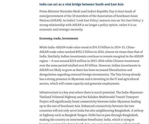
 OLD ROUTES ANEW LOOKING EAST FROM THE NORTH EAST By Pradyut Bordoloi Minister, Assam 60 years ago the transport networks of South & South East Asia were one of the most integrated in the developing world.
Grade 7 Social Studies
 Standard 1: History Students will examine the major movements, events, and figures that contributed to the development of nations in modern Africa, Asia, and the Southwest Pacific from acient civilizations
UNIVERSITY OF CAMBRIDGE INTERNATIONAL EXAMINATIONS Cambridge International Level 3 Pre-U Certificate Principal Subject
 UNIVERSITY OF CAMBRIDGE INTERNATIONAL EXAMINATIONS Cambridge International Level 3 Pre-U Certificate Principal Subject GEOGRAPHY 9768/04 Paper 4 Research Topic May/June 2012 INSERT 1 hour 30 minutes READ
CONFERENCE STATEMENT
 Final draft CONFERENCE STATEMENT We, the elected representatives of Canada, Denmark/Greenland, the European Parliament, Finland, Iceland, Norway, Russia, Sweden and the United States of America; In collaboration
Oceanography Exercise 1 Time Line of Ocean Exploration
 NAME Oceanography Exercise 1 Time Line of Ocean Exploration Match the persons or groups listed below with the technological advance or accomplishment in the history of ocean exploration. Some names may
Iceland and the Arctic: The Politics of Territoriality. Valur Ingimundaron Professor of Contemporary History, University of Iceland
 Iceland and the Arctic: The Politics of Territoriality Valur Ingimundaron Professor of Contemporary History, University of Iceland Drivers of Icelandic Arctic Policies Geostrategic Position Economic Interests
Texas Essential Knowledge and Skills (TEKS) Science Grade: 6 - Adopted: 2010
 Science Grade: 6 - Adopted: 2010") Main Criteria: Texas Essential Knowledge and Skills (TEKS) Secondary Criteria: Subjects: Science, Social Studies Grade: 6 Correlation Options: Show Correlated Texas Essential Knowledge and Skills (TEKS)
Main Criteria: Texas Essential Knowledge and Skills (TEKS) Secondary Criteria: Subjects: Science, Social Studies Grade: 6 Correlation Options: Show Correlated Texas Essential Knowledge and Skills (TEKS)
Canada s lowest recorded temperature is as cold as Mars
 Canada s lowest recorded temperature is as cold as Mars One of the most common facts about Canada is that it can get pretty cold in the winter (anyone who s ever had to chisel their car out of a block
Peoples, Places and Cultures in Africa, Asia and the Southwest Pacific
 GRADE 7 Peoples, Places and Cultures in Africa, Asia and the Southwest Pacific Course 0470-07 Students in seventh grade explore the history, geography, government, economic systems, current issues, and
Council conclusions on Arctic issues. 2985th FOREIGN AFFAIRS Council meeting Brussels, 8 December 2009
 COU CIL OF THE EUROPEA U IO EN Council conclusions on Arctic issues 2985th FOREIGN AFFAIRS Council meeting Brussels, 8 December 2009 The Council adopted the following conclusions: The Council recalls its
International Guidelines for Ecosystem-based, Marine Spatial Management
 International Guidelines for Ecosystem-based, Marine Spatial Management Charles Ehler and Fanny Douvere, Consultants Intergovernmental Oceanographic Commission and Man and the Biosphere Programme UNESCO
SMART NOTES ON INDIAN GEOGRAPHY - 1
 ON INDIAN GEOGRAPHY - 1 Point. Precise. Powerful. www.thesmartnotes.org ON INDIAN GEOGRAPHY - 1 To our Hardworking and persistence aspirants. Success is going from failure to failure without losing enthusiasm.
BOWDITCH PLUS! The Complete Navigator s Library Table of Contents
 STARPATH BOWDITCH PLUS! The Complete Navigator s Library Table of Contents The American Practical Navigator (Bowditch 2002) The US encyclopedia of navigation, some 1000 pages covers all aspects of navigation,
Climate Outlook for October 2017 March 2018
 The APEC CLIMATE CENTER Climate Outlook for October 2017 March 2018 BUSAN, 25 September 2017 The synthesis of the latest model forecasts for October 2017 to March 2018 (ONDJFM) from the APEC Climate Center
Citizen Rights Rules Procedures Laws Community Responsibility
 Rights and Responsibilities Q1a People in a community have rights and responsibilities. Laws, rights and rules help us live as responsible citizens. Individual actions contribute to the common good of
THE ARCTIC COUNCIL 2019
 THE ARCTIC COUNCIL 2019 BACKGROUND GUIDE CHAIRS SINAN BRUCE TRISTAN OHLER LEXINGTON 1 LETTER FROM THE CHAIR: Hello delegates of the Arctic Council of LEXMUN, My name is Tristan Ohler and my co-chair is
Explain the impact of location, climate, natural resources, and population distribution on Europe. a. Compare how the location, climate, and natural
 SS6G10 Explain the impact of location, climate, natural resources, and population distribution on Europe. a. Compare how the location, climate, and natural resources of Germany, the United Kingdom and
Semi-enclosed seas. Estuaries are only a particular type of semi-enclosed seas which are influenced by tides and rivers
 Semi-enclosed seas Estuaries are only a particular type of semi-enclosed seas which are influenced by tides and rivers Other semi-enclosed seas vary from each other, mostly by topography: Separated from
Social Studies: The World Post Test Study Guide
 Name: Period: Social Studies: The World Post Test Study Guide Map and Globe Skills: Label the continents and oceans on the lines below the map. 1 11 3 4 5 8 2 9 10 8 6 7 1. 8. 2. 9. 3. 10. 4. 11. 5. 6.
1 st Term Test 2014 Maris Stella College - Negombo. Geography
 Grade 9 1 st Term Test 2014 Maris Stella College - Negombo Geography 2 Hour Name(. Class ( No ( Use MCQ paper to answer Part 1. 1) What is the Blue Planet? i. Neptune iii. Uranus ii. Earth iv. Merury 2)
Chapter 24 Test on Southeast Asia
 Name Score Chapter 24 Test on Southeast Asia Part 1 - Multiple Choice (24 pts.) Read the following statements carefully. Select and circle the most correct choice from among the choices provided. 1. Which
GLOBAL NETWORK OF NATIONAL GEOPARKS. Patrick J Mc Keever
 Patrick J Mc Keever A GEOPARK is an area with. geological heritage of international significance but also with. a sustainable development strategy or plan involving local communities. IS A GEOPARK JUST
Marine Clusters. Vilhjálmur Jens Árnason. Matis - A workshop on coastal fisheries in the North Atlantic
 Marine Clusters Strengthening cooperation and best practices between clusters around the North Atlantic Ocean and how it can lead to new opportunities Vilhjálmur Jens Árnason Matis - A workshop on coastal
Central Valley School District Social Studies Curriculum Map Grade 7. August - September
 August - September Geographical/Historical Skills Identify and analyze timelines. Construct and use cause and effect charts. Differentiate between fact and opinion. Use of word webs, flip charts, outlines
SAMPLE. Succeeding in Social Studies 3 4 TH IN A SERIES OF 7. Years 3 4. Written by Valerie Marett. CORONEOS PUBLICATIONS Item No 506
 AUSTRALIAN HOMESCHOOLING SERIES Succeeding in Social Studies 3 4 TH IN A SERIES OF 7 Years 3 4 Written by Valerie Marett CORONEOS PUBLICATIONS Item No 506 Contents Notes to Parents......2 Maps...... 3
On Earth, the land is broken into large pieces. These pieces are separated by large bodies of water called oceans. We call some of these pieces of
 The 7 Continents On Earth, the land is broken into large pieces. These pieces are separated by large bodies of water called oceans. We call some of these pieces of land continents. A continent is an area
OUR COUNTRY INDIA LOCATIONAL SETTING
 7 India is a country of vast geographical expanse. In the north, it is bound by the lofty Himalayas. The Arabian Sea in the west, the Bay of Bengal in the east and the Indian Ocean in the south, wash the
PENNSYLVANIA ACADEMIC STANDARDS
 PENNSYLVANIA ACADEMIC STANDARDS ARTS AND HUMANITIES 9.2 Historical and Cultural Contexts A. Explain historical, cultural and social context of an individual work in the arts B. Relate works in the arts
Why VOCABULARY? clues
 It s GHSGT Time! Why VOCABULARY? Social Studies is all about MAKING CONNECTIONS Key Terms provide relational clues to guide you in answering test questions! The more WORDS you know, the smarter you are
W E E K L Y MONSOON INSIGHT
 W E E K L Y MONSOON INSIGHT 08 th July 2016 Indian Monsoon Dynamics Recent Weather Development India received 35% surplus rainfall in the week ended 6 July with all regions recording above-normal rainfall
Unit 1: Geography. For additional information, refer to this website: 1 G e o g r a p h y
 Unit 1: Geography For additional information, refer to this website: http://mryoungtms.weebly.com/ 1 G e o g r a p h y Continents and Oceans SOL USI. 2a Essential Understanding: Continents are large land
World Studies
 World Studies 200 2013 2014 Instructor: Rick Rogers Prep Hour: 4th e mail:rogerric@crandon.k12.wi.us Phone: (715) 478 3339 Room: 65 Text/Materials: World History, by Jackson J. Spielvogel, Ph.D., McGraw
LANDSLIDE MITIGATION IN CCOP
 "International Workshop on Landslide Risk Assessment and Management for ASEAN Member States 1-2 June 2017 Bangkok, Thailand LANDSLIDE MITIGATION IN CCOP Dr. Adichat Surinkum Director Email: adichat_s@ccop.or.th,
Edgebrook Geography Bee Workshop
 Edgebrook Geography Bee Workshop January 12, 2015 1/13/2015 1 Image from https://www.google.com/search?q=world+map 1/13/2015 2 Two Bees Grade 4-8: National Geographic Society (NGS) Geography Bee School
5 Oceans, Value of oceans
 5 Oceans, Value of oceans Knowledge Bank Integrator : Sanjay Moreshwar Bapat Arctic Ocean Atlantic Ocean Indian Ocean Pacific Ocean Southern Ocean Value of Oceans Sponsor banner SRidentity.com Arctic Ocean
Issue of the Name of the Sea of Japan. Overview of study of maps possessed by the Bibliotheque Nationale de France
 Issue of the Name of the Sea of Japan Overview of study of maps possessed by the Bibliotheque Nationale de France (March 2004) From October 2003 to January 2004, the Ministry of Foreign Affairs of Japan
MEADOWS PRIMARY SCHOOL and NURSERY GEOGRAPHY POLICY
 MEADOWS PRIMARY SCHOOL and NURSERY GEOGRAPHY POLICY Purpose of study The teaching of Geography at Meadows is done by following the 2014 National Curriculum. The planning and teaching of the subject aims
DESKTOP STUDY ON GLOBAL IMPORTS OF HANDMADE CARPETS & FLOOR COVERINGS AT A GLANCE
 DESKTOP STUDY ON GLOBAL IMPORTS OF HANDMADE CARPETS & FLOOR COVERINGS AT A GLANCE By: National Centre for Trade Information Hall No. 19, Pragati Maidan, New Delhi-10001, INDIA (Sponsored by Ministry of
Five Themes of Geography of Ecuador
 LESSON 1 Five Themes of Geography of Ecuador Lesson Objective The students will be able to: find the five themes of geography (location, movement, human/environment interaction, place, and region) of Ecuador
Sixth Grade Social Studies. QPA Schedule
 2017 2018 Sixth Grade Social Studies Unit 1: Concepts Used in Global Studies 5 Weeks Unit 2: History & Geography of Europe 5 Weeks Unit 3: Europe Today 6 Weeks Unit 4: History & Geography of Latin America
(Please send us your name, organisation and address via the ESI website here. For enquiries, please contact Ms. Jan Lui at
 ESI Conference Energy Security and Geopolitics in the Arctic: Challenges and Opportunities in the 21 st Century Date: Monday & Tuesday, 9 to 10 January 2012 Time: 9:00am to 5:00pm Venue: Traders Hotel
4th Grade Social Studies First Nine Weeks
 4th Grade Social Studies First Nine Weeks Multiple Choice Identify the choice that best completes the statement or answers the question. 1 Name the mountains that are located in the eastern United States.
Pre-AP World Geography Summer Assignment
 Pre-AP World Geography 2018-2019 Summer Assignment This is the summer assignment for students who intend on being accepted and enrolled in Pre-AP World Geography. Successful performance on this assignment
Learning Target : Describe the purposes and uses of different types of maps.
 Learning Target : Describe the purposes and uses of different types of maps. Directions: 1. Below, place a where you think you are located. 2. In which continent are you located? 3. In which country are
An Overview on the Ancient Charts in China From the Fifteenth to the Eighteenth Century
 An Overview on the Ancient Charts in China From the Fifteenth to the Eighteenth Century Zhu Jianqiu, Li Hanrong and Zhujin Tianjin Institute of Hydrographic Surveying and Charting, P.R China Fax: (8622)
Researching Earth's Moving Crust
 Chapter 3 The Changing Earth Chapter Science Investigation Researching Earth's Moving Crust Find Out Do this activity to see what evidence exists today of plate movement or volcanic eruptions. newspapers,
Key Issue #1. Where are states located?
 Political Geography Key Issue #1 Where are states located? Current World States State and Nation Terminology A nation is a group of people with a common ancestral heritage based on belief systems, customs,
Northern Sweden: Centre (Regional Maps - Sweden) READ ONLINE
 READ ONLINE") Northern Sweden: Centre (Regional Maps - Sweden) READ ONLINE If looking for a book Northern Sweden: Centre (Regional Maps - Sweden) in pdf format, then you've come to right website. We present complete
Northern Sweden: Centre (Regional Maps - Sweden) READ ONLINE If looking for a book Northern Sweden: Centre (Regional Maps - Sweden) in pdf format, then you've come to right website. We present complete
Sample. Contents SECTION 1: PLACE NAMES 6 SECTION 2: CONNECTING TO PLACES 21 SECTION 3: SPACES: NEAR AND FAR 53
 Contents Teachers' Notes 4 National Curriculum Links 5 SECTION 1: PLACE NAMES 6 Teachers' Notes 7-8 Activities Names Of Places 9 Place Names Are Important 1 10 Place Names Are Important 2 11 The Meanings
SEMINAR: ITALIAN-FINNISH COOPERATION IN THE ARCTIC: A GREAT OPPORTUNITY
 SEMINAR: ITALIAN-FINNISH COOPERATION IN THE ARCTIC: A GREAT OPPORTUNITY Session on: Environmental Protection, Sustainable Use of Resources, Arctic Navigation Gianfranco Tamburelli National Research Council
Essential Questions What are the major physical components of the world, and how are they represented on a map? 3.4
 Third Grade Social Studies Unit One Six Weeks GEOGRAPHY Originally compiled by Russellville In order for students to understand that geography influences the development of a region as well as the interactions
Your web browser (Safari 7) is out of date. For more security, comfort and the best experience on this site: Update your browser Ignore
 is out of date. For more security, comfort and the best experience on this site: Update your browser Ignore") Your web browser (Safari 7) is out of date. For more security, comfort and the best experience on this site: Update your browser Ignore Activitydevelop RESEARCH EXAMPL ES O F PHYSICAL GEO GRAPHY How do
Your web browser (Safari 7) is out of date. For more security, comfort and the best experience on this site: Update your browser Ignore Activitydevelop RESEARCH EXAMPL ES O F PHYSICAL GEO GRAPHY How do
End of Geopolitics and the Beginnings of Geopolinomics: United States in Central and Southwest Asia
 End of Geopolitics and the Beginnings of Geopolinomics: United States in Central and Southwest Asia By Aftab Kazi, PhD (Pittsburgh), Senior Fellow Central Asia-Caucasus Institute & Silk Road Studies Program
Map Skills Scavenger Hunt
 Map Skills Scavenger Hunt Introduction to: Continents Cardinal Directions Relative Location Equator and Prime Meridian Hemispheres Reading a Political Map Reading a Physical Map Idea: This product includes
National Geographic Science Of Everything: How Things Work In Our World By National Geographic
 National Geographic Science Of Everything: How Things Work In Our World By National Geographic If you are searching for a book National Geographic Science of Everything: How Things Work in Our World by
Geography. Programmes of study for Key Stages 1-3
 Geography Programmes of study for Key Stages 1-3 February 2013 Contents Purpose of study 3 Aims 3 Attainment targets 3 Subject content 4 Key Stage 1 4 Key Stage 2 5 Key Stage 3 6 2 Purpose of study A high-quality
What is the largest country in the world? Russia
 What is the largest country in the world? #1 Russia CSCOPE 2007 2 Russia Dimensions #2-3 Spans 11 Time Zones From East to West: Gulf of Finland to Alaska From North to South: Above the Arctic Circle to
The Arctic. Topical Tidbits. Greetings and Welcome to the Arctic! Editor/Creator: Aimée Devine
 Topical Tidbits January March 2018 Volume 7 Issue 1 Editor/Creator: Aimée Devine The Arctic Greetings and Welcome to the Arctic! Even though the temperature can get as low as 94 F, about four million people
Latitude & Longitude. Worksheets & activities to teach latitude & longitude. Includes notes, activities, review & all answer keys. 11 pages!
 Latitude & Longitude Worksheets & activities to teach latitude & longitude. Includes notes, activities, review & all answer keys. 11 pages! Lines of Latitude & Longitude Name: Lines of latitude and longitude
Distribution of Natural Resources 7 th Grade PSI Science
 Distribution of Natural Resources 7 th Grade PSI Science Name Directions: Humans and animals use natural resources every day. But where are these resources found? The maps below show the distribution of