Estimation via Data Assimilation Using. Mississippi State University GeoResources Institute
|
|
|
- Samuel Potter
- 5 years ago
- Views:
Transcription
1 High Resolution Soil Moisture Estimation via Data Assimilation Using NASA Land Information System Mississippi State University GeoResources Institute
2 LIS Evaluation Team & Collaborators RPC Team Valentine Anantharaj, Georgy Mostovoy, Nicholas Younan, and Anish Turlapathy Christa Peters-Lidard (NASA GSFC HSB) Paul Houser and Yan Luo (GMU CREW) Bailing Li and Sujay Kumar (NASA GSFC) Collaborators and Consultants USDA NRCS MSU DREC and USDA (Stoneville, MS) NASA Review (4/18/08) 2


3 Identified Needs of USDA NRCS Routine analysis soil moisture over the continental needs water soils sun weather climate vegetation terrain observe, model, assimilate NASA Review (4/18/08) 3
4 Soil Moisture Data Sources in this RPC Experiment In-situ observations USDA Soil Climate Analysis Network (SCAN) Remotely sensed and estimated NASA and JAXA Aqua Advanced Scanning Microwave Radiometer EOS (AMSR-E) Numerical Models The Noah model in the NASA Land Information System NASA Review (4/18/08) 4

")

5 USDA NRCS SCAN NASA Review (4/18/08) 5
6 Anticipated Societal Benefits 1. provides critical information to support drought monitoring and mitigation 2. provides essential information for predicting droughts based on weather and climate predictions 3. supports irrigation water management 4. supports fire risk assessment 5. supports water supply forecasting and NWS flood forecasting 6. supplies a critical missing component to assist with snow, climate and associated hydrometeorological data analysis 7. supports climate change assessment 8. enables water quality monitoring 9. supports a wide variety of natural resource management & research activities such as NASA remote sensing activities of soil moisture and ARS watershed studies. NASA Review (4/18/08) 6
7 An Integrated Framework for Land Data Assimilation il System Inputs Physics Outputs Applications Topography, Soils Land Cover and Vegetation (MODIS, AMSR, TRMM, SRTM) Meteorology Modeled & Observed (TRMM, GOES, Station) Observed Land States (Snow, ET, Soil Moisture, Water, Carbon, etc.) Land Surface Models (LSM) Physical Process Models Noah, CLM, VIC, SiB2, Mosaic, Catchment, etc. Data Assimilation Modules (EnKF, EKF) Rule-based Energy Fluxes: Le & H Biogeochemistry: Carbon, Nitrogen, etc. Water Fluxes: Runoff Surface States: Moisture, Carbon, Ts Water Supply & Demand, Agriculture, Hydro- Electric Power, Ecological Forecasting, Water Quality Improved Short Term & Long Term Predictions (Peters-Lidard, Houser, Kumar, Tian, Geiger) NASA Review (4/18/08) 7
8 LIS Evaluations: Purpose and Activities NASA Review (4/18/08) 8
9 Purpose of RPC Evaluations Primary: Evaluate LIS capabilities and NASA data to enhance and extend USDA-NRCS SCAN Approach: Evaluate LIS performance Assimilate SCAN and AMSR-E observations and evaluate LIS capabilities to enhance SCAN by means of Observation Sensitivity Experiments (OSE) Derive physically consistent soil moisture maps at a range of spatial resolutions from 25x25 km 2 to 1x1 km 2 Quantify uncertainties at all scales NASA Review (4/18/08) 9
10 Team Activity MsState: Project Management, RPC Integration, Control Run, MODIS-VF, [SSURGO] NASA GSFC: LIS Support, AMSR-E data assimilation, science expertise GMU CREW: SCAN data assimilation, science expertise NASA Review (4/18/08) 10
11 Five Data Assimilation Experiments System : LIS-Noah LSM (v.2.7.1) and 1D-EnKF Synthetic Run: observations are derived from model simulations plus random errors AMSR-E Run: observations are derived from AMSR-E retrievals Scaled AMSR-E Run: observations are derived from Scaled AMSR-E retrievals SCAN Run: observations are derived from 12 SCAN site measurements AMSR-E LIS 5.0 EnKF Run (Part II) NASA Review (4/18/08) 11
12 Data Assimilation using LIS (Part I) NASA Review (4/18/08) 12
13 Soil Moisture Data Assimilation and Evaluation AMSR-E on NASA AQUA Satellite OR Soil Climate Analysis Network Soil Moisture Data EnKF DA Noah Land Surface Model of NASA Land Information System Soil Climate Analysis Network No DA Soil Moisture Data Soil Moisture Data Soil Moisture Data Evaluation NASA Study Review (4/18/08) 13
14 Data assimilation scheme-- Ensemble Kalman Filter (EnKF) Propagation Step Analysis Step Propagation Step x α t x - state vector f - land surface model y - observations x f i,t+1 x f i,t x i,t-1 t n-1 t n t n+1 Time D t Propagation Step Propagation Step ( x, u, w ) f x i, t = f i, t 11 α, P = t f = N 1 1 D t D T t f f f [ x1, t x t, x 2, t x t,..., x N, t x t ] K a i, t Analysis Step f ( y Hx v ) x + t f = x i, t + K t t i, t f T ( HP H + ) 1 f T = P H R t t i NASA Review (4/18/08) 14
 Top layer in upper 10cm NASA Land")

 Outputs Soil Moisture & Temperature Evaporation Runoff")
15 LIS-based Noah LSM Noah Land Surface Model (NOAH) Model is driven by NLDAS forcing (observationcorrected meteorological forcing input) Top layer in upper 10cm NASA Land Information System Inputs Physics Topography, Land Surface Models Soils (Noah,Mosaic,CLM,VIC,SiB,CLSM,..) Land Cover, Vegetation Properties Meteorology Snow Soil Moisture Temperature Data Assimilation Modules (DI,EKF,EnKF) Outputs Soil Moisture & Temperature Evaporation Runoff Snowpack Properties Application s Weather/ Climate Water Resources Homeland Security Military Ops 15 Natural Hazards
16 AMSR-E soil moisture retrievals and CDF matching Advanced Microwave Scanning Radiometer (AMSR) Official AMSR-E Soil moisture dataset available since June 18, 2002 Upper about 1cm, global, ~twice daily at 06Z, 18Z AMSR-E Brightness Temperature Radiative Transfer Model NASA Review (4/18/08) Soil Moisture 16


17 Surface Soil Moisture [v/v%] 4yr ( ) Climatology Noah AMSRE Noah - AMSRE Noah is wetter NASA Review (4/18/08) 17


18 Bias correction-cdf matching CDF matching CDF Soil moisture CDF matching at 31.73N, W AMSR AMSR scaled NOAH model Soil Moisture [v/v] NASA Review (4/18/08) CDF Soil moisture CDF matching at 42.02N, 93.73W AMSR AMSR scaled NOAH model Soil Moisture [v/v]


19 Bias correction-cdf matching Before CDF Matching After CDF Matching NOAH AMSR-E SCAN NOAH Scaled AMSR-E SCAN Ames, IA NASA Review (4/18/08) 19
")
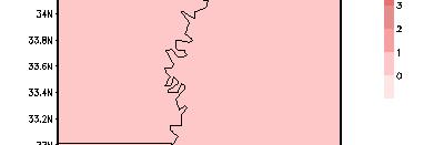
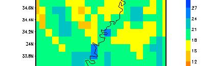
20 Experiment Domain - Mississippi Delta Region AMSR-E data assimilation runs 1/8th Degree (~15 km) LIS domain SCAN data assimilation runs 12 SCAN sites and 1-km LIS domain MS *Synthetic data assimilation runs *Synthetic data assimilation runs NASA Review (4/18/08) 20
21 Assimilation of real soil moisture data( SCAN, AMSR-E) 1/2 hr forecast+obs 1/2 hr forecast+obs 00Z 03Z 06Z 09Z 12Z 15Z 18Z 21Z 00Z 1/2 hour time step, 3 hourly output, and 20 ensemble members Data assimilation frequency is twice daily at 06Z and 18Z, with 184 assimilation events over a fixed time period, from 1 Jun thru 31 August DA will not be turned on until observation is available we take the ensemble mean as first guess for next time step initial conditions NASA Review (4/18/08) 21


22 The performance of EnKF: Synthetic Runs 0.125lat/lon 0.125lat/lon 1 km NASA Review (4/18/08) 1 km 22


23 The performance of EnKF: Synthetic Runs 0.125lat/lon 0.125lat/lon 1 km 1 km NASA Review (4/18/08) 23
 Variance (1.02438) 0.125lat/lon 0.")
 Variance (1.")
24 The performance of EnKF: Synthetic Runs Mean( ) Variance ( ) 0.125lat/lon 0.125lat/lon Open Loop EnKF OBS Truth Open Loop EnKF Mean( ) Variance ( ) 1 km NASA Review (4/18/08) 1 km 24


25 EnKF Assimilation of AMSR-E SM Retrievals EnKF Assimilation of Scaled AMSR-E SM Retrievals NASA Review (4/18/08) 25

 Variance (1.")
26 Impact of AMSR-E assimilation Open Loop AMSR-E EnKF AMSR-E SCAN NASA Review (4/18/08) Mean( ) Variance ( ) 26

 Mean(-0.")
27 Impact of Scaled AMSR-E assimilation Open Loop Scaled AMSR-E EnKF Scaled AMSR-E SCAN NASA Review (4/18/08) Mean( ) Variance ( ) 27

 Variance (1.")
28 Impact of SCAN assimilation Open Loop SCAN EnKF SCAN NASA Review (4/18/08) Mean( ) Variance ( ) 28
29 Data assimilation verification against SCAN observations Verification: SCAN point-scale measurements (Assumed truth!). Performance varied among assimilations of various real observations with the best one resulting from the SCAN EnKF: Smallest RMSE for 12 out of 12 sites Highest correlations for 10 out of 12 sites Compared to Open Loop, EnKF improved Soil moisture estimation in SCAN assimilation, but performance was degraded in AMSR-E assimilation RMSE(v/v%) Correlation ms_2025 ms_2032 ms_2034 ms_2035 ms_2046 ms_2086 ms_2087 ar_2030 SCAN Sites ar_2083 ar_2084 ar_2085 ar_2091 Open Loop AMSR-E EnKF Scaled AMSR-E EnKF SCAN EnKF SCAN Sites Open Loop AMSR-E EnKF Scaled AMSR-E EnKF SCAN EnKF NASA Review (4/18/08) 29
30 Data assimilation verification against SCAN observations (2) 25 When soil moisture model simulation performs better than satellite retrieval comparing with field measurements, using CDF-matching to calibrate the retrievals may make the retrieval accuracy better and consequently cause their assimilation improved relative to non- calibrated case. RMSE(v/v%) RMSE(v/v%) ms_ ms_2032 ms_2034 ms_2035 ms_2046 ms_2086 ms_2087 ar_2030 SCAN Sites ar_2083 ar_2084 NOAH AMSR-E Scaled AMSR-E ar_2085 ar_ ms_2025 ms_2032 ms_2034 ms_2035 ms_2046 ms_2086 ms_2087 ar_2030 ar_2083 ar_2084 ar_2085 ar_2091 SCAN Sites Open Loop AMSR-E EnKF Scaled AMSR-E EnKF SCAN EnKF NASA Review (4/18/08) 30
31 SCAN DA: Summary (1/2) The synthetic DA runs demonstrates a reasonable skill of the EnKF framework Increased resolution has less of an impact on the soil moisture assimilation, suggesting the importance of model physics and data assimilation algorithm. Assimilations of various real soil moisture observations have been evaluated against in-situ observations at 12 SCAN sites over the Mississippi Delta Region during June-August 2005 Soil moisture results from SCAN assimilation are encouraging: the SCAN assimilation has overall positive impact on soil moisture estimation, reflected not only in RMS errors but also in the correlations. The improved simulation skill by assimilating the SCAN data using EnKF is consistently better than assimilating the AMSR-E data into the data assimilation system. Although assimilation product of rescaled AMSR-E via CDF matching agrees better with ground data than that of unscaled AMSR-E, both perform worse than the no assimilation il case (open loop Noah simulations) NASA Review (4/18/08) 31
 should be further investigated.")
")
32 SCAN DA: Summary (2/2) In spite of the success in the SCAN assimilation, the quality of SCAN data in some sites (e.g. VANCE) should be further investigated. Very close sites, similar Noah simulations, but different SCAN measurement results, lead to different SCAN assimilation results Open Loop SCAN EnKF SCAN NASA Review (4/18/08) Open Loop SCAN EnKF SCAN 32
33 Data Assimilation using LIS (Part II) NASA Review (4/18/08) 33
34 Completed Activities Evaluation of Precipitation Forcing Data Evaluation of Noah Model Physics Spin-up Experiment Data Assimilation Control Run AMSR-E Assimilation Module in LIS AMSR-E Data Assimilation Findings and Recommendations NASA Review (4/18/08)


35 Evaluation of Precipitation Forcing Data In order to evaluate which precipitation forcing should be used for the RPC project, Stage IV and NLDAS forcing data were compared to measured rainfall amounts at five SCAN sites.
36 Comparison of NLDAS (red) and Stage IV (green) yearly statistics relative to measured rainfall at five SCAN sites SCAN site ID Beasley Lake Bias (NLD/STG4) (mm/sec) e e-06 RMSE (NLD/STG4) (mm/sec) 1.53 e e-07 FAR (NLD/STG4) POD (NLD/STG4) TotalRain (NLD/STG4) (mm) 1,441 1,403 TotalRain (observation) (mm) 1,640 Perthshire 1.55 e e e e ,523 1,553 1,475 Scott 5.81 e e e e ,597 1,635 1,415 Silver City 5.54 e e06 e e e e ,296 1,043 1,151 North Issaquena 4.59 e e e e ,331 1,134 1,342 NLDAS, in general, has a lower bias and root mean squared error (RMSE) than Stage IV forcing. While NLDAS shows slightly higher false alarm rates (FAR) than Stage IV, it has better probability of detection (POD) rates. The annual rainfall amounts estimated from the two analyses are in reasonable agreement with the in situ measured rainfall amounts at each site. Stage IV shows no advantage over NLDAS.
37 Evaluation of Noah Model Physics The underlining mathematic principle of the Noah model implies that the simulated soil moisture fields from Noah are point values and so can be readily compared to in situ soil moisture measurements. This evaluation focuses on using point values of the measured soil moisture field to examine the simulated soil moisture profiles by the Noah LSM. 37 NASA Review (4/18/08)
38 SCAN Evaluation of Noah Model Physics Subsurface measurements taken at five depths: 5.1, 10.2, 20.3, 50.8, 101.6cm below the surface Hourly Measured fields: precipitation, soil moisture, soil temperature, air temperature, wind, relative humidity, etc. 38


39 Study Area Evaluation of Noah Model Physics Study area: ~ Lat ~ Lon Five scan sites Perthshire Scott Beasley Lake Silver City North Issaquena 39
40 Model Setup Evaluation of Noah Model Physics Land Surface Model: Noah 1 km horizontal grid resolution 20 uniform layers (10 cm for each layer) outputs are interpolated to the exact depths of obs for comparisons Model run period: 03/2004~03/ /2006 Base forcing: NLDAS Supplemental forcing: SCAN site measured precipitation STATSGO soil texture classes UMD land cover and vegetation type Initial soil moisture condition: 0.3 Platform: Land Information System (LIS) 40

41 Monthly Precipitation in the Region Evaluation of Noah Model Physics Monthly precipitation amount averaged on five sites 41


42 Noah Control Run vs. SCAN Observations Simulated soil moisture content vs. measured at the 5 cm depth (averaged over all five sites) Evaluation of Noah Model Physics
43 Noah Control Run vs. SCAN Observations Simulated soil moisture vs. measured at the 102 cm depth (averaged over all five sites) Evaluation of Noah Model Physics
44 What is the problem? free drainage boundary condition Evaluation of Noah Model Physics The 1-D Richards equation: θ = t θ ( D + K ( θ )) + R E z z Lower boundary(2 m below the surface): free drainage (gravity driven) θ Darcy s Law: q = ( D( θ ) + K( θ )) z q z = θ z 2 m = K( θ) = z = 2 m 0 Constant drainage No upward movement of moisture by capillary force 44
45 What is a more appropriate boundary condition? constant water content Evaluation of Noah Model Physics Prescribed water content: constant in this study θ = θ ( t) z= 2m b By linear extrapolation θ b =
46 Comparison of Soil Moisture Profiles The effect of boundary conditions Evaluation of Noah Model Physics Soil moisture profile at Silver City at 10Z Sept.29, 2005 Free drainage: The near vertical soil moisture profile at the lower end The depletion of soil moisture in the middle soil profile Constant water content 0.41 at the bottom Much wetter profile through entire domain 46


47 Evaluation of Noah Model Physics Free Drainage vs. Constant Water Content Soil moisture at the 5 cm depth (averaged over five sites)


48 Evaluation of Noah Model Physics Free Drainage vs. Constant Water Content Soil moisture at the 102 cm depth (averaged over five sites)


49 Evaluation of Noah Model Physics Free Drainage vs. Constant Water Content Bias averaged over five sites and five depths


50 Evaluation of Noah Model Physics Free Drainage vs. Constant Water Content RMSE averaged over five sites and five depths

51 Evaluation of Noah Model Physics Free Drainage vs. Constant Water Content Daily averaged water storage in the upper 1-m soil column

52 Effect of Boundary Condition on a Perfect Initial Condition Five-depth averaged bias at Silver City Evaluation of Noah Model Physics Both runs were initiated with measured soil moisture content 52
53 Effect of Different Precip Forcing on Averaged Soil Moisture Profiles Free drainage Constant water content Evaluation of Noah Model Physics 53
54 Ancillary results Evaluation of Noah Model Physics The free drainage condition used by many land surface models including Noah is not applicable in this region and possibly many other areas as well; instead, a constant head boundary condition may be more appropriate based on the observations and the hydrogeological conditions in the region. The constant water content condition improves Noah s soil moisture simulation in Mississippi with unbiased estimation of soil moisture. 54
55 Results (continued) Evaluation of Noah Model Physics This approach and results of this evaluation demonstrate that an in-depth examination of the modeled soil moisture fields against observations at all levels can reveal deficiencies in model physics and result in more accurate soil moisture profile predictions. The SCAN measurements (in depth and continuous observations) are crucial in identifying the problem with the free drainage and finding an alternative. 55
56 Spin-up Experiment Spin-up is a common approach used in the land surface modeling community to generate initial conditions needed for numerical simulations. A spin-up experiment is said to reach a converging solution if the simulated profiles remain unchanged at the end of the model run as the run period increases. Three Noah runs were conducted using a six months, eight months and one year spin up period, respectively, with all runs ending at 00Z, May 1,
57 Spin-up Experiment Vertical water content profiles of three spin-up runs and the observations at Silver City, Mississippi at 23Z April 30, In each spin-up run, initial water content was set at 0.3 and the entire model was forced with NLDAS precipitation data. The three runs yield very similar soil moisture profiles at the end of each run, with the profiles from 10 months and one year spin-ups overlapping each other. It is clear that 10 months are long enough to spin up the soil moisture in this Mississippi region. 57
58 Ancillary Conclusions #2 Spin-up Experiment The converged solution from any spin-up process is not warranted to match the observations. As shown in the previous slide, the differences between the simulations and field measurements at the SCAN site can be significant. The discrepancy can be caused by many sources. But based on the previous analyses, the model physics, i.e., the free drainage boundary condition is mostly responsible for the drier soil moisture profile, especially at the lower profile. This experiment further demonstrates that, without correct model physics, the generated soil moisture state from any spin-up experiment is not warranted to be consistent with in situ measurements, no matter how long the model is spun up. 58
59 Data Assimilation Control Run The control run (CR) is designed to establish baseline simulated soil moisture fields so that any improvements made by the data assimilation can be illustrated. Even though the free drainage boundary condition is found to be inappropriate in this region, we still choose to use it for the data assimilation. The primary reason is that the free drainage condition is used in the official version of the Noah land surface model which is used by the majority of the community. 59
60 Simulation domain and location of SCAN sites used for data assimilation Data Assimilation Control Run Larger domain than used for evaluating model physics so more SCAN sites can be included for evaluating data assimilation 300 km by 300 km with latitude and longitude ranging g from to , and to , respectively Horizontal grid resolution is 0.01 degree Official standard four layers of soil Forced with NLDAS forcing data UMD 1 km land cover data set used to provide vegetation type STATSGO soil texture data set used for deriving the soil hydraulic parameters Baseline run period is from 2002 to 2006 Initial soil moisture set to 0.3 Soil moisture content output at 3-hour intervals. 60
61 AMSR-E Assimilation Module in LIS A general data assimilation module based on the ensemble Kalman filter is used for assimilating soil moisture into land surface models in LIS (Kumar et al., 2007). The filter has been tested with the Catchment model and AMSR-E soil moisture retrievals (Reichle et al., 2007), and a synthetic soil moisture assimilation using Noah. AMSR-E soil moisture is retrieved based on measured brightness temperature from the NASA polar-orbiting Aqua satellite. The level 3 AMSR-E soil moisture data set, which contains both ascending and descending retrievals, is used. Even though the level 3 are interpolated to the 25 km cell spacing, the actual foot print each retrieval represents is about 56 km. The daily AMSR-E data files are stored in HDF-EOS format and in the Equal-Area Scalable Earth Grid (EASE-Grid) projection. Since LIS uses equal distance cylindrical projection, a re-projection of the gridded AMSR-E, based on a nearest neighbor searching algorithm, is implemented in LIS to convert the equal area based EASE grid projection to the equal latitude/longitude projection. 61
62 CDF Matching Technique AMSR-E Assimilation Module in LIS One of the key issues in using AMSR-E soil moisture data is the apparent bias between AMSR-E retrieved soil moisture values and the modeled values. The difference can be attributed to retrieval errors, scale issues and the model bias. To reduce the bias, Reichle and Koster (2004) used the cumulative distribution function (CDF) matching technique which maps the CDF of observed soil moisture contents to that of the modeled ones and therefore forces the two sets of soil moisture to share the same mean value. For our AMSR-E assimilation, at each LIS grid point CDFs are derived for the soil moisture obtained from the 5 year baseline run and the 5 year AMSR-E retrievals, respectively. At each point, 500 bins are used for deriving these functions. When AMSR-E is assimilated into Noah, the retrieved soil moisture is converted to model compatible values based on the CDFs at the given location. 62
63 AMSR-E Data Assimilation To evaluate the assimilation results, the correlation coefficients of the daily mean anomalies of modeled soil moisture fields with that of the SCAN in situ measurements are calculated, as well as correlation coefficients for the baseline CR and the unconverted AMSR-E soil moisture. The five year soil moisture data for both the modeled and observed ed are treated as a complete continuous o time series. SCAN Sites CR Assimilation AMSR-E Years of SCAN Perthshire Silver City Scott Beasely Lake NIssaquena Tunica Vance Lonoke Farm Campus PB Marianna Earle DeWitt Average
64 AMSR-E DA Results AMSR-E Data Assimilation AMSR-E data in general have a lower correlation with SCAN than the modeled d soil moisture fields produced by the Noah baseline CR. This can be attributed to the NLDAS forcing data used in this study which, as shown earlier, compares very well with the gauged rainfall measurements. The lack of strong correlation for the AMSR-E retrievals with the SCAN data are likely related to the fact that AMSR-E retrievals are not sensitive to the daily changes of soil moisture either due to the retrieval algorithm or due to the larger scale they represent. In addition, there are only about two retrievals daily in the Mississippi region, which may lower dynamic ranges of the soil moisture at any pixel. On average the assimilation results did not improve over the Noah baseline simulation. However, at sites (for instance, Scott, Lonoke Farm, and Earle) where the correlation bt between AMSR-E AMSRE and SCAN is comparable to the correlation between the model baseline CR and SCAN, the assimilation did improve the modeled performance. It can be drawn from this study that the satellite observations need to have compatible quality y( (i.e., correlation in this study) with the model in order to see improvement through data assimilation. 64
 at any given location.")
65 Normalized Innovations AMSR-E Data Assimilation The underlining i filter used for the data assimilation il can be evaluated by examining i the mean and variance of the normalized innovation which is defined as the difference between actual observations and the predicted observations divided by the sum of the model and observations errors (standard deviation) at any given location. Mean (left) and variance (right) of five year innovation time series The spatial average of the innovation variance in the study area is around 1.2 which shows the filter is reasonably configured. 65
66 Preliminary Findings and Recommendations The LIS architecture is designed using advanced software engineering principles, allowing the interoperability of land surface models, meteorological inputs, land surface parameters and observational data, and data assimilation capabilities. The AMSR-E data assimilation experiments carried out in this project demonstrate the utility of the flexible, extensible LIS data assimilation framework to apply hydrological observations and modeling tools. A new module to re- project the gridded AMSR-E data was implemented in LIS to facilitate data assimilation using AMSR-E data and the Noah LSM. On average the assimilation of NASA AMSR-E soil moisture product did not improve over the Noah baseline simulation in the MS domain. However, at sites where the correlation between AMSR-E and SCAN is comparable to the correlation between the model baseline and SCAN, the assimilation il did improve the modeled d performance. 66
67 Preliminary Findings and Recommendations (continued) The approach and results of the Noah model physics evaluation demonstrate that an in-depth examination of the modeled d soil moisture fields against observations at all levels can reveal deficiencies in model physics and result in more accurate soil moisture profile predictions. The SCAN measurements (in depth and continuous observations) are crucial in identifying the problem with the free drainage and finding an alternative. A fundamental issue with the CDF matching technique is it does not correct the mean of the modeled soil moisture fields. When observations are transformed through the CDF matching process, they assume the mean of the modeled fields. If the model has a systematic bias, the assimilation with CDF matching will not correct it. Statistically and meteorologically, the mean behavior of the soil moisture fields is more important than others. Without a correct mean, the increased correlation from any data assimilation may not improve the soil moisture prediction. Therefore, data assimilation should be conducted in conjunction with examining model physics such as the one conducted on this project to achieve optimum soil moisture prediction. 67
68 Preliminary Findings and Recommendations (continued) The approach and results of the Noah model physics evaluation demonstrate that an in-depth examination of the modeled d soil moisture fields against observations at all levels can reveal deficiencies in model physics and result in more accurate soil moisture profile predictions. The SCAN measurements (in depth and continuous observations) are crucial in identifying the problem with the free drainage and finding an alternative. A fundamental issue with the CDF matching technique is it does not correct the mean of the modeled soil moisture fields. When observations are transformed through the CDF matching process, they assume the mean of the modeled fields. If the model has a systematic bias, the assimilation with CDF matching will not correct it. Statistically and meteorologically, the mean behavior of the soil moisture fields is more important than others. Without a correct mean, the increased correlation from any data assimilation may not improve the soil moisture prediction. Therefore, data assimilation should be conducted in conjunction with examining model physics such as the one conducted on this project to achieve optimum soil moisture prediction. 68
69 Recommendation for Future Work Conduct further verification of longer time period Study the impact of DA on soil moisture at deeper layers and the surface energy balance terms Examine the influence of assimilation frequency Evaluate complementary AMSR-E products derived using other algorithms (USDA and Princeton) Evaluate the feasibility of combining in-situ and remotely sensed data using the emerging implementation of the 3-D EnKF using LIS NASA Review (4/18/08) 69
70 Future Plans Extend assimilating SCAN soil moisture at top layer (~5cm) only to all layers(~5, 20, 51, 102cm). NASA Review (4/18/08) 70
71 Future Plans Extend 1D-EnKF to 3D-EnKF, which h can spread dinformation from observed to unobserved locations. 1D-EnKF: The state estimate is only updated at a grid point when observation is available (red dots), no observation (yellow dots) no update. 3D-EnKF: The state estimate is updated at any grid point (both red and yellow dots) with all observations within the local region (red circle). NASA Review (4/18/08) 71
72 NASA Review (4/18/08) 72
73 Accepted NASA Review (4/18/08) 73
74 Questions? NASA Review (4/18/08) 74
75 Contact Information Valentine Anantharaj edu> Tel: (662) NASA Review (4/18/08) 75
Evaluation of GPM Precipitation Estimates for Land Data Assimilation Applications
 Evaluation of GPM Precipitation Estimates for Land Data Assimilation Applications PI: Prof. Lori Bruce, Ph.D Mississippi State University GeoResources Institute RPC Review (04/14/08) 1 GPM Evaluation Team
Georgy V. Mostovoy*¹, Valentine Anantharaj¹, Paul R. Houser², and Christa D. Peters-Lidard³
 P2.3 USE OF SCAN OBSERVATIONS FOR VALIDATION OF SOIL MOISTURE SPATIAL DISTRIBUTION SIMULATED BY THE LAND-SURFACE MODEL OVER THE LOWER MISSISSIPPI DELTA REGION Georgy V. Mostovoy*¹, Valentine Anantharaj¹,
Acknowledging: Paul R. Houser (CREW & GMU)
") Recent Advances in Land Surace Data Assimilation Acknowledging: Paul R. Houser (CREW & GMU) Yan Luo, Xiwu Zhan, Je Walker, Brian Cosgrove, Jared Entin, Jiarui Dong, Alok Sahoo, Gabrielle de Lannoy Water
Recent Advances in Land Surace Data Assimilation Acknowledging: Paul R. Houser (CREW & GMU) Yan Luo, Xiwu Zhan, Je Walker, Brian Cosgrove, Jared Entin, Jiarui Dong, Alok Sahoo, Gabrielle de Lannoy Water
Can assimilating remotely-sensed surface soil moisture data improve root-zone soil moisture predictions in the CABLE land surface model?
 19th International Congress on Modelling and Simulation, Perth, Australia, 12 16 December 2011 http://mssanz.org.au/modsim2011 Can assimilating remotely-sensed surface soil moisture data improve root-zone
An Ensemble Land Surface Modeling and Assimilation Testbed for HEPEX
 GSFC s Land Data Assimilation Systems: An Ensemble Land Surface Modeling and Assimilation Testbed for HEPEX Christa Peters-Lidard Lidard,, Paul Houser, Matthew Rodell, Brian Cosgrove NASA Goddard Space
Land Data Assimilation at NCEP NLDAS Project Overview, ECMWF HEPEX 2004
 Dag.Lohmann@noaa.gov, Land Data Assimilation at NCEP NLDAS Project Overview, ECMWF HEPEX 2004 Land Data Assimilation at NCEP: Strategic Lessons Learned from the North American Land Data Assimilation System
Multivariate assimilation of satellite-derived remote sensing datasets in the North American Land Data Assimilation System (NLDAS)
") Multivariate assimilation of satellite-derived remote sensing datasets in the North American Land Data Assimilation System (NLDAS) Sujay V. Kumar 1,2, Christa D. Peters-Lidard 1, David Mocko 1,2,3, Rolf
Multivariate assimilation of satellite-derived remote sensing datasets in the North American Land Data Assimilation System (NLDAS) Sujay V. Kumar 1,2, Christa D. Peters-Lidard 1, David Mocko 1,2,3, Rolf
Drought Monitoring with Hydrological Modelling
 st Joint EARS/JRC International Drought Workshop, Ljubljana,.-5. September 009 Drought Monitoring with Hydrological Modelling Stefan Niemeyer IES - Institute for Environment and Sustainability Ispra -
Enhancing Weather Forecasts via Assimilating SMAP Soil Moisture and NRT GVF
 CICS Science Meeting, ESSIC, UMD, 2016 Enhancing Weather Forecasts via Assimilating SMAP Soil Moisture and NRT GVF Li Fang 1,2, Christopher Hain 1,2, Xiwu Zhan 2, Min Huang 1,2 Jifu Yin 1,2, Weizhong Zheng
Land data assimilation in the NASA GEOS-5 system: Status and challenges
 Blueprints for Next-Generation Data Assimilation Systems Boulder, CO, USA 8-10 March 2016 Land data assimilation in the NASA GEOS-5 system: Status and challenges Rolf Reichle Clara Draper, Ricardo Todling,
Assimilation of satellite derived soil moisture for weather forecasting
 Assimilation of satellite derived soil moisture for weather forecasting www.cawcr.gov.au Imtiaz Dharssi and Peter Steinle February 2011 SMOS/SMAP workshop, Monash University Summary In preparation of the
Interaction of North American Land Data Assimilation System and National Soil Moisture Network: Soil Products and Beyond
 Interaction of North American Land Data Assimilation System and National Soil Moisture Network: Soil Products and Beyond Youlong Xia 1,2, Michael B. Ek 1, Yihua Wu 1,2, Christa Peters-Lidard 3, David M.
Implementation of the NCEP operational GLDAS for the CFS land initialization
 Implementation of the NCEP operational GLDAS for the CFS land initialization Jesse Meng, Mickael Ek, Rongqian Yang NOAA/NCEP/EMC July 2012 1 Improving the Global Land Surface Climatology via improved Global
2009 Progress Report To The National Aeronautics and Space Administration NASA Energy and Water Cycle Study (NEWS) Program
 Program") 2009 Progress Report To The National Aeronautics and Space Administration NASA Energy and Water Cycle Study (NEWS) Program Proposal Title: Grant Number: PI: The Challenges of Utilizing Satellite Precipitation
2009 Progress Report To The National Aeronautics and Space Administration NASA Energy and Water Cycle Study (NEWS) Program Proposal Title: Grant Number: PI: The Challenges of Utilizing Satellite Precipitation
Comparing the SEKF with the DEnKF on a land surface model
 Comparing the SEKF with the DEnKF on a land surface model David Fairbairn, Alina Barbu, Emiliano Gelati, Jean-Francois Mahfouf and Jean-Christophe Caret CNRM - Meteo France Partly funded by European Union
Application of Pattern Recognition and Adaptive DSP Methods for Spatio-temporal Analysis of Satellite Based Hydrological Datasets
 Application of Pattern Recognition and Adaptive DSP Methods for Spatio-temporal Analysis of Satellite Based Hydrological Datasets Anish Chand Turlapaty DISSERTATION.COM Boca Raton Application of Pattern
Improving Streamflow Prediction in Snow- fed River Basins via Satellite Snow Assimilation
 Improving Streamflow Prediction in Snow- fed River Basins via Satellite Snow Assimilation Yuqiong Liu NASA GSFC & University of Maryland, College Park Co- authors: Christa Peters- Lidard, Sujay Kumar,
Development of the Canadian Precipitation Analysis (CaPA) and the Canadian Land Data Assimilation System (CaLDAS)
 and the Canadian Land Data Assimilation System (CaLDAS)") Development of the Canadian Precipitation Analysis (CaPA) and the Canadian Land Data Assimilation System (CaLDAS) Marco L. Carrera, Vincent Fortin and Stéphane Bélair Meteorological Research Division Environment
Development of the Canadian Precipitation Analysis (CaPA) and the Canadian Land Data Assimilation System (CaLDAS) Marco L. Carrera, Vincent Fortin and Stéphane Bélair Meteorological Research Division Environment
1.11 CROSS-VALIDATION OF SOIL MOISTURE DATA FROM AMSR-E USING FIELD OBSERVATIONS AND NASA S LAND DATA ASSIMILATION SYSTEM SIMULATIONS
 1.11 CROSS-VALIDATION OF SOIL MOISTURE DATA FROM AMSR-E USING FIELD OBSERVATIONS AND NASA S LAND DATA ASSIMILATION SYSTEM SIMULATIONS Alok K. Sahoo *, Xiwu Zhan** +, Kristi Arsenault** and Menas Kafatos
GLOBAL LAND DATA ASSIMILATION SYSTEM (GLDAS) PRODUCTS FROM NASA HYDROLOGY DATA AND INFORMATION SERVICES CENTER (HDISC) INTRODUCTION
 PRODUCTS FROM NASA HYDROLOGY DATA AND INFORMATION SERVICES CENTER (HDISC) INTRODUCTION") GLOBAL LAND DATA ASSIMILATION SYSTEM (GLDAS) PRODUCTS FROM NASA HYDROLOGY DATA AND INFORMATION SERVICES CENTER (HDISC) Hongliang Fang, Patricia L. Hrubiak, Hiroko Kato, Matthew Rodell, William L. Teng,
GLOBAL LAND DATA ASSIMILATION SYSTEM (GLDAS) PRODUCTS FROM NASA HYDROLOGY DATA AND INFORMATION SERVICES CENTER (HDISC) Hongliang Fang, Patricia L. Hrubiak, Hiroko Kato, Matthew Rodell, William L. Teng,
Optimization of GPM Precipitation Estimates for Land Data Assimilation Applications
 Optimization of GPM Precipitation Estimates for Land Data Assimilation Applications PI: Prof. Lori Bruce, Ph.D Mississippi State University GeoResources Institute GPM Optimization Team & MSU Team Lori
P2.4 REGIONAL VARIABILITY OF SOIL MOISTURE FROM SCAN MEASUREMENTS: IMPLICATION FOR LAND SURFACE MODELING AND ASSIMILATION
 P2.4 REGIONAL VARIABILITY OF SOIL MOISTURE FROM SCAN MEASUREMENTS: IMPLICATION FOR LAND SURFACE MODELING AND ASSIMILATION Georgy V. Mostovoy*, Valentine Anantharaj, and Louis Wasson Mississippi State University,
Developing a High-Resolution Texas Water and Climate Prediction Model
 Developing a High-Resolution Texas Water and Climate Prediction Model Zong-Liang Yang (512) 471-3824 liang@jsg.utexas.edu Water Forum II on Texas Drought and Beyond, Austin, Texas, 22-23 October, 2012
GRID RAINFALL DISAGGREGATION TOWARD A PATCH-BASED ENSEMBLE KALMAN FILTER FOR SOIL MOISTURE DATA ASSIMILATION
 GRID RAINFALL DISAGGREGATION TOWARD A PATCH-BASED ENSEMBLE KALMAN FILTER FOR SOIL MOISTURE DATA ASSIMILATION Filip Jagodzinski, Villanova University, Bryn Mawr, PA (filip.jagodzinski@villanova.edu) Mentor:
Amita Mehta and Ana Prados
 Building Capacity in Utilizing NASA Remote Sensing Observations in SWAT for Water Resources and Agricultural Management Applications Amita Mehta and Ana Prados NASA - University of Maryland Baltimore County
3850 IEEE JOURNAL OF SELECTED TOPICS IN APPLIED EARTH OBSERVATIONS AND REMOTE SENSING, VOL. 10, NO. 9, SEPTEMBER 2017
 3850 IEEE JOURNAL OF SELECTED TOPICS IN APPLIED EARTH OBSERVATIONS AND REMOTE SENSING, VOL. 10, NO. 9, SEPTEMBER 2017 Comparison of X-Band and L-Band Soil Moisture Retrievals for Land Data Assimilation
Assimilation of ASCAT soil wetness
 EWGLAM, October 2010 Assimilation of ASCAT soil wetness Bruce Macpherson, on behalf of Imtiaz Dharssi, Keir Bovis and Clive Jones Contents This presentation covers the following areas ASCAT soil wetness
The National Operational Hydrologic Remote Sensing Center Operational Snow Analysis
 The National Operational Hydrologic Remote Sensing Center Operational Snow Analysis World Meteorological Organization Global Cryosphere Watch Snow-Watch Workshop Session 3: Snow Analysis Products Andrew
Towards a probabilistic hydrological forecasting and data assimilation system. Henrik Madsen DHI, Denmark
 Towards a probabilistic hydrological forecasting and data assimilation system Henrik Madsen DHI, Denmark Outline Hydrological forecasting Data assimilation framework Data assimilation experiments Concluding
Land Analysis in the NOAA CFS Reanalysis. Michael Ek, Ken Mitchell, Jesse Meng Helin Wei, Rongqian Yang, and George Gayno
 Land Analysis in the NOAA CFS Reanalysis Michael Ek, Ken Mitchell, Jesse Meng Helin Wei, Rongqian Yang, and George Gayno 1 Outline CFS Reanalysis execution Land surface model upgrade from OSU to Noah LIS/GLDAS
SMAP and SMOS Integrated Soil Moisture Validation. T. J. Jackson USDA ARS
 SMAP and SMOS Integrated Soil Moisture Validation T. J. Jackson USDA ARS Perspective Linkage of SMOS and SMAP soil moisture calibration and validation will have short and long term benefits for both missions.
Soil Moisture Prediction and Assimilation
 Soil Moisture Prediction and Assimilation Analysis and Prediction in Agricultural Landscapes Saskatoon, June 19-20, 2007 STEPHANE BELAIR Meteorological Research Division Prediction and Assimilation Atmospheric
Evaluation of remotely sensed and modelled soil moisture products using global ground-based in situ observations
 Evaluation of remotely sensed and modelled soil moisture products using global ground-based in situ observations C. Albergel (1), P. de Rosnay (1), G. Balsamo (1),J. Muñoz-Sabater(1 ), C. Gruhier (2),
10. FIELD APPLICATION: 1D SOIL MOISTURE PROFILE ESTIMATION
 Chapter 1 Field Application: 1D Soil Moisture Profile Estimation Page 1-1 CHAPTER TEN 1. FIELD APPLICATION: 1D SOIL MOISTURE PROFILE ESTIMATION The computationally efficient soil moisture model ABDOMEN,
A SATELLITE LAND DATA ASSIMILATION SYTEM COUPLED WITH A MESOSCALE MODEL: TOWARDS IMPROVING NUMERICAL WEATHER PREDICTION
 A SATELLITE LAND DATA ASSIMILATION SYTEM COUPLED WITH A MESOSCALE MODEL: TOWARDS IMPROVING NUMERICAL WEATHER PREDICTION Mohamed Rasmy*, Toshio Koike*, Souhail Bousseta**, Xin Li*** Dept. of Civil Engineering,
Land surface precipitation and hydrology in MERRA-2
 Land surface precipitation and hydrology in MERRA-2 R. Reichle, R. Koster, C. Draper, Q. Liu, M. Girotto, S. Mahanama, G. De Lannoy, G. Partyka, and many others 5th International Conference on Reanalysis
SPATIO-TEMPORAL CONSISTENCY ANALYSIS OF AMSR-E SOIL MOISTURE DATA USING WAVELET-BASED FEATURE EXTRACTION AND ONE-CLASS SVM INTRODUCTION
 SPATIO-TEMPORAL CONSISTENCY ANALYSIS OF AMSR-E SOIL MOISTURE DATA USING WAVELET-BASED FEATURE EXTRACTION AND ONE-CLASS SVM Anish C. Turlapaty 1,2, Graduate Student Valentine Anantharaj 2, Research Associate
ASimultaneousRadiometricand Gravimetric Framework
 Towards Multisensor Snow Assimilation: ASimultaneousRadiometricand Gravimetric Framework Assistant Professor, University of Maryland Department of Civil and Environmental Engineering September 8 th, 2014
Land Data Assimilation for operational weather forecasting
 Land Data Assimilation for operational weather forecasting Brett Candy Richard Renshaw, JuHyoung Lee & Imtiaz Dharssi * *Centre Australian Weather and Climate Research Contents An overview of the Current
Advances in land data assimilation at NASA/GSFC
 ECMWF / GLASS Workshop on Land Surface Modelling and Data Assimilation and the Implications for Predictability 10 November 2009 Advances in land data assimilation at NASA/GSFC Rolf Reichle 1* M. Bosilovich
Land Data Assimilation and the (Coordinated) National Soil Moisture Network
 National Soil Moisture Network") Land Data Assimilation and the (Coordinated) National Soil Moisture Network Wade Crow USDA ARS Hydrology and Remote Sensing Laboratory Alexander Gruber, Wouter Dorigo TU-Wien, Department of Geodesy and
Land Data Assimilation and the (Coordinated) National Soil Moisture Network Wade Crow USDA ARS Hydrology and Remote Sensing Laboratory Alexander Gruber, Wouter Dorigo TU-Wien, Department of Geodesy and
Analysis of real-time prairie drought monitoring and forecasting system. Lei Wen and Charles A. Lin
 Analysis of real-time prairie drought monitoring and forecasting system Lei Wen and Charles A. Lin Back ground information A real-time drought monitoring and seasonal prediction system has been developed
Aquarius/SAC-D Soil Moisture Product using V3.0 Observations
 Aquarius/SAC-D Soil Moisture Product using V3. Observations R. Bindlish, T. Jackson, M. Cosh November 214 Overview Soil moisture algorithm Soil moisture product Validation Linkage between Soil Moisture
Cross-Validation of AMSR-E Soil Moisture Retrievals and the Surface Soil Moisture Simulations from NASA s Global Land Data Assimilation System (GLDAS)
") Cross-Validation of AMSR-E Soil Moisture Retrievals and the Surface Soil Moisture Simulations from NASA s Global Land Data Assimilation System (GLDAS) Alok Kumar Sahoo, George Mason University, Fairfax,
Cross-Validation of AMSR-E Soil Moisture Retrievals and the Surface Soil Moisture Simulations from NASA s Global Land Data Assimilation System (GLDAS) Alok Kumar Sahoo, George Mason University, Fairfax,
NOAA Soil Moisture Operational Product System (SMOPS): Version 2
: Version 2") CICS-MD Science Meeting (November 12-13, 2014) NOAA Soil Moisture Operational Product System (SMOPS): Version 2 Jicheng Liu 1, 2, Xiwu Zhan 2, Limin Zhao 3, Christopher R. Hain 1, 2, Li Fang 1,2, Jifu
CICS-MD Science Meeting (November 12-13, 2014) NOAA Soil Moisture Operational Product System (SMOPS): Version 2 Jicheng Liu 1, 2, Xiwu Zhan 2, Limin Zhao 3, Christopher R. Hain 1, 2, Li Fang 1,2, Jifu
3.3 SMOS SOIL MOISTURE DATA ASSIMILATION IN THE NASA LAND INFORMATION SYSTEM: IMPACT ON LSM INITIALIZATION AND NWP FORECASTS
 3.3 SMOS SOIL MOISTURE DATA ASSIMILATION IN THE NASA LAND INFORMATION SYSTEM: IMPACT ON LSM INITIALIZATION AND NWP FORECASTS Clay B. Blankenship, USRA, Huntsville, Alabama* Jonathan L. Case, ENSCO, Inc.,
Global Integrated Drought Monitoring and Prediction System. GIDMaPS
 Global Integrated Drought Monitoring and Prediction System GIDMaPS Global Integrated Drought Monitoring and Prediction System GIDMaPS and Center for Hydrology & Remote Sensing Authors: Amir AghaKouchak
Multi-scale Soil Moisture Model Calibration and Validation: Evan Coopersmith & Michael Cosh, USDA-ARS, Dept. of Hydrology and Remote Sensing
 Multi-scale Soil Moisture Model Calibration and Validation: Evan Coopersmith & Michael Cosh, USDA-ARS, Dept. of Hydrology and Remote Sensing An Ideal Location: Three Types of Similarity Hydro-climatic
Michael B. Ek 1, Youlong Xia 1,2, Jesse Meng 1,2, and Jiarui Dong 1,2
 Michael B. Ek 1, Youlong Xia 1,2, Jesse Meng 1,2, and Jiarui Dong 1,2 1 Land-Hydrology Team Environmental Modeling Center (EMC) National Centers for Environmental Prediction (NCEP) National Weather Service
Climate Models and Snow: Projections and Predictions, Decades to Days
 Climate Models and Snow: Projections and Predictions, Decades to Days Outline Three Snow Lectures: 1. Why you should care about snow 2. How we measure snow 3. Snow and climate modeling The observational
D. Lohmann, Pablo Grunman, and Kenneth Mitchell (2004), Land data assimilation at NOAA/NCEP/EMC, in Proceedings of the 2 nd international CAHMDA
, Land data assimilation at NOAA/NCEP/EMC, in Proceedings of the 2 nd international CAHMDA") D. Lohmann, Pablo Grunman, and Kenneth Mitchell (2004), Land data assimilation at NOAA/NCEP/EMC, in Proceedings of the 2 nd international CAHMDA workshop on: The Terrestrial Water Cycle: Modelling and
D. Lohmann, Pablo Grunman, and Kenneth Mitchell (2004), Land data assimilation at NOAA/NCEP/EMC, in Proceedings of the 2 nd international CAHMDA workshop on: The Terrestrial Water Cycle: Modelling and
CARFFG System Development and Theoretical Background
 CARFFG Steering Committee Meeting 15 SEPTEMBER 2015 Astana, KAZAKHSTAN CARFFG System Development and Theoretical Background Theresa M. Modrick, PhD Hydrologic Research Center Key Technical Components -
Incorporation of SMOS Soil Moisture Data on Gridded Flash Flood Guidance for Arkansas Red River Basin
 Incorporation of SMOS Soil Moisture Data on Gridded Flash Flood Guidance for Arkansas Red River Basin Department of Civil and Environmental Engineering, The City College of New York, NOAA CREST Dugwon
Implementation of Land Information System in the NCEP Operational Climate Forecast System CFSv2. Jesse Meng, Michael Ek, Rongqian Yang, Helin Wei
 Implementation of Land Information System in the NCEP Operational Climate Forecast System CFSv2 Jesse Meng, Michael Ek, Rongqian Yang, Helin Wei 1 Outline NCEP CFSRR Land component CFSv1 vs CFSv2 Land
Prospects for river discharge and depth estimation through assimilation of swath altimetry into a raster-based hydraulics model
 Prospects for river discharge and depth estimation through assimilation of swath altimetry into a raster-based hydraulics model Kostas Andreadis 1, Elizabeth Clark 2, Dennis Lettenmaier 1, and Doug Alsdorf
The Canadian Land Data Assimilation System (CaLDAS)
") The Canadian Land Data Assimilation System (CaLDAS) Marco L. Carrera, Stéphane Bélair, Bernard Bilodeau and Sheena Solomon Meteorological Research Division, Environment Canada Dorval, QC, Canada 2 nd Workshop
The Canadian Land Data Assimilation System (CaLDAS) Marco L. Carrera, Stéphane Bélair, Bernard Bilodeau and Sheena Solomon Meteorological Research Division, Environment Canada Dorval, QC, Canada 2 nd Workshop
Toward improving the representation of the water cycle at High Northern Latitudes
 Toward improving the representation of the water cycle at High Northern Latitudes W. A. Lahoz a, T. M. Svendby a, A. Griesfeller a, J. Kristiansen b a NILU, Kjeller, Norway b Met Norway, Oslo, Norway wal@nilu.no
Near Real-Time Runoff Estimation Using Spatially Distributed Radar Rainfall Data. Jennifer Hadley 22 April 2003
 Near Real-Time Runoff Estimation Using Spatially Distributed Radar Rainfall Data Jennifer Hadley 22 April 2003 Introduction Water availability has become a major issue in Texas in the last several years,
First International Surface Working Group (ISWG)
") First International Surface Working Group (ISWG) LIS-based operational land data assimilation at the 557 th weather wing Mahdi Navari 6,1,Christa Peters-Lidard 2, Sujay Kumar 1, Jerry Wegiel 3,1, Eric
First International Surface Working Group (ISWG) LIS-based operational land data assimilation at the 557 th weather wing Mahdi Navari 6,1,Christa Peters-Lidard 2, Sujay Kumar 1, Jerry Wegiel 3,1, Eric
Overview of Data for CREST Model
 Overview of Data for CREST Model Xianwu Xue April 2 nd 2012 CREST V2.0 CREST V2.0 Real-Time Mode Forcasting Mode Data Assimilation Precipitation PET DEM, FDR, FAC, Slope Observed Discharge a-priori parameter
High resolution land reanalysis
 Regional Reanalysis Workshop 19-20 May 2016, Reading High resolution land reanalysis P. de Rosnay, G. Balsamo, J. Muñoz Sabater, E. Dutra, C. Albergel, N. Rodríguez-Fernández, H. Hersbach Introduction:
ECMWF. ECMWF Land Surface Analysis: Current status and developments. P. de Rosnay M. Drusch, K. Scipal, D. Vasiljevic G. Balsamo, J.
 Land Surface Analysis: Current status and developments P. de Rosnay M. Drusch, K. Scipal, D. Vasiljevic G. Balsamo, J. Muñoz Sabater 2 nd Workshop on Remote Sensing and Modeling of Surface Properties,
Accuracy Issues Associated with Satellite Remote Sensing Soil Moisture Data and Their Assimilation
 Proceedings of the 8th International Symposium on Spatial Accuracy Assessment in Natural Resources and Environmental Sciences Shanghai, P. R. China, June 25-27, 2008, pp. 213-220 Accuracy Issues Associated
FLORA: FLood estimation and forecast in complex Orographic areas for Risk mitigation in the Alpine space
 Natural Risk Management in a changing climate: Experiences in Adaptation Strategies from some European Projekts Milano - December 14 th, 2011 FLORA: FLood estimation and forecast in complex Orographic
ASSESSMENT OF NORTHERN HEMISPHERE SWE DATASETS IN THE ESA SNOWPEX INITIATIVE
 ASSESSMENT OF NORTHERN HEMISPHERE SWE DATASETS IN THE ESA SNOWPEX INITIATIVE Kari Luojus 1), Jouni Pulliainen 1), Matias Takala 1), Juha Lemmetyinen 1), Chris Derksen 2), Lawrence Mudryk 2), Michael Kern
Assimilation of land surface satellite data for Numerical Weather Prediction at ECMWF
 4 th workshop on Remote Sensing and Modelling of Surface properties Saint Martin d Hères, 14-16 March 2016 Assimilation of land surface satellite data for Numerical Weather Prediction at ECMWF P. de Rosnay,
Recent Data Assimilation Activities at Environment Canada
 Recent Data Assimilation Activities at Environment Canada Major upgrade to global and regional deterministic prediction systems (now in parallel run) Sea ice data assimilation Mark Buehner Data Assimilation
5. General Circulation Models
 5. General Circulation Models I. 3-D Climate Models (General Circulation Models) To include the full three-dimensional aspect of climate, including the calculation of the dynamical transports, requires
Abebe Sine Gebregiorgis, PhD Postdoc researcher. University of Oklahoma School of Civil Engineering and Environmental Science
 Abebe Sine Gebregiorgis, PhD Postdoc researcher University of Oklahoma School of Civil Engineering and Environmental Science November, 2014 MAKING SATELLITE PRECIPITATION PRODUCTS WORK FOR HYDROLOGIC APPLICATION
The Canadian Precipitation Analysis (CaPA) and the Canadian Land Data Assimilation System (CaLDAS)
 and the Canadian Land Data Assimilation System (CaLDAS)") The Canadian Precipitation Analysis (CaPA) and the Canadian Land Data Assimilation System (CaLDAS) Vincent Fortin (and many collaborators) Division de la recherche en météorologie Environnement en Changement
The Canadian Precipitation Analysis (CaPA) and the Canadian Land Data Assimilation System (CaLDAS) Vincent Fortin (and many collaborators) Division de la recherche en météorologie Environnement en Changement
ECMWF. ECMWF Land Surface modelling and land surface analysis. P. de Rosnay G. Balsamo S. Boussetta, J. Munoz Sabater D.
 Land Surface modelling and land surface analysis P. de Rosnay G. Balsamo S. Boussetta, J. Munoz Sabater D. Vasiljevic M. Drusch, K. Scipal SRNWP 12 June 2009 Slide 1 Surface modelling (G. Balsamo) HTESSEL,
Introduction to Data Assimilation
 Introduction to Data Assimilation Alan O Neill Data Assimilation Research Centre University of Reading What is data assimilation? Data assimilation is the technique whereby observational data are combined
CLIMATE CHANGE AND REGIONAL HYDROLOGY ACROSS THE NORTHEAST US: Evidence of Changes, Model Projections, and Remote Sensing Approaches
 CLIMATE CHANGE AND REGIONAL HYDROLOGY ACROSS THE NORTHEAST US: Evidence of Changes, Model Projections, and Remote Sensing Approaches Michael A. Rawlins Dept of Geosciences University of Massachusetts OUTLINE
Studying snow cover in European Russia with the use of remote sensing methods
 40 Remote Sensing and GIS for Hydrology and Water Resources (IAHS Publ. 368, 2015) (Proceedings RSHS14 and ICGRHWE14, Guangzhou, China, August 2014). Studying snow cover in European Russia with the use
THE RAINWATER HARVESTING SYMPOSIUM 2015
 THE RAINWATER HARVESTING SYMPOSIUM 2015 Remote Sensing for Rainwater Harvesting and Recharge Estimation under Data Scarce Conditions Taye Alemayehu Ethiopian Institute of Water Resources, Metameta Research
Application and verification of ECMWF products 2016
 Application and verification of ECMWF products 2016 Icelandic Meteorological Office (www.vedur.is) Bolli Pálmason and Guðrún Nína Petersen 1. Summary of major highlights Medium range weather forecasts
The University of Texas at Austin, Jackson School of Geosciences, Austin, Texas 2. The National Center for Atmospheric Research, Boulder, Colorado 3
 Assimilation of MODIS Snow Cover and GRACE Terrestrial Water Storage Data through DART/CLM4 Yong-Fei Zhang 1, Zong-Liang Yang 1, Tim J. Hoar 2, Hua Su 1, Jeffrey L. Anderson 2, Ally M. Toure 3,4, and Matthew
Joint International Surface Working Group and Satellite Applications Facility on Land Surface Analysis Workshop, IPMA, Lisboa, June 2018
 Joint International Surface Working Group and Satellite Applications Facility on Land Surface Analysis Workshop, IPMA, Lisboa, 26-28 June 2018 Introduction Soil moisture Evapotranspiration Future plan
REVISION OF THE STATEMENT OF GUIDANCE FOR GLOBAL NUMERICAL WEATHER PREDICTION. (Submitted by Dr. J. Eyre)
") WORLD METEOROLOGICAL ORGANIZATION Distr.: RESTRICTED CBS/OPAG-IOS (ODRRGOS-5)/Doc.5, Add.5 (11.VI.2002) COMMISSION FOR BASIC SYSTEMS OPEN PROGRAMME AREA GROUP ON INTEGRATED OBSERVING SYSTEMS ITEM: 4 EXPERT
WORLD METEOROLOGICAL ORGANIZATION Distr.: RESTRICTED CBS/OPAG-IOS (ODRRGOS-5)/Doc.5, Add.5 (11.VI.2002) COMMISSION FOR BASIC SYSTEMS OPEN PROGRAMME AREA GROUP ON INTEGRATED OBSERVING SYSTEMS ITEM: 4 EXPERT
Operational Hydrologic Ensemble Forecasting. Rob Hartman Hydrologist in Charge NWS / California-Nevada River Forecast Center
 Operational Hydrologic Ensemble Forecasting Rob Hartman Hydrologist in Charge NWS / California-Nevada River Forecast Center Mission of NWS Hydrologic Services Program Provide river and flood forecasts
Influence of rainfall space-time variability over the Ouémé basin in Benin
 102 Remote Sensing and GIS for Hydrology and Water Resources (IAHS Publ. 368, 2015) (Proceedings RSHS14 and ICGRHWE14, Guangzhou, China, August 2014). Influence of rainfall space-time variability over
Hydrologic Modelling of the Upper Malaprabha Catchment using ArcView SWAT
 Hydrologic Modelling of the Upper Malaprabha Catchment using ArcView SWAT Technical briefs are short summaries of the models used in the project aimed at nontechnical readers. The aim of the PES India
Adaptation for global application of calibration and downscaling methods of medium range ensemble weather forecasts
 Adaptation for global application of calibration and downscaling methods of medium range ensemble weather forecasts Nathalie Voisin Hydrology Group Seminar UW 11/18/2009 Objective Develop a medium range
GE G Climate Science Lab
 GE G Climate Science Lab North American Soil Moisture Database: Development and Applications Steven M. Quiring Texas A&M University Trenton Ford Texas A&M University http://climatology.tamu.edu http://facebook.com/geogcsl
REQUIREMENTS FOR WEATHER RADAR DATA. Review of the current and likely future hydrological requirements for Weather Radar data
 WORLD METEOROLOGICAL ORGANIZATION COMMISSION FOR BASIC SYSTEMS OPEN PROGRAMME AREA GROUP ON INTEGRATED OBSERVING SYSTEMS WORKSHOP ON RADAR DATA EXCHANGE EXETER, UK, 24-26 APRIL 2013 CBS/OPAG-IOS/WxR_EXCHANGE/2.3
Regional Precipitation and ET Patterns: Impacts on Agricultural Water Management
 Regional Precipitation and ET Patterns: Impacts on Agricultural Water Management Christopher H. Hay, PhD, PE Ag. and Biosystems Engineering South Dakota State University 23 November 2010 Photo: USDA-ARS
Analysis of Radar-Rainfall Uncertainties and effects on Hydrologic Applications. Emad Habib, Ph.D., P.E. University of Louisiana at Lafayette
 Analysis of Radar-Rainfall Uncertainties and effects on Hydrologic Applications Emad Habib, Ph.D., P.E. University of Louisiana at Lafayette Motivation Rainfall is a process with significant variability
Japanese Programs on Space and Water Applications
 Japanese Programs on Space and Water Applications Tamotsu IGARASHI Remote Sensing Technology Center of Japan June 2006 COPUOS 2006 Vienna International Centre Water-related hazards/disasters may occur
The NASA Soil Moisture Active Passive Mission (SMAP) Status and Early Results
 Status and Early Results") 20154 California Institute of Technology. Government sponsorship acknowledged. National Aeronautics and Space Administration The NASA Soil Moisture Active Passive Mission (SMAP) Status and Early Results
20154 California Institute of Technology. Government sponsorship acknowledged. National Aeronautics and Space Administration The NASA Soil Moisture Active Passive Mission (SMAP) Status and Early Results
1. Current atmospheric DA systems 2. Coupling surface/atmospheric DA 3. Trends & ideas
 1 Current issues in atmospheric data assimilation and its relationship with surfaces François Bouttier GAME/CNRM Météo-France 2nd workshop on remote sensing and modeling of surface properties, Toulouse,
Operational Perspectives on Hydrologic Model Data Assimilation
 Operational Perspectives on Hydrologic Model Data Assimilation Rob Hartman Hydrologist in Charge NOAA / National Weather Service California-Nevada River Forecast Center Sacramento, CA USA Outline Operational
Remote Sensing Applications for Drought Monitoring
 Remote Sensing Applications for Drought Monitoring Amir AghaKouchak Center for Hydrometeorology and Remote Sensing Department of Civil and Environmental Engineering University of California, Irvine Outline
APPENDIX 2 OVERVIEW OF THE GLOBAL PRECIPITATION MEASUREMENT (GPM) AND THE TROPICAL RAINFALL MEASURING MISSION (TRMM) 2-1
 AND THE TROPICAL RAINFALL MEASURING MISSION (TRMM) 2-1") APPENDIX 2 OVERVIEW OF THE GLOBAL PRECIPITATION MEASUREMENT (GPM) AND THE TROPICAL RAINFALL MEASURING MISSION (TRMM) 2-1 1. Introduction Precipitation is one of most important environmental parameters.
APPENDIX 2 OVERVIEW OF THE GLOBAL PRECIPITATION MEASUREMENT (GPM) AND THE TROPICAL RAINFALL MEASURING MISSION (TRMM) 2-1 1. Introduction Precipitation is one of most important environmental parameters.
Introduction to SMAP. ARSET Applied Remote Sensing Training. Jul. 20,
 National Aeronautics and Space Administration ARSET Applied Remote Sensing Training http://arset.gsfc.nasa.gov @NASAARSET Introduction to SMAP Jul. 20, 2016 www.nasa.gov Outline 1. Mission objectives 2.
Land Surface Processes and Their Impact in Weather Forecasting
 Land Surface Processes and Their Impact in Weather Forecasting Andrea Hahmann NCAR/RAL with thanks to P. Dirmeyer (COLA) and R. Koster (NASA/GSFC) Forecasters Conference Summer 2005 Andrea Hahmann ATEC
Assimilation of passive and active microwave soil moisture retrievals
 GEOPHYSICAL RESEARCH LETTERS, VOL. 39,, doi:10.1029/2011gl050655, 2012 Assimilation of passive and active microwave soil moisture retrievals C. S. Draper, 1,2 R. H. Reichle, 1 G. J. M. De Lannoy, 1,2,3
A comparison of methods for a priori bias correction in soil moisture data assimilation
 WATER RESOURCES RESEARCH, VOL. 48, W03515, doi:10.1029/2010wr010261, 2012 A comparison of methods for a priori bias correction in soil moisture data assimilation Sujay V. Kumar, 1,2 Rolf H. Reichle, 3
NIDIS Intermountain West Regional Drought Early Warning System February 7, 2017
 NIDIS Drought and Water Assessment NIDIS Intermountain West Regional Drought Early Warning System February 7, 2017 Precipitation The images above use daily precipitation statistics from NWS COOP, CoCoRaHS,
NIDIS Intermountain West Drought Early Warning System February 12, 2019
 NIDIS Intermountain West Drought Early Warning System February 12, 2019 Precipitation The images above use daily precipitation statistics from NWS COOP, CoCoRaHS, and CoAgMet stations. From top to bottom,
Haiti and Dominican Republic Flash Flood Initial Planning Meeting
 Dr Rochelle Graham Climate Scientist Haiti and Dominican Republic Flash Flood Initial Planning Meeting September 7 th to 9 th, 2016 Hydrologic Research Center http://www.hrcwater.org Haiti and Dominican