Agenda. INDOT Office of Environmental Services. Describe Results of FHWA QAR. Landscape and Waterway Permitting Unit. Interviews Site Inspections
|
|
|
- Bathsheba Thomas
- 5 years ago
- Views:
Transcription


1 Nathan Saxe Administrator, Ecology and Waterway Permitting Section Back to Basics: Erosion and Sediment Control FHWA INDOT Quality Assurance Review (QAR) Results 1


2 Agenda INDOT Office of Environmental Services Landscape and Waterway Permitting Unit Describe Results of FHWA QAR Construction ti Site Investigations Interviews Site Inspections 2
3 Current Role of OES Landscape/Waterway Permits Unit Reviews INDOT projects impacting aquatic resources to determine appropriate type/level of waterway permitting needed. Perform Woody Re-vegetation Reviews Develop/Review/Process Landscape Design Plans Waterway Permits Mitigation required with waterway permits applications Performs site visits to ensure proper enforcement of permits 3
4 Overview Describe Results of FHWA QAR Construction Site Investigations Interviews Site Inspections Permits Are Not Usually Posted on the Work Site Rule 5 (327 IAC ) Requires Posting of the following Rule 5 NOI Letter Project Site Owner or Local Contact Info Location of the Construction Plan Jobsite Project Board is an Ideal Location 4
5 Knowledge of the Requirements of the Permit Conditions Ranged from Slight to Thorough About 50% of those visited were aware of many of the Rule 5 conditions Usually Projects had Erosion and Sediment Control Plans that Varied in Quality of Design Some overdesigned/some underdesigned PE/PSs suggestions Use of undistributed quantities more Include more standard items in the plans Otherwise need a change order to include them 5
6 Most Projects had an Erosion and Sediment Control Supervisor Assigned by the Contractor PE/PSs generally weren t aware whether this designee was trained PE/PSs thought a majority of Contractors performing inspections Only a few of the PE/PSs received inspection reports from Contractor Locating, Constructing and Maintaining Proper Erosion and Sediment Control Measures Nearly Always Needed Improvement Lack of knowledge of what permits or addendums were needed Many didn t know if/when IDEM needed an update 6
7 Almost 100% indicated a lack of existing training and a desire for more training Designer the PE/PS the contractor the erosion and sediment control supervisor INDOT project inspectors Lack of sequencing plan and Lack of sequencing plan, and understanding of why it is needed and what it is supposed to do. If it existed, it was at times poorly designed 7
8 Lack of understanding how erosion and sediment control features function Lack of appropriate design of the erosion Lack of appropriate design of the erosion and sediment control features 8
9 Lack of timely inspections and maintenance of the erosion and sediment control features to ensure proper performance Lack of timely inspections and maintenance Lack of timely inspections and maintenance of the erosion and sediment control features to ensure proper performance 9
10 Lack of knowledge of how to construct, locate and maintain the features Perceived lack of a means to force the Perceived lack of a means to force the contractor to make changes when needed 10
11 Lack of control of utilities The staging area for borrow/waste as The staging area for borrow/waste as well as the concrete washout area were located in conformance with the specifications 11
12 Expired permits Before project was let During construction Erosion and Sediment Control Plan Erosion and Sediment Control Plan Lacks Pay Items for Necessary Features 12
13 There are often insufficient quantities of erosion and sediment control features in the plan The Pre construction Conference needs The Pre-construction Conference needs someone from either OES or district environmental to describe the permits, conditions, sensitive areas and mitigation. 13
14 The letting packages are now provided mostly online. A good field manual for erosion and A good field manual for erosion and sediment control measures would be very helpful 14
15 NEPA Document Not at the Project Office. Neither were the Commitments Forms. NOT RULE 5 Site Inspection Findings Failure to fully meet the permit Failure to fully meet the permit conditions in the field was a common occurrence Especially Rule 5 15
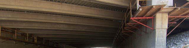
16 Overview Erosion Vs. Sedimentation Example Projects What are some of the problems INDOT and FHWA encountered on a majority of the sites? Good vs. Bad Practices Erosion and Sediment Control Sequencing Construction Activities Expose Soil Grading Excavation Structure Replacements Pavement Replacement New Fill 16


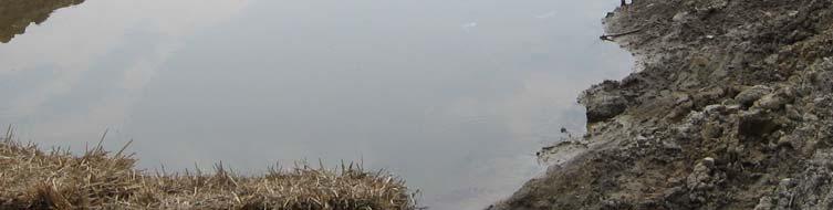
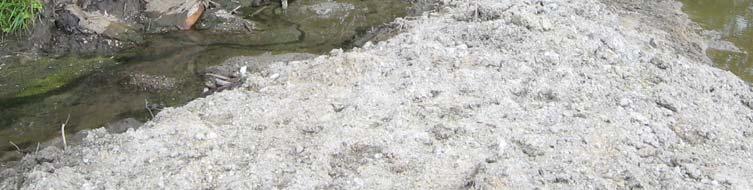
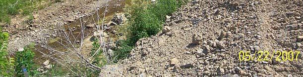
17 Construction Activity Causes Sedimentation Frequency: Common Sediment is the # 1 pollutant in IN waterways (by volume) Construction sites erode at rates 100 x that of Ag land Activity Erosion and subsequent sedimentation is allowed to discharge into streams and wetlands Conclusions Rule 5 violation Potential 404/ 401 violation if it changes the bottom elev. of the stream Examples of Sedimentation 17


18 Examples of Sedimentation More Examples 18
")


19 Where is the stream? What Can INDOT Do? Follow IDEM Rule 5 Notice of Intent (NOI) INDOT Intends to Reduce Erosion Prevent Sedimentation Install Erosion and Sediment Control Measures Maintain Erosion and Sediment Control Measures Permanently Stabilize Soils Post-construction 19
20 Erosion Control VS Sediment Control Reducing Erosion = Reducing Sedimentation Erosion of bare, exposed soil Mulch Cover Reduces Erosion by 90%! Vegetation Reduces Erosion by 97%!!! Increase in Erosion Control Measures on site = Decreased need for Sediment Control Measures Erosion Control Measures Minimize Vegetation Clearing Retain Existing Vegetation Stabilize Exposed Areas ASAP Temporary Seeding within 15 days of Exposure Anchored Mulches Soil Treatments Polyachrylamide (PAM) Permanent Final Seeding/Planting As Designed Rip Rap Placement Erosion Control Blankets and Matting 20
21 Erosion Control Measures (cont.) Others Flumes Temporary Slope Drains Check Dams Temporary Diversion Dikes Diversion Channel Dewatering Temporary Pump Around Coffer Dams Stable Diversion Channel Sediment Control Measures Silt Fence Straw Bale Barrier Sediment Traps Turbidity Curtain Stable Construction ti Entrance De-watering Structures Filter Bag Straw Bale/Silt Fence Pit 21


22 Examples Example Projects Erosion and Sediment Control Measure Recommendations Sequencing Recommendations The Good: Sediment Trap with Stable Outlet to Stream Existing Vegetation The Bad Sediment Trap Size Too Small No Silt Fence Protecting Unvegetated Area No Temporary Seeding of Ditch OR Slopes OR Exposed Soil 22


 These")


23 Notes: Identify Locations Where Sediment Leaves the Project (i.e. this stream) These Areas Should be Protected FIRST with Sediment Control Measures!!! Mi Maintain/Establish i/e blihvegetation to Rd Reduce Erosion The Good? The Bad Re-energized Stream without Stable Banks Finalized Grades, Erosion Control Blanket, Vegetation etc No Erosion or Sediment Control Measures Present! 23


24 The Good? The Bad Re-energized Stream without Stable Banks No Erosion or Sediment Control Measures Present! Already Flow in the Ditch Need Stabilized Ditch Prior to Energizing with Flow 24


25 Dry Retention Basin Stable Channel Flow Path Must be Vegetated PRIOR to Energizing Stormwater Outlet Dry Retention Basin Outlet Straw Bale Barriers won t last once channel is energized Channel must be Vegetated PRIOR to Energizing Stormwater Outlet 25


26 Dry Retention Basin Outlet Outlets into this Stream Which is filling in with Sediment Dry Retention Basin Outlet and Stream Meet Island of Fill Stream is Sediment Laden No channel Worst Case Scenario is Dry Retention Basin is Energized and then all of this sediment goes downstream!!! 26


27 The Good? The Bad Lots of Exposed Soil = Lots of Erosion Potential!!! Temporary Seeding, PAM Tackifier No Erosion or Sediment Control Measures Present! Erosion will Occur on the Exposed Soils Sediment will be Transported Downgrade In this case it will follow this path to the creek crossing Next Slide 27


28 The Good Existing Vegetation Protecting Stream Silt Fence is Doing its Job The Bad All the Sedimentation in the Stream Coming from the Crossing The Good? The Bad No Erosion or Sediment Control Measures 28


29 The Good Temporary Seeding is Providing Erosion Control The Bad? Seeding the Rest of the Slopes? The Good Good Looking Silt Fence! The Bad Good Looking Silt Fence! Looks like it was installed after sedimentation into stream Only on one side of stream Temporary Seeding? 29


30 Lack of Erosion Control Measures Creates Sedimentation Islands! 30
 Lowest in Center Filter Medium")


31 Rock Check Dams for Erosion Control (Slow the Flow) Lowest in Center Filter Medium Geotextile Fabric Toe to Crest The Good Attempt at Reducing Erosion with Check Dams The Bad Too Many Check Dams, Improper Construction, Waste of $$$ Temporary Seeding and/or Mulch would work better! Water Flows Around Dam at this Elevation Shallow Dam Stone above elevation waste of $$$ 31


32 The Good Attempt at Reducing Erosion with Check Dams The Bad Improperly Built Where s the water going? Temporary Seeding and/or Mulch would work better! Check Dams Only Work if They Aren t Run Over! 32


33 Sediment Control Measures Silt Fence Needs to be Maintained Especially where Protecting Wetland and Waters Areas Sediment Control Measures Silt Fence Needs to be Maintained Especially where Protecting Wetland and Waters Areas 33


34 Slit Fence Needs to be Repaired/Replaced Sagging Can See Under the Fence!! Silt Curtain Floats, Tied into Banks, Weighted Anchors on Bottom Protects Sediment from Polluting the Rest of Waterway 34


35 Straw Bale Barrier Sediment Control Measure Recommend Straw Bales Lay on Their Side and Entrenched 4 Temp. or Permanent Seeding and Mulching Negates Need for as many Straw Bale Barriers 35


36 Keep Construction Debris out of the Channel! Temporary Crossings Should have stable approaches Should not effect normal flow path of stream 36


37 Recommended Erosion Control Features Tracking up the Slope Seeding and Anchored Mulch Erosion Control Blanket Temporary Slope Drains 37


38 Stable Construction Entrance Prevent Sediment from Tracking onto Road and into Drains! 38


39 Good Slope Protection! Anchored Erosion Control Mat Rock Chute Vegetation Stabilized Channel Sod, Seed and Mulch 39


40 Erosion Control Blankets or Sod Ideal for Channel until Vegetation Comes in Dewatering INDOT Bridge, Structure Replacements Temporary Pump Around Diversion Channel Dam and Pipe Coffer Dams 40


41 Stream Diversion? Temporary Diversion Channel Should be Stabilized with Fabric, Mats or Plastic Liner 41


42 Stream Diverted into Pipe and Site Dewatered by Pump! Dewatering Pump Outlet Straw Bales and Silt Fence Ideal 42
43 Sequencing Install Perimeter Sediment Control Features First! Protect Areas Where Water Leaves ROW!!! Construction Site Low Spots Usually a Wetland and/or Stream Avoid Clearing Herbaceous Vegetation until Necessary Temporary Seed after 15 days of exposure!!! Install Temporary Diversion Dikes Directs sediment-laden water where YOU want it. Inspect Erosion and Sediment Control Measures Weekly! 43
B805 TEMPORARY EROSION AND SEDIMENT CONTROL MEASURES - OPSS 805
 B805 MEASURES - OPSS 805 805.1 GENERAL Construction activities frequently remove protective cover and expose soil to accelerated rates of erosion. Sediments generated thereby can be conveyed via runoff
APPENDIX B WORKSHEETS & EXHIBITS
 APPENDIX B WORKSHEETS & EXHIBITS A worksheet provides the designer a representation of a measure that allows for input of specific design criteria. The plan designer will be required to assess field conditions
**Temporary Erosion Control**
 Construction operations And methods **Temporary Erosion Control** The test will more than likely just have a basic word problem dealing with Erosion control, if it has anything on the test. So just review,
Culvert and Pipe Phasing
 Culvert and Pipe Phasing Barney Blackburn, PE, CPESC, CPSWQ NCDOT Roadside Environmental Unit Soil & Water Engineering Section Supervisor NCDOT Culvert Phasing Process Hydraulics Unit: Culvert Survey Report
Materials. Use materials meeting the following.
 208.01 Section 208. SOIL EROSION AND SEDIMENTATION CONTROL 208.01 Description. Install and maintain erosion and sedimentation controls to minimize soil erosion and to control sedimentation from affecting
Selected Site BMPs: Why s the Water Muddy? John C. Hayes, Ph.D., P. E. Biosystems Engineering Clemson University
 Selected Site BMPs: Why s the Water Muddy? John C. Hayes, Ph.D., P. E. Biosystems Engineering Clemson University The BMP worked fine until last week when it rained! Turbidity Best Management Practices
Continuing Education Associated with Maintaining CPESC and CESSWI Certification
 Continuing Education Associated with Maintaining CPESC and CESSWI Certification Module 2: Stormwater Management Principles for Earth Disturbing Activities Sponsors: ODOTs Local Technical Assistance Program
Sediment Trap. A temporary runoff containment area, which promotes sedimentation prior to discharge of the runoff through a stabilized spillway.
 Sediment Trap SC-15 Source: Caltrans Construction Site Best Management Practices Manual, 2003. Description A temporary runoff containment area, which promotes sedimentation prior to discharge of the runoff
APPENDIX A: EROSION & SEDIMENT CONTROL FORMS
 APPENDIX A: EROSION & SEDIMENT CONTROL FORMS Croy Engineering # 1580.08 EROSION & SEDIMENT CONTROL FORMS Appendix-1 This page intentionally left blank. Croy Engineering # 1580.08 EROSION & SEDIMENT CONTROL
Stone Outlet Sediment Trap
 3.12 Sediment Control Description: A stone outlet sediment trap is a small detention area formed by placing a stone embankment with an integral stone filter outlet across a drainage swale for the purpose
Woodford County Erosion Prevention Plan and Permit. Application #
 Woodford County Erosion Prevention Plan and Permit Application # Date Instructions: Applicant will complete Parts A and B, and attach a proposed site diagram. This diagram must be completed in accordance
TPDES: Soil, Erosion and Sedimentation Methods
 SAWS TPDES: Soil, Erosion and Sedimentation Methods Philip Handley Supervisor-Resource Protection & Compliance August 25, 2014 TPDES: Soil, Erosion and Sedimentation Methods Soil Common term: Dirt Common
Stormwater Outlet Sediment Traps
 Stormwater Outlet Traps SEDIMENT CONTROL TECHNIQUES Photo 1 Excavated sediment trap just prior to scheduled clean-out (note energy dissipater at end of pipe) Photo 2 A supplementary straw bale barrier
Instream Sediment Control Systems
 Instream Sediment Control Systems INSTREAM PRACTICES Photo 1 Photo 2 Modular sediment The information contained within this series of fact sheets deals only with the design of temporary instream sediment
Specifications Whitcomb Elementary School Demolition January 15, 2016
 SECTION 31 2500 - EROSION CONTROL PART 1 - GENERAL 1.1 RELATED DOCUMENTS: A. The provisions of the Contract Documents apply to the work of this Section. B. The Virginia Erosion and Sediment Control Handbook,
FOR PROJECTS INITIATED AFTER NOVEMBER 1, 2008 ITEM 716 EMBANKMENT EARTH OUTLET SEDIMENT TRAP
 AFTER NOVEMBER 1, 2008 ITEM 716 EMBANKMENT EARTH OUTLET SEDIMENT TRAP 716.1 Description. This work shall consist of furnishing, installing, maintaining, and removing temporary erosion protection and sediment
Type 1 System Sheet Flow Sandy Soils Type 2 System Concentrated Flow Clayey Soils Type 3 System [1] Supplementary Trap Dispersive Soils
![Type 1 System Sheet Flow Sandy Soils Type 2 System Concentrated Flow Clayey Soils Type 3 System [1] Supplementary Trap Dispersive Soils](/thumbs/77/76519623.jpg "Type 1 System Sheet Flow Sandy Soils Type 2 System Concentrated Flow Clayey Soils Type 3 System [1] Supplementary Trap Dispersive Soils") Sediment Weirs SEDIMENT CONTROL TECHNIQUE Type 1 System Sheet Flow Sandy Soils Type 2 System Concentrated Flow Clayey Soils Type 3 System [1] Supplementary Trap Dispersive Soils [1] Type 3 classification
Sediment Weirs SEDIMENT CONTROL TECHNIQUE Type 1 System Sheet Flow Sandy Soils Type 2 System Concentrated Flow Clayey Soils Type 3 System [1] Supplementary Trap Dispersive Soils [1] Type 3 classification
MIDDLESEX COUNTY Department of Planning and Community Development P.O. Box 427, Saluda, VA Phone: Fax:
 MIDDLESEX COUNTY Department of Planning and Community Development P.O. Box 427, Saluda, VA 23149 Phone: 804-758-3382 Fax: 804-758-0061 LAND DISTURBANCE PERMIT SUBMISSION REQUIREMENTS In order to expedite
CONSTRUCTION EXIT SEDIMENT BARRIER
 241428_itizen ield Guide_v3 2/22/06 11:09 M Page 1 (1,1) ONSTRUTION EXIT stone pad located where traffic leaves a construction site to eliminate the transport of soil to public streets. SEDIMENT BRRIER
M. Sloat, AAg., CPESC R.J. Redden, R.P.Bio., A.Sc.T., CPESC. EDI Environmental Dynamics Inc Continental Way Prince George, B.C.
 OVERVIEW OF BEST PRACTICES FOR SURFACE EROSION PROTECTION AND SEDIMENT CONTROL FOR THE DEVELOPMENT PHASE OF SURFACE MINING FOR COAL IN NORTHEAST BRITISH COLUMBIA M. Sloat, AAg., CPESC R.J. Redden, R.P.Bio.,
Sediment Weirs (Instream)
") Sediment Weirs (Instream) INSTREAM PRACTICES Flow Control No Channel Flow Dry Channels Erosion Control Low Channel Flows Shallow Water Sediment Control High Channel Flows [1] Deep Water [1] Sediment weirs
Sediment Weirs (Instream) INSTREAM PRACTICES Flow Control No Channel Flow Dry Channels Erosion Control Low Channel Flows Shallow Water Sediment Control High Channel Flows [1] Deep Water [1] Sediment weirs
U-Shaped Sediment Traps
 U-Shaped Sediment Traps SEDIMENT CONTROL TECHNIQUE Type 1 System Sheet Flow Sandy Soils Type 2 System Concentrated Flow Clayey Soils [1] Type 3 System Supplementary Trap Dispersive Soils [1] Generally
Rock & Aggregate Drop Inlet Protection
 Rock & Aggregate Drop Inlet Protection SEDIMENT CONTROL TECHNIQUE Type 1 System Sheet Flow Sandy Soils Type 2 System [1] Concentrated Flow Clayey Soils Type 3 System Supplementary Trap Dispersive Soils
[1] Performance of the sediment trap depends on the type of outlet structure and the settling pond surface area.
![[1] Performance of the sediment trap depends on the type of outlet structure and the settling pond surface area.](/thumbs/76/74245181.jpg "[1] Performance of the sediment trap depends on the type of outlet structure and the settling pond surface area.") Sediment Trench SEDIMENT CONTROL TECHNIQUE Type 1 System Sheet Flow Sandy Soils Type 2 System [1] Concentrated Flow Clayey Soils Type 3 System [1] Supplementary Trap Dispersive Soils [1] Performance of
Sediment Trench SEDIMENT CONTROL TECHNIQUE Type 1 System Sheet Flow Sandy Soils Type 2 System [1] Concentrated Flow Clayey Soils Type 3 System [1] Supplementary Trap Dispersive Soils [1] Performance of
Sediment Trap. At multiple locations within the project site where sediment control is needed.
 Sediment Trap SE-3 Objectives EC Erosion Control SE Sediment Control TR Tracking Control WE Wind Erosion Control Non-Stormwater NS Management Control Waste Management and WM Materials Pollution Control
Sediment and Erosion Control Techniques on Stream Restoration Projects
 Sediment and Erosion Control Techniques on Stream Restoration Projects D. R. Clinton, G. D. Jennings, R. A. McLaughlin, D. A. Bidelspach 1 ABSTRACT Erosion control, sediment loss and turbidity control
STREUVER FIDELCO CAPPELLI, LLC YONKERS DOWNTOWN DEVELOPMENT PHASE 1. DRAFT ENVIRONMENTAL IMPACT STATEMENT For: PALISADES POINT
 STREUVER FIDELCO CAPPELLI, LLC YONKERS DOWNTOWN DEVELOPMENT PHASE 1 DRAFT ENVIRONMENTAL IMPACT STATEMENT For: PALISADES POINT Prepared by: PAULUS, SOKOLOWSKI & SARTOR STORMWATER MANAGEMENT 1. Methodology
Sediment Control Practices. John Mathews Ohio Dept. of Natural Resources, Division of Soil and Water Resources
 Sediment Control Practices John Mathews Ohio Dept. of Natural Resources, Division of Soil and Water Resources Practices Treat the Largest Soil Particles Sand Sand Silt Clay Treated Untreated Settleable
Template for Sediment and Erosion Control Plan General Instructions. Section Instructions
 Template for Sediment and Erosion Control Plan General Instructions Introduction: Soil erosion and sediment deposition from farmlands can contribute to degraded surface water quality. Sediment delivery
Stormwater Inlet Sediment Traps
 Stormwater Inlet Sediment Traps SEDIMENT CONTROL TECHNIQUES Photo 1 Kerb inlet Photo 2 Field (drop) inlet Table 1 provides the recommended default classification of various sediment control systems suitable
December 11, 2006 File:
 December 11, 2006 File: 15-85-38 Alberta Infrastructure and Transportation Room 301, Provincial Building 9621-96 Avenue Peace River, Alberta T8S 1T4 Attention: Mr. Ed Szmata PEACE REGION (SWAN HILLS AREA)
Suitable Applications Sediment traps should be considered for use:
 Categories EC Erosion Control SE Sediment Control TC Tracking Control WE Wind Erosion Control Non-Stormwater NS Management Control Waste Management and WM Materials Pollution Control Legend: Primary Objective
APPENDIX B DESIGN CRITERIA FOR TEMPORARY WATER QUALITY BMPS USED DURING CONSTRUCTION
 APPENDIX B DESIGN CRITERIA FOR TEMPORARY WATER QUALITY BMPS USED DURING CONSTRUCTION This Appendix presents design criteria and example calculations for the following temporary water quality BMPs for use
Template for Sediment and Erosion Control Plan General Instructions
 Template for Sediment and Erosion Control Plan General Instructions Introduction: Soil erosion and sediment deposition from farmlands can contribute to degraded surface water quality. Sediment delivery
EROSION AND SEDIMENT CONTROL AT CONSTRUCTION SITES GUIDELINES. City of Moncton Engineering and Environmental Services
 EROSION AND SEDIMENT CONTROL AT CONSTRUCTION SITES GUIDELINES City of Moncton Engineering and Environmental Services Revised March 2011 TABLE OF CONTENTS INTRODUCTION... 2 THE EROSION AND SEDIMENT CONTROL
Coarse Sediment Traps
 Coarse Sediment Traps SEDIMENT CONTROL TECHNIQUE Type 1 System Sheet Flow Sandy Soils Type 2 System [1] Concentrated Flow Clayey Soils [2] Type 3 System Supplementary Trap Dispersive Soils [1] Though primarily
Sediment Control Log (SCL)
") Description A sediment control log is a linear roll made of natural materials such as straw, coconut fiber, or other fibrous material trenched into the ground and held with a wooden stake. Sediment control
Description A sediment control log is a linear roll made of natural materials such as straw, coconut fiber, or other fibrous material trenched into the ground and held with a wooden stake. Sediment control
NORTH DAKOTA DEPARTMENT OF TRANSPORTATION SPECIAL PROVISION TEMPORARY EROSION AND SEDIMENT BEST MANAGEMENT PRACTICES
 Page 1 of 5 NORTH DAKOTA DEPARTMENT OF TRANSPORTATION SPECIAL PROVISION TEMPORARY EROSION AND SEDIMENT BEST MANAGEMENT PRACTICES 1. GENERAL Install, maintain and remove appropriate Temporary Best Management
Orica Australia Pty Ltd Ammonium Nitrate Facility Upgrade
 Orica Australia Pty Ltd Ammonium Nitrate Facility Upgrade January 2010 Revision 0 Contents 1. Introduction 1 1.1 Purpose 1 1.2 Objectives 1 1.3 Relevant Environmental Legislation, Guidelines and Policies
Local Conditions-NE Minnesota
 Local Conditions-NE Minnesota Identifying Regional Stormwater Challenges Selecting BMPs for our area Experience & observations from MNDOT & MPCA BMPs that work / don t work in NE Minnesota Local Conditions-NE
Tom Blackman Project Lead. Mékell Mikell Communications Representative
 Sediment Cleanup Middle River Complex, 2016-17 Season 1 Project Photo Tour Updated November 15, 2016 Tom Blackman Project Lead Mékell Mikell Communications Representative 1 Sediment Cleanup - Season 1
 DRAFT DRAFT DRAFT DRAFT DRAFT SEDIMENT CONTROLS Method Application Description BMP Sediment fencing Flat Ground Y Anywhere low flow runoff is Sloping Ground Y Geotextile fabric, buried at the bottom
Chutes Part 5: Rock linings
 Chutes Part 5: Rock linings DRAINAGE CONTROL TECHNIQUE Low Gradient Velocity Control Short-Term Steep Gradient Channel Lining Medium-Long Term Outlet Control [1] Soil Treatment Permanent [2] [1] Chutes
1.0 INSPECTION ANNUAL INSPECTION, JUNE 29, 2011 CARMACKS COPPER PROJECT, CARMACKS, YUKON. Dear Mr. West-Sells,
 Doc. No. 162 Rev. 0 Mr. Paul West-Sells President & Chief Operating Officer Western Copper Corporation 2060-1111 West Georgia Street Vancouver, BC V6E 4M3 ANNUAL INSPECTION, JUNE 29, 2011 CARMACKS COPPER
Standards for Soil Erosion and Sediment Control in New Jersey May 2012
 STANDARD FOR SEDIMENT BASIN Definition A barrier, dam, excavated pit, or dugout constructed across a waterway or at other suitable locations to intercept and retain sediment. Basins created by construction
Countermeasure Calculations and Design
 Countermeasure Calculations and Design Summarized from Bridge Scour and Stream Instability Countermeasures, Experience, Selection, and Design Guidance, Second Edition, Publication No. FHWA NHI 01-003,
FINAL REPORT NO.54. Erosion and Sediment Control Plan - Coastal Reclamation. Tauranga City Council. Private Bag Tauranga 16 August
 J:\Jobs\42066678\6000 Reports\Erosion Management\(Cover).doc FINAL REPORT NO.54 Erosion and Sediment Control Plan - Coastal Reclamation Prepared for Tauranga City Council Private Bag 12022 Tauranga 16
Delaware Bay Dikes Repair and Prevention Project Preliminary Design for New Castle Dikes
 City of New Castle Presentation Delaware Bay Dikes Repair and Prevention Project Preliminary Design for New Castle Dikes New Castle Conservation District DNREC August 22, 2012 Agenda Project Background
Guide to the use of the Erosion and Sediment Control Evaluation Tool
 Guide to the use of the Erosion and Sediment Control Evaluation Tool December 2017 If you require content in an alternate format please contact us at 905-895-1281 or by email at Accessibility@LSRCA.on.ca
Provide sediment tubes for ditch check and Type A inlet structure filter applications that meet the minimum performance requirements of Table 1.
 Supplemental Technical Specification for SEDIMENT TUBES SCDOT Designation: SC-M-815-1 (03/08) 1.0 Sediment Tubes This Supplemental Specification replaces sections 815.1.1.2, 815.2.3, 815.4.5, 815.5, and
Photographic Log. Photo No. 1. Date: 10/27/15. Direction Photo Taken: Southwest. Photo Taken By: JBH1
 1 Southwest 10/27/15 Looking southwest on Copper Park Lane viewing clearing and grubbing of area south of Copper Park Lane prior to excavation. 2 Southeast 10/29/15 Looking southeast at the sump and pump
Rock Sizing for Small Dam Spillways
 Rock Sizing for Small Dam Spillways STORMWATER MANAGEMENT PRACTICES Photo 1 Rock-lined spillway on a construction site sediment basin Photo 2 Rock-lined spillway on a small farm dam 1. Introduction A chute
Instream Erosion Control General
 Instream Erosion Control General EROSION CONTROL TECHNIQUES Revegetation Temperate Climates Short-Term Non Vegetation Wet Tropics Long-Term Weed Control [1] Semi-Arid Zones Permanent [1] Weed control attributes
Rock Sizing for Batter Chutes
 Rock Sizing for Batter Chutes STORMWATER MANAGEMENT PRACTICES Photo 1 Rock-lined batter chute Photo 2 Rock-lined batter chute 1. Introduction In the stormwater industry a chute is a steep drainage channel,
Erosion and Sediment Control Measures 2.7 Silt Fences
 Erosion and Sediment Control Measures Silt fences are designed to intercept sheet flow sediment laden stormwater run-off and filter out both the larger and smaller particles of sediment. Silt fences and
Rock Sizing for Multi-Pipe & Culvert Outlets
 Rock Sizing for Multi-Pipe & Culvert Outlets STORMWATER AND WATERWAY MANAGEMENT PRACTICES Photo 1 Rock pad outlet structure at end of a duel stormwater pipe outlet Photo 2 Rock pad outlet structure at
Construction Exits Rock pads
 Construction Exits Rock pads SEDIMENT CONTROL TECHNIQUE Type 1 System Sheet Flow Sandy Soils Type 2 System Concentrated Flow [1] Clayey Soils Type 3 System Supplementary Trap Dispersive Soils [1] Minor
TENNESSEE EROSION & SEDIMENT CONTROL HANDBOOK
 TENNESSEE EROSION & SEDIMENT CONTROL HANDBOOK A Guide for Protection of State Waters through the use of Best Management Practices during Land Disturbing Activities Second Edition MARCH 2002 TENNESSEE EROSION
Low Gradient Velocity Control Short Term Steep Gradient Channel Lining Medium-Long Term Outlet Control Soil Treatment Permanent [1]
![Low Gradient Velocity Control Short Term Steep Gradient Channel Lining Medium-Long Term Outlet Control Soil Treatment Permanent [1]](/thumbs/87/96478185.jpg "Low Gradient Velocity Control Short Term Steep Gradient Channel Lining Medium-Long Term Outlet Control Soil Treatment Permanent [1]") Rock Linings DRAINAGE CONTROL TECHNIQUE Low Gradient Velocity Control Short Term Steep Gradient Channel Lining Medium-Long Term Outlet Control Soil Treatment Permanent [1] [1] The design of permanent installations
Rock Linings DRAINAGE CONTROL TECHNIQUE Low Gradient Velocity Control Short Term Steep Gradient Channel Lining Medium-Long Term Outlet Control Soil Treatment Permanent [1] [1] The design of permanent installations
Rock Sizing for Waterway & Gully Chutes
 Rock Sizing for Waterway & Gully Chutes WATERWAY MANAGEMENT PRACTICES Photo 1 Rock-lined waterway chute Photo 2 Rock-lined gully chute 1. Introduction A waterway chute is a stabilised section of channel
Vetiver System for Stream Bank Stabilisation. Paul Truong
 Vetiver System for Stream Bank Stabilisation (With special references to the river and canal bank stabilisation in Australia and Vietnam) Paul Truong Director, The Vetiver Network International, Veticon
Best Management Practices for Coldwater Fisheries Enhancement and Restoration
 Best Management Practices for Coldwater Fisheries Enhancement and Restoration MACC Annual Environmental Conference 2017 March 3, 2017 Tim Dexter, MassDOT Highway Division 1 Leading the Nation in Transportation
Degradation Concerns related to Bridge Structures in Alberta
 Degradation Concerns related to Bridge Structures in Alberta Introduction There has been recent discussion regarding the identification and assessment of stream degradation in terms of how it relates to
In-channel coarse sediment trap Best Management Practice
 In-channel coarse sediment trap Best Management Practice By Henry R. Hudson July 2002 Environmental Management Associates Ltd., Christchurch Complexity Environmental Value Cost Low Moderate High Low Moderate
Stream Geomorphology. Leslie A. Morrissey UVM July 25, 2012
 Stream Geomorphology Leslie A. Morrissey UVM July 25, 2012 What Functions do Healthy Streams Provide? Flood mitigation Water supply Water quality Sediment storage and transport Habitat Recreation Transportation
East Branch Grand Calumet River Great Lakes Legacy Act Sediment Remediation and Restoration Project
 East Branch Grand Calumet River Great Lakes Legacy Act Sediment Remediation and Restoration Project Jointly funded by the U.S. EPA Great Lakes Legacy Act, Indiana Department of Environmental Management
X X X X X X X X. Montgomery Associates, Resource Solutions Construction Site Inspection Report/Erosion Control Checklist
 Montgomery Associates, Resource Solutions Construction Site Inspection Report/Erosion Control Checklist Name of Permittee: Rock Koshkonong Lake District (RKLD) Construction Site (Project) Name: Lake Koshkonong
3.11 Floodplains Existing Conditions
 Other stormwater control practices may be needed to mitigate water quality impacts. In addition to detention facilities, other practices such as vegetated basins/buffers, infiltration basins, and bioswales
May 22, Mr. Tim Tyler TRWME Properties, LLC 240 Hwy. 65 N Conway, AR RE: Royal Oaks Vista Subdivision Site. Dear Mr.
 May 22, 2008 Mr. Tim Tyler TRWME Properties, LLC 240 Hwy. 65 N Conway, AR 72032 RE: Royal Oaks Vista Subdivision Site AFIN: 12-00272 NPDES Permit No.: ARR150472 Dear Mr. Tyler: On March 26, 2008, I performed
North Carolina Department of Environment and Natural Resources Division Energy, Mineral, and Land Resources Land Quality Section
 Tracy E. Davis, PE, CPM Director City of Greenville Attention: Scott Godefroy 1500 Beatty Street Greenville, NC 27834 North Carolina Department of Environment and Natural Resources Division Energy, Mineral,
Gully Erosion Part 1 GULLY EROSION AND ITS CAUSES. Introduction. The mechanics of gully erosion
 Gully Erosion Part 1 GULLY EROSION AND ITS CAUSES Gully erosion A complex of processes whereby the removal of soil is characterised by incised channels in the landscape. NSW Soil Conservation Service,
OC Public Works El Niño Storm Preparation 2015
 OC Public Works El Niño Storm Preparation 2015 December 8, 2015 Overview About OC Public Works Storm Preparation Pre-Storm During Storm Post-Storm Storm Preparation Canyon and Burn Areas County Department
Required Documents. Title: Number: AEP Administration 2017 No. 1. Provincial Wetlands and Water Boundaries Section. Effective Date: September 1, 2017
 Title: Number: Program Name: Provincial Wetlands and Water Boundaries Section Effective Date: September 1, 2017 This document was updated on: August 25, 2017 The Provincial Wetlands and Water Boundaries
October 26, Ms. Aimee Zack Canadian Pacific 120 S. Sixth Street Suite 900 Minneapolis, Minnesota 55402
 October 26, 2017 Ms. Aimee Zack Canadian Pacific 120 S. Sixth Street Suite 900 Minneapolis, Minnesota 55402 Re: Soo Line Dump Site 2017 Annual Soil Cover Inspection Dear Aimee: The purpose of this letter
Project (Project No. US-CA-62-2) Maintenance Inspection and Reports (Subtask 14.1) Inspection Report No.2
 Maintenance Inspection and Reports (Subtask 14.1) Inspection Report No.2") MEMORANDUM TO: FROM: Jim Well, Ducks Unlimited Mike Harvey, PhD, PG SUBJECT: M&T/ Llano Seco Fish Screen Project (Project No. US-CA-62-2) Maintenance Inspection and Reports (Subtask 14.1) Inspection Report
MEMORANDUM TO: FROM: Jim Well, Ducks Unlimited Mike Harvey, PhD, PG SUBJECT: M&T/ Llano Seco Fish Screen Project (Project No. US-CA-62-2) Maintenance Inspection and Reports (Subtask 14.1) Inspection Report
UGRC 144 Science and Technology in Our Lives/Geohazards
 UGRC 144 Science and Technology in Our Lives/Geohazards Flood and Flood Hazards Dr. Patrick Asamoah Sakyi Department of Earth Science, UG, Legon College of Education School of Continuing and Distance Education
Snead Pond Restoration
 Snead Pond Restoration Project overview Location: Crewe, VA Date of Project: Summer 2016 Scope of work: Construction of check dam & hydraulic dredging of 530 cubic yards of in situ sediment utilizing geotubes
CCR Rule Annual Inspection Report (cont.) 2
 2") The inspection findings consisted of maintenance items and items that were not observed to be signs or potential signs of significant structural weakness. No deficiencies or disrupting conditions that
The inspection findings consisted of maintenance items and items that were not observed to be signs or potential signs of significant structural weakness. No deficiencies or disrupting conditions that
Rock Sizing for Bank Stabilisation
 Rock Sizing for Bank Stabilisation WATERWAY MANAGEMENT PRACTICES Photo 1 Lower bank rock stabilisation with voids filled with small rocks Photo 2 Rock stabilisation with plants introduced at time of rock
Westmoreland Conservation District Donohoe Center 218 Donohoe Road Greensburg, PA Tech. FAX:
 Westmoreland Conservation District Donohoe Center 218 Donohoe Road Greensburg, PA 15601 724-837-5271 Tech. FAX: 724-837-4127 www.wcdpa.com 0 Typical Best Management Practices TABLE OF CONTENTS Mission,
WELCOME Lake Wabukayne OPEN HOUSE
 WELCOME Lake Wabukayne Sediment Removal Project OPEN HOUSE We are here to: Update you, the community, on recent developments and activities at Lake Wabukayne Present the preferred alternative and receive
Little Swan Lake. Dam Inspection & Siltation Study Prepared By: William Klingner, P.E., CFM October 28, 2018
 Little Swan Lake Dam Inspection & Siltation Study Prepared By: William Klingner, P.E., CFM October 28, 2018 Agenda Little Swan Lake Dam Inspection Theoretical Little Swan Lake Siltation Rate Calculations
Crows Landing Naval Base Easement
 1 of 15 West Stanislaus Resource Conservation District Crows Landing Naval Base Easement Annual Reserve Monitoring Report Jamie McFarlin 11/112012 2 of 15 West Stanislaus Resource Conservation District
Rock Sizing for Drainage Channels
 Rock Sizing for Drainage Channels STORMWATER MANAGEMENT PRACTICES Photo 1 Rock-lined drainage channel Photo 2 Rock-lined catch drain (during construction phase) 1. Introduction Rock size is primarily dependent
SILT FENCE EFFECTIVENESS
 SILT FENCE EFFECTIVENESS Michelle G. Holloway, Department of Earth Sciences, University of South Alabama, Mobile, AL 36688. E-mail: MLG@jaguar1.usouthal.edu. Sediment is the number one pollutant in Dog
NORTHUMBERLAND COUNTY, PA
 QUAKER RUN Stream and Wetland Restoration As-Built Completion Report and First Year Monitoring Data Coal Township NORTHUMBERLAND COUNTY, PA Upstream Before Upstream After Prepared for: COAL TOWNSHIP 805
Fish Passage at Road Crossings
 Fish Passage at Road Crossings 1 Crossing Design Workshop Outline 1:00 to 2:00 Intro, Design Overview, Channel Width 2:00 to 2:15 Break 2:15 to 3:15 No-Slope, Stream Simulation Design 3:15 to 3:30 Break
Soil Erosion and Sediment Control. Basic Principles and Practices
 Soil Erosion and Sediment Control Basic Principles and Practices Acknowledgements The following document was created by Healthy Land and Water with some material sourced from Brisbane City Council, and
1 PROJECT BACKGROUND. August 14, Alberta Transportation Central Region #401, Street Red Deer, Alberta T4N 6K8
 August 14, 2013 Alberta Transportation Central Region #401, 4902 51 Street Red Deer, Alberta T4N 6K8 Mr. Dennis Grace, P.Eng. Construction Engineer Dear Mr. Grace: Central Region Geohazard Assessment 2013
Module 5: Channel and Slope Stability. Channel and Slope Protection. Upslope diversions Channel Protection. Slope Protection
 Massive Streambank Failure at New Outfall in a Suburban Area Module 5: Channel and Slope Stability Robert Pitt Department of Civil, Construction and Environmental Engineering University of Alabama Tuscaloosa,
ARMORED DITCH DEGRADATION AND ISSUES WITH EROSION
 ARMORED DITCH DEGRADATION AND ISSUES WITH EROSION Cody Morris, Department of Earth Sciences, University of South Alabama, Mobile AL, 36688. E- mail: csm805@jagmail.southalabama.edu. When armored ditches
CHAPTER GEOLOGICALLY HAZARDOUS AREAS Applicability Regulations.
 CHAPTER 19.07 GEOLOGICALLY HAZARDOUS AREAS 19.07.010 Applicability. Geologically hazardous areas may pose a threat to the health and safety of citizens when incompatible development is sited in areas of
CR AAO Bridge. Dead River Flood & Natural Channel Design. Mitch Koetje Water Resources Division UP District
 CR AAO Bridge Dead River Flood & Natural Channel Design Mitch Koetje Water Resources Division UP District Old County Road AAO Bridge Map courtesy of Marquette County Silver Lake Basin McClure Basin
Sediment Capture in Pervious Concrete Pavement tsystems: Effects on Hydrological Performance and Suspended Solids
 Concrete Sustainability Conference April 14 th 2010, Tempe, AZ Sediment Capture in Pervious Concrete Pavement tsystems: Effects on Hydrological l Performance and Suspended Solids Discharge Luis A. Mata,
HAW CREEK, PIKE COUNTY, MISSOURI-TRIB TO SALT RIVER ERODING STREAM THREATHENING COUNTY ROAD #107, FOURTEEN FT TALL ERODING BANK WITHIN 4 FT OF THE
 HAW CREEK, PIKE COUNTY, MISSOURI-TRIB TO SALT RIVER ERODING STREAM THREATHENING COUNTY ROAD #107, FOURTEEN FT TALL ERODING BANK WITHIN 4 FT OF THE ROAD, PROJECT CONSTRUCTED IN 1 DAY, MARCH 10, 2009 BY
Flood and Stream Restoration
 2 3 4 Pedestrian bridge under construction 3 CSPs perched on DS side Large area of sand deposition Bottom layer of gabions has been scoured out large bar of gabion stone Gabions slumping bank slope failure
Why Geomorphology for Fish Passage
 Channel Morphology - Stream Crossing Interactions An Overview Michael Love Michael Love & Associates mlove@h2odesigns.com (707) 476-8938 Why Geomorphology for Fish Passage 1. Understand the Scale of the
HISTORY OF CONSTRUCTION FOR EXISTING CCR SURFACE IMPOUNDMENT PLANT GASTON ASH POND 40 CFR (c)(1)(i) (xii)
(1)(i) (xii)") HISTORY OF CONSTRUCTION FOR EXISTING CCR SURFACE IMPOUNDMENT PLANT GASTON ASH POND 40 CFR 257.73(c)(1)(i) (xii) (i) Site Name and Ownership Information: Site Name: E.C. Gaston Steam Plant Site Location:
HISTORY OF CONSTRUCTION FOR EXISTING CCR SURFACE IMPOUNDMENT PLANT GASTON ASH POND 40 CFR 257.73(c)(1)(i) (xii) (i) Site Name and Ownership Information: Site Name: E.C. Gaston Steam Plant Site Location:
1. PROJECT BACKGROUND. July 18, Alberta Infrastructure & Transportation Central Region #401, Street Red Deer, Alberta T4N 6K8
 July 18, 2005 Alberta Infrastructure & Transportation Central Region #401, 4902 51 Street Red Deer, Alberta T4N 6K8 Mr. Alain Momedi, P.Eng. Project Engineer Dear Mr. Momedi: H11:04 km 11.1 Erosion along
January 16, Re: Soo Line Dump Site 2018 Annual Soil Cover Inspection. Dear Mr. Nichols:
 January 16, 2019 Mr. Andrew Nichols Minnesota Pollution Control Agency Voluntary Investigation and Cleanup Program 520 Lafayette Road Saint Paul, Minnesota 55155 Re: Soo Line Dump Site 2018 Annual Soil