Selected Site BMPs: Why s the Water Muddy? John C. Hayes, Ph.D., P. E. Biosystems Engineering Clemson University
|
|
|
- Myron Tyler
- 6 years ago
- Views:
Transcription


1 Selected Site BMPs: Why s the Water Muddy? John C. Hayes, Ph.D., P. E. Biosystems Engineering Clemson University
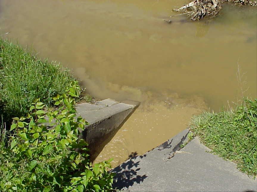
2 The BMP worked fine until last week when it rained!
3 Turbidity
4

5 Best Management Practices or

6 Better Management Practices or

7 Boondoggle Management Practices???
8 WHAT IS A BMP? Structural or Non- Structural Measure that controls runoff, erosion, or sediment
9 EXAMPLES OF STRUCTURAL BMPs Sediment Ponds Silt or Filter Fence Sediment Traps Rock Ditch Checks Vegetative Filter Strips Stormwater Detention Infiltration Zones Etc., etc.
10 EXAMPLES OF NON- STRUCTURAL BMPs Riparian Zones Buffer Strips Phasing/Staging Vegetative Covers Topsoiling Etc., etc.


11 Geologic Erosion
12 Accelerated Erosion
13 EROSION VS SEDIMENT CONTROL EROSION CONTROL Keeps soil from leaving soil matrix SEDIMENT CONTROL Removes sediment from flowing water
14 TYPES OF EROSION
15 Raindrop
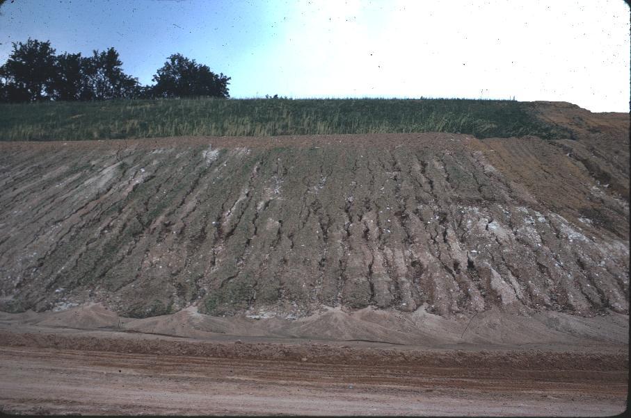
16 Rill

17 Channel /Gully
18 PREDICTING EROSION USLE/RUSLE A = R K LS C P Some things we can control Some things we cannot control
19 Rainfall We cannot control R factor Florence: R = ~250 Clemson: R = ~300 NOT evenly distributed through the year

20 Soil Erodibility We have little control on K factor Silt loam: K = 0.32 Sandy loam: K = 0.24 Loamy fine sand: K = 0.17


21 Length-Slope We have limited control on LS factor 9% slope, 72.6 ft: LS = % slope, 200 ft: LS = % slope, 200 ft: LS = % slope, 200 ft: LS = 11.3

22 Cover Management Undisturbed Forest: C =.001 to.0001

23 Cover Management 0.5 tons/ac straw C = tons/ac straw C= tons/ac woodchips C=0.42

24 Practice Factor 0.3<P<1.0
25 USLE/RUSLE A = R K LS C P
26 EXAMPLE 1 Typical => R = 250 Sandy loam soil => K = 0.24 Slope Length = 300 ft Slope = 5% } Mature Forest => C = Practice Factor => P = 1 => LS = 1.0 A = 0.06 tons/ac-yr
27 EXAMPLE 2 Typical => R = 250 Sandy loam => K = 0.24 Slope Length = 300 ft } => LS = 1.0 Slope = 5% Bare Soil (bulldozed) => C = 1 Practice Factor => P = 1 A = 60 tons/ac-yr
28 Is this obvious? A = 60 tons/ac-yr This is equivalent to about 0.4 in. of depth!
29 EROSION REDUCTION Phasing Scheduling Vegetation, Fabrics and Mulches
30 WHAT CAN WE DO ABOUT IT? or Local Problems and Solutions
31 Storm Water Runoff BMPs Pipe slope drain Runoff diversion measures Temporary stream crossing Construction de-watering 31
32 Pipe Slope Drain Description: Pipe slope drains are used when it is necessary for water to flow down slope without causing erosion, especially before slope has been stabilized or before permanent drainage structures are installed. Pipe slope drains can be temporary or permanent depending on installation and material used. 32
33 33 Pipe Slope Drain

34 Pipe Slope Drain Troubleshooting: 34
35 Runoff Diversion Measures Description 35 Diversion dikes and berms (ridges of compacted soil) are used to divert upslope clean water runoff from crossing areas where there is high risk of erosion. Temporary silt ditches or swales (excavated depressions) are used to prevent sediment laden runoff from leaving site before being treated by sediment control BMP.

36 Runoff Diversion Measures Silt Ditches 36

37 Temporary Stream Crossing Description: A temporary stream crossing is typically a bridge or culvert erected to provide safe and stable way for construction vehicle traffic to cross a running watercourse. Typically only used for DOT projects because they require extra permitting (DHEC and/or Corps of Engineers) 37

38 Construction De-watering Description: 38 Construction de-watering involves removing storm water or ground water from bore pits, trenches and other excavations. Usually this removal of water involves pumping of water to appropriate receiving area such as a sediment basin, sediment trap, or geotextile filter bag.
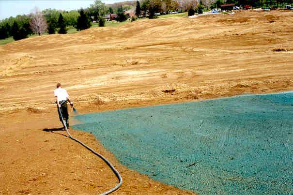
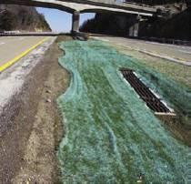
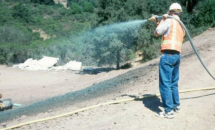
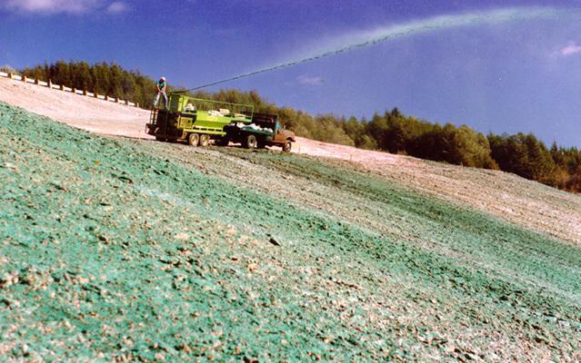
39 Erosion Prevention BMPs Surface Roughening Temporary Stabilization Mulching Erosion Control Blankets (ECBs) Turf Reinforcement Mats (TRMs) 39
40 Erosion Prevention BMPs Final Stabilization Outlet Protection Dust Control Polyacrylamide (PAM) 40

41 Surface Roughening Description: Creation of horizontal depressions, steps or grooves that run parallel to contour of land. Methods include: 41 Tracking Stair-step grading Grooving

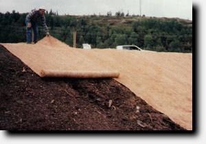
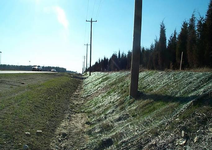
42 Surface Roughening Tracking (Correct Installation) 42
 43")
43 Surface Roughening Tracking (Incorrect Installation) 43
.")
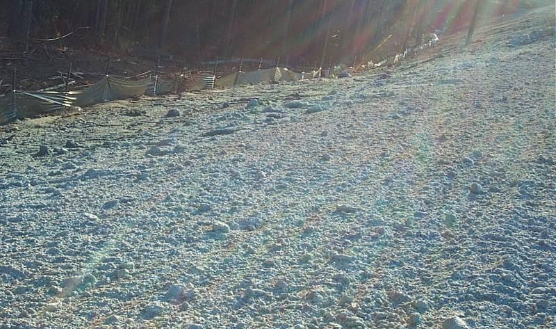
44 Temporary Stabilization Description: Reduce erosion and sedimentation by stabilizing disturbed areas that would otherwise lay bare for long periods of time before they are worked or stabilized. Any disturbed areas that will not be worked for 14 days or more must have temporary cover 44 applied by 14th day (DOT has 7 day requirement).

45 45 Temporary Stabilization

46 Mulching Description: 46 Temporary practice where materials such as grass, hay, wood chips, straw, or compost are placed on exposed or recently planted soil surfaces. Natural woody vegetative material cleared from site can be ground to create usable wood chips that are spread back onto disturbed areas.


47 Mulching Blowing Straw Adding Tackifier 47 Wood Mulch

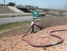
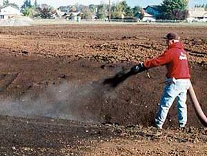
48 Mulching Pneumatic Application of Wood Mulch 48
49 Erosion Control Blankets Description: Erosion Control Blankets (ECBs) are temporary erosion control BMPs that hold seed and soil in place, degrading over time period of approximately 1- to 3-years as vegetation becomes established. 49

50 Turf Reinforcement Mats Description: Turf Reinforcement Mats (TRMs) are permanent erosion control BMPs often used in areas of concentrated flows. Composed of synthetic materials, TRMs provide immediate erosion protection and outstanding long-term 50 erosion resistance.

51 51 ECBs / TRMs

52 52 ECBs / TRMs
53 ECBs / TRMs Troubleshooting: 53

54 Final Stabilization Description: Several methods can be used for final stabilization: Permanent seeding and planting of grasses Permanent planting of ground cover plants Sodding 54
55 Final Stabilization Final stabilization means that all soil disturbing activities at the site have been completed and either of the two following criteria are met: 1. An uniform perennial vegetative cover with a density of 70% of native background vegetative cover has been established on all unpaved areas and areas not covered by permanent structures; or 2. Equivalent permanent stabilization measures (riprap, gabions, or geotextiles) have been employed. 55
56 The Same Coverage? OK OK 70% 70% 56
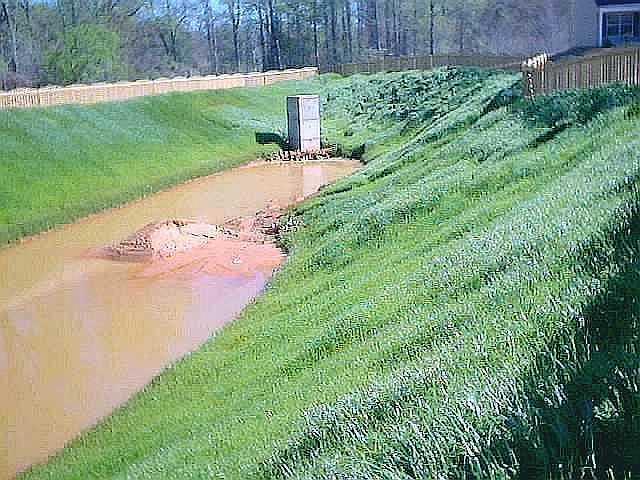
57 57 Final Stabilization
58 Outlet Protection Description: 58 Protects immediate area around pipe and culvert outlets from scour and deterioration by dissipating flow energy. Outlet protection includes TRMs, riprap, grouted riprap, concrete, gabion baskets, or other structural measures.

59 Outlet Protection 59 TRM Outlet Protection Riprap Outlet Protection
60 Dust Control Description: 60 Practices that help reduce surface and air movement of dust from disturbed soil surfaces. Dust control methods include: project phasing, vegetative cover, mulch, sprinkling water, spray-on adhesives, barriers and covers.

61 61 Dust Control
 are used as a")


62 Polyacrylamide (PAM) Description: Anionic polyacrylamides (PAM, or polymers) are used as a non-toxic chemical temporary tackifier for controlling soil erosion and as a flocculant to aid sedimentation. Polymers are available as: Dry/Powder Polyacrylamides Liquid Polyacrylamides Solid/Block Polyacrylamides 62
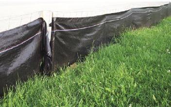
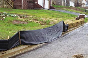
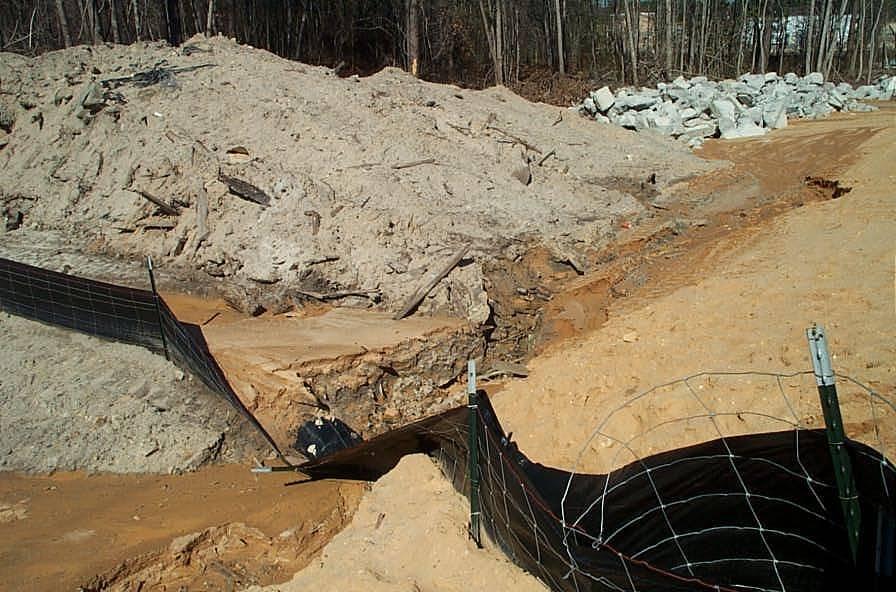
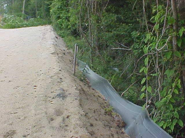
63 63 Polyacrylamide (PAM)
64 Sediment Control BMPs Sediment basin Multi-purpose basin Sediment dam (trap) Silt fence Rock ditch check Sediment tube ditch check 64
65 Sediment Control BMPs Stabilized construction entrance Filter fabric inlet protection Block and gravel inlet protection Hardware fabric and stone inlet protection Pre-fabricated inlet protection 65

66 Sediment Basin Description: A structure designed to capture sediment from storm water runoff before it leaves construction site. Basins should be constructed before any grading takes place within drainage area. 66


67 67 Sediment Basin

68 Troubleshooting: Sediment Basin 68


69 Multipurpose Basin Description: Permanent detention basins designed for use as temporary sediment basins during construction phase of project. 69 During Construction After Construction

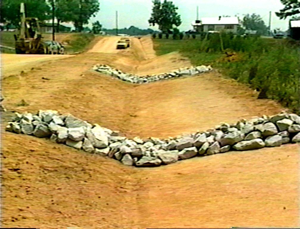
70 Sediment Dam (Trap) Description: Formed by excavating pond or by placing earthen embankment across low area or drainage swale. An outlet or spillway is constructed using No. 5 washed stone and Class B riprap aggregate. 70

")
71 71 Sediment Dam (Trap)

72 Sediment Dam (Trap) Troubleshooting: 72

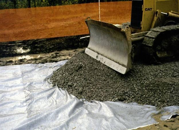
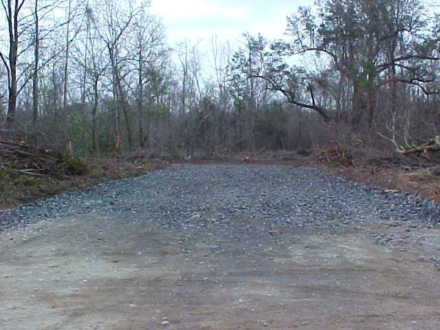
73 Silt Fence Description: 73 Used as temporary perimeter controls around sites where there will be soil disturbance due to construction activities. Consist of posts with geotextile fabric stretched across posts (nonreinforced) preferably with wire support fence (reinforced).
74 Silt Fence 74 Silt Fence with Tie-backs
75 75 Silt Fence
76 Troubleshooting: Silt Fence 76
77 Troubleshooting: Silt Fence 77
78 Troubleshooting: Silt Fence 78
79 Troubleshooting: Silt Fence 79
80 Rock Ditch Check Description: 80 A rock ditch check is a small, temporary or permanent rock fill dam constructed across drainage ditch, swale, or channel to lower speed of concentrated flows. Rock must be placed by hand or mechanical placement (no dumping of rock to form dam) to ensure that center of check is lower than edges.

81 81 Rock Ditch Check

82 Sediment Tube Ditch Check Description: 82 Sediment tubes are elongated tubes of compacted geotextiles, curled excelsior wood, natural coconut fiber or hardwood mulch. Sediment tubes may be installed in drainage conveyance swales as ditch checks to help reduce effects soil erosion and retain sediment.


83 83 Sediment Tube Ditch Check
84 Stabilized Construction Entrance Description: 84 A stabilized construction entrance is temporary stonestabilized pad located at points of vehicular ingress and egress on construction site to reduce amount of mud, dirt, and rocks transported onto public roads by motor vehicles equipment and runoff.
85 Stabilized Construction Entrance 85
 with low velocities and where inlet drains relatively flat area (slopes no greater than 5%).")
86 Filter Fabric Inlet Protection Description: Filter fabric is used for inlet protection for small storm water flows (0.5 cfs or less) with low velocities and where inlet drains relatively flat area (slopes no greater than 5%). This practice should not be used where inlets are paved or where inlets receive concentrated flows such as in streets or highway medians. 86

87 87 Filter Fabric Inlet Protection

88 Filter Fabric Inlet Protection Troubleshooting: 88

89 Filter Fabric Inlet Protection Troubleshooting: 89
90 Block and Gravel Inlet Protection Description: Block and gravel filters can be used where heavy flows and higher velocities are expected and where overflow capacity is necessary to prevent excessive ponding around structure. 90

91 Block and Gravel Inlet Protection 91
92 Block and Gravel Inlet Protection 92

93 Hardware Fabric and Stone Inlet Protection Description: 93 Supported wire material with filter stone can be used where concentrated flows may be expected. Wire mesh and gravel protection is used when flows exceed 0.5 cfs and when construction traffic will occur over inlet.

94 Pre-Fabricated Inlet Protection Description: Structures designed to keep silt, sediment and construction debris from entering pipe systems through open inlet structures. 94


95 Pre-Fabricated Inlet Protection Installation: Weighted Sediment Tubes -Install lying flat on ground. 95

96 Pre-Fabricated Inlet Protection Installation: Rigid Inlet Filters - Installed to ensure BMP completely encloses inlet. 96
97


98
**Temporary Erosion Control**
 Construction operations And methods **Temporary Erosion Control** The test will more than likely just have a basic word problem dealing with Erosion control, if it has anything on the test. So just review,
APPENDIX B WORKSHEETS & EXHIBITS
 APPENDIX B WORKSHEETS & EXHIBITS A worksheet provides the designer a representation of a measure that allows for input of specific design criteria. The plan designer will be required to assess field conditions
APPENDIX B DESIGN CRITERIA FOR TEMPORARY WATER QUALITY BMPS USED DURING CONSTRUCTION
 APPENDIX B DESIGN CRITERIA FOR TEMPORARY WATER QUALITY BMPS USED DURING CONSTRUCTION This Appendix presents design criteria and example calculations for the following temporary water quality BMPs for use
Materials. Use materials meeting the following.
 208.01 Section 208. SOIL EROSION AND SEDIMENTATION CONTROL 208.01 Description. Install and maintain erosion and sedimentation controls to minimize soil erosion and to control sedimentation from affecting
TPDES: Soil, Erosion and Sedimentation Methods
 SAWS TPDES: Soil, Erosion and Sedimentation Methods Philip Handley Supervisor-Resource Protection & Compliance August 25, 2014 TPDES: Soil, Erosion and Sedimentation Methods Soil Common term: Dirt Common
B805 TEMPORARY EROSION AND SEDIMENT CONTROL MEASURES - OPSS 805
 B805 MEASURES - OPSS 805 805.1 GENERAL Construction activities frequently remove protective cover and expose soil to accelerated rates of erosion. Sediments generated thereby can be conveyed via runoff
Continuing Education Associated with Maintaining CPESC and CESSWI Certification
 Continuing Education Associated with Maintaining CPESC and CESSWI Certification Module 2: Stormwater Management Principles for Earth Disturbing Activities Sponsors: ODOTs Local Technical Assistance Program
Stone Outlet Sediment Trap
 3.12 Sediment Control Description: A stone outlet sediment trap is a small detention area formed by placing a stone embankment with an integral stone filter outlet across a drainage swale for the purpose
CONSTRUCTION EXIT SEDIMENT BARRIER
 241428_itizen ield Guide_v3 2/22/06 11:09 M Page 1 (1,1) ONSTRUTION EXIT stone pad located where traffic leaves a construction site to eliminate the transport of soil to public streets. SEDIMENT BRRIER
Culvert and Pipe Phasing
 Culvert and Pipe Phasing Barney Blackburn, PE, CPESC, CPSWQ NCDOT Roadside Environmental Unit Soil & Water Engineering Section Supervisor NCDOT Culvert Phasing Process Hydraulics Unit: Culvert Survey Report
Agenda. INDOT Office of Environmental Services. Describe Results of FHWA QAR. Landscape and Waterway Permitting Unit. Interviews Site Inspections
 Nathan Saxe Administrator, Ecology and Waterway Permitting Section Back to Basics: Erosion and Sediment Control FHWA INDOT Quality Assurance Review (QAR) Results 1 Agenda INDOT Office of Environmental
What Is Water Erosion? Aren t they the same thing? What Is Sediment? What Is Sedimentation? How can Sediment Yields be Minimized?
 Jerald S. Fifield, Ph.D. CISEC HydroDynamics Incorporated Parker, CO 303-841-0377 Aren t they the same thing? What Is Sediment? Soil particles deposited or suspended in water or air The process of depositing
Sediment Trap. A temporary runoff containment area, which promotes sedimentation prior to discharge of the runoff through a stabilized spillway.
 Sediment Trap SC-15 Source: Caltrans Construction Site Best Management Practices Manual, 2003. Description A temporary runoff containment area, which promotes sedimentation prior to discharge of the runoff
EROSION AND SEDIMENT CONTROL AT CONSTRUCTION SITES GUIDELINES. City of Moncton Engineering and Environmental Services
 EROSION AND SEDIMENT CONTROL AT CONSTRUCTION SITES GUIDELINES City of Moncton Engineering and Environmental Services Revised March 2011 TABLE OF CONTENTS INTRODUCTION... 2 THE EROSION AND SEDIMENT CONTROL
 DRAFT DRAFT DRAFT DRAFT DRAFT SEDIMENT CONTROLS Method Application Description BMP Sediment fencing Flat Ground Y Anywhere low flow runoff is Sloping Ground Y Geotextile fabric, buried at the bottom
Rock & Aggregate Drop Inlet Protection
 Rock & Aggregate Drop Inlet Protection SEDIMENT CONTROL TECHNIQUE Type 1 System Sheet Flow Sandy Soils Type 2 System [1] Concentrated Flow Clayey Soils Type 3 System Supplementary Trap Dispersive Soils
Erosion and Sediment Control Measures 2.7 Silt Fences
 Erosion and Sediment Control Measures Silt fences are designed to intercept sheet flow sediment laden stormwater run-off and filter out both the larger and smaller particles of sediment. Silt fences and
Stormwater Inlet Sediment Traps
 Stormwater Inlet Sediment Traps SEDIMENT CONTROL TECHNIQUES Photo 1 Kerb inlet Photo 2 Field (drop) inlet Table 1 provides the recommended default classification of various sediment control systems suitable
Specifications Whitcomb Elementary School Demolition January 15, 2016
 SECTION 31 2500 - EROSION CONTROL PART 1 - GENERAL 1.1 RELATED DOCUMENTS: A. The provisions of the Contract Documents apply to the work of this Section. B. The Virginia Erosion and Sediment Control Handbook,
Coarse Sediment Traps
 Coarse Sediment Traps SEDIMENT CONTROL TECHNIQUE Type 1 System Sheet Flow Sandy Soils Type 2 System [1] Concentrated Flow Clayey Soils [2] Type 3 System Supplementary Trap Dispersive Soils [1] Though primarily
[1] Performance of the sediment trap depends on the type of outlet structure and the settling pond surface area.
![[1] Performance of the sediment trap depends on the type of outlet structure and the settling pond surface area.](/thumbs/76/74245181.jpg "[1] Performance of the sediment trap depends on the type of outlet structure and the settling pond surface area.") Sediment Trench SEDIMENT CONTROL TECHNIQUE Type 1 System Sheet Flow Sandy Soils Type 2 System [1] Concentrated Flow Clayey Soils Type 3 System [1] Supplementary Trap Dispersive Soils [1] Performance of
Sediment Trench SEDIMENT CONTROL TECHNIQUE Type 1 System Sheet Flow Sandy Soils Type 2 System [1] Concentrated Flow Clayey Soils Type 3 System [1] Supplementary Trap Dispersive Soils [1] Performance of
Sediment Control Practices. John Mathews Ohio Dept. of Natural Resources, Division of Soil and Water Resources
 Sediment Control Practices John Mathews Ohio Dept. of Natural Resources, Division of Soil and Water Resources Practices Treat the Largest Soil Particles Sand Sand Silt Clay Treated Untreated Settleable
STREUVER FIDELCO CAPPELLI, LLC YONKERS DOWNTOWN DEVELOPMENT PHASE 1. DRAFT ENVIRONMENTAL IMPACT STATEMENT For: PALISADES POINT
 STREUVER FIDELCO CAPPELLI, LLC YONKERS DOWNTOWN DEVELOPMENT PHASE 1 DRAFT ENVIRONMENTAL IMPACT STATEMENT For: PALISADES POINT Prepared by: PAULUS, SOKOLOWSKI & SARTOR STORMWATER MANAGEMENT 1. Methodology
Type 1 System Sheet Flow Sandy Soils Type 2 System Concentrated Flow Clayey Soils Type 3 System [1] Supplementary Trap Dispersive Soils
![Type 1 System Sheet Flow Sandy Soils Type 2 System Concentrated Flow Clayey Soils Type 3 System [1] Supplementary Trap Dispersive Soils](/thumbs/77/76519623.jpg "Type 1 System Sheet Flow Sandy Soils Type 2 System Concentrated Flow Clayey Soils Type 3 System [1] Supplementary Trap Dispersive Soils") Sediment Weirs SEDIMENT CONTROL TECHNIQUE Type 1 System Sheet Flow Sandy Soils Type 2 System Concentrated Flow Clayey Soils Type 3 System [1] Supplementary Trap Dispersive Soils [1] Type 3 classification
Sediment Weirs SEDIMENT CONTROL TECHNIQUE Type 1 System Sheet Flow Sandy Soils Type 2 System Concentrated Flow Clayey Soils Type 3 System [1] Supplementary Trap Dispersive Soils [1] Type 3 classification
Sediment Trap. At multiple locations within the project site where sediment control is needed.
 Sediment Trap SE-3 Objectives EC Erosion Control SE Sediment Control TR Tracking Control WE Wind Erosion Control Non-Stormwater NS Management Control Waste Management and WM Materials Pollution Control
Sediment and Erosion Control Techniques on Stream Restoration Projects
 Sediment and Erosion Control Techniques on Stream Restoration Projects D. R. Clinton, G. D. Jennings, R. A. McLaughlin, D. A. Bidelspach 1 ABSTRACT Erosion control, sediment loss and turbidity control
Construction Exits Rock pads
 Construction Exits Rock pads SEDIMENT CONTROL TECHNIQUE Type 1 System Sheet Flow Sandy Soils Type 2 System Concentrated Flow [1] Clayey Soils Type 3 System Supplementary Trap Dispersive Soils [1] Minor
Erosion and Sedimentation Basics
 Erosion and Sedimentation Basics Coastal San Luis Resource Conservation District G.W. Bates, PE, CPESC Outline: 1. Terms & Concepts 2. Causes of Erosion 3. The Erosion/Sedimentation Process 4. Erosion
APPENDIX A: EROSION & SEDIMENT CONTROL FORMS
 APPENDIX A: EROSION & SEDIMENT CONTROL FORMS Croy Engineering # 1580.08 EROSION & SEDIMENT CONTROL FORMS Appendix-1 This page intentionally left blank. Croy Engineering # 1580.08 EROSION & SEDIMENT CONTROL
Stormwater Outlet Sediment Traps
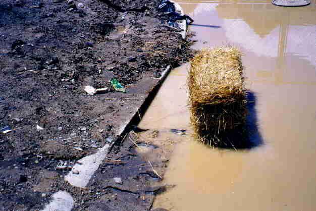
 Stormwater Outlet Traps SEDIMENT CONTROL TECHNIQUES Photo 1 Excavated sediment trap just prior to scheduled clean-out (note energy dissipater at end of pipe) Photo 2 A supplementary straw bale barrier
Suitable Applications Sediment traps should be considered for use:
 Categories EC Erosion Control SE Sediment Control TC Tracking Control WE Wind Erosion Control Non-Stormwater NS Management Control Waste Management and WM Materials Pollution Control Legend: Primary Objective
APPENDIX G APPENDIX G SEDIMENT CONTAINMENT SYSTEM DESIGN RATIONALE
 APPENDIX G SEDIMENT CONTAINMENT SYSTEM DESIGN RATIONALE March 18, 2003 This page left blank intentionally. March 18, 2003 G-2 FIGURES Page # Figure G.1 Estimated Runoff from Precipitation Over Different
Provide sediment tubes for ditch check and Type A inlet structure filter applications that meet the minimum performance requirements of Table 1.
 Supplemental Technical Specification for SEDIMENT TUBES SCDOT Designation: SC-M-815-1 (03/08) 1.0 Sediment Tubes This Supplemental Specification replaces sections 815.1.1.2, 815.2.3, 815.4.5, 815.5, and
Instream Sediment Control Systems
 Instream Sediment Control Systems INSTREAM PRACTICES Photo 1 Photo 2 Modular sediment The information contained within this series of fact sheets deals only with the design of temporary instream sediment
Template for Sediment and Erosion Control Plan General Instructions. Section Instructions
 Template for Sediment and Erosion Control Plan General Instructions Introduction: Soil erosion and sediment deposition from farmlands can contribute to degraded surface water quality. Sediment delivery
Local Conditions-NE Minnesota
 Local Conditions-NE Minnesota Identifying Regional Stormwater Challenges Selecting BMPs for our area Experience & observations from MNDOT & MPCA BMPs that work / don t work in NE Minnesota Local Conditions-NE
Sediment Weirs (Instream)
") Sediment Weirs (Instream) INSTREAM PRACTICES Flow Control No Channel Flow Dry Channels Erosion Control Low Channel Flows Shallow Water Sediment Control High Channel Flows [1] Deep Water [1] Sediment weirs
Sediment Weirs (Instream) INSTREAM PRACTICES Flow Control No Channel Flow Dry Channels Erosion Control Low Channel Flows Shallow Water Sediment Control High Channel Flows [1] Deep Water [1] Sediment weirs
TENNESSEE EROSION & SEDIMENT CONTROL HANDBOOK
 TENNESSEE EROSION & SEDIMENT CONTROL HANDBOOK A Guide for Protection of State Waters through the use of Best Management Practices during Land Disturbing Activities Second Edition MARCH 2002 TENNESSEE EROSION
M. Sloat, AAg., CPESC R.J. Redden, R.P.Bio., A.Sc.T., CPESC. EDI Environmental Dynamics Inc Continental Way Prince George, B.C.
 OVERVIEW OF BEST PRACTICES FOR SURFACE EROSION PROTECTION AND SEDIMENT CONTROL FOR THE DEVELOPMENT PHASE OF SURFACE MINING FOR COAL IN NORTHEAST BRITISH COLUMBIA M. Sloat, AAg., CPESC R.J. Redden, R.P.Bio.,
MIDDLESEX COUNTY Department of Planning and Community Development P.O. Box 427, Saluda, VA Phone: Fax:
 MIDDLESEX COUNTY Department of Planning and Community Development P.O. Box 427, Saluda, VA 23149 Phone: 804-758-3382 Fax: 804-758-0061 LAND DISTURBANCE PERMIT SUBMISSION REQUIREMENTS In order to expedite
Template for Sediment and Erosion Control Plan General Instructions
 Template for Sediment and Erosion Control Plan General Instructions Introduction: Soil erosion and sediment deposition from farmlands can contribute to degraded surface water quality. Sediment delivery
Module 5: Channel and Slope Stability. Channel and Slope Protection. Upslope diversions Channel Protection. Slope Protection
 Massive Streambank Failure at New Outfall in a Suburban Area Module 5: Channel and Slope Stability Robert Pitt Department of Civil, Construction and Environmental Engineering University of Alabama Tuscaloosa,
Standards for Soil Erosion and Sediment Control in New Jersey May 2012
 STANDARD FOR SEDIMENT BASIN Definition A barrier, dam, excavated pit, or dugout constructed across a waterway or at other suitable locations to intercept and retain sediment. Basins created by construction
Sediment Control Log (SCL)
") Description A sediment control log is a linear roll made of natural materials such as straw, coconut fiber, or other fibrous material trenched into the ground and held with a wooden stake. Sediment control
Description A sediment control log is a linear roll made of natural materials such as straw, coconut fiber, or other fibrous material trenched into the ground and held with a wooden stake. Sediment control
December 11, 2006 File:
 December 11, 2006 File: 15-85-38 Alberta Infrastructure and Transportation Room 301, Provincial Building 9621-96 Avenue Peace River, Alberta T8S 1T4 Attention: Mr. Ed Szmata PEACE REGION (SWAN HILLS AREA)
U-Shaped Sediment Traps
 U-Shaped Sediment Traps SEDIMENT CONTROL TECHNIQUE Type 1 System Sheet Flow Sandy Soils Type 2 System Concentrated Flow Clayey Soils [1] Type 3 System Supplementary Trap Dispersive Soils [1] Generally
Module 5: Channel and Slope Protection Example Assignments
 Module 5: Channel and Slope Protection Example Assignments A) Example Project Assignment on Slope and Swale Design North America Green Software Example (Erosion Control Materials Design Software) The following
ONE ROCK DAM ORD. capture more sediment. The original ORD becomes the splash apron for the new layer. STEP 4: When ORD fills in, add a new layer
 ONE ROCK DAM ORD A low grade control structure built with a single layer of rock on the bed of the channel. ORDs stabilize the bed of the channel by slowing the flow of water, increasing roughness, recruiting
Instream Erosion Control General
 Instream Erosion Control General EROSION CONTROL TECHNIQUES Revegetation Temperate Climates Short-Term Non Vegetation Wet Tropics Long-Term Weed Control [1] Semi-Arid Zones Permanent [1] Weed control attributes
Chutes Part 5: Rock linings
 Chutes Part 5: Rock linings DRAINAGE CONTROL TECHNIQUE Low Gradient Velocity Control Short-Term Steep Gradient Channel Lining Medium-Long Term Outlet Control [1] Soil Treatment Permanent [2] [1] Chutes
5. ROADSIDE AND MEDIAN CHANNELS
 5. ROADSIDE AND MEDIAN CHANNELS Roadside and median channels are open-channel systems which collect and convey stormwater from the pavement surface, roadside, and median areas. These channels may outlet
20217 CLEAR STONE TON $14.20 $5, $ $ $ %
 ACCOUNT NO: 10332-84-174-84300: 54250(91223) ACCOUNT NO: 10529-403-172: 54440 (91226) ACCOUNT NO: 10463-51-130: 54250 (91223) ACCOUNT NO: 10332-84-174-84300: 54250 (91223) 20217 CLEAR STONE 375.00 TON
Construction Exits Vibration grids
 Construction Exits Vibration grids SEDIMENT CONTROL TECHNIQUE Type 1 System Sheet Flow Sandy Soils Type 2 System Concentrated Flow Clayey Soils [1] Type 3 System Supplementary Trap Dispersive Soils [1]
Westmoreland Conservation District Donohoe Center 218 Donohoe Road Greensburg, PA Tech. FAX:
 Westmoreland Conservation District Donohoe Center 218 Donohoe Road Greensburg, PA 15601 724-837-5271 Tech. FAX: 724-837-4127 www.wcdpa.com 0 Typical Best Management Practices TABLE OF CONTENTS Mission,
Photographic Log. Photo No. 1. Date: 10/27/15. Direction Photo Taken: Southwest. Photo Taken By: JBH1
 1 Southwest 10/27/15 Looking southwest on Copper Park Lane viewing clearing and grubbing of area south of Copper Park Lane prior to excavation. 2 Southeast 10/29/15 Looking southeast at the sump and pump
Black Gore Creek 2013 Sediment Source Monitoring and TMDL Sediment Budget
 Black Gore Creek 2013 Sediment Source Monitoring and TMDL Sediment Budget Prepared for: Prepared By: - I. Introduction The Black Gore Creek Total Maximum Daily Load (TMDL) was developed in collaboration
Acronyms. Section 10. Acronyms, Glossary and Bibliography. Following is a list of acronyms used in this Manual:
 Acronyms Following is a list of acronyms used in this Manual: APEN Air Pollutant Emission Notice ASTM American Society of Testing Materials BMP Best Management Practice CB Compost Blanket CD Check Dam
Low Gradient Velocity Control Short Term Steep Gradient Channel Lining Medium-Long Term Outlet Control Soil Treatment Permanent [1]
![Low Gradient Velocity Control Short Term Steep Gradient Channel Lining Medium-Long Term Outlet Control Soil Treatment Permanent [1]](/thumbs/87/96478185.jpg "Low Gradient Velocity Control Short Term Steep Gradient Channel Lining Medium-Long Term Outlet Control Soil Treatment Permanent [1]") Rock Linings DRAINAGE CONTROL TECHNIQUE Low Gradient Velocity Control Short Term Steep Gradient Channel Lining Medium-Long Term Outlet Control Soil Treatment Permanent [1] [1] The design of permanent installations
Rock Linings DRAINAGE CONTROL TECHNIQUE Low Gradient Velocity Control Short Term Steep Gradient Channel Lining Medium-Long Term Outlet Control Soil Treatment Permanent [1] [1] The design of permanent installations
Track design and management
 1 Track design and management Peter Fogarty, Certified Professional Soil Scientist NSW Soil Knowledge Network Cooma, June 18, 2018 Acknowledgements Antia Brademann, Cooma Waterwatch, Organiser Jo Powells,
20217 CLEAR STONE TON $14.20 $5, $ $ $ %
 ACCOUNT NO: 10332-84-174-84300: 54250(91223) ACCOUNT NO: 10529-403-172: 54440 (91226) ACCOUNT NO: 10463-51-130: 54250 (91223) ACCOUNT NO: 10332-84-174-84300: 54250 (91223) 20217 CLEAR STONE 375.00 TON
1.0 INSPECTION ANNUAL INSPECTION, JUNE 29, 2011 CARMACKS COPPER PROJECT, CARMACKS, YUKON. Dear Mr. West-Sells,
 Doc. No. 162 Rev. 0 Mr. Paul West-Sells President & Chief Operating Officer Western Copper Corporation 2060-1111 West Georgia Street Vancouver, BC V6E 4M3 ANNUAL INSPECTION, JUNE 29, 2011 CARMACKS COPPER
Chapter Introduction EROSION AND SEDIMENT CONTROL. Erosion
 Chapter 8. EROSION AND SEDIMENT CONTROL 8.1. Introduction Natural erosion has been occurring since the earth was formed. This process, which generally occurs at a relatively slow rate, has shaped and molded
FOR PROJECTS INITIATED AFTER NOVEMBER 1, 2008 ITEM 716 EMBANKMENT EARTH OUTLET SEDIMENT TRAP
 AFTER NOVEMBER 1, 2008 ITEM 716 EMBANKMENT EARTH OUTLET SEDIMENT TRAP 716.1 Description. This work shall consist of furnishing, installing, maintaining, and removing temporary erosion protection and sediment
Gully Erosion Part 1 GULLY EROSION AND ITS CAUSES. Introduction. The mechanics of gully erosion
 Gully Erosion Part 1 GULLY EROSION AND ITS CAUSES Gully erosion A complex of processes whereby the removal of soil is characterised by incised channels in the landscape. NSW Soil Conservation Service,
Orica Australia Pty Ltd Ammonium Nitrate Facility Upgrade
 Orica Australia Pty Ltd Ammonium Nitrate Facility Upgrade January 2010 Revision 0 Contents 1. Introduction 1 1.1 Purpose 1 1.2 Objectives 1 1.3 Relevant Environmental Legislation, Guidelines and Policies
INFLOW DESIGN FLOOD CONTROL SYSTEM PLAN 40 C.F.R. PART PLANT YATES ASH POND 2 (AP-2) GEORGIA POWER COMPANY
 GEORGIA POWER COMPANY") INFLOW DESIGN FLOOD CONTROL SYSTEM PLAN 40 C.F.R. PART 257.82 PLANT YATES ASH POND 2 (AP-2) GEORGIA POWER COMPANY EPA s Disposal of Coal Combustion Residuals from Electric Utilities Final Rule (40 C.F.R.
INFLOW DESIGN FLOOD CONTROL SYSTEM PLAN 40 C.F.R. PART 257.82 PLANT YATES ASH POND 2 (AP-2) GEORGIA POWER COMPANY EPA s Disposal of Coal Combustion Residuals from Electric Utilities Final Rule (40 C.F.R.
Long Valley Meadow Restoration Project
 Long Valley Meadow Restoration Project USDA Forest Service Mogollon Rim Ranger District Coconino National Forest Coconino County, Arizona T13N, R9E, Section 12 and T13N, R10E, Sections 6 and 7 Gila and
Stormwater Guidelines and Case Studies. CAHILL ASSOCIATES Environmental Consultants West Chester, PA (610)
") Stormwater Guidelines and Case Studies CAHILL ASSOCIATES Environmental Consultants West Chester, PA (610) 696-4150 www.thcahill.com Goals and Challenges for Manual State Stormwater Policy More Widespread
Stormwater Guidelines and Case Studies CAHILL ASSOCIATES Environmental Consultants West Chester, PA (610) 696-4150 www.thcahill.com Goals and Challenges for Manual State Stormwater Policy More Widespread
CCR Rule Annual Inspection Report (cont.) 2
 2") The inspection findings consisted of maintenance items and items that were not observed to be signs or potential signs of significant structural weakness. No deficiencies or disrupting conditions that
The inspection findings consisted of maintenance items and items that were not observed to be signs or potential signs of significant structural weakness. No deficiencies or disrupting conditions that
Rock Sizing for Batter Chutes
 Rock Sizing for Batter Chutes STORMWATER MANAGEMENT PRACTICES Photo 1 Rock-lined batter chute Photo 2 Rock-lined batter chute 1. Introduction In the stormwater industry a chute is a steep drainage channel,
Sediment Capture in Pervious Concrete Pavement tsystems: Effects on Hydrological Performance and Suspended Solids
 Concrete Sustainability Conference April 14 th 2010, Tempe, AZ Sediment Capture in Pervious Concrete Pavement tsystems: Effects on Hydrological l Performance and Suspended Solids Discharge Luis A. Mata,
Bachelor of Biosystems Technology Faculty of Technology South Eastern University of Sri Lanka
 Bachelor of Biosystems Technology Faculty of Technology South Eastern University of Sri Lanka BSE 11042 Principles of Irrigation Furrow Irrigation Running water in small channels (furrows) Water infiltration
In-channel coarse sediment trap Best Management Practice
 In-channel coarse sediment trap Best Management Practice By Henry R. Hudson July 2002 Environmental Management Associates Ltd., Christchurch Complexity Environmental Value Cost Low Moderate High Low Moderate
Crows Landing Naval Base Easement
 1 of 15 West Stanislaus Resource Conservation District Crows Landing Naval Base Easement Annual Reserve Monitoring Report Jamie McFarlin 11/112012 2 of 15 West Stanislaus Resource Conservation District
STRUCTURAL STABILITY ASSESSMENT
 STRUCTURAL STABILITY ASSESSMENT CFR 257.73(d) Bottom Ash Pond Complex Cardinal Plant Brilliant, Ohio October, 2016 Prepared for: Cardinal Operating Company Cardinal Plant Brilliant, Ohio Prepared by: Geotechnical
Soil Erosion and Sediment Control. Basic Principles and Practices
 Soil Erosion and Sediment Control Basic Principles and Practices Acknowledgements The following document was created by Healthy Land and Water with some material sourced from Brisbane City Council, and
EROSION CONTROL FIELD GUIDE By Craig Sponholtz & Avery C. Anderson
 WORKING WITH NATURE TO HEAL EROSION Soil loss caused by flowing water diminishes the fertility, productivity and healing capacity of the land. This guide was created to empower landowners and managers
Countermeasure Calculations and Design
 Countermeasure Calculations and Design Summarized from Bridge Scour and Stream Instability Countermeasures, Experience, Selection, and Design Guidance, Second Edition, Publication No. FHWA NHI 01-003,
Rock Sizing for Small Dam Spillways
 Rock Sizing for Small Dam Spillways STORMWATER MANAGEMENT PRACTICES Photo 1 Rock-lined spillway on a construction site sediment basin Photo 2 Rock-lined spillway on a small farm dam 1. Introduction A chute
Module 4: Overview of the Fundamentals of Runoff and Erosion
 Module 4: Overview of the Fundamentals of Runoff and Erosion Module 4a Goal Once we can better understand the forces which cause erosion and runoff, only then can we begin to minimize the negative results.
Best Management Practices for Coldwater Fisheries Enhancement and Restoration
 Best Management Practices for Coldwater Fisheries Enhancement and Restoration MACC Annual Environmental Conference 2017 March 3, 2017 Tim Dexter, MassDOT Highway Division 1 Leading the Nation in Transportation
X X X X X X X X. Montgomery Associates, Resource Solutions Construction Site Inspection Report/Erosion Control Checklist
 Montgomery Associates, Resource Solutions Construction Site Inspection Report/Erosion Control Checklist Name of Permittee: Rock Koshkonong Lake District (RKLD) Construction Site (Project) Name: Lake Koshkonong
DGM [Type the company name] 06/06/2016
![DGM [Type the company name] 06/06/2016](/thumbs/94/121741620.jpg "DGM [Type the company name] 06/06/2016") 2016 DISTRICT SURVEY REPORT GARIYABAND (Chhattisgarh) AS PER NOTIFICATION NO. S.O. 141(E) NEW DELHI, 15TH JANUARY, 2016 OF MINISTRY OF ENVIRONMENT, FOREST AND CLIMATE CHANGE DGM [Type the company name]
2016 DISTRICT SURVEY REPORT GARIYABAND (Chhattisgarh) AS PER NOTIFICATION NO. S.O. 141(E) NEW DELHI, 15TH JANUARY, 2016 OF MINISTRY OF ENVIRONMENT, FOREST AND CLIMATE CHANGE DGM [Type the company name]
NORTH DAKOTA DEPARTMENT OF TRANSPORTATION SPECIAL PROVISION TEMPORARY EROSION AND SEDIMENT BEST MANAGEMENT PRACTICES
 Page 1 of 5 NORTH DAKOTA DEPARTMENT OF TRANSPORTATION SPECIAL PROVISION TEMPORARY EROSION AND SEDIMENT BEST MANAGEMENT PRACTICES 1. GENERAL Install, maintain and remove appropriate Temporary Best Management
Black Gore Creek Sediment Source Monitoring and TMDL Sediment Budget
 Black Gore Creek 2012 Sediment Source Monitoring and TMDL Sediment Budget Prepared for: The Eagle River Watershed Council Prepared By: RiverRestoration.org - I. Introduction Interstate 70 is a major highway
Guide to the use of the Erosion and Sediment Control Evaluation Tool
 Guide to the use of the Erosion and Sediment Control Evaluation Tool December 2017 If you require content in an alternate format please contact us at 905-895-1281 or by email at Accessibility@LSRCA.on.ca
EROSION CONTROL NARRATIVE
 EROSION CONTROL NARRATIVE Erosion and sediment control has been designed for the Willow Bend Phase I Subdivision according to UDFCD and the City of Thornton criteria, in order to minimize erosion and sediment
Black Gore Creek Total Maximum Daily Load Sediment Source Monitoring 2007 Vail Pass, Colorado
 Black ore Creek Total Maximum Daily Load Sediment Source Monitoring 2007 Vail Pass, Colorado The photograph above shows the Black ore Creek channel at Mile Marker 183.5 Prepared for: Eagle River Watershed
Large-Scale Sediment Retention Device Testing (ASTM D 7351) SedCatch Sediment Basket Inlet Filter Exposed to 6% Sediment Load
 SedCatch Sediment Basket Inlet Filter Exposed to 6% Sediment Load") Large-Scale Sediment Retention Device Testing (ASTM D 7351) of SedCatch Sediment Basket Inlet Filter Exposed to 6% Sediment Load February 2010 Submitted to: SedCatch Environmental Products 8380 Point O
Large-Scale Sediment Retention Device Testing (ASTM D 7351) of SedCatch Sediment Basket Inlet Filter Exposed to 6% Sediment Load February 2010 Submitted to: SedCatch Environmental Products 8380 Point O
Large-Scale Sediment Retention Device Testing (ASTM D 7351) SedCatch Sediment Basket Inlet Filter Exposed to 1.5% Sediment Load
 SedCatch Sediment Basket Inlet Filter Exposed to 1.5% Sediment Load") Large-Scale Sediment Retention Device Testing (ASTM D 7351) of SedCatch Sediment Basket Inlet Filter Exposed to 1.5% Sediment Load February 2010 Submitted to: SedCatch Environmental Products 8380 Point
Large-Scale Sediment Retention Device Testing (ASTM D 7351) of SedCatch Sediment Basket Inlet Filter Exposed to 1.5% Sediment Load February 2010 Submitted to: SedCatch Environmental Products 8380 Point
WQ Outlet Design Single Orifice Orifice diameter = 24. Perforated riser/orifice Plate Outlet area per perforation row = 4
 These calculations should be used when designing the outlet structures for extended wet and dry detention basins (Sections 4. 7 and 4.8). The water quality outlet size and the trash rack design will vary
Subject Name: SOIL AND WATER CONSERVATION ENGINEERING 3(2+1) COURSE OUTLINE
 COURSE OUTLINE") Subject Name: SOIL AND WATER CONSERVATION ENGINEERING 3(2+1) COURSE OUTLINE (Name of Course Developer: Prof. Ashok Mishra, AgFE Department, IIT Kharagpur, Kharagpur 721 302) Module 1: Introduction and
Subject Name: SOIL AND WATER CONSERVATION ENGINEERING 3(2+1) COURSE OUTLINE (Name of Course Developer: Prof. Ashok Mishra, AgFE Department, IIT Kharagpur, Kharagpur 721 302) Module 1: Introduction and
Woodford County Erosion Prevention Plan and Permit. Application #
 Woodford County Erosion Prevention Plan and Permit Application # Date Instructions: Applicant will complete Parts A and B, and attach a proposed site diagram. This diagram must be completed in accordance
Erosion and Sediment Control Field Guide for Builders. Version 3, January 2013
 Version 3, 2013 Erosion and Sediment Control Field Guide for Builders Version 3, January 2013 Prepared by: Published by: Diagrams by: Photos by: Grant Witheridge, Catchments & Creeks Pty Ltd Catchments
Snead Pond Restoration
 Snead Pond Restoration Project overview Location: Crewe, VA Date of Project: Summer 2016 Scope of work: Construction of check dam & hydraulic dredging of 530 cubic yards of in situ sediment utilizing geotubes
Delaware Bay Dikes Repair and Prevention Project Preliminary Design for New Castle Dikes
 City of New Castle Presentation Delaware Bay Dikes Repair and Prevention Project Preliminary Design for New Castle Dikes New Castle Conservation District DNREC August 22, 2012 Agenda Project Background
FINAL REPORT NO.54. Erosion and Sediment Control Plan - Coastal Reclamation. Tauranga City Council. Private Bag Tauranga 16 August
 J:\Jobs\42066678\6000 Reports\Erosion Management\(Cover).doc FINAL REPORT NO.54 Erosion and Sediment Control Plan - Coastal Reclamation Prepared for Tauranga City Council Private Bag 12022 Tauranga 16
CPESC Syllabus Australasia
 CPESC Syllabus Australasia 2 August 2012 PREAMBLE The purpose of this document is to provide details related to competency areas, performance objectives or syllabus relevant to the Certified Professionals
Stormwater Work Projects 2013
 Stormwater Work Projects 2013 Pound Ln. A customer called in a complaint that every >me it rained, his driveway was flooded from the water coming off the roadway. Driveway Pound Ln. Pound Ln. 16 th Ave.
10701 TRAFFIC CONTROL 1.00 LUMP SUM $4, $4, $ $4, $4, %
 ACCOUNT NO. 10154-403-172 ACCOUNT NO. 10154-403-174 ACCOUNT NO. 11712-84-174-84600 ACCOUNT NO. 10154-403-172 10701 TRAFFIC CONTROL 1.00 LUMP SUM $4,000.00 $4,000.00 0.00 $0.00 1.00 $4,000.00 1.00 $4,000.00