V. Pinel, A. Hooper, S. de la Cruz-Reyna, G. Reyes-Davila, M.P. Doin
|
|
|
- Lily Goodwin
- 5 years ago
- Views:
Transcription
1 !"#$%&'(&")*&$*('+,-".'/&(.*0$&'(&"1'&-2".3*&4*5.2-/& 6"+-"'3'02-/'*6 78'9'2-"*9*"0 -/$&&:'0.,- ;'02-/'<& =%&".,*&6*+.*6&'( $-"-. V. Pinel, A. Hooper, S. de la Cruz-Reyna, G. Reyes-Davila, M.P. Doin
2 Two typical andesitic stratovolcanoes Steep slopes (> 30 ) Highly vegetated 5426 m 3850 m
3 Caracteristiques des strato-volcans andesitiques Two typical andesitic stratovolcanoes In the past: - Plinian eruptions/pyroclastic flows - Large flank sector collapses
4 Caracteristiques des strato-volcans andesitiques Current activity of Popocatepetl and Colima Volcano Since 1994 Succession of eruptive cycles - Dome construction - Explosions - Lava or Pyroclastic flows Since 1998


5 Caracteristiques des strato-volcans andesitiques Current activity of Popocatepetl and Colima Volcano Since Juin Succession of eruptive cycles - Dome construction - Explosions - Lava or Pyroclastic flows Since Fin


6 Caracteristiques des strato-volcans andesitiques Current activity of Popocatepetl and Colima Volcano July 2001 Succession of eruptive cycles - Dome construction - Explosions - Lava or Pyroclastic flows Since March

7 Caracteristiques des strato-volcans andesitiques Current activity of Popocatepetl and Colima Volcano Pyroclastic Since 1994flow of January 2001 Succession of eruptive cycles - Dome construction - Explosions - Lava or Pyroclastic flows Since Lava 1998 flow October 2004

8 ENVISAT data (ESA Cat 1 project N 3312): (11/2002! 02/2007) B T Descending Track 255 Small activity Small deformation reversible (EDM) B TLAMACAS-CANARIO Nov- Mar- Jul-01 Nov Mar- Jul-02 Nov Jul Jul Mar- 03 Nov- Mar- 04 Oct- Feb fecha 27- Jun Oct- Feb Jun Oct Feb Jun- 07 T Ascending Track 148
:")
 Effusive")


9 ENVISAT data (ESA Cat 1 project N 3312): (12/2002! 08/2006) Effusive activity : sept!nov Explosions : march!sept Descending Tracks 255 and 384 B B 103W T T Ascending track 48 B B T


10 Temporal baseline ( T, days) Perpendicular Baseline (B, m)
11 Method used to improve signal/noise ratio :!Interferograms obtained with DORIS.!Persistent Scatterers : (Hooper et al, 2007) Optimised for non urban areas. No assumption on the deformation temporal behaviour.
12 Method used to improve signal/noise ratio :!Interferograms obtained with DORIS.!Persistent Scatterers : (Hooper et al, 2007) Optimised for non urban areas. No assumption on the deformation temporal behaviour.!small Baseline Method:
13 Method used to improve signal/noise ratio :!Interferograms obtained with DORIS.!Persistent Scatterers : (Hooper et al, 2007) Optimised for non urban areas. No assumption on the deformation temporal behaviour.!small Baseline Method: (Using a subset) 41000
14 Method used to improve signal/noise ratio :!Interferograms obtained with DORIS.!Persistent Scatterers : (Hooper et al, 2007) Optimised for non urban areas. No assumption on the deformation temporal behaviour.!small Baseline Method: (Using a subset) 41000! Combination of both pixel data sets


 41000!")
15 Method used to improve signal/noise ratio :!Interferograms obtained with DORIS.!Persistent Scatterers : (Hooper et al, 2007) Optimised for non urban areas. No assumption on the deformation temporal behaviour.!small Baseline Method: (Using a subset) 41000! Combination of both pixel data sets 54950! Spatio-temporal unwrapping ( 3D )

16 Unwrapping errors : -21 mm/y 41.9mm/y Mean velocity
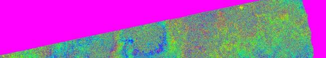
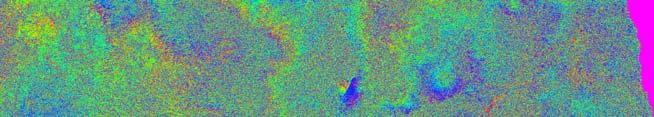

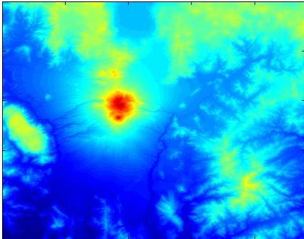
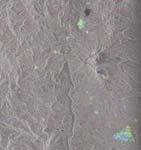
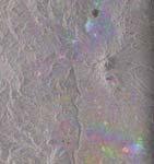
17 Strong tropospheric artefacts : Colima Volcano. Phase/elevation correlation. DEM-SRTM 16/04/ /05/2005 B =5m
18 Methods to correct this effect: - Temporal filtering. - Continuous GPS data. - Meteorological inputs. - Correlation phase/elevation.
19 North American Regional Reanalysis data P: Total Pressure T: Temperature e : Partial pressure H 2 O φ tropo = cte * ƒ(k 1 (P/T)+ k 2 (e/t) + k 3 ( e/t 2 ) + k 4 W clouds + k 5 n e /f 2 + n rain ) dz Dry delay Wet delay (k 2 <<k 3 ) δφ tropo / δz = (cte/cos(θ)) * (k 1 (P/T)+ k 2 (e/t) + k 3 ( e/t 2 ) )
20 North American Regional Reanalysis data Ex: Colima Volcano Dry (k 1 ) Mean total delay (rad/km) Wet 1st order (k 3 ) Wet 2nd order (k2) Total delay
21 North American Regional Reanalysis data Ex: Colima Volcano Maximum delay 10 rad/km! 4 fringes Track 384 Total delay (rad/km) Track 155
22 Comparison NARR / correlation phase-elevation elevation. Ex. Colima Volcano Delay (rad/m) NARR. Estimation on wrapped phase.. Interferogram number
23 Comparison NARR / correlation phase-elevation elevation. Ex. Colima Volcano Delay (rad/m) Interferogram number NARR. Estimation on wrapped phase. Estimation on unwrapped phase. Estimation on unwrapped phase using NARR.
24 Method applied : - NARR data are used to help unwrapping (removed before and add back after). - 3D Unwrapping *2 - Estimation of tropospheric delays by phase/elevation correlation (+ spatially correlated DEM error). - Correction of the unwrapped phase.


25 -21 mm/y 41.9mm/y mm/y 43.3mm/y Without helping unwrapping Helping unwrapping
26 19.8 Colima volcano Descending track Ascending track Mean displacement rate in LOS (mm/y)


27 19.8 Colima volcano- Summit subsidence Guzman 19.6 Tamazula fault Summit Descending track Ascending track Mean displacement rate in LOS (mm/y)


28 Colima volcano- Summit subsidence Descending track 384 Descending track 155 Ascending track Mean displacement rate in LOS (mm/y)

29 Colima volcano- Summit subsidence 1.68 cm/y cm/y 2.81 cm/y 1.63 cm/y 0.07 cm/y Descending track 384
 11 µrad Displacemenet rate (cm/y) 14 µrad Distance from crater center (m) Distance from crater")
30 Colima volcano- Summit subsidence Descending track 384 Displacemenet rate (cm/y) 9 µrad Distance from crater center (m) Displacemenet rate (cm/y) 11 µrad Displacemenet rate (cm/y) 14 µrad Distance from crater center (m) Distance from crater center (m)
31 Explanation - Load and compaction of eruptive products. - Dome load. - Withdrawal of a magma storage zone.
 (Navarro-Ochoa et al.")
32 Maximum of displacement is observed around the 1998 lava flow. 39*10 6 m 3 (!2.8 km from the crater center, 20 m thick) (Navarro-Ochoa et al., JVGR, 2002)
 E=0.87GPa RMS=5.")
33 Dome load? Descending track Elastic model : R=130m =40m ρ=2500 kg/m Data Residual velocity Mean displacement rate in LOS (mm/y) E=0.87GPa RMS=5.9mm
 03/2003")

34 Dome load? Displacement in LOS (cm) 03/ / /2005 Subsidence 1.68 cm/y Time (since 1 st Jan. 2003) 2 domes of 2*10 6 m 3 removed in 3 years
 -12.4 44.8 Residual velocity E=3GPa RMS=8.6 mm")
35 Load of the redistributed domes? Descending track 384 Elastic model: R=1 km =0.4m ρ=2500 kg/m 3 V=1.3 million m 3 /y Data Mean displacement rate in LOS (mm/y) Residual velocity E=3GPa RMS=8.6 mm

 V=-1.")
36 Withdrawal superficial magma reservoir? Elastic model (Mogi): Descending track 384 H Data Residual velocity Mean displacement rate in LOS (mm/y) V=-1.3*10 6 m 3 /y, H=4700m RMS=5.35mm
 V=-0.9*10 6 m 3 /y RMS=5.")
37 Chamber withdrawal + load of redistributed domes? Elastic model : 19.6 Descending track 384 1km m Data Residual velocity Mean displacement rate in LOS (mm/y) V=-0.9*10 6 m 3 /y RMS=5.26mm
 Overcorrected -0.")
 0.")
38 After correction (dome( redistributed ted domes load + chamber deflation) Descending track 384 Displacement rate (cm/y) Overcorrected -0.39cm/y Distance from the crater center (m) Displacement rate (cm/y) -0.07cm/y Displacement rate (cm/y) 0.93 cm/y Distance from the crater center (m) Distance from the crater center (m)

39 Popocatepetl No significant deformation Descending track 255 Ascending track Mean displacement rate in LOS (mm/y)
 1 cm/y Time (since 1 st Jan.")
40 Small and localised displacement on the SW flank? 0.47 cm/y Descending track Displacement in LOS (cm) 1 cm/y Time (since 1 st Jan. 2003)

41 Small and localised displacement on the SW flank? PPX5 PPX6 2 cm of displacement measured by EDM in PPX - PPX /11/ 95 6/03/ 96 14/06 /96 22/09 31/12/ / /04 /97 19/07 /97 27/10 4/02/ / /05 /98 23/08 /98 1/12/9 11/03/ 8 99 fecha 19/06 27/09 5/01/ /99 / /04 /00 23/07 31/10/ 8/02/ / /05 27/08 /01 /01 PPX - PPX6 PPX 2071 m /1 6/03 14/0 22/0 31/1 10/0 19/0 27/1 4/02 15/0 23/0 1/12 11/0 19/0 27/0 5/01 14/0 23/0 31/1 8/02 19/0 1/95 /96 6/96 9/96 2/96 4/97 7/97 0/97 /98 5/98 8/98 /98 3/99 6/99 9/99 /00 4/00 7/00 0/00 /01 5/01 fecha
42 Conclusions Main difficulty is to removed tropospheric artefacts.! difficult to detect: - small and reversible displacements. - displacements of the same wavelength of the edifice. No evidence of magma injection during period for the two Mexican strato-volcanoes. Summit deflation at Colima might be explained by the 1998 lava flow load and withdrawal of a magma reservoir at sea level before the last effusive period.
Degassing processes and recent activity at Volcán de Colima. Universidad de Colima, Mexico Corresponding author
 Degassing processes and recent activity at Volcán de Colima Nick Varley * & Gabriel Reyes Dávila Universidad de Colima, Mexico Corresponding author email: nick@ucol.mx Volcán de Colima is currently in
Geochemistry, Geophysics, Geosystems. Supporting Information for
 1 2 3 4 5 6 7 8 Geochemistry, Geophysics, Geosystems Supporting Information for Volcano Deformation Survey over the Northern and Central Andes with ALOS InSAR Time Series Anieri M. Morales Rivera 1, Falk
3D temporal evolution of displacements recorded on Mt. Etna from the 2007 to 2010 through the SISTEM method
 3D temporal evolution of displacements recorded on Mt. Etna from the 2007 to 2010 through the SISTEM method Bonforte A., Guglielmino F.,, Puglisi G. INGV Istituto Nazionale di Gofisica e vulcanologia Osservatorio
InSAR measurements of volcanic deformation at Etna forward modelling of atmospheric errors for interferogram correction
 InSAR measurements of volcanic deformation at Etna forward modelling of atmospheric errors for interferogram correction Rachel Holley, Geoff Wadge, Min Zhu Environmental Systems Science Centre, University
InSAR atmospheric effects over volcanoes - atmospheric modelling and persistent scatterer techniques
 InSAR atmospheric effects over volcanoes - atmospheric modelling and persistent scatterer techniques Rachel Holley 1,2, Geoff Wadge 1, Min Zhu 1, Ian James 3, Peter Clark 4 Changgui Wang 4 1. Environmental
MEASURING VOLCANIC DEFORMATION AT UNIMAK ISLAND FROM 2003 TO 2010 USING
 MEASURING VOLCANIC DEFORMATION AT UNIMAK ISLAND FROM 2003 TO 2010 USING WEATHER MODEL-ASSISTED TIME SERIES INSAR Gong, W. a, Meyer, F. J. a, Lee, C. W. b, Lu, Z. c, Freymueller, J a. a. Geophysical Institute,
ALOS PI Symposium 2009, 9-13 Nov 2009 Hawaii MOTION MONITORING FOR ETNA USING ALOS PALSAR TIME SERIES
 ALOS PI Symposium 2009, 9-13 Nov 2009 Hawaii ALOS Data Nodes: ALOS RA-094 and RA-175 (JAXA) MOTION MONITORING FOR ETNA USING ALOS PALSAR TIME SERIES Urs Wegmüller, Charles Werner and Maurizio Santoro Gamma
Slow Deformation of Mt. Baekdu Stratovolcano Observed by Satellite Radar Interferometry
 Slow Deformation of Mt. Baekdu Stratovolcano Observed by Satellite Radar Interferometry Sang-Wan Kim and Joong-Sun Won Department of Earth System Sciences, Yonsei University 134 Shinchon-dong, Seodaemun-gu,
Evolution of the 2007 earthquake swarm, Tanzania: Envisat and ALOS interferometry, ground observations and elastic modeling
 Evolution of the 2007 earthquake swarm, Tanzania: Envisat and ALOS interferometry, ground observations and elastic modeling Gidon Baer, Yariv Hamiel, Gadi Shamir, Ran Nof Geological Survey of Israel East
Analysis of mining deformations based on PSInSAR technique case study of the Walbrzych coal mines (Poland)
") Analysis of mining deformations based on PSInSAR technique case study of the Walbrzych coal mines (Poland) Dr. Jan Blachowski, Dr. Wojciech Milczarek Faculty of Geoengineering, Mining and Geology, Wroclaw
Analysis of mining deformations based on PSInSAR technique case study of the Walbrzych coal mines (Poland) Dr. Jan Blachowski, Dr. Wojciech Milczarek Faculty of Geoengineering, Mining and Geology, Wroclaw
Recent activity. Current episode 12 years Transition between styles 4 periods of dome growth Since 2003, Vulcanian explosions (4 25 per day)
") Recent activity Current episode 12 years Transition between styles 4 periods of dome growth Since 2003, Vulcanian explosions (4 25 per day) 02 December 09 Explosions originating from dome e.g. 10 Jan 2010
Recent activity Current episode 12 years Transition between styles 4 periods of dome growth Since 2003, Vulcanian explosions (4 25 per day) 02 December 09 Explosions originating from dome e.g. 10 Jan 2010
The Santorini Inflation Episode, Monitored by InSAR and GPS
 The Santorini Inflation Episode, Monitored by InSAR and GPS Ioannis Papoutsis 1,2, Xanthos Papanikolaou 2, Michael Floyd 3, Kang Hyeun Ji 4, Charalampos Kontoes 1, Demitris Paradissis 2, Demitris Anastasiou
Diverse deformation patterns of Aleutian volcanoes from InSAR
 Diverse deformation patterns of Aleutian volcanoes from InSAR Zhong Lu 1, Dan Dzurisin 1, Chuck Wicks 2, and John Power 3 U.S. Geological Survey 1 Cascades Volcano Observatory, Vancouver, Washington 2
Ground surface deformation of L Aquila. earthquake revealed by InSAR time series
 Ground surface deformation of L Aquila earthquake revealed by InSAR time series Reporter: Xiangang Meng Institution: First Crust Monitoring and Application Center, CEA Address: 7 Naihuo Road, Hedong District
Vulcanicity. Objectives to identify the basic structure of volcanoes and understand how they form.
 Vulcanicity Objectives to identify the basic structure of volcanoes and understand how they form. Some key terms to start.. Viscosity how well a substance (lava) flows. Acid lavas have a high viscosity,
High-resolution temporal imaging of. Howard Zebker
 High-resolution temporal imaging of crustal deformation using InSAR Howard Zebker Stanford University InSAR Prehistory SEASAT Topographic Fringes SEASAT Deformation ERS Earthquake Image Accurate imaging
Ground deformation in Thessaly, Central Greece, between 1992 and 2000 by means of ERS multi-temporal InSAR
 INGV Ground deformation in Thessaly, Central Greece, between 1992 and 2000 by means of ERS multi-temporal InSAR S. Atzori (1), C. Tolomei (1), S. Salvi (1), A. Ganas (2), S. Stramondo (1) and L. Colini
The Removal of Lava Flow Subsidence Signals from deformation interferograms at Nyamuragira Volcano, D.R. Congo
 The Removal of Lava Flow Subsidence Signals from deformation interferograms at Nyamuragira Volcano, D.R. Congo Andy Toombs & Geoff Wadge Environmental Systems Science Centre National Centre for Earth Observation
Physical Geography. Tectonics, Earthquakes, and Volcanism. Chapter 12 GEOGRAPHY Earthquakes and Volcanoes. What are Earthquakes?
 Physical Geography GEOGRAPHY 1710 DAVID R. SALLEE Tectonics, Earthquakes, and Chapter 12 Earthquakes and Volcanoes Earthquakes? The shaking or trembling caused by the sudden release of energy Usually associated
What is the Relationship between Pressure & Volume Change in a Magma Chamber and Surface Deformation at Active Volcanoes?
 SSAC-pv2007.QE522.PL1.1 What is the Relationship between Pressure & Volume Change in a Magma Chamber and Surface Deformation at Active Volcanoes? What factors control the magnitude of surface deformation?
Lecture 19: Volcanoes II. GEOS 655 Tectonic Geodesy Jeff Freymueller
 Lecture 19: Volcanoes II GEOS 655 Tectonic Geodesy Jeff Freymueller July-August 2008 Photo J. Larsen, AVO Volume Change Inferred from Model GPS Site Time Series Average rate from 2005.0-2008.0 subtracted
EAS 116 Earthquakes and Volcanoes
 EAS 116 Earthquakes and Volcanoes J. Haase Forecasting Volcanic Eruptions Assessment of Volcanic Hazard Is that volcano active? Mount Lassen: 12000 BP and 1915 Santorini, IT: 180,000 BP, 70,000 BP, 21000
In order to obtain a long term monitoring result for the Kilauea Volcano, ALOS PALSAR images taken on Track 287, Frame 38, ascending orbit with 21.5 d
 ALOS PALSAR OBSERVATION OF KILAUEA VOLCANO ACTIVITIES FROM 2006 TO 2009 Zhe Hu, Linlin Ge, Xiaojing Li, Kui Zhang, Alex Hay-Man NG and Chris Rizos Cooperative Research Centre for Spatial Information &
Photo credit: S Dumont
 Satellite Monitoring of the 2014 Dyke Intrusion and Eruption within the Bárðarbunga Volcanic System, facilitated by the CEOS Icelandic SUPERSITE M Parks, S Dumont, V Drouin, F Sigmundsson, K Spaans, A
Application of differential SAR interferometry for studying eruptive event of 22 July 1998 at Mt. Etna. Abstract
 Application of differential SAR interferometry for studying eruptive event of 22 July 1998 at Mt. Etna Coltelli M. 1, Puglisi G. 1, Guglielmino F. 1, Palano M. 2 1 Istituto Nazionale di Geofisica e Vulcanologia,
ERS-ENVISAT CROSS-INTERFEROMETRY SIGNATURES OVER DESERTS. Urs Wegmüller, Maurizio Santoro and Christian Mätzler
 ERS-ENVISAT CROSS-INTERFEROMETRY SIGNATURES OVER DESERTS Urs Wegmüller, Maurizio Santoro and Christian Mätzler Gamma Remote Sensing AG, Worbstrasse 225, CH-3073 Gümligen, Switzerland, http://www.gamma-rs.ch,
The Potential of High Resolution Satellite Interferometry for Monitoring Enhanced Oil Recovery
 The Potential of High Resolution Satellite Interferometry for Monitoring Enhanced Oil Recovery Urs Wegmüller a Lutz Petrat b Karsten Zimmermann c Issa al Quseimi d 1 Introduction Over the last years land
EHaz 26 April 2007 Questions. The following questions are arranged by topic. Risk assessment & management MTU
 EHaz 26 April 2007 Questions The following questions are arranged by topic. Risk assessment & management Slide 17 (very good slide, by the way!): In the case of the Merapi and Mt. St. Helens crises, how
Implementation of Multi-Temporal InSAR to monitor pumping induced land subsidence in Pingtung Plain, Taiwan
 Implementation of Multi-Temporal InSAR to monitor pumping induced land subsidence in Pingtung Plain, Taiwan Presenter: Oswald Advisor: Chuen-Fa Ni Date: March 09, 2017 Literature Review Pingtung Plain
Haiti Earthquake (12-Jan-2010) co-seismic motion using ALOS PALSAR
 co-seismic motion using ALOS PALSAR") Haiti Earthquake (12-Jan-2010) co-seismic motion using ALOS PALSAR Urs Wegmüller, Charles Werner, Maurizio Santoro Gamma Remote Sensing, CH-3073 Gümligen, Switzerland SAR data: JAXA, METI; PALSAR AO Project
Haiti Earthquake (12-Jan-2010) co-seismic motion using ALOS PALSAR Urs Wegmüller, Charles Werner, Maurizio Santoro Gamma Remote Sensing, CH-3073 Gümligen, Switzerland SAR data: JAXA, METI; PALSAR AO Project
TEMPORAL VARIABILITY OF ICE FLOW ON HOFSJÖKULL, ICELAND, OBSERVED BY ERS SAR INTERFEROMETRY
 TEMPORAL VARIABILITY OF ICE FLOW ON HOFSJÖKULL, ICELAND, OBSERVED BY ERS SAR INTERFEROMETRY Florian Müller (1), Helmut Rott (2) (1) ENVEO IT, Environmental Earth Observation GmbH, Technikerstrasse 21a,
Geophysical surveys Anomaly maps 2D modeling Discussion Conclusion
 Introduction Geophysical surveys Anomaly maps 2D modeling Discussion Conclusion General context Growth of volcanic domes is a multiphase process: extrusion phases 2005 lava dome growth inside the Mount
InSAR Observation for the Surface Displacements at Mt. Etna between 2003 and 2007
 International Journal of Geosciences, 2015, 6, 159-171 Published Online February 2015 in SciRes. http://www.scirp.org/journal/ijg http://dx.doi.org/10.4236/ijg.2015.62010 InSAR Observation for the Surface
Introduction to Volcanic Seismology
 Introduction to Volcanic Seismology Second edition Vyacheslav M. Zobin Observatorio Vulcanolo'gico, Universidad de Colima, Colima, Col., Mexico ELSEVIER AMSTERDAM BOSTON HEIDELBERG LONDON * NEW YORK OXFORD
to: Interseismic strain accumulation and the earthquake potential on the southern San
 Supplementary material to: Interseismic strain accumulation and the earthquake potential on the southern San Andreas fault system by Yuri Fialko Methods The San Bernardino-Coachella Valley segment of the
Influence of pre-existing volcanic edifice geometry on caldera formation
 1 2 Author manuscript, published in "Geophysical Research Letters 38 (2011) L11305" DOI : 101029/2011gl047900 Influence of pre-existing volcanic edifice geometry on caldera formation V Pinel, 1 V Pinel,
GAMINGRE 8/1/ of 7
 FYE 09/30/92 JULY 92 0.00 254,550.00 0.00 0 0 0 0 0 0 0 0 0 254,550.00 0.00 0.00 0.00 0.00 254,550.00 AUG 10,616,710.31 5,299.95 845,656.83 84,565.68 61,084.86 23,480.82 339,734.73 135,893.89 67,946.95
Mt St Helens was know to have entered into active periods that lasted from years once every years over the last 500 years, (Figure 5).
.") Lecture #8 notes; Geology 3950, Spring 2006; CR Stern May 1980 eruption of Mt St Helens volcano (text pages 183-192 in the 4 th edition and 206-222 in the 5 th edition) Mt St Helens in southwest Washington
Lecture #8 notes; Geology 3950, Spring 2006; CR Stern May 1980 eruption of Mt St Helens volcano (text pages 183-192 in the 4 th edition and 206-222 in the 5 th edition) Mt St Helens in southwest Washington
Images from: Boston.com
 Images from: Boston.com Ireland in the shadow of a volcano: Understanding the 2010 eruption at Eyjafjallajökull, Iceland. Chris Bean, School of Geological Sciences, UCD. World Quakes and Volcanoes 1960-2010
Nick Varley Universidad de Colima, Mexico
 Nick Varley Universidad de Colima, Mexico nick@ucol.mx Remote sensing often is the first signal of a new eruption for remote volcanoes Fumarole direct temperature measurements Spring water temperatures
Seismic quantification of the explosions that destroyed the dome of Volcán de Colima, Mexico, in July August 2003
 Bull Volcanol (2006) 69: 141 147 DOI 10.1007/s00445-006-0060-y RESEARCH ARTICLE Vyacheslav M. Zobin. Carlos J. Navarro-Ochoa. Gabriel A. Reyes-Dávila Seismic quantification of the explosions that destroyed
Monitoring long-term ground movements and Deep Seated Gravitational
 Monitoring long-term ground movements and Deep Seated Gravitational Slope Deformations by InSAR time series: cases studies in Italy Salvatore Stramondo (1), M. Saroli (1, 2), M. Moro (1, 2), S. Atzori
A bowl shaped depression formed by the collapse of a volcano is called a. Magma that has left the vent of a volcano is known as. Lava.
 Magma that has left the vent of a volcano is known as Lava A bowl shaped depression formed by the collapse of a volcano is called a Caldera This can form in a caldera when magma starts to come back up
Deformation measurement using SAR interferometry: quantitative aspects
 Deformation measurement using SAR interferometry: quantitative aspects Michele Crosetto (1), Erlinda Biescas (1), Ismael Fernández (1), Ivan Torrobella (1), Bruno Crippa (2) (1) (2) Institute of Geomatics,
Living in the shadow of Italy's volcanoes
 Living in the shadow of Italy's volcanoes Where is Mount Etna? Mount Etna is located on the east coast of Sicily roughly midway between Messina and Catania (Figure 1). It is the largest and tallest volcano
Overview of Ch. 4. I. The nature of volcanic eruptions 9/19/2011. Volcanoes and Other Igneous Activity Chapter 4 or 5
 Overview of Ch. 4 Volcanoes and Other Igneous Activity Chapter 4 or 5 I. Nature of Volcanic Eruptions II. Materials Extruded from a Volcano III.Types of Volcanoes IV.Volcanic Landforms V. Plutonic (intrusive)
Volcanism (Chapter 5)
") GEOLOGY 306 Laboratory Instructor: TERRY J. BOROUGHS NAME: Volcanism (Chapter 5) For this assignment, you will require: a calculator, colored pencils, string, protractor, stereoscopes (provided). Objectives
GEOLOGY 306 Laboratory Instructor: TERRY J. BOROUGHS NAME: Volcanism (Chapter 5) For this assignment, you will require: a calculator, colored pencils, string, protractor, stereoscopes (provided). Objectives
GSNL - Geohazard Supersites and Natural Laboratories. Biennial report for Candidate/Permanent Supersite. Hawaiʻi Supersite. Annex to report
 Introduction Biennial report for Candidate/Permanent Supersite Hawaiʻi Supersite Annex to 2014 2016 report During 2014 2016, the Hawaiʻi Supersite achieved a number of noteworthy results. This annex details
A - Piton de la Fournaise activity
 OVPF-IPGP November 2018 Page 1/7 Monthly bulletin of the Piton de la Fournaise Volcanological Observatory ISSN ISSN 2610-5101 A - Piton de la Fournaise activity PITON DE LA FOURNAISE (VNUM #233020) Latitude:
Improvement of active volcano monitoring system in east Asia by using SGLI : preparation for realtime high spatial resolution observation
 GCOM WS 2014.1.16 Improvement of active volcano monitoring system in east Asia by using SGLI : preparation for realtime high spatial resolution observation T. Kaneko, A. Yasuda, T. Fujii and K. Kajiwara*
DEFORMATION DUE TO MAGMA MOVEMENT AND ICE UNLOADING AT KATLA VOLCANO, ICELAND, DETECTED BY PERSISTENT SCATTERER INSAR
 DEFORMATION DUE TO MAGMA MOVEMENT AND ICE UNLOADING AT KATLA VOLCANO, ICELAND, DETECTED BY PERSISTENT SCATTERER INSAR Andrew Hooper and Rikke Pedersen Nordic Volcanological Center, Institute of Earth Sciences,
Supporting the response to the 2018 lower East Rift Zone and summit collapse at Kīlauea Volcano, Hawaiʻi
 Hawaiʻi Supersite success story Supporting the response to the 2018 lower East Rift Zone and summit collapse at Kīlauea Volcano, Hawaiʻi Since 1983, Kīlauea Volcano, on the Island of Hawaiʻi, has actively
Magma. Objectives. Describe factors that affect the formation of magma. Compare and contrast the different types of magma. Vocabulary.
 Magma Objectives Describe factors that affect the formation of magma. Compare and contrast the different types of magma. Vocabulary viscosity Magma Magma The ash that spews from some volcanoes can form
The PaTrop Experiment
 Improved estimation of the tropospheric delay component in GNSS and InSAR measurements in the Western Corinth Gulf (Greece), by the use of a highresolution meteorological model: The PaTrop Experiment N.
The March 11, 2011, Tohoku-oki earthquake (Japan): surface displacement and source modelling
: surface displacement and source modelling") The March 11, 2011, Tohoku-oki earthquake (Japan): surface displacement and source modelling Salvatore Stramondo Bignami C., Borgstrom S., Chini M., Guglielmino F., Melini D., Puglisi G., Siniscalchi V.,
The March 11, 2011, Tohoku-oki earthquake (Japan): surface displacement and source modelling Salvatore Stramondo Bignami C., Borgstrom S., Chini M., Guglielmino F., Melini D., Puglisi G., Siniscalchi V.,
Operational use of InSAR for volcano observatories : experience from Montserrat
 Operational use of InSAR for volcano observatories : experience from Montserrat G.Wadge 1, B.Scheuchl 1,5, L.Cabey 1,2, M.D.Palmer 3, C. Riley 3, A. Smith 4, N.F.Stevens 1 1. ESSC, University of Reading,
Activity Flour box volcano deformation model
 Activity Flour box volcano deformation model A balloon and a box of flour model a magma chamber and overlying rock Some volcanic craters form by the violent expulsion of magma (liquid rock) when it reaches
ENV-5004B/ENVK5005B. Figure 6. Student Registration No. ENV-5004B/ENVK5005B Version 2
 ENV-5004B/ENVK5005B Figure 6 Student Registration No UNIVERSITY OF EAST ANGLIA School of Environmental Sciences Main Series UG Examination 014-15 SOLID EARTH GEOPHYSICS SOLID EARTH GEOPHYSICS WITH FIELDCOURSE
Landslide Monitoring in Three Gorges Area By Joint Use of Phase Based and Amplitude Based Methods
 Landslide Monitoring in Three Gorges Area By Joint Use of Phase Based and Amplitude Based Methods Xuguo Shi, Lu Zhang, Mingsheng Liao, Timo Balz LIESMARS, Wuhan University Outlines Introduction InSAR Results
Hawai i Volcanoes Data
 Data Here are reports from the end of April, 208 about each of the five volcanoes on the island of Hawai i. Kohala 20.09º N, 55.72º W Summit elevation 5,479 ft (,670 m) Kohala is an extinct volcano that
Retrieving 3D deformation pattern of a landslide with hiresolution InSAR and in-situ measurements: Just landslide case-study
 Retrieving 3D deformation pattern of a landslide with hiresolution InSAR and in-situ measurements: Just landslide case-study Zbigniew Perski (1), Petar Marinković (2), Yngvar Larsen (3), Tomasz Wojciechowski
Radar Remote Sensing: Monitoring Ground Deformations and Geohazards from Space
 Radar Remote Sensing: Monitoring Ground Deformations and Geohazards from Space Xiaoli Ding Department of Land Surveying and Geo-Informatics The Hong Kong Polytechnic University A Question 100 km 100 km
Case History: Mt. St. Helens
 Case History: Mt. St. Helens EAS 458 Volcanology Introduction 1980 eruption of Mt. St. Helens was particularly interesting and violent eruption with an unusual lateral blast. In the 1970 s, the USGS (Crandell(
White Rose Research Online URL for this paper: Version: Accepted Version
 This is a repository copy of Dome growth, collapse, and valley fill at Soufrière Hills Volcano, Montserrat, from 1995 to 2013: Contributions from satellite radar measurements of topographic change. White
OIKOS > volcano > mechanism >types of volcanoes
 Main Types of Volcanoes Volcanologists have classified volcanoes into groups based on the shape of the volcano, the materials they are built of, and the way the volcano erupts. The main one can be described
FLANK COLLAPSE AND NEW RELATIVE INSTABILITY ANALYSIS TECHNIQUES APPLIED TO VOLCAN DE COLIMA AND MT ST. HELENS Lorenzo Borselli*, Damiano Sarocchi *
 FLANK COLLAPSE AND NEW RELATIVE INSTABILITY ANALYSIS TECHNIQUES APPLIED TO VOLCAN DE COLIMA AND MT ST. HELENS Lorenzo Borselli*, Damiano Sarocchi * *Instituto de Geología Universidad Autónoma de San Luis
Application of PSI technique to slope stability monitoring in the Daunia mountains, Italy
 ESA ESRIN - Frascati 28 November- 2 December Application of PSI technique to slope stability monitoring in the Daunia mountains, Italy F. Bovenga (1) (fabio.bovenga@ba.infn.it) L. Guerriero (1) R. Nutricato
Volcanic Deformation and Evolution.
 Volcanic Deformation and Evolution of Mt. Saint SitHelens http://pubs.usgs.gov/sim/3008/ B. A. Digital perspective view derived from USGS Digital Elevation Model (DEM) of Mount St. Helens as seen from
4-D seismology at volcanoes: Probing the inside of volcanoes. Florent Brenguier
 4-D seismology at volcanoes: Probing the inside of volcanoes Florent Brenguier INTRODUCTION The origin of volcanic activity Volcanoes are clustered in active tectonic regions Large historical eruptions
Assessment Schedule 2015 Earth and Space Science: Demonstrate understanding of the causes of extreme Earth events in New Zealand (91191)
") NCEA Level 2 Earth and Space Science (91191) 2015 page 1 of 6 Assessment Schedule 2015 Earth and Space Science: Demonstrate understanding of the causes of extreme Earth events in New Zealand (91191) Evidence
NCEA Level 2 Earth and Space Science (91191) 2015 page 1 of 6 Assessment Schedule 2015 Earth and Space Science: Demonstrate understanding of the causes of extreme Earth events in New Zealand (91191) Evidence
Dyke-maintained rift segmentation at continental rupture
 Dyke-maintained rift segmentation at continental rupture the 2005 Dabbahu (Afar) rifting episode Tim Wright, C. Ebinger, J. Biggs, A. Ayele, G. Yirgu, D. Keir, and A. Stork Supplementary Information Structure
1/31/2013 BASALTIC BASALTIC ANDESITIC RHYOLITIC
 Can you predict the location of volcanoes? What is causing this eruption? What factors influence its character? A volcano is any landform from which lava, gas, or ashes, escape from underground or have
Fig. 1. Joint volcanological experiment on volcanic structure and magma supply system in Japan.
 2. Joint Volcanological Experiment on Volcanic Structure and Magma Supply System Since 1994, joint experiments have been conducted in several volcanoes in Japan to reveal the structure and the magma supply
Volcano Seismicity and Tremor. Geodetic + Seismic
 Volcano Seismicity and Tremor Seismic Imaging Geodetic + Seismic Model based joint inversion Geodetic Monitoring How is magma stored in the crust? geometry, volume and physical state of crustal melts.
CHAPTER-7 INTERFEROMETRIC ANALYSIS OF SPACEBORNE ENVISAT-ASAR DATA FOR VEGETATION CLASSIFICATION
 147 CHAPTER-7 INTERFEROMETRIC ANALYSIS OF SPACEBORNE ENVISAT-ASAR DATA FOR VEGETATION CLASSIFICATION 7.1 INTRODUCTION: Interferometric synthetic aperture radar (InSAR) is a rapidly evolving SAR remote
Hands-on Activity Predicting Eruptions on Montserrat
 Hands-on Activity Predicting Eruptions on Montserrat Predicting Eruptions No one can predict exactly when a volcano might explode. There are, however, common clues to look for to let people know that the
Calc-alkaline Volcanic Rocks. Calc-alkali Volcanics. Fabric. Petrography. Compositional Classification. Petrography. Processes.
 Calc-alkaline Volcanic Rocks Calc-alkali Volcanics Winter Chapters 16 & 17 Petrography Processes Field relations Volcanic arcs Petrogenesis Petrography Fabric Classification Alteration Fabric Aphanitic
Monthly Volcanic Activity Report (March 2013)
") Monthly Volcanic Activity Report (March 2013) Hakoneyama (Alert Level: 1) Shallow earthquake activity from the area near Mt. Komagatake to Sengokuhara has largely remained at low levels since the middle
Monthly Volcanic Activity Report (March 2013) Hakoneyama (Alert Level: 1) Shallow earthquake activity from the area near Mt. Komagatake to Sengokuhara has largely remained at low levels since the middle
Chapter 18 - Volcanic Activity. Aka Volcano Under the City
 Chapter 18 - Volcanic Activity Aka Volcano Under the City 18.1 Magma Describe factors that affect the formation of magma. Compare and contrast the different types of magma. Temperature and pressure increase
GLY 155 Introduction to Physical Geology, W. Altermann
 17.04.2010 Eyjafjallokull Volcano Shield Volcano on Iceland Phreatomagmatic eruption 1 Eyjafjallokull Volcano Shield Volcano on Iceland Phreatomagmatic eruption Eyjafjallokull Volcano Shield Volcano on
Strategies for Measuring Large Scale Ground Surface Deformations: PSI Wide Area Product Approaches
 Strategies for Measuring Large Scale Ground Surface Deformations: PSI Wide Area Product Approaches J. Duro (1), R. Iglesias (1), P. Blanco-Sánchez (1), D. Albiol (1), T. Wright (2), N. Adam (3), F. Rodríguez
Towards Routine Monitoring of Tectonic and Volcanic Deformation with Sentinel-1
 INSARAP Towards Routine Monitoring of Tectonic and Volcanic Deformation with Sentinel-1 Wright, Tim J (1); Biggs, Juliet (2); Crippa, Paula (3); Ebmeier, Susanna K. (2); Elliott, John (4); Gonzalez, Pablo
3/7/17. #16 - Case Studies of Volcanoes II. Announcements Monday 2/27
 Announcements Monday 2/27 Exam #1: Monday Feb. 27 th, 7:15-8:15 (see web site) Last Names A - N Loomis 141 Last Names O - Z Loomis 151 Bring your student ID An old exam is posted in Compass If you are
Earthquake and Volcano Service
 Ref. Ares(2014)73773-15/01/2014 Earthquake and Volcano Service WP Leader: Istituto Nazionale di Geofisica e Vulcanologia (Italy) Contributors: NILU (Norway), EUCENTRE (Italy), GAMMA (Switzerland), IGAR
Determining the relationship between the summit and Pu u Ō ō on Kilauea
 Name: Determining the relationship between the summit and Pu u Ō ō on Kilauea After completing this activity, you will be able to: 1. summarize the physical events that produce the data volcanologists
Volcano Monitoring on a Regional Scale:
 Volcano Monitoring on a Regional Scale: Results from the CEOS Disaster Risk Management Volcano Pilot David Arnold 1 Juliet Biggs 1 Francisco Delgado 2 Matt Pritchard 2 Susi Ebmeier 1 Mike Poland 3 Simona
"Dynamics and structural evolution of collapse calderas: A comparison between field evidence, analogue and mathematical models"
 Tesi doctoral presentada per En/Na Adelina GEYER TRAVER amb el títol "Dynamics and structural evolution of collapse calderas: A comparison between field evidence, analogue and mathematical models" per
Life Cycle of Convective Systems over Western Colombia
 Life Cycle of Convective Systems over Western Colombia Meiry Sakamoto Uiversidade de São Paulo, São Paulo, Brazil Colombia Life Cycle of Convective Systems over Western Colombia Convective System (CS)
1.0 Introduction 1.1 Geographic Location 1.2 Topography 1.3 Climate and Rainfall 1.4 Geology and Hydrogeology 1.5 Water Availability 1.
 1.0 1.1 Geographic Location 1.2 Topography 1.3 Climate and Rainfall 1.4 Geology and Hydrogeology 1.5 Water Availability 1.6 Demography 1.0 1.1 Geographic Location St. Lucia forms part of an archipelago
Chapter 18. Abstract. Introduction. By Chang-Wook Lee 1, Zhong Lu 2, Hyung-Sup Jung 3, Joong-Sun Won 4, and Daniel Dzurisin 5
 The 2006 Eruption of Augustine Volcano, Alaska Power, J.A., Coombs, M.L., and Freymueller, J.T., editors U.S. Geological Survey Professional Paper 1769 Chapter 18 Surface Deformation of Augustine Volcano,
DIFFERENTIAL INSAR STUDIES IN THE BOREAL FOREST ZONE IN FINLAND
 DIFFERENTIAL INSAR STUDIES IN THE BOREAL FOREST ZONE IN FINLAND Kirsi Karila (1,2), Mika Karjalainen (1), Juha Hyyppä (1) (1) Finnish Geodetic Institute, P.O. Box 15, FIN-02431 Masala, Finland, Email:
Deformation Characteristics of Unzen Lava Dome based on Long Range Displacement Monitoring
 Deformation Characteristics of Unzen Lava Dome based on Long Range Displacement Monitoring Yasuyuki SATOU, 1 Tadanori ISHIZUKA, 2 Senro KURAOKA, 3,* Yuichi NAKASHIMA, 3 and Takanori KAMIJO 3 1 Unzen Restoration
Debris Avalanches. Debris avalanche deposits on a volcano in Chile. All of the area in the foreground is buried by a thick debris avalanche.
 Debris Avalanches Volcanoes are not very stable structures. From time to time, they collapse producing large rock and ash avalanches that travel at high speeds down valleys. Collapse maybe caused by an
Visualizing Earth Science. Chapter Overview. Volcanoes and Eruption Types. By Z. Merali and B. F. Skinner. Chapter 9 Volcanism and Other
 Visualizing Earth Science By Z. Merali and B. F. Skinner Chapter 9 Volcanism and Other Igneous Processes Volcanoes types and effects of eruption Chapter Overview Melting and cooling of rocks Geological
Committee on Earth Observation Satellites. The CEOS Volcano Demonstrator Rationale and Implementation
 Committee on Earth Observation Satellites The CEOS Volcano Demonstrator Rationale and Implementation Why focus on volcanoes? Over 300,000 people have been killed by volcanoes since the 1600s Globally,
Part A GEOLOGY 12 CHAPTER 4 WORKSHEET VOLCANOES. Name
 GEOLOGY 12 CHAPTER 4 WORKSHEET VOLCANOES Name Part A 1. The rough, jumbled blocky or jagged surface of a lava flow is called a. pahoehoe b. lahar c. aa d. phreatic 2. The Cascade volcanoes like Mt. St.
Continuously Monitored by JMA. Latitude: 24 45'02" N, Longitude: '21" E, Elevation: 169 m (Suribachiyama) (GSI Measuring Point)
 (GSI Measuring Point)") 74. Ioto Continuously Monitored by JMA Latitude: 24 45'02" N, Longitude: 141 17'21" E, Elevation: 169 m (Suribachiyama) (GSI Measuring Point) Overview of Ioto taken from northwest side on July 29, 2008
74. Ioto Continuously Monitored by JMA Latitude: 24 45'02" N, Longitude: 141 17'21" E, Elevation: 169 m (Suribachiyama) (GSI Measuring Point) Overview of Ioto taken from northwest side on July 29, 2008
Monthly Volcanic Activity Report (April 2013)
") Monthly Volcanic Activity Report (April 2013) Zaozan (Calm) Small-amplitude volcanic tremors were recorded on April 7 (duration: 3 min 20 sec), 9 (4 min 20 sec) and 21 (5 min 40 sec). These were the first
Monthly Volcanic Activity Report (April 2013) Zaozan (Calm) Small-amplitude volcanic tremors were recorded on April 7 (duration: 3 min 20 sec), 9 (4 min 20 sec) and 21 (5 min 40 sec). These were the first
The eruption of Volcán de Colima, Mexico: an application of Maeda s viscoelastic model
 Geofísica Internacional 49 (2), 83-96 (2010) The 1998-1999 eruption of Volcán de Colima, Mexico: an application of Maeda s viscoelastic model R. Cabrera-Gutiérrez and J. M. Espíndola * Instituto de Geofísica
A SCALING CRITERION TO ESTIMATE AND COMPARE THE VOLCANIC HAZARD AMONG DIFFERENT VOLCANOES
 A SCALING CRITERION TO ESTIMATE AND COMPARE THE VOLCANIC HAZARD AMONG DIFFERENT VOLCANOES Servando De la Cruz-Reyna 1, A.T Mendoza-Rosas 2 1. Instituto de Geofísica,, Universidad Nacional Autónoma de México,