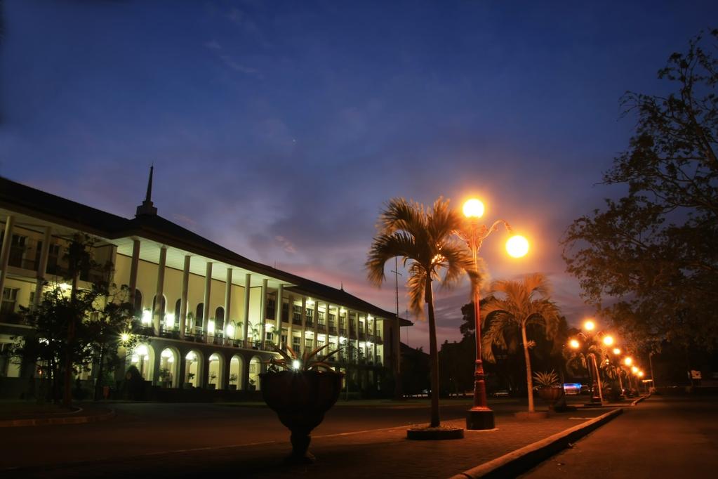
Universitas Gadjah Mada implements research, enhances knowledge, empowers society Join us to lead the way!
|
|
|
- Gervase Knight
- 5 years ago
- Views:
Transcription

1 SPIRIT OF MERAPI Universitas Gadjah Mada implements research, enhances knowledge, empowers society Join us to lead the way! UNIVERSITAS GADJAH MADA Yogyakarta, Indonesia
2

3


4
 This research aims to: (1) map the land form of the peak of Mt.")
.")
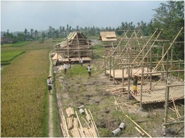
5 SPIRIT OF MERAPI Field : Geography Mapping the Hazard Zone of Merapi Volcano through Land Geomorphology Approach (Prof. Dr. Junun Sartohadi, M.Sc.) This research aims to: (1) map the land form of the peak of Mt. Merapi, (2) illustrate the prone zones of volcanic eruption in the area of mountain peak (3) verify the result of the research with the latest eruption data. The method used in this particular research is survey. The survey method applied in the research is by the image interpretation and morphological map of Indonesia(RBI map). Map interpretation and image is done before field survey. RBI map interpretation is also provided with remote sensing before and after the eruption of Mt. Merapi Field survey is done stratified based on the unit/denomination of the morphology of the image interpretation result and RBI map. Field: Animal Science Livestock Treatment during Emergency Response (Prof. Dr. Ir. Ali Agus, DAA., DEA) Mt. Merapi eruption on October 26 and November had caused not only material lost but also casualties and livestock loss. Around cows in Magelang, Klaten, and Sleman were endangered by the eruption. During the emergency response, generally people have no time to take care of their cattle, meanwhile the need of the woof and water for cattle are emerging. Thus, in emergency response, optimal and appropriate strategies are demanded in evacuating and taking care of the cattle in order to minimize the loss. This paper presents a review of cattle treatment as well as the particular woof during the eruption, i.e. the compact food called grass burger, as an emergency woof for cattle. Among those strategies and steps, the people who live in the area of Mt. Merapi are expected to stay calm, and there will be more treated cattle, and the loss of the productivity of cattle during the eruption is able to be minimized. S P I R I T O F M E R A P I 0 4


6
 The natural condition of Indonesia (specifically the hydro-climate condition), is very potential to cause disaster.")
7 SPIRIT OF MERAPI Institutions and Study Centre Related to Merapi Eruption Master in Natural Disaster Management Magister Pengelolaan Bencana Alam (MPBA) Centre for Natural Disaster Studies Pusat Studi Bencana Alam (PSBA) The natural condition of Indonesia (specifically the hydro-climate condition), is very potential to cause disaster. The mentioned natural disaster might arise in the form of floods, droughts, land slides, volcanic eruptions, etc. It is known that the mechanism process of erosion-sedimentation as an interaction between the liquid and solid material might be the trigger of the hazard. The movement of solid material from upstream toward downstream of the river often causes considerable damage not only in the stream itself but also the surrounding valley. The management of solid material or sediment due to the volcanic activity should be carried out through the concept of integrated and sustainable. In order to fulfill the need of anticipating the natural disaster, especially the sediment-related natural disaster, specific human resources should be made available. Master in Natural Disaster Management (MPBA), Universitas Gadjah Mada analyze both technical and non-technical aspects affecting the disaster management problems. Although the establishment of the specific human resources has been initiated for over the last two decades, however, the appropriate ones are still insufficient. As one of Universitas Gadjah Mada's Study Center, PSBA focuses on researches related to disasters in the field of environment, social, education, health, etc. Its vision is to be a study center in the disaster field with orientation on disaster management for the welfare of the society, with a mission to take part in supporting sustainability of the national development by means of study and solution endorsement in the disaster management which are conducted by researches with multidisciplinary approaches. PSBA has a goal to develop disaster management before, while, and after the disaster, and elaborate a disaster management information system with the implementation of geographic information system. Other goals of PSBA are to be a data and information management center for disasters that occur in Indonesia, perform integrated researches and scientific studies about various aspects of disaster (natural and that triggered by human activities) such as landslide, flood, drought, earthquake, tsunami, volcano eruptions, hurricanes, and social disasters, and also develop the science and technology for disaster mitigation in order to reduce the effects and increase the welfare of society. S P I R I T O F M E R A P I 0 6

8


9
10
Socio-Eco-Engineering-based Approach on Integrated Sediment Management in Mt. Merapi Area, Indonesia
 Socio-Eco-Engineering-based Approach on Integrated Sediment Management in Mt. Merapi Area, Indonesia Legono DJOKO, 1,* Katsuhiko OTANI 2, and Suharyanto 3 1 Civil and Environmental Engineering Department,
UNIVERSITY GADJAH MADA EUBIOS YOUTH LOOKING BEYOND DISASTER (LBD5) FORUM 4-8 SEPTEMBER, Hosted by: Universitas Gadjah Mada
 FORUM 4-8 SEPTEMBER, Hosted by: Universitas Gadjah Mada") UNIVERSITY GADJAH MADA EUBIOS YOUTH LOOKING BEYOND DISASTER (LBD5) FORUM 4-8 SEPTEMBER, 2014 Hosted by: Universitas Gadjah Mada Outline LBD program Brief Information of Universitas Gadjah Mada, Indonesia
UNIVERSITY GADJAH MADA EUBIOS YOUTH LOOKING BEYOND DISASTER (LBD5) FORUM 4-8 SEPTEMBER, 2014 Hosted by: Universitas Gadjah Mada Outline LBD program Brief Information of Universitas Gadjah Mada, Indonesia
USING 3D GIS TO ASSESS ENVIRONMENTAL FLOOD HAZARDS IN MINA
 King Fahd University of Petroleum & Minerals College of Environmental Design Geographical Information system USING 3D GIS TO ASSESS ENVIRONMENTAL FLOOD HAZARDS IN MINA Prepared by : Ali AL-Zahrani OUTLINE
2008 JC2 H2 GEOGRAPHY: PIONEER JUNIOR COLLEGE PRELIMINARY EXAMS. Figure 1 for Question 1
 PHYSICAL GEOGRAPHY Figure 1 for Question 1 Figure 2 for Question 2 Tropical air mass source regions Figure 3 for Question 3 Figure 4 for Question 4 Volcanic gases Figure 5 for Question 5 EITHER Photograph
Assessing Hazards and Risk
 Page 1 of 6 EENS 204 Tulane University Natural Disasters Prof. Stephen A. Nelson Assessing Hazards and Risk This page last updated on 07-Jan-2004 As discussed before, natural disasters are produced by
UGRC 144 Science and Technology in Our Lives/Geohazards
 UGRC 144 Science and Technology in Our Lives/Geohazards Session 1 Introduction to Hazards and Disasters Dr. Patrick Asamoah Sakyi Department of Earth Science, UG, Legon College of Education School of Continuing
DEBRIS FLOW DISASTER MITIGATION THROUGH COMMUNITY-BASED INTEGRATED SEDIMENT MANAGEMENT (BEST PRACTICE IN MT. MERAPI AREA, INDONESIA)
") Civil Engineering Forum Volume XXI/3 - September 2012 DEBRIS FLOW DISASTER MITIGATION THROUGH COMMUNITY-BASED INTEGRATED SEDIMENT MANAGEMENT (BEST PRACTICE IN MT. MERAPI AREA, INDONESIA) K. Otani Yachiyo
Civil Engineering Forum Volume XXI/3 - September 2012 DEBRIS FLOW DISASTER MITIGATION THROUGH COMMUNITY-BASED INTEGRATED SEDIMENT MANAGEMENT (BEST PRACTICE IN MT. MERAPI AREA, INDONESIA) K. Otani Yachiyo
Natural Processes. Were you prepared for the fast approaching storm? Were you able to take shelter? What about pets, livestock or plants?
 Have you ever been caught in a storm? You are outside on a summer night and all of a sudden here come the wind, lightning and heavy rain. It starts raining so hard that you can hardly see in front of you.
Natural Disasters in Member Countries (2002 Summary)
") 4.2 Member Countries and their Disaster Characteristics: Table 5: Natural Disasters in Member Countries (2002 Summary) (Country/Disaster Type/Disaster Characteristics) Data Country DisType Count of TotAff
4.2 Member Countries and their Disaster Characteristics: Table 5: Natural Disasters in Member Countries (2002 Summary) (Country/Disaster Type/Disaster Characteristics) Data Country DisType Count of TotAff
GUIDELINES FOR CONSTRUCTION TECHNOLOGY TRANSFER DEVELOPMENT OF WARNING AND EVACUATION SYSTEM AGAINST SEDIMENT DISASTERS IN DEVELOPING COUNTRIES
 GUIDELINES FOR CONSTRUCTION TECHNOLOGY TRANSFER DEVELOPMENT OF WARNING AND EVACUATION SYSTEM AGAINST SEDIMENT DISASTERS IN DEVELOPING COUNTRIES MARCH 2004 Ministry of Land, Infrastructure and Transport
LANDSCAPES LANDSCAPES HUMAN IMPACT. PART II: People and their 4/10/2018. GEOG 101 Part II People and their Physical Environment R E M I N D E R S
 R E M I N D E R S Get study guide from course home page. TEXTBOOK READING FOR EXAM II WEATHER and CLIMATE: Ch. 2 LITHOSPHERE: chapter 3 BIOSPHERE: chapter 4 EARTH RESOURCES: chapter 5 Two required essays
GENERAL. CHAPTER 1 BACKGROUND AND PURPOSE OF THE GUIDELINES Background of the Guidelines Purpose of the Guidelines...
 GENERAL CHAPTER 1 BACKGROUND AND PURPOSE OF THE GUIDELINES... 1 1.1 Background of the Guidelines... 1 1.2 Purpose of the Guidelines... 3 CHAPTER 2 APPLICATION OF THE GUIDELINES... 3 2.1 Potential Users
Geography GCSE. Year 9 Term and Topic Unit Content Homework Opportunities
 Geography GCSE Year 9 Term and Topic Unit Content Homework Opportunities Autumn Term 1: Geographical Skills Autumn Term 2: Tectonic Hazards Spring Term 1: Ecosystems Rainforest Students are required to
The Application of Sabo Technology for Lahars Flood Mitigation and Warning System in Volcanic Area. Agus Sumaryono Bambang Sukatja F.
 The Application of Sabo Technology for Lahars Flood Mitigation and Warning System in Volcanic Area Agus Sumaryono Bambang Sukatja F. Tata Yunita BACKGROUND The Indonesia Government has constructed several
Volcanoes. Introduction
 Volcanoes Introduction Display Slide V-0 Explain that a volcano is a vent through which molten rock escapes to the Earth s surface. Unlike other mountains, which are pushed up from below, volcanoes are
Catastrophic Events Impact on Ecosystems
 Catastrophic Events Impact on Ecosystems Hurricanes Hurricanes An intense, rotating oceanic weather system with sustained winds of at least 74 mph and a welldefined eye Conditions for formation: Warm water
They include earthquakes, volcanic eruptions, floods, landslides, and other processes and occurrences. They are included in the broader concept of.
 They include earthquakes, volcanic eruptions, floods, landslides, and other processes and occurrences. They are included in the broader concept of. In general, natural processes are labeled hazardous only
Integrated and Multi-Hazard Disaster Management
 GeoSmart Asia 2016: GI for Disaster Preparedness and Risk Reduction Bandung, Indonesia 12 October 2016 Integrated and Multi-Hazard Disaster Management Lim Choun Sian & Nurfashareena Muhamad Centre for
EARTH S SYSTEMS: PROCESSES THAT SHAPE THE EARTH
 9 Week Unit UNIT 2 EARTH S SYSTEMS: PROCESSES THAT SHAPE THE EARTH Fourth Grade Rogers Public Schools : Earth s Systems: Processes that Shape the Earth 9 weeks In this unit, students develop understandings
This table connects the content provided by Education Perfect to the NSW Syllabus.
 Education Perfect Geography provides teachers with a wide range of quality, engaging and innovative content to drive positive student learning outcomes. Designed by teachers and written by our in-house
Year 4 Geography Revision Pack Summer 2018 Name
 Year 4 Geography Revision Pack Summer 2018 Name Welcome to your geography revision pack for the upcoming Summer exams. Everything that we have been working on in lessons since Christmas will be covered
Volcanic Disaster Mitigation for Living in Harmony with Active Volcanoes
 Volcanic Disaster Mitigation for Living in Harmony with Active Volcanoes SURONO Expert Staf of Ministry of Energy and Mineral Resources, Republic of Indonesia Presented on : The 9 th International Graduate
Term Knowledge Using and applying Grade Criteria Autumn 1 Assessment window October Natural hazards pose major risks to people and property.
 Assessment Schedule Year 9 2015/6 Term Knowledge Using and applying Grade Criteria Autumn 1 Assessment window October 2015 3.1.1.2 Tectonic Natural hazards pose major risks to people and property. Definition
Also, when Cascade volcanoes do erupt, high-speed avalanches of pyroclastic flows
 INTRODUCTION A volcano is a vent through which molten rock escapes to the Earth s surface. Unlike other mountains, which are pushed up from below, volcanoes are built by surface accumulation of their eruptive
Building Disaster Resilience Community in Asia: Indonesian perspective
 Workshop C of the 7th Science Council of Asia (SCA) Conference Construction of Secure and Safe Society against Global Changes of Natural Disasters Okinawa, June 14 th, 2007 Building Disaster Resilience
Unit 2: The World in Spatial Terms (Lessons 6-7)
") Unit 2: The World in Spatial Terms (Lessons 6-7) Physical Features of Earth Create Challenges and Opportunities The physical features of Earth create both challenges and opportunities for the people living
Unit 2: The World in Spatial Terms (Lessons 6-7) Physical Features of Earth Create Challenges and Opportunities The physical features of Earth create both challenges and opportunities for the people living
The Third UN-GGIM-AP Plenary Meeting. Use of Geospatial Information in Disaster and Coordination among NDMA and Relevant Organizations/Stakeholders
 The Third UN-GGIM-AP Plenary Meeting Use of Geospatial Information in Disaster and Coordination among NDMA and Relevant Organizations/Stakeholders Bali Indonesia 10 November 2014 Bernardus Wisnu Widjaja
CONCEPT ON SUSTAINABLE SAND MINING MANAGEMENT IN MERAPI AREA
 CONCEPT ON SUSTAINABLE SAND MINING MANAGEMENT IN MERAPI AREA Jazaul IKHSAN 1, Masaharu FUJITA 2, Hiroshi TAKEBAYASHI 3 and Muhammad SULAIMAN 4 1 Member of JSCE, Graduate Student, Dept. of Civil and Earth
NORTH VISTA SECONDARY SCHOOL HUMANITIES DEPARTMENT SECONDARY 3 EXPRESS HUMANITIES (GEOGRAPHY) 2272/02 CONTENT OUTLINE Term 1
 2272/02 CONTENT OUTLINE Term 1") NORTH VISTA SECONDARY SCHOOL HUMANITIES DEPARTMENT SECONDARY 3 EXPRESS HUMANITIES (GEOGRAPHY) 2272/02 CONTENT OUTLINE 2019 Term 1 Week Learning Outcomes Skills to be covered Assignment Test Project 1-2
NORTH VISTA SECONDARY SCHOOL HUMANITIES DEPARTMENT SECONDARY 3 EXPRESS HUMANITIES (GEOGRAPHY) 2272/02 CONTENT OUTLINE 2019 Term 1 Week Learning Outcomes Skills to be covered Assignment Test Project 1-2
Assessing the Volcanic Threat in Latin America. Jose L. Palma, University at Buffalo Bill Rose, Michigan Technological University
 Assessing the Volcanic Threat in Latin America Jose L. Palma, University at Buffalo Bill Rose, Michigan Technological University PASI Workshop, January 2011 Natural Disasters by Type, 1991-2005 90% 7%
Level 1/Level 2 Certificate Specimen Paper
 Centre Number Surname Other Names Candidate Number For Examiner s Use Examiner s Initials Candidate Signature Geography 8031/1 Dynamic Physical World For this paper you must have: the colour insert (enclosed).
Global Map: A Tool for Disaster Mitigation for the Asia and Pacific Region
 Global Map: A Tool for Disaster Mitigation for the Asia and Pacific Region D. R. Fraser Taylor Chair, International Steering Committee for Global Mapping (ISCGM) fraser_taylor@carleton.ca www. 18 th United
Debris flow: categories, characteristics, hazard assessment, mitigation measures. Hariklia D. SKILODIMOU, George D. BATHRELLOS
 Debris flow: categories, characteristics, hazard assessment, mitigation measures Hariklia D. SKILODIMOU, George D. BATHRELLOS Natural hazards: physical phenomena, active in geological time capable of producing
Lesson 8. Natural Disasters
 Lesson 8 Natural Disasters 1 Reading is NOT a spectator sport! 2 Reading requires active participation! 3 PREDICT Try to figure out what information will come next and how the selection might end. 4 Natural
INDIANA ACADEMIC STANDARDS FOR SOCIAL STUDIES, WORLD GEOGRAPHY. PAGE(S) WHERE TAUGHT (If submission is not a book, cite appropriate location(s))
 WHERE TAUGHT (If submission is not a book, cite appropriate location(s))") Prentice Hall: The Cultural Landscape, An Introduction to Human Geography 2002 Indiana Academic Standards for Social Studies, World Geography (Grades 9-12) STANDARD 1: THE WORLD IN SPATIAL TERMS Students
Prentice Hall: The Cultural Landscape, An Introduction to Human Geography 2002 Indiana Academic Standards for Social Studies, World Geography (Grades 9-12) STANDARD 1: THE WORLD IN SPATIAL TERMS Students
AND. A GEOMORPHOLOGIST SVIEWS HERMAN Th. VERSTAPPEN. International Institute for Geoinformation. Enschede the Netherlands
 NATURAL DISASTER REDUCTION AND ENVIRONMENTAL MANAGEMENT A GEOMORPHOLOGIST SVIEWS HERMAN Th. VERSTAPPEN Em. Professor of Geomorphology International Institute for Geoinformation Science and Earth Observation
World Geography. WG.1.1 Explain Earth s grid system and be able to locate places using degrees of latitude and longitude.
 Standard 1: The World in Spatial Terms Students will use maps, globes, atlases, and grid-referenced technologies, such as remote sensing, Geographic Information Systems (GIS), and Global Positioning Systems
EFFECT OF SAND MINING ACTIVITY ON THE SEDIMENT CONTROL SYSTEM (A CASE STUDY OF SOMBE-LEWARA RIVER, DONGGALA, INDONESIA)
") Civil Engineering Forum Volume XXI/1 - January 01 EFFECT OF SAND MINING ACTIVITY ON THE SEDIMENT CONTROL SYSTEM (A CASE STUDY OF SOMBE-LEWARA RIVER, DONGGALA, INDONESIA) Y. A. Bawias Agency of Public Works,
Civil Engineering Forum Volume XXI/1 - January 01 EFFECT OF SAND MINING ACTIVITY ON THE SEDIMENT CONTROL SYSTEM (A CASE STUDY OF SOMBE-LEWARA RIVER, DONGGALA, INDONESIA) Y. A. Bawias Agency of Public Works,
Trends of Natural Disasters in the Asia- Pacific Region and the Direction of Disaster Management
 2016 APEC SCCC, Arequipa, Peru Session 6 - Human Security: Food, Health, Natural Disasters and Environmental Issues Trends of Natural Disasters in the Asia- Pacific Region and the Direction of Disaster
Assessment Objectives Grid for Geography - G1. Summer Application Skills Total. (a) (b) (c) (a)
 (b) (c) (a)") Assessment Objectives Grid for Geography - G1 Summer 2014 Question 1 Knowledge and Understanding Application Skills Total Key Question (a) 0 2 3 5 1.5 (b) 8 2 10 1.3 (c) 7 3 10 1.4 15 7 3 25 Question 2
Assessment Objectives Grid for Geography - G1 Summer 2014 Question 1 Knowledge and Understanding Application Skills Total Key Question (a) 0 2 3 5 1.5 (b) 8 2 10 1.3 (c) 7 3 10 1.4 15 7 3 25 Question 2
NATIONAL FRAMEWORK FOR FLOOD DISASTER MANAGEMENT IN INDONESIA. 11 th GEOSS ASIA PASIFIC SYMPOSIUM Kyoto, October 2018
 NATIONAL FRAMEWORK FOR FLOOD DISASTER MANAGEMENT IN INDONESIA 11 th GEOSS ASIA PASIFIC SYMPOSIUM Kyoto, 24-26 October 2018 1 OUTLINE Disasters in Indonesia The Disaster Management Mechanism Current Status
EVALUATION ON THE IMPLEMENTATION OF EARLY WARNING SYSTEM FOR DEBRIS FLOW IN MERAPI AREA (CASE STUDY AT BOYONG RIVER)
") Journal of the Civil Engineering Forum Vol. 1 No. 3 (September 2015) EVALUATION ON THE IMPLEMENTATION OF EARLY WARNING SYSTEM FOR DEBRIS FLOW IN MERAPI AREA (CASE STUDY AT BOYONG RIVER) Ali Cahyadi Achmad
Journal of the Civil Engineering Forum Vol. 1 No. 3 (September 2015) EVALUATION ON THE IMPLEMENTATION OF EARLY WARNING SYSTEM FOR DEBRIS FLOW IN MERAPI AREA (CASE STUDY AT BOYONG RIVER) Ali Cahyadi Achmad
CANBERRA SECONDARY SCHOOL Preliminary Examination 2
 CANBERRA SECONDARY SCHOOL 2015 Preliminary Examination 2 Secondary Four (Normal Academic) COMBINED HUMANITIES 11 August 2015 Geography Elective (2194/02) 1 hour 40 minutes 10.30 12.10 Name: ( ) Class:
Revealing the interaction between Society and Nature. DesInventar, disaster inventories for damage and loss assessment
 UNFCCC Regional expert meeting on a range approaches to address loss and damage associated with the adverse effects climate change, including impacts related to extreme weather events and slow onset events
Physical Geography: Patterns, Processes, and Interactions, Grade 11, University/College Expectations
 Geographic Foundations: Space and Systems SSV.01 explain major theories of the origin and internal structure of the earth; Page 1 SSV.02 demonstrate an understanding of the principal features of the earth
Implementation Status & Results Indonesia Third National Program for Community Empowerment in Rural Areas - Disaster Management Support (P125600)
") Public Disclosure Authorized Public Disclosure Authorized The World Bank Implementation Status & Results Indonesia Third National Program for Community Empowerment in Rural Areas - Disaster Management
Public Disclosure Authorized Public Disclosure Authorized The World Bank Implementation Status & Results Indonesia Third National Program for Community Empowerment in Rural Areas - Disaster Management
Earthquake (Go Facts: Natural Disasters) By BLAKES
 By BLAKES") Earthquake (Go Facts: Natural Disasters) By BLAKES If looking for the ebook by BLAKES Earthquake (Go Facts: Natural Disasters) in pdf format, then you've come to faithful site. We furnish the utter variation
Earthquake (Go Facts: Natural Disasters) By BLAKES If looking for the ebook by BLAKES Earthquake (Go Facts: Natural Disasters) in pdf format, then you've come to faithful site. We furnish the utter variation
Edexcel GCSE Geography A
 Edexcel GCSE Comparing the 2012 AQA GCSE specification with the new 2016 Edexcel specification This document is designed to help you compare the existing 2012 AQA GCSE specification (9030) with the new
Jeopardy. Final Jeopardy $100 $100 $100 $100 $100 $200 $200 $200 $200 $200 $300 $300 $300 $300 $400 $400 $400 $500 $500 $500 $500 $500
 Jeopardy Earthquakes Volcanoes Tsunamis Wildfires Landslides/ Droughts $100 $100 $100 $100 $100 $200 $200 $200 $200 $200 $300 $300 $300 $300 $300 $400 $400 $400 $400 $400 $500 $500 $500 $500 $500 Final
INTRODUCTION. Climate
 INTRODUCTION Climate Landslides are serious natural disasters in many parts of the world. Since the past 30 years, rainfall triggered landslides and debris flows had been one of the natural disasters of
Emergency and Humanitarian Action (EHA), WHO Indonesia. Mt. Merapi Volcano Eruption, Central Java Province, Republic of Indonesia
, WHO Indonesia. Mt. Merapi Volcano Eruption, Central Java Province, Republic of Indonesia") Emergency and Humanitarian Action (EHA), WHO Indonesia Emergency Situation Report Mt. Merapi Volcano Eruption, Central Java Province, Republic of Indonesia HIGHLIGHTS On 26 October 2010, 17:02 local time,
Emergency and Humanitarian Action (EHA), WHO Indonesia Emergency Situation Report Mt. Merapi Volcano Eruption, Central Java Province, Republic of Indonesia HIGHLIGHTS On 26 October 2010, 17:02 local time,
A Presentation By: Dr. G. M. Dar Centre for Disaster Management & Env. Studies, J&K IMPA, Srinagar
 A Presentation By: Dr. G. M. Dar Centre for Disaster Management & Env. Studies, J&K IMPA, Srinagar Introduction Disaster: Sudden or great misfortune. A catastrophe, a calamitous event. Hazards are a natural
INTEGRATING CLIMATE VULNERABILITY & RISK ASSESSMENT INTO URBAN SPATIAL PLANNING PROCESS
 INTEGRATING CLIMATE VULNERABILITY & RISK ASSESSMENT INTO URBAN SPATIAL PLANNING PROCESS (CASE STUDY: BLITAR CITY, EAST JAVA, INDONESIA) SHINTA MICHIKO PUTERI, ST, MT. DR. IR. DENNY ZULKAIDI, MUP. WRITER
Role of Hydro-Met Services in Disaster Risk Management
 Role of Hydro-Met Services in Disaster Risk Management Tshewang Rigzin (Mr) National Centre for Hydrology and Meteorology, Bhutan 30 th November 2017 Outline Vision and Mission Functions related to Disaster
Year 11 Geography GCSE Assessment Booklet Section A: The challenge of natural hazards
 Year 11 Geography GCSE Assessment Booklet Section A: The challenge of natural hazards Question Mark & Grade 9 1 Explain why the majority of earthquakes and volcanoes occur at plate margins (6 marks) Choose
Debris flows and flash floods in the Putih River after the 2010 eruption of Mt. Merapi, Indonesia
 International Journal of Erosion Control Engineering Vol. 7, No. 2, 214 Original Article Debris flows and flash floods in the Putih River after the 21 eruption of Mt. Merapi, Indonesia 1 2 3 Yutaka GONDA,
UGRC 144 Science and Technology in Our Lives/Geohazards
 UGRC 144 Science and Technology in Our Lives/Geohazards Session 6 Volcanic Hazards Lecturer: Dr. Patrick Asamoah Sakyi Department of Earth Science, UG Contact Information: pasakyi@ug.edu.gh College of
Academic Vocabulary CONTENT BUILDER FOR THE PLC WORLD GEOGRAPHY
 Academic Vocabulary CONTENT BUILDER FOR THE PLC WORLD GEOGRAPHY : academic vocabulary directly taken from the standard STANDARD WG.1A analyze the effects of physical and human geographic patterns and processes
Title: Concepts of Flood Risk
 Title: Concepts of Flood Risk Title Prepared by: Dr. Mohammed Abdulkadir and Dr. Micha Werner Outline of presentation Hazards Flood Event Flood losses Classification of floods Flood management Concepts
Oregon APA Legal Issues Workshop December 7, Tricia Sears, DLCD With information from Bill Burns, DOGAMI
 Oregon APA Legal Issues Workshop December 7, 2018 Tricia Sears, DLCD With information from Bill Burns, DOGAMI How this Topic Arrived WE FREQUENTLY HEAR CONCERNS ABOUT LIABILITY AND TAKINGS. Current federal
East Penn School District Curriculum and Instruction
 East Penn School District Curriculum and Instruction Curriculum for: Geology of National Parks Course(s): Geology of the National Parks Grades: 10-12 Department: Science Length of Period (average minutes):
Processes and Impact of Natural Hazards
 The Big Island of Hawaii is the largest of the Hawaiian Islands. It is also home to a very active volcano. The Kilauea volcano has been active since 1983. The lava that flows from the Kilauea volcano has
Increasingly technological
 QU: How can tectonic events be managed? AIM: To explain the approaches to tectonic hazard prediction, monitoring and event modification. Hazard Modification, Mitigation and Adaption Modify the loss Modify
UNIT 11 SOUTH ASIA SG 1 - PHYSICAL GEOGRAPHY & THE ENVIRONMENT
 UNIT 11 SOUTH ASIA SG 1 - PHYSICAL GEOGRAPHY & THE ENVIRONMENT I. PHYSICAL GEOGRAPHY TAKE OUT YOUR PHYSICAL MAP OF SOUTH ASIA A. The Himalayan Mountains form the northern boundary of the region (color
Tectonic Processes and Hazards Enquiry Question 1: Why are some locations more at risk from tectonic hazards?
 Tectonic Processes and Hazards Enquiry Question 1: Why are some locations more at risk from tectonic hazards? Key words Basalt Andesite Rhyolite Benioff Zone Subduction zone Crustal fracturing Definition
What type of map is this?
 What type of map is this? This? What type of map is this? This? How about this? And this? INTERNAL FORCES THAT SHAPE THE EARTH Chp. 2 Section 3 Learning goal: Explain plate tectonics and the effects they
Year 7 Geography. ü BBC Bitesize: Map and Atlas Skills https://www.bbc.com/education/topics/zm38q6f
 Year 7 Year 7 Geography ü Mapping and map skills (continents, compass directions, grid references) ü Tourism in the UK ü Rivers (Water cycle, river landforms) ü Population (push and pull factors, population
Time allowed: 1 hour 30 minutes
 SPECIMEN ASSESSMENT MATERIAL: SET 2 GCSE GEOGRAPHY Paper 1 Living with the physical environment Specimen Materials For this paper you must have: a pencil a ruler. Time allowed: 1 hour 30 minutes Instructions
Word Cards. 2 map. 1 geographic representation. a description or portrayal of the Earth or parts of the Earth. a visual representation of an area
 Name: Date: Hour: Word Cards 1 geographic representation a description or portrayal of the Earth or parts of the Earth Example: A map is a representation of an actual location or place. 2 map a visual
2018 Geography Mock Examination
 2018 Geography Mock Examination Your Geography mock examination will test your understanding of Paper 1 (Living with the physical environment) and Section B (Fieldwork) from Paper 2. Attached are the necessary
Copernicus EMS: Αξιολόγηση πολλαπλών φυσικών κινδύνων - Σχεδιασμός και Ανάκτηση
 Building Capacity for a Centre of Excellence for EO-based monitoring of Natural Disasters Copernicus EMS: Αξιολόγηση πολλαπλών φυσικών κινδύνων - Σχεδιασμός και Ανάκτηση Γιάννης Παπουτσής ΙΑΑΔΕΤ Εθνικό
PROF. DR HAB. PIOTR TRYJANOWSKI
 IMPACT OF EXTREME WEATHER EVENTS ON LOCAL COMMUNITIES AND POSSIBLE RESPONSE FROM THE LOCAL LEVEL PROF. DR HAB. PIOTR TRYJANOWSKI FACULTY OF VETERINARY MEDICINE AND ANIMAL SCIENCES Changes in natural
Interpretive Map Series 24
 Oregon Department of Geology and Mineral Industries Interpretive Map Series 24 Geologic Hazards, and Hazard Maps, and Future Damage Estimates for Six Counties in the Mid/Southern Willamette Valley Including
Geospatial Information Management in the Americas: Lessons for the Post-2015 development agenda
 Geospatial Information Management in the Americas: Lessons for the Post-2015 development agenda Rolando Ocampo President, UN-GGIM: Americas October 2014 The integration of statistical and geographical
1. Outline of the Workshop
 1. Outline of the Workshop 2007 11 22 11 23 2 The Second International Workshop on Water and Sediment Management COE 1 Jasa Tirta 1 Public Cooperation 2005 7 28 29 1 11,800km 2 320km 2 1960 2 1. Introduction
Grade 8 Learning Objectives MS-PS2-4.
 MS-PS2-4. Construct and present arguments using evidence to support the claim that gravitational interactions are attractive and depend on the masses of interacting objects. [Clarification Statement: Examples
Authors. Executive Editors Sutopo Purwo Nugroho Razali Ritonga Rosilawati Anggraini
 Authors Executive Editors Sutopo Purwo Nugroho Razali Ritonga Rosilawati Anggraini Writers Suprapto Theophilus Yanuarto Ratih Nurmasari Ikhsan Prabowo Editors Agus Wibowo Indra Murty Surbakti Ario Akbar
Disaster Management and Spatial Data An Experience of Sri Lanka for Joint project team meeting 2012
 Disaster Management and Spatial Data An Experience of Sri Lanka for Joint project team meeting 2012 1 by Padma Kumara Withana Provincial Surveyor General Uva Province 2 Out line ü Introduction ü Natural
I can classify objects by two of their properties. I can classify objects or events in sequential order.
 I can classify objects by two of their properties (attributes). S.C. Science 3-1.1 I can classify objects or events in sequential order. S.C. Science 3-1.2 I can generate questions such as what if? or
M14/3/GEOGR/SP2/ENG/TZ0/XX/Q GEOGRAPHY STANDARD LEVEL PAPER 2. Monday 19 May 2014 (morning) 1 hour 20 minutes INSTRUCTIONS TO CANDIDATES
 1 hour 20 minutes INSTRUCTIONS TO CANDIDATES") M14/3/GEOGR/SP2/ENG/TZ0/XX/Q 22145203 GEOGRAPHY STANDARD LEVEL PAPER 2 Monday 19 May 2014 (morning) 1 hour 20 minutes INSTRUCTIONS TO CANDIDATES Do not open this examination paper until instructed to do
M14/3/GEOGR/SP2/ENG/TZ0/XX/Q 22145203 GEOGRAPHY STANDARD LEVEL PAPER 2 Monday 19 May 2014 (morning) 1 hour 20 minutes INSTRUCTIONS TO CANDIDATES Do not open this examination paper until instructed to do
Conceptual Understandings for K-2 Teachers
 AFK12SE/NGSS Strand Disciplinary Core Ideas ESS1: Earth s Place in the Universe What is the universe, and what is Earth s place in it? ESS1. A: The Universe and Its Stars What is the universe, and what
FLOODING. Flood any relatively high stream flow overtopping the natural or artificial banks in a water system.
 CATASTROPHIC EVENTS FLOODING Flood any relatively high stream flow overtopping the natural or artificial banks in a water system. Common Causes: Long-lasting rainfall over a broad area Locally intense
GEOGRAPHY. In relation to the above aims, candidates should, after completing this syllabus, be able to
 GEOGRAPHY AIMS The aims of this syllabus are to enable candidates 1. to recognize and understand the arrangement of phenomena and features on Earth as well as the inter-relationship and interaction among
Aim: To be able to describe and explain techniques used to predict or reduce the impacts of volcanic eruptions in NAMED locations.
 C/W Qu: Can we predict volcanoes? 18/10/12 Aim: To be able to describe and explain techniques used to predict or reduce the impacts of volcanic eruptions in NAMED locations. Starter: Read and correct the
Copernicus Overview and Emergency Management Service
 Copernicus Overview and Emergency Management Service Frédéric BASTIDE European Commission Open informal session of the United Nations Inter-Agency Meeting on Outer Space Activities 12 March 2013, Geneva
International Journal of Modern Trends in Engineering and Research e-issn No.: , Date: April, 2016
 International Journal of Modern Trends in Engineering and Research www.ijmter.com e-issn No.:2349-9745, Date: 28-30 April, 2016 Landslide Hazard Management Maps for Settlements in Yelwandi River Basin,
Natural Disasters & Assessing Hazards and Risk. Natural Hazards and Natural Disasters
 Page 1 of 9 EENS 3050 Tulane University Natural Disasters Prof. Stephen A. Nelson Natural Disasters & Assessing Hazards and Risk This page last updated on 09-Jan-2018 Natural Hazards and Natural Disasters
b. Why is the area affected by each earthquake circular or nearly circular? Where is the epicenter of each quake located?
 Name: Skill Sheet 29-A Interpreting Geologic Hazard Maps Plate tectonics and the weather are often the cause of geologic hazards such as earthquakes, volcanic eruptions, and flooding. Geologic hazard events
Orting Community College Proposal
 Orting Community College Proposal Cedric, Celina, Francine, Sarah, Samuel GEO CORP Located in Washington, 42 miles south of Seattle. Situated between two rivers on fertile plains. Built on lahar deposits.
GFS Geography Medium Term Plan Year 7 SUMMER
 Context: This unit investigates the processes that cause the Earth s plates to move and the landforms that result. It then investigates the interaction between people and these potentially hazardous environments.
Environmental Geology
 F O U R T H E D I T I O N Introduction to Environmental Geology Edward A. Keller University of California, Santa Barbara PEARSON Prentice Hall Pearson Education International CONTENTS Preface xiii PART
In a valedictory address given in 1989, H.T. Verstappen stresses the importance
 Global climate change coupled with an increasing world population, provide a sufficient rationale for the continued research of natural hazards. As the magnitude and frequency of hazards increase, there
Need of Proper Development in Hilly Urban Areas to Avoid
 Need of Proper Development in Hilly Urban Areas to Avoid Landslide Hazard Dr. Arvind Phukan, P.E. Cosultant/Former Professor of Civil Engineering University of Alaska, Anchorage, USA RI District Governor
Geography General Course Year 12. Selected Unit 3 syllabus content for the. Externally set task 2019
 Geography General Course Year 12 Selected Unit 3 syllabus content for the Externally set task 2019 This document is an extract from the Geography General Course Year 12 syllabus, featuring all of the content
Hazard Resilience Index (HRI) Earthquakes, Tsunamis, and Volcanoes
 Earthquakes, Tsunamis, and Volcanoes") Hazard Index (HRI) Earthquakes, Tsunamis, and Volcanoes Earthquakes Tsunamis Volcano-Ash Falls, Projectiles and Lateral Blasts, Pyroclastic Flows and Lava Flows Earthquakes, Tsunamis and Volcanoes Please
Hazard Index (HRI) Earthquakes, Tsunamis, and Volcanoes Earthquakes Tsunamis Volcano-Ash Falls, Projectiles and Lateral Blasts, Pyroclastic Flows and Lava Flows Earthquakes, Tsunamis and Volcanoes Please
LECTURE #11: Volcanoes: Monitoring & Mitigation
 GEOL 0820 Ramsey Natural Disasters Spring, 2018 LECTURE #11: Volcanoes: Monitoring & Mitigation Date: 15 February 2018 I. What is volcanic monitoring? the continuous collection of one or more data sources
Weather Satellite Data Applications for Monitoring and Warning Hazard at BMKG
 The 5th Meeting of the Coordinating Group of the RA II WIGOS Satellite Project 21 October 2017, Vladivostok city, Russky Island, Russia Far Eastern Federal University Weather Satellite Data Applications
GG101 Dynamic Earth Fall 2015!
 GG101 Dynamic Earth Fall 2015! Instructor:! Dr. Bridget Smith-Konter!!!!! office: 819D POST!!! e-mail: brkonter@hawaii.edu! Syllabus Quick Guide! etext Physical Geology Fletcher, 2014 WileyPLUS Learning
Geography Class XI Fundamentals of Physical Geography Section A Total Periods : 140 Total Marks : 70. Periods Topic Subject Matter Geographical Skills
 Geography Class XI Fundamentals of Physical Geography Section A Total Periods : 140 Total Marks : 70 Sr. No. 01 Periods Topic Subject Matter Geographical Skills Nature and Scope Definition, nature, i)
A physical feature of the Earth s surface
 Earth s Landforms A physical feature of the Earth s surface A physical feature of the Earth s surface LANDFORM Highest of Earth s physical features Highest of Earth s physical features MOUNTAIN Low area