Prof. Isaac Kerlow. Principal Investigator Art+Media Group Leader
|
|
|
- Merilyn Perkins
- 5 years ago
- Views:
Transcription

1 Prof. Isaac Kerlow Principal Investigator Art+Media Group Leader
2 The EOS/AXA Partnership The EOS/AXA Partnership 1. AXA Chair for Natural Hazards 2. Living with Disaster
3 Mission of the Earth Observatory of Singapore EOS conducts fundamental research on earthquakes, volcanic eruptions, tsunamis and climate change in and around Southeast Asia, towards safer and more sustainable societies. EOS Website
4 Research Groups EOS CLIMATE TECTONICS VOLCANO ART+MEDIA Research Groups EOS Coastal Lab Geodesy Group Marine Geochemistry Tropical Atmosphere Hydroclimatology Isotope Geochemistry Atmospheric Chemistry Volcanic Petrology Group Magma Transport Dynamics Physical Volcanology and Petrology Lab Volcanoes WOVOdat Tectonics Earthquake Geology Structural Geology Geodesy Group Earthquake Physics Observational Seismology Coastal Lab Tsunami Modelling Communication of Science Intersections of Art and Science Society


5 The AXA Chair for Natural Hazards Prof. Kerry Sieh In Laos this week

6 AXA Gift to EOS In early 2012 AXA made a 3 million gift to the Earth Observatory of Singapore to set up a Chair in Natural Hazards. Studying the Past to Understand the Present


7 Geo-Archeology in Banda Aceh ACEH RIVER We do this through mapping, digging, and dating. Geo-Archeology in Banda Aceh Dutch Map from 1884 Deciphering the interaction between a dynamic Earth and cultural development requires the use of old maps. Grave markers and cultural artifacts from the past millennium help us date the movement of communities and the evolution of landforms.


8 Slip Behavior of the Sunda Megathrust Banyak Islands Slip Behavior of the Sunda Megathrust Banyak Islands Using data from GPS and coral data to study the diverse slip behavior of the Banyak Islands section of the Sunda megathrust, offshore Sumatra. Using the different data sets to reconstruct the slip history on this hazardous fault.


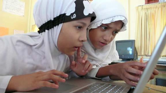
9 Slip Behavior of the Sunda Megathrust The coral data give evidence for a 15-year slow slip event at the Banyak Islands in the period From Tsang et al.; A 15-year slow slip event on the Sunda megathrust offshore Sumatra; GRL, Slip Behavior of the Sunda Megathrust This 15-year slow-slip event was located in an area that saw low slip in the 2005 Mw 8.6 Nias-Simeulue earthquake From Morgan et al., work in progress

10 Slip Behavior of the Sunda Megathrust We have modeled the GPS data to show that this earthquake was generated by a patch just up dip of the slow-slip event. Living with Disaster Prof. Isaac Kerlow

11 AXA Research Fund Outlook Project Communicating Risk Living with Disaster is a multimedia scenario that communicates the complex risks of living in naturally hazardous areas.
12 Communicating Risk Understanding risk from natural hazards and within different geographical contexts is not only a knowledge problem: it is also a communications challenge. The Art+Media Group at EOS The Art+Media Group explores innovative methods for communicating Earth science to a wide audience.


13 The Art+Media Group at EOS We also produce artworks and media projects inspired by natural hazards, with the purpose of raising awareness about Earth science issues. Documentary Films Art Projects Interactive Games Communication Pieces
14 Earth Girl 2 Tsunami Preparedness Casual Game Save lives from the tsunami. Free at Google Play, for tablets and large phones. Free at App Store, optimized for ipad Air


15 Earth Girl 2 Tsunami Preparedness Casual Game We have multiple audiences


16 Our core audience for outreach is non-scientists Woodlands Admiralty Primary School Government Officials Philippines Luzon Province Gov. Joey Salceda
17 Art+Media Group Website Emotion and Storytelling Living with Disaster uses the power of emotion and storytelling techniques to communicate the ideas behind the data,

18 Emotion and Storytelling so that average individuals can internalize different characterizations of risk and make it their own. Communicating through Interviews

19 Communicating through Graphics The AXA Outlook Project Living with Disaster shows how people have lived near disaster-prone areas throughout the ages and what survival strategies they have developed, followed or ignored.
20 The AXA Outlook Project It provides a qualitative characterization of risk across cultures using case studies of different natural hazards throughout multiple continents and centuries. 1 of 5 Only five AXA Outlook projects were awarded by the AXA Research Fund 2015 Scientific Committee, and Living with Disaster is the only one headed by a filmmaker.
21 Thank you! Q&A
Building Disaster Resilience Community in Asia: Indonesian perspective
 Workshop C of the 7th Science Council of Asia (SCA) Conference Construction of Secure and Safe Society against Global Changes of Natural Disasters Okinawa, June 14 th, 2007 Building Disaster Resilience
Inquiry: Sumatran earthquakes with GPS Earth Science Education
 Inquiry: Sumatran earthquakes with GPS Earth Science Education www.earthobservatory.sg Preparation: Before doing this investigation, complete two introductory investigations using GPS data from UNAVCO
Earth Observatory of Singapore. Nina Lin 22 Jan 2018
 Earth Observatory of Singapore Nina Lin 22 Jan 2018 EOS Our Mission Our Mission Director Prof. Kerry Sieh The Earth Observatory of Singapore conducts fundamental research on earthquakes, volcanic eruptions,
News Release December 30, 2004 The Science behind the Aceh Earthquake
 News Release December 30, 2004 The Science behind the Aceh Earthquake PASADENA, Calif. - Kerry Sieh, the Robert P. Sharp Professor of Geology at the California Institute of Technology and a member of Caltech's
Table of Contents. 17 Applied Projects. 5 Overview. 6 Focus on Nepal. 18 Community Engagement Office. 11 Paul Tapponnier. 19 Technical Office
 conducts fundamental research on earthquakes, volcanic eruptions, tsunamis and climate change in and around Southeast Asia, toward safer and more sustainable societies. Table of Contents 5 Overview 6 Focus
Bringing Earth Science to Life
 Bringing Earth Science to Life Earth History Geomorphology Surface Processes Soils Rocks Minerals Tectonics Using Natural Resources Careers www.edgeo.org In partnership with: Students investigate the
This document is downloaded from DR-NTU, Nanyang Technological University Library, Singapore.
 This document is downloaded from DR-NTU, Nanyang Technological University Library, Singapore. Title Aceh Andaman earthquake : what happened and what's next? Author(s) Sieh, Kerry Citation Sieh, K. (2005).
JICA s Experiences of Connecting Japanese Science & Technologies for Disaster Risk Reduction in Developing Countries
 JICA s Experiences of Connecting Japanese Science & Technologies for Disaster Risk Reduction in Developing Countries Junji WAKUI Deputy Director General, Group Leader Disaster Risk Reduction Group Global
NORTH VISTA SECONDARY SCHOOL HUMANITIES DEPARTMENT SECONDARY 3 EXPRESS HUMANITIES (GEOGRAPHY) 2272/02 CONTENT OUTLINE Term 1
 2272/02 CONTENT OUTLINE Term 1") NORTH VISTA SECONDARY SCHOOL HUMANITIES DEPARTMENT SECONDARY 3 EXPRESS HUMANITIES (GEOGRAPHY) 2272/02 CONTENT OUTLINE 2019 Term 1 Week Learning Outcomes Skills to be covered Assignment Test Project 1-2
NORTH VISTA SECONDARY SCHOOL HUMANITIES DEPARTMENT SECONDARY 3 EXPRESS HUMANITIES (GEOGRAPHY) 2272/02 CONTENT OUTLINE 2019 Term 1 Week Learning Outcomes Skills to be covered Assignment Test Project 1-2
GEOLOGICAL HAZARD MITIGATION STRATEGY IN INDONESIA
 GEOLOGICAL HAZARD MITIGATION STRATEGY IN INDONESIA Surono Head of Geological Agency presented in: The 2nd Global Summit of Research Institutes for Disaster Risk Reduction Kihada Hall, Uji Campus, Kyoto
EARTH SCIENCE OUTREACH AND COMMUNICATION EOS KNOWLEDGE CAPSULES
 EARTH SCIENCE OUTREACH AND COMMUNICATION EOS KNOWLEDGE CAPSULES The Earth Observatory of Singapore conducts fundamental research on earthquakes, volcanoes, tsunamis and climate change in and around Southeast
2008 JC2 H2 GEOGRAPHY: PIONEER JUNIOR COLLEGE PRELIMINARY EXAMS. Figure 1 for Question 1
 PHYSICAL GEOGRAPHY Figure 1 for Question 1 Figure 2 for Question 2 Tropical air mass source regions Figure 3 for Question 3 Figure 4 for Question 4 Volcanic gases Figure 5 for Question 5 EITHER Photograph
"The Natural Disasters, like The Sumatra Tsunami had taught us before -BUT" U Than Myint President Myanmar Engineering Society
 "The Natural Disasters, like The Sumatra Tsunami had taught us before -BUT" U Than Myint President Myanmar Engineering Society Present Day Regional Tectonic Setting of South East Asia Tsunami-generated
Risk posed by landslide generated tsunamis near southern Taiwan
 Risk posed by landslide generated tsunamis near southern Taiwan Adam D. Switzer 1,2, Linlin Li 1, Yu Wang 1, Robert Weiss 3, Qiang Qiu 1,2, Chung-Han Chan 1 1 Earth Observatory of Singapore, Nanyang Technological
The University of Tokyo
 The University of Tokyo Our ultimate mission is to study earthquake phenomenon scientifically, and to find out the ways to prevent or mitigate the disasters caused directly/indirectly by earthquakes. Slow
STUDY ON TSUNAMIGENIC EARTHQUAKE CRITERIA FOR THE INDONESIAN TSUNAMI EARLY WARNING SYSTEM
 STUDY ON TSUNAMIGENIC EARTHQUAKE CRITERIA FOR THE INDONESIAN TSUNAMI EARLY WARNING SYSTEM Nanang T. Puspito 1 1 Geophysics Research Group, Faculty of Mining and Petroleum Engineering, Institute of Technology
What are the social, technical, environmental and economic benefits and opportunities of accessing and sharing geodetic data?
 What are the social, technical, environmental and economic benefits and opportunities of accessing and sharing geodetic data? Graeme Blick Group Manager Positioning and Resilience Land Information New
The Indian Ocean. Copyright 2010 LessonSnips
 The Indian Ocean One of the five major geographic divisions of the world s ocean, the Indian Ocean is located in the Eastern Hemisphere. The Indian Ocean is bounded by three continents: Africa to the west,
Exploring Geography. Chapter 1. Chapter 1, Section
 Chapter 1, Section World Geography Chapter 1 Exploring Geography Copyright 2003 by Pearson Education, Inc., publishing as Prentice Hall, Upper Saddle River, NJ. All rights reserved. Chapter 1, Section
Word Cards. 2 map. 1 geographic representation. a description or portrayal of the Earth or parts of the Earth. a visual representation of an area
 Name: Date: Hour: Word Cards 1 geographic representation a description or portrayal of the Earth or parts of the Earth Example: A map is a representation of an actual location or place. 2 map a visual
SCIENCE IN THE NEWS Plate Tectonics
 SCIENCE IN THE NEWS Plate Tectonics From VOA Learning English, this is Science in the News. I m Anna Matteo. And I m Christopher Cruise. Scientists who study the Earth tell us the continents and ocean
Of topic specific knowledge and understanding To encourage progressive development in 'thinking geographically'
 [August 2012] Content exemplars 1. Broad description of the content: Single paragraph, written with technical precision Content rigour (avoiding generic statements) Identifying the core of essential knowledge
Geography GCSE. Year 9 Term and Topic Unit Content Homework Opportunities
 Geography GCSE Year 9 Term and Topic Unit Content Homework Opportunities Autumn Term 1: Geographical Skills Autumn Term 2: Tectonic Hazards Spring Term 1: Ecosystems Rainforest Students are required to
LECTURE #11: Volcanoes: Monitoring & Mitigation
 GEOL 0820 Ramsey Natural Disasters Spring, 2018 LECTURE #11: Volcanoes: Monitoring & Mitigation Date: 15 February 2018 I. What is volcanic monitoring? the continuous collection of one or more data sources
Determining Earth's History Rocks and Ice Cores
 Earths History Reu2.notebook November 14, 2013 Determining Earth's History Rocks and Ice Cores One goal of geology is to develop a timeline of Earth's past, including both geological and biological events.
Tuesday, September 05, 2017 Planet Earth
 Tuesday, September 05, 2017 Planet Earth Objective: Describe the solar system and Earth s location in it. Identify Earth s shape. Discuss Earth s structure. List Earth s landforms Do Now: What is a compass
CANBERRA SECONDARY SCHOOL Preliminary Examination 2
 CANBERRA SECONDARY SCHOOL 2015 Preliminary Examination 2 Secondary Four (Normal Academic) COMBINED HUMANITIES 11 August 2015 Geography Elective (2194/02) 1 hour 40 minutes 10.30 12.10 Name: ( ) Class:
General Oceanography Geology 105 Expedition 8 Plate Boundaries Beneath the Sea Complete by Thursday at 11:00 PM
 General Oceanography Geology 105 Expedition 8 Plate Boundaries Beneath the Sea Complete by Thursday at 11:00 PM Name Expedition Objectives Learn about the types of plate boundaries and their key characteristics
EARTHQUAKE SOURCE PARAMETERS FOR SUBDUCTION ZONE EVENTS CAUSING TSUNAMIS IN AND AROUND THE PHILIPPINES
 EARTHQUAKE SOURCE PARAMETERS FOR SUBDUCTION ZONE EVENTS CAUSING TSUNAMIS IN AND AROUND THE PHILIPPINES Joan Cruz SALCEDO Supervisor: Tatsuhiko HARA MEE09186 ABSTRACT We have made a set of earthquake source
RVO s Mission Statement and some of the Key Result Areas stated below captures some of these alternative best practices.
 PART I. Introduction Rabaul Volcanological Observatory (RVO) is the national institution responsible for monitoring volcanoes Papua New Guinea. It comes under the Department of Mineral Policy and Geohazards
DATA BASE DEVELOPMENT OF ETA (ESTIMATED TIME OF ARRIVAL) FOR TSUNAMI DISASTER MITIGATION AT SOUTHWESTERN CITIES OF ACEH, INDONESIA
 FOR TSUNAMI DISASTER MITIGATION AT SOUTHWESTERN CITIES OF ACEH, INDONESIA") 6 th South China Sea Tsunami Workshop Nanyang Technology University, Singapore, 6-8 November 2013 DATA BASE DEVELOPMENT OF ETA (ESTIMATED TIME OF ARRIVAL) FOR TSUNAMI DISASTER MITIGATION AT SOUTHWESTERN
6 th South China Sea Tsunami Workshop Nanyang Technology University, Singapore, 6-8 November 2013 DATA BASE DEVELOPMENT OF ETA (ESTIMATED TIME OF ARRIVAL) FOR TSUNAMI DISASTER MITIGATION AT SOUTHWESTERN
Plate Tectonics. By Destiny, Jarrek, Kaidence, and Autumn
 Plate Tectonics By Destiny, Jarrek, Kaidence, and Autumn .The Denali Fault and San Andreas Fault - The San Andreas Fault is a continental transform fault that extends roughly 1300 km (810 miles) through
Chapter 2: Plate Tectonics: A Unifying Theory
 Chapter 2: Plate Tectonics: A Unifying Theory Chapter Outline 2.1 Introduction 2.2 Early Ideas About Continental Drift 2.3 What Is the Evidence for Continental Drift? 2.4 Features of the Seafloor 2.5 Earth
Year 7 Geography. ü BBC Bitesize: Map and Atlas Skills https://www.bbc.com/education/topics/zm38q6f
 Year 7 Year 7 Geography ü Mapping and map skills (continents, compass directions, grid references) ü Tourism in the UK ü Rivers (Water cycle, river landforms) ü Population (push and pull factors, population
Australia Government Geospatial Capacity Building Efforts in Asia and the Pacific. Dr John Dawson
 Australia Government Geospatial Capacity Building Efforts in Asia and the Pacific Dr John Dawson Presentation Overview About Geoscience Australia Examples of Geospatial Capacity Building Activity Geodesy
The Cascading Hazards from Cascadia s Earthquakes
 Tsunamis The Cascading Hazards from Cascadia s Earthquakes Earthquakes (Nisqually earthquake, Seattle, WA) Volcanoes (Mt St Helens eruption, WA) Joan Gomberg gomberg@usgs.gov Landslides (Oso landslide,
Natural Disasters in Member Countries (2002 Summary)
") 4.2 Member Countries and their Disaster Characteristics: Table 5: Natural Disasters in Member Countries (2002 Summary) (Country/Disaster Type/Disaster Characteristics) Data Country DisType Count of TotAff
4.2 Member Countries and their Disaster Characteristics: Table 5: Natural Disasters in Member Countries (2002 Summary) (Country/Disaster Type/Disaster Characteristics) Data Country DisType Count of TotAff
International Research Collaboration in Indonesia: LIPI as a special reference
 Workshop on Science & Technology Cooperation With Developing Countries on Global Issues. Tokyo, 8 October 2008 International Research Collaboration in Indonesia: LIPI as a special reference Hery Harjono
EARTH S SYSTEMS: PROCESSES THAT SHAPE THE EARTH
 9 Week Unit UNIT 2 EARTH S SYSTEMS: PROCESSES THAT SHAPE THE EARTH Fourth Grade Rogers Public Schools : Earth s Systems: Processes that Shape the Earth 9 weeks In this unit, students develop understandings
Current tsunami research activities in the Philippines
 DOST PHIVOLCS Current tsunami research activities in the Philippines Graciano P. Yumul, Jr. 1,2, Carla B. Dimalanta 1 and Bart Bautista 3 1 National Institute of Geological Sciences, University of the
Overview of Philippine Geohazards Programs
 Overview of Philippine Geohazards Programs 53 rd CCOP Annual Session CCOP-IUGS Task Group on Geohazards Joint Seminar Cebu City, PHILIPPINES October 18, 2017 Renato U. Solidum, Jr. Department of Science
GEOSCIENCES (GEO) Geosciences (GEO) 1. GEO 307H. *NATIONAL PARK GEOLOGY AND PRESERVATION. (3 Credits)
 Geosciences (GEO) 1. GEO 307H. *NATIONAL PARK GEOLOGY AND PRESERVATION. (3 Credits)") Geosciences (GEO) 1 GEOSCIENCES (GEO) GEO 100. *NATURAL DISASTERS: HOLLYWOOD VERSUS REALITY. (4 Introduction to natural hazards, as seen through the lens of popular media. Course will explore the causes
Geosciences (GEO) 1 GEOSCIENCES (GEO) GEO 100. *NATURAL DISASTERS: HOLLYWOOD VERSUS REALITY. (4 Introduction to natural hazards, as seen through the lens of popular media. Course will explore the causes
Report for 15th PCGIAP Meeting at 18th UNRCC-AP Working Group 1 Regional Geodesy
 Report for 15th PCGIAP Meeting at 18th UNRCC-AP Working Group 1 Regional Geodesy Chairman Shigeru Matsuzaka, Japan - shigeru@gsi.go.jp Vice Chairman Prof. Pengfei Cheng, China - chengpf@casm.ac.cn John
CAPE Unit 1 Module 2 & 3. Topic Specific Objectives Content Explain the main concepts, flows and processes associated with coastal environments
 # Week(s) Wks 1-3 CAPE Unit 1 Module 2 & 3 Topic Specific Objectives Content Explain the main concepts, flows and processes associated with coastal environments Wave formation, structure, types Textbook
The Challenge of Earthquake Disaster in Indonesia. Hery Harjono Indonesian Institute of Sciences
 The Challenge of Earthquake Disaster in Indonesia Hery Harjono Indonesian Institute of Sciences * Presented at the J-Rapid Symposium, Sendai, Japan, March 6-7, 2013 INTRODUCTION The 2004 Giant Sumatran-Andaman
Disclaimer. This report was compiled by an ADRC visiting researcher (VR) from ADRC member countries.
 from ADRC member countries.") Disclaimer This report was compiled by an ADRC visiting researcher (VR) from ADRC member countries. The views expressed in the report do not necessarily reflect the views of the ADRC. The boundaries and
Disclaimer This report was compiled by an ADRC visiting researcher (VR) from ADRC member countries. The views expressed in the report do not necessarily reflect the views of the ADRC. The boundaries and
GEO-VIII November Geohazard Supersites and Natural Laboratories Progress Report. Document 9
 GEO-VIII 16-17 November 2011 Geohazard Supersites and Natural Laboratories Progress Report Document 9 This document is submitted to GEO-VIII for information. Geohazard Supersites and Natural Laboratories
Colorado Academic Standards for High School Science Earth Systems Science
 A Correlation of Pearson 12 th Edition 2015 Colorado Academic Standards Introduction This document demonstrates the alignment between, 12 th Edition, 2015, and the, Earth Systems Science. Correlation page
No. of Periods. Syllabus Topics Specific Objectives Teaching Strategies. rational to live in hazard-prone areas?
 (Syllabus for F.4 Geog. September 2016 - July 2017) -1- SING YIN SECONDARY SCHOOL SYLLABUS FOR GEOGRAPHY -- SEPTEMBER 2016 - JULY 2017 FORM FOUR Textbooks : Senior Secondary Exploring Geography 1 (Second
Scripps News at 2014 AGU Fall Meeting
 UNIVERSITY OF CALIFORNIA, SAN DIEGO SCRIPPS INSTITUTION OF OCEANOGRAPHY NEWS Scripps contact: Mario Aguilera (858-245-3175) or AGU Press Room Scripps Communications: 858-534-3624, scrippsnews@ucsd.edu
Preparation for Future Earthquake and Tsunami Hazards: Lessons Learned from the 2004 Sumatra-Andaman Earthquake and the Asian Tsunami
 First International Conference of Aceh and Indian Ocean Studies Organized by Asia Research Institute, National University of Singapore & Rehabilitation and Construction Executing Agency for Aceh and Nias
NATIONAL SPORTS SCHOOL ST BENEDICT COLLEGE
 NATIONAL SPORTS SCHOOL ST BENEDICT COLLEGE Mark HALF-YEARLY EXAMINATION 2013/14 FORM 2 GEOGRAPHY (Levels 8 7 6 5) TIME: 1h 30 min Name: Class: Answer ALL the questions. 1. TRUE or FALSE? Put a in the correct
FINAL EXAM December 20 th, here at 1:00 3:00 pm
 FINAL EXAM December 20 th, here at 1:00 3:00 pm REVIEW SESSION December 11 th at 6:00-7:30 pm Morrill I Auditorium (Room N375) Same as last time Don t forget your online course evaluations! Major Volcanic
Earth Science (Tarbuck, et al) 2009 Correlated to: Colorado Academic Standards Science (High School)
 2009 Correlated to: Colorado Academic Standards Science (High School)") Content Area: Science Standard: Earth Systems Science Prepared Graduates: Describe and interpret how Earth's geologic history and place in space are relevant to our understanding of the processes that
Content Area: Science Standard: Earth Systems Science Prepared Graduates: Describe and interpret how Earth's geologic history and place in space are relevant to our understanding of the processes that
Burnaby Online Program School District #41 Burnaby. Course: Geography 12 Course Length: 10 months (approx 100 hours) Teacher: Phone: IM:
 Teacher: Phone: IM:") Course Plan Burnaby Online Program School District #41 Burnaby Course: Geography 12 Course Length: 10 months (approx 100 hours) Teacher: Email: Phone: IM: Course Description: Lesson 1-1: Major Themes of
Course Plan Burnaby Online Program School District #41 Burnaby Course: Geography 12 Course Length: 10 months (approx 100 hours) Teacher: Email: Phone: IM: Course Description: Lesson 1-1: Major Themes of
Earthquake Hazards. Tsunami
 Earthquake Hazards Tsunami Measuring Earthquakes Two measurements that describe the power or strength of an earthquake are: Intensity a measure of the degree of earthquake shaking at a given locale based
Earthquake Hazards. Tsunami
 Earthquake Hazards Tsunami Review: What is an earthquake? Earthquake is the vibration (shaking) and/or displacement of the ground produced by the sudden release of energy. The point inside the Earth where
Progress Report: Sentinel Asia Success Story in the Philippines
 Progress Report: Sentinel Asia Success Story in the Philippines 3 rd Joint Project Team Meeting on the Sentinel Asia STEP-2 July 6-8, 2010 Hyatt Hotel, Manila, Philippines Renato U. Solidum Jr. Director
Lessons from the 2004 Sumatra earthquake and the Asian tsunami
 Lessons from the 2004 Sumatra earthquake and the Asian tsunami Kenji Satake National Institute of Advanced Industrial Science and Technology Outline 1. The largest earthquake in the last 40 years 2. Tsunami
Mount Pinatubo and the Ring of Fire
 Mount Pinatubo and the Ring of Fire Mount Pinatubo and the Ring of Fire On July 16, 1990, a large earthquake struck Luzon, an island in the Philippines. The earthquake devastated cities for hundreds of
21CLD Learning Activity Description
 Learning Activity Example: Olympics Site Selection 1 21CLD Learning Activity Description 1. Title of Learning Activity & Average Age of Students Title: Olympics Site Selection Average Age of Students:
PALEOGEOGRAPHY of NYS. Definitions GEOLOGIC PROCESSES. Faulting. Folding 9/6/2012. TOPOGRAPHIC RELIEF MAP of NYS GRADATIONAL TECTONIC
 TOPOGRAPHIC RELIEF MAP of NYS PALEOGEOGRAPHY of NYS Prof. Anthony Grande AFG 2012 Definitions GEOLOGIC PROCESSES Geography: study of people living on the surface of the earth. Geology: the scientific study
NGIAs' roles in successful disaster response
 The Second UN-GGIM-AP Plenary Meeting NGIAs' roles in successful disaster response Japan Teheran Iran 28 October 2013 Shin-ichi SAKABE, Director of International Affairs Division Geospatial Information
Core Curriculum Supplement
 Core Curriculum Supplement Academic Unit / Office EAS Catalog Year of Implementation 2018-2019 Course (Prefix / Number) GEOL / 1370 Core Proposal Request Add to Core Curriculum Course Title Natural Disasters
GEOLOGY (GEOL) Geology (GEOL) 1. GEOL 118 Societal Issues in Earth Science (4 crs)
 Geology (GEOL) 1. GEOL 118 Societal Issues in Earth Science (4 crs)") Geology (GEOL) 1 GEOLOGY (GEOL) GEOL 102 Oceanography (3 crs) Survey of the world oceans with emphasis on geologic processes. Also includes chemical, physical, and biological aspects of the sea. Investigates
Geology (GEOL) 1 GEOLOGY (GEOL) GEOL 102 Oceanography (3 crs) Survey of the world oceans with emphasis on geologic processes. Also includes chemical, physical, and biological aspects of the sea. Investigates
The potential tsunami threats from the South China Sea and hazard mitigation
 The potential tsunami threats from the South China Sea and hazard mitigation Dr. Tso-Ren Wu ( 吳祚任 ) Graduate Institute of Hydrological and Oceanic Sciences National Central University 國立中央大學水文與海洋科學研究所
Tsunami Research and Its Practical Use for Hazard Mitigation. Hiroo Kanamori Seismological Laboratory, California Institute of Technology
 Tsunami Research and Its Practical Use for Hazard Mitigation Hiroo Kanamori Seismological Laboratory, California Institute of Technology Cause of Tsunami Earthquakes Landslides Volcanic origin Impact (Dr.
Cooperating Organization Report of Circum Pacific Council for Energy and Mineral Resources (CPC)
") CCOP-41AS/6.2-29 Coordinating Committee for Geoscience Programmes in East and Southeast Asia (CCOP) 41 st CCOP Annual Session 15 18 November 2004 Tsukuba, Japan Cooperating Organization Report of Circum
CCOP-41AS/6.2-29 Coordinating Committee for Geoscience Programmes in East and Southeast Asia (CCOP) 41 st CCOP Annual Session 15 18 November 2004 Tsukuba, Japan Cooperating Organization Report of Circum
Tectonic Processes and Hazards Enquiry Question 1: Why are some locations more at risk from tectonic hazards?
 Tectonic Processes and Hazards Enquiry Question 1: Why are some locations more at risk from tectonic hazards? Key words Basalt Andesite Rhyolite Benioff Zone Subduction zone Crustal fracturing Definition
Disaster Prevention and Management in Asia: The Context of Human Security and Its Relevance to Infrastructure Planning and Management
 Disaster Prevention and Management in Asia: The Context of Human Security and Its Relevance to Infrastructure Planning and Management Rajib Shaw http://www.iedm.ges.kyoto-u.ac.jp/ Contents Background and
Natural hazards risk factors a card sort
 Student tasks 1. Cut up the cards below. 2. Read all of the risk factors and explanations carefully. Match each risk factor to its correct explanation. 3. Identify and explain which risk factor you feel
MCAS QUESTIONS: THE EARTH S INTERIOR, CONTINENTAL DRIFT, PLATE TECTONICS
 NAME: PER: MCAS QUESTIONS: THE EARTH S INTERIOR, CONTINENTAL DRIFT, PLATE TECTONICS 1. Which of the following statements best explains why the lower mantle of Earth is much more rigid and dense than the
M14/3/GEOGR/SP2/ENG/TZ0/XX/Q GEOGRAPHY STANDARD LEVEL PAPER 2. Monday 19 May 2014 (morning) 1 hour 20 minutes INSTRUCTIONS TO CANDIDATES
 1 hour 20 minutes INSTRUCTIONS TO CANDIDATES") M14/3/GEOGR/SP2/ENG/TZ0/XX/Q 22145203 GEOGRAPHY STANDARD LEVEL PAPER 2 Monday 19 May 2014 (morning) 1 hour 20 minutes INSTRUCTIONS TO CANDIDATES Do not open this examination paper until instructed to do
M14/3/GEOGR/SP2/ENG/TZ0/XX/Q 22145203 GEOGRAPHY STANDARD LEVEL PAPER 2 Monday 19 May 2014 (morning) 1 hour 20 minutes INSTRUCTIONS TO CANDIDATES Do not open this examination paper until instructed to do
Tectonic Forces Simulation: Earthquakes Activity One
 Tectonic Forces Simulation: Earthquakes Activity One Introduction If you marked all the earthquakes from the past century on a world map, you'd notice that most tend to occur along certain lines around
EXPLORE PLATE TECTONICS & MORE THROUGH GPS DATA. Shelley Olds, UNAVCO April 12, 2018 NGSS Webinar
 EXPLORE PLATE TECTONICS & MORE THROUGH GPS DATA Shelley Olds, UNAVCO April 12, 2018 NGSS Webinar Today s Outline Central question: How do we know the tectonic plates are still moving? -- What evidence
Publishable Summary. Summary Description of the project context and main objectives
 Publishable Summary Summary Description of the project context and main objectives Tsunamis are low frequency but high impact natural disasters. In 2004, the Boxing Day tsunami killed hundreds of thousands
Students will be able, using GIS, to locate the largest and most destructive earthquakes;
 Exploring Earthquake Hazards with GIS Laboratory for Introduction to Geophysics, Spring 2007 Prof. Constantin Cranganu Brooklyn College of the City University of New York Learning Objectives: Students
Earthquakes Modified
 Plate Tectonics Earthquakes Modified Recall that the earth s crust is broken into large pieces called. These slowly moving plates each other, each other, or from each other. This causes much on the rocks.
Geospatial framework for monitoring SDGs/Sendai targets By Shimonti Paul Sr. Assistant Editor Geospatial Media & Communications
 Geospatial framework for monitoring SDGs/Sendai targets By Shimonti Paul Sr. Assistant Editor Geospatial Media & Communications Outline 1. Introduction to Geospatial Media and Communications 2. Geospatial
The Dynamic Earth Section 1. Chapter 3 The Dynamic Earth Section 1: The Geosphere DAY 1
 Chapter 3 The Dynamic Earth Section 1: The Geosphere DAY 1 The Earth as a System The Earth is an integrated system that consists of rock, air, water, and living things that all interact with each other.
Vocabulary Words. theory continental drift fault magma lava. weathering glacier erosion deposition delta
 Earth s Landforms Vocabulary Words theory continental drift fault magma lava weathering glacier erosion deposition delta Theory: A possible explanation. Continental drift: The continuing movement of the
Earthquake Hazards. Tsunami
 Earthquake Hazards Tsunami Review: What is an earthquake? Earthquake is the vibration (shaking) and/or displacement of the ground produced by the sudden release of energy. The point inside the Earth where
New A-Level Physical Geography
 Half Term 1 3.1 Physical Geography: 3.1.5 Hazards: Plate Tectonics This optional section of our specification focuses on the lithosphere and the atmosphere, which intermittently but regularly present natural
A GLOBAL SURGE OF GREAT EARTHQUAKES FROM AND IMPLICATIONS FOR CASCADIA. Thorne Lay, University of California Santa Cruz
 A GLOBAL SURGE OF GREAT EARTHQUAKES FROM 2004-2014 AND IMPLICATIONS FOR CASCADIA Thorne Lay, University of California Santa Cruz Last 10 yrs - 18 great earthquakes: rate 1.8/yr; rate over preceding century
Changing Earth: Plate Tectonics
 Changing Earth: Plate Tectonics Static Earth Theory People used to believe that the Earth and its continents could not change since it was created They thought that earthquakes and volcanoes were caused
Year 11 Geography GCSE Assessment Booklet Section A: The challenge of natural hazards
 Year 11 Geography GCSE Assessment Booklet Section A: The challenge of natural hazards Question Mark & Grade 9 1 Explain why the majority of earthquakes and volcanoes occur at plate margins (6 marks) Choose
The Third UN-GGIM-AP Plenary Meeting. Use of Geospatial Information in Disaster and Coordination among NDMA and Relevant Organizations/Stakeholders
 The Third UN-GGIM-AP Plenary Meeting Use of Geospatial Information in Disaster and Coordination among NDMA and Relevant Organizations/Stakeholders Bali Indonesia 10 November 2014 Bernardus Wisnu Widjaja
Coseismic slip model
 Figure 3 - Preliminary highly smoothed model of coseismic slip for the 11 March UCL Institute for Risk & Disaster Reduction Magnitude 9.0 (JMA scale) earthquake Occurred at 02:46:23 pm local time near
Level 1 Geography, 2015
 91007 910070 1SUPERVISOR S Level 1 Geography, 2015 91007 Demonstrate geographic understanding of environments that have been shaped by extreme natural event(s) 9.30 a.m. Thursday 12 November 2015 Credits:
Seismic Activity and Crustal Deformation after the 2011 Off the Pacific Coast of Tohoku Earthquake
 J-RAPID Symposium March 6-7, 2013 Seismic Activity and Crustal Deformation after the 2011 Off the Pacific Coast of Tohoku Earthquake Y. Honkura Tokyo Institute of Technology Japan Science and Technology
Application of a GIS for Earthquake Hazard Assessment and Risk Mitigation in Vietnam
 Application of a GIS for Earthquake Hazard Assessment and Risk Mitigation in Vietnam Nguyen Hong Phuong Earthquake Information and Tsunami Warning Centre, VAST OUTLINE Introduction Fault Source Model and
Assessing Hazards and Risk
 Page 1 of 6 EENS 204 Tulane University Natural Disasters Prof. Stephen A. Nelson Assessing Hazards and Risk This page last updated on 07-Jan-2004 As discussed before, natural disasters are produced by
MINISTRY OF NATURAL RESOURCES AND ENVIRONMENT Vietnam Institute of Geosciences and Mineral Resources (VIGMR)
") MINISTRY OF NATURAL RESOURCES AND ENVIRONMENT (VIGMR) Nguyen Quoc Dinh Representative of VIGMR to Sentinel Asia Awaji, Japan, November 1 st,2018 CONTENTS INTRODUCTION TO VIGMR COOPERATION and CONTRIBUTION
MINISTRY OF NATURAL RESOURCES AND ENVIRONMENT (VIGMR) Nguyen Quoc Dinh Representative of VIGMR to Sentinel Asia Awaji, Japan, November 1 st,2018 CONTENTS INTRODUCTION TO VIGMR COOPERATION and CONTRIBUTION
Plate Tectonic Review, Types of Plates
 Plate Tectonic Review, Types of Plates Review from last week: 1. Alfred Wegener: thought that sections of the Earth s crust moved, but people were confused, and thought that continents drifted over water
SEISMIC HAZARD ANALYSIS AND SEISMIC INPUT TO TSUNAMI MODELING FOR MICROZONATION OF MEURAXA DISTRICT CITY OF BANDA ACEH
 SEISMIC HAZARD ANALYSIS AND SEISMIC INPUT TO TSUNAMI MODELING FOR MICROZONATION OF MEURAXA DISTRICT CITY OF BANDA ACEH I W. Sengara 1, Hendarto 1, P. Sumiartha 1, H. Latief 1, S.B. Kusuma 1 and Munirwansjah
Ch. 9 Review. Pgs #1-31 Write Questions and Answers
 Ch. 9 Review Pgs. 356-357 #1-31 Write Questions and Answers 356-357 #1-5 Answers 1. The layer of the upper mantle that can flow is the: A - Asthenosphere 2. Most scientists rejected Wegener s theory of
SPICE & Disaster Risk Managment
 SPICE & Disaster Risk Managment Linking Integrated Coastal Zone Management (ICZM) with Tsunami Disaster Risk Management: Some Experiences from Capacity Building Measures in Indonesia International Symposium
Commission on Statistics in Volcanology (COSIV)
") Commission on Statistics in Volcanology (COSIV) IAVCEI meeting, Kagoshima, 23 July 2013, 12:00-13:30, Room A2 Agenda 1. Structure/organization of commission (see attached draft) 2. Workshop(s) 3. The commission
Commission on Statistics in Volcanology (COSIV) IAVCEI meeting, Kagoshima, 23 July 2013, 12:00-13:30, Room A2 Agenda 1. Structure/organization of commission (see attached draft) 2. Workshop(s) 3. The commission
Conceptual Understandings for K-2 Teachers
 AFK12SE/NGSS Strand Disciplinary Core Ideas ESS1: Earth s Place in the Universe What is the universe, and what is Earth s place in it? ESS1. A: The Universe and Its Stars What is the universe, and what
Moho (Mohorovicic discontinuity) - boundary between crust and mantle
 - boundary between crust and mantle") Earth Layers Dynamic Crust Unit Notes Continental crust is thicker than oceanic crust Continental Crust Thicker Less Dense Made of Granite Oceanic Crust Thinner More Dense Made of Basalt Moho (Mohorovicic
Earth Layers Dynamic Crust Unit Notes Continental crust is thicker than oceanic crust Continental Crust Thicker Less Dense Made of Granite Oceanic Crust Thinner More Dense Made of Basalt Moho (Mohorovicic