ASSESSMENT REPORT. Geochemical and Geological Surveys. on the. Gooch#1-4. Mineral Claims. Omenica Mining District NTS 93L/7W
|
|
|
- Reynard Haynes
- 5 years ago
- Views:
Transcription
1 f- GEOLOGICAL BRANCH ASSESSMENT REPORT ASSESSMENT REPORT Geochemical and Geological Surveys on the Gooch#1-4 Mineral Claims Omenica Mining District NTS 93L/7W LAT: 54O25'W LONG: 126O26'W Operator: SMD Mining Co. Ltd. Owner: SMD Mining Co. Ltd. Diane Howe October 1982
2 SUMMARY Jailbird Prospect (Gooch Claims) - Summary The Gooch 1-4 claims are located in an area of gentle to moderate topography 8 kilometres west of Houston and 60 kilometres south of Smithers in west-central British Columbia (Figure 1). Previous work in the area involved programs of geological, geochemical and geophysical surveys and diamond drillng to test for copper-molybdenum mineralization. The group is presently held by SMD Mining Co. Ltd. of Vancouver who are examining the area as a potential host for bulk-tonnage epithermal precious metal deposits. Field work in 1982 consisted of: A soil geochemical survey of 320 soil, silt and rock samples analyzed for Au, Ag, Cu, Mo, Pb, Zn, As and Sb; and geological mapping at a scale of 1:5,000 over most of the property. Oldest rocks on the property are Lower Jurassic volcaniclastic and sedimentary rocks belonging to the Hazelton Group. Locally, these rocks have been intruded by a quartz-feldspar porphyritic "plug1'. An advanced argillic alteration zone has been defined, and appears to envelop the porphyry intrusive. A well developed qua'rtz-stockwork with fine-grained molybdenite mineralization is associated with the argillic a1 teration. Pyrite is widespread throughout the altered zone and occurs in veinlets and disseminations. A strong soil geochemical anomaly with coincident high gold, silver, arsenic and molybdenum values (1300 metres x 1000 metres) is concentrated within the zone of inferred argillic alteration.
3 (ii) TABLE OF CONTENTS Page SUMMARY TABLE OF CONTENTS LIST OF MAPS i ii iii Introduction Claims Status History Geology Geochemis try Soil and Silt Recommendations STATEMENT OF EXPENDITURES STATEMENT OF QUALIFICATIONS ; 5 6 iv V
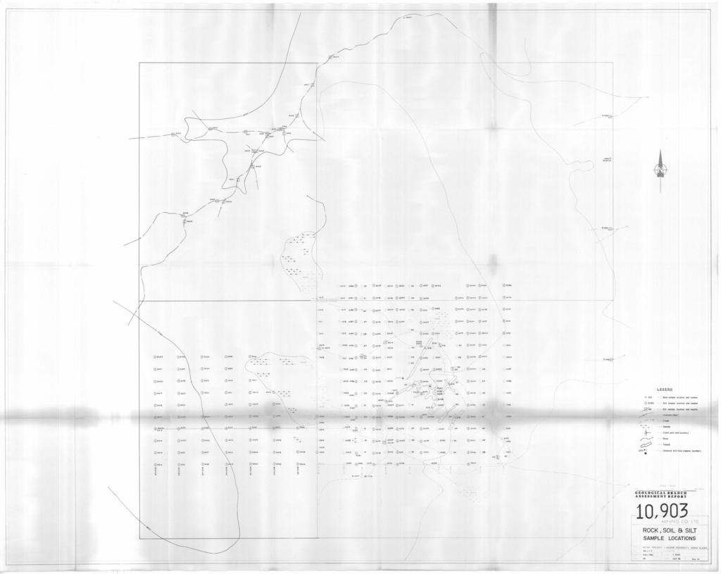
4 . (iii) LIST OF MAPS Fig. 1 Fig. 2 Fig. 3 Property Location Map Claim Disposition Map Regional Geology Map Geology and Rock Geochemistry Gold and Silver Soil and Silt Geochemistry Lead and Zinc Soil and Silt Geochemistry Copper and Molybdenum Soil and Silt Geochemistry Arsenic and Antimony Soil and Silt Geochemistry Sample Location Map in pocket in pocket in pocket in pocket in pocket in pocket
5 BUL KL EY RANGES PROVINCIAL lo km. SCALE I :1,000, I A LOCATION MAP Gooch claims FIG. 1.-
6 -I- Introduction The Gooch 1-4 claims are centered at 54' 2YN latitude and 126'54'W longitude on NTS map sheet 93 L/7W and is located 60 kilometres south of the city of Smithers, a modern mining community of approximately 7000 (Fig. 2). Easiest access to the claims is via the Morice River - Telkwa forestry trunk road which exits off Yellowhead MI6 Highway at Quick, 33 kilometres south of Smithers. Final access is by a four-wheel drive road which leaves the forestry road 25 km south of Quick. An alternative route is near Houston where the Morice River -Telkwa road joins the Owen-Morice River forestry road 8 kilometres south of Houston. Physiographically the Gooch claims are located on the east side of the Telkwa Ranges within the Hazelton Mountains of west-central British Columbia. There is very little relief on the property which lies at 950 metres ASL. Logged out or burned deadfall cover 25% of the claims area otherwise the property has thick forest coverage and/or is swamp covered.
7 I 126'54' 54025' GOOCH 3 L.C.P.. GOOCH 2 GOOCH 4 \ to Houston aprox. 8 km EMERSON 1000 I metres P smd MINING CO. LTD. PROJECT CLAIMS DlSPOSlT ION MAP FIG. 2
8 - 2- Claims Status Claim Name Units Record No. Record Date Expiry Date Gooch fl June 28, 1982 June 28, 1983 Gooch # June 28, 1982 June 28, 1983 Gooch # Aug 4, 1982 Aug 4, 1983 Gooch # Aug 4, 1982 Aug 4, History Earliest recorded activity in the Gooch area was in 1966 when W.H. Smith of Telkwa B.C. staked the Lybdenum 1-3 claims and optioned them to Amax of Vancouver, who subsequently staked the Barr 1-42 claims immediately to the west. During the summers of Amax,: as operators, conducted geological mapping, geochemical surveys for copper and molybdenum, 7 miles of I.P. work, approximately 4000 linear feet of trenching and diamond drilling totalling 3079 feet. Amax subsequently dropped the options giving both the Barr and Lybdenum claims back to Smith. In 1969 Fortune Channel Mines staked the claims (Ba, Lb, Cu, Mag, Jane) around the Barr and Lybdenum claims. Fortune Channel conducted geochemical and magnetometer surveys covering a total of 31.5 line miles between 1969 and After 1971 it is believed all claims were allowed to lapse. There is no recorded activity between 1972 and In 1977, K.W. Livingstone staked the Jailbird and Jailbird 2 claims to cover ground once held by the Barr and Lybdenum claims. Work conducted in 1977 included a rock geochemical survey of the trenches. Samples were analyzed for Cu, Mo, Pb, Zn, Sn, W.
9 - 3 - There has been no further work done until SMD Mining restaked the property as the Gooch claims in June Geology Bedrock exposure is sparse and largely confined to stream gulleys and old trenches. Glacial alluvium masks a great deal of the claim area. Geological mapping at a scale of 1:5,000 was conducted over selected areas of the property using a topographic map for control. The oldest rocks on the claim group are Early Jurassic, dominantly andesitic to dacitic pyroclastics, epiclastics, flows and sedimentary rocks belonging to the Telkwa formation of the Hazelton Group (Fig. 3). Green and purple weathering volcanic breccia and lapilli-tuff are common. An interbedded succession of greywacke, tuffaceous siltstone and shales have been mapped in the northwest corner of the claim block. Generally strike is north-northeast and dips are low at 35'- 15' east. Intrusive to the volcanic pile is an intensely argillized quartzfeldspar, porphyritic "plug". Surrounding, and believed extrusive equivalents to the quartz-feldspar porphyry are flow-banded rhyolites, rhyolitic crystal-tuffs and a porphyritic quartz-eye rhyolite which could represent the outer phase of the intrusive. An advanced argillic alteration zone envelops the intrusive and its extrusive equivalents. Argillic alteration is recognized by the presence of quartz, and clay replacement of feldspars. A quartz stockwork with veins and veinlets up to 0.5 cm wide is directly associated with the alteration. Small grains of molybdenite have been recognized within the veins in some hand samples. Pyritic
10 t c U - N.C. I I! a LEGEND TERTIARY 0 Ootmo Loke Group a Cronodiorlc, monzonitc JURASSIC Hozrllon Group Cronodiorte, monzonitc, quartz diortc, SCALE I~2,000,000 pdg MINING CO. LTD. REGIONAL GEOLOGY Gooch claims pe'.:!1 FIG. 3
11 - 4- mineralization is widespread throughout the argillic zone. Pyrite was not noted in the volcanic host rocks. A local breccia pipe (?) occurs on the north side of the quartz-feldspar porphyry. Geochemistry A total of 320 soil, silt and rock geochemical samples were collected on the Gooch d 1-4 claims. Soil samples were collected on flagged lines 200 metres apart at 100 metre stations. Between lines 2+00W and 14+00W, lines were spaced at 100 metres. Rock chips were collected from trench sites and from various rock outcrops within the claim area. All samples were analyzed for Au, Ag, Pb, Zn, Cu, Mo, As and Sb by Acme Analytical Laboratories of Vancouver. All samples were sieved to - 80 mesh then pulverized to 100% -200 mesh. Analysis was by I.C.P. except for gold where A.A. methods were employed. Threshold levels were selected as follows: Soil & Silt (ppm) Gold 30 (ppb) Silver 1.2 Lead 100 Zinc 200 Copper 50 Molybdenum 5 Arsenic 35 Antimony 5 Range (for rock) (1-125) (2-190) (2-13)
12 - 5 - Soil and Silt Gold Values in general are low. Anomalous samples vary between 35 and 180ppb, and probably average about 90ppb. An irregular shaped 200 metre x 400 metre anomalous zone encompasses the area of trenching. One scattered high value occurs 500 metres to the west in close proximity to an altered rhyolitic crystal tuff outcrop. Anomalous gold values appear to have a bedrock affinity and may only reflect bedrock highs (i.e., thin over burden). Silver An encouraging irregular shaped, east-west trending silver anomaly occurs between lines 6+00W to 22+00W. Anomalous values range from 1.2 to 5.Oppm with average around 2.5 ppm. Over the trenched area, an overlapping NW-SE- trending anomaly occurs associated with the gold. There are a few scattered high values occurring elsewhere on the grid. High copper values are sporadic and clusters of anomalous values are scattered across the grid. Anomalous values range from 40 to 100ppm with the average near 55 ppm. Molybdenum High molybdenum values occur only within the zone of inferred argillic alteration. Anomalous values range from 5 to 24 ppm with the average value near 10 ppm. High molybdenum values are coincident with gold and silver and show a partial association with copper values.
13 - 6 - Arsenic and Antimony High arsenic values (35 ppm) show a tendency to cluster around anomalous gold values generally coincident with the silver anomaly. Several anomalous values occur scattered across the grid. There are no striking antimony anomalies. A few scattered anomalous samples that do occur are located within the silver anomaly. Recommendations Results of the 1982 field geochemistry program are sufficiently encouraging to recommend further work. Backhoe trenching and more complete rock litho-geochemistry should be done to delineate or extend areas of interest as a prelude to a percussion drilling program. I It is also recommended that at least two deep diamond drill holes involving metres be drilled to test for deep porphyry molybdenite mineralization.
14 - iv - STATEMENT OF EXPENDITURES Itemized Cost Statement - Gooch Claims Salaries R. Cann, Project Geologist, July 31 - Aug. 5 6 i 1, D. Howe, Geologist June 6 - June 10 5 $95.00/day A. Young, Jr. Assistant June 6 - June 10 5 $68.00/day D. O'Neil, Sr. Assistant June 7 - June 10 4 $76.00/day Mark Baker July 28 - Aug. 4 8 $51.00/day , Charles Dodsworth July 28 - Aug. 4 8 $58.00/day $ 3, Geochemistry (analysis, preparation and shipping) 320 $10.12/sample (Au, Ag, Pb, Zu, Cu, Mo, As, Sb, Bay Bi, Ma) $ 3, Motel, Room & Board (Midway Inn, Houston) June 6 - June 10 July 28 - Aug. 5 $ $ 1, Tuck Rental - June 6 - June 10 - July 28 - Aug. $900/mo. Gas Drafting & Materials Report Writing - 2 $1,25O/mo. $ $ $ $ $ Total $ 8,626.00
15 -v - STATEMENT OF QUALIFICATIONS I, Diane J. Howe, of Vancouver, British Columbia, hereby certify: That I am a geologist residing at 3926 Valley Drive, Vancouver, British Colu m b ia. That I am a graduate of the University of British Columbia with a B.Sc. Degree in Geology, That I have practiced my profession since graduation. That I personally supervised and carried out the work on the Gooch #l-4 claim group. Diane Howe Oct. 28, 1982
16
17
18
19
20
21
22
CONTENTS. Location, Access and History...6. Tenure Status and Geology Regional Andy Property Geology Map...9
 TYPE OFWORK IN THIS REPORT EXTENT OF WORK (rn METRTC UNITS) ON WHICH CLAIMS PROJECT COSTS APPORTIONED (incl. support) GEOLOGICAL (scale, area) Ground, mapping Photo interpretation GEOPHYSICAL (line-kilometres)
lat ' N Long ' W
 305 7 ec1;, REPORT ON THE JERY CLAIMS OF POLA RESOURCES LTD. NTS 93L/16 0 0 lat. 54 45' N Long. 126 22' W BABIXE LAKE AREA OMINECA MINING DIVISION, B.C. PAUL PLICKA CONSULTING GEOLOGIST DECEMBER 30, 1981
PRECIOUS METALS. owner. JMT Services Corp. GEOCHPlICAL SAMPLING CHELASLIE WCE, NORTH CENTRAL, B.C. OMINECA MINING DIVISION NTS 93F/5E & 6W
 PRECIOUS METALS REPORT ON 1980 RECONNAISSANCE GEOCHPlICAL SAMPLING CHELASLIE WCE, NORTH CENTRAL, B.C. OMINECA MINING DIVISION NTS 93F/5E & 6W LATITUDE 53O28 N LONGITUDE 125O31 W DATES Qp WORK: JULY 10
UNION MINIERE EXPLORATIONS AND MINING CORPORATION LIMITED ASSESSMENT REPORT ON FITINAT MINERAL CLAIM. Alberni Mining Division Record No.
 M F )( UNION MINIERE EXPLORATIONS AND MINING CORPORATION LIMITED Suite 200, 4299 Canada Way, Burnaby, B.C. V5G 1 H4 Telephone (604) 437-9491 ASSESSMENT REPORT ON GEOCHEMICAL SOIL SURVEYS AND ROCKSAMPLING
PROSPECTORS ASSISTANCE PROGRAM MINISTRY OF ENERGY AND MINES
 BRITISH COLUMBIA PROSPECTORS ASSISTANCE PROGRAM MINISTRY OF ENERGY AND MINES GEOLOGICAL SURVEY BRANCH PROGRAM YEAR: 1999/2000 REPORT #: PAP 99-l 6 NAME: KIM ANSCHETZ PROSPECTORS TlEPORT on the 99 LOUIS
RECONNAISSANCE GEOCHEMICAL SURVEY
 RECONNAISSANCE GEOCHEMICAL SURVEY LEGAL, RITA, LOUISE FR. (CHAPLEAU GROUP) REVERTED CROWN GRANTS CHAPLEAU CREEK AREAJ, SLOC& MINING DIVISION 82 F/11W Lat: 49'44" Long: 117"22'W MINERAL RESOURCES BRANCH
R.A. COMINCO LTD. EXPLORATION NTS: 92H/16. WESTERN DISTRICT January 6, 1982 ASSESSMENT REPORT 1981 SOIL GEOCHEMISTRY ON THE TROUT PROPERTY
 COMINCO LTD. EXPLORATION NTS: 92H/16 WESTERN DISTRICT January 6, 1982 ASSESSMENT REPORT 1981 SOIL GEOCHEMISTRY ON THE TROUT PROPERTY (Trout 1 and 6 Claims) SIWASH LAKE AREA, SIMILKAMEEN M.D., B.C. (Work
for the Greenwood Mining Division, B.C. NTS 82E/7W Latitude 49' 27' W, Longitude 118' 5 Prepared by a= D. Dylan Watt, B.Sc.
 t. b LOGnO: 37~ -08 m. ACTIO#: for the AMP AMP 2 AMP 3 t AMP 4 CLAIMS Greenwood Mining Division, B.C. NTS 82E/7W Latitude 49' 27' W, Longitude 8' 5 %E c,w zc *& a w Prepared by a= -4c. D. Dylan Watt, B.Sc.
GEOLOGICAL MAPPING REPORT ON THE ASH MINERAL CLAIM OSOYOOS MINING DIVISION ASHNOLA RIVER MAP SHEET NTS M092,H019 MCBRIDE CREEK AREA, ASHNOLA RIVER,
 GEOLOGICAL MAPPING REPORT ON THE ASH MINERAL CLAIM OSOYOOS MINING DIVISION ASHNOLA RIVER MAP SHEET NTS M092,H019 LATITUDE 49 o O6, LONGITUDE 120 o 22 MCBRIDE CREEK AREA, ASHNOLA RIVER, KEREMEOS, B.C. CANADA
ASSESSMENT REPORT GEOLOGICAL BRANCH. 50' 23 'North. GEOLOGICAL and GEOCHEMICAL SURVEYS ON THE. PUTNAM PROPERTY (Putnam Mineral Claim)
") GEOLOGICAL and GEOCHEMICAL SURVEYS ON THE PUTNAM PROPERTY (Putnam Mineral Claim) VERNON MINING DIVISION, B.C. GEOLOGICAL BRANCH ASSESSMENT REPORT NTS : Latitude: 82L17W 50' 23 'North LOCATION, ACCESS,
GEOLOGICAL and GEOCHEMICAL SURVEYS ON THE PUTNAM PROPERTY (Putnam Mineral Claim) VERNON MINING DIVISION, B.C. GEOLOGICAL BRANCH ASSESSMENT REPORT NTS : Latitude: 82L17W 50' 23 'North LOCATION, ACCESS,
PHYSICAL WORK REPORT. the BAY CLAIMS. Omineca Mining Division Smithers, British Columbia N.T.S. 93E 13E/W
 PHYSICAL WORK REPORT the BAY CLAIMS Omineca Mining Division Smithers, British Columbia a N.T.S. 93E 13E/W LATITUDE: 53 57 00 N I LONGITUDE: 127 45 OO W for Home Ventures Ltd. 1201-675 West Hastings Street
W. 1.NELSON Jr. P. ENG.
 GEOCHEMICAL AND GEOPHYSICAL SURVEY SNO GROUP CLAIMS W. 1.NELSON Jr. P. ENG. NORANDA EXPLORATION COMPANY, LIMITED OMINECA MINING DIVISION AUG. 17, 1971 - AUG. 29, 1971 TABLE OF CONTENTS - Page INTRODUCTION
The Cobalt Rainbow. Airborne geophysical maps show that a north trending aeromagnetic high suggests further undiscovered mineralisation.
 The Cobalt Rainbow The property is located on Greenstone Creek, approximately 4.8 kilometres south west of the creek mouth. The property is located about 24 km due west of Campbell River, in the east-central
ASSESSMENT REPORT ON THE PEAVINE PROJECT. DGW & Associates # Alberni Street, Vancouver, British Columbia, V6E 4V2
 ASSESSMENT REPORT ON THE PEAVINE PROJECT KAMLOOPS MINING DIVISION BRITISH COLUMBIA NTS 082M 12 Latitude 51 36' 19.0"North -- Longitude --119 47' 27.0"West UTM Zone 11, NAD 83 5720827N 306744E Prepared
HDN MINERAL PRO iperty
 HDN MINERAL PRO iperty ROCK SAMPLE GEOCHEMISTRY ASSESSMENT REPORT 2010 OMINECA MINING DIVISION, BRITISH COLUMBIA 93L047 LATITUDE: 54 29' 16.9" N LONGITUDE: 126 39' 39.8" W GPS: NAD 83 UTM ZONE 9 NORTHING:
Lat. 52' 43' N Long ' W
 &A exploration ltd MINING ENGINEERING GEOLOGY- GEOPHYSICS 4570 HOSKINS ROAD, NORTH VANCOUVER, 6. C. TELEPHONE (804) 985,7921 V7K 2R1 GEOLOGICAL AND GEOCHEMICAL REPORT on the BLUE CLAIMS Cariboo Mining
sq N & %%.& GEOPHYSICAL CONSULTING rr SERVICES LTD. $%& Long. 118o3OtW N.T.S. 82 E/15 -I- AUTROR: Glen E. Whi*e, B.Sc., P. %g.
 -\ GEOCHEMICAL EXPORT.,~.,~..'.. AMORE MINERALS 1NCORPOR;ITZC,' ~. 3rd fl5 Geo 3. and 2 mineral claims, Vernon- ~ $lining Division, B. C. Lat. 49 47'T?,,/ Long. 118o3OtW N.T.S. 82 E/15 -I- AUTROR: Glen
Serengeti Resources Inc GEOCHEMICAL REPORT ON THE SHADOW PROPERTY a.
 Serengeti Resources Inc. 2004 GEOCHEMICAL REPORT ON THE SHADOW PROPERTY a. Located in the Johanson Lake Area Omenica Mining Division NTS 94D/9 6 degrees and 32 minutes North Latitude 126 degrees and 2
DSM SYNDICATE DISCOVERS POLYMETALLIC MINERALIZATION WITH TALUS GRAB SAMPLES CONTAINING UP TO PERCENT LEAD AND 18
 DSM SYNDICATE DISCOVERS POLYMETALLIC MINERALIZATION WITH TALUS GRAB SAMPLES CONTAINING UP TO 92.8 GRAMS PER TONNE GOLD, 13,643 GRAMS PER TONNE SILVER, 13.85 PERCENT LEAD AND 18.65 PERCENT COPPER FROM DIFFERENT
Structural Analysis Using Hillshade Imagery. on the. LLC Property
 Structural Analysis Using Hillshade Imagery on the LLC Property Liard Mining Division NTS 104F/16W Latitude: 57 53' 47'' N Longitude: 132 03' 06'' W Owner Garry John Payie 3714 Raymond Street South, Victoria,
GEOPHYSICAL REPORT CHU CHUA PROJECT Green Mountain Group. KAMLOOPS MINING DIVISION NTS 92P/8E, 82M/5W Lat: 51'24' N Long: 120'00' w
 I GEOPHYSICAL REPORT CHU CHUA PROJECT Green Mountain Group KAMLOOPS MINING DIVISION NTS 92P/8E, 82M/5W Lat: 51'24' N Long: 120'00' w I rvm #.,_..._..._._._.- $...-...! 1 VANCOUVER, B.C. 1 G E 0 I, 0.G
NEW HAZELTON, OMINECA M.D.,
 PROSPECTING REPORT JUDI 1 TO 6 MINERAL CLAIMS NEW HAZELTON, OMINECA M.D., B.C. MAP 93M/4E, LAT. SS014'N, LONG. 127'33'W OWNED BY: A. L'ORSA ANTHONY L'ORSA Smithers, B.C. 21 February, 1981 TABLE OF CONTENTS
ASX Announcement. 28 January Drill results indicate large Porphyry Copper Gold System at Peenam
 ASX Announcement 28 January 2010 Drill results indicate large Porphyry Copper Gold System at Peenam Highlights: 270 metres of visible copper (gold) mineralisation in first diamond core hole at Peenam Prospect
twd$ yqsi+hca
 -t@~cl--t,i twd$ yqsi+hca C ASSESSMENT REPORT ON THE OR0 1-5 CLAIMS NEAR GOLDBRIDGE, B.C. Lillooet Mining Division N.T.S. 92 J / 15 W Long. 122 51.5 W. Lat. 50 47.5 N. Owned by Levon Resources Ltd. Optioned
NTS 93L/9W GEOCHEMICAL AND GEOPHYSICAL REPORT MONA CLAIM OMINICA MINING DIVISION. Lati tude 54036'N; Longitude 'W
 GEOCHEMICAL AND GEOPHYSICAL REPORT ON MONA CLAIM OMINICA MINING DIVISION Lati tude 54036'N; Longitude 126018'W NTS 93L/9W April 1981 Paul Plicka Consulting Geologist LOCATION MAP INTRODUCTION TABLE OF
for the Greenwood Mining Division, B.C. NTS 82E/7W 29' W, Longitude 118' 53' N Prepared by D. Dylan Watt, B.Sc.
 for the FltE NO: u VOLT 1, VOLT 2, VOLT 3, & VOLT 4 CLAIMS Greenwood Mining Division, B.C. NTS 82E/7W Latitude 49' 29' W, Longitude 118' 53' N Prepared by D. Dylan Watt, B.Sc. #309-1996 Trutch Street Vancouver,
PROSPECTING REPORT THE WALLACE CLAIM OMENICA MINING DIVISION. 54" x6" 3.d d. for. Reako Exlorat ions Ltd. Wallace Rev. C.G.
 PROSPECTING REPORT ON THE WALLACE CLAIM OMENICA MINING DIVISION 54"44 14 1x6" 3.d d by David A. Howard P.Eng. for Reako Exlorat ions Ltd. Claim Locat ion Wallace Rev. C.G. #1560 Dome Mountain Area 9 3
BALFOUR MINING LTD. (N.P.L.) HAM GROUP 92-P-6, CLINTON M. D.8 B. C. Lat 51 17'N, GEOCHEMICAL REPORT. V. CUKOR, P. Eng.
 HAM GROUP 92-P-6, CLINTON M. D.8 B. C. Lat 51 17'N, GEOCHEMICAL REPORT. V. CUKOR, P. Eng.") 34q '7 BALFOUR MINING LTD. (N.P.L.) HAM GROUP 92-P-6, CLINTON M. D.8 B. C. Lat 51 17'N, Long 12lo14'W GEOCHEMICAL REPORT, V. CUKOR, P. Eng. January 31, 1972 TABLE OF CONTENTS 1. INTRODUCTION 2. PROPERTY,
34q '7 BALFOUR MINING LTD. (N.P.L.) HAM GROUP 92-P-6, CLINTON M. D.8 B. C. Lat 51 17'N, Long 12lo14'W GEOCHEMICAL REPORT, V. CUKOR, P. Eng. January 31, 1972 TABLE OF CONTENTS 1. INTRODUCTION 2. PROPERTY,
HOWE COPPER MINE PROJECT HIGH GRADE Cu-Ag with Au
 HOWE COPPER MINE PROJECT HIGH GRADE Cu-Ag with Au The Howe Copper Mine property is located approximately 55 kilometres northwest of Vancouver, BC. It is situated at 1431 metres elevation on the eastern
TABLE OF CONTENTS APPENDICES SUMMARY DRILL LOG STATEMENT OF QUALIFICATION STATEMENT OF EXPENDITURES LIST OF FIGURES
 ASSESSMENT WORK REPORT DIAMOND DRILLING PROGRAM AUGUST AND SEPTEMBER, 1980 ON CLAIMS Molly Tom 1-4 and 8 Omineca Mining Division NTS 93M/llU 55'35'N, 127"29'W by David A. Bending Owner: Operator: Texasgulf
GEOPHYSICAL ASSESSMENT REPORT (TOP & BOTTOM CLAIMS) MCINTYRE LAKE. VERNON MINING DIVISION, B-Cm
 MCINTYRE LAKE. VERNON MINING DIVISION, B-Cm") GEOPHYSICAL ASSESSMENT REPORT on the TOP PROPERTY (TOP & BOTTOM CLAIMS) MCINTYRE LAKE VERNON MINING DIVISION, B-Cm NTS : Latitude: 50'04' North Longitude: Owner: Consultant : Author : 118'33 ' West Brican
GEOPHYSICAL ASSESSMENT REPORT on the TOP PROPERTY (TOP & BOTTOM CLAIMS) MCINTYRE LAKE VERNON MINING DIVISION, B-Cm NTS : Latitude: 50'04' North Longitude: Owner: Consultant : Author : 118'33 ' West Brican
Tameapa Regional Geology
 Tameapa Project 1 Tameapa Regional Geology History San Francisco Mines of Mexico Ltd. (San Francisco), which completed an exploration program, including six drill holes (1,157 m) between 1956 and 1959.
5 & GEOCHEMICAL REPORT. on the JULIET CLAIM. Coquihalla Area Nicola Mining Division. GRANT F. CROOKER, B.Sc., Geologist F.G.A.C.
 GEOCHEMICAL REPORT 5 & on the JULIET CLAIM Coquihalla Area Nicola Mining Division 92H-llE (49O 44 N. Lat., 121O 04 W. Long.) GRANT F. CROOKER, B.Sc., Geologist F.G.A.C.. (Owner and Operator) August 1987
For personal use only
 10 July 2012 Encouraging New Gold Results from Gunung Rosa Drilling Highlights Assay results from three drill holes at depth under the Cap Palu section confirm significantly wider intercepts of gold-copper-base
MtNERAL EXPLORATION CONSULTANTS ASSESSMENT REPORT MT. MILLIGAN AREA OMINECA M.D. Latitude: 55' 07' N Longitude: 123" 56' W NTS : 93 0/4 W.
 D. L. COOKE AND ASSOCIATES LTD. MtNERAL EXPLORATION CONSULTANTS ASSESSMENT REPORT 1989 PRELIMINARY GEOCHEMICAL SURVEY KC MINERAL CLAIMS MT. MILLIGAN AREA OMINECA M.D. Latitude: 55' 07' N Longitude: 123"
The McPhillamys Gold Deposit, Discovery History & Geology. Presenter: Tara French
 The McPhillamys Gold Deposit, Discovery History & Geology. Presenter: Tara French Forward-Looking Statements This presentation contains forward-looking statements. without limitation: Estimates of future
ASSESSMENT REPORT MAGNETOMETER SURVEY GOLDEN ROD, GOLDEN ROD #2. Long.: General Delivery, Vananda, B. C.
 ASSESSMENT REPORT MAGNETOMETER SURVEY GOLDEN ROD, GOLDEN ROD #2 t=/ NTS 92~110w Lat.: Long.: 49O 44' N 124O 34' W Owner: E. Johanson General Delivery, Vananda, B. C. Operator: Rhyolite Resources I nc.
compietea since tnat date, and wnicn comprisea btage I ot tne recommended
 compietea since tnat date, and wnicn comprisea btage I ot tne recommended four-stage program. GEOLOGY & MINERALIZATION The property situate6 on the southeast slope of Nickel Plate Mtn., and within the
GEOLOGICAL BRANCH ASSESSMENT REPORT
 GEOLOGICAL BRANCH ASSESSMENT REPORT REPORT ON GEOPHYSICAL GROUND SURVEYS ON THE CHILI CLAIM MAGNETIC, VLF DIP ANGLE ELECTROMAGNETIC, AND VLF RESISTIVITY SURVEYS BY HI LIMION SEPTEMBER 12, 1986 &! FILMED
SECOND and THIRD YEAR ASSESSMENT REPORT PROSPECTING LICENCE M, ROCK CUT PROPERTY, NTS 1N/12, NEWFOUNDLAND. ROY FRENCH (licence holder )
") SECOND and THIRD YEAR ASSESSMENT REPORT Of PROSPECTING On LICENCE 013704M, ROCK CUT PROPERTY, NTS 1N/12, NEWFOUNDLAND. By ROY FRENCH (licence holder ) Work Conducted: Sept. 17, 2008 Nov. 03, 2009 Total
SECOND and THIRD YEAR ASSESSMENT REPORT Of PROSPECTING On LICENCE 013704M, ROCK CUT PROPERTY, NTS 1N/12, NEWFOUNDLAND. By ROY FRENCH (licence holder ) Work Conducted: Sept. 17, 2008 Nov. 03, 2009 Total
49" 3-4 I4 I \ Y 59 tj
 ASSESSMENT REPORT Mary 4 FORT STEELE M.D. NTS 82G/5W 49" 3-4 4 \ Y 59 tj Owner: St. Eugene Mining Corporation Limited Operator : St. Eugene Mining Corporation Limited Author: John R. Wilson Date Submitted:
Sombrero Butte Copper Project Arizona, USA
 Sombrero Butte Copper Project Arizona, USA January 2017 Sombrero Butte Project Location COPPER CREEK DEPOSIT (7.75 Billion Lbs Cu) SAN MANUEL KALAMAZOO MINE (BHP) (10.4 Billion Lbs Cu) SOMBRERO BUTTE EXPLORATION
_ JUL RM. Durfeld, B.Sc., P.Geo. REPORT ON TEIE GAMBIER PROPERTY VANCOUVER MINING DIVISION, BRITISH COLUMBIA NTS 92G/11
 GEOLOGICAL ASSESSMENT REPORTS DATE RF
REPORT. on the. Omineca Mining Division, British Columbia. Latitude N., Longitude W. NTS map sheet 93F/7E. James W. McLeod, P.Geo.
 REPORT on the CHU MOLYBDENUM PROPERTY Omineca Mining Division, British Columbia Latitude 53 21 N., Longitude 124 37 W. NTS map sheet 93F/7E James W. McLeod, P.Geo. on behalf of Mr. Chris Delorme TABLE
Goliath Reports Grams Per Tonne Gold Equivalent Over 2 Metres Channel Cut at Golddigger in the Golden Triangle; Bulk Sample Recommended
 Goliath Reports 22.83 Grams Per Tonne Gold Equivalent Over 2 Metres Channel Cut at Golddigger in the Golden Triangle; Bulk Sample Recommended November 28, 2017 Goliath Resources Ltd. (TSX-V: GOT) (the
Prospecting Report 'S Office i DB Property, B.C. -J Negro Creek Nelson Mining District NTS 82F.050. Operator: Kootenay Gold Inc.
 . '.' I"' i9 12 Prospecting Report 'S Office i DB Property, B.C. -J Negro Creek Nelson Mining District NTS 82F.050 Operator: Kootenay Gold Inc. Owner: Darlene Lavoie Work Performed Summer of 2007 Report
Narrow High-Grade Gold and Long Low-Grade Porphyry Gold and Copper-Gold Intercepts at Bulago
 CONTACTS PHONE EMAIL PO Box 52 +61 (08) 9295 0388 info@frontierresources.com.au West Perth FAX WEBSITE WA 6872 Australia +61 (08) 9295 3480 www.frontierresources.com.au ASX Limited Company Announcements
Prospecting Report Moore Creek
 Prospecting Report Moore Creek Area {.% \..\ F' -2 Assessment Report 4 Anthony L'Orsa, PGeo 7 October 2004 TABLE OF CONTENTS Page SUMMARY... INTRODUCTION... DISCLAIMER... LOCATION AND ACCESS... PHYSIOGRAPHY
Beekeeper Property The Geology South of Mint Lake. Cariboo Mining Division
 Beekeeper Property The Geology South of Mint Lake NTS: 93A/6 Cariboo Mining Division Claims: Beekeeper 1 #I2055 Beekeeper 2 #3892 Beekeeper 3 #7895 Beekeeper 4 #8503 Latitude: Longitude: 52 degrees 24
FOLLOW-UP GEOCHEMICAL REPORT ON THE PM CLAIM OMINECA MINING DIVISION N.T.S. 93 5/ degrees 123 degrees
 FOLLOW-UP GEOCHEMICAL REPORT ON THE PM CLAIM OMINECA MINING DIVISION N.T.S. 93 5/3 PO mm w o Latitude: Longitude: 54 degrees 3 degrees 59" 44'W NORANDA EXPLORATION COMPANY, LIMITED (NO PERSONAL LIABILITY)
Summary of Rover Metals Geologic Mapping Program at the Up Town Gold Project, Northwest Territories
 October 13, 2017 Summary of Rover Metals Geologic Mapping Program at the Up Town Gold Project, Northwest Territories Vancouver, British Columbia, Canada - Rover Metals Corp., Rover, is pleased to provide
A PRELIMINARY REPORT ON THE ZYMOST2 CLAIM GROtP, TERRACE, B.C.
 NATIVE EXPLORATIONS LTD. A PRELIMINARY REPORT ON THE ZYMOST2 CLAIM GROtP, TERRACE, B.C. INTRODUCTION': The Zymoetz claim group is, at present, held under option by Native Explorations Ltd.. On the 19th
ENCOURAGING GOLD-BASE METALS AT MAY DAY, MOLY- GOLD AT ATTUNGA
 ASX / MEDIA RELEASE 5 JULY 2010 ENCOURAGING GOLD-BASE METALS AT MAY DAY, MOLY- GOLD AT ATTUNGA Peel Exploration is pleased to announce that recent drilling at the Company s Attunga and May Day projects
1 FILMED 1. FILE NO:!..rsrru -* -. GRAND TWO CLAIM
 FILE NO:!..rsrru -* -. GRAND TWO CLAIM REPORT ON 1993 ASSESSMENT WORK GRAND TWO CLAIM REC. NO. 301849 NELSON MINING DIVISION NTS MAP SHEET 82F6/W 49 25'51" NORTH 117 18'08" WEST 1 FILMED 1 AUTHOR: R. Jordan,
DÉCOUVERTE Positioned for Discovery in James Bay, Quebec. Investor Presentation, January 2018 by Danae Voormeij, MSc, PGeo
 DÉCOUVERTE Positioned for Discovery in James Bay, Quebec Investor Presentation, January 2018 by Danae Voormeij, MSc, PGeo Location Maps and Infrastructure Location: Durango Resources 100% owned Découverte
PROSPECTING REPORT. Silver Dollar Property. EVENT # TENURE # Tenure Name: GPEX Silver Dollar
 2008-2009 PROSPECTING REPORT Silver Dollar Property EVENT # 4267989 TENURE # 555462 Tenure Name: GPEX Silver Dollar Similkameen Mining Division Map 092H Central Coordinate Reference 120 06 26.9 W Longitude
7 MILES WEST OF PORT HARDY, B.C.
 GEOPHYSICAL REPORT VERTICAL INTENSITY MAGNETOMEER SURVEY ON LUK CLAIMS, 7 MILES WEST OF PORT HARDY, B.C. 50' 127O SE BY R. E. SHIELDS UNDER SUPERVISION OF J. R. BILLINGSLEY FOR SECOND0 MINING LTD. (N.
The MAPLE BAY PROJECT Copper Silver - Gold
 The MAPLE BAY PROJECT Copper Silver - Gold Good grade and tonnage potential within close proximity to Tidewater The Maple Bay Copper Silver Gold Project covers highly favourable geological host rocks of
PERCY CONTRACTING SERVICES LTD.
 GEOLOGICAL REPORT ON TEN PLACER LEASES (3139, 3140, 3141, 3142, 3143, 3144, 3145, 3146, 3147, 3148) MOREHEAD CREEK CARIB00 MINING DIVISION, B.C. 938/12W (52 38 N, 121 47 W) For PERCY CONTRACTING SERVICES
2013 GEOLOGICAL ASSESSMENT REPORT SHERIDAN HILL PROPERTY
 2013 GEOLOGICAL ASSESSMENT REPORT ON THE SHERIDAN HILL PROPERTY NEW WESTMINSTER MINING DIVISION BRITISH COLUMBIA NTS 092G07 49 16 31 NORTH LATITUDE, 122 39 48 WEST LONGITUDE PREPARED FOR Sheridan Hill
on the SALAL CREEK MOLYBDENUM PROPERTY, SALAL CREEK, B.C. LILLOOET MINING DIVISION, BRITISH COLUMBIA
 on the J PLUG 9-12, PLUG 19-24, BAT 10-14, BAT 15 Fr., BAT 16 Fr. MINERAL CLAIMS, SALAL CREEK MOLYBDENUM PROPERTY, SALAL CREEK, B.C. LILLOOET MINING DIVISION, BRITISH COLUMBIA N.T.S. 92 J 14 LATITUDE 50
Longitude W
 APRIL GEOLOGICAL AND GEOCHEMICAL REPORT on the APRIL MINERAL CLAIMS Skeena Mining Division Lye11 Island, Queen Charlotte Islands, B.C. NTS 103B/12E Latitude 52O41 IN Longitude 13 1 4 1 W Dates of Work:
GEOLOGIC SETTING OF THE WADSWORTH VEIN: AN INTRUSIVE-RELATED GOLD DISCOVERY NEAR TERRACE, B.C.
 WADSWORTH VEIN By Paul J. Wojdak, Wayne Bulmer and Daryl J. Hanson LOCATION: Lat. 54 57 33 N Long. 128 50 09 W (103I/15W) CLAIMS: ACCESS: SKEENA MINING DIVISION. The property is located in the Cedar River
Elephant Mountain, Alaska Intrusive Related Gold Project July Option to Earn 100%
 Elephant Mountain, Alaska Intrusive Related Gold Project July 2018 Option to Earn 100% CORPORATE Corporate DISCLOSURE Disclosure The information contained herein, while obtained from sources which we believe
Mineral Claims. Aspen Grove Area Nicola Mining Division, British Columbia. Latitude N., Longitude W. NTS Map Sheet 92H/lSE
 Mineral Claims Aspen Grove Area Nicola Mining Division, British Columbia Latitude 49 51 N., Longitude 120 35 W. NTS Map Sheet 92H/lSE James P. Balmer, B.SC., P.Geo. on behalf of Gary Brown November 26,2003
3 I1 I I Ill 111 II! II 111 II Ill I IlE I I P I
 -7 3 1 1 11111111111111111111111111111111 ll 111! 111 111 111 111 111111111111111 ll 1111111 1 11111111111111 le P GEOCHEMCAL SURVEY OF THE KE AND D'ARCY CLAM GROUPS.. Similkameen Mining Division, B.C.
TERA 1-4; reccrd no s Clifford McNeill TENA 5-10; record no s Owner: lrnest G. Olfert
 GEOCHENIC-:-I, SURVEY REPORT ON MINXAL CLAIMS TERA 1-4; reccrd no s 9107-9110 Owner: Clifford McNeill TENA 5-10; record no s 9399-9404 Owner: lrnest G. Olfert Located in the Orineca Mining Division of
Compilation Report Hawke Hill South. Licence No M NTS 01N/06. Newfoundland and Labrador. Submitted by Gordon E. Cooper and Kevin P.
 Compilation Report 2010 Hawke Hill South Licence No. 017282M NTS 01N/06 Newfoundland and Labrador Submitted by Gordon E. Cooper and Kevin P. Ryan For Kevin P. Ryan (Licence holder) January, 2011 Work Year:
GEOPHYSICAL REPORT ON AN INDUCED POLAR.IZATION SURVEY
 GEOPHYSICAL REPORT ON AN INDUCED POLAR.IZATION SURVEY T & V Claim Groups some 12 miles Northwest of Babine Lake, B.C. Latitude 55' 26'N Longitude 126' 35'W AUTHOR: Glen E. White, Chief Geophysicist,a,
cpw 6. E. Spencer Engineering Ltd. HANNA 9 M. C. 104 REP 0 RT DIAMOND DRILLING PROGRAMME LIARD MINING DISTRICT, K.T.S. FOR TAURUS RESOURCES LTD.
 6. E. Spencer Engineering Ltd. LlJ REP 0 RT ON DAMOND DRLLNG PROGRAMME cpw HANNA 9 M. C. LARD MNNG DSTRCT, K.T.S. 104 P@g FOR TAURUS RESOURCES LTD. BY B. E. SPENCER, P. ENG. B. E. SPENCER ENGNEERNG LTD.
BCGold Corp. Discovery Driven
 BCGold Corp. Discovery Driven Sickle-Sofia Property Copper-Gold Porphyry Discovery in the Toodoggone Camp! Cautionary Statement This presentation does not constitute an offer to sell or solicitation of
ASX / MEDIA RELEASE 6 MAY MILE SILVER-LEAD-ZINC DISCOVERY; HIGH GRADE SILVER-GOLD IN ROCK CHIPS AT RUBY SILVER
 ASX / MEDIA RELEASE 6 MAY 2011 4-MILE SILVER-LEAD-ZINC DISCOVERY; HIGH GRADE SILVER-GOLD IN ROCK CHIPS AT RUBY SILVER Highlights: Silver-lead-zinc discovery at 4-Mile; mineralisation intersected in all
Rich Saddle North Au-Cu-Ag Porphyry Expands by 275m Along Strike and 250m Down-Dip
 GT Gold Drills 281 Metres of 0.65 g/t Au, 0.38% Cu, 1.38 g/t Ag (1.24 g/t AuEq 1 ) Within 685 Metres 2 of 0.40 g/t Au, 0.26% Cu, 1.03 g/t Ag (0.81 g/t AuEq) in Step-out Hole TTD098 Rich Saddle North Au-Cu-Ag
GEOLOGICAL BRANCH ASSESSMENT REPORT 12. FItE NO: ACTION: THE GOLDEN MINING DIVISION, GOLDEN, Including THE NTS MAP; M82K/15W
 ACTION: FItE NO: Including 1990 GEO-CHEM SURVEY RESULTS -- THE AVD CLAIMS - THE GOLDEN MINING DIVISION, GOLDEN, B.C. NTS MAP; M82K/15W Lat. 50 deg. 55 Min. Long 116 deg. 55 min. For GEOLOGICAL BRANCH ASSESSMENT
GRANGES EXPLORATION AB CANADIAN DIVISION
 GRANGES EXPLORATON AB CANADAN DVSON GEOCHEMCAL REPORT ON "B" and "D" CLAMS OMNECA MNNG DEVSON FAWNE NOSE AREA LATTUDE: 53O 19' LONGTUDE: 125O 1' MNERAL RESOURCES BRANCH N.T.S 93F/6 E Owner and Operator
PROSPECTING REPORT. Medallion Property. EVENT # TENURE # Tenure Name: GPEX CLVIII Medallion
 2006-2007 PROSPECTING REPORT Medallion Property EVENT # 4167980 TENURE # 540362 Tenure Name: GPEX CLVIII Medallion Watson Bar Region Clinton Mining Division Map 092O Central Coordinate Reference Long.
LOS AZULES April 2018
 April 2018 lies along the southern extensions of the highly productive Paleocene Mineral Belt in northern Chile that contains numerous important copper, gold and silver mines and projects, and to the south
REPORT SOIL GEOCHEMICAL SURVEY. ATTYCELLEY NO. 2 GROUP (Attycelley Mineral Claims No. 7-10)
") REPORT SOIL GEOCHEMICAL SURVEY ATTYCELLEY NO. 2 GROUP (Attycelley Mineral Claims No. 7-10) Situated 7 miles east of north end of Thutade Lake, Omineca Mining Division British Columbia I Department of I
REPORT SOIL GEOCHEMICAL SURVEY ATTYCELLEY NO. 2 GROUP (Attycelley Mineral Claims No. 7-10) Situated 7 miles east of north end of Thutade Lake, Omineca Mining Division British Columbia I Department of I
FILE NO. ASSESSMENT REPORT VLF-EM GEOPHY S I CS BUCK CLAIMS. Moyie River and Perry Creek Area FORT STEELE MINING DIVISION. NTS 82 F/8 E and 82 G/5 W
 FILE NO. ASSESSMENT REPORT on - VLF-EM GEOPHY S I CS BUCK CLAIMS Moyie River and Perry Creek Area FORT STEELE MINING DIVISION NTS 82 F/8 E and 82 G/5 W Latitude 49 27' N Longitude 116 03' W PETER KLEWCHUK
The SL group is located 10 miles east of Lac La Hache and can be reached by good secondary roads.
 0 Summary Soil samples were collected and analyzed for trace mercury vapour content over a magnetic and electromagnetic anomaly. Weak positive evidence of base metal mineralization was obtained. Location
News Release No GOLD AND COPPER MINERALIZATION DISCOVERED DURING PHASE 2 EXPLORATION AT THE MCBRIDE PROPERTY
 November 19, 2018 TSX Venture Exchange Listed Frankfurt Exchange Listed News Release No. 303-2018 GOLD AND COPPER MINERALIZATION DISCOVERED DURING PHASE 2 EXPLORATION AT THE MCBRIDE PROPERTY Vancouver,
COMBINATION OF MMI AND ENZYME LEACH METHODS IN EXPLORATION FOR GOLD IN AN AREA OF THE CANADIAN SHIELD COVERED WITH GLACIAL SEDIMENTS: A CASE STUDY
 COMBINATION OF MMI AND ENZYME LEACH METHODS IN EXPLORATION FOR GOLD IN AN AREA OF THE CANADIAN SHIELD COVERED WITH GLACIAL SEDIMENTS: A CASE STUDY Nadia Yavorskaya 450 Bonner Ave., Winnipeg, MB, Canada
Cominco ltd. REPORT OF GRID "C" GEOCHEMICAL SURVEY ON VINE 1 CLAIM, VINE 1, 25, 27 CLAIM GROUP Fort Steele Mining Division
 GOVERNMENT OFFICE Cominco ltd. EXPLORATION DIVISION REPORT OF GRID "C" GEOCHEMICAL SURVEY ON VINE 1 CLAIM, VINE 1, 25, 27 CLAIM GROUP Fort Steele Mining Division Submitted by: E.W. BATCHELOR Cominco Ltd.
Durango SANTA CRUZ. Santa Cruz. Project, Mexico. TOPIA 7.4 million Ag eq oz (M&I) 11.9 million Ag eq oz (Inferred) CIENEGA
 11.9 million Ag eq oz (Inferred) CIENEGA") Santa Cruz Project, Mexico SILVER LAKE TREND October 2012 Durango TOPIA 7.4 million Ag eq oz (M&I) 11.9 million Ag eq oz (Inferred) CIENEGA 43.3 million Ag oz, 840k Au oz (P&P) METATES BACIS 19 million
Santa Cruz Project, Mexico SILVER LAKE TREND October 2012 Durango TOPIA 7.4 million Ag eq oz (M&I) 11.9 million Ag eq oz (Inferred) CIENEGA 43.3 million Ag oz, 840k Au oz (P&P) METATES BACIS 19 million
GEOCHEMISTRY REPORT OWNER
 . -". --...... GEOCHEMISTRY REPORT HMPLESTILTSKIN #l-5, CEASAR, NOT ALL THERE WILLY'S FIRST MINERAL CLAIMS SKEENA MINING DIVISION NTS 103 P/8W LATITUDE 53O 21'N LONGITUDE 132O2O'W DATES OF WORK: July 7,
CARIBOO - GRIZZLY ZINC PROJECT
 CARIBOO - GRIZZLY ZINC PROJECT The Grizzly Lake or Cariboo Zinc property straddles the gravel Weldwood 8400 logging road in the Grizzly Lake area about 55 kilometres northeast of Likely. Roads constructed
Assessment Work Report. on the Geophysical Surveys carried out over the
 Assessment Work Report on the Geophysical Surveys carried out over the PINE GROUP of Mineral Claims 951-J-15-W Lillooet Mining Division Goldbridge, B.C. Long 122 48' Lat. 50 48' by Levon Resources Ltd.
 ..m,"f.k*"--v- A tot,al of 18 line miles of magnetometer surveying was completed on the "B" and "J" claim groups during August of 197. Approximately two-thirds of the area covered by the survey is glaciated,
Based on the positive 2017 results, the company has expanded the claims block from 9852 hectares to 14,552 hectares.
 JUGGERNAUT DISCOVERS NEW ZONES WITH CHANNEL SAMPLES GRADING.2 GRAMS PER TONNE GOLD EQUIVALENT OVER 4.6 METRES, 6.8 GRAMS PER TONNE GOLD EQUIVALENT OVER 5 METRES, AND 59 GRAMS PER TONNE GOLD EQUIVALENT
ASSESSMENT REPORT ON THE VLF-EM SURVEY. Trail Creek Mining Division NTS: 82 F/4 W Longitude: 1 17' 49' 50" Latitude: 49O 03' 40"
 ASSESSMENT REPORT ON THE JERO 5 MINERAL CLAIM ROSSLAND, BRJTISH COLUMBIA VLF-EM SURVEY Trail Creek Mining Division NTS: 82 F/4 W Longitude: 1 17' 49' 50" Latitude: 49O 03' 40" Owner: Operator: Author:
490 20' 30" North Latitude ' 30" West Longitude
 _._.. I CONSULTING GEOLOGISTS 605-602 WEST HASTINGS STREET, VANCOUVER, B.C. V6B 1P2 TELEPHONE: (604) 689-5533 6 I F: ASSESSMENT REPORT ON THE PATSY 1 MINERAL CLAIM ' '?%2% I WHISTLE CREEK, HEDLEY ARE L-l-
GEOLOGICAL BRANCH ASSESSMENT REPORT
 GEOLOGY AND GEOCHEMISTRY REPORT WILLY'S FIRST, CEASAR, NOT ALL THERE and WILLY'S TUTU MINERAL CLAIMS (Bridge #2 Group) SKEENA MINING DIVISION NTS103 F/8W LATITUDE 53' 21 'N LONGITUDE 132' 20'W DATES OF
ASSESSMENT REPORT I.P./RESISTIVITY AND MAGNETICS SURVEY ON THE HAUTETE PROPERTY LATITUDE: 55O 12' N LONGITUDE: 126O 07' W
 NTS: 93W1 ASSESSMENT REPORT I.P./RESISTIVITY AND MAGNETICS SURVEY ON THE HAUTETE PROPERTY LATITUDE: 55O 12' N LONGITUDE: 126O 07' W OMINECA MINING DISTRICI'. B.C. CLAIMS COVERED : TET 1-8 TIME PERIOD:
003Y30RN W
 W ENGINEER CLAIMS REPORT ON PRELIMINARY GEOLOGICAL MAPPING AND GEOCHEMICAL SAMPLING ENGINEER 1,2,3, dt 4 CLAIMS LILLOOET MINING DIVISION NTS MAP SHEET 92511 E - ; 003Y30RN 123001 15 W I AND PETROLEUM RESOURCES
GEOLOGICAL BRANCH ASSESSMENT REPORT COMINCO LTD. EXPLORATION 93 G 15 WESTERN DISTRICT ASSESSMENT REPORT 1 I PRINCE GEORGE. Caribou Mining Division
 COMINCO LTD. EXPLORATION 93 G 15 WESTERN DISTRICT ASSESSMENT REPORT 1 I PRINCE GEORGE Caribou Mining Division Latitude: 53 deg. 45' N Longitude: 122 deg. 46' W 24 September 1991 A. M. Pauwels GEOLOGICAL
ON TRACK FOR DISCOVERY. January
 ON TRACK FOR DISCOVERY http://dsmsyndicate.ca/ January 2018 1 PROJECT GENERATOR MODEL The DSM syndicate is a project generator focused on original discovery resulting from glacial and snowpack recession.
GEOCHEMICAL STREAM SAMPLING. on the PLACER LEASES NO. Jordan River/Bear Creek Area. Victoria Mining Division. Latitude 48 degrees 32 minutes N.T.S.
 GEOCHEMCAL STREAM SAMPLNG on the PLACER LEASES NO P. 8149, 8150, 8151, 8152, 8161, 8162, 8163, 8400, 10844, 10845 Jordan River/Bear Creek Area Victoria Mining Division Latitude 48 degrees 32 minutes Longitude
SIMUKU DRILLING TO OVER 1000 METRES DEMONSTRATES SIGNIFICANTLY INCREASED TONNAGE POTENTIAL OF THE INFERRED RESOURCE
 ADDRESS PHONE PO Box 6965 +61(07) 5592 1001 Gold Coast Mail Centre FAX Qld 9726 Australia +61 (07) 5592 1011 EMAIL ABN 54 126 490 855 info@coppermoly.com.au WEBSITE www.coppermoly.com.au ASX Announcement
GEOPHYSICAL SURVEY ASSESSMENT REPORT FOR THE RHONE GROUP ROCK CREEK, B.C. AREA GREENWOOD MINING DIVISION, B.C. N.T.S.
 I ACTION: -I FILE NO:. -..J GEOPHYSICAL SURVEY ASSESSMENT REPORT FOR THE RHONE GROUP ROCK CREEK, B.C. AREA GREENWOOD MINING DIVISION, B.C. N.T.S. 82E/3E AND 82E/6E LATITUDE NORTH: 49O 15' LONGITUDE WEST:
REPORT ON GEOCHEMICAL AND GEOLOGICAL EXPLORATION PROGRAM WITH BACKHOE TRENCHING IRK CLAIMS LONGITUDE 126~38'
 REPORT ON GEOCHEMICAL AND GEOLOGICAL EXPLORATION PROGRAM WITH BACKHOE TRENCHING IRK CLAIMS LATITUDE 54O12' LONGITUDE 126~38' By R. E. GALE AS ARC0 EXPLORATION COMPANY OF CANADA LTD. AUGUST 22, 1984 GEOLOGICAL