Beneath the sand of the Tanami Desert
|
|
|
- Marsha Griffin
- 5 years ago
- Views:
Transcription


1 Beneath the sand of the Tanami Desert ARGA 2018, Wallaroo, SA Nadir de Souza Kovacs


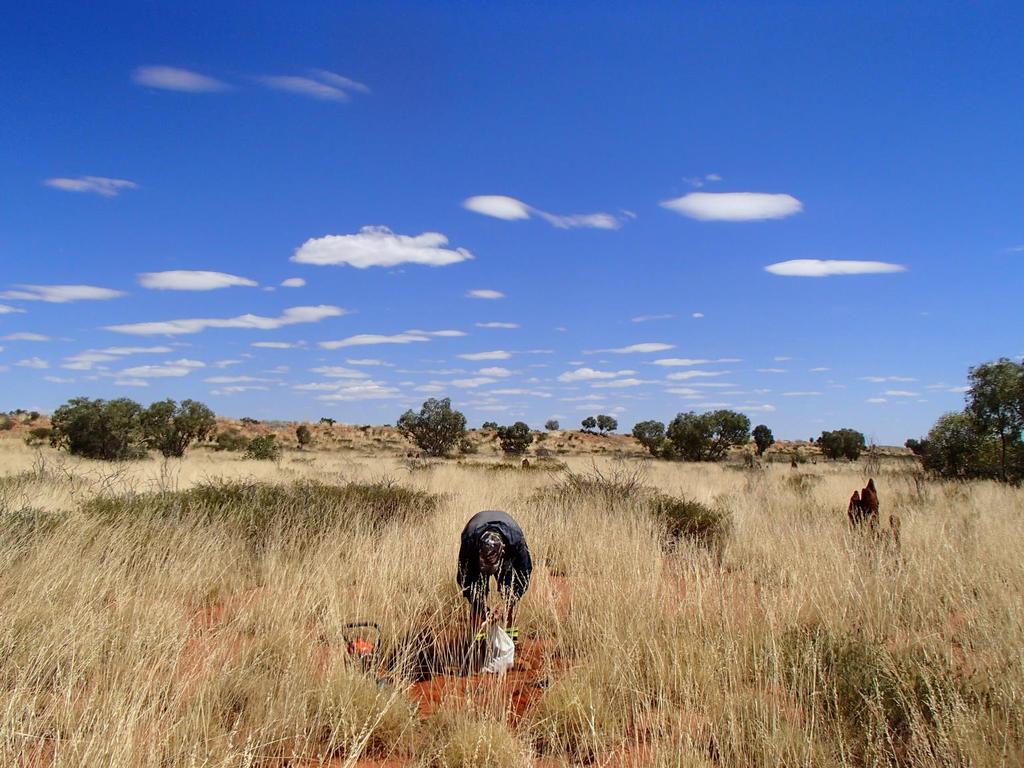
2 Ngururrpa program The program area covers the traditional land of the Parna Ngururrpa People in a remote part of the Tanami Desert in WA Parna Ngururrpa people invited GSWA to survey their country aiming to stimulate mineral exploration gravity survey regolith landform map 1: geochemical soil sampling


3 Geomorphology E-W longitudinal dunes and spinifex covered interdunes The landscape is flat, with variably weathered, low lying rock outcrops, and extensive eolian dune fields, sandplain and lacustrine - playa terrain. Semi-arid, sandy soils, spinifex, sparse small shrubs and scattered small trees NW-SE Stansmore Range, max 510m asl to the west lies the Canning Plain and the Great Sandy Dessert Salt lakes and Neoproterozoic sandstone ridges covered by silcrete veneers are common to the East


4 Regolith sampling GSWA 2015 regional regolith geochemistry program collected 637 soil samples at 5 km grid, up to 90 cm depth.

5 Geology Phanerozoic Canning Basin -Eastern margin sandstone, siltstone, minor conglomerate, coal, limestone ProterozoicCentralia Murraba Basin sandstone, wacke, conglomerate, siltstone, shale, limestone, dolomite, chert, and glauconitic sandstone Proterozoic NAC -N border Granites-Tanami Orogen; granitic and S border Arunta Orogen; meta-igneous and meta-sedimentary Regional faults and linear structures Stansmore Fault Minor linear structures


6 Beneath the sand but how far beneath At the Surface Orthophotos, Digital Elevation Models Surface to cm deep Radiometric KTU, LANDSAT AGSO ratios Near surface deeper (?) (1 m to 90 m) Magnetic VD1, Gravity.depends on the information provided by Direct observation 2015 sampling rock and residual regolith at less than 1 m deep Geophysical image -expression of regolith Inference from shallow stratigraphic holes in the neighbouring area (regolith thickness 1m to 90m)


7 Remote sensed imagery Radiometric - KTU top cm of the surface. Outlines spatial distribution of materials and erosion. Granites-Tanami Canning Basin Murraba Basin Arunta Orogen reddish-pink - quartzofelspatic and clay-rich sediments greenish-blue - sediments, residual regolith and rocks lacking K-minerals, with relative amounts of U and Th Eolian sand of local origin - some areas of sandplain form a thin veneer over weathered bedrock 200 km


 Ferricrete (_Rr-hm) Outcrop")
8 Landsat AGSO* Ratio top cm of the surface. Outlines spatial distribution of materials and erosion. Fe- rich sheetwash (_W-f) Calcrete (_Rr-k-kg) Ferricrete (_Rr-hm) Outcrop * Ratios of bands 5/7,4/7 & 4/2 displayed as RGB respectively
 Residual regolith Rock and residual")
9 Regolith Regolith-landform relationship with structures below Regolith cover will vary from > 1 m to >150 m Transported regolith Eolian sand of local origin - some areas of sandplain form a thin veneer over weathered bedrock Paleodrainage connecting to Lake Mackay Relict ferruginous magnetic palaeochannels containing magnetic minerals (magnetite/maghemite) Residual regolith Rock and residual regolith, < 1m deep at places Saprolite to 70 m thick under paleovalleys 1, 2 Ferruginous duricrust on sandstone and monzogranite Calcrete in paleovalleys Silcrete veneer on Murraba basin rocks Image: regolith-landform map on DEM Simplified Ngurrurpa regolith-landform map 1 Blake, 1974 Shallow stratigraphic drilling in the Granite-Tanami Region, BMR Record Aquitaine Point Moody No.1 Well, Well Completion report English, P Ancient origins of some major Australian salt lakes: geomorphic and regional implications
10 Paleodrainage and paleochannels Two paleodrainage systems Calcrete-filled paleovalley network up to 93 m deep Four paleovalleys of a regional internal paleodrainage connecting to Lake Mackay Shallower paleochannel system showing a stronger magnetic response Relict ferruginous magnetic palaeochannels containing magnetic minerals (magnetite/maghemite)


11 Calcrete fill paleovalleys Regional-scale paleovalleys occupy topographic depressions, as part of an internal drainage network into Lake Mackay 3 Palleovalleys are delineated by calcrete and lacustrine landforms Paleovalleys run along linear structures as contact between lithology, faults and as fill in fault blocks Distribution of calcrete and playa in relation to tectonic structures insert Site M604 1 Blake, 1974 Shallow stratigraphic drilling in the Granite-Tanami Region, BMR Record English, P Ancient origins of some major Australian salt lakes: geomorphic and regional implications
 and unconsolidated alluvial sandy-clay and clay (up to 90m)1 Potable")

12 Calcrete fill paleovalleys Four paleovalleys as part of an internal drainage network into Lake Mackay 2 Paleovalleys 1 and 4 are extensions of the Wilkinkarra Paleovalley 5 in NT Cenozoic sedimentary basin at northern end of Paleovalley 3 is 91 m deep in drillhole BMR Lucas 36 1 Depressions are filled with calcrete (up 15 m) and unconsolidated alluvial sandy-clay and clay (up to 90m)1 Potable water between m, below 4 m of calcrete and 10 m of sand. 1 Blake, 1974 Shallow stratigraphic drilling in the Granite-Tanami Region, BMR Record English, P Ancient origins of some major Australian salt lakes: geomorphic and regional implications 5 Woodgate et al, 2012, Hydrological investigation of Paleovalley Aquifers in the Wilkinkarra Region, Northern Territory. Record 2012/09. Geoscience Australia Paleodrainage network. Figure drapped on DEM. Source: GSWA record 2018/3


13 Paleovalley sequences Fining upwards channel sequences. At the northern end of Paleovalley 3 is a broad Cenozoic basin reaching up to 91 m in depth 1, below 6 m of eolian sand Source: modified from Blake, Blake, 1974 Shallow stratigraphic drilling in the Granite-Tanami Region, BMR Record
, visible on mag RTV")

14 Magnetic-fill paleochannels Up to 4.5 m deep Network of dendritic buried palaeochannels filled with ferruginous magnetic material (maghemite gravel 4 ), visible on mag RTV 1VD images. To be visible in mag image maghemite-gravel lenses have to be 0.4 m -1 m thick at 1.5 m 4.5 m deep 4 Eroded upper channels surface expression ferricrete, Fe-rich sheetwash. Mag 1VD colour on DEM Stansmore Range Mag 1VD greyscale on base map 4 Mackey, T Palaeochannels near West Wyalong, New South Wales: a case study in delineation and modelling using aeromagnetics


 Abundant magnetic lag in sheetwash deposits west of Stansmore")

15 Magnetic-fill paleochannels Surface expression High U- Th radiometric residual minerals Images: Landsat AGSO ratio on mag 1VD Landsat AGSO ratio (30 45 cm deep) Images: Radiometric Uranium on mag 1VD greyscale Site E9499 Sheetwash, playa or interdunes containing veneer of magnetic ferruginous lag ( cm) Abundant magnetic lag in sheetwash deposits west of Stansmore Fault, Stansmore Range. outcropping or weathering materials derived from paleochannels appear in shades of red and yellow - concentrations of clay and Fe-rich minerals


16 Magnetic-fill paleochannels appear as tributaries of calcrete-fill paleovalley Source: GSWA record 2018/3 Similar maghemite-rich paleochannels in the Yilgarn are tributaries of main trunks of paleodrainages. These contain basal fluvial sand overlain by ferruginous gravel, and fragments of ferruginous duricrust 5 5 Anand, RR and de Broekert, P, 2005, Regolith landscape evolution across Australia: CRC LEME, Perth, Western Australia, 345p
fault active since Devonian? active in the Cenozoic?")


17 Neotectonism Stansmore Fault Devonian (?)fault active since Devonian? active in the Cenozoic? Is this paleochannel crossing the fault? Is it the same channel or 2 networks flowing at different directions? Orthophoto on Mag Sheetwash with magnetic lag at west of the fault. Palaeochannel buried under eolian sand dunes to the east of the fault Magnetic 1VD colour on DEM Landsat AGSO ratio on Mag Palaeochannel in heritage area; not sampled


18 What s beneath the sand? Transported regolith - few metres to 93 m thick 1, 2 eolian sand cover - 5m to 20m regolith infill in paleovalleys are up to 90 m thick Two networks buried paleodrainages Calcrete filled paleovalleys up to 93 m deep Magnetic palaeochannels up to 4.5 m deep Paleovalley Paleovalley
19 What s beneath the sand? Transported regolith - few metres to 93 m thick 1, 2 eolian sand cover - 5m to 20m regolith infill in paleovalleys are up to 90 m thick Two networks buried paleodrainages Calcrete filled paleovalleys up to 93 m deep Magnetic palaeochannels up 4.5 m deep Insitu weathered bedrock Rock and insitu weathered rock - shallow depths < 1 meter to near 70m thick below paleovalleys Neotectonism Vertical displacement of paleochannels at Stansmore Fault 1 Lucas 250k, Billilluna 250k Shallow stratigraphic drilling in the Granite-Tanami Region, BMR Record Aquitaine Point Moody No.1 Well, Well Completion report 1966
20
Cretes and Chemical Landscapes, South Australia
 5 th ARGA Conference Wallaroo, S.A. 8-12 April, 2018 Cretes and Chemical Landscapes, South Australia K.G. McQueen IAE, University of Canberra Physical and Chemical Landscapes Processes Landscapes erosion
REGOLITH GEOCHEMISTRY OF THE NORTH KIMBERLEY, WESTERN AUSTRALIA: A STRONG PROXY FOR BEDROCK
 REGOLITH GEOCHEMISTRY OF THE NORTH KIMBERLEY, WESTERN AUSTRALIA: A STRONG PROXY FOR BEDROCK Paul A. Morris 1 1 Geological Survey of Western Australia, 100 Plain Street, East Perth 6004, Western Australia;
Follow this and additional works at: Part of the Geology Commons
 Western Michigan University ScholarWorks at WMU Michigan Geological Repository for Research and Education Geosciences 2016 Geology of Michigan William B. Harrison III Michigan Geological Repository for
14. Weathering and Regolith
 The Australian Continent: A Geophysical Synthesis Weathering and Regolith 123 14. Weathering and Regolith The regolith consists of the zone at the Earth's surface between fresh rock and the interface with
3. Radiometry. The Australian Continent: A Geophysical Synthesis Radiometry
 16 3. Radiometry A major effort has been made to assemble a continent-scale study combining the results of many different airborne radiometric surveys (Figure 3.1). The radiometric surveys measure the
YILGARN REGOLITH AND LANDSCAPE
 Short Course for Northern Star Resources YILGARN REGOLITH AND LANDSCAPE Mehrooz F Aspandiar Department of Applied Geology Western Australian School of Mines The Yilgarn Craton surface regolith Image: Churhward
GRAVITY. Raymond M. Tracey and Nicholas G. Direen
 GRAVITY Raymond M. Tracey and Nicholas G. Direen Geoscience Australia. PO Box 378, Canberra, ACT 2601. E-mail: ray.tracey@ga.gov.au, nick.direen@ga.gov.au 1. DESCRIPTION Gravity surveys measure variations
Lab 7: Sedimentary Structures
 Name: Lab 7: Sedimentary Structures Sedimentary rocks account for a negligibly small fraction of Earth s mass, yet they are commonly encountered because the processes that form them are ubiquitous in the
Geochemical exploration in regolithdominated terrains global perspective. Ravi Anand May 2014
 Geochemical exploration in regolithdominated terrains global perspective Ravi Anand May 2014 Acknowledgements Numerous mining companies CSIRO/CRC LEME/MDU AMIRA Why regolith research for mineral exploration
GEOPHYSICS GRAVITY DATA COVERAGE
 GEOPHYSICS DATA COVERAGE The Mudgee-Gulgong district lies within the Dubbo 1:250,000 sheet area. This area is now covered by high res_olution gravity, magnetic and radiometric data. The aeromagnetic and
Sediment and sedimentary rocks Sediment
 Sediment and sedimentary rocks Sediment From sediments to sedimentary rocks (transportation, deposition, preservation and lithification) Types of sedimentary rocks (clastic, chemical and organic) Sedimentary
LANDSAT-TM IMAGES IN GEOLOGICAL MAPPING OF SURNAYA GAD AREA, DADELDHURA DISTRICT WEST NEPAL
 LANDSAT-TM IMAGES IN GEOLOGICAL MAPPING OF SURNAYA GAD AREA, DADELDHURA DISTRICT WEST NEPAL L. N. Rimal* A. K. Duvadi* S. P. Manandhar* *Department of Mines and Geology Lainchaur, Kathmandu, Nepal E-mail:
BROKEN HILL 1:100,000 REGOLITH-LANDFORM MAP: DEVELOPMENT, FEATURES AND APPLICATIONS
 58 BROKEN HILL 1:100,000 REGOLITH-LANDFORM MAP: DEVELOPMENT, FEATURES AND APPLICATIONS S.M. Hill CRC LEME, Division of Science and Design, University of Canberra, Canberra, ACT 2601 INTRODUCTION The Broken
Section I: Multiple Choice Select the best answer to each question. Mark your final answer on the answer sheet. (1 pt each)
") Sedimentary Rocks & Surface Processes Quest Name: Earth Science 2013 Block: Date: Section I: Multiple Choice Select the best answer to each question. Mark your final answer on the answer sheet. (1 pt each)
Sedimentary Rocks & Surface Processes Quest Name: Earth Science 2013 Block: Date: Section I: Multiple Choice Select the best answer to each question. Mark your final answer on the answer sheet. (1 pt each)
OZ SEEBASE TM. Datasets. Digital Elevation Model
 Digital Elevation Model 10 Digital Elevation Models (DEM s) often show the youngest structures, and any active geological structures. They are widely used for neotectonic analysis. The composition of eroding
Laboratory Exercise #4 Geologic Surface Processes in Dry Lands
 Page - 1 Laboratory Exercise #4 Geologic Surface Processes in Dry Lands Section A Overview of Lands with Dry Climates The definition of a dry climate is tied to an understanding of the hydrologic cycle
Sedimentary Rocks. Origin, Properties and Identification. Physical Geology GEOL 101 Lab Ray Rector - Instructor
 Sedimentary Rocks Origin, Properties and Identification Physical Geology GEOL 101 Lab Ray Rector - Instructor Sedimentary Rock Origin and Identification Lab Pre-Lab Internet Link Resources 1) http://www.rockhounds.com/rockshop/rockkey/index.html
Continental Landscapes
 Continental Landscapes Landscape influenced by tectonics, climate & differential weathering Most landforms developed within the last 2 million years System moves toward an equilibrium Continental Landscapes
Sedimentary Rocks. Rocks made of bits & pieces of other rocks.
 Sedimentary Rocks Rocks made of bits & pieces of other rocks. Sedimentary Rocks Igneous rocks are the most common rocks on Earth, but because most of them exist below the surface you might not have seen
Sedimentary Rocks. Origin, Properties and Identification. Geology Laboratory GEOL 101 Lab Ray Rector - Instructor
 Sedimentary Rocks Origin, Properties and Identification Geology Laboratory GEOL 101 Lab Ray Rector - Instructor Sedimentary Rock Origin and Identification Lab Pre-Lab Internet Link Resources 1) http://www.rockhounds.com/rockshop/rockkey/index.html
Lecture Outline Wednesday - Friday February 14-16, 2018
 Lecture Outline Wednesday - Friday February 14-16, 2018 Quiz 2 scheduled for Friday Feb 23 (Interlude B, Chapters 6,7) Questions? Chapter 6 Pages of the Past: Sedimentary Rocks Key Points for today Be
Environmental Scoping Report for the proposed establishment of a New Coal-Fired Power Station in the Lephalale Area, Limpopo Province
 8. GEOLOGY, SOILS AND AGRICULTURAL POTENTIAL 8.1. Geology 8.1.1. Candidate Site Geology Due to the layered natured of the geology and various structures the candidate sites are underlain by differing geological
For personal use only
 ASX ANNOUNCEMENT 26 October 2011 5 TENEMENTS PEGGED FOR SANDSTONE HOSTED URANIUM AT PONTON Enterprise Metals Limited ( Enterprise or the Company, ASX: ENT ) wishes to announce that it s 100% owned subsidiary
Your web browser (Safari 7) is out of date. For more security, comfort and the best experience on this site: Update your browser Ignore
 is out of date. For more security, comfort and the best experience on this site: Update your browser Ignore") Your web browser (Safari 7) is out of date. For more security, comfort and the best experience on this site: Update your browser Ignore BEDRO CK For the complete encyclopedic entry with media resources,
Your web browser (Safari 7) is out of date. For more security, comfort and the best experience on this site: Update your browser Ignore BEDRO CK For the complete encyclopedic entry with media resources,
Understanding Earth Fifth Edition
 Understanding Earth Fifth Edition Grotzinger Jordan Press Siever Chapter 5: SEDIMENTATION: Rocks Formed by Surface Processes Lecturer: H Mohammadzadeh Assistant professors, Department of Geology, FUM Copyright
Prentice Hall EARTH SCIENCE
 Prentice Hall EARTH SCIENCE Tarbuck Lutgens Chapter 7 Glaciers, Desert, and Wind 7.1 Glaciers Types of Glaciers A glacier is a thick ice mass that forms above the snowline over hundreds or thousands of
Sedimentary Rocks. Origin, Properties and Identification. Physical Geology GEOL 100. Ray Rector - Instructor
 Sedimentary Rocks Origin, Properties and Identification Physical Geology GEOL 100 Ray Rector - Instructor Sedimentary Rock Origin and Identification Lab Pre-Lab Internet Link Resources 1) http://www.rockhounds.com/rockshop/rockkey/index.html
USING A LIDAR DEM, RADIOMETRICS AND MAGNETICS TO MAP BASALTIC REGOLITH IN THE LAKE CORANGAMITE CATCHMENT, VICTORIA
 112 USING A LIDAR DEM, RADIOMETRICS AND MAGNETICS TO MAP BASALTIC REGOLITH IN THE LAKE CORANGAMITE CATCHMENT, VICTORIA David Gibson, Andrew Fitzpatrick & Heike Apps CRC LEME, Geoscience Australia, PO Box
Buried-valley Aquifers: Delineation and Characterization from Reflection Seismic and Core Data at Caledon East, Ontario
 Buried-valley Aquifers: Delineation and Characterization from Reflection Seismic and Core Data at Caledon East, Ontario Russell, H.A.J. 1, S.E. Pullan 1, J.A. Hunter 1, D.R. Sharpe 1, and S. Holysh 2 1
N. J. Macala. C ONTENT S. LIST OF PLATES.
 REPORT ON WATER SUikLY AT MANBULLOO STATION, NORTHERN TERRITORY. by N. J. Macala. Records 1957/62. C ONTENT S. Page. Introduction. 1. General Geology, 1. Hydrology. 1. New Bore Sites Selected. 2. Reference.
Sedimentary Rocks, our most Valuable Rocks. Or, what you will probably find when you are outdoors exploring.
 Sedimentary Rocks, our most Valuable Rocks Or, what you will probably find when you are outdoors exploring. Sedimentary rocks give us evidence to earth s earlier history. We look at processes happening
Euler Deconvolution Technique for Gravity Survey
 Journal of Applied Sciences Research, 6(11): 1891-1897, 2010 2010, INSInet Publication Euler Deconvolution Technique for Gravity Survey 12,3 Piyaphong Chenrai, 2 Jayson Meyers, 1,4 Punya Charusiri 1 Earthquake
ASX Company Announcement
 ASX Company Announcement Yellow Rock Resources ACN: 116 221 740 35 Great Eastern Highway Rivervale WA 6103 Telephone: (08) 9361 5400 Facsimile: (08) 9361 5900 Email: info@aurium.com.au Companies Announcement
CET Discovery Day. Mulga Rock Project The Ambassador, Emperor and Shogun discoveries. 24 February Xavier Moreau GM Geology & Exploration
 CET Discovery Day Mulga Rock Project The Ambassador, Emperor and Shogun discoveries 24 February 2015 Xavier Moreau GM Geology & Exploration Mulga Rock Uranium Project Presentation Outline: 1. Context behind
Pratice Surface Processes Test
 1. The cross section below shows the movement of wind-driven sand particles that strike a partly exposed basalt cobble located at the surface of a windy desert. Which cross section best represents the
Sedimentary Rocks. Weathering. Mechanical & Chemical Weathering. Sediments. Lithification. Deposition. Transport. Erosion.
 Lithification Sedimentary Rocks Sediments Deposition Transport Erosion Weathering Weathering The sediments that make up sedimentary rocks are produced by: Mechanical & Chemical Weathering Mechanical Weathering
Ministry of Oil and Minerals Petroleum Exploration & Production Authority BLOCK 85 (Al Uqlah North)
") Ministry of Oil and Minerals Petroleum Exploration & Production Authority BLOCK 85 (Al Uqlah North) The Al Uqlah North Block (85) occupies an area of 597 km 2 in the Sabatayn Basin in the province of Shabwah
Ministry of Oil and Minerals Petroleum Exploration & Production Authority BLOCK 85 (Al Uqlah North) The Al Uqlah North Block (85) occupies an area of 597 km 2 in the Sabatayn Basin in the province of Shabwah
FROM LITTLE THINGS BIG THINGS GROW: RECONSTRUCTING PAST ENVIRONMENTS FROM QUATERNARY DESERT DUNE SEDIMENTS AND STRATIGRAPHY
 102 FROM LITTLE THINGS BIG THINGS GROW: RECONSTRUCTING PAST ENVIRONMENTS FROM QUATERNARY DESERT DUNE SEDIMENTS AND STRATIGRAPHY Kathryn E. Fitzsimmons CRC LEME, Department of Earth and Marine Sciences,
COASTAL QUATERNARY GEOLOGY MAPPING FOR NSW: EXAMPLES AND APPLICATIONS
 COASTAL QUATERNARY GEOLOGY MAPPING FOR NSW: EXAMPLES AND APPLICATIONS A Troedson Geological Survey of New South Wales Abstract Detailed geological mapping of the coastal plains of regional NSW was undertaken
Basin Analysis Applied to Modelling Buried Valleys in the Great Lakes Basin
 EARTH SCIENCES SECTOR GENERAL INFORMATION PRODUCT 35 Basin Analysis Applied to Modelling Buried Valleys in the Great Lakes Basin Sharpe, D R; Russell, H A J 2004 Originally released as: Basin Analysis
1. Base your answer to the following question on the map below, which shows the generalized bedrock of a part of western New York State.
 1. Base your answer to the following question on the map below, which shows the generalized bedrock of a part of western New York State. 3. The table below describes the deposits that an observer saw while
11/22/2010. Groundwater in Unconsolidated Deposits. Alluvial (fluvial) deposits. - consist of gravel, sand, silt and clay
 deposits. - consist of gravel, sand, silt and clay") Groundwater in Unconsolidated Deposits Alluvial (fluvial) deposits - consist of gravel, sand, silt and clay - laid down by physical processes in rivers and flood plains - major sources for water supplies
Groundwater in Unconsolidated Deposits Alluvial (fluvial) deposits - consist of gravel, sand, silt and clay - laid down by physical processes in rivers and flood plains - major sources for water supplies
The boundary between two formations (or any distinct layers) is called a contact. Sedimentary rocks cover 75% of continents.
 is called a contact. Sedimentary rocks cover 75% of continents.") Sedimentary Rocks Sedimentary rocks form at the Earth s surface through interactions of the hydrologic system and the crust. Fortunately, many of these processes are in operation today, and geologists
Sedimentary Rocks Sedimentary rocks form at the Earth s surface through interactions of the hydrologic system and the crust. Fortunately, many of these processes are in operation today, and geologists
Aim and objectives Components of vulnerability National Coastal Vulnerability Assessment 2
 ASSESSING THE UTILITY OF GEOMORPHIC SENSITIVITY MAPPING ON THE ILLAWARRA COAST Pamela Abuodha, Christina Baker, Chris Sharples, Darren Skene and Colin Woodroffe Geoquest Research Centre, University of
Evaluating the information content of National ASTER Geoscience Maps in the Wagga Wagga and Cobar regions of New South Wales
 Evaluating the information content of National ASTER Geoscience Maps in the Wagga Wagga and Cobar regions of New South Wales The National ASTER Geoscience Maps, freely available from CSIRO/GA (https://data.csiro.au/dap/
The Geology and Soils of the Southern Alice Springs District
 Agnote 316 No. G6 July 2005 Agdex No: 000/506 ISSN No: 0157-8243 The Geology and Soils of the Southern Alice Springs District A. White, formerly Senior Rangeland Production Officer, Alice Springs GEOLOGY
As compaction and cementation of these sediments eventually occur, which area will become siltstone? A) A B) B C) C D) D
 A B) B C) C D) D") 1. A student obtains a cup of quartz sand from a beach. A saltwater solution is poured into the sand and allowed to evaporate. The mineral residue from the saltwater solution cements the sand grains together,
1. A student obtains a cup of quartz sand from a beach. A saltwater solution is poured into the sand and allowed to evaporate. The mineral residue from the saltwater solution cements the sand grains together,
EROSION, DEPOSITION AND SEDIMENTARY ROCKS. Reading: Earth Science Tarbuck and Lutgens Chapter 5: pages Chapter 3: pages 52-54, 61-69
 EROSION, DEPOSITION AND SEDIMENTARY ROCKS Reading: Earth Science Tarbuck and Lutgens Chapter 5: pages 124-133 Chapter 3: pages 52-54, 61-69 Base Level Resistant bed Resistant bed creates a local base level
GEOPHYSICAL MAPS AND PETROPHYSICAL DATA OF MOZAMBIQUE
 Geophysical maps and petrophysical data of Mozambique GTK Consortium Geological Surveys in Mozambique 2002 2007, edited by Yrjö Pekkala, Tapio Lehto & Hannu Mäkitie, 65 80, 2008 GEOPHYSICAL MAPS AND PETROPHYSICAL
Name: Which rock layers appear to be most resistant to weathering? A) A, C, and E B) B and D
 A, C, and E B) B and D") Name: 1) The formation of soil is primarily the result of A) stream deposition and runoff B) precipitation and wind erosion C) stream erosion and mass movement D) weathering and biological activity 2)
Name: 1) The formation of soil is primarily the result of A) stream deposition and runoff B) precipitation and wind erosion C) stream erosion and mass movement D) weathering and biological activity 2)
ROCK CLASSIFICATION AND IDENTIFICATION
 Name: Miramar College Grade: GEOL 101 - Physical Geology Laboratory SEDIMENTARY ROCK CLASSIFICATION AND IDENTIFICATION PRELAB SECTION To be completed before labs starts: I. Introduction & Purpose: The
GOURDIS AND EMPIRE LATERITIC GOLD DEPOSITS, WESTERN AUSTRALIA
 GOURDIS AND EMPIRE LATERITIC GOLD DEPOSITS, WESTERN AUSTRALIA INTRODUCTION M.D. Paine1 and M.F.P. Foo2 1. CRC LEME, CSIRO Exploration and Mining, PO Box 1130, Bentley, WA 6102 2. 20 Hibbertia Court, Forrest
EOLIAN PROCESSES & LANDFORMS
 EOLIAN PROCESSES & LANDFORMS Wind can be an effective geomorphic agent under conditions of sparse vegetation & abundant unconsolidated sediment egs. hot & cold deserts, beaches & coastal regions, glacial
Sedimentary Rocks. Rocks made of bits & pieces of other rocks.
 Sedimentary Rocks Rocks made of bits & pieces of other rocks. Sedimentary Rocks Igneous rocks are the most common rocks on Earth, but because most of them exist below the surface you might not have seen
Ministry of Oil and Minerals Petroleum Exploration & Production Authority BLOCK 6 (Iryam)
") Ministry of Oil and Minerals Petroleum Exploration & Production Authority BLOCK 6 (Iryam) The Iryam Block (6) occupies an area of 3,911 km 2 in the Sabatayn Basin in the province of Shabwah in central
Ministry of Oil and Minerals Petroleum Exploration & Production Authority BLOCK 6 (Iryam) The Iryam Block (6) occupies an area of 3,911 km 2 in the Sabatayn Basin in the province of Shabwah in central
Bell Ringer. Are soil and dirt the same material? In your explanation be sure to talk about plants.
 Bell Ringer Are soil and dirt the same material? In your explanation be sure to talk about plants. 5.3 Mass Movements Triggers of Mass Movements The transfer of rock and soil downslope due to gravity is
ENVI.2030L Geologic Time
 Name ENVI.2030L Geologic Time I. Introduction There are two types of geologic time, relative and absolute. In the case of relative time geologic events are arranged in their order of occurrence. No attempt
WEATHERING, EROSION & DEPOSITION STUDY GUIDE
 WEATHERING, EROSION & DEPOSITION STUDY GUIDE Weathering: The difference between mechanical & chemical weathering is: Sort terms as being mechanical/physical or chemical weathering: acid rain, root splitting
Answers. Rocks. Year 8 Science Chapter 8
 Answers Rocks Year 8 Science Chapter 8 p171 1 Rocks are made up of minerals such as quartz, feldspars, micas, and calcite. Different rocks are made up of different combinations of minerals. 2 Igneous,
GEOLOGY MEDIA SUITE Chapter 5
 UNDERSTANDING EARTH, SIXTH EDITION GROTZINGER JORDAN GEOLOGY MEDIA SUITE Chapter 5 Sedimentation Rocks Formed by Surface Processes 2010 W.H. Freeman and Company Mineralogy of sandstones Key Figure 5.12
Michigan s Geology and Groundwater
 Michigan s Geology and Groundwater Ralph J. Haefner Deputy Director U.S. Geological Survey Michigan-Ohio Water Science Center Lansing, Michigan Outline About the USGS Geology 101 Michigan s geology Bedrock
Uranium deposit types: a systems perspective
 Uranium deposit types: a systems perspective Roger Skirrow Onshore Energy & Minerals Division roger.skirrow@ga.gov.au Outline 1. A new view of U deposit types: 3 families of mineral systems 2. Concepts
UNIT 4 SEDIMENTARY ROCKS
 UNIT 4 SEDIMENTARY ROCKS WHAT ARE SEDIMENTS Sediments are loose Earth materials (unconsolidated materials) such as sand which are transported by the action of water, wind, glacial ice and gravity. These
Chapter 1 Quantitative Analysis of Geomorphometric Parameters of Wadi Kerak, Jordan, Using Remote Sensing and GIS
 Chapter 1 Quantitative Analysis of Geomorphometric Parameters of Wadi Kerak, Jordan, Using Remote Sensing and GIS Yahya Farhan, Ali Anbar, Omar Enaba, Nisrin Al-Shaikh Geomorphometric analysis was carried
Soils, Hydrogeology, and Aquifer Properties. Philip B. Bedient 2006 Rice University
 Soils, Hydrogeology, and Aquifer Properties Philip B. Bedient 2006 Rice University Charbeneau, 2000. Basin Hydrologic Cycle Global Water Supply Distribution 3% of earth s water is fresh - 97% oceans 1%
Unit 3 Review - Surface Processes
 Unit 3 Review - Surface Processes 1. Why is the surface of Mercury covered with meteor impact craters, while Earth s surface has relatively few craters? A) Mercury is larger than Earth, so it gets hit
NC Earth Science Essential Standards
 NC Earth Science Essential Standards EEn. 2.1 Explain how processes and forces affect the Lithosphere. EEn. 2.1.1 Explain how the rock cycle, plate tectonics, volcanoes, and earthquakes impact the Lithosphere.
CHARACTERISING THE SPECRTAL SIGNAL OF DISCHARGE ZONES AT THE MARGIN OF THE GREAT ARTESIAN BASIN.
 CHARACTERISING THE SPECRTAL SIGNAL OF DISCHARGE ZONES AT THE MARGIN OF THE GREAT ARTESIAN BASIN. V.Matic, J.F.Costelloe, A.W.Western, J.P.Walker Department of Civil and Environmental Engineering, University
Frome uranium province, South Australia: Systems analysis and potential for major basin-hosted uranium deposits
 Frome uranium province, South Australia: Systems analysis and potential for major basin-hosted uranium deposits Roger Skirrow, E. Bastrakov, A. Cross, S. Jaireth, A. Schofield, S. van der Wielen Frome
residuum resulting from weathering over an extended period of time has vertical layers called soil profile from surface down to fresh parent material
 Soil residuum resulting from weathering over an extended period of time has vertical layers called soil profile from surface down to fresh parent material time to develop soil profile varies with intensity
Ni-Cu-Au-U TYPE AIRBORNE ANOMALIES OUTLINED
 ABN 28 122 180 205 www.juttholdings.com ASX ANNOUNCEMENT (ASX Code: JUT) 29 February 2008 Ni-Cu-Au-U TYPE AIRBORNE ANOMALIES OUTLINED Tay - Munglinup Project: near Ravensthorpe in the SW of Western Australia
Pre-Lab Reading Questions ES202
 ES202 The are designed to encourage students to read lab material prior to attending class during any given week. Reading the weekly lab prior to attending class will result in better grade performance
Figure 2.1: Constituent Area
 2 The Region 2.1 CONSTITUENT AREA The National Capital Region includes NCT-Delhi, nine districts of Haryana, six districts of Uttar Pradesh and one district of Rajasthan. Total area of the region is 34,144
Anthill Resources Yukon - An Update on the Einarson Project
 Anthill Resources Yukon - An Update on the Einarson Project The Eastern Extension of a Carlin-type Gold Trend in the Selwyn Basin Anthill Resources Ltd Yukon Claim Holdings Over 2400 km 2 Property Location
APPENDIX G GLOSSARY. Mn/DOT/WR-0200
 APPENDIX G GLOSSARY Mn/DOT/WR-0200 Alluvial - comprised of clay, silt, sand, gravel, and/or other detritus deposited by water. Usually refers to accretionary overbank, floodplain or levee deposits. Biomantling
Rockall Plateau. OCN 201: Shelf Sediments
 Rockall Plateau OCN 201: Shelf Sediments Classification by Size Classification by Mode of Formation Detrital sediments Transported and deposited as particles Derived from weathering of pre-existing rocks
Sediment. Weathering: mechanical and chemical decomposition and disintegration of rock and minerals at the surface
 Sediment Some basic terminology Weathering: mechanical and chemical decomposition and disintegration of rock and minerals at the surface Erosion: removal of weathered rock and minerals from one place to
Seismic Reflection Imaging across the Johnson Ranch, Valley County, Idaho
 Seismic Reflection Imaging across the Johnson Ranch, Valley County, Idaho Report Prepared for the Skyline Corporation Lee M. Liberty Center for Geophysical Investigation of the Shallow Subsurface (CGISS)
Exploration, Drilling & Production
 Nontechnical Guide to PETMOLEUM Geology, Exploration, Drilling & Production Third Edition Norman J. Hyne, Ph.D. Contents Preface *i Introduction 1 The Nature of Gas and Oil 1 Petroleum 1 The Chemistry
Chapter 6 Pages of Earth s Past: Sedimentary Rocks
 Chapter 6 Pages of Earth s Past: Sedimentary Rocks Introduction! Drilling into the bottom of the North Sea, we encounter: " Soft mud and loose sand, silt, pebbles, and shells. Then: " Similar materials
Erosion and Deposition
 Erosion and Deposition Erosion Sediment natural forces move rock/soil from one place to another. gravity, water, wind, glaciers, waves are causes material moved by erosion Deposition when erosion lays
The Welsh Borderland. Geologically recent surface deposits. The Welsh Borderland
 The Welsh Borderland This account provides a broad perspective of the geology of the Welsh Borderland region which comprises the southeast of Powys, southern Shropshire, northern Gwent, the western half
Chapter 2. Regional Landscapes and the Hydrologic Cycle
 Chapter 2. Regional Landscapes and the Hydrologic Cycle W. Lee Daniels Department of Crop and Soil Environmental Sciences, Virginia Tech Table of Contents Introduction... 23 Soils and landscapes of the
UNDERSTANDING THE REGOLITH IN TROPICAL AND SUB-TROPICAL TERRAINS: THE KEY TO EXPLORATION UNDER COVER.
 UNDERSTANDING THE REGOLITH IN TROPICAL AND SUB-TROPICAL TERRAINS: THE KEY TO EXPLORATION UNDER COVER. C.R.M. Butt Cooperative Research Centre for Landscape Environments and Mineral Exploration CSIRO Exploration
Section 5. Rock Units and Your Community. What Do You See? Think About It. Investigate. Learning Outcomes
 Chapter 3 Minerals, Rocks, and Structures Section 5 Rock Units and Your Community What Do You See? Learning Outcomes In this section, you will Recognize that rocks are arranged in Earth s crust as well-defined
Correlations between spectral mineralogy and borehole rock properties in the Eromanga Basin. Ian Roach
 Correlations between spectral mineralogy and borehole rock properties in the Eromanga Basin Ian Roach Introduction The Southern Thomson Project Stratigraphic drilling & logging program Rock properties
Airborne gravity gradiometer surveying of petroleum systems under Lake Tanganyika, Tanzania
 Airborne gravity gradiometer surveying of petroleum systems under Lake Tanganyika, Tanzania D. Roberts Beach Energy P. Roy Chowdhury CGG S. J. Lowe CGG A. N. Christensen CGG Outline Introduction Geology
EMPIRICAL INVESTIGATION OF AIRBORNE GAMMA-RAY IMAGES AS AN INDICATOR OF SOIL PROPERTIES - WAGGA WAGGA, NSW.
 EMPIRICAL INVESTIGATION OF AIRBORNE GAMMA-RAY IMAGES AS AN INDICATOR OF SOIL PROPERTIES - WAGGA WAGGA, NSW. Phil Bierwirth 1, Paul Gessler 2 and Dermot McKane 3 1 Australian Geological Survey Organisation,
Physical Geology, 15/e
 Lecture Outlines Physical Geology, 15/e Plummer, Carlson & Hammersley Deserts & Wind Action Physical Geology 15/e, Chapter 13 Deserts Desert any arid region that receives less than 25 cm of precipitation
Cattaraugus Creek: A Story of Flowing Water and the Geology of the Channel It Flows Through Presentation to West Valley Citizen Task Force 4/27/16
 Cattaraugus Creek: A Story of Flowing Water and the Geology of the Channel It Flows Through Presentation to West Valley Citizen Task Force 4/27/16 Raymond C. Vaughan, Ph.D. What happens if you drop a
ESC102. Sedimentary Rocks. Our keys to the past. Monday, February 11, 13
 ESC102 Sedimentary Rocks Our keys to the past Sedimentary Rocks Sedimentary rocks are rocks that form through the accumulation of sediment and the process of lithification. Lithification occurs after deposition
The Geology of Sebago Lake State Park
 Maine Geologic Facts and Localities September, 2002 43 55 17.46 N, 70 34 13.07 W Text by Robert Johnston, Department of Agriculture, Conservation & Forestry 1 Map by Robert Johnston Introduction Sebago
DÉCOUVERTE Positioned for Discovery in James Bay, Quebec. Investor Presentation, January 2018 by Danae Voormeij, MSc, PGeo
 DÉCOUVERTE Positioned for Discovery in James Bay, Quebec Investor Presentation, January 2018 by Danae Voormeij, MSc, PGeo Location Maps and Infrastructure Location: Durango Resources 100% owned Découverte
3D Geometry of the Xade Complex inferred from Gravity and Magnetic Data
 Geophysical Case Histories 3D Geometry of the Xade Complex inferred from Gravity and Magnetic Data 1. British Geological Survey, Edinburgh, United Kingdom Paper 92 Pouliquen, G. [1], Key, R. [1] ABSTRACT
Sedimentary rocks. Mechanical Weathering. Weathering. Chemical weathering. Rates of weathering. Fossil Fuel Resources. Two kinds of weathering
 Sedimentary rocks Fossil Fuel Resources Exam next Tuesday February 14 Bring Scantron and Review Questions About 75% of all rock outcrops on the continents Important to reconstruct much of Earth's history
Chapter 2: Geomorphology of the Swan Coastal Plain
 Chapter 2: Geomorphology of the Swan Coastal Plain 2.1 Overview of geology This introduction is not meant to be a comprehensive description of the geology of the Australian continent. The intention is
=%REPORT RECONNAISSANCE OF CHISHOLM LAKE PROSPECT. October 25, 1977
 =%REPORT ON FIELD RECONNAISSANCE OF CHISHOLM LAKE PROSPECT October 25, 1977 Bruce D. Vincent Imperial Oil Limited, Minerals - Coal, CALGARY, ALBERTA CHISHOLM LAKE PROSPECT Introduction The Chisholm Lake
Landscape evolution. An Anthropic landscape is the landscape modified by humans for their activities and life
 Landforms Landscape evolution A Natural landscape is the original landscape that exists before it is acted upon by human culture. An Anthropic landscape is the landscape modified by humans for their activities
Exploration Significance of Unconformity Structure on Subtle Pools. 1 Vertical structure characteristics of unconformity
 Exploration Significance of Unconformity Structure on Subtle Pools Wu Kongyou (China University of Petroleum,College of Geo-Resources and Information,Shandong Qingdao 266555) Abstract: Vertical structure