About Visualizing Density
|
|
|
- Arlene West
- 5 years ago
- Views:
Transcription
1
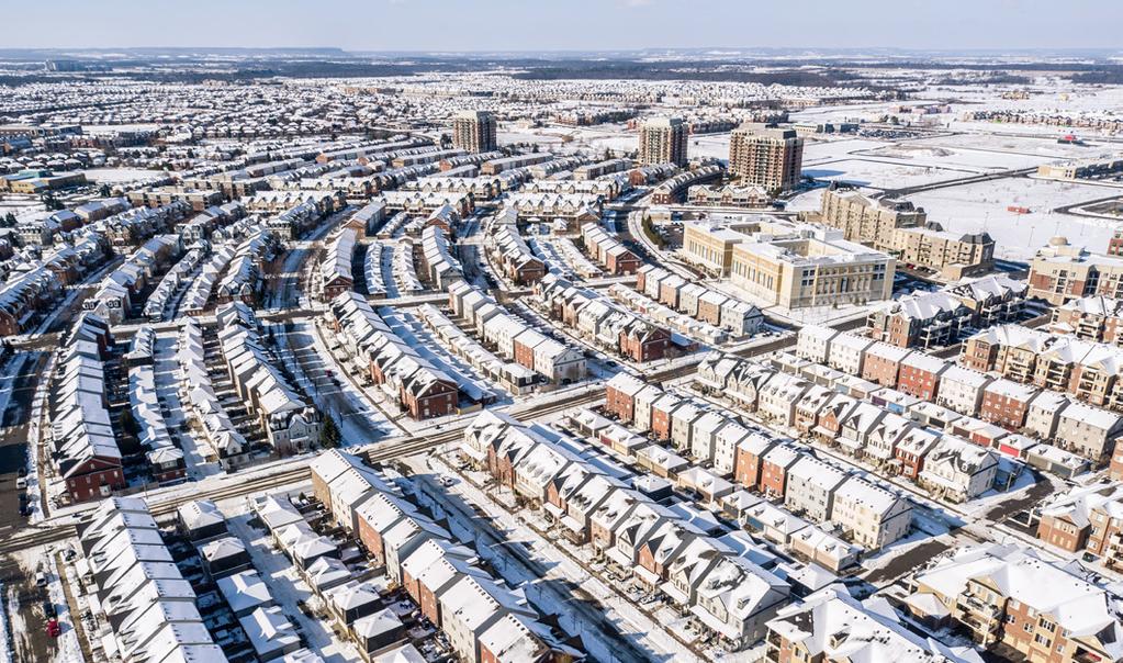
2 About Visualizing Density Visualizing Density is a pilot project created by the Canadian Urban Institute to help planners, designers, elected officials, residents groups, and private sector builders design more complete communities and adapt existing communities over time. It includes a website ( and a report; which contain identical information. We selected 5 very different communities in the GGH and calculated their density in terms of people and jobs per hectare at the neighbourhood and block scale, so that people can understand what the neighbourhood built-form looks like in relation to density targets set out in the Provincial Growth Plan. The visuals and analysis in the 5 case studies also encourage users to look beyond buildings and consider the attributes that work with density to make complete communities. We chose 6 key drivers of complete communities to help us illustrate this. They are walkability, diversity, green and open spaces, amenities, transit and design. Our methodology is easily replicated and can be used by municipalities, university courses, or volunteers to undertake additional case studies that could be shared on this website. Existing case studies could also be regularly updated to assess what progress is being made towards becoming complete communities. We want Visualizing Density to contribute to the ongoing conversation about managing growth and building great communities in the Greater Golden Horseshoe. This report was created by the Canadian Urban Institute with support from the Ontario Growth Secretariat through the Places to Grow Implementation Fund. VISUALIZING DENSITY ABOUT 01
3 Density is... Higher Density is Here to Stay a ratio of residents and jobs to a land area is the way density is calculated in the Growth Plan. Density is a key metric the province uses to measure how municipalities and regions in the GGH are planning to achieve the goals of the Growth Plan. Sustained population growth over the next 15 years combined with provincial land use plans mean that 12 million people will need to live and work in the same land area in the Greater Golden Horseshoe (GGH) currently occupied by 9 million people. More people in the same space means we have to live at a greater density. To accommodate this growth while making efficient use of existing infrastructure, preserving natural areas, protecting drinking water and farmland, the province uses policy tools like the Provincial Growth Plan to require municipalities to plan for more compact, higher density communities. But, it's not just policy that drives the trend to compact, higher denser communities. The building industry and the housing market in the GGH is also changing in response to land costs, more diverse family types and population growth. More townhouses, condo towers and mid-rise apartments are being built, with a focus on people, amenities and active transportation rather than the circulation and storage of cars. The result has been a visible change to a denser built environment in the GGH. Visualizing Density provides a way of seeing that change and assessing if greater density is working to provide residents with the attributes of a great community. VISUALIZING DENSITY DENSITY 02
4 Getting to Higher Density Density can evolve over time. Higher densities don t have to mean overcrowding and congestion. Intensification can happen in a subtle, incremental way through buildings that fit into the existing community. Good design and appropriate zoning can introduce density that is not intrusive. The case studies help to show examples of good design in existing communities. A variety of building types. Well designed communities contain a mix of housing types that provide for the needs of residents at all stages of their lives. The way that these housing types are arrayed through a variety of street configurations, block sizes, lot sizes, site layouts and designs can produce different densities. Although density is a useful way to measure what is being achieved with new development, it isn t necessarily the best or only way to make the decisions that lead to the kind of development anticipated with the province s plans. The key to building complete communities may be to ensure that higher density can evolve over time. Density can help create the artificial mass of people needed to support healthy living, and the attributes of a complete community. The more people live in a neighbourhood the more likely it is to have frequent service on higher order transit and quality retail. A variety of tools in the planning approval process allow community amenities like child care, library services, human services and parks to be paid for by higher density. More compact, higher density neighbourhoods are positively associated with walkability and more active lifestyles that reduce obesity, diabetes and cardiovascular illnesses. Understanding Density 5 Key Points 1. Density is a key metric the province uses to measure how municipalities and regions in the GGH are planning to achieve the goals of the Growth Plan. The Growth Plan intends to manage growth and protect food supply and water by encouraging changes to the built environment in the GGH and promoting measures to hold the urban edge. To do this, the Growth Plan aims to: Revitalize downtowns to become vibrant centres; (the 25 urban growth centres) Create complete communities that offer more options for living, working, shopping, and playing; Provide greater choice in housing types to meet the needs of people at all stages of life; (more multi-unit buildings) Curb sprawl and protect farmland and green spaces; (hold the urban edge) Reduce traffic gridlock by improving access to a greater range of transportation choices (encourage transit, cycling and walkability) 2. Density targets are a key performance measure. The ratio of residents (and jobs) to a land area is the way density is calculated in the Growth Plan. To measure how municipalities and regions are planning to accommodate a growing number of people in a finite amount of space, the province has created density targets of 50, 150, 200, and 400 residents and jobs per hectare to which municipalities and regions must comply in their Official Plans. VISUALIZING DENSITY DENSITY 03
5 3. Density is not a design recipe. Achieving a certain net residential density will not guarantee a viable urban centre or sustain benefits such as viable public transport or walkability. Often people confuse density with building type. Higher density does not always equal higher buildings. A high-rise tower with large units set on a park-like site may be lower density than a variety of grade related multi-unit buildings and detached houses on smaller lots. Perceived density is not highly related to any one building type but is affected by landscaping, aesthetics, noise, and building type - in a word design. Similarly, zoning by-laws that allow for a mix and variety of building types (rather than segregate) will likely achieve both density targets and create the diversity and walkability that supports inclusive, complete communities. 5. Many factors affect density target numbers. The density numbers that we show in the visualizations are meant to give people the look and feel of what various density numbers look like in different communities. In our case studies, we measure density at the neighbourhood and block scales. Density varies greatly depending on the scale or base land area used in the density calculation. The parcel or site density is almost always higher than the neighborhood density, because at a neighborhood scale more land not in development (e.g. parks, roads, etc.) is included in the base land area calculation. Land area excluded from density calculations are called take outs. We acknowledge that ideas about take outs vary between the province and municipalities and that they are important from a compliance point of view. 4. Measuring density is different from planning for density. There is a difference between measuring density (residents and jobs / land area) and planning for density (a co-efficient of residents and/or jobs /unit or area). The density we are calculating in our case studies comprises a ratio of the actual population on the ground at the time of the census or employment study to the land area. Many municipalities when planning for density calculate density using persons per unit (PPU) measure for residential and persons per sq. ft. for commercial. This underlines the fact that buildings can go through several evolutions of use and there is always a potential for changed population or employment counts due to vacancies or levels of economic activity. VISUALIZING DENSITY DENSITY 04
6 Methodology Overview Our main research question is: What do the density targets in the Growth Plan look like in existing communities? At the same time, we wanted to create a replicable methodology for measuring density at the neighbourhood or community scale in the context of the Growth Plan. We reviewed a number of existing studies, such as the Lincoln Land Institute Visualizing Density, the Waterloo Report Visualizing Densities Part One and Part Two, and Urban Strategies Citizen's Guide to Density. Two observations emerged: Density is inevitable and we need to make it part of how we build great communities. The Greater Golden Horseshoe is projected to grow by more than 3 million people by To accommodate this growth while making efficient use of existing infrastructure, preserving natural areas, protecting drinking water and farmland, we need to plan for more compact, higher density communities. There are several drivers or neighbourhood characteristics that can work with density to create complete communities where people want to live, work and recreate. The 6 Drivers of Complete Communities are: walkability, diversity, green and open spaces, amenities, transit and design. 5 Case Study Communities With advice from an expert panel, we selected and analysed 5 communities from across the Greater Golden Horseshoe. We chose places that were known for being desirable places to live and for having elements of a complete community. We tried to select areas that represented a range of built form, and neighbourhood types from across the Greater Golden Horseshoe. Measuring Density For each of the 5 areas, we measured residential density (# of people per hectare), as well as a combined density (people + jobs per hectare). The Growth Plan uses the combined targets for greenfield areas and Urban Growth Centres. It also reflects the need to have a mix of uses in a community. The Ministry s Technical Backgrounded on Intensification and Density Targets provides details on measuring density in relation to the Growth Plan. Population (e.g. number of residents) and employment data (e.g. number of jobs) are available through the Census at the Dissemination Area (DA) level (usually about the size of a neighbourhood). We used Census DAs to define the boundaries of each study area. Most of the time, the DAs did not line up exactly with the community as it is defined by the municipality or the public, in which case we used the DA that most closely matched the boundaries of the community. Publicly available employment data from the Census is based on a person's place of residence, not the location of where they work. VISUALIZING DENSITY METHODOLOGY 05
7 However, we were able purchase 2011 employment data from Statistics Canada for a nominal cost. Called Place of Work for Small Areas, this data provided an estimate of the 2011 employed labour force 15 years and over with a usual place of work by Dissemination Area Census population data is currently available however, jobs data for 2016 has not yet been released and therefore we used 2011 data throughout to be consistent. In some communities, new developments have been built since Based on our methodology, any development completed and occupied between 2011 and 2016, would not be included in the calculation. These instances have been noted in the individual case studies where possible. To calculate the combined densities, we added the number of people and the number of jobs, and divided that by the number of hectares in each area. For each area, we also measured the population density of smaller areas (block level), using Census Data for Dissemination Blocks (smaller than Dissemination Areas), and dividing that by the number of hectares. Employment data is not available at the Dissemination Bloc level, which is why the combined density was not calculated for these areas. Drivers and Measure of Complete Communities The 6 Drivers of Complete Communities were developed based on research from a variety of sources and general experience of CUI. The Measures were identified by looking at what data was easily available and what could be analyzed through mapping and photos. We used drone photography images, Google Earth and Google Street View to identify each of these drivers in the 5 communities. Amenities, parks and commercial space - Open Data portals for each of the 5 communities were explored for data providing the location of schools, daycare and community centres and municipal parks. In the absence of relevant data, Google Earth location search was used to identify amenities within 400m radius of the community boundary, and municipal parks and commercial space within the community boundary. Transit Stops - General Transit Feed Specification (GTFS) data were available on municipalities Open Data Portals for all 5 communities. The GTFS data contains the location of transit stops that can be mapped in a GIS. All transit stops within a 400m radius were mapped. Take-outs The Growth Plan describes certain non-developable areas that should be excluded from density calculations - sometimes called net-outs or take outs. These include: features that are both identified in any applicable official plan or provincial plan, and where the applicable provincial plan or policy statement prohibits development within the features, including: wetlands, coastal wetlands, woodlands, valley lands, areas of natural and scientific interest, habitat of endangered species and threatened species, wildlife habitat, and fish habitat. The updated Growth Plan (2016) provides more specific clear guidelines that can be consistently applied but expanded in their scope to be true to the principle and purpose of net outs. We used the 2006 definition for net-outs and used open data from the Land Information Ontario Open Data catalogue to identify those areas, and removed them from the density calculations. VISUALIZING DENSITY METHODOLOGY 06
8 Measure & Drivers of Complete Communities Density Increased density alone does not make a great neighbourhood. We identified 6 'Drivers of a Complete Communities', which work with density, to create vibrant, inclusive, desirable places for people to live and work. For each Driver, we selected several Measures, for understanding its presence in a community. The Drivers and Measures were used as a basis for analyzing the 5 case studies. Density is measure of how many people live and work in a particular area. Building more compact, higher density communities is key to accommodating growth while making efficient use of existing infrastructure, preserving natural areas, and protecting farm land and drinking water. The province uses density targets as a measure of how municipalities and regions in the GGH are planning to achieve the goals of the Growth Plan. MEASURES: Population by area (hectares) # of jobs by area People + jobs by area VISUALIZING DENSITY MEASURES & DRIVERS 07
9 Walkability Diversity Good design of streets, such as the use of grid network and pedestrian pathways (as opposed to cul-de-sacs) can optimize pedestrian movement. Connectivity between places and having destinations (parks, shopping, schools) to walk to are also key. Many people refer to 400m being a reasonable distance for people to walk. MEASURES: Walking distance to destinations Street connectivity and granularity Sidewalks A variety of building types can help to ensure a neighbourhood can accommodate diverse residents and support life long living. Policy and zoning that supports infill means a neighbourhood can utilize development potential and easily evolve over time. MEASURES: Diverse range of building types Supportive policy and zoning Development potential Green & Open Spaces Access to green & open space, whether it's parks, playgrounds, or trails, is strongly connected to neighbourhood livability, health and quality of life. The average green space provision rate in Canadian cities is 9.2 hectares/1,000 people. MEASURES: Park space (hectares) VISUALIZING DENSITY MEASURES & DRIVERS 08
10 Amenities Design Retail and services, recreational and community centres, schools and child care are all types of amenities. They are one of most important things that people look for when choosing a place to live. MEASURES: Retail and services Community facilities # of jobs The look and feel of a community, the scale and character of the buildings and the design of the public realm, make a big impact on how a liveable a place is. How the built form is organized - and whether it primarily supports the circulation and storage of cars or people, also makes an impact on liveability. MEASURES: Scale, height, and character of buildings Attractive and vibrant public realm Area of parking lots Transit Access to transit is critical for creating sustainable and healthy communities. It reduces reliance on the car, lowers greenhouse gases, increases walking. Some sources suggest that 50 people and jobs per hectare is a 'transit-supportive' density, while other suggest it is much higher. MEASURES: Transit stops Technology VISUALIZING DENSITY MEASURES & DRIVERS 09
11 Case Studies We looked at density and the drivers of complete communities (i.e. what makes density work) through the lens of 5 existing neighbourhoods across the Greater Golden Horseshoe. P.12 Carlaw & Dundas, Toronto Located in the east end of Toronto; Leslieville neighbourhood Old industrial area; some light industry remains today Mix of employment and residential uses Recent increase in mid-rise condo development Combined density of 115 jobs + people/ha P.22 Uptown Core, Oakville Located in central Oakville, at major intersection of Trafalgar and Dundas Designated as a Growth Area by City of Oakville On-going development activity; mostly residential Combined density of 41 jobs + people/ha P.32 Downtown Burlington Located along Lake Ontario Designated as a mixed-use area in the City's Official Plan Brant Street is a typical mid-size city main street, surrounded by residential Combined density of 77 jobs + people/ha P.42 Cornell, Markham Master-planned community on a greenfield Designed in the mid-90s using new urbanism principles Primarily residential development; commercial areas mostly unrealized Combined density of 17 jobs + people/ha P.52 Barrel Yards, Waterloo Located adjacent to the downtown and Waterloo University Diverse housing types; combination of new and old Planning study for area will guide residential and commercial growth over the next 20 years and beyond Combined density of 32 jobs + people/ha VISUALIZING DENSITY CASE STUDIES 10

12 MAP OF GREATER GOLDEN HORSESHOE AND 5 CASE STUDY COMMUNITIES. MAP CREATED USING NEPTIS GEOWEB. VISUALIZING DENSITY CASE STUDIES 11

13 01. Dundas & Carlaw, Toronto Located in the Leslieville neighbouhood in the east end of Toronto, Dundas and Carlaw has seen significant growth over the past several years units were built between 2006 and Carlaw Ave. is designated as a mixed-use street, while the surrounding areas are zoned for a combination of residential and employment. The area's density, along with the variety amenities, good connectivity, and access to transit make it a vibrant, complete community. The area also has room to grow and intensify, which is supported by the City's planning policy. VISUALIZING DENSITY CASE STUDIES 12

14 CASE STUDY 01 DUNDAS & CARLAW, TORONTO Density 2,894 PEOPLE 1,655 JOBS 39 HA 74 PEOPLE/HA 115 JOBS + PEOPLE/HA VISUALIZING DENSITY CASE STUDIES 13


15 CASE STUDY 01 DUNDAS & CARLAW, TORONTO Block Density PEOPLE HA PEOPLE/HA VISUALIZING DENSITY CASE STUDIES 14


16 CASE STUDY 01 DUNDAS & CARLAW, TORONTO Block Density PEOPLE HA PEOPLE/HA VISUALIZING DENSITY CASE STUDIES 15


17 CASE STUDY 01 DUNDAS & CARLAW, TORONTO Walkability Highly walkable neighbourhood Several schools, daycares and community centres are within walking distance Grid street network makes it easy to get around on foot or bicycle Sidewalks are prominent and houses are oriented towards the street, with cars and garages in the back VISUALIZING DENSITY CASE STUDIES 16

18 CASE STUDY 01 DUNDAS & CARLAW, TORONTO Transit Many transit stops within walking distance Three main transit routes (along Queen, Gerrard and Carlaw), means most residences are within walking distance to transit Good connectivity to transit nodes (e.g. Bloor St. subway) VISUALIZING DENSITY CASE STUDIES 17

19 CASE STUDY 01 DUNDAS & CARLAW, TORONTO Diversity Mix of single-detached, mid-rise (4-12 stories), semi-detached, multiplex units Parking lots, industrial buildings provide opportunity for development The Official Plan and site specific policies support re-development 12 redevelopment sites approved over last 15 years VISUALIZING DENSITY CASE STUDIES 01 18

20 CASE STUDY 01 DUNDAS & CARLAW, TORONTO Green & Open Spaces 8 ha OF PARK SPACE This is equivalent to 3 ha/1000 people (the average in Canadian cities is 9.2 hectares/1000 people) Within short walking distance of residential areas VISUALIZING DENSITY CASE STUDIES 01 19

21 CASE STUDY 01 DUNDAS & CARLAW, TORONTO 1,655 2,894 JOBS PEOPLE Amenities Lots of places to eat, shop, & enjoy leisure time. Shops Cafes and restaurants Drug store Cultural spaces Yoga studios Dry cleaning Dentist Artist studios Community facilities (schools, day cares, etc.) Grocery store VISUALIZING DENSITY CASE STUDIES 20 01


22 CASE STUDY 01 DUNDAS & CARLAW, TORONTO Design Height, density and massing of new buildings respects and reinforces the existing character Opportunities for public realm improvements, such as street furniture, improved lighting and parks space Redevelopment of the area must continue to retain industrial heritage VISUALIZING DENSITY CASE STUDIES 21

23 02. Uptown Core, Oakville Uptown Core is the name of a larger neighbourhood that extends south of Dundas Street and is designated as a growth area by the City of Oakville. It is located in Central Oakville at the major intersection of Trafalgar and Dundas. The area has a range of housing types including townhouses, high-rise and mid-rise, at higher densities than typical suburban neighbourhoods within the GGH. There are lots of amenities, such as community centres, schools, shops and restaurants, but they are mostly separated from the residential areas, making walking inconvenient. VISUALIZING DENSITY CASE STUDIES 22

24 CASE STUDY 02 UPTOWN CORE, OAKVILLE Density 8,672 PEOPLE 2,340 JOBS 271 HA 32 PEOPLE/HA 41 JOBS + PEOPLE/HA VISUALIZING DENSITY CASE STUDIES 23


25 CASE STUDY 02 UPTOWN CORE, OAKVILLE Block Density PEOPLE HA PEOPLE/HA VISUALIZING DENSITY CASE STUDIES 24


26 CASE STUDY 02 UPTOWN CORE, OAKVILLE Block Density PEOPLE HA PEOPLE/HA VISUALIZING DENSITY CASE STUDIES 25


27 CASE STUDY 02 UPTOWN CORE, OAKVILLE Walkability Several schools, daycares and community centres within walking distance Short block sizes make it easier to reach destinations Large parking lots separate residential and commercial areas, making it difficult to reach anything on foot Big-box format retail - oriented towards the car VISUALIZING DENSITY CASE STUDIES 26

28 CASE STUDY 02 UPTOWN CORE, OAKVILLE Transit Many transit stops within walking distance. A number of local public transit routes service the neighbourhood and connect it to the GO Transit station, Sheridan College, the Hospital and 407 GO Carpool. Uptown Core Bus Terminal has bus shelter that acts as mini transit node; connects local transit with Oakville GO Transit station (20 minutes by bus). VISUALIZING DENSITY CASE STUDIES 27

29 CASE STUDY 02 UPTOWN CORE, OAKVILLE Diversity Mix of housing types with lots of opportunity for growth. Parking lots, industrial buildings provide opportunity for development Official Plan and site specific policies support re-development and increased density VISUALIZING DENSITY CASE STUDIES 28

30 CASE STUDY 02 UPTOWN CORE, OAKVILLE Green & Open Spaces 51 ha OF GREEN & OPEN SPACE This is equivalent to 5 hectares per 1000 people Linear greenspaces make it more accessible to greater number of people VISUALIZING DENSITY CASE STUDIES 29 01
 Halton Regional Police Service Optometrist")
31 CASE STUDY 02 UPTOWN CORE, OAKVILLE 2,340 8,672 JOBS PEOPLE Amenities Lots of amenities in big box plazas. Various restaurants Banks Walmart and Canadian Superstore Community facilities (schools, child care, and community centres) Halton Regional Police Service Optometrist Pharmacy Gym Liquor store VISUALIZING DENSITY CASE STUDIES 30 01


32 CASE STUDY 02 UPTOWN CORE, OAKVILLE Design Front entrances provide easy access to the street Car storage in the back keeps streets clear Parking dominates the public realm in commercial area VISUALIZING DENSITY CASE STUDIES 31

33 03. Downtown Burlington Downtown Burlington is located on Lake Ontario. It is a typical mid-sized city downtown, characterized by a main street, and surrounded by residential neighbourhoods. The Downtown is designated as a mixed-use centre in the Official Plan and is identified as an Urban Growth Centre in the Provincial Growth Plan. The area is well connected by transit (although the Go Station is a car or bus ride away) and the main street provides lots of amenities within walking distance of residential neighbourhoods. VISUALIZING DENSITY CASE STUDIES 32

34 CASE STUDY 03 DOWNTOWN BURLINGTON Density 9,635 4, PEOPLE JOBS HA PEOPLE/HA JOBS + PEOPLE/HA VISUALIZING DENSITY CASE STUDIES 33


35 CASE STUDY 03 DOWNTOWN BURLINGTON Block Density PEOPLE HA PEOPLE/HA VISUALIZING DENSITY CASE STUDIES 34


36 CASE STUDY 03 DOWNTOWN BURLINGTON Block Density PEOPLE HA PEOPLE/HA VISUALIZING DENSITY CASE STUDIES 35
 there are 2 schools, 3 community")


37 CASE STUDY 03 DOWNTOWN BURLINGTON Walkability Within walking distance (400m) there are 2 schools, 3 community centres and 2 daycare facilities Residential areas are close to the downtown, making it easy to walk to shops and services Neighbourhoods were built for the car; garages and driveways are prominent; blocks are long and some streets don't connect to main street Access to waterfront trail provides recreational opportunities VISUALIZING DENSITY CASE STUDIES 36
38 CASE STUDY 03 DOWNTOWN BURLINGTON Transit Many transit stops within walking distance. Burlington Bus Terminal located downtown, with buses arriving every 30 minutes Local buses connect to Burlington GO Station (15 minutes by bus) VISUALIZING DENSITY CASE STUDIES 37

39 CASE STUDY 03 DOWNTOWN BURLINGTON Diversity Good mix of housing, including detached and attached single family, high-rise, mid-rise and town homes Parking lots and low-rise buildings along main street (Brant St.) provide opportunity for growth Also opportunity for growth along waterfront Policy and zoning support growth and redevelopment VISUALIZING DENSITY CASE STUDIES 38

40 CASE STUDY 03 DOWNTOWN BURLINGTON Green & Open Spaces 13 ha OF MUNICIPAL PARK SPACE This is equivalent to 1.3 hectares per 1000 people Waterfront provides great opportunities for recreational and nature-based activity VISUALIZING DENSITY CASE STUDIES 39 01

41 CASE STUDY 03 DOWNTOWN BURLINGTON 9,635 4,605 JOBS PEOPLE Amenities Wide range of shops & amenities along the main street. Grocery stores Burlington Public Library Several gyms, YMCA Cultural spaces Municipal office Hotels Wide range of restaurants, cafes and bakeries Banks Several parks and green spaces Post office VISUALIZING DENSITY CASE STUDIES 40 01


42 CASE STUDY 03 DOWNTOWN BURLINGTON Design Heritage buildings contribute to unique sense of place Public realm improvements (e.g. signage, benches, etc.) along main street make for pleasant pedestrian environment Opportunity for Façade improvements of older buildings along Brant Street Opportunity to animate waterfront and connect it with the downtown commercial areas Parking lots along Brant Street reduce visual interest and make the public realm less attractive VISUALIZING DENSITY CASE STUDIES 41

43 04. Cornell, Markham Planned on a greenfield, Cornell was designed in the mid-90s using New Urbanism principles. The area is anticipated to develop as a walkable, high density, mixed-use area. The area has seen significant residential development, however the commercial centre Cornell Centre, remains undeveloped within the larger community. VISUALIZING DENSITY CASE STUDIES 42

44 CASE STUDY 04 CORNELL, MARKHAM Density 2, PEOPLE JOBS HA PEOPLE/HA JOBS + PEOPLE/HA VISUALIZING DENSITY CASE STUDIES 43


45 CASE STUDY 04 CORNELL, MARKHAM Block Density PEOPLE HA PEOPLE/HA VISUALIZING DENSITY CASE STUDIES 44


46 CASE STUDY 04 CORNELL, MARKHAM Block Density PEOPLE HA PEOPLE/HA VISUALIZING DENSITY CASE STUDIES 45


47 CASE STUDY 04 CORNELL, MARKHAM Walkability Only 2 schools within walking distance The closest community centre is a 28 minute walk Grid-like pattern of streets and blocks is improvement on subdivisions of the 60s-90s Garages in the back, favours pedestrians over cars Lack of destinations to walk to make walking uninteresting VISUALIZING DENSITY CASE STUDIES 46

48 CASE STUDY 04 CORNELL, MARKHAM Transit Several local bus stops go through the neighbourhoood. Frequency of local buses and lack of central transit node make it difficult to reach amenities such as grocery stories by transit Getting to the local grocery store by transit, would require one to walk over the 407 Basically, a car dependent neighbourhood VISUALIZING DENSITY CASE STUDIES 47


49 CASE STUDY 04 CORNELL, MARKHAM Diversity Little diversity in built form. All detached and semi-detached Undeveloped land provides opportunity for increasing density over time, but likely to be more of the same VISUALIZING DENSITY CASE STUDIES 48

50 CASE STUDY 04 CORNELL, MARKHAM Green & Open Spaces 13 ha OF MUNICIPAL PARK SPACE This is equivalent to 0.4 hectares for every 100 people VISUALIZING DENSITY CASE STUDIES 49 01
51 CASE STUDY 04 CORNELL, MARKHAM Primarily residential area: 5 2,894 JOBS PEOPLE Amenities Two neighbourhood schools No other amenities within 400m walking distance VISUALIZING DENSITY CASE STUDIES 50 01


52 CASE STUDY 04 CORNELL, MARKHAM Design Lack of street furniture or public realm amenities to animate the street Laneways put the cars in the back and help to ensure the attractiveness of the public streets VISUALIZING DENSITY CASE STUDIES 51

53 05. Barrel Yards, Waterloo The Barrel Yards is the name of a larger area that extends south east of the study area and is being planned as a mixed-use development that incorporates a hotel, commercial office space, apartments and townhouses and high-rise condominiums. This area is located adjacent to the University of Waterloo and the Downtown, which is designated as an Urban Growth Centre in the Growth Plan. The older parts of the community are low density, and lack connectivity with amenities and community facilities. VISUALIZING DENSITY CASE STUDIES 52

54 CASE STUDY 05 BARREL YARDS, WATERLOO Density 649 PEOPLE* 1,515 JOBS 68 HA 10 PEOPLE/HA 32 JOBS + PEOPLE/HA *based on 2011 datadoes not include 3 new condo buildings. VISUALIZING DENSITY CASE STUDIES 53


55 CASE STUDY 05 BARREL YARDS, WATERLOO Block Density PEOPLE HA PEOPLE/HA VISUALIZING DENSITY CASE STUDIES 54


56 CASE STUDY 05 BARREL YARDS, WATERLOO Block Density PEOPLE HA PEOPLE/HA VISUALIZING DENSITY CASE STUDIES 55


57 CASE STUDY 05 BARREL YARDS, WATERLOO Walkability Several schools, community centres and child care centres within walking distance Barriers between residential areas and community amenities, reduce walkability 15 minute walk from Downtown VISUALIZING DENSITY CASE STUDIES 56

58 CASE STUDY 05 BARREL YARDS, WATERLOO Transit Local bus stops surround the neighbourhood. Possible to reach Central Business District, University or Hospital by bus Lack of bus shelters or benches at bus stops can make taking transit unpleasant Difficult for some areas to reach transit VISUALIZING DENSITY CASE STUDIES 57

59 CASE STUDY 05 BARREL YARDS, WATERLOO Diversity Diverse types of housing. Retirement community means area has a high percentage of seniors New high-rise condos may attract more diverse residence Land available for new development near high-rise condos; policy framework supports growth VISUALIZING DENSITY CASE STUDIES 58

60 CASE STUDY 05 BARREL YARDS, WATERLOO Green & Open Spaces 24 ha OF MUNICIPAL PARK SPACE This is equivalent to 36.9 ha/1000 people (average for Canada is 9.2) A large park, sports fields, a skate park and open green space, supports livability in this neighbourhood VISUALIZING DENSITY CASE STUDIES 59 01
61 CASE STUDY 05 BARREL YARDS, WATERLOO Amenities Amenities concentrated in plaza. Shopping plaza medical services Office building located in South-West corner Waterloo Recreational Complex Hotel Restaurants Post office Banks Day care and community centre VISUALIZING DENSITY CASE STUDIES 60 01


62 CASE STUDY 05 BARREL YARDS, WATERLOO Design Parking lots dominate the public realm in commercial areas Old street trees make the residential areas pleasant VISUALIZING DENSITY CASE STUDIES 61
63 For more information about Visualizing Density, please contact Canadian Urban Institute: VISUALIZINGDENSITY.CA
Economic Activity Economic A ctivity
 5 Economic Economic Activity Activity ECONOMIC ACTIVITY 5.1 EMPLOYMENT... 5-7 5.1.1 OBJECTIVE... 5-7 5.1.2 POLICIES... 5-7 5.2 PROTECTING THE AREA OF EMPLOYMENT... 5-9 5.2.1 OBJECTIVE... 5-9 5.2.2 POLICIES...
CLAREMONT MASTER PLAN 2017: LAND USE COMMUNITY INPUT
 Planning and Development Department 14 North Street Claremont, New Hampshire 03743 Ph: (603) 542-7008 Fax: (603) 542-7033 Email: cityplanner@claremontnh.com www.claremontnh.com CLAREMONT MASTER PLAN 2017:
CITY OF CAMBRIDGE Growth & Intensification Study Secondary Plan Stakeholder Session June 26th, 2017
 CITY OF CAMBRIDGE Growth & Intensification Study Secondary Plan Stakeholder Session June 26th, 2017 Dillon Consulting Limited Watson & Associates Economists Curtis Planning Inc. Tim Welch Consulting Inc.
King City URA 6D Concept Plan
 King City URA 6D Concept Plan King City s Evolution Among the fastest growing cities 2000 Census 1,949 2010 Census 3,111 60% increase 2016 Census estimate 3,817 23% increase Average annual rate 4.3% Surpassing
Neighborhood Locations and Amenities
 University of Maryland School of Architecture, Planning and Preservation Fall, 2014 Neighborhood Locations and Amenities Authors: Cole Greene Jacob Johnson Maha Tariq Under the Supervision of: Dr. Chao
Urban Planning Word Search Level 1
 Urban Planning Word Search Level 1 B C P U E C O S Y S T E M P A R E U O E U R B A N P L A N N E R T N S T D H E C O U N T Y G E R E R D W R E N I C I T Y C O U N C I L A A A S U G G C I L A G P R I R
City of Cambridge. HEMSON C o n s u l t i n g L t d.
 GROWTH MANAGEMENT STRATEGY LAND INVENTORY AND CAPACITY ANALYSIS City of Cambridge C o n s u l t i n g L t d. October 2009 EXECUTIVE SUMMARY This report examines the residential and employment land inventory
CERTIFIED RESOLUTION. introduction: and dated May 29, 2017, as attached, as appropriate
 15322 Buena Vista Avenue, White Rock BC, Canada V4B 1Y6 www.whiterockcity.ca City of White Rock P: 604.541.22121 F: 604.541.9348 /2tC% City Clerk s Office IT E ROC K June 13,2017 Stephanie Lam, Deputy
Growth Management: Analysis of Comments Received and Responses Comments received as of October 16, 2017
 Growth Management: Analysis of Comments Received and s Comments received as of October 16, Comments informing the Region of Peel s growth management work have been summarized with responses below. These
Council Workshop on Neighbourhoods Thursday, October 4 th, :00 to 4:00 p.m. Burlington Performing Arts Centre
 Council Workshop on Neighbourhoods Thursday, October 4 th, 2012 1:00 to 4:00 p.m. Burlington Performing Arts Centre Agenda Introductions Warm-Up Exercise Presentation Exercise Neighbourhood Planning Break
The 3V Approach. Transforming the Urban Space through Transit Oriented Development. Gerald Ollivier Transport Cluster Leader World Bank Hub Singapore
 Transforming the Urban Space through Transit Oriented Development The 3V Approach Gerald Ollivier Transport Cluster Leader World Bank Hub Singapore MDTF on Sustainable Urbanization The China-World Bank
Committee Meeting November 6, 2018
 Committee Meeting November 6, 2018 Agenda Where we are in the process Land Use Plan Transportation Element Housing & Neighborhoods Elements Next Steps Schedule November 6: Plan Elements December: Plan
Proposed Scope of Work Village of Farmingdale Downtown Farmingdale BOA Step 2 BOA Nomination Study / Draft Generic Environmental Impact Statement
 Proposed Scope of Work Village of Farmingdale Downtown Farmingdale BOA Step 2 BOA Nomination Study / Draft Generic Environmental Impact Statement The scope of work that follows incorporates and covers
Shaping Your Neighbourhood
 Shaping Your Neighbourhood Building a Core Sustainable Neighbourhood Action Plan Nov. 25 & 26, 2006 Welcome! Peter Russell Planner, Holland Barrs Planning Group Inc. Role in this project: Work with the
Date: June 19, 2013 Meeting Date: July 5, Consideration of the City of Vancouver s Regional Context Statement
 Section E 1.5 To: From: Regional Planning and Agriculture Committee Lee-Ann Garnett, Senior Regional Planner Planning, Policy and Environment Department Date: June 19, 2013 Meeting Date: July 5, 2013 Subject:
East Bay BRT. Planning for Bus Rapid Transit
 East Bay BRT Planning for Bus Rapid Transit Regional Vision Draper Prison The Bottleneck is a State-Level issue, Salt Lake County 2050 Population: 1.5M Draper Prison hopefully with some State-Level funding!
Coordinated Transit and Land Use Planning in the Region of Waterloo
 Coordinated Transit and Land Use Planning in the Region of Waterloo Jeffrey M. Casello University of Waterloo Kevin Curtis Graham Vincent Region of Waterloo Transportation Research Board Best Practices:
Riocan Centre Study Area Frontenac Mall Study Area Kingston Centre Study Area
 OVERVIEW the biggest challenge of the next century (Dunham Jones, 2011). New books are continually adding methods and case studies to a growing body of literature focused on tackling this massive task.
A Method for Mapping Settlement Area Boundaries in the Greater Golden Horseshoe
 A Method for Mapping Settlement Area Boundaries in the Greater Golden Horseshoe Purpose This paper describes a method for mapping and measuring the lands designated for growth and urban expansion in the
ENVISIONING OUR CITY: 2041 PUBLIC INFORMATION CENTRE #2 November 16, 2017
 ENVISIONING OUR CITY: 2041 PUBLIC INFORMATION CENTRE #2 November 16, 2017 Purpose of the Public Information Centre The City of Brantford is undertaking three studies to guide future development to 2041
Attachment 3. Updating UBC s Regional Context Statement. University of British Columbia CONSIDERATION MEMORANDUM OF CONSULTATION INPUT
 Attachment 3 University of British Columbia Updating UBC s Regional Context Statement CONSIDERATION MEMORANDUM OF CONSULTATION INPUT Campus and Community Planning February 24, 2014 1 CONSIDERATION MEMORANDUM
CORRIDORS OF FREEDOM Access Management (Ability) Herman Pienaar: Director City Transformation and Spatial Planning
 Herman Pienaar: Director City Transformation and Spatial Planning") CORRIDORS OF FREEDOM Access Management (Ability) 2016 Herman Pienaar: Director City Transformation and Spatial Planning PLANNING DEVELOPMENT PROCESS RATHER THAN A PLAN CAPITAL INVESTMENT DEVELOPMENT FACILITATION
CORRIDORS OF FREEDOM Access Management (Ability) 2016 Herman Pienaar: Director City Transformation and Spatial Planning PLANNING DEVELOPMENT PROCESS RATHER THAN A PLAN CAPITAL INVESTMENT DEVELOPMENT FACILITATION
Integrated Infrastructure Planning & Spatial Mapping
 Integrated Infrastructure Planning & Spatial Mapping Presenter: Heidi Dixon, Principal Social Planner, DTPLI 23 May 2014 PART 1 PLAN MELBOURNE : Metropolitan Planning Strategy PART 2 Case Study: DTPLI
Date: March 31, 2014 PATE; fyril 2.3,2 >H
 aj BRAMPTON fifs Rower City XH-l-f r.t "»* City Council The Corporation of the City of Brampton SRAMPTON CITY COUNCIL Date: March 31, 2014 PATE; fyril 2.3,2 >H File: POO GR VisWhtoJed ^t'th-meeh'^a Subject:
A new type of RICEPOTS
 A new type of RICEPOTS Alan Parkinson Geography teaching resource College Crown Copyright and Database Right 2014. Ordnance Survey (Digimap Licence) This is one of a series of teaching resources for use
Measuring connectivity in London
 Measuring connectivity in London OECD, Paris 30 th October 2017 Simon Cooper TfL City Planning 1 Overview TfL Connectivity measures in TfL PTALs Travel time mapping Catchment analysis WebCAT Current and
CORPORATION OF THE CITY OF COURTENAY COUNCIL MEETING AGENDA
 CORPORATION OF THE CITY OF COURTENAY COUNCIL MEETING AGENDA DATE: Monday, January 14, 2013 PLACE: City Hall Council Chambers TIME: 4:00 p.m. 1.00 ADOPTION OF MINUTES 1. Adopt January 7, 2013 Regular Council
NATURE AND EXTENT OF PROPOSED DEVELOPMENT. Amount of Development Development Zones Distribution of Density Policies
 NATURE AND EXTENT OF PROPOSED DEVELOPMENT Amount of Development Development Zones Distribution of Density Policies DRAFT POOLBEG PLANNING SCHEME Amount of Development 78 4.1 The rationale for the overall
submission to plan melbourne
 submission to plan melbourne prepared by hansen partnership pty ltd december 2013 submission to plan melbourne hansen partnership pty ltd contents 1 introduction... 2 2 key issues facing melbourne...
Developing Built Environment Indicators for Urban Oregon. Dan Rubado, MPH EPHT Epidemiologist Oregon Public Health Division
 Developing Built Environment Indicators for Urban Oregon Dan Rubado, MPH EPHT Epidemiologist Oregon Public Health Division What is the built environment? The built environment encompasses spaces and places
GIS Analysis of Crenshaw/LAX Line
 PDD 631 Geographic Information Systems for Public Policy, Planning & Development GIS Analysis of Crenshaw/LAX Line Biying Zhao 6679361256 Professor Barry Waite and Bonnie Shrewsbury May 12 th, 2015 Introduction
Town of Davie B-2 (Community Business) Zoning:
 Zoning:") Town of Davie B-2 (Community Business) Zoning: Commercial Conservation Districts: These districts are intended to preserve the character of existing nonresidential or commercial areas, neighborhoods and
Town of Davie B-2 (Community Business) Zoning: Commercial Conservation Districts: These districts are intended to preserve the character of existing nonresidential or commercial areas, neighborhoods and
CITY OF CEDAR FALLS D O W N T O W N PA R K I N G S T U D Y P U B L I C W O R K S H O P D E C E M B E R 5,
 CITY OF CEDAR FALLS D O W N T O W N PA R K I N G S T U D Y P U B L I C W O R K S H O P D E C E M B E R 5, 2 0 1 8 PA R K I N G S T U D Y S C O P E O F W O R K Parking study methodology Parking inventory
Regional Snapshot Series: Transportation and Transit. Commuting and Places of Work in the Fraser Valley Regional District
 Regional Snapshot Series: Transportation and Transit Commuting and Places of Work in the Fraser Valley Regional District TABLE OF CONTENTS Complete Communities Daily Trips Live/Work Ratio Commuting Local
KEY: R-1 Low Density Residential. R-2 Medium Density Residential. R-3 High Density Residential. S-C Service Commercial. D-C Downtown Commercial
 KEY: R-1 Low Density Residential R-2 Medium Density Residential R-3 High Density Residential S-C Service Commercial D-C Downtown Commercial M-C Medical Commercial H-I Heavy Industrial PARKING MATRIX A
SHADOW IMPACT STUDY REPORT
 SHADOW IMPACT STUDY REPORT 175 Zoo Park Road Town of Wasaga Beach Date: September 2017 Prepared for: Simcoe County Housing Corporation Prepared by: MacNaughton Hermsen Britton Clarkson Planning Limited
Forecasts for the Reston/Dulles Rail Corridor and Route 28 Corridor 2010 to 2050
 George Mason University Center for Regional Analysis Forecasts for the Reston/Dulles Rail Corridor and Route 28 Corridor 21 to 25 Prepared for the Fairfax County Department of Planning and Zoning Lisa
Figure 8.2a Variation of suburban character, transit access and pedestrian accessibility by TAZ label in the study area
 Figure 8.2a Variation of suburban character, transit access and pedestrian accessibility by TAZ label in the study area Figure 8.2b Variation of suburban character, commercial residential balance and mix
Urban White Paper on Tokyo Metropolis 2002
 Urban White Paper on Tokyo Metropolis 2002 By Bureau of City Planning Tokyo Metropolitan Government Part I. "Progress in IT and City Building" Effects of computer networks on cities and cities' response
CHAPTER 4 HIGH LEVEL SPATIAL DEVELOPMENT FRAMEWORK (SDF) Page 95
 Page 95") CHAPTER 4 HIGH LEVEL SPATIAL DEVELOPMENT FRAMEWORK (SDF) Page 95 CHAPTER 4 HIGH LEVEL SPATIAL DEVELOPMENT FRAMEWORK 4.1 INTRODUCTION This chapter provides a high level overview of George Municipality s
CHAPTER 4 HIGH LEVEL SPATIAL DEVELOPMENT FRAMEWORK (SDF) Page 95 CHAPTER 4 HIGH LEVEL SPATIAL DEVELOPMENT FRAMEWORK 4.1 INTRODUCTION This chapter provides a high level overview of George Municipality s
PIBC Annual Conference, 2016
 Land Use Quantified PIBC Annual Conference, 2016 A collaboration between: Christy & Associated Planning Consultants The Sustainable Transportation Partnership of the Central Okanagan Hazel Christy Rafael
I. M. Schoeman North West University, South Africa. Abstract
 Urban Transport XX 607 Land use and transportation integration within the greater area of the North West University (Potchefstroom Campus), South Africa: problems, prospects and solutions I. M. Schoeman
Managing Growth: Integrating Land Use & Transportation Planning
 Managing Growth: Integrating Land Use & Transportation Planning Metro Vancouver Sustainability Community Breakfast Andrew Curran Manager, Strategy June 12, 2013 2 Integrating Land Use & Transportation
Urban development. The compact city concept was seen as an approach that could end the evil of urban sprawl
 The compact city Outline 1. The Compact City i. Concept ii. Advantages and the paradox of the compact city iii. Key factor travel behavior 2. Urban sustainability i. Definition ii. Evaluating the compact
Discerning sprawl factors of Shiraz city and how to make it livable
 Discerning sprawl factors of Shiraz city and how to make it livable 1. Introduction: Iran territory has now been directly affected by urban land-uses which are shaping landscapes in cities and around them.
New Partners for Smart Growth: Building Safe, Healthy, and Livable Communities Mayor Jay Williams, Youngstown OH
 New Partners for Smart Growth: Building Safe, Healthy, and Livable Communities Mayor Jay Williams, Youngstown OH The City of Youngstown Youngstown State University Urban Strategies Inc. Youngstown needed
Social Indicators and Trends 2014
 Social Indicators and Trends 2014 Healthy City for All Target Add to the Greenest City Action Plan, a biodiversity target and a target related to toxins prevention. By 2025: every Vancouver neighbourhood
California Urban Infill Trip Generation Study. Jim Daisa, P.E.
 California Urban Infill Trip Generation Study Jim Daisa, P.E. What We Did in the Study Develop trip generation rates for land uses in urban areas of California Establish a California urban land use trip
Dublin Chamber submission on Dublin City Development Plan : Outdoor Advertising Strategy
 Dublin Chamber submission on Dublin City Development Plan 2011 2017: Outdoor Advertising Strategy January 2012 Key Points: Sustainable and appropriate advertising can play an important positive role in
Shall we Dense?: Policy Potentials. Summary. Simon McPherson Director SJB Urban Australia au
 Shall we dense? Shall we Dense?: Policy Potentials Simon McPherson Director SJB Urban Australia smcpherson@sjb.com. au Adam Haddow Director SJB Architects Australia ahaddow@sjb.com.au Summary This paper
October 16, Dear Mr. Hawkins:
 IBI GROUP 101 410 Albert Street Waterloo ON N2L 3V3 Canada tel 519 585 2255 fax 519 585 2269 October 16, 2017 Mr. Trevor Hawkins Manager of Applications and Implementation Integrated Planning and Public
PlaceTypes. How the built environment is measured. Variables Measures Levels. AREA TYPE + DEVELOPMENT TYPE = PlaceType
 PlaceTypes In order to better understand land use and transportation interactions and to make more informed policy decisions, neighborhood characteristics can be analyzed by the role that they play in
Module 3 Educator s Guide Overview
 Module 3 Educator s Guide Overview Human footprints on Earth as seen by NASA scientists Module Overview This module draws upon NASA images and research to introduce students to the various ways humans
Land Use and Zoning Page 1 of 10 LAND USE AND ZONING
 LAND USE AND ZONING Land Use and Zoning Page 1 of 10 BACKGROUND The Clifton-Fruitvale planning area is about 3,962 acres (6.2 sq. miles) with a population of 14,000 residents. The density of the area is
Regal House #CREATESOMETHING. ALL ENQUIRIES 53,647 sq.ft. RE-DEVELOPMENT OPPORTUNITY SUITABLE FOR A VARIETY OF USES OFFICE HOTEL RESIDENTIAL
 SK1 3AA #CREATESOMETHING RE-DEVELOPMENT OPPORTUNITY OFFICE HOTEL RESIDENTIAL Stockport has everything Excellent motorway access First class rail links Efficient local bus services Easy access to Manchester
GRB QUICK REFERENCE: Contact Information.
 1 GEORGE R. BROWN C O N V E N T I O N C E N T E R WITH A VIBRANT DOWNTOWN, a walkable convention district and one of the largest convention facilities in America, there has never been a better time to
Visit our Publications and Open Data Catalogue to find our complete inventory of our freely available information products.
 Welcome to Mississauga Data This report and other related documents can be found at www.mississauga.ca/data. Mississauga Data is the official City of Mississauga website that contains urban planning related
APPENDIX I - AREA PLANS
 ROUTE 37 WEST LAND USE PLAN ROUTE 37 WEST LAND USE PLAN Recent land use decisions and development trends have drawn attention to the land within the Route 37 western by-pass area between Route 50 and
ZONING DISTRICT REGULATIONS. Table 4-2 Permitted Uses by Zoning Districts Use Types AG RR R-1 R-2 R-3 MH LC CC DC GC LI GI P Addl Reg
 ZONING DITRICT REGULATION Table 4-2 Permitted Uses by Zoning Districts Agricultural Uses Horticulture P P P P P P P P P 39.06.002a Crop Production P P P 39.06.002a Type I Animal Production Type II Animal
River Realty Services Commercial
 1 4 6 N O R T H U S 9 W, C O N G E R S, N Y 1 0 9 2 0 TA B L E O F C O N T E N T S E X E C U T I V E S U M M A RY 03 Z O N I N G 09 R EG I S T R AT I O N S 04 S U B J EC T P H OTO S 10 M A P V I E W 05
2 nd Semester. Core Courses. C 2.1 City and Metropolitan Planning. Module 1: Urban Structure and Growth Implications
 2 nd Semester Core Courses C 2.1 City and Metropolitan Planning Module 1: Urban Structure and Growth Implications Growth of cities; cities as engine of growth; urban sprawl; land value, economic attributes
Port Cities Conference: How Regional Planning can Help Support a Competitive Port. Christina DeMarco Metro Vancouver
 Port Cities Conference: How Regional Planning can Help Support a Competitive Port Christina DeMarco Metro Vancouver June 12. 2008 Metro Vancouver Regional Growth Management Three ways to help support the
Developing urban ecosystem accounts for Great Britain. Emily Connors Head of Natural Capital Accounting Office for National Statistics (UK)
") Developing urban ecosystem accounts for Great Britain Emily Connors Head of Natural Capital Accounting Office for National Statistics (UK) UN 2014 UN 2014 ONS 2017 UK motivation 54% 82% 5,900 Of the world
Developing urban ecosystem accounts for Great Britain Emily Connors Head of Natural Capital Accounting Office for National Statistics (UK) UN 2014 UN 2014 ONS 2017 UK motivation 54% 82% 5,900 Of the world
Introduction and Project Overview
 Greater New Orleans Regional Land Use Modeling GIS Techniques in a P olitical C ontext Louisiana Remote Sensing and GIS Workshop Wednesday, April 24, 2013 Working Towards a Shared Regional Vision Introduction
Zoning Ordinance. Requirements Used Districts R1 R2 R2.6 R3 R4 R5 B1 B2 B3 B4 M1 M2 RH Density Low Low Med Med High High Gen Local CBD Local LT Hvy Ag
 The ordinance shall be known as the Zoning Ordinance of Wetumpka, Alabama, and the map herein referred to as the Zoning Map of Wetumpka, Alabama. The map and all explanatory matter thereon are hereby adopted
Mapping Accessibility Over Time
 Journal of Maps, 2006, 76-87 Mapping Accessibility Over Time AHMED EL-GENEIDY and DAVID LEVINSON University of Minnesota, 500 Pillsbury Drive S.E., Minneapolis, MN 55455, USA; geneidy@umn.edu (Received
Tackling urban sprawl: towards a compact model of cities? David Ludlow University of the West of England (UWE) 19 June 2014
 19 June 2014") Tackling urban sprawl: towards a compact model of cities? David Ludlow University of the West of England (UWE) 19 June 2014 Impacts on Natural & Protected Areas why sprawl matters? Sprawl creates environmental,
Tackling urban sprawl: towards a compact model of cities? David Ludlow University of the West of England (UWE) 19 June 2014 Impacts on Natural & Protected Areas why sprawl matters? Sprawl creates environmental,
Metrolinx Transit Accessibility/Connectivity Toolkit
 Metrolinx Transit Accessibility/Connectivity Toolkit Christopher Livett, MSc Transportation Planning Analyst Research and Planning Analytics Tweet about this presentation #TransitGIS OUTLINE 1. Who is
Frequently Asked Questions
 What is the Regional Transit Engagement Series? As one of the fastest growing regions in the country, there is recognition that long-term transit planning efforts should be accelerated if we are to remain
TOD Priority Tool Executive Summary
 TOD Priority Tool Executive Summary A Resource for Identifying TOD Opportunities to Support High-Capacity Transit Capital Metropolitan Transportation Authority Austin, Texas 3 TOD PRIORITY TOOL THE TOD
Subject: Note on spatial issues in Urban South Africa From: Alain Bertaud Date: Oct 7, A. Spatial issues
 Page 1 of 6 Subject: Note on spatial issues in Urban South Africa From: Alain Bertaud Date: Oct 7, 2009 A. Spatial issues 1. Spatial issues and the South African economy Spatial concentration of economic
COUNCIL POLICY MANUAL
 COUNCIL POLICY MANUAL SECTION: PUBLIC WORKS SUBJECT: SNOW & ICE CONTROL POLICY 2012/2013 GOAL: Pages: 1 of 10 Approval Date: Dec. 3, 2012 Res. # 1001/2012 To annually identify the winter maintenance costs
A Comparison of the Accessibility of Three Neighborhoods Institutions and Amenities in Frederick, MD
 A Comparison of the Accessibility of Three Neighborhoods Institutions and Amenities in Frederick, MD Elizabeth Hampton Christopher Johansson Yana Demireva Albert Engel Table of Contents EXECUTIVE SUMMARY...
Regional Training Workshop on Human Settlement Indicators
 Regional Training Workshop on Human Settlement Indicators Module 6 Indicator 11.7.1: Average share of the built-up area of cities that is open space for public use for all, by sex, age and persons with
RESIDENTIAL SATISFACTION IN THE CHANGING URBAN FORM IN ADELAIDE: A COMPARATIVE ANALYSIS OF MAWSON LAKES AND CRAIGBURN FARM, SOUTH AUSTRALIA
 RESIDENTIAL SATISFACTION IN THE CHANGING URBAN FORM IN ADELAIDE: A COMPARATIVE ANALYSIS OF MAWSON LAKES AND CRAIGBURN FARM, SOUTH AUSTRALIA by Michael Chadbourne BEPM (Hons) University of Adelaide Thesis
Winning Farm of Winchester
 Winning Farm of Winchester Planning Board Presentation Winning Farm of Winchester 12.9 acres of undeveloped forest on the former Winning Farm site Located north of Thornberry Road in the northwestern corner
Foreword. Vision and Strategy
 GREATER MANCHESTER SPATIAL FRAMEWORK Friends of Walkden Station Consultation Response January 2017 Foreword Friends of Walkden Station are a group of dedicated volunteers seeking to raise the status and
Long Term Plan What is planned for Murchison?
 Long Term Plan 2018-2028 What is planned for Murchison? 1.0 Introduction The following information provides an overview of significant projects Council has planned for the Murchison settlement in the Long
The Spatial Structure of Cities: International Examples of the Interaction of Government, Topography and Markets
 Module 2: Spatial Analysis and Urban Land Planning The Spatial Structure of Cities: International Examples of the Interaction of Government, Topography and Markets Alain Bertaud Urbanist Summary What are
Local Economic Activity Around Rapid Transit Stations
 Local Economic Activity Around Rapid Transit Stations The Case of Chicago s Orange Line Julie Cooper, MPP 2014 Harris School of Public Policy Transport Chicago June 6, 2014 Motivation Impacts of transit
MULTIPLE CHOICE. Choose the one alternative that best completes the statement or answers the question.
 AP Test 13 Review Name MULTIPLE CHOICE. Choose the one alternative that best completes the statement or answers the question. 1) Compared to the United States, poor families in European cities are more
City of Hermosa Beach Beach Access and Parking Study. Submitted by. 600 Wilshire Blvd., Suite 1050 Los Angeles, CA
 City of Hermosa Beach Beach Access and Parking Study Submitted by 600 Wilshire Blvd., Suite 1050 Los Angeles, CA 90017 213.261.3050 January 2015 TABLE OF CONTENTS Introduction to the Beach Access and Parking
Data driven approaches to Urban Planning Experience from Derry/Londonderry
 Data driven approaches to Urban Planning Experience from Derry/Londonderry Anna Rose RTPI Belfast 11 th of September 1 June 26 07:47AM 2 The value of the City The space of the city is a theatre: playing
Accessibility as an Instrument in Planning Practice. Derek Halden DHC 2 Dean Path, Edinburgh EH4 3BA
 Accessibility as an Instrument in Planning Practice Derek Halden DHC 2 Dean Path, Edinburgh EH4 3BA derek.halden@dhc1.co.uk www.dhc1.co.uk Theory to practice a starting point Shared goals for access to
Local Area Key Issues Paper No. 13: Southern Hinterland townships growth opportunities
 Draft Sunshine Coast Planning Scheme Review of Submissions Local Area Key Issues Paper No. 13: Southern Hinterland townships growth opportunities Key Issue: Growth opportunities for Southern Hinterland
The spatial network Streets and public spaces are the where people move, interact and transact
 The spatial network Streets and public spaces are the where people move, interact and transact The spatial network Cities are big spatial networks that create more of these opportunities Five key discoveries
Reserve Forecast Details
 10-26th St South of Maryland Reserve (1552) Opening Balance 158,947 158,947 0 0 0 0 0 0 0 0 1058 - Street Construction 0 (158,947) 0 0 0 0 0 0 0 0 Total 0 (158,947) 0 0 0 0 0 0 0 0 Closing Balance 158,947
NEW WATERFRONT METROPARK. P u b l i c O p e n H o u s e, J u n e 2 1,
 NEW WATERFRONT METROPARK P u b l i c O p e n H o u s e, J u n e 2 1, 2 0 1 7 U N D E R S T A N D I N G YO U R P E R S P E C T I V E PUBLIC OPEN HOUSE Welcome/Introductions Project Presentation Project
Land Accounts - The Canadian Experience
 Land Accounts - The Canadian Experience Development of a Geospatial database to measure the effect of human activity on the environment Who is doing Land Accounts Statistics Canada (national) Component
Recovery Renewal Rebuilding
 Recovery Renewal Rebuilding Federal Reserve Foreclosure Series Washington, D.C. October 20, 2008 Mayor Jay Williams, Youngstown OH The City of Youngstown Youngstown State University Urban Strategies Inc.
Comments about the 2014 Agglomeration Land Use and Development Plan, November 17, 2014
 Comments about the 2014 Agglomeration Land Use and Development Plan, November 17, 2014 By Tracey Arial The Agglomeration Land Use and Development Plan is a great opportunity to discuss Montreal s future
[Leveraging & Improving Neighborhood Connections] Area E Cedar Creek
![[Leveraging & Improving Neighborhood Connections] Area E Cedar Creek](/thumbs/86/93508963.jpg "[Leveraging & Improving Neighborhood Connections] Area E Cedar Creek") Community Charrette LINC Dallas [Leveraging & Improving Neighborhood Connections] Area E Cedar Creek 06.02.12 LINC Workshop Area E Area E has the unique distinction of at-grade frontage to the Trinity
Community Charrette LINC Dallas [Leveraging & Improving Neighborhood Connections] Area E Cedar Creek 06.02.12 LINC Workshop Area E Area E has the unique distinction of at-grade frontage to the Trinity
Community and Infrastructure Services Committee
 REPORT TO: DATE OF MEETING: November 7, 2016 Community and Infrastructure Services Committee SUBMITTED BY: Cynthia Fletcher, Interim Executive Director INS 519-741- PREPARED BY: WARD(S) INVOLVED: 2600
Looking at Communities: Comparing Urban and Rural Neighborhoods
 Looking at Communities: Comparing Urban and Rural Neighborhoods OVERVIEW & OBJECTIVES Our urban areas have become so dominant that frequently the children we teach have no connection with and very few
Edexcel Geography Advanced Paper 2
 Edexcel Geography Advanced Paper 2 SECTION B: SHAPING PLACES Assessment objectives AO1 Demonstrate knowledge and understanding of places, environments, concepts, processes, interactions and change, at
Oman NSDI Supporting Economic Development. Saud Al-Nofli Director of Spatial Data Directorate General of NSDI, NCSI
 Oman NSDI Supporting Economic Development 2017 Saud Al-Nofli Director of Spatial Data Directorate General of NSDI, NCSI "It s critical to make correct decisions the first time to optimize the Investments
c. What is the most distinctive above ground result of high land costs and intensive land use? i. Describe the vertical geography of a skyscraper?
 AP Human Geography Unit 7b Guided Reading: Urban Patterns and Social Issues Mr. Stepek Key Issue #1: Why Do Services Cluster Downtown? (Rubenstein p 404 410) 1. What is the CBD? What does it contain and
5.0 POPULATION, HOUSEHOLD AND EMPLOYMENT FORECASTS
 5.0 POPULATION, HOUSEHOLD AND EMPLOYMENT FORECASTS 5.1 Hemson Consulting Ltd. Forecasts Hemson Consulting Ltd. was retained in 03 to prepare new growth projections for the County as part of its Official
2015 Nonresidential Construction
 Montgomery County Data: Nonresidential 2015 Nonresidential Construction Montgomery County, Pennsylvania In 2015, nonresidential construction in Montgomery County increased by over 380,000 SF. This represents