GeoSpatial Water Distribution, Sanitary Sewer and Stormwater Network Modeling
|
|
|
- Isaac Jenkins
- 5 years ago
- Views:
Transcription

1 2009 Bentley Systems, Incorporated GeoSpatial Water Distribution, Sanitary Sewer and Stormwater Network Modeling Angela Battisti, Gary Griffiths Bentley Systems Inc


2 Presenter Profile Angela Battisti, CE, MBA Civil Engineer Master in Business Administration 6 Years of Water Industry Experience 3 Years of Hydraulics & Hydrology Modeling Training Experience Over 500 Presentations and Training Worldwide


3 Benefits of hydraulic modeling Why use Models? To gain commanding knowledge of their Water, Wastewater & Stormwater infrastructure and make informed decisions. Minimize Costs Capital investment, operations and maintenance. Maximize Benefits Hydraulic performance & system reliability.

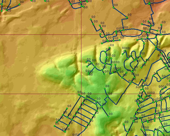
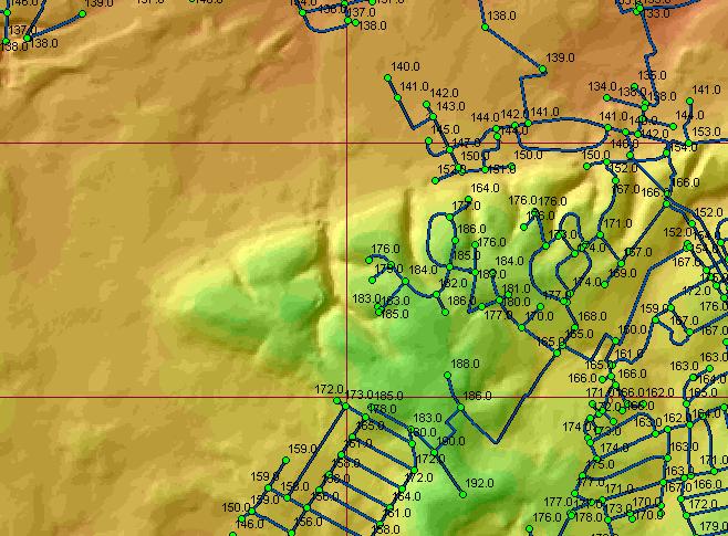
4 Models let you see what is happening in your pipes

5 And predict the future before you build


6 How are the models used? Site development Urban stormwater management Distribution Mains Fire flow analysis Typical Users Plan & regulatory reviewers Design & consulting firms Municipal & Governments Regional drainage planners Site designers Utility operational engineers Detention & retention facility designers Roadway & transportation designers Master Planners Academia Master planning Sewer capacity analysis Water Quality Modeling Pumping Optimization
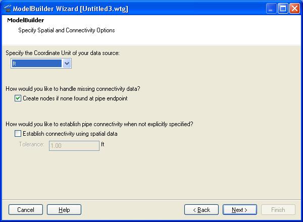
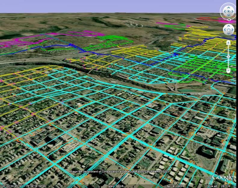
7 GIS / Water modeling relationship Build Water models from GIS data Maintain model up-to-date Load Water models from billing records (meters) Assign demand elevation from terrain files Correlate model results with GIS data (ex: queries vulnerable pipes and hospitals) Generate reports, export to Google Earth, etc.
8 Why build models from GIS? Because it is much faster and easier to build your model from GIS than any other method, provided you avoid some pitfalls CAD x,y x,y GIS J-1 z=357 ft x,y P-1 d= 8 in L= 320 ft c= 111 Ductile Iron Start node =J-1 Stop node = J-2 J-2 z=365 ft x,y


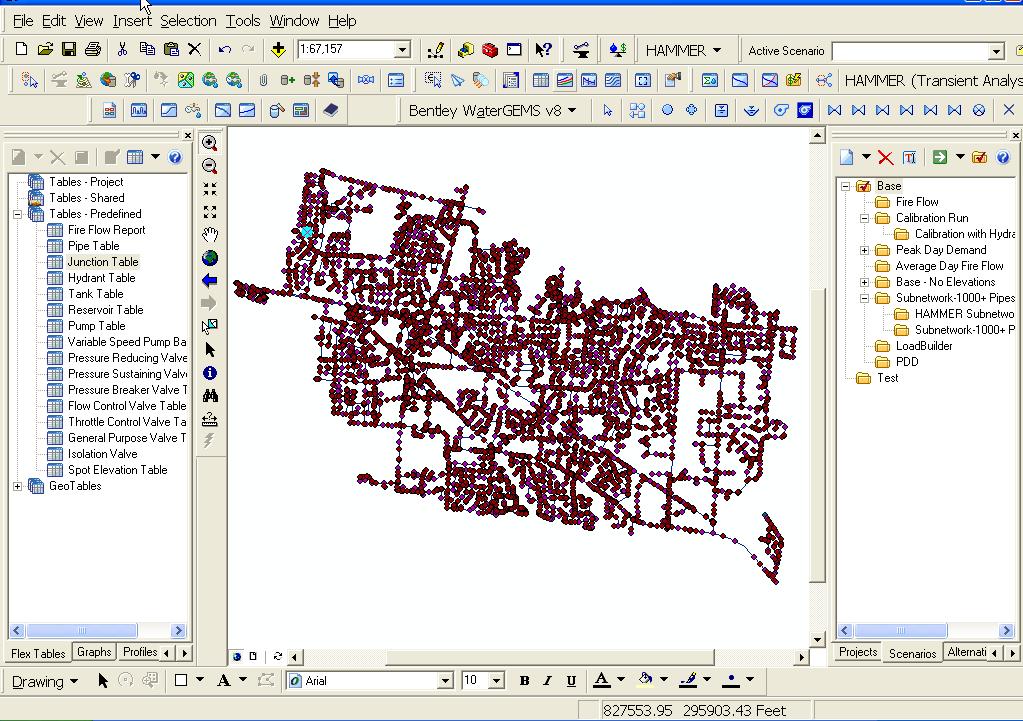
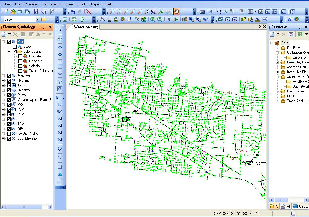
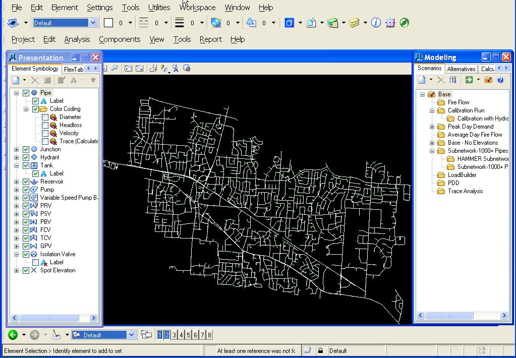
9 WaterGEMS WaterGEMS Modeling Data *.wtg ArcGIS MicroStation *.wtg.mdb *.mxd *.dgn AutoCAD Stand Alone *.dwg *.dwh The only 4 platform water distribution modeling package on the market!! One single model file, four platforms included!
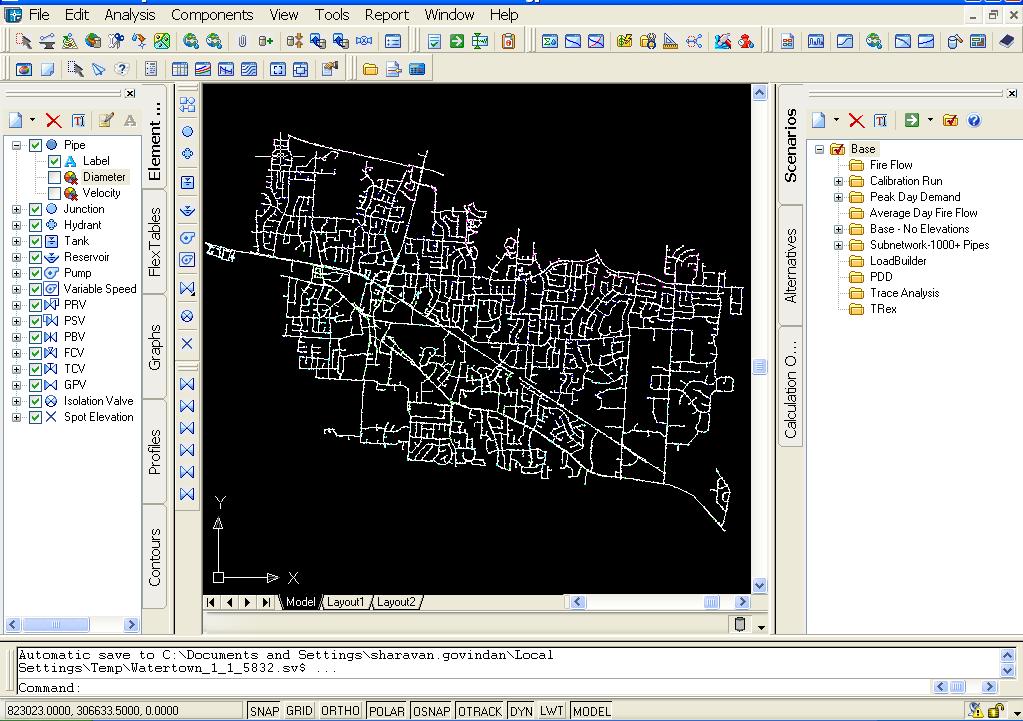
10 Interoperability 4 Platforms one database
11 BUILDING A HYDRAULIC MODEL FROM GIS DATA
12 It s all about relationships GIS features WaterGEMS elements

13 Not always a 1:1 relation GIS features WaterGEMS elements

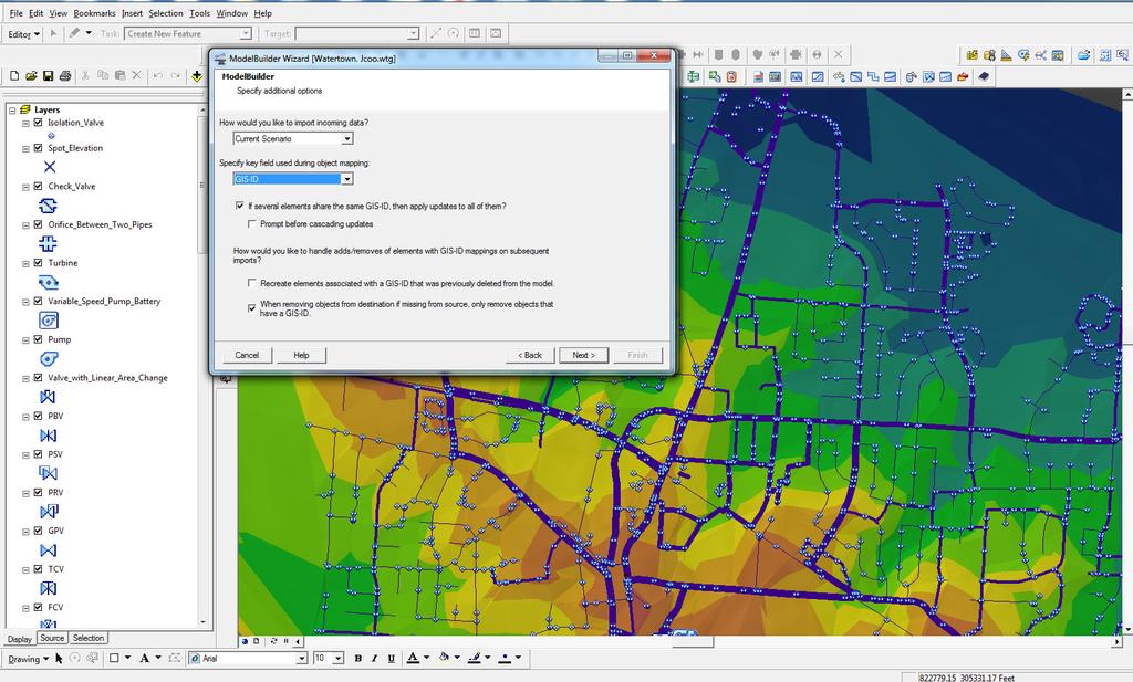
14 Importing GIS to model : ModelBuilder GIS Sources in WaterGEMS, SewerGEMS, HAMMER (ArcGIS interface): Geometric Network, Geodatabase features, and Shapefiles GIS Sources in WaterCAD, SewerCAD, CIvilStorm, PondPack or StormCAD : Shapefiles


15 GIS not created with hydraulic model in mind GIS has: Hydraulic modeling needs:
16 Element Representation Gate valve Check valve Tee fitting REAL LIFE Flowmeter Pump NEEDED FOR MODEL STATION IN GIS
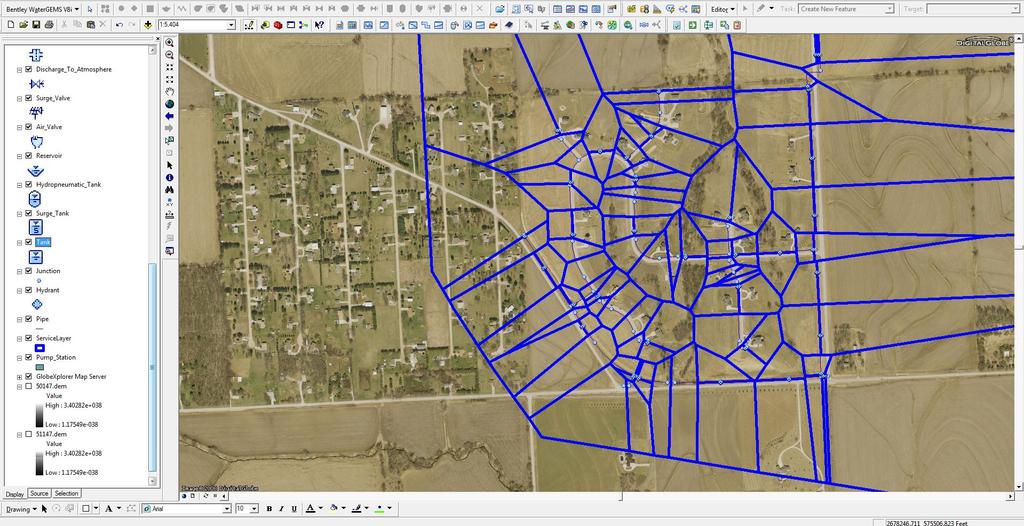
17 What is a pipe? Air release Valve Control Valve Isolation Valve Main Service lines Hydrant Detailed view J-201 P-21 P-22 PRV-4 J-202 Skeletonized Model View

18 Skelebrator Reduces model size intelligently Depends on use of model
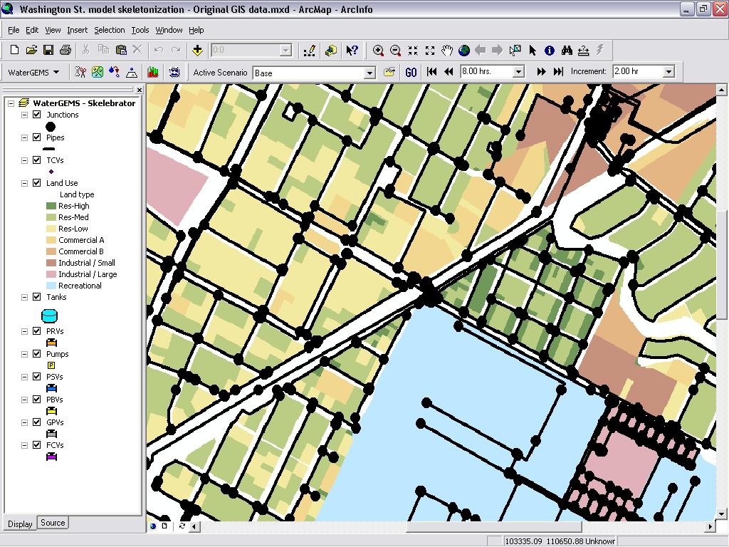
19 Before Skelebrator

20 After Skelebrator
21 Avoiding Connectivity Issues Pipes without end nodes Pipes that don t connect but should Pipes that appear to connect but aren t Pipes that cross without junctions

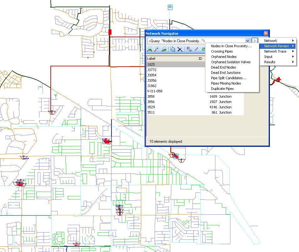
22 Connectivity rules and Network Navigator
23 Maintaining GIS and model up-to-date GIS GIS GIS Model Model Model Day 1 Year 1 Year 2

24 GIS rules and GIS ID

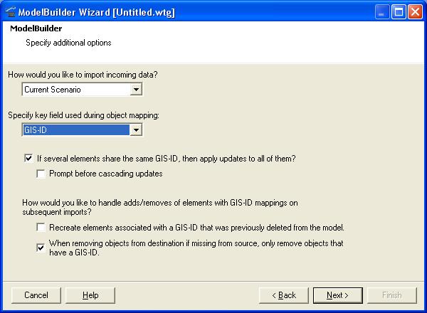
25 What s that GIS ID? 1:1,or, many :1,or, 1: many ModelBuilder will intelligently maintain GIS-ID when: Deleting Morphing Splitting pipes Merging Nodes in Close Proximity
26

27
28 ADDING DEMANDS


29 LoadBuilder- Automated Load Assignment Water Consumption Data Loading Flow Monitoring Data Loading Land Use Parcel and Census Data Loading
30

31 Automated Elevation Extraction Automated extraction of elevations from digital elevation models Intelligent elevation assignment Assign elevations to all node elements Create new what-if elevation or replace existing elevation
32
33
34
35
36 Citywater saves money through Modeling Townsville, Australia Fastest growing city in the state of Queensland 134 km of gravity mains, 17.5 km of rising mains (force mains) 20 pumping stations Citiwater Townsville s water and sewer business unit Responsible for: monitoring capabilities of existing system managing infrastructure improvements to ensure it can support expansion Consulting firm: GHD Pty. Ltd. Develop a calibrated model of the 4 main regions of Townsville Provide a 15-year planning report for southern suburbs of Townsville
37 Model Building process Created sewer model directly from GIS Shapefile and Drawing Review to «clean» the data 10% Analysis 2500-pipe sewer model Calibration 20% Model Building 70% Sanitary loading data from the 250 subcatchments in MapInfo GIS, imported using ModelBuilder
38 Calibration of flow Analysis Calibration Calibrated using 4 scenarios: Model Building Steady-state and average daily flow Steady-state and peak daily flow To calibrate observed flows in gravity sewer Extended-Period and average daily flow Extended-Period and peak daily flow To calibrate flows in pumping stations and rising mains (force mains)


39 Modeling Results Achieved high level of validation to use Wastewater model to: Confidently make important financial decisions regarding future augmentation work Undertake capital works planning and design Make overall operations and maintenance adjustments Increase the accuracy of emergency planning Conduct financial analysis
40 Recommendations 1. Decide who, how, when of model maintenance BEFORE you build the model 2. Plan GIS schema for use in Hydraulic modeling IF possible. ESRI template 2. Create and maintain unique GIS IDs 3. When building model obtain necessary data not likely to be in GIS: pump curves demand/loading patterns pump and valve controls more
41 Resources Tech Support Tech Notes: Building a Model Using ModelBuilder Updating A Model Using Model Builder Updating Source File Using Model Builder Discussion Forums: BE communities Water and WasteWater Hydraulicmodel.com
42 2009 Bentley Systems, Incorporated Thank You!
CLICK HERE TO KNOW MORE
 CLICK HERE TO KNOW MORE Integrating GIS data for Water Distribution Modeling Case Study: General Directorate of Water Eng. Atif Karrani - GIS Manager karrani@sewa.gov.ae Agenda Introduction Enterprise
Hydraulic Modeling for Esri ArcGIS Users
 Hydraulic Modeling for Esri ArcGIS Users A Bentley Technical White Paper Gregg Herrin Director, Product Management Cyndi Smith Senior Industry Marketing Director Published: August, 2017 www.bentley.com
Bentley Map Advancing GIS for the World s Infrastructure
 Bentley Map Advancing GIS for the World s Infrastructure Presentation Overview Why would you need Bentley Map? What is Bentley Map? Where is Bentley Map Used? Why would you need Bentley Map? Because your
IMPERIAL COUNTY PLANNING AND DEVELOPMENT
 IMPERIAL COUNTY PLANNING AND DEVELOPMENT GEODATABASE USER MANUAL FOR COUNTY BUSINESS DEVELOPMENT GIS June 2010 Prepared for: Prepared by: County of Imperial Planning and Development 801 Main Street El
Systems Interoperability at the Port of Long Beach
 Systems Interoperability at the Port of Long Beach Tuesday, June 11, 2013 2:45 pm 4:00 pm, Garden Salon One, 2nd Fl. Presented by: Brien Green, Account Manager, Bentley Systems Daniel Lee, Business Analyst,
Systems Interoperability at the Port of Long Beach
 Systems Interoperability at the Port of Long Beach Tuesday, June 11, 2013 2:45 pm 4:00 pm, Garden Salon One, 2nd Fl. Presented by: Brien Green, Account Manager, Bentley Systems Daniel Lee, Business Analyst,
MODERNIZATION OF THE MUNICIPAL MAPPING USING HIGH END GNSS SYSTEM AND GIS SOFTWARE
 MODERNIZATION OF THE MUNICIPAL MAPPING USING HIGH END GNSS SYSTEM AND GIS SOFTWARE Mr. R. A. R. Khan Assistant Engineer, Sewerage Utility Management Centre (SUMC) Municipal Corporation Of Greater Mumbai
spatial water demand (population density) spatial junctions distribution (building density) digital elevation map
 spatial junctions distribution (building density) digital elevation map") SYSTEM ID: WDS-Designer NARRATIVE DESCRIPTION With the WDS Designer a tool for the algorithmic generation of synthetic water distribution systems (swds) based on GIS data was presented (Sitzenfrei et al.,
SYSTEM ID: WDS-Designer NARRATIVE DESCRIPTION With the WDS Designer a tool for the algorithmic generation of synthetic water distribution systems (swds) based on GIS data was presented (Sitzenfrei et al.,
Bentley Map Advancing GIS for the World s Infrastructure
 Bentley Map Advancing GIS for the World s Infrastructure Presentation Overview Why would you need Bentley Map? What is Bentley Map? Where is Bentley Map Used? Red text signifies new things in Bentley Map
USING GIS IN WATER SUPPLY AND SEWER MODELLING AND MANAGEMENT
 USING GIS IN WATER SUPPLY AND SEWER MODELLING AND MANAGEMENT HENRIETTE TAMAŠAUSKAS*, L.C. LARSEN, O. MARK DHI Water and Environment, Agern Allé 5 2970 Hørsholm, Denmark *Corresponding author, e-mail: htt@dhigroup.com
City of Marquette. Geographic Information Systems (GIS) Global Positioning Systems (GPS)
 Global Positioning Systems (GPS)") City of Marquette Geographic Information Systems (GIS) Global Positioning Systems (GPS) Presented by: Matthew Koss GIS Engineering Technician Email- makoss@mqtcty.org The main focus of my job at the City
City of Marquette Geographic Information Systems (GIS) Global Positioning Systems (GPS) Presented by: Matthew Koss GIS Engineering Technician Email- makoss@mqtcty.org The main focus of my job at the City
Mapping Utilities with Mobile GIS Applications
 Mapping Utilities with Mobile GIS Applications Kristy M. Capobianco Reynolds, Smith and Hills, Inc. GIS Analyst Kristy.Capobianco@rsandh.com (904) 256-2251 2007 ESRI Southeast User Group Conference May
Esri UC2013. Technical Workshop.
 Esri International User Conference San Diego, California Technical Workshops July 9, 2013 CAD: Introduction to using CAD Data in ArcGIS Jeff Reinhart & Phil Sanchez Agenda Overview of ArcGIS CAD Support
Bentley Geospatial update
 Bentley Geospatial update Tallinna, 01.11.2007 Timo Tuukkanen, Bentley Systems Issues today Bentley Map available now detailed introduction to Bentley Map Bentley Geo Web Publisher Bentley Web GIS update,
GIS-based Smart Campus System using 3D Modeling
 GIS-based Smart Campus System using 3D Modeling Smita Sengupta GISE Advance Research Lab. IIT Bombay, Powai Mumbai 400 076, India smitas@cse.iitb.ac.in Concept of Smart Campus System Overview of IITB Campus
ArcGIS for Local Government
 Wednesday, June 29th ArcGIS for Local Government Dan Rose, GIS Analyst WaterOne IT/GIS Agenda / Talking Points What is the LGIM? WaterOne s GIS and LGIM background Our geodatabase redesign Our strategies
Strategies for Integrating CAD and BIM in ArcGIS. Don Kuehne Esri 3D Product Manager: CAD/BIM/AEC
 Strategies for Integrating CAD and BIM in ArcGIS Don Kuehne Esri 3D Product Manager: CAD/BIM/AEC CAD Digital Drawing CAD in ArcGIS Desktop CAD in Desktop CAD as Data CAD as a Map EXPORT TO CAD Create and
This paper outlines the steps we took to process the repository file into a Geodatabase Utility Data Model for Bloomfield Township s analysis.
 Title of Paper Importing CAD Drawings into a Utility Data Model Authors Names Kevin G. Broecker & James R. Miller Abstract This presentation covers the process needed to integrate data from a CAD drawing
Iowa Department of Transportation Office of Transportation Data GIS / CAD Integration
 Iowa Department of Transportation Office of Transportation Data GIS / CAD Integration From GIS data to CAD graphics - Iowa DOT's workflow utilizing GeoMedia and MicroStation to develop map products. Mark
GIS-T 2010 Building a Successful Geospatial Data Sharing Framework: A Ohio DOT Success Story
 GIS-T 2010 Building a Successful Geospatial Data Sharing Framework: A Ohio DOT Success Story ODOT District 2 GIS John Puente District 1 GIS Coordinator\ Planning Administrator 2 Interoperability 3 District
Plan for Developing a Smart Water System for the Prince William County Service Authority. Paul Moyano, PE, PMP Principal Engineer MWH Americas, Inc.
 Plan for Developing a Smart Water System for the Prince William County Service Authority Paul Moyano, PE, PMP Principal Engineer MWH Americas, Inc. November 17, 2015 Evolution of Hydraulic Models PLANNING
From Geographics Stella to Bentley Map Stella Map. Kimmo Soukki, Account Manager Bentley Finland
 From Geographics Stella to Bentley Map Stella Map Kimmo Soukki, Account Manager Bentley Finland This presentation Stella? Why migrate? New Bentley Stella Map - How it is done? Data migration Bonuses? What
Application of GIS in Public Transportation Case-study: Almada, Portugal
 Case-study: Almada, Portugal Doutor Jorge Ferreira 1 FSCH/UNL Av Berna 26 C 1069-061 Lisboa, Portugal +351 21 7908300 jr.ferreira@fcsh.unl.pt 2 FSCH/UNL Dra. FCSH/UNL +351 914693843, leite.ines@gmail.com
Building GIS for Fairfax County Wastewater Management. Gilbert Osei-Kwadwo
 Abstract: Building GIS for Fairfax County Wastewater Management Gilbert Osei-Kwadwo Wastewater Management Agency (WWM) of Fairfax County in Virginia has put a lot of efforts into building an effective
CAD: Introduction to using CAD Data in ArcGIS. Kyle Williams & Jeff Reinhart
 CAD: Introduction to using CAD Data in ArcGIS Kyle Williams & Jeff Reinhart What we will accomplish today Overview of ArcGIS CAD Support Georeferencing CAD data for ArcGIS How Mapping Specification for
Using CAD data in ArcGIS
 Using CAD data in ArcGIS Phil Sanchez and Jeff Reinhart Esri UC 2014 Technical Workshop Agenda Overview of ArcGIS CAD Support Using CAD Datasets in ArcMap Georeferencing CAD data for ArcGIS Loading CAD
SUPPORTS SUSTAINABLE GROWTH
 DDSS BBUUN NDDLLEE G E O S P AT I A L G O V E R N A N C E P A C K A G E SUPPORTS SUSTAINABLE GROWTH www.digitalglobe.com BRISBANE, AUSTRALIA WORLDVIEW-3 30 CM International Civil Government Programs US
Working with Land Records in ArcGIS. Amadea Azerki CA Cadastral Mapping Association October 15-16, 2009
 Working with Land Records in ArcGIS Amadea Azerki CA Cadastral Mapping Association October 15-16, 2009 Agenda An Overview of Land Records Resource Center Template Resources Editing Toolbar Configuration
Steve Pietersen Office Telephone No
 Steve Pietersen Steve.Pieterson@durban.gov.za Office Telephone No. 031 311 8655 Overview Why geography matters The power of GIS EWS GIS water stats EWS GIS sanitation stats How to build a GIS system EWS
KING GEORGE COUNTY DEPARTMENT OF COMMUNITY DEVELOPMENT
 GIS REPORT 2016 KING GEORGE COUNTY DEPARTMENT OF COMMUNITY DEVELOPMENT Background The GIS (Geographic Information System) coordinator was hired in 2001 to develop a GIS for King George County. Prior to
Leveraging GIS data and tools for maintaining hydraulic sewer models
 Leveraging GIS data and tools for maintaining hydraulic sewer models Ben Gamble & Joseph Koran Metropolitan Sewer District of Greater Cincinnati Carl C. Chan & Michael York CDM Smith Ben Gamble Senior
STATE GEOGRAPHIC INFORMATION DATABASE
 STATE GEOGRAPHIC INFORMATION DATABASE Data Information and Knowledge Management STATE GEOGRAPHIC INFORMATION DATABASE EXECUTIVE SUMMARY Utah has developed one of the most comprehensive statewide GIS resources
Construction in my Neighborhood - Communication with Stakeholder and Public -
 Construction in my Neighborhood - Communication with Stakeholder and Public - Presented by: Navneet Virk East Bay Municipal Utility District, Oakland, CA 0 Mission at EBMUD To manage the natural resources
Enabling Success in Enterprise Asset Management: Case Study for Developing and Integrating GIS with CMMS for a Large WWTP
 Enabling Success in Enterprise Asset Management: Case Study for Developing and Integrating GIS with CMMS for a Large WWTP Allison Blake, P.E. 1*, Matthew Jalbert, P.E. 2, Julia J. Hunt, P.E. 2, Mazen Kawasmi,
The University of Akron. William Troyer The Dr. Gary B. and Pamela S. Williams Honors College
 The University of Akron IdeaExchange@UAkron Honors Research Projects The Dr. Gary B. and Pamela S. Williams Honors College Spring 2018 Applying Control Logic to the End of the Ohio Canal Interceptor Tunnel
GIS Geographical Information Systems. GIS Management
 GIS Geographical Information Systems GIS Management Difficulties on establishing a GIS Funding GIS Determining Project Standards Data Gathering Map Development Recruiting GIS Professionals Educating Staff
Assessment of Unaccounted-for Water in Municipal Water Networks Using GIS and Modeling
 24 Assessment of Unaccounted-for Water in Municipal Water Networks Using GIS and Modeling Homayoun Motiee, Ali Motiei, Ahmad Hejranfar and M.Reza Delavar This chapter presents a study to calculate Unaccounted-for
GIS = Geographic Information Systems;
 What is GIS GIS = Geographic Information Systems; What Information are we talking about? Information about anything that has a place (e.g. locations of features, address of people) on Earth s surface,
Oman NSDI Business Values and Future Directions. Hassan Alawi Alghazali Acting Director General National Spatial Data Infrastructure
 Oman NSDI Business Values and Future Directions Hassan Alawi Alghazali Acting Director General National Spatial Data Infrastructure Presentation Outline Geospatial Maturity Current Challenges NCSI s Role
GIS AND GEOSPATIAL INFORMATION MANAGEMENT FOR URBAN PLANNING AND LAND MANAGEMENT IN SAUDI ARABIA
 GIS AND GEOSPATIAL INFORMATION MANAGEMENT FOR URBAN PLANNING AND LAND MANAGEMENT IN SAUDI ARABIA Manal Al-Hajji GIS Consultant Oman Geospatial Forum Oman April 10-11, 2017 CONTENTS 1. Future Saudi Cities
Infrastructure Industry Vertical Solutions and Beyond
 Infrastructure Industry Vertical Solutions and Beyond Chris Bradshaw Vice President Autodesk Investor Day 2005 1 Infrastructure Industry Customers Manage Large, Complex Infrastructure Systems Engineering
WHY DO WE NEED MODEL MAINTENANCE?
 MODEL MAINTENANCE WHY DO WE NEED MODEL MAINTENANCE? HOW DO WE UPDATE MODELS? WHAT ARE THE OPTIONS? DISCUSSION WHY DO WE NEED MODEL MAINTENANCE? 2000 1 2 3 4 5 6 7 8 9 CONFIDENCE RATING GOOD POOR DO SOMETHING
Utilizing GIS as a Critical Campus. Karen Jordan February 24, 2011
 Utilizing GIS as a Critical Campus Resource Karen Jordan February 24, 2011 Agenda Campus Background Opportunity for a Campus-wide GIS Data Structure and Collection How Has GIS Been Utilized on Campus Over
Bentley Map V8i (SELECTseries 3)
") Bentley Map V8i (SELECTseries 3) A quick overview Why Bentley Map Viewing and editing of geospatial data from file based GIS formats, spatial databases and raster Assembling geospatial/non-geospatial data
Bentley Map V8i (SELECTseries 3) A quick overview Why Bentley Map Viewing and editing of geospatial data from file based GIS formats, spatial databases and raster Assembling geospatial/non-geospatial data
Empowering water/wastewater network management with GIS
 Empowering water/wastewater network management with GIS Ioannis Kavouras_GIS Manager Surveying Engineer, MSc, MBA The Company responsible for fresh water distribution & sanitation serving 1.500.000 citizens
This whitepaper was originally presented by the authors at the annual Pipeline Simulation Interest Group (PSIG) conference.
 conference.") WHITEPAPER SYNERGI GAS Using GIS information to build pipeline models AUTHOR: Brent Mandich, DNV GL - Software DATE: March 2017 This whitepaper was originally presented by the authors at the annual Pipeline
WHITEPAPER SYNERGI GAS Using GIS information to build pipeline models AUTHOR: Brent Mandich, DNV GL - Software DATE: March 2017 This whitepaper was originally presented by the authors at the annual Pipeline
GIS Level 2. MIT GIS Services
 GIS Level 2 MIT GIS Services http://libraries.mit.edu/gis Email: gishelp@mit.edu TOOLS IN THIS WORKSHOP - Definition Queries - Create a new field in the attribute table - Field Calculator - Add XY Data
MAPPS 2012 Geospatial Products and Services Excellence Awards Awards Entry Form
 MAPPS 2012 Geospatial Products and Services Excellence Awards 2012 Awards Entry Form Please include a copy of this document with the project/product submission Entry Information Submission Number: 1741558
Introduction-Overview. Why use a GIS? What can a GIS do? Spatial (coordinate) data model Relational (tabular) data model
 data model Relational (tabular) data model") Introduction-Overview Why use a GIS? What can a GIS do? How does a GIS work? GIS definitions Spatial (coordinate) data model Relational (tabular) data model intro_gis.ppt 1 Why use a GIS? An extension
Introduction-Overview Why use a GIS? What can a GIS do? How does a GIS work? GIS definitions Spatial (coordinate) data model Relational (tabular) data model intro_gis.ppt 1 Why use a GIS? An extension
Exelis and Esri Technologies for Defense and National Security. Cherie Muleh
 Exelis and Esri Technologies for Defense and National Security Cherie Muleh Cherie.Muleh@exelisinc.com ENVI IMAGERY AND DATA BECOME KNOWLEDGE > Add information from imagery to your GIS > Automated workflows
AUTOMATED METERED WATER CONSUMPTION ANALYSIS
 AUTOMATED METERED WATER CONSUMPTION ANALYSIS Shane Zhong 1, Nick Turich 1, Patrick Hayde 1 1. Treatment and Network Planning, SA Water, Adelaide, SA, Australia ABSTRACT Water utilities collect and store
THE 3D SIMULATION INFORMATION SYSTEM FOR ASSESSING THE FLOODING LOST IN KEELUNG RIVER BASIN
 THE 3D SIMULATION INFORMATION SYSTEM FOR ASSESSING THE FLOODING LOST IN KEELUNG RIVER BASIN Kuo-Chung Wen *, Tsung-Hsing Huang ** * Associate Professor, Chinese Culture University, Taipei **Master, Chinese
UTILITY REPORT FOR THORNTON SELF STORAGE THORNTON, COLORADO
 UTILITY REPORT FOR THORNTON SELF STORAGE THORNTON, COLORADO Prepared by: Bowman Consulting 63 Park Point Dr. Suite 1 Golden, CO 841 (33)-81-29 June 29, 215 Revised August 14, 215 Revised September 3, 215
GIS and Web Technologies to Improve Irrigation Districts
 GIS and Web Technologies to Improve Irrigation Districts Presented To: Montana Association of Dam and Canal Systems Workshop Presented By: Brian Fischer, CFM GIS Manager October 07, 2010 What you won t
Building a GIS with Limited Resources
 Building a GIS with Limited Resources VILLAGE OF LOMBARD Daniel Price, GIS Technician David Dratnol, Village Engineer About Lombard... 22 Miles from downtown Chicago 43,251 Residents (28th among 272 NIPC
GIS. in the City of Lewiston Maine
 GIS in the City of Lewiston Maine The purpose of this slideshow is to provide an overview of the city GIS and how it is used, maintained and accessed in-house as well as by the public. Please simply hit
Geographical Information System in Managing Mega Infrastructure Projects
 Geographical Information System in Managing Mega Infrastructure Projects Ankita Adhikary, M.Sc. Geomatics and Space Application, CEPT University Ahmedabad G eographic Information System (GIS) is a computer
Geospatial Products V8i (SELECTseries 1)
") Geospatial Products V8i (SELECTseries 1) Keith Raymond Product Manager Geospatial Desktop Products Presentation Overview What are the various products? Why would you need them? Demonstrations 2 WWW.BENTLEY.COM
Geospatial Products V8i (SELECTseries 1) Keith Raymond Product Manager Geospatial Desktop Products Presentation Overview What are the various products? Why would you need them? Demonstrations 2 WWW.BENTLEY.COM
Chapter 6. Fundamentals of GIS-Based Data Analysis for Decision Support. Table 6.1. Spatial Data Transformations by Geospatial Data Types
 Chapter 6 Fundamentals of GIS-Based Data Analysis for Decision Support FROM: Points Lines Polygons Fields Table 6.1. Spatial Data Transformations by Geospatial Data Types TO: Points Lines Polygons Fields
What is GIS and How Can It Help Me?
 esri European User Conference Madrid 2011 What is GIS and How Can It Help Me? Jaime Nieves Ignacio Vázquez esri spain «Knowing where things are, and why, is essential to rational decision making.» Jack
Oklahoma GIS for GeoCIP
 GeoCIP Program Partners Oklahoma GIS for GeoCIP A Center for Spatial Analysis Report to Oklahoma GI Council 6 November 2009 The CSA team Kathy Hines Tran Trung Semiha Caliskan Peter Camili Scott March
Bridging the Gap between Engineering and GIS
 Bridging the Gap between Engineering and GIS Presented by: Karen Stewart, B.Tech, GISP Manager of Geomatics Township of Langley February 13, 2006 Agenda Introduction History Goals Implementation Benefits
Asset Management Planning. GIS and Asset Management Integration Readiness Assessment
 Asset Management Planning GIS and Asset Management Integration Readiness Assessment With too little data, you won t be able to make any conclusions that you trust. With loads of data you will find relationships
Eastlake Assited Living & Memory Care
 UTILITY REPORT FOR Eastlake Assited Living & Memory Care 1 st Submittal January 23, 2016 2 nd Submittal March 04, 2016 June 7, 2016 Final Submittal August 08, 2016 Prepared for: 3301 E. 120 th Ave, LLC.
Florida Department of Transportation s
 Controls Conference - Hyatt Regency Savannah, Georgia - April 14-18, 2013 Florida Department of Transportation s 1) Virtual R/W Application Development 2) 3D Utility Mapping for 3D Design Update John Krause,
ESRI Survey Summit August Clint Brown Director of ESRI Software Products
 ESRI Survey Summit August 2006 Clint Brown Director of ESRI Software Products Cadastral Fabric How does Cadastral fit with Survey? Surveyors process raw field observations Survey measurements define high-order
ArcGIS Pro: Essential Workflows STUDENT EDITION
 ArcGIS Pro: Essential Workflows STUDENT EDITION Copyright 2018 Esri All rights reserved. Course version 6.0. Version release date August 2018. Printed in the United States of America. The information contained
Experiences and Directions in National Portals"
 FIG Seminar on e-land Administration Innsbruck/Austria 2-4 June 2004 "ESRI's Experiences and Directions in National Portals" Kevin Daugherty Cadastral/Land Records Manager ESRI Topic Points Technology
Data Aggregation with InfraWorks and ArcGIS for Visualization, Analysis, and Planning
 Data Aggregation with InfraWorks and ArcGIS for Visualization, Analysis, and Planning Stephen Brockwell President, Brockwell IT Consulting, Inc. Join the conversation #AU2017 KEYWORD Class Summary Silos
Paths Toward CAD and GIS Interoperability
 Paths Toward CAD and GIS Interoperability Bo Guo, PhD, PE Gistic Research, Inc Outline CAD and GIS Differences Interoperability Paths UDOT ROW Research Project CAD and GIS: The Difference (I) History Users
GIS for Surveyors: Wetland Studies and Solutions, Inc.
 GIS for Surveyors: Concepts, Solutions, and Applications ` New Jersey Society of Professional Land Surveyors (NJSPLS) SurvCon 2013, Atlantic City, New Jersey Presented by John Cooke and Yeoanny A. Venetsanos,
3301 East 120 th Avenue Assited Living & Memory Care
 UTILITY REPORT FOR 3301 East 120 th Avenue Assited Living & Memory Care 1 st Submittal January 23, 2016 2 nd Submittal March 04, 2016 Prepared for: 3301 E. 120 th Ave, LLC. 8200 E. Maplewood Ave., Suite
KING FAHD UNIVERSITY OF PETROLEUM & MINERALS
 KING FAHD UNIVERSITY OF PETROLEUM & MINERALS Department of City & Regional Planning Introduction To GIS (CRP 514) Identifying & Planning Public School Facility In California Using GIS Presented to Dr.
Road Ahead: Linear Referencing and UPDM
 Road Ahead: Linear Referencing and UPDM Esri European Petroleum GIS Conference November 7, 2014 Congress Centre, London Your Work Making a Difference ArcGIS Is Evolving Your GIS Is Becoming Part of an
Geodatabase An Overview
 Federal GIS Conference February 9 10, 2015 Washington, DC Geodatabase An Overview Ralph Denkenberger - esri Session Path The Geodatabase - What is it? - Why use it? - What types are there? Inside the Geodatabase
Mapping of Sewerage System of Aurangabad City using GIS Software
 Mapping of Sewerage System of Aurangabad City using GIS Software Amol Adhave, Sachin Bajaj M.Tech Student, Department of CS & IT, Dr.Babasaheb Ambedkar Marathwada University, Aurangabad, Maharashtra, India
An Introduction to the Community Maps Information Model
 Esri International User Conference July 23 27 San Diego Convention Center An Introduction to the Community Maps Information Model Seth Sarakaitis Agenda Overview of Community Maps Program Information Models
Geodatabase An Introduction
 Federal GIS Conference 2014 February 10 11, 2014 Washington DC Geodatabase An Introduction Ralph Denkenberger esri Session Path The Geodatabase - What is it? - Why use it? - What types are there? Inside
GIS and Remote Sensing Support for Evacuation Analysis
 GIS and Remote Sensing Support for Evacuation Analysis Presented to GIS for Transportation Symposium Rapid City, South Dakota March 28-31, 2004 Demin Xiong Oak Ridge National Laboratory 2360 Cherahala
Tools for GASB34 Implementation GIS/GPS
 Tools for GASB34 Implementation GIS/GPS Geographic Technologies Group February, 2002 Curtis Hinton Goldsboro, NC Augusta, GA Raleigh, NC Boynton Beach, FL Houston, TX http://www.geotg.com 919-759 759-92149214
presents challenges related to utility infrastructure planning. Many of these challenges
 1 Introduction: - a. Purpose According to U.S. Census Bureau the population of stark county was 367,585 in 1990, and in 2000 it was increase to 378,098. Thus County is experiencing a growth that presents
GIS Integration to Maximo
 GIS Integration to Maximo Tuesday 15 th January 2008 Mahmoud Jaafar Systems Director GISTEC Agenda Introduction Why AMS & GIS Integration? ESRI GIS Enabling Technology. Integrating GIS & Maximo. What do
Leveraging Oracle Spatial and Graph for Airport GIS
 Leveraging Oracle Spatial and Graph for Airport GIS Presenter: Ed Maghboul President, x-spatial, LLC Los Angeles World Airports / x-spatial, LLC Airport Enterprise GIS, AEGIS OVERVIEW Los Angeles World
Visitor Flows Model for Queensland a new approach
 Visitor Flows Model for Queensland a new approach Jason. van Paassen 1, Mark. Olsen 2 1 Parsons Brinckerhoff Australia Pty Ltd, Brisbane, QLD, Australia 2 Tourism Queensland, Brisbane, QLD, Australia 1
Innovative GIS solutions
 Dušan Cibulka GIS Consultant / Analyst 5. - 6. June 2014 8 th Forum of Young Geoinformaticians 2014 Contents Our Vision and Philosophy Technologies we use Selected solutions implemented in projects: Renovation
UTAH S STATEWIDE GEOGRAPHIC INFORMATION DATABASE
 UTAH S STATEWIDE GEOGRAPHIC INFORMATION DATABASE Data Information and Knowledge Management NASCIO Awards 2009 STATE GEOGRAPHIC INFORMATION DATABASE B. EXECUTIVE SUMMARY Utah has developed one of the most
John Laznik 273 Delaplane Ave Newark, DE (302)
") Office Address: John Laznik 273 Delaplane Ave Newark, DE 19711 (302) 831-0479 Center for Applied Demography and Survey Research College of Human Services, Education and Public Policy University of Delaware
Office Address: John Laznik 273 Delaplane Ave Newark, DE 19711 (302) 831-0479 Center for Applied Demography and Survey Research College of Human Services, Education and Public Policy University of Delaware
A Web-GIS Based Integrated Climate Adaptation Model (ICAM): Exemplification from the City of Melbourne, Australia
: Exemplification from the City of Melbourne, Australia") A Web-GIS Based Integrated Climate Adaptation Model (ICAM): Exemplification from the City of Melbourne, Australia JOSHPHAR KUNAPO 1,2, MATTHEW J. BURNS 1, TIM D. FLETCHER 1, ANTHONY R. LADSON 3, LUKE CUNNINGHAM
A Web-GIS Based Integrated Climate Adaptation Model (ICAM): Exemplification from the City of Melbourne, Australia JOSHPHAR KUNAPO 1,2, MATTHEW J. BURNS 1, TIM D. FLETCHER 1, ANTHONY R. LADSON 3, LUKE CUNNINGHAM
ArcMap - EXPLORING THE DATABASE Part I. SPATIAL DATA FORMATS Part II
 Week 5 ArcMap - EXPLORING THE DATABASE Part I SPATIAL DATA FORMATS Part II topics of the week Exploring the Database More on the Table of Contents Exploration tools Identify, Find, Measure, Map tips, Hyperlink,
June 19 Huntsville, Alabama 1
 June 19 Huntsville, Alabama 1 Real-Time Geospatial Data: The Fusion of PI and ArcGIS Enabling Smarter Facilities Management OSIsoft and Esri Mapping and Location Analytics Platform Supporting Your Use
GEOGRAPHICAL INFORMATION SYSTEMS. GIS Foundation Capacity Building Course. Introduction
 GEOGRAPHICAL INFORMATION SYSTEMS. GIS Foundation Capacity Building Course. Introduction In recent times digital mapping has become part and parcel of our daily lives with experience from Google Maps on
Innovation. The Push and Pull at ESRI. September Kevin Daugherty Cadastral/Land Records Industry Solutions Manager
 Innovation The Push and Pull at ESRI September 2004 Kevin Daugherty Cadastral/Land Records Industry Solutions Manager The Push and The Pull The Push is the information technology that drives research and
APPLICATION OF GIS IN ELECTRICAL DISTRIBUTION NETWORK SYSTEM
 See discussions, stats, and author profiles for this publication at: https://www.researchgate.net/publication/305263658 APPLICATION OF GIS IN ELECTRICAL DISTRIBUTION NETWORK SYSTEM Article October 2015
GIS for ChEs Introduction to Geographic Information Systems
 GIS for ChEs Introduction to Geographic Information Systems AIChE Webinar John Cirucci 1 GIS for ChEs Introduction to Geographic Information Systems What is GIS? Tools and Methods Applications Examples
Esri Training by Microcenter Prepare to Innovate. Microcenter Course Catalog
 Esri Training by Microcenter Prepare to Innovate 2015 Instructor-Led Courses Microcenter Course Catalog ArcGIS Foundational Courses Designed to meet the learning needs of professionals whose GIS experience
High Speed / Commuter Rail Suitability Analysis For Central And Southern Arizona
 High Speed / Commuter Rail Suitability Analysis For Central And Southern Arizona Item Type Reports (Electronic) Authors Deveney, Matthew R. Publisher The University of Arizona. Rights Copyright is held
GIS Applications for Water Distribution Systems
 21 GIS Applications for Water Distribution Systems Uzair(Sam) Shamsi This chapter describes the geographic information system (GIS) applications for water distribution systems. The GIS applications that
Kenneth Melchert (Senior Statistician - Regional Liaison Officer)
") Sourcing Spatial Data from Local Government Getting the Data Right The Supplier s Perspective Presenter: Kenneth Melchert (Senior Statistician - Regional Liaison Officer) Information Products and Services
Sourcing Spatial Data from Local Government Getting the Data Right The Supplier s Perspective Presenter: Kenneth Melchert (Senior Statistician - Regional Liaison Officer) Information Products and Services
Climate Risk Visualization for Adaptation Planning and Emergency Response
 Climate Risk Visualization for Adaptation Planning and Emergency Response NCR Flood Fact Finding Workshop Ricardo Saavedra ricardo@vizonomy.com Social Media, Mobile, and Big Data St. Peter s Basilica,
Creating Basemaps to Manage Buildings and Facilities
 Esri International User Conference San Diego, California Technical Workshops July 26, 2012 Creating Basemaps to Manage Buildings and Facilities Mark Stewart and Tamara Yoder Topics for this Session Overview