Lecture 2: Modelling Histories: Types and Styles:
|
|
|
- Bathsheba Ward
- 5 years ago
- Views:
Transcription


1 SCHOOL OF GEOGRAPHY Lecture 2: Modelling Histories: Types and Styles: Urban Models defined, The Urban Modelling Timeline, What Kind of Cities, Examples of Three Model Types
2 Outline Origins: Location Theory and Social Physics The Urban Modelling TimeLine What Kind of Cities? 1950s 1970s : What Kinds of Models? Comparative Statics Cities in Equilibrium The Quest for Dynamics: Macro Dynamics, Catastrophe, Bifurcation, Chaos The Move to the Micro in Space, Time and Attributes: Cells, Agents, and the New Dynamics Other Types: Three Examples
3 1. Origins: Location Theory and Social Physics We will say more about this later this afternoon but for now some history is needed of where all these ideas come from Von Thunen 1826 The German Location Theorists from Weber to Losch Central Place Theory and Christaller 1933 The Empiricist Americans: Reilly, Stewart & Gravitation 1920s 1950s: Social Physics The Urban Geographers 1920s + Isard and the Beginnings of Regional Science the Urban Modeling Time Line begins here mid 1950s
4 Von Thunen s Model has everything that characterizes cities for the last 200 years or rather from pre the industrial revolution to around rent Distance from market Let me show you a simple model that illustrates how we can experiment with this kind of thinking because it characterizes many modelling strategies that came from the past

5
6 2. The Urban Modelling TimeLine Models Von Thunen 1826 Location Theory CPT 1933 Regional Science Isard 1955 Macro Static Models 60 70s Aggregate Dynamics 70 80s Cells Agents Cities Monocentric Forms Chicago School 1920s Urban Markets 1960s+ Edge Cities Polynucleated 1970s + Planning Top Down Control Centralised 1920s On Participatory 1970s On Bottom Up Decentralised Individualistic 1990s + There are many time lines
7 3. What Kind of Cities? Monocentric ie single centered, little choice of location limited transport choices, strictly differentiated due to income, daily routine, homogeneous life styles dull! This is the industrial city Contrast this with cities now heterogeneous, diverse mix, less routine, less emphasis on transport to work much greater opportunities for different locations for living Edge cities, polynucleated forms, more like a currant pudding than a doughnut or birthday cake for a 1 year old


8 s 1970s : What Kinds of Models? Comparative Statics Cities in Equilibrium The theory was locational and gravitational, the methods were eclectic there was a focus on urban and regional economics with transport based on the journey to work the theory was encapsulated in key books like
9 The models were cross sectional static, simulating an equilibrium based on a rudimentary systems approach which focused on physical interactions transport and trips Econometric simultaneous regression ad hoc empiricist Gravitational the Lowry Model which was a transport model embedded with an economic base or input output model Simulation, not unlike CA and agent based Chapin UNC Optimization LP models and economic optimization


10 The 1960s Books From the US for Advanced Spatial Analysis CentreCentre for Advanced Spatial Analysis, University College London
11 The models were strongly applied and were forced into existence through policy initiatives by federal govt in US and by structure planning in UK Right from the start researchers were conscious of dynamics and disaggregation eg TOMMS model There was massive consolidation of these styles into the Lowry model framework in the late 1960s and 1970s Not much new innovation but a research program was put in place only to find that fashions changed Optimization was pursued as a paradigm showing the strong top down focus of model use in planning


12 The largely UK contributions, the 1970s


13 And the contributions into the 1980s as these kinds of models began to slide out of fashion.
14 5. The Quest for Dynamics: Macro Dynamics, Catastrophe, Bifurcation, Chaos A concern for macro dynamics catastrophe theory Wilson embedding spatial interaction models in logistic style equations, Note it was macro not micro The Allen Prigogine initiatives The Dimitrios Dendrinos Development of Lotka Volterra Models Later Developments of Chaos Theory Nijkamp and Reggiani


15 Here are some of the contributions
16 6. The Move to the Micro in Space, Time and Attributes: Cells, Agents, and the New Dynamics I must stress that there are many, many ideas and models and theories that have impacted on this field that I have not covered all the planning techniques etc and all the urban and regional theory in economic terms. But the wave of concern for macro dynamics also began to work itself out and there is much less focus on this now. Essentially my own work during the 1980s was largely in reskilling myself in computer graphics and my work on fractals was not focused directly on urban models per se
17 The concern for detail at the micro scale has come from a sea change in the way we look at the world, from the top down, from an ordered world in equilibrium to one which is full of pulsating change driven from the bottom up Why did we never think that way in the first place? I am not going to answer that question at one level it can t be answered but it is having quite dramatic effects on how we think about a science of cities Here are some reasons first the focus on bottom up thinking, second the idea of time and change, not equilibrium far from equilibrium, third better data, better computers, fourth heterogeneity not homogeneity, fifth representation as neutral objects grids, pixels, raster, GIS
18 The elements of complexity theory are key to the new modes or representation which focuses on emergence This quest began with cellular automata models as key examples of emergence which were methods to generate fractal morphologies Recently the idea of mobile cells or agents has come onto the agenda The biggest problems of these class of models is that they are far richer than any of their predecessors and they break the rule of parsimony they are hard if not impossible to calibrate in their pure form
19 They also deal with interaction rather poorly and generally fail to grasp the appropriate notions of action at a distance The cell size is a problem too in terms of states and land uses They tend to be physicalist and the rules of behavior are problematic But this is an exciting area as this meeting will show and here are some examples of what has been done so far


20 Some samples of what is being synthesised. Note that urban models per se is no longer the focus it is now a science of cities or a tool box
21 7. Other Types: Three Examples (that merge into each other) Iconic Modelling: architect s models, toy models but all models are toys of a kind in that we learn from them We never anticipated that these kinds of near physical as opposed to symbolic or abstract model being made digital. But in fact the whole of the reality has become digital To give you an example, we can take a model of a city say London build the geometry digitally then have it on the desktop of in Google Earth, and then push into a CAD CAM machine and print it out in 3D these are the stages in building such digital iconic models Let me show you how it works

22


23

24

25

26


27

28

29


30 Hard Copy from Soft Copy: Printing Bits of Virtual London
31

32
33 Conclusions so far Iconic and symbolic models are beginning to connect up A great deal of this is moving from reflected time to real time building models on the fly encoding this knowledge into the web Web 2.0 and web 3.0 technologies if you have not had enough then come to my lecture at 6pm to see some of these ideas in action More and more of this knowledge is being packaged and cut and sliced in different ways look at what is going on in GIS To Read: well I haven t given you any references on iconic modelling as these are easy to understand but you could look at my PSS article the one for the last lecture at the end of the web page
34 Questions?
1 A Science of Cities
 5 th February 2014 1 A Science of Cities Michael Batty m.batty@ucl.ac.uk @jmichaelbatty http://www.complexcity.info/ http://www.casa.ucl.ac.uk/ Centre Centre for Advanced for Advanced Spatial Spatial Analysis,
A Science of Cities. Models of Urban Form and Function. Michael
 July 27- August 2, 2014 A Science of Cities Models of Urban Form and Function Michael Batty m.batty@ucl.ac.uk @jmichaelbatty http://www.complexcity.info/ http://www.casa.ucl.ac.uk/ Centre Centre for Advanced
ECNU Writing Workshop, October 28 th, Urban Models: The Decline of Theory, The Rise of Big Data and the Fragmentation of Applications
 ECNU Writing Workshop, October 28 th, 2012 CAMUSS Urban Models: The Decline of Theory, The Rise of Big Data and the Fragmentation of Applications Michael Batty University College London m.batty@ucl.ac.uk
Part 1. Modeling the Relationships between Societies and Nature... 1
 Contents Introduction........................................ xi Part 1. Modeling the Relationships between Societies and Nature............................................ 1 Chapter 1. The Theoretical
Modern Urban and Regional Economics
 Modern Urban and Regional Economics SECOND EDITION Philip McCann OXFORD UNIVERSITY PRESS Contents List of figures List of tables Introduction xii xiv xvii Part I Urban and Regional Economic Models and
Lecture 7: Cellular Automata Modelling: Principles of Cell Space Simulation
 SCHOOL OF GEOGRAPHY Lecture 7: Cellular Automata Modelling: Principles of Cell Space Simulation Outline Types of Urban Models Again The Cellular Automata Approach: Urban Growth and Complexity Theory The
Lecture 7: Cellular Automata Modelling: Principles of Cell Space Simulation
 MRes in Advanced Spatial Analysis and Visualisation Lecture 7: Cellular Automata Modelling: Principles of Cell Space Simulation Outline Types of Urban Models Again The Cellular Automata Approach: Urban
Answers to questions for The New Introduction to Geographical Economics, 2 nd edition
 Answers to questions for The New Introduction to Geographical Economics, 2 nd edition Chapter 2 Geography and economic theory Question 2.1* Assume a trade model with transportation costs but without increasing
Techniques for Science Teachers: Using GIS in Science Classrooms.
 Techniques for Science Teachers: Using GIS in Science Classrooms. After ESRI, 2008 GIS A Geographic Information System A collection of computer hardware, software, and geographic data used together for
COSMIC: COmplexity in Spatial dynamic
 COSMIC: COmplexity in Spatial dynamic MICs 9 10 November, Brussels Michael Batty University College London m.batty@ucl.ac.uk http://www.casa.ucl.ac.uk/ Outline The Focus of the Pilot The Partners: VU,
Table of Contents. Foreword... xiii Michael F. GOODCHILD Introduction... xix Stéphane ROCHE and Claude CARON
 Table of Contents Foreword... xiii Michael F. GOODCHILD Introduction... xix Stéphane ROCHE and Claude CARON PART 1. ISSUES AND PROSPECTS OF GIS RELATIONSHIPS, ORGANIZATIONS AND SOCIETY... 1 Chapter 1.
PROGRESS IN GEOGRAPHY
 28 1 2009 01 PROGRESS IN GEOGRAPHY Vol28 No1 Jan 2009 ( 100101) : 19-20 40-20 80 20 80 GIS RS : ; ; [1] -20 80 [2] 20 80 [3] 19 : 19-20 40 :2008-08; : 2008-12 (40671054); (40635026); : GIS Email:gouty@igsnrraccn
A Constrained CA Model to Simulate Urban Growth of the Tokyo Metropolitan Area
 A Constrained CA Model to Simulate Urban Growth of the Tokyo Metropolitan Area Yaolong Zhao 1, 2, Yuji Murayama 2 1 Faculty of Land Resource Engineering, Kunming University of Science and Technology, Kunming,
UC Santa Barbara CSISS Classics
 UC Santa Barbara CSISS Classics Title Walter Christaller, Hierarchical Patterns of Urbanization. CSISS Classics Permalink https://escholarship.org/uc/item/6188p69v Author Agarwal, Pragya Publication Date
Introduction to Scientific Modeling Stephanie Forrest Dept. of Computer Science Univ. of New Mexico Albuquerque, NM
 Introduction to Scientific Modeling Stephanie Forrest Dept. of Computer Science Univ. of New Mexico Albuquerque, NM August, 20112 http://cs.unm.edu/~forrest forrest@cs.unm.edu " Introduction" The three
THE GENERAL URBAN MODEL: RETROSPECT AND PROSPECT. Alan Wilson Centre for Advanced Spatial Analysis University College London
 THE GENERAL URBAN MODEL: RETROSPECT AND PROSPECT Alan Wilson Centre for Advanced Spatial Analysis University College London PART 1: RETROSPECT Achievements and insights INTRODUCTION anniversaries: beyond
Geostatistics and Spatial Scales
 Geostatistics and Spatial Scales Semivariance & semi-variograms Scale dependence & independence Ranges of spatial scales Variable dependent Fractal dimension GIS implications Spatial Modeling Spatial Analysis
The Building Blocks of the City: Points, Lines and Polygons
 The Building Blocks of the City: Points, Lines and Polygons Andrew Crooks Centre For Advanced Spatial Analysis andrew.crooks@ucl.ac.uk www.gisagents.blogspot.com Introduction Why use ABM for Residential
Geographic Information Systems (GIS) in Environmental Studies ENVS Winter 2003 Session III
 in Environmental Studies ENVS Winter 2003 Session III") Geographic Information Systems (GIS) in Environmental Studies ENVS 6189 3.0 Winter 2003 Session III John Sorrell York University sorrell@yorku.ca Session Purpose: To discuss the various concepts of space,
Geographic Information Systems (GIS) in Environmental Studies ENVS 6189 3.0 Winter 2003 Session III John Sorrell York University sorrell@yorku.ca Session Purpose: To discuss the various concepts of space,
Space-adjusting Technologies and the Social Ecologies of Place
 Space-adjusting Technologies and the Social Ecologies of Place Donald G. Janelle University of California, Santa Barbara Reflections on Geographic Information Science Session in Honor of Michael Goodchild
Esri and GIS Education
 Esri and GIS Education Organizations Esri Users 1,200 National Government Agencies 11,500 States & Regional Agencies 30,800 Cities & Local Governments 32,000 Businesses 8,500 Utilities 12,600 NGOs 11,000
Simple Spatial Growth Models The Origins of Scaling in Size Distributions
 Lectures on Spatial Complexity 17 th 28 th October 2011 Lecture 3: 21 st October 2011 Simple Spatial Growth Models The Origins of Scaling in Size Distributions Michael Batty m.batty@ucl.ac.uk @jmichaelbatty
A.P. Human Geography
 A.P. Human Geography 2012-2013 Instructor: Chris Vitt Brief Description of Course AP Human Geography is designed to provide students with a learning experience equivalent to that obtained in most college
Advanced Placement Human Geography
 Advanced Placement Human Geography I. Overview of the Course The purpose of the Advanced Placement (AP) Human Geography course is to introduce students to the systematic study of patterns and processes
A simple agricultural land use model implemented using Geographical Vector Agents (GVA)
") A simple agricultural land use model implemented using Geographical Vector Agents (GVA) A. B. Moore 1, Y. Hammam 2, P. A. Whigham 2 1 School of Surveying / 2 Department of Information Science, University
A simple agricultural land use model implemented using Geographical Vector Agents (GVA) A. B. Moore 1, Y. Hammam 2, P. A. Whigham 2 1 School of Surveying / 2 Department of Information Science, University
Infrastructure to Explore Geographic Systems through Models and Maps
 Exemplar 1: GeoVUE Then GENeSIS (GENerative e SocIalScience) Infrastructure to Explore Geographic Systems through Models and Maps Michael Batty University College London m.batty@ucl.ac.uk http://www.casa.ucl.ac.uk/
Cities, AI, Design, & the Future Can Artificial Intelligence Improve Design Intelligence?
 March 27 th 28 Cities, AI, Design, & the Future Can Artificial Intelligence Improve Design Intelligence? Michael Batty m.batty@ucl.ac.uk @jmichaelbatty http://www.spatialcomplexcity.info/ http://www.casa.ucl.ac.uk/
Cell-based Model For GIS Generalization
 Cell-based Model For GIS Generalization Bo Li, Graeme G. Wilkinson & Souheil Khaddaj School of Computing & Information Systems Kingston University Penrhyn Road, Kingston upon Thames Surrey, KT1 2EE UK
Welcome to GST 101: Introduction to Geospatial Technology. This course will introduce you to Geographic Information Systems (GIS), cartography,
, cartography,") Welcome to GST 101: Introduction to Geospatial Technology. This course will introduce you to Geographic Information Systems (GIS), cartography, remote sensing, and spatial analysis through a series of
Welcome to GST 101: Introduction to Geospatial Technology. This course will introduce you to Geographic Information Systems (GIS), cartography, remote sensing, and spatial analysis through a series of
GEOG 508 GEOGRAPHIC INFORMATION SYSTEMS I KANSAS STATE UNIVERSITY DEPARTMENT OF GEOGRAPHY FALL SEMESTER, 2002
 GEOG 508 GEOGRAPHIC INFORMATION SYSTEMS I KANSAS STATE UNIVERSITY DEPARTMENT OF GEOGRAPHY FALL SEMESTER, 2002 Course Reference #: 13210 Meeting Time: TU 2:05pm - 3:20 pm Meeting Place: Ackert 221 Remote
M. Saraiva* 1 and J. Barros 1. * Keywords: Agent-Based Models, Urban Flows, Accessibility, Centrality.
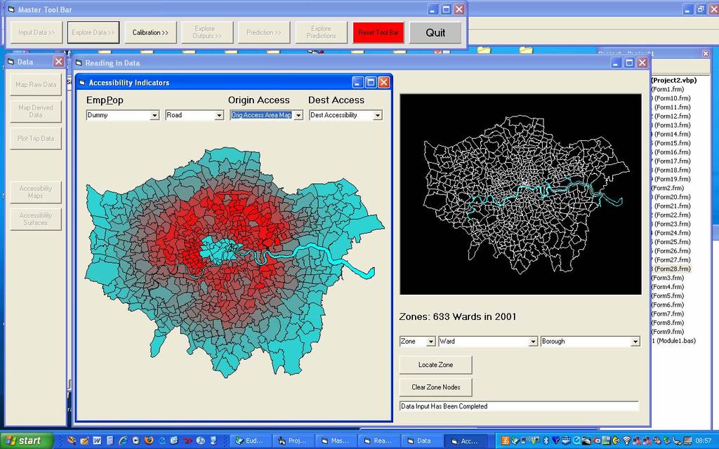
 The AXS Model: an agent-based simulation model for urban flows M. Saraiva* 1 and J. Barros 1 1 Department of Geography, Birkbeck, University of London, 32 Tavistock Square, London, WC1H 9EZ *Email: m.saraiva@mail.bbk.ac.uk
CPSC 695. Future of GIS. Marina L. Gavrilova
 CPSC 695 Future of GIS Marina L. Gavrilova The future of GIS Overview What is GIS now How GIS was viewed before Current trends and developments Future directions of research What is GIS? Internet's definition
Book Review: A Social Atlas of Europe
 Book Review: A Social Atlas of Europe Ferreira, J Author post-print (accepted) deposited by Coventry University s Repository Original citation & hyperlink: Ferreira, J 2015, 'Book Review: A Social Atlas
UNIVERSITY OF NAIROBI COLLEGE OF HUMANITIES AND SOCIAL SCIENCES FACULTY OF ARTS & SCHOOL OF PHYSICAL SCIENCES
 UNIVERSITY OF NAIROBI COLLEGE OF HUMANITIES AND SOCIAL SCIENCES FACULTY OF ARTS & SCHOOL OF PHYSICAL SCIENCES Department of Geography and Environmental Studies TEACHING MODULE CGP/SGP 321: ECONOMIC GEOGRAPHY
Outline. Geographic Information Analysis & Spatial Data. Spatial Analysis is a Key Term. Lecture #1
 Geographic Information Analysis & Spatial Data Lecture #1 Outline Introduction Spatial Data Types: Objects vs. Fields Scale of Attribute Measures GIS and Spatial Analysis Spatial Analysis is a Key Term
Table of Contents. Preface... xiii. Introduction... xv
 Preface... xiii Introduction... xv Chapter 1. Modeling Concepts Used in Spatial Analysis... 1 François DURAND-DASTÈS 1.1. Introduction... 1 1.2. Modeling universals... 2 1.2.1. Logical frames for modeling...
G E O G RAP H Y Geomorphology: Climatology : Oceanography: Geographic Thought : Population Geography :
 GEOGRAPHY SYALLABUS Geomorphology: Fundamental concepts; Endogenetic and Exogenetic forces; Denudation and weathering; Geosynclines, continental drift and plate tectonics; Concept of geomorphic cycle;
Session 4: Lecture 4: Cellular Automata. One and Two D D Automata and the Beginnings of ABM. Michael Batty
 Lectures on Complexity and Spatial Simulation Thursday, 14 March 2013 Session 4: Lecture 4: Cellular Automata One and Two D D Automata and the Beginnings of ABM Michael Batty m.batty@ucl.ac.uk @jmichaelbatty
Mathematical Biology - Lecture 1 - general formulation
 Mathematical Biology - Lecture 1 - general formulation course description Learning Outcomes This course is aimed to be accessible both to masters students of biology who have a good understanding of the
GCSE GEOGRAPHY. Your guide to GCSE St. Richard s Catholic College
 GCSE GEOGRAPHY Your guide to GCSE Geography @ St. Richard s Catholic College A Geographer s way of thinking Caring for the environment Understand cultural differences Understand and explore worldwide disasters
Representation of Geographic Data
 GIS 5210 Week 2 The Nature of Spatial Variation Three principles of the nature of spatial variation: proximity effects are key to understanding spatial variation issues of geographic scale and level of
PLANNING (PLAN) Planning (PLAN) 1
 Planning (PLAN) 1") Planning (PLAN) 1 PLANNING (PLAN) PLAN 500. Economics for Public Affairs Description: An introduction to basic economic concepts and their application to public affairs and urban planning. Note: Cross-listed
Planning (PLAN) 1 PLANNING (PLAN) PLAN 500. Economics for Public Affairs Description: An introduction to basic economic concepts and their application to public affairs and urban planning. Note: Cross-listed
A Land Use Transport Model for Greater London:
 Spatio-Temporal Analysis of Network Data and Road Developments Launch Event Workshop UCL Monday 18 May 2009 A Land Use Transport Model for Greater London: With Applications to an Integrated Assessment
transportation research in policy making for addressing mobility problems, infrastructure and functionality issues in urban areas. This study explored
 ABSTRACT: Demand supply system are the three core clusters of transportation research in policy making for addressing mobility problems, infrastructure and functionality issues in urban areas. This study
GIS FOR PLANNING. Course Overview. Schedule. Instructor. Prerequisites. Urban Planning 792 Thursday s 5:30-8:10pm SARUP 158
 GIS FOR PLANNING Urban Planning 792 Thursday s 5:30-8:10pm SARUP 158 Schedule Class/Lab - SARUP 158 Thursdays 5:30pm - 8:10pm Office Hours - By Appointment Project Ideas - Week 4 Final - 5/10/2018 Instructor
Task A4, Appendix A: Maryland Land Use and Impact Assessment Model
 Task A4, Appendix A: Maryland Land Use and Impact Assessment Model The LEAM Model During the last two decades, spatial analysis tools, geographic information systems (GIS), and remote-sensing (RS) technologies
PÀ ÁðlPÀ gádå G À Áå ÀPÀgÀ CºÀðvÁ ÀjÃPÉë KARNATAKA STATE ELIGIBILITY TEST FOR LECTUERSHIP
 PÀ ÁðlPÀ gádå G À Áå ÀPÀgÀ CºÀðvÁ ÀjÃPÉë KARNATAKA STATE ELIGIBILITY TEST FOR LECTUERSHIP Subject: GEOGRAPHY Subject Code: 08 Note: There will be two question papers, Paper-II and Paper-III. Paper II will
UNIT 22 THEORY AND PRACTICE OF CENTRAL SETTLEMENTS IN DEVELOPMENT PLANNING
 and Administration UNIT 22 THEORY AND PRACTICE OF CENTRAL SETTLEMENTS IN DEVELOPMENT PLANNING Structure 22.0 Objectives 22.1 Introduction 22.2 Region and Central Place in the Context of Decentralised Development
DOI: /j.cnki.tr (Soils), 2003, 35 (6): 456~460 [5] [4] [2] [4] LUCC (4) GTR GTR(Generalized Thunen- [2~8]
![DOI: /j.cnki.tr (Soils), 2003, 35 (6): 456~460 [5] [4] [2] [4] LUCC (4) GTR GTR(Generalized Thunen- [2~8]](/thumbs/93/113780099.jpg "DOI: /j.cnki.tr (Soils), 2003, 35 (6): 456~460 [5] [4] [2] [4] LUCC (4) GTR GTR(Generalized Thunen- [2~8]") DOI:10.13758/j.cnki.tr.2003.06.003 (Soils), 2003, 35 (6): 456~460 LUCC 1 2 1 2100962 210008 (GIS) Cellular Automata CA CA CA CA / (LUCC) P208 / LUCC / LUCC : [1] LUCC (1) [5] CA 8 CA LUCC [4] (2) 1980~1994
DOI:10.13758/j.cnki.tr.2003.06.003 (Soils), 2003, 35 (6): 456~460 LUCC 1 2 1 2100962 210008 (GIS) Cellular Automata CA CA CA CA / (LUCC) P208 / LUCC / LUCC : [1] LUCC (1) [5] CA 8 CA LUCC [4] (2) 1980~1994
GIS = Geographic Information Systems;
 What is GIS GIS = Geographic Information Systems; What Information are we talking about? Information about anything that has a place (e.g. locations of features, address of people) on Earth s surface,
The Spatial Perspective
 Department of Geography University of California at Santa Barbara GEOGRAPHY 5 MIDTERM REVIEW SHEET The Spatial Perspective - Review all of chapter 1 carefully except for Box 1.B (but do review Box 1.A
Geo Business Gis In The Digital Organization
 We have made it easy for you to find a PDF Ebooks without any digging. And by having access to our ebooks online or by storing it on your computer, you have convenient answers with geo business gis in
An urban growth model for strategic urban planning on a regional level: a proposed model prototype for Greater Cairo in the year 2050
 The Sustainable City VII, Vol. 1 71 An urban growth model for strategic urban planning on a regional level: a proposed model prototype for Greater Cairo in the year 2050 S. A. Magdi Architectural Engineering
GEOBIA state of the art, science or technology
 GEOBIA state of the art, science or technology Paul Aplin School of Geography, paul.aplin@nottingham.ac.uk Geographic Object-Based Image Analysis Aplin et al., 1999, Remote Sensing of Environment Progress?
DISCOVERING PATTERNS OF URBAN DEVELOPMENT IN SKOPJE
 CITTA Modelli virtuali della città: GIS, modelli 3D e simulazioni HD Sonja Gievska 1 Ognen Marina 2 Ilija Ilievski 3 Keywords: Urban dynamics, urban transformation, knowledge-based approach, data mining
Forecasting Regional Employment in Germany: A Review of Neural Network Approaches. Objectives:
 Forecasting Regional Employment in Germany: A Review of Neural Network Approaches Peter Nijkamp, Aura Reggiani, Roberto Patuelli Objectives: To develop and apply Neural Network (NN) models in order to
Health and Medical Geography (GEOG 222)
") Spring 2019 Class meets: Tuesdays and Thursdays 12:30-1:45pm Carolina Hall Room 220 Instructor: Michael Emch Email: emch@unc.edu Course Objectives Health and Medical Geography (GEOG 222) This course is
Spring 2019 Class meets: Tuesdays and Thursdays 12:30-1:45pm Carolina Hall Room 220 Instructor: Michael Emch Email: emch@unc.edu Course Objectives Health and Medical Geography (GEOG 222) This course is
Advanced Placement Human Geography
 Advanced Placement Human Geography Introduction to AP Human Geography The Advanced Placement course in Human Geography is designed to introduce students to the systematic study of the processes that have
Chapter 1 Introduction
 1 Chapter 1 Introduction Figure 1.1: Westlake Plaza A warm sunny day on a downtown street and plaza, pedestrians pass on the sidewalks, people sit on benches and steps, enjoying a cup of coffee, shoppers
Letting reality speak. How the Chicago School Sociology teaches scholars to speak with our findings.
 Letting reality speak. How the Chicago School Sociology teaches scholars to speak with our findings. By Nanke Verloo n.verloo@uva.nl Assistant professor in Urban Planning, University of Amsterdam. Think
Mapping Welsh Neighbourhood Types. Dr Scott Orford Wales Institute for Social and Economic Research, Data and Methods WISERD
 Mapping Welsh Neighbourhood Types Dr Scott Orford Wales Institute for Social and Economic Research, Data and Methods WISERD orfords@cardiff.ac.uk WISERD Established in 2008 and funded by the ESRC and HEFCW
Spatial Epidemic Modelling in Social Networks
 Spatial Epidemic Modelling in Social Networks Joana Margarida Simoes Centre for Advanced Spatial Analysis, University College of London, UK Abstract. The spread of infectious diseases is highly influenced
Building a Vibrant and Enduring Spatial Science John P. Wilson IWGIS2014 Beijing, China
 Building a Vibrant and Enduring Spatial Science John P. Wilson IWGIS2014 Beijing, China Outline Spatial roots o Geography o Landscape architecture o Computer science The (current) opportunity Guiding principles
Table of Contents. General Introduction... Part 1. Introduction... 3
 Table of Contents General Introduction... xi PART 1. THE STRUCTURE OF THE GEOGRAPHIC SPACE... 1 Part 1. Introduction... 3 Chapter 1. Structure and System Concepts... 5 1.1. The notion of structure... 5
Location Theory and Decision Analysis
 Location Theory and Decision Analysis Analytics of Spatial Information Second Edition Yupo Chan Professor & Founding Chair Department of Systems Engineering Donaghey College of Engineering and Information
INTEGRATION OF GIS AND MULTICRITORIAL HIERARCHICAL ANALYSIS FOR AID IN URBAN PLANNING: CASE STUDY OF KHEMISSET PROVINCE, MOROCCO
 Geography Papers 2017, 63 DOI: http://dx.doi.org/10.6018/geografia/2017/280211 ISSN: 1989-4627 INTEGRATION OF GIS AND MULTICRITORIAL HIERARCHICAL ANALYSIS FOR AID IN URBAN PLANNING: CASE STUDY OF KHEMISSET
INTRODUCTION TO GIS. Dr. Ori Gudes
 INTRODUCTION TO GIS Dr. Ori Gudes Outline of the Presentation What is GIS? What s the rational for using GIS, and how GIS can be used to solve problems? Explore a GIS map and get information about map
A Preliminary Model of Community-based Integrated Information System for Urban Spatial Development
 A Preliminary Model of Community-based Integrated Information System for Urban Spatial Development Bauni HAMID 1, Devin DEFRIZA 2 1 2 CAITAD (Center of Applied Information Technology in Planning and Design),
Of topic specific knowledge and understanding To encourage progressive development in 'thinking geographically'
 [August 2012] Content exemplars 1. Broad description of the content: Single paragraph, written with technical precision Content rigour (avoiding generic statements) Identifying the core of essential knowledge
Dynamical Systems: Lecture 1 Naima Hammoud
 Dynamical Systems: Lecture 1 Naima Hammoud Feb 21, 2017 What is dynamics? Dynamics is the study of systems that evolve in time What is dynamics? Dynamics is the study of systems that evolve in time a system
Environmental Science EES B02H3 PRINCIPLES OF GEOMORPHOLOGY
 THE UNIVERSITY of TORONTO at SCARBOROUGH January, 2009 Department of Physical & Environmental Sciences Environmental Science EES B02H3 PRINCIPLES OF GEOMORPHOLOGY The earth s surface form and its dynamic
LOUISIANA STUDENT STANDARDS FOR SOCIAL STUDIES THAT CORRELATE WITH A FIELD TRIP TO DESTREHAN PLANTATION KINDERGARTEN
 LOUISIANA STUDENT STANDARDS FOR SOCIAL STUDIES THAT CORRELATE WITH A FIELD TRIP TO DESTREHAN PLANTATION KINDERGARTEN Standard 2 Historical Thinking Skills Students distinguish between events, people, and
The Social Life of Location. David Sonnen September 2008
 The Social Life of Location David Sonnen September 2008 Three Transformations Traditional Cartography -- 2300 B.C. - ~ 1980 Maps represent location and attributes Portable, persistent communication/ reference
MODELLING AND UNDERSTANDING MULTI-TEMPORAL LAND USE CHANGES
 MODELLING AND UNDERSTANDING MULTI-TEMPORAL LAND USE CHANGES Jianquan Cheng Department of Environmental & Geographical Sciences, Manchester Metropolitan University, John Dalton Building, Chester Street,
Lecture I. What is Quantitative Macroeconomics?
 Lecture I What is Quantitative Macroeconomics? Gianluca Violante New York University Quantitative Macroeconomics G. Violante, What is Quantitative Macro? p. 1 /11 Qualitative economics Qualitative analysis:
Unit 1 Continents And Geo Skills Lesson 1 Getting To
 We have made it easy for you to find a PDF Ebooks without any digging. And by having access to our ebooks online or by storing it on your computer, you have convenient answers with unit 1 continents and
Spatial Modeling of Land Use and Land Cover Change
 Spatial Modeling of Land Use and Land Cover Change Daniel G. Brown Environmental Spatial Analysis Lab School of Natural Resources and Environment University of Michigan Synthesis Products Modeling Chapter
biologically-inspired computing lecture 5 Informatics luis rocha 2015 biologically Inspired computing INDIANA UNIVERSITY
 lecture 5 -inspired Sections I485/H400 course outlook Assignments: 35% Students will complete 4/5 assignments based on algorithms presented in class Lab meets in I1 (West) 109 on Lab Wednesdays Lab 0 :
Spatial Modeling, Regional Science, Arthur Getis Emeritus, San Diego State University March 1, 2016
 Spatial Modeling, Regional Science, and UCSB Arthur Getis Emeritus, San Diego State University March 1, 2016 My Link to UCSB The 1980s at UCSB (summers and sabbatical) Problems within Geography: The Quantitative
Interactive GIS in Veterinary Epidemiology Technology & Application in a Veterinary Diagnostic Lab
 Interactive GIS in Veterinary Epidemiology Technology & Application in a Veterinary Diagnostic Lab Basics GIS = Geographic Information System A GIS integrates hardware, software and data for capturing,
THE UNIVERSITY of TORONTO at SCARBOROUGH January, 2010 Department of Physical & Environmental Sciences
 THE UNIVERSITY of TORONTO at SCARBOROUGH January, 2010 Department of Physical & Environmental Sciences Environmental Science EES B02H3 PRINCIPLES OF GEOMORPHOLOGY The earth s surface form and its dynamic
USING MAPS Designed by Catherine Denial Assistant Professor of History Knox College, Galesburg IL
 USING MAPS Designed by Catherine Denial Assistant Professor of History Knox College, Galesburg IL Most college-level textbooks contain numerous maps related to key historical events westward expansion;
A cellular automata model for the study of small-size urban areas
 Context and Motivation A cellular automata model for the study of small-size urban areas Centre de Política de Sòl i Valoracions Barcelona 23 January 2007 Nuno Norte Pinto School of Technology and Management
VECTOR CELLULAR AUTOMATA BASED GEOGRAPHICAL ENTITY
 Geoinformatics 2004 Proc. 12th Int. Conf. on Geoinformatics Geospatial Information Research: Bridging the Pacific and Atlantic University of Gävle, Sweden, 7-9 June 2004 VECTOR CELLULAR AUTOMATA BASED
Issues around verification, validation, calibration, and confirmation of agent-based models of complex spatial systems
 Issues around verification, validation, calibration, and confirmation of agent-based models of complex spatial systems David O Sullivan 1 Mark Gahegan 2 1 School of Geography, Geology, and Environmental
Foundation Geospatial Information to serve National and Global Priorities
 Foundation Geospatial Information to serve National and Global Priorities Greg Scott Inter-Regional Advisor Global Geospatial Information Management United Nations Statistics Division UN-GGIM: A global
TRAITS to put you on the map
 TRAITS to put you on the map Know what s where See the big picture Connect the dots Get it right Use where to say WOW Look around Spread the word Make it yours Finding your way Location is associated with
Lecture 1 Introduction to GIS. Dr. Zhang Spring, 2017
 Lecture 1 Introduction to GIS Dr. Zhang Spring, 2017 Topics of the course Using and making maps Navigating GIS Map design Working with spatial data Geoprocessing Spatial data infrastructure Digitizing
Land Use Modeling at ABAG. Mike Reilly October 3, 2011
 Land Use Modeling at ABAG Mike Reilly michaelr@abag.ca.gov October 3, 2011 Overview What and Why Details Integration Use Visualization Questions What is a Land Use Model? Statistical relationships between
Integrating GIS into Food Access Analysis
 GIS Day at Kansas University Integrating GIS into Food Access Analysis Daoqin Tong School of Geography and Development Outline Introduction Research questions Method Results Discussion Introduction Food
(Emerging?) topics in resilience research perspectives from a critical urban and regional studies view
 topics in resilience research perspectives from a critical urban and regional studies view") (Emerging?) topics in resilience research perspectives from a critical urban and regional studies view Thilo Lang Head of Department Regional Geography of Europe Leibniz Institute for Regional Geography
(Emerging?) topics in resilience research perspectives from a critical urban and regional studies view Thilo Lang Head of Department Regional Geography of Europe Leibniz Institute for Regional Geography
Lecture I. What is Quantitative Macroeconomics?
 Lecture I What is Quantitative Macroeconomics? Gianluca Violante New York University Quantitative Macroeconomics G. Violante, What is Quantitative Macro? p. 1 /11 Qualitative economics Qualitative analysis:
MODULE 4 1 of 7. C. macro-economics - aggregate indicators of international, national, or regional economic performance and their interrelationships.
 MODULE 4 1 of 7 SPATIAL ECONOMICS: URBANIZATION AND DEVELOPMENT I. Space in economics II. Historical context: urbanization, innovation, and development III. Micro-economics perspective: - internal structure
Urban Transportation Planning Prof. Dr.V.Thamizh Arasan Department of Civil Engineering Indian Institute of Technology Madras
 Urban Transportation Planning Prof. Dr.V.Thamizh Arasan Department of Civil Engineering Indian Institute of Technology Madras Module #03 Lecture #12 Trip Generation Analysis Contd. This is lecture 12 on
GEOGRAPHY (GE) Courses of Instruction
 Courses of Instruction") GEOGRAPHY (GE) GE 102. (3) World Regional Geography. The geographic method of inquiry is used to examine, describe, explain, and analyze the human and physical environments of the major regions of the
GEOGRAPHY (GE) GE 102. (3) World Regional Geography. The geographic method of inquiry is used to examine, describe, explain, and analyze the human and physical environments of the major regions of the
Types of spatial data. The Nature of Geographic Data. Types of spatial data. Spatial Autocorrelation. Continuous spatial data: geostatistics
 The Nature of Geographic Data Types of spatial data Continuous spatial data: geostatistics Samples may be taken at intervals, but the spatial process is continuous e.g. soil quality Discrete data Irregular:
Canadian Historical GIS Partnership Development: Taking Steps for Historical Mapping in Canada
 Canadian Historical GIS Partnership Development: Taking Steps for Historical Mapping in Canada Byron Moldofsky Manager, GIS and Cartography Office Department of Geography and Planning University of Toronto
Chapter 10: The Future of GIS Why Speculate? 10.2 Future Data 10.3 Future Hardware 10.4 Future Software 10.5 Some Future Issues and Problems
 Chapter 10: The Future of GIS 10.1 Why Speculate? 10.2 Future Data 10.3 Future Hardware 10.4 Future Software 10.5 Some Future Issues and Problems Theme of the Course GIS's place in understanding geographic
Introduction to Geographic Information Science. Updates/News. Last Lecture 1/23/2017. Geography 4103 / Spatial Data Representations
 Geography 4103 / 5103 Introduction to Geographic Information Science Spatial Data Representations Updates/News Waitlisted students First graded lab this week: skills learning Instructional labs vs. independence
Spatial profile of three South African cities
 Spatial Outcomes Workshop South African Reserve Bank Conference Centre Pretoria September 29-30, 2009 Spatial profile of three South African cities by Alain Bertaud September 29 Email: duatreb@msn.com