Land Use Modeling at ABAG. Mike Reilly October 3, 2011
|
|
|
- Jordan Wheeler
- 5 years ago
- Views:
Transcription
1 Land Use Modeling at ABAG Mike Reilly October 3, 2011
2 Overview What and Why Details Integration Use Visualization Questions
3 What is a Land Use Model? Statistical relationships between three major groups of people in cities Households and firms choosing locations to be near each other and other stuff Developers providing space for HHs and firms Simulation of these relationships into the future while adjusting assumptions and/or policy levers
4 Why Use a Land Use Model? Insights: behavior of complex systems e.g. place a toll on the Bay Bridge at peak periods More people take BART or shift their timing (transport model) Some households move to San Francisco The price of housing in San Francisco rises More housing gets built in San Francisco Some firms leave San Francisco Some firms leave the Bay Area Objective: rational people (decision makers, advocates, public) often disagree about the impact of policies and projects Comprehensive: can be applied over a large geographic region Often hard to stay objective about trade-offs when every bit counts Guestimates: Reasonable estimate of how much might be if everything turns out the way your scenario is phrased This is unlikely but still powerful Eliminating scenarios that don t pan out under nice assumptions Ballpark
5 Why ABAG Ability to test modest strategies within a large, complex real estate market ABAG/MTC will not be a large player in the region s land use planning any time soon/ever Strategies will be on the margin We are another agent in a complex system not the government at the top setting up the rules or the boundaries or even the dominant goals Do these have an impact? How can we maximize this impact? Can we find synergies?
6 Details: Basic Two components Location Choice: where do households and firms choose to locate? à Demand Real Estate Development: can developers build buildings profitably in the locations where they are wanted under planning codes? à Supply Simulate all the region s future agents interacting and finding locations Model runs yearly
7 Details: HH Loc Choice A subset of HHs moves in a given year Chooses a new location based on: Access to employment types Access to amenity Housing characteristics Neighborhood characteristics Price, or relative Housing Supply (from Real Estate Development model)
8 Details: Firm Loc Choice A subset of firms moves in a given year Chooses a new location based on: Access to labor pools Access to agglomeration economies Access to special metropolitan locations Building characteristics Access to amenity Price, or relative Commercial Building Supply (from Real Estate Development model)
9 Details: Real Estate Development Developers scan the metropolitan area assessing profit to be made considering: Rent offered by type (Demand from Location Choice models) Existing use of the land (cost to purchase and demolish/prepare) Zoning limitations Fees, subsidies, and property taxes Site level characteristics: pollution, small lot
10 Details: Space Households and firms choose buildings that are attached to 2m parcels Developers assess parcels or groups of parcels to build on (split/assmembly at a cost) Results aggregated to 1454 TAZs that connect the model to with the travel model
11
12
13 Details: Integration Cities exist so people and firms can get near each other Near is satisfying and profitable but also costly and frustrating à different degrees of near for different people/companies access back in the choice slides TAZs are linked together by the Travel Model s network = the ease of moving between different parts of the metropolis This ease changes with congestion and new facilities à changes on the travel side change land use distributions Similarly, land use related to transport investments are now dynamic and inform the Travel Model every 5 years
 / yearly Steelhead Location Choice firm and household location")

14 HENRY Regional Economics overall economic change county / yearly Input-Output sectoral expansion/contraction, trade, regional attractiveness regional totals to 2040 land use efficiency transp efficiency Population Synthesizer creates synthetic population that conforms to control totals Probablistic Expansion 1454 zones (TAZ) / yearly Steelhead Location Choice firm and household location choice 1.8 million buildings / yearly Micro-Simulation, Logistic Regression agglomerative economies, HH neighborhood choice, amenity Regional Demographics overall population change county / yearly Cohort Survival; Migration; etc birth/death rates, household formation, regional attractiveness Model Flow DRAFT MTC and ABAG June 3, 2011 Greenhouse Gas Emissions VMT translated into emissions VMT totals by HH type EMFAC vehicle fleet composition, fuel and technology improvements Other Targets ease of movement btwn LUZs (every 5 years) RTP policy VMT etc Urban Visualization 3D scenes and traffic animation Building, neighborhood / yearly Procedural Urban Simulation building massing, neighborhood character/congestion, sketch planning Daily Transport Model simulation of synthetic population s transport choices through a typical day 1454 zones / hourly Micro-Simulation, Logistic Regression modal costs, accessibility, land use configuration Real Estate Development real estate developer choice of project and location 2 million parcels / yearly Micro-Simulation, pro forma db zoning, fees, planning process, parcel size, PDA characteristics jobs by type SCS policy MTC Activity-Based Travel Model RTP policy prices HHs persons Long-Term Choices simulation of household choice of car ownership and work/school location millions of HHs / yearly Micro-Simulation, Logistic Regression vehicles per worker, commute trip characteristics RTP policy buildings Other Targets
15
16
17
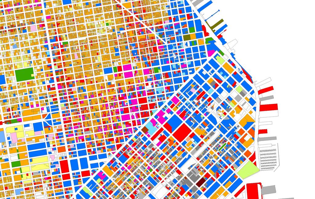
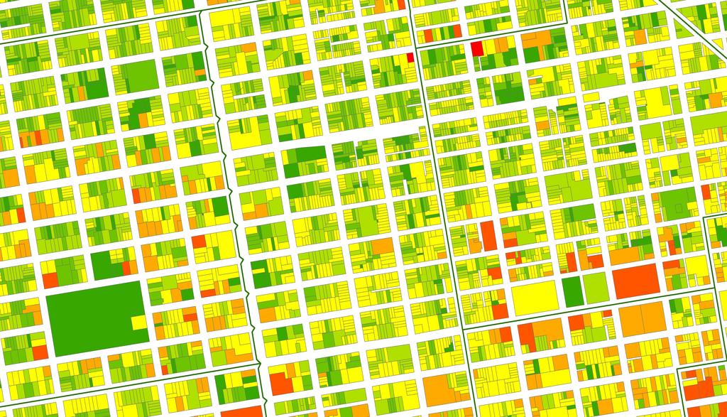
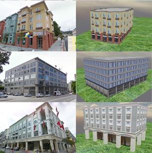
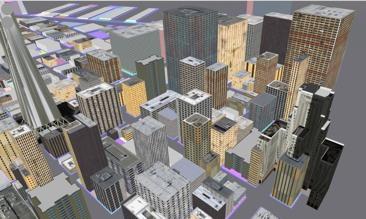
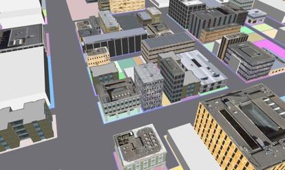
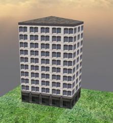
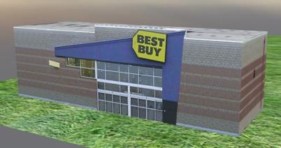
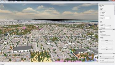
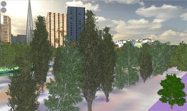
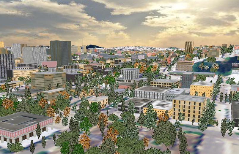
18 Visualization Most efforts end with the maps and tables We re lucky to be working on moving this into something more interactive with Paul Waddell at UC Berkeley Here I ll show some early outputs Procedural Modeling: structures are semi-randomly generated Some details supplied from underlying Steelhead results (building type, stories, square feet, age, quality)

19 Tuesday, July 5, 2011!"#$%&'"()*+',)&,-./
20 !"#$%&'"()*+',)&,-./


21 !"#!$%&#!"''!"'/!"#)*+,&-.!"(' Tuesday, July 5, 2011
*+',$-.")


22 !"#"$%&'#!()*+',$-.# /012 /011 Tuesday, July 5, 2011

23 Tuesday, July 5, 2011!"#"$%&'()#!*+,$-#

24 !"#"$%&'$()*+,-./0%#!&1$'#!"23 Tuesday, July 5, 2011

25 Tuesday, July 5, 2011!"#$%"&'(

26 Tuesday, July 5, 2011!"#$%&'"()*+%,%-(.#/

27 Tuesday, July 5, 2011!"#$%&"'

28 Tuesday, July 5, 2011!"#$%&"'
29 Questions?
THE FUTURE OF FORECASTING AT METROPOLITAN COUNCIL. CTS Research Conference May 23, 2012
 THE FUTURE OF FORECASTING AT METROPOLITAN COUNCIL CTS Research Conference May 23, 2012 Metropolitan Council forecasts Regional planning agency and MPO for Twin Cities metropolitan area Operates regional
The Future of Met Council Forecasts
 The Future of Met Council Forecasts Todd Graham todd.graham@metc.state.mn.us Dennis Farmer dennis.farmer@metc.state.mn.us Metropolitan Council Research Today s Agenda Why we forecast, how we use forecasts
Advancing Urban Models in the 21 st Century. Jeff Tayman Lecturer, Dept. of Economics University of California, San Diego
 Advancing Urban Models in the 21 st Century Jeff Tayman Lecturer, Dept. of Economics University of California, San Diego 1 Regional Decision System Better tools Better data Better access Better Decisions
2040 MTP and CTP Socioeconomic Data
 SE Data 6-1 24 MTP and CTP Socioeconomic Data Purpose of Socioeconomic Data The socioeconomic data (SE Data) shows the location of the population and employment, median household income and other demographic
Paul Waddell Professor, City and Regional Planning University of California, Berkeley Director, Urban Analy;cs Lab President, UrbanSim Inc.
 2017 Philomathia Forum Urban Data Science and Simula9on For Metropolitan Sustainability Paul Waddell Professor, City and Regional Planning University of California, Berkeley Director, Urban Analy;cs Lab
Subject: Note on spatial issues in Urban South Africa From: Alain Bertaud Date: Oct 7, A. Spatial issues
 Page 1 of 6 Subject: Note on spatial issues in Urban South Africa From: Alain Bertaud Date: Oct 7, 2009 A. Spatial issues 1. Spatial issues and the South African economy Spatial concentration of economic
Decentralisation and its efficiency implications in suburban public transport
 Decentralisation and its efficiency implications in suburban public transport Daniel Hörcher 1, Woubit Seifu 2, Bruno De Borger 2, and Daniel J. Graham 1 1 Imperial College London. South Kensington Campus,
Spatial profile of three South African cities
 Spatial Outcomes Workshop South African Reserve Bank Conference Centre Pretoria September 29-30, 2009 Spatial profile of three South African cities by Alain Bertaud September 29 Email: duatreb@msn.com
Impact of Metropolitan-level Built Environment on Travel Behavior
 Impact of Metropolitan-level Built Environment on Travel Behavior Arefeh Nasri 1 and Lei Zhang 2,* 1. Graduate Research Assistant; 2. Assistant Professor (*Corresponding Author) Department of Civil and
HORIZON 2030: Land Use & Transportation November 2005
 PROJECTS Land Use An important component of the Horizon transportation planning process involved reviewing the area s comprehensive land use plans to ensure consistency between them and the longrange transportation
Dimantha I De Silva (corresponding), HBA Specto Incorporated
, HBA Specto Incorporated") Paper Author (s) Dimantha I De Silva (corresponding), HBA Specto Incorporated (dds@hbaspecto.com) Daniel Flyte, San Diego Association of Governments (SANDAG) (Daniel.Flyte@sandag.org) Matthew Keating,
Paper Author (s) Dimantha I De Silva (corresponding), HBA Specto Incorporated (dds@hbaspecto.com) Daniel Flyte, San Diego Association of Governments (SANDAG) (Daniel.Flyte@sandag.org) Matthew Keating,
THE MOST TRANSPARENT TREND in metropolitan areas is the decentralization of jobs and housing into
 AS JOBS SPRAWL, WHITHER THE COMMUTE? BY RANDALL CRANE AND DANIEL G. CHATMAN THE MOST TRANSPARENT TREND in metropolitan areas is the decentralization of jobs and housing into the suburbs and beyond. Scholars
Appendixx C Travel Demand Model Development and Forecasting Lubbock Outer Route Study June 2014
 Appendix C Travel Demand Model Development and Forecasting Lubbock Outer Route Study June 2014 CONTENTS List of Figures-... 3 List of Tables... 4 Introduction... 1 Application of the Lubbock Travel Demand
Geospatial Analysis of Job-Housing Mismatch Using ArcGIS and Python
 Geospatial Analysis of Job-Housing Mismatch Using ArcGIS and Python 2016 ESRI User Conference June 29, 2016 San Diego, CA Jung Seo, Frank Wen, Simon Choi and Tom Vo, Research & Analysis Southern California
StanCOG Transportation Model Program. General Summary
 StanCOG Transportation Model Program Adopted By the StanCOG Policy Board March 17, 2010 What are Transportation Models? General Summary Transportation Models are technical planning and decision support
Regional Performance Measures
 G Performance Measures Regional Performance Measures Introduction This appendix highlights the performance of the MTP/SCS for 2035. The performance of the Revenue Constrained network also is compared to
Mapping Accessibility Over Time
 Journal of Maps, 2006, 76-87 Mapping Accessibility Over Time AHMED EL-GENEIDY and DAVID LEVINSON University of Minnesota, 500 Pillsbury Drive S.E., Minneapolis, MN 55455, USA; geneidy@umn.edu (Received
Behavioural Analysis of Out Going Trip Makers of Sabarkantha Region, Gujarat, India
 Behavioural Analysis of Out Going Trip Makers of Sabarkantha Region, Gujarat, India C. P. Prajapati M.E.Student Civil Engineering Department Tatva Institute of Technological Studies Modasa, Gujarat, India
Lee County, Alabama 2015 Forecast Report Population, Housing and Commercial Demand
 Lee County, Alabama 2015 Forecast Report Population, Housing and Commercial Demand Thank you for purchasing this report, which contains forecasts of population growth, housing demand and demand for commercial
Simulating Mobility in Cities: A System Dynamics Approach to Explore Feedback Structures in Transportation Modelling
 Simulating Mobility in Cities: A System Dynamics Approach to Explore Feedback Structures in Transportation Modelling Dipl.-Ing. Alexander Moser [amoser@student.tugraz.at] IVT Tagung 2013 - Kloster Kappel
Forecasts for the Reston/Dulles Rail Corridor and Route 28 Corridor 2010 to 2050
 George Mason University Center for Regional Analysis Forecasts for the Reston/Dulles Rail Corridor and Route 28 Corridor 21 to 25 Prepared for the Fairfax County Department of Planning and Zoning Lisa
East Bay BRT. Planning for Bus Rapid Transit
 East Bay BRT Planning for Bus Rapid Transit Regional Vision Draper Prison The Bottleneck is a State-Level issue, Salt Lake County 2050 Population: 1.5M Draper Prison hopefully with some State-Level funding!
Regional Performance Measures
 G Performance Measures Regional Performance Measures Introduction This appendix highlights the performance of the MTP/SCS for 2035. The performance of the Revenue Constrained network also is compared to
The effects of impact fees on urban form and congestion in Florida
 The effects of impact fees on urban form and congestion in Florida Principal Investigators: Andres G. Blanco Ruth Steiner Presenters: Hyungchul Chung Jeongseob Kim Urban and Regional Planning Contents
Lee County, Florida 2015 Forecast Report Population, Housing and Commercial Demand
 Lee County, Florida 2015 Forecast Report Population, Housing and Commercial Demand Thank you for purchasing this report, which contains forecasts of population growth, housing demand and demand for commercial
The Built Environment, Car Ownership, and Travel Behavior in Seoul
 The Built Environment, Car Ownership, and Travel Behavior in Seoul Sang-Kyu Cho, Ph D. Candidate So-Ra Baek, Master Course Student Seoul National University Abstract Although the idea of integrating land
Commuting, public transport investments and gentrification
 Commuting, public transport investments and gentrification Evidence from Copenhagen Ismir Mulalic Technical University of Denmark and Kraks Fond June 12, 2018 Ismir Mulalic (DTU and Kraks Fond) Commuting
Draft. Strategy for a Sustainable Region. Draft Summary of Predicted Land Use Responses. March Association of Bay Area Governments
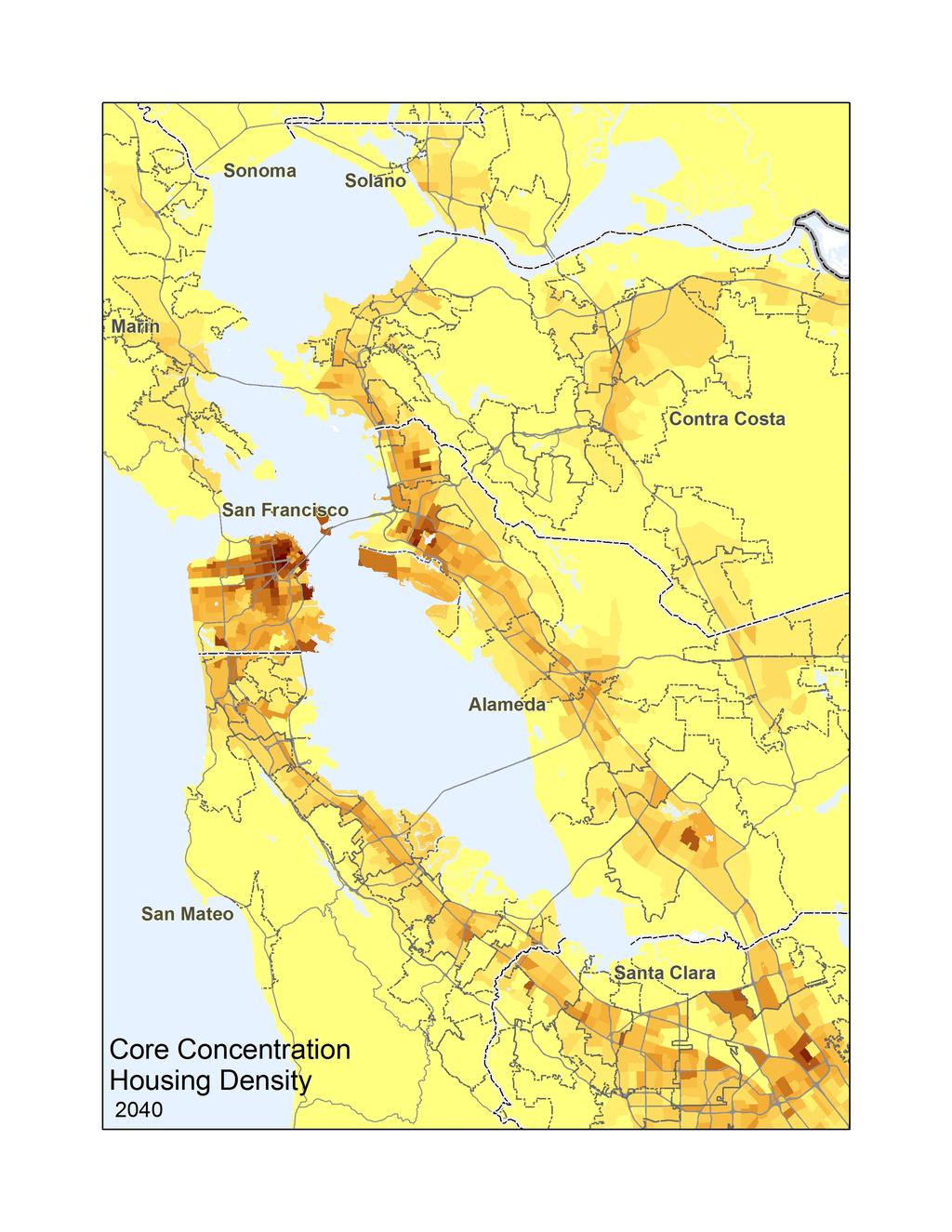
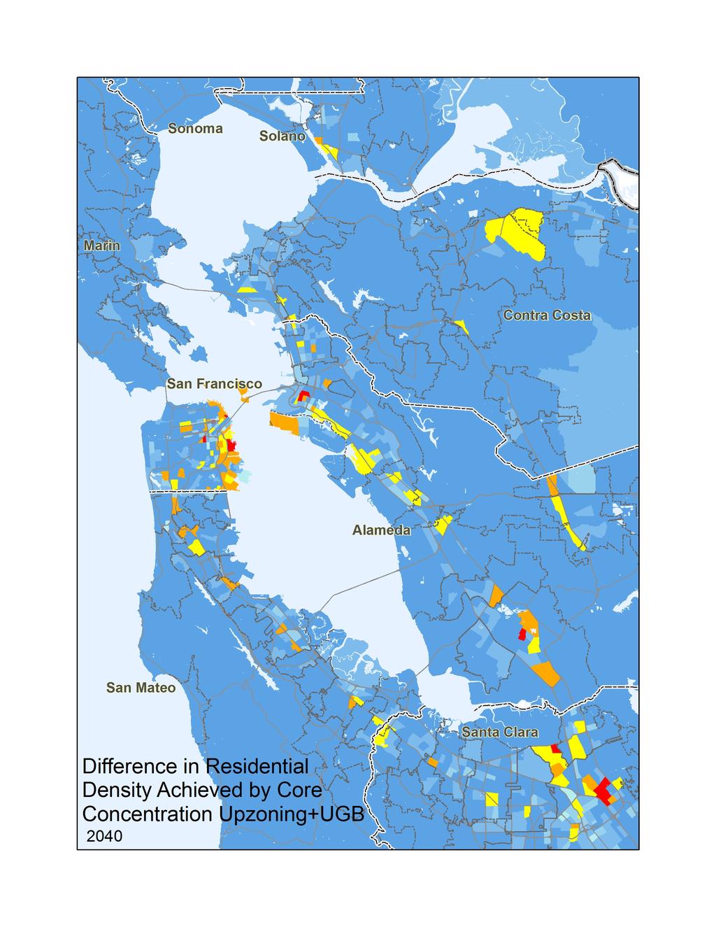
 Draft March 2013 Strategy for a Sustainable Region Association of Bay Area Governments Metropolitan Transportation Commission Draft Summary of Predicted Land Use Responses Metropolitan Transportation Commission
CIV3703 Transport Engineering. Module 2 Transport Modelling
 CIV3703 Transport Engineering Module Transport Modelling Objectives Upon successful completion of this module you should be able to: carry out trip generation calculations using linear regression and category
Spatiotemporal Analysis of Commuting Patterns in Southern California Using ACS PUMS, CTPP and LODES
 Spatiotemporal Analysis of Commuting Patterns in Southern California Using ACS PUMS, CTPP and LODES 2017 ACS Data Users Conference May 11-12, 2017 Alexandria, VA Jung Seo, Tom Vo, Frank Wen and Simon Choi
MOR CO Analysis of future residential and mobility costs for private households in Munich Region
 MOR CO Analysis of future residential and mobility costs for private households in Munich Region The amount of the household budget spent on mobility is rising dramatically. While residential costs can
The UrbanSim Project: Using Urban Simulation to Inform Public Decision-making about Land Use and Transportation Choices
 The UrbanSim Project: Using Urban Simulation to Inform Public Decision-making about Land Use and Transportation Choices Alan Borning Dept of Computer Science & Engineering University of Washington, Seattle
The 3V Approach. Transforming the Urban Space through Transit Oriented Development. Gerald Ollivier Transport Cluster Leader World Bank Hub Singapore
 Transforming the Urban Space through Transit Oriented Development The 3V Approach Gerald Ollivier Transport Cluster Leader World Bank Hub Singapore MDTF on Sustainable Urbanization The China-World Bank
MPOs SB 375 LAFCOs SCAG Practices/Experiences And Future Collaborations with LAFCOs
 Connecting LAFCOs and COGs for Mutual Benefits MPOs SB 375 LAFCOs SCAG Practices/Experiences And Future Collaborations with LAFCOs Frank Wen, Manager Research & Analysis Land Use & Environmental Planning
Typical information required from the data collection can be grouped into four categories, enumerated as below.
 Chapter 6 Data Collection 6.1 Overview The four-stage modeling, an important tool for forecasting future demand and performance of a transportation system, was developed for evaluating large-scale infrastructure
VALIDATING THE RELATIONSHIP BETWEEN URBAN FORM AND TRAVEL BEHAVIOR WITH VEHICLE MILES TRAVELLED. A Thesis RAJANESH KAKUMANI
 VALIDATING THE RELATIONSHIP BETWEEN URBAN FORM AND TRAVEL BEHAVIOR WITH VEHICLE MILES TRAVELLED A Thesis by RAJANESH KAKUMANI Submitted to the Office of Graduate Studies of Texas A&M University in partial
Encapsulating Urban Traffic Rhythms into Road Networks
 Encapsulating Urban Traffic Rhythms into Road Networks Junjie Wang +, Dong Wei +, Kun He, Hang Gong, Pu Wang * School of Traffic and Transportation Engineering, Central South University, Changsha, Hunan,
Employment Decentralization and Commuting in U.S. Metropolitan Areas. Symposium on the Work of Leon Moses
 Employment Decentralization and Commuting in U.S. Metropolitan Areas Alex Anas Professor of Economics University at Buffalo Symposium on the Work of Leon Moses February 7, 2014 9:30-11:15am, and 2:30-4:30pm
Transit Market Index. Validating Local Potential for Transit Ridership
 Transit Market Index Validating Local Potential for Transit Ridership Transit Market Areas Characteristics 2010 TPP Characterized by different levels of transit service. Core Areas, 1 & 2: A variety of
Overview of Improved Data and Tools for Integrated Land Use-Transportation Planning in California Caltrans Planning Horizons program November 7, 2012
 Overview of Improved Data and Tools for Integrated Land Use-Transportation Planning in California Caltrans Planning Horizons program November 7, 2012 Presentation Outline Part 1. Overview - Terry Parker,
CIE4801 Transportation and spatial modelling Land-use and transport interaction models (TIGRIS) and choice modelling (+reprise)
 and choice modelling (+reprise)") CIE4801 Transportation and spatial modelling Land-use and transport interaction models (TIGRIS) and choice modelling (+reprise) Rob van Nes, Transport & Planning 31-08-18 Delft University of Technology
CIE4801 Transportation and spatial modelling Land-use and transport interaction models (TIGRIS) and choice modelling (+reprise) Rob van Nes, Transport & Planning 31-08-18 Delft University of Technology
Leveraging Urban Mobility Strategies to Improve Accessibility and Productivity of Cities
 Leveraging Urban Mobility Strategies to Improve Accessibility and Productivity of Cities Aiga Stokenberga World Bank GPSC African Regional Workshop May 15, 2018 Roadmap 1. Africa s urbanization and its
Can Public Transport Infrastructure Relieve Spatial Mismatch?
 Can Public Transport Infrastructure Relieve Spatial Mismatch? Evidence from Recent Light Rail Extensions Kilian Heilmann University of California San Diego April 20, 2015 Motivation Paradox: Even though
(page 2) So today, I will be describing what we ve been up to for the last ten years, and what I think might lie ahead.
 So today, I will be describing what we ve been up to for the last ten years, and what I think might lie ahead.") Activity-Based Models: 1994-2009 MIT ITS Lab Presentation March 10, 2009 John L Bowman, Ph.D. John_L_Bowman@alum.mit.edu JBowman.net DAY ACTIVITY SCHEDULE APPROACH (page 1) In 1994, Moshe and I began developing
Activity-Based Models: 1994-2009 MIT ITS Lab Presentation March 10, 2009 John L Bowman, Ph.D. John_L_Bowman@alum.mit.edu JBowman.net DAY ACTIVITY SCHEDULE APPROACH (page 1) In 1994, Moshe and I began developing
Location theory and clusters. Dr. Hans Koster Assistant professor
 Dr. Hans Koster Assistant professor 1 Internal economies of scale (EofS) can lead to Trading cities (EofS in transport) Factory cities (EofS in production) But where do cities emerge? Why is Colombo located
Changes in the Spatial Distribution of Mobile Source Emissions due to the Interactions between Land-use and Regional Transportation Systems
 Changes in the Spatial Distribution of Mobile Source Emissions due to the Interactions between Land-use and Regional Transportation Systems A Framework for Analysis Urban Transportation Center University
Data Collection. Lecture Notes in Transportation Systems Engineering. Prof. Tom V. Mathew. 1 Overview 1
 Data Collection Lecture Notes in Transportation Systems Engineering Prof. Tom V. Mathew Contents 1 Overview 1 2 Survey design 2 2.1 Information needed................................. 2 2.2 Study area.....................................
FHWA Peer Exchange Meeting on Transportation Systems Management during Inclement Weather
 Travel Demand Modeling & Simulation at GBNRTC Matt Grabau Kimberly Smith Mike Davis Why Model? Travel modeling is a tool for transportation planners and policy makers, to observe impacts of a transportation
3.0 ANALYSIS OF FUTURE TRANSPORTATION NEEDS
 3.0 ANALYSIS OF FUTURE TRANSPORTATION NEEDS In order to better determine future roadway expansion and connectivity needs, future population growth and land development patterns were analyzed as part of
Modeling Real Estate Demand. Land Use Forecasting Webinar Series
 Modeling Real Estate Demand Webinar 6 of an 8-part TMIP Webinar series on land use forecasting methods. Land Use Forecasting Webinar Series 1. The Evolving State of the Practice 2. Land Use Theory and
Regional Growth Strategy Regional TOD Advisory Committee
 Regional Strategy Regional TOD Advisory Committee September 21, 2018 Overview Regional Geographies Transit-Oriented Development Goal Scenarios Next Steps 2 Schedule + Process September 6 Management Policy
INTRODUCTION TO TRANSPORTATION SYSTEMS
 INTRODUCTION TO TRANSPORTATION SYSTEMS Lectures 5/6: Modeling/Equilibrium/Demand 1 OUTLINE 1. Conceptual view of TSA 2. Models: different roles and different types 3. Equilibrium 4. Demand Modeling References:
Solutions for Assignment #2 for Environmental and Resource Economics Economics 359M, Spring 2017
 Solutions for Assignment #2 for Environmental and Resource Economics Economics 59M, Spring 207 Due date: Wednesday, March, 207 A. Kolstad, Ch., problem. Ans. (a) The Pareto criterion fails completeness,
Note on Transportation and Urban Spatial Structure
 Note on Transportation and Urban Spatial Structure 1 By Alain Bertaud, Washington, ABCDE conference, April 2002 Email: duatreb@msn.com Web site: http://alain-bertaud.com/ http://alainbertaud.com/ The physical
Regional Snapshot Series: Transportation and Transit. Commuting and Places of Work in the Fraser Valley Regional District
 Regional Snapshot Series: Transportation and Transit Commuting and Places of Work in the Fraser Valley Regional District TABLE OF CONTENTS Complete Communities Daily Trips Live/Work Ratio Commuting Local
Contemporary Human Geography 3 rd Edition
 Contemporary Human Geography 3 rd Edition Chapter 13: Urban Patterns Marc Healy Elgin Community College Services are attracted to the Central Business District (CBD) because of A. accessibility. B. rivers.
Modern Urban and Regional Economics
 Modern Urban and Regional Economics SECOND EDITION Philip McCann OXFORD UNIVERSITY PRESS Contents List of figures List of tables Introduction xii xiv xvii Part I Urban and Regional Economic Models and
Forecasting Australian Transport
 Australasian Transport Research Forum Proceedings 3 September - 2 October, Sydney, Australia Publication website: http://www.atrf.info/papers/index.aspx Forecasting Australian Transport David Gargett Bureau
How Geography Affects Consumer Behaviour The automobile example
 How Geography Affects Consumer Behaviour The automobile example Murtaza Haider, PhD Chuck Chakrapani, Ph.D. We all know that where a consumer lives influences his or her consumption patterns and behaviours.
accessibility accessibility by-pass bid-rent curve bridging point administrative centre How easy or difficult a place is to reach.
 accessibility accessibility How easy or difficult a place is to reach. How easy or difficult it is to enter a building. administrative centre bid-rent curve The function of a town which is a centre for
The Spatial Structure of Cities: International Examples of the Interaction of Government, Topography and Markets
 Module 2: Spatial Analysis and Urban Land Planning The Spatial Structure of Cities: International Examples of the Interaction of Government, Topography and Markets Alain Bertaud Urbanist Summary What are
Analysis of travel-to-work patterns and the identification and classification of REDZs
 Analysis of travel-to-work patterns and the identification and classification of REDZs Dr David Meredith, Teagasc, Spatial Analysis Unit, Rural Economy Development Programme, Ashtown, Dublin 15. david.meredith@teagasc.ie
Instituto Superior Técnico Masters in Civil Engineering. Theme 3: Transport networks and external costs. Transport land-use interaction
 Instituto Superior Técnico Masters in Civil Engineering REGIÕES E REDES () Theme 3: Transport land-use interaction Prof. Filipe Moura 1 OUTLINE Transport networks, external costs and market failures Transport
Palmerston North Area Traffic Model
 Palmerston North Area Traffic Model Presentation to IPWEA 7 November 2014 PNATM Presentation Overview Model Scope and type Data collected The model Forecasting inputs Applications PNCC Aims and Objectives
A Simplified Travel Demand Modeling Framework: in the Context of a Developing Country City
 A Simplified Travel Demand Modeling Framework: in the Context of a Developing Country City Samiul Hasan Ph.D. student, Department of Civil and Environmental Engineering, Massachusetts Institute of Technology,
Johns Hopkins University Fall APPLIED ECONOMICS Regional Economics
 Johns Hopkins University Fall 2017 Applied Economics Sally Kwak APPLIED ECONOMICS 440.666 Regional Economics In this course, we will develop a coherent framework of theories and models in the field of
Forecasts from the Strategy Planning Model
 Forecasts from the Strategy Planning Model Appendix A A12.1 As reported in Chapter 4, we used the Greater Manchester Strategy Planning Model (SPM) to test our long-term transport strategy. A12.2 The origins
LOCATIONAL PREFERENCES OF FDI FIRMS IN TURKEY
 LOCATIONAL PREFERENCES OF FDI FIRMS IN TURKEY Prof. Dr. Lale BERKÖZ Assist. Prof. Dr.S. SenceTÜRK I.T.U. Faculty of Architecture Istanbul/TURKEY E-mail: lberkoz@itu.edu.tr INTRODUCTION Foreign direct investment
Connectivity. RTPI Scotland Annual Conference Edinburgh, 2nd October 2018
 Connectivity Tom Rye, Professor and Director, Transport Research Institute (TRI), Edinburgh Napier University, Scotland, UK (with input from Nina Plevnik, TRI) RTPI Scotland Annual Conference Edinburgh,
Spatiotemporal Analysis of Commuting Patterns: Using ArcGIS and Big Data
 Spatiotemporal Analysis of Commuting Patterns: Using ArcGIS and Big Data 2017 ESRI User Conference July 13, 2017 San Diego, VA Jung Seo, Tom Vo, Frank Wen and Simon Choi Research & Analysis Southern California
Development of a Prototype Land Use Model for Statewide Transportation Planning Activities. Final Report Project Number: BDK
 Development of a Prototype Land Use Model for Statewide Transportation Planning Activities Final Report Project Number: BDK77 977-03 Submitted to the Systems Planning Office, Florida Department of Transportation
Rising Wage Inequality and the Effectiveness of Tuition Subsidy Policies:
 Rising Wage Inequality and the Effectiveness of Tuition Subsidy Policies: Explorations with a Dynamic General Equilibrium Model of Labor Earnings based on Heckman, Lochner and Taber, Review of Economic
Urban Economics City Size
 Urban Economics City Size Utility and City Size Question: Why do cities differ in size and scope? While NYC has a population of more 18 million, the smallest urban area in the U.S. has only 13,000. A well
Community Development, Economic Development, or Community Economic Development? Concepts, Tools and Practices
 Community Development, Economic Development, or Community Economic Development? Concepts, Tools and Practices Location Theory: Part I Location theory helps us one basic question: why does economic activity
Population and Employment Forecast
 Population and Employment Forecast How Do We Get the Numbers? Thurston Regional Planning Council Technical Brief Updated July 2012 We plan for forecast growth in Population and Employment, but where do
Assessing the Employment Agglomeration and Social Accessibility Impacts of High Speed Rail in Eastern Australia: Sydney-Canberra-Melbourne Corridor
 Assessing the Employment Agglomeration and Social Accessibility Impacts of High Speed Rail in Eastern Australia: Sydney-Canberra-Melbourne Corridor Professor David A. Hensher FASSA Founding Director Institute
An Investigation of Urban form in Lahore and neighboring cities
 An Investigation of Urban form in Lahore and neighboring cities PRESENTER NAME: ENGR. MUHAMMAD KAMRAN Author Names: Engr. Muhammad Kamran Dr. Zahara Batool Engr. Umair Durrani Contents Introduction Literature
Economic and Social Urban Indicators: A Spatial Decision Support System for Chicago Area Transportation Planning
 Economic and Social Urban Indicators: A Spatial Decision Support System for Chicago Area Transportation Planning Piyushimita Thakuriah (Vonu), P.S. Sriraj, Paul Metaxatos, Inshu Minocha & Tanushri Swarup
What s wrong with sprawl? The urgent need for cost benefit analyses of modern urban growth patterns. Jacy Gaige
 What s wrong with sprawl? The urgent need for cost benefit analyses of modern urban growth patterns. Jacy Gaige Urban Econ 245 Professor Charles Becker Literature Review 1 Urban is hip. Bikes, messenger
Introduction and Project Overview
 Greater New Orleans Regional Land Use Modeling GIS Techniques in a P olitical C ontext Louisiana Remote Sensing and GIS Workshop Wednesday, April 24, 2013 Working Towards a Shared Regional Vision Introduction
Traffic Demand Forecast
 Chapter 5 Traffic Demand Forecast One of the important objectives of traffic demand forecast in a transportation master plan study is to examine the concepts and policies in proposed plans by numerically
Evidence on the linkages between productivity, agglomeration economies, and transport
 Evidence on the linkages between productivity, agglomeration economies, and transport Institute for Transport Planning and Systems (IVT) Seminar, 7 th May 2009 Patricia C. Melo Centre for Transport Studies,
Trip Generation Model Development for Albany
 Trip Generation Model Development for Albany Hui (Clare) Yu Department for Planning and Infrastructure Email: hui.yu@dpi.wa.gov.au and Peter Lawrence Department for Planning and Infrastructure Email: lawrence.peter@dpi.wa.gov.au
Spatial and Socioeconomic Analysis of Commuting Patterns in Southern California Using LODES, CTPP, and ACS PUMS
 Spatial and Socioeconomic Analysis of Commuting Patterns in Southern California Using LODES, CTPP, and ACS PUMS Census for Transportation Planning Subcommittee meeting TRB 95th Annual Meeting January 11,
GIS Analysis of Crenshaw/LAX Line
 PDD 631 Geographic Information Systems for Public Policy, Planning & Development GIS Analysis of Crenshaw/LAX Line Biying Zhao 6679361256 Professor Barry Waite and Bonnie Shrewsbury May 12 th, 2015 Introduction
Scale and Spatial Complexity: Agent-based models and geographical economics. December 7 th, 2007 Christopher Fowler and Mark Ellis
 Scale and Spatial Complexity: Agent-based models and geographical economics December 7 th, 2007 Christopher Fowler and Mark Ellis Scale Body Household City Region Nation Interscalar Relationships Example:
Volume Author/Editor: Gregory K. Ingram, John F. Kain, and J. Royce Ginn. Volume URL:
 This PDF is a selection from an out-of-print volume from the National Bureau of Economic Research Volume Title: The Detroit Prototype of the NBER Urban Simulation Model Volume Author/Editor: Gregory K.
River North Multi-Modal Transit Analysis
 River North Multi-Modal Transit Analysis November 7, 2006 Dan Meyers, AICP URS Corporation 612-373-6446 / dan_meyers@urscorp.com River North Study Area Reasons for initiating the study Downtown areas north
Transit Modeling Update. Trip Distribution Review and Recommended Model Development Guidance
 Transit Modeling Update Trip Distribution Review and Recommended Model Development Guidance Contents 1 Introduction... 2 2 FSUTMS Trip Distribution Review... 2 3 Proposed Trip Distribution Approach...
Understanding Land Use and Walk Behavior in Utah
 Understanding Land Use and Walk Behavior in Utah 15 th TRB National Transportation Planning Applications Conference Callie New GIS Analyst + Planner STUDY AREA STUDY AREA 11 statistical areas (2010 census)
Challenges of Urbanisation & Globalisation
 Challenges of Urbanisation & Globalisation Prepared by: Khairul Hisyam Kamarudin, PhD Feb 2016 Based on original lecture note by: Wan Nurul Mardiah Wan Mohd Rani, PhD URBANIZATION What is Urbanization?
PlaceTypes. How the built environment is measured. Variables Measures Levels. AREA TYPE + DEVELOPMENT TYPE = PlaceType
 PlaceTypes In order to better understand land use and transportation interactions and to make more informed policy decisions, neighborhood characteristics can be analyzed by the role that they play in
The Role of Transitways in Our Region s Economic Competitiveness. The 23rd CTS Annual Research Conference St. Paul, MN May 23, 2012
 The Role of Transitways in Our Region s Economic Competitiveness The 23rd CTS Annual Research Conference St. Paul, MN May 23, 2012 1 2 Twin Cities Competitive Clusters 3 Competitive Clusters interconnected
Population Trends Along the Coastal United States:
 Coastal Trends Report Series Population Trends Along the Coastal United States: 1980-2008 U.S. Department of Commerce National Oceanic and Atmospheric Administration National Ocean Service Assessing the
Guidelines on Using California Land Use/Transportation Planning Tools
 Guidelines on Using California Land Use/Transportation Planning Tools 1. Selecting Ds Analysis Modules Appropriate to a Region In almost all cases, the appropriate Ds Analysis Module to use for analysis
Smart Growth: Threat to the Quality of Life. Experience
 Smart Growth: Threat to the Quality of Life Presentation by Wendell Cox Wendell Cox Consultancy Visiting Professor Conservatoire National des Arts et Metiers Paris Frontier Centre for Public Policy Winnipeg
ANNEX 3 SOFIA S DEVELOPMENT AND SPATIAL STRUCTURE. 1. Introduction
 61 SOFIA S DEVELOPMENT AND SPATIAL STRUCTURE 1. Introduction 1. Municipal objectives have implications for Sofia s spatial structure. The objectives are by definition political. They represent priorities
OPTIMISING SETTLEMENT LOCATIONS: LAND-USE/TRANSPORT MODELLING IN CAPE TOWN
 OPTIMISING SETTLEMENT LOCATIONS: LAND-USE/TRANSPORT MODELLING IN CAPE TOWN Molai, L. and Vanderschuren, M.J.W.A. Civil Engineering, Faculty of Engineering and the Built Environment, University of Cape
Financing Urban Transport. UNESCAP-SUTI Event
 Financing Urban Transport UNESCAP-SUTI Event October 2017 Urban Transport in Context 2 The spiky urban economy of global cities 3 Mass transit networks converge towards a characteristic structure with
Urban Planning Word Search Level 1
 Urban Planning Word Search Level 1 B C P U E C O S Y S T E M P A R E U O E U R B A N P L A N N E R T N S T D H E C O U N T Y G E R E R D W R E N I C I T Y C O U N C I L A A A S U G G C I L A G P R I R