Geostatistics and Spatial Scales
|
|
|
- Ellen Martin
- 5 years ago
- Views:
Transcription
1 Geostatistics and Spatial Scales Semivariance & semi-variograms Scale dependence & independence Ranges of spatial scales Variable dependent Fractal dimension GIS implications Spatial Modeling
2 Spatial Analysis Tools & Geo- Statistics
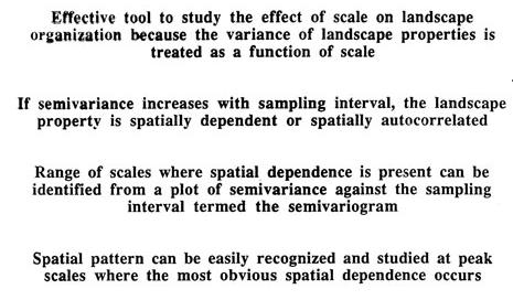
3 Semivariance Analysis
4 Semivariograms
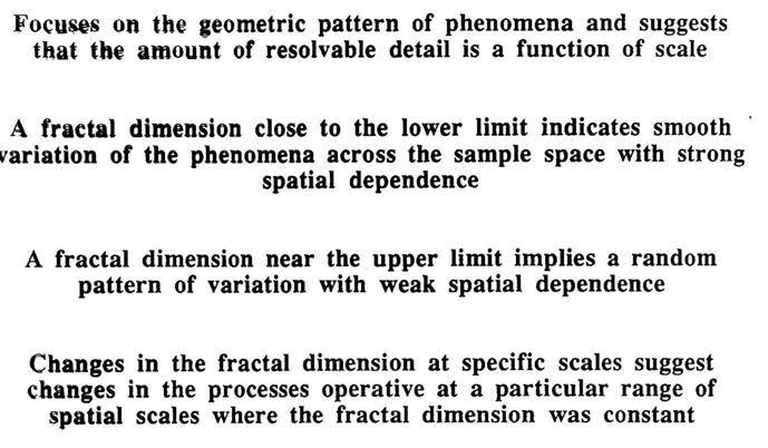
5 Fractal Dimensions
6 Modeling Approaches & Considerations Why model? Types of model Technology for modeling Multi-criteria methods Accuracy and validity Modeling examples
7 What Is a Model? A data model provides a template for representing the real world in a GIS For modeling - how the world looks? Patterns & processes
8 Spatial Models Represent variation over the Earth's surface Produce results that change when the locations of features change GIS provides a suitable platform Manipulate geographic information in multiple stages Representing either a single point in time, or predictions about future points in time
9 Statistical Models & GIS Dependent & independent variables Measures of spatial pattern Measures of temporal pattern Variable representation & generation Database manipulation & variables For example, mapping regression residuals Calibration & validation
10 Spatial & Temporal Resolution Models work at defined levels of resolution All variation at finer resolutions is ignored The model must leave the user uncertain to some degree about the real world A model of a dynamic process has a temporal resolution equal to the size of its time steps
11 The Value of Models They allow experiments to be conducted on simulated systems, rather than the real thing Cheaper, less invasive They allow alternative scenarios to be evaluated Different policy options and their impacts on the future
12 To Analyze or to Model? Analysis is static Revealing what would otherwise be invisible Looking for anomalies, patterns Leading to hypotheses about systems Modeling can be dynamic Testing hypotheses about systems Evaluating alternative scenarios
13 Individual and Aggregate Models Individual models simulate the behavior of every individual in the system Every person in a crowd Aggregate models are used when there are too many individual elements to model Impossible to model every molecule of water, grain of sand
14 Spatial Modeling Approaches & Considerations Complexity theory Non linear system dynamics Emergence Complex adaptive systems Spatial simulations What if scenarios Extend in space & time and conditions of change Cellular automata Initial conditions, neighbor associations, transition rules Agent based models Dynamic actors, environment, and interactions
15 Cellular Models Model a system using a raster Each cell can be in one of a number of states Change through time is represented by change of cell state Change is defined by a series of rules Depending on the state of the cell and its neighbors More on CA & ABM later (for spatial simulation)
16 Cellular Models of Urban Growth Each cell is either undeveloped or developed Transitions may occur at each time step from undeveloped to developed Depending on the state of neighboring cells Growth rules Initial conditions And on the characteristics of the cell slope, access to transportation, protected status, etc.
 Growth limited by current urban growth boundary; (Lower) growth limited only by")
17 Simulation of future urban growth patterns in Santa Barbara, California, U.S.A. (Upper) Growth limited by current urban growth boundary; (Lower) growth limited only by existing parks.
18 Cartographic Modeling & Map Algebra Organizes all GIS operations on a raster into four types Local operations are determined by the attributes of each cell alone Focal operations are determined by a cell's neighbors Global operations compute properties of the entire raster layer Zonal operations apply to all contiguous cells with the same value
19 Technology for Modeling Scripts Sequences of GIS operations that can be stored and shared written in a scripting language such as Visual Basic for Applications, Perl, Python, or JavaScript a model can be written and executed as a script Scripts can be manipulated visually e.g., through ESRI's ModelBuilder
20 Coupling Models to GIS Models often exist as separate, stand-alone programs Can be used in conjunction with a GIS through various forms of coupling Loose coupling The GIS and the model exchange data in the form of files Close coupling Both GIS and the model read and write to the same file through a common interface
21
22
23
24


25
26 Multi-Criteria Methods Many decisions depend on numerous factors The factors must be combined in some fashion Often stakeholders disagree on how the factors should be combined Multi-criteria methods attempt to reconcile such differences and to reach consensus
27 Accuracy and Validity How can the results of a model be assessed? Are the predictions of a scenario correct? A model is only as accurate as its inputs And the rules used to emulate real processes And subject to the limitations of its spatial and temporal resolution Models help to reduce uncertainty about the future But can never reduce it to zero Forecasts or to understand processes?
28 Sensitivity Analysis Used to assess the effects of uncertainty in model parameters and assumptions Systematically raise and lower the value of each parameter Observe the effects on model predictions Helps in identifying those parameters that are more important and need to be carefully examined
GEOGRAPHY 350/550 Final Exam Fall 2005 NAME:
 1) A GIS data model using an array of cells to store spatial data is termed: a) Topology b) Vector c) Object d) Raster 2) Metadata a) Usually includes map projection, scale, data types and origin, resolution
GEOGRAPHIC INFORMATION SYSTEMS AND IT SOLUTIONS FOR THE ENVIRONMENT
 GEOGRAPHIC INFORMATION SYSTEMS AND IT SOLUTIONS FOR THE ENVIRONMENT Mission We focus on Solutions is a worldwide operating business offering Geographic Information Systems and IT solutions to assist environmental
SPATIAL MODELING GIS Analysis Winter 2016
 SPATIAL MODELING GIS Analysis Winter 2016 Spatial Models Spatial Modeling attempts to represent how the world works All models are wrong, but some are useful (G.E. Box, quoted in course textbook pg. 379)
Geog 469 GIS Workshop. Data Analysis
 Geog 469 GIS Workshop Data Analysis Outline 1. What kinds of need-to-know questions can be addressed using GIS data analysis? 2. What is a typology of GIS operations? 3. What kinds of operations are useful
Modeling forest insect infestation: GIS and agentbased
 Modeling forest insect infestation: GIS and agentbased approaches Taylor Anderson and Suzana Dragićević 2014 Esri Canada s Annual User Conference October 7 th, Toronto, Canada Presentation Overview Emerald
ArcGIS Pro: Analysis and Geoprocessing. Nicholas M. Giner Esri Christopher Gabris Blue Raster
 ArcGIS Pro: Analysis and Geoprocessing Nicholas M. Giner Esri Christopher Gabris Blue Raster Agenda What is Analysis and Geoprocessing? Analysis in ArcGIS Pro - 2D (Spatial xy) - 3D (Elevation - z) - 4D
The Building Blocks of the City: Points, Lines and Polygons
 The Building Blocks of the City: Points, Lines and Polygons Andrew Crooks Centre For Advanced Spatial Analysis andrew.crooks@ucl.ac.uk www.gisagents.blogspot.com Introduction Why use ABM for Residential
Among various open-source GIS programs, QGIS can be the best suitable option which can be used across partners for reasons outlined below.
 Comparison of Geographic Information Systems (GIS) software As of January 2018, WHO has reached an agreement with ESRI (an international supplier of GIS software) for an unlimited use of ArcGIS Desktop
Spatial Data Management of Bio Regional Assessments Phase 1 for Coal Seam Gas Challenges and Opportunities
 Spatial Data Management of Bio Regional Assessments Phase 1 for Coal Seam Gas Challenges and Opportunities By Dr Zaffar Sadiq Mohamed-Ghouse Principal Consultant, Spatial & IT, GHD zaffar.sadiq@ghd.com
Contents. Interactive Mapping as a Decision Support Tool. Map use: From communication to visualization. The role of maps in GIS
 Contents Interactive Mapping as a Decision Support Tool Claus Rinner Assistant Professor Department of Geography University of Toronto otru gis workshop rinner(a)geog.utoronto.ca 1 The role of maps in
Cell-based Model For GIS Generalization
 Cell-based Model For GIS Generalization Bo Li, Graeme G. Wilkinson & Souheil Khaddaj School of Computing & Information Systems Kingston University Penrhyn Road, Kingston upon Thames Surrey, KT1 2EE UK
DP Project Development Pvt. Ltd.
 Dear Sir/Madam, Greetings!!! Thanks for contacting DP Project Development for your training requirement. DP Project Development is leading professional training provider in GIS technologies and GIS application
Statistical Perspectives on Geographic Information Science. Michael F. Goodchild University of California Santa Barbara
 Statistical Perspectives on Geographic Information Science Michael F. Goodchild University of California Santa Barbara Statistical geometry Geometric phenomena subject to chance spatial phenomena emphasis
Software. People. Data. Network. What is GIS? Procedures. Hardware. Chapter 1
 People Software Data Network Procedures Hardware What is GIS? Chapter 1 Why use GIS? Mapping Measuring Monitoring Modeling Managing Five Ms of Applied GIS Chapter 2 Geography matters Quantitative analyses
Geo-spatial Analysis for Prediction of River Floods
 Geo-spatial Analysis for Prediction of River Floods Abstract. Due to the serious climate change, severe weather conditions constantly change the environment s phenomena. Floods turned out to be one of
Exelis and Esri Technologies for Defense and National Security. Cherie Muleh
 Exelis and Esri Technologies for Defense and National Security Cherie Muleh Cherie.Muleh@exelisinc.com ENVI IMAGERY AND DATA BECOME KNOWLEDGE > Add information from imagery to your GIS > Automated workflows
What is GIS? ESRI Canada. August 2011
 What is GIS? ESRI Canada August 2011 Geography Matters! Environmental Park Management Agriculture Public Utilities Health Care Emergency 911 Real Estate Marketing Environmental What are the effects of
Geometric Algorithms in GIS
 Geometric Algorithms in GIS GIS Visualization Software Dr. M. Gavrilova GIS Software for Visualization ArcView GEO/SQL Digital Atmosphere AutoDesk Visual_Data GeoMedia GeoExpress CAVE? Visualization in
TOWARDS THE DEVELOPMENT OF A MONITORING SYSTEM FOR PLANNING POLICY Residential Land Uses Case study of Brisbane, Melbourne, Chicago and London
 TOWARDS THE DEVELOPMENT OF A MONITORING SYSTEM FOR PLANNING POLICY Residential Land Uses Case study of Brisbane, Melbourne, Chicago and London Presented to CUPUM 12 July 2017 by Claire Daniel Urban Planning/Data
Optimizing Urban Modeling based on Road Network and Land Use/Cover Changes by Using Agent Base Cellular Automata Model
 Optimizing Urban Modeling based on Road Network and Land Use/Cover Changes by Using Agent Base Cellular Automata Model Yousef Khajavigodellou 1, A. A. Alesheikh 2, Farshad Hakimpour 3, Kamra Chapi 4 1
Watershed Sciences 4930 & 6920 GEOGRAPHIC INFORMATION SYSTEMS
 Watershed Sciences 4930 & 6920 GEOGRAPHIC INFORMATION SYSTEMS WEEK TWELVE UNCERTAINTY IN GIS Joe Wheaton HOUSEKEEPING Labs Do you need extended Quinney Lab hours? Okay with Lab 9? Geoprocessing worked?
CyberGIS: What Still Needs to Be Done? Michael F. Goodchild University of California Santa Barbara
 CyberGIS: What Still Needs to Be Done? Michael F. Goodchild University of California Santa Barbara Progress to date Interoperable location referencing coordinate transformations geocoding addresses point-of-interest
IndiFrag v2.1: An Object-based Fragmentation Analysis Software Tool
 IndiFrag v2.1: An Object-based Fragmentation Analysis Software Tool Geo-Environmental Cartography and Remote Sensing Group http://cgat.webs.upv.es/software/ Universitat Politècnica de València Introduction
A GIS Tool for Modelling and Visualizing Sustainability Indicators Across Three Regions of Ireland
 International Conference on Whole Life Urban Sustainability and its Assessment M. Horner, C. Hardcastle, A. Price, J. Bebbington (Eds) Glasgow, 2007 A GIS Tool for Modelling and Visualizing Sustainability
Discovery and Access of Geospatial Resources using the Geoportal Extension. Marten Hogeweg Geoportal Extension Product Manager
 Discovery and Access of Geospatial Resources using the Geoportal Extension Marten Hogeweg Geoportal Extension Product Manager DISCOVERY AND ACCESS USING THE GEOPORTAL EXTENSION Geospatial Data Is Very
Modeling Smart Growth in the Southeast Using Smart-SLEUTH. November 20, 2014 SOUTH ATLANTIC LCC WEB FORUM Monica A. Dorning
 Modeling Smart Growth in the Southeast Using Smart-SLEUTH November 20, 2014 SOUTH ATLANTIC LCC WEB FORUM Monica A. Dorning (Sub)Urbanization in the Southeast November 20, 2014 SOUTH ATLANTIC LCC WEB FORUM
Leveraging Your Geo-spatial Data Investments with Quantum GIS: an Open Source Geographic Information System
 Leveraging Your Geo-spatial Data Investments with Quantum GIS: an Open Source Geographic Information System Donald L. Schrupp Colorado Division of Wildlife (Retired) Danny Lewis Texas Parks and Wildlife
OBEUS. (Object-Based Environment for Urban Simulation) Shareware Version. Itzhak Benenson 1,2, Slava Birfur 1, Vlad Kharbash 1
 Shareware Version. Itzhak Benenson 1,2, Slava Birfur 1, Vlad Kharbash 1") OBEUS (Object-Based Environment for Urban Simulation) Shareware Version Yaffo model is based on partition of the area into Voronoi polygons, which correspond to real-world houses; neighborhood relationship
OBEUS (Object-Based Environment for Urban Simulation) Shareware Version Yaffo model is based on partition of the area into Voronoi polygons, which correspond to real-world houses; neighborhood relationship
Types of spatial data. The Nature of Geographic Data. Types of spatial data. Spatial Autocorrelation. Continuous spatial data: geostatistics
 The Nature of Geographic Data Types of spatial data Continuous spatial data: geostatistics Samples may be taken at intervals, but the spatial process is continuous e.g. soil quality Discrete data Irregular:
An urban growth model for strategic urban planning on a regional level: a proposed model prototype for Greater Cairo in the year 2050
 The Sustainable City VII, Vol. 1 71 An urban growth model for strategic urban planning on a regional level: a proposed model prototype for Greater Cairo in the year 2050 S. A. Magdi Architectural Engineering
Improving Spatial Data Interoperability
 Improving Spatial Data Interoperability A Framework for Geostatistical Support-To To-Support Interpolation Michael F. Goodchild, Phaedon C. Kyriakidis, Philipp Schneider, Matt Rice, Qingfeng Guan, Jordan
4. GIS Implementation of the TxDOT Hydrology Extensions
 4. GIS Implementation of the TxDOT Hydrology Extensions A Geographic Information System (GIS) is a computer-assisted system for the capture, storage, retrieval, analysis and display of spatial data. It
Presented at ESRI Education User Conference, July 6-8, 2001, San Diego, CA
 Presented at ESRI Education User Conference, July 6-8, 2001, San Diego, CA Irina V. Sharkova, Ph.D., Research Assistant Professor Richard Lycan, Ph.D., Senior Research Associate Population Research Center
a system for input, storage, manipulation, and output of geographic information. GIS combines software with hardware,
 Introduction to GIS Dr. Pranjit Kr. Sarma Assistant Professor Department of Geography Mangaldi College Mobile: +91 94357 04398 What is a GIS a system for input, storage, manipulation, and output of geographic
Basics of GIS. by Basudeb Bhatta. Computer Aided Design Centre Department of Computer Science and Engineering Jadavpur University
 Basics of GIS by Basudeb Bhatta Computer Aided Design Centre Department of Computer Science and Engineering Jadavpur University e-governance Training Programme Conducted by National Institute of Electronics
Formalization of GIS functionality
 Formalization of GIS functionality Over the past four decades humans have invested significantly in the construction of tools for handling digital representations of spaces and their contents. These include
Spatial Epidemic Modelling in Social Networks
 Spatial Epidemic Modelling in Social Networks Joana Margarida Simoes Centre for Advanced Spatial Analysis, University College of London, UK Abstract. The spread of infectious diseases is highly influenced
Spatial Analysis and Modeling (GIST 4302/5302) Guofeng Cao Department of Geosciences Texas Tech University
 Guofeng Cao Department of Geosciences Texas Tech University") Spatial Analysis and Modeling (GIST 4302/5302) Guofeng Cao Department of Geosciences Texas Tech University TTU Graduate Certificate Geographic Information Science and Technology (GIST) 3 Core Courses and
Spatial Analysis and Modeling (GIST 4302/5302) Guofeng Cao Department of Geosciences Texas Tech University TTU Graduate Certificate Geographic Information Science and Technology (GIST) 3 Core Courses and
YYT-C3002 Application Programming in Engineering GIS I. Anas Altartouri Otaniemi
 YYT-C3002 Application Programming in Engineering GIS I Otaniemi Overview: GIS lectures & exercise We will deal with GIS application development in two lectures. Because of the versatility of GIS data models
Cities, AI, Design, & the Future Can Artificial Intelligence Improve Design Intelligence?
 March 27 th 28 Cities, AI, Design, & the Future Can Artificial Intelligence Improve Design Intelligence? Michael Batty m.batty@ucl.ac.uk @jmichaelbatty http://www.spatialcomplexcity.info/ http://www.casa.ucl.ac.uk/
SRJC Applied Technology 54A Introduction to GIS
 SRJC Applied Technology 54A Introduction to GIS Overview Lecture of Geographic Information Systems Fall 2004 Santa Rosa Junior College Presented By: Tim Pudoff, GIS Coordinator, County of Sonoma, Information
Relief Camp Tool Using GIS
 Relief Camp Tool Using GIS MAYANK SINGH SAKLA 1, JANKI ADHVARYU 2 1 M.TECH GEOMATICS STUDENT, CEPT UNIVERSITY 2 M.TECH GEOMATICS STUDENT, CEPT UNIVERSITY K L CAMPUS UNIVERSITY AREA NAVARANG PURA AHMEDABAD
Overview of Statistical Analysis of Spatial Data
 Overview of Statistical Analysis of Spatial Data Geog 2C Introduction to Spatial Data Analysis Phaedon C. Kyriakidis www.geog.ucsb.edu/ phaedon Department of Geography University of California Santa Barbara
USING GIS IN WATER SUPPLY AND SEWER MODELLING AND MANAGEMENT
 USING GIS IN WATER SUPPLY AND SEWER MODELLING AND MANAGEMENT HENRIETTE TAMAŠAUSKAS*, L.C. LARSEN, O. MARK DHI Water and Environment, Agern Allé 5 2970 Hørsholm, Denmark *Corresponding author, e-mail: htt@dhigroup.com
ArcGIS for Desktop. ArcGIS for Desktop is the primary authoring tool for the ArcGIS platform.
 ArcGIS for Desktop ArcGIS for Desktop ArcGIS for Desktop is the primary authoring tool for the ArcGIS platform. Beyond showing your data as points on a map, ArcGIS for Desktop gives you the power to manage
FIRE DEPARMENT SANTA CLARA COUNTY
 DEFINITION FIRE DEPARMENT SANTA CLARA COUNTY GEOGRAPHIC INFORMATION SYSTEM (GIS) ANALYST Under the direction of the Information Technology Officer, the GIS Analyst provides geo-spatial strategic planning,
Lecture 2. A Review: Geographic Information Systems & ArcGIS Basics
 Lecture 2 A Review: Geographic Information Systems & ArcGIS Basics GIS Overview Types of Maps Symbolization & Classification Map Elements GIS Data Models Coordinate Systems and Projections Scale Geodatabases
GIS for ChEs Introduction to Geographic Information Systems
 GIS for ChEs Introduction to Geographic Information Systems AIChE Webinar John Cirucci 1 GIS for ChEs Introduction to Geographic Information Systems What is GIS? Tools and Methods Applications Examples
Toward an automatic real-time mapping system for radiation hazards
 Toward an automatic real-time mapping system for radiation hazards Paul H. Hiemstra 1, Edzer J. Pebesma 2, Chris J.W. Twenhöfel 3, Gerard B.M. Heuvelink 4 1 Faculty of Geosciences / University of Utrecht
A spatial literacy initiative for undergraduate education at UCSB
 A spatial literacy initiative for undergraduate education at UCSB Mike Goodchild & Don Janelle Department of Geography / spatial@ucsb University of California, Santa Barbara ThinkSpatial Brown bag forum
Spatial Analysis with Web GIS. Rachel Weeden
 Spatial Analysis with Web GIS Rachel Weeden Agenda Subhead goes here Introducing ArcGIS Online Spatial Analysis Workflows Scenarios Other Options Resources ArcGIS is a Platform Making mapping and analytics
GIS for integrated 2D H&H modeling support. Dean Djokic and Lori Armstrong, Esri Inc.
 GIS for integrated 2D H&H modeling support Dean Djokic and Lori Armstrong, Esri Inc. Overview GIS for H&H modeling support 1D vs. 2D modeling with GIS GIS techniques for data simplification Schematization
Chapter 6. Fundamentals of GIS-Based Data Analysis for Decision Support. Table 6.1. Spatial Data Transformations by Geospatial Data Types
 Chapter 6 Fundamentals of GIS-Based Data Analysis for Decision Support FROM: Points Lines Polygons Fields Table 6.1. Spatial Data Transformations by Geospatial Data Types TO: Points Lines Polygons Fields
Lessons From the Trenches: using Mobile Phone Data for Official Statistics
 Lessons From the Trenches: using Mobile Phone Data for Official Statistics Maarten Vanhoof Orange Labs/Newcastle University M.vanhoof1@newcastle.ac.uk @Metti Hoof MaartenVanhoof.com Mobile Phone Data (Call
Web-based Interactive Landform Simulation Model (WILSIM)
") Web-based Interactive Landform Simulation Model (WILSIM) Wei Luo Dept. of Geography Northern Illinois University, DeKalb, IL 60115 Project Funded by NSF CCLI (2002-2004) Collaborators: Kirk Duffin, Jay
Web-based Interactive Landform Simulation Model (WILSIM) Wei Luo Dept. of Geography Northern Illinois University, DeKalb, IL 60115 Project Funded by NSF CCLI (2002-2004) Collaborators: Kirk Duffin, Jay
How GIS based Visualizations Support Land Use and Transportation Modeling
 How GIS based Visualizations Support Land Use and Transportation Modeling ESRI International Users Conference San Diego, CA - July 23, 2015 Prepared by: Troy Hightower Introduction This presentation will
![)UDQFR54XHQWLQ(DQG'tD]'HOJDGR&](/thumbs/95/125846872.jpg ")UDQFR54XHQWLQ(DQG'tD]'HOJDGR&") &21&(37,21$1',03/(0(17$7,212)$1+
&21&(37,21$1',03/(0(17$7,212)$1+ GENERALIZATION IN THE NEW GENERATION OF GIS. Dan Lee ESRI, Inc. 380 New York Street Redlands, CA USA Fax:
 GENERALIZATION IN THE NEW GENERATION OF GIS Dan Lee ESRI, Inc. 380 New York Street Redlands, CA 92373 USA dlee@esri.com Fax: 909-793-5953 Abstract In the research and development of automated map generalization,
Scripting and Geoprocessing for Raster Analysis Multiyear Crop Analysis
 Authors: David T. Hansen and Barbara Simpson Scripting and Geoprocessing for Raster Analysis Multiyear Crop Analysis Presented by David T. Hansen and Barbara Simpson at the ESRI User Conference, 2012,
The GeoCLIM software for gridding & analyzing precipitation & temperature. Tamuka Magadzire, FEWS NET Regional Scientist for Southern Africa
 The GeoCLIM software for gridding & analyzing precipitation & temperature Tamuka Magadzire, FEWS NET Regional Scientist for Southern Africa Outline What is GeoCLIM GeoCLIM Development Team GeoCLIM: objectives
NREL, Intro to GIS for Wind Energy Siting for IGERT Wind NSF
 NREL, 2010 Intro to GIS for Wind Energy Siting for IGERT Wind NSF Challenge: How to encourage offshore wind in the US while managing ecological responsibility and ocean use conflicts? Introduction NREL,
FUNDAMENTALS OF GEOINFORMATICS PART-II (CLASS: FYBSc SEM- II)
") FUNDAMENTALS OF GEOINFORMATICS PART-II (CLASS: FYBSc SEM- II) UNIT:-I: INTRODUCTION TO GIS 1.1.Definition, Potential of GIS, Concept of Space and Time 1.2.Components of GIS, Evolution/Origin and Objectives
FUNDAMENTALS OF GEOINFORMATICS PART-II (CLASS: FYBSc SEM- II) UNIT:-I: INTRODUCTION TO GIS 1.1.Definition, Potential of GIS, Concept of Space and Time 1.2.Components of GIS, Evolution/Origin and Objectives
ArcGIS Enterprise: What s New. Philip Heede Shannon Kalisky Melanie Summers Sam Williamson
 ArcGIS Enterprise: What s New Philip Heede Shannon Kalisky Melanie Summers Sam Williamson ArcGIS Enterprise is the new name for ArcGIS for Server What is ArcGIS Enterprise ArcGIS Enterprise is powerful
ADVANCE GIS ANALYSIS ON ZONAL URBAN PLAN PROJECT
 Journal of Young Scientist, Volume II, 2014 ISSN 2344-1283; ISSN CD-ROM 2344-1291; ISSN Online 2344-1305; ISSN-L 2344 1283 ADVANCE GIS ANALYSIS ON ZONAL URBAN PLAN PROJECT Andrei-Șerban TOMPEA 1 Scientific
A Land Use Transport Model for Greater London:
 Spatio-Temporal Analysis of Network Data and Road Developments Launch Event Workshop UCL Monday 18 May 2009 A Land Use Transport Model for Greater London: With Applications to an Integrated Assessment
1 Descriptions of Function
 Wide-Area Wind Generation Forecasting 1 Descriptions of Function All prior work (intellectual property of the company or individual) or proprietary (non-publicly available) work should be so noted. 1.1
Linking local multimedia models in a spatially-distributed system
 Linking local multimedia models in a spatially-distributed system I. Miller, S. Knopf & R. Kossik The GoldSim Technology Group, USA Abstract The development of spatially-distributed multimedia models has
Enabling ENVI. ArcGIS for Server
 Enabling ENVI throughh ArcGIS for Server 1 Imagery: A Unique and Valuable Source of Data Imagery is not just a base map, but a layer of rich information that can address problems faced by GIS users. >
Time Series Analysis with SAR & Optical Satellite Data
 Time Series Analysis with SAR & Optical Satellite Data Thomas Bahr ESRI European User Conference Thursday October 2015 harris.com Motivation Changes in land surface characteristics mirror a multitude of
The integration of land change modeling framework FUTURES into GRASS GIS 7
 The integration of land change modeling framework FUTURES into GRASS GIS 7 Anna Petrasova, Vaclav Petras, Douglas A. Shoemaker, Monica A. Dorning, Ross K. Meentemeyer NCSU OSGeo Research and Education
Spatial Analysis with ArcGIS Pro STUDENT EDITION
 Spatial Analysis with ArcGIS Pro STUDENT EDITION Copyright 2018 Esri All rights reserved. Course version 2.0. Version release date November 2018. Printed in the United States of America. The information
Spatial Modeling Approaches & Considerations Class #12. Major Elements: Complexity Theory. Complexity Theory: Theoretical Context
 Spatial Modeling Approaches & Considerations Class #12 Complexity theory Non linear system dynamics Emergence Complex adaptive systems Spatial simulations What if scenarios Extend in space & time and conditions
Experiences and Directions in National Portals"
 FIG Seminar on e-land Administration Innsbruck/Austria 2-4 June 2004 "ESRI's Experiences and Directions in National Portals" Kevin Daugherty Cadastral/Land Records Manager ESRI Topic Points Technology
POPULAR CARTOGRAPHIC AREAL INTERPOLATION METHODS VIEWED FROM A GEOSTATISTICAL PERSPECTIVE
 CO-282 POPULAR CARTOGRAPHIC AREAL INTERPOLATION METHODS VIEWED FROM A GEOSTATISTICAL PERSPECTIVE KYRIAKIDIS P. University of California Santa Barbara, MYTILENE, GREECE ABSTRACT Cartographic areal interpolation
Lecture 5 Geostatistics
 Lecture 5 Geostatistics Lecture Outline Spatial Estimation Spatial Interpolation Spatial Prediction Sampling Spatial Interpolation Methods Spatial Prediction Methods Interpolating Raster Surfaces with
GIS and Spatial Statistics: One World View or Two? Michael F. Goodchild University of California Santa Barbara
 GIS and Spatial Statistics: One World View or Two? Michael F. Goodchild University of California Santa Barbara Location as attribute The data table Census summary table What value is location as an explanatory
Fundamental Spatial Concepts. Michael F. Goodchild University of California Santa Barbara
 Fundamental Spatial Concepts Michael F. Goodchild University of California Santa Barbara A spatial turn in science Adding space to theory the New Economic Geography space impeding flows of information,
Marine Spatial Planning Leslie-Ann McGee Battelle Memorial Institute
 Marine Spatial Planning Leslie-Ann McGee Battelle Memorial Institute Rev061708 1 Marine Spatial Planning What is it? Why is it different? Where is it currently being employed? What is happening in the
Why Is It There? Attribute Data Describe with statistics Analyze with hypothesis testing Spatial Data Describe with maps Analyze with spatial analysis
 6 Why Is It There? Why Is It There? Getting Started with Geographic Information Systems Chapter 6 6.1 Describing Attributes 6.2 Statistical Analysis 6.3 Spatial Description 6.4 Spatial Analysis 6.5 Searching
Transactions on Information and Communications Technologies vol 18, 1998 WIT Press, ISSN
 STREAM, spatial tools for river basins, environment and analysis of management options Menno Schepel Resource Analysis, Zuiderstraat 110, 2611 SJDelft, the Netherlands; e-mail: menno.schepel@resource.nl
Planning in a Geospatially Enabled Society. Michael F. Goodchild University of California Santa Barbara
 Planning in a Geospatially Enabled Society Michael F. Goodchild University of California Santa Barbara What is a geospatially enabled society? Knowing the locations of all points of interest and their
Task A4, Appendix A: Maryland Land Use and Impact Assessment Model
 Task A4, Appendix A: Maryland Land Use and Impact Assessment Model The LEAM Model During the last two decades, spatial analysis tools, geographic information systems (GIS), and remote-sensing (RS) technologies
Issues around verification, validation, calibration, and confirmation of agent-based models of complex spatial systems
 Issues around verification, validation, calibration, and confirmation of agent-based models of complex spatial systems David O Sullivan 1 Mark Gahegan 2 1 School of Geography, Geology, and Environmental
Michael Harrigan Office hours: Fridays 2:00-4:00pm Holden Hall
 Announcement New Teaching Assistant Michael Harrigan Office hours: Fridays 2:00-4:00pm Holden Hall 209 Email: michael.harrigan@ttu.edu Guofeng Cao, Texas Tech GIST4302/5302, Lecture 2: Review of Map Projection
Environmental Systems Research Institute
 Introduction to ArcGIS ESRI Environmental Systems Research Institute Redlands, California 2 ESRI GIS Development Arc/Info (coverage model) Versions 1-7 from 1980 1999 Arc Macro Language (AML) ArcView (shapefile
Developing a Subdivision Build- Out Study and Site Suitability Tool; Enabling Access Through a Web GIS Application
 Developing a Subdivision Build- Out Study and Site Suitability Tool; Enabling Access Through a Web GIS Application DOUG SEXTON GEOG 596A SUMMER 2017 ADVISOR: DR. JAMES O BRIEN Project Outline Introduction
GIS CONCEPTS ARCGIS METHODS AND. 3 rd Edition, July David M. Theobald, Ph.D. Warner College of Natural Resources Colorado State University
 GIS CONCEPTS AND ARCGIS METHODS 3 rd Edition, July 2007 David M. Theobald, Ph.D. Warner College of Natural Resources Colorado State University Copyright Copyright 2007 by David M. Theobald. All rights
Brief Glimpse of Agent-Based Modeling
 Brief Glimpse of Agent-Based Modeling Nathaniel Osgood Using Modeling to Prepare for Changing Healthcare Need January 9, 2014 Agent-Based Models Agent-based model characteristics One or more populations
Introduction to GIS I
 Introduction to GIS Introduction How to answer geographical questions such as follows: What is the population of a particular city? What are the characteristics of the soils in a particular land parcel?
Key Points Sharing fosters participation and collaboration Metadata has a big role in sharing Sharing is not always easy
 Sharing Resources Geoff Mortson esri, Inc. SDI Solutions Team Key Points Sharing fosters participation and collaboration Metadata has a big role in sharing Sharing is not always easy Data Sharing is Good
Spatial Analysis 1. Introduction
 Spatial Analysis 1 Introduction Geo-referenced Data (not any data) x, y coordinates (e.g., lat., long.) ------------------------------------------------------ - Table of Data: Obs. # x y Variables -------------------------------------
SPACE Workshop NSF NCGIA CSISS UCGIS SDSU. Aldstadt, Getis, Jankowski, Rey, Weeks SDSU F. Goodchild, M. Goodchild, Janelle, Rebich UCSB
 SPACE Workshop NSF NCGIA CSISS UCGIS SDSU Aldstadt, Getis, Jankowski, Rey, Weeks SDSU F. Goodchild, M. Goodchild, Janelle, Rebich UCSB August 2-8, 2004 San Diego State University Some Examples of Spatial
Spatio-temporal models
 Spatio-temporal models Involve a least a three dimensional representation of one or more key attribute variation in planar (X-Y) space and through time. (a 4 th dimension could also be use, like Z for
8/28/2011. Contents. Lecture 1: Introduction to GIS. Dr. Bo Wu Learning Outcomes. Map A Geographic Language.
 Contents Lecture 1: Introduction to GIS Dr. Bo Wu lsbowu@polyu.edu.hk Department of Land Surveying & Geo-Informatics The Hong Kong Polytechnic University 1. Learning outcomes 2. GIS definition 3. GIS examples
Calibrated Virtual Urban Water Systems software tool for one partner city. Software
 Calibrated Virtual Urban Water Systems software tool for one partner city Software COLOPHON Title Calibrated Virtual Urban Water Systems software tool for one partner city - Software Report number: PREPARED
COMPARISON OF DIGITAL ELEVATION MODELLING METHODS FOR URBAN ENVIRONMENT
 COMPARISON OF DIGITAL ELEVATION MODELLING METHODS FOR URBAN ENVIRONMENT Cahyono Susetyo Department of Urban and Regional Planning, Institut Teknologi Sepuluh Nopember, Indonesia Gedung PWK, Kampus ITS,
EasySDM: A Spatial Data Mining Platform
 EasySDM: A Spatial Data Mining Platform (User Manual) Authors: Amine Abdaoui and Mohamed Ala Al Chikha, Students at the National Computing Engineering School. Algiers. June 2013. 1. Overview EasySDM is
INTEGRATION OF SYSTEM DYNAMIC AND SPATIAL DYNAMIC MODELS TO SUPPORT REGIONAL DEVELOPMENT PLANNING (Case Study in Java Madura Bali)
") INTEGRATION OF SYSTEM DYNAMIC AND SPATIAL DYNAMIC MODELS TO SUPPORT REGIONAL DEVELOPMENT PLANNING (Case Study in Java Madura Bali) 1,2 1 Ferrari Pinem, 2 Sigit Purnomo, National Coordinating Agency for
INTEGRATION OF SYSTEM DYNAMIC AND SPATIAL DYNAMIC MODELS TO SUPPORT REGIONAL DEVELOPMENT PLANNING (Case Study in Java Madura Bali) 1,2 1 Ferrari Pinem, 2 Sigit Purnomo, National Coordinating Agency for
Karsten Vennemann, Seattle. QGIS Workshop CUGOS Spring Fling 2015
 Karsten Vennemann, Seattle 2015 a very capable and flexible Desktop GIS QGIS QGIS Karsten Workshop Vennemann, Seattle slide 2 of 13 QGIS - Desktop GIS originally a GIS viewing environment QGIS for the
SPATIAL-TEMPORAL TECHNIQUES FOR PREDICTION AND COMPRESSION OF SOIL FERTILITY DATA
 SPATIAL-TEMPORAL TECHNIQUES FOR PREDICTION AND COMPRESSION OF SOIL FERTILITY DATA D. Pokrajac Center for Information Science and Technology Temple University Philadelphia, Pennsylvania A. Lazarevic Computer