Geographic Information Systems and Science: Today and Tomorrow. Michael F. Goodchild University of California Santa Barbara
|
|
|
- Crystal McKenzie
- 5 years ago
- Views:
Transcription
1 Geographic Information Systems and Science: Today and Tomorrow Michael F. Goodchild University of California Santa Barbara
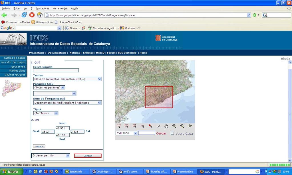
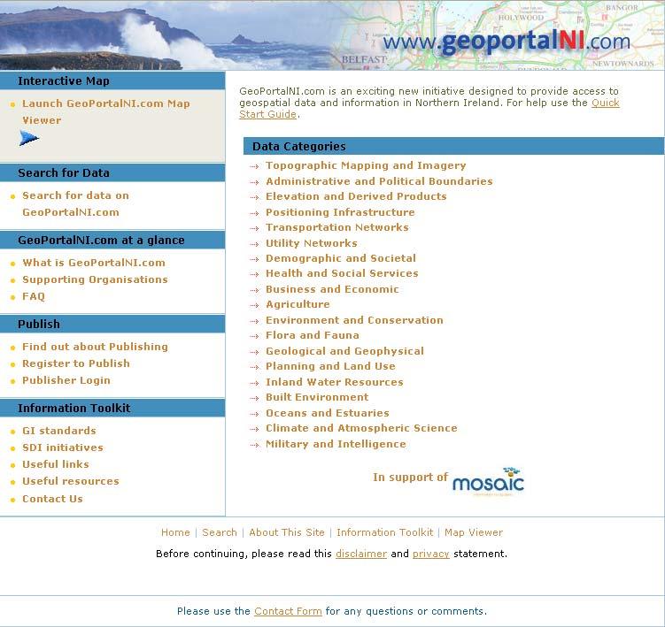
2 Geospatial technologies Positioning on the Earth s surface GPS, RFID Acquisition systems remote sensing volunteered geographic information Data dissemination geoportals virtual globes Analysis searching for patterns and anomalies testing hypotheses, modeling change

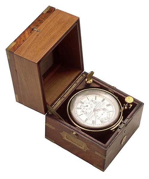

3 Positioning technologies Navigation sextant chronometer
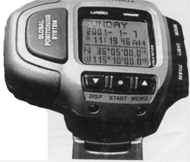
4 Positioning technologies Surveying measurement with respect to a known point tape, compass, clinometer GPS, Galileo accurate timing of signals from satellites easily incorporated into mobile devices

5


6 Dynamic geographic information Live feed to desktop, laptop, mobile phone integrated with other map data

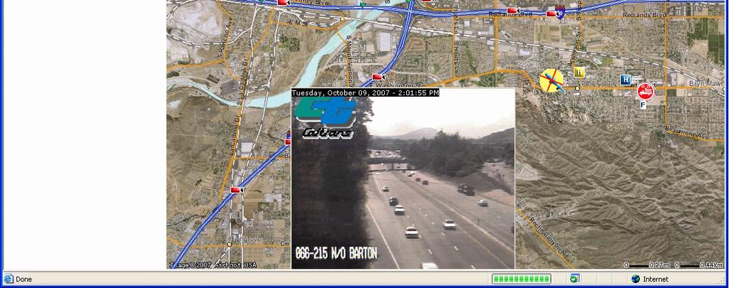
7
8

9


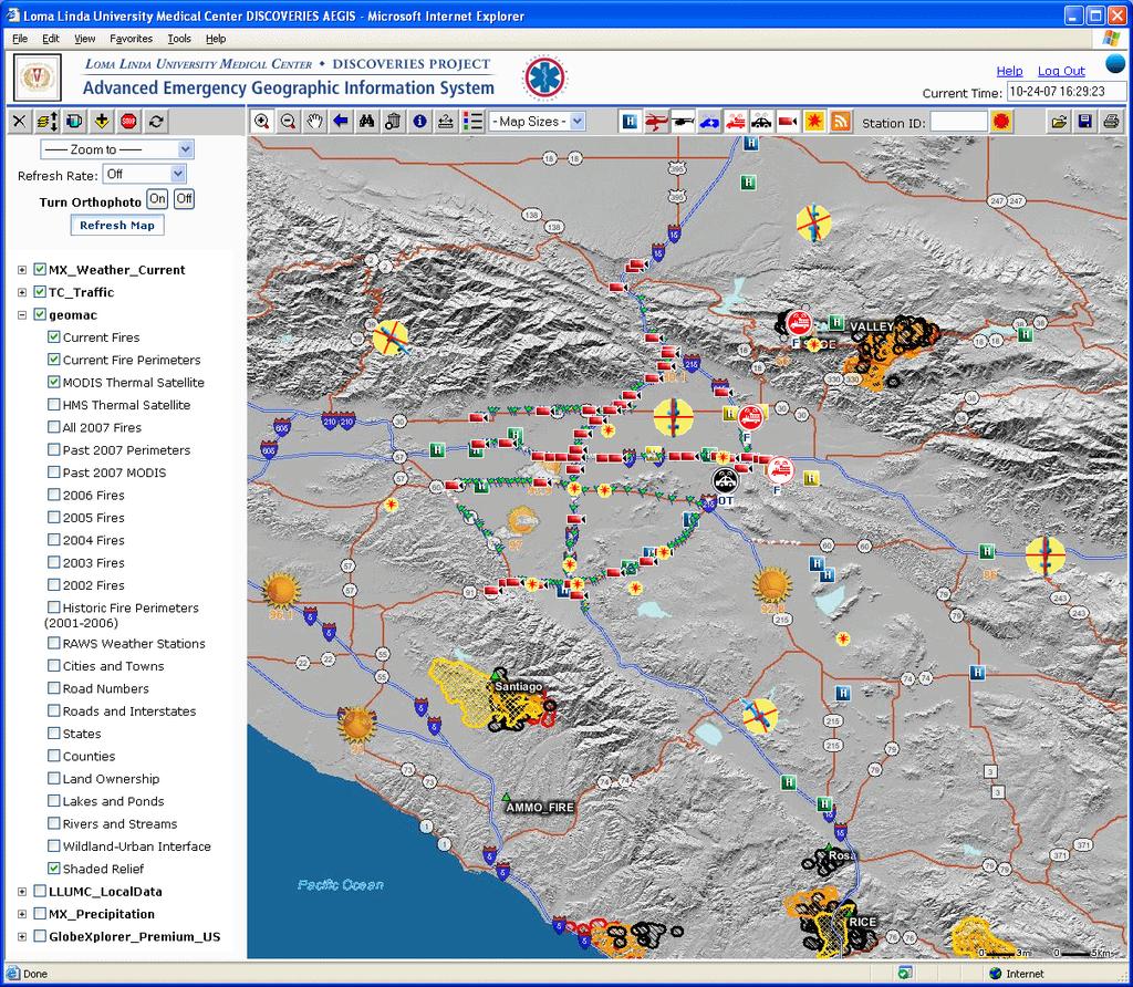
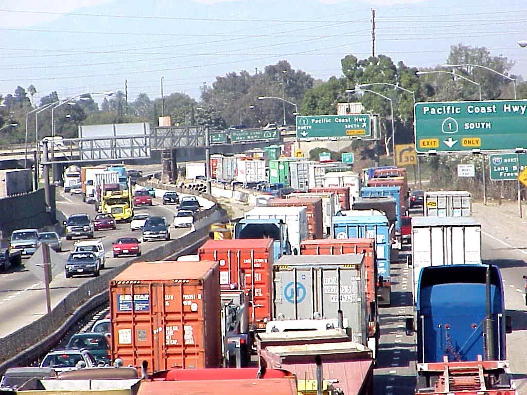
10 Pacific Rim Trade - LA/LB ports 2002 = 10 million TEU containers 2003 = 11.8 million TEU containers 2004 = 13 million TEU containers 2005 = 14,194,442 TEU containers 2006 = estimated 8% growth Destination estimates? 50% Intermodal train (21% on-dock rail from ship) 50% Local distribution warehouses for local consumption and outbound distribution On-dock rail containers move from ship to train instead of being trucked to the rail ramps 23% In Los Angeles 27% in Long Beach Combined 1.5 million containers in 2005! This reduces the dwell time on dock and the amount of gate and yard transactions for the marine terminal further reducing yard congestion
11

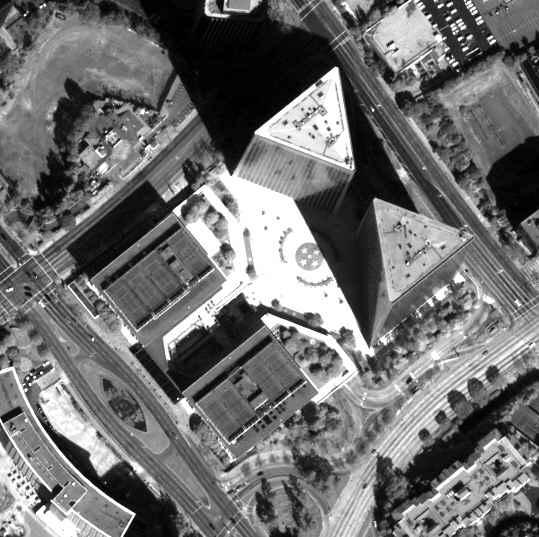
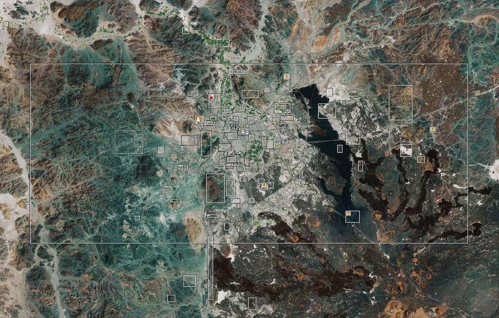
12 L002: Port terminals
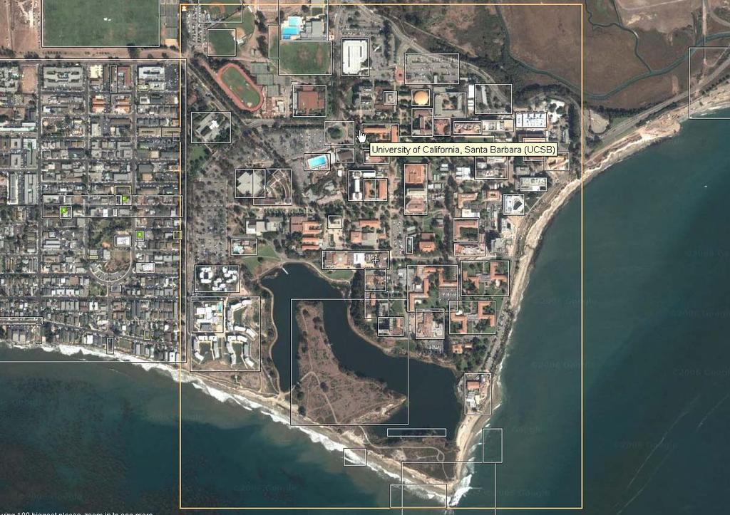
13 L002: LA Basin, 4 months
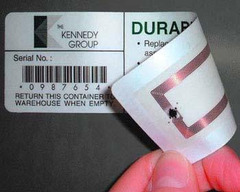
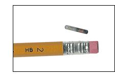
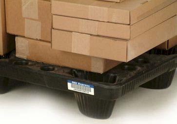
14 RFID Radio frequency identification scanning without the laser active or passive Tracking of objects goods from production to retail display to sale construction materials pets, livestock, children, parolees


15
16


17 NYC Office of Emergency Management and NY Office of Cyber Security and Critical Infrastructure Coordination

18 Street Images + Extraction + Annotation 360 Panoramic + Ad Annotation
19
20
21

22
23 Neogeography A breaking down of the traditional barriers between expert and non-expert The engagement of thousands of individuals in the production of geographic information
24
25
26

27


28 Andrew Curtis, Department of Geography, Louisiana State University

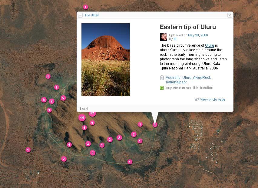
29 1. Google Earth image map of London from David Rumsey collection 3. Pump and death locations from my own web site
30


31 Multiple attribution Shapes ESRI ~~~ USGS Names D aowaga Lake Tahoe Sierra Lake Types +Water Body Plate carre -Lake - Reservoir
32
33 Analysis Mining spatial data for patterns and anomalies Making inferences about disease prevalence and transmission Testing hypotheses about cause

34 Source: Mason et al., Atlas of Cancer Mortality for U.S. Counties, NCI, 1975
35

36
37 Geographic information science The science behind the systems The fundamental issues raised by the technologies The principles implemented in the technologies
38 Major discoveries in GIScience Theories of representation discrete objects and continuous fields object fields, metamaps unification Models of uncertainty error propagation downscaling Principles of spatial cognition Theories of the geographic world spatial dependence, spatial heterogeneity
39 Future prospects Knowing where everything is (at all times) every mobile phone every vehicle every farm animal every item in a store every construction beam every asset for emergency response every victim of a disaster Representation of 3D structures and positioning inside them extending navigation to indoors
40 The role of the citizen Placenames, streets, social characteristics Early notification of change Early reports of damage from a disaster Both producer and consumer of geographic information The local expert
41 Access Systems that are easy to use, open to all A technology of design simulations of future landscapes evaluation of the effects of natural processes and human actions
42 A technology of dynamics Real-time, continuous monitoring The state of the world at all times the state of the transportation network the state of human health the state of the environment Sensor networks static carried on moving objects humans as sensors
43 The grand challenges of GIScience Representing the full range of conditions and phenomena on a dynamic Earth 4D, unary and binary Providing simulations of real processes that are indistinguishable from reality Managing the flow of data from a host of sensors Communicating knowledge of abstract phenomena and uncertainty to the non-expert user Capturing the local geographic knowledge of citizens Making it possible to search efficiently over a distributed, global data resource Preserving what we know about the geographic world for future generations
44 Concluding points A rapidly expanding area of technology Raising some fundamental questions presenting some grand scientific challenges Prompting a rethinking of how we educate
The Future of Geography in an. Society. Michael F. Goodchild University of California Santa Barbara
 The Future of Geography in an Emerging Information-Technology Society Michael F. Goodchild University of California Santa Barbara Geographic technologies Positioning i on the Earth s surface GPS, RFID
GIScience: Current Technology. Michael F. Goodchild University of California Santa Barbara
 GIScience: Current Technology Michael F. Goodchild University of California Santa Barbara What is a GIS? A class of software designed to handle geographic information and perform virtually any conceivable
Citizens as Sensors: Web 2.0 and the World of Volunteered Geography. Michael F. Goodchild University of California Santa Barbara
 Citizens as Sensors: Web 2.0 and the World of Volunteered Geography Michael F. Goodchild University of California Santa Barbara How is geographic information created? By authorities USGS NGA Ordnance Survey
Twenty Years of Progress: GIScience in Michael F. Goodchild University of California Santa Barbara
 Twenty Years of Progress: GIScience in 2010 Michael F. Goodchild University of California Santa Barbara Outline The beginnings: GIScience in 1990 Major accomplishments research institutional The future
The Spatial Web: Visions for a Geospatial World. Michael F. Goodchild Walton Fellow National Centre for Geocomputation
 The Spatial Web: Visions for a Geospatial World Michael F. Goodchild Walton Fellow National Centre for Geocomputation Outline Context Current technology My own research Technological vision Social issues
Geographic information systems and science: today and tomorrow
 Procedia Earth and Planetary Science 1 (2009) 1037 1043 Procedia Earth and Planetary Science www.elsevier.com/locate/procedia 6th International Conference on Mining Science and Technology Geographic information
Cartographic and Geospatial Futures
 Cartographic and Geospatial Futures 1. Web Cartography, WebGIS, & Virtual Globes--New Roles for Maps, GIS, and GIS professionals 2. Map Mashups, the Neo Neo-geography Movement, & Crowd-sourcing Geospatial
CyberGIS: What Still Needs to Be Done? Michael F. Goodchild University of California Santa Barbara
 CyberGIS: What Still Needs to Be Done? Michael F. Goodchild University of California Santa Barbara Progress to date Interoperable location referencing coordinate transformations geocoding addresses point-of-interest
California Reality and Nova Scotia Dreaming. Michael F. Goodchild University of California Santa Barbara
 California Reality and Nova Scotia Dreaming Michael F. Goodchild University of California Santa Barbara 1 The geospatial world Remote sensing Geographic information systems Automated cartography Global
A Broad View of Geospatial Technology & Systems
 A Broad View of Geospatial Technology & Systems Pete Large Vice President, Trimble On the shoulders of giants 1 Since their time, our ability to generate geospatial information has grown exponentially
Vision 2020: Focus on the Future. Michael F. Goodchild University of California Santa Barbara
 Vision 2020: Focus on the Future Michael F. Goodchild University of California Santa Barbara A little context Gore, Earth in the Balance, 1992 a single portal to Earth information Fall 1997 Tom Kalil,
30 YEARS SINCE Z_GIS FOUNDING: PROVIDING SOLUTIONS FOR SOCIETY AND BUSINESS
 30 YEARS SINCE Z_GIS FOUNDING: PROVIDING SOLUTIONS FOR SOCIETY AND BUSINESS Michael F Goodchild Emeritus Professor of Geography University of California, Santa Barbara Keynote GIScience Symposium, Salzburg,
A General Framework for Conflation
 A General Framework for Conflation Benjamin Adams, Linna Li, Martin Raubal, Michael F. Goodchild University of California, Santa Barbara, CA, USA Email: badams@cs.ucsb.edu, linna@geog.ucsb.edu, raubal@geog.ucsb.edu,
Planning in a Geospatially Enabled Society. Michael F. Goodchild University of California Santa Barbara
 Planning in a Geospatially Enabled Society Michael F. Goodchild University of California Santa Barbara What is a geospatially enabled society? Knowing the locations of all points of interest and their
Creating a Staff Development Plan with Esri
 Creating a Staff Development Plan with Esri Michael Green David Schneider Guest Presenter: Shane Feirer, University of California Esri UC 2014 Technical Workshop Agenda What is a Staff Development Plan?
Cutting Edge Engineering for Modern Geospatial Systems Rear Admiral Dr. S Kulshrestha, retd
 Cutting Edge Engineering for Modern Geospatial Systems Rear Admiral Dr. S Kulshrestha, retd 11 Jun 2015 GeoIntelligence Asia 2015 The technology would become so pervasive that it becomes a part of you
GEOGRAPHIC INFORMATION SYSTEMS Session 8
 GEOGRAPHIC INFORMATION SYSTEMS Session 8 Introduction Geography underpins all activities associated with a census Census geography is essential to plan and manage fieldwork as well as to report results
8/28/2011. Contents. Lecture 1: Introduction to GIS. Dr. Bo Wu Learning Outcomes. Map A Geographic Language.
 Contents Lecture 1: Introduction to GIS Dr. Bo Wu lsbowu@polyu.edu.hk Department of Land Surveying & Geo-Informatics The Hong Kong Polytechnic University 1. Learning outcomes 2. GIS definition 3. GIS examples
Space-adjusting Technologies and the Social Ecologies of Place
 Space-adjusting Technologies and the Social Ecologies of Place Donald G. Janelle University of California, Santa Barbara Reflections on Geographic Information Science Session in Honor of Michael Goodchild
GEOGRAPHIC INFORMATION SYSTEMS AND SCIENCE: TODAY AND TOMORROW
 GEOGRAPHIC INFORMATION SYSTEMS AND SCIENCE: TODAY AND TOMORROW Michael F. Goodchild 1 ABSTRACT Great strides have been made in geographic information systems and science over the past 14 years, through
The Social Life of Location. David Sonnen September 2008
 The Social Life of Location David Sonnen September 2008 Three Transformations Traditional Cartography -- 2300 B.C. - ~ 1980 Maps represent location and attributes Portable, persistent communication/ reference
Putting the U.S. Geospatial Services Industry On the Map
 Putting the U.S. Geospatial Services Industry On the Map December 2012 Definition of geospatial services and the focus of this economic study Geospatial services Geospatial services industry Allow consumers,
Geography for the 2020 Round of Census
 Boundaries Key Census Data EA Id Population Male Female EA Id Area EA Id Num HH Avg HH size Geography for the 2020 Round of Census Linda Peters, Esri lpeters@esri.com Integration of Statistical and Geospatial
Chapter 10: The Future of GIS Why Speculate? 10.2 Future Data 10.3 Future Hardware 10.4 Future Software 10.5 Some Future Issues and Problems
 Chapter 10: The Future of GIS 10.1 Why Speculate? 10.2 Future Data 10.3 Future Hardware 10.4 Future Software 10.5 Some Future Issues and Problems Theme of the Course GIS's place in understanding geographic
ArcGIS. for Server. Understanding our World
 ArcGIS for Server Understanding our World ArcGIS for Server Create, Distribute, and Manage GIS Services You can use ArcGIS for Server to create services from your mapping and geographic information system
Michael F. Goodchild University of California Santa Barbara
 The Changing Face of GIS Michael F. Goodchild University of California Santa Barbara 1 Two topics New data sources Critical spatial thinking 2 How is geographic information created? By authorities and
Building a National Data Repository
 Building a National Data Repository Mladen Stojic, Vice President - Geospatial 1/30/2013 2012 Intergraph Corporation 1 Information has meaning and gives power only when shared and distributed. Information,
United States Multi-Hazard Early Warning System
 United States Multi-Hazard Early Warning System Saving Lives Through Partnership Lynn Maximuk National Weather Service Director, Central Region Kansas City, Missouri America s s Weather Enterprise: Protecting
Your web browser (Safari 7) is out of date. For more security, comfort and. the best experience on this site: Update your browser Ignore
 is out of date. For more security, comfort and. the best experience on this site: Update your browser Ignore") Your web browser (Safari 7) is out of date. For more security, comfort and Activityengage the best experience on this site: Update your browser Ignore Introduction to GIS What is a geographic information
Your web browser (Safari 7) is out of date. For more security, comfort and Activityengage the best experience on this site: Update your browser Ignore Introduction to GIS What is a geographic information
Reimaging GIS: Geographic Information Society. Clint Brown Linda Beale Mark Harrower Esri
 Reimaging GIS: Geographic Information Society Clint Brown Linda Beale Mark Harrower Esri 8 billion = Number of basemap requests per month on AGOL 14,000 = Unique requests per second 12,000 = New Items
Towards data driven decision-making using crowd-sourced geographic information. Linna Li University of Redlands December 2, 2015
 Towards data driven decision-making using crowd-sourced geographic information Linna Li (linna.li@csulb.edu) University of Redlands December 2, 2015 WalMap: Walgreens store location map Geographic information
Climate Risk Visualization for Adaptation Planning and Emergency Response
 Climate Risk Visualization for Adaptation Planning and Emergency Response NCR Flood Fact Finding Workshop Ricardo Saavedra ricardo@vizonomy.com Social Media, Mobile, and Big Data St. Peter s Basilica,
Michael F. Goodchild University of California Santa Barbara
 The Changing Face of GIS Michael F. Goodchild University of California Santa Barbara 1 Two topics New data sources Critical spatial thinking 2 How is geographic information created? By authorities and
Geographical Information System GIS
 Geographical Information System GIS LOOM.02.331 anto.aasa@ut.ee Scale GIS and spatial planning National Regional Local Strategic (National Dev. Plan) National Goals and development policy Tactical (Regional
GeoWorlds: Integrated Digital Libraries and Geographic Information Systems
 GeoWorlds: Integrated Digital Libraries and Geographic Information Systems http://www.isi.edu/geoworlds Robert Neches In-Young Ko, Robert MacGregor, Ke-Thia Yao Distributed Scalable Systems Division USC
Introduction to GIS. Phil Guertin School of Natural Resources and the Environment GeoSpatial Technologies
 Introduction to GIS Phil Guertin School of Natural Resources and the Environment dguertin@cals.arizona.edu Mapping GeoSpatial Technologies Traditional Survey Global Positioning Systems (GPS) Remote Sensing
Assessing pervasive user-generated content to describe tourist dynamics
 Assessing pervasive user-generated content to describe tourist dynamics Fabien Girardin, Josep Blat Universitat Pompeu Fabra, Barcelona, Spain {Fabien.Girardin, Josep.Blat}@upf.edu Abstract. In recent
Sustainability Adaptation Transparency Accountability. $400 FBC of fuel.
 Sustainability Adaptation Transparency Accountability $400 FBC of fuel. We need a sustainability platform Tools for organization, collaboration, policy, data collection, storage, analysis, understanding,
Key Points Sharing fosters participation and collaboration Metadata has a big role in sharing Sharing is not always easy
 Sharing Resources Geoff Mortson esri, Inc. SDI Solutions Team Key Points Sharing fosters participation and collaboration Metadata has a big role in sharing Sharing is not always easy Data Sharing is Good
Introduction to Geographic Information Systems
 Introduction to Geographic Information Systems What is GIS? GIScience, Geography and Cartography GIS Maps Why is it important? What is Driving GIS? Applications of GIS Case Studies Components of a GIS
Imagery and the Location-enabled Platform in State and Local Government
 Imagery and the Location-enabled Platform in State and Local Government Fred Limp, Director, CAST Jim Farley, Vice President, Leica Geosystems Oracle Spatial Users Group Denver, March 10, 2005 TM TM Discussion
Mapping Secondary Cities for Resiliency and Emergency Preparedness
 Mapping Secondary Cities for Resiliency and Emergency Preparedness Secondary Cities Geospatial Training Workshop Pilot Project: Cusco, Peru June 29 July 3 2015 WHO ARE WE? Office of the Geographer (GGI)
1The Many Uses of GIS
 1The Many Uses of GIS BUILDING EUROPEAN SPATIAL DATA INFRASTRUCTURES In April 2006, Esri president Jack Dangermond gave a presentation on the INSPIRE Directive at the European Union (EU) Interparliamentary
Geo Business Gis In The Digital Organization
 We have made it easy for you to find a PDF Ebooks without any digging. And by having access to our ebooks online or by storing it on your computer, you have convenient answers with geo business gis in
CENSUS MAPPING WITH GIS IN NAMIBIA. BY Mrs. Ottilie Mwazi Central Bureau of Statistics Tel: October 2007
 CENSUS MAPPING WITH GIS IN NAMIBIA BY Mrs. Ottilie Mwazi Central Bureau of Statistics E-mail: omwazi@npc.gov.na Tel: + 264 61 283 4060 October 2007 Content of Presentation HISTORICAL BACKGROUND OF CENSUS
NOMAD Workshop Linking Humanitarian Organizations with Mobile Data Collection Tool Providers, 15 th -17 th May, Paris!
 NOMAD Workshop Linking Humanitarian Organizations with Mobile Data Collection Tool Providers, 15 th -17 th May, Paris! Their Work is Contributing to build a Better World... IAEA UNODC Public Health Global
Key Issue #1. How do geographers describe where things are? 2014 Pearson Education, Inc.
 Key Issue #1 How do geographers describe where things are? Learning Outcomes 1.1.1: Explain differences between early maps and contemporary maps. 1.1.2: Describe the role of map scale and projections and
Urban Geo-Informatics John W Z Shi
 Urban Geo-Informatics John W Z Shi Urban Geo-Informatics studies the regularity, structure, behavior and interaction of natural and artificial systems in the urban context, aiming at improving the living
VGIscience Summer School Interpretation, Visualisation and Social Computing of Volunteered Geographic Information (VGI)
") VGIscience Summer School Interpretation, Visualisation and Social Computing of Volunteered Geographic Information (VGI) TU Dresden, 11.-15. September 2017 Welcome PhD students working on research topics
VGIscience Summer School Interpretation, Visualisation and Social Computing of Volunteered Geographic Information (VGI) TU Dresden, 11.-15. September 2017 Welcome PhD students working on research topics
Interactive GIS in Veterinary Epidemiology Technology & Application in a Veterinary Diagnostic Lab
 Interactive GIS in Veterinary Epidemiology Technology & Application in a Veterinary Diagnostic Lab Basics GIS = Geographic Information System A GIS integrates hardware, software and data for capturing,
Current Research Trends from an Australian Perspective. Dr Philip Collier Research Director
 Current Research Trends from an Australian Perspective Dr Philip Collier Research Director Growth in the spatial sector. 11% pa in the Global Navigation Satellite System market 2010-2020 300% growth in
ArcGIS is Advancing. Both Contributing and Integrating many new Innovations. IoT. Smart Mapping. Smart Devices Advanced Analytics
 ArcGIS is Advancing IoT Smart Devices Advanced Analytics Smart Mapping Real-Time Faster Computing Web Services Crowdsourcing Sensor Networks Both Contributing and Integrating many new Innovations ArcGIS
Advanced Algorithms for Geographic Information Systems CPSC 695
 Advanced Algorithms for Geographic Information Systems CPSC 695 Think about Geography What is Geography The 3 W s of Geography What is where Why is it there Why do I care Data - Data - Data We all got
AP Human Geography Chapter 1: Thinking Geographically Key Issue 1: How do Geographers describe where things are?
 AP Human Geography Chapter 1: Thinking Geographically Key Issue 1: How do Geographers describe where things are? Studying Human Geography Physical Geography Physical geography deals with Earth s natural
ESRI Survey Summit August Clint Brown Director of ESRI Software Products
 ESRI Survey Summit August 2006 Clint Brown Director of ESRI Software Products Cadastral Fabric How does Cadastral fit with Survey? Surveyors process raw field observations Survey measurements define high-order
Lesson 16: Technology Trends and Research
 http://www.esri.com/library/whitepapers/pdfs/integrated-geoenabled-soa.pdf GEOG DL582 : GIS Data Management Lesson 16: Technology Trends and Research Overview Learning Objective Questions: 1. Why is integration
OFWIM 2017 Annual Conference What Does Web GIS Really Mean for Fish and Wildlife Agencies?
 Content Open Mapping OFWIM 2017 Annual Conference What Does Web GIS Really Mean for Fish and Wildlife Agencies? Imagery Spatial Analysis Mike Bialousz, Esri 3D Data Exploration Real-Time Apps Visualization
AN INTRODUCTION TO GEOSPATIAL TECHNOLOGY AS IT RELATES TO CREATING BASELINE INFORMATION FOR CLIMATE, HEALTH, DISASTER, AND DISEASE MAPPING AND CHANGE
 AN INTRODUCTION TO GEOSPATIAL TECHNOLOGY AS IT RELATES TO CREATING BASELINE INFORMATION FOR CLIMATE, HEALTH, DISASTER, AND DISEASE MAPPING AND CHANGE Carl L. Zimmerman, PhD Tufts University, UEPP and Geospatial
The Challenge of Geospatial Big Data Analysis
 288 POSTERS The Challenge of Geospatial Big Data Analysis Authors - Teerayut Horanont, University of Tokyo, Japan - Apichon Witayangkurn, University of Tokyo, Japan - Shibasaki Ryosuke, University of Tokyo,
Industry Trends and Direction: a quick look! John Whitehead Trimble Navigation Ltd.
 Industry Trends and Direction: a quick look! John Whitehead Trimble Navigation Ltd. Converging forces have placed geospatial information at the center of an evolving ecosystem Technology Societal Forces
GIS CONCEPTS Part I. GIS ON THE WEB Part II
 Week 2 GIS CONCEPTS Part I GIS ON THE WEB Part II topics of the week part I GIS functions and GIS data Spatial relationships Organizing convention for spatial data Store Information by thematic layers
Powerful Combination: GIS and Web Services
 IEEE DISTRIBUTED SYSTEMS ONLINE 1541-4922 2004 Published by the IEEE Computer Society Vol. 5, No. 2; February 2004 Powerful Combination: GIS and Web Services Adam Stone At the University of North Texas's
Manual of Digital Earth
 V8.0 March 27, 2018 International Society for Digital Earth Manual of Digital Earth (Tentative Title) OUTLINE Foreword Chapter 1 Understanding Digital Earth 1.1 Origins and Precursors of Digital Earth
HIGH RESOLUTION BASE MAP: A CASE STUDY OF JNTUH-HYDERABAD CAMPUS
 HIGH RESOLUTION BASE MAP: A CASE STUDY OF JNTUH-HYDERABAD CAMPUS K.Manjula Vani, Abhinay Reddy, J. Venkatesh, Ballu Harish and R.S. Dwivedi ABSTRACT The proposed work High Resolution Base map: A Case study
PERCEPTION and Focus on Maps. Focus on Maps 8/29/2014. English and Dutch Maps from the 1600s and 1680 British Maps of N. Am.
 PERCEPTION English and Dutch Maps from the 600s The Nature of New York Dutch67 Prof. Anthony Grande English 67 Copyright 04 AFG 676 and 680 British Maps of N. Am. 70 and 776 4 Focus on Maps Maps are geographers
Fundamental Spatial Concepts. Michael F. Goodchild University of California Santa Barbara
 Fundamental Spatial Concepts Michael F. Goodchild University of California Santa Barbara A spatial turn in science Adding space to theory the New Economic Geography space impeding flows of information,
GIS for Crime Analysis. Building Better Analysis Capabilities with the ArcGIS Platform
 GIS for Crime Analysis Building Better Analysis Capabilities with the ArcGIS Platform Crime Analysis The Current State One of the foundations of criminological theory is that three things are needed for
Joanne N. Halls, PhD Dept. of Geography & Geology David Kirk Information Technology Services
 Joanne N. Halls, PhD Dept. of Geography & Geology David Kirk Information Technology Services Geographic Information Systems manage and analyze data to solve spatial problems. Real World Abstraction Analysis
Citizen Science at the. U.S. Geological Survey
 Citizen Science at the U.S. Geological Survey David Applegate USGS Associate Director for Natural Hazards NRC Board on Earth Science & Resources December 5, 2014 U.S. Department of the Interior U.S. Geological
Are You Maximizing The Value Of All Your Data?
 Are You Maximizing The Value Of All Your Data? Using The SAS Bridge for ESRI With ArcGIS Business Analyst In A Retail Market Analysis SAS and ESRI: Bringing GIS Mapping and SAS Data Together Presented
enny Mills chool of Civil ngineering & eosciences ewcastle University
 Future of Surveying: Educating the future geospatial expert A Newcastle University perspective enny Mills chool of Civil ngineering & eosciences ewcastle University Future of surveying: Do we still need
Re-imagining Religion: The Spatial Humanities as a Framework for New Scholarship
 2010 Re-imagining Religion: The Spatial Humanities as a Framework for New Scholarship David J. Bodenhamer The Polis Center at IUPUI Virtual Center for Spatial Humanities New Technologies and Interdisciplinary
Applications: Introduction Task 1: Introduction to ArcCatalog Task 2: Introduction to ArcMap Challenge Question References
 CHAPTER 1 INTRODUCTION 1.1 GIS? 1.1.1 Components of a GIS 1.1.2 A Brief History of GIS 1.1.3 GIS Software Products Box 1.1 A List of GIS Software Producers and Their Main Products 1.2 GIS Applications
FUTURE DATA. Future data Future hardware Future software Future issues. Getting Started With GIS. Chapter 10
 THE FUTURE OF GIS Getting Started With GIS Chapter 10 GIS Futures Future data Future hardware Future software Future issues Dursun Z. ªeker Theme of the book GIS's place in understanding geographic distributions
Geo-Enabling Mountain Bike Trail Maintenance:
 Title Slide Geo-Enabling Mountain Bike Trail Maintenance: Enhanced Stewardship of the Fountainhead Mountain Bike Trail through GIS Technology Ruthann Ligon Follow the Trail Fountainhead Mountain Bike
Demystifying ArcGIS Online. Karen Lizcano Esri
 Demystifying ArcGIS Online Karen Lizcano Esri An Integrated Web GIS Platform Desktop Web Device Powered by Services Managed via Portal Access from any Device Portal Server Online Content and Services ArcGIS
Empowering water/wastewater network management with GIS
 Empowering water/wastewater network management with GIS Ioannis Kavouras_GIS Manager Surveying Engineer, MSc, MBA The Company responsible for fresh water distribution & sanitation serving 1.500.000 citizens
Zero Hours of System Training
 Zero Hours of System Training A challenge for the next 25 years Werner Kuhn Center for Spatial Studies Department of Geography University of California at Santa Barbara 1854 http://en.wikipedia.org/wiki/file:snow-cholera-map-1.jpg
Aboriginal communities strengthen governance with location-based tools in the 21st century
 Aboriginal communities strengthen governance with location-based tools in the 21st century Today, Aboriginal communities are taking advantage of the geomatics technologies that underpin popular online
geographic patterns and processes are captured and represented using computer technologies
 Proposed Certificate in Geographic Information Science Department of Geographical and Sustainability Sciences Submitted: November 9, 2016 Geographic information systems (GIS) capture the complex spatial
GEOG 3340: Introduction to Human Geography Research
 GEOG 3340: Introduction to Human Geography Research Lecture 1: Course Overview Guofeng Cao www.myweb.ttu.edu/gucao Department of Geosciences Texas Tech University guofeng.cao@ttu.edu Fall 2015 Course Description
FROM WATER LEAKS TO WINE GRAPES: A NEW OUTLOOK FOR IMAGERY ANALYSIS
 Place image here (10 x 3.5 ) FROM WATER LEAKS TO WINE GRAPES: A NEW OUTLOOK FOR IMAGERY ANALYSIS ENVI AS A FRAMEWORK FOR CLOUD SERVICES & DEEP LEARNING Presented By Gordon Sumerling on Behalf of Cherie
XXIII CONGRESS OF ISPRS RESOLUTIONS
 XXIII CONGRESS OF ISPRS RESOLUTIONS General Resolutions Resolution 0: Thanks to the Czech Society commends: To congratulate The Czech Society, its president and the Congress Director Lena Halounová, the
GIS Workshop Data Collection Techniques
 GIS Workshop Data Collection Techniques NOFNEC Conference 2016 Presented by: Matawa First Nations Management Jennifer Duncan and Charlene Wagenaar, Geomatics Technicians, Four Rivers Department QA #: FRG
Detecting Origin-Destination Mobility Flows From Geotagged Tweets in Greater Los Angeles Area
 Detecting Origin-Destination Mobility Flows From Geotagged Tweets in Greater Los Angeles Area Song Gao 1, Jiue-An Yang 1,2, Bo Yan 1, Yingjie Hu 1, Krzysztof Janowicz 1, Grant McKenzie 1 1 STKO Lab, Department
Your web browser (Safari 7) is out of date. For more security, comfort and the best experience on this site: Update your browser Ignore
 is out of date. For more security, comfort and the best experience on this site: Update your browser Ignore") Your web browser (Safari 7) is out of date. For more security, comfort and the best experience on this site: Update your browser Ignore GIS ( GEO GRAPHIC INFO RMATIO N SYSTEM) geospatial information system
Your web browser (Safari 7) is out of date. For more security, comfort and the best experience on this site: Update your browser Ignore GIS ( GEO GRAPHIC INFO RMATIO N SYSTEM) geospatial information system
Remote Sensing and Incident Support. Department of Homeland Security February 22, 2013
 Remote Sensing and Incident Support Department of Homeland Security February 22, 2013 Introductions and Goals Today s Webcast will be Presented by: Chris Barnard DHS Remote Sensing Advisor Chris Vaughan
Designing smart & Resilient cities:
 Designing smart & Resilient cities: How can Egyptian cities learn from an emerging global practice On the Cuspof Change Professor Samer Bagaeen FRICS MRTPI FRSA AoU 1. GLOBAL CHALLENGES POPULATION GROWTH,
GIS for ChEs Introduction to Geographic Information Systems
 GIS for ChEs Introduction to Geographic Information Systems AIChE Webinar John Cirucci 1 GIS for ChEs Introduction to Geographic Information Systems What is GIS? Tools and Methods Applications Examples
Welcome to GST 101: Introduction to Geospatial Technology. This course will introduce you to Geographic Information Systems (GIS), cartography,
, cartography,") Welcome to GST 101: Introduction to Geospatial Technology. This course will introduce you to Geographic Information Systems (GIS), cartography, remote sensing, and spatial analysis through a series of
Welcome to GST 101: Introduction to Geospatial Technology. This course will introduce you to Geographic Information Systems (GIS), cartography, remote sensing, and spatial analysis through a series of
REVIEW MAPWORK EXAM QUESTIONS 31 JULY 2014
 REVIEW MAPWORK EXAM QUESTIONS 31 JULY 2014 Lesson Description In this lesson we: Focus on key concepts and exam questions relating to GIS. Question 1 Test Yourself The most important component of a GIS
Grand Challenges in GIScience: UCGIS experiences
 Grand Challenges in GIScience: UCGIS experiences 2006-2010 Tim Nyerges University of Washington University Consortium of Geographic Information Science (UCGIS) AAG Annual Meeting April 17, 2010 Outline
Smart Citizens. Maria Antonia Brovelli Politecnico di Milano, Italy
 Smart Citizens Maria Antonia Brovelli Politecnico di Milano, Italy UN-GGIM Academic Network Forum Secure Land Rights and Smart Cities: Making It Work for Sustainable Development New York, 31 July 2017
Michael F. Goodchild University of California Santa Barbara
 Challenges in GIS Research Michael F. Goodchild University of California Santa Barbara Thanks to Ordnance Survey of GB SPLINT Leicester, Nottingham, UCL Organizers GIS research Since 1960s Changing agenda
GIS = Geographic Information Systems;
 What is GIS GIS = Geographic Information Systems; What Information are we talking about? Information about anything that has a place (e.g. locations of features, address of people) on Earth s surface,
Web Visualization of Geo-Spatial Data using SVG and VRML/X3D
 Web Visualization of Geo-Spatial Data using SVG and VRML/X3D Jianghui Ying Falls Church, VA 22043, USA jying@vt.edu Denis Gračanin Blacksburg, VA 24061, USA gracanin@vt.edu Chang-Tien Lu Falls Church,
Esri and GIS Education
 Esri and GIS Education Organizations Esri Users 1,200 National Government Agencies 11,500 States & Regional Agencies 30,800 Cities & Local Governments 32,000 Businesses 8,500 Utilities 12,600 NGOs 11,000
Gov 2.0. Encourage citizen engagement, deliver transparency, and foster collaboration with ArcGIS.
 Gov 2.0 Encourage citizen engagement, deliver transparency, and foster collaboration with ArcGIS. F E D E R A L GIS A Platform for Open Government Upon taking office, President Barack Obama issued an open
Exploring Digital Earth. Michael F. Goodchild University of California Santa Barbara
 Exploring Digital Earth Michael F. Goodchild University of California Santa Barbara Some explaining to do What a curious career Nevill Mott, Cavendish Professor of Physics, University of Cambridge, 1965
GEOMATICS. Shaping our world. A company of
 GEOMATICS Shaping our world A company of OUR EXPERTISE Geomatics Geomatics plays a mayor role in hydropower, land and water resources, urban development, transport & mobility, renewable energy, and infrastructure