SDI Implementation at the Local
|
|
|
- Kimberly Turner
- 6 years ago
- Views:
Transcription

1 SDI Implementation at the Local Administration Level of Germany Hartmut Müller and Stephan von St. Vith FIG Working Week 2009 Surveyors Key Role in Accelerated Development, Eilat, Israel, 3-8 May 2009 TS 5B Current Trends in SDI (3494) Germany 1


 County")

")

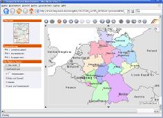
2 Federal States (16) Federal State of Rhineland-Palatinate Independent cities in Rheinland-Palatinate (14) Counties in Rhineland-Palatinate (24) County of Bernkastel-Wittlich Independent Municipalities (2) Association of municipalities (7) Municipalities (106) National egovernment strategy of Germany Deutschland Online 2


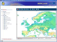
3 European project initiative INSPIRE egovernment connected with SDI -to be available at different SDI levels national regional local 3
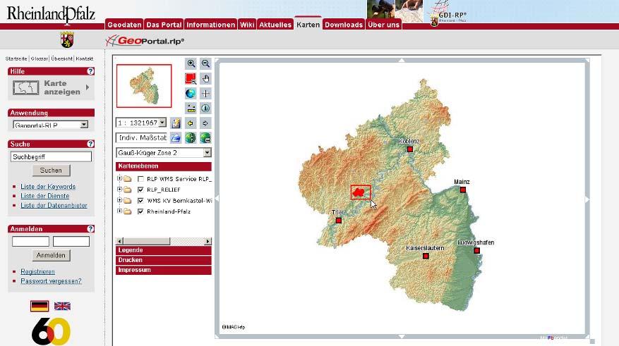
 INHABITANTS inhabitants/km² (2007) inhabitants (absolut) 5,2-25,0 25,1-50,0 8-500 501-1.")
4 Case study - Germany State of Rhineland- Palatinate - County of Bernkastel-Wittlich area 1178 km² inhabitants 78 of 106 municipalities < 1000 inhabitants 97 inhabitants/km² population density (2007) INHABITANTS inhabitants/km² (2007) inhabitants (absolut) 5,2-25,0 25,1-50, ,1-100,0 100,1-150,0 150,1-500, Project initiatives towards SDI implementation at the local level several state-wide project initiatives starting in 2003 concerning local SDI implementation initiated by the umbrella organisation of all counties Project no 1 GIS implementation in the Rhineland-Palatinate counties Goal: Developing a GIS implementation strategy for one exemplary local authority and creation of a functional specification for a modular build-up of a GIS Project no 2 Promotion of building up spatial data infrastructures (SDI) at local level Goal: How to build up a spatial data infrastructure for the co-operation and the data exchange within local authorities and in between local and other authorities Project no 3 Build-Up of Rhineland-Palatinate regional SDI as a basis for the Federal State Development Plan IV (Landesentwicklungsprogramm IV) Goal: what s the important spatial data for spatial planning at regional level to define a feasible spatial data repository project partners Landkreistag Rheinland-Pfalz (umbrella organisation for all Rhineland-Palatinate counties) i3mainz - Institut for Spatial Information and Surveying Techology (Mainz Univ. of Apl. Sc.) County administration of Bernkastel-Wittlich (pilot authority) Project group with other GIS experienced counties and some federal state institutions 4


 Digital Terrain Model (DGM) aspect")

")
 Automated land survey")
5 system implementation at the local level principal workplan System analysis Strategic planning Field research and analysis Conceptional modelling Professional concept IT-concept System selection Public tender Offer rating Functional tests System rating, system recommendation System implementation System installation, system acceptance Data acquisition, data migration System use Cost benefit analysis geo-spatial basic data initial spark for the GIS implementation Digital Landscape Models (DLM) Digital Terrain Model (DGM) aspect (here ) slope (here > 25 ) Topographic Maps (DTK 25, DTK 50, hier DTK 100) Digital Orthophotos (DOP) Digital Topographic Map 1:5000 (DTK 5) Official house coordinates (georeferenced building addresses) Automated land survey register (ALK) Automated register of land owners (ALB) 5


 Acceleration of workflows (efficiency) Permanent access to required data")
 Analysis and presentation options (presentiveness) Establishment of a")
6 So far analogue Analogue data (paper documents and maps): Double or even multiple data Difficult retrieval of correct data in the existing data pool Rapid aging of the data, therefore limited use Data can not be found or it is not known that such data exist Complicated updates Missing spatial reference nowdigital! Web-Server Browser GEO-DB Geodaten Geographical information system (GIS) Data is up to date (planning safety) Acceleration of workflows (efficiency) Permanent access to required data (time saving) Avoidance of redundant data storage (cost saving) Easy data exchange (time and cost saving) Analysis and presentation options (presentiveness) Establishment of a common spatial reference (combinability and comparability) 6

")


 Hierarchic navigation: association")


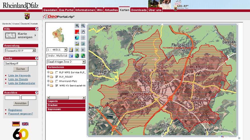
7 From experience Presentation of some practical applications For all users: obtaining information from automated land survey register (ALK) and automated register of land owners (ALB) Department of building and environment: mapping of habitats and reserves Health department: geocoding of all locations of livestock farming within the county as prevention for avian influenza Planning department: examination of potential locations for wind power stations Department of buildung and environment: information system of legally binding land use plans Integration of preparatory land-use plans in the federal state SDI Most used application - obtaining information from automated land survey register (ALK) and automated register of real owners (ALB) Hierarchic navigation: association of municipalties municipality/district local subdistrict cadastral district number of land parcel moving to the information part selection of a land parcel Output of an owner proof Output of a land parcel extract 7
8 Hartmut Mü Müller Department of building and environment mapping of habitats and reserves Describing information directly linked With the spatial conservation data Conservation data in part as OGC web map service (WMS) From the Federal State Ministry for Environment, Forest and Consumer Protection Hartmut Mü Müller Health department geocoding of all locations of livestock farming within the county as prevention for avian influenza case 8

 Precedence area for wind power")
 Locations to")


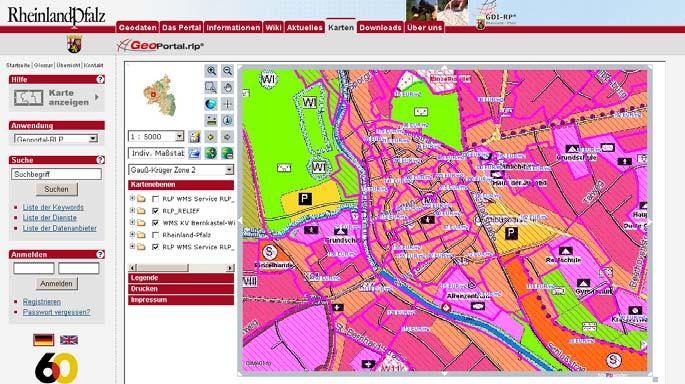
9 Planning department examination of potential locations for wind power stations Locations not to be affected (green) Precedence area for wind power stations (violet) Planned locations for wind power stations (red) Locations to be protected are buffered with 500 and 1000 meters distance, resp. Minimum distance of planned locations from critical locations ok Department of buildung and environment information system for legally binding land use plans select the municipality all plans available for the municipality are listed select the appropriate plan and zoom to the extent of the plan set the appropriate scale and layer activate the metadata available for the plan activate the textual description activate the legend 9


10 Department of buildung and environment information system for legally binding land use plans interface to the building permit application management Open building permit application program Mark the parcel for which building permit is applied for Move to the GIS application program Creation of a map centered to the marked parcel Call metadata to identify the legally binding land-use plan Display identified plan in PDF format Regional and local SDI Steps to be done at local level Implementation of GIS Built-up of local SDI Providing for OGC-conform services Using GeoWebServices INSPIRE Europa# SDI Germany SDI Rhineland-Palatinate Pilot-project Bernkastel-Wittlich Regional and locale SDI Services Catalogues 10


11 Hartmut Mü Müller Spatial Data Infrastructure from local level to European level zed trali n e dec nt nda u d e -r non uine gen Decentralized up to date spatial data is available and can be merged via internet technology Hartmut Mü Müller Preparatory land use plan in Federal State Regional SDI 11
12 Conclusions and further work SDI implementation at the local level closely related to and able to fulfil many basic needs of citizens and public administration by providing huge amounts of basic spatial data Careful SDI design and implementation at the local level indispensable for establishing a working SDI at all higher levels Consideration of standards, mainly those defined by OGC makes it possible to integrate local SDI bricks smoothly into an overall SDI Many questions concerning semantic interoperability, metadata specification and maintenance not yet answered in a sufficient way 12
SDI Implementation at the Local Administration Level of Germany
 Hartmut MÜLLER and Stephan von St. VITH, Germany Key words: SDI, Municipality, egovernment, Geospatial Basic Data SUMMARY Germany is a federal republic consisting of 16 states (so called "Laender"). At
Who are we? Use of German State s Rhineland-Palatinate Spatial Data Infrastructure for e-government INSPIRE. Topics of Presentation INSPIRE
 Who are we? University of Applied Sciences, Mainz, Germany Institute for Spatial Information and Surveying Technology Use of German State s Rhineland-Palatinate Spatial Data Infrastructure for e-government
A Case Study on Local SDI Implementation in Germany
 A Case Study on Local SDI Implementation in Germany Hartmut MÜLLER, Falk WÜRRIEHAUSEN, Germany Key words: Local SDI, Municipality, Commune SDI, Geospatial Basic Data, Geospatial Thematic Data, Web Service,
Information Technology and Spatial Data Infrastructure for E-Government
 Technology and Hartmut Müller Who are we? University of Applied Sciences, Mainz, Germany Institute for Spatial and Surveying Technology Who are we? University of Applied Sciences, Mainz, Germany Institute
E-Government and SDI in Bavaria, Germany
 135 E-Government and SDI in Bavaria, Germany Wolfgang STOESSEL, Germany Key words: GDI-BY, Bavaria, Spatial Data Infrastructure SUMMARY Spatial Data Infrastructure (SDI) is an important part of the e-government
Sustainable and Harmonised Development for Smart Cities The Role of Geospatial Reference Data. Peter Creuzer
 Sustainable and Harmonised Development for Smart Cities The Role of Geospatial Reference Data Peter Creuzer 1. Introduction - Smart Cities and Geodata 2. Geodata in Germany 3. Examples 4. Data and Service
GIS Building Communities beyond National Borders (Building Successful Spatial Data Infrastructures) Nick Land, ESRI Europe
 Nick Land, ESRI Europe") GIS Building Communities beyond National Borders (Building Successful Spatial Data Infrastructures) Nick Land, ESRI Europe UK worst flooding in the last 60 years 350,000 households without drinking water
GIS Building Communities beyond National Borders (Building Successful Spatial Data Infrastructures) Nick Land, ESRI Europe UK worst flooding in the last 60 years 350,000 households without drinking water
Integration of Authoritative and Volunteered Cultural Landscape Information
 Integration of Authoritative and Volunteered Cultural Landscape Information Hartmut MÜLLER and Falk WÜRRIEHAUSEN, Germany Key words: e-governance; VGI; SDI; citizen participation SUMMARY Cultural heritage
Demonstration of a local SDI solution with several stakeholders in pilot areas in line with EU best practices
 EU Twinning project for the Agency of Land Relations and Cadaster (ALRC)- Organization, Streamlining and Computerization Process in Mapping in the Republic of Moldova. Demonstration of a local SDI solution
Modular Web Framework for the BRANDENBURGVIEWER
 Modular Web Framework for the BRANDENBURGVIEWER Geoinformation System (GIS) 2 GIS = geo + information + system + + Survey of data Organization of data Processing and Analysis Presentation geodata infrastructure
Spread over a central peninsula and its surroundings, Split's greater area includes the surrounding seaside towns as well.
 Split is a Mediterranean city on the eastern shores of the Adriatic Sea, centered around the ancient Roman Palace of the Emperor Diocletian and its bay and port. With a population of 178,192 citizens,
Geospatial Information Management, a Feasible Tool for Small Island Developing States?
 Geospatial Information Management, a Feasible Tool for Small Island Developing States? Hartmut Müller FIG Pacific Small Island Developing States Symposium, Policies and Practices for Responsible Governance
INSPIRE - A Legal framework for environmental and land administration data in Europe
 INSPIRE - A Legal framework for environmental and land administration data in Europe Dr. Markus Seifert Bavarian Administration for Surveying and Cadastre Head of the SDI Office Bavaria Delegate of Germany
Innovation in Land Management: Integrated Solutions For National Cadastre Projects
 Success With GIS Innovation in Land Management: Integrated Solutions For National Cadastre Projects XXIII International FIG Congress Munich These documents are only complete, when used in connection with
SWEDISH SDI DEVELOPMENT & IMPLEMENTATION OF INSPIRE
 SWEDISH SDI DEVELOPMENT & IMPLEMENTATION OF INSPIRE Christina Wasström, Lantmäteriet, 801 82 Gävle, Sweden, christina.wasstrom@lm.se ABSTRACT The Swedish Government and Parliament has given Lantmäteriet
Zagreb Spatial Data Infrastructure. Sanja Batić, APIS IT Split, 14. rujna 2011.
 Zagreb Spatial Data Infrastructure Sanja Batić, APIS IT Split, 14. rujna 2011. Agenda Zagreb Spatial Data Infrastructure - ZIPP Guidelines for further ZIPP Geoportal development Conclusion 1964 The Centre
IDEBarcelona: Cooperating for a Smart Region Infrastructure
 IDEBarcelona: Cooperating for a Smart Region Infrastructure Marta Codinachs Serra Diputació de Barcelona Territory and Sustainability Area Territorial Information Systems Department SMART CITY EXPO WORLD
NOKIS - Information Infrastructure for the North and Baltic Sea
 NOKIS - Information Infrastructure for the North and Baltic Sea Carsten Heidmann 1 and Jörn Kohlus 2 Abstract 1. General The initial motivation for the project NOKIS (German title: Nord- und Ostsee-Küsteninformationssystem)
TIM-online A part of the egovernment strategy by the Federal State North-Rhine Westphalia
 TIM-online A part of the egovernment strategy by the Federal State North-Rhine Westphalia Stefan Sandmann Surveying and mapping agency of North - Rhine Westphalia Muffendorfer Straße 19 21, D-53177 Bonn
Roadmap to interoperability of geoinformation
 Roadmap to interoperability of geoinformation and services in Europe Paul Smits, Alessandro Annoni European Commission Joint Research Centre Institute for Environment and Sustainability paul.smits@jrc.it
GIS FOR MAZOWSZE REGION - GENERAL OUTLINE
 GIS FOR MAZOWSZE REGION - GENERAL OUTLINE S. Bialousz 1), K Mączewski 2), E. Janczar 2), K. Osinska-Skotak 1) 1) Warsaw University of Technology, Warsaw, Poland 2) Office of the Surveyor of the Mazowieckie
INSPIRing Geospatial Framework For Local Administrations
 This project is financed by the European Union and the Republic of Turkey Presented at the FIG Congress 2018, May 6-11, 2018 in Istanbul, Turkey National Programme for Turkey 2010 Instrument for Pre-Accession
UTAH S STATEWIDE GEOGRAPHIC INFORMATION DATABASE
 UTAH S STATEWIDE GEOGRAPHIC INFORMATION DATABASE Data Information and Knowledge Management NASCIO Awards 2009 STATE GEOGRAPHIC INFORMATION DATABASE B. EXECUTIVE SUMMARY Utah has developed one of the most
The Process of Spatial Data Harmonization in Italy. Geom. Paola Ronzino
 The Process of Spatial Data Harmonization in Italy Geom. Paola Ronzino ISSUES Geospatial Information in Europe: lack of data harmonization the lack of data duplication of data CHALLENGES Challenge of INSPIRE:
GIS Geographical Information Systems. GIS Management
 GIS Geographical Information Systems GIS Management Difficulties on establishing a GIS Funding GIS Determining Project Standards Data Gathering Map Development Recruiting GIS Professionals Educating Staff
The state-of-the-art of the Finnish SDI. Arctic SDI WG Meeting
 The state-of-the-art of the Finnish SDI Arctic SDI WG Meeting Moscow 8.9.2011 Esa Tiainen Development Centre 1 NATIONAL LAND SURVEY DOWN TO EARTH Contents Legal framework Coordination structure Network
Oman NSDI Business Values and Future Directions. Hassan Alawi Alghazali Acting Director General National Spatial Data Infrastructure
 Oman NSDI Business Values and Future Directions Hassan Alawi Alghazali Acting Director General National Spatial Data Infrastructure Presentation Outline Geospatial Maturity Current Challenges NCSI s Role
Implementing the Smart Growth Priority in an Open and Interoperable System for Geographic Data: Sardinia SITR- IDT
 REGION OF SARDINIA (ITALY) LOCAL AUTHORITY FOR MUNICIPALITIES, FINANCES AND URBAN PLANNING DEPT. FOR THE REGIONAL SPATIAL DATA INFRASTRUCTURE Implementing the Smart Growth Priority in an Open and Interoperable
Global Geospatial Information Management Country Report Finland. Submitted by Director General Jarmo Ratia, National Land Survey
 Global Geospatial Information Management Country Report Finland Submitted by Director General Jarmo Ratia, National Land Survey Global Geospatial Information Management Country Report Finland Background
ESDIN Results from a Crossborder INSPIRE Preparatory Project. Jörgen Hartnor, Lantmäteriet.
 ESDIN Results from a Crossborder INSPIRE Preparatory Project Jörgen Hartnor, Lantmäteriet www.esdin.eu Ett econtentplus Best Practice Network projekt September 2008 February 2011 Coordinated by EuroGeographics
SITR-IDT The Spatial Data Infrastructure of Sardinia Region
 ITALY LOCAL AUTHORITY FOR MUNICIPALITIES, FINANCES AND URBAN PLANNING REGIONAL DEPARTMENT FOR CARTOGRAPHY AND INFORMATION SYSTEMS SITR-IDT The Spatial Data Infrastructure of Sardinia Region Content of
for Effective Land Administration
 Role of Geospatial Technology in Land Information System(LIS) for Effective Land Administration Dr. Deb Jyoti Pal Sections Role of GIS in Land Records Proposed Work Flow Case Studies Role of GIS Creating
IHO STAKEHOLDERS FORUM. Hydrographic data and its role in MSDI. Thursday 27 September Jens Peter Hartmann KMS
 IHO STAKEHOLDERS FORUM Hydrographic data and its role in MSDI Thursday 27 September Jens Peter Hartmann KMS Agenda Traditional approach to hydrographic data Expectations within the marine / maritime field
STATE GEOGRAPHIC INFORMATION DATABASE
 STATE GEOGRAPHIC INFORMATION DATABASE Data Information and Knowledge Management STATE GEOGRAPHIC INFORMATION DATABASE EXECUTIVE SUMMARY Utah has developed one of the most comprehensive statewide GIS resources
Technical Specifications. Form of the standard
 Used by popular acceptance Voluntary Implementation Mandatory Legally enforced Technical Specifications Conventions Guidelines Form of the standard Restrictive Information System Structures Contents Values
Spatial Information Management in the Context of Organizational Development the Approach in North-Rhine Westphalia, Germany
 Spatial Information Management in the Context of Organizational Development the Approach in North-Rhine Westphalia, Germany Dr. Jens Riecken DVW Vice President c/o Ministry of the Interior North-Rhine
Project based approach developing National Spatial Data Infrastructure in Lithuania
 Project based approach developing National Spatial Data Infrastructure in Lithuania National Land Service under the Ministry of Agriculture of The Republic of Lithuania Cadastres & Geodesy Department Director
Turkey s National SDI Implementation
 Onur PAŞAOĞULLARI Head of Department Turkey s National SDI Implementation Presentation Plan NSDI Background General Directorate of Geographic Information Systems NSDI Project INSPIRE Directive Urban Information
SITMUN: Cooperating to Build Local SDIs in the Barcelona Region
 SITMUN: Cooperating to Build Local SDIs in the Barcelona Region Diputació de Barcelona Territory and Sustainability Area Territorial Information Systems Department INSPIRE CONFERENCE Barcelona, September
ArcGIS for INSPIRE. Marten Hogeweg
 ArcGIS for INSPIRE Marten Hogeweg Please Take Our Survey on the App Download the Esri Events app and find your event Select the session you attended Scroll down to find the feedback section Complete answers
INSPIRE General Introduction & Service Architecture
 INSPIRATION Spatial Data Infrastructure in the Western Balkans INSPIRE General Introduction & Service Architecture 1st National INSPIRATION Workshop Croatia November 21-22, 2012 A multi-countryprojectfunded
Remich, Luxembourg, February 2006 (river Mosel)
") Remich, Luxembourg, February 2006 (river Mosel) Transnational Internet Map Information System on Flooding Cross border flood hazard maps for Luxembourg and Rhineland-Palatinate Experiences from the TIMIS
Remich, Luxembourg, February 2006 (river Mosel) Transnational Internet Map Information System on Flooding Cross border flood hazard maps for Luxembourg and Rhineland-Palatinate Experiences from the TIMIS
Paper UC1351. Conference: User Conference Date: 08/10/2006 Time: 8:30am-9:45am Room: Room 23-B (SDCC)
") Conference: User Conference Date: 08/10/2006 Time: 8:30am-9:45am Room: Room 23-B (SDCC) Title of Paper: Increasing the Use of GIS in the Federal Government Author Name: Miss Abstract This presentation
Conference: User Conference Date: 08/10/2006 Time: 8:30am-9:45am Room: Room 23-B (SDCC) Title of Paper: Increasing the Use of GIS in the Federal Government Author Name: Miss Abstract This presentation
reviewed paper EU-Project: Cross-border Spatial Information System with High Added Value (CROSS-SIS) Stefan SANDMANN
 Stefan SANDMANN") reviewed paper EU-Project: Cross-border Spatial Information System with High Added Value (CROSS-SIS) Stefan SANDMANN Surveying and Mapping Agency NRW, Bonn, Muffendorfer Str. 19-21, Germany, sandman@lverma.nrw.de
reviewed paper EU-Project: Cross-border Spatial Information System with High Added Value (CROSS-SIS) Stefan SANDMANN Surveying and Mapping Agency NRW, Bonn, Muffendorfer Str. 19-21, Germany, sandman@lverma.nrw.de
The ecadastre System. Francis KAELL ecadastre project manager
 The ecadastre System Francis KAELL ecadastre project manager ecadastre what s that? A mapping tool to view, combine and analyze geodata in a browser A product catalogue which describes all the available
Building a National Data Repository
 Building a National Data Repository Mladen Stojic, Vice President - Geospatial 1/30/2013 2012 Intergraph Corporation 1 Information has meaning and gives power only when shared and distributed. Information,
Building a national spatial data infrastructure. Thorben Hansen, Head of Division Danish Agency for Data Supply and Efficiency
 Building a national spatial data infrastructure Thorben Hansen, Head of Division Danish Agency for Data Supply and Efficiency About Spatial Data Infrastructure Spatial data come from many sources and is
SDI Development in Georgia. Mari Khardziani Head of International Relations Unit National Agency of Public Registry
 SDI Development in Georgia Mari Khardziani Head of International Relations Unit National Agency of Public Registry Kehl, Germany September 5, 2017 2 National Agency of Public Registry Legal Entity of Public
Presented at the FIG Congress 2018, May 6-11, 2018 in Istanbul, Turkey
 Presented at the FIG Congress 2018, May 6-11, 2018 in Istanbul, Turkey INVESTIGATION OF THE SPATIAL ADDRESS RECORDING SYSTEM (SARS) PROJECT PROCESS TO BE BASE THE URBAN INFORMATION SYSTEM 1 FANİSE USLU,
Qatar Statistical Geospatial Integration
 Qatar Statistical Geospatial Integration A Presentation by the Ministry of Development Planning & Statistics (MDPS), State of Qatar http://www.mdps.gov.qa (Fourth UN-GGIM Arab States Committee Meeting,
Emerging Trends in Institutional Arrangements Europe - Finland
 Emerging Trends in Institutional Arrangements Europe - Finland Arvo Kokkonen Deputy Director General National Land Survey of Finland 1 Contents Facts about Finland National Land Survey of Finland European
INSPIRE Shared Service
 INSPIRE Shared Service Creation and operation out of the box Petra Fritz (HZD), Michael Voigtländer (Esri Deutschland GmbH) INSPIRE Shared Service Agenda HZD backbone for a geodata infrastructure Implementing
Local SDI Collaboration on SOA
 Institute of Geodesy Local SDI Collaboration on SOA Dr.-Ing. Jörg Blankenbach Dipl.-Ing. Christian Hickel FIG Commission 3 Workshop Paris, 27.10.2011 Agenda Local SDI in Hesse: GDI-Südhessen Overview Service
Local Spatial Data Infrastructure, a Solid Base for Sustainable Land Management in Germany
 Local Spatial Data Infrastructure, a Solid Base for Sustainable Land Management in Germany FIG Commission 3 Workshop and Commission 3 Annual Meeting The Empowerment of Local Authorities: Spatial Information
a national geological survey perspective François ROBIDA BRGM (French Geological Survey)
") a national geological survey perspective François ROBIDA BRGM (French Geological Survey) Pre-Conference Seminar on Socio-Economic Value of Geospatial for National and Regional Development 21 August 2017,
a national geological survey perspective François ROBIDA BRGM (French Geological Survey) Pre-Conference Seminar on Socio-Economic Value of Geospatial for National and Regional Development 21 August 2017,
From the Venice Lagoon Atlas towards a collaborative federated system
 From the Venice Lagoon Atlas towards a collaborative federated system City of Venice Alessandro Mulazzani CORILA Consortium for Coordination of Research Activities Concerning the Venice Lagoon System ISMAR-CNR
ISO Series Standards in a Model Driven Architecture for Landmanagement. Jürgen Ebbinghaus, AED-SICAD
 ISO 19100 Series Standards in a Model Driven Architecture for Landmanagement Jürgen Ebbinghaus, AED-SICAD 29.10.2003 The Company 100% SIEMENS PTD SIEMENS Business Services Shareholder & Strategic Business
Open Data meets Big Data
 Open Data meets Big Data Max Craglia, Sven Schade, Anders Friis European Commission Joint Research Centre www.jrc.ec.europa.eu Serving society Stimulating innovation Supporting legislation JRC is Technical
Gis for Land Management: An Overview on Italy
 Gis for Land Management: An Overview on Italy Paola RONZINO, Italy Key words: Cartography, Land Management, Spatial Planning, Urban Renewal, Spatial Information, Environment SUMMARY The introduction of
Implementation of Inspire in Denmark - How we get it flying! Olav Eggers National Survey & Cadastre -Denmark
 Implementation of Inspire in Denmark - How we get it flying! Olav Eggers oe@kms.dk National Survey & Cadastre -Denmark Introduction Overview Infrastructure for Spatial Information Act National Survey and
CHAPTER 22 GEOGRAPHIC INFORMATION SYSTEMS
 CHAPTER 22 GEOGRAPHIC INFORMATION SYSTEMS PURPOSE: This chapter establishes the administration and use of to improve the quality and accessibility of Department s spatial information and support graphical
Ministry of ICT of I.R.IRAN
 The ECO 8/6 mill km 2 10 Slamic countries ~330 mill people Oil, Gas, Industries,Tourism 2 Issue transformation in last decade Problem solving needs more integrated approach More interaction &complexity
High Resolution Land Use Information by combined Analysis of Digital Landscape Models and Statistical Data Sets. Tobias Krüger Gotthard Meinel
 High Resolution Land Use Information by combined Analysis of Digital Landscape Models and Statistical Data Sets Tobias Krüger Gotthard Meinel Agenda Monitoring approach Input Data Data Processing Output
EuroGeographics & INSPIRE. Nick Land, Executive Director of EuroGeographics
 EuroGeographics & INSPIRE Nick Land, Executive Director of EuroGeographics EuroGeographics A growing association 49 Members, 42 countries Topographic mapping, cadastre, land registry + Networked organisation
Infrastructure for Spatial Information in Europe (INSPIRE)
") Infrastructure for Spatial Information in Europe (INSPIRE) 2011 GISCO Working Party 8-9.3.2012 INSPIRE is about improving access to spatial information: the environment doesn t stop at borders EU Geoportal
Infrastructure for Spatial Information in Europe (INSPIRE) 2011 GISCO Working Party 8-9.3.2012 INSPIRE is about improving access to spatial information: the environment doesn t stop at borders EU Geoportal
Ready for INSPIRE.... connecting worlds. European SDI Service Center
 Ready for INSPIRE Consultancy SOFTWARE T r a i n i n g Solutions... connecting worlds European SDI Service Center Increasing Added Value with INSPIRE and SDI Components INSPIRE In 2007, the European Commission
RESOURCES DEVELOPMENT GEOSPATIAL DATA USING THE DIGITAL TOPOGRAPHIC PLAN OF ROMANIA- TOPRO5
 C. C-tin Muşat, F. M. Brebu, A. C. Bălă, I. S. Herban Resources Development Digital Geospatial Data Using the Digital Topographic Plan of Romania - TOPRO5 RESOURCES DEVELOPMENT GEOSPATIAL DATA USING THE
IRDAT Fvg, evolving a regional Spatial Data Infrastructure according to INSPIRE
 IRDAT Fvg, evolving a regional Spatial Data Infrastructure according to INSPIRE Tutti i diritti riservati. Proprietà INSIEL SpA. A. Benvenuti, A. Chiarandini Insiel (Italy) M. Lunardis - Friuli Venezia
Technical Framework Methodology as a core of building up the NSDI NSDI Implementation Specifics in Serbia
 Technical Framework Methodology as a core of building up the NSDI NSDI Implementation Specifics in Serbia Luka Jovičić SDI Consultant@ Gramont Ltd. Aleksandar Dedić RGA NSDI department Dragica Pajić RGA
Plan4all (econtentplus project)
") Plan4all (econtentplus project) Karel CHARVAT 1, Tomáš MILDORF 2 1 Help service remote sensing, Ltd., Černoleská 1600, 256 01 Benešov u Prahy, Czech Republic charvat@bnhelp.cz 2 Department of Mathematics
Plan4all (econtentplus project) Karel CHARVAT 1, Tomáš MILDORF 2 1 Help service remote sensing, Ltd., Černoleská 1600, 256 01 Benešov u Prahy, Czech Republic charvat@bnhelp.cz 2 Department of Mathematics
Stay of play in the Serbian geo-sector
 Stay of play in the Serbian geo-sector Republic Geodetic Authority, Serbia IGN France International, France INSPIRE Conference Florence, 27 th June 2013 Outline NSDI status Institutional framework Technical
Bridging the Gap between Engineering and GIS
 Bridging the Gap between Engineering and GIS Presented by: Karen Stewart, B.Tech, GISP Manager of Geomatics Township of Langley February 13, 2006 Agenda Introduction History Goals Implementation Benefits
Proposal for a DIRECTIVE OF THE EUROPEAN PARLIAMENT AND OF THE COUNCIL. establishing an infrastructure for spatial information in the Community
 Proposal for a DIRECTIVE OF THE EUROPEAN PARLIAMENT AND OF THE COUNCIL establishing an infrastructure for spatial information in the Community INSPIRE http://inspire.jrc.it/ Alessandro Annoni 1 EU Commission
Pal NIKOLLI Bashkim IDRIZI Ismail KABASHI Adelajda HALILI THE IMPLEMENTATION OF NATIONAL SPATIAL DATA INFRASTRUCTURE IN ALBANIA
 Pal NIKOLLI Bashkim IDRIZI Ismail KABASHI Adelajda HALILI THE IMPLEMENTATION OF NATIONAL SPATIAL DATA INFRASTRUCTURE IN ALBANIA Overview: Goals of paper Some definitions of SDI NSDI Development NSDI in
INSPIREd solutions for Air Quality problems Alexander Kotsev
 INSPIREd solutions for Air Quality problems Alexander Kotsev www.jrc.ec.europa.eu Serving society Stimulating innovation Supporting legislation The European data puzzle The European data puzzle 24 official
Major Opportunities in Spatial Data Infrastructure Communities
 Major Opportunities in Spatial Data Infrastructure Communities Bas Kok President GSDI June 17 th 2008 FIG Working Week: Integrating Generations 14-19 June 2008 Stockholm, Sweden http://www.gsdi.org 1 GSDI
Spatial Data Infrastructure Concepts and Components. Douglas Nebert U.S. Federal Geographic Data Committee Secretariat
 Spatial Data Infrastructure Concepts and Components Douglas Nebert U.S. Federal Geographic Data Committee Secretariat August 2009 What is a Spatial Data Infrastructure (SDI)? The SDI provides a basis for
GEOVEKST A Norwegian Program for Cost Sharing in Production, Updating and Administration of Geographic Data
 GEOVEKST A Norwegian Program for Cost Sharing in Production, Updating and Administration of Dr. Anne Kirsten S. HØSTMARK, Norway Key words: Mapping in large scale, formal co-operation, cost sharing, standarised
INSPIRE implementation in the Turkish Ministry of Environment and Urbanization Producing and Publishing Environmental Data
 INSPIRE implementation in the Turkish Ministry of Environment and Urbanization Producing and Publishing Environmental Data Ezgi Sarmusak Urban Planner, MoEU Sibel Süer Toybıyık - Assistant Expert, MoEU
The Application of 3D Web GIS In Land Administration - 3D Building Model System
 The Application of 3D Web GIS In Land Administration - 3D Building Model System Hui-Wen Chen *, Wen-Yuan Ku *, Lan-Kun Chung *, Tien-Yin Chou *, Li-Min Yi2 ** * Feng Chia University, Taiwan, ** Land Department
The challenge of linking or integrating data on Buildings
 The challenge of linking or integrating data on Buildings Expected benefits: user requirements Wide use of data on Buildings Buildings are places where people live, work, spend more of their time => Data
INSPIRing effort. Peter Parslow Ordnance Survey December Various European approaches to managing an SDI
 INSPIRing effort Peter Parslow Ordnance Survey December 2015 Various European approaches to managing an SDI WHAT IS INSPIRE? A European Union Directive A community effort: http://inspire.ec.europa.eu/
Land Board, NW Services and SDI Tambet Tiits, FRICS
 Land Board, NW Services and SDI Tambet Tiits, FRICS 07.09.2016 200th anniversary of the Struve Geodetic Arc Friedrich Georg Wilhelm Struve and Carl Friedrich Tenner Struve Geodetic Arc The Struve Geodetic
The German GDI a public-private cooperation project. Heinz BRÜGGEMANN Surveying and Mapping Agency NRW, Germany
 The German GDI a public-private cooperation project Heinz BRÜGGEMANN Surveying and Mapping Agency NRW, Germany Definition of Grimm Public tasks are all action lines..., which are handled by public actors,
INSPIRATION results and benefits for the Agency for Real Estate Cadastre
 JOINT RESEARCH CENTER - E&I WORKSHOP INSPIRATION results and benefits for the Agency for Real Estate Cadastre Sonja Dimova, state advisor AGENCY FOR REAL ESTATE CADASTRE REPUBLIC OF MACEDONIA Wednesday,
Upgrade the Datasets in NSDI for Smarter Services with the Cases of China
 Upgrade the Datasets in NSDI for Smarter Services with the Cases of China By Dr. JIANG Jie Dept of GeoInformaiton Service Platform National Geomatics Center of China October 7, 2015 Jeju, Republic of Korea
Innovation in mapping and photogrammetry at the Survey of Israel
 16, October, 2017 Innovation in mapping and photogrammetry at the Survey of Israel Yaron Felus and Ronen Regev Contents Why HD mapping? Government requirements Mapping regulations o Quality requirements
Geoservices in Hamburg
 Geoservices in Hamburg Dr.-Ing. Winfried Hawerk Freie und Hansestadt Hamburg Landesbetrieb Geoinformation und Vermessung FIG Commission 7 Symposium Celje 16 May 2006 Hamburg and the Metropolitan Area Hamburg
GSDI Global Spatial Data Infrastructure. Convergences between Geo Spatial Communities: key decision for decision making
 GSDI Global Spatial Data Infrastructure Convergences between Geo Spatial Communities: key decision for decision making April 14 th 2010 Bas Kok GSDI Past-President Director of International Affairs, Dutch
Estonian approach to implementation of INSPIRE directive. Sulev Õitspuu Head of Bureau of Geoinfosystems Estonian Land Board
 Estonian approach to implementation of INSPIRE directive Sulev Õitspuu Head of Bureau of Geoinfosystems Estonian Land Board 13.06.2016 Contents - INSPIRE coordination in Estonia - INSPIRE implementation
Monitoring of Settlement Development Methodological Problems and Solutions in Germany
 Monitoring of Settlement Development Methodological Problems and Solutions in Germany Gotthard Meinel Leibniz Institute for Ecological Urban and Regional Development (IOER), Germany/Dresden Overview LU-Problem
INSPIRE Basics. Vlado Cetl European Commission Joint Research Centre. https://ec.europa.eu/jrc/
 INSPIRE Basics Vlado Cetl European Commission Joint Research Centre https://ec.europa.eu/jrc/ Serving society Stimulating innovation Supporting legislation Outline SDI? Why European SDI? INSPIRE Policy
Geocoding of Statistics Portugal Business Register and it s integration with the INSPIRE s Annex III Buildings theme
 Geocoding of Statistics Portugal Business Register and it s integration with the INSPIRE s Annex III Buildings theme Barcelona, 26th September2016 INE/DMSI-GEO» 1 The summary Business Register (BR) Enterprise
Implementing strategy for the Infrastructure for Spatial Information in Europe - INSPIRE Paul Smits
 Implementing strategy for the Infrastructure for Spatial Information in Europe - INSPIRE Paul Smits European Commission DG Joint Research Centre Institute for Environment and Sustainability Ispra, Italy
Harmonizing spatial databases and services at local and regional level
 Harmonizing spatial databases and services at local and regional level A. Ionita 1, M. Caian 2, V. Vassilev 3, V. Craciunescu 2, I. Nedelcu 4 1 Research Institute for Artificial Intelligence, Bucuresti,
Status of implementation of the INSPIRE Directive 2016 Country Fiches. COUNTRY FICHE France
 Status of implementation of the INSPIRE Directive 2016 Country Fiches COUNTRY FICHE France Introduction... 1 1. State of Play... 2 1.1 Coordination... 2 1.2 Functioning and coordination of the infrastructure...
Tomas Mildorf, Karel Janecka University of West Bohemia in Pilsen Czech Republic
 European Network of Best Practices for Interoperability of Spatial Planning Information Tomas Mildorf, Karel Janecka mildorf@centrum.cz, kjanecka@kma.zcu.cz University of West Bohemia in Pilsen Czech Republic
INSPIRE Directive. Status June 2007
 INSPIRE Directive INfrastructure for SPatial InfoRmation in Europe Status June 2007 European Commission Directorate-General Environment Research, Science and Innovation Unit Rue de la Loi, 200 1049 Brussels
Data harmonization aspects of the Irish pilot project for INSPIRE data publishing and Network Services
 Data harmonization aspects of the Irish pilot project for INSPIRE data publishing and Network Services Gareth John (Department of Environment, Community and Local Government) Sören Dupke (con terra) INSPIRE
Adding value to Copernicus services with member states reference data
 www.eurogeographics.org Adding value to Copernicus services with member states reference data Neil Sutherland neil.sutherland@os.uk GIS in the EU 10 November 2016 Copyright 2016 EuroGeographics 61 member