Monitoring of Settlement Development Methodological Problems and Solutions in Germany
|
|
|
- Gwenda Evans
- 5 years ago
- Views:
Transcription
, Germany/Dresden")
1 Monitoring of Settlement Development Methodological Problems and Solutions in Germany Gotthard Meinel Leibniz Institute for Ecological Urban and Regional Development (IOER), Germany/Dresden
2 Overview LU-Problem Goals of LU-Monitoring Technical solution Some results Conclusion and outlook
3 Problem Land use development Problem? Continuous land use take-up Urban sprawl and landscape fragmentation Loss and degradation of soil New settlements on false location Not enough brownfield recycling Land use development not sustainable!
4 Goal LU Development - Goals in Germany Sustainability Strategy (2016) Restriction of land use consuming (<30 ha/day) No decrease of settlement density Decrease loss of open space per head Biodiversity Strategy (2007) More inside then outside development (3:1) Climate Action Plan 2050 (2016) Settlement area circular flow (no loss of open space until 2050) Many quantitative goals > many monitoring tasks
5 Goal Requirements on Land Use Monitoring Description of actual land use and its changes by indicators as up-to-date and accurate as possible Indicator values for all administration units up to municipalities, city districts and non-administration regions (e.g. flooding areas) Description of land use quality -> urban sprawl, landscape quality, soil sealing etc. Measure of building density, infill potential of built-up areas etc.
6 Goal Comparison of LU-Monitoring Technologies Data Source Image classification Satellite or Orthoimages Manuel Survey Ground truth or Orthoimages Topographic Geo Data Sets Digital Land use Modell Cadaster (only Buildings) Only Building Footprint Data Collection time low high high high Covering complete sample points complete complete Calculation method Automatic classification Statistic analysis GIS- Analyses GIS- Analyses Processing time high low low middle Topicality middle middle middle high Spatial resolution high low middle high Temporal resolution high low low - Thematic accuracy low high middle -
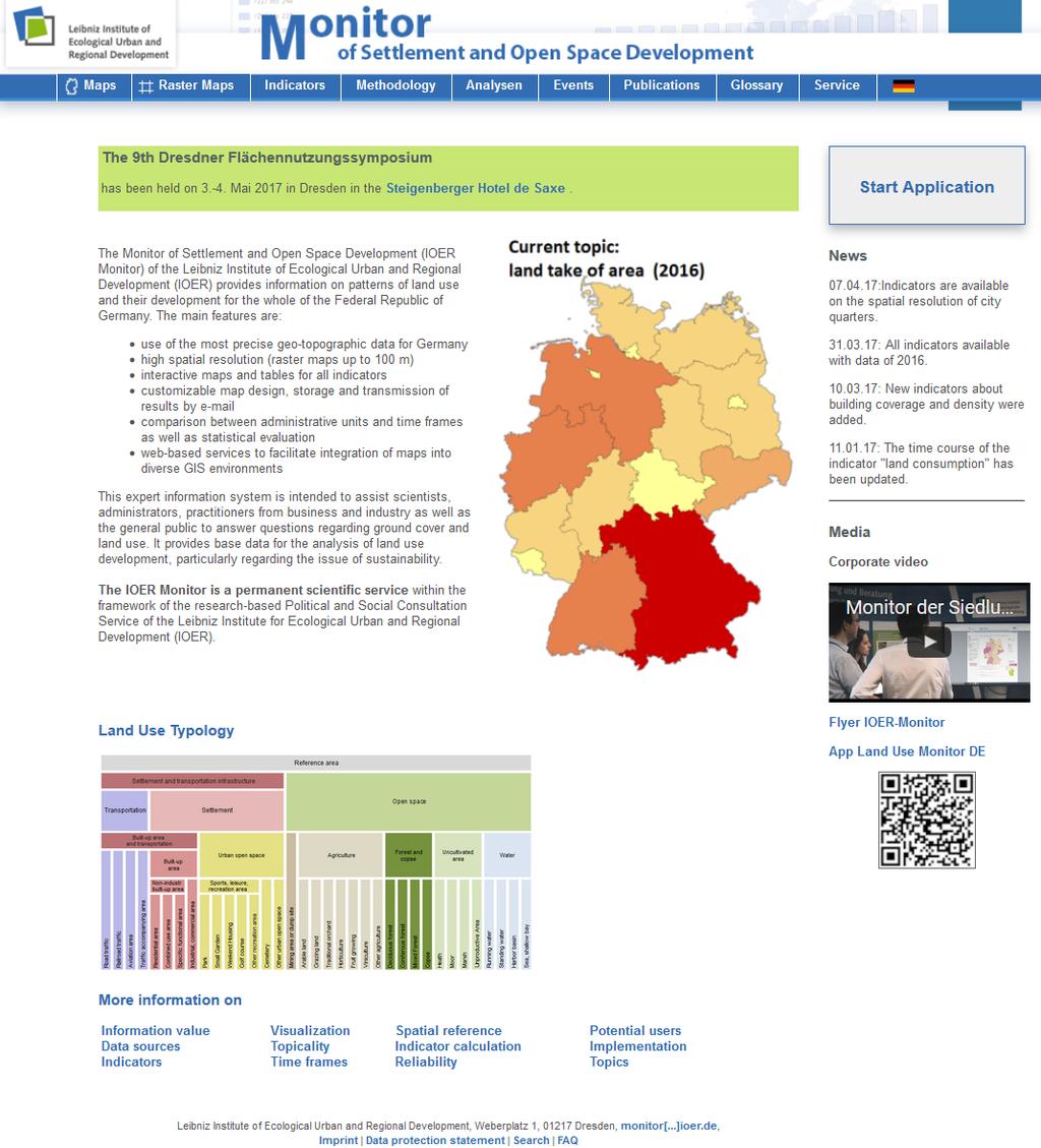
7 Goal Characterization of Monitor of Settlement and Open Space Development (IOER-Monitor) Goal: Description of sustainability of development Focus land use und land cover Quantitatively and indicator based Coverage whole area of Germany High spatial resolution Visualization in Internet Spatial and temporal comparison of development on all administration units
8 Geo-Processing Input Data for IOER-Monitor Land use from Geotopographic Product Authorative Topographic-Cartographic Information System (ATKIS ) Topographic geo objects in scale 1: Block based land use information Traffic infrastructure (by lines) Boundaries of administration units Buildings from Authoritative Real Estate Cadastre Information System (ALKIS ) Thematic geo data sets: protected area (BfN), flooding areas (BfG), soil sealing raster (EEA) Statistical data sets (inhabitants, buildings, flats, GDP)

9 Geo-Processing Data Input: Geotopographic (ATKIS) Scale 1: classes Update cycle: 3-5 years, traffic lines <3 months


10 Geo-Processing Monitor of Settlement and Open Space Development Ecosystem services States Risk Buildings Regions Landscape Quality Districts Traffic structure Land use protection Open space structure Municipalities Cities successive processing of history forcastin Settlement structure Quarter Raster map up to 100 m 2000, 2006, 2008, since 2009 each year Indicator Topics Spatial Units Temporal Resolution
 LU classes sum up to 100 % reference area Full redundancy-free land use")
11 Geo-Processing Land use Scheme of IOER-Monitor Hierarchical concept Non-overlapping of LU classes (priority settlement classes) LU classes sum up to 100 % reference area Full redundancy-free land use classification
 Land")
 Thematic Geo Data sets Protected Area")
 Inhabitants ZENSUS-Raster")


 WMS-Services")

12 Geo-Processing Indicator Processing IOER-Monitor Input Data Geo base data sets Land use (ATKIS) Land cover (LBM-DE) Building (LoD1) Terrain (DGM10) Adm. borders (VG25) Thematic Geo Data sets Protected Area (BfN) Flooding areas (BfG) Soil Sealing (EEA) Statistic data (Destatis) Inhabitants ZENSUS-Raster Inhabitants GDP Data preparation Completeness of attribute Topicality analysis Projection align Import in geo data base Processing GIS-Script computation Indicator specific Geo data handling Intersection by administration Units Calculation statistics Publication www (maps, tables, graphs) WMS-Services Indicator calculation Calculation Data base import Plausibility check Results Data sets Vector data Raster data Tables Data Process Output
13


14 Geo-Processing Interactive maps Interactive tables Monitor Functions Indicator Development High resolution raster maps Administration profiles Statistical Reports/Histograms
15 Results Prozent Prozent Prozent Prozent Development of Land Use Settlement ,3 +0, Traffic areas Agriculture areas ,0 Wood ,
![Results Building ground area in built-up area [%] (2010) State Building ground area in built-up area [%] Berlin 23,2 Baden-Württemberg 22,8 Hessen 22,8 Hamburg 22,3 Bremen 21,5](/docs-images/80/81224638/images/16-1.jpg "Rheinland-Pfalz 21,2 Nordrhein-Westfalen 21,1 Bayern 20,8 Saarland 20,6 Sachsen-Anhalt 18,9 Niedersachsen 18,4 Thüringen 18,3 Sachsen 17,7 Schleswig-Holstein 16,7 Brandenburg 14,8")
16 Results Building ground area in built-up area [%] (2010) State Building ground area in built-up area [%] Berlin 23,2 Baden-Württemberg 22,8 Hessen 22,8 Hamburg 22,3 Bremen 21,5 Rheinland-Pfalz 21,2 Nordrhein-Westfalen 21,1 Bayern 20,8 Saarland 20,6 Sachsen-Anhalt 18,9 Niedersachsen 18,4 Thüringen 18,3 Sachsen 17,7 Schleswig-Holstein 16,7 Brandenburg 14,8 Mecklenburg-Vorpommern 13,3
17 Building ground area per Inhabitant Minimum: 26,85 m²/ew (B) Maximum: 97,25 m²/ew (BB) Minimum: 26,85 m²/ew (Berlin) Maximum: 163,36 m²/ew (Salzwedel) Mean: 77,5 m²/ew


18 Results Prozent Soil Sealing in Germany Base: Classified Satellite Data (Source: EEA) State Soil Sealing [%] Berlin 35,6 Hamburg 32,1 Bremen 30,9 Indicator calculation for all administrative Regions Nordrhein-Westfalen 9,8 Saarland 7,8 Sachsen 6,0 Baden-Württemberg 5,7 Hessen 5,5 Rheinland-Pfalz 4,6 Schleswig-Holstein 4,5 Niedersachsen 4,4 Bayern 4,2 Sachsen-Anhalt 3,8 Thüringen 3,7 Brandenburg 3,1 Mecklenburg-Vorpommern 2, City Soil Sealing [%] 1. Herne 45,6 2. München 45, Düsseldorf 35,9 11. Berlin 35, Leipzig 29,3 28. Dresden 28, Trier 15, Baden-Baden 6, Development of Soil Sealing, Germany


19 Results Prozent Example Flooding Risk Built-up area in flooding region (percent of whole flooding area) Sachsen NRW Deutschland 2015 Built-up area development in flooding areas
20 Conclusion and Outlook World wide land use take-up needs a accurate monitoring Topographic geo data sets in Germany are the best source for settlement monitoring Better understanding of complex LU-processes by combined processing of topographic, cadaster, remote sensing, environmental and statistic data sets Earlier land use development can calculate on base of old topographic maps Longtime Monitoring is one key for reach sustainable goals and a better assessment of planning instruments


21 Thank you for your attention! Invitation to International Land Use Symposium (ILUS) November in Dresden Call for papers:
High Resolution Land Use Information by combined Analysis of Digital Landscape Models and Statistical Data Sets. Tobias Krüger Gotthard Meinel
 High Resolution Land Use Information by combined Analysis of Digital Landscape Models and Statistical Data Sets Tobias Krüger Gotthard Meinel Agenda Monitoring approach Input Data Data Processing Output
Clusters in chemical regions: provision of infrastructure open for innovation: Chemistry Cluster in North Rhine- Westphalia
 Clusters in chemical regions: provision of infrastructure open for innovation: Chemistry Cluster in North Rhine- Westphalia Cluster Manager Prof. Michael Droescher, 2009-10-12 Goals and objections of NRW
Applied spatial data for sustainable development strategy in Germany
 Applied spatial data for sustainable development strategy in Germany Stephan Arnold Areal Statistics, Federal Statistical Office, Germany Federal Statistical Office Headquarter: Wiesbaden Branch Office:
Quasigeoid of the Federal Republic of Germany GCG2016
 The height reference surface of the Working Committee of the Surveying Authorities of the States of the Federal Republic of Germany (German Combined QuasiGeoid 2016) Status of documentation: 18.09.2017
Sustainable and Harmonised Development for Smart Cities The Role of Geospatial Reference Data. Peter Creuzer
 Sustainable and Harmonised Development for Smart Cities The Role of Geospatial Reference Data Peter Creuzer 1. Introduction - Smart Cities and Geodata 2. Geodata in Germany 3. Examples 4. Data and Service
ISO Series Standards in a Model Driven Architecture for Landmanagement. Jürgen Ebbinghaus, AED-SICAD
 ISO 19100 Series Standards in a Model Driven Architecture for Landmanagement Jürgen Ebbinghaus, AED-SICAD 29.10.2003 The Company 100% SIEMENS PTD SIEMENS Business Services Shareholder & Strategic Business
GEOMATICS. Shaping our world. A company of
 GEOMATICS Shaping our world A company of OUR EXPERTISE Geomatics Geomatics plays a mayor role in hydropower, land and water resources, urban development, transport & mobility, renewable energy, and infrastructure
Innovation in Land Management: Integrated Solutions For National Cadastre Projects
 Success With GIS Innovation in Land Management: Integrated Solutions For National Cadastre Projects XXIII International FIG Congress Munich These documents are only complete, when used in connection with
Estimation of the area of sealed soil using GIS technology and remote sensing
 From the SelectedWorks of Przemysław Kupidura 2010 Estimation of the area of sealed soil using GIS technology and remote sensing Stanisław Białousz Przemysław Kupidura Available at: https://works.bepress.com/przemyslaw_kupidura/14/
Significant increases in model data volumes and other challenges for a meteorological visualisation platform
 Significant increases in model data volumes and other challenges for a meteorological visualisation platform Visualisation in Meteorology Week 1st Oct 2015, Marcus Werner, DWD Overview NinJo at DWD Operational
The Governance of Land Use
 The planning system Levels of government and their responsibilities The Governance of Land Use Country fact sheet Germany Germany is a federal country with four levels of government. Below the national
SDI Implementation at the Local
 SDI Implementation at the Local Administration Level of Germany Hartmut Müller and Stephan von St. Vith FIG Working Week 2009 Surveyors Key Role in Accelerated Development, Eilat, Israel, 3-8 May 2009
Potential and Accuracy of Digital Landscape Analysis based on high resolution remote sensing data
 'Spatial Information for Sustainable Management of Urban Areas' Mainz, 2-4 February 2009, Germany Potential and Accuracy of Digital Landscape Analysis based on high resolution remote sensing data Dr. Matthias
Shalaby, A. & Gad, A.
 Urban Sprawl Impact Assessment on the Fertile Agricultural Land of Egypt Using Remote Sensing and Digital Soil Database, Case study: Qalubiya Governorate Shalaby, A. & Gad, A. National Authority for Remote
E-Government and SDI in Bavaria, Germany
 135 E-Government and SDI in Bavaria, Germany Wolfgang STOESSEL, Germany Key words: GDI-BY, Bavaria, Spatial Data Infrastructure SUMMARY Spatial Data Infrastructure (SDI) is an important part of the e-government
Geoservices in Hamburg
 Geoservices in Hamburg Dr.-Ing. Winfried Hawerk Freie und Hansestadt Hamburg Landesbetrieb Geoinformation und Vermessung FIG Commission 7 Symposium Celje 16 May 2006 Hamburg and the Metropolitan Area Hamburg
Land Accounts - The Canadian Experience
 Land Accounts - The Canadian Experience Development of a Geospatial database to measure the effect of human activity on the environment Who is doing Land Accounts Statistics Canada (national) Component
RADAR BACKSCATTER AND COHERENCE INFORMATION SUPPORTING HIGH QUALITY URBAN MAPPING
 RADAR BACKSCATTER AND COHERENCE INFORMATION SUPPORTING HIGH QUALITY URBAN MAPPING Peter Fischer (1), Zbigniew Perski ( 2), Stefan Wannemacher (1) (1)University of Applied Sciences Trier, Informatics Department,
Landuse/Landcover Change Detection in Umshing- Mawkynroh of East Khasi Hills District, Meghalaya Using Spatial Information Technology
 International Journal of Scientific and Research Publications, Volume 6, Issue 1, January 2016 197 Landuse/Landcover Change Detection in Umshing- Mawkynroh of East Khasi Hills District, Meghalaya Using
Copernicus Land HRL Imperviousness: 2012 dataset, indicator Title
 Copernicus Land HRL Imperviousness: 2012 dataset, 06-09 indicator and outlook Title 2015+ Tobias LANGANKE First name SURNAME Project manager, Copernicus Position land services Name European of the Environment
Assessment of Sustainable Land Use within the Town Planning Process Experiences with a Multi Criteria Approach (MCA)
") Assessment of Sustainable Land Use within the Town Planning Process Experiences with a Multi Criteria Approach (MCA) Dipl.-Geogr. Sophie Schetke Dipl.-Ing. Benedikt Frielinghaus, University of Bonn, Germany
Assessment of Sustainable Land Use within the Town Planning Process Experiences with a Multi Criteria Approach (MCA) Dipl.-Geogr. Sophie Schetke Dipl.-Ing. Benedikt Frielinghaus, University of Bonn, Germany
The UN-GGIM: Europe core data initiative to encourage Geographic information supporting Sustainable Development Goals Dominique Laurent, France
 INSPIRE conference Strasbourg 6 September 2017 The UN-GGIM: Europe core data initiative to encourage Geographic information supporting Sustainable Development Goals Dominique Laurent, France Introduction
European Topic Centre on Land Urban and Soil Systems. Green Infrastructure at EEA
 Green Infrastructure at EEA A SPATIAL APPROACH TO MAPPING GI Stefan Kleeschulte, ETC ULS GI and territorial cohesion 2011 first EEA report on Green Infrastructure Underlining the need to develop tools
Compact guides GISCO. Geographic information system of the Commission
 Compact guides GISCO Geographic information system of the Commission What is GISCO? GISCO, the Geographic Information System of the COmmission, is a permanent service of Eurostat that fulfils the requirements
CHAPTER 2 REMOTE SENSING IN URBAN SPRAWL ANALYSIS
 9 CHAPTER 2 REMOTE SENSING IN URBAN SPRAWL ANALYSIS 2.1. REMOTE SENSING Remote sensing is the science of acquiring information about the Earth's surface without actually being in contact with it. This
Modelling of the Interaction Between Urban Sprawl and Agricultural Landscape Around Denizli City, Turkey
 Modelling of the Interaction Between Urban Sprawl and Agricultural Landscape Around Denizli City, Turkey Serhat Cengiz, Sevgi Gormus, Şermin Tagil srhtcengiz@gmail.com sevgigormus@gmail.com stagil@balikesir.edu.tr
GEO-Government in Baden-Wuerttemberg Strategy on INSPIRE-Coordinates, Nodes and Standards
 INSPIRE Conference 2017: Thinking out of the box GEO-Government in Baden-Wuerttemberg Strategy on INSPIRE-Coordinates, Nodes and Standards Dipl. Ing. Dieter Heß Ministry of Rural Affairs and Consumer Protection
Spatial Information Management in the Context of Organizational Development the Approach in North-Rhine Westphalia, Germany
 Spatial Information Management in the Context of Organizational Development the Approach in North-Rhine Westphalia, Germany Dr. Jens Riecken DVW Vice President c/o Ministry of the Interior North-Rhine
GIS Solutions in Natural Resource Management: Balancing the Technical- Political Equation
 GIS Solutions in Natural Resource Management: Balancing the Technical- Political Equation Stan Morain, Editor SUB Gdttlngen 7 208 520 309 98 A14447 0NW0RD PRESS V? % \
Land Administration and Cadastre
 Geomatics play a major role in hydropower, land and water resources and other infrastructure projects. Lahmeyer International s (LI) worldwide projects require a wide range of approaches to the integration
Country Report of Spain *
 Committee of Experts on Global Geospatial Information Management Second Session New York, United Nations (UN), 13 15 de August de 2012 Country Report of Spain * * Submitted by: Mr. Antonio Arozarena, Deputy
Spanish national plan for land observation: new collaborative production system in Europe
 ADVANCE UNEDITED VERSION UNITED NATIONS E/CONF.103/5/Add.1 Economic and Social Affairs 9 July 2013 Tenth United Nations Regional Cartographic Conference for the Americas New York, 19-23, August 2013 Item
Local Spatial Data Infrastructure, a Solid Base for Sustainable Land Management in Germany
 Local Spatial Data Infrastructure, a Solid Base for Sustainable Land Management in Germany FIG Commission 3 Workshop and Commission 3 Annual Meeting The Empowerment of Local Authorities: Spatial Information
DEPARTMENT OF GEOGRAPHY B.A. PROGRAMME COURSE DESCRIPTION
 DEPARTMENT OF GEOGRAPHY B.A. PROGRAMME COURSE DESCRIPTION (3 Cr. Hrs) (2340100) Geography of Jordan (University Requirement) This Course pursues the following objectives: - The study the physical geographical
Who are we? Use of German State s Rhineland-Palatinate Spatial Data Infrastructure for e-government INSPIRE. Topics of Presentation INSPIRE
 Who are we? University of Applied Sciences, Mainz, Germany Institute for Spatial Information and Surveying Technology Use of German State s Rhineland-Palatinate Spatial Data Infrastructure for e-government
Analysis of European Topographic Maps for Monitoring Settlement Development
 Analysis of European Topographic Maps for Monitoring Settlement Development Ulrike Schinke*, Hendrik Herold*, Gotthard Meinel*, Nikolas Prechtel** * Leibniz Institute of Ecological Urban and Regional Development,
Regional Plan 4: Integrating Ecosystem Services Mapping into Regional Land Use Planning
 Rural-Urban Outlooks: Unlocking Synergies (ROBUST) ROBUST receives funding from the European Union s Horizon 2020 research and innovation programme under grant agreement No 727988.* October 2018 Natural
Megacity Research Project TP. Ho Chi Minh Adaptation to Global Climate Change in Vietnam: Integrative Urban and Environmental Planning Framework
 1. Organization 2. Global Warming 3. Starting Phase 4. Results, Transdisciplinarity, Low-Rise High Density 5. Risk of Flooding 6. Partners 7. Action Field 1 8. Action Field 2 9. Urban Development Trends
Investigation of the Effect of Transportation Network on Urban Growth by Using Satellite Images and Geographic Information Systems
 Presented at the FIG Congress 2018, May 6-11, 2018 in Istanbul, Turkey Investigation of the Effect of Transportation Network on Urban Growth by Using Satellite Images and Geographic Information Systems
THE OVERALL EAGLE CONCEPT
 Sentinel Hub THE OVERALL EAGLE CONCEPT GEBHARD BANKO, 30. MAY 2018, COPENHAGEN ISO TC 211, STANDARDS IN ACTION SEMINAR CONTENT Background and Motivation Criteria and Structure of Data Model Semantic decomposition
NEDS. Nachhaltige Entwicklung zwischen Durchsatz und Symbolik Sustainable Development between Throuput and Symbolism
 SERI Brownbag seminar 27.01.2004, Vienna NEDS Nachhaltige Entwicklung zwischen Durchsatz und Symbolik Sustainable Development between Throuput and Symbolism Mark Hammer SERI www.seri.at/neds www.neds-projekt.de
Land Monitoring Core Service Implementation Group (LMCS IG) - Results and Outlook
 - Results and Outlook") Land Monitoring Core Service Implementation Group (LMCS IG) - Results and Outlook Pr. Dietmar Grünreich, President of BKG, Germany Chairman of the GMES LMCS IG Outline 1 Introduction 2 Preparatory Projects
Land Monitoring Core Service Implementation Group (LMCS IG) - Results and Outlook Pr. Dietmar Grünreich, President of BKG, Germany Chairman of the GMES LMCS IG Outline 1 Introduction 2 Preparatory Projects
INSPIRE - A Legal framework for environmental and land administration data in Europe
 INSPIRE - A Legal framework for environmental and land administration data in Europe Dr. Markus Seifert Bavarian Administration for Surveying and Cadastre Head of the SDI Office Bavaria Delegate of Germany
Applying Hazard Maps to Urban Planning
 Applying Hazard Maps to Urban Planning September 10th, 2014 SAKAI Yuko Disaster Management Expert JICA Study Team for the Metro Cebu Roadmap Study on the Sustainable Urban Development 1 Contents 1. Outline
Copernicus for Statistics
 Copernicus for Statistics Stephan Arnold Areal statistics, Federal Statistical Office Thomas Wiatr Remote sensing, Federal Agency for Cartography and Geodesy Content Requirements and Setting Eurostat s
EO Information Services. Assessing Vulnerability in the metropolitan area of Rio de Janeiro (Floods & Landslides) Project
 Project") EO Information Services in support of Assessing Vulnerability in the metropolitan area of Rio de Janeiro (Floods & Landslides) Project Ricardo Armas, Critical Software SA Haris Kontoes, ISARS NOA World
EO Information Services in support of Assessing Vulnerability in the metropolitan area of Rio de Janeiro (Floods & Landslides) Project Ricardo Armas, Critical Software SA Haris Kontoes, ISARS NOA World
Geospatial workflows and potential applications to the Sustainable Development Goals of countries in West Asia
 Geospatial workflows and potential applications to the Sustainable Development Goals of countries in West Asia Ameer Abdulla, PhD Senior Advisor, European Topic Center for Spatial Analysis, Spain Associate
Land Accounts in Canada
 Land Accounts in Canada 22 nd meeting of the London Group September 29 th, 2016 Statistics Norway, Oslo Gabriel Gagnon Statistics Canada Land accounts in Canada OVERVIEW Context Strategic direction Latest
Spatial information in strategic city planning - Zagreb experience. Darko Šiško City office for strategic planning, Zagreb
 Spatial information in strategic city planning - Zagreb experience Darko Šiško City office for strategic planning, Zagreb Overview Strategic city planning GI tools and trends Spatial data for strategic
AdV. National Report. Official German Surveying and Mapping
 Working Committee of the Surveying Authorities of the States of the Federal Republic of Germany (AdV) AdV Official German Surveying and Mapping National Report 2005/2006 President: Prof. Dr-Ing. Klaus
The EAGLE Concept - Paving the way for a new European Land Monitoring System
 The EAGLE Concept - Paving the way for a new European Land Monitoring System Stephan Arnold, Barbara Kosztra, Gebhard Banko, Geoff Smith, Christoph Perger, Michael Bock, Geir-Harald Strand, Cesar Martinez,
CityGML & opendrive Urban Simulation Based on Open Standards
 CREATE MAINTAIN DISTRIBUTE 3D Mapping Solutions CityGML & opendrive Urban Simulation Based on Open Standards Dr.-Ing. Stefan Trometer virtualcitysystems GmbH virtualcitysystems Experts for 3D City Models
TYPOLOGIES OF THE BUILT ENVIRONMENT - AN APPROACH FOR INVENTORY, BENCHMARKING AND MONITORING TOWARDS SUSTAINABILITY
 TYPOLOGIES OF THE BUILT ENVIRONMENT - AN APPROACH FOR INVENTORY, BENCHMARKING AND MONITORING TOWARDS SUSTAINABILITY Andreas BLUM 1 Karin GRUHLER 2 Keywords: built environment, city, building, typology,
Overview of Remote Sensing in Natural Resources Mapping
 Overview of Remote Sensing in Natural Resources Mapping What is remote sensing? Why remote sensing? Examples of remote sensing in natural resources mapping Class goals What is Remote Sensing A remote sensing
Land Use and Land Cover Mapping and Change Detection in Jind District of Haryana Using Multi-Temporal Satellite Data
 Land Use and Land Cover Mapping and Change Detection in Jind District of Haryana Using Multi-Temporal Satellite Data Ravindra Prawasi, M.P. Sharma, T. P. Babu, Om Pal, Saroj, Kirti Yadav, R.S.Hooda Abstract
GERMANY CITIES IN EUROPE AND CENTRAL ASIA METHODOLOGY. Public Disclosure Authorized. Public Disclosure Authorized. Public Disclosure Authorized
 Public Disclosure Authorized Public Disclosure Authorized Public Disclosure Authorized Public Disclosure Authorized CITIES IN EUROPE AND CENTRAL ASIA GERMANY METHODOLOGY This country snapshot was produced
The German GDI a public-private cooperation project. Heinz BRÜGGEMANN Surveying and Mapping Agency NRW, Germany
 The German GDI a public-private cooperation project Heinz BRÜGGEMANN Surveying and Mapping Agency NRW, Germany Definition of Grimm Public tasks are all action lines..., which are handled by public actors,
RESULTS OF DEVELOPMENT AND APPLICATION GEOGRAPHIC INFORMATION STANDARDS IN VIETNAM. Dr. Tran Bach Giang Vietnam
 RESULTS OF DEVELOPMENT AND APPLICATION GEOGRAPHIC INFORMATION STANDARDS IN VIETNAM Dr. Tran Bach Giang Vietnam Shibu lijack Contents 1. BACKGROUND 2. BASIC GEOGRAPHIC INFORMATION STANDARDS (BGIS) Background
Urban Spatial Scenario Design Modelling (USSDM) in Dar es Salaam: Background Information
 in Dar es Salaam: Background Information") Urban Spatial Scenario Design Modelling (USSDM) in Dar es Salaam: Background Information Modelling urban settlement dynamics in Dar es Salaam Revision: 2 (July 2013) Prepared by: Katja Buchta TUM team
Urban Spatial Scenario Design Modelling (USSDM) in Dar es Salaam: Background Information Modelling urban settlement dynamics in Dar es Salaam Revision: 2 (July 2013) Prepared by: Katja Buchta TUM team
Norwegian spatial data infrastructure supporting disaster risk management Norwegian Mapping Authority
 Norwegian spatial data infrastructure supporting disaster risk management Norwegian Mapping Authority Arvid Lillethun, Norwegian Mapping Authority Land and Poverty 2018 Conference, World Bank 19.-23. March
Plenary Session 2, part 2 A European shared information system
 3 rd GMES Forum 5 6 June 2003 Athens Plenary Session 2, part 2 A European shared information system Gordon McInnes Deputy Director European Environment Agency 1 I keep six honest serving men. They taught
Fig. 1: Test area the Municipality of Mali Idjos, Cadastral Municipality Feketic
 Remote Sensing Application for Agricultural Land Value Classification Integrated in the Land Consolidation Survey Stojanka Brankovic, Ljiljana Parezanovic Republic Geodetic Authority, Belgrade, Serbia
USING GIS CARTOGRAPHIC MODELING TO ANALYSIS SPATIAL DISTRIBUTION OF LANDSLIDE SENSITIVE AREAS IN YANGMINGSHAN NATIONAL PARK, TAIWAN
 CO-145 USING GIS CARTOGRAPHIC MODELING TO ANALYSIS SPATIAL DISTRIBUTION OF LANDSLIDE SENSITIVE AREAS IN YANGMINGSHAN NATIONAL PARK, TAIWAN DING Y.C. Chinese Culture University., TAIPEI, TAIWAN, PROVINCE
ABSTRACT The first chapter Chapter two Chapter three Chapter four
 ABSTRACT The researches regarding this doctoral dissertation have been focused on the use of modern techniques and technologies of topography for the inventory and record keeping of land reclamation. The
Advanced Image Analysis in Disaster Response
 Advanced Image Analysis in Disaster Response Creating Geographic Knowledge Thomas Harris ITT The information contained in this document pertains to software products and services that are subject to the
Work Group A «Core Data» Report and Update François Chirié, Dominique Laurent, France
 JOINT UN-GGIM: EUROPE ESS MEETING ON THE INTEGRATION OF STATISTICAL AND GEOSPATIAL INFORMATION LUXEMBOURG 11 MARCH 2016 Work Group A «Core Data» Report and Update François Chirié, Dominique Laurent, France
The Added Value of Geospatial Data in a Statistical Office. Pedro Diaz Munoz Director Sectoral and Regional Statistics EUROSTAT European Commission
 The Added Value of Geospatial Data in a Statistical Office Pedro Diaz Munoz Director Sectoral and Regional Statistics EUROSTAT European Commission Why integrate Responsibility of all the information we
C N E S, U M R I R I S A
 M O N I T O R I N G U R B A N A R E A S W I T H S E N T I N E L - 2. APPLICATION TO THE UPDATE OF THE COPERNICUS HIGH RESOLUTION LAYER IMPERVIOUSNESS DEGREE O c t o b e r 2 5 th 2016, Brussels A n t o
March 2007 The Survey Department of Sri Lanka
 Contribution of Survey Department of Sri Lanka for Mitigation of Disasters in Sri Lanka K.A.U.N.Kasthuri Deputy Surveyor General (Information Technology) March 2007 The Survey Department of Sri Lanka 1
Geoinformation Science at TU Berlin
 Technische Universität Berlin Department of Geoinformation Science Geoinformation Science at TU Berlin Prof. Dr. Thomas H. Kolbe Institute for Geodesy and Geoinformation Science Berlin University of Technology
AdV Project: Map Production of the DTK50
 Geoinformation und Landentwicklung AdV Project: Map Production of the DTK50 Sabine Urbanke, LGL Baden-Württemberg Landesamt für Geoinformation und Landentwicklung Baden-Württemberg (LGL) (State Authority
Increasing GI awareness in local authorities in Poland experiences from the INSPIRE Academy training programme
 Increasing GI awareness in local authorities in Poland experiences from the INSPIRE Academy training programme http://www.akademiainspire.pl Maria Andrzejewska, Monika Rusztecka UNEP/GRID-Warsaw Centre,
GIScience - Activities. Geomatics Department. Humboldt University Berlin. Tobia Lakes Patrick Hostert
 Institute of Geography GIScience - Activities Geomatics Department Humboldt University Berlin Tobia Lakes Patrick Hostert GIScience Meeting, 2nd February 2007 Content Geomatics Department at the Humboldt
National Geographic Institute (IGN)
") (IGN) National Centre of Geographic Information (CNIG) Tenth United Nations Regional Cartographic Conference of the Americas New York, 19-23 August 2013 Spanish National Land Observation Program (PNOT)
(IGN) National Centre of Geographic Information (CNIG) Tenth United Nations Regional Cartographic Conference of the Americas New York, 19-23 August 2013 Spanish National Land Observation Program (PNOT)
THE SPATIAL DATA WAREHOUSE OF SEOUL
 THE SPATIAL DATA WAREHOUSE OF SEOUL Jae-Ho Han The Seoul Metropolitan Government Seoul City Hall, Taepyeongno 1(il)-ga, Jung-gu, Seoul 100-744, Korea djhjha@hanmail.net Impyeong Lee Dept. of Geoinformatics,
Land Use in the context of sustainable, smart and inclusive growth
 Land Use in the context of sustainable, smart and inclusive growth François Salgé Ministry of sustainable development France facilitator EUROGI vice president AFIGéO board member 1 Introduction e-content+
I&CLC2000 in support to new policy initiatives (INSPIRE, GMES,..)
") I&CLC2000 in support to new policy initiatives (INSPIRE, GMES,..) Manfred Grasserbauer, Director Joint Research Centre Institute for Environment and Sustainability 1 IMAGE 2000 European mosaic of satellite
I&CLC2000 in support to new policy initiatives (INSPIRE, GMES,..) Manfred Grasserbauer, Director Joint Research Centre Institute for Environment and Sustainability 1 IMAGE 2000 European mosaic of satellite
WP4: COASTAL PROCESSES
 WP4: COASTAL PROCESSES Coordinator: G. EBERHARDS Faculty of Geography and Earth Sciences, University of Latvia Daugavpils, 2008 Goal: The objective of this study is analysis of coastal changes and forecast
Statistical-geospatial integration - The example of Sweden. Marie Haldorson Director, Statistics Sweden
 Statistical-geospatial integration - The example of Sweden Marie Haldorson Director, Statistics Sweden Spatial data and geospatial applications at Statistics Sweden Long tradition GI integrated in production
ENV208/ENV508 Applied GIS. Week 1: What is GIS?
 ENV208/ENV508 Applied GIS Week 1: What is GIS? 1 WHAT IS GIS? A GIS integrates hardware, software, and data for capturing, managing, analyzing, and displaying all forms of geographically referenced information.
Urban Scaling and Its Relation with Governance Structures and Future Prospects of Cities draft version
 Urban Scaling and Its Relation with Governance Structures and Future Prospects of Cities draft version 20180312 Ton van Raan Centre for Science and Technology Studies Leiden University Kolffpad 1 P.O.
Study Visit University of Applied Sciences Utrecht Netherlands
 Study Visit University of Applied Sciences Utrecht Netherlands Directorate-General for Territorial Development Lisbon 1 April 2014 1 Agenda Presentation Cadastre Department Surveying / Geodesy Department
2.- Area of built-up land
 2.- Area of built-up land Key message Over recent decades, built-up areas have been steadily increasing all over Europe. In Western European countries, built-up areas have been increasing faster than the
Spatial Data Infrastructures in Germany: State of play 2010
 Spatial Data Infrastructures in : State of play 2010 SPATIAL APPLICATIONS DIVISION K.U.LEUVEN RESEARCH & DEVELOPMENT Celestijnenlaan 200 E, BE-3001 LEUVEN TEL.: 32 16 32 97 32 FAX: 32 16 32 97 24 URL:
Utilization of Global Map for Societal Benefit Areas
 Utilization of Global Map for Societal Benefit Areas The Fourth GEOSS AP Symposium Bali Indonesia, 11th March 2010 Shuhei Kojima Geographical Survey Institute Ministry of Land, Infrastructure, Transport
CHAPTER 4 HIGH LEVEL SPATIAL DEVELOPMENT FRAMEWORK (SDF) Page 95
 Page 95") CHAPTER 4 HIGH LEVEL SPATIAL DEVELOPMENT FRAMEWORK (SDF) Page 95 CHAPTER 4 HIGH LEVEL SPATIAL DEVELOPMENT FRAMEWORK 4.1 INTRODUCTION This chapter provides a high level overview of George Municipality s
CHAPTER 4 HIGH LEVEL SPATIAL DEVELOPMENT FRAMEWORK (SDF) Page 95 CHAPTER 4 HIGH LEVEL SPATIAL DEVELOPMENT FRAMEWORK 4.1 INTRODUCTION This chapter provides a high level overview of George Municipality s
Combining Geospatial and Statistical Data for Analysis & Dissemination
 Combining Geospatial and Statistical Data for Analysis & Dissemination (with Special Reference to Qatar Census 2010) Presentation by Mansoor Al Malki, Director of IT Department Qatar Statistics Authority
Snow Service Central Europe Operational Earth Observation NOAA-AVHRR + ENVISAT ASAR Maps of
 PROVISION OF SNOW INFORMATION FROM SATELLITE DATA FOR CENTRAL EUROPE WITHIN THE GMES ACTIVITY POLARVIEW Heike Bach 1), Florian Appel 1), Wolfram Mauser 2) 1) VISTA Remote Sensing in Geosciences GmbH, Gabelsbergerstrasse
Introduction to GIS I
 Introduction to GIS Introduction How to answer geographical questions such as follows: What is the population of a particular city? What are the characteristics of the soils in a particular land parcel?
Land Use/Cover Changes & Modeling Urban Expansion of Nairobi City
 Land Use/Cover Changes & Modeling Urban Expansion of Nairobi City Overview Introduction Objectives Land use/cover changes Modeling with Cellular Automata Conclusions Introduction Urban land use/cover types
Swedish examples on , and
 Swedish examples on 11.2.1, 11.3.1 and 11.7.1 Marie Haldorson, Director Seminar in Nairobi 7 Dec 2018 SDG Indicator Tests by Countries in Europe GEOSTAT 3: ESS Project with a purpose to guide countries
Validation and verification of land cover data Selected challenges from European and national environmental land monitoring
 Validation and verification of land cover data Selected challenges from European and national environmental land monitoring Gergely Maucha head, Environmental Applications of Remote Sensing Institute of
Taxonomies of Building Objects towards Topographic and Thematic Geo-Ontologies
 Taxonomies of Building Objects towards Topographic and Thematic Geo-Ontologies Melih Basaraner Division of Cartography, Department of Geomatic Engineering, Yildiz Technical University (YTU), Istanbul Turkey
Urban Growth Analysis: Calculating Metrics to Quantify Urban Sprawl
 Urban Growth Analysis: Calculating Metrics to Quantify Urban Sprawl Jason Parent jason.parent@uconn.edu Academic Assistant GIS Analyst Daniel Civco Professor of Geomatics Center for Land Use Education
Graduate Courses Meteorology / Atmospheric Science UNC Charlotte
 Graduate Courses Meteorology / Atmospheric Science UNC Charlotte In order to inform prospective M.S. Earth Science students as to what graduate-level courses are offered across the broad disciplines of
From individual perceptions and statistical data to instruments for land resource management
 From individual s and statistical data to instruments for land Land Ulrike Tappeiner, Innsbruck / Bolzano Status quo versus Stefan Marzelli, München Instruments Status quo versus The two sides of the same
Preparation of Database for Urban Development
 Preparation of Database for Urban Development By PunyaP OLI, 1. Chairman, ERMC (P) Ltd., Kathmandu, Nepal. Email: punyaoli@ermcnepal.com 2. Coordinator, Himalayan College of Geomatic Engineering and Land
VHR in Cartography, Urban & Land planning. Introduction : Jean-Philippe Cantou, IGN Espace
 VHR in Cartography, Urban & Land planning Introduction : Jean-Philippe Cantou, IGN Espace Pleiades days 17th January 2012 1/11 Framework of the WG3 National spatial data infrastructure (NSDI) geographic
The Combination of Geospatial Data with Statistical Data for SDG Indicators
 Session x: Sustainable Development Goals, SDG indicators The Combination of Geospatial Data with Statistical Data for SDG Indicators Pier-Giorgio Zaccheddu Fabio Volpe 5-8 December2018, Nairobi IAEG SDG
IAEG SDGs WG GI, , Mexico City
 IAEG SDGs WG GI, 12-14.12.2016, Mexico City UN-GGIM:Europe s perspective and activities to support better integration of geospatial information and statistics and the UN SDG monitoring Pier-Giorgio Zaccheddu,