INSPIRE Land Cover and Land Use workshop
|
|
|
- Lucas Moody
- 5 years ago
- Views:
Transcription
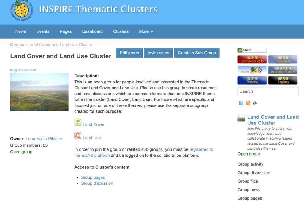
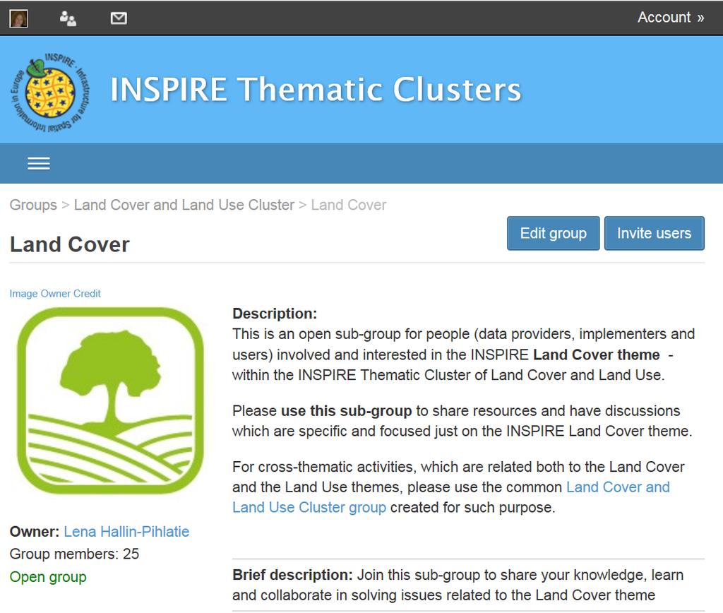
1 INSPIRE Land Cover and Land Use workshop Opening of the workshop Chair: Lena Hallin-Pihlatie, Facilitator of the Land Cover and Land Use Cluster Copernicus Land products on their way towards INSPIRE Christian Ansorge, European Environment Agency ELF Land Cover Vector products Teemu Saloriutta, National Land Survey of Finland INSPIRE Land Cover GML dataset: validation and use Stefania Morrone, Epsilon Italia INSPIRE Planned Land Use as a basis for revising SOSI Planned Land Use Morten Borrebaekk, Norwegian Mapping Authority Harmonising regional Land Use Plan data the Finnish approach Lena Hallin-Pihlatie, Finnish Environment Institute Wrap-up and promotion of other LC/LU presentations at the INSPIRE Conference


2 INSPIRE Thematic Cluster on Land Cover and Land Use Lena Hallin-Pihlatie Facilitator INSPIRE Conference 2016 Barcelona, 27 th September Serving society Stimulating innovation Supporting legislation


3 Thematic Cluster Platform - since 12/2014 Collaborative platform to support thematic communities INSPIRE Maintenance and Implementation Framework activity (MIWP14) Nine thematic clusters One sub-group per INSPIRE theme Nine facilitators
4 Group Statistics LC and LU cluster group level 125 Members 13 Discussion topics 21 Discussion replies 15 Uploaded files 8 Pages 8News LC sub-group LU sub-group 48 Members 39 Members 19 Discussion topics 8 Discussion topics 72 Discussion replies 13 Discussion replies 2 Uploaded files 1 Uploaded file 0 Pages 14 Pages 0 News 0 News
5
6 Content highlights: Discussion topics Discussion topics have helped in documenting and resolving software issues, for example in QGIS and HALE Examples of discussion topics How to understand the TG on LC regarding code lists and documentation of the nomenclature? How should Inspire data look like when being according to the LC/LU application schemas? How to name different layers in a WMS to meet the requirements of INSPIRE? How to build WFS using present tools, following the INSPIRE Guidelines? Based on Discussion topics a list of Proposals for change have been compiled
7 Content highlights: Recommended implementation examples Sample data Land Cover Vector GML example 1 (Best Practice), example 2 and example 3 Existing Land Use GML example Land Cover Vector ESRI database template populated with CLC data, ArcGIS for INSPIRE, example Matching tables Filled in Matching tables where Corine Land Cover and Urban Atlas data have been mapped to Land Cover Vector application schema Main sources: EAGLE INSPIRE and eenvplus projects
8 Content highlights: LCLU presentations Links to relevant INSPIRE Conference presentations (2013, 2014, 2015) 1. Cross-thematic Presentations 2. Presentations related to Land Cover 3. Presentations related to Land Use 4. Land Cover workshop held at INSPIRE/GWF 2015, Lisbon» Link to the presentations from session I» Links to the presentations from session II (EAGLE)

9 Content: practical hint Use tags and categories to find information to tag and categorise new contents Welcome to join the TC activity to raise and discuss issues of importance to you!
10 Questions?
11 LCLU presentations coming up Planned Land Use Standardization on Spatial Planning in Turkey: Plan GML by Fulya Baybas. Wednesday :00 10:20 (room H2) Improved land use planning in 3D by Tor Gunnar Overli Thursday :20 (room H1) A WFS profile for the national urban planning website (Geoportail de l urbanisme) by Marie Lambois Friday :15 11:35 (room J) The exchange platform for Flemish spatial zoning plans: the local government challenge by Peter Willems Friday :15 11:35 (room H1) Land Cover and Existing Land Use Open Land Use Map by Tomas Mildorff Wednesday :20 (room H1) Deriving Copernicus land cover and land use data from national datasets following bottom-up approach and INSPIRE data specifications: EAGLE geometric test case by Julian Delgado Hernandez Wednesday :30 14:50 (room J) Land Cover spatial datasets harmonization in Portugal using HALE by Ana Luisa Gomes Wednesday :00 16:20 (room H2) Development of Strategic Urban Land Use Analysis Model by Darko Sisko Thursday :00 16:20 (room A) Deriving INSPIRE compliant land-use maps from open public sector information by Henning Sten Hansen Thursday :15 16:35 (room A) The EAGLE Concept - Paving the way for a new European Land Monitoring System by Stephan Arnold Thursday :30 17:50 (room A) LCLU Cluster member meeting Discussion related to the Thematic Cluster activity, Thursday 10:30 11:00 coffee break, EC INSPIRE room
INSPIRE Thematic Cluster on Land Cover and Land Use & Feedback from implementers
 INSPIRE Thematic Cluster on Land Cover and Land Use & Feedback from implementers Lena Hallin-Pihlatie Facilitator of the LC and LU Thematic Cluster www.jrc.ec.europa.eu Serving society Stimulating innovation
INSPIRE Thematic Cluster on Elevation, Orthoimagery, Reference systems and Geographical grids
 INSPIRE Thematic Cluster on Elevation, Orthoimagery, Reference systems and Geographical grids Jordi Escriu - facilitator www.jrc.ec.europa.eu Serving society Stimulating innovation Supporting legislation
EAGLE Data Model and Outcomes of HELM (Harmonised European Land Monitoring)
") EAGLE Data Model and Outcomes of HELM (Harmonised European Land Monitoring) Contribution towards better land information harmonisation and INSPIRE compliance EAGLE working group Stephan Arnold, Barbara
EAGLE Data Model and Outcomes of HELM (Harmonised European Land Monitoring) Contribution towards better land information harmonisation and INSPIRE compliance EAGLE working group Stephan Arnold, Barbara
INSPIRE Land Cover and Land Use Data Specifications
 INSPIRE Land Cover and Land Use Data Specifications Lena Hallin-Pihlatie Facilitator of the Land Cover and Land Use INSPIRE Thematic Cluster www.jrc.ec.europa.eu Serving society Stimulating innovation
The EAGLE concept - first practical implementations. Title. Stephan Arnold. Position Gebhard Banko. Place, Copenhagen, date 20.
 The EAGLE concept - first practical implementations Title Stephan Arnold DeStatis First name SURNAME Position Gebhard Banko Environment Name of the entity Agency Austria Place, Copenhagen, date 20. October2015
THE OVERALL EAGLE CONCEPT
 Sentinel Hub THE OVERALL EAGLE CONCEPT GEBHARD BANKO, 30. MAY 2018, COPENHAGEN ISO TC 211, STANDARDS IN ACTION SEMINAR CONTENT Background and Motivation Criteria and Structure of Data Model Semantic decomposition
EAGLE concept, as part of the HELM vision
 EAGLE concept, as part of the HELM vision EAGLE working group Barbara Kosztra (Hungary), Stephan Arnold (Germany), Lena Hallin-Pihlatie & Elise Järvenpää (Finland) 16.06.2014 HELM / EAGLE Workshop - INSPIRE
ArcGIS for INSPIRE. Marten Hogeweg
 ArcGIS for INSPIRE Marten Hogeweg Please Take Our Survey on the App Download the Esri Events app and find your event Select the session you attended Scroll down to find the feedback section Complete answers
Pushing implementation of European coverage data and services forward
 Pushing implementation of European coverage data and services forward Jordi Escriu jordi.escriu@icgc.cat Head of Unit / IDEC - SDI of Catalonia Facilitator INSPIRE Thematic Cluster #3 Elevation, Orthoimagery,
INSPIRE a backbone in spatially enabling the digital maritime society in the Baltic Sea region
 Lise Schrøder (AAU), Lena Hallin Pihlatie (SYKE) & Manuel Frias Vega (Helcom) INSPIRE a backbone in spatially enabling the digital maritime society in the Baltic Sea region Agenda The Baltic LINes project
INSPIRE Thematic Cluster on Topographic and Cadastral Reference data
 INSPIRE Thematic Cluster on Topographic and Cadastral Reference data Anja Hopfstock - facilitator www.jrc.ec.europa.eu Serving society Stimulating innovation Supporting legislation Status of Thematic cluster
Update on INSPIRE; interoperable framework for natural hazards
 Update on INSPIRE; interoperable framework for natural hazards Robert Tomas EC-DG Joint Research Centre 16 th Meeting of Working Group F on Floods 2014, Rome www.jrc.ec.europa.eu Serving society Stimulating
EAGLE Data Model and Outcomes of HELM (Harmonised European Land Monitoring)
") EAGLE Data Model and Outcomes of HELM (Harmonised European Land Monitoring) Contribution towards better land information harmonisation and INSPIRE compliance EAGLE working group Stephan Arnold, Barbara
EAGLE Data Model and Outcomes of HELM (Harmonised European Land Monitoring) Contribution towards better land information harmonisation and INSPIRE compliance EAGLE working group Stephan Arnold, Barbara
The EAGLE Concept - Paving the way for a new European Land Monitoring System
 The EAGLE Concept - Paving the way for a new European Land Monitoring System Stephan Arnold, Barbara Kosztra, Gebhard Banko, Geoff Smith, Christoph Perger, Michael Bock, Geir-Harald Strand, Cesar Martinez,
INSPIRE implementation in Portugal: the operational approach
 INSPIRE implementation in Portugal: the operational approach REIS, Rui; SANTOS, Ana Sofia; FONSECA, Alexandra; SILVA, Henrique; GOMES, Ana Luisa; FURTADO, Danilo; GEIRINHAS, João rui.reis@igeo.pt AGENDA
Status of implementation of the INSPIRE Directive 2016 Country Fiches. COUNTRY FICHE Malta
 Status of implementation of the INSPIRE Directive 2016 Country Fiches COUNTRY FICHE Malta Introduction... 1 1. State of Play... 2 1.1 Coordination... 2 1.2 Functioning and coordination of the infrastructure...
National datasets transformation to INSPIRE specifications with FME
 http://www.ign.es Instituto Geográfico Nacional National datasets transformation to INSPIRE specifications with FME Land Cover, Land Use and Orthoimageries Julián Delgado Hernández INSPIRE Clusters Presentation
European Location Framework data in the ArcGIS platform
 European Location Framework data in the ArcGIS platform Presentation to: Author: Date: INSPIRE Conference 2016 Clemens Portele 26 September 2016 Why ELF? Global (e.g. UN GGIM) Regional Europe (INSPIRE
INSPIREd solutions for Air Quality problems Alexander Kotsev
 INSPIREd solutions for Air Quality problems Alexander Kotsev www.jrc.ec.europa.eu Serving society Stimulating innovation Supporting legislation The European data puzzle The European data puzzle 24 official
Status Finland Eero Hietanen NLS-FI SDI.Next: Linked Spatial Data in Europe 12th of March 2019
 Open European Location Services Title Speaker Event Date Status Finland Eero Hietanen NLS-FI SDI.Next: Linked Spatial Data in Europe 12th of March 2019 #OpenELS #OpenELS Content 1. National Geospatial
Sharing soil information with the help of INSPIRE, key challenges with soil data management
 Sharing soil information with the help of INSPIRE, key challenges with soil data management Katharina Feiden e-mail: gssoil@portalu.de GS Soil: project outline GS Soil: Assessment and strategic development
State-of-play... The EAGLE concept conceptual basis for a future European Land Monitoring Framework
 State-of-play... The EAGLE concept conceptual basis for a future European Land Monitoring Framework Stephan Arnold, Geir-H. Strand, Barbara Kosztra, Tomas Soukup, Gebhard Banko, Gerard Hazeu, Geoff Smith,
Land Monitoring Core Service Implementation Group (LMCS IG) - Results and Outlook
 - Results and Outlook") Land Monitoring Core Service Implementation Group (LMCS IG) - Results and Outlook Pr. Dietmar Grünreich, President of BKG, Germany Chairman of the GMES LMCS IG Outline 1 Introduction 2 Preparatory Projects
Land Monitoring Core Service Implementation Group (LMCS IG) - Results and Outlook Pr. Dietmar Grünreich, President of BKG, Germany Chairman of the GMES LMCS IG Outline 1 Introduction 2 Preparatory Projects
SITMUN: Cooperating to Build Local SDIs in the Barcelona Region
 SITMUN: Cooperating to Build Local SDIs in the Barcelona Region Diputació de Barcelona Territory and Sustainability Area Territorial Information Systems Department INSPIRE CONFERENCE Barcelona, September
Spatial Data Analysis with ArcGIS Desktop: From Basic to Advance
 Spatial Data Analysis with ArcGIS Desktop: From Basic to Advance 1. Course overview Modern environmental, energy as well as resource modeling and planning require huge amount of geographically located
INSPIRE Implementation in Estonia using ArcGIS
 INSPIRE Implementation in Estonia using ArcGIS Sulev Õitspuu Head of Bureau of Geoinfosystems Estonian Land Board 26.09.2016 Population: 1,3 million (69% Estonians) Area: 45,339 km 2 15 counties Estonia
Towards a harmonised land monitoring system: NRC bottom-up activities in EAGLE and HELM H
 B. Kosztra Towards a harmonised land monitoring system: NRC bottom-up activities in EAGLE and HELM H Gebhard Banko Environment Agency Austria Geoland 2 Forum 18.-19. October 2012 Copenhagen 1 1 NRC * opinion
Project EuroGeoNames (EGN) Results of the econtentplus-funded period *
 Results of the econtentplus-funded period *") UNITED NATIONS Working Paper GROUP OF EXPERTS ON No. 33 GEOGRAPHICAL NAMES Twenty-fifth session Nairobi, 5 12 May 2009 Item 10 of the provisional agenda Activities relating to the Working Group on Toponymic
UNITED NATIONS Working Paper GROUP OF EXPERTS ON No. 33 GEOGRAPHICAL NAMES Twenty-fifth session Nairobi, 5 12 May 2009 Item 10 of the provisional agenda Activities relating to the Working Group on Toponymic
NAG-City Expert Workshop Oslo 8-9. October 2012 SOSI standards and mapping for Europe (INSPIRE)
") NAG-City Expert Workshop Oslo 8-9. October 2012 SOSI standards and mapping for Europe (INSPIRE) Per Ryghaug, Geomatics The Norwegian national standard on geographic information - SOSI Started in 1984 NGU
NAG-City Expert Workshop Oslo 8-9. October 2012 SOSI standards and mapping for Europe (INSPIRE) Per Ryghaug, Geomatics The Norwegian national standard on geographic information - SOSI Started in 1984 NGU
econtentplus GS Soil
 econtentplus GS Soil General aims Assessment and strategic development of INSPIRE compliant Geodata-Services for European Soil Data BPN on basis of the EU 2007/2/EC (INSPIRE) Directive for Annex III theme
FINNISH LINKED DATA PILOTS
 FINNISH LINKED DATA PILOTS Kai Koistinen Data Linking by Indirect Reference Systems -workshop 5.9.2018 1 NLS FINLAND National Land Survey of Finland National mapping and cadastral agency Geodetic research
The EAGLE-Concept. A Data Model for Future Land Monitoring
 The EAGLE-Concept A Data Model for Future Land Monitoring Stephan Arnold, Barbara Kosztra, Geir-Harald Strand, Gebhard Banko, Lena Hallin-Pihlatie, Geoff Smith, Chris Perger, Julian Delgado EAGLE Group
A donor partner view. Olaf Magnus Østensen. 'Modernization of spatial data infrastructure to reduce risks and impacts of floods'
 A donor partner view Olaf Magnus Østensen 'Modernization of spatial data infrastructure to reduce risks and impacts of floods' About the EEA Grants programme http://eeagrants.org/ Beneficiary country Donor
Ready for INSPIRE.... connecting worlds. European SDI Service Center
 Ready for INSPIRE Consultancy SOFTWARE T r a i n i n g Solutions... connecting worlds European SDI Service Center Increasing Added Value with INSPIRE and SDI Components INSPIRE In 2007, the European Commission
Solving the European Data Puzzle Simplifying INSPIRE Challenges and Usage. con terra GmbH Dipl.-Ing. Mark Döring
 Solving the European Data Puzzle Simplifying INSPIRE Challenges and Usage con terra GmbH Dipl.-Ing. Mark Döring INSPIRE Reference Projects GeoBAK 2.0 Project // INSPIRE Data & Services The Project Evolution
Compact guides GISCO. Geographic information system of the Commission
 Compact guides GISCO Geographic information system of the Commission What is GISCO? GISCO, the Geographic Information System of the COmmission, is a permanent service of Eurostat that fulfils the requirements
Estonian approach to implementation of INSPIRE directive. Sulev Õitspuu Head of Bureau of Geoinfosystems Estonian Land Board
 Estonian approach to implementation of INSPIRE directive Sulev Õitspuu Head of Bureau of Geoinfosystems Estonian Land Board 13.06.2016 Contents - INSPIRE coordination in Estonia - INSPIRE implementation
EAGLE data model for land monitoring - Use cases and state of play
 EAGLE data model for land monitoring - Use cases and state of play Stephan Arnold, Barbara Kosztra, Gebhard Banko, Geoff Smith, Christoph Perger, Michael Bock, Geir-Harald Strand, Cesar Martinez, Julian
Implementing INSPIRE Geoportal in Turkey
 Implementing INSPIRE Geoportal in Turkey Gencay SERTER City and Regional Planner 1 Presentation Plan Introduction INSPIRE and Turkey Importance of al Spatial Planning Portal Logical&Legal Hierarchy GeoPortal
HARMO-DATA Project Cross border spatial data harmonization using INSPIRE model
 HARMO-DATA Project Cross border spatial data harmonization using INSPIRE model Blaž Barborič, Raffaela Cefalo, Alessandra Chiarandini, Silvano Dezorzi, Tomaž Petek, Martin Puhar, Mauro Zanardo, Tatiana
Newsletter. Nr. 5 / June Special Issue HLanData Pilot Projects
 Nr. 5 / June 2012 Newsletter Special Issue HLanData Pilot Projects Pilot 1: Land Use and Land Cover Data Analysis System for Intermediate-Level Users The main objective of PILOT 1 is to demonstrate the
An open-source based SDI for local spatial planning compliant to policy requirements
 An open-source based SDI for local spatial planning compliant to policy requirements, Istanbul 26.06.2012 G. Martirano, V. Gagliardi, F. Vinci (Epsilon Italia) M. Gaccione (Province of Cosenza) SUMMARY
Global Geospatial Information Management Country Report Finland. Submitted by Director General Jarmo Ratia, National Land Survey
 Global Geospatial Information Management Country Report Finland Submitted by Director General Jarmo Ratia, National Land Survey Global Geospatial Information Management Country Report Finland Background
ESDIN Results from a Crossborder INSPIRE Preparatory Project. Jörgen Hartnor, Lantmäteriet.
 ESDIN Results from a Crossborder INSPIRE Preparatory Project Jörgen Hartnor, Lantmäteriet www.esdin.eu Ett econtentplus Best Practice Network projekt September 2008 February 2011 Coordinated by EuroGeographics
Spatial information for urban planning and management case study Zagreb Darko ŠIŠKO, Vlado CETL, Tomislav CICELI. Strasbourg, September 7th, 2017
 Spatial information for urban planning and management case study Zagreb Darko ŠIŠKO, Vlado CETL, Tomislav CICELI Strasbourg, September 7th, 2017 Contents: Cities & INSPIRE Cities in Croatian NSDI City
Relevant INSPIRE clusters/themes
 Relevant INSPIRE clusters/themes Marine and Atmosphere Cluster (III-13) Atmospheric conditions (AC) Ozone, composition (SO2, CH4, CO2), aerosols (III-14) Meteorological geographical features (MF) Temperature,
Arctic Spatial Data Infrastructure Enabling Access to Arctic Location-Based Information
 Arctic Spatial Data Infrastructure Enabling Access to Arctic Location-Based Information Arctic SDI Side Event Co-Chairs: Arvo Kokkonen Arctic SDI Board Chair & Director General, National Land Survey of
Status of implementation of the INSPIRE Directive 2016 Country Fiches. COUNTRY FICHE Portugal
 Status of implementation of the INSPIRE Directive 2016 Country Fiches COUNTRY FICHE Portugal Introduction... 1 1. State of Play... 2 1.1 Coordination... 2 1.2 Functioning and coordination of the infrastructure...
Enabling Access to Arctic Location Based Information
 Enabling Access to Arctic Location Based Information Jani Kylmäaho Arctic SDI Geoportal WG Lead National Land Survey of Finland INSPIRE Conference 29 September 2016 http://wallpaper.imcphoto.net/animals/polar
ELF- Providing Platforms for Accessing INSPIRE Based Reference Data
 ELF- Providing Platforms for Accessing INSPIRE Based Reference Data Presentation to: By: Date: General Antti Jakobsson 11 th Sept 2015 15 September, 2015 Why ELF? Crowdsourcing Authoritysourcing = ELF
GIS Applications on Environmental Education in Taiwan
 GIS Applications on Environmental Education in Taiwan Track: Education Authors: Yu-Chen Lai, Mei-Ling Yeh, Tien-Yin Chou Abstract GIS is a perfect vehicle to deliver environmental knowledge and spatial
Status of implementation of the INSPIRE Directive 2016 Country Fiches. COUNTRY FICHE Finland
 Status of implementation of the INSPIRE Directive 2016 Country Fiches COUNTRY FICHE Finland Introduction... 1 1. State of Play... 2 1.1 Coordination... 2 1.2 Functioning and coordination of the infrastructure...
INSPIRE Shared Service
 INSPIRE Shared Service Creation and operation out of the box Petra Fritz (HZD), Michael Voigtländer (Esri Deutschland GmbH) INSPIRE Shared Service Agenda HZD backbone for a geodata infrastructure Implementing
Pilot Applications deployment
 Pilot Applications deployment ISPRA- Geological Survey of Italy Carlo Cipolloni Workshop INSPIRE Conference 2014 Aalborg 17 th June Scenarios >> Pilots: INSPIRE Data Themes In 10 pilots, 9 Scenarios, 3
Large Scale Mapping Policy for the Province of Nova Scotia
 Large Scale Mapping Policy for the Province of Nova Scotia December, 2005 Version 1.0 TABLE OF CONTENTS PAGE BACKGROUND...3 POLICY...5 Policy 1.0 Large Scale Mapping Program...5 Policy 2.0 Service Offering...5
Paper UC1351. Conference: User Conference Date: 08/10/2006 Time: 8:30am-9:45am Room: Room 23-B (SDCC)
") Conference: User Conference Date: 08/10/2006 Time: 8:30am-9:45am Room: Room 23-B (SDCC) Title of Paper: Increasing the Use of GIS in the Federal Government Author Name: Miss Abstract This presentation
Conference: User Conference Date: 08/10/2006 Time: 8:30am-9:45am Room: Room 23-B (SDCC) Title of Paper: Increasing the Use of GIS in the Federal Government Author Name: Miss Abstract This presentation
The state-of-the-art of the Finnish SDI. Arctic SDI WG Meeting
 The state-of-the-art of the Finnish SDI Arctic SDI WG Meeting Moscow 8.9.2011 Esa Tiainen Development Centre 1 NATIONAL LAND SURVEY DOWN TO EARTH Contents Legal framework Coordination structure Network
TheEuropean Location Framework
 TheEuropean Location Framework Presentation to: Author: Date: TN-ITS/INSPIRE session at INSPIRE Conference Olaf Magnus Østensen, ELF co-ordinator 18 June2014 The ELF project 15 national mapping authorities
2018/1 The integration of statistical and geospatial information. The Regional Committee of UN-GGIM: Americas:
 The following are the conclusions and recommendations of the Regional Committee of the United Nations on Global Geospatial Information Management for the Americas, during its Fifth Session, Thursday 8
SDI-Challenges European perspective
 THE HIGH LEVEL FORUM ON GLOBAL GEOSPATIAL INFORMATION MANAGEMENT Seoul, Republic of Korea, 24-26 October 2011 Session 1: Challenges in geospatial policy formation and institutional arrangements SDI-Challenges
Status of implementation of the INSPIRE Directive 2016 Country Fiches. COUNTRY FICHE Netherlands
 Status of implementation of the INSPIRE Directive 2016 Country Fiches COUNTRY FICHE Netherlands Introduction... 1 1. State of Play... 2 1.1 Coordination... 2 1.2 Functioning and coordination of the infrastructure...
Some practices of Geospatial coding and referencing statistics in Finland and in Europe
 Some practices of Geospatial coding and referencing statistics in Finland and in Europe Marja Tammilehto-Luode UN Expert Group on the Integration of Statistical and Geospatial Information 30.10. 1.11.2013
INDICATORS FOR INTEGRATED COASTAL ZONE MANAGEMENT (ICZM)
") IOC UNESCO / Leader Task 4.1 Contact Francesca Santoro, Julian Barbiere E-mail: f.santoro@unesco.org, j.barbiere@unesco.org Phone: +33 1 45683952 How to cite this factsheet: PEGASO Consortium. 2013. Area
IOC UNESCO / Leader Task 4.1 Contact Francesca Santoro, Julian Barbiere E-mail: f.santoro@unesco.org, j.barbiere@unesco.org Phone: +33 1 45683952 How to cite this factsheet: PEGASO Consortium. 2013. Area
SCAUG Community Maps Building a Living Atlas of the World
 SCAUG Community Maps Building a Living Atlas of the World Mark Stewart Topics: SCAUG ArcGIS Online Overview Community Maps Overview Community Maps Workflow Update Process Utilizing Your Contribution Community
Spatial data interoperability and INSPIRE compliance the platform approach BAGIS
 Spatial data interoperability and INSPIRE compliance the platform approach BAGIS BAGIS Voluntary, independent, public, non-profit organization; Organization with main mission to promote the growth of the
Web Portal to European Soil Database
 Web Portal to European Soil Database A step towards harmonization of Soil Information in Europe Marc Van Liedekerke, Panos Panagos, Jean Dusart Soils Portal: http://eusoils.jrc.it Data The European Soil
CHAPTER 22 GEOGRAPHIC INFORMATION SYSTEMS
 CHAPTER 22 GEOGRAPHIC INFORMATION SYSTEMS PURPOSE: This chapter establishes the administration and use of to improve the quality and accessibility of Department s spatial information and support graphical
Status of implementation of the INSPIRE Directive 2016 Country Fiches. COUNTRY FICHE Spain
 Status of implementation of the INSPIRE Directive 2016 Country Fiches COUNTRY FICHE Spain Introduction... 1 1. State of Play... 2 1.1 Coordination... 2 1.2 Functioning and coordination of the infrastructure...
GISCO Working Party Meeting. 8 March 2012 Luxembourg. The ESPON 2013 Programme: State of Affairs. Marjan van Herwijnen project expert in the ESPON CU
 GISCO Working Party Meeting 8 March 2012 Luxembourg The ESPON 2013 Programme: State of Affairs Marjan van Herwijnen project expert in the ESPON CU The ESPON 2013 Programme Role in Structural Funds 2007-2013:
GENERATING INSPIRE PLU DATA ON BASE OF THE GERMAN NATIONAL STANDARD XPLANUNG. Dr. Joachim Benner Dr. Kai-Uwe Krause September
 GENERATING INSPIRE PLU DATA ON BASE OF THE GERMAN NATIONAL STANDARD XPLANUNG Dr. Joachim Benner Dr. Kai-Uwe Krause September Introduction city state Hamburg North Sea Hamburg Hamburg as a city state is
TRANSFORMATION THROUGH CLC WITH THE CONTINUOUS RESEARCH TECHNIQUES - GIS (OPEN CODE) AND RS (GEO-WEB SERVICES)
 AND RS (GEO-WEB SERVICES)") DOI 10.2478/pesd-2018-0036 PESD, VOL. 12, no. 2, 2018 TRANSFORMATION THROUGH CLC WITH THE CONTINUOUS RESEARCH TECHNIQUES - GIS (OPEN CODE) AND RS (GEO-WEB SERVICES) Florim Isufi 1, Shpejtim Bulliqi 2,
DOI 10.2478/pesd-2018-0036 PESD, VOL. 12, no. 2, 2018 TRANSFORMATION THROUGH CLC WITH THE CONTINUOUS RESEARCH TECHNIQUES - GIS (OPEN CODE) AND RS (GEO-WEB SERVICES) Florim Isufi 1, Shpejtim Bulliqi 2,
New COST Action: Towards a European Network on Chemical Weather Forecasting and Information Systems
 New COST Action: Towards a European Network on Chemical Weather Forecasting and Information Systems Proposer: Mikhail Sofiev Finnish Meteorological Institute Historical background EUMETNET Workshop on
INSPIRing Geospatial Framework For Local Administrations
 This project is financed by the European Union and the Republic of Turkey Presented at the FIG Congress 2018, May 6-11, 2018 in Istanbul, Turkey National Programme for Turkey 2010 Instrument for Pre-Accession
Validation and verification of land cover data Selected challenges from European and national environmental land monitoring
 Validation and verification of land cover data Selected challenges from European and national environmental land monitoring Gergely Maucha head, Environmental Applications of Remote Sensing Institute of
ArcGIS for INSPIRE. Marten Hogeweg Satish Sankaran
 ArcGIS for INSPIRE Marten Hogeweg Satish Sankaran Outline What is ArcGIS ArcGIS for INSPIRE Web GIS Case Studies Roadmap Q&A What is INSPIRE? INSPIRE is the legal framework for a European Spatial Data
Activities relating to the Working Group on Toponymic Data Files and Gazetteers*
 UNITED NATIONS WORKING PAPER GROUP OF EXPERTS NO. 10 ON GEOGRAPHICAL NAMES Twenty-seventh session 30 July and 10 August 2012, New York Item 3 of the Provisional Agenda Reports of the working groups Activities
Use of the ISO Quality standards at the NMCAs Results from questionnaires taken in 2004 and 2011
 Use of the ISO 19100 Quality standards at the NMCAs Results from questionnaires taken in 2004 and 2011 Eurogeographics Quality Knowledge Exchange Network Reference: History Version Author Date Comments
Núria Blanes, Stefan Kleeschulte Geir Harald Strand, Geoff Smith, Gerard Hazeu, Gergely Maucha
 Minutes Projects Activity Participants 1.2 GMES (EEA Subvention) EAGLE Working group meeting Antonio Arozarena (ES), Nuria Valcárcel (ES), Guillermo Villa (ES), Sokol Bezhani (Albania), Geir-Harald Strand
ArcGIS Enterprise: What s New. Philip Heede Shannon Kalisky Melanie Summers Shreyas Shinde
 ArcGIS Enterprise: What s New Philip Heede Shannon Kalisky Melanie Summers Shreyas Shinde ArcGIS Enterprise is the new name for ArcGIS for Server ArcGIS Enterprise Software Components ArcGIS Server Portal
LUCAS: current product and its evolutions
 LUCAS: current product and its evolutions Workshop Land Use and Land Cover products: challenges and opportunities Brussels 15 Nov 2017 Eurostat E4: estat-dl-lucas@ec.europa.eu Contents 1) The context 2)
Status of implementation of the INSPIRE Directive 2016 Country Fiches. COUNTRY FICHE Estonia
 Status of implementation of the INSPIRE Directive 2016 Country Fiches COUNTRY FICHE Estonia Introduction... 1 1. State of Play... 2 1.1 Coordination... 2 1.2 Functioning and coordination of the infrastructure...
Open Data meets Big Data
 Open Data meets Big Data Max Craglia, Sven Schade, Anders Friis European Commission Joint Research Centre www.jrc.ec.europa.eu Serving society Stimulating innovation Supporting legislation JRC is Technical
The Global Fundamental Geospatial Data Themes Journey. April Clare Hadley WG Chair
 The Global Fundamental Geospatial Data Themes Journey April 2018 Clare Hadley WG Chair The Road to here Why Global? Why Geospatial? Why Fundamental? Why Themes? The route we took Where does the road go
Status of implementation of the INSPIRE Directive 2016 Country Fiches. COUNTRY FICHE France
 Status of implementation of the INSPIRE Directive 2016 Country Fiches COUNTRY FICHE France Introduction... 1 1. State of Play... 2 1.1 Coordination... 2 1.2 Functioning and coordination of the infrastructure...
DUSP INTRODUCTIONS WHAT IS GIS? REQUIREMENTS AND TESTOUT GIS TESTOUT REVIEW FALL 2015 SEPTEMBER 3, 2015 ROOM :00-5:00PM
 GIS @ DUSP INTRODUCTIONS WHAT IS GIS? REQUIREMENTS AND TESTOUT GIS TESTOUT REVIEW FALL 2015 SEPTEMBER 3, 2015 ROOM 4-237 - 3:00-5:00PM Merge Geography, Data, and Planning Promote Literacy in Spatial Technology
SWEDISH SDI DEVELOPMENT & IMPLEMENTATION OF INSPIRE
 SWEDISH SDI DEVELOPMENT & IMPLEMENTATION OF INSPIRE Christina Wasström, Lantmäteriet, 801 82 Gävle, Sweden, christina.wasstrom@lm.se ABSTRACT The Swedish Government and Parliament has given Lantmäteriet
Economic and Social Council
 United Nations Economic and Social Council Distr.: General 21 May 2012 Original: English E/CONF.101/91 Tenth United Nations Conference on the Standardization of Geographical Names New York, 31 July 9 August
reviewed paper Information Around Us: Questions Connected to Information and Data Heterogeneities in Planning Activities Otakar Cerba
 reviewed paper Information Around Us: Questions Connected to Information and Data Heterogeneities in Planning Activities Otakar Cerba (Ing. et Mgr. Otakar Cerba, Ph.D, University of West Bohemia, Univerzitni
INSPIRE d Land Use Planning Dynamic Indicators to Improve Planning Achievements
 INSPIRE d Land Use Planning Dynamic Indicators to Improve Planning Achievements Maria José Vale, mvale@dgterritorio.pt M. M.Vale, R. R. Saraiva, B. R. Meneses, Rei, P. Patrico R. Reis, INSPIRE INSPIRE
INSPIRE and egovernment policies: a common governance for a wider public sector information infrastructure
 INSPIRE and egovernment policies: a common governance for a wider public sector information infrastructure Gabriele Ciasullo Leonardo Donnaloia Antonio Rotundo 2 EU needs and actions Reference document
Spatially Enabled Society
 International Seminar on Land Administration Trends and Issues in Asia and the Pacific Region Spatially Enabled Society Abbas Rajabifard Vice Chair PCGIAP-WG3 Vice-President (President Elect), GSDI Association
ACTION PLAN FOR WORLD HERITAGE IN LATIN AMERICA AND THE CARIBBEAN ( )
") Annex ACTION PLAN FOR WORLD HERITAGE IN LATIN AMERICA AND THE CARIBBEAN (2014-2024) The current Regional Action Plan for Latin America and the Caribbean for 2014-2024 has been elaborated by the State Parties
Annex ACTION PLAN FOR WORLD HERITAGE IN LATIN AMERICA AND THE CARIBBEAN (2014-2024) The current Regional Action Plan for Latin America and the Caribbean for 2014-2024 has been elaborated by the State Parties
L A N D C O P E R N I C U S. Den Haag, Land Monitoring
 C O P E R N I C U S M O N I T O R I N G L A N D S E R V I C E Den Haag, 13.06.2018 hans.dufourmont@eea.europa.eu W A A R O M EEN C O P E R N I C U S L A N D M O N I T O R I N G D I E N S T? C O P E R N
Status of implementation of the INSPIRE Directive 2016 Country Fiches. COUNTRY FICHE Czech Republic
 Status of implementation of the INSPIRE Directive 2016 Country Fiches COUNTRY FICHE Czech Republic Introduction... 1 1. State of Play... 2 1.1 Coordination... 2 1.2 Functioning and coordination of the
Esri UC2013. Technical Workshop.
 Esri International User Conference San Diego, California Technical Workshops July 9, 2013 CAD: Introduction to using CAD Data in ArcGIS Jeff Reinhart & Phil Sanchez Agenda Overview of ArcGIS CAD Support
Development of Strategic Urban Land Use Analysis Model
 Development of Strategic Urban Land Use Analysis Model Darko Šiško City office of strategic planning and development, Zagreb Vlado Cetl Faculty of geodesy, University of Zagreb Tihomir Jukić Faculty of
Spatial Data Infrastructure Concepts and Components. Douglas Nebert U.S. Federal Geographic Data Committee Secretariat
 Spatial Data Infrastructure Concepts and Components Douglas Nebert U.S. Federal Geographic Data Committee Secretariat August 2009 What is a Spatial Data Infrastructure (SDI)? The SDI provides a basis for
8 th Arctic Regional Hydrographic Commission Meeting September 2018, Longyearbyen, Svalbard Norway
 8 th Arctic Regional Hydrographic Commission Meeting 11-13 September 2018, Longyearbyen, Svalbard Norway Status Report of the Arctic Regional Marine Spatial Data Infrastructures Working Group (ARMSDIWG)
Applied spatial data for sustainable development strategy in Germany
 Applied spatial data for sustainable development strategy in Germany Stephan Arnold Areal Statistics, Federal Statistical Office, Germany Federal Statistical Office Headquarter: Wiesbaden Branch Office:
ARCH PROJET Activity 1 -Synthesis-
 ARCH PROJET Activity 1 -Synthesis- CONTENT 1 ARCH project context... 3 1.1. General context... 3 1.2. The ARCH Project... 3 1.3. The Project ARCH partners... 3 1.4. The ARCH project content... 4 2 Activity