The Global Fundamental Geospatial Data Themes Journey. April Clare Hadley WG Chair
|
|
|
- Gertrude Davidson
- 5 years ago
- Views:
Transcription

1 The Global Fundamental Geospatial Data Themes Journey April 2018 Clare Hadley WG Chair
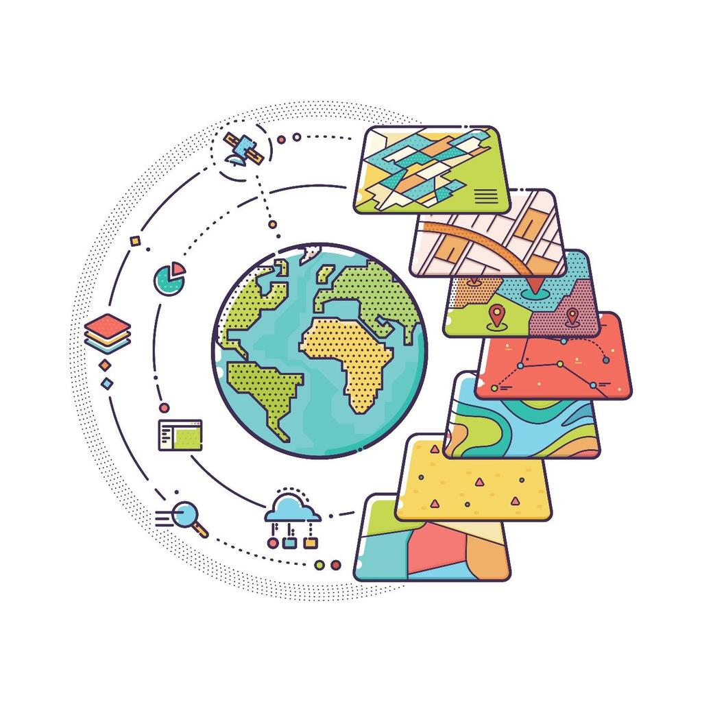
2 The Road to here Why Global? Why Geospatial? Why Fundamental? Why Themes? The route we took Where does the road go now?

3 Why Global?

4 With thanks to Greg Scott, UN-GGIM Secretariat
5 Why Geospatial?
6 Geospatial? Source: Oxford English Dictionary

7 With thanks to Greg Scott, UN-GGIM Secretariat

8 With thanks to Greg Scott, UN-GGIM Secretariat

9 Why Fundamental?
10 We all use different words Fundamental? Foundation? Basic? Reference? Core? Base level? Referential? Critical?
11 Possible Characteristics Will form a common information framework Not very volatile Adds value to other data Not domain specific Custodian or Trusted source Required across many sectors Defined, endorsed and used by all or many data users Maintained Data others use to reference their own data Uses global standards Applies to all or most regions Required for many applications Common link between applications Enables linking of spatial and non-spatial data Underpins other information
12 Fundamental? Conclusion: Fundamental in this context does not have a definition, but a non-exclusive and non-exhaustive list of characteristics. As such we cannot produce a definitive list of fundamental data themes only a consensus view on what is important for the applications we have in mind i.e. achieving the SDGs.
13 Fundamental for what? SDG requirements: Baseline measurement Evidence-based policy making Implementation of actions Monitoring and reporting
14 Policy Cycle

15 Policy Cycle
16 HY source analysis Assess current resources ; forecast future ones Forecast propagation of flood, tsunami, pollutions Understand influence of water on ecosystems, climate change, transport Locate where the water is Decide on protection measures (against pollution ) Decide on exploitation measures (drinking water, energy, industry, agriculture ) decision operational communication Background 2D map 3D models (risk, projects ) monitoring Water abstraction permits, water police Reporting for European Directive (WFD )

17 Why Themes?

18 Geog Names Addresses Functional Areas Settlements Land parcels Transport Networks Elevation/Depth Popn distribution Land Cover/Use Geology/Soils Physical infrastructure Imagery Water With thanks to Greg Scott, UN-GGIM Secretariat
19 Themes or datasets? Subject matter Theme Dataset something about which data can be collected a high level categorisation of subject matter which can be further broken down into sub-themes a collection of data about specific features


20 Example 1 Theme: Transport Network Sub-theme: Road, Water, Rail Dataset: Rail Network, Bus stops, Road surface

")
")
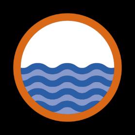
21 Example 2 Theme: Water Sub-theme: Rivers, Sea, groundwater Dataset: Water quality (data integration) Wave height (sensors) Sea ice (imagery interpretation) CC BY 2.0 NASA Ice
22 We need fundamental geospatial data about: People Built Environment Natural Environment To locate this subject matter we need data which: can be about the actual subjects, and/or use proxies for them e.g. an address as a proxy for a person or a phone track as a proxy for a road

23 The route we took

24 Background to the FDWG GGIM 5 A report on fundamental data themes prepared by GGIM:Europe. GGIM5 agreed that there is: an urgent need for a set of global fundamental geospatial data themes that could be harmonized in order to enable the measurement, monitoring and management of sustainable development in a consistent way over time and to facilitate evidence-based decision-making and policy-making

25 UN GGIM:Europe asked to take lead to: Produce a recommendation for a minimum list of global fundamental geospatial data themes. Each data theme should be supported by a description and guidelines. Take account of existing activity being undertaken by UN-GGIM regional committees, ensuring that where possible existing resources are used. Consider the prioritisation of the data themes and how they link to other data needs with in the UN-GGIM programme of work. Consider the specific needs and vulnerabilities of small island developing States. Ensure that the data themes should be technical in nature so as not to raise political concerns.
26 Methodology Regions Workshops Input Input Input WG Members


27 It s not difficult to find existing work
28 Common Denominator approach UN-GGIM: Europe GGIM: Africa GGIM: AP UN-GGIM: Arab States UN GGIM: Americas WG - NIA (UNECA and GSDR) (ANZLIC) (PAIGH) Geographical names Geographic names Place names Names Geographic names Geographical names Administrative units Boundaries Administrative Administrative Administrative Units Administrative units boundaries Boundaries Transport networks Transportation Transport Transport Networks Communications Transport networks networks Hydrography Hydrography Water Hydrography Hydrography Hydrography Drainage Orthoimagery Imagery Imagery Imagery Images Imagery Elevation Hypsography Elevation and depth Elevation Relief Elevation Land cover Natural environment Land cover Land cover Land cover Land Cover Cadastral parcels Addresses Buildings Utilities and government services Area Management Statistical Units Land Use Tenure/parcels (part of land management theme) Street addresses (part of land management theme) Populated places (part of Boundaries theme) Utilities and services Land management units/areas Land parcel and property Land parcels Cadastral records Cadastral parcels Geocoded addressing Addresses Addresses Utilities Population Settlements
29 SDG Requirements approach INSPIRE Theme Address Administrative units Cadastral parcels Geographical Names Hydrography Transport networks (road, rail, water, air, cable) Protected sites Elevation Land cover Ortho-Imagery Geology Buildings Land use (existing, planned) Soils Human health Governmental services and utilities Environmental Monitoring facilities Production facilities Agricultural facilities Population distribution/ Statistical Units Area management - Regulated areas Natural risk zones Sea regions Oceanographic features Atmospheric conditions meteorologic features Biogeographical regions Habitats and biotope Species distribution Energy resources Mineral resources Sustainable Development Goal
30 Methodology Regions GGIM Groups + SIDS Workshops Input Input Input Minimum List (Draft) Input Review Input Minimum List WG Members GGIM7
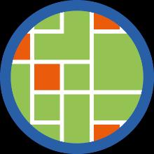
31 Data Themes and Reference Frame Addresses Buildings and Settlements Elevation and depth Functional Areas Geographical Names Geology and Soils Land Cover and Land Use Land Parcels Orthoimagery Physical infrastructure Population distribution Transport Networks Water Reference Frame: Global Geodetic Reference Framework
 Input Review Input Minimum List Input Theme Descriptions (Draft) Input WG Members GGIM7 WG")
32 Methodology Regions GGIM Groups + SIDS Theme Experts Workshops Input Input Input Minimum List (Draft) Input Review Input Minimum List Input Theme Descriptions (Draft) Input WG Members GGIM7 WG Members
33 Theme Description One side A4 only Theme title Description Why this theme fundamental? Which sustainable development goals (SDGs) will it help to meet? Geospatial data features in more detail Longer description of data features included in the theme Possible sources of geospatial data Existing geospatial data standards
34 Example - Addresses Theme title: Description Addresses An address is a structured label, usually containing a property number, a street name and a locality name. It s used to identify a plot of land, a building or part of a building, or some other construction, together with coordinates indicating their geographic position. Addresses are often used as a proxy for other data themes such as Land Parcels. Why is this theme fundamental? Addresses underpin government administration at all levels; and good administration is a prerequisite for achieving sustainable development goals. An address is often the unit to which a public service, such as water, is provided. Addresses also enable effective communication with citizens; informing them of policies applying to them, and notifying them of relevant incidents. The theme also helps in managing buildings and properties, and supports social surveys. Datasets relating to individuals or households are often linked to addresses, which can therefore play a role in connecting otherwise-unrelated information. Geocoding addresses relates such information to geographic location. This allows for location-based data analytics and data mining. Which sustainable development goals (SDGs) will it help to meet? Addresses have been identified as playing a key role in the achievement of SDGs 4,6,7, 9 and 11. Geospatial data features in more detail The addresses theme comprises a single feature type, address, to which a variable number of attributes may be attached. Typically, in urban areas these comprise at least one locator (building, floor or apartment number and/or name), a two-dimensional geographic position and a number of address components which place the address within other features such as a road, a locality, an administrative unit or postal code. In rural areas the locator may be less precise. Possible sources of geospatial data Address datasets are usually maintained by public authorities. While data may be created and maintained at local level, it should ideally be compiled into a single national register. Existing geospatial data standards Note: This is indicative. Other lists of standards exist and UN-GGIM will seek to work with thematic experts to develop a list of relevant data standards. INSPIRE Data Specification on Addresses Technical Guidelines 3.1 ISO :2015 Addressing -- Part 1: Conceptual model ISA Programme Location Core Vocabulary ISO (UPU, Universal Postal Union) Addressing--Part4: International postal address components and template language
35 Methodology Regions GGIM Groups + SIDS Theme Experts Regions Workshops Input Input Input Minimum List (Draft) Input Review Input Minimum List Input Theme Descriptions (Draft) Input Input Review Input Theme Descriptions WG Members GGIM7 WG Members GGIM8

36 Where does the road go now?
37 Where does the road go now? Promotion and awareness raising


38 Logos Global Geodetic Reference Frame Geographical Names Addresses Functional Areas Buildings and Settlements Land Parcels Transport Networks Elevation and Depth Population Distribution Land Cover and Land Use Geology and Soils Physical Infrastructure Water Orthoimagery
39 Where does the road go now? Promotion and awareness raising Inclusion in the Geospatial Framework

40 Geospatial Framework
41 Where does the road go now? Promotion and awareness raising Inclusion in the Geospatial Framework Workshops on implementation
42 Workshop on implementation

43 Thank you!
Workshop on Global Fundamental Geospatial Data Themes
 Workshop on Global Fundamental Geospatial Data Themes June 2018 Objectives of the Workshop Introduce you to the work and outputs of the Fundamental Data WG (FDWG) Consider how the themes apply to SDGs
Fundamental Geospatial Data Themes
 Fundamental Geospatial Data Themes April 2016 Workshop Agenda Background why and how What is our objective? Fundamental data what are they? What are the candidate themes? Breakout Session Conclusion Background
Work Group A «Core Data» Report and Update François Chirié, Dominique Laurent, France
 JOINT UN-GGIM: EUROPE ESS MEETING ON THE INTEGRATION OF STATISTICAL AND GEOSPATIAL INFORMATION LUXEMBOURG 11 MARCH 2016 Work Group A «Core Data» Report and Update François Chirié, Dominique Laurent, France
The UN-GGIM: Europe core data initiative to encourage Geographic information supporting Sustainable Development Goals Dominique Laurent, France
 INSPIRE conference Strasbourg 6 September 2017 The UN-GGIM: Europe core data initiative to encourage Geographic information supporting Sustainable Development Goals Dominique Laurent, France Introduction
Fundamental Geospatial Data Themes. Panel Discussion
 Fundamental Geospatial Data Themes Panel Discussion April 2016 Background GGIM5 discussed fundamental geospatial data themes Agreed there is an urgent need for a set of global fundamental geospatial data
UN-GGIM: Europe ExCom 1 June 2016 Francfort Work Group A «Core Data» Status and Progress François Chirié, France
 UN-GGIM: Europe ExCom 1 June 2016 Francfort Work Group A «Core Data» Status and Progress François Chirié, France Plan The Core Data Scope Deliverable 7-8 June 2016 WGA workshop to investigate work plans
Report on the establishment of UN GGIM: Europe Item 14. 4th session of the Committee of Experts on UN-GGIM
 Report on the establishment of UN GGIM: Europe Item 14 1 Why regional European committees of UN GGIM? In the ECOSOC resolution 2011/24 on the UN GGIM: Emphasizes the importance of promoting national, regional
Progress of UN-GGIM: Europe Working Group A on Core Data
 INSPIRE KEN 13 December 2016 Progress of UN-GGIM: Europe Working Group A on Core Data François Chirié, Dominique Laurent, IGN France Plan Introduction Objectives of the working group with respect to INSPIRE
Progress of UN-GGIM: Europe Working Group A on Core Data
 PolicyKEN Budapest 29 November 2016 Progress of UN-GGIM: Europe Working Group A on Core Data François Chirié, Dominique Laurent, IGNF Core data context Background and purpose Aim of Work Group A to propose
INSPIRE Basics. Vlado Cetl European Commission Joint Research Centre. https://ec.europa.eu/jrc/
 INSPIRE Basics Vlado Cetl European Commission Joint Research Centre https://ec.europa.eu/jrc/ Serving society Stimulating innovation Supporting legislation Outline SDI? Why European SDI? INSPIRE Policy
EuroGeographics & INSPIRE. Nick Land, Executive Director of EuroGeographics
 EuroGeographics & INSPIRE Nick Land, Executive Director of EuroGeographics EuroGeographics A growing association 49 Members, 42 countries Topographic mapping, cadastre, land registry + Networked organisation
ESBN. Working Group on INSPIRE
 ESBN Working Group on INSPIRE by Marc Van Liedekerke, Endre Dobos and Paul Smits behalf of the WG members WG participants Marc Van Liedekerke Panos Panagos Borut Vrščaj Ivana Kovacikova Erik Obersteiner
Spatially enabling e-government through geo-services
 Spatially enabling e-government through geo-services Mauro Salvemini EUROGI PRESIDENT Professor at Sapienza Università di Roma (IT) 1 About the presentation Few information about Eurogi ; Some essential
INSPIRE. Data Specification for Meteorology. Bruce Wright, Expert Strategic Advisor (Data Management)
") INSPIRE Data Specification for Meteorology Bruce Wright, Expert Strategic Advisor (Data Management) Third Workshop on the use of GIS/OGC Standards in Meteorology- 15 November 2010 Table of Contents INSPIRE
INSPIRE Data Specification for Meteorology Bruce Wright, Expert Strategic Advisor (Data Management) Third Workshop on the use of GIS/OGC Standards in Meteorology- 15 November 2010 Table of Contents INSPIRE
INSPIREd solutions for Air Quality problems Alexander Kotsev
 INSPIREd solutions for Air Quality problems Alexander Kotsev www.jrc.ec.europa.eu Serving society Stimulating innovation Supporting legislation The European data puzzle The European data puzzle 24 official
a national geological survey perspective François ROBIDA BRGM (French Geological Survey)
") a national geological survey perspective François ROBIDA BRGM (French Geological Survey) Pre-Conference Seminar on Socio-Economic Value of Geospatial for National and Regional Development 21 August 2017,
a national geological survey perspective François ROBIDA BRGM (French Geological Survey) Pre-Conference Seminar on Socio-Economic Value of Geospatial for National and Regional Development 21 August 2017,
The contribution of EUREF to Inspire
 EUREF2010 SYMPOSIUM The contribution of EUREF to Inspire J. Torres, V. Bitenc, A. Caporali, P. Cruddace, L. Engberg, B. Garayt and H. Habrich (members of TWG-RS) June 2-4, 2010 Gävle 1 EUREF2010 SYMPOSIUM
Standards in support of UN-GGIM and sustainable development
 2 nd High 2Level nd High Forum Level on GGIM, Forum QNCC, on GGIM Doha, Qatar, 6 February 2013 QNCC, Doha, Qatar, 6 February 2013 Standards in support of UN-GGIM and sustainable development Olaf Østensen
GIS Building Communities beyond National Borders (Building Successful Spatial Data Infrastructures) Nick Land, ESRI Europe
 Nick Land, ESRI Europe") GIS Building Communities beyond National Borders (Building Successful Spatial Data Infrastructures) Nick Land, ESRI Europe UK worst flooding in the last 60 years 350,000 households without drinking water
GIS Building Communities beyond National Borders (Building Successful Spatial Data Infrastructures) Nick Land, ESRI Europe UK worst flooding in the last 60 years 350,000 households without drinking water
INSPIRE - A Legal framework for environmental and land administration data in Europe
 INSPIRE - A Legal framework for environmental and land administration data in Europe Dr. Markus Seifert Bavarian Administration for Surveying and Cadastre Head of the SDI Office Bavaria Delegate of Germany
INSPIRATION results and benefits for the Agency for Real Estate Cadastre
 JOINT RESEARCH CENTER - E&I WORKSHOP INSPIRATION results and benefits for the Agency for Real Estate Cadastre Sonja Dimova, state advisor AGENCY FOR REAL ESTATE CADASTRE REPUBLIC OF MACEDONIA Wednesday,
INSPIRE Directive. Status June 2007
 INSPIRE Directive INfrastructure for SPatial InfoRmation in Europe Status June 2007 European Commission Directorate-General Environment Research, Science and Innovation Unit Rue de la Loi, 200 1049 Brussels
Disaster Management & Recovery Framework: The Surveyors Response
 Disaster Management & Recovery Framework: The Surveyors Response Greg Scott Inter-Regional Advisor Global Geospatial Information Management United Nations Statistics Division Department of Economic and
The Infrastructure for Spatial Information in the European Community vs. regional SDI: the shortest way for reaching economic and social development
 The Infrastructure for Spatial Information in the European Community vs. regional SDI: the shortest way for reaching economic and social development Mauro Salvemini EUROGI PRESIDENT Professor at Sapienza
ArcGIS for INSPIRE. Marten Hogeweg
 ArcGIS for INSPIRE Marten Hogeweg Please Take Our Survey on the App Download the Esri Events app and find your event Select the session you attended Scroll down to find the feedback section Complete answers
Economic and Social Council
 United Nations Economic and Social Council Distr.: General 18 July 2016 Original: English Committee of Experts on Global Geospatial Information Management Sixth session New York, 3-5 August 2016 Item 2
Open Data meets Big Data
 Open Data meets Big Data Max Craglia, Sven Schade, Anders Friis European Commission Joint Research Centre www.jrc.ec.europa.eu Serving society Stimulating innovation Supporting legislation JRC is Technical
Fundamental Geospatial Datasets in Africa. Andre Nonguierma New York, 03 August 2015
 Fundamental Geospatial Datasets in Africa United Nations Economic Commission for Africa Geoinformation & Spatial Statistics Andre Nonguierma New York, 03 August 2015 Core Data : Lack of consistency Infrastructure
INSPIRE General Introduction & Service Architecture
 INSPIRATION Spatial Data Infrastructure in the Western Balkans INSPIRE General Introduction & Service Architecture 1st National INSPIRATION Workshop Croatia November 21-22, 2012 A multi-countryprojectfunded
Foundation Geospatial Information to serve National and Global Priorities
 Foundation Geospatial Information to serve National and Global Priorities Greg Scott Inter-Regional Advisor Global Geospatial Information Management United Nations Statistics Division UN-GGIM: A global
Economic and Social Council
 United Nations Economic and Social Council Distr.: General 2 July 2012 E/C.20/2012/10/Add.1 Original: English Committee of Experts on Global Geospatial Information Management Second session New York, 13-15
UN GGIM and National SDI Strategy
 MSDI Open Forum on 26 th January 2016 Contributing to the successful delivery of MSDI UN GGIM and National SDI Strategy Hiroshi Murakami Deputy Administrator Geospatial Information Authority of Japan Geospatial
The Global Statistical Geospatial Framework and the Global Fundamental Geospatial Themes
 The Global Statistical Geospatial Framework and the Global Fundamental Geospatial Themes Sub-regional workshop on integration of administrative data, big data and geospatial information for the compilation
Infrastructure for Spatial Information in Europe (INSPIRE)
") Infrastructure for Spatial Information in Europe (INSPIRE) 2011 GISCO Working Party 8-9.3.2012 INSPIRE is about improving access to spatial information: the environment doesn t stop at borders EU Geoportal
Infrastructure for Spatial Information in Europe (INSPIRE) 2011 GISCO Working Party 8-9.3.2012 INSPIRE is about improving access to spatial information: the environment doesn t stop at borders EU Geoportal
Geographical Names: Relevance and place within the UN-GGIM framework
 Geographical Names: Relevance and place within the UN-GGIM framework Greg Scott Inter-Regional Advisor Global Geospatial Information Management United Nations Statistics Division UN-GGIM: A global initiative
Version
 Core Data Scope Working Group A - First Deliverable of Task 1.a Version 1.1-2016-07-19 1 Version History Version number Date Modified by Comments 0.1 2016-04-12 Dominique Laurent - François Chirié (France)
Turkey s National SDI Implementation
 Onur PAŞAOĞULLARI Head of Department Turkey s National SDI Implementation Presentation Plan NSDI Background General Directorate of Geographic Information Systems NSDI Project INSPIRE Directive Urban Information
SITMUN: Cooperating to Build Local SDIs in the Barcelona Region
 SITMUN: Cooperating to Build Local SDIs in the Barcelona Region Diputació de Barcelona Territory and Sustainability Area Territorial Information Systems Department INSPIRE CONFERENCE Barcelona, September
IAEG SDGs WG GI, , Mexico City
 IAEG SDGs WG GI, 12-14.12.2016, Mexico City UN-GGIM:Europe s perspective and activities to support better integration of geospatial information and statistics and the UN SDG monitoring Pier-Giorgio Zaccheddu,
The Geospatial Information Management (GIM) INSPIRE Data Specification and COPERNICUS In situ data
 INSPIRE Data Specification and COPERNICUS In situ data") INSPIRE conference Barcelona 29 September 2016 INSPIRing a sustainable environment The Geospatial Information Management (GIM) INSPIRE Data Specification and COPERNICUS In situ data Antonio Arozarena,
INSPIRE conference Barcelona 29 September 2016 INSPIRing a sustainable environment The Geospatial Information Management (GIM) INSPIRE Data Specification and COPERNICUS In situ data Antonio Arozarena,
Proposal for a DIRECTIVE OF THE EUROPEAN PARLIAMENT AND OF THE COUNCIL. establishing an infrastructure for spatial information in the Community
 Proposal for a DIRECTIVE OF THE EUROPEAN PARLIAMENT AND OF THE COUNCIL establishing an infrastructure for spatial information in the Community INSPIRE http://inspire.jrc.it/ Alessandro Annoni 1 EU Commission
A donor partner view. Olaf Magnus Østensen. 'Modernization of spatial data infrastructure to reduce risks and impacts of floods'
 A donor partner view Olaf Magnus Østensen 'Modernization of spatial data infrastructure to reduce risks and impacts of floods' About the EEA Grants programme http://eeagrants.org/ Beneficiary country Donor
Providing Marine Data. The German Marine Data Infrastructure (MDI-DE) as an example for best practice
 as an example for best practice") Providing Marine Data The German Marine Data Infrastructure (MDI-DE) as an example for best practice Data Originators 18 Agencies and Institutions in the EEZ and 12 Mile Zone Federal Government BSH Schleswig-Holstein
Providing Marine Data The German Marine Data Infrastructure (MDI-DE) as an example for best practice Data Originators 18 Agencies and Institutions in the EEZ and 12 Mile Zone Federal Government BSH Schleswig-Holstein
US National Spatial Data Infrastructure A Spatial Framework for Governance and Policy Development to Enable a Location-Based Digital Ecosystem
 GeoPlatform Workshop 7 Dec 2016, Department of the Interior Washington, D.C. US National Spatial Infrastructure A Spatial Framework for Governance and Policy Development to Enable a Location-Based Digital
Data Origin. Ron van Lammeren CGI-GIRS 0910
 Data Origin Ron van Lammeren CGI-GIRS 0910 How to obtain geodata? Geo data initiative Executive Order 12906, "Coordinating Geographic Data Acquisition and Access: The National Spatial Data Infrastructure,"
Data Origin. How to obtain geodata? Ron van Lammeren CGI-GIRS 0910
 Data Origin How to obtain geodata? Ron van Lammeren CGI-GIRS 0910 Spatial Data interest Improvement of policy making. ± 90% of all information used by government has spatial characteristics SPATIAL INFORMATION
SDI Development in Georgia. Mari Khardziani Head of International Relations Unit National Agency of Public Registry
 SDI Development in Georgia Mari Khardziani Head of International Relations Unit National Agency of Public Registry Kehl, Germany September 5, 2017 2 National Agency of Public Registry Legal Entity of Public
Local Spatial Data Infrastructure, a Solid Base for Sustainable Land Management in Germany
 Local Spatial Data Infrastructure, a Solid Base for Sustainable Land Management in Germany FIG Commission 3 Workshop and Commission 3 Annual Meeting The Empowerment of Local Authorities: Spatial Information
The Global Statistical Geospatial Framework. Martin Brady Director Geospatial Solutions Australian Bureau of Statistics Australia
 The Global Statistical Geospatial Framework Martin Brady Director Geospatial Solutions Australian Bureau of Statistics Australia Outline 1. Origins of the Global Statistical Geospatial Framework 2. Global
UN-GGIM: Strengthening Geospatial Capability
 Fifth Plenary Meeting of UN-GGIM: Europe Brussels, 6-7 June 2018 UN-GGIM: Strengthening Geospatial Capability Walking the talk to leave no one behind Greg Scott, UN-GGIM Secretariat Environmental Statistics
ESDIN Results from a Crossborder INSPIRE Preparatory Project. Jörgen Hartnor, Lantmäteriet.
 ESDIN Results from a Crossborder INSPIRE Preparatory Project Jörgen Hartnor, Lantmäteriet www.esdin.eu Ett econtentplus Best Practice Network projekt September 2008 February 2011 Coordinated by EuroGeographics
State of the Art. in Spatial Planning Data Harmonisation & Spatial Data Infrastructure (SDI) Julia Neuschmid, CEIT ALANOVA
 Julia Neuschmid, CEIT ALANOVA") INSPIRE Conference, June 2010, Krakow State of the Art in Spatial Planning Data Harmonisation & Spatial Data Infrastructure (SDI) Julia Neuschmid, CEIT ALANOVA Co-funded by the Community programme econtentplus
INSPIRE Conference, June 2010, Krakow State of the Art in Spatial Planning Data Harmonisation & Spatial Data Infrastructure (SDI) Julia Neuschmid, CEIT ALANOVA Co-funded by the Community programme econtentplus
Emerging Trends in Institutional Arrangements Europe - Finland
 Emerging Trends in Institutional Arrangements Europe - Finland Arvo Kokkonen Deputy Director General National Land Survey of Finland 1 Contents Facts about Finland National Land Survey of Finland European
Swedish Spatial Data Infrastructure and the National Geodata Strategy
 Submitted to the United Nations Committee of Experts on Global Geospatial Information Management Seventh Session New York, August 2018 Registration number 519-2018/4327 Country Report, Sweden Swedish Spatial
Presented to Sub-regional workshop on integration of administrative data, big data and geospatial information for the compilation of SDG indicators
 Presented to Sub-regional workshop on integration of administrative data, big data and geospatial information for the compilation of SDG indicators 23-25 April,2018 Addis Ababa, Ethiopia By: Deogratius
THE ROLE OF GEOSPATIAL AT THE WORLD BANK
 THE ROLE OF GEOSPATIAL AT THE WORLD BANK INSPIRE Conference Barcelona, Spain September 26, 2016 Kathrine Kelm Senior Land Administration Specialist Global Land and Geospatial Unit The World Bank Group
ArcGIS for INSPIRE. Marten Hogeweg Satish Sankaran
 ArcGIS for INSPIRE Marten Hogeweg Satish Sankaran Outline What is ArcGIS ArcGIS for INSPIRE Web GIS Case Studies Roadmap Q&A What is INSPIRE? INSPIRE is the legal framework for a European Spatial Data
The road to national Inspire-compliant datasets in the Czech republic
 The road to national Inspire-compliant datasets in the Czech republic Ing. Pavel Šidlichovský (Land Survey Office of Czech Republic) INSPIRE 2014; 18.6. Aalborg Overview Directive transposition COSMC and
Sharthi Laldaparsad Statistics South Africa, Policy Research & Analysis. Sub-regional workshop on integration of administrative data,
 Sub-regional workshop on integration of administrative data, big data and geospatial information for the compilation of SDG indicators and International Workshop on Global Fundamental Geospatial Data Themes
Economic and Social Council
 United Nations E/CN.3/2019/31 Economic and Social Council Distr.: General 19 December 2018 Original: English Statistical Commission Fiftieth session 5-8 March 2019 Item 4(i) of the provisional agenda*
Infrastructure for Spatial Information in Europe (INSPIRE) Steve Peedell
 Steve Peedell") Infrastructure for Spatial Information in Europe (INSPIRE) Steve Peedell European Commission DG Joint Research Centre Institute for Environment and Sustainability ESDI Action Overview JRC, European Commission
Infrastructure for Spatial Information in Europe (INSPIRE) Steve Peedell European Commission DG Joint Research Centre Institute for Environment and Sustainability ESDI Action Overview JRC, European Commission
KUNMING FORUM ON UNITED NATIONS GLOBAL GEOSPATIAL INFORMATION MANAGEMENT CITIES OF THE FUTURE: SMART, RESILIENT
 KUNMING FORUM ON UNITED NATIONS GLOBAL GEOSPATIAL INFORMATION MANAGEMENT CITIES OF THE FUTURE: SMART, RESILIENT and SUSTAINABLE Yunnan Zhenzhuang Guest House, Kunming, China 10 12 May 2017 BACKGROUND CONCEPT
SDI and VGI Parallel Universes? Max Craglia Institute for Environment and Sustainability Spatial Data Infrastructures Unit
 1 SDI and VGI Parallel Universes? Max Craglia Institute for Environment and Sustainability Spatial Data Infrastructures Unit 2 Background There is a growing awareness that we are living at a time when
A proposal for building an infrastructure for European geospatial statistics
 A proposal for building an infrastructure for European geospatial statistics Marie Haldorson, Statistics Sweden Ekkehard Petri, Eurostat What is geospatial statistics? The location, extent or spatial relations
HydroSpatial II Practical application of INSPIRE in Marine Mapping Data
 HydroSpatial II Practical application of INSPIRE in Marine Mapping Data INSPIRE Conference 30 th June 2011 Carlos Berná Esteban, GIS Analyst, SeaZone carlos.berna-esteban@seazone.com Overview HydroSpatial
Geospatial Information Management in the Americas: Lessons for the Post-2015 development agenda
 Geospatial Information Management in the Americas: Lessons for the Post-2015 development agenda Rolando Ocampo President, UN-GGIM: Americas October 2014 The integration of statistical and geographical
GIS Geographical Information Systems. GIS Management
 GIS Geographical Information Systems GIS Management Difficulties on establishing a GIS Funding GIS Determining Project Standards Data Gathering Map Development Recruiting GIS Professionals Educating Staff
1The Many Uses of GIS
 1The Many Uses of GIS BUILDING EUROPEAN SPATIAL DATA INFRASTRUCTURES In April 2006, Esri president Jack Dangermond gave a presentation on the INSPIRE Directive at the European Union (EU) Interparliamentary
Tomas Mildorf, Karel Janecka University of West Bohemia in Pilsen Czech Republic
 European Network of Best Practices for Interoperability of Spatial Planning Information Tomas Mildorf, Karel Janecka mildorf@centrum.cz, kjanecka@kma.zcu.cz University of West Bohemia in Pilsen Czech Republic
Principle 3: Common geographies for dissemination of statistics Poland & Canada. Janusz Dygaszewicz Statistics Poland
 Principle 3: Common geographies for dissemination of statistics Poland & Canada Janusz Dygaszewicz Statistics Poland Reference materials Primary: Ortophotomap, Cadastral Data, Administrative division borders,
The story of sharing environmental data
 The story of sharing environmental data Kallio, Pyhälahti, Harju, Teiniranta, Lahtinen, Finnish Environment Institute SYKE OKFestival, Finnish Open Data, 18. Sep 2012 Contents Call for environmental knowledge
Harmonisation of Spatial Planning Data
 INSPIRE Conference 18 June 2011 Edinburgh, Great Britain Harmonisation of Spatial Planning Data Tomas Mildorf University of West Bohemia mildorf@centrum.cz Pilsen, Czech Republic Co-funded by the Community
Georeferencing and Satellite Image Support: Lessons learned, Challenges and Opportunities
 Georeferencing and Satellite Image Support: Lessons learned, Challenges and Opportunities Shirish Ravan shirish.ravan@unoosa.org UN-SPIDER United Nations Office for Outer Space Affairs (UNOOSA) UN-SPIDER
1) United Nations Committee of Experts on Global Geospatial Information Management (UN-GGIM)
 United Nations Committee of Experts on Global Geospatial Information Management (UN-GGIM)") International Workshop on Legal and Policy Frameworks for Geospatial Information Management Licensing of Geospatial Information 7 9 November 2017 Tianjin Zhengxie Club Hotel Tianjin, China Outline of presentation
International Workshop on Legal and Policy Frameworks for Geospatial Information Management Licensing of Geospatial Information 7 9 November 2017 Tianjin Zhengxie Club Hotel Tianjin, China Outline of presentation
Cooperation is the key, FIG can facilitate
 Cooperation is the key, FIG can facilitate Mikael Lilje Vice President 2017-2020 Head, Geodetic infrastructure, Swedish mapping, cadastral and land registration authority Presented at the GIS/RS Conference
A proposal for building an infrastructure for European geospatial statistics. Marie Haldorson, Statistics Sweden Ekkehard Petri, Eurostat
 A proposal for building an infrastructure for European geospatial statistics Marie Haldorson, Statistics Sweden Ekkehard Petri, Eurostat What is geospatial statistics? The location, extent or spatial relations
Second Administrative Level Boundaries (SALB) initiative & geographic names in cartography. Geospatial Information Section
 initiative & geographic names in cartography. Geospatial Information Section") Second Administrative Level Boundaries (SALB) initiative & geographic names in cartography Geospatial Information Section Introduction Goals Global agenda How does SALB work? Latest News on geographic
Second Administrative Level Boundaries (SALB) initiative & geographic names in cartography Geospatial Information Section Introduction Goals Global agenda How does SALB work? Latest News on geographic
Interoperability of Spatial Planning Data
 INSPIRE Conference 2010, Krakow, Poland Interoperability of Spatial Planning Data European Network of Best Practices for Interoperability of Spatial Planning Information Tomas Mildorf mildorf@centrum.cz
GEOGRAPHICAL NAMES AS PART OF THE GLOBAL, REGIONAL AND NATIONAL SPATIAL DATA INFRASTRUCTURES
 GEOGRAPHICAL NAMES AS PART OF THE GLOBAL, REGIONAL AND NATIONAL SPATIAL DATA INFRASTRUCTURES Željko HEĆIMOVIĆ, Željka JAKIR, Zvonko ŠTEFAN, Danijela KUKIĆ zeljko.hecimovic@cgi.hr, zeljka.jakir@cgi.hr,
Establishing the National Spatial Data Infrastructure (NSDI) for Norway a joint effort by many stakeholders SPATIAL DATA FOR BENEFIT OF THE SOCIETY
 for Norway a joint effort by many stakeholders SPATIAL DATA FOR BENEFIT OF THE SOCIETY") Establishing the National Spatial Data Infrastructure (NSDI) for Norway a joint effort by many stakeholders SPATIAL DATA FOR THE BENEFIT OF SOCIETY OUTLINE Political background Norway digital - The Norwegian
Establishing the National Spatial Data Infrastructure (NSDI) for Norway a joint effort by many stakeholders SPATIAL DATA FOR THE BENEFIT OF SOCIETY OUTLINE Political background Norway digital - The Norwegian
Observations on CSDI/MGDI Data Themes
 Observations on CSDI/MGDI Data Themes Roger Longhorn Secretary-General, GSDI Association - rlonghorn@gsdi.org Member, IHO Marine SDI Working Group ral@alum.mit.edu Member, UNESCO IOC IODE International
Adding value to Copernicus services with member states reference data
 www.eurogeographics.org Adding value to Copernicus services with member states reference data Neil Sutherland neil.sutherland@os.uk GIS in the EU 10 November 2016 Copyright 2016 EuroGeographics 61 member
Plenary Session 2, part 2 A European shared information system
 3 rd GMES Forum 5 6 June 2003 Athens Plenary Session 2, part 2 A European shared information system Gordon McInnes Deputy Director European Environment Agency 1 I keep six honest serving men. They taught
Bengt Kjellson Chair of the Executive Committee UN-GGIM: Europe. 2 nd Joint UN-GGIM: Europe ESS Meeting 11 th March 2016, Luxembourg
 Bengt Kjellson Chair of the Executive Committee UN-GGIM: Europe 2 nd Joint UN-GGIM: Europe ESS Meeting 11 th March 2016, Luxembourg A global geospatial mandate At its 47th plenary in July 2011, ECOSOC,
GIS Solutions in Natural Resource Management: Balancing the Technical- Political Equation
 GIS Solutions in Natural Resource Management: Balancing the Technical- Political Equation Stan Morain, Editor SUB Gdttlngen 7 208 520 309 98 A14447 0NW0RD PRESS V? % \
Roadmap to interoperability of geoinformation
 Roadmap to interoperability of geoinformation and services in Europe Paul Smits, Alessandro Annoni European Commission Joint Research Centre Institute for Environment and Sustainability paul.smits@jrc.it
Report of the Regional Committee of UN-GGIM for Asia and the Pacific (UN-GGIM-AP)
") Report of the Regional Committee of UN-GGIM for Asia and the Pacific (UN-GGIM-AP) At the Eighth Session of UN-GGIM UN Headquarters, New York, 1 3 August 2018 About UN-GGIM-AP One of the five regional committees
Report of the Regional Committee of UN-GGIM for Asia and the Pacific (UN-GGIM-AP) At the Eighth Session of UN-GGIM UN Headquarters, New York, 1 3 August 2018 About UN-GGIM-AP One of the five regional committees
Land Accounts - The Canadian Experience
 Land Accounts - The Canadian Experience Development of a Geospatial database to measure the effect of human activity on the environment Who is doing Land Accounts Statistics Canada (national) Component
Integration for Informed Decision Making
 Geospatial and Statistics Policy Intervention: Integration for Informed Decision Making Greg Scott Global Geospatial Information Management United Nations Statistics Division Department of Economic and
INSPIRE Implementation in Estonia using ArcGIS
 INSPIRE Implementation in Estonia using ArcGIS Sulev Õitspuu Head of Bureau of Geoinfosystems Estonian Land Board 26.09.2016 Population: 1,3 million (69% Estonians) Area: 45,339 km 2 15 counties Estonia
EuroGEOSS Protected Areas Pilot
 EuroGEOSS Protected Areas Pilot Max Craglia European Commission Joint Research Centre Part 1: the present MyNatura2000 Mobile app. Awareness raising & volunteered data collection. Natura2000 covers 18%
The Integrated Ge spatial Information Framework to the strengthening of NSDI, Mongolia
 Young Geospatial Professionals Summit 21 NOV 2018 The Integrated Ge spatial Information Framework to the strengthening of NSDI, Mongolia BAYARMAA ENKHTUR Geospatial information and technology department
Marine Spatial Planning, a Norwegian user case NSHC33
 Marine Spatial Planning, a Norwegian user case NSHC33 Marine Spatial Management Tool Support the marine spatial planning process with updated and reliable geospatial information Marine management is important
8 th Meeting of IAEG-SDGs 5 8 November 2018, Stockholm, Sweden. Meetings. Report
 Meetings 8 th Meeting of IAEG-SDGs Between April 2018 and November 2018, the Working Group on Geospatial Information of the IAEG- SDGs held two online meetings; presented a report to the United Nations
UN-GGIM: An Overview Stefan Schweinfest, Director (UNSD) Bangkok, 27 March 2015
 Bangkok, 27 March 2015") UN-GGIM: An Overview Stefan Schweinfest, Director (UNSD) Bangkok, 27 March 2015 ggim.un.org UN-GGIM: A global initiative Formal inter-governmental UN Committee of Experts to: Discuss, enhance and coordinate
UN-GGIM: An Overview Stefan Schweinfest, Director (UNSD) Bangkok, 27 March 2015 ggim.un.org UN-GGIM: A global initiative Formal inter-governmental UN Committee of Experts to: Discuss, enhance and coordinate
GMES Service for Geospatial Reference Data Access (RDA) Covering Areas Outside Europe
 Covering Areas Outside Europe") INSPIRE Conference 2011 Edinburgh 27 June - 1 July GMES Service for Geospatial Reference Data Access (RDA) Covering Areas Outside Europe Andrea Ajmar, Simone Balbo, Piero Boccardo, Simone Dalmasso, Anna
INSPIRE Conference 2011 Edinburgh 27 June - 1 July GMES Service for Geospatial Reference Data Access (RDA) Covering Areas Outside Europe Andrea Ajmar, Simone Balbo, Piero Boccardo, Simone Dalmasso, Anna
MARINE SPATIAL PLANNING & MARINE CADASTRE: CHALLENGES AND ISSUES
 MARINE SPATIAL PLANNING & MARINE CADASTRE: CHALLENGES AND ISSUES Roger Longhorn Secretary General, GSDI Association rlonghorn@gsdi.org Member, IHO Marine SDI Working Group ral@alum.mit.edu Member, UNESCO
Implementing the Sustainable Development Goals: The Role of Geospatial Technology and Innovation
 Fifth High Level Forum on UN Global Geospatial Information Management Implementing the Sustainable Development Goals: The Role of Geospatial Technology and Innovation 28-30 November 2017 Sheraton Maria
Core Spatial Data Theme Buildings Recommendation for Content. Working Group A - Deliverable of Task 1.b. Version
 Core Spatial Data Theme Buildings Recommendation for Content Working Group A - Deliverable of Task 1.b Version 1.0-2018-06-01 1 Version History Version number Date Modified by Comments 1.0 2018-06-01 Dominique
TWG BU State of Play November 2010
 TWG BU State of Play November 2010 TWG BU members General methodology Existing data Use cases User requirements Existing standards Modelling approach Next steps Plan of presentation TWG BU members TWG