CONNECTING THE HUMAN DIMENSION OF HAZARDS AND DISASTERS
|
|
|
- Ralf King
- 5 years ago
- Views:
Transcription

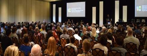
1 CONNECTING THE HUMAN DIMENSION OF HAZARDS AND DISASTERS Lori Peek, Ph.D. Director, Natural Hazards Center Professor, Department of Sociology Principal Investigator, NHERI-CONVERGE University of Colorado Boulder

2


3 3

4 The Natural Hazards Center 1. Translating and Sharing Information 2. Facilitating Connections 3. Training and Mentoring the Next Generation 4. Advancing New Social Science and Interdisciplinary Knowledge
5

6 Award
7 7 CONVERGE headquartered at the Natural Hazards Center is a new National Science Foundation-Natural Hazards Engineering Research Infrastructure (NSF-NHERI) facility dedicated to: linking social science, engineering, and interdisciplinary research communities through networks and research platforms; developing and sharing best practices for the ethical conduct of research; enhancing and promoting social science, engineering, and interdisciplinary natural hazards research to reduce vulnerability.


8 What is Convergence? Convergence research is often driven by a specific and compelling problem. It requires the integration of knowledge, theories, methods, and expertise from different disciplines to achieve scientific breakthroughs that otherwise would not be possible. Problem Breakthrough See: National Research Council, National Science Foundation,
 networks and NHERI facilities designed to support those")
9 CONVERGE represents a coming together for the first time of NSF-Extreme Events Reconnaissance (EER) networks and NHERI facilities designed to support those efforts.

10 Why CONVERGE?

11 Post-Disaster Research Contributions Challenges
12 Post-Disaster Research Contributions Challenges


13 Post-Disaster Research Contributions Challenges Who sets the post-disaster research agenda? Who benefits from the knowledge produced? Methodological and ethical critiques: Overemphasis on acute onset, largescale events. Lack of identification and coordination of researchers. Exclusion of local researchers. Focus on perishable data collection leaves little time to understand local cultures, norms, and policies. Problems with duplication, and not enough scientific replication.
14 14

15 15

16 How many social science hazards and disaster researchers are there? The size and composition of the hazards and disaster workforce will significantly determine the extent to which the social sciences, in general, can respond forcefully to twenty-first century demands for basic social science knowledge and its application The committee does not have a precise accounting of the numbers of social scientists from respective disciplines currently engaged in hazards and disaster research. Neither government agencies nor professional associations systematically collect data on this research workforce (NRC, 2006, pp. 317, 320, emphasis added).
17 How many social science hazards and disaster researchers are there? Where are these researchers located?


18 How many social science hazards and disaster researchers are there? Where are these researchers located? What disciplines do they represent and what is their topical and methodological expertise?


19 How many social science hazards and disaster researchers are there? Where are these researchers located? What disciplines do they represent and what is their topical and methodological expertise? What phases of the disaster lifecycle and what disasters have they studied?
20 How many social science hazards and disaster researchers are there? Where are these researchers located? What disciplines do they represent and what is their topical and methodological expertise? What disasters have they studied? What is the demographic composition of the research workforce?


21 21
22 SSEER is a NSF-supported network and online platform for social science hazards and disaster researchers. The mission is to: 1) identify and connect social science researchers to one another, to interdisciplinary teams, and to communities at risk to and affected by hazards and disasters 2) amplify and advance social science hazards and disaster research
23 The form to join SSEER has been live since July 2018: hazards.colorado.edu/join-sseer hazards.colorado.edu/news/director/a-call-to-social-scientists

24 How many social science hazards and disaster researchers are there?* 618 *as of October 30, 2018; this is not a complete census

25 How many social science hazards and disaster researchers are there? Where are these researchers located?

26 The SSEER Census: 618 respondents, by UN Region [as of October 30, 2018] hazards.colorado.edu/join-sseer

27 SSEER Researchers by 7 UN Regions

28 SSEER Researchers by 24 UN Subregions

29 SSEER Researchers by Nation
30 How many social science hazards and disaster researchers are there? Where are these researchers located? What disciplines do they represent and what is their topical and methodological expertise?
31 The SSEER Census: 187 Primary Social Science Discipline* *Does not total 618 as respondents could choose more than one discipline. hazards.colorado.edu/join-sseer
32 The SSEER Census: Primary Professional Status 4% 5% Academic Researcher Student Private-Sector Researcher Non-Profit Researcher Government Researcher Independent Researcher Other 4% 2% 16% 8% 61% hazards.colorado.edu/join-sseer
33 The SSEER Census: Approaches to Data Collection and/or Analysis* hazards.colorado.edu/join-sseer *Does not total 618 as respondents could choose more than one approach.
34 event critical assessments crisis reduction modeling governance health practice preparedness education media program hurricane recovery change perception risk communication management response hazard policy evaluation urban water wildfire action technology development systems use resilience making populations science analysis gis term housing floods participatory support coastal justice security behavior spatial capital post The SSEER Census: Areas of Expertise based coordination earthquake environmental warning planning adaptation emerging vulnerable community long social political organizational disasters drought studies gender sociology capacity culture infrastructure research mitigation climate public networks early decision impacts evacuation weather nature information land organization livelihoods human extreme Top 10 Areas Community Resilience Social Dimensions Vulnerability Reduction Disaster Recovery Risk Communication Emergency/Risk Management Disaster Preparedness Climate Change Risk Analysis Disaster Mitigation +100s more hazards.colorado.edu/join-sseer

35 Searching for SSEER Researchers + Individualized Researcher Profiles hazards.colorado.edu/join-sseer
36 Examples of How to Use the SSEER Maps + Disciplinary Expertise for Research Purposes

37 Using the SSEER Map, Real Time w/ Current Weather

38 Using the SSEER Map w/ Areas of Hazards Risk Natural Hazards Areas of Occurrence and Risk RQ: What is the spatial relationship between hazards and disaster researchers and zones of risk for different types of hazards? Not just earthquakes, could be flood zones, tornado alley, etc.

39 Using the SSEER Map w/ CDC Social Vulnerability Data Location of Vulnerable Populations at Risk from Hazards and Disasters RQ: Where are hazards and disaster researchers in relation to the most vulnerable populations?
40 How many social science hazards and disaster researchers are there? Where are these researchers located? What disciplines do they represent and what is their topical and methodological expertise? What phases of the disaster lifecycle and what disasters have they studied?
41 The SSEER Census: *Does not total 618 as respondents could choose more than one stage. Disaster Stages Studied* Disaster Preparedness Emergency Response Short-Term Reconstruction Long-Term Recovery Mitigation hazards.colorado.edu/join-sseer


42 The SSEER Census: Terrorist Attacks or Other Intentional Violence 114 Disaster Types Studied* Technological Hazards 176 Natural Hazards Natural Hazards *Does not total 618 as respondents could choose more than one type. hazards.colorado.edu/join-sseer
43 2002 east new zealand spill nepal river storm oil wildfire harvey haiti 2003 events oklahoma county joplin west canterbury terrorist city great louisiana outbreak california eruption moore superstorm andrew drought katrina ike fire 2009 horizon central rita india texas ebola present The SSEER Census: Extreme Events Studied southern 1993 chile 1995 disaster floods earthquake hurricanes explosion 1997 attacks 1994 matthew accident christchurch heat fort crisis nuclear deepwater bangladesh indonesia japan bombing cyclone ocean florence 2004 sandy tsunami 2016 tornado maria irma 2014 landslide 2006 indian china extreme colorado tropical typhoon brazil Most Common Disaster Events Studied Hurricane Katrina 2005 Hurricane Harvey 2017 Hurricane Sandy 2012 Hurricane Irma 2017 Hurricane Maria s more hazards.colorado.edu/join-sseer


44 How many social science hazards and disaster researchers are there? Where are these researchers located? What disciplines do they represent and what is their topical and methodological expertise? What disasters have they studied? What is the demographic composition of the research workforce?
45 The SSEER Census Demographic Information Highest Degree 1% 4% 24% Associate degree Bachelor's degree Master's degree 71% Doctoral degree hazards.colorado.edu/join-sseer
46 The SSEER Census Demographic Information 0.52% 4.81% 4.47% 0.17% Race and Ethnicity 0.86% 14.60% 62.71% 5.15% 6.70% American Indian/Alaska Native Arab/Arab American/Middle Eastern Asian/Asian American Black/African American Hispanic/Latino White Native Hawaiian/Pacific Islander Prefer not to answer Self-describe hazards.colorado.edu/join-sseer
47 The SSEER Census Demographic Information Gender/Gender Identity Female Male Non-Binary Third Gender hazards.colorado.edu/join-sseer Prefer not to answer Prefer to selfdescribe
48 The SSEER Census Demographic Information All researchers: Age range: 23 to 78 years-old Average age: years-old Average of 10.1 years of research experience in hazards and disaster field hazards.colorado.edu/join-sseer
49 The SSEER Census: Emerging Researcher 21% Current Status as a Researcher Situational Researcher 6% Core Researcher 52% Periodic Researcher 21% hazards.colorado.edu/join-sseer


50 Current and Future Visions Create a novel, systematic database and maps Work to democratize the research and engagement process before, during, and after disaster strikes Encourage more effective cross-disciplinary collaborations between researchers, practitioners, and policy makers Ensure that research is holistic, rigorous, and ethically-grounded Increase the visibility and positive impact of the social science hazards and disaster community by publicly articulating who we are, what we know, and how we can use our knowledge and skills to reduce hazards and disaster losses, especially among the most vulnerable people Advance a social science hazards and disaster research agenda grounded in concerns regarding justice, equity, and risk reduction


51 Thank you! Lori Peek Director, Natural Hazards Center and NHERI-CONVERGE Professor, Department of Sociology University of Colorado Boulder hazards.colorado.edu Special thanks to the Natural Hazards Center team and especially Mason Mathews, Haorui Wu, Jeffrey Gunderson, Emma Hines, Helen Gardner, and Jennifer Tobin, who contributed to the analyses, maps, and other visuals included in this presentation.
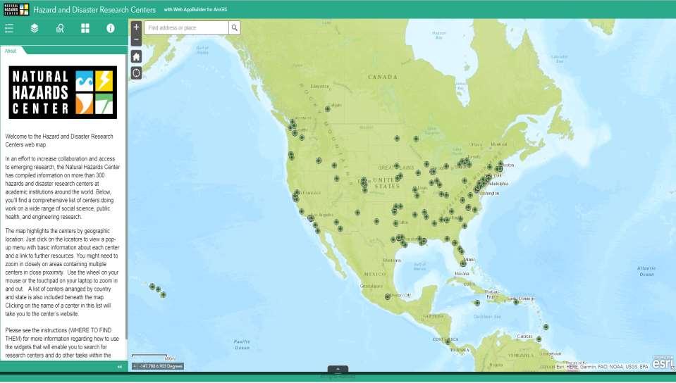
52 55 hazards.colorado.edu/resources/research-centers
Utilizing GIS to Identify and Mobilize Interdisciplinary Disaster Reconnaissance Research Teams: The SSEER and ISEEER Platforms
 Utilizing GIS to Identify and Mobilize Interdisciplinary Disaster Reconnaissance Research Teams: The SSEER and ISEEER Platforms NSF-EAGER Award #1745611 Lori Peek, Director Mason Mathews and Haorui Wu,
Esri Disaster Response Program. Ryan Lanclos Jeff Baranyi
 Esri Disaster Response Program Ryan Lanclos Jeff Baranyi Esri was founded to help solve some of the world s most difficult problems. When disaster strikes, we re here to support you. We support disaster
INTEGRATING CLIMATE VULNERABILITY & RISK ASSESSMENT INTO URBAN SPATIAL PLANNING PROCESS
 INTEGRATING CLIMATE VULNERABILITY & RISK ASSESSMENT INTO URBAN SPATIAL PLANNING PROCESS (CASE STUDY: BLITAR CITY, EAST JAVA, INDONESIA) SHINTA MICHIKO PUTERI, ST, MT. DR. IR. DENNY ZULKAIDI, MUP. WRITER
ENHANCING COMMITMENTS TO DISASTER PREPAREDNESS AND RESILIENCE OF PEOPLE WITH DISABILITIES
 ENHANCING COMMITMENTS TO DISASTER PREPAREDNESS AND RESILIENCE OF PEOPLE WITH DISABILITIES Global Risk Forum GRF Davos www.grforum.org Global Risk Forum GRF Davos Disasters Conflicts Natural Hazards Anthropogenic
Word Cards. 2 map. 1 geographic representation. a description or portrayal of the Earth or parts of the Earth. a visual representation of an area
 Name: Date: Hour: Word Cards 1 geographic representation a description or portrayal of the Earth or parts of the Earth Example: A map is a representation of an actual location or place. 2 map a visual
Reducing Vulnerability to Extreme Heat: Science-Policy Interface
 Reducing Vulnerability to Extreme Heat: Science-Policy Interface Olga Wilhelmi, Mary Hayden, Jennifer Boehnert, Ursula Lauper and SIMMER research team October 23, 2013 Toronto SIMMER workshop Science-Policy
Syllabus Post Graduate Diploma in Disaster Management (PGDDM)
") Syllabus Post Graduate Diploma in Disaster Management (PGDDM) Programme Objective: The Programme has been framed with an intention to provide a general concept in the dimensions of disasters caused by
Syllabus Post Graduate Diploma in Disaster Management (PGDDM) Programme Objective: The Programme has been framed with an intention to provide a general concept in the dimensions of disasters caused by
Report of the Working Group 2 Data Sharing and Integration for Disaster Management *
 UNITED NATIONS E/CONF.104/6 ECONOMIC AND SOCIAL COUNCIL Twentieth United Nations Regional Cartographic Conference for Asia and the Pacific Jeju, 6-9 October 2015 Item 5 of the provisional agenda Report
Global Atmospheric Circulation. Past climate change and natural causes. Global climate change and human activity
 GCSE Geography Edexcel B Revision Checklist Paper 1. Global Geographical Issues Topic 1. Hazardous Earth Key Idea I know/ understand The world s climate system Global Atmospheric Circulation Past climate
Social Vulnerability Index. Susan L. Cutter Department of Geography, University of South Carolina
 Social Vulnerability Index Susan L. Cutter Department of Geography, University of South Carolina scutter@sc.edu Great Lakes and St. Lawrence Cities Initiative Webinar December 3, 2014 Vulnerability The
Local Weather History
 Local Weather History 52 40- to 2+ 50-minute sessions ACTIVITY OVERVIEW P RO J E C T Students design and conduct a survey to learn about the history of weather disasters in the local area, and then compare
Impact of Cyclone Nargis
 Lessons Learnt from Nargis Recovery for the Next Disaster International Recovery Forum (2011) 12, JAN 2011, Kobe, Japan Home for over 100 national races. Profile of Myanmar The 2 nd largest country in
Hurricane Readiness for Coastal Communities
 Hurricane Readiness for Participant Guide Developed for: Federal Emergency Management Agency Emergency Management Institute 16825 South Seton Avenue Emmitsburg, MD 21727-8998 Developed by: C² Technologies,
Geographic Information Infrastructure and Policy Framework for Sustainable Mountain Development in the Hindu Kush-Himalayas
 Geo SMART ASIA 2017 22-24 August, Kualalampur Geographic Information Infrastructure and Policy Framework for Sustainable Mountain Development in the Hindu Kush-Himalayas Basanta Shrestha, Director Strategic
Risk-based land use and spatial planning
 Risk-based land use and spatial planning Miho OHARA International Centre for Water Hazards and Risk Management (ICHARM) Public Works Research Institute PWRI), Japan Under the auspices of UNESCO Introduction
Semester: Two. Study Hours: 28 contact/80 independent BSU Credits: 10 ECTS: 5
 BATH SPA UNIVERSITY Erasmus, exchange & study abroad module catalogue Geography: semester 2 Modules at Bath Spa University are usually worth either 10, 20 or 40 credits. If you are using the European Credit
GEO Geohazards Community of Practice
 GEO Geohazards Community of Practice 1) Co-Chair of GHCP With input from: Stuart Marsh, GHCP Co-Chair Francesco Gaetani, GEO Secretariat and many GHCP contributors 1) Nevada Bureau of Mines and Geology
Assessing Social Vulnerability to Biophysical Hazards. Dr. Jasmine Waddell
 Assessing Social Vulnerability to Biophysical Hazards Dr. Jasmine Waddell About the Project Built on a need to understand: The pre-disposition of the populations in the SE to adverse impacts from disaster
Crisis Support and Disaster Response. in Latin America and the Caribbean
 Crisis Support and Disaster Response in Latin America and the Caribbean The Pan American Agenda 2010-2020 of the Pan American Institute of Geography and History (PAIGH), and the resulting 2010 Implementation
Hazard Vulnerability Analysis (HVA)
") Hazard Vulnerability Analysis (HVA) What is an HVA Systematic approach to recognizing hazards that may effect the ability to care for residents The risks associated with each hazard are analyzed to prioritize
Hazard Vulnerability Analysis (HVA) What is an HVA Systematic approach to recognizing hazards that may effect the ability to care for residents The risks associated with each hazard are analyzed to prioritize
Global Map: A Tool for Disaster Mitigation for the Asia and Pacific Region
 Global Map: A Tool for Disaster Mitigation for the Asia and Pacific Region D. R. Fraser Taylor Chair, International Steering Committee for Global Mapping (ISCGM) fraser_taylor@carleton.ca www. 18 th United
Strategic Framework on Geospatial Information and Services for Disasters
 Strategic Framework on Geospatial Information and Services for Disasters Case Studies for the Caribbean and the Philippines --- Kunming Forum on United Nations Global Geospatial Information Management
ESCAP Promotes Geo-referenced Information System for Disaster Risk Management in Asia and the Pacific
 Third High Level Forum on UNGGIM 22-24 October 2014 Beijing, China ESCAP Promotes Geo-referenced Information System for Disaster Risk Management in Asia and the Pacific Keran Wang Space Applications Section,
Esri and GIS Education
 Esri and GIS Education Organizations Esri Users 1,200 National Government Agencies 11,500 States & Regional Agencies 30,800 Cities & Local Governments 32,000 Businesses 8,500 Utilities 12,600 NGOs 11,000
Progress on the Development of the Strategic Framework on Geospatial Information and Services for Disasters
 Progress on the Development of the Strategic Framework on Geospatial Information and Services for Disasters Dr. Peter N. Tiangco Administrator, NAMRIA, Philippines Co-chair, Working Group on Geospatial
2015 Hurricane Season Outlook and Preparedness. Amy Godsey State Meteorologist State Emergency Response Team Florida Division of Emergency Management
 2015 Hurricane Season Outlook and Preparedness Amy Godsey State Meteorologist State Emergency Response Team Florida Division of Emergency Management 2015 Hurricane Season Last Hurricane Landfall: Kate
Application of Geospatial Technology in an Emergency Management Academic Program
 Application of Geospatial Technology in an Emergency Management Academic Program Author Edwin Leachman Visiting Assistant Professor Department of Emergency Administration and Management Arkansas Tech University
Urban Climate Resilience
 Urban Climate Resilience in Southeast Asia Partnership Project Introduction Planning for climate change is a daunting challenge for governments in the Mekong Region. Limited capacity at the municipal level,
ACTION PLAN FOR WORLD HERITAGE IN LATIN AMERICA AND THE CARIBBEAN ( )
") Annex ACTION PLAN FOR WORLD HERITAGE IN LATIN AMERICA AND THE CARIBBEAN (2014-2024) The current Regional Action Plan for Latin America and the Caribbean for 2014-2024 has been elaborated by the State Parties
Annex ACTION PLAN FOR WORLD HERITAGE IN LATIN AMERICA AND THE CARIBBEAN (2014-2024) The current Regional Action Plan for Latin America and the Caribbean for 2014-2024 has been elaborated by the State Parties
Disaster RISK Management : Bhutanese Scenario
 Disaster RISK Management : Bhutanese Scenario Expert Group Meeting (EGM) on Geo-referenced Information Systems for Disaster Risk Management (Geo-DRM) and sustaining the Community of Practice (COP), Bangkok,
Copernicus Overview and Emergency Management Service
 Copernicus Overview and Emergency Management Service Frédéric BASTIDE European Commission Open informal session of the United Nations Inter-Agency Meeting on Outer Space Activities 12 March 2013, Geneva
2014 Russell County Hazard Mitigation Plan Update STAKEHOLDERS AND TECHNICAL ADVISORS MEETING 2/6/14
 2014 Russell County Hazard Mitigation Plan Update STAKEHOLDERS AND TECHNICAL ADVISORS MEETING 2/6/14 Welcome and Introductions We cannot direct the wind, but we can adjust our sails. 44 CFR 201.6; Local
INDONESIA IMPACT BASED FORECAST PROGRAM
 INDONESIA IMPACT BASED FORECAST PROGRAM Seoul, 19-21 November 2018 The 2nd Regional Workshop on Impact-based Forecasts in Asia Indonesia Agency for Meteorology Climatology and Geophysics (BMKG) A. Fachri
Assessing Hazards and Risk
 Page 1 of 6 EENS 204 Tulane University Natural Disasters Prof. Stephen A. Nelson Assessing Hazards and Risk This page last updated on 07-Jan-2004 As discussed before, natural disasters are produced by
DIPLOMA IN DISASTER MANAGEMENT. (Non-Semester) (With effect from the academic year )
 (With effect from the academic year )") DIPLOMA IN DISASTER MANAGEMENT (Non-Semester) (With effect from the academic year 2013-14) Eligibility for the Course Candidate should have passed the Higher Secondary Examination conducted by the Board
DIPLOMA IN DISASTER MANAGEMENT (Non-Semester) (With effect from the academic year 2013-14) Eligibility for the Course Candidate should have passed the Higher Secondary Examination conducted by the Board
Building Disaster Resilience Community in Asia: Indonesian perspective
 Workshop C of the 7th Science Council of Asia (SCA) Conference Construction of Secure and Safe Society against Global Changes of Natural Disasters Okinawa, June 14 th, 2007 Building Disaster Resilience
West Carroll Parish Hazard Mitigation Plan Update Public Meeting. August 25, 2015 Oak Grove, LA
 West Carroll Parish Hazard Mitigation Plan Update Public Meeting August 25, 2015 Oak Grove, LA Agenda Hazard Mitigation Planning Process SDMI Staff Risk Assessment SDMI Staff Update on Previous/Current
STATUS OF HAZARD MAPS VULNERABILITY ASSESSMENTS AND DIGITAL MAPS
 JapanInternational Cooperation Agency STATUS OF HAZARD MAPS VULNERABILITY ASSESSMENTS AND DIGITAL MAPS ANGUILLA REPORT THE CARIBBEAN DISASTER EMERGENCY RESPONSE AGENCY () Table of Contents Page Preface
Business Preparedness and Hurricane Risk
 Business Preparedness and Hurricane Risk Hurricanes are one of the more predictable natural disasters compared to events such as earthquakes, wildfires and tornadoes. Meteorologists gather data to predict
FIG Congress 2014 Engaging the Challenges, Enhancing the Relevance Kuala Lumpur, Malaysia, June 2014
 FIG Congress 2014 Engaging the Challenges, Enhancing the Relevance Kuala Lumpur, Malaysia, 16 21 June 2014 Disaster Risk Maps for Gender Empowerment in Disaster Management Lalitya Narieswari, Sri Lestari
They include earthquakes, volcanic eruptions, floods, landslides, and other processes and occurrences. They are included in the broader concept of.
 They include earthquakes, volcanic eruptions, floods, landslides, and other processes and occurrences. They are included in the broader concept of. In general, natural processes are labeled hazardous only
CapacityAssessmentofNational MeteorologicalandHydrological ServicesinSupportof DisasterRiskReduction
 CapacityAssessmentofNational MeteorologicalandHydrological ServicesinSupportof DisasterRiskReduction Analysisofthe2006WMO DisasterRiskReduction Country-levelSurvey Capacity Assessment of National Meteorological
The Third UN-GGIM-AP Plenary Meeting. Use of Geospatial Information in Disaster and Coordination among NDMA and Relevant Organizations/Stakeholders
 The Third UN-GGIM-AP Plenary Meeting Use of Geospatial Information in Disaster and Coordination among NDMA and Relevant Organizations/Stakeholders Bali Indonesia 10 November 2014 Bernardus Wisnu Widjaja
Disaster Risk Management in India. Kamal Kishore New Delhi, 27 October 2016
 Disaster Risk Management in India Kamal Kishore New Delhi, 27 October 2016 Hazard, Exposure and Vulnerability Disaster Prevention Mitigation Hurricane Matthew: Cuba & Haiti Emergency Response Coordination
KUNMING FORUM ON UNITED NATIONS GLOBAL GEOSPATIAL INFORMATION MANAGEMENT CITIES OF THE FUTURE: SMART, RESILIENT
 KUNMING FORUM ON UNITED NATIONS GLOBAL GEOSPATIAL INFORMATION MANAGEMENT CITIES OF THE FUTURE: SMART, RESILIENT and SUSTAINABLE Yunnan Zhenzhuang Guest House, Kunming, China 10 12 May 2017 BACKGROUND CONCEPT
CONCEPT NOTE. UNESCO s International Science School 29 May - 1 June 2018, Havana, Cuba
 CONCEPT NOTE UNESCO s International Science School 29 May - 1 June 2018, Havana, Cuba Building resilient societies through the links between research, disaster risk reduction and climate change adaptation
2018 REVIEW OF DISASTER EVENTS
 2018 REVIEW OF DISASTER EVENTS Supplementary Information* BRUSSELS, 24 January, 2019 In 2018, there were 281 climate-related and geophysical events recorded in the EM-DAT (International Disaster Database)
Disaster Management & Recovery Framework: The Surveyors Response
 Disaster Management & Recovery Framework: The Surveyors Response Greg Scott Inter-Regional Advisor Global Geospatial Information Management United Nations Statistics Division Department of Economic and
Emergency Management Service (EMS) mapping
 mapping") GMES Emergency Management Service (EMS) mapping Frédéric BASTIDE GMES unit, European Commission UN-SPIDER Expert Meeting: "Crowdsource Mapping for Disaster Risk Management and Emergency Response" 3-5 December,
GMES Emergency Management Service (EMS) mapping Frédéric BASTIDE GMES unit, European Commission UN-SPIDER Expert Meeting: "Crowdsource Mapping for Disaster Risk Management and Emergency Response" 3-5 December,
Bossier Parish Hazard Mitigation Plan Update Public Meeting. August 10, 2016 Bossier City, LA
 Bossier Parish Hazard Mitigation Plan Update Public Meeting August 10, 2016 Bossier City, LA Agenda Hazard Mitigation Planning Process SDMI Staff Risk Assessment SDMI Staff Update on Previous/Current Mitigation
National Disaster Management Centre (NDMC) Republic of Maldives. Location
 Republic of Maldives. Location") National Disaster Management Centre (NDMC) Republic of Maldives Location Country Profile 1,190 islands. 198 Inhabited Islands. Total land area 300 sq km Islands range b/w 0.2 5 sq km Population approx.
National Disaster Management Centre (NDMC) Republic of Maldives Location Country Profile 1,190 islands. 198 Inhabited Islands. Total land area 300 sq km Islands range b/w 0.2 5 sq km Population approx.
THE 3D SIMULATION INFORMATION SYSTEM FOR ASSESSING THE FLOODING LOST IN KEELUNG RIVER BASIN
 THE 3D SIMULATION INFORMATION SYSTEM FOR ASSESSING THE FLOODING LOST IN KEELUNG RIVER BASIN Kuo-Chung Wen *, Tsung-Hsing Huang ** * Associate Professor, Chinese Culture University, Taipei **Master, Chinese
Oregon APA Legal Issues Workshop December 7, Tricia Sears, DLCD With information from Bill Burns, DOGAMI
 Oregon APA Legal Issues Workshop December 7, 2018 Tricia Sears, DLCD With information from Bill Burns, DOGAMI How this Topic Arrived WE FREQUENTLY HEAR CONCERNS ABOUT LIABILITY AND TAKINGS. Current federal
COLLEGE OF PUBLIC AFFAIRS AND COMMUNITY SERVICE School of Public Administration Emergency Services Program Bachelor of Science in Emergency Management
 COLLEGE OF PUBLIC AFFAIRS AND COMMUNITY SERVICE School of Public Administration Emergency Services Program Bachelor of Science in Emergency Management (2015/2016 Catalog) Emergency Management develops
Disaster Risk Assessment: Opportunities for GIS and data management with Open DRI
 Disaster Risk Assessment: Opportunities for GIS and data management with Open DRI Jacob Opadeyi Department of Geomatics Engineering and Land Management, The University of the West Indies, St. Augustine,
A GEOGRAPHIC ASSESSMENT OF MAJOR DISASTER DECLARATIONS ACROSS THE LOWER 48 STATES
 A GEOGRAPHIC ASSESSMENT OF MAJOR DISASTER DECLARATIONS ACROSS THE LOWER 48 STATES A summary report produced by the Southern Climate Impacts Planning Program (SCIPP) Author: James Hocker Southern Climate
West Baton Rouge Parish Hazard Mitigation Plan Update Public Meeting. September 9, 2015 Port Allen, LA
 West Baton Rouge Parish Hazard Mitigation Plan Update Public Meeting September 9, 2015 Port Allen, LA Agenda Hazard Mitigation Planning Process SDMI Staff Risk Assessment SDMI Staff Update on Previous/Current
Storm Surge/Coastal Inundation State of the Union. Jamie Rhome Storm Surge Team Lead NOAA/National Hurricane Center
 Storm Surge/Coastal Inundation State of the Union Jamie Rhome Storm Surge Team Lead NOAA/National Hurricane Center 2 Tampa: Cat 5 Scenario 3 4 The Stakes are High Combination of SLR and increasing coastal
Geography General Course Year 12. Selected Unit 3 syllabus content for the. Externally set task 2019
 Geography General Course Year 12 Selected Unit 3 syllabus content for the Externally set task 2019 This document is an extract from the Geography General Course Year 12 syllabus, featuring all of the content
5.2 IDENTIFICATION OF HAZARDS OF CONCERN
 5.2 IDENTIFICATION OF HAZARDS OF CONCERN 2016 HMP Update Changes The 2011 HMP hazard identification was presented in Section 3. For the 2016 HMP update, the hazard identification is presented in subsection
Revealing the interaction between Society and Nature. DesInventar, disaster inventories for damage and loss assessment
 UNFCCC Regional expert meeting on a range approaches to address loss and damage associated with the adverse effects climate change, including impacts related to extreme weather events and slow onset events
United States Multi-Hazard Early Warning System
 United States Multi-Hazard Early Warning System Saving Lives Through Partnership Lynn Maximuk National Weather Service Director, Central Region Kansas City, Missouri America s s Weather Enterprise: Protecting
A Presentation By: Dr. G. M. Dar Centre for Disaster Management & Env. Studies, J&K IMPA, Srinagar
 A Presentation By: Dr. G. M. Dar Centre for Disaster Management & Env. Studies, J&K IMPA, Srinagar Introduction Disaster: Sudden or great misfortune. A catastrophe, a calamitous event. Hazards are a natural
5.2 IDENTIFICATION OF HAZARDS OF CONCERN
 5.2 IDENTIFICATION OF HAZARDS OF CONCERN 2015 HMP Update Changes The 2010 HMP hazard identification was presented in Section 6. For the 2015 HMP update, the hazard identification is presented in subsection
Md. Shahidul ISLAM Assistant Professor Department of Disaster Science and Management University of Dhaka, Bangladesh 12 December 2016 Nepal
 On the Spot Identification of Flood Inundation Depth from Gridded Data using GPS enabled Smartphone Application to help People fix Plinth Levels of their Houses Md. Shahidul ISLAM Assistant Professor Department
KNOWLEDGE NOTE 5-1. Risk Assessment and Hazard Mapping. CLUSTER 5: Hazard and Risk Information and Decision Making. Public Disclosure Authorized
 Public Disclosure Authorized Public Disclosure Authorized Public Disclosure Authorized Public Disclosure Authorized KNOWLEDGE NOTE 5-1 CLUSTER 5: Hazard and Risk Information and Decision Making Risk Assessment
Governance and Disaster Recovery: Lessons from the Field
 Governance and Disaster Recovery: Lessons from the Field Build it Better Leadership Forum Charlotte, North Carolina Gavin Smith, Ph.D., AICP Associate Research Professor University of North Carolina at
RISK ASSESSMENT COMMUNITY PROFILE NATURAL HAZARDS COMMUNITY RISK PROFILES. Page 13 of 524
 RISK ASSESSMENT COMMUNITY PROFILE NATURAL HAZARDS COMMUNITY RISK PROFILES Page 13 of 524 Introduction The Risk Assessment identifies and characterizes Tillamook County s natural hazards and describes how
Applying Health Outcome Data to Improve Health Equity
 Applying Health Outcome Data to Improve Health Equity Devon Williford, MPH, Health GIS Specialist Lorraine Dixon-Jones, Policy Analyst CDPHE Health Equity and Environmental Justice Collaborative Mile High
What are the social, technical, environmental and economic benefits and opportunities of accessing and sharing geodetic data?
 What are the social, technical, environmental and economic benefits and opportunities of accessing and sharing geodetic data? Graeme Blick Group Manager Positioning and Resilience Land Information New
CONFERENCE STATEMENT
 Final draft CONFERENCE STATEMENT We, the elected representatives of Canada, Denmark/Greenland, the European Parliament, Finland, Iceland, Norway, Russia, Sweden and the United States of America; In collaboration
NOAA S2S Planning. Dave DeWitt Fred Toepfer
 NOAA S2S Planning Dave DeWitt Fred Toepfer 1 Agenda 1. Brief synopsis of The Weather Research and Forecasting Act of 2017 2. Report to Congress a. Timeline b. Process c. Document Outline 3. Some Preliminary
SDI DEVELOPMENT UPDATES OF INDONESIA
 SDI DEVELOPMENT UPDATES OF INDONESIA DR. ANTONIUS B. WIJANARTO Center For Management And Dissemination Of Geospatial Information GEOSPATIAL INFORMATION AUTHORITY GOVERNMENT OF THE REPUBLIC OF INDONESIA
geographic patterns and processes are captured and represented using computer technologies
 Proposed Certificate in Geographic Information Science Department of Geographical and Sustainability Sciences Submitted: November 9, 2016 Geographic information systems (GIS) capture the complex spatial
Roles of NGII in successful disaster management
 The Second UN-GGIM-AP Plenary Meeting Roles of NGII in successful disaster management Republic of Korea Teheran Iran 28 October 2013 Sanghoon Lee, Ph.D. NGII Outline Type of Disasters Occur in Korea Practical
IDENTIFICATION OF HAZARDS OF CONCERN
 IDENTIFICATION OF HAZARDS OF CONCERN To provide a strong foundation for mitigation strategies considered in Section 6, the Village considered a full range of hazards that could impact the area and then
Smart City Governance for effective urban governance. David Ludlow Assoc. Professor European Smart Cities University of the West of England, Bristol
 Smart City Governance for effective urban governance David Ludlow Assoc. Professor European Smart Cities University of the West of England, Bristol Complexities of urban territorial governance Complexities
2014 Emergency Preparedness Conference. Tuesday, June 3, 2014 The Wildwoods Convention Center 4501 Boardwalk Wildwood, New Jersey 08260
 2014 Emergency Preparedness Conference Tuesday, June 3, 2014 The Wildwoods Convention Center 4501 Boardwalk Wildwood, New Jersey 08260 A Look back at Winter 2013-2014 A Look ahead to the 2014 Hurricane
Welcome. C o n n e c t i n g
 Welcome C o n n e c t i n g YOU D i s c i p l i n e s Why is This Meeting......So Important Now? OUR WORLD Is Increasingly Challenged The Evidence Is Clear We Need Better Understanding and More Collaboration
Chippewa County Natural Hazards Mitigation Plan
 2014 Chippewa County Natural Hazards Mitigation Plan Prepared for: Chippewa County Office of Emergency Management With the Assistance of: Eastern U.P. Regional Planning & Development Commission April,
Geohazards and disaster risk reduction
 Geohazards and disaster risk reduction Susanne Sargeant 8 November 2017 Overview University and my PhD Seismology at BGS Learning other skills Working at the interface between science and resilience building
Baldwin County, Alabama
 2015 Baldwin County, Alabama Multi-Hazard Mitigation Plan I. Comprehensive Plan A multi-jurisdiction plan City of Bay Minette City of Daphne Town of Elberta City of Fairhope City of Foley City of Gulf
DAGUPAN CITY EXPERIENCES, GOOD PRACTICES, CHALLENGES AND LESSONS LEARNED ON DISASTER RISK MANAGEMENT
 DAGUPAN CITY EXPERIENCES, GOOD PRACTICES, CHALLENGES AND LESSONS LEARNED ON DISASTER RISK MANAGEMENT Reducing Vulnerability to Climate Change Impacts and Related Natural Disasters in East Asia 12 and 13
International Research Collaboration in Indonesia: LIPI as a special reference
 Workshop on Science & Technology Cooperation With Developing Countries on Global Issues. Tokyo, 8 October 2008 International Research Collaboration in Indonesia: LIPI as a special reference Hery Harjono
Disaster Prevention and Management in Asia: The Context of Human Security and Its Relevance to Infrastructure Planning and Management
 Disaster Prevention and Management in Asia: The Context of Human Security and Its Relevance to Infrastructure Planning and Management Rajib Shaw http://www.iedm.ges.kyoto-u.ac.jp/ Contents Background and
Use of Geospatial data for disaster managements
 Use of Geospatial data for disaster managements Source: http://alertsystemsgroup.com Instructor : Professor Dr. Yuji Murayama Teaching Assistant : Manjula Ranagalage What is GIS? A powerful set of tools
NOAA s National Weather Service. National Weather Service
 NOAA s National Weather Service Serving the Nation s Environmental Forecasting Needs Lynn Maximuk Regional Director National Weather Service Central Region Headquarters Kansas City, Missouri America s
JCOMM-CHy Coastal Inundation Forecasting Demonstration Project (CIFDP)
") WMO World Meteorological Organization Working together in weather, climate and water JCOMM-CHy Coastal Inundation Forecasting Demonstration Project (CIFDP) Coastal Flooding & Vulnerable Populations Coastal
WMO World Meteorological Organization Working together in weather, climate and water JCOMM-CHy Coastal Inundation Forecasting Demonstration Project (CIFDP) Coastal Flooding & Vulnerable Populations Coastal
Country Report Vanuatu
 Country Report Vanuatu Ministry Infrastructure and Public Utilities. Application of Space Technology and the Geographic information system for DRR and Sustainable Development 18 th 22 nd December 2012
Theme 4. Disaster Mitigation and Risk Management
 Theme 4 Disaster Mitigation and Risk Management World Flood Map in 2002 Released by WMO as of August 29 Over 17 million were affected (in more than 80 countries) 3,000 were killed Total damage of over
Coastal Inundation Forecasting Demonstration Project CIFDP. Flood Forecasting Initiative-Advisory Group (FFI-AG 3), Geneva, 5-7 Dec, 2017
, Geneva, 5-7 Dec, 2017") Coastal Inundation Forecasting Demonstration Project CIFDP Flood Forecasting Initiative-Advisory Group (FFI-AG 3), Geneva, 5-7 Dec, 2017 Coastal Flooding & Vulnerable Populations Coastal populations are
Coastal Inundation Forecasting Demonstration Project CIFDP Flood Forecasting Initiative-Advisory Group (FFI-AG 3), Geneva, 5-7 Dec, 2017 Coastal Flooding & Vulnerable Populations Coastal populations are
OnTheMap for Emergency Management
 OnTheMap for Emergency Management Robert Pitts Geographer/Project Manager Longitudinal Employer Household Dynamics (LEHD) Center for Economic Studies U.S. Census Bureau Jody Hoon-Star Geographer/Application
Geospatial Technologies for Resources Planning & Management
 Geospatial Technologies for Resources Planning & Management Lal Samarakoon, PhD Director, Geoinformatics Center Asian Institute of Technology, Thailand Content Geoinformatics for SDG Information Integration
GIS: a common operational picture for public safety and emergency management
 Safety and Security Engineering IV 455 GIS: a common operational picture for public safety and emergency management J. Perdikaris School of Engineering, University of Guelph, Canada Abstract Not so long
Building Institutional Capacity for Multi-Hazard Early Warning in Asia and the Pacific Subtitle
 Building Institutional Capacity for Multi-Hazard Early Warning in Asia and the Pacific Subtitle Title Keran Wang Chief, Space Applications Section ICT and Disaster Risk Reduction Division 22 May 2018 Pillar
5.2 IDENTIFICATION OF HAZARDS OF CONCERN
 5.2 IDENTIFICATION OF HAZARDS OF CONCERN 2016 HMP Update Changes The 2011 HMP hazard identification was presented in Section 3. For the 2016 HMP update, the hazard identification is presented in subsection
Community Inclusion in Colorado
 A Mapping Project for Emergency Preparedness and Response Aimee Voth Siebert, MA Julia Beems, MA Rachel Coles, MA Devon Williford, MPH Adam Anderson, MURP, MPH March 2015 understanding that HUMAN ENERGY
Trends of Natural Disasters in the Asia- Pacific Region and the Direction of Disaster Management
 2016 APEC SCCC, Arequipa, Peru Session 6 - Human Security: Food, Health, Natural Disasters and Environmental Issues Trends of Natural Disasters in the Asia- Pacific Region and the Direction of Disaster
Geography GCSE. Year 9 Term and Topic Unit Content Homework Opportunities
 Geography GCSE Year 9 Term and Topic Unit Content Homework Opportunities Autumn Term 1: Geographical Skills Autumn Term 2: Tectonic Hazards Spring Term 1: Ecosystems Rainforest Students are required to
UGRC 144 Science and Technology in Our Lives/Geohazards
 UGRC 144 Science and Technology in Our Lives/Geohazards Session 1 Introduction to Hazards and Disasters Dr. Patrick Asamoah Sakyi Department of Earth Science, UG, Legon College of Education School of Continuing