Modelling the influence of land use and land cover change on ecosystem services
|
|
|
- Cordelia Evans
- 5 years ago
- Views:
Transcription
1 Modelling the influence of land use and land cover change on ecosystem services Peter Verburg Institute for Environmental Studies VU University Amsterdam With contributions of: Derek van Berkel, Wieteke Willemen, Diego Valbuena


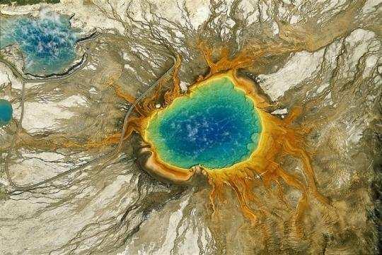
2 How do we represent the land system in models? Yann Arthus-Bertrand

3 IMAGE model; Bouwman et al.; Alcamo et al.
4 Scale

5 What is the correct resolution???????

6 How do we represent the land system in models? Agricultural management representation: Homogenous within world regions Land cover representation Spatial resolution: Approx. 5x5km
 LUCAS 23, 26")
7 Intensity of agriculture in 6. LUCAS points (N/ha) LUCAS 23, 26 CAPRI 2
8 -intended -unintended

9
")

10 From land cover to land use to land function Land cover can be a cause, constraint or consequence of land use (Cihlar and Jansen, 2) -intended -unintended Land functions: the capacity of the land to provide goods and services Verburg et al., 29 Journal of Environmental Management
11 Challenges for ecosystem services research Quantification and mapping.. Modelling. Communicating and discussing.
12 Quantification and mapping Methods depend on scale Local scale: Direct observation/measurement of land function indicators (actual provision of goods/services) -tourists recreational function -species (agro)biodiversity -water regulation peak flow measurements etc. Regional/continental scale: Use of location factors/proxies to determine land functions -beach recreational function -agricultural intensity agro-biodiversity
13 Quantification and mapping: regional scale Socio-economic properties Biophysical properties Landscape configuration Service provision Land use/cover
 -.2. -.3 2.7 Distance to swimming location -.. -.9.25 Local roads 5 m (%).388.37.9.7 Openness (m) -.4. -..6 Nature 5m (%) -.578.48 -.8 7.")
14 Quantification and mapping: regional scale Tourism function Variable Beta estim ate SD Variation coefficien t VIF Intercept Agriculture 5m (%) Distance to highway (m) Distance to nature >km2 (m) Distance to swimming location Local roads 5 m (%) Openness (m) Nature 5m (%) Tourism accomodation Clustered nature 5km (%) Accessible nature, 5m (%) Ugly elements, 5m (%) Willemen et al.,28. Landscape and urban planning


15 Quantification and mapping: regional scale Function capacity Plant Residential Cult. Arable Int. Tourism habitat heritage Leisure livestock prod. Summed capacity of landscape functions (-3) Multifunctionality: increase of total capacity to provide goods and services Number of functions Multifunctionality: decrease of capacity per landscape function Willemen et al., 29 (Ecological Indicators)
 between 2-25 Service supply Economic")
16 Quantification and mapping: regional scale Evaluation of policy plans and development trends Mapping changes in service supply and value (market price) between 2-25 Service supply Economic value
17 Quantification and mapping: European scale Approach based on location factors and proxies of landscape functions Define which land cover types and landscape conditions support ecosystem services Map spatial distribution of ecosystem services Kienast et al., 29. Environmental Management
18 3.4 nature protection area 3.3 wetlands (Corine unit 4) 3.2 waterbodies (Corine unit 5) 3. shrub& herbaceous (Corine unit 3.2) 3. permanent crops (Corine unit 2.2) 3.9 pastures (Corine unit 2.3) 3.8 open space with little or no vegetation (Corine unit 3.3) 3.7 heterogeneous agric. areas (Corine unit 2.4) 3.6 forested area (Corine unit 3.) 3.5 intertidal flats area (corine unit 4.2.3) 3.4 arable land (Corine unit 2.) 3.3 presence (%) or absence (%) of functional urban area with more than > 5 inhabitants in NUTS-X region 3.2 artificial surface (Corine unit ) 3. coastline 2.2 higher than 5m a.s.l 2. up to 5m a.s.l.3 steppic.2 arctic. all Europe except arctic & steppic Non-weighted links (nwl) between land characteristics and landscape functions ( = indifferent role ; = supportive role) Cultural & artistic information Recreation & tourism Aesthetic information Habitat function Biological control Erosion prevention Waste treatment Water regulation Natural hazards reduction Climate regulation Energy( biofuel&renewable energy) Transportation & housing Commercial forest products Cultivated products Wildlife products Number of independent land characteristic Landscape functions (Lf) Land characteristics (lc) Define which land cover types and landscape conditions support ecosystem services (experts)


19 Map spatial distribution of ecosystem services Kienast et al., 29 Environmental Mngmnt.


20 Quantification and mapping: European scale Tourism function Legend Function VALUE Low Moderate High Expert Van Berkel and Verburg, in prep. Statistical
21 Modelling. Mostly based on land cover modelling Ecosystem service change is analyzed as effect of land cover change Scenario Land cover change simulation Ecosystem service assessment


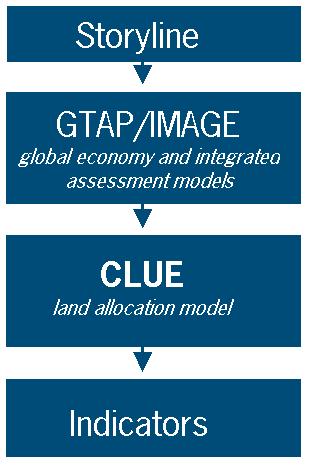
22 Modelling.a multi-scale, multi-model approach Global models Regional models Indicator models Ecosystem services CLUE-Scanner New generic platform Open source, etc. etc. Verburg et al, 28. Annals of Regional Science Verburg and Overmars, 29. Landscape Ecology
23


24 Modelling.a multi-scale, multi-model approach Assessing the impact of European Biofuels policy Effects of: Biofuel targets in OECD countries on Europe European Biofuel policies within and outside Europe A study for DG ENVIRONMENT (29) With: JP Lesschen, I Staritsky, M Perez Soba, M Hilferink M van Beek, E Koomen, M Banse, E Stehfest, AG Prins

25 Impact of Biofuel Directives on Agricultural Land Use, in million ha, 23 relative to CLUE-Scanner Africa Asia C&SAmer EU27 NAFTA World Reference Biofuel, w/o EU Biofuel, with EU Martin Banse; Results of GTAP model DG-ENV project

26 Reference scenario (B) (2-23) CLUE-Scanner
27 Global directives only (2-23) 23)
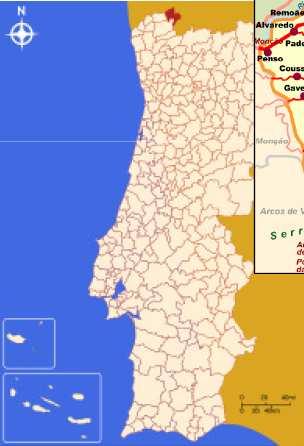
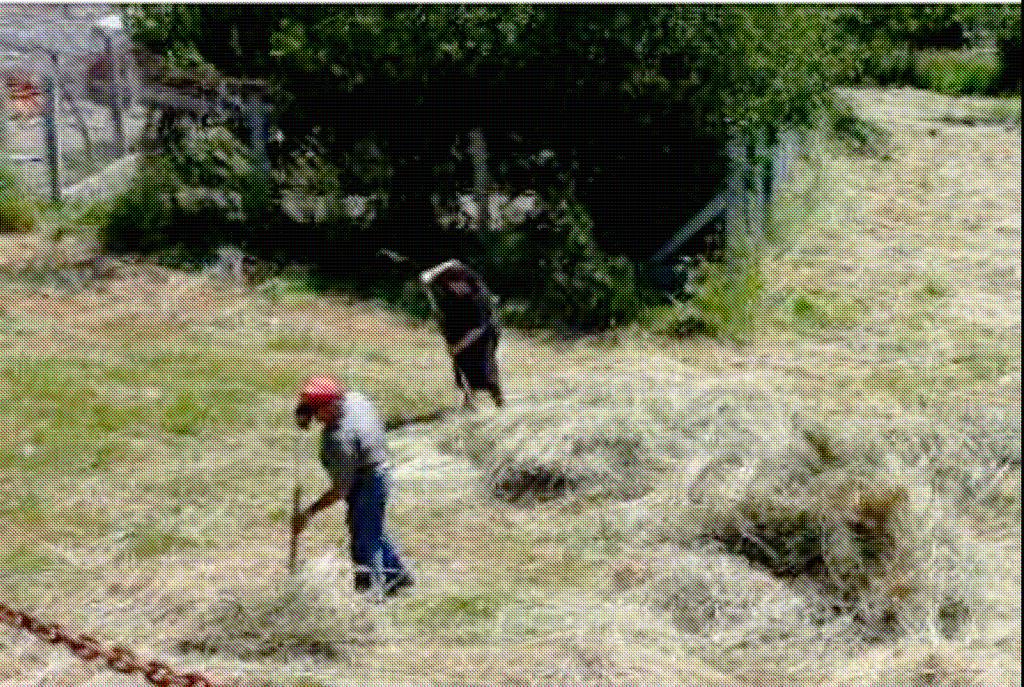
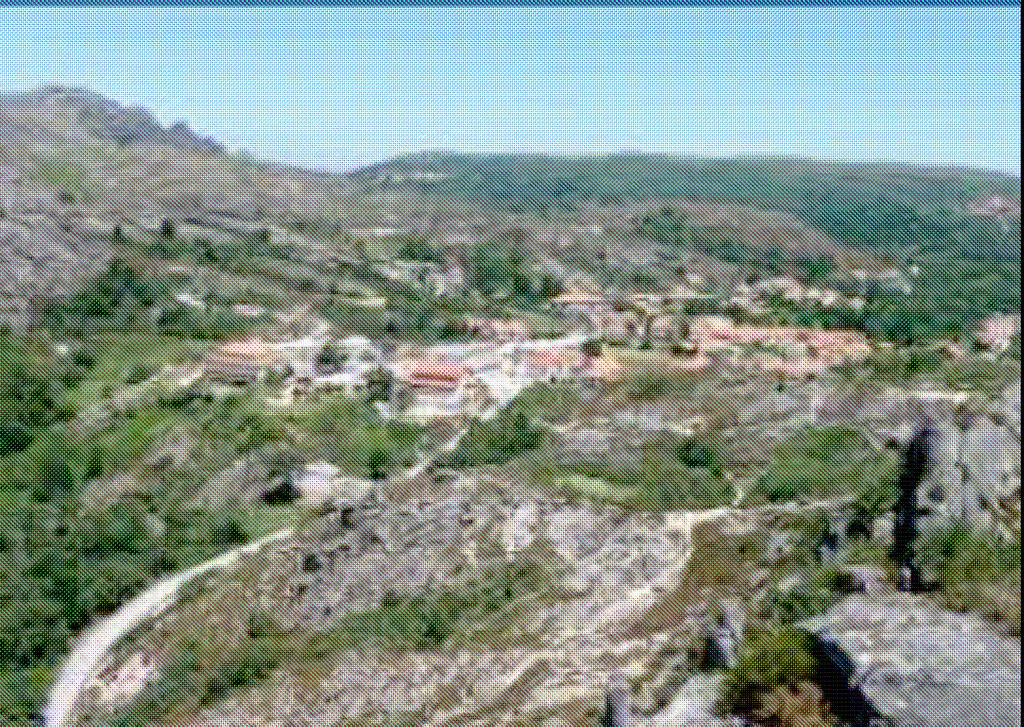
28 Global and European directives (2-23) 23)

29 Carbon sequestration Current C-sequestration LULUFC CLUE-Scanner 2 23 Reference 23 Biofuel policies Method based on: Schulp et al., 28 Agriculture, Ecosystems and Environment


biodiversity -Residential area")
30 Modelling.a multi-agent approach Ecosystem services: -Agricultural production -Recreation/tourism -Cultural heritage -Landscape aesthetics -(agro)biodiversity -Residential area (rural living) Winterswijk municipality, the Netherlands
31 Modelling.a multi-agent approach Conceptualization of system Valbuena et al., 2. Landscape Ecology
32 Modelling.a multi-agent approach Agents decision-making Internal factors External factors Feedback Farm scale Ability Willingness Options Decisions Actions Policies & subsidies Demand Advice Social networks & institutions Regional scale Land-use pattern Feedback Valbuena et al., Landsc. Ecol., 2
33 Modelling.a multi-agent approach Agent typology Valbuena, Verburg, Bregt, Agriculture, Ecosystems and Environment 28

34 Modelling.a multi-agent approach Processes modelled Farm expansion Land abandonment Management of treelines/hedgerows 2 23


35 Current Future situation result Landscape types
36 Modelling.some observations Most models treat ecosystem services as an indicator of land cover change Few models represent demand for non-commodity services explicitly (demand/supply relations needed) Model development, calibration and validation is difficult due to limited observations of ecosystem service changes

37 Communicating.trade-off analysis Trade-off analysis

38 Communicating.trade-off analysis Change in ecosystem services 2-25 Increase Decrease Plant habitat change Arable production change Willemen, Hein, Verburg, subm.

39 Communicating.visualisations A visualization of land abandonment for a case study area in Northern Portugal


40 Current situation Van Berkel, Ribeiro, Lovett and Verburg, in prep.

41 Scenario: continuation of abandonment Van Berkel, Ribeiro et al., in prep.
42 Scenario: rural development, multifunctionality Van Berkel, Ribeiro et al., in prep.
43 Communicating. Different rural futures provide a different bundle of ecosystem services Different stakeholders have a different demand and preference for ecosystem services national park local entrepreneurs Visualisations enable discussions about the tradeoffs and highlight the importance of spatial variation Visualisations (and models) are a tool for discussion support (validation based on success of supporting the negotiation process)
44 Synthesis and challenges No single method is perfect, portfolio approach needed to deal with multiple scales and sectors (Young et al., Ecol Soc 26) Attention for feedbacks Across scales: top-down and bottom-up Between impacts and drivers Ecosystem services change as result of land cover change Land cover change is a result of changing demand for ecosystem services Move from land cover to land function (ecosystem goods and services) Modelling is just a tool.....to help testing our understanding of the land system..to help answer specific questions..comparison of model representation and reality is needed to learn.

45 Thank you Institute for Environmental Studies VU University Amsterdam

46 From land cover to land use: Kenyan highlands Van de Steeg, Verburg et al. 2. Applied Geography
47 Quantification and mapping Monetary valuation vs. service supply -one consistent measure versus different units and measures Aggregate scale (administrative units?) vs. mapping Land use and land cover Climate Land functions Location characteristics Demographic Characteristics and demand
Mapping of ecosystems and their services in the EU and its Member States
 Mapping of ecosystems and their services in the EU and its Member States Leon C. Braat, Alterra, Wageningen, The Netherlands MESEU Brussels, July 1, 2015 MESEU FINAL REPORT OCTOBER 2015 The Objective :
Mapping and Assessment of Ecosystems and their Services
 Mapping and Assessment of Ecosystems and their Services ALTER-Net Conference 2013: Science underpinning the EU 2020 Biodiversity Strategy. April 2013 Gent Joachim MAES 1 This presentation is based on the
SPLAN-Natura Towards an integrated spatial planning approach for Natura th January, 2017 Brussels. Commissioned by DG Environment
 SPLAN-Natura 2000 Towards an integrated spatial planning approach for Natura 2000 Commissioned by DG Environment 17 th January, 2017 Brussels V. Simeonova (Ph.D.) Drivers towards integrating Biodiversity
16540/14 EE/cm 1 DG E 1A
 Council of the European Union Brussels, 5 December 2014 (OR. en) 16540/14 ENV 965 CULT 139 NOTE From: To: Subject: General Secretariat of the Council Delegations Charter of Rome on Natural and Cultural
The Governance of Land Use
 The planning system Levels of government and their responsibilities The Governance of Land Use COUNTRY FACT SHEET NORWAY Norway is a unitary state with three levels of government; the national level, 19
Fig 1. Steps in the EcoValue Project
 Assessing the Social and Economic Value of Ecosystem Services in the Northern Forest Region: A Geographic Information System (GIS) Approach to Landscape Valuation Principal Investigator(s): Dr. Matthew
Assessing and mapping ecosystem services in a small islands state
 Assessing and mapping ecosystem services in a small islands state Mario V. Balzan Laboratory of Terrestrial Ecology, Institute of Applied Science, MCAST, Malta. E-mail: mario.balzan@mcast.edu.mt SGA Mentoring
Assessment and valuation of Ecosystem Services for decision-makers
 Assessment and valuation of Ecosystem Services for decision-makers An introduction to the ARIES approach Ferdinando Villa *, Ken Bagstad Gary Johnson, Marta Ceroni *Basque Center for Climate Change, Bilbao,
Framework for the Basin-Wide Socio-Economic Analysis of Four Proposed Sediment Diversions. August 4, 2015
 Framework for the Basin-Wide Socio-Economic Analysis of Four Proposed Sediment Diversions August 4, 2015 Proposed Sediment Diversions Mid-Breton Mid-Barataria Lower Barataria Lower Breton Overview of Presentation
EAGLE Data Model and Outcomes of HELM (Harmonised European Land Monitoring)
") EAGLE Data Model and Outcomes of HELM (Harmonised European Land Monitoring) Contribution towards better land information harmonisation and INSPIRE compliance EAGLE working group Stephan Arnold, Barbara
EAGLE Data Model and Outcomes of HELM (Harmonised European Land Monitoring) Contribution towards better land information harmonisation and INSPIRE compliance EAGLE working group Stephan Arnold, Barbara
Spatial Disaggregation of Land Cover and Cropping Information: Current Results and Further steps
 CAPRI CAPRI Spatial Disaggregation of Land Cover and Cropping Information: Current Results and Further steps Renate Koeble, Adrian Leip (Joint Research Centre) Markus Kempen (Universitaet Bonn) JRC-AL
SEEA Experimental Ecosystem Accounting
 SEEA Experimental Ecosystem Accounting Sokol Vako United Nations Statistics Division Training for the worldwide implementation of the System of Environmental Economic Accounting 2012 - Central Framework
Global Land Project: major scientific questions for coupled modelling
 Global Land Project: major scientific questions for coupled modelling Richard Aspinall Macaulay Land Use Research Institute and GLP Nodal Office on Integration and Modelling Aberdeen, Scotland NATO Advanced
Making maps: Traditions and perceptions in Europe. European spatial planning and cartographic representations
 ESPON Create Europe! Making maps: Traditions and perceptions in Europe Dr. Stefanie Dühr University of the West of England, Bristol, UK European spatial planning and cartographic representations Scenarios.
Establishment of the Hellenic Ecosystem Services Partnership (HESP) research group: Drafting the national agenda for the implementation of the
 research group: Drafting the national agenda for the implementation of the") Establishment of the Hellenic Ecosystem Services Partnership (HESP) research group: Drafting the national agenda for the implementation of the ES concept in Greece Establishment of the Hellenic Ecosystem
Establishment of the Hellenic Ecosystem Services Partnership (HESP) research group: Drafting the national agenda for the implementation of the ES concept in Greece Establishment of the Hellenic Ecosystem
Sustainable development of the Greek islands
 Sustainable development of the Greek islands Coccossis H. in Camarda D. (ed.), Grassini L. (ed.). Interdependency between agriculture and urbanization: Conflicts on sustainable use of soil and water Bari
Exploring the provision of ecosystem services through rural landscape management: a development of conceptual framework
 Exploring the provision of ecosystem services through rural landscape management: a development of conceptual framework Rovai M., Bartolini F., Fastelli L., Brunori G. Department of Agriculture, Food and
PROMOTING NATURE CONSERVATION AND SUSTAINABLE AGRICULTURAL DEVELOPMENT IN THE RURAL AREAS OF HONG KONG
 1 PROMOTING NATURE CONSERVATION AND SUSTAINABLE AGRICULTURAL DEVELOPMENT IN THE RURAL AREAS OF HONG KONG Director of Agriculture, Fisheries and Conservation Dr. LEUNG Siu-fai A STONE S THROW AWAY FROM
Maria Andrzejewska UNEP/GRID Warsaw Centre
 Maria Andrzejewska UNEP/GRID Warsaw Centre Agenda 1. Environment matters! 2. Spatial data to benefit environment 3. Environment management with cadastral data 4. Cadaster in spatial planning 5. Conclusions
Most people used to live like this
 Urbanization Most people used to live like this Increasingly people live like this. For the first time in history, there are now more urban residents than rural residents. Land Cover & Land Use Land cover
SIF_7.1_v2. Indicator. Measurement. What should the measurement tell us?
 Indicator 7 Area of natural and semi-natural habitat Measurement 7.1 Area of natural and semi-natural habitat What should the measurement tell us? Natural habitats are considered the land and water areas
Regional Plan 4: Integrating Ecosystem Services Mapping into Regional Land Use Planning
 Rural-Urban Outlooks: Unlocking Synergies (ROBUST) ROBUST receives funding from the European Union s Horizon 2020 research and innovation programme under grant agreement No 727988.* October 2018 Natural
Directorate E: Sectoral and regional statistics Unit E-4: Regional statistics and geographical information LUCAS 2018.
 EUROPEAN COMMISSION EUROSTAT Directorate E: Sectoral and regional statistics Unit E-4: Regional statistics and geographical information Doc. WG/LCU 52 LUCAS 2018 Eurostat Unit E4 Working Group for Land
Standardization of the land cover classes using FAO Land Cover Classification System (LCCS)
") Sofia, 17-18 September 2008, LPIS Workshop LPIS applications and quality 1 Standardization of the land cover classes using FAO Land Cover Classification System (LCCS) Pavel MILENOV Agriculture Unit, JRC
Sofia, 17-18 September 2008, LPIS Workshop LPIS applications and quality 1 Standardization of the land cover classes using FAO Land Cover Classification System (LCCS) Pavel MILENOV Agriculture Unit, JRC
Update ecosystem services analysis in SEEA Experimental Ecosystem Accounting
 Update ecosystem services analysis in SEEA Experimental Ecosystem Accounting Prof. Dr Lars Hein, Wageningen University With materials produced by or in collaboration with CBS, Statistics the Netherlands
Land Cover and Land Use Diversity Indicators in LUCAS 2009 data
 Land Cover and Land Use Diversity Indicators in LUCAS 2009 data A. Palmieri, L. Martino, P. Dominici and M. Kasanko Abstract Landscape diversity and changes are connected to land cover and land use. The
EcoServ-GIS. EcoServ GIS Stage I. Why EcoServ GIS? 17/12/2012
 EcoServ-GIS Ecosystem Services Mapping: A Wildlife Trust GIS Toolkit to map ecosystem services at a county scale Dr Jonathan Winn Living Landscape Coordinator Durham Wildlife Trust Dr Chloe Bellamy Ecosystem
Vulnerability and Adaptation to Climate Change
 Vulnerability and Adaptation to Climate Change Prof. Dr. Christoph Görg Department of Social Sciences, University of Kasssel Head of Department Environmental Politics, UFZ Leipzig 1 Introduction: Climate
Land accounting perspective on water resources management
 European Water 60: 161-166, 2017. 2017 E.W. Publications Land accounting perspective on water resources management G.T. Paschos, G.E. Bariamis * and E.A. Baltas Department of Water Resources and Environmental
Low Density Areas : Places of Opportunity. Enrique Garcilazo, OECD Directorate for Public Governance and Territorial Development
 Low Density Areas : Places of Opportunity Enrique Garcilazo, OECD Directorate for Public Governance and Territorial Development Open Days, Brussels, 11 th October, 2016 Outline 1. Performance low density
This table connects the content provided by Education Perfect to the NSW Syllabus.
 Education Perfect Geography provides teachers with a wide range of quality, engaging and innovative content to drive positive student learning outcomes. Designed by teachers and written by our in-house
Accounting Units for Ecosystem Accounts Paper prepared by Alessandra Alfieri, Daniel Clarke, and Ivo Havinga United Nations Statistics Division
 DEPARTMENT OF ECONOMIC AND SOCIAL AFFAIRS STATISTICS DIVISION UNITED NATIONS Expert Meeting on Ecosystem Accounts London, UK 5-7 December 2011 Accounting Units for Ecosystem Accounts Paper prepared by
System of Environmental-Economic Accounting. Advancing the SEEA Experimental Ecosystem Accounting. Extent Account (Levels 1 and 2)
") Advancing the SEEA Experimental Ecosystem Accounting Extent Account (Levels 1 and 2) Overview: The Extent Account 1. Learning objectives 2. Review of Level 0 (5m) What is it? Why do we need it? What does
Advancing the SEEA Experimental Ecosystem Accounting Extent Account (Levels 1 and 2) Overview: The Extent Account 1. Learning objectives 2. Review of Level 0 (5m) What is it? Why do we need it? What does
Spatial Decision Support Systems for policy support in urban planning contexts
 Spatial Decision Support Systems for policy support in urban planning contexts Roel Vanhout P.O. Box 463 6200 AL Maastricht The Netherlands www.riks.nl About RIKS w Independent research institute w Founded
Millennium Ecosystem Assessment
 Millennium Ecosystem Assessment Global Data Challenges from an MA perspective Global Spatial Data and Information User Workshop 21-23 September 2004! What is the MA?! How and what kinds of data does it
The National Spatial Strategy
 Purpose of this Consultation Paper This paper seeks the views of a wide range of bodies, interests and members of the public on the issues which the National Spatial Strategy should address. These views
Typology of Rural Regions in Europe RUFUS. Johanna Scholz& Sylvia Herrmann. A regional typology as instrument for integrative rural development
 Typology of Rural Regions in Europe A regional typology as instrument for integrative rural development RUFUS Rural Future Networks Workshop Hannover 25-26 August 2010 `Diversities of rural areas in Europe
Land Use in the context of sustainable, smart and inclusive growth
 Land Use in the context of sustainable, smart and inclusive growth François Salgé Ministry of sustainable development France facilitator EUROGI vice president AFIGéO board member 1 Introduction e-content+
Navigable maritime and river waterways in the seaside - Danube Delta area and the connected rural development
 SUMMARY OF Ph-D Thesis, with title RESEARCH STUDIES ON MANAGEMENT IMPROVEMENT OF MARITIME AND RIVER TRANSPORT ACTIVITY IN THE COASTAL AND DANUBE DELTA AREA FROM AN ENVIROMENTAL, ECONOMIC AND SOCIAL PERSPECTIVE
Multifunctional theory in agricultural land use planning case study
 Multifunctional theory in agricultural land use planning case study Introduction István Ferencsik (PhD) VÁTI Research Department, iferencsik@vati.hu By the end of 20 th century demands and expectations
The Role of Wilderness in Climate Change Adaptation
 The Role of Wilderness in Climate Change Adaptation A Case Study of the Northern Rockies Greg Aplet, Bo Wilmer Goal: Sustaining Ecosystem Services Sustaining the full suite of benefits we receive from
M14/3/GEOGR/SP2/ENG/TZ0/XX/Q GEOGRAPHY STANDARD LEVEL PAPER 2. Monday 19 May 2014 (morning) 1 hour 20 minutes INSTRUCTIONS TO CANDIDATES
 1 hour 20 minutes INSTRUCTIONS TO CANDIDATES") M14/3/GEOGR/SP2/ENG/TZ0/XX/Q 22145203 GEOGRAPHY STANDARD LEVEL PAPER 2 Monday 19 May 2014 (morning) 1 hour 20 minutes INSTRUCTIONS TO CANDIDATES Do not open this examination paper until instructed to do
M14/3/GEOGR/SP2/ENG/TZ0/XX/Q 22145203 GEOGRAPHY STANDARD LEVEL PAPER 2 Monday 19 May 2014 (morning) 1 hour 20 minutes INSTRUCTIONS TO CANDIDATES Do not open this examination paper until instructed to do
COMMON CONCEPTUAL AND OPERATIONAL FRAMEWORKS FOR RESEARCH AND SUSTAINABLE MANAGEMENT OF NESTED SOCIO-ECOLOGICAL SYSTEMS ACROSS LARGE WATERSHEDS
 COMMON CONCEPTUAL AND OPERATIONAL FRAMEWORKS FOR RESEARCH AND SUSTAINABLE MANAGEMENT OF NESTED SOCIO-ECOLOGICAL SYSTEMS ACROSS LARGE WATERSHEDS Angheluta VADINEANU 1 & Nusret KARAKAYA 2 1 Department of
The ESPON Programme. Goals Main Results Future
 The ESPON Programme Goals Main Results Future Structure 1. Goals Objectives and expectations Participation, organisation and networking Themes addressed in the applied research undertaken in ESPON projects
Are EU Rural Areas still Lagging behind Urban Regions? An Analysis through Fuzzy Logic
 Are EU Rural Areas still Lagging behind Urban Regions? An Analysis through Fuzzy Logic Francesco Pagliacci Department of Economics and Social Sciences Università Politecnica delle Marche Ancona (Italy)
Developing urban ecosystem accounts for Great Britain. Emily Connors Head of Natural Capital Accounting Office for National Statistics (UK)
") Developing urban ecosystem accounts for Great Britain Emily Connors Head of Natural Capital Accounting Office for National Statistics (UK) UN 2014 UN 2014 ONS 2017 UK motivation 54% 82% 5,900 Of the world
Developing urban ecosystem accounts for Great Britain Emily Connors Head of Natural Capital Accounting Office for National Statistics (UK) UN 2014 UN 2014 ONS 2017 UK motivation 54% 82% 5,900 Of the world
Note on Definition of Socio-Ecological Landscape Unit, SELU Classification and its Policy Application
 Note on Definition of Socio-Ecological Landscape Unit, SELU Classification and its Policy Application Alessandra Alfieri, Daniel Clarke and Ivo Havinga, United Nations Statistics Division and Jean Louis
A Comparison of the Social Valuation of Ecosystem Services in Urban and Rural Contexts
 A Comparison of the Social Valuation of Ecosystem Services in Urban and Rural Contexts Jarrod L. Loerzel College of Charleston Zachary D. Cole University of Florida Presentation Map 1. What is SolVES?
CLLD Cooperation OFFER
 Title of the proposed project (English) CLLD Cooperation OFFER PARKS PROTECTION III - Management, Protection and Economic Development in Protected Areas Type of project (select as many as you want) Cooperation
Land Use Planning and Agriculture: Austrian Experiences and Challenges I
 Land Use Planning and Agriculture: Austrian Experiences and Challenges I SULANET Summer School 2016 Walter Seher BOKU Vienna 1 Land Use Planning and Agriculture 2 Land Use Planning and Agriculture Agriculture
EcoServ-GIS. Ecosystem Services Mapping: A Wildlife Trust GIS Toolkit to map ecosystem services at a county scale
 EcoServ-GIS Ecosystem Services Mapping: A Wildlife Trust GIS Toolkit to map ecosystem services at a county scale Dr Jonathan Winn Living Landscape Coordinator Durham Wildlife Trust Dr Chloe Bellamy Ecosystem
How rural the EU RDP is? An analysis through spatial funds allocation
 How rural the EU RDP is? An analysis through spatial funds allocation Beatrice Camaioni, Roberto Esposti, Antonello Lobianco, Francesco Pagliacci, Franco Sotte Department of Economics and Social Sciences
European Regional and Urban Statistics
 European Regional and Urban Statistics Dr. Berthold Feldmann berthold.feldmann@ec.europa.eu Eurostat Structure of the talk Regional statistics in the EU The tasks of Eurostat Regional statistics Urban
Extent. Level 1 and 2. October 2017
 Extent Level 1 and 2 October 2017 Overview: Extent account 1. Learning objectives 2. Review of Level 0 (5m) 3. Level 1 (Compilers): Concepts (15m) Group exercise and discussion (15m) 4. Level 2 (Data Providers)
Local Area Key Issues Paper No. 13: Southern Hinterland townships growth opportunities
 Draft Sunshine Coast Planning Scheme Review of Submissions Local Area Key Issues Paper No. 13: Southern Hinterland townships growth opportunities Key Issue: Growth opportunities for Southern Hinterland
LUCAS: current product and its evolutions
 LUCAS: current product and its evolutions Workshop Land Use and Land Cover products: challenges and opportunities Brussels 15 Nov 2017 Eurostat E4: estat-dl-lucas@ec.europa.eu Contents 1) The context 2)
COURSES OUTSIDE THE JOURNALISM SCHOOL
 COURSES OUTSIDE THE JOURNALISM SCHOOL Students are not limited to the science courses on this list and may select classes from additional specialties. In accordance with University policy, 400-level courses
Cross-border Maritime Spatial Plan for the Black sea - Romania and Bulgaria project
 Cross-border Maritime Spatial Plan for the Black sea - Romania and Bulgaria project in Romania and Bulgaria Plan Presentation A first step in the management of the marine areas of Romania and Bulgaria
Data sources and classification for ecosystem accounting g
 Data sources and classification for ecosystem accounting Ken Bagstad 23 February 2015 Wealth Accounting and the Valuation of Ecosystem Services www.wavespartnership.org Data sources and classification
Urban-rural relations in Europe
 Urban-rural relations in Europe Typology of urban and rural characteristics developed by the ESPON 1.1.2 project Kaisa Schmidt-Thomé 14.12.2006 Sevilla JRC/IPTS Rural typologies -workshop ESPON 2006 Programme
Local Development Pilot Project: Island of Cres. Ranka Saračević Würth, Ministry of Culture, Republic of Croatia
 Local Development Pilot Project: Island of Cres Ranka Saračević Würth, Ministry of Culture, Republic of Croatia BACKGROUND, RATIFICATION OF THE FARO CONVENTION BY REPUBLIC OF CROATIA The Framework Convention
Possibilities for applying ES assessment results in spatial planning in Latvia
 Possibilities for applying ES assessment results in spatial planning in Latvia Inga Hoņavko LIFE EcosystemServices project manager LIFE Viva Grass seminar, Sigulda, 17.05.2018 Projekts LIFE EcosystemServices,
From individual perceptions and statistical data to instruments for land resource management
 From individual s and statistical data to instruments for land Land Ulrike Tappeiner, Innsbruck / Bolzano Status quo versus Stefan Marzelli, München Instruments Status quo versus The two sides of the same
GGY 301: Research Methods
 GGY 301: Research Methods Course No GGY 301 Course Title Research Methods Core/Optional Core for Special Degree :This course provides students with a basic knowledge and understanding of the research methodology
Mapping ecosystem services provided by benthic habitats in the European Atlantic Ocean
 Mapping and Assessment Ecosystem Services and Links to Good Environmental Status Mapping ecosystem services provided by benthic habitats in the European Atlantic Ocean Ibon Galparsoro, Angel Borja and
Accounting for Ecosystem and Biodiversity Related Themes in Uganda
 Introduction Accounting for Ecosystem and Biodiversity Related Themes in Uganda Calls for more evidence-based approaches to policy have increased the need for integrated environmental-economic information
The inland water related tourism in South Africa by 2030 in the light of global change
 The inland water related tourism in South Africa by 2030 in the light of global change KSA 2 Water-Linked Ecosystems T4: Green economy and sustainable (green) innovations K5/2620 How can natural capital
Mapping Ecosystem Services: Current Trends
 Mapping Ecosystem Services: Current Trends Ignacio Palomo, Berta Martín-López, Carlos Montes Social Ecological Systems Laboratory Department of Ecology Universidad Autónoma de Madrid ACES 2008: A Conference
ENV208/ENV508 Applied GIS. Week 1: What is GIS?
 ENV208/ENV508 Applied GIS Week 1: What is GIS? 1 WHAT IS GIS? A GIS integrates hardware, software, and data for capturing, managing, analyzing, and displaying all forms of geographically referenced information.
Mediterranean Sea and Territorial Development, Opportunities and Risks
 EESC Hearing Towards an EU Macro-Regional Strategy for the Mediterranean Mediterranean Sea and Territorial Development, Opportunities and Risks Michaela Gensheimer Structure of Intervention Part I: What
TERRITORIAL IMPACT ASSESSMENT: AN APPROACH TO IMPROVE THE VERTICAL AND HORIZONTAL INTEGRATION OF EU POLICIES
 TERRITORIAL IMPACT ASSESSMENT: AN APPROACH TO IMPROVE THE VERTICAL AND HORIZONTAL INTEGRATION OF EU POLICIES Naja Marot & Mojca Golobič Biotehnical Faculty, University of Ljubljana, Slovenia RSA Workshop
GEOGRAPHY ADVANCED LEVEL
 GEOGRAPHY ADVANCED LEVEL The syllabus is based on the belief that geography makes a valuable contribution to education. This partly derives from the nature of the questions which geographers raise and
European spatial policy and regionalised approaches
 Findings of the ESPON 2006 Programme COMMIN Final Conference 26-27 April 2007 European spatial policy and regionalised approaches by Dr. Kai BöhmeB ! Territory matters Structure of presentation! Territorial
Modelling of land cover changes with CLUE-S in Bac Kan province, Vietnam
 SAM Paper Series 17 (2002) Mountain Agrarian Systems Modelling of land cover changes with CLUE-S in Bac Kan province, Vietnam Louise Willemen a, Peter H. Verburg a, Jean-Christophe Castella b, Vu Nguyen
Role of SF-MST. A summary of SF-MST
 A summary of SF-MST UNWTO Committee on Statistics and TSA Madrid, 27 & 28 February 2018 Carl Obst, IDEEA Group Consultant to UNWTO Role of SF-MST Respond to the significant demand for robust measures of
Foundation Geospatial Information to serve National and Global Priorities
 Foundation Geospatial Information to serve National and Global Priorities Greg Scott Inter-Regional Advisor Global Geospatial Information Management United Nations Statistics Division UN-GGIM: A global
Organizing Inter- and Transdisciplinary Research in TERRECO TERRECO Seminar, Winter term 2009/10
 Organizing Inter- and Transdisciplinary Research in TERRECO TERRECO Seminar, Winter term 2009/10 Prof. Dr. Thomas Köllner Professorship of Ecological Services (PES), University of Bayreuth Goals 1. Learn
Discussion paper on spatial units
 Discussion paper on spatial units for the Forum of Experts in SEEA Experimental Ecosystem Accounting 2018 Version: 8 June 2018 Prepared by: SEEA EEA Revision Working Group 1 on spatial units (led by Sjoerd
Modeling Smart Growth in the Southeast Using Smart-SLEUTH. November 20, 2014 SOUTH ATLANTIC LCC WEB FORUM Monica A. Dorning
 Modeling Smart Growth in the Southeast Using Smart-SLEUTH November 20, 2014 SOUTH ATLANTIC LCC WEB FORUM Monica A. Dorning (Sub)Urbanization in the Southeast November 20, 2014 SOUTH ATLANTIC LCC WEB FORUM
Possible links between a sample of VHR images and LUCAS
 EUROPEAN COMMISSION EUROSTAT Directorate E: Sectoral and regional statistics Unit E-1: Farms, agro-environment and rural development CPSA/LCU/08 Original: EN (available in EN) WORKING PARTY "LAND COVER/USE
Integration: multifunctional adaptation to climate change
 Integration: multifunctional adaptation to climate change Work package leader : Dr. C.C. Vos Content Integration: multifunctional adaptation to climate change... 1 1 Description work package... 1 1.1 Problem
Heritage and Cultural Tourism Management
 Unit 34: Heritage and Cultural Tourism Management Unit code: L/601/1757 QCF level: 4 Credit value: 15 Aim The aim of this unit is to enable learners to gain understanding of the heritage and cultural,
Geographical knowledge and understanding scope and sequence: Foundation to Year 10
 Geographical knowledge and understanding scope and sequence: Foundation to Year 10 Foundation Year 1 Year 2 Year 3 Year 4 Year 5 Year 6 Year level focus People live in places Places have distinctive features
Spatial Economics Ph.D. candidate E: JJan Rouwendal Associate Professor E:
 M k van D Mark Duijn ij Spatial Economics Ph.D. candidate E: m.van.duijn@vu.nl JJan Rouwendal R d l Spatial Economics Associate Professor E: j.rouwendal@vu.nl Jobs are the main amenity of cities but certainly
Together towards a Sustainable Urban Agenda
 Together towards a Sustainable Urban Agenda The City We (Youth) Want Preliminary findings from youth consultations Areas Issue Papers Policy Units 1.Social Cohesion and Equity - Livable Cities 2.Urban
A Spatial Decision Support System for Agriculture and Natural Resources Management in China
 9 th APGEOSS Symposium Xiangzheng Deng A Spatial Decision Support System for Agriculture and Natural Resources Management in China Need to take decisions and make critical day-to-day and long-term planning
Land Accounts - The Canadian Experience
 Land Accounts - The Canadian Experience Development of a Geospatial database to measure the effect of human activity on the environment Who is doing Land Accounts Statistics Canada (national) Component
Spatial Modeling of Land Use and Land Cover Change
 Spatial Modeling of Land Use and Land Cover Change Daniel G. Brown Environmental Spatial Analysis Lab School of Natural Resources and Environment University of Michigan Synthesis Products Modeling Chapter
Spatial Analysis and Modeling of Urban Land Use Changes in Lusaka, Zambia: A Case Study of a Rapidly Urbanizing Sub- Saharan African City
 Spatial Analysis and Modeling of Urban Land Use Changes in Lusaka, Zambia: A Case Study of a Rapidly Urbanizing Sub- Saharan African City January 2018 Matamyo SIMWANDA Spatial Analysis and Modeling of
European Topic Centre on Land Urban and Soil Systems. Green Infrastructure at EEA
 Green Infrastructure at EEA A SPATIAL APPROACH TO MAPPING GI Stefan Kleeschulte, ETC ULS GI and territorial cohesion 2011 first EEA report on Green Infrastructure Underlining the need to develop tools
SEEA EXPERIMENTAL ECOSYSTEM ACCOUNTING SEEA EEA TECHNICAL RECOMMENDATIONS PAPER PREPARED FOR UNCEEA MEETING, JUNE 2017
 SEEA EXPERIMENTAL ECOSYSTEM ACCOUNTING SEEA EEA TECHNICAL RECOMMENDATIONS PAPER PREPARED FOR UNCEEA MEETING, JUNE 2017 14 June 2017 Background 1. In March 2017, a revised draft of the SEEA EEA Technical
Arctic ecosystem services: TEEB Arctic Scoping study. Alexander Shestakov WWF Global Arctic Programme 3 December Arctic Biodiversity Congress
 Arctic ecosystem services: TEEB Arctic Scoping study Alexander Shestakov WWF Global Arctic Programme 3 December 20143 Arctic Biodiversity Congress Content 1. Project design 2. Approach 3. Challenges and
COUNCIL OF THE EUROPEAN UNION. Brussels, 2 May /14 CULT 68
 COUNCIL OF THE EUROPEAN UNION Brussels, 2 May 2014 9129/14 CULT 68 NOTE from: General Secretariat of the Council to: Permanent Representatives Committee (Part 1) / Council No. prev. doc.: 8892/14 CULT
China-ASEAN Advanced Academy on Oceans Law and Governance 7-16 November 2016, NISCSS, Haikou
 China-ASEAN Advanced Academy on Oceans Law and Governance 7-16 November 2016, NISCSS, Haikou Topics to cover Why ocean? The importance of the oceans Why ocean governance? Key concerns affecting the oceans
Thomas Koellner 1, Adrienne Grét-Regamey 1, Miguel Marchamalo 2, and Raffaele Vignola 3. ETH Zurich, Switzerland. Polytecnica Madrid, Spain
 Thomas Koellner 1, Adrienne Grét-Regamey 1, Miguel Marchamalo 2, and Raffaele Vignola 3 1 ETH Zurich, Switzerland 2 Polytecnica Madrid, Spain 3 CATIE, Costa Rica Our concept of human-environment systems
Applying GIS to Coastal Management in Cork Harbour: the Corepoint experience
 Applying GIS to Coastal Management in Cork Harbour: the Corepoint experience Kathrin Köpke University College Cork, Ireland Thematic Conference: THE WATERFRONT MANAGEMENT AND GI (IT), 14 th -18 th November
Ecological Valuation for Land Use Planning Decision Support in South Florida: The Ecosystem Portfolio Model
 Ecological Valuation for Land Use Planning Decision Support in South Florida: The Ecosystem Portfolio Model Bill Labiosa, Rich Bernknopf, Paul Hearn, Dianna Hogan, Dave Strong, Leonard Pearlstine, Amy
TEEB: The Economics of Ecosystems and Biodiversity Overview of Process, Content and Approach
 TEEB: The Economics of Ecosystems and Biodiversity Overview of Process, Content and Approach Heidi Wittmer TEEBAgriFood writers workshop Paris, 9-10 May 2016 TEEB s genesis Potsdam Initiative Biological
Spatial Units, Scaling and Aggregation (Level 1) October 2017
 October 2017") Spatial Units, Scaling and Aggregation (Level 1) October 2017 Overview: Spatial Units 1. Learning objectives 2. Review of Level 0 (5m) 3. Level 1 (Compilers): Presentation & group exercise Spatial units
Spatial Units, Scaling and Aggregation (Level 1) October 2017 Overview: Spatial Units 1. Learning objectives 2. Review of Level 0 (5m) 3. Level 1 (Compilers): Presentation & group exercise Spatial units
CHAPTER 4 HIGH LEVEL SPATIAL DEVELOPMENT FRAMEWORK (SDF) Page 95
 Page 95") CHAPTER 4 HIGH LEVEL SPATIAL DEVELOPMENT FRAMEWORK (SDF) Page 95 CHAPTER 4 HIGH LEVEL SPATIAL DEVELOPMENT FRAMEWORK 4.1 INTRODUCTION This chapter provides a high level overview of George Municipality s
CHAPTER 4 HIGH LEVEL SPATIAL DEVELOPMENT FRAMEWORK (SDF) Page 95 CHAPTER 4 HIGH LEVEL SPATIAL DEVELOPMENT FRAMEWORK 4.1 INTRODUCTION This chapter provides a high level overview of George Municipality s