Towards more integrated research and observation in the Alps. The Bavarian Academy of Sciences and Humanities and its
|
|
|
- Leon Jones
- 6 years ago
- Views:
Transcription
1 Towards more integrated research and observation in the Alps The Bavarian Academy of Sciences and Humanities and its Commission i for Glaciology l Our activities in Alpine Research
2 Towards more integrated research and observation in the Alps The Bavarian Academy of Sciences and Humanities and its Commission i for Glaciology l Our activities in Alpine Research
3 Structure Research organisation and topics Monitoring and process oriented research Linkages and cooperations
4 Bavarian Academy of Sciences and Humanities (Bayerische Akademie der Wissenschaften) Research Programme: Glacier Research Commission for Glaciology Chairman: Prof. Dr. H. Hagedorn (Würzburg), Investigation period Basic Programme Long-term monitoring of Vernagtferner, Austrian Alps Geodetic survey of selected glaciers in the Eastern Alps Run-off generation from glaciated watersheds Glacier conditions in High Asia (debris covered glaciers) Polar research Education and training Advisory organisation for decision makers Public outreach
5


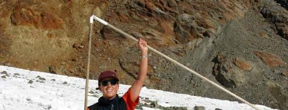
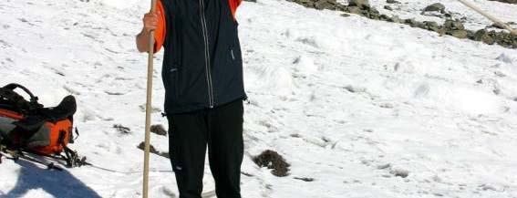
6 W. Hagg, 2008 Vernagtferner, Ötztaler Alpen, Austria


7 Advancing Vernagtferner Lithography h ca. 1810, C.F.Hoppe


8 E. Heucke L. Braun L. Braun M. Weber
9 Cumulative mass balance of Vernagtferner
10
11 Long time series of glacier mass balance in Europe
12 Climate Station Vernagtbach
13 Vernagtferner during climate variations
14 Trends in air temperature at gauging station Vernagtbach
15 :30 Run-off Vernagtbach ca. 11 m 3 /s
16
17 Lambrecht & Mayer, 2009
18 2000
19 2009


20 Annual mean air temperature at Zugspitze (2940 m), summer full year winter (source: DWD)
21 Geodetic Survey of Glaciers in the Eastern Alps


22 Glacier extent Zugspitzplatt : 1890 and 2003
23 Ablation on debris covered glaciers


24 Ablation on debris covered glaciers
25 Mass Balance in a more general understanding Scales I (temporal): Post glacial Little Ice Age (centuries) Recent development Scales II (spatial): Alpine glaciation Glacier cover of mountain ranges (Ötztal, central Pamir) Local glaciers Changes of the storage characteristics Glaciers - Ground Water - Discharge
26
27 Archive KfG
28 Archive KfG


29


30 Notgemeinschaft Lake Sarez Fedtschenko Remote Sensing Data: - Optical Data (Aster, Landsat) - Aster/SRTM Elevation Data - ERS 1/2 tandem SAR (Velocities, Elevations) - ICESAT and Cryosat 2 Data (Elevations) In Combination with: GRACE, GOCE (Gravity)
31 Scientific approach: Local/regional: glaciological mass balance, hydrology GPS-Monitoring Monitoring, local gravity field Large scale: ground truth for validation, remote sensing methods (Cryosat 2, Grace, Goce, TerraSAR-X, optical satellite data) Relevance: Ice losses and crustal movement Changes of discharge charateristics Increase of natural hazards and geological processes
32 Linkages and cooperations: Department for Geosciences, LMU, Munich: Bavarian glaciers, Central Asian Studies Insitute for Cartography, TU Munich and DLR: Glacier mapping, remote sensing techniques IMGI, Univ. Innsbruck: Glacier inventory, Glacier hydrology, Central Asian Studies Department of Geosciences, Univ. Milan: Central Asian Studies, Ablation on debris covered galciers GFZ, Potsdam, CAIAG, Bishkek and Univ. of Idaho: Central Asian Studies, Glacial hazards, ards Glacier hydrology BEK, Munich: Geodesy and Gravity Reporting: Austrian Hydrography Service, Vienna WGMS, Zurich
33
Quantification and visualization of periglacial surface deformation in the Inneres Hochebenkar cirque, Ötztal Alps, Austria
 Quantification and visualization of periglacial surface deformation in the Inneres Hochebenkar cirque, Ötztal Alps, Austria Institute of Geodesy Graz University of Technology Steyrergasse 30 A-8010 Graz,
GG S. Internal Vision of GGOS. Markus Rothacher. GFZ Potsdam
 Internal Vision of GGOS Markus Rothacher GFZ Potsdam GGOS Retreat DGFI in Munich February 15-16, 2006 Contents Motivation Four Levels of Products of the IAG Services: First Level: Raw Data Collection Second
International Workshop on the Northern Eurasia High Mountain Ecosystems.
 International Workshop on the Northern Eurasia High Mountain Ecosystems B.Moldobekov, H.Echtler HEchtler http://www.caiag.kg Bishkek, Kyrgyzstan September 8-15, 2009 GFZ: Focus on Central Asia 1992 Space
Cryosphere matters attribution of observed streamflow changes in headwater catchments of the Tarim River
 Cryosphere matters attribution of observed streamflow changes in headwater catchments of the Tarim River Doris Düthmann, Tobias Bolch *, Tino Pieczonka *, Daniel Farinotti, David Kriegel, Sergiy Vorogushyn,
Glaciers Response after Disintegration of Northern Larsen Ice Shelf, Antarctic Peninsula, observed by Multisensor Satellite Data
 Glaciers Response after Disintegration of Northern Larsen Ice Shelf, Antarctic Peninsula, observed by Multisensor Satellite Data Helmut Rott1,2, Jan Wuite1, Thomas Nagler1, Dana Floricioiu3, Michael Kern4
Modeling of water balance response to an extreme future scenario in the Ötztal catchment, Austria
 Adv. Geosci., 32, 63 68, 2012 doi:10.5194/adgeo-32-63-2012 Author(s) 2012. CC Attribution 3.0 License. Advances in Geosciences Modeling of water balance response to an extreme future scenario in the Ötztal
A u s t r i a n A l p s
 Documentation of the glacier retreat in the eastern part of the Granatspitz Mountains (Austrian Alps) using aerial photographs V. Kaufmann*, R. Plösch**, S. Ritter*, J. Streber* * Institute of Remote Sensing
ECVs: What s operational and what still requires R&D?
 Glaciers_cci input on ECVs: What s operational and what still requires R&D? Frank Paul* Department of Geography, University of Zurich *on behalf of the Glaciers_cci consortium Google Earth Operational
The CAWa Project. CA High Elevation Research
 The CAWa Project A New Potential for Cooperation in CA High Elevation Research Katy Unger-Shayesteh & Gerd Rücker CAWa Project Coordination Outline CAWa Project Overview Selected Activities Hydrometeorological
10 years of monitoring of the Doesen rock glacier (Ankogel group, Austria) a review of the research activities for the time period
 a review of the research activities for the time period") 10 years of monitoring of the Doesen rock glacier (Ankogel group, Austria) a review of the research activities for the time period 1995-2005 V. Kaufmann 1, R. Ladstädter 1 and G. Kienast 2 1 Institute
10 years of monitoring of the Doesen rock glacier (Ankogel group, Austria) a review of the research activities for the time period 1995-2005 V. Kaufmann 1, R. Ladstädter 1 and G. Kienast 2 1 Institute
Geodetic Observing Systems: tools in observing the Glacial Isostatic Adjustment. Markku Poutanen Finnish Geodetic Institute
 Geodetic Observing Systems: tools in observing the Glacial Isostatic Adjustment Markku Poutanen Finnish Geodetic Institute Glacial Isostatic Adjustment Land uplift is just one consequence of the physical
Active Glacier Protection in Austria - An adaptation strategy for glacier skiing resorts
 in Austria - An adaptation strategy for glacier skiing resorts Presented by Marc Olefs Ice and Climate Group, Institute of Meteorology And Geophysics (IMGI), University of Innsbruck Centre for Natural
CAIAG actions on high elevation observations in Kyrgyzstan
 CAIAG actions on high elevation observations in Kyrgyzstan Project structure Aim of the project Water in Central Asia covers study of principal components of the water resources in Kyrgyzstan. One of
Monitoring and study of glacier systems in Kyrgyzstan under conditions of climate change (under the CAWa and GCO projects)
") Central Asian Institute of Applied Geosciences Joint NASA LCLUC Science Team Meeting with GOFC-GOLD CARIN, NEESPI and MAIRS on Land Use and Water Resources in Central Asia Monitoring and study of glacier
Central Asian Institute of Applied Geosciences Joint NASA LCLUC Science Team Meeting with GOFC-GOLD CARIN, NEESPI and MAIRS on Land Use and Water Resources in Central Asia Monitoring and study of glacier
Central Asian Institute for Applied Geosciences: one year with Sentinel Asia
 Central Asian Institute for Applied Geosciences: one year with Sentinel Asia http://www.caiag.kg Dr. B.Moldobekov DPN and JPTM 2010 for Sentinel Asia STEP-2 5-8 July 2010, Manila, Philippines Concept of
ALPINE GLACIERS AS A CLIMATE PROXY AND AS A PROMINENT CLIMATE IMPACT
 ALPINE GLACIERS AS A CLIMATE PROXY AND AS A PROMINENT CLIMATE IMPACT Wilfried Haeberli and Martin Hoelzle World Glacier Monitoring Service and Glaciology and Geomorphodynamics Group, Geography Department,
A Unique Reference Frame: Basis of the Global Geodetic Observing System (GGOS) for Geodynamics and Global Change
 for Geodynamics and Global Change") SRTM (InSAR) A Unique Reference Frame: Basis of the Global Geodetic Observing System (GGOS) for Geodynamics and Global Change Hermann Drewes President IAG Commission 1 Reference Frames Deutsches Geodätisches
SRTM (InSAR) A Unique Reference Frame: Basis of the Global Geodetic Observing System (GGOS) for Geodynamics and Global Change Hermann Drewes President IAG Commission 1 Reference Frames Deutsches Geodätisches
EXPLORE PLATE TECTONICS & MORE THROUGH GPS DATA. Shelley Olds, UNAVCO April 12, 2018 NGSS Webinar
 EXPLORE PLATE TECTONICS & MORE THROUGH GPS DATA Shelley Olds, UNAVCO April 12, 2018 NGSS Webinar Today s Outline Central question: How do we know the tectonic plates are still moving? -- What evidence
Central Asia High Elevation International Geophysical (HEIG) Project, since 2015
 Project, since 2015") Central Asia High Elevation International Geophysical (HEIG) Project, since 2015 Under auspices of UNESCO: the International Geoscience Programme (IGCP), the US, Japan, Germany, China, France, Kazakhstan,
Central Asia High Elevation International Geophysical (HEIG) Project, since 2015 Under auspices of UNESCO: the International Geoscience Programme (IGCP), the US, Japan, Germany, China, France, Kazakhstan,
Dealing with climate-change impacts on glacier and permafrost hazards: adaptation strategies in mountain regions
 Dealing with climate-change impacts on glacier and permafrost hazards: adaptation strategies in mountain regions Christian Huggel Luzia Fischer, Wilfried Haeberli, Stephan Gruber, Jeannette Nötzli Glaciology
TOPO-EUROPE: 4D Topography Evolution in Europe: Uplift, Subsidence and Sea Level Rise
 Exploratory workshop Budapest, Hungary 17-18 March 2005 ESF ILP Academia Europaea ELTE ISES GFZ TOPO-EUROPE Geoscience of coupled lithosphere/mantle and surface processes of continental Europe and its
Scientific component of Berlin Process (CAWa Project)
") Regional Research Network Central Asian Water Scientific component of Berlin Process (CAWa Project) Almas Kitapbayev, Abror Gafurov, Sarah Schönbrodt-Stitt, Lars Gerlitz Tashkent, 24.11.2017 CAWa Project
Regional Research Network Central Asian Water Scientific component of Berlin Process (CAWa Project) Almas Kitapbayev, Abror Gafurov, Sarah Schönbrodt-Stitt, Lars Gerlitz Tashkent, 24.11.2017 CAWa Project
Remote Sensing I: Basics
 Remote Sensing I: Basics Kelly M. Brunt Earth System Science Interdisciplinary Center, University of Maryland Cryospheric Science Laboratory, Goddard Space Flight Center kelly.m.brunt@nasa.gov (Based on
Ice in a changing climate
 Ice in a changing climate ESA$Ice$sheets$CCI$$ Phase$1$Results$&$Contribu8on$to$Climate$ Research$ $ $ R"Forsberg,"L"Sørensen,"R"Meister,"J"Levinsen,"" J"Dall,"A"Kusk"(DTU>Space,"Denmark)" T"Nagler"(ENVEO,"Austria)"
MASS TRANSPORT AND MASS DISTRIBUTION IN THE EARTH SYSTEM
 MASS TRANSPORT AND MASS DISTRIBUTION IN THE EARTH SYSTEM Jakob Flury (1) and Reiner Rummel (1) (1) German GOCE Project Bureau Institute for Astronomical and Physical Geodesy Technische Universität München,
SNOW AND GLACIER HYDROLOGY
 SNOW AND GLACIER HYDROLOGY by PRATAP SINGH National Institute of Hydrology, Roorkee, India and VIJAY P. SINGH Department of Civil and Environmental Engineering, Louisiana State University, Baton Rouge,
Estimating Glacial Volume on the Tibetan Plateau: A Combination Approach of Numerical Modeling and Remote Sensing
 Estimating Glacial Volume on the Tibetan Plateau: A Combination Approach of Numerical Modeling and Remote Sensing Introduction The retreat of the Antarctic and Greenland ice sheets, as well as that of
SLR Graz: khz Satellite Laser Ranging & Co
 Graz in Space 2014 KFU Graz 4. 5. September 2014 SLR Graz: khz Satellite Laser Ranging & Co Georg Kirchner, Franz Koidl, Oliver Baur Space Research Institute Austrian Academy of Sciences Outline What is
Chapter 4 Observations of the Cryosphere. David G. Vaughan British Antarctic Survey
 Chapter 4 Observations of the Cryosphere David G. Vaughan British Antarctic Survey Coordinating Lead Authors: David G. Vaughan (UK), Josefino C. Comiso (USA) Lead Authors: Ian Allison (Australia), Jorge
ANALYSIS OF GLACIER CHANGE IN THE SIERRA NEVADA PORTLAND STATE UNIVERSITY DEPARTMENT OF GEOLOGY BRADLEY BUSELLI
 ANALYSIS OF GLACIER CHANGE IN THE SIERRA NEVADA PORTLAND STATE UNIVERSITY DEPARTMENT OF GEOLOGY BRADLEY BUSELLI Study area: Sierra Nevada (Glaciers, 2015) Closer look (Glaciers, 2015) Primary goal: Research
Hydrological Mass Variations due to Extreme Weather Conditions in Central Europe from Regional GRACE 4D Expansions
 Hydrological Mass Variations due to Extreme Weather Conditions in Central Europe from Regional GRACE 4D Expansions Florian Seitz 1, Michael Schmidt 2, C.K. Shum 3, Yiqun Chen 3 1 Earth Oriented Space Science
The Mountain Geohazard Assessment Model MoGAM
 Taj Haz Remote Geohazards Assessment in Tajikistan The Mountain Geohazard Assessment Model MoGAM Presented by Ingrid Kleinbauer University of Natural Resources and Applied Life Sciences, Vienna 1 Mountain
Glaciers and climate change Jon Ove Hagen, Department of Geosciences University of Oslo
 Glaciers and climate change Jon Ove Hagen, Department of Geosciences University of Oslo joh@geo.uio.no Department of geosciences, Faculty of Mathematics and Natural Sciences Glaciers and climate change
Breakout Session III Evolving landscapes and global environmental change
 Breakout Session III Evolving landscapes and global environmental change 1. Hydrology and critical zone imaging 2. Glaciology: Instrumenting glaciers and ice sheets 3. Polar networks and glacial isostatic
Uncertainty modeling of glacier surface mapping from GPS: An example from Pedersenbreen, Arctic
 Uncertainty modeling of glacier surface mapping from GPS: An example from Pedersenbreen, Arctic Xi Zhao, Songtao Ai 1 Chinese Antarctic Center of Surveying and Mapping, Wuhan University, Wuhan 430079,
MODELLING FUTURE CHANGES IN CRYOSPHERE OF INDUS BASIN
 MODELLING FUTURE CHANGES IN CRYOSPHERE OF INDUS BASIN ANIL V. KULKARNI DISTINGUISHED VISITING SCIENTIST DIVECHA CENTRE FOR CLIMATE CHANGE INDIAN INSTITUTE OF SCIENCE BANGALORE 560012 INDIA Presented at
The Global Geodetic Observing System (GGOS) of the International Association of Geodesy, IAG
 of the International Association of Geodesy, IAG") The Global Geodetic Observing System (GGOS) of the International Association of Geodesy, IAG Hans-Peter Plag (1), Markus Rothacher (2), Richard Gross (3), Srinivas Bettadpur (4) (1) Nevada Bureau of Mines
The Global Geodetic Observing System (GGOS) of the International Association of Geodesy, IAG Hans-Peter Plag (1), Markus Rothacher (2), Richard Gross (3), Srinivas Bettadpur (4) (1) Nevada Bureau of Mines
Down-stream process transition (f (q s ) = 1)
 = 1)") Down-stream process transition (f (q s ) = 1) Detachment Limited S d >> S t Transport Limited Channel Gradient (m/m) 10-1 Stochastic Variation { Detachment Limited Equilibrium Slope S d = k sd A -θ d S
Down-stream process transition (f (q s ) = 1) Detachment Limited S d >> S t Transport Limited Channel Gradient (m/m) 10-1 Stochastic Variation { Detachment Limited Equilibrium Slope S d = k sd A -θ d S
CAWa Central Asian Water. Training Course Geographical Information Systems in Hydrology
 CAWa Central Asian Water Training Course Geographical Information Systems in Hydrology 1 Place & Time Place to hold the workshop: Helmholtz Centre Potsdam GFZ German Research Center for Geosciences, Germany
Global & National Geodesy, GNSS Surveying & CORS Infrastructure
 Global & National Geodesy, GNSS Surveying & CORS Infrastructure Chris Rizos School of Surveying & Spatial Information Systems University of New South Wales, Sydney, Australia President-elect, International
Earth-Oriented Space Research at TU-Delft
 Earth-Oriented Space Research at TU-Delft The contribution of DEOS to the South-East Asia: Mastering Environmental Research with Geodetic Space Techniques (SEAMERGES) project Kick-off meeting, Chulalongkorn
Report for 15th PCGIAP Meeting at 18th UNRCC-AP Working Group 1 Regional Geodesy
 Report for 15th PCGIAP Meeting at 18th UNRCC-AP Working Group 1 Regional Geodesy Chairman Shigeru Matsuzaka, Japan - shigeru@gsi.go.jp Vice Chairman Prof. Pengfei Cheng, China - chengpf@casm.ac.cn John
SEASONAL VARIATIONS IN THE TRITIUM ACTIVITY OF RUN-OFF FROM AN ALPINE GLACIER (KESSELWANDFERNER, OETZTAL ALPS, AUSTRIA)
") SEASONAL VARIATIONS IN THE TRITIUM ACTIVITY OF RUN-OFF FROM AN ALPINE GLACIER (KESSELWANDFERNER, OETZTAL ALPS, AUSTRIA) By W. AMBACH, H. EISNER and M. URL (Physikalisches Institut, Universitat Innsbruck,
SEASONAL VARIATIONS IN THE TRITIUM ACTIVITY OF RUN-OFF FROM AN ALPINE GLACIER (KESSELWANDFERNER, OETZTAL ALPS, AUSTRIA) By W. AMBACH, H. EISNER and M. URL (Physikalisches Institut, Universitat Innsbruck,
RELATIVE IMPORTANCE OF GLACIER CONTRIBUTIONS TO STREAMFLOW IN A CHANGING CLIMATE
 Proceedings of the Second IASTED International Conference WATER RESOURCE MANAGEMENT August 20-22, 2007, Honolulu, Hawaii, USA ISGN Hardcopy: 978-0-88986-679-9 CD: 978-0-88-986-680-5 RELATIVE IMPORTANCE
Austria s Information Portal Climate Change Getting climate science across
 Zentralanstalt für Meteorologie und Geodynamik Johann Hiebl, Barbara Chimani, Klaus Haslinger, Daniel Binder, Harald Bamberger, Ingeborg Auer Getting climate science across Overview 1. Climate service
Modelling snow accumulation and snow melt in a continuous hydrological model for real-time flood forecasting
 IOP Conference Series: Earth and Environmental Science Modelling snow accumulation and snow melt in a continuous hydrological model for real-time flood forecasting To cite this article: Ph Stanzel et al
GEOSPATIAL ANALYSIS OF GLACIAL DYNAMICS OF SHIGAR AND SHAYOK BASINS. Syed Naseem Abbas Gilany 1
 GEOSPATIAL ANALYSIS OF GLACIAL DYNAMICS OF SHIGAR AND SHAYOK BASINS 1 OUTLINE Introduction Problem Statement / Rationale Objectives Material and Methods Study Area Datasets Required Data Analysis / Assessment
The PermaSense Project. Computer Engineering and Networks Lab, ETH Zurich Geography Department, University of Zurich
 The PermaSense Project Computer Engineering and Networks Lab, ETH Zurich Geography Department, University of Zurich PermaSense Aims and Vision Interdisciplinary geo-science and engineering collaboration
Report on cryosphere related activity in Uzbekistan.
 Report on cryosphere related activity in Uzbekistan. CryoNet Asia Workshop (The second Session) Salekhard, 2 5 February 2016 Klimentiy Valiev Centre of Hydrometeorological Service at Cabinet of Ministers
The Hydrology and Water Resources of the Proglacial Zone of a Monsoonal Temperate Glacier
 International Conference on Architectural, Civil and Hydraulics Engineering (ICACHE 2015) The Hydrology and Water Resources of the Proglacial Zone of a Monsoonal Temperate Glacier Yuchuan Meng1, a and
Skeletal remains of what was a debris-covered glacier near Mt. Everest
 Annual satellite imaging of the world s glaciers Assessment of glacier extent and change GLIMS Development and population of a digital glacier data inventory HIGH ICE Skeletal remains of what was a debris-covered
MONITORING OF GLACIAL CHANGE IN THE HEAD OF THE YANGTZE RIVER FROM 1997 TO 2007 USING INSAR TECHNIQUE
 MONITORING OF GLACIAL CHANGE IN THE HEAD OF THE YANGTZE RIVER FROM 1997 TO 2007 USING INSAR TECHNIQUE Hong an Wu a, *, Yonghong Zhang a, Jixian Zhang a, Zhong Lu b, Weifan Zhong a a Chinese Academy of
UN-GGIM: Europe GRF-Europe. Markku Poutanen
 UN-GGIM: Europe GRF-Europe Markku Poutanen Global Geodetic Reference Frame GGRF The UN Committee of Experts on Global Geospatial Information Management (UN-GGIM) decided in July 2013 to formulate and facilitate
Polar and Snow Cover: cross-cutting needs
 Polar and Snow Cover: cross-cutting needs Polar and Snow Cover Applications Users Requirements Workshop 23.06.2016 Breydel building, Brussels Dr. Sebastian d Oleire-Oltmanns Department of Geoinformatics
DETECTING ICE MOTION IN GROVE MOUNTAINS, EAST ANTARCTICA WITH ALOS/PALSAR AND ENVISAT/ASAR DATA
 DETECTING ICE MOTION IN GROVE MOUNTAINS, EAST ANTARCTICA WITH ALOS/PALSAR AND ENVISAT/ASAR DATA TIAN Xin (1), LIAO Mingsheng (1), ZHOU Chunxia (2), ZHOU Yu (3) (1) State Key Laboratory of Information Engineering
A statistical mass-balance model for reconstruction of LIA ice mass for glaciers in the European Alps
 Annals of Glaciology 46 2007 161 A statistical mass-balance model for reconstruction of LIA ice mass for glaciers in the European Alps Wolfgang SCHÖNER, Reinhard BÖHM Zentralanstalt für Meteorologie und
Prepared by Dongchen E Chinese Antarctic Center of Surveying and Mapping Chinese representative to SCAR WG-GGI
 SCAR XXVI Tokyo,Japan July, 2000 Report of Current Activities of China for 1998-2000 Prepared by Dongchen E Chinese Antarctic Center of Surveying and Mapping Chinese representative to SCAR WG-GGI Chinese
1 st Newsletter. IPA Task Force on Remote Sensing of Permafrost
 1 st Newsletter IPA Task Force on Remote Sensing of Permafrost Co Chairs: Guido Grosse (UAF; ffgg1@uaf.edu) & Claude Duguay (University of Waterloo; crduguay@uwaterloo.ca) http://www.permafrostwatch.org/news/ipa_taskforce_remotesensing.html
Precision Gravimetry in the New Zugspitze Gravity Meter Calibration System
 Precision Gravimetry in the New Zugspitze Gravity Meter Calibration System J. Flury, T. Peters, M. Schmeer Institute for Astronomical and Physical Geodesy (IAPG), Technische Universität München, 80290
2 nd Asia CryoNet Workshop Current methods of measurement of the cryosphere in Asia consistency and issues
 2 nd Asia CryoNet Workshop Current methods of measurement of the cryosphere in Asia consistency and issues Dongqi Zhang, Cunde Xiao, Vladimir Aizen and Wolfgang Schöner Feb.5, 2016, Salekhard, Russia 1.
Roadmap Towards Future Satellite Gravity Missions in Support of Monitoring of Mass Redistribution, Global Change, and Natural Hazards
 Roadmap Towards Future Satellite Gravity Missions in Support of Monitoring of Mass Redistribution, Global Change, and Natural Hazards STRATEGIC TARGET A multi-decade, continuous series of space-based observations
Gravimetry: Theory and Applications
 Satellite Altimetry and Gravimetry Gravimetry: Theory and Applications C.K. Shum 1,2, Alexander Bruan 2,1 1,2 Laboratory for Space Geodesy & Remote Sensing 2,1 Byrd Polar Research Center The Ohio State
MONITORING OF WET SNOW AND ACCUMULATIONS AT HIGH ALPINE GLACIERS USING RADAR TECHNOLOGIES
 MONITORING OF WET SNOW AND ACCUMULATIONS AT HIGH ALPINE GLACIERS USING RADAR TECHNOLOGIES A. Wendleder a, A. Heilig b, A. Schmitt a, C. Mayer c a German Aerospace Center (DLR), German Remote Sensing Data
Towards combined global monthly gravity field solutions
 source: https://doi.org/10.7892/boris.44108 downloaded: 13.3.2017 Towards combined global monthly gravity field solutions A. Jäggi 1, U. Meyer 1, G. Beutler 1, M. Weigelt 2, T. van Dam 2, T. Mayer-Gürr
IGFS Structure Director : Rene Forsberg
 IGFS Structure Director : Rene Forsberg International Gravimetric Bureau (BGI) Director S. Bonvalot International Geoid Service (IGeS) Director R. Barzaghi International Center for Global Earth Models
How significant is the dynamic component of the North American vertical datum?
 CGU Annual Scientific Meeting -8 June 212, Banff, Canada How significant is the dynamic component of the North American vertical datum? E. Rangelova, M.G. Sideris (University of Calgary) W. van der Wal
Use of climate reanalysis for EEA climate change assessment. Blaz Kurnik. European Environment Agency (EEA)
") Use of climate reanalysis for EEA climate change assessment Blaz Kurnik European Environment Agency (EEA) 2016: EEA content priorities Circular economy Climate and Energy Sustainable Development Goals
Use of climate reanalysis for EEA climate change assessment Blaz Kurnik European Environment Agency (EEA) 2016: EEA content priorities Circular economy Climate and Energy Sustainable Development Goals
Mapping Glaciers and surging glaciers in the Karakoram using satellite data
 Mapping Glaciers and surging glaciers in the Karakoram using satellite data Frank Paul Department of Geography University of Zurich Sentinel 2: Copernicus 2015! Satellites Image source: Internet Landsat
A RADAR-BASED CLIMATOLOGY OF HIGH PRECIPITATION EVENTS IN THE EUROPEAN ALPS:
 2.6 A RADAR-BASED CLIMATOLOGY OF HIGH PRECIPITATION EVENTS IN THE EUROPEAN ALPS: 2000-2007 James V. Rudolph*, K. Friedrich, Department of Atmospheric and Oceanic Sciences, University of Colorado at Boulder,
LANDSLIDE IDENTIFICATION, MOVEMENT MONITORING AND RISK ASSESSMENT USING ADVANCED EARTH OBSERVATION TECHNIQUES
 LANDSLIDE IDENTIFICATION, MOVEMENT MONITORING AND RISK ASSESSMENT USING ADVANCED EARTH OBSERVATION TECHNIQUES European Leader Investigator Dr. Zbigniew Perski Carpathian Branch, Polish Geological Institute
Relationship between runoff and meteorological factors and its simulation in a Tianshan glacierized basin
 Snow, Hydrology and Forests in High Alpine Areas (Proceedings of the Vienna Symposium, August 1991). IAHS Pubf. no. 205,1991. Relationship between runoff and meteorological factors and its simulation in
Magnetotelluric data from the Tien Shan and Pamir continental collision zones, Central Asia
 Magnetotelluric data from the Tien Shan and Pamir continental collision zones, Central Asia P. Sass*, O. Ritter*, A. Rybin**, G. Muñoz*, V. Batalev** and M. Gil* *Helmholtz Centre Potsdam GFZ, German Research
REGIONAL REFERENCE FRAMES: THE IAG PERSPECTIVE
 REGIONAL REFERENCE FRAMES: THE IAG PERSPECTIVE João Agria Torres SPUIAGG IAG Sub-commission 1.3: Regional Reference Frames jatorres@iol.pt 1. About the IAG CONTENT 2. Objectives and organization of SC
A new era of geodetic big data - challenges and opportunities Tim Wright (COMET, University of
 A new era of geodetic big data - challenges and opportunities Tim Wright (COMET, University of Leeds) S @NERC_COMET N A New Era of Geodetic Big Data? GEM Strain Rate Model 17,491 GNSS sites included in
International Union of Geodesy and Geophysics. Resolutions
 International Union of Geodesy and Geophysics Resolutions ADOPTED BY THE COUNCIL AT THE XXVI GENERAL ASSEMBLY PRAGUE, CZECH REPUBLIC (22 JUNE 2 JULY 2015) 0 Page Resolution 1: Role of Ocean in Climate
The Importance of Snowmelt Runoff Modeling for Sustainable Development and Disaster Prevention
 The Importance of Snowmelt Runoff Modeling for Sustainable Development and Disaster Prevention Muzafar Malikov Space Research Centre Academy of Sciences Republic of Uzbekistan Water H 2 O Gas - Water Vapor
The Summer Flooding 2005 in Southern Bavaria A Climatological Review. J. Grieser, C. Beck, B. Rudolf
 168 DWD Klimastatusbericht 2005 The Summer Flooding 2005 in Southern Bavaria A Climatological Review J. Grieser, C. Beck, B. Rudolf The Flood-Event During the second half of August 2005 severe floodings
Vertical Motion from Satellite Altimetry and Tide gauges
 Vertical Motion from Satellite Altimetry and Tide gauges Alexander Braun, C.K. Shum and C.-Y. Kuo Byrd Polar Research Center and Laboratory for Space Geodesy and Remote Sensing, The Ohio State University,
Distributed modelling of snow- and ice-melt in the Lhasa River basin from 1971 to 2080
 Cold Regions Hydrology in a Changing Climate (Proceedings of symposium H02 held during IUGG2011 in Melbourne, Australia, July 2011) (IAHS Publ. 346, 2011). 57 Distributed modelling of snow- and ice-melt
Georeferencing and Satellite Image Support: Lessons learned, Challenges and Opportunities
 Georeferencing and Satellite Image Support: Lessons learned, Challenges and Opportunities Shirish Ravan shirish.ravan@unoosa.org UN-SPIDER United Nations Office for Outer Space Affairs (UNOOSA) UN-SPIDER
Research highlights from permafrost research: Rock glacier mapping in the HKH region with Google Earth
 Research highlights from permafrost research: Rock glacier mapping in the HKH region with Google Earth M.-O. Schmid, P. Baral, S. Gruber, S. Shahi, T. Shrestha, D. Stumm, and P. Wester International Centre
Use of geo-referenced data for DRM in Central Asia, problems and prospective
 Use of geo-referenced data for DRM in Central Asia, problems and prospective Dr. Akylbek Chymyrov Director, Kyrgyz Center of Geoinformation Systems Member of the Public Supervisory Board MES KR KSUCTA,
Radar mapping of snow melt over mountain glaciers in High Mountain Asia Mentor: Tarendra Lakhankar Collaborators: Nir Krakauer, Kyle MacDonald and
 Radar mapping of snow melt over mountain glaciers in High Mountain Asia Mentor: Tarendra Lakhankar Collaborators: Nir Krakauer, Kyle MacDonald and Nick Steiner How are Glaciers Formed? Glaciers are formed
TRAINING ON GLACIER STUDIES AND REMOTE SENSING
 1 TRAINING ON GLACIER STUDIES AND REMOTE SENSING Sponsored by June 04-14, 2018 Divecha Centre for Climate Change, Indian Institute of Science, Bengaluru 560 012 Introduction Glaciers, ice and seasonal
GG S Global Geodetic Observing System (GGOS): Status and Future. Markus Rothacher, Ruth Neilan, Hans-Peter Plag
: Status and Future. Markus Rothacher, Ruth Neilan, Hans-Peter Plag") 2020 Global Geodetic Observing System (GGOS): Status and Future Markus Rothacher, Ruth Neilan, Hans-Peter Plag GeoForschungsZentrum Potsdam (GFZ) Jet Propulsion Laboratory (JPL) University of Nevada, Reno
2020 Global Geodetic Observing System (GGOS): Status and Future Markus Rothacher, Ruth Neilan, Hans-Peter Plag GeoForschungsZentrum Potsdam (GFZ) Jet Propulsion Laboratory (JPL) University of Nevada, Reno
ESA Climate Change Initiative
 ESA Climate Change Initiative Olivier Arino Frascati, 23 June 2009 Climate Change Initiative Rationale Two climate action paths GCOS-82 in 2003 GCOS-92 in 2004 GCOS-107 in 2006 CEOS response 2006 GEOSS
GGOS, ECGN and NGOS: Global and regional geodetic observing systems. Markku Poutanen Finish Geodetic Institute
 GGOS, ECGN and NGOS: Global and regional geodetic observing systems Markku Poutanen Finish Geodetic Institute Contents GGOS, ECGN, NGOS Why? How? Future? (geodesy) GGOS Structure GGOS Structure European
Snow and glacier change modelling in the French Alps
 International Network for Alpine Research Catchment Hydrology Inaugural Workshop Barrier Lake Field Station, Kananaskis Country, Alberta, Canada 22-24 October 2015 Snow and glacier change modelling in
Gravimetry as a tool for hydrologic research at the Sutherland Observatory
 Gravimetry as a tool for hydrologic research at the Sutherland Observatory Andreas Güntner, Christoph Förste, Theresa Blume GFZ German Research Centre for Geosciences Gaathier Mahed, Maarten De Wit, Moctour
Methods of Assessing the Effects of Climatic Changes on Snow and Glacier Hydrology
 Snow and Glacier Hydrology (Proceedings of the Kathmandu Symposium, November 1992). IAHS Publ. no. 218,1993. 135 Methods of Assessing the Effects of Climatic Changes on Snow and Glacier Hydrology M. KUHN
Why modelling? Glacier mass balance modelling
 Why modelling? Glacier mass balance modelling GEO 4420 Glaciology 12.10.2006 Thomas V. Schuler t.v.schuler@geo.uio.no global mean temperature Background Glaciers have retreated world-wide during the last
Radio occultation at GFZ Potsdam: Current status and future prospects
 Radio occultation at GFZ Potsdam: Current status and future prospects J. Wickert, T. Schmidt, G. Beyerle, S. Heise, R. Stosius GFZ German Research Centre for Geosciences, Potsdam, Germany The CHAMP, GRACE,
Pan-Arctic Digital Elevation Model (DEM)
") Pan-Arctic Digital Elevation Model (DEM) Tazio Strozzi and Maurizio Santoro Gamma Remote Sensing, Gümligen, Switzerland Annett Bartsch et al. Institute of Photogrammetry and Remote Sensing, TU Wien, Austria
Pan-Arctic Digital Elevation Model (DEM) Tazio Strozzi and Maurizio Santoro Gamma Remote Sensing, Gümligen, Switzerland Annett Bartsch et al. Institute of Photogrammetry and Remote Sensing, TU Wien, Austria
TEMPORAL VARIABILITY OF ICE FLOW ON HOFSJÖKULL, ICELAND, OBSERVED BY ERS SAR INTERFEROMETRY
 TEMPORAL VARIABILITY OF ICE FLOW ON HOFSJÖKULL, ICELAND, OBSERVED BY ERS SAR INTERFEROMETRY Florian Müller (1), Helmut Rott (2) (1) ENVEO IT, Environmental Earth Observation GmbH, Technikerstrasse 21a,
Antarctic Ice Sheet cci. Anna Hogg
 Antarctic Ice Sheet cci Anna Hogg Overview 1.Project Summary and Status 2.AIS cci Products Surface Elevation Change Gravimetry Mass Balance Ice Velocity Grounding Line Location 3.Climate Assessment 4.AIS
Ingo Meirold-Mautner Yong Wang Alexander Kann Benedikt Bica Georg Pistotnik
 INCA-CE: The challenge of severe weather warnings Ingo Meirold-Mautner Yong Wang Alexander Kann Benedikt Bica Georg Pistotnik INCA Central Europe Integrated nowcasting for the Central European area BALTRAD
Glaciology Exchange (Glacio-Ex) Norwegian/Canadian/US Partnership Program
 Norwegian/Canadian/US Partnership Program") Glaciology Exchange (Glacio-Ex) Norwegian/Canadian/US Partnership Program Luke Copland University of Ottawa, Canada Jon Ove Hagen University of Oslo, Norway Kronebreeen, Svalbard. Photo: Monica Sund The
Glaciology Exchange (Glacio-Ex) Norwegian/Canadian/US Partnership Program Luke Copland University of Ottawa, Canada Jon Ove Hagen University of Oslo, Norway Kronebreeen, Svalbard. Photo: Monica Sund The
Validation of GRACE time-variable gravity field by ICESat, GPS, WGHM and altimetry satellites
 Validation of GRACE time-variable gravity field by ICESat, GPS, WGHM and altimetry satellites Christian Gruber 1, Andreas Groh 2, Elisa Fagiolini 1, Christoph Dahle 1, Sergei Rudenko 1 (1) German Research
UN Resolution on GGRF ( and its implementation in Europe)
") Presented at the FIG Working Week 2017, UN Resolution on GGRF ( and its implementation in Europe) May 29 - June 2, 2017 in Helsinki, Finland Markku Poutanen, FGI Contents Global Geodetic Reference Frame
Presented at the FIG Working Week 2017, UN Resolution on GGRF ( and its implementation in Europe) May 29 - June 2, 2017 in Helsinki, Finland Markku Poutanen, FGI Contents Global Geodetic Reference Frame
Investigations of the precipitation conditions in the central part of the Tianshan mountains
 Hydrology in Mountainous Regions. I - Hydrological Measurements; the Water Cycle (Proceeoings of two Lausanne Symposia, August 990). IAHS Publ. no. 9,990. Investigations of the precipitation conditions