Fish Passage Studies III: Sediment Redistribution and Impact Analysis: Springborn Dam - Enfield, Connecticut
|
|
|
- Augustine Watkins
- 5 years ago
- Views:
Transcription
1 University of Massachusetts Amherst Amherst International Conference on Engineering and Ecohydrology for Fish Passage International Conference on Engineering and Ecohydrology for Fish Passage 2016 Jun 21st, 5:15 PM - 5:30 PM Fish Passage Studies III: Sediment Redistribution and Impact Analysis: Springborn Dam - Enfield, Connecticut Josh Wilson Fuss & O'Neill, Inc. Follow this and additional works at: Wilson, Josh, "Fish Passage Studies III: Sediment Redistribution and Impact Analysis: Springborn Dam - Enfield, Connecticut" (2016). International Conference on Engineering and Ecohydrology for Fish Passage This Event is brought to you for free and open access by the Fish Passage Community at UMass Amherst at ScholarWorks@UMass Amherst. It has been accepted for inclusion in International Conference on Engineering and Ecohydrology for Fish Passage by an authorized administrator of ScholarWorks@UMass Amherst. For more information, please contact scholarworks@library.umass.edu.


2 Sediment Redistribution & Impact Analysis Springborn Dam - Enfield, Connecticut Josh Wilson, PWS Fuss & O Neill, Inc International Conference on River Connectivity June 21, 2016


3 Dams in Connecticut Connecticut owns over 150 dams in the State. Connecticut DEEP wants to: Open up rivers to fish passage Reduce cost & risk of dam ownership
4 Project Question What is the environmental risk of allowing sediments (clean or polluted) to re-distribute downstream naturally? While controversial in some regulatory jurisdictions, the answer to this question has the potential of making some dam removals much more affordable and thus feasible without causing long-term harm to downstream resources and properties.
5 Long-Term O&M Challenges Regular inspections Yearly clearing and cleaning of spillways, outlets and embankments Managing water levels in the reservoir and stream flows downstream Repairs to existing structures or other deficiencies.

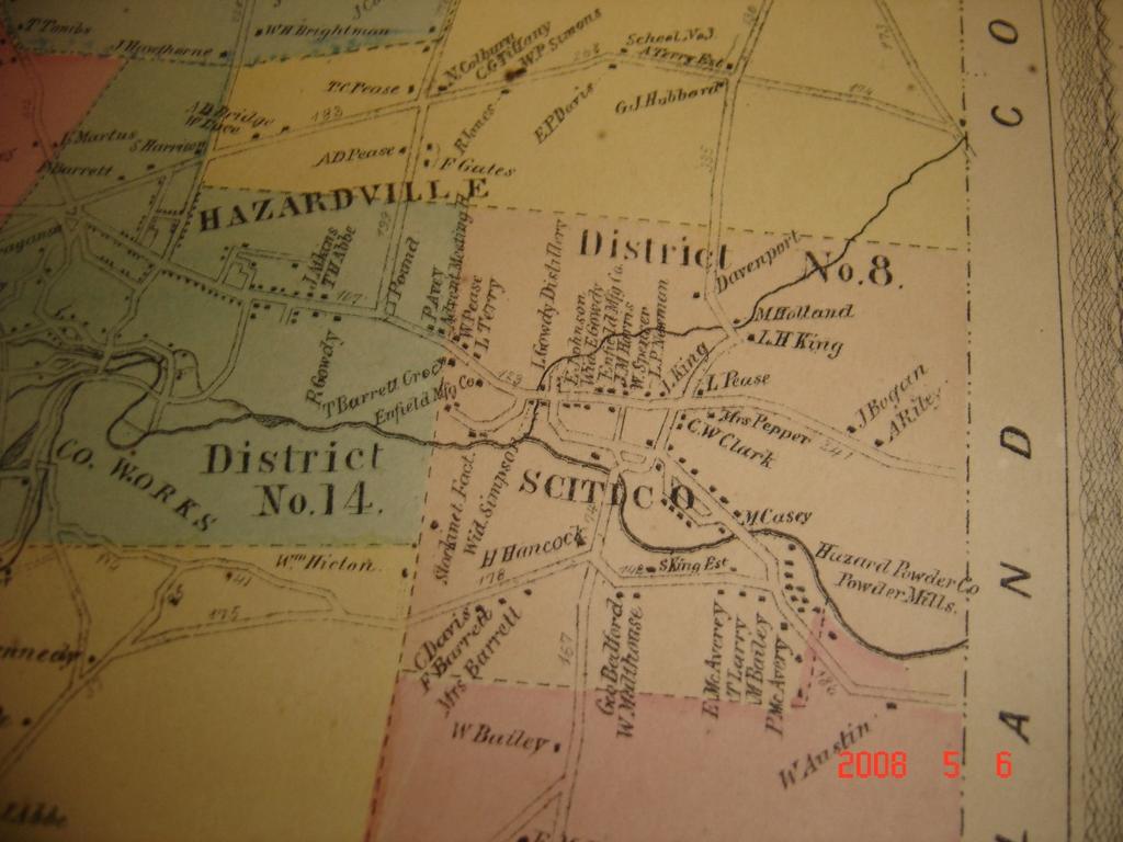
6 Springborn Dam There is great interest in removing the Springborn Dam as it is currently deteriorating The removal would restore an additional 2.5 miles of fish habitat and support efforts to restore an additional 27.5 miles (Somersville Mill Pond Dam)

7 Springborn Dam Drainage Basin
8 Scantic River Topographic Map N

9 Springborn Dam

10 Springborn Dam - Overview Constructed c Modified in 1900 s, 1920 s 1950 s and 1980 s


11 Springborn Dam - Overview Timber Crib over Block Masonry Run-of-River, Composite Structure

12 Springborn Dam

 access Land ownership")
13 Technical Challenges to Removal Management of accumulated sediments Scouring of upstream infrastructure Riverbanks and natural resources Downstream hydrologic and sediment impacts from flood flows Steep embankments limit construction (removal) access Land ownership challenges
14 Springborn Dam The concern with the sediment management alternative is the potential impacts to downstream organisms due to physical and chemical effects of the sediment redistribution process. This evaluation was conducted in two-stages: Stage 1 Preliminary Sediment Characterization Stage 2 Toxicological Assessment


15 Stage 1 Preliminary Sediment Characterization


16 Stage 1a Sediment Quantity & Quality Quantity: Depths Volume Estimated 90,000 CY of impounded sediment 41,000 CY mobile
17 Stage 1a Sediment Quantity & Quality Quality: Analytical Chemistry Metals, ETPH, PCBs, PAHs, Pesticide/Herbicides Compared Against Results: RSRs (Human Health) Effects-Based Screening Criteria (Ecological Health) Elevated concentrations of PAHs, Metals (Cd, Cr, Cu, Pb, Hg, Ag, Zn), Pesticides Assumed for all 41,000 CY of sediment
18 Stage 1b Hydrobiogeomorphic Assessment Field analysis What potential physical impact sediment released from the impoundment upon dam removal would have on downstream river reaches? Existing data reviewed included: Historic and contemporary maps and aerial photos of the stream channel, valley and watershed Geologic and physiographic maps Land use data Regional curves Habitat assessments Biological sampling Scantic River Watershed Association data/reports

19 Stage 1b Hydrobiogeomorphic Assessment N


20 Stage 1b Hydrobiogeomorphic Assessment Maps courtesy of KCI Technologies
21 Stage 1b - Conclusion Sediment release from behind the dam would pass through Reach 1 and settle in low gradient reaches downstream (Reaches 2 and 3) Evidence of biological degradation (low benthic diversity, marginal fish habitat) in some reaches downstream of the dam The similarity of gradation of impoundment sediment and sediment downstream of the dam make natural redistribution a viable option
22 Stage 2 Toxicological Assessment Detailed chemical and toxicological assessment of impounded sediment Re-tested for metals, PAHs and pesticides Bioavailability Analysis Metals & PAHS Sediment Toxicity Testing Whole Sediment Water Column Re-deposited Whole Sediment Surface Water Toxicity
23 Stage 2 Toxicological Assessment Whole Sediment (Impoundment) Agitate Suspended Sediment (Water Column) H. azteca C. dilutus Consolidate C. dubia P. promelas Whole Sediment (Re-Deposited) H. azteca C. dilutus


24 Stage 2 Toxicological Assessment Whole Sediment & Re-deposited Whole Sediment 28-day Hyella azteca 20-day Chironomus dilutus Water Column 48-hour Ceriodaphnia dubia 96-hour Pimephales promelas


25 Stage 2 Toxicological Assessment
26 Stage 2 Toxicological Assessment Conclusions Accumulated sediments near the dam show toxicity Chemistry shows elevated concentrations of metals, pesticides and PAHs Cd, Cr, Ag, Zn B(a)A and B(b)F Dieldrin Water column shows no toxicity Re-deposition of sediment shows similar toxicity to sediments in place
27 Overall Conclusion Approximately 14,000 CY of sediment was considered ecologically unsafe for redistribution Remaining 27,000 CY could be dredged OR left in place Reduced overall cost of dredging and disposal to $2.2M (from $6.0M)


28 Acknowledgements
29 Questions?
Session C1 - Applying the Stream Functions Pyramid to Geomorphic Assessments and Restoration Design
 University of Massachusetts - Amherst ScholarWorks@UMass Amherst International Conference on Engineering and Ecohydrology for Fish Passage International Conference on Engineering and Ecohydrology for Fish
DAM REMOVAL ENGINEERING ISSUES & OPTIONS
 DAM REMOVAL ENGINEERING ISSUES & OPTIONS Presented by: James G. Mac Broom, P.E. Milone & Mac Broom, Inc. October 2011 CLEAR GOALS and OBJECTIVES Fish Passage Habitat Defragmentation Water Quality Dam Failure
Sediment Management for Dam Removals
 Sediment Management for Dam Removals As Presented To: Sediment Management for Dam Removals, A Hands on Workshop on the Latest Techniques for Dam Modification and Removal, Purdue University Calumet, IN,
Why Geomorphology for Fish Passage
 Channel Morphology - Stream Crossing Interactions An Overview Michael Love Michael Love & Associates mlove@h2odesigns.com (707) 476-8938 Why Geomorphology for Fish Passage 1. Understand the Scale of the
Feasibility Study for Potential Removal of McLane & Goldman Dams Souhegan River, Milford, NH. Public Kick-off Meeting
 Feasibility Study for Potential Removal of McLane & Goldman Dams Souhegan River, Milford, NH Public Kick-off Meeting Mark Wamser Gomez and Sullivan Engineers, P.C. 603-428-4960 Aug 16, 2010 Agenda Opening
Subcommittee on Sedimentation Draft Sediment Analysis Guidelines for Dam Removal
 Subcommittee on Sedimentation Draft Sediment Analysis Guidelines for Dam Removal August 4, 2011 Jennifer Bountry, M.S., P.E. Tim Randle, M.S., P.E., D.WRE. Blair Greimann, Ph.D., P.E. Sedimentation and
CONTAMINATED SEDIMENTS IN THE RHINE BASIN RELEVANT POLLUTANTS AND RESUSPENSION RISK. Martin Keller Federal Institute of Hydrology, Koblenz, Germany
 CONTAMINATED SEDIMENTS IN THE RHINE BASIN RELEVANT POLLUTANTS AND RESUSPENSION RISK Martin Keller Federal Institute of Hydrology, Koblenz, Germany CHR/ISI SEDIMENT WORKSHOP, Bern 27.-3.4.28 1 CONTAMINATED
CR AAO Bridge. Dead River Flood & Natural Channel Design. Mitch Koetje Water Resources Division UP District
 CR AAO Bridge Dead River Flood & Natural Channel Design Mitch Koetje Water Resources Division UP District Old County Road AAO Bridge Map courtesy of Marquette County Silver Lake Basin McClure Basin
Environmental impact assessment study of the new offshore dumping sites for Šventoji port in Lithuania
 Environmental impact assessment study of the new offshore dumping sites for Šventoji port in Lithuania Introduction Summary In 2003 Lithuanian Ministry of Transport initiated the preparation of feasibility
Swift Creek Sediment Management Action Plan (SCSMAP)
") Swift Creek Sediment Management Action Plan (SCSMAP) PHASE 3 PROJECT PLAN PROPOSAL Whatcom County Public Works Department 322 N. Commercial Street, Suite 210 Bellingham, WA 98225 (360) 676-6692 June 2013
Swift Creek Sediment Management Action Plan (SCSMAP) PHASE 3 PROJECT PLAN PROPOSAL Whatcom County Public Works Department 322 N. Commercial Street, Suite 210 Bellingham, WA 98225 (360) 676-6692 June 2013
Integrated biological, geological and cultural diversity of river basins with hydroelectric potential
 University of Massachusetts Amherst ScholarWorks@UMass Amherst International Conference on Engineering and Ecohydrology for Fish Passage International Conference on Engineering and Ecohydrology for Fish
Continuing Education Associated with Maintaining CPESC and CESSWI Certification
 Continuing Education Associated with Maintaining CPESC and CESSWI Certification Module 2: Stormwater Management Principles for Earth Disturbing Activities Sponsors: ODOTs Local Technical Assistance Program
Coarse Sediment Augmentation on Regulated Rivers. Scott McBain McBain & Trush, Inc.
 Coarse Sediment Augmentation on Regulated Rivers Scott McBain McBain & Trush, Inc. scott@mcbaintrush.com Components Some geomorphic and ecological considerations Conceptual approach at understanding augmentation
CAUSES FOR CHANGE IN STREAM-CHANNEL MORPHOLOGY
 CAUSES FOR CHANGE IN STREAM-CHANNEL MORPHOLOGY Chad A. Whaley, Department of Earth Sciences, University of South Alabama, MobileAL, 36688. E-MAIL: caw408@jaguar1.usouthal.edu The ultimate goal of this
Best Management Practices for Coldwater Fisheries Enhancement and Restoration
 Best Management Practices for Coldwater Fisheries Enhancement and Restoration MACC Annual Environmental Conference 2017 March 3, 2017 Tim Dexter, MassDOT Highway Division 1 Leading the Nation in Transportation
Mississippi River and Tributaries Project Mississippi River Geomorphology and Potamology Program
 Mississippi River and Tributaries Project Mississippi River Geomorphology and Potamology Program Barb Kleiss, Mississippi Valley Division Freddie Pinkard, Vicksburg District June, 2016 Program Objectives
Source Control Early Action Focused Feasibility Study
 Source Control Early Action Focused Feasibility Study Empirical Mass Balance Model Results or the Lower Passaic River Edward A. Garvey, PhD, PG Malcolm Pirnie, Inc. Remedial Options Workgroup Meeting June
Lower South Fork McKenzie River Floodplain Enhancement Project
 Lower South Fork McKenzie River Floodplain Enhancement Project McKenzie River Ranger District Willamette National Forest Project Location The project is located in the South Fork McKenzie River Watershed,
Assessment of Lake Forest Lake Sediment Trapping Efficiency and Capacity. Marlon R. Cook Groundwater Assessment Program Geological Survey of Alabama
 Assessment of Lake Forest Lake Sediment Trapping Efficiency and Capacity Marlon R. Cook Groundwater Assessment Program Geological Survey of Alabama Impacts of the Lake at Lake Forest on the connectivity
Swift Creek Sediment Management Action Plan (SCSMAP)
") Swift Creek Sediment Management Action Plan (SCSMAP) PHASE 2 PROJECT PLAN PROPOSAL Whatcom County Public Works Department 322 N. Commercial Street, Suite 210 Bellingham, WA 98225 (360) 676-6692 June 2013
Swift Creek Sediment Management Action Plan (SCSMAP) PHASE 2 PROJECT PLAN PROPOSAL Whatcom County Public Works Department 322 N. Commercial Street, Suite 210 Bellingham, WA 98225 (360) 676-6692 June 2013
Technical Review of Pak Beng Hydropower Project (1) Hydrology & Hydraulics and (2) Sediment Transport & River Morphology
 Hydrology & Hydraulics and (2) Sediment Transport & River Morphology") Technical Review of Pak Beng Hydropower Project (1) Hydrology & Hydraulics and (2) Sediment Transport & River Morphology The 2 nd Regional Stakeholder Forum The Pak Beng Hydropower Project 5 th May 2017
Technical Review of Pak Beng Hydropower Project (1) Hydrology & Hydraulics and (2) Sediment Transport & River Morphology The 2 nd Regional Stakeholder Forum The Pak Beng Hydropower Project 5 th May 2017
Special Public Notice
 Special Public Notice Applicability: General Public Date: June 3, 2014 The purpose of this public notice is to inform you of existing guidance and policy contained in Regulatory Guidance Letter 05-04 concerning
GEOL 1121 Earth Processes and Environments
 GEOL 1121 Earth Processes and Environments Wondwosen Seyoum Department of Geology University of Georgia e-mail: seyoum@uga.edu G/G Bldg., Rm. No. 122 Seyoum, 2015 Chapter 6 Streams and Flooding Seyoum,
Degradation Concerns related to Bridge Structures in Alberta
 Degradation Concerns related to Bridge Structures in Alberta Introduction There has been recent discussion regarding the identification and assessment of stream degradation in terms of how it relates to
Evaluation of Geomorphic Effects of Removal of Marmot and Little Sandy Dams and Potential Impacts on Anadromous Salmonids
 PRELIMINARY FINAL Evaluation of Geomorphic Effects of Removal of Marmot and Little Sandy Dams and Potential Impacts on Anadromous Salmonids Prepared for: Portland General Electric 121 SW Salmon Street
Tom Ballestero University of New Hampshire. 1 May 2013
 Tom Ballestero University of New Hampshire 1 May 2013 1 Hydrology 2 Basic Hydrology Low flows most common Flows that fill the stream to the banks and higher are much less common Filling the stream to the
WELCOME Lake Wabukayne OPEN HOUSE
 WELCOME Lake Wabukayne Sediment Removal Project OPEN HOUSE We are here to: Update you, the community, on recent developments and activities at Lake Wabukayne Present the preferred alternative and receive
SCOPE OF PRESENTATION STREAM DYNAMICS, CHANNEL RESTORATION PLANS, & SEDIMENT TRANSPORT ANALYSES IN RELATION TO RESTORATION PLANS
 DESIGN METHODS B: SEDIMENT TRANSPORT PROCESSES FOR STREAM RESTORATION DESIGN PETER KLINGEMAN OREGON STATE UNIVERSITY CIVIL ENGINEERING DEPT., CORVALLIS 2 ND ANNUAL NORTHWEST STREAM RESTORATION DESIGN SYMPOSIUM
Strategies for managing sediment in dams. Iwona Conlan Consultant to IKMP, MRCS
 Strategies for managing sediment in dams Iwona Conlan Consultant to IKMP, MRCS 1 Sediment trapping by dams Active storage capacity Dead storage coarse material (bed load) Fine materials (suspension) Francis
Old Stone Sewer Main Street
 Bangor Landing Bangor, Maine Case Study-Sediment Sediment Investigation Maine Department of Environmental Protection City of Bangor, with RMT, Inc. Site Location and Local Site Features 1 Bangor Landing
Solutions to Flooding on Pescadero Creek Road
 Hydrology Hydraulics Geomorphology Design Field Services Photo courtesy Half Moon Bay Review Solutions to Flooding on Pescadero Creek Road Prepared for: San Mateo County Resource Conservation District
1 INTRODUCTION AND MAJOR FINDINGS... 1
 Memorandum To: Lindsey Clark, Stillwater Valley Watershed Council Coordinator From: Chad Raisland, Pioneer Technical Services, Inc. and Karin Boyd, Applied Geomorphology, Inc. CC: Tanya Lester, Stillwater
State Water Survey Division SURFACE WATER SECTION
 State Water Survey Division SURFACE WATER SECTION AT THE UNIVERSITY OF ILLINOIS Illinois Department of Energy and Natural Resources SWS Miscellaneous Publication 88 SEDIMENTATION OF POOL 19 ON THE MISSISSIPPI
Rock Sizing for Waterway & Gully Chutes
 Rock Sizing for Waterway & Gully Chutes WATERWAY MANAGEMENT PRACTICES Photo 1 Rock-lined waterway chute Photo 2 Rock-lined gully chute 1. Introduction A waterway chute is a stabilised section of channel
North Carolina Simplified Inundation Maps For Emergency Action Plans December 2010; revised September 2014; revised April 2015
 North Carolina Simplified Inundation Maps For Emergency Action Plans December 2010; revised September 2014; revised April 2015 INTRODUCTION Emergency Action Plans (EAPs) are critical to reducing the risks
Hydrologic Analysis for Ecosystem Restoration
 Hydrologic Analysis for Ecosystem Restoration Davis, California Objectives: To provide participants with: 1) an understanding of the issues in restoration studies; 2) an overview of Corps policies and
Module/Unit: Landforms Grade Level: Fifth
 Module/Unit: Landforms Grade Level: Fifth PA Academic Standards for Science and Technology and Environment and Ecology: 3.1.7.B Describe the use of models as an application or scientific or technological
Surface Processes Focus on Mass Wasting (Chapter 10)
") Surface Processes Focus on Mass Wasting (Chapter 10) 1. What is the distinction between weathering, mass wasting, and erosion? 2. What is the controlling force in mass wasting? What force provides resistance?
Surface Processes Focus on Mass Wasting (Chapter 10) 1. What is the distinction between weathering, mass wasting, and erosion? 2. What is the controlling force in mass wasting? What force provides resistance?
Muck. Kevin Henderson, P.E. Evergreen Engineering, Inc. Presentation to Rivers Coalition 9/29/16
 Muck Kevin Henderson, P.E. Evergreen Engineering, Inc. Presentation to Rivers Coalition 9/29/16 LITERATURE REVIEW Schropp (1994) defined muck sediments as sediment with greater than 60% silts and clays,
A PRIMER ON DAM REMOVALS IN MICHIGAN. Joe Rathbun Michigan Dept. Environmental Quality
 A PRIMER ON DAM REMOVALS IN MICHIGAN Joe Rathbun Michigan Dept. Environmental Quality rathbunj@michigan.gov Talk Outline Michigan dam factoids Effects of dams Removing a dam Steps Potential stumbling blocks
Stream Geomorphology. Leslie A. Morrissey UVM July 25, 2012
 Stream Geomorphology Leslie A. Morrissey UVM July 25, 2012 What Functions do Healthy Streams Provide? Flood mitigation Water supply Water quality Sediment storage and transport Habitat Recreation Transportation
New Approaches to Restoring NH s Rivers Natural Channel Design and Dam Removal
 NHACC Annual Meeting 2012 New Approaches to Restoring NH s Rivers Natural Channel Design and Dam Removal Peter J. Walker CROOKED STREAMS are a menace to life and crops in the areas bordering on their banks.
Step 5: Channel Bed and Planform Changes
 Step 5: Channel Bed and Planform Changes When disturbed, streams go through a series of adjustments to regain equilibrium with the flow and sediment supply of their watersheds. These adjustments often
Dam Removal Analysis Guidelines for Sediment
 A review of: Dam Removal Analysis Guidelines for Sediment Joe Rathbun (Retired) rathbunj@sbcglobal.net Some Potential Sediment Issues Reservoir restoration Downstream water quality Downstream deposition
Black Gore Creek 2013 Sediment Source Monitoring and TMDL Sediment Budget
 Black Gore Creek 2013 Sediment Source Monitoring and TMDL Sediment Budget Prepared for: Prepared By: - I. Introduction The Black Gore Creek Total Maximum Daily Load (TMDL) was developed in collaboration
Illinois River Sediment Quality and Beneficial Use Options
 Illinois River Sediment Quality and Beneficial Use Options John C. Marlin Illinois Sustainable Technology Center Robert G. Darmody Dept. of Natural Resources and Environmental Science University of Illinois
Do you think sediment transport is a concern?
 STREAM RESTORATION FRAMEWORK AND SEDIMENT TRANSPORT BASICS Pete Klingeman 1 What is Your Restoration Project Like? k? Do you think sediment transport is a concern? East Fork Lewis River, WA Tidal creek,
FOLLOW-UP ON CHANNELIZATION IN SPRING CREEK SUB-WATERSHED
 FOLLOW-UP ON CHANNELIZATION IN SPRING CREEK SUB-WATERSHED Justin R. Beebe, Department of Earth Sciences, University of South Alabama, Mobile, AL 36688. jrb308@jaguar1.usouthal.edu. Spring Creek is a tributary
SPECIFIC DEGRADATION AND RESERVOIR SEDIMENTATION. By Renee Vandermause & Chun-Yao Yang
 SPECIFIC DEGRADATION AND RESERVOIR SEDIMENTATION By Renee Vandermause & Chun-Yao Yang Outline Sediment Degradation - Erosion vs Sediment Yield - Sediment Yield - Methods for estimation - Defining Sediment
Little Swan Lake. Dam Inspection & Siltation Study Prepared By: William Klingner, P.E., CFM October 28, 2018
 Little Swan Lake Dam Inspection & Siltation Study Prepared By: William Klingner, P.E., CFM October 28, 2018 Agenda Little Swan Lake Dam Inspection Theoretical Little Swan Lake Siltation Rate Calculations
CASE STUDY SOLIS, SWITZERLAND
 SEDIMENT MANAGEMENT CASE STUDY SOLIS, SWITZERLAND Key project features Name: Solis Country: Switzerland Category: bypass channel/tunnel Reservoir volume (original): 4.1 Mm 3 Installed capacity: 64 MW Date
Rock & Aggregate Drop Inlet Protection
 Rock & Aggregate Drop Inlet Protection SEDIMENT CONTROL TECHNIQUE Type 1 System Sheet Flow Sandy Soils Type 2 System [1] Concentrated Flow Clayey Soils Type 3 System Supplementary Trap Dispersive Soils
Use of benthic invertebrate biological indicators in evaluating sediment deposition impairment on the Middle Truckee River, California
 Use of benthic invertebrate biological indicators in evaluating sediment deposition impairment on the Middle Truckee River, California David B. Herbst Sierra Nevada Aquatic Research Laboratory University
Assessment. Assessment
 2001 SPRINGBROOK CREEK RESTORATION - THREE YEAR POST-CONSTRUCTION REVIEW - Presented by Bruce Henderson and Andy Harris 2005 River Restoration Northwest Symposium Skamania Lodge, Washington www.hendersonlandservices.com
DISCUSSION PURPOSES ONLY C A L I F O R N I A S T A T E L A N D S C O M M I S S I O N
 C A L I F O R N I A S T A T E L A N D S C O M M I S S I O N SAN JOAQUIN RIVER REACH 2B OVERVIEW OF THE CALIFORNIA STATE LANDS COMMISSION ADMINISTRATIVE MAPS PRESENTATION Water Boundary Principles Best
Dan Miller + Kelly Burnett, Kelly Christiansen, Sharon Clarke, Lee Benda. GOAL Predict Channel Characteristics in Space and Time
 Broad-Scale Models Dan Miller + Kelly Burnett, Kelly Christiansen, Sharon Clarke, Lee Benda GOAL Predict Channel Characteristics in Space and Time Assess Potential for Fish Use and Productivity Assess
Stickney Avenue Depositional Zone (SADZ) Investigation
 Investigation") The Ottawa River: A Report to the Community Stickney Avenue Depositional Zone (SADZ) Investigation May 22, 2007 Presented by: Scott Bell, P.E., BCEE (LimnoTech) Kelly Bensman (Hull & Associates) SADZ Location
The Ottawa River: A Report to the Community Stickney Avenue Depositional Zone (SADZ) Investigation May 22, 2007 Presented by: Scott Bell, P.E., BCEE (LimnoTech) Kelly Bensman (Hull & Associates) SADZ Location
Griswold Creek August 22, 2013
 Creek August 22, 2013 1 Lake Erie Protection Fund Creek Study ver Evaluate the overall condition of Creek Determine stable channel dimensions & appropriate restoration techniques Starting Stat gpoint for
May 7, Roger Leventhal, P.E. Marin County Public Works Laurel Collins Watershed Sciences
 May 7, 2013 Roger Leventhal, P.E. Marin County Public Works Laurel Collins Watershed Sciences Background Funded in 2009 under EPA 2100 Grant for $30k and managed by SFEP Project Goals: Update original
APPENDIX B Hydraulic Considerations for Pipeline Crossings of Stream Channels
 APPENDIX B Hydraulic Considerations for Pipeline Crossings of Stream Channels B-1 B-2 APPENDIX B HYDRAULIC CONSIDERATIONS FOR PIPELINE CROSSINGS OF STREAM CHANNELS Pipeline crossings of perennial, intermittent,
Addressing the Impact of Road-Stream Crossing Structures on the Movement of Aquatic Organisms
 Scott Jackson University of Massachusetts Amherst Addressing the Impact of Road-Stream Crossing Structures on the Movement of Aquatic Organisms Dams Sub-standard Culverts Excessive Velocities Inlet Drop
River basin geology and geological processes in relation to potential hydropower developments in a volcanic environment.
 University of Massachusetts Amherst ScholarWorks@UMass Amherst International Conference on Engineering and Ecohydrology for Fish Passage International Conference on Engineering and Ecohydrology for Fish
Stone Outlet Sediment Trap
 3.12 Sediment Control Description: A stone outlet sediment trap is a small detention area formed by placing a stone embankment with an integral stone filter outlet across a drainage swale for the purpose
Bank Erosion and Morphology of the Kaskaskia River
 Bank Erosion and Morphology of the Kaskaskia River US Army Corps Of Engineers St. Louis District Fayette County Soil and Water Conservation District Team Partners : Carlyle Lake Ecosystem Partnership Vicinity
[1] Performance of the sediment trap depends on the type of outlet structure and the settling pond surface area.
![[1] Performance of the sediment trap depends on the type of outlet structure and the settling pond surface area.](/thumbs/76/74245181.jpg "[1] Performance of the sediment trap depends on the type of outlet structure and the settling pond surface area.") Sediment Trench SEDIMENT CONTROL TECHNIQUE Type 1 System Sheet Flow Sandy Soils Type 2 System [1] Concentrated Flow Clayey Soils Type 3 System [1] Supplementary Trap Dispersive Soils [1] Performance of
Sediment Trench SEDIMENT CONTROL TECHNIQUE Type 1 System Sheet Flow Sandy Soils Type 2 System [1] Concentrated Flow Clayey Soils Type 3 System [1] Supplementary Trap Dispersive Soils [1] Performance of
RAILWAYS AND FISH: HOW TO PROTECT AND ENHANCE FISH HABITAT VALUES AT STREAM CROSSINGS THROUGH PROJECT DESIGN AND CONSTRUCTION
 RAILWAYS AND FISH: HOW TO PROTECT AND ENHANCE FISH HABITAT VALUES AT STREAM CROSSINGS THROUGH PROJECT DESIGN AND CONSTRUCTION Rail Environment Conference November 2016 AGENDA Objective Background Benefits
Fish Passage at Road Crossings
 Fish Passage at Road Crossings 1 Crossing Design Workshop Outline 1:00 to 2:00 Intro, Design Overview, Channel Width 2:00 to 2:15 Break 2:15 to 3:15 No-Slope, Stream Simulation Design 3:15 to 3:30 Break
Session: For more information:
 Session: For more information: www.hydropower.org/congress San Juan, Puerto Rico www.glmengineers.com 2015 World Hydropower Congress Sustainable Sediment Management and Hydropower Reservoirs 21 May 2015
U-Shaped Sediment Traps
 U-Shaped Sediment Traps SEDIMENT CONTROL TECHNIQUE Type 1 System Sheet Flow Sandy Soils Type 2 System Concentrated Flow Clayey Soils [1] Type 3 System Supplementary Trap Dispersive Soils [1] Generally
Steven Noble MDEQ - WRD Enbridge Response Unit
 EPA situation report, October 19, 2012 Steven Noble MDEQ - WRD Enbridge Response Unit Brief history of the spill Monitoring Monitoring the impacts Follow the oil The Current Situation A Look at the Future
DAM SAFETY PROGRAM DAM INSPECTION REPORT FORM FOR REGULATORY INSPECTION
 DAM SAFETY PROGRAM DAM INSPECTION REPORT FORM FOR REGULATORY INSPECTION Please complete this form in accordance with the instructions (DEEP-DAM-INST-002). Part I: Summary of Dam Inspection Dam Name: Knofla
Riparian Assessment. Steps in the right direction... Drainage Basin/Watershed: Start by Thinking Big. Riparian Assessment vs.
 Riparian Assessment vs. Monitoring Riparian Assessment What is a healthy stream? Determine stream/riparian health Determine change or trend, especially in response to mgmt Classification = designation
Summary of Hydraulic and Sediment-transport. Analysis of Residual Sediment: Alternatives for the San Clemente Dam Removal/Retrofit Project,
 Appendix N SUMMARY OF HYDRAULIC AND SEDIMENT-TRANSPORT ANALYSIS OF RESIDUAL SEDIMENT: ALTERNATIVES FOR THE SAN CLEMENTE DAM REMOVAL/RETROFIT PROJECT, CALIFORNIA the San Clemente Dam Removal/Retrofit Project,
Gully Erosion Part 1 GULLY EROSION AND ITS CAUSES. Introduction. The mechanics of gully erosion
 Gully Erosion Part 1 GULLY EROSION AND ITS CAUSES Gully erosion A complex of processes whereby the removal of soil is characterised by incised channels in the landscape. NSW Soil Conservation Service,
Elwha River response to dam removals through four years and a big flood:
 Elwha River response to dam removals through four years and a big flood: Lessons learned, channel response, and sediment effects from the world s largest engineered dam removal Andy Ritchie NPS Elwha Restoration
Remaining Capacity in Great Lakes Reservoirs
 US Army Corps of Engineers Detroit District Remaining Capacity in Great Lakes Reservoirs Storage Capacity Behind Great Lakes Dams Field Data and Modeling Motivation for project Project overview Data and
EAGLES NEST AND PIASA ISLANDS
 EAGLES NEST AND PIASA ISLANDS HABITAT REHABILITATION AND ENHANCEMENT PROJECT MADISON AND JERSEY COUNTIES, ILLINOIS ENVIRONMENTAL MANAGEMENT PROGRAM ST. LOUIS DISTRICT FACT SHEET I. LOCATION The proposed
Stream Simulation: A Simple Example
 Stream Simulation: A Simple Example North Thompson Creek, CO Paul T. Anderson U.S.D.A. Forest Service Here s How We Started May 2011 2-1 USDA-Forest Service Here s How We Finished Forest Service Aquatic
Sediment Trap. At multiple locations within the project site where sediment control is needed.
 Sediment Trap SE-3 Objectives EC Erosion Control SE Sediment Control TR Tracking Control WE Wind Erosion Control Non-Stormwater NS Management Control Waste Management and WM Materials Pollution Control
What is a watershed or landscape perspective?
 What is a watershed or landscape perspective? -remove sediment -add sediment -add wood, riparian manipulation -alter (engineer) channel/floodplain morphology -restore/abandon roads You are here What is
INFLOW DESIGN FLOOD CONTROL SYSTEM PLAN 40 C.F.R. PART PLANT YATES ASH POND 2 (AP-2) GEORGIA POWER COMPANY
 GEORGIA POWER COMPANY") INFLOW DESIGN FLOOD CONTROL SYSTEM PLAN 40 C.F.R. PART 257.82 PLANT YATES ASH POND 2 (AP-2) GEORGIA POWER COMPANY EPA s Disposal of Coal Combustion Residuals from Electric Utilities Final Rule (40 C.F.R.
INFLOW DESIGN FLOOD CONTROL SYSTEM PLAN 40 C.F.R. PART 257.82 PLANT YATES ASH POND 2 (AP-2) GEORGIA POWER COMPANY EPA s Disposal of Coal Combustion Residuals from Electric Utilities Final Rule (40 C.F.R.
Watershed Assessment of River Stability and Sediment Supply: Advancing the Science of Watershed Analysis
 Watershed Assessment of River Stability and Sediment Supply: Advancing the Science of Watershed Analysis 2009 MWEA Annual Conference Rob Myllyoja, CET rmyllyoja@hrc-engr.com Watershed Assessment of River
Recent developments in the ICPR sediment management activities in the Rhine basin
 Recent developments in the ICPR sediment management activities in the Rhine basin Martin Keller Federal Institute of Hydrology, Koblenz, Germany 5 th SedNet Conference, Oslo 27 th -29 th May 2008 1 The
Mobrand to Jones and Stokes. Sustainable Fisheries Management Use of EDT
 Sustainable Fisheries Management Use of EDT Ecosystem Diagnosis and Treatment EDT EDT designed to provide a practical, science-based approach for developing and implementing watershed plans. Provides decision
Running Water Earth - Chapter 16 Stan Hatfield Southwestern Illinois College
 Running Water Earth - Chapter 16 Stan Hatfield Southwestern Illinois College Hydrologic Cycle The hydrologic cycle is a summary of the circulation of Earth s water supply. Processes involved in the hydrologic
HISTORY OF CONSTRUCTION FOR EXISTING CCR SURFACE IMPOUNDMENT PLANT GASTON ASH POND 40 CFR (c)(1)(i) (xii)
(1)(i) (xii)") HISTORY OF CONSTRUCTION FOR EXISTING CCR SURFACE IMPOUNDMENT PLANT GASTON ASH POND 40 CFR 257.73(c)(1)(i) (xii) (i) Site Name and Ownership Information: Site Name: E.C. Gaston Steam Plant Site Location:
HISTORY OF CONSTRUCTION FOR EXISTING CCR SURFACE IMPOUNDMENT PLANT GASTON ASH POND 40 CFR 257.73(c)(1)(i) (xii) (i) Site Name and Ownership Information: Site Name: E.C. Gaston Steam Plant Site Location:
Stormwater Outlet Sediment Traps
 Stormwater Outlet Traps SEDIMENT CONTROL TECHNIQUES Photo 1 Excavated sediment trap just prior to scheduled clean-out (note energy dissipater at end of pipe) Photo 2 A supplementary straw bale barrier
Programmatic Approaches to Assessing and Mitigating Risk to Pipelines from Natural Forces
 Programmatic Approaches to Assessing and Mitigating Risk to Pipelines from Natural Forces 23 rd International Petroleum Environmental Conference New Orleans, Louisiana November 8-10, 2016 Introduction
GIS-Based Sediment Quality Database for the St. Louis River Area of Concern (AOC): Overview Presentations and Demonstration
: Overview Presentations and Demonstration") GIS-Based Sediment Quality Database for the St. Louis River Area of Concern (AOC): Overview Presentations and Demonstration Judy L. Crane 1 and Dawn E. Smorong 2 1 Minnesota Pollution Control Agency, St.
GIS-Based Sediment Quality Database for the St. Louis River Area of Concern (AOC): Overview Presentations and Demonstration Judy L. Crane 1 and Dawn E. Smorong 2 1 Minnesota Pollution Control Agency, St.
Aquatic Sediment Sampling and Analyses
 Aquatic Sediment Sampling and Analyses Richard B. Shepard, Ph.D. March 16, 2011 Introduction Collecting sediment samples for analysis of contaminants particularly in river systems is not just a matter
Earth Science Chapter 6 Section 2 Review
 Name: Class: Date: Earth Science Chapter 6 Section Review Multiple Choice Identify the choice that best completes the statement or answers the question. 1. Most streams carry the largest part of their
Illinois State Water Survey Division
 Illinois State Water Survey Division SURFACE WATER SECTION SWS Contract Report 413 AT THE UNIVERSITY OF ILLINOIS SEDIMENTATION SURVEY OF DAWSON LAKE, MORAINE VIEW STATE PARK, MC LEAN COUNTY, ILLINOIS by
HEC-RAS Reservoir Transport Simulation of Three Reservoirs in the Lower Susquehanna River Basin. Mike Langland and Ed Koerkle
 HEC-RAS Reservoir Transport Simulation of Three Reservoirs in the Lower Susquehanna River Basin Mike Langland and Ed Koerkle Topics Background / Project Objectives Data Selection - Sediment and Geometric
Restoration Goals TFG Meeting. Agenda
 San Joaquin River Restoration Program Restoration Goals TFG Meeting Reach 2B Update April 28, 2010 Agenda 1. Introductions 2. Program Restoration Goal Context 3. Program Update a) Interim Flows b) EIS/EIR
Sediment and nutrient transport and storage along the urban stream corridor
 Sediment and nutrient transport and storage along the urban stream corridor Greg Noe, Cliff Hupp, Ed Schenk, Jackie Batson, Nancy Rybicki, Allen Gellis What is the role of floodplains everywhere? Noe 2013,
Seagrass Transplantation & Environmental & Marine Consulting Services, Inc. Drew Campbell, Vice President & Lead Scientst.
 Indian River Lagoon Symposium Seagrass Transplantation & Project Considerations Environmental & Marine Consulting Services, Inc. Drew Campbell, Vice President & Lead Scientst March 26 th, 2013 Regulatory
Landscape Development
 Landscape Development Slopes Dominate Natural Landscapes Created by the interplay of tectonic and igneous activity and gradation Deformation and uplift Volcanic activity Agents of gradation Mass wasting
Recent changes of suspended sediment yields in the Upper Yangtze River and its headwater tributaries
 Sediment Dynamics from the Summit to the Sea 297 (Proceedings of a symposium held in New Orleans, Louisiana, USA, 11 14 December 2014) (IAHS Publ. 367, 2014). Recent changes of suspended sediment yields
Learning Objectives: I can identify and interpret river flows and directions.
 Learning Objectives: I can identify and interpret river flows and directions. Bellringer Review: Check for Understanding Questions: 1 2 What Are The Key Parts Of A River s Anatomy? In your data notebooks
Historical channel change on the Upper Gila River, Arizona and New Mexico in response to anthropogenic modifications and extreme floods
 Historical channel change on the Upper Gila River, Arizona and New Mexico in response to anthropogenic modifications and extreme floods www.archives.gov www.paztcn.wr.usgs.gov wrh.noaa.gov Upper Gila River