APPENDIX A GEOTECHNICAL REPORT
|
|
|
- Patrick Watkins
- 5 years ago
- Views:
Transcription
1 The City of Winnipeg Bid Opportunity No Template Version: C RW APPENDIX A GEOTECHNICAL REPORT
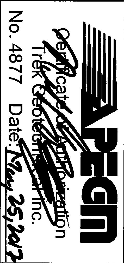
2 Quality Engineering Valued Relationships KGS Group 2017 Industrial Street Rehabilitation Sub-Surface Investigation Prepared for: KGS Group 3 rd Floor, 865 Waverley Street Winnipeg, MB R3T 5P4 Attention: Jarrod Boscow Project Number: Date: May 25, 2017 Final Report St. James Street Winnipeg, Manitoba R3H 0L3 Tel Fax


3


4
5 2017 Industrial Street Rehabilitation Program Sub Surface Investigation Table of Contents Letter of Transmittal Revision History and Authorization Signatures 1.0 Introduction Sub-Surface Investigation and Laboratory Program Closure... 1 List of Figures Figure 01 Test Hole Location Plan Bournais Drive, Beghin Avenue, De Baets Street and Paquin Road Figure 02 Test Hole Location Plan St Matthews Avenue List of Appendices Appendix A Test Hole Logs, Lab Testing Summary & Pavement Core Photos - Bournais Drive, Beghin Avenue, De Baets Street and Paquin Road Appendix B Test Hole Logs, Lab Testing Summary & Pavement Core Photos St Matthews Avenue Our File No May 2017 Page ii
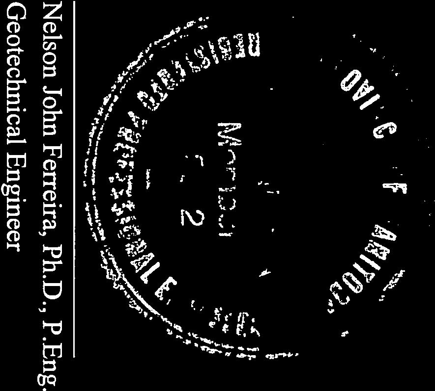
6 2017 Industrial Street Rehabilitation Program Sub Surface Investigation 1.0 Introduction This report summarizes the results of the sub-surface investigation completed for the 2017 Industrial Street Rehabilitation Program. The streets investigation includes Bournais Drive, Beghin Avenue, De Baets Street and Paquin Road in the St. Boniface Industrial Park area and St Matthews Avenue. The information collected describes the pavement structure of the existing road as well as the soil stratigraphy beneath the pavement structure. 2.0 Sub-Surface Investigation and Laboratory Program For each street, test holes were drilled approximately every 50 m of street length with specific locations shown in Figure 1 and Figure 2. The test holes were drilled to determine sub-surface conditions for use in design and construction of the roads. The sub-surface investigation was conducted between April 24 th and April 27, The test holes were drilled to a depth of 3.1 m below road surface by Paddock Drilling Ltd. using a Canterra CT 250 truck mounted drill rig equipped with 125 mm diameter solid stem augers. The pavement structure (asphalt or concrete) was cored by Paul Bevel of Trek Geotechnical, using a portable coring press equipped with a hollow 150 mm diameter diamond core drill bit. The sub-surface conditions were observed during drilling were visually classified by Shane Broderick of TREK. Other pertinent information such as groundwater and drilling conditions were also recorded during drilling. Disturbed (auger cuttings) samples retrieved during the sub-surface investigation were transported to TREK s material testing laboratory for further testing. Core samples were also retrieved and logged at TREK s material testing laboratory. The laboratory testing program consisted of moisture content determination, Atterberg limits, and grain size analysis (mechanical sieve and hydrometer methods). Information gathered for the St. Boniface Area (Appendix A) and St. Matthews Avenue (Appendix B) are included in separate appendices. The information provided in the Appendices includes test hole logs, laboratory testing summary tables, and photos of the pavement cores. Test hole locations are noted on the test hole logs and shown on Figure 01 and Figure 02 based on measured distances from the nearest address, edge of pavement or other permanent features. 3.0 Closure The geotechnical information provided in this report is in accordance with current engineering principles and practices (Standard of Practice). The findings of this report were based on information provided (field investigation and laboratory testing). Soil conditions are natural deposits that can be highly variable across a site. If subsurface conditions are different than the conditions previously encountered on-site or those presented here, we should be notified to adjust our findings if necessary. All information provided in this report is subject to our standard terms and conditions for engineering services, a copy of which is provided to each of our clients with the original scope of work, or a mutually executed standard engineering services agreement. If these conditions are not attached, and you are not already in possession of such terms and conditions, contact our office and you will be promptly provided with a copy. This report has been prepared by TREK Geotechnical Inc. (the Consultant) for the exclusive use of KGS Group (the Client) and their agents for the work product presented in the report. Any findings or recommendations provided in this report are not to be relied upon by any third parties, except as agreed to in writing by the Client and Consultant prior to use. Our File No Page 1 May 2017
7 . Figures
 Z:\Projects\0012 KGS")


 PAQUIN RD.")


8 m SCALE = 1 : (279 mm x 432 mm) Z:\Projects\0012 KGS Group\ Industrial Streets\3 Survey and Dwg\3.4 CAD\3.4.3 Working Folder, 5/25/2017 8:21:31 AM ANSI full bleed B (11.00 x Inches) PAQUIN RD. TH17-14 DE BAETS ST. DUGALD RD. BEGHIN AVE. TH17-04 TH17-05 BOURNAIS DR KGS Group 2017 Industrial Streets - St. Boniface Industrial Park TH17-02 TH17-01 TH17-03 TH17-07 TH17-06 TH17-08 TH17-09 TH17-10 PROJECT LOCATION TH17-13 TH17-12 TH17-11 KEYPLAN SCALE N.T.S. LEGEND: TEST HOLE (TREK, 2017) NOTES: 1. AERIAL IMAGE FROM CITY OF WINNIPEG Figure 01 Test Hole Location Plan

 PROJECT LOCATION KEYPLAN SCALE N.T.S. TH17-16 FERRY RD.")
 NOTES: 1. AERIAL IMAGE FROM CITY OF WINNIPEG 2016. ST. MATTHEWS AVE.")
9 0 TH17-18 TH m SCALE = 1 : (279 mm x 432 mm) Z:\Projects\0012 KGS Group\ Industrial Streets\3 Survey and Dwg\3.4 CAD\3.4.3 Working Folder, 5/25/2017 8:22:47 AM ANSI full bleed B (11.00 x Inches) PROJECT LOCATION KEYPLAN SCALE N.T.S. TH17-16 FERRY RD. TH17-14 TH17-12 TH17-15 TH17-13 TH17-11 TH17-10 TH17-08 TH17-06 TH17-04 TH17-09 TH17-07 TH17-05 LEGEND: TEST HOLE (TREK, 2017) NOTES: 1. AERIAL IMAGE FROM CITY OF WINNIPEG ST. MATTHEWS AVE. TH KGS Group 2017 Industrial Streets TH17-02 TH17-01 Figure 02 Test Hole Location Plan CENTURY ST.
10 EXPLANATION OF FIELD AND LABORATORY TESTING GENERAL NOTES 1. Classifications are based on the United Soil Classification System and include consistency, moisture, and color. Field descriptions have been modified to reflect results of laboratory tests where deemed appropriate. 2. Descriptions on these test hole logs apply only at the specific test hole locations and at the time the test holes were drilled. Variability of soil and groundwater conditions may exist between test hole locations. 3. When the following classification terms are used in this report or test hole logs, the primary and secondary soil fractions may be visually estimated. Major Divisions Coarse-Grained soils (More than half the material is larger than No. 200 sieve size) Fine-Grained soils (More than half the material is smaller than No. 200 sieve size) s (More than half of coarse fraction is larger than 4.75 mm) s (More than half of coarse fraction is smaller than 4.75 mm) s and s (Liquid limit less than 50) with fines s and s (Liquid limit greater than 50) Highly Organic Soils Clean gravel (Little or no fines) (Appreciable amount of fines) Clean sands (Little or no fines) s with fines (Appreciable amount of fines) USCS Classification GW GP GM GC SW SP SM SC ML CL OL MH CH OH Pt Symbols Typical Names Well-graded gravels, gravel-sand mixtures, little or no fines Poorly-graded gravels, gravel-sand mixtures, little or no fines y gravels, gravel-sand-silt mixtures ey gravels, gravel-sand-silt mixtures Well-graded sands, gravelly sands, little or no fines Poorly-graded sands, gravelly sands, little or no fines y sands, sand-silt mixtures ey sands, sand-clay mixtures Inorganic silts and very fine sands, rock floor, silty or clayey fine sands or clayey silts with slight plasticity Inorganic clays of low to medium plasticity, gravelly clays, sandy clays, silty clays, lean clays Organic silts and organic silty clays of low plasticity Inorganic silts, micaceous or distomaceous fine sandy or silty soils, organic silts Inorganic clays of high plasticity, fat clays Organic clays of medium to high plasticity, organic silts Peat and other highly organic soils Determine percentages of sand and gravel from grain size curve, depending on percentage of fines (fraction smaller than No. 200 sieve) coarse-grained soils are classified as follows: PLASTICITY INDEX Less than 5 percent... GW, GP, SW, SP More than 12 percent... GM, GC, SM, SC 6 to 12 percent... Borderline case4s requiring dual symbols* C = U Laboratory Classification Criteria D 60 D 10 2 ( D ) greater than 4; 30 C C = between 1 and 3 D 10 x D 60 Not meeting all gradation requirements for GW Atterberg limits below "A" line or P.I. less than 4 Atterberg limits above "A" line or P.I. greater than 7 Not meeting all gradation requirements for SW Atterberg limits above "A" line or P.I. greater than 7 Above "A" line with P.I. between 4 and 7 are borderline cases requiring use of dual symbols D ( D U = greater than 6; 30 ) 2 60 C C = between 1 and 3 D C 10 D 10 x D60 Atterberg limits below "A" line or P.I. less than 4 Plasticity chart for solid fraction with particles smaller than mm Above "A" line with P.I. between 4 and 7 are borderline cases requiring use of dual symbols OR CL-ML ML OL OR LIQUID LIMIT CL Von Post Classification Limit Plasticity Chart CI CH "U" LINE MH OH Strong colour or odour, and often fibrous texture "A" LINE Material Particle Size Particle Size Material mm ASTM Sieve Sizes mm ASTM Sieve sizes Boulders > 300 > 12 in. Cobbles 75 to in. to 12 in. Coarse 2.00 to 4.75 #10 to #4 Medium to 2.00 #40 to #10 Coarse 19 to 75 3/4 in. to 3 in. Fine to #200 to #40 Fine 4.75 to 19 #4 to 3/4 in. or < < #200 * Borderline classifications used for soils possessing characteristics of two groups are designated by combinations of groups symbols. For example; GW-GC, well-graded gravel-sand mixture with clay binder. Other Symbol Types Asphalt Bedrock (undifferentiated) Cobbles Concrete Limestone Bedrock Boulders and Cobbles Fill Cemented Shale Till Non-Cemented Shale Till
11 EXPLANATION OF FIELD AND LABORATORY TESTING LL PL PI MC SPT RQD Qu Su VW SI LEGEND OF ABBREVIATIONS AND SYMBOLS Liquid Limit Plastic Limit Plasticity Index Moisture Content Standard Penetration Test Rock Quality Designation Unconfined Compression Undrained Shear Strength Vibrating Wire Piezometer Slope Inclinometer Water Level at Time of Drilling Water Level at End of Drilling Water Level After Drilling as Indicated on Test Hole Logs FRACTION OF SECONDARY SOIL CONSTITUENTS ARE BASED ON THE FOLLOWING TERMINOLOGY TERM and "y" or "ey" some trace EXAMPLES and CLAY clayey, silty some silt trace gravel PERCENTAGE 35 to 50 percent 20 to 35 percent 10 to 20 percent 1 to 10 percent TERMS DESCRIBING CONSISTENCY OR COMPACTION CONDITION The Standard Penetration Test blow count (N) of a non-cohesive soil can be related to compactness condition as follows: Descriptive Terms Very loose Loose Compact Dense Very dense Descriptive Terms < 4 4 to to to 50 > 50 The Standard Penetration Test blow count (N) of a cohesive soil can be related to its consistency as follows: Very soft Soft Firm Stiff Very stiff Hard Descriptive Terms Very soft Soft Firm Stiff Very stiff Hard SPT (N) (Blows/300 mm) SPT (N) (Blows/300 mm) < 2 2 to 4 4 to 8 8 to to 30 > 30 The undrained shear strength (Su) of a cohesive soil can be related to its consistency as follows: Undrained Shear Strength (kpa) < to to to to 200 > 200
12 Appendix A Test Hole Logs, Lab Testing Summary & Pavement Core Photos - Bournais Drive, Beghin Avenue, De Baets Street and Paquin Road.
13 Sub-Surface Log Test Hole TH of 1 Client: KGS Group Project Number: Project Name: 2017 Industrial Streets - St. Boniface Location: UTM N , E Contractor: Paddock Drilling Ltd. Ground Elevation: Existing Ground Method: 125 mm Solid Stem Auger, Canterra CT-250 Truck Mount Date Drilled: 26 April 2017 Sample Type: Grab (G) Shelby Tube (T) Split Spoon (SS) Split Barrel (SB) Core (C) Depth Particle Size Legend: Soil Symbol Fines CONCRETE (190 mm THICK) MATERIAL DESCRIPTION Sample Type Sample Number C01 Cobbles Bulk Unit Wt (kn/m 3 ) Particle Size Boulders Undrained Shear Strength (kpa) Test Type Torvane Pocket Pen. Qu PL MC LL Field Vane SAND and GRAVEL (FILL) - trace clay, trace silt - light brown, moist, compact, sub-angular to sub-rounded - poorly graded fine sand to fine gravel (<20 mm dia.) - "pit run" CLAY (Fill) - silty, trace sand, trace gravel (<20 mm dia.), trace organics - mottled black to grey - moist, stiff to very stiff G08 G09 G10 SUB-SURFACE LOG LOGS ST. BONIFACE 0_A_SGBR GPJ TREK GEOTECHNICAL.GDT 25/5/ CLAY - silty, trace sand, trace precipitates (sulphates, <20 mm dia.), trace organics between 1.2 m and 1.7 m, silt inclusions (<20 mm dia.) below 1.2 m - mottled dark brown to green - moist, stiff to very stiff END OF TEST HOLE AT 3.1 m IN CLAY Notes: 1) No sloughing or seepage observed. 2) Test hole backfilled with auger cuttings, bentonite, sand, and cold patch asphalt to surface. 3) Test hole located on Bournais Drive, 340 m north from Dugald Road, southbound lane, 1.7 m east from west curb. ( m N m E) Logged By: Shane Broderick Reviewed By: Nelson Ferreira Project Engineer: Nelson Ferreira G11 G12 G13 G14 G15
14 Sub-Surface Log Test Hole TH of 1 Client: KGS Group Project Number: Project Name: 2017 Industrial Streets - St. Boniface Location: UTM N , E Contractor: Paddock Drilling Ltd. Ground Elevation: Existing Ground Method: 125 mm Solid Stem Auger, Canterra CT-250 Truck Mount Date Drilled: 26 April 2017 Sample Type: Grab (G) Shelby Tube (T) Split Spoon (SS) Split Barrel (SB) Core (C) Depth Particle Size Legend: Soil Symbol Fines CONCRETE (190 mm THICK) MATERIAL DESCRIPTION Sample Type Sample Number C02 Cobbles Bulk Unit Wt (kn/m 3 ) Particle Size Boulders Undrained Shear Strength (kpa) Test Type Torvane Pocket Pen. Qu PL MC LL Field Vane SAND and GRAVEL (FILL) - trace clay, trace silt - light brown, moist, compact, sub-angular to sub-rounded - poorly graded fine sand to fine gravel (<20 mm dia.), "pit run" CLAY (Fill) - some silt - mottled dark grey to black - moist, stiff to very stiff G01a G01 G silty below 0.9 m G03 SUB-SURFACE LOG LOGS ST. BONIFACE 0_A_SGBR GPJ TREK GEOTECHNICAL.GDT 25/5/ CLAY - some silt, trace sand, trace gravel, trace precipitates (sulphates, <10 mm dia.), trace oxidation - mottled brown - moist, firm to stiff END OF TEST HOLE AT 3.1 m IN CLAY Notes: 1) No sloughing or seepage observed. 2) Test hole backfilled with auger cuttings, bentonite, sand, and cold patch asphalt to surface. 3) Test hole located on Bournais Drive, 250 m north from Dugald Road, northbound lane, 1.7 m west from east curb. ( m N m E) Logged By: Shane Broderick Reviewed By: Nelson Ferreira Project Engineer: Nelson Ferreira G04 G05 G06 G07
15 Sub-Surface Log Test Hole TH of 1 Client: KGS Group Project Number: Project Name: 2017 Industrial Streets - St. Boniface Location: UTM N , E Contractor: Paddock Drilling Ltd. Ground Elevation: Existing Ground Method: 125 mm Solid Stem Auger, Canterra CT-250 Truck Mount Date Drilled: 26 April 2017 Sample Type: Grab (G) Shelby Tube (T) Split Spoon (SS) Split Barrel (SB) Core (C) Depth Particle Size Legend: Soil Symbol Fines CONCRETE (210 mm THICK) MATERIAL DESCRIPTION Sample Type Sample Number C03 Cobbles Bulk Unit Wt (kn/m 3 ) Particle Size Boulders Undrained Shear Strength (kpa) Test Type Torvane Pocket Pen. Qu PL MC LL Field Vane SAND and GRAVEL (FILL) - trace clay, trace silt - light brown, moist, compact, sub-angular to sub-rounded - poorly graded fine sand to fine gravel (<20 mm dia.), "pit run" CLAY (FILL) - silty, some sand, trace gravel, trace silt inclusions (<30 mm dia.) - black - moist, stiff to very stiff G16 G17 G G19 SUB-SURFACE LOG LOGS ST. BONIFACE 0_A_SGBR GPJ TREK GEOTECHNICAL.GDT 25/5/ CLAY - silty, trace precipitates (sulphates <15 mm dia.), trace oxidation, trace organics - light brown to brown - moist, stiff to very stiff END OF TEST HOLE AT 3.1 m IN CLAY Notes: 1) No sloughing or seepage observed. 2) Test hole backfilled with auger cuttings, bentonite, sand, and cold patch asphalt to surface. 3) Test hole located on Bournais Drive, 170 m north from Dugald Road, southbound lane, 1.7 m east from west curb. ( m N m E) Logged By: Shane Broderick Reviewed By: Nelson Ferreira Project Engineer: Nelson Ferreira G20 G21 G22 G23
16 Sub-Surface Log Test Hole TH of 1 Client: KGS Group Project Number: Project Name: 2017 Industrial Streets - St. Boniface Location: UTM N , E Contractor: Paddock Drilling Ltd. Ground Elevation: Existing Ground Method: 125 mm Solid Stem Auger, Canterra CT-250 Truck Mount Date Drilled: 26 April 2017 Sample Type: Grab (G) Shelby Tube (T) Split Spoon (SS) Split Barrel (SB) Core (C) Depth Particle Size Legend: Soil Symbol Fines CONCRETE (210 mm THICK) MATERIAL DESCRIPTION Sample Type Sample Number C04 Cobbles Bulk Unit Wt (kn/m 3 ) Particle Size Boulders Undrained Shear Strength (kpa) Test Type Torvane Pocket Pen. Qu PL MC LL Field Vane SAND and GRAVEL (FILL) - trace clay, trace silt - light brown, moist, compact, sub-angular to sub-rounded - poorly graded fine sand to fine gravel (<20 mm dia.), "pit run" CLAY (FILL) - silty, trace sand, trace fine gravel (<15 mm dia.) - black - moist, stiff - intermediate plasticity G24 G25 G26 SUB-SURFACE LOG LOGS ST. BONIFACE 0_A_SGBR GPJ TREK GEOTECHNICAL.GDT 25/5/ SILT - clayey - brown - moist, soft - low plasticity CLAY - silty, trace oxidation - light to dark brown - moist, stiff to very stiff - trace silt inclusions (<30 mm dia.) below 2.0 m END OF TEST HOLE AT 3.1 m IN CLAY Notes: 1) No sloughing or seepage observed. 2) Test hole backfilled with auger cuttings, bentonite, sand, and cold patch asphalt to surface. 3) Test hole located on Bournais Drive, 75 m north from Dugald Road, northbound lane, 5.5 m east from west curb. ( m N m E) Logged By: Shane Broderick Reviewed By: Nelson Ferreira Project Engineer: Nelson Ferreira G27 G28 G29 G30 G31
17 Sub-Surface Log Test Hole TH of 1 Client: KGS Group Project Number: Project Name: 2017 Industrial Streets - St. Boniface Location: UTM N , E Contractor: Paddock Drilling Ltd. Ground Elevation: Existing Ground Method: 125 mm Solid Stem Auger, Canterra CT-250 Truck Mount Date Drilled: 26 April 2017 Sample Type: Grab (G) Shelby Tube (T) Split Spoon (SS) Split Barrel (SB) Core (C) Depth Particle Size Legend: Soil Symbol Fines ASPHALT (110 mm THICK) CONCRETE (190 mm THICK) MATERIAL DESCRIPTION Sample Type Sample Number C05 C05 Cobbles Bulk Unit Wt (kn/m 3 ) Particle Size Boulders Undrained Shear Strength (kpa) Test Type Torvane Pocket Pen. Qu PL MC LL Field Vane CLAY - silty, some sand, some gravel (<25 mm dia.) - light brown to brown - moist, stiff G32 G trace sand, trace gravel between 0.9 m and 1.2 m G34 SUB-SURFACE LOG LOGS ST. BONIFACE 0_A_SGBR GPJ TREK GEOTECHNICAL.GDT 25/5/ trace silt inclusions (<50 mm dia.) below 1.2 m SILT - clayey, trace oxidation, some silt inclusions (<50 mm dia.) - light brown, soft - moist, soft to firm - intermediate plasticity CLAY - some silt, trace sand, trace oxidation, trace silt inclusions (<25 mm dia.) - mottled light brown to brown - moist, stiff - silty below 2.7 m END OF TEST HOLE AT 3.1 m IN CLAY Notes: 1) No sloughing or seepage observed. 2) Test hole backfilled with auger cuttings, bentonite, sand, and cold patch asphalt to surface. 3) Test hole located on Beghin Avenue, 25 m south from Dugald Road, southbound lane, 6.0 m east from west curb. ( m N m E) Logged By: Shane Broderick Reviewed By: Nelson Ferreira Project Engineer: Nelson Ferreira G35 G36 G37 G38
18 Sub-Surface Log Test Hole TH of 1 Client: KGS Group Project Number: Project Name: 2017 Industrial Streets - St. Boniface Location: UTM N , E Contractor: Paddock Drilling Ltd. Ground Elevation: Existing Ground Method: 125 mm Solid Stem Auger, Canterra CT-250 Truck Mount Date Drilled: 26 April 2017 Sample Type: Grab (G) Shelby Tube (T) Split Spoon (SS) Split Barrel (SB) Core (C) Depth Particle Size Legend: Soil Symbol Fines CONCRETE (190 mm THICK) MATERIAL DESCRIPTION Sample Type Sample Number C06 Cobbles Bulk Unit Wt (kn/m 3 ) Particle Size Boulders Undrained Shear Strength (kpa) Test Type Torvane Pocket Pen. Qu PL MC LL Field Vane SAND and GRAVEL (FILL) - trace clay, trace silt - light brown, moist, compact, sub-angular to sub-rounded - poorly graded fine sand to fine gravel (<20 mm dia.), "pit run" CLAY (FILL)- silty, trace sand, trace gravel, mottled dark grey, moist, stiff to very stiff CLAY - silty, trace sand, trace oxidation, trace silt inclusions (<20 mm dia.) - mottled greenish brown to dark grey - moist, stiff to very stiff G47 G48 G49 G50 SUB-SURFACE LOG LOGS ST. BONIFACE 0_A_SGBR GPJ TREK GEOTECHNICAL.GDT 25/5/ SILT - clayey, trace oxidation - light brown to brown, moist to wet, soft, low plasticity SILT and CLAY - trace oxidation, trace silt inclusions (<30 mm dia.) - light to dark brown - moist, stiff END OF TEST HOLE AT 3.1 m IN SILT and CLAY Notes: 1) No sloughing or seepage observed. 2) Test hole backfilled with auger cuttings, bentonite, sand, and cold patch asphalt to surface. 3) Test hole located on Beghin Avenue, 100 m north from Dugald Road, northbound lane, 5.9 m west from east curb. ( m N m E) Logged By: Shane Broderick Reviewed By: Nelson Ferreira Project Engineer: Nelson Ferreira G51 G52 G53 G54 G55
19 Sub-Surface Log Test Hole TH of 1 Client: KGS Group Project Number: Project Name: 2017 Industrial Streets - St. Boniface Location: UTM N , E Contractor: Paddock Drilling Ltd. Ground Elevation: Existing Ground Method: 125 mm Solid Stem Auger, Canterra CT-250 Truck Mount Date Drilled: 26 April 2017 Sample Type: Grab (G) Shelby Tube (T) Split Spoon (SS) Split Barrel (SB) Core (C) Depth Particle Size Legend: Soil Symbol Fines CONCRETE (175 mm THICK) MATERIAL DESCRIPTION Sample Type Sample Number C07 Cobbles Bulk Unit Wt (kn/m 3 ) Particle Size Boulders Undrained Shear Strength (kpa) Test Type Torvane Pocket Pen. Qu PL MC LL Field Vane and CLAY - some sand - light brown, soft to firm, loose - intermediate plasticity G39 CLAY - silty, trace sand, trace gravel (<20 mm dia.), trace silt inclusions (<25 mm dia.) - mottled dark grey to black - moist, stiff G G41 SUB-SURFACE LOG LOGS ST. BONIFACE 0_A_SGBR GPJ TREK GEOTECHNICAL.GDT 25/5/ trace precipitates (sulphates, <10 mm dia.) below 1.8 m SILT and CLAY - clayey, some oxidation, trace silt inclusions (<30 mm dia.) - light to dark brown - moist, stiff - intermediate plasticity CLAY - silty, trace silt inclusions (<25 mm dia.) - mottled greenish brown - moist, stiff END OF TEST HOLE AT 3.1 m IN CLAY Notes: 1) No sloughing or seepage observed. 2) Test hole backfilled with auger cuttings, bentonite, sand, and cold patch asphalt to surface. 3) Test hole located on Beghin Avenue, 175 m south from Dugald Road, southbound lane, 6.0 m east from west curb. ( m N m E) Logged By: Shane Broderick Reviewed By: Nelson Ferreira Project Engineer: Nelson Ferreira G42 G43 G44 G45 G46
20 Sub-Surface Log Test Hole TH of 1 Client: KGS Group Project Number: Project Name: 2017 Industrial Streets - St. Boniface Location: UTM N , E Contractor: Paddock Drilling Ltd. Ground Elevation: Existing Ground Method: 125 mm Solid Stem Auger, Canterra CT-250 Truck Mount Date Drilled: 26 April 2017 Sample Type: Grab (G) Shelby Tube (T) Split Spoon (SS) Split Barrel (SB) Core (C) Depth Particle Size Legend: Soil Symbol Fines CONCRETE (180 mm THICK) MATERIAL DESCRIPTION Sample Type Sample Number C08 Cobbles Bulk Unit Wt (kn/m 3 ) Particle Size Boulders Undrained Shear Strength (kpa) Test Type Torvane Pocket Pen. Qu PL MC LL Field Vane SAND and GRAVEL (FILL) - trace clay, trace silt - light brown, moist, compact, sub-angular to sub-rounded - poorly graded fine sand to fine gravel (<20 mm dia.) - "pit run" CLAY (FILL) - silty, trace sand, trace gravel - light brown to dark grey - moist, stiff - trace silt inclusions (<25 mm dia.) below 0.9 m G56 G57 G58 SUB-SURFACE LOG LOGS ST. BONIFACE 0_A_SGBR GPJ TREK GEOTECHNICAL.GDT 25/5/ SILT - clayey - light to dark brown - moist, soft - low plasticity CLAY - silty - light to dark brown - moist, stiff - trace precipitates (sulphates, <10 mm dia.), mottled dark grey below 2.0 m SILT - clayey, trace oxidation - light brown, moist - soft, low plasticity CLAY - silty, trace precipitates (sulphates<10 mm dia.) - light to dark brown - moist, stiff END OF TEST HOLE AT 3.1 m IN CLAY Notes: 1) No sloughing or seepage observed. 2) Test hole backfilled with auger cuttings, bentonite, sand, and cold patch asphalt to surface. 3) Test hole located on De Baets Street, 30 m east from Beghin Ave, eastbound lane, 1.7 m north from south curb. ( m N m E) Logged By: Shane Broderick Reviewed By: Nelson Ferreira Project Engineer: Nelson Ferreira G59 G60 G61 G62 G63
21 Sub-Surface Log Test Hole TH of 1 Client: KGS Group Project Number: Project Name: 2017 Industrial Streets - St. Boniface Location: UTM N , E Contractor: Paddock Drilling Ltd. Ground Elevation: Existing Ground Method: 125 mm Solid Stem Auger, Canterra CT-250 Truck Mount Date Drilled: 27 April 2017 Sample Type: Grab (G) Shelby Tube (T) Split Spoon (SS) Split Barrel (SB) Core (C) Depth 0.5 Particle Size Legend: Soil Symbol Fines CONCRETE (170 mm THICK) MATERIAL DESCRIPTION SAND and GRAVEL (FILL) - trace clay, trace silt - light brown, moist, compact, sub-angular to sub-rounded - poorly graded fine sand to fine gravel (<20 mm dia.) - "pit run" CLAY - silty, some sand, trace gravel to 0.6 m, trace oxidation - light brown to dark green - moist, firm to stiff - trace organics between 0.6 m and 0.9 m Sample Type Sample Number C09 G104 G105 G106 Cobbles Bulk Unit Wt (kn/m 3 ) Particle Size Boulders Undrained Shear Strength (kpa) Test Type Torvane Pocket Pen. Qu PL MC LL Field Vane G107 SUB-SURFACE LOG LOGS ST. BONIFACE 0_A_SGBR GPJ TREK GEOTECHNICAL.GDT 25/5/ trace oxidation, trace silt inclusions (<35 mm dia.) below 1.2 m SILT - clayey, trace oxidation - light brown - moist, soft - low plasticity END OF TEST HOLE AT 3.1 m IN SILT Notes: 1) No sloughing or seepage observed. 2) Test hole backfilled with auger cuttings, bentonite, sand, and cold patch asphalt to surface. 3) Test hole located on De Baets Street, 135 m east from Beghin Ave, westbound lane, 1.7 m south from north curb. ( m N m E) Logged By: Shane Broderick Reviewed By: Nelson Ferreira Project Engineer: Nelson Ferreira G108 G109 G110 G111 G112
22 Sub-Surface Log Test Hole TH of 1 Client: KGS Group Project Number: Project Name: 2017 Industrial Streets - St. Boniface Location: UTM N , E Contractor: Paddock Drilling Ltd. Ground Elevation: Existing Ground Method: 125 mm Solid Stem Auger, Canterra CT-250 Truck Mount Date Drilled: 26 April 2017 Sample Type: Grab (G) Shelby Tube (T) Split Spoon (SS) Split Barrel (SB) Core (C) Depth Particle Size Legend: Soil Symbol Fines CONCRETE (160 mm THICK) MATERIAL DESCRIPTION SAND and GRAVEL (FILL) - trace clay, trace silt - light brown, moist, compact, Sub angular to Sub rounded - poor graded, fine sand to gravel (<20 mm dia.), "pit run" Sample Type Sample Number C10 G64 Cobbles Bulk Unit Wt (kn/m 3 ) Particle Size Boulders Undrained Shear Strength (kpa) Test Type Torvane Pocket Pen. Qu PL MC LL Field Vane CLAY (FILL) - silty, some sand, trace gravel - black - moist, stiff - mottled greenish dark grey, trace (precipitates (sulphates) (<5 mm dia.) below 0.6 m G65 G G67 SUB-SURFACE LOG LOGS ST. BONIFACE 0_A_SGBR GPJ TREK GEOTECHNICAL.GDT 25/5/ CLAY - silty, trace precipitates (sulphates, <50 mm dia.), some silt inclusions (<25 mm dia.) - light brown to dark grey - moist, stiff END OF TEST HOLE AT 3.1 m IN CLAY Notes: 1) No sloughing or seepage observed. 2) Test hole backfilled with auger cuttings, bentonite, sand, and cold patch asphalt to surface. 3) Test hole located on De Baets Street, 270 m east from Beghin Ave, eastbound lane, 1.7 m north from south curb. ( m N m E) Logged By: Shane Broderick Reviewed By: Nelson Ferreira Project Engineer: Nelson Ferreira G68 G69 G70 G71
23 Sub-Surface Log Test Hole TH of 1 Client: KGS Group Project Number: Project Name: 2017 Industrial Streets - St. Boniface Location: UTM N , E Contractor: Paddock Drilling Ltd. Ground Elevation: Existing Ground Method: 125 mm Solid Stem Auger, Canterra CT-250 Truck Mount Date Drilled: 27 April 2017 Sample Type: Grab (G) Shelby Tube (T) Split Spoon (SS) Split Barrel (SB) Core (C) Depth Particle Size Legend: Soil Symbol Fines CONCRETE (185 mm THICK) MATERIAL DESCRIPTION Sample Type Sample Number C11 Cobbles Bulk Unit Wt (kn/m 3 ) Particle Size Boulders Undrained Shear Strength (kpa) Test Type Torvane Pocket Pen. Qu PL MC LL Field Vane SAND and GRAVEL (FILL) - trace clay, trace silt - light brown, moist, compact, sub-angular to sub-rounded - poorly graded fine sand to fine gravel (<20 mm dia.), "pit run" CLAY - silty, some sand, trace gravel (<20 mm dia.) - mottled brown to dark brown, moist, stiff, high plasticity SILT and CLAY - light to dark brown - moist, soft to firm CLAY - silty, trace oxidation, trace silt inclusions (<30 mm dia.) - light brown to brown - moist, stiff to very stiff - intermediate plasticity G96 G97 G98 G99 SUB-SURFACE LOG LOGS ST. BONIFACE 0_A_SGBR GPJ TREK GEOTECHNICAL.GDT 25/5/ SILT - clayey, trace oxidation - light brown - moist, soft to firm - low plasticity CLAY - silty, trace precipitate (sulphates, <25 mm dia.) - light to dark brown - moist, stiff END OF TEST HOLE AT 3.1 m IN CLAY Notes: 1) No sloughing or seepage observed. 2) Test hole backfilled with auger cuttings, bentonite, sand, and cold patch asphalt to surface. 3) Test hole located on De Baets Street, 400 m east from Beghin Ave, westbound lane, 1.7 m south from north curb. ( m N m E) Logged By: Shane Broderick Reviewed By: Nelson Ferreira Project Engineer: Nelson Ferreira G100 G101 G102 G103
24 Sub-Surface Log Test Hole TH of 1 Client: KGS Group Project Number: Project Name: 2017 Industrial Streets - St. Boniface Location: UTM N , E Contractor: Paddock Drilling Ltd. Ground Elevation: Existing Ground Method: 125 mm Solid Stem Auger, Canterra CT-250 Truck Mount Date Drilled: 26 April 2017 Sample Type: Grab (G) Shelby Tube (T) Split Spoon (SS) Split Barrel (SB) Core (C) Depth Particle Size Legend: Soil Symbol Fines CONCRETE (200 mm THICK) MATERIAL DESCRIPTION Sample Type Sample Number C12 Cobbles Bulk Unit Wt (kn/m 3 ) Particle Size Boulders Undrained Shear Strength (kpa) Test Type Torvane Pocket Pen. Qu PL MC LL Field Vane CLAY - silty, trace sand, trace gravel (<25 mm dia.) to 0.9 m - mottled light brown to dark green - moist, stiff G72 G73 G G75 SUB-SURFACE LOG LOGS ST. BONIFACE 0_A_SGBR GPJ TREK GEOTECHNICAL.GDT 25/5/ trace oxidation below 1.5 m - trace precipitates (sulphates, <15 mm dia.) below 1.8 m END OF TEST HOLE AT 3.1 m IN CLAY Notes: 1) No sloughing or seepage observed. 2) Test hole backfilled with auger cuttings, bentonite, sand, and cold patch asphalt to surface. 3) Test hole located on Paquin Road, 40 m south from DeBaets Street, southbound lane, 1.7 m east from west curb.( m N m E) Logged By: Shane Broderick Reviewed By: Nelson Ferreira Project Engineer: Nelson Ferreira G76 G77 G78 G79
25 Sub-Surface Log Test Hole TH of 1 Client: KGS Group Project Number: Project Name: 2017 Industrial Streets - St. Boniface Location: UTM N , E Contractor: Paddock Drilling Ltd. Ground Elevation: Existing Ground Method: 125 mm Solid Stem Auger, Canterra CT-250 Truck Mount Date Drilled: 27 April 2017 Sample Type: Grab (G) Shelby Tube (T) Split Spoon (SS) Split Barrel (SB) Core (C) Depth Particle Size Legend: Soil Symbol Fines CONCRETE (210 mm THICK) MATERIAL DESCRIPTION Sample Type Sample Number C13 Cobbles Bulk Unit Wt (kn/m 3 ) Particle Size Boulders Undrained Shear Strength (kpa) Test Type Torvane Pocket Pen. Qu PL MC LL Field Vane SAND and GRAVEL (FILL) - trace clay, trace silt - light brown, moist, compact, sub-angular to sub-rounded - poorly graded fine sand to fine gravel (<20 mm dia.), "pit run" CLAY (FILL) - silty, trace sand, trace gravel (<20 mm dia.) - mottled dark green to black - moist, firm to very stiff G87 G88 G G90 SUB-SURFACE LOG LOGS ST. BONIFACE 0_A_SGBR GPJ TREK GEOTECHNICAL.GDT 25/5/ CLAY - silty, trace silt inclusions (<50 mm dia.), trace organics - light brown to brown - moist, firm to stiff - trace oxidation below 1.8 m SILT - some clay, trace oxidation - light brown - moist, soft - low plasticity CLAY - silty, trace precipitates (sulphates, <10 mm dia.) - light brown to brown - moist, stiff END OF TEST HOLE AT 3.1 m IN CLAY Notes: 1) No sloughing or seepage observed. 2) Test hole backfilled with auger cuttings, bentonite, sand, and cold patch asphalt to surface. 3) Test hole located on Paquin Road, 140 m south from DeBaets Street, northbound lane, 1.5 m west from east edge.( m N m E) Logged By: Shane Broderick Reviewed By: Nelson Ferreira Project Engineer: Nelson Ferreira G91 G92 G93 G94 G95
26 Sub-Surface Log Test Hole TH of 1 Client: KGS Group Project Number: Project Name: 2017 Industrial Streets - St. Boniface Location: UTM N , E Contractor: Paddock Drilling Ltd. Ground Elevation: Existing Ground Method: 125 mm Solid Stem Auger, Canterra CT-250 Truck Mount Date Drilled: 27 April 2017 Sample Type: Grab (G) Shelby Tube (T) Split Spoon (SS) Split Barrel (SB) Core (C) Depth Particle Size Legend: Soil Symbol Fines ASPHALT (55 mm THICK) CONCRETE (195 mm THICK) MATERIAL DESCRIPTION Sample Type Sample Number C14 C14 Cobbles Bulk Unit Wt (kn/m 3 ) Particle Size Boulders Undrained Shear Strength (kpa) Test Type Torvane Pocket Pen. Qu PL MC LL Field Vane CLAY - silty, some sand, some gravel between 0.3 m and 0.6 m - mottled greenish to dark brown - moist, firm to very stiff - grey trace silt inclusions (<30 mm dia.) between 0.6 m and 0.9 m G80 G trace sand between 0.9 m and 1.2 m G82 SUB-SURFACE LOG LOGS ST. BONIFACE 0_A_SGBR GPJ TREK GEOTECHNICAL.GDT 25/5/ trace precipitates (sulphates, <5 mm dia.) between 1.5 m and 1.8 m END OF TEST HOLE AT 3.1 m IN CLAY Notes: 1) No sloughing or seepage observed. 2) Test hole backfilled with auger cuttings, bentonite, sand, and cold patch asphalt to surface. 3) Test hole located on Paquin Road, 250 m south from DeBaets Street, southbound lane, 1.7 m east from west curb.( m N m E) Logged By: Shane Broderick Reviewed By: Nelson Ferreira Project Engineer: Nelson Ferreira G83 G84 G85 G86
27 Local Street Rehabilitation (St. Boniface Industrial Park Area) Sub-Surface Investigation Summary Table 1 Test Hole No. Test Hole Location Pavement Surface Thickness Type (mm) Pavement Structure Material Thickness Type (mm) Subgrade Description Sample Depth Top Bottom Moisture Content Grain Size Analysis Atterberg Limits Plasticity Liquid Plastic Index Concrete 190 and Fill TH17-01 U14 ( m N m E) Bournais Drive, 340 m north from Dugald Road, southbound lane, 1.7 m east from west curb Fill Fill Concrete 190 and Fill TH17-02 U14 ( m N m E) Bournais Drive, 250 m north from Dugald Road, northbound lane, 1.7 m west from east curb Fill Fill Fill Fill Fill Concrete 210 and Fill TH17-03 U14 ( m N m E) Bournais Drive, 170 m north from Dugald Road, southbound lane, 1.7 m east from west curb Fill Fill Fill Concrete 210 and Fill TH17-04 U14 ( m N m E) Bournais Drive, 75 m north from Dugald Road, northbound lane, 5.5 m west from east curb Fill Fill
28 Local Street Rehabilitation (St. Boniface Industrial Park Area) Sub-Surface Investigation Summary Table 1 Test Hole No. TH17-05 TH17-06 TH17-07 TH17-08 Test Hole Location U14 ( m N m E) Beghin Avenue, 25 m south from Dugald Road, southbound lane, 6.0 m east from west curb U14 ( m N m E) Beghin Avenue, 100 m north from Dugald Road, northbound lane, 5.9 m west from east curb U14 ( m N m E) Beghin Avenue, 175 m south from Dugald Road, southbound lane, 6.0 m east from west curb U14 ( m N m E) De Baets Street, 30 m east from Beghin Ave, eastbound lane, 1.7 m north from south curb Pavement Surface Thickness Type (mm) Pavement Structure Material Thickness Type (mm) Asphalt 110 Concrete 190 Concrete 180 Concrete 175 Concrete 190 Subgrade Description Sample Depth Top Bottom Moisture Content and Fill Fill and Grain Size Analysis Atterberg Limits Plasticity Liquid Plastic Index and and and Fill Fill Fill
29 Local Street Rehabilitation (St. Boniface Industrial Park Area) Sub-Surface Investigation Summary Table 1 Test Hole No. Test Hole Location Pavement Surface Thickness Type (mm) Pavement Structure Material Thickness Type (mm) Subgrade Description Sample Depth Top Bottom Moisture Content Grain Size Analysis Atterberg Limits Plasticity Liquid Plastic Index Concrete 170 TH17-09 TH17-10 TH17-11 TH17-12 U14 ( m N m E) De Baets Street, 135 m east from Beghin Ave, westbound lane, 1.7 m south from north curb U14 ( m N m E) De Baets Street, 270 m east from Beghin Ave, eastbound lane, 1.7 m north from south curb U14 ( m N m E) De Baets Street, 400 m east from Beghin Ave, westbound lane, 1.7 m south from north curb U14 ( m N m E) Paquin Road, 40 m south from De Baets Street, southbound lane, 1.7 m east from west curb Concrete 160 Concrete 185 Concrete 200 *Last Sieve Test Completed and fines noted and Fill and Fill Fill Fill Fill and Fill and *
30 Local Street Rehabilitation (St. Boniface Industrial Park Area) Sub-Surface Investigation Summary Table 1 Test Hole No. TH17-13 TH17-14 Test Hole Location U14 ( m N m E) Paquin Road, 140 m south from De Baets Street, northbound lane, 1.5 m west from east edge U14 ( m N m E) Paquin Road, 250 m south from De Baets Street, southbound lane, 1.7 m east from west curb Pavement Surface Thickness Type (mm) Concrete 210 Pavement Structure Material Thickness Type (mm) Asphalt 55 Concrete 195 Subgrade Description Sample Depth Top Bottom Moisture Content and Fill Fill Fill Fill Grain Size Analysis Atterberg Limits Plasticity Liquid Plastic Index
31 KGS Group 2017 Industrial Streets St. Boniface Photo 1: Pavement Core Sample at Test Hole TH17-01 Photo 2: Pavement Core Sample at Test Hole TH17-02 Our Project No May 2017
32 KGS Group 2017 Industrial Streets St. Boniface Photo 3: Pavement Core Sample at Test Hole TH17-03 Photo 4: Pavement Core Sample at Test Hole TH17-04 Our Project No May 2017
33 KGS Group 2017 Industrial Streets St. Boniface Photo 5: Pavement Core Sample at Test Hole TH17-05 Photo 6: Pavement Core Sample at Test Hole TH17-06 Our Project No May 2017
34 KGS Group 2017 Industrial Streets St. Boniface Photo 7: Pavement Core Sample at Test Hole TH17-07 Photo 8: Pavement Core Sample at Test Hole TH17-08 Our Project No May 2017
35 KGS Group 2017 Industrial Streets St. Boniface Photo 9: Pavement Core Sample at Test Hole TH17-09 Photo 10: Pavement Core Sample at Test Hole TH17-10 Our Project No May 2017
36 KGS Group 2017 Industrial Streets St. Boniface Photo 11: Pavement Core Sample at Test Hole TH17-11 Photo 12: Pavement Core Sample at Test Hole TH17-12 Our Project No May 2017


37 KGS Group 2017 Industrial Streets St. Boniface Photo 13: Pavement Core Sample at Test Hole TH17-13 Photo 14: Pavement Core Sample at Test Hole TH17-14 Our Project No May 2017
38 Appendix B Test Hole Logs, Lab Testing Summary & Pavement Core Photos St Matthews Avenue.
39 Sub-Surface Log Test Hole TH of 1 Client: KGS Group Project Number: Project Name: 2017 Industrial Streets - St. Matthews Street Location: UTM N , E Contractor: Paddock Drilling Ltd. Ground Elevation: Existing Ground Method: 125 mm Solid Stem Auger, Canterra CT-250 Truck Mount Date Drilled: 27 April 2017 Sample Type: Grab (G) Shelby Tube (T) Split Spoon (SS) Split Barrel (SB) Core (C) Depth Particle Size Legend: Soil Symbol Fines ASPHALT (45 mm THICK) CONCRETE (225 mm THICK) MATERIAL DESCRIPTION Sample Type Sample Number C01M C01M Cobbles Bulk Unit Wt (kn/m 3 ) Particle Size Boulders Undrained Shear Strength (kpa) Test Type Torvane Pocket Pen. Qu PL MC LL Field Vane CLAY (Fill) - silty, trace sand, trace gravel (<20 mm dia), trace oxidation - mottled light grey to black - moist, firm G85 G86 SUB-SURFACE LOG LOGS ST. BONIFACE 0_A_SGBR GPJ TREK GEOTECHNICAL.GDT 25/5/ SILT - clayey - mottled light brown to brown - moist, firm - low plasticity SILT and CLAY - trace oxidation - light brown - moist, soft to firm - low plasticity CLAY - silty, trace sand, trace precipitate (sulphate, <20 mm dia), trace silt inclustion (25 mm dia.) - light brown to green - moist, firm - trace oxidation, trace silt inclusions (<15 mm dia.) below 2.0 m END OF TEST HOLE AT 3.1 m IN CLAY Notes: 1) No sloughing or seepage observed. 2) Test hole backfilled with auger cuttings, bentonite, sand, and cold patch asphalt to surface. 3) Test hole located 300 m east of Berry Street, eastbound lane, 5.5 m north of south curb. ( m N m E) Logged By: Shane Broderick Reviewed By: N.J Ferreira Project Engineer: Nelson Ferreira G87 G88 G89 G90 G91
40 Sub-Surface Log Test Hole TH of 1 Client: KGS Group Project Number: Project Name: 2017 Industrial Streets - St. Matthews Street Location: UTM N , E Contractor: Paddock Drilling Ltd. Ground Elevation: Existing Ground Method: 125 mm Solid Stem Auger, Canterra CT-250 Truck Mount Date Drilled: 24 April 2017 Sample Type: Grab (G) Shelby Tube (T) Split Spoon (SS) Split Barrel (SB) Core (C) Depth Particle Size Legend: Soil Symbol Fines ASPHALT (40 mm THICK) CONCRETE (185 mm THICK) MATERIAL DESCRIPTION Sample Type Sample Number C02M C02M Cobbles Bulk Unit Wt (kn/m 3 ) Particle Size Boulders Undrained Shear Strength (kpa) Test Type Torvane Pocket Pen. Qu PL MC LL Field Vane CLAY (Fill) - silty, some sand, some gravel (<20 mm dia.) - light to dark grey - moist, firm CLAY - silty, trace precipitates (sulphates, <30 mm dia.) - mottled grey to black - moist, firm G01 G02 G03 SUB-SURFACE LOG LOGS ST. BONIFACE 0_A_SGBR GPJ TREK GEOTECHNICAL.GDT 25/5/ SILT - clayey - mottled light brown to brown - moist, soft - low plasticity CLAY - silty, trace precipitates (sulphates, <30 mm dia.) - brown - moist, firm END OF TEST HOLE AT 3.1 m IN CLAY Notes: 1) No sloughing or seepage observed. 2) Test hole backfilled with auger cuttings, bentonite, sand, and cold patch asphalt to surface. 3) Test hole located 780 m east of Berry Street, westbound lane, 5.6 m south of north curb. ( m N m E) Logged By: Shane Broderick Reviewed By: N.J Ferreira Project Engineer: Nelson Ferreira G04 G05 G06 G07
41 Sub-Surface Log Test Hole TH of 1 Client: KGS Group Project Number: Project Name: 2017 Industrial Streets - St. Matthews Street Location: UTM N , E Contractor: Paddock Drilling Ltd. Ground Elevation: Existing Ground Method: 125 mm Solid Stem Auger, Canterra CT-250 Truck Mount Date Drilled: 25 April 2017 Sample Type: Grab (G) Shelby Tube (T) Split Spoon (SS) Split Barrel (SB) Core (C) Depth Particle Size Legend: Soil Symbol Fines ASPHALT (45 mm THICK) CONCRETE (210 mm THICK) MATERIAL DESCRIPTION Sample Type Sample Number C03M C03M Cobbles Bulk Unit Wt (kn/m 3 ) Particle Size Boulders Undrained Shear Strength (kpa) Test Type Torvane Pocket Pen. Qu PL MC LL Field Vane CLAY (Fill) - some silt, some gravel (<20 mm dia.), trace sand - mottled light brown to black - moist, soft G92 G SILT and CLAY - trace sand, trace gravel, trace oxidation below 1.6 m - mottled light brown to black - moist, soft to firm - low plasticity G94 SUB-SURFACE LOG LOGS ST. BONIFACE 0_A_SGBR GPJ TREK GEOTECHNICAL.GDT 25/5/ CLAY - silty, trace silt inclusions (<25 mm dia.) - grey - moist, soft to firm - low plasticity SILT - clayey - light brown - moist to wet, soft - low plasticity END OF TEST HOLE AT 3.1 m IN SILT Notes: 1) No sloughing or seepage observed. 2) Test hole backfilled with auger cuttings, bentonite, sand, and cold patch asphalt to surface. 3) Test hole located 190 m east of Berry Street, eastbound lane, 1.7 m north of south curb. ( m N m E) Logged By: Shane Broderick Reviewed By: N.J Ferreira Project Engineer: Nelson Ferreira G95 G96 G97 G98
42 Sub-Surface Log Test Hole TH of 1 Client: KGS Group Project Number: Project Name: 2017 Industrial Streets - St. Matthews Street Location: UTM N , E Contractor: Paddock Drilling Ltd. Ground Elevation: Existing Ground Method: 125 mm Solid Stem Auger, Canterra CT-250 Truck Mount Date Drilled: 24 April 2017 Sample Type: Grab (G) Shelby Tube (T) Split Spoon (SS) Split Barrel (SB) Core (C) Depth Particle Size Legend: Soil Symbol Fines ASPHALT (35 mm THICK) CONCRETE (190 mm THICK) MATERIAL DESCRIPTION Sample Type Sample Number C04M C04M Cobbles Bulk Unit Wt (kn/m 3 ) Particle Size Boulders Undrained Shear Strength (kpa) Test Type Torvane Pocket Pen. Qu PL MC LL Field Vane CLAY (Fill) - silty, some sand, some gravel - light to dark brown - moist, soft to frim G08 G SILT - clayey - light brown to brown - moist, stiff - low plasticity G10 SUB-SURFACE LOG LOGS ST. BONIFACE 0_A_SGBR GPJ TREK GEOTECHNICAL.GDT 25/5/ CLAY - silty, trace precipitates (sulphate, 15 mm dia.) - light to dark brown - moist, firm END OF TEST HOLE AT 3.1 m IN CLAY Notes: 1) No sloughing or seepage observed. 2) Test hole backfilled with auger cuttings, bentonite, sand, and cold patch asphalt to surface. 3) Test hole located 140 m east of Berry Street, westbound lane, 1.7 m south of north curb. ( m N m E) Logged By: Shane Broderick Reviewed By: N.J Ferreira Project Engineer: Nelson Ferreira G11 G12 G13 G14
43 Sub-Surface Log Test Hole TH of 1 Client: KGS Group Project Number: Project Name: 2017 Industrial Streets - St. Matthews Street Location: UTM N , E Contractor: Paddock Drilling Ltd. Ground Elevation: Existing Ground Method: 125 mm Solid Stem Auger, Canterra CT-250 Truck Mount Date Drilled: 27 April 2017 Sample Type: Grab (G) Shelby Tube (T) Split Spoon (SS) Split Barrel (SB) Core (C) Depth Particle Size Legend: Soil Symbol Fines ASPHALT (50 mm THICK) CONCRETE (210 mm THICK) MATERIAL DESCRIPTION Sample Type Sample Number C05M C05M Cobbles Bulk Unit Wt (kn/m 3 ) Particle Size Boulders Undrained Shear Strength (kpa) Test Type Torvane Pocket Pen. Qu PL MC LL Field Vane CLAY (FILL) - some silt, some sand, some gravel (20 mm dia.) - light brown to brown - moist, stiff G122 G trace sand, trace gravel below 0.9 m G124 SUB-SURFACE LOG LOGS ST. BONIFACE 0_A_SGBR GPJ TREK GEOTECHNICAL.GDT 25/5/ SILT - trace oxidation, some silt inclusions (<50 mm dia.) below 1.2 m - light brown, soft - moist, soft to firm - intermediate plasticity CLAY - silty, trace sand, trace oxidation, trace silt inclusions (<25 mm dia.) - mottled light brown to brown - moist, soft to firm END OF TEST HOLE AT 3.1 m IN CLAY Notes: 1) No sloughing or seepage observed. 2) Test hole backfilled with auger cuttings, bentonite, sand, and cold patch asphalt to surface. 3) Test hole located 100 m east of Berry Street, eastbound lane, 1.7 m north of south curb. ( m N m E) Logged By: Shane Broderick Reviewed By: N.J Ferreira Project Engineer: Nelson Ferreira G125 G126 G127 G128
44 Sub-Surface Log Test Hole TH of 1 Client: KGS Group Project Number: Project Name: 2017 Industrial Streets - St. Matthews Street Location: UTM N , E Contractor: Paddock Drilling Ltd. Ground Elevation: Existing Ground Method: 125 mm Solid Stem Auger, Canterra CT-250 Truck Mount Date Drilled: 24 April 2017 Sample Type: Grab (G) Shelby Tube (T) Split Spoon (SS) Split Barrel (SB) Core (C) Depth Particle Size Legend: Soil Symbol Fines ASPHALT (45 mm THICK) CONCRETE (210 mm THICK) MATERIAL DESCRIPTION Sample Type Sample Number C06M C06M Cobbles Bulk Unit Wt (kn/m 3 ) Particle Size Boulders Undrained Shear Strength (kpa) Test Type Torvane Pocket Pen. Qu PL MC LL Field Vane SAND and GRAVEL (FILL) - trace clay, trace silt - light brown, moist, compact, sub-angular - poorly graded fine sand to coarse gravel (<50 mm dia.), pit run - "pit run" CLAY (FILL) - silty, trace sand, trace gravel - mottled dark grey - moist, stiff SILT - clayey, - light brown - moist, soft to firm - low plasticity G15 G16 G17 SUB-SURFACE LOG LOGS ST. BONIFACE 0_A_SGBR GPJ TREK GEOTECHNICAL.GDT 25/5/ CLAY - silty, trace precipitates (sulphate, <20 mm dia.) - mottled brown - moist, firm END OF TEST HOLE AT 3.1 m IN CLAY Notes: 1) No sloughing or seepage observed. 2) Test hole backfilled with auger cuttings, bentonite, sand, and cold patch asphalt to surface. 3) Test hole located 50 m east of Berry Street, westbound lane, 5.6 m south of north curb. ( m N m E) Logged By: Shane Broderick Reviewed By: N.J Ferreira Project Engineer: Nelson Ferreira G18 G19 G20 G21
45 Sub-Surface Log Test Hole TH of 1 Client: KGS Group Project Number: Project Name: 2017 Industrial Streets - St. Matthews Street Location: UTM N , E Contractor: Paddock Drilling Ltd. Ground Elevation: Existing Ground Method: 125 mm Solid Stem Auger, Canterra CT-250 Truck Mount Date Drilled: 27 April 2017 Sample Type: Grab (G) Shelby Tube (T) Split Spoon (SS) Split Barrel (SB) Core (C) Depth Particle Size Legend: Soil Symbol Fines ASPHALT (40 mm THICK) CONCRETE (240 mm THICK) MATERIAL DESCRIPTION Sample Type Sample Number C07M C07M Cobbles Bulk Unit Wt (kn/m 3 ) Particle Size Boulders Undrained Shear Strength (kpa) Test Type Torvane Pocket Pen. Qu PL MC LL Field Vane CLAY (FILL) - silty, trace sand, trace gravel to 1.8 m - dark green to black - moist, firm G115 G G117 SUB-SURFACE LOG LOGS ST. BONIFACE 0_A_SGBR GPJ TREK GEOTECHNICAL.GDT 25/5/ CLAY - silty, trace precipitates (sulphate, <20 mm dia.) - mottled brown to dark brown - moist, firm END OF TEST HOLE AT 3.1 m IN CLAY Notes: 1) No sloughing or seepage observed. 2) Test hole backfilled with auger cuttings, bentonite, sand, and cold patch asphalt to surface. 3) Test hole located 20 m east of Berry Street, eastbound lane, 1.7 m north of south curb. ( m N m E) Logged By: Shane Broderick Reviewed By: N.J Ferreira Project Engineer: Nelson Ferreira G118 G119 G120 G121
46 Sub-Surface Log Test Hole TH of 1 Client: KGS Group Project Number: Project Name: 2017 Industrial Streets - St. Matthews Street Location: UTM N , E Contractor: Paddock Drilling Ltd. Ground Elevation: Existing Ground Method: 125 mm Solid Stem Auger, Canterra CT-250 Truck Mount Date Drilled: 24 April 2017 Sample Type: Grab (G) Shelby Tube (T) Split Spoon (SS) Split Barrel (SB) Core (C) Depth Particle Size Legend: Soil Symbol Fines ASPHALT (45 mm THICK) CONCRETE (205 mm THICK) MATERIAL DESCRIPTION Sample Type Sample Number C08M C09M Cobbles Bulk Unit Wt (kn/m 3 ) Particle Size Boulders Undrained Shear Strength (kpa) Test Type Torvane Pocket Pen. Qu PL MC LL Field Vane CLAY (FILL) - some silt, trace sand, trace gravel (<20 mm dia.) - dark grey to black - moist, firm G22 G G24 SUB-SURFACE LOG LOGS ST. BONIFACE 0_A_SGBR GPJ TREK GEOTECHNICAL.GDT 25/5/ CLAY - silty, trace precipitate (sulphate,<10 mm dia.) - brown - moist, firm END OF TEST HOLE AT 3.1 m IN CLAY Notes: 1) No sloughing or seepage observed. 2) Test hole backfilled with auger cuttings, bentonite, sand, and cold patch asphalt to surface. 3) Test hole located 40 m west of Berry Street, westbound lane, 1.7 m south of north curb. ( m N m E) Logged By: Shane Broderick Reviewed By: N.J Ferreira Project Engineer: Nelson Ferreira G25 G26 G27 G28
47 Sub-Surface Log Test Hole TH of 1 Client: KGS Group Project Number: Project Name: 2017 Industrial Streets - St. Matthews Street Location: UTM N , E Contractor: Paddock Drilling Ltd. Ground Elevation: Existing Ground Method: 125 mm Solid Stem Auger, Canterra CT-250 Truck Mount Date Drilled: 24 April 2017 Sample Type: Grab (G) Shelby Tube (T) Split Spoon (SS) Split Barrel (SB) Core (C) Depth Particle Size Legend: Soil Symbol Fines CONCRETE (210 mm THICK) MATERIAL DESCRIPTION Sample Type Sample Number C09M Cobbles Bulk Unit Wt (kn/m 3 ) Particle Size Boulders Undrained Shear Strength (kpa) Test Type Torvane Pocket Pen. Qu PL MC LL Field Vane CLAY (FILL) - silty, trace precipitates (sulphates, <20 mm dia.) - mottled brown - moist, firm G43 G CLAY - silty, trace sand - mottle light brown to black - moist, firm to stiff G45 SUB-SURFACE LOG LOGS ST. BONIFACE 0_A_SGBR GPJ TREK GEOTECHNICAL.GDT 25/5/ trace gravel (<20 mm dia.) between 1.5 m and 1.8 m - trace oxidation, trace precipitates (sulphates, <20 mm dia.) below 2.1 m END OF TEST HOLE AT 3.1 m IN CLAY Notes: 1) No sloughing or seepage observed. 2) Test hole backfilled with auger cuttings, bentonite, sand, and cold patch asphalt to surface. 3) Test hole located 90 m west of Berry Road, eastbound lane, 5.7 m north of south curb. ( m N m E) Logged By: Shane Broderick Reviewed By: N.J Ferreira Project Engineer: Nelson Ferreira G46 G47 G48 G49
48 Sub-Surface Log Test Hole TH of 1 Client: KGS Group Project Number: Project Name: 2017 Industrial Streets - St. Matthews Street Location: UTM N , E Contractor: Paddock Drilling Ltd. Ground Elevation: Existing Ground Method: 125 mm Solid Stem Auger, Canterra CT-250 Truck Mount Date Drilled: 24 April 2017 Sample Type: Grab (G) Shelby Tube (T) Split Spoon (SS) Split Barrel (SB) Core (C) Depth Particle Size Legend: Soil Symbol Fines ASPHALT (55 mm THICK) CONCRETE (200 mm THICK) MATERIAL DESCRIPTION Sample Type Sample Number C10M C10M Cobbles Bulk Unit Wt (kn/m 3 ) Particle Size Boulders Undrained Shear Strength (kpa) Test Type Torvane Pocket Pen. Qu PL MC LL Field Vane CLAY (FILL) - some silt, trace sand, trace gravel (<20 mm dia.), trace silt inclusions (<15 mm dia.) - dark grey to black - moist, firm G29 G G31 SUB-SURFACE LOG LOGS ST. BONIFACE 0_A_SGBR GPJ TREK GEOTECHNICAL.GDT 25/5/ CLAY - silty, trace precipitates (sulphates, <10 mm dia.) - mottled greenish to black - moist, firm END OF TEST HOLE AT 3.1 m IN CLAY Notes: 1) No sloughing or seepage observed. 2) Test hole backfilled with auger cuttings, bentonite, sand, and cold patch asphalt to surface. 3) Test hole located 135 m west of Berry Street, westbound lane, 5.6 m south of north curb. ( m N m E) Logged By: Shane Broderick Reviewed By: N.J Ferreira Project Engineer: Nelson Ferreira G32 G33 G34 G35
49 Sub-Surface Log Test Hole TH of 1 Client: KGS Group Project Number: Project Name: 2017 Industrial Streets - St. Matthews Street Location: UTM N , E Contractor: Paddock Drilling Ltd. Ground Elevation: Existing Ground Method: 125 mm Solid Stem Auger, Canterra CT-250 Truck Mount Date Drilled: 27 April 2017 Sample Type: Grab (G) Shelby Tube (T) Split Spoon (SS) Split Barrel (SB) Core (C) Depth Particle Size Legend: Soil Symbol Fines CONCRETE (205 mm THICK) MATERIAL DESCRIPTION Sample Type Sample Number C11M Cobbles Bulk Unit Wt (kn/m 3 ) Particle Size Boulders Undrained Shear Strength (kpa) Test Type Torvane Pocket Pen. Qu PL MC LL Field Vane CLAY (FILL) - silty, trace sand, trace gravel (<20 mm dia.), trace organics - mottled green to dark green - moist, firm CLAY - silty, trace sand - mottle brown - moist, stiff G107 G108 G109 G110 SUB-SURFACE LOG LOGS ST. BONIFACE 0_A_SGBR GPJ TREK GEOTECHNICAL.GDT 25/5/ trace precipitates (sulphates, <15 mm dia.) below 1.5 m END OF TEST HOLE AT 3.1 m IN CLAY Notes: 1) No sloughing or seepage observed. 2) Test hole backfilled with auger cuttings, bentonite, sand, and cold patch asphalt to surface. 3) Test hole located 175 m west of Berry Street, eastbound lane, 1.7 m north of south curb. ( m N m E) Logged By: Shane Broderick Reviewed By: N.J Ferreira Project Engineer: Nelson Ferreira G111 G112 G113 G114
50 Sub-Surface Log Test Hole TH of 1 Client: KGS Group Project Number: Project Name: 2017 Industrial Streets - St. Matthews Street Location: UTM N , E Contractor: Paddock Drilling Ltd. Ground Elevation: Existing Ground Method: 125 mm Solid Stem Auger, Canterra CT-250 Truck Mount Date Drilled: 25 April 2017 Sample Type: Grab (G) Shelby Tube (T) Split Spoon (SS) Split Barrel (SB) Core (C) Depth Particle Size Legend: Soil Symbol Fines ASPHALT (45 mm THICK) CONCRETE (190 mm THICK) MATERIAL DESCRIPTION Sample Type Sample Number C12M C12M Cobbles Bulk Unit Wt (kn/m 3 ) Particle Size Boulders Undrained Shear Strength (kpa) Test Type Torvane Pocket Pen. Qu PL MC LL Field Vane CLAY (FILL) - trace sand, trace gravel (<20 mm dia.) - dark grey to black - moist, firm CLAY - silty, trace precipitates (sulphates, <10 mm dia.) - mottled greenish to black - moist, firm G36 G37 G38 SUB-SURFACE LOG LOGS ST. BONIFACE 0_A_SGBR GPJ TREK GEOTECHNICAL.GDT 25/5/ END OF TEST HOLE AT 3.1 m IN CLAY Notes: 1) No sloughing or seepage observed. 2) Test hole backfilled with auger cuttings, bentonite, sand, and cold patch asphalt to surface. 3) Test hole located 230 m west of Berry Street, westbound lane, 1.7 m south of north curb. ( m N m E) Logged By: Shane Broderick Reviewed By: N.J Ferreira Project Engineer: Nelson Ferreira G39 G40 G41 G42
51 Sub-Surface Log Test Hole TH of 1 Client: KGS Group Project Number: Project Name: 2017 Industrial Streets - St. Matthews Street Location: UTM N , E Contractor: Paddock Drilling Ltd. Ground Elevation: Existing Ground Method: 125 mm Solid Stem Auger, Canterra CT-250 Truck Mount Date Drilled: 27 April 2017 Sample Type: Grab (G) Shelby Tube (T) Split Spoon (SS) Split Barrel (SB) Core (C) Depth Particle Size Legend: Soil Symbol Fines CONCRETE (205 mm THICK) MATERIAL DESCRIPTION Sample Type Sample Number C13M Cobbles Bulk Unit Wt (kn/m 3 ) Particle Size Boulders Undrained Shear Strength (kpa) Test Type Torvane Pocket Pen. Qu PL MC LL Field Vane CLAY (FILL) - some silt, trace sand, trace gravel - dark grey to black - moist, firm to stiff G78 G G80 SUB-SURFACE LOG LOGS ST. BONIFACE 0_A_SGBR GPJ TREK GEOTECHNICAL.GDT 25/5/ CLAY - silty, trace sand, trace gravel, trace silt inclusions (<30 mm dia.), trace precipitates (sulphate, <10 mm dia.), trace orangics - mottled light brown to brown - moist, firm to stiff END OF TEST HOLE AT 3.1 m IN CLAY Notes: 1) No sloughing or seepage observed. 2) Test hole backfilled with auger cuttings, bentonite, sand, and cold patch asphalt to surface. 3) Test hole located 240 m east of Ferry Road, eastbound lane, 5.6 m north of south curb. ( m N m E) Logged By: Shane Broderick Reviewed By: N.J Ferreira Project Engineer: Nelson Ferreira G81 G82 G83 G84
52 Sub-Surface Log Test Hole TH of 1 Client: KGS Group Project Number: Project Name: 2017 Industrial Streets - St. Matthews Street Location: UTM N , E Contractor: Paddock Drilling Ltd. Ground Elevation: Existing Ground Method: 125 mm Solid Stem Auger, Canterra CT-250 Truck Mount Date Drilled: 25 April 2017 Sample Type: Grab (G) Shelby Tube (T) Split Spoon (SS) Split Barrel (SB) Core (C) Depth Particle Size Legend: Soil Symbol Fines ASPHALT (30 mm THICK) CONCRETE (200 mm THICK) MATERIAL DESCRIPTION Sample Type Sample Number C14M C14M Cobbles Bulk Unit Wt (kn/m 3 ) Particle Size Boulders Undrained Shear Strength (kpa) Test Type Torvane Pocket Pen. Qu PL MC LL Field Vane CLAY (FILL) - some silt, trace sand, trace gravel (<20 mm dia.), - mottle light grey to black - moist, soft to firm - silty below 0.6 m G50 G CLAY - silty, trace precipitates (sulphates, <20 mm dia.) - mottled greenish brown to light grey - moist, firm G52 SUB-SURFACE LOG LOGS ST. BONIFACE 0_A_SGBR GPJ TREK GEOTECHNICAL.GDT 25/5/ trace oxidation, light brown to brown below 2.0 m END OF TEST HOLE AT 3.1 m IN CLAY Notes: 1) No sloughing or seepage observed. 2) Test hole backfilled with auger cuttings, bentonite, sand, and cold patch asphalt to surface. 3) Test hole located 210 m east of Ferry Road, westbound lane, 5.6 m south of north curb. ( m N m E) Logged By: Shane Broderick Reviewed By: N.J Ferreira Project Engineer: Nelson Ferreira G53 G54 G55 G56
53 Sub-Surface Log Test Hole TH of 1 Client: KGS Group Project Number: Project Name: 2017 Industrial Streets - St. Matthews Street Location: UTM N , E Contractor: Paddock Drilling Ltd. Ground Elevation: Existing Ground Method: 125 mm Solid Stem Auger, Canterra CT-250 Truck Mount Date Drilled: 27 April 2017 Sample Type: Grab (G) Shelby Tube (T) Split Spoon (SS) Split Barrel (SB) Core (C) Depth Particle Size Legend: Soil Symbol Fines CONCRETE (215 mm THICK) MATERIAL DESCRIPTION Sample Type Sample Number C15M Cobbles Bulk Unit Wt (kn/m 3 ) Particle Size Boulders Undrained Shear Strength (kpa) Test Type Torvane Pocket Pen. Qu PL MC LL Field Vane SAND and GRAVEL (FILL) - trace clay, trace silt, brown, moist, compact, sub-angular - poorly graded fine sand to coarse gravel (<50 mm dia.), "pit run" CLAY (Fill) - silty, trace sand, trace gravel, trace precipitate (sulphate) (<15 mm dia.), trace organics - mottled dark green to black - moist, G99 G100 G G102 SUB-SURFACE LOG LOGS ST. BONIFACE 0_A_SGBR GPJ TREK GEOTECHNICAL.GDT 25/5/ CLAY - silty, trace silt inclusions (<25 mm dia.), trace oxidation - light brown - moist, firm END OF TEST HOLE AT 3.1 m IN CLAY Notes: 1) No sloughing or seepage observed. 2) Test hole backfilled with auger cuttings, bentonite, sand, and cold patch asphalt to surface. 3) Test hole located 140 m east of Ferry Road, eastbound lane, 1.7 m north of south curb. ( m N m E) Logged By: Shane Broderick Reviewed By: N.J Ferreira Project Engineer: Nelson Ferreira G103 G104 G105 G106
54 Sub-Surface Log Test Hole TH of 1 Client: KGS Group Project Number: Project Name: 2017 Industrial Streets - St. Matthews Street Location: UTM N , E Contractor: Paddock Drilling Ltd. Ground Elevation: Existing Ground Method: 125 mm Solid Stem Auger, Canterra CT-250 Truck Mount Date Drilled: 25 April 2017 Sample Type: Grab (G) Shelby Tube (T) Split Spoon (SS) Split Barrel (SB) Core (C) Depth 0.5 Particle Size Legend: Soil Symbol Fines ASPHALT (55 mm THICK) CONCRETE (175 mm THICK) MATERIAL DESCRIPTION CLAY (FILL) - silty, trace sand, trace gravel (<20 mm dia.), trace organics - mottle light grey to black - moist, soft to firm Sample Type Sample Number C16M C16M G57 Cobbles Bulk Unit Wt (kn/m 3 ) Particle Size Boulders Undrained Shear Strength (kpa) Test Type Torvane Pocket Pen. Qu PL MC LL Field Vane G CLAY - silty, trace precipitates (sulphates, <15 mm dia.) - mottled greenish to grey - moist, firm G59 SUB-SURFACE LOG LOGS ST. BONIFACE 0_A_SGBR GPJ TREK GEOTECHNICAL.GDT 25/5/ trace oxidation, light brown to brown below 2.0 m END OF TEST HOLE AT 3.1 m IN CLAY Notes: 1) No sloughing or seepage observed. 2) Test hole backfilled with auger cuttings, bentonite, sand, and cold patch asphalt to surface. 3) Test hole located 110 m east of Ferry Road, westbound lane, 1.7 m south of north curb. ( m N m E) Logged By: Shane Broderick Reviewed By: N.J Ferreira Project Engineer: Nelson Ferreira G60 G61 G62 G63
55 Sub-Surface Log Test Hole TH of 1 Client: KGS Group Project Number: Project Name: 2017 Industrial Streets - St. Matthews Street Location: UTM N , E Contractor: Paddock Drilling Ltd. Ground Elevation: Existing Ground Method: 125 mm Solid Stem Auger, Canterra CT-250 Truck Mount Date Drilled: 25 April 2017 Sample Type: Grab (G) Shelby Tube (T) Split Spoon (SS) Split Barrel (SB) Core (C) Depth Particle Size Legend: Soil Symbol Fines CONCRETE (200 mm THICK) MATERIAL DESCRIPTION Sample Type Sample Number C17M Cobbles Bulk Unit Wt (kn/m 3 ) Particle Size Boulders Undrained Shear Strength (kpa) Test Type Torvane Pocket Pen. Qu PL MC LL Field Vane CLAY (FILL) - silty, trace sand, trace gravel (<20 mm dia.), trace oxidation - mottle greenish to black - moist, firm CLAY - silty, trace sand, trace orangics - mottled light green to black - moist, stiff to very stiff G71 G72 G73 SUB-SURFACE LOG LOGS ST. BONIFACE 0_A_SGBR GPJ TREK GEOTECHNICAL.GDT 25/5/ CLAY (TILL) - silty, some gravel, trace sand - mottled greenish to light brown - moist, firm - intermediate to high plasticity END OF TEST HOLE AT 3.1 m IN CLAY Till Notes: 1) No sloughing or seepage observed. 2) Test hole backfilled with auger cuttings, bentonite, sand, and cold patch asphalt to surface. 3) Test hole located 60 m east of Ferry Road, eastbound lane, 5.6 m north of south curb. ( m N m E) Logged By: Shane Broderick Reviewed By: N.J Ferreira Project Engineer: Nelson Ferreira G74 G75 G76 G77

56 Sub-Surface Log Test Hole TH of 1 Client: KGS Group Project Number: Project Name: 2017 Industrial Streets - St. Matthews Street Location: UTM N , E Contractor: Paddock Drilling Ltd. Ground Elevation: Existing Ground Method: 125 mm Solid Stem Auger, Canterra CT-250 Truck Mount Date Drilled: 25 April 2017 Sample Type: Grab (G) Shelby Tube (T) Split Spoon (SS) Split Barrel (SB) Core (C) Depth Particle Size Legend: Soil Symbol Fines ASPHALT (210 mm THICK) CONCRETE (210 mm THICK) MATERIAL DESCRIPTION Sample Type Sample Number C18M C18M Cobbles Bulk Unit Wt (kn/m 3 ) Particle Size Boulders Undrained Shear Strength (kpa) Test Type Torvane Pocket Pen. Qu PL MC LL Field Vane SAND and GRAVEL (FILL) - trace clay, trace silt - light brown, moist, compact, sub-angular - poorly graded fine sand to coarse gravel (<50 mm dia.), pit run - "pit run" CLAY - silty, trace sand, trace gravel, trace precipitates (sulphates, <15 mm dia.), trace oxidation - mottled light brown to brown - moist, firm G64 G65 G66 SUB-SURFACE LOG LOGS ST. BONIFACE 0_A_SGBR GPJ TREK GEOTECHNICAL.GDT 25/5/ END OF TEST HOLE AT 3.1 m IN CLAY Notes: 1) No sloughing or seepage observed. 2) Test hole backfilled with auger cuttings, bentonite, sand, and cold patch asphalt to surface. 3) Test hole located 10 m east of Ferry Road, westbound lane, 1.7 m south of north curb. ( m N m E) Logged By: Shane Broderick Reviewed By: N.J Ferreira Project Engineer: Nelson Ferreira G67 G68 G69 G70
57 Local Street Renewal (St. Matthews Avenue) Sub-Surface Investigation Summary Table 2 Test Hole No. Test Hole Location Pavement Surface Thickness Type (mm) Pavement Structure Material Thickness Type (mm) Subgrade Description Sample Depth Top Bottom Moisture Content Grain Size Analysis Atterberg Limits Plasticity Liquid Plastic Index Asphalt 45 Concrete 225 TH17-01 U14 ( m N m E) 300 m east of Berry Street, eastbound median lane, 5.5 m north of south curb Fill Fill and CLAY Asphalt 40 Concrete 185 TH17-02 U14 ( m N m E) 240 m east of Berry Street, westbound median lane, 5.6 m south of north curb Fill Asphalt 45 Concrete 210 TH17-03 U14 ( m N m E) 190 m east of Berry Street, eastbound curb lane, 1.7 m north of south curb Fill Fill and and and Asphalt 35 Concrete 190 TH17-04 U14 ( m N m E) 140 m east of Berry Street, westbound curb lane, 1.7 m south of north curb Fill Fill
58 Local Street Renewal (St. Matthews Avenue) Sub-Surface Investigation Summary Table 2 Test Hole No. Test Hole Location Pavement Surface Thickness Type (mm) Pavement Structure Material Thickness Type (mm) Subgrade Description Sample Depth Top Bottom Moisture Content Grain Size Analysis Atterberg Limits Plasticity Liquid Plastic Index Asphalt 50 Concrete 210 TH17-05 U14 ( m N m E) 100 m east of Berry Street, eastbound curb lane, 1.7 m north of south curb Fill Fill Fill Asphalt 45 Concrete 210 TH17-06 U14 ( m N m E) 50 m east of Berry Street, westbound median lane, 5.6 m south of north curb and Fill Fill Asphalt 40 Concrete 240 TH17-07 U14 ( m N m E) 20 m east of Berry Street, eastbound curb lane, 1.7 m north of south curb Fill Fill Fill Fill Fill Asphalt 45 Concrete 205 TH17-08 U14 ( m N m E) 40 m west of Berry Street, westbound curb lane, 1.7 m south of north curb Fill Fill Fill Fill Fill
59 Local Street Renewal (St. Matthews Avenue) Sub-Surface Investigation Summary Table 2 Test Hole No. TH17-09 TH17-10 TH17-11 TH17-12 Test Hole Location U14 ( m N m E) 90 m west of Berry Street, eastbound median lane, 5.7 north of south curb U14 ( m N m E) 135 m west of Berry Street, westbound median lane, 5.6 m south of north curb U14 ( m N m E) 175 m west of Berry Street, eastbound curb lane, 1.7 m north of south curb U14 ( m N m E) 230 m west of Berry Street, westbound curb lane, 1.7 m south of north curb Pavement Surface Thickness Type (mm) Concrete 210 Pavement Structure Material Thickness Type (mm) Asphalt 55 Concrete 200 Concrete 205 Asphalt 45 Concrete 190 Subgrade Description Sample Depth Top Bottom Moisture Content Grain Size Analysis Atterberg Limits Plasticity Liquid Plastic Index Fill Fill Fill Fill Fill Fill Fill Fill Fill Fill
60 Local Street Renewal (St. Matthews Avenue) Sub-Surface Investigation Summary Table 2 Test Hole No. Test Hole Location Pavement Surface Thickness Type (mm) Pavement Structure Material Thickness Type (mm) Subgrade Description Sample Depth Top Bottom Moisture Content Grain Size Analysis Atterberg Limits Plasticity Liquid Plastic Index Concrete 205 TH17-13 TH17-14 TH17-15 TH17-16 U14 ( m N m E) 240 m east of Ferry Road, eastbound median lane, 5.7 m north of south curb U14 ( m N m E) 210 m east of Ferry Road, westbound median lane, 5.6 m south of north curb U14 ( m N m E) 140 m east of Ferry Road, eastbound curb lane, 1.7 m north of south curb U14 ( m N m E) 110 m east of Ferry Road, westbound curb lane, 1.7 m south of north curb Asphalt 30 Concrete 200 Concrete 215 Asphalt 55 Concrete 175 Fill Fill Fill Fill Fill Fill Fill and Fill Fill Fill Fill Fill Fill Fill
 60 m east of Ferry Road, eastbound median lane, 5.")
61 Local Street Renewal (St. Matthews Avenue) Sub-Surface Investigation Summary Table 2 Test Hole No. TH17-17 TH17-18 Test Hole Location U14 ( m N m E) 60 m east of Ferry Road, eastbound median lane, 5.6 m north of south curb U14 ( m N m E) 10 m east of Ferry Road, westbound curb lane, 1.7 m south of north curb Pavement Surface Thickness Type (mm) Concrete 200 Pavement Structure Material Thickness Type (mm) Asphalt 70 Concrete 210 Subgrade Description Sample Depth Top Bottom Moisture Content Fill Till Till Till Till Grain Size Analysis Atterberg Limits Plasticity Liquid Plastic Index and Fill

62 KGS Group 2017 Industrial Streets St. Matthews Photo 1: Pavement Core Sample at Test Hole TH17-01 Photo 2: Pavement Core Sample at Test Hole TH17-02 Our Project No May 2017

63 KGS Group 2017 Industrial Streets St. Matthews Photo 3: Pavement Core Sample at Test Hole TH17-03 Photo 4: Pavement Core Sample at Test Hole TH17-04 Our Project No May 2017
64 KGS Group 2017 Industrial Streets St. Matthews Photo 5: Pavement Core Sample at Test Hole TH17-05 Photo 6: Pavement Core Sample at Test Hole TH17-06 Our Project No May 2017
65 KGS Group 2017 Industrial Streets St. Matthews Photo 7: Pavement Core Sample at Test Hole TH17-07 Photo 8: Pavement Core Sample at Test Hole TH17-08 Our Project No May 2017
66 KGS Group 2017 Industrial Streets St. Matthews Photo 9: Pavement Core Sample at Test Hole TH17-09 Our Project No May 2017 Photo 10: Pavement Core Sample at Test Hole TH17-10


67 KGS Group 2017 Industrial Streets St. Matthews Photo 11: Pavement Core Sample at Test Hole TH17-11 Photo 12: Pavement Core Sample at Test Hole TH17-12 Our Project No May 2017
68 KGS Group 2017 Industrial Streets St. Matthews Photo 13: Pavement Core Sample at Test Hole TH17-13 Photo 14: Pavement Core Sample at Test Hole TH17-14 Our Project No May 2017

69 KGS Group 2017 Industrial Streets St. Matthews Photo 15: Pavement Core Sample at Test Hole TH17-15 Photo 16: Pavement Core Sample at Test Hole TH17-16 Our Project No May 2017
 Project: ITHACA-TOMPKINS REGIONAL AIRPORT EXPANSION Project Location: ITHACA, NY Project Number: 218-34 Key to Soil Symbols and Terms TERMS DESCRIBING CONSISTENCY OR CONDITION COARSE-GRAINED SOILS (major
 Photo 1 - Southerly view across 2700 parking lot toward existing building. Multi-residential building borders western side of property in upper right of view. Photo 2 - Southerly view across 2750 parking
B-1 BORE LOCATION PLAN. EXHIBIT Drawn By: 115G BROOKS VETERINARY CLINIC CITY BASE LANDING AND GOLIAD ROAD SAN ANTONIO, TEXAS.
 N B-1 SYMBOLS: Exploratory Boring Location Project Mngr: BORE LOCATION PLAN Project No. GK EXHIBIT Drawn By: 115G1063.02 GK Scale: Checked By: 1045 Central Parkway North, Suite 103 San Antonio, Texas 78232
APPENDIX A. Borehole Logs Explanation of Terms and Symbols
 APPENDIX A Borehole Logs Explanation of Terms and Symbols Page 153 of 168 EXPLANATION OF TERMS AND SYMBOLS The terms and symbols used on the borehole logs to summarize the results of field investigation
APPENDIX A - PART 2 GEOTECHNICAL AND ENVIRONMENTAL REPORTS
 The City of Winnipeg Appendix A - Part 2 Bid Opportunity No. 210-2014 Addendum #1 Page 1 of 1 Template Version: C420131129 - RW APPENDIX A - PART 2 GEOTECHNICAL AND ENVIRONMENTAL REPORTS Quality Engineering
Depth (ft) USCS Soil Description TOPSOIL & FOREST DUFF
 USCS Soil Description TOPSOIL & FOREST DUFF") Test Pit No. TP-6 Location: Latitude 47.543003, Longitude -121.980441 Approximate Ground Surface Elevation: 1,132 feet Depth (ft) USCS Soil Description 0 1.5 1.5 5.0 SM 5.0 8.0 SM Loose to medium dense,
Test Pit No. TP-6 Location: Latitude 47.543003, Longitude -121.980441 Approximate Ground Surface Elevation: 1,132 feet Depth (ft) USCS Soil Description 0 1.5 1.5 5.0 SM 5.0 8.0 SM Loose to medium dense,
 SOIL CLASSIFICATION CHART COARSE-GRAINED SOILS MORE THAN 50% RETAINED ON NO.200 SIEVE FINE-GRAINED SOILS 50% OR MORE PASSES THE NO.200 SIEVE PRIMARY DIVISIONS GRAVELS MORE THAN 50% OF COARSE FRACTION RETAINED
Field Exploration. March 31, J-U-B ENGINEERS, Inc. 115 Northstar Avenue Twin Falls, Idaho Attn: Mr. Tracy Ahrens, P. E. E:
 March 31, 201 11 Northstar Avenue 83301 Attn: Mr. Tracy Ahrens, P. E. E: taa@jub.com Re: Geotechnical Data Report Preliminary Phase 1 Field Exploration Revision No. 1 Proposed Rapid Infiltration Basin
CE 240 Soil Mechanics & Foundations Lecture 3.2. Engineering Classification of Soil (AASHTO and USCS) (Das, Ch. 4)
 (Das, Ch. 4)") CE 240 Soil Mechanics & Foundations Lecture 3.2 Engineering Classification of Soil (AASHTO and USCS) (Das, Ch. 4) Outline of this Lecture 1. Particle distribution and Atterberg Limits 2. Soil classification
CE 240 Soil Mechanics & Foundations Lecture 3.2 Engineering Classification of Soil (AASHTO and USCS) (Das, Ch. 4) Outline of this Lecture 1. Particle distribution and Atterberg Limits 2. Soil classification
APPENDIX C. Borehole Data
 APPENDIX C Borehole Data MAJOR DIVISIONS SOIL CLASSIFICATION CHART SYMBOLS GRAPH LETTER TYPICAL DESCRIPTIONS ADDITIONAL MATERIAL
ADDENDUM 1 FISHER SLOUGH RESTORATION PROJECT SKAGIT COUNTY, WASHINGTON
 F I N A L A D D E N D U M 1 R E P O R T ADDENDUM 1 FISHER SLOUGH RESTORATION PROJECT SKAGIT COUNTY, WASHINGTON REPORT OF GEOTECHNICAL INVESTIGATION URS JOB NO. 3376186 Prepared for Tetra Tech Inc. 142
Solution:Example 1. Example 2. Solution: Example 2. clay. Textural Soil Classification System (USDA) CE353 Soil Mechanics Dr.
 CE353 Soil Mechanics Dr.") CE353 Soil Mechanics CE353 Lecture 5 Geotechnical Engineering Laboratory SOIL CLASSIFICATION Lecture 5 SOIL CLASSIFICATION Dr. Talat A Bader Dr. Talat Bader 2 Requirements of a soil Systems Why do we need
CE353 Soil Mechanics CE353 Lecture 5 Geotechnical Engineering Laboratory SOIL CLASSIFICATION Lecture 5 SOIL CLASSIFICATION Dr. Talat A Bader Dr. Talat Bader 2 Requirements of a soil Systems Why do we need
APPENDIX C HYDROGEOLOGIC INVESTIGATION
 Figure B-5.7 Figure B-5.8 Preliminary Geotechnical and Environmental Report Appendix C Hydrogeologic Investigation APPENDIX C HYDROGEOLOGIC INVESTIGATION December 21, 2011 WESTSIDE SUBWAY EXTENSION PROJECT
DATA REPORT GEOTECHNICAL INVESTIGATION GALVESTON CRUISE TERMINAL 2 GALVESTON, TEXAS
 DATA REPORT GEOTECHNICAL INVESTIGATION GALVESTON CRUISE TERMINAL 2 GALVESTON, TEXAS SUBMITTED TO PORT OF GALVESTON 123 ROSENBERG AVENUE, 8TH FLOOR GALVESTON, TEXAS 77553 BY HVJ ASSOCIATES, INC. HOUSTON,
DYREGROV ROBINSON INC.
 DYREGROV ROBINSON INC. Consulting Geotechnical Engineers 101-1555 St. James Street Winnipeg, MB R3H 1B5 TEL (204) 632-7252 FAX (204) 632-1442 June 14, 2013 File No. 133583 Accutech Engineering Inc. 605-287
December 5, Junction Gateway, LLC 7551 W. Sunset Boulevard #203 Los Angeles, CA Mr. James Frost P: Dear Mr.
 December 5, 2014 Junction Gateway, LLC 7551 W. Sunset Boulevard #203 90046 Attn: Re: Mr. James Frost P: 323.883.1800 Geotechnical Update Letter Sunset & Effie Mixed Use Development 4301 to 4311 Sunset
Civil Engineering, Surveying and Environmental Consulting WASP0059.ltr.JLS.Mich Ave Bridge Geotech.docx
 2365 Haggerty Road South * Canton, Michigan 48188 P: 734-397-3100 * F: 734-397-3131 * www.manniksmithgroup.com August 29, 2012 Mr. Richard Kent Washtenaw County Parks and Recreation Commission 2330 Platt
Geotechnical Data Report
 Geotechnical Data Report Downtown Greenville Future Conveyance Study December 1, 2015 Terracon Project No. 86155032 Prepared for: Prepared by: Terracon Consultants, Inc. December 1, 2015 561 Mauldin Road
CITY OF VALDEZ Project Title: East Pioneer Reconstruction Project No.: Contract No.: TO: All Recipients Date: April 14, 2014
 CITY OF VALDEZ Project Title: East Pioneer Reconstruction Project No.: 13-3-1.32 Contract No.: 11 TO: All Recipients Date: April 14, 214 SUBJECT: Addendum No.1 This seventeen (17) page Addendum forms a
Clay Robinson, PhD, CPSS, PG copyright 2009
 Engineering: What's soil got to do with it? Clay Robinson, PhD, CPSS, PG crobinson@wtamu.edu, http://www.wtamu.edu/~crobinson, copyright 2009 Merriam-Webster Online Dictionary soil, noun 1 : firm land
GEOTECHNICAL INVESTIGATION. Proposed Douglas Street Bus Lane
 May, 0 GEOTECHNICAL INVESTIGATION Proposed Douglas Street Bus Lane Submitted to: Greg Smith P.Eng. Senior Transportation Engineer Urban Systems Ltd. 0- Homer Street Vancouver, BC V6B W9 REPORT Report Number:
 FIGURES 200 200 200 SW 175TH AVE 350 SW SCHOLLS FERRY RD SW FRIENDLY LN Area 64 SW ROY ROGERS RD 300 250 SW ONEILL CT SW LUKE LN SW LEEDING LN SW TUSCANY ST SW 164TH AVE SW BULL MOUNTAIN RD SW 164TH AVE
Boreholes. Implementation. Boring. Boreholes may be excavated by one of these methods: 1. Auger Boring 2. Wash Boring 3.
 Implementation Boreholes 1. Auger Boring 2. Wash Boring 3. Rotary Drilling Boring Boreholes may be excavated by one of these methods: 4. Percussion Drilling The right choice of method depends on: Ground
Geotechnical Data Report
 Geotechnical Data Report ReWa Solar Farm at Durbin Creek Fountain Inn, South Carolina September 1, 2017 Terracon Project No. 86165043 Prepared for: Renewable Water Resources Greenville, South Carolina
Appendix A. Producer Statement Advisory Note
 Appendix A Producer Statement Advisory Note Ref. No. 17095 26 May 2017 PRODUCER STATEMENT CONSTRUCTION REVIEW (PS4) IMPORTANT ADVISORY NOTE The Building Consent Authority (BCA) frequently requires Producer
Report of Preliminary Geotechnical Exploration. CSO-012 Sewer Separation Cincinnati, Hamilton County, Ohio. February, 2011
 11242843_GeoTech_Preliminary - Feburary 2011_1/40 Report of Preliminary Geotechnical Exploration CSO-012 Sewer Separation Cincinnati, Hamilton County, Ohio February, 2011 11242843_GeoTech_Preliminary -
Limited Geotechnical Engineering Evaluation Classroom Additions Albany County Campus Laramie, Wyoming
 Limited Geotechnical Engineering Evaluation Classroom Additions Albany County Campus 2300 Missile Drive, Cheyenne, Wyoming 82001 Phone 307-635-0222 www.stratageotech.com Limited Geotechnical Engineering
CONQUEST ENGINEERING LTD.
 CONQUEST ENGINEERING LTD. Geotechnical and Materials Engineers Concrete Technology, Blasting Consultants Construction Quality Assurance / Quality Control 8 Bluewater Road, Bedford, NS BB J6 Phone (9)85-7
ATTACHMENT A PRELIMINARY GEOTECHNICAL SUMMARY
 ATTACHMENT A PRELIMINARY GEOTECHNICAL SUMMARY Kevin M. Martin, P.E. KMM Geotechnical Consultants, LLC 7 Marshall Road Hampstead, NH 0384 603-489-6 (p)/ 603-489-8 (f)/78-78-4084(m) kevinmartinpe@aol.com
Geotechnical Engineering Report
 Geotechnical Engineering Report Turner Turnpike Widening Bridge B Bridge Crossing: South 257 th West Avenue Creek County, Oklahoma June 1, 2016 Terracon Project No. 04155197 Prepared for: Garver, LLC Tulsa,
Geotechnical Investigation
 Geotechnical Investigation Slope Stability Analysis for the Existing Slope Southwest of the Proposed Condo Developments 50 Ann Street, Bolton, Ontario Prepared For: Brookfield Homes (Ontario) Limited GeoPro
Dashed line indicates the approximate upper limit boundary for natural soils. C L o r O L C H o r O H
 SYMBOL SOURCE 8 9 1 SOIL DATA NATURAL SAMPLE DEPTH WATER PLASTIC LIQUID PLASTICITY NO. CONTENT LIMIT LIMIT INDEX (%) (%) (%) (%) Client: County of Berthoud Project: Project No.: Boring B-2 S-1-5' 6.2 8
New WW Hastings Hospital Geotechnical Investigation RFP Addendum #1
 88 E. Marshall Street, Suite 0 Tulsa, OK 76 98 8 9 Phone 98 8 798 FAX DATE: April 9, 0 ADDENDUM NO.: PROJECT: New WW Hastings Hospital BID PACKAGE NO: Geotechnical Investigation RFP SUBMITTED BY: CNCR
REPORT ON SLOPE STABILITY INVESTIGATION DON MILLS ROAD AND EGLINTON AVENUE EAST TORONTO, ONTARIO. Prepared for:
 REPORT ON SLOPE STABILITY INVESTIGATION DON MILLS ROAD AND EGLINTON AVENUE EAST TORONTO, ONTARIO Prepared for: TORONTO AND REGION CONSERVATION AUTHORITY Prepared By: SIRATI & PARTNERS CONSULTANTS LIMITED
Geotechnical Engineering Report
 Geotechnical Engineering Report Turner Turnpike Widening Polecat Creek Bridge (Bridge A) June 1, 2016 Terracon Project No. 04155197 Prepared for: Garver, LLC Prepared by: Terracon Consultants, Inc. TABLE
DRILL HOLE # BH-BGC13-FN-01
 DILL HOLE # BH-BGC3-FN-0 Drill Method: Mud otary/coring Depth To ock (m): N/A Page of 7 eviewed by: AJB 0 GAVEL (GW) Fine to coarse, sandy, well graded, dense, max particle size = 30 mm, angular to subrounded,
Appendix G GEOLOGICAL INVESTIGATION
 Appendix G GEOLOGICAL INVESTIGATION JOB NUMBER: 3268.001 DATE: 10-14-13 BY: CC SITE 0 2000 1"=2000' VICINITY MAP CARGILL PARCEL HICKORY STREET AND ENTERPRISE DRIVE NEWARK, CALIFORNIA FOR
General. DATE December 10, 2013 PROJECT No TO Mary Jarvis Urbandale/Riverside South Development Corporation
 DATE December 10, 201 PROJECT No. 10-1121-0260- TO Mary Jarvis Urbandale/Riverside South Development Corporation CC Justin Robitaille, Urbandale Jonathan Párraga, J.L. Richards & Associates Limited FROM
Terraprobe Consulting Geotechnical & Environmental Engineering Construction Materials Inspection & Testing
 Terraprobe Consulting Geotechnical & Environmental Engineering Construction Materials Inspection & Testing GEOTECHNICAL INVESTIGATION BLOCKS TO PIER HAMILTON, ONTARIO PREPARED FOR: City of Hamilton Waterfront
 TP-1 N61E 0 DARK BROWN SANDY SILT (ML) stiff, wet with roots (Disturbed Surficial Soil) DEPTH (FEET) 5 REDDISH BROWN SANDSTONE intensely fractured, weak to friable, deeply weathered, tight (Franciscan
GEOTECHNICAL REPORT. Matanuska-Susitna Borough. Parks Highway Connections Museum Drive. Matanuska-Susitna Borough, Alaska.
 Matanuska-Susitna Borough GEOTECHNICAL REPORT Parks Highway Connections Museum Drive Matanuska-Susitna Borough, Alaska March 2, 20 Prepared By: John Thornley, PE Geotechnical Engineer 333 Arctic Blvd.,
patersongroup Design for Earthquakes Consulting Engineers May 19, 2016 File: PG3733-LET.01
 patersongroup May 19, 2016 File: PG3733-LET.01 Hydro Ottawa Limited c/o Cresa Toronto 170 University Avenue, Suite 1 Toronto, Ontario M5H 3B3 Attention: Ms. Barbara Wright Consulting Engineers 154 Colonnade
Introduction to Soil Mechanics Geotechnical Engineering-II
 Introduction to Soil Mechanics Geotechnical Engineering-II ground SIVA Dr. Attaullah Shah 1 Soil Formation Soil derives from Latin word Solum having same meanings as our modern world. From Geologist point
Chapter 12 Subsurface Exploration
 Page 12 1 Chapter 12 Subsurface Exploration 1. The process of identifying the layers of deposits that underlie a proposed structure and their physical characteristics is generally referred to as (a) subsurface
LEGEND BUSINESS ZONE NORTH OF AGRESEARCH BOREHOLE CPT SEISMIC CPT AUGER SCALE. Powells Road TEST PIT AGRESEARCH INNOVATION PARK. Hamilton Ring Road
 LEGEND ra R aku Ru BUSINESS ZONE NORTH OF Powells Road oad AGRESEARCH BOREHOLE CPT SEISMIC CPT AUGER SCALE 3 mm TEST PIT AS121 SCPT12 TP18 BH13 TP15 2 AS125 AS126 TP14 BH12 AGRESEARCH CPT13 TP17 INNOVATION
Geotechnical Engineering Report
 Geotechnical Engineering Report Single-Span Bridge North Western Road & Hall of Fame Avenue August 25, 2015 Terracon Project No. 03155156 Prepared for: Olsson Associates Prepared by: Terracon Consultants,
Ardaman & Associates, Inc. Geotechnical, Environmental and Materials Consultants
 SUBSURFACE SOIL EXPLORATION 42-INCH FORCE MAIN REPLACEMENT CHIQUITA BOULEVARD S AND SW 34 TH STREET CAPE CORAL, LEE COUNTY, FLORIDA Ardaman & Associates, Inc. Geotechnical, Environmental and Materials
File: Highway 1 Admirals/McKenzie Interchange, Saanich, BC Pavement Drilling / Coring Geotechnical Investigation
 TECHNICAL MEMO To: Mr. Salem Bahamdun, P.Eng. Date: February 2, 2017 c: Memo No.: From: Ms. Susanne Ouellet, E.I.T. Mr. Andrew Walker, P.Eng. File: 704TRN.PAVE0303807 ISSUED FOR USE Subject: Highway 1
SOIL FORMATION SOIL CLASSIFICATION FOR GEOTECHNICAL ENGINEERS. Soil Properties and Classification
 SOIL CLASSIFICATION FOR GEOTECHNICAL ENGINEERS Soil Properties and Classification Soil Formation Soil Types Particle Size Analysis and Grading Characteristics Consistency Indices Engineering classification
REPORT OF PRELIMINARY SUBSURFACE EXPLORATION. VCU Basketball Practice Facility 1300/1328 West Marshall Street City of Richmond, Virginia.
 REPORT OF PRELIMINARY SUBSURFACE EXPLORATION VCU Basketball Practice Facility 100/18 West Marshall Street City of Richmond, Virginia For Mr. Carl F. Purdin, AIA Assistant Director of Design Services VCU
Geotechnical Engineering Report
 Geotechnical Engineering Report Richland Creek Trunk Sewer Greenville, South Carolina March 31, 2014 Terracon Project No. 86145008 Prepared for: Renewable Water Resources Greenville, South Carolina Prepared
Geotechnical Engineering Report
 Geotechnical Engineering Report SH-9 Bridge over Wewoka Creek Hughes County, Oklahoma Job Piece No. 27059(04) July 16, 2015 Terracon Project No. 04125055 Prepared for: Holloway, Updike, and Bellen, Inc.
PRELIMINARY GEOTECHNICAL ENGINEERING REPORT. Proposed Re-Development 44 Old Worcester Road Charlton, Massachusetts. Prepared For:
 PRELIMINARY GEOTECHNICAL ENGINEERING REPORT Proposed Re-Development 44 Old Worcester Road Charlton, Massachusetts Prepared For: Meridian Associates, Inc. 500 Cummings Center, Suite 5950 Beverly, Massachusetts
APPENDIX D W.L. GIBBONS AND ASSOCIATES GROUNDWATER REPORT
 The City of Winnipeg Appendix D Bid Opportunity No. 1058-2013 Page 1 of 57 Template Version: C220130321 - C Bldg APPENDIX D W.L. GIBBONS AND ASSOCIATES GROUNDWATER REPORT W.L. Gibbons & Associates Inc.
Northern Colorado Geotech
 PRELIMINARY GEOTECHNICAL ENGINEERING REPORT PROPOSED CECIL FARMS DEVELOPMENT WELD COUNTY ROAD 7, BETWEEN ROADS 7 AND 7 SEVERANCE, COLORADO NORTHERN COLORADO GEOTECH PROJECT NO. 0-6 APRIL 0, 06 Prepared
APPENDIX E SOILS TEST REPORTS
 Otsego County, NY Site Work Specifications APPENDIX E SOILS TEST REPORTS Blue Wing Services, Inc. July 1, 2010 Blue Wing Services May 20, 2010 Page 2 the site, was not made available to Empire at this
Ardaman & Associates, Inc. Geotechnical, Environmental and Materials Consultants
 SUBSURFACE SOIL EXPLORATION DRAINAGE IMPROVEMENTS TO THE HENDRY COUNTY, FLORIDA Ardaman & Associates, Inc. Geotechnical, Environmental and Materials Consultants OFFICES Orlando, 88 S. Orange Avenue, Orlando,
APPENDIX B: BORING LOGS
 New Orleans Levee Systems Independent Levee Hurricane Katrina Investigation Team July, 6 APPENDIX B: BORING S As part of the field investigation 9 borings were performed at the sites of interest, as listed
Preliminary Geotechnical Investigation Cadiz / Trigg County I-24 Business Park. Cadiz, Kentucky
 Environmental & Geoscience, LLC 834 Madisonville Road Hopkinsville, KY 440 70.44.000 FAX 70.44.8300 www.wedrill.com A member of Trinity Energy & Infrastructure Group, LLC Preliminary Geotechnical Investigation
CIVE.5370 EXPERIMENTAL SOIL MECHANICS Soil Sampling, Testing, & Classification Review
 DATA COLLECTION, INTERPRETATION, & ANALYSIS TO GEOTECHNICAL SOLUTIONS FLOW CHART PRIOR INFORMATION Reconnaissance Topography Geology Hydrology Environment SITE EXPLORATION Geophysics Drilling and Coring
CENTRAL REGION GEOHAZARDS RISK ASSESSMENT SITE INSPECTION FORM
 SITE NUMBER AND NAME C55 H861:02 Slide LEGAL DESCRIPTION NW 14-40-14-W4 CENTRAL REGION GEOHAZARDS RISK ASSESSMENT SITE INSPECTION FORM HIGHWAY & KM NAD 83 COORDINATES N 5811217 E 437291 PREVIOUS INSPECTION
3.0 SUMMARY OF FINDINGS
 AECOM 500 W Jefferson St. Suite 1600 Louisville, KY 40202 www.aecom.com 502-569-2301 tel 502-569-2304 fax October 17, 2018 Big Rivers Electric Corporation Sebree Generating Station 9000 Highway 2096 Robards,
Correlation of unified and AASHTO soil classification systems for soils classification
 Journal of Earth Sciences and Geotechnical Engineering, vol. 8, no. 1, 2018, 39-50 ISSN: 1792-9040 (print version), 1792-9660 (online) Scienpress Ltd, 2018 Correlation of unified and AASHTO classification
Soil Mechanics Brief Review. Presented by: Gary L. Seider, P.E.
 Soil Mechanics Brief Review Presented by: Gary L. Seider, P.E. 1 BASIC ROCK TYPES Igneous Rock (e.g. granite, basalt) Rock formed in place by cooling from magma Generally very stiff/strong and often abrasive
6.2 Geotechnical Investigation and Construction Material Survey
 6.2 Geotechnical Investigation and Construction Material Survey Geological surveys and investigations were conducted to obtain information on the subsurface geological condition required for the preliminary
PRELIMINARY GEOTECHNICAL ENGINEERING REPORT
 PRELIMINARY GEOTECHNICAL ENGINEERING REPORT TOWN OF ASHLAND TOWN HALL 101 THOMPSON STREET ASHLAND, VIRGINIA JOB NUMBER: 39016 PREPARED FOR: PMA PLANNERS & ARCHITECTS 10325 WARWICK BOULEVARD NEWPORT NEWS,
Appendix H. Geotechnical Investigation Report. Krosno Creek Flood Reduction Project PROJECT FILE REPORT CITY OF PICKERING
 Krosno Creek Flood Reduction Project PROJECT FILE REPORT CITY OF PICKERING Appendix H Geotechnical Investigation Report TMIG THE MUNICIPAL INFRASTRUCTURE GROUP LTD Report on Geotechnical Investigation
ENCE 3610 Soil Mechanics. Site Exploration and Characterisation Field Exploration Methods
 ENCE 3610 Soil Mechanics Site Exploration and Characterisation Field Exploration Methods Geotechnical Involvement in Project Phases Planning Design Alternatives Preparation of Detailed Plans Final Design
CITY OF CAPE CORAL NORTH 2 UTILITIES EXTENSION PROJECT CONTRACT 3
 GEOTECHNICAL REPORT CITY OF CAPE CORAL NORTH UTILITIES EXTENSION PROJECT CONTRACT City of Cape Coral Procurement Division Cultural Park Boulevard, nd Floor Cape Coral, FL ISSUED FOR BID VOLUME of GEOTECHNICAL
ENGINEERING ASSOCIATES
 July 16, 211 Vista Design, Inc. 11634 Worcester Highway Showell, Maryland 21862 Attention: Reference: Dear Mr. Polk: Mr. Richard F. Polk, P.E. Geotechnical Engineering Report Charles County RFP No. 11-9
GZA GeoEnvironmental, Inc.
 GZA BORING NO.: GZ-1 SHEET: 1 of 1 PROJECT NO: 9.223. Drilling Co.: Geologic Type of Rig: Skid Boring Location: See Plan H. Datum: See Plan Rig Model: Mudline : Foreman: Ray Eastwood CME -.8 Final Boring
December 13, Washington County Public Works Department Myeron Road North Stillwater, MN Attn: Mr. Andrew Giesen
 CONSULTANTS ENVIRONMENTAL GEOTECHNICAL MATERIALS FORENSICS December 13, 2016 Washington County Public Works Department 11660 Myeron Road North Stillwater, MN 55082 Attn: Mr. Andrew Giesen RE: Geotechnical
PRELIMINARY GEOTECHNICAL REPORT. State College Redevelopment State College Borough, Centre County, Pennsylvania. CMT Laboratories File No.
 PRELIMINARY GEOTECHNICAL REPORT State College Redevelopment State College Borough, Centre County, Pennsylvania CMT Laboratories File No. 1638700 Prepared for: National Development Council One Battery Park
GEOTECHNICAL SUBSOIL PROPERTIES FOR WASIT GOVERNORATE
 ; www.jead.org Vol. 20, No.02, March 2016 ISSN 1813-7822 EVALUATION OF GEOTECHNICAL SUBSOIL PROPERTIES FOR WASIT GOVERNORATE *Hadeel Majid Hussein Assist Lecturer, Civil Engineering Department, Al-Esra'a
BR-01 PAINT BRIDGE NO. 55 C GENERAL PLAN 720'-0" VC 605'-0" VC 1. FOR INDEX TO PLANS, QUANTITIES, AND GENERAL NOTES, SEE "INDEX TO PLANS" SHEET.
 2'-" VC 6'-" VC BB EB 1 1 1 1 1 TV - " TV CONDUITS (COX E 8 - " ELECTRIC CONDUITS (SDG & E T - " TELEPHONE CONDUITS 1. FOR INDEX TO PLANS, QUANTITIES, AND GENERAL NOTES, SEE "INDEX TO PLANS" SHEET. 2.
GEOTECHNICAL SITE INVESTIGATION REPORT SUBDIVISION - SELECTED LOTS AKISQNUK FIRST NATION WINDERMERE, BC
 GEOTECHNICAL SITE INVESTIGATION REPORT SUBDIVISION - SELECTED LOTS AKISQNUK FIRST NATION WINDERMERE, BC Prepared For: Akisqnuk First Nation Windermere, BC Box 688 Fernie, BC V0B 1M0 250 423 4829 August
Geotechnical Engineering Report
 Geotechnical Engineering Report Turner Turnpike Widening Bridge D Bridge Crossing: South 209 th West Avenue Creek County, Oklahoma June 1, 2016 Terracon Project No. 04155197 Prepared for: Garver, LLC Tulsa,
Hydro One (Sept 2014) Hydro One (Sept 2014) Hydro One (Sept 2014)
 Hydro One (Sept 2014) Hydro One (Sept 2014)") TABLE 1 WELL CONSTRUCTION DETAILS MOE WWR No Well ID Location Installation Date Status Easting Coordinates Northing Source Elevation Screened Interval Screened Material Borehole Well Stick-up Ground Top
TABLE 1 WELL CONSTRUCTION DETAILS MOE WWR No Well ID Location Installation Date Status Easting Coordinates Northing Source Elevation Screened Interval Screened Material Borehole Well Stick-up Ground Top
4. Soil Consistency (Plasticity) (Das, chapter 4)
 (Das, chapter 4)") 4. Soil Consistency (Plasticity) (Das, chapter 4) 1 What is Consistency? Consistency is a term used to describe the degree of firmness of fine-grained soils (silt and clay). The consistency of fine grained
4. Soil Consistency (Plasticity) (Das, chapter 4) 1 What is Consistency? Consistency is a term used to describe the degree of firmness of fine-grained soils (silt and clay). The consistency of fine grained
February 16, 2015 File No Ms. Robin Yates TRC Engineers Inc N. Fresno Street, Suite 200 Fresno, California 93710
 February 16, 2015 File No. 20152738 Ms. Robin Yates TRC Engineers Inc. 6051 N. Fresno Street, Suite 200 Fresno, California 93710 SUBJECT: Geotechnical Design Memorandum Fresno BPMP Scour Countermeasure
Appendix F Laboratory test results
 Appendix F Laboratory test results SOIL AND ROCK SAMPLE ANALYSIS LABORATORY TEST REPORT To: Bord Gais Copy: Orla Smyth (kkidd@bge.ie) From: Stephen Watson Laboratory Manager Causeway Geotech Ltd Tel: +44(0)2827666640
Technical Memorandum. Soil Borings
 Technical Memorandum To: Project File and Appendix F to Sediment Remedial Investigation Report From: Sara L. Leow, PE Subject: Geotechnical Investigation and Results Summary Date: February 213 Project:
SLOPE STABILITY ASSESSMENT PROPOSED RESIDENTIAL SUBDIVISION 161 LAKESHORE ROAD EAST TOWN OF THE BLUE MOUNTAINS, ONTARIO
 SLOPE STABILITY ASSESSMENT PROPOSED RESIDENTIAL SUBDIVISION 161 LAKESHORE ROAD EAST TOWN OF THE BLUE MOUNTAINS, ONTARIO PETO MacCALLUM LTD. 19 CHURCHILL DRIVE BARRIE, ONTARIO L4N 8Z5 PHONE: (705) 734-3900
Tikrit University College of Engineering Civil engineering Department
 Tikrit University SOIL CLASSIFICATION College of Engineering Civil engineering Department Soil Mechanics 3 rd Class Lecture notes Up Copyrights 2016 Classification of soil is the separation of soil into
Parsons APPENDIX A BORING LOGS AND DEVELOPMENT LOG
 Parsons APPENDIX A BORING LOGS AND DEVELOPMENT LOG GEOLOGIC LOG DATE STARTED: DATE COMPLETED: 08-Sep-09 08-Sep-09 LOGGER: Quin Kinnebrew WEATHER: Clear & Warm PAGE 1 OF 2 WELL NO. GMW-66 COMPANY NAME:
SUPPLEMENTARY INVESTIGATION AND LABORATORY TESTING Aggregate Resource Evaluation Proposed Bernand Quarry San Diego County, California
 October 3, 2 Mr. Mark San Agustin Project No. 28-- Home Land Investments Document No. -92 2239 Curlew Street San Diego, CA 92 SUBJECT: SUPPLEMENTARY INVESTIGATION AND LABORATORY TESTING Aggregate Resource
GEOTECHNICAL INVESTIGATION
 GEOTECHNICAL INVESTIGATION I-80 WILDLIFE OVERCROSSING @ SILVER ZONE PASS ELKO COUNTY, NEVADA EA #73438 JULY 2011 MATERIALS DIVISION Table of Contents 1.0 INTRODUCTION... 1 2.0 PROJECT DESCRIPTION... 1
Eastgate Parking Lot Geotechnical Investigation
 Eastgate Parking Lot Geotechnical Investigation Cambium Reference No.: 336- March 4, 24 Prepared for: City of Peterborough Cambium Inc. P.O. Box 325 52 Hunter Street East, Peterborough Ontario, K9H G5
Prof. B V S Viswanadham, Department of Civil Engineering, IIT Bombay
 06 Index properties Review Clay particle-water interaction Identification of clay minerals Sedimentation analysis Hydrometer analysis 0.995 20-40 Hydrometer is a device which is used to measure the specific
Attachment B. Grain Size Distribution Curves
 Attachment B Grain Size Distribution Curves AREVA Resources Canada Inc. Kiggavik Project EIS December 11 Attachment B Technical Appendix 6A Surficial Geology and Terrain Client: Areva Project:
patersongroup 1.0 Geotechnical Desktop Review Consulting Engineers April 18, 2017 PG4080-LET.01
 patersongroup April 18, 2017 PG080-LET.01 2015-2017 RR Ltd 311 Richmond Road, Suite 203 Ottawa, ON K1Z 6X3 Attention: Subject: Mr. Jonah Bonn Geotechnical Desktop Review Proposed Drive-Thru Lanes 2015-2017
LEGEND ODOT CLASS. A-4b. A-6a. A-6b TOTAL VISUAL WEATHERED SANDSTONE VISUAL BORING LOCATION - PLAN VIEW
 PROJECT THE PROJECT CONSISTS IN PART OF ACING TWO STRUCTURES, EASTBOUND AND WESTBOUND STRUCTURES, RESPECTIVELY FOR THE PROPOSED SR OVER BLUE ROAD (CR 9). THE TWO STRUCTURES AS ANNED, ARE SINGLE-SPAN STRUCTURES
AN EMPLOYEE OWNED COMPANY
 CTL Engineering, Inc. 2860 Fisher Road, P.O. Box 4448, Columbus, Ohio 43204338 Phone: 614/2768123 Fax: 614/2766377 Email: ctl@ctleng.com AN EMPLOYEE OWNED COMPANY Consulting Engineers Testing Inspection
Chapter 1 - Soil Mechanics Review Part A
 Chapter 1 - Soil Mechanics Review Part A 1.1 Introduction Geotechnical Engineer is concerned with predicting / controlling Failure/Stability Deformations Influence of water (Seepage etc.) Soil behavour
Table of Contents. Description
 Table of Contents Description Page A. Introduction... 1 A.1. Project Description... 1 A.2. Site Conditions and History... 2 A.3. Purpose... 3 A.4. Background Information and Reference Documents... 4 A.5.
B-1 SURFACE ELEVATION
 5A 5B LOGGED BY El. S. Bhangoo DRILLING CONTRACTOR Pitcher Drilling DRILLING METHOD Rotary Wash BEGIN DATE 12-14-12 SAMPLER TYPE(S) AND SIZE(S) (ID) SPT, MC BOREHOLE BACKFILL AND COMPLETION COMPLETION
patersongroup memorandum 1.0 Field Investigation consulting engineers
 consulting engineers memorandum to: KDSA Development Corporation - Ms. Susan Anglin - susananglin6@gmail.com re: Pavement Structure Recommendations - Shady Maple Road Proposed Braeburn Estates Residential
The process of determining the layers of natural soil deposits that will underlie a proposed structure and their physical properties is generally
 The process of determining the layers of natural soil deposits that will underlie a proposed structure and their physical properties is generally referred to as sub surface investigation 2 1 For proper
IN SITU SPECIFIC GRAVITY VS GRAIN SIZE: A BETTER METHOD TO ESTIMATE NEW WORK DREDGING PRODUCTION
 IN SITU SPECIFIC GRAVITY VS GRAIN SIZE: A BETTER METHOD TO ESTIMATE NEW WORK DREDGING PRODUCTION Nancy Case O Bourke, PE 1, Gregory L. Hartman, PE 2 and Paul Fuglevand, PE 3 ABSTRACT In-situ specific gravity
Geotechnical Investigation Report
 Geotechnical Investigation Report Proposed Salt Storage Shed Majestic Hills Drive Hamilton Township, Ontario Hamilton Township 7 Pido Road Peterborough Ontario K9J 6X7 Canada 568 0 Report No June 08 Table