Isotope Hydrology. Jay Banner Department of Geological Sciences Environmental Science Institute April 19, 2005
|
|
|
- Christal Gilmore
- 5 years ago
- Views:
Transcription
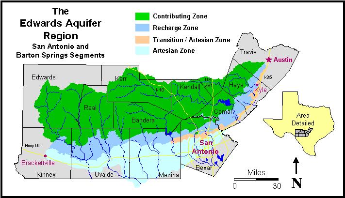
1 Isotope Hydrology Jay Banner Department of Geological Sciences Environmental Science Institute April 19, 2005 Outline 1. Background: Isotope systematics stable & radiogenic 2. Tracing atmospheric vs. hydrologic processes 3. Edwards aquifer examples 4. The temporal evolution of groundwater Isotopes Different isotopes of the same element have the same number of protons and electrons, but different numbers of neutrons.
2 Stable Isotope Systems Many elements of low atomic weight have two or more stable isotopes, e.g., Hydrogen - 1 H, 2 H (= D) δd Carbon - 12 C, 13 C δ 13 C Oxygen - 16 O, 18 O δ 18 O The different masses cause isotopes to behave differently in physical and chemical processes. Consider two water molecules: H 2 18 O and H 2 16 O Radiogenic Isotope Systems Some elements undergo radioactive decay due to inherent instability of their nuclei, producing a daughter product of another element. The daughter product produced is termed radiogenic. The relative amounts of radiogenic vs. stable isotopes of the same element in rocks, minerals, and waters provide information about age and sources of dissolved ions.
3 Isotope Fractionation Isotope fractionation: the development of differences in isotopic composition as a result of physical and chemical processes. The degree of fractionation depends on the relative weights of the isotopes. Commonly fractionated: H, C, N, O, S (stable) Negligible fractionation: Sr, Nd, U, Pb (radiogenic) H and O isotopes in the hydrologic cycle Distillation and fractionation during cycle Effects of Evaporation Rainfall amount Topography Temperature Climate change


")

4 Map of North America showing contours of the average hydrogen isotope values (δd or 2 H/ 1 H values) of meteoric surface waters. An identical pattern is found for oxygen isotopes (δ 18 O or 18 O/ 16 O) in meteoric waters. Hydrogen isotopes in meteoric water Taylor (1974) Oxygen in hydrologic cycle cartoon
 H-O isotopes in rain and groundwater on")
5 Barbados Monthly Rainfall Jones et al. (2000) H-O isotopes in rain and groundwater on Barbados
6 Barb Rain oxygen vs time Groundwaters Groundwater Rain Jones and Banner (2003)

 varies in nature with")

7 What is strontium? An alkaline earth element with 4 naturally occurring isotopes ( 84 Sr, 86 Sr, 87 Sr, 88 Sr). The 87 Sr/ 86 Sr ratio (δ 87 Sr) varies in nature with age and composition of aquifer rock and soil. Groundwaters reacting with rock and soil may reflect these variations. Radiogenic isotope variations in a karst aquifer
8 0 87 Rb 87 Sr radioactive decay system β - 37 Rb 38 Sr Half life = 48.8 b.y. 87 Sr = 87 Sr o + 87 Rb (e λt 1) 87 Sr/ 86 Sr = ( 87 Sr/ 86 Sr) o + 87 Rb/ 86 Sr (e λt 1) y = b + m x Sr isotope evolution of the Earth Sr 86 Sr Proterozoic Crust Fig. 1 Archean Crust Mantle Mantle Initial Earth Age (Ga) Banner (2004)

 Burke et al. (1982) Musgrove et al.")
9 Sr isotopes in the oceans through time Sr/ 86Sr Q Tertiary Cretaceous Jurassic Triassic Permian Penn. Miss. Devonian Silurian Ordovician Cambrian PC Age (Ma) Burke et al. (1982) Musgrove et al Honey Creek
10


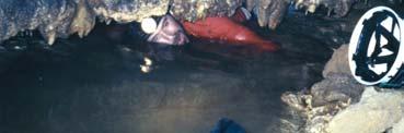
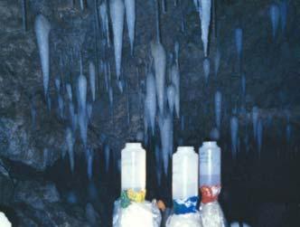
11 Soils = High Sr isotope ratios Low Mg/Ca and Sr/Ca values Limestone = Low Sr isotope ratios High Mg/Ca and Sr/Ca values Methods Soils are leached using a NH 4 Ac solution to approximate the ion exchange by infiltrating rainwater as it moves through the soil. Cave waters and soil leachates are analyzed for elemental composition using ICP-mass spectrometry. Sr is extracted from waters using ion-exchange chemistry. Waters are analyzed for Sr isotope ratios using thermalionization mass spectrometry.


12 Edwards Aquifer: Regional groundwater compositions Water-calcite interaction Water-dolomite interaction phreatic vadose Soil waters Cretaceous limestones Edwards Aquifer: Local groundwater compositions Natural Bridge dripwaters Inner Space dripwaters NB soil waters IS soil waters


13 Inner Space Cavern drip site ISST: Temporal Variations in 87 Sr/ 86 Sr and Effective Precipitation Sr/ 86 Sr 6 87 Sr/ 86 Sr effective precipitation monthly effective precipitation (inches) /19/2001 April 2001 May 2002 June 2003 Aug /5/2001 5/24/ /10/2002 6/28/2003 1/14/2004 8/1/2004 2/17/2005 Edwards Limestone

14 Vadose Flow Routes in Karst After Smart & Friederich (1987) Vadose Groundwater Flow Model After Smart and Friederich (1987)

 Collaborators:")

15 Rainfall Flow route model summary High recharge = conduit flow = high 87 Sr/ 86 Sr Low recharge = diffuse flow = low 87 Sr/ 86 Sr Honey Creek Study Area and Setting Preliminary data: Sr isotopes for spring waters in the control watersheds (Bravo and Delta Springs, and the treatment watershed) Collaborators: MaryLynn Musgrove Libby Stern Honey Creek Guadalupe River treatment Bravo Spring Cotton Spring Delta Spring Echo Spring Other springs Rainfall simulation site 20 contour control
16 HCSNA Sr Isotope Variations NH 4 Ac soil leachates HCSNA spring waters HCSNA Sr Isotope Variations NH 4 Ac soil leachates HCSNA spring waters control watershed treatment watershed

17 Temporal Variations in Spring Water 87 Sr/ 86 Sr and Effective Precipitation Effective preciptation: rainfall less evaporation Impact of Urbanization on Austin-area streams Lance Christian Geological Sciences MS thesis

 0.70900 0.70880 R 2 = 0.923 0.70860 87 Sr/ 86 Sr 0.70840 0.70820 0.70800 0.70780 0.70760 0.0 2.0 4.0 6.0 8.0 10.0 12.0 14.")
18 Current Study: Street Indicators of Urbanization Bull Creek West Bull Creek Shoal Creek Barton Creek Waller Creek Williamson Slaughter Onion Creek Big and Little Bear Source data: City of Austin Amy Hobbs, Dept. of Architecture, Univ. of TX Strontium Isotope Versus Building Area Urbanization Indicator (for watersheds: Waller, Shoal Bull, West Bull, Williamson, and Slaughter) R 2 = Sr/ 86 Sr building area per watershed (%)


19 Temporal Evolution of Groundwater: An Isotopic Perspective


![study of] the](/docs-images/92/110677776/images/20-2.jpg "exploration and")


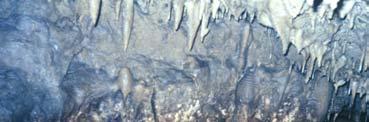
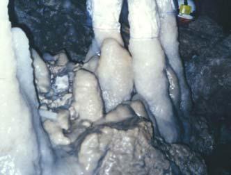
20 Speleothems Speleology, n. [Greek speleon, cave; ology, study of] the exploration and study of caves Speleothems, n. [Greek speleon, cave; them, them things] them things that grow in caves


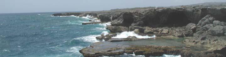
21 Applicability of Speleothems to Studies of the Temporal Evolution of Groundwater Wide geographic coverage Dateable and continuous on a range of time scales Range of tracers: Stable and radiogenic isotopes Trace elements, inclusions Pittman, 1999 The West Indies
22 Tectonic Setting of Barbados Torrini et al. (1985) Barbados, West Indies After Scoffin, 1987

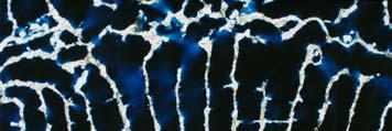
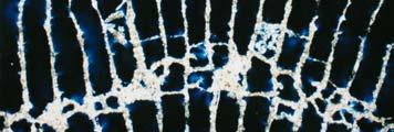
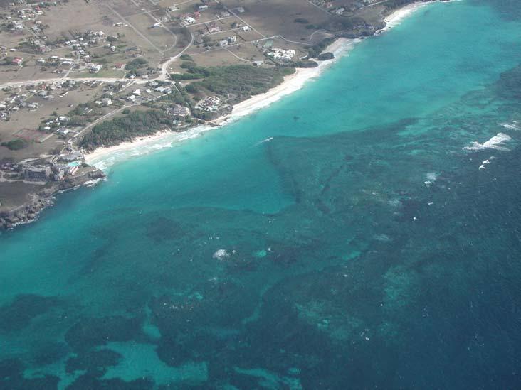
23 1 mm 1 mm Southeast Barbados

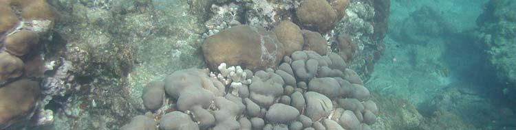
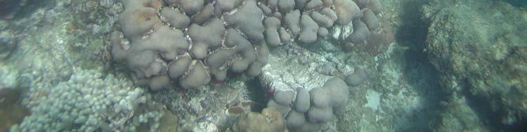

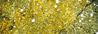
24 Modern Barbados Reef


25 Horse Hill Saharan dust transport patterns The New York Times Oct 29, 1992

26 NASA image of Saharan Dust over Canary Islands NASA 3/6/98 Barb speleo Sr v time eps Banner et al. (1996)
27 Vadose Flow Routes in Karst After Smart & Friederich (1987) Barb Speleo Sr record


28 Holocene climate records, Mesoamerican tropics Lake levels Lake chemistry: mineralogy stable isotopes Pollen, vegetation Fires Archeology
Environmental Isotopes in Hydrology. Woocay substituting for Walton
 Environmental Isotopes in Hydrology Oct 7, 2010 1 What is an Isotope? An element is defined by the number of protons (Z) in the nucleus The number of neutrons (N) defines the isotope(s) of that element
Journal of Hydrology
 Journal of Hydrology 388 (2010) 144 156 Contents lists available at ScienceDirect Journal of Hydrology journal homepage: www.elsevier.com/locate/jhydrol Springwater geochemistry at Honey Creek State Natural
Tracers and Isotopes in Urban Hydrology
 Tracers and Isotopes in Urban Hydrology What is a hydrologic tracer? Any substance that can be used for tracking water movement is a tracer An ideal tracer behaves exactly as the traced material behaves
Groundwater from ophiolite aquifer: flow path and recharge rate
 Groundwater from ophiolite aquifer: flow path and recharge rate Rashid Al Abri 1,2, Osman Abdalla 2 and Khadija Semhi 2 1 Ministry of Regional Municipalities and Water Resources, Muscat, Oman 2 Dept. of
Environmental Isotopes in Hydrogeology. land. Clark and Peter Fritz
 Environmental Isotopes in Hydrogeology land. Clark and Peter Fritz www. science.uottawa. ca/~eih LEWIS PUBLISHERS Boca Raton New York CONTENTS CHAPTER 1: THE ENVIRONMENTAL ISOTOPES 1 Environmental Isotopes
Karst Topography In order to understand karst topography we must first have a basic understanding of the water cycle, the formation of limestone (carb
 Karst Topography The formation of caves and other associated features in limestone bedrock is called karst topography. Limestone, a sedimentary rock made mostly of the mineral calcite and small amounts
LBJWC - Sinkhole Lesson
 LBJWC - Sinkhole Lesson Concept Caves and sinkholes are major openings in the ground that recharge water to the Edwards Aquifer. Objective - Students will: 1) identify a sinkhole, cave, fracture, fault,
Groundwater. (x 1000 km 3 /y) Reservoirs. Oceans Cover >70% of Surface. Groundwater and the. Hydrologic Cycle
 Reservoirs. Oceans Cover >70% of Surface. Groundwater and the. Hydrologic Cycle") Chapter 13 Oceans Cover >70% of Surface Groundwater and the Hydrologic Cycle Oceans are only 0.025% of Mass Groundwater Groundwater is liquid water that lies in the subsurface in fractures in rocks and
Chapter 13 Oceans Cover >70% of Surface Groundwater and the Hydrologic Cycle Oceans are only 0.025% of Mass Groundwater Groundwater is liquid water that lies in the subsurface in fractures in rocks and
Groundwater. (x 1000 km 3 /y) Oceans Cover >70% of Surface. Groundwater and the. Hydrologic Cycle
 Oceans Cover >70% of Surface. Groundwater and the. Hydrologic Cycle") Chapter 17 Oceans Cover >70% of Surface Groundwater and the Hydrologic Cycle Vasey s Paradise, GCNP Oceans are only 0.025% of Mass Groundwater Groundwater is liquid water that lies in the subsurface in
Chapter 17 Oceans Cover >70% of Surface Groundwater and the Hydrologic Cycle Vasey s Paradise, GCNP Oceans are only 0.025% of Mass Groundwater Groundwater is liquid water that lies in the subsurface in
WATER ON AND UNDER GROUND. Objectives. The Hydrologic Cycle
 WATER ON AND UNDER GROUND Objectives Define and describe the hydrologic cycle. Identify the basic characteristics of streams. Define drainage basin. Describe how floods occur and what factors may make
Chapter 3 Time and Geology
 Chapter 3 Time and Geology Methods of Dating Rocks 1. Relative dating - Using fundamental principles of geology (Steno's Laws, Fossil Succession, etc.) to determine the relative ages of rocks (which rocks
Biology. Slide 1 of 40. End Show. Copyright Pearson Prentice Hall
 Biology 1 of 40 2 of 40 Fossils and Ancient Life What is the fossil record? 3 of 40 Fossils and Ancient Life The fossil record provides evidence about the history of life on Earth. It also shows how different
Stable Isotopes OUTLINE
 Stable Isotopes OUTLINE Reading: White Ch 9.1 to 9.7.1 (or digital p370-400) Exercise answer? What does the salt do? Today 1. 2 leftovers 2. Stable Isotopes for hydrologic and climate applications 1 CaCO
BS University of the Pacific (Stockton, CA) May 2004 Major: Geological Sciences
 May 2004 Major: Geological Sciences") Professional Experience Corinne I. Wong University of California President s Postdoctoral Fellow Department of Geology, University of California, Davis 2119 Earth and Physical Sciences, Davis, CA 95616
Professional Experience Corinne I. Wong University of California President s Postdoctoral Fellow Department of Geology, University of California, Davis 2119 Earth and Physical Sciences, Davis, CA 95616
1. The timeline below represents time on Earth from the beginning of the Paleozoic Era Ato the present B.
 Name Roy G Biv 1. The timeline below represents time on Earth from the beginning of the Paleozoic Era Ato the present B. Which numbered position best represents the time when humans first appeared in the
Dating of ground water
 PART 16 Dating of ground water Introduction Why date? - to determine when recharge occurred - to determine groundwater velocities - to reconstruct regional flow patterns How to do this? - decay of radioactive
Cycles in the Phanerozoic
 Cycles in the Phanerozoic Evolutionary trends: extinctions, adaptive radiations, diversity over time Glaciations Sea level change Ocean chemistry Atmospheric CO 2 biosphere Mass extinctions in the..you
Paleoclimate indicators
 Paleoclimate indicators Rock types as indicators of climate Accumulation of significant thicknesses of limestone and reef-bearing limestone is restricted to ~20º + - equator Gowganda tillite, Ontario
Earth Science Institute II June 23, 2010 Day 3 Correlation of EarthComm Curriculum and HSCE s
 Earth Science Institute II June 23, 2010 Day 3 Correlation of EarthComm Curriculum and s EDG1 = Earth s Dynamic Geospheres: Chapter 1, Volcanoes EDG2 = Earth s Dynamic Geospheres: Chapter 2, Plate Tectonics
Time. How we achieved a modern sense of time. Yearly Calendars are Ancient
 Time How we achieved a modern sense of time. Yearly Calendars are Ancient Stonehenge is 2000+ BC and indicates that ancient cultures counted days and knew precisely the repeat cycle of the seasons. 1 Renaissance
SAMPLE QUESTIONS FOR GEOLOGY 103, TEST 1
 SAMPLE QUESTIONS FOR GEOLOGY 103, TEST 1 The correct answers are listed at the bottom (no peeking!). These questions are to give you an idea of the type of questions that will be asked. They are not a
Hydrogeology of Karst NE Wisconsin. Dr. Maureen A. Muldoon UW-Oshkosh Geology Department
 Hydrogeology of Karst NE Wisconsin Dr. Maureen A. Muldoon UW-Oshkosh Geology Department WI Bedrock Outline Karst Landscapes Existing WQ Data Flow in Karst Aquifers Overview of Silurian Aquifer Water Level
The principle of fossil succession allows strata in different parts of the world to be correlated, and worldwide relative ages to be worked out
 Correlating beds using index fossils Stratigraphic Classification: Piles of stratified rocks need to be classified. A formation is an easily identifiable rock unit that differs from layers above and below
Reconstructing Past Droughts in Texas. Richard Casteel Jay Banner Jackson School of Geosciences Environmental Science Institute
 Reconstructing Past Droughts in Texas Richard Casteel Jay Banner Jackson School of Geosciences Environmental Science Institute Texas climate Outline Present and past droughts Drought reconstructions: Tree
Mammoth Cave National Park, Kentucky
 Mammoth Cave National Park, Kentucky Objectives of Today s Lecture Refresher on Sedimentary Depositional Systems and Rock Classifications Transgressive and Regressive Marine Environments Carbonate Depositional
Water percolating through hot lava dissolves soluble minerals containing chlorine, bromine and sulphur compounds
 Figure 5 The sources of dissolved ions in sea water. Water falls as rain Compounds containing mainly calcium, magnesium, carbonate and silicate ions are leached from the soil Rivers carry ions in solution
EARTH SCIENCE 11 CHAPTER 9 NOTES WATER MOVING UNDERGROUND
 EARTH SCIENCE 11 CHAPTER 9 NOTES WATER MOVING UNDERGROUND KEY A. ALL THE WORLD S WATER 1. The world has an estimated one and one third thousand million cubic kilometers of water. 2. The earth s water is
17-1 The Fossil Record Slide 1 of 40
 1 of 40 Fossils and Ancient Life Fossils and Ancient Life Paleontologists are scientists who collect and study fossils. All information about past life is called the fossil record. The fossil record includes
Chapter 3 Time and Geology
 Chapter 3 Time and Geology Finding the age of rocks: Relative versus Actual Dating The science that deals with determining the ages of rocks is called geochronology. Methods of Dating Rocks 1. Relative
Fossils Biology 2 Thursday, January 31, 2013
 Fossils Biology 2 Evolution Change in the genetic composition of a group of organisms over time. Causes: Natural Selection Artificial Selection Genetic Engineering Genetic Drift Hybridization Mutation
S6E1. Obtain, evaluate, and communicate information about current scientific views of the universe and how those views evolved. a.
 S6E1. Obtain, evaluate, and communicate information about current scientific views of the universe and how those views evolved. a. Ask questions to determine changes in models of Earth s position in the
Science Online Instructional Materials Correlation to the 2010 Earth Science Standards of Learning and Curriculum Framework
 and Curriculum Framework Provider York County School Division Course Title Earth Science Last Updated 2010-11 Course Syllabus URL http://yorkcountyschools.org/virtuallearning/coursecatalog.aspx ES.1 The
17-1 The Fossil Record Slide 2 of 40
 2 of 40 Fossils and Ancient Life What is the fossil record? 3 of 40 Fossils and Ancient Life Fossils and Ancient Life Paleontologists are scientists who collect and study fossils. All information about
GY 112: Earth History
 UNIVERSITY OF SOUTH ALABAMA GY 112: Earth History Lecture 8a: Stable Isotope Stratigraphy Instructor: Dr. Douglas W. Haywick GY 112: Lecture test preparation Thursday February 9th Word List for Lecture
Unit A (225 m.y. old) Unit B (how old is it?) Unit C (275 m.y. old)
 Unit B (how old is it?) Unit C (275 m.y. old)") Radiometric Dating Relative dating techniques are based on principles can be used to differentiate the relative age rock units and landforms. Relative dating techniques by themselves cannot be used to
Radiometric Dating Relative dating techniques are based on principles can be used to differentiate the relative age rock units and landforms. Relative dating techniques by themselves cannot be used to
El Niño-Southern Oscillation and global warming: new data from old corals
 El Niño-Southern Oscillation and global warming: new data from old corals Kim M. Cobb Georgia Inst. of Technology Chris Charles, Scripps Inst. of Oceanography Larry Edwards, Hai Cheng, UMN Emory University
Stable isotopes that have large differences in mass may be fractionated during physical, chemical, or biological
 NAME 89.215 - FORENSIC GEOLOGY DEMISE OF THE ICE MAN - ISOTOPIC EVIDENCE I. Introduction Stable and radiogenic isotopic data have been used in a variety of fields to answer a wide range of scientific questions.
Crosswalk of Georgia Performance Standards & Georgia Standards of Excellence GSE Implementation in Sixth Grade
 Implementation in 2017-18 S6E1. Students will explore current scientific views of the universe and how those views evolved. a. Relate the Nature of Science to the progression of basic historical scientific
GO ON. Directions: Use the diagram below to answer question 1.
 d i a g n o s t i c t e s t : e a r t h a n d s p a c e s c i e n c e question 1. 1. What is the correct order (starting from the surface) of Earth s layers? A crust, outer core, inner core, mantle B mantle,
Prof. Stephen A. Nelson EENS 111. Groundwater
 Page 1 of 8 Prof. Stephen A. Nelson EENS 111 Tulane University Physical Geology This page last updated on 20-Oct-2003 is water that exists in the pore spaces and fractures in rock and sediment beneath
From Isotopes to Temperature: Using Ice Core Data!
 From Isotopes to Temperature: Using Ice Core Data! Spruce W. Schoenemann schoes@uw.edu UWHS Atmospheric Sciences 211 May 2013 Dept. of Earth and Space Sciences University of Washington Seattle http://www.uwpcc.washington.edu
Hydrologic Influences of the Blanco River on the Trinity and Edwards Aquifers, Central Texas, USA
 Hydrologic Influences of the Blanco River on the and Aquifers, Central Texas, USA B.A. Smith, B.B. Hunt, A.G. Andrews, J.A. Watson, M.O. Gary, D.A. Wierman and A.S. Broun Abstract The Blanco River of central
Introduction to Weathering
 Name: Date: Period: Unit 9: Earth s Destructive Forces A. Kinds of Weathering Introduction to Weathering Distinguish between two major processes that change the Earth surface. Identify two types of weathering.
1 BASIC CONCEPTS AND MODELS
 1 BASIC CONCEPTS AND ODELS 1.1 INTRODUCTION This Volume III in the series of textbooks is focused on applications of environmental isotopes in surface water hydrology. The term environmental means that
PAPER No.4: Environmental Chemistry MODULE No.5 : Properties of Water and hydrologic cycle
 Subject Chemistry Paper No and Title Module No and Title Module Tag Paper 4: Environmental Chemistry 5: Properties of Water and Hydrologic Cycle CHE_P4_M5 TABLE OF CONTENTS 1. Learning Outcomes 2. Introduction
Temporal variability in the isotopic composition of meteoric water in Christchurch, New Zealand; Can we create reliable isoscapes?
 1 2 3 4 5 6 7 8 9 10 11 12 13 14 15 16 17 18 19 20 21 22 23 24 25 26 27 28 29 30 31 Temporal variability in the isotopic composition of meteoric water in Christchurch, New Zealand; Can we create reliable
Quiz Three (9:30-9:35 AM)
") Quiz Three (9:30-9:35 AM) UNIVERSITY OF SOUTH ALABAMA GY 112: Earth History Lecture 7 & 8: Dating Instructor: Dr. Douglas W. Haywick Last Time 1. William Smith and Water 2. Stratigraphic Principles 3.
Quiz Three (9:30-9:35 AM) UNIVERSITY OF SOUTH ALABAMA GY 112: Earth History Lecture 7 & 8: Dating Instructor: Dr. Douglas W. Haywick Last Time 1. William Smith and Water 2. Stratigraphic Principles 3.
Earth History. What is the Earth s time scale? Geological time Scale. Pre-Cambrian. FOUR Eras
 The Earth is 4.6 billion years old! Earth History Mrs. Burkey ESS Cy Creek HS 17-18 If the Earth formed at midnight 6:00 am First life appears 10:00 pm First animals/plants on land 11:59 pm First humans
RR#5 - Free Response
 Base your answers to questions 1 through 3 on the data table below and on your knowledge of Earth Science. The table shows the area, in million square kilometers, of the Arctic Ocean covered by ice from
EARTH S HISTORY. What is Geology? logy: science. Geology is the scientific study of the Earth, including its:
 EARTH S HISTORY 1 What is Geology? Geo: earth logy: science Geology is the scientific study of the Earth, including its: composition, structure, and physical properties. 2 1 Geologists study: the origin
Name Date EARTH S HISTORY VOCABULARY
 Name Date EARTH S HISTORY VOCABULARY Use Figure 2 to answer the following two questions. 10. Interpreting Graphics Which is older the sandstone layer or Dike A? Explain your answer. Conglomerate Sandstone
Chapter 13. Groundwater
 Chapter 13 Groundwater Introduction Groundwater is all subsurface water that completely fills the pores and other open spaces in rocks, sediments, and soil. Groundwater is responsible for forming beautiful
Geologic Time. Geologic Events
 Geologic Time Much of geology is focused on understanding Earth's history. The physical characteristics of rocks and minerals offer clues to the processes and conditions on and within Earth in the past.
Chapter 14. Groundwater
 Chapter 14 Groundwater Importance of groundwater! Groundwater is water found in the pores of soil and sediment, plus narrow fractures in bedrock! Groundwater is the largest reservoir of fresh water that
Timing of Geologic Events. Geologic Time Terms. Laws / Principles of Stratigraphy
 Geologic Time Terms Hadean Archean Proterozoic Phanerozoic Paleozoic Mesozoic Cenozoic(Tertiary) Cambrian Unconformity Angular unconformity Half-life Alpha particle Beta particle Gamma ray Neutron UT How
Test is over no later than 9:40 p.m. There are 43 questions. Each is worth points, for a total of 100 points.
 Student name NOTE: Test 2 - Form B 3370:133 Section 001 SAMPLE Caves Count pages to make sure that you have all of them. Turn in this question sheet when done. Fill in all information requested on the
GEOLOGIC EVENTS SEDIMENTARY ROCKS FAULTING FOLDING TILTING
 RELATIVE TIME (DATING) ABSOLUTE TIME (DATING) GEOLOGIC TIME List the order in which events occurred, without regard to the amount of time separating them. Refers to the age of a rock in relation to other
Geography Class XI Fundamentals of Physical Geography Section A Total Periods : 140 Total Marks : 70. Periods Topic Subject Matter Geographical Skills
 Geography Class XI Fundamentals of Physical Geography Section A Total Periods : 140 Total Marks : 70 Sr. No. 01 Periods Topic Subject Matter Geographical Skills Nature and Scope Definition, nature, i)
Florida s Karst Geology
 Florida s Karst Geology Orange Creek Basin Interagency Working Group Public Workshop, November 5 th, 2015 Harley Means, P.G. Assistant State Geologist Florida Geological Survey Karst Karst a type of topography
Chapter 23 test. Multiple Choice Identify the choice that best completes the statement or answers the question. Figure 23-1
 Chapter 23 test Multiple Choice Identify the choice that best completes the statement or answers the question. Figure 23-1 1. In Figure 23-1, what process does the arrow labeled A represent? a. transpiration
3. The diagram below shows how scientists think some of Earth's continents were joined together in the geologic past.
 1. The map below shows the present-day locations of South America and Africa. Remains of Mesosaurus, an extinct freshwater reptile, have been found in similarly aged bedrock formed from lake sediments
Isotopes as tools. Isotopes Equal places Stable versus unstable/radiogenic (anthropogenic vs natural) Basics Examples
 Basics Examples") Discussion 2 Paper due to me Sept 30-pdf and complete citation Find a paper using isotopes as tool for understanding biogeochemical processes They may be radiogenic or stable Written paper same requirements
Discussion 2 Paper due to me Sept 30-pdf and complete citation Find a paper using isotopes as tool for understanding biogeochemical processes They may be radiogenic or stable Written paper same requirements
HID 362 MESLEKİ İNGİLİZCE 2
 HID 362 MESLEKİ İNGİLİZCE 2 Hafta 5 Prof. Dr. N. Nur ÖZYURT 2017-2018 Bahar Dönemi http://www.philippe-crochet.com/galerie/karst/details/18/lapiaz-et-sites-ruiniformes/236104/rr-14-0032-pic-saint-loupherault-figures-de-karstification-sur-la-crete-ouest
Fossils: evidence of past life
 Fossils: evidence of past life Remains or traces of prehistoric life Petrified Cavities and pores are filled with precipitated mineral matter Petrified Formed by replacement Cell material is removed and
11/5/2015. Creating a Time Scale - Relative Dating Principles. Creating a Time Scale - Relative Dating Principles. The Geologic Time Scale
 GEOL 110: PHYSICAL GEOLOGY Why is the Geologic Time Scale important? Rocks record geologic and evolutionary changes throughout Earth s history Without a time perspective, events have little meaning Chapter
The Environment and Change Over Time
 The Environment and Change Over Time Fossil Evidence of Evolution What do you think? Read the two statements below and decide whether you agree or disagree with them. Place an A in the Before column if
GEOL 110. Sedimentary Layering. Geologic Structures (faults, joints, folds), Unconformities, Karst. Sedimentary Layering 9/23/17. Geologic Structures
, Unconformities, Karst. Sedimentary Layering 9/23/17. Geologic Structures") GEOL 110 Sedimentary Layering Geologic Structures (faults, joints, folds), Unconformities, Karst Layering = horizontal, continuous banding produced during sediment deposition Sedimentary Layering Geologic
GEOL 110 Sedimentary Layering Geologic Structures (faults, joints, folds), Unconformities, Karst Layering = horizontal, continuous banding produced during sediment deposition Sedimentary Layering Geologic
2 Eras of the Geologic Time Scale
 CHAPTER 8 2 Eras of the Geologic Time Scale SECTION The History of Life on Earth BEFORE YOU READ After you read this section, you should be able to answer these questions: What kinds of organisms evolved
Ecoregions Glossary. 7.8B: Changes To Texas Land Earth and Space
 Ecoregions Glossary Ecoregions The term ecoregions was developed by combining the terms ecology and region. Ecology is the study of the interrelationship of organisms and their environments. The term,
Table of Isotopic Masses and Natural Abudances
 Table of Isotopic Masses and Natural Abudances in amu, where 1amu = 1/12 mass 12 C Atomic weight element = M i (abun i )+M j (abun j ) + Four types of radioactive decay 1) alpha (α) decay - 4 He nucleus
Anticipation Guide #4 Ice wedging is a form of chemical weathering Erosion is the process where rocks are broken down The most active erosion agent
 Weathering Anticipation Guide #4 Ice wedging is a form of chemical weathering Erosion is the process where rocks are broken down The most active erosion agent on the planet is running water Gravity plays
PLANET EARTH CAMBRIDGE UNIVERSITY PRESS. Cesare Emiliani. Cosmology, Geology, and the Evolution off Life and Environment
 PLANET EARTH Cosmology, Geology, and the Evolution off Life and Environment Cesare Emiliani Department of Geological Sciences, The University of Miami CAMBRIDGE UNIVERSITY PRESS Preface page xi PART I
IMPACT OF CLIMATE CHANGE OVER THE ARABIAN PENINSULA
 IMPACT OF CLIMATE CHANGE OVER THE ARABIAN PENINSULA By: Talal Alharbi June, 29 2017 1 Motivation: In arid and semi-arid regions of the world the demand for fresh water resources is increasing due to: increasing
Which map shows the stream drainage pattern that most likely formed on the surface of this volcano? A) B)
 B)") 1. When snow cover on the land melts, the water will most likely become surface runoff if the land surface is A) frozen B) porous C) grass covered D) unconsolidated gravel Base your answers to questions
1. When snow cover on the land melts, the water will most likely become surface runoff if the land surface is A) frozen B) porous C) grass covered D) unconsolidated gravel Base your answers to questions
Objective 3: Earth and Space Systems
 Name Class Period: Objective 3: Earth and Space Systems 1. The diagram above shows the orbit of the moon around Earth. At which point in the moon s orbit will a person standing on Earth see a waxing crescent
5 Time Marches On. TAKE A LOOK 1. Identify What kinds of organisms formed the fossils in the picture?
 CHAPTER 6 5 Time Marches On SECTION The Rock and Fossil Record BEFORE YOU READ After you read this section, you should be able to answer these questions: How do geologists measure time? How has life changed
Unit 7.2 W.E.D. & Topography Test
 Name: Score: Unit 7.2 W.E.D. & Topography Test 1. 2. 3. 4. 5. 6. 7. 8. 9. 10. 11. 12. 13. 14. 15. 16. 17. 18. 19. 20. 21. 22. 23. 24. 25. 1. The formation of mountains is due mainly to while the destruction
Origin and Evolution of Formation Waters in the West-Central Part of the Alberta Basin
 Page No. 004-1 Origin and Evolution of Formation Waters in the West-Central Part of the Alberta Basin Karsten Michael* University of Alberta, 1-26 ESB, Edmonton, AB T6G 2E3 karsten@ualberta.ca and Stefan
Section 11.1 pp Where Mountains Form
 Section 11.1 pp. 236 237 Where Mountains Form Chapter 11 Set a Purpose: TE, p. 236 Reading Study Guide, p. 36 Discussion: TE, p. 236 Differentiating ion Reading Support: TE, p. 236 Visual Teaching Interpret
Karst found mostly in limestone (rock with at least 50% carbonate minerals), depends on 1) permeability & porosity
, depends on 1) permeability & porosity") KARST LANDFORMS produced by weathering & erosion in regions of carbonate rocks and evaporites processes called karstification mainly below ground surface predominantly underground drainage poorly-developed
KARST LANDFORMS produced by weathering & erosion in regions of carbonate rocks and evaporites processes called karstification mainly below ground surface predominantly underground drainage poorly-developed
Geologic History. A. Basic Geologic Principles The relative age of rock formations relies on the following basic geologic principles:
 Geologic History I. Relative Age Dating of Rocks Relative age of rocks does not rely on an exact date of a rock, but relates its age relative to other rock formations or layers. A. Basic Geologic Principles
 http://dx.doi.org/10/1061/40698(2003)19 Green, J., Pavlish, J., Leete, J., and Alexander, Jr., E. (2003) Quarrying Impacts on Groundwater Flow Paths. Sinkholes and the Engineering and Environmental Impacts
What is a water table? What is an aquifer? What is the difference between a spring and a well?
 CHAPTER 11 3 Water Underground SECTION The Flow of Fresh Water BEFORE YOU READ After you read this section, you should be able to answer these questions: What is a water table? What is an aquifer? What
Earth s s Geologic History
 The Earth s s Geologic History and The Earth s s Interior Earth s s Geologic History Geologic timescale Divides Earth s s history into relative time periods Relative dating based on: (apply for entire
Remains or traces of prehistoric life
 Fossils: evidence of past life Remains or traces of prehistoric life Petrified Cavities and pores are filled with precipitated p mineral matter Petrified Formed by replacement Cell material is removed
The Earth System Connections among the great spheres
 Why should we discuss the Earth System? The Earth System Connections among the great spheres Before we delve into the connection between geology, health, and forensics, we must gain an appreciation of
Lecture Outlines PowerPoint. Chapter 5 Earth Science 11e Tarbuck/Lutgens
 Lecture Outlines PowerPoint Chapter 5 Earth Science 11e Tarbuck/Lutgens 2006 Pearson Prentice Hall This work is protected by United States copyright laws and is provided solely for the use of instructors
Chapter. Introduction to Earth Science
 EARTH SCIENCE Chapter 1 Introduction to Earth Science 1.1 What Is Earth Science? Overview of Earth Science Encompasses all sciences that seek to understand Earth Earth's neighbors in space 1.1 What Is
The Lithosphere and the Tectonic System. The Structure of the Earth. Temperature 3000º ºC. Mantle
 The Lithosphere and the Tectonic System Objectives: Understand the structure of the planet Earth Review the geologic timescale as a point of reference for the history of the Earth Examine the major relief
OCE 290A (Topics in Chemical Oceanography) Application of Isotopes in Geological and Environmental Research
 Application of Isotopes in Geological and Environmental Research") OCE 290A (Topics in Chemical Oceanography) Application of Isotopes in Geological and Environmental Research Class participation 25%, Oral presentation 25%, Mid-term manuscript to review 25%, Final 3-5
OCE 290A (Topics in Chemical Oceanography) Application of Isotopes in Geological and Environmental Research Class participation 25%, Oral presentation 25%, Mid-term manuscript to review 25%, Final 3-5
Chapter 5. The Biogeochemical Cycles. Botkin & Keller Environmental Science 5e
 Chapter 5 The Biogeochemical Cycles How Chemicals Cycle Biogeochemical Cycle The complete path a chemical takes through the four major components or reservoirs of Earth s systems 1. Atmosphere 2. Hydrosphere
Rock cycle diagram. Principle of Original Horizontality. Sediment is deposited horizontally
 Geologic Time Rock cycle diagram Leaves of History Chapter 21 Lateral Continuity Principle of Original Horizontality Sediment is deposited horizontally Principle of Superposition Oldest rock A Younger
Ecological Context - Urban settlements are part of their surrounding ecosystem. Austin
 Ecological Context - Urban settlements are part of their surrounding ecosystem Austin Ecotone Division between West and East Flyway Uplift River Balcones Escarpment Central Texas Climate The principal
Trace Elements - Definitions
 Trace Elements - Definitions Elements that are not stoichiometric constituents in phases in the system of interest For example, IG/MET systems would have different trace elements than aqueous systems Do
Name HW - Landscapes
 Name HW - Landscapes 1. New York s Tug Hill landscape region is classified as a plateau because this region has a A) high elevation with distorted bedrock B) high elevation with nearly horizontal layers
GEOLOGY CURRICULUM. Unit 1: Introduction to Geology
 Chariho Regional School District - Science Curriculum September, 2016 GEOLOGY CURRICULUM Unit 1: Introduction to Geology OVERVIEW Summary In this unit students will be introduced to the field of geology.
Stable isotope. Relative atomic mass. Mole fraction. Chlorine isotopes in Earth/planetary science
 Stable isotope Relative atomic mass Mole fraction 35 Cl 34.968 8527 0.7576 37 Cl 36.965 9026 0.2424 / Chlorine isotopes in Earth/planetary science Because molecules, atoms, and ions of the stable isotopes
6.1 Water. The Water Cycle
 6.1 Water The Water Cycle Water constantly moves among the oceans, the atmosphere, the solid Earth, and the biosphere. This unending circulation of Earth s water supply is the water cycle. The Water Cycle
HISTORICAL GEOLOGY. Relative & Absolute age, fossils and geologic time
 HISTORICAL GEOLOGY Relative & Absolute age, fossils and geologic time Historical Geology A. Measuring Time 1. Relative Time (Relative Age) Measurement of time using comparison. No numbers used; uses words
Prentice Hall EARTH SCIENCE
 Prentice Hall EARTH SCIENCE Tarbuck Lutgens Running Water and Groundwater Running Water The Water Cycle Water constantly moves among the oceans, the atmosphere, the solid Earth, and the biosphere. This