Some associated features of Severe Thunderstorms in Bangladesh extracted from conventional method and numerical modelling
|
|
|
- Anne Davis
- 6 years ago
- Views:
Transcription
1 International Forum on Tornado Disaster Risk Reduction for Bangladesh -To Cope with Neglected Disasters December 2009, Dhaka, Bangladesh Some associated features of Severe Thunderstorms in Bangladesh extracted from conventional method and numerical modelling Presenter: Md. Abdul Mannan, BMD Collaboration with: Arjumand Habib, Md. Shah Alam and S. M. Quamrul Hassan
2 Contents of presentation Vulnerability of Bangladesh in context of Severe Thunderstorm and Tornado Synoptic or conventional analysis of a Severe Thunderstorm in Bangladesh Simulation of a Severe Thunderstorm using WRF model Simulation of a Severe Thunderstorm using MM5 model Conclusion

3 Tornado occurring areas in the world
4 Ten deadliest tornadoes Death Toll Event Location Date 1,300 The Saturia-Manikganj Sadar Tornado Bangladesh (Manikganj) East Pakistan Tornado Bangladesh The Tri-State Tornado United States (Missouri Illinois Indiana) March 18, Dhaka Tornado Bangladesh The Malta Tornado Malta The Sicily Tornado Italy The Narail-Magura Tornadoes Bangladesh (Jessore) The Comoro Tornado Comoro The Tangail Tornado Bangladesh Ivanovo, Yaroslavl Tornado Russia 1984


5

6 What is a tornado? A tornado is defined as a violently rotating column of air extending from a thunderstorm to the ground. The most violent tornadoes are capable of tremendous destruction with wind speeds of 250 mph or more. Damage paths can be in excess of one mile wide and 50 miles long. 800 tornadoes are reported/yr in USA.

7 Life stages: A sequence of images showing the birth of a tornado. First, the rotating cloud base lowers. This lowering becomes a funnel, which continues descending while winds build near the surface, kicking up dust and other debris. Finally, the visible funnel extends to the ground, and the tornado begins causing major damage.

8

9 Types of Nor wester associated with Severe Thunderstorm TYPE A Develop over WB in the afternoon /late evening, speed kph % are of this type. TYPE B A B D Sub mountainous districts of North Bengal during Night/EM, speed kph. 10% are of this type. TYPE C C Hills of N/L, Manipur & Mizoram, they are very rare. TYPE D Similar to B, but originate near Khashi hills & moves from N to S. 5% are of this type.
10 Distribution of Wind direction related to severe thunderstorm in March In March about 42% severe thunderstorms are associated with northwesterly wind 14% are associated with westerly wind 13% are associated with northerly or southwesterly winds; 10% are associated with northeasterly wind. There is no record of severe thunderstorms associated with easterly wind during this month. 42% 13% 10% 0% 2% NE 14% 6% 13% E SE S SW W NW Fig: Distribution of Wind direction in March N
11 Distribution of Wind direction related to severe thunderstorm in April In April about 40% severe thunderstorms are associated with northwesterly wind, 21% severe thunderstorms are associated with westerly wind. 17% severe thunderstorms are associated with northerly wind and 7% and 9% are associated with northeasterly and southwesterly winds respectively. Severe thunderstorms associated with easterly, southeasterly or southwesterly winds are very rare during this month. 40% NE 2% 17% 7% 1% E 3% SE 9% 21% S SW W NW Fig: Distribution of Wind direction in April N
12 Distribution of Wind direction related to severe thunderstorm in May In May about 37% thunderstorms are associated with northwesterly 21% thunderstorms are associated with westerly and 17% severe thunderstorms are associated with northerly wind respectively. The percentages of contribution of northeasterly and southwesterly winds are 8% and 7% respectively. Severe thunderstorms associated with easterly, southeasterly or southerly winds are very rare wind during this month. 37% 17% 8% 4% 4% 2% 7% 21% NE E SE S SW W NW Fig: Distribution of Wind direction in May N
13 TIME OF OCCURRENCE TIMES BST


14


15

16 HAIL
17 Causes of Severe thunderstorms A lower level warm & moist layer of air extending from surface to ft. An upper level cold & Dry layer of air. One or more of the following triggering actions: Insolation Inflow of moist wind from Bay Eastward passage of Western Disturbance
18 FORMATION MECHANISM OF NOR WESTER A low pressure over WB & Bihar during months of March to May. Moist air from surface to 7,000 ft. Cold & dry air within 20 to 30,000 ft. Inversion layer between 10 to ft. 30,000 ft 20,000 ft 7000 ft Surface L *Cold & dry air *65 to 75 % RH *Warm & moist air Cold & dry air Inversion Low level warm and moist air, 65 to 75 %
19 FORMATION OF A TORNADO

20 TORNADO GETTING STRENGTHS OVER WATER BODIES WIND GETS TWISTED DRAWING DEBRIS OVER GROUND

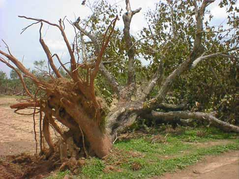
21 Severe thunderstorm in Bangladesh: 15May 2009 Severe thunderstorm in Bangladesh: 06May 2009
22 Synoptic analysis of severe thunderstorm
23 Synoptic analysis In this method the following meteorological parameters are carefully analyzed in each synoptic observation time based on the surface synoptic and upper air observation over the area of Bangladesh and its surroundings: Surface pressure, temperature, relative humidity, dew point temperature fields pressure change fields, temperature change fields during 24 hours and its lower time intervals; Pressure departure fields, temperature departure fields from the normal values upper air temperature, humidity and wind field are analyzed based on the pilot balloon observation and Rawin Sonde observational data in each observational period. The stability indices like SI, LI etc. are calculated for understanding the instability conditions of the troposphere.
24 Observed meteorological features a. surface and lower troposphere Existence of a trough of low pressure over Uttar Prodesh and Bihar with its axis extending West-East direction across the plains. The orientation of the axis and its intensity are affected by the passage of Western Disturbances in the form of low pressure area. In such a situation the accentuated axis of trough extends SEwards into Gangetic West Bengal and Bangladesh. Around the trough SW/S ly wind normally blows from the Bay of Bengal upto a level of about 3000ft. (1Km) incurring moisture influx over the region covering Bangladesh, West Bengal and Assam. Quite often through northeast Assam, ENE/NE ly dry and cooler wind descends downwards to the West across the foot of the Himalayas. In such a situation with the existence of ENE/E ly wind over extreme north Assam and SW/S ly wind from the South, East-West line of wind discontinuity takes place over north Bangladesh and upper Assam.
25 b. Upper troposphere In the upper troposphere, westerlies or northwesterlies prevailed over Pakistan, North Indian Plains, Bangladesh and Assam. The passage of upper air trough in the westerlies or the jet can often be detected at 30,000ft to 40,000ft (about 9.0 to 12.0 km) levels. The superposition of upper divergence having association with a perturbation like a jet, jet-cum-trough or trough on the convergence having association with a lowlevel low or even straight southerly flow upto 3000ft. (1 km) is quite a significant feature on the days of nor westers over this area.
26 Forecasting Technique for severe thunderstorm The area over which nor westers occur varies usually from one day to the other mostly depending on the synoptic situation at the surface and upper level. Identification of this area with positive threat of the storms is one of the most difficult problems for the forecasters. To observe the basic favourable conditions being fulfilled, a forecaster within a short span of time has to adopt certain quick techniques to make a decision about the occurrence or non-occurrence of nor westers. These are: determine the stability indices; locate the dynamic heat low over the vulnerable area like north Orissa, Bihar, Gangetic West Bengal or southwestern part of Bangladesh; find out the middle and upper-level jet shear; see whether the positive area in greater than the negative area in the thermodynamic chart find out the 12 hour surface pressure fall; see the low-level moisture influx upto at least 3000ft from the pilot balloon chart locate the area of low-level convergence from the pilot balloon charts and carefully interpret and follow the radar echoes observed by BMD radars interpret the satellite observation received by satellite receiving systems of BMD
27 Gaps and needs Occurrence time of thunderstorm is not forecasted precisely Occurrence area of thunderstorm is not forecasted precisely duration of thunderstorm is not forecasted Possibility of thunderstorm is not well informed to the public due to updated communication. People s awareness is not in satisfactory level. Research on thunderstorms or severe thunderstorm related to tornado in Bangladesh is very limited.
28 A case study: 03 May 2009
 On 03")
29 Recorded wind on 03 May 2009 Km/hr May03_0001 May03_0101 May03_0201 May03_0301 May03_0401 May03_0501 May03_0601 May03_0701 May03_0801 May03_0901 May03_1001 May03_1101 May03_1201 May03_1301 May03_1401 May03_1501 May03_1601 May03_1701 May03_1801 May03_1901 May03_2001 May03_2101 May03_2201 May03_2301 Recorded rainfall (mm) On 03 May 2009


30


31 : 0000UTC : 0300UTC : 0600UTC : 0900UTC


32 : 1200UTC : 1500UTC : 1800UTC : 2100UTC


33 : 0000UTC- 1000ft : 0000UTC- 2000ft : 0000UTC and 5000ft : 0000UTC and 10,000ft.


34 May 03, 2009 at 6000UTC: 1000ft May 03, 2009 at 6000UTC: 2000ft May 03, 2009 at 6000UTC: 3000 and 5000ft May 03, 2009 at 6000UTC: 7000 and 10000ft


35 May 03, 2009 at 1200UTC: 1000ft May 03, 2009 at 1200UTC: 2000ft May 03, 2009 at 1200UTC: 3000 and 5000ft May 03, 2009 at 1200UTC: 7000 and 10,000ft


36 Stability indices: 01 May 2009: a. SI:+ 8.6 b. LI : May 2009: SI:- 4.9 LI : May 2009: SI:-6.6 LI : -3.2

37 Chittagong Rajshahi Dhaka Barisal Khulna Sylhet
38 Maximum temperature field: On 03 May maximum temperature gradient was higher MaxT_Field: 03May2009 Minimum temperature field: On 03 May uniform minimum temperature gradient was across northwest to northeast over the country. MinT_Field: 03May2009

39 MaxT_24hrsChange_03May09 MaxT_Departure_03May09 MinT_24hrsChange_03May09 MinT_Departure_03May09

40 WRF model Set up WRF modelling for 03 May 2009 WRF V3.1 MODEL May03_09_18hrs Point in x-direction: 219 Lon: ºE Points in y-direction: 243 Lat: ºN Vertical levels: 27 Considered output: 60m No. of Variables: 97 Centered location: Lat: 24.05ºN & Lon: 90.91ºE Resolution: 3 km Bangladesh Bay of Bengal Domain Area
41 10m_WF_May03_ 09: 0100UTC 10m_WF_May03_ 09: 0200UTC 10m_WF_May03_ 09: 0300UTC 10m_WF_May03_ 09: 0400UTC 10m_WF_May03_ 09: 0500UTC 10m_WF_May03_ 09: 0600UTC 10m_WF_May03_ 09: 0700UTC 10m_WF_May03_ 09: 0800UTC
42 10m_WF_May03_ 09: 0900UTC 10m_WF_May03_ 09: 1000UTC 10m_WF_May03_ 09: 1100UTC 10m_WF_May03_ 09: 1200UTC 10m_WF_May03_ 09: 1300UTC 10m_WF_May03_ 09: 1400UTC 10m_WF_May03_ 09: 1500UTC 10m_WF_May03_ 09: 1600UTC


 using")
43 03May_0100UTC 03May_0200UTC 03May_0300UTC 03May_0400UTC 03May_0500UTC 03May_0600UTC 03May_0700UTC 03May_0800UTC Simulated TF(2m) using WRF model: 03 May 2009


44 03May_0900UTC 03May_1000UTC 03May_1100UTC 03May_1200UTC 03May_1300UTC 03May_1400UTC 03May_1500UTC 03May_1600UTC Simulated TF(2m) using WRF model: 03 May 2009


 using")

45 03May_0100UTC 03May_0200UTC 03May_0300UTC 03May_0400UTC 03May_0500UTC 03May_0600UTC 03May_0700UTC 03May_0800UTC Simulated olr (W/m2) using WRF model: 03 May 2009


 using WRF")
46 03May_0900UTC 03May_1000UTC 03May_1100UTC 03May_1200UTC 03May_1300UTC 03May_1400UTC 03May_1500UTC 03May_1600UTC Simulated olr (W/m2) using WRF model: 03 May 2009
47 Barisal Chittagong Dhaka Rajshahi

48 Model Predicted rainfall: 03 May 2009
 of ~9 km resolutions and fine domain (D2) of ~3 km resolutions with grid cells 57x57 and 93 93 and have been prepared using MM5.")
 USGS (United States Geological Survey) land cover data set.")
49 Model Description The 5th generation PSU/NCAR mesoscale model (MM5) is a limited-area, Non-hydrostatic and terrain-following sigmacoordinate model designed to simulate or predict mesoscale & regional scale atmospheric circulation. Two way nested domains i.e. coarse domain (D1) of ~9 km resolutions and fine domain (D2) of ~3 km resolutions with grid cells 57x57 and and have been prepared using MM5. These domains have covered the areas N; E for coarse grid mesh and N; E for fine grid mesh. The topography in the model has been obtained from six resolutions (1, 30, 10, 5 and 2 minutes, and 30 seconds) USGS (United States Geological Survey) land cover data set. At the boundaries of the coarse domain, 1x1 degree resolution NCEP data have been provided at every 6 hrs as input.
50 Model Description continue The model has then been run using the Grell or Anthes-Kuo (Anthes, 1977) option for cumulus parameterization and MRF for the boundary layer parameterization (Hong and Pan, 1996). The simple ice scheme of Dudhia (Dudhia, 1996) is employed for explicit treatment of moisture and water vapor. Cloud radiation interaction is allowed for radiation anticipation. Five layer soil option is used for soil temperature. The model is run with 22 sigma levels in the vertical from the ground to the 100 hpa top surface. The time frames of simulation for five cases in this study are 0000 UTC of 21 April to 0000UTC of 23 April 2007; Precipitation outputs of MM5 have been generated at 30 minute intervals and processed using Grid Analysis and Display system (GrADS) software for visual and calculation purpose.


51 21 May_0300UTC 21 May_0600UTC 21 May_0900UTC 21 May_1200UTC 21 May_1500UTC 21 May_1800UTC 21 May_2100UTC 22 May_0000UTC Simulated PF using MM5 model: April 2007
52 22May_0300UTC 22May_0600UTC 22May_0900UTC 22May_1200UTC 22May_1500UTC 22May_1800UTC 22May_2100UTC 23May_0000UTC Simulated PF using MM5 model: April 2007


53 21May_0300UTC 21May_0600UTC 21May_0900UTC 21May_1200UTC 21May_1500UTC 21May_1800UTC 21May_2100UTC 22May_0000UTC Simulated TF using MM5 model: April 2007


54 22May_0300UTC 22May_0600UTC 22May_0900UTC 22May_1200UTC 22May_1500UTC 22May_1800UTC 22May_2100UTC 23May_0000UTC Simulated TF using MM5 model: April 2007


55 21May_0300UTC 21May_0600UTC 21May_0900UTC 21May_1200UTC 21May_1500UTC 21May_1800UTC 21May_2100UTC 22May_0000UTC Simulated WF using MM5 model: April 2007


56 22May_0300UTC 22May_0600UTC 22May_0900UTC 22May_1200UTC 22May_1500UTC 22May_1800UTC 22May_2100UTC 23May_0000UTC Simulated WF using MM5 model: April 2007
 (D2)")
")
")

57 21 April 2007 (D1) 21 April 2007 (D2) 21 April Raingauge 22 April 2007 (D1) 22 April 2007 (D2) 21 April Raingauge
58 Conclusion Meteorology is a relatively young science and the study of tornadoes is newer still. Although researched for about 140 years and intensively for around 60 years, there are still aspects of tornadoes which remain a mystery. Scientists have a fairly good understanding of the development of thunderstorms and mesocyclones, and the meteorological conditions conducive to their formation. Reliably predicting tornado intensity and longevity remains a problem, as do details affecting characteristics of a tornado during its life cycle and tornadolysis. Scientists still do not know the exact mechanisms by which most tornadoes form, and occasional tornadoes still strike without a tornado warning being issued. Numerical modeling also provides new insights as observations and new discoveries are integrated into our physical understanding and then tested in computer simulations which validate new notions as well as produce entirely new theoretical findings, many of which are otherwise unattainable. Importantly, development of new observation technologies and installation of finer spatial and temporal resolution observation networks have aided increased understanding and better predictions. Therefore more active research are very much essential.
59
Simulation of a Heavy Rainfall Event on 14 September 2004 over Dhaka, Bangladesh Using MM5 Model
 Available Online Publications J. Sci. Res. 3 (2), 261-270 (2011) JOURNAL OF SCIENTIFIC RESEARCH www.banglajol.info/index.php/jsr Simulation of a Heavy Rainfall Event on 14 September 2004 over Dhaka, Bangladesh
Synoptic situations of severe local convective storms during the pre-monsoon season in Bangladesh
 INTERNATIONAL JOURNAL OF CLIMATOLOGY Int. J. Climatol. 33: 725 734 (2013) Published online 13 March 2012 in Wiley Online Library (wileyonlinelibrary.com) DOI: 10.1002/joc.3460 Synoptic situations of severe
WEATHER FORECAST DHAKA
 WEATHER FORECAST DHAKA 21.10.2017 Hourly 1 PM 4 PM 8 PM 11 PM Temp. / Dew Point 26 / 24 26 / 23 26 / 22 26 / 22 Wind 20 km/h S 29 km/h SSW 17 km/h SW 13 km/h WSW Humidity 91% 86% 79% 78% Chance of Precip
The project that I originally selected to research for the OC 3570 course was based on
 Introduction The project that I originally selected to research for the OC 3570 course was based on remote sensing applications of the marine boundary layer and their verification with actual observed
3. HYDROMETEROLOGY. 3.1 Introduction. 3.2 Hydro-meteorological Aspect. 3.3 Rain Gauge Stations
 3. HYDROMETEROLOGY 3.1 Introduction Hydrometeorology is a branch of meteorology and hydrology that studies the transfer of water and energy between the land surface and the lower atmosphere. Detailed hydrological
Foundations of Earth Science, 6e Lutgens, Tarbuck, & Tasa
 Foundations of Earth Science, 6e Lutgens, Tarbuck, & Tasa Weather Patterns and Severe Weather Foundations, 6e - Chapter 14 Stan Hatfield Southwestern Illinois College Air masses Characteristics Large body
MET Lecture 29 Tornadoes IV
 MET 4300 Lecture 29 Tornadoes IV Outline Definition, life cycle, & climatology of tornadoes Tornado formation within supercells Tornado formation within nonsupercell thunderstorms Fujita scale Tornado
Numerical Simulation of a Severe Thunderstorm over Delhi Using WRF Model
 International Journal of Scientific and Research Publications, Volume 5, Issue 6, June 2015 1 Numerical Simulation of a Severe Thunderstorm over Delhi Using WRF Model Jaya Singh 1, Ajay Gairola 1, Someshwar
MET 3502 Synoptic Meteorology. Lecture 8: September 16, AIRMASSES, FRONTS and FRONTAL ANALYSIS (2)
") MET 3502 Synoptic Meteorology Lecture 8: September 16, 2010 AIRMASSES, FRONTS and FRONTAL ANALYSIS (2) Identifying a cold front on a surface weather map: 1. Surface front is located at the leading edge
MET 3502 Synoptic Meteorology Lecture 8: September 16, 2010 AIRMASSES, FRONTS and FRONTAL ANALYSIS (2) Identifying a cold front on a surface weather map: 1. Surface front is located at the leading edge
Case Study 3: Dryline in TX and OK 3 May 1999
 Case Study 3: Dryline in TX and OK 3 May 1999 Brandy Lumpkins Department of Atmospheric and Oceanic Sciences University of Wisconsin Madison 8 May 2006 ABSTRACT A massive tornadic outbreak swept across
1st Tornado Photograph
 Lecture 26 Part II Tornados Environment Storm Structure Life Cycle Source of Spin Forecasting Climatology Damage Marilee Thomas of Beaver City, NE took this photograph of her daughter Audra about two miles
INVESTIGATION FOR A POSSIBLE INFLUENCE OF IOANNINA AND METSOVO LAKES (EPIRUS, NW GREECE), ON PRECIPITATION, DURING THE WARM PERIOD OF THE YEAR
, ON PRECIPITATION, DURING THE WARM PERIOD OF THE YEAR") Proceedings of the 13 th International Conference of Environmental Science and Technology Athens, Greece, 5-7 September 2013 INVESTIGATION FOR A POSSIBLE INFLUENCE OF IOANNINA AND METSOVO LAKES (EPIRUS,
Proceedings of the 13 th International Conference of Environmental Science and Technology Athens, Greece, 5-7 September 2013 INVESTIGATION FOR A POSSIBLE INFLUENCE OF IOANNINA AND METSOVO LAKES (EPIRUS,
Anthony A. Rockwood Robert A. Maddox
 Anthony A. Rockwood Robert A. Maddox An unusually intense MCS produced large hail and wind damage in northeast Kansas and northern Missouri during the predawn hours of June 7 th, 1982. Takes a look at
THE IMPACT OF GROUND-BASED GPS SLANT-PATH WET DELAY MEASUREMENTS ON SHORT-RANGE PREDICTION OF A PREFRONTAL SQUALL LINE
 JP1.17 THE IMPACT OF GROUND-BASED GPS SLANT-PATH WET DELAY MEASUREMENTS ON SHORT-RANGE PREDICTION OF A PREFRONTAL SQUALL LINE So-Young Ha *1,, Ying-Hwa Kuo 1, Gyu-Ho Lim 1 National Center for Atmospheric
Severe Thunderstorms
 Lecture 26 Severe Thunderstorms NWS Criteria Environment Structure Climatology 1 Severe Thunderstorms NWS Criteria Environment Structure Climatology 2 Severe Thunderstorms: NWS Criteria NWS Criteria: to
Ch. 3: Weather Patterns. Sect. 1: Air Mass & Fronts Sect. 2: Storms Sect. 3: Predicting the Weather
 Ch. 3: Weather Patterns Sect. 1: Air Mass & Fronts Sect. 2: Storms Sect. 3: Predicting the Weather Sect. 1: Air Masses & Fronts An air mass is a huge body of air that has similar temperature, humidity,
ANSWER KEY. Part I: Synoptic Scale Composite Map. Lab 12 Answer Key. Explorations in Meteorology 54
 ANSWER KEY Part I: Synoptic Scale Composite Map 1. Using Figure 2, locate and highlight, with a black dashed line, the 500-mb trough axis. Also, locate and highlight, with a black zigzag line, the 500-mb
Type of storm viewed by Spotter A Ordinary, multi-cell thunderstorm. Type of storm viewed by Spotter B Supecell thunderstorm
 ANSWER KEY Part I: Locating Geographical Features 1. The National Weather Service s Storm Prediction Center (www.spc.noaa.gov) has issued a tornado watch on a warm spring day. The watch covers a large
REGRESSION FORECASTING OF PRE-MONSOON RAINFALL IN BANGLADESH ABSTRACT
 Proceedings of the SAAC Seminar on Agricultural Applications of Meteorology, held on 23-24 December 2003, published by SMC in 2004 EGESSION FOECASTING OF PE-MONSOON AINFALL IN BANGLADESH SAMAENDA KAMAKA
PROBABILISTIC EXTREMES OF THE FREQUENCY OF THUNDERSTORM DAYS OVER BANGLADESH DURING THE PRE- MONSOON SEASON
 225 PROBABILISTIC EXTREMES OF THE FREQUENCY OF THUNDERSTORM DAYS OVER BANGLADESH DURING THE PRE- MONSOON SEASON Samarendra Karmakar Bangladesh Meteorological Department, Sher-e-Bangla Nagar, Agargaon Dhaka-1207,
Chapter 14 Thunderstorm Fundamentals
 Chapter overview: Thunderstorm appearance Thunderstorm cells and evolution Thunderstorm types and organization o Single cell thunderstorms o Multicell thunderstorms o Orographic thunderstorms o Severe
Weather Notes. Chapter 16, 17, & 18
 Weather Notes Chapter 16, 17, & 18 Weather Weather is the condition of the Earth s atmosphere at a particular place and time Weather It is the movement of energy through the atmosphere Energy comes from
International Journal of Integrated Sciences & Technology 2 (2016) 55-61
 55-61") International Journal of Integrated Sciences & Technology 2 (2016) 55-61 Changes in Latent Heat Energy and Moist Static Energy Contents of the Atmosphere over Bangladesh and Neighbourhood during the Formation
International Journal of Integrated Sciences & Technology 2 (2016) 55-61 Changes in Latent Heat Energy and Moist Static Energy Contents of the Atmosphere over Bangladesh and Neighbourhood during the Formation
NUMERICAL SIMULATION OF A BAY OF BENGAL TROPICAL CYCLONE: A COMPARISON OF THE RESULTS FROM EXPERIMENTS WITH JRA-25 AND NCEP REANALYSIS FIELDS
 NUMERICAL SIMULATION OF A BAY OF BENGAL TROPICAL CYCLONE: A COMPARISON OF THE RESULTS FROM EXPERIMENTS WITH JRA-25 AND NCEP REANALYSIS FIELDS Dodla Venkata Bhaskar Rao Desamsetti Srinivas and Dasari Hari
Weather Systems III: Thunderstorms and Twisters
 Weather Systems III: Thunderstorms and Twisters Review 1. Definition of airmasses? Bergeron classification of air masses 2. Surface weather analysis: Station model, wind speed code, present weather 3.
Prediction of western disturbances and associated weather over Western Himalayas
 Prediction of western disturbances and associated weather over Western Himalayas H. R. Hatwar*, B. P. Yadav and Y. V. Rama Rao India Meteorological Department, Lodi Road, New Delhi 110 003, India Two cases
Lecture Outlines PowerPoint. Chapter 19 Earth Science 11e Tarbuck/Lutgens
 Lecture Outlines PowerPoint Chapter 19 Earth Science 11e Tarbuck/Lutgens 2006 Pearson Prentice Hall This work is protected by United States copyright laws and is provided solely for the use of instructors
Earth Science, 11e. Weather Patterns and Severe Storms Chapter 19. Air masses. A cold Canadian air mass Figure Air masses. Air masses 9/5/2012
 2006 Pearson Prentice Hall Lecture Outlines PowerPoint Chapter 19 Earth Science 11e Tarbuck/Lutgens This work is protected by United States copyright laws and is provided solely for the use of instructors
Weather is the of the Earth s atmosphere at a place and time. It is the movement of through the atmosphere o Energy comes from the
 Weather Notes Weather Weather is the of the Earth s atmosphere at a place and time It is the movement of through the atmosphere o Energy comes from the The sun is the force that weather The sun s energy
MSG FOR NOWCASTING - EXPERIENCES OVER SOUTHERN AFRICA
 MSG FOR NOWCASTING - EXPERIENCES OVER SOUTHERN AFRICA Estelle de Coning and Marianne König South African Weather Service, Private Bag X097, Pretoria 0001, South Africa EUMETSAT, Am Kavalleriesand 31, D-64295
Science Olympiad Meteorology Quiz #2 Page 1 of 8
 1) The prevailing general direction of the jet stream is from west to east in the northern hemisphere: 2) Advection is the vertical movement of an air mass from one location to another: 3) Thunderstorms
1 of 7 Thunderstorm Notes by Paul Sirvatka College of DuPage Meteorology. Thunderstorms
 1 of 7 Thunderstorm Notes by Paul Sirvatka College of DuPage Meteorology Thunderstorms There are three types of thunderstorms: single-cell (or air mass) multicell (cluster or squall line) supercell Although
HURRICANES AND TORNADOES
 HURRICANES AND TORNADOES The most severe weather systems are hurricanes and tornadoes. They occur in extremely low pressure systems, or cyclones, when the air spirals rapidly into the center of a low.
Heavy Rainfall Event of June 2013
 Heavy Rainfall Event of 10-11 June 2013 By Richard H. Grumm National Weather Service State College, PA 1. Overview A 500 hpa short-wave moved over the eastern United States (Fig. 1) brought a surge of
Tuesday, September 13, 16
 Weather Weather State Objectives 4.c, 4.d, 4.h. Discussion What are some ways in which weather affects your everyday life? Discussion What are some ways in which weather affects your everyday life? What
 This article was originally published in a journal published by Elsevier, and the attached copy is provided by Elsevier for the author s benefit and for the benefit of the author s institution, for non-commercial
CHAPTER 8 NUMERICAL SIMULATIONS OF THE ITCZ OVER THE INDIAN OCEAN AND INDONESIA DURING A NORMAL YEAR AND DURING AN ENSO YEAR
 CHAPTER 8 NUMERICAL SIMULATIONS OF THE ITCZ OVER THE INDIAN OCEAN AND INDONESIA DURING A NORMAL YEAR AND DURING AN ENSO YEAR In this chapter, comparisons between the model-produced and analyzed streamlines,
On the Predictability of the Physical and Dynamical Characteristics of the Troposphere Associated with Early Nor westers using WRF Model
 Vayu Mandal 43(2), 2017 On the Predictability of the Physical and Dynamical Characteristics of the Troposphere Associated with Early Nor westers using WRF Model Samarendra Karmakar 1,3 and Mohan Kumar
TOPICS: What are Thunderstorms? Ingredients Stages Types Lightning Downburst and Microburst
 THUNDERSTORMS TOPICS: What are Thunderstorms? Ingredients Stages Types Lightning Downburst and Microburst What are Thunderstorms? A storm produced by a cumulonimbus cloud that contains lightning and thunder
Ch. 3: Weather Patterns
 Ch. 3: Weather Patterns Sect. 1: Air Mass & Fronts Sect. 2: Storms Sect. 3: Predicting the Weather Sect. 4: Weather forecasters use advanced technologies Ch. 3 Weather Fronts and Storms Objective(s) 7.E.1.3
P3.17 THE DEVELOPMENT OF MULTIPLE LOW-LEVEL MESOCYCLONES WITHIN A SUPERCELL. Joshua M. Boustead *1 NOAA/NWS Weather Forecast Office, Topeka, KS
 P3.17 THE DEVELOPMENT OF MULTIPLE LOW-LEVEL MESOCYCLONES WITHIN A SUPERCELL Joshua M. Boustead *1 NOAA/NWS Weather Forecast Office, Topeka, KS Philip N. Schumacher NOAA/NWS Weather Forecaster Office, Sioux
Daniel J. Cecil 1 Mariana O. Felix 1 Clay B. Blankenship 2. University of Alabama - Huntsville. University Space Research Alliance
 12A.4 SEVERE STORM ENVIRONMENTS ON DIFFERENT CONTINENTS Daniel J. Cecil 1 Mariana O. Felix 1 Clay B. Blankenship 2 1 University of Alabama - Huntsville 2 University Space Research Alliance 1. INTRODUCTION
HAZARDOUS WEATHER 1. Dr. Julie Laity Geography 266
 HAZARDOUS WEATHER 1 Dr. Julie Laity Geography 266 Violent Weather Thunderstorms Atmospheric turbulence Lightning and thunder Hail Derechos Tornadoes Tornado measurement and science Tropical Cyclones Hurricanes
Multi-day severe event of May 2013
 Abstract: Multi-day severe event of 18-22 May 2013 By Richard H. Grumm and Charles Ross National Weather Service State College, PA A relatively slow moving Trough over the western United States and a ridge
High Resolution Modeling of Multi-scale Cloud and Precipitation Systems Using a Cloud-Resolving Model
 Chapter 1 Atmospheric and Oceanic Simulation High Resolution Modeling of Multi-scale Cloud and Precipitation Systems Using a Cloud-Resolving Model Project Representative Kazuhisa Tsuboki Author Kazuhisa
How strong does wind have to be to topple a garbage can?
 How strong does wind have to be to topple a garbage can? Imagine winds powerful enough to pick up a truck and toss it the length of a football field. Winds of this extreme sometimes happen in a tornado.
Severe Thunderstorms. MET 200 Lecture 24 Flooding in Hawaii and Intro to Severe Thunderstorms. MET 200 Lecture 24 Severe Thunderstorms.
 MET 200 Lecture 24 Severe Thunderstorms Damage Swath 1 2 MET 200 Lecture 24 Flooding in Hawaii and Intro to Severe Thunderstorms Severe Thunderstorms Kona Lows Cause more flash floods in Hawaii than any
DEPARTMENT OF EARTH & CLIMATE SCIENCES NAME SAN FRANCISCO STATE UNIVERSITY Fall ERTH FINAL EXAMINATION KEY 200 pts
 DEPARTMENT OF EARTH & CLIMATE SCIENCES NAME SAN FRANCISCO STATE UNIVERSITY Fall 2016 Part 1. Weather Map Interpretation ERTH 365.02 FINAL EXAMINATION KEY 200 pts Questions 1 through 9 refer to Figure 1,
Government of India India Meteorological Department (Ministry of Earth Sciences) Subject: Current weather conditions and forecast for next two weeks
 Subject: Current weather conditions and forecast for next two weeks") Government of India India Meteorological Department (Ministry of Earth Sciences) Press Release Dated 18 June, 2010 Subject: Current weather conditions and forecast for next two weeks Advance of monsoon
Government of India India Meteorological Department (Ministry of Earth Sciences) Press Release Dated 18 June, 2010 Subject: Current weather conditions and forecast for next two weeks Advance of monsoon
Tornadogenesis in Supercells: The Three Main Ingredients. Ted Funk
 Tornadogenesis in Supercells: The Three Main Ingredients Ted Funk NWS Louisville, KY Spring 2002 Environmental Parameters Supercells occur within environments exhibiting several wellknown characteristics
P474 SYDNEY AIRPORT WIND SHEAR ENCOUNTER - 15 APRIL 2007
 P474 SYDNEY AIRPORT WIND SHEAR ENCOUNTER - 15 APRIL 2007 Rodney Potts* 1, Barry Hanstrum 2 and Peter Dunda 2 1. CAWCR, Bureau of Meteorology, Melbourne, VIC, Australia 2. Bureau of Meteorology, Sydney,
P12.6 Multiple Modes of Convection in Moderate to High Wind Shear Environments
 P12.6 Multiple Modes of Convection in Moderate to High Wind Shear Environments Adam J. French and Matthew D. Parker North Carolina State University, Raleigh, North Carolina 1. INTRODUCTION A principle
ESCI 1010 Lab 6 Midlatitude Cyclones and Thunderstorms
 ESCI 1010 Lab 6 Midlatitude Cyclones and Thunderstorms Before Lab: Review pages 244-324 in your Weather and Climate textbook. Pay special attention to the sections entitled Fronts, Life Cyclone of a Midlatitude
11/19/14. Chapter 11: Hurricanes. The Atmosphere: An Introduction to Meteorology, 12 th. Lutgens Tarbuck
 Chapter 11: Hurricanes The Atmosphere: An Introduction to Meteorology, 12 th Lutgens Tarbuck Lectures by: Heather Gallacher, Cleveland State University! Hurricanes: " Hurricanes are intense centers of
EFFECTIVE TROPICAL CYCLONE WARNING IN BANGLADESH
 Country Report of Bangladesh On EFFECTIVE TROPICAL CYCLONE WARNING IN BANGLADESH Presented At JMA/WMO WORKSHOP ON EFFECTIVE TROPICAL CYCLONE WARNING IN SOUTHEAST ASIA Tokyo, Japan,11-14 March 2014 By Sayeed
Weather Patterns and Severe Storms
 Weather Patterns and Severe Storms 20.1 Air Masses Air Masses and Weather Air Masses An air mass is an immense body of air that is characterized by similar temperatures and amounts of moisture at any given
Ki-Hong Min 1*, Seonhee Choo 2, and Gyuwon Lee 1, and Kyung-Eak Kim 1,3
 Ki-Hong Min 1*, Seonhee Choo 2, and Gyuwon Lee 1, and Kyung-Eak Kim 1,3 1 School of Earth System Sciences, Major in Atmospheric Science, Kyungpook National University, Daegu, South Korea 2 Forecast Technology
TFS WEATHER BRIEF. Monday, March 25
 TFS WEATHER BRIEF Monday, March 25 Review: The leading edge of cooler and drier air was pushing through Central and East TX this morning. A few lingering thunderstorms were in progress south of I-20 in
Investigation of the Arizona Severe Weather Event of August 8 th, 1997
 Investigation of the Arizona Severe Weather Event of August 8 th, 1997 Tim Hollfelder May 10 th, 2006 Abstract Synoptic scale forcings were very weak for these thunderstorms on August 7-8, 1997 over the
The most abundant gas in the atmosphere by volume is. This gas comprises 78% of the Earth atmosphere by volume.
 The most abundant gas in the atmosphere by volume is. This gas comprises 78% of the Earth atmosphere by volume. A. Oxygen B. Water Vapor C. Carbon Dioxide D. Nitrogen An isobar is a line of constant. A.
DEPARTMENT OF EARTH & CLIMATE SCIENCES SAN FRANCISCO STATE UNIVERSITY. Metr Fall 2014 Test #1 September 30, 2014
 DEPARTMENT OF EARTH & CLIMATE SCIENCES SAN FRANCISCO STATE UNIVERSITY NAME Metr 302.02 Fall 2014 Test #1 September 30, 2014 200 pts (4 pts each answer) Part I. Surface Chart Interpretation. Questions 1
Flooding and Severe weather of 27 June 2013
 Flooding and Severe weather of 27 June 2013 By Richard H. Grumm National Weather Service State College, PA 1. Overview Flooding and severe weather affected Pennsylvania on 27 June 2013 (Fig 1). The severe
1. INTRODUCTION * Figure 1. National Weather Service Storm Prediction Center (SPC) storm reports for December 1, 2006.
 storm reports for December 1, 2006.") P1.14 FORECAST ISSUES RELATED TO THE UNPRECEDENTED SEVERE AND HIGH WIND EVENT OF DECEMBER 2006 by Greg A. DeVoir* and Richard H. Grumm National Weather Service Office State College, PA 16803 1. INTRODUCTION
P1.14 FORECAST ISSUES RELATED TO THE UNPRECEDENTED SEVERE AND HIGH WIND EVENT OF DECEMBER 2006 by Greg A. DeVoir* and Richard H. Grumm National Weather Service Office State College, PA 16803 1. INTRODUCTION
Aviation Hazards: Thunderstorms and Deep Convection
 Aviation Hazards: Thunderstorms and Deep Convection TREND Empirical thunderstorm forecasting techniques Contents Necessary conditions for convection: Instability Low-level moisture Trigger mechanism Forecasting
Presented by Ertan TURGU*
 Ministry of Forestry and Water Affairs Turkish State Meteorological Service A Case Study: Analysis of Flash Flood Using FFGS Products on 17 January 2016 in Çeşme, Dikili, Izmir and Manisa. Presented by
ALL INDIA WEATHER SUMMARY AND FORECAST BULLETIN
 Saturday 21 April 2018 MORNING Time of Issue: 0800 hours IST ALL INDIA WEATHER SUMMARY AND FORECAST BULLETIN Significant Weather Features Isolated thunder squalls and hailstorms are very likely over Sub
National Weather Service-Pennsylvania State University Weather Events
 National Weather Service-Pennsylvania State University Weather Events Historic Ohio Valley January Severe weather and Tornado Event by Richard H. Grumm National Weather Service State College PA 16803 and
Practical Use of the Skew-T, log-p diagram for weather forecasting. Primer on organized convection
 Practical Use of the Skew-T, log-p diagram for weather forecasting Primer on organized convection Outline Rationale and format of the skew-t, log-p diagram Some basic derived diagnostic measures Characterizing
Chapter 21. Weather Patterns and Severe Storms
 Chapter 21 Weather Patterns and Severe Storms 20.1 Air Masses Air Masses and Weather Air Masses An air mass is an immense body of air that is characterized by similar temperatures and amounts of moisture
Guided Notes Weather. Part 2: Meteorology Air Masses Fronts Weather Maps Storms Storm Preparation
 Guided Notes Weather Part 2: Meteorology Air Masses Fronts Weather Maps Storms Storm Preparation The map below shows North America and its surrounding bodies of water. Country borders are shown. On the
4/29/2011. Mid-latitude cyclones form along a
 Chapter 10: Cyclones: East of the Rocky Mountain Extratropical Cyclones Environment prior to the development of the Cyclone Initial Development of the Extratropical Cyclone Early Weather Along the Fronts
Synoptic Meteorology II: Frontogenesis Examples Figure 1
 Synoptic Meteorology II: Frontogenesis Examples The below images, taken from the 1200 UTC 17 January 2019 GFS forecast run, provide examples of the contributions of deformation and divergence to frontogenesis.
Global Wind Patterns
 Name: Earth Science: Date: Period: Global Wind Patterns 1. Which factor causes global wind patterns? a. changes in the distance between Earth and the Moon b. unequal heating of Earth s surface by the Sun
ATS 351, Spring 2010 Lab #11 Severe Weather 54 points
 ATS 351, Spring 2010 Lab #11 Severe Weather 54 points Question 1 (10 points): Thunderstorm development a) Sketch and describe the stages of development of a single cell thunderstorm. About how long does
Earth Science Chapter 16 and 17. Weather and Climate
 Earth Science Chapter 16 and 17 Weather and Climate Prediction Old way Groundhog Color of the sky Modern way satellites instruments computers Goal Weather Factors Studied by meteorologists Several factors
III. Section 3.3 Vertical air motion can cause severe storms
 III. Section 3.3 Vertical air motion can cause severe storms http://www.youtube.com/watch?v=nxwbr60tflg&feature=relmfu A. Thunderstorms form from rising moist air Electrical charges build up near the tops
Weather and Climate 1. Elements of the weather
 Weather and Climate 1 affect = to have an effect on, influence, change altitude = the height of a place above the sea axis = the line around which an object rotates certain = special consist of = to be
P8.14 CLASSIC AND HP MINI-SUPERCELLS IN SOUTHEAST OREGON AND SOUTHWEST IDAHO ON 3 MAY
 P8.14 CLASSIC AND HP MINI-SUPERCELLS IN SOUTHEAST OREGON AND SOUTHWEST IDAHO ON 3 MAY 2009 Stephen S. Parker* National Weather Service, Boise, ID 1. INTRODUCTION During the early afternoon hours of 3 May
Severe Weather with a strong cold front: 2-3 April 2006 By Richard H. Grumm National Weather Service Office State College, PA 16803
 Severe Weather with a strong cold front: 2-3 April 2006 By Richard H. Grumm National Weather Service Office State College, PA 16803 1. INTRODUCTION A strong cold front brought severe weather to much of
Unpredictability of Tornado Occurrence: the Atypical Case of Cassacco, ITALY, Winter F2 Tornado
 Title and Authors Unpredictability of Tornado Occurrence: the Atypical Case of Cassacco, ITALY, Winter 2006 - F2 Tornado by (1) Gallai I., (1,2) Giaiotti D. B., (3,4) Gladich I., (1,2) Stel F. dario.giaiotti@osmer.fvg.it
The WRF Microphysics and a Snow Event in Chicago
 2.49 The WRF Microphysics and a Snow Event in Chicago William Wilson* NOAA/NWS/WFO Chicago 1. Introduction Mesoscale meteorological models are increasingly being used in NWS forecast offices. One important
Test Form: A Key Final Exam: Spring 2011
 Test Form: A Key Final Exam: Spring 2011 Instructions: Write your name (last name and first name) on your bubble sheet. Write your student identification number on the bubble sheet, and carefully and completely
Mature Tornado. Tornado funnel and debris cloud. Mature Tornado
 Mature Tornado Tornado funnel and debris cloud 43 Mature Tornado 44 Tornado in Final Rope Stage 45 Source of Spin 46 Source of Spin Updraft Stretches Rotating Column 47 Simulation of Tornado Formation
Deep Cyclone and rapid moving severe weather event of 5-6 June 2010 By Richard H. Grumm National Weather Service Office State College, PA 16803
 Deep Cyclone and rapid moving severe weather event of 5-6 June 2010 By Richard H. Grumm National Weather Service Office State College, PA 16803 1. INTRODUCTION A rapidly deepening surface cyclone raced
Impact of different cumulus parameterizations on the numerical simulation of rain over southern China
 Impact of different cumulus parameterizations on the numerical simulation of rain over southern China P.W. Chan * Hong Kong Observatory, Hong Kong, China 1. INTRODUCTION Convective rain occurs over southern
CHAPTER 11 THUNDERSTORMS AND TORNADOES MULTIPLE CHOICE QUESTIONS
 CHAPTER 11 THUNDERSTORMS AND TORNADOES MULTIPLE CHOICE QUESTIONS 1. A thunderstorm is considered to be a weather system. a. synoptic-scale b. micro-scale c. meso-scale 2. By convention, the mature stage
NOTES Surface Weather Maps.notebook. April 05, atmospheric. rises. Coriolis. Coriolis. counterclockwise. counterclockwise. point. origin.
 Surface Weather Maps L Symbol : Indicates an area of low air pressure (aka, pressure or pressure). Called a relatively barometric atmospheric cyclone Formation: As warm air in the center cyclone of a,
Science Olympiad Meteorology Quiz #1 Page 1 of 7
 1) What is generally true about the stratosphere: a) Has turbulent updrafts and downdrafts. b) Has either a stable or increasing temperature profile with altitude. c) Where the auroras occur. d) Both a)
National Weather Service-Pennsylvania State University Weather Events
 National Weather Service-Pennsylvania State University Weather Events Eastern United States Winter Storm and Severe Event of 28-29 February 2012 by Richard H. Grumm National Weather Service State College
8/18/2014. Chapter 17: Weather Patterns. Section 1 (Air Masses and Fronts) 8 th Grade
 8 th Grade") Section 1 (Air Masses and Fronts) Chapter 17: Weather Patterns 8 th Grade air mass a huge body of air that has similar temperature, humidity, and pressure throughout Cold, dense air has a higher pressure
Section 1 (Air Masses and Fronts) Chapter 17: Weather Patterns 8 th Grade air mass a huge body of air that has similar temperature, humidity, and pressure throughout Cold, dense air has a higher pressure
1. What influence does the Coriolis force have on pressure gradient wind direction in the Northern Hemisphere?
 1. What influence does the Coriolis force have on pressure gradient wind direction in the Northern Hemisphere? A. Pushes wind to the left B. Pushes wind to the right C. Pushes wind up D. Pushes wind backwards
KUALA LUMPUR MONSOON ACTIVITY CENT
 T KUALA LUMPUR MONSOON ACTIVITY CENT 2 ALAYSIAN METEOROLOGICAL http://www.met.gov.my DEPARTMENT MINISTRY OF SCIENCE. TECHNOLOGY AND INNOVATIO Introduction Atmospheric and oceanic conditions over the tropical
Station A. 1. In the Northern Hemisphere, the general direction of the flow of the jet stream is toward the: a. north b. east c.
 Station A 1. In the Northern Hemisphere, the general direction of the flow of the jet stream is toward the: a. north b. east c. south 2. The percentage of oxygen in the atmosphere is: a. 78% b. 99% c.
The Climate of Texas County
 The Climate of Texas County Texas County is part of the Western High Plains in the north and west and the Southwestern Tablelands in the east. The Western High Plains are characterized by abundant cropland
The Jarrell Tornado of May 27, 1997
 The Jarrell Tornado of May 27, 1997 ANDREW MANKOWSKI University of Wisconsin Madison Atmospheric and Oceanic Sciences ABSTRACT A tornado outbreak occurred over Central Texas on May 27, 1997. This outbreak
SCI-4 Mil-Brock-Weather Exam not valid for Paper Pencil Test Sessions
 SCI-4 Mil-Brock-Weather Exam not valid for Paper Pencil Test Sessions [Exam ID:1TLR5H 1 Warm air rises and cools. Moisture in the air forms clouds that will bring rain. What pressure system is described?
- tornadoes. Further Reading: Chapter 08 of the text book. Outline. - cyclones and anti-cyclones. -tropical storms. -Storm surge
 (1 of 16) Further Reading: Chapter 08 of the text book Outline - cyclones and anti-cyclones - tornadoes -tropical storms -Storm surge (2 of 16) Introduction Previously, We talked about fronts and their
Michael F. Stringfellow
 Michael F. Stringfellow Thermals Columns or bubbles of warm air that rise from the ground when it is heated by the sun Soaring Sustained engineless flight using natural sources of lift Boundary or mixing
Multiscale Analyses of Inland Tropical Cyclone Midlatitude Jet Interactions: Camille (1969) and Danny (1997)
 and Danny (1997)") Multiscale Analyses of Inland Tropical Cyclone Midlatitude Jet Interactions: Camille (1969) and Danny (1997) Matthew Potter, Lance Bosart, and Daniel Keyser Department of Atmospheric and Environmental
Multiscale Analyses of Inland Tropical Cyclone Midlatitude Jet Interactions: Camille (1969) and Danny (1997) Matthew Potter, Lance Bosart, and Daniel Keyser Department of Atmospheric and Environmental
Impacts of the April 2013 Mean trough over central North America
 Impacts of the April 2013 Mean trough over central North America By Richard H. Grumm National Weather Service State College, PA Abstract: The mean 500 hpa flow over North America featured a trough over