The impact of assimilating radar and SCAN data on a WRF simulation of a Mississippi Delta squall line
|
|
|
- Julie Cole
- 5 years ago
- Views:
Transcription
1 The impact of assimilating radar and SCAN data on a WRF simulation of a Mississippi Delta squall line Pat Fitzpatrick, Yongzuo Li, and Chris Hill GeoResources Institute Mississippi State University Stennis Space Center branch James Dyer GeoSciences Department Mississippi State University Eunha Lim, Juanzhen Sun, and Qingnong Xiao NCAR Boulder, CO
2 Outline 1. Description of squall line case study 2. Datasets 3. WRF model configuration 4. 3DVAR background error calculations 5. Simulation results 6. Conclusion
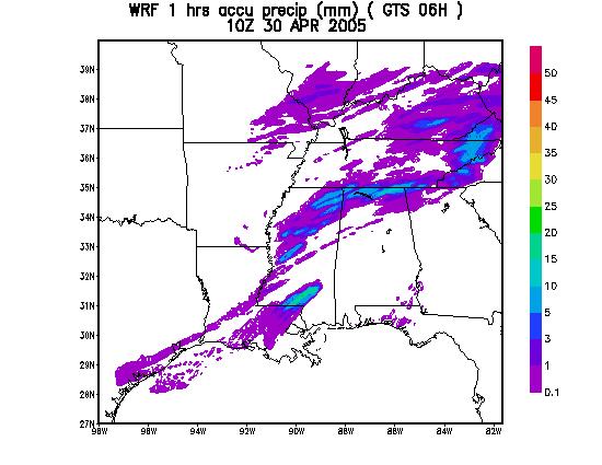
3 1. Case Study A severe squall line entered northwest Mississippi, and propagated southeast from 00Z to 12Z on 30 April This storm caused strong winds, heavy rainfall, and a few tornadoes. 2. Data NAM 40-km is background field NCAR s Global Telecommunication System. Contains standard synoptic buoy, satellitederived data, wind profiles. USDA s SCAN (Soil Climate Analysis Network). Contains 2-m and 10-m surface measurements, concentrated in eastern Arkansas and western Mississippi but also spread throughout the southern U.S. Radar. Provides 3D radial wind from 9 sites KSHV KLCH KLZK KNQA KGWX KBMX KDGX KLIX KMOB
4 3. WRF Model Set Up 3.1 Grid size 4 km 3.2 Grid points 350*350* DVAR assimilation with cycling 18Z Z Z Z 3DVAR 3DVAR 3DVAR { }{ } Data Assimilation Forecast 3.4 Experiments 1) RADAR Radar, SCAN, and GTS data assimilation. 2) SCAN SCAN and GTS data assimilation. 3) GTS Only GTS data assimilation 4) COLD Forecast starting at 18Z till 12Z 30, no data assimilation
5 4. 3DVAR Background Error (BE) Details 4.1 NMC method used( Parrish and Derber, 1992 ) 4.2 NAM used for WRF IC-BC 4.3 Time period, 1 April April Two BE time periods are compared (12 h and 6 h) BE12H based on time interval 12H (30 forecasts) 00Z---fcst---12H---fcst--- 24H (1 Apr) DIFF 12Z---fcst--- 12H---fcst--- 24H DIFF (2 Apr) 00Z---fcst---12H---fcst---24H BE06H based on time interval 06H (60 forecasts) 00Z--fcst--06H--fcst-- 12H (1 April) DIFF 06Z--fcst-- 06H--fcst--12H DIFF 12Z--fcst--06H fcst--12h DIFF 18Z--fcst-- 06H--fcst--12H DIFF (2 Apr) 00Z--fcst---06H fcst 12H


6 Increment difference between BE06H and BE12H is small with combined radar, SCAN, and GTS. Using 6- or 12-h BE will yield similar results. Analysis increment differences with just SCAN and GTS have different patterns. Radar, SCAN, & GTS Radar, SCAN, & GTS SCAN & GTS Radar, SCAN, & GTS Radar, SCAN, & GTS SCAN & GTS


7 Comparison of default WRF BE to case study BE Default WRF analysis increment Analysis increments using NMC method at 4-km Also note noise in default WRF analysis increment
8 5. Results 5.1 Comparison of observed radar rainfall with WRF forecast. 5.2 Difference among WRF forecast rainfall using different combined observations: RADAR + SCAN + GTS SCAN + GTS GTS 5.3 Comparison of BE12H forecasts to BE06H forecasts 5.4 Model comparisons of NMC method to ensemble background errors.


9 GTS and SCAN results are very close. SCAN makes only minimum contribution. GTS GTS GTS SCAN SCAN SCAN

10 BE12H BE12H and BE06H results are close. BE12H BE12H BE06H BE06H BE06H
11 Comparison of Radar, GTS, and COLD runs Top left Top right Bottom left Bottom right Observed rain RADAR case GTS case Cold case

12

13
14 Even radar does not fully predict squall line

15 But radar predicts new squall line
16
17
18 Radar depicts overall structure better
19 Model comparisons of NMC method to ensemble background errors.


20 Comparison of two forecasts, 3-h accumulated rain Observed With Ensemble Background Error With NMC Background Error Fcst time: Results are somewhat different, but neither seems to be better or worse
21 6. Conclusions 6-h and 12-h background errors (NMC method) yield similar results. Analysis increments from radar data different than those based on just using standard observations. Analysis increments for case study different than those based on WRF default background SCAN data provided small impact Radar data assimilation provided better squall line structure overall, and predicted the formation of a secondary squall. However, it did not predict the squall line structure entering Mississippi very well. Simulations using ensemble background error yielded somewhat different results, but not an apparently significant difference. This suggests using ensemble technique may be worth further study, since it is easier to implement and contains flow-dependent structure.
22 Bonus slides (not used in talk), but available for potential questions
23 3 hours accumulated rainfall OBS 30 member ensemble mean perturbing ETA initial conditions (cold start) Leading time


24 Wind and convergence areas look close. The main differences will be from the added thermodynamic information from radar, and the 3D wind field. RADAR SCAN
P2.7 THE IMPACT OF DOPPLER RADAR DATA ON RAINFALL FORECAST: A CASE STUDY OF A CONVECTIVE RAINBAND EVENT IN MISSISSIPPI DELTA USING WRF 3DVAR
 P2.7 THE IMPACT OF DOPPLER RADAR DATA ON RAINFALL FORECAST: A CASE STUDY OF A CONVECTIVE RAINBAND EVENT IN MISSISSIPPI DELTA USING WRF 3DVAR Eunha Lim 1*, Qingnong Xiao 1, Juanzhen Sun 1, Patrick J. Fitzpatrick
Hurricane Initialization Using Airborne Doppler Radar Data for WRF
 Hurricane Initialization Using Airborne Doppler Radar Data for WRF Qingnong Xiao* 1, Xiaoyan Zhang 1, Christopher Davis 1, John Tuttle 1, Greg Holland 1, Pat Fitzpatrick 2 1. Mesoscale and Microscale Meteorology
Some Applications of WRF/DART
 Some Applications of WRF/DART Chris Snyder, National Center for Atmospheric Research Mesoscale and Microscale Meteorology Division (MMM), and Institue for Mathematics Applied to Geoscience (IMAGe) WRF/DART
ABSTRACT 3 RADIAL VELOCITY ASSIMILATION IN BJRUC 3.1 ASSIMILATION STRATEGY OF RADIAL
 REAL-TIME RADAR RADIAL VELOCITY ASSIMILATION EXPERIMENTS IN A PRE-OPERATIONAL FRAMEWORK IN NORTH CHINA Min Chen 1 Ming-xuan Chen 1 Shui-yong Fan 1 Hong-li Wang 2 Jenny Sun 2 1 Institute of Urban Meteorology,
Experiments of Hurricane Initialization with Airborne Doppler Radar Data for the Advancedresearch Hurricane WRF (AHW) Model
 Model") Experiments of Hurricane Initialization with Airborne Doppler Radar Data for the Advancedresearch Hurricane WRF (AHW) Model Qingnong Xiao 1, Xiaoyan Zhang 1, Christopher Davis 1, John Tuttle 1, Greg Holland
Experiments of Hurricane Initialization with Airborne Doppler Radar Data for the Advancedresearch Hurricane WRF (AHW) Model Qingnong Xiao 1, Xiaoyan Zhang 1, Christopher Davis 1, John Tuttle 1, Greg Holland
The Nowcasting Demonstration Project for London 2012
 The Nowcasting Demonstration Project for London 2012 Susan Ballard, Zhihong Li, David Simonin, Jean-Francois Caron, Brian Golding, Met Office, UK Introduction The success of convective-scale NWP is largely
Jidong Gao and David Stensrud. NOAA/National Severe Storm Laboratory Norman, Oklahoma
 Assimilation of Reflectivity and Radial Velocity in a Convective-Scale, Cycled 3DVAR Framework with Hydrometeor Classification Jidong Gao and David Stensrud NOAA/National Severe Storm Laboratory Norman,
across track scanning microwave radiometer CIS CrIS Fourier transform spectrometer cross-track resolution: 14.0 km vertical resolution: ~ 3.
 A Rapid Prototyping Capability Experiment to Evaluate CrIS / ATMS Observations for Urban Modeling Applications (PI: Prof. Lori Bruce, Ph.D) Christopher M. Hill Patrick J. Fitzpatrick Valentine ae e G.
Variational data assimilation of lightning with WRFDA system using nonlinear observation operators
 Variational data assimilation of lightning with WRFDA system using nonlinear observation operators Virginia Tech, Blacksburg, Virginia Florida State University, Tallahassee, Florida rstefane@vt.edu, inavon@fsu.edu
Thunderstorm-Scale EnKF Analyses Verified with Dual-Polarization, Dual-Doppler Radar Data
 Thunderstorm-Scale EnKF Analyses Verified with Dual-Polarization, Dual-Doppler Radar Data David Dowell and Wiebke Deierling National Center for Atmospheric Research, Boulder, CO Ensemble Data Assimilation
A new mesoscale NWP system for Australia
 A new mesoscale NWP system for Australia www.cawcr.gov.au Peter Steinle on behalf of : Earth System Modelling (ESM) and Weather&Environmental Prediction (WEP) Research Programs, CAWCR Data Assimilation
Seoul National University. Ji-Hyun Ha, Gyu-Ho Lim and Dong-Kyou Lee
 Numerical simulation with radar data assimilation over the Korean Peninsula Seoul National University Ji-Hyun Ha, Gyu-Ho Lim and Dong-Kyou Lee Introduction The forecast skill associated with warm season
Convective-scale Warn-on-Forecast The Future of Severe Weather Warnings in the USA?
 Convective-scale Warn-on-Forecast The Future of Severe Weather Warnings in the USA? David J. Stensrud Department of Meteorology The Pennsylvania State University Present Warning System: 2 March 2012 Warning
Retrospective and near real-time tests of GSIbased EnKF-Var hybrid data assimilation system for HWRF with airborne radar data
 Retrospective and near real-time tests of GSIbased EnKF-Var hybrid data assimilation system for HWRF with airborne radar data Xuguang Wang, Xu Lu, Yongzuo Li University of Oklahoma, Norman, OK In collaboration
Comparing Variational, Ensemble-based and Hybrid Data Assimilations at Regional Scales
 Comparing Variational, Ensemble-based and Hybrid Data Assimilations at Regional Scales Meng Zhang and Fuqing Zhang Penn State University Xiang-Yu Huang and Xin Zhang NCAR 4 th EnDA Workshop, Albany, NY
IMPACT OF GROUND-BASED GPS PRECIPITABLE WATER VAPOR AND COSMIC GPS REFRACTIVITY PROFILE ON HURRICANE DEAN FORECAST. (a) (b) (c)
 (b) (c)") 9B.3 IMPACT OF GROUND-BASED GPS PRECIPITABLE WATER VAPOR AND COSMIC GPS REFRACTIVITY PROFILE ON HURRICANE DEAN FORECAST Tetsuya Iwabuchi *, J. J. Braun, and T. Van Hove UCAR, Boulder, Colorado 1. INTRODUCTION
9B.3 IMPACT OF GROUND-BASED GPS PRECIPITABLE WATER VAPOR AND COSMIC GPS REFRACTIVITY PROFILE ON HURRICANE DEAN FORECAST Tetsuya Iwabuchi *, J. J. Braun, and T. Van Hove UCAR, Boulder, Colorado 1. INTRODUCTION
Using a high-resolution ensemble modeling method to inform risk-based decision-making at Taylor Park Dam, Colorado
 Using a high-resolution ensemble modeling method to inform risk-based decision-making at Taylor Park Dam, Colorado Michael J. Mueller 1, Kelly Mahoney 2, Kathleen Holman 3, David Gochis 4 1 Cooperative
CAPS Storm-Scale Ensemble Forecasting (SSEF) System
 System") CAPS Storm-Scale Ensemble Forecasting (SSEF) System Fanyou Kong, Ming Xue, Xuguang Wang, Keith Brewster Center for Analysis and Prediction of Storms University of Oklahoma (collaborated with NSSL, SPC,
CAPS Storm-Scale Ensemble Forecasting (SSEF) System Fanyou Kong, Ming Xue, Xuguang Wang, Keith Brewster Center for Analysis and Prediction of Storms University of Oklahoma (collaborated with NSSL, SPC,
Multiple-Radar Data Assimilation and Short-Range Quantitative Precipitation Forecasting of a Squall Line Observed during IHOP_2002
 OCTOBER 2007 X I A O A N D S U N 3381 Multiple-Radar Data Assimilation and Short-Range Quantitative Precipitation Forecasting of a Squall Line Observed during IHOP_2002 QINGNONG XIAO AND JUANZHEN SUN Mesoscale
Development and research of GSI based hybrid EnKF Var data assimilation for HWRF to improve hurricane prediction
 Development and research of GSI based hybrid EnKF Var data assimilation for HWRF to improve hurricane prediction Xuguang Wang, Xu Lu, Yongzuo Li School of Meteorology University of Oklahoma, Norman, OK,
David C. Dowell NOAA/ESRL, Boulder, Colorado. 1. Introduction
 13.5 Impact of Microphysical Parameterizations on Supercell Thunderstorm Cold Pools using WRF-DART Experiments Anthony E. Reinhart *, Christopher C. Weiss, Texas Tech University, Lubbock, Texas David C.
The Impacts of GPSRO Data Assimilation and Four Ices Microphysics Scheme on Simulation of heavy rainfall Events over Taiwan during June 2012
 The Impacts of GPSRO Data Assimilation and Four Ices Microphysics Scheme on Simulation of heavy rainfall Events over Taiwan during 10-12 June 2012 Pay-Liam LIN, Y.-J. Chen, B.-Y. Lu, C.-K. WANG, C.-S.
Lightning Data Assimilation using an Ensemble Kalman Filter
 Lightning Data Assimilation using an Ensemble Kalman Filter G.J. Hakim, P. Regulski, Clifford Mass and R. Torn University of Washington, Department of Atmospheric Sciences Seattle, United States 1. INTRODUCTION
School of Earth and Environmental Sciences, Seoul National University. Dong-Kyou Lee. Contribution: Dr. Yonhan Choi (UNIST/NCAR) IWTF/ACTS
 IWTF/ACTS") School of Earth and Environmental Sciences, Seoul National University Dong-Kyou Lee Contribution: Dr. Yonhan Choi (UNIST/NCAR) IWTF/ACTS CONTENTS Introduction Heavy Rainfall Cases Data Assimilation Summary
School of Earth and Environmental Sciences, Seoul National University Dong-Kyou Lee Contribution: Dr. Yonhan Choi (UNIST/NCAR) IWTF/ACTS CONTENTS Introduction Heavy Rainfall Cases Data Assimilation Summary
Assimilation of Airborne Doppler Radar Observations Using the Unified GSI based Hybrid Ensemble Variational Data Assimilation System for HWRF
 Assimilation of Airborne Doppler Radar Observations Using the Unified GSI based Hybrid Ensemble Variational Data Assimilation System for HWRF Xuguang Wang xuguang.wang@ou.edu University of Oklahoma, Norman,
3.23 IMPROVING VERY-SHORT-TERM STORM PREDICTIONS BY ASSIMILATING RADAR AND SATELLITE DATA INTO A MESOSCALE NWP MODEL
 3.23 IMPROVING VERY-SHORT-TERM STORM PREDICTIONS BY ASSIMILATING RADAR AND SATELLITE DATA INTO A MESOSCALE NWP MODEL Q. Zhao 1*, J. Cook 1, Q. Xu 2, and P. Harasti 3 1 Naval Research Laboratory, Monterey,
Accelerating the spin-up of Ensemble Kalman Filtering
 Accelerating the spin-up of Ensemble Kalman Filtering Eugenia Kalnay * and Shu-Chih Yang University of Maryland Abstract A scheme is proposed to improve the performance of the ensemble-based Kalman Filters
Outline of 4 Lectures
 Outline of 4 Lectures 1. Sept. 17, 2008: TC best track definition and datasets, global distribution of TCs; Review of history of meteorological satellites, introducing different orbits, scanning patterns,
Australia. Fine Scale Hail Hazard Prediction using the WRF Model. IBM Research Australia
 Fine Scale Hail Hazard Prediction using the WRF Model Badrinath Nagarajan, Lloyd Treinish*, James Cipriani* Jeffrey Calusinski** badrinath.nagarajan@au1.ibm.com : Melbourne,, *Yorktown Heights, NY IBM
Development and Research of GSI-based EnVar System to Assimilate Radar Observations for Convective Scale Analysis and Forecast
 Development and Research of GSI-based EnVar System to Assimilate Radar Observations for Convective Scale Analysis and Forecast Xuguang Wang, Yongming Wang School of Meteorology University of Oklahoma,
13A. 4 Analysis and Impact of Super-obbed Doppler Radial Velocity in the NCEP Grid-point Statistical Interpolation (GSI) Analysis System
 Analysis System") 13A. 4 Analysis and Impact of Super-obbed Doppler Radial Velocity in the NCEP Grid-point Statistical Interpolation (GSI) Analysis System Shun Liu 1, Ming Xue 1,2, Jidong Gao 1,2 and David Parrish 3 1 Center
13A. 4 Analysis and Impact of Super-obbed Doppler Radial Velocity in the NCEP Grid-point Statistical Interpolation (GSI) Analysis System Shun Liu 1, Ming Xue 1,2, Jidong Gao 1,2 and David Parrish 3 1 Center
Ensemble 4DVAR for the NCEP hybrid GSI EnKF data assimilation system and observation impact study with the hybrid system
 Ensemble 4DVAR for the NCEP hybrid GSI EnKF data assimilation system and observation impact study with the hybrid system Xuguang Wang School of Meteorology University of Oklahoma, Norman, OK OU: Ting Lei,
Implementation and Evaluation of WSR-88D Radial Velocity Data Assimilation for WRF-NMM via GSI
 Implementation and Evaluation of WSR-88D Radial Velocity Data Assimilation for WRF-NMM via GSI Shun Liu 1, Ming Xue 1,2 1 Center for Analysis and Prediction of Storms and 2 School of Meteorology University
Weather Hazard Modeling Research and development: Recent Advances and Plans
 Weather Hazard Modeling Research and development: Recent Advances and Plans Stephen S. Weygandt Curtis Alexander, Stan Benjamin, Geoff Manikin*, Tanya Smirnova, Ming Hu NOAA Earth System Research Laboratory
Object-oriented verification of WRF forecasts from 2005 SPC/NSSL Spring Program
 Object-oriented verification of WRF forecasts from 2005 SPC/NSSL Spring Program Mike Baldwin Purdue University References Baldwin et al. (2005): Development of an automated classification procedure for
Current and future configurations of MOGREPS-UK. Susanna Hagelin EWGLAM/SRNWP, Rome, 4 Oct 2016
 Current and future configurations of MOGREPS-UK Susanna Hagelin EWGLAM/SRNWP, Rome, 4 Oct 2016 Contents Current configuration PS38 and package trial results Soil moisture perturbations case study Future
A Comparison between the 3/4DVAR and Hybrid Ensemble-VAR Techniques for Radar Data Assimilation ABSTRACT
 36 th AMS CONFERENCE ON RADAR METEOROLOGY, 16-2 SEPTEMBER 213, BRECKENRIDGE, COLORADO A Comparison between the 3/4DVAR and Hybrid Ensemble-VAR Techniques for Radar Data Assimilation Hongli Wang *1, Xiang-Yu
Severe Weather with a strong cold front: 2-3 April 2006 By Richard H. Grumm National Weather Service Office State College, PA 16803
 Severe Weather with a strong cold front: 2-3 April 2006 By Richard H. Grumm National Weather Service Office State College, PA 16803 1. INTRODUCTION A strong cold front brought severe weather to much of
Mesoscale Ensemble Data Assimilation: Opportunities and Challenges. Fuqing Zhang Penn State University
 Mesoscale Ensemble Data Assimilation: Opportunities and Challenges Fuqing Zhang Penn State University Mesoscale EnKF: some incomplete background 1 st proposed by Evensen (1994); Houtekamer and Micthell
The Impacts of GPS Radio Occultation Data on the Analysis and Prediction of Tropical Cyclones. Bill Kuo, Xingqin Fang, and Hui Liu UCAR COSMIC
 The Impacts of GPS Radio Occultation Data on the Analysis and Prediction of Tropical Cyclones Bill Kuo, Xingqin Fang, and Hui Liu UCAR COSMIC GPS Radio Occultation α GPS RO observations advantages for
EARLY ONLINE RELEASE
 AMERICAN METEOROLOGICAL SOCIETY Weather and Forecasting EARLY ONLINE RELEASE This is a preliminary PDF of the author-produced manuscript that has been peer-reviewed and accepted for publication. Since
3.01 ASSIMILATION OF DOPPLER RADAR OBSERVATIONS USING WRF/MM5 3D-VAR SYSTEM AND ITS IMPACT ON SHORT-RANGE QPF
 3.01 ASSIMILATION OF DOPPLER RADAR OBSERVATIONS USING WRF/MM5 3D-VAR SYSTEM AND ITS IMPACT ON SHORT-RANGE QPF Qingnong Xiao 1*, Ying-Hwa Kuo 1, Juanzen Sun 1, Jianfeng Gu 2, Euna Lim 3, Dale M. Barker
Toward improved initial conditions for NCAR s real-time convection-allowing ensemble. Ryan Sobash, Glen Romine, Craig Schwartz, and Kate Fossell
 Toward improved initial conditions for NCAR s real-time convection-allowing ensemble Ryan Sobash, Glen Romine, Craig Schwartz, and Kate Fossell Storm-scale ensemble design Can an EnKF be used to initialize
Exploring the Use of Dynamical Weather and Climate Models for Risk Assessment
 Exploring the Use of Dynamical Weather and Climate Models for Risk Assessment James Done Willis Research Network Fellow National Center for Atmospheric Research Boulder CO, US Leverages resources in the
WEATHER NOTIFICATION STATEMENT
 WEATHER NOTIFICATION STATEMENT NEW DATA SHOWS SNOWSTORM THREAT FOR JAN 13-14 LOOKS MUCH HEAVIER BIGGER COVERAGE northwest NC (ice) ALL OF VA (Except Hampton Roads) all of MD/ DEL eastern southern PA southern
The ECMWF Extended range forecasts
 The ECMWF Extended range forecasts Laura.Ferranti@ecmwf.int ECMWF, Reading, U.K. Slide 1 TC January 2014 Slide 1 The operational forecasting system l High resolution forecast: twice per day 16 km 91-level,
Sensitivity of precipitation forecasts to cumulus parameterizations in Catalonia (NE Spain)
") Sensitivity of precipitation forecasts to cumulus parameterizations in Catalonia (NE Spain) Jordi Mercader (1), Bernat Codina (1), Abdelmalik Sairouni (2), Jordi Cunillera (2) (1) Dept. of Astronomy and
Sensitivity of precipitation forecasts to cumulus parameterizations in Catalonia (NE Spain) Jordi Mercader (1), Bernat Codina (1), Abdelmalik Sairouni (2), Jordi Cunillera (2) (1) Dept. of Astronomy and
Radiance Data Assimilation with an EnKF
 Radiance Data Assimilation with an EnKF Zhiquan Liu, Craig Schwartz, Xiangyu Huang (NCAR/MMM) Yongsheng Chen (York University) 4/7/2010 4th EnKF Workshop 1 Outline Radiance Assimilation Methodology Apply
Convective-scale data assimilation in the Weather Research and Forecasting model using a nonlinear ensemble filter
 Convective-scale data assimilation in the Weather Research and Forecasting model using a nonlinear ensemble filter Jon Poterjoy, Ryan Sobash, and Jeffrey Anderson National Center for Atmospheric Research
UNITED STATES AND SOUTH AMERICA OUTLOOK (FULL REPORT) Wednesday, April 18, 2018
 Wednesday, April 18, 2018") T-storm Weather Summary Coolness continues over the next week in much of the central U.S., most likely producing the coldest April since 1907 in the Corn Belt, but followed by seasonable to mild weather
T-storm Weather Summary Coolness continues over the next week in much of the central U.S., most likely producing the coldest April since 1907 in the Corn Belt, but followed by seasonable to mild weather
2012 and changes to the Rapid Refresh and HRRR weather forecast models
 2012 and 2013-15 changes to the Rapid Refresh and HRRR weather forecast models 31 October 2012 Stan Benjamin Steve Weygandt Curtis Alexander NOAA Earth System Research Laboratory Boulder, CO FPAW - 2012
Chengsi Liu 1, Ming Xue 1, 2, Youngsun Jung 1, Lianglv Chen 3, Rong Kong 1 and Jingyao Luo 3 ISDA 2019
 Development of Optimized Radar Data Assimilation Capability within the Fully Coupled EnKF EnVar Hybrid System for Convective Permitting Ensemble Forecasting and Testing via NOAA Hazardous Weather Testbed
Assimilate W88D Doppler Vr for Humberto 05
 Assimilate W88D Doppler Vr for Humberto 05 WRF/EnKF Forecast vs. Observations vs. 3DVAR Min SLP Max wind The WRF/3DVAR (as a surrogate of operational algorithm) assimilates the same radar data but without
Jordan G. Powers Priscilla A. Mooney Kevin W. Manning
 Jordan G. Powers Priscilla A. Mooney Kevin W. Manning Mesoscale and Microscale Meteorology Laboratory Na
10/21/2012. Chapter 10 Thunderstorms. Part II. Growth and Development of ordinary Cell Thunderstorms Thunderstorm Electrification.
 Chapter 10 Thunderstorms Part I Growth and Development of ordinary Cell Thunderstorms Thunderstorm Electrification Tornadoes Part II Simplified model depicting the life cycle of an ordinary thunderstorm
Possible Applications of Deep Neural Networks in Climate and Weather. David M. Hall Assistant Research Professor Dept. Computer Science, CU Boulder
 Possible Applications of Deep Neural Networks in Climate and Weather David M. Hall Assistant Research Professor Dept. Computer Science, CU Boulder Quick overview of climate and weather models Weather models
Generating climatological forecast error covariance for Variational DAs with ensemble perturbations: comparison with the NMC method
 Generating climatological forecast error covariance for Variational DAs with ensemble perturbations: comparison with the NMC method Matthew Wespetal Advisor: Dr. Eugenia Kalnay UMD, AOSC Department March
NASA SCIENCE MISSION DIRECTORATE
 NASA SCIENCE MISSION DIRECTORATE APPLIED SCIENCES PROGRAM Earth Science for Disaster Management A Rapid Prototyping Capability Experiment to Evaluate CrIS / ATMS Observations for a Mesoscale Weather Event
Hybrid Variational Ensemble Data Assimilation for Tropical Cyclone
 Hybrid Variational Ensemble Data Assimilation for Tropical Cyclone Forecasts Xuguang Wang School of Meteorology University of Oklahoma, Norman, OK Acknowledgement: OU: Ting Lei, Yongzuo Li, Kefeng Zhu,
Ensemble Kalman Filter Assimilation of Radar Data for a Convective Storm using a Two-moment Microphysics Scheme 04/09/10
 Ensemble Kalman Filter Assimilation of Radar Data for a Convective Storm using a Two-moment Microphysics Scheme 04/09/10 Youngsun Jung 1, Ming Xue 1,2, and Mingjing Tong 3 CAPS 1 and School of Meteorology
Implementation and evaluation of a regional data assimilation system based on WRF-LETKF
 Implementation and evaluation of a regional data assimilation system based on WRF-LETKF Juan José Ruiz Centro de Investigaciones del Mar y la Atmosfera (CONICET University of Buenos Aires) With many thanks
Jordan G. Powers Kevin W. Manning. Mesoscale and Microscale Meteorology Laboratory National Center for Atmospheric Research Boulder, Colorado, USA
 Jordan G. Powers Kevin W. Manning Mesoscale and Microscale Meteorology Laboratory National Center for Atmospheric Research Boulder, Colorado, USA Background : Model for Prediction Across Scales = Global
A Cycled GSI+EnKF and Storm-Scale Ensemble Forecasting (SSEF) Experiment
 Experiment") A Cycled GSI+EnKF and Storm-Scale Ensemble Forecasting (SSEF) Experiment Fanyou Kong, Ming Xue, Youngsun Jung, Keith A. Brewster, Gang Zhao Center for Analysis and Prediction of Storms University of Oklahoma
A Cycled GSI+EnKF and Storm-Scale Ensemble Forecasting (SSEF) Experiment Fanyou Kong, Ming Xue, Youngsun Jung, Keith A. Brewster, Gang Zhao Center for Analysis and Prediction of Storms University of Oklahoma
Testing and Evaluation of GSI Hybrid Data Assimilation for Basin-scale HWRF: Lessons We Learned
 4th NOAA Testbeds & Proving Ground Workshop, College Park, MD, April 2-4, 2013 Testing and Evaluation of GSI Hybrid Data Assimilation for Basin-scale HWRF: Lessons We Learned Hui Shao1, Chunhua Zhou1,
Assimilation of Satellite Infrared Brightness Temperatures and Doppler Radar Observations in a High-Resolution OSSE
 Assimilation of Satellite Infrared Brightness Temperatures and Doppler Radar Observations in a High-Resolution OSSE Jason Otkin and Becky Cintineo University of Wisconsin-Madison, Cooperative Institute
Radar data assimilation using a modular programming approach with the Ensemble Kalman Filter: preliminary results
 Radar data assimilation using a modular programming approach with the Ensemble Kalman Filter: preliminary results I. Maiello 1, L. Delle Monache 2, G. Romine 2, E. Picciotti 3, F.S. Marzano 4, R. Ferretti
Convective-scale NWP for Singapore
 Convective-scale NWP for Singapore Hans Huang and the weather modelling and prediction section MSS, Singapore Dale Barker and the SINGV team Met Office, Exeter, UK ECMWF Symposium on Dynamical Meteorology
Eastern United States Wild Weather April 2014-Draft
 1. Overview Eastern United States Wild Weather 27-30 April 2014-Draft Significant quantitative precipitation bust By Richard H. Grumm National Weather Service State College, PA and Joel Maruschak Over
Mid-Atlantic Severe Weather Event of 23 June 2015
 Mid-Atlantic Severe Weather Event of 23 June 2015 By Richard H. Grumm National Weather Service State College, PA 1. Overview A widespread severe weather event occurred in the eastern United States on 23
A New Typhoon Bogus Data Assimilation and its Sampling Method: A Case Study
 ATMOSPHERIC AND OCEANIC SCIENCE LETTERS, 2011, VOL. 4, NO. 5, 276 280 A New Typhoon Bogus Data Assimilation and its Sampling Method: A Case Study WANG Shu-Dong 1,2, LIU Juan-Juan 2, and WANG Bin 2 1 Meteorological
The Climate System and Climate Models. Gerald A. Meehl National Center for Atmospheric Research Boulder, Colorado
 The Climate System and Climate Models Gerald A. Meehl National Center for Atmospheric Research Boulder, Colorado The climate system includes all components of the physical earth system that affect weather
ECMWF global reanalyses: Resources for the wind energy community
 ECMWF global reanalyses: Resources for the wind energy community (and a few myth-busters) Paul Poli European Centre for Medium-range Weather Forecasts (ECMWF) Shinfield Park, RG2 9AX, Reading, UK paul.poli
Di Wu, Xiquan Dong, Baike Xi, Zhe Feng, Aaron Kennedy, and Gretchen Mullendore. University of North Dakota
 Di Wu, Xiquan Dong, Baike Xi, Zhe Feng, Aaron Kennedy, and Gretchen Mullendore University of North Dakota Objectives 3 case studies to evaluate WRF and NAM performance in Oklahoma (OK) during summer 2007,
Using Ensemble Sensitivity to Understand the Role of Sea Surface Temperatures in Midlatitude Storm Development in the Gulf Stream Region
 Using Ensemble Sensitivity to Understand the Role of Sea Surface Temperatures in Midlatitude Storm Development in the Gulf Stream Region Jimmy Booth, Susan Bates, LuAnne Thompson, Kathie Kelly University
National Weather Service-Pennsylvania State University Weather Events
 National Weather Service-Pennsylvania State University Weather Events Heavy rainfall of 23 November 2011 by Richard H. Grumm National Weather Service State College PA 16803 Abstract:. A fast moving mid-tropospheric
The Texas drought. Kingtse Mo Climate Prediction Center NWS/NCEP/NOAA
 The 2011-2012 Texas drought Kingtse Mo Climate Prediction Center NWS/NCEP/NOAA 1 outline Evolution of the 2011-2012 Texas drought Climatology and historical perspective The 2011 drought Onset Feedback
HRRR and the Mid-Mississippi Valley Severe and Heavy rainfall event of October 2014
 HRRR and the Mid-Mississippi Valley Severe and Heavy rainfall event of 13-14 October 2014 By Richard H. Grumm National Weather Service State College, PA contributions by Charles Ross 1. Overview A deep
Enhancing information transfer from observations to unobserved state variables for mesoscale radar data assimilation
 Enhancing information transfer from observations to unobserved state variables for mesoscale radar data assimilation Weiguang Chang and Isztar Zawadzki Department of Atmospheric and Oceanic Sciences Faculty
Winter Storm of February 2008 By Richard H. Grumm National Weather Service Office State College PA 16803
 1. INTRODUCTION Winter Storm of 11-13 February 2008 By Richard H. Grumm National Weather Service Office State College PA 16803 A potent winter storm brought snow, sleet, freezing rain, and rain to the
Goals of Presentation
 Hydrometeorlogical Prediction Center (HPC) Forecast Operations Branch Winter Weather Desk Dan Petersen Dan.Petersen@noaa.gov 301-763-8201 Review HPC winter weather desk forecasts Review winter weather
C. Gebhardt, S. Theis, R. Kohlhepp, E. Machulskaya, M. Buchhold. developers of KENDA, ICON-EPS, ICON-EDA, COSMO-D2, verification
 Convective-scale EPS at DWD status, developments & plans C. Gebhardt, S. Theis, R. Kohlhepp, E. Machulskaya, M. Buchhold developers of KENDA, ICON-EPS, ICON-EDA, COSMO-D2, verification 1 Outline new operational
Winter Storm of 15 December 2005 By Richard H. Grumm National Weather Service Office State College, PA 16803
 Winter Storm of 15 December 2005 By Richard H. Grumm National Weather Service Office State College, PA 16803 1. INTRODUCTION A complex winter storm brought snow, sleet, and freezing rain to central Pennsylvania.
 Identification of Predictors for Nowcasting Heavy Rainfall In Taiwan --------------------- Part II: Storm Characteristics and Nowcasting Applications Challenges in Developing Nowcasting Applications for
Mid Atlantic Severe Event of 1 May 2017 Central Pennsylvania QLCS event By Richard H. Grumm National Weather Service, State College, PA 16803
 1. Overview Mid Atlantic Severe Event of 1 May 2017 Central Pennsylvania QLCS event By Richard H. Grumm National Weather Service, State College, PA 16803 A strong upper-level wave (Fig.1) moving into a
Comparison of 3D-Var and LETKF in an Atmospheric GCM: SPEEDY
 Comparison of 3D-Var and LEKF in an Atmospheric GCM: SPEEDY Catherine Sabol Kayo Ide Eugenia Kalnay, akemasa Miyoshi Weather Chaos, UMD 9 April 2012 Outline SPEEDY Formulation Single Observation Eperiments
Convection-Resolving NWP with WRF. Section coordinator Ming Xue University of Oklahoma
 Convection-Resolving NWP with WRF Section coordinator Ming Xue University of Oklahoma Convection-resolving NWP Is NWP that explicitly treats moist convective systems ranging from organized MCSs to individual
USE OF TOTAL COLUMN WATER VAPOR MEASUREMENTS FOR FORECASTS OF THE NORTH AMERICAN MONSOON PRECIPITATION
 USE OF TOTAL COLUMN WATER VAPOR MEASUREMENTS FOR FORECASTS OF THE NORTH AMERICAN MONSOON PRECIPITATION Presented by Yolande Serra University of Arizona Collaborators / Support Ave Arellano (UA Faculty)
Single-Doppler EnKF assimilation of high-resolution data from the 29 May 2004 OKC supercell: Comparisons with dual-doppler analyses.
 Single-Doppler assimilation of high-resolution data from the 29 May 2004 OKC supercell: Comparisons with dual-doppler analyses. Lou Wicker NOAA/National Severe Storms Lab, Norman OK With lots of help from:
Representation of model error in a convective-scale ensemble
 Representation of model error in a convective-scale ensemble Ross Bannister^*, Stefano Migliorini^*, Laura Baker*, Ali Rudd* ^ National Centre for Earth Observation * DIAMET, Dept of Meteorology, University
Pre-Christmas Warm-up December 2013-Draft
 Pre-Christmas Warm-up 21-23 December 2013-Draft By Richard H. Grumm National Weather Service State College, PA 1. Overview A large ridge over the west-central Atlantic (Fig.1) and trough moving into eastern
Short-term sea ice forecasts with the RASM-ESRL coupled model
 Short-term sea ice forecasts with the RASM-ESRL coupled model A testbed for improving simulations of ocean-iceatmosphere interactions in the marginal ice zone Amy Solomon 12, Janet Intrieri 2, Mimi Hughes
THE IMPACT OF GROUND-BASED GPS SLANT-PATH WET DELAY MEASUREMENTS ON SHORT-RANGE PREDICTION OF A PREFRONTAL SQUALL LINE
 JP1.17 THE IMPACT OF GROUND-BASED GPS SLANT-PATH WET DELAY MEASUREMENTS ON SHORT-RANGE PREDICTION OF A PREFRONTAL SQUALL LINE So-Young Ha *1,, Ying-Hwa Kuo 1, Gyu-Ho Lim 1 National Center for Atmospheric
AMPS Update June 2017
 AMPS Update June 2017 Kevin W. Manning Jordan G. Powers Mesoscale and Microscale Meteorology Laboratory National Center for Atmospheric Research Boulder, CO 12th Workshop on Antarctic Meteorology and Climate
Overview of radar data assimilation at KMA: Status and Plan
 Overview of radar data assimilation at KMA: Status and Plan 2 November 2012 Eunha Lim and Hoon Park Numerical Model Development Division, KMA Contents Status of radar DA Brief history of radar DA Configuration
The Properties of Convective Clouds Over the Western Pacific and Their Relationship to the Environment of Tropical Cyclones
 The Properties of Convective Clouds Over the Western Pacific and Their Relationship to the Environment of Tropical Cyclones Principal Investigator: Dr. Zhaoxia Pu Department of Meteorology, University
ARW/EnKF performance for the 2009 Hurricane Season
 ARW/EnKF performance for the 2009 Hurricane Season Ryan D. Torn, Univ. at Albany, SUNY Chris Davis, Steven Cavallo, Chris Snyder, Wei Wang, James Done, NCAR/MMM 4 th EnKF Workshop 8 April 2010, Rensselaerville,
1 Introduction. Kuldeep Srivastava, Vivek Sinha, and Rashmi Bharadwaj
 Assimilation of Doppler Weather Radar Data Through Rapid Intermittent Cyclic (RIC) for Simulation of Squall Line Event over India and Adjoining Bangladesh Kuldeep Srivastava, Vivek Sinha, and Rashmi Bharadwaj
TROPICAL STORM HARVEY BRIEFING
 TROPICAL STORM HARVEY BRIEFING 2:00 PM CDT Tuesday, August 29, 2017 Prepared by: NWS LIX NWSNewOrleans www.weather.gov/neworleans Situation Overview New Information Moving NNE Max sustained wind 45 mph
The Use of GPS Radio Occultation Data for Tropical Cyclone Prediction. Bill Kuo and Hui Liu UCAR
 The Use of GPS Radio Occultation Data for Tropical Cyclone Prediction Bill Kuo and Hui Liu UCAR Current capability of the National Hurricane Center Good track forecast improvements. Errors cut in half
1. INTRODUCTION. The super storm of March 1993 produced severe weather and tornadoes as it s trailing cold front pushed through Florida (Kocin eta 1l
 1. INTRODUCTION Super Tuesday and awful Wednesday: the 5-6 February 2008 Severe Weather Outbreak By Richard H. Grumm National Weather Service State College, PA And Seth Binau National Weather Service,